Via Algarviana
How would you rate Via Algarviana?
Tap a star to share your experience and help other hikers.
Via Algarviana: Inland Algarve Hiking Guide
HikeList Score
Via Algarviana scored 87/100 on HikeList's trail-quality metrics.
See score breakdownHide breakdown
- Ideal length 87
- Balanced challenge 84
- Scenery & wildness 98
- Varied terrain 83
- Accommodation 83
- Food & support 74
- Path quality 98
- Season flexibility 76
Computed from length, challenge, scenery & wildness, terrain variety, accommodation, food & support, path quality and season flexibility.
The Via Algarviana (GR13) is a 300 km, 14-day point-to-point hike across the inland Algarve in southern Portugal, from Alcoutim on the Guadiana River to Cabo de São Vicente near Sagres. It is a hard long-distance trail: not technical, but demanding because of repeated climbs, several long days, rocky and gravel tracks, limited shade and heat outside the best seasons. It suits experienced walkers who want rural villages, cork-oak forests and mountain scenery rather than the Algarve coast.
Route Overview
The route is normally walked east to west, starting at Alcoutim on the Spanish border and finishing at Cabo de São Vicente on the Atlantic headland near Vila do Bispo. The GR13 links Balurcos, Furnazinhas, Vaqueiros, Cachopo, Barranco do Velho, Salir, Alte, São Bartolomeu de Messines, Silves, Monchique, Marmelete, Bensafrim / Barão de São João and Vila do Bispo. It crosses the Serra do Caldeirão, Serra de Monchique and Espinhaço de Cão, plus the limestone Barrocal and the edge of the Costa Vicentina natural park. If you want a coastal contrast in Portugal, compare it with the Fishermen’s Trail or the Caminho Português.
History of the Via Algarviana
The Via Algarviana was created by Almargem, an Algarve environmental NGO, to bring walkers into the region’s depopulated rural interior and away from the crowded coast. It was officially inaugurated on 29 May 2009 as the GR13. In November 2013, six coastal connection trails were added to link the main route to the sea. Much of the trail follows old paths between inland villages, ending at Cabo de São Vicente, a headland long associated with Portugal’s Age of Discovery.
Notable highlights
- Alcoutim and the Guadiana River: The trail starts in this quiet riverside village opposite Sanlúcar de Guadiana in Spain. Its castle and river setting make the first steps feel distinctly frontier-like.
- Serra do Caldeirão cork-oak forests: The long eastern section winds through cork-oak country, with almond, carob and olive groves between small inland villages.
- Medieval Silves: Silves is the most substantial historic town on the route, known for its red-sandstone castle, cathedral and position above the Arade River.
- Serra de Monchique, Foia and Picota: The route enters the Algarve’s highest range, passing below Foia, with an optional detour to the 902 m summit, and climbing Picota on the trail proper.
- Medronho country: Around Monchique, the strawberry tree is common and its fruit is distilled into medronho, the local spirit often encountered in village meals.
- Cabo de São Vicente finish: The GR13 ends at a cliff-bound Atlantic headland with a historic lighthouse, giving the inland traverse a dramatic ocean finish.
Challenges to expect
Expect a hard walk because of cumulative distance, roughly 8,000 m of ascent, and several long 20–32 km days rather than technical terrain. Surfaces include dirt tracks, forest paths, old cobbled lanes, gravel, quiet tarmac and rocky mountain paths. Summer is widely discouraged: the interior is hot and shade can be limited. Villages are small, so book accommodation and meals ahead.
HikeList Score
Via Algarviana scored 87/100 on HikeList's trail-quality metrics.
See score breakdownHide breakdown
- Ideal length 87
- Balanced challenge 84
- Scenery & wildness 98
- Varied terrain 83
- Accommodation 83
- Food & support 74
- Path quality 98
- Season flexibility 76
Computed from length, challenge, scenery & wildness, terrain variety, accommodation, food & support, path quality and season flexibility.
 Portugal
Show more data Show less
- Mountain
- Forest
- Hills
- Dirt
- Rock
- Gravel
- Guesthouses
- Hotels
- Campsites
- Family Friendly
- Pet Friendly
- Water Sources
- Campsites
Download Our Full Guide to Via Algarviana FREE!
Get our comprehensive guide to this hike for free. Save it for later reading or print out at home.
Photos from hikers
Taken on the trail by people who've reviewed Via Algarviana.
Via Algarviana: The Complete Guide
The Via Algarviana is the Algarve turned inland: a 300 km waymarked traverse from Alcoutim on the Rio Guadiana to the lighthouse at Cabo de São Vicente. Instead of resort towns and beaches, it follows cork-oak hills, whitewashed villages, stony ridges and quiet mountain tracks across the Faro district.
The route is normally walked east to west in 14 stages, crossing the Serra do Caldeirão, the limestone Barrocal, the Serra de Monchique and the Serra do Espinhaço de Cão before reaching the Atlantic. Along the way it links places such as Cachopo, Alte, Silves, Monchique, Marmelete and Vila do Bispo, with the final day finishing above the ocean at Cape St Vincent.
This is a strong choice for experienced hikers who want a rural, self-reliant long-distance walk rather than a busy coastal trail. The rewards are quiet frontier country, historic hill towns, spring wildflowers in season, and the option to add the Fóia detour near Monchique if the Algarve’s highest summit is part of the plan.
The walk asks for respect: several stages are 20–32 km, shade can be limited, services are thin, and beds in small villages need booking before starting. Summer is strongly discouraged, and water, food, transport links, fire risk and mobile coverage all need proper planning.
This guide covers the stages, daily difficulty, accommodation, food, transport, terrain and common mistakes that matter on the Via Algarviana.
Stage-by-Stage Guide
The Via Algarviana is officially split into 14 sectors. The notes below follow that east-to-west breakdown from Alcoutim to Cabo de São Vicente and are intended for planning rather than turn-by-turn navigation.
Across the whole route, treat food, water and beds as pre-planned logistics. Several sectors have no refreshments en route, mobile coverage is absent for long stretches, and accommodation in the inland villages is limited. Carry the day’s food and more water than a normal European village-to-village walk, especially in warm weather.
Stage 1: Alcoutim to Balurcos — 24 km
The route begins in Alcoutim on the Rio Guadiana, opposite Sanlúcar de Guadiana in Spain, and immediately sets the tone for the eastern Via Algarviana: dry inland hill country, small settlements and long gaps between services. The first day is a full walking stage rather than a gentle warm-up, so it is worth arriving in Alcoutim the previous day rather than trying to combine transport and walking.
Expect dirt and gravel tracks, old rural lanes and stony ground through the border hills. Shade can be limited and the heat builds quickly outside the cooler months, even early in the route.
Alcoutim itself is the main landmark, with its castle above the Guadiana giving a clear start point and orientation. After leaving the river, the interest is mostly in the change from frontier village to quiet upland Algarve: scattered almond, olive and cork-oak country rather than major intermediate sights.
Do not rely on refreshments between Alcoutim and Balurcos unless these have been checked in advance. Carry a full day’s water and lunch from Alcoutim.
Accommodation at or near Balurcos should be booked before starting the route. Options in these small inland villages are limited, and turning up without a bed is a poor strategy on the Via Algarviana.
Public transport is relevant mainly for reaching Alcoutim: the usual approach is train to Vila Real de Santo António, then bus to Alcoutim. Times should be checked before travelling. Once on the stage, road access exists at villages and minor roads, but onward public transport is sparse.
Navigation is by red-and-white GR13 waymarks, but the open, dry landscape can make missed turns costly in heat. Carry offline mapping and avoid starting without a clear water plan.
Stage 2: Balurcos to Furnazinhas — 14 km
This is one of the shorter official sectors, but it should not be treated as a rest day unless accommodation and meals have already been secured. The walking remains rural and exposed, with small settlements separated by quiet tracks and lanes.
Terrain is typical eastern Algarve hinterland: gravel tracks, dirt paths, stony sections and occasional quiet tarmac. The shorter distance gives more margin in hot weather, but there is still limited shade.
The stage links Balurcos with Furnazinhas, both small inland settlements. The appeal is in the remoteness and the gradual westward movement away from the Guadiana borderlands rather than in a sequence of large landmarks.
Food and water should be arranged before leaving Balurcos. Any village shop, café or meal option should be checked in advance, as opening times and availability can be unreliable in small communities.
Accommodation in Furnazinhas or nearby is limited and should be booked well ahead. If using a transfer to reach lodging away from the route, arrange it before walking because mobile reception cannot be assumed.
Public transport is not a reliable fallback in this part of the route. Road access may allow arranged pick-up, but scheduled services are sparse or absent in several inland villages. This should be checked before travelling.
Navigation is generally straightforward if the GR13 markings are followed carefully, but complacency is the main risk on a shorter day. Keep the map to hand through junctions in farm and hill tracks.
Stage 3: Furnazinhas to Vaqueiros — 23 km
This stage returns to a more substantial day’s distance and continues through the quieter eastern hills. It is a self-sufficient walking day, with the main planning issue being water rather than technical difficulty.
Underfoot, expect a mix of dirt and gravel tracks, rocky paths, old lanes and short road sections. The route is not technical, but the surface is often hard and uneven, so footwear needs to cope with repeated stony kilometres.
The stage runs from Furnazinhas to Vaqueiros, passing through the rural inland Algarve rather than tourist infrastructure. Cork-oak, almond, carob and olive country become increasingly characteristic as the route works towards the Serra do Caldeirão.
Carry lunch and enough water for the whole stage unless current services have been checked. Several Via Algarviana sectors have no refreshments en route, and this is exactly the sort of day where assumptions can cause problems.
Vaqueiros is the overnight objective, and accommodation should be reserved before committing to the stage. In small villages, also confirm whether an evening meal is available at or near the lodging.
Public transport is limited in the interior, so Vaqueiros should not be treated as an easy bail-out point without prior arrangements. If a support transfer is needed, book it before setting off.
Navigation requires attention at track junctions and on any quiet road links. Download the route and carry a power reserve; long sections of the Via Algarviana have no mobile-network coverage.
Stage 4: Vaqueiros to Cachopo — 15 km
The walk from Vaqueiros to Cachopo is relatively short by Via Algarviana standards, but it moves deeper into the Serra do Caldeirão area. This is the eastern mountain section of the route: quiet, sparsely populated and logistically thin.
The terrain is a practical mix of forest paths, dirt and gravel tracks, old cobbled village lanes and stony rural ways. Gradients are not alpine, but the constant rise and fall adds up over consecutive days.
Cachopo is one of the notable inland villages of the Serra do Caldeirão, surrounded by cork-oak country and the small-scale agricultural landscape of the interior Algarve. The stage is useful for pacing before the much longer sector that follows.
Food and water planning remains important despite the shorter distance. Start with sufficient water for the whole day and confirm any meal options in Cachopo before arrival.
Accommodation in Cachopo should be booked in advance. Beds in this part of the route are limited, and the next official sector is long, so arriving without a confirmed night can compromise the following day.
Road access exists at Cachopo, but public transport should not be relied upon without checking current services. Transfers, if needed, should be arranged before walking.
Navigation is mainly about staying disciplined through rural tracks and village exits. In dry, bright conditions the waymarking can feel easy to follow, but missed junctions can add unwelcome distance.
Stage 5: Cachopo to Barranco do Velho — 30 km
This is one of the longest and most serious sectors of the Via Algarviana. It crosses a substantial part of the Serra do Caldeirão between two small inland villages, and the combination of distance, heat exposure and limited services makes it a key planning stage.
Expect long stretches on gravel and dirt tracks, forest paths and rocky mountain ways. The walking is not technical, but 30 km on hard surfaces with cumulative ascent is demanding, especially after several previous days on the trail.
The stage showcases the Serra do Caldeirão: cork-oak forest, scattered agricultural land, small rural communities and a strong sense of distance from the coastal Algarve. Barranco do Velho is a significant waypoint on the route and was the place where the Via Algarviana was officially inaugurated.
Carry all food and plenty of water from Cachopo. This is a sector where en-route refreshments should not be assumed, and water capacity should be planned for the weather rather than for the map distance alone.
Accommodation at or near Barranco do Velho should be secured early. Also confirm dinner and breakfast arrangements, because the next day starts from another small inland settlement.
Public transport options in this area are sparse. Any exit plan, luggage transfer or taxi connection should be organised in advance; do not rely on mobile reception to solve problems mid-stage.
Navigation needs care because fatigue can lead to mistakes late in the day. Start early in warm conditions, keep checking GR13 waymarks and avoid this stage in high summer, when heat and fire risk make the route hazardous.
Stage 6: Barranco do Velho to Salir — 14 km
This shorter sector takes the route out of the Serra do Caldeirão towards Salir, a hill village associated with the ruins of a Moorish castle. It is a useful change of rhythm after the long Cachopo to Barranco do Velho day.
The walking remains on a mixture of forest paths, rural tracks, stony lanes and quiet tarmac. The general trend is towards the Barrocal landscape, though the route still has the rough surfaces and sun exposure typical of the Via Algarviana.
Salir is the main landmark and makes a natural place to pause after the more remote eastern stages. The castle ruins give the village historical interest and mark the transition towards the central Algarve interior.
Even on a shorter day, carry water from Barranco do Velho and do not assume that anything will be open en route. Confirm shops, cafés and meal availability at Salir before relying on them.
Accommodation in Salir or nearby should be booked ahead. This is especially important if walking in the recommended spring or autumn windows, when demand for the limited beds can still exceed supply.
Road access improves compared with the most remote parts of the Caldeirão, but scheduled transport should still be checked before travelling. Public transport across the inland route is generally limited.
Navigation is likely to feel easier as the route approaches a more settled area, but the same GR13 discipline applies. Watch village approaches and exits, where waymarks, lanes and local roads can be closer together.
Stage 7: Salir to Alte — 16 km
The Salir to Alte stage crosses the Barrocal, the limestone belt between the mountains and the coastal plain. It is a moderate-distance day and one of the more village-focused sections of the route.
Terrain includes dirt and gravel tracks, old lanes, stony rural paths and quiet road sections. The limestone Barrocal can feel open and bright, so sun protection and water still matter even though the stage is not especially long.
Alte is one of the best-known villages on the Via Algarviana, with traditional whitewashed houses and the Fonte Grande and Fonte Pequena springs. These make it a memorable overnight stop after the drier hill stages.
Carry food and water from Salir unless current services are known. Alte has more visitor interest than many smaller villages on the route, but opening times and meal availability should still be confirmed before arrival.
Accommodation in Alte should be booked in advance, particularly because it is an attractive stopping point. If staying outside the village, arrange any transfer before setting off.
Public transport and road access should be checked rather than assumed. The Via Algarviana passes through inhabited places, but it is not a route with frequent public transport between every stage end.
Navigation is generally about following the red-and-white waymarks through a more settled rural landscape. Take care where lanes, tracks and village paths intersect.
Stage 8: Alte to São Bartolomeu de Messines — 21 km
This stage continues west through the central Algarve interior, linking the Barrocal village of Alte with São Bartolomeu de Messines. It is a solid mid-length day and should be planned as a full walking stage.
The route uses a mix of tracks, rural paths, old lanes and some quiet tarmac. Surfaces can be hard and stony, so the cumulative effect on feet is often more significant than any single climb.
The main interest is the continued passage through inland Algarve villages and agricultural country rather than a dramatic summit or technical section. São Bartolomeu de Messines is a more substantial stage end than the smallest eastern villages.
Carry sufficient water and food from Alte, and check whether there are any reliable options en route before reducing supplies. Do not count on finding water just because the day passes through a more settled part of the region.
Accommodation at São Bartolomeu de Messines should still be reserved before arrival. The Via Algarviana’s official advice is to book every night before starting the trail, and this remains sensible even at larger stage ends.
Public transport may be more plausible around larger towns than in the Caldeirão, but any train, bus or taxi plan should be checked before travelling. Do not build a tight itinerary around unconfirmed services.
Navigation requires normal GR13 attention, especially around road crossings, lane junctions and the approach to the town. Keep offline mapping available in case mobile coverage drops.
Stage 9: São Bartolomeu de Messines to Silves — 29 km
This is another long sector and a major step towards the western mountains. The destination, Silves, is the most substantial historic town on the route, but the distance means the day still needs an early and well-supplied start.
Expect a long mix of rural tracks, gravel, dirt paths, stony sections and quiet tarmac. The difficulty is cumulative: nearly 30 km of inland Algarve terrain, often with limited shade and hard underfoot conditions.
Silves is the clear highlight. Its red-sandstone Moorish castle, cathedral and old quarter above the Rio Arade make it one of the most important cultural stops on the Via Algarviana.
Carry food and plenty of water from São Bartolomeu de Messines. Any intermediate refreshments should be treated as a bonus unless checked in advance.
Silves has more accommodation potential than the small mountain villages, but booking ahead is still the right approach. It is also a sensible place to confirm onward food supplies before the long stage to Monchique.
Road access is better around Silves than in the remoter interior, but specific public transport options and timings should be checked before relying on them. A planned exit here is more realistic than in many smaller villages, but it still needs proper arrangements.
Navigation into a larger town can be more complex than crossing open country, with local roads and paths competing for attention. Follow GR13 waymarks carefully and keep the GPS track available through the approach to Silves.
Stage 10: Silves to Monchique — 32 km
Silves to Monchique is the longest official sector and one of the defining days of the Via Algarviana. It links the Rio Arade town of Silves with the Serra de Monchique, the highest range in the Algarve, and should be treated as a serious mountain-stage-length walk.
The terrain includes long rural tracks, gravel roads, rocky paths and climbing towards the Monchique area. The route is non-technical, but 32 km with ascent and hard surfaces makes it one of the hardest days on the trail.
The stage leads into medronho country, with Monchique set among wooded hills where the fruit of the strawberry tree is distilled into aguardente de medronho. The high ground around Monchique gives a very different feel from the Barrocal and eastern Caldeirão sections.
Carry a full day’s food and substantial water from Silves. This is not a day for depending on uncertain en-route services, and hot conditions can make the distance significantly harder.
Accommodation in Monchique should be booked well ahead. Monchique is one of the key overnight stops on the Via Algarviana, and it is also the point from which walkers consider the nearby high summits.
Public transport and road access around Monchique should be checked before travelling, especially if planning to end or pause the trail here. Do not assume an easy same-day connection after a 32 km walking day.
Navigation is important in the Monchique hills, particularly if considering any optional detour. The GR13 itself climbs Picota, about 774 m and the Algarve’s second-highest peak; Fóia, at 902 m, is the Algarve’s highest summit but is reached by a short detour from the main route near Monchique. Count Fóia as the high point only if that detour is actually included.
Stage 11: Monchique to Marmelete — 15 km
After the long approach to Monchique, this shorter sector crosses the western side of the Serra de Monchique towards Marmelete. The reduced distance is useful, but the terrain remains hilly and should not be dismissed as easy recovery walking.
Expect mountain tracks, forest paths, stony ground and quiet lanes. The route remains exposed in places and can still be hot outside the cooler months, despite the higher setting.
This is one of the best stages for appreciating the Serra de Monchique landscape and the wooded hills around Monchique. The route continues through medronho country before reaching the smaller settlement of Marmelete.
Carry water and food from Monchique. Even on a 15 km day, limited services and uncertain opening times mean supplies should be settled before departure.
Accommodation in Marmelete or nearby should be booked in advance. Also confirm dinner, breakfast and the next day’s packed food, because the following sector to Bensafrim is long.
Public transport in this part of the interior is limited and should be checked before travelling. If using a transfer from Marmelete, arrange it before the stage rather than relying on phone signal at the end.
Navigation is mainly on the marked GR13, but mountain tracks can be confusing at junctions. Carry offline mapping and keep an eye on the weather and fire-risk conditions.
Stage 12: Marmelete to Bensafrim — 30 km
Marmelete to Bensafrim is another long sector and marks the transition from the Monchique area towards the quieter western hills of the Serra do Espinhaço de Cão. It is a demanding day because of distance, remoteness and limited services.
The terrain is a mixture of tracks, woodland paths, gravel, dirt and stony rural ways. The walking remains non-technical but physically wearing, particularly on hard surfaces over 30 km.
The stage crosses the less visited western hill country as the route begins its run-in towards the coast. The landscape gradually shifts from mountain interior towards the more open western Algarve.
Carry a full day’s food and plenty of water from Marmelete. Do not rely on refreshments en route unless they have been checked in advance.
Accommodation in Bensafrim should be booked before starting the stage. Because this is a long walking day, it is especially important to know exactly where the night’s lodging is and whether food is available on arrival.
Road access improves as the route nears the western Algarve, but public transport still needs checking before it forms part of the plan. If a pick-up is needed, arrange it before leaving Marmelete.
Navigation demands concentration over the full day. Fatigue late in the stage can lead to missed waymarks, so keep the map or GPS track accessible and do not depend on mobile reception.
Stage 13: Bensafrim to Vila do Bispo — 30 km
This long western stage takes the Via Algarviana from Bensafrim to Vila do Bispo, bringing the route close to the Atlantic and the edge of the Costa Vicentina natural park area. It is one of the final big-distance days before the shorter finish to Cabo de São Vicente.
Expect open tracks, gravel and dirt paths, stony ground and some quiet road walking. The landscape becomes more exposed as the route works west, with less shelter from sun and wind.
The main highlight is the sense of transition: after many days in cork-oak hills, Barrocal villages and mountain country, the route approaches the windswept western Algarve. Vila do Bispo is the final overnight stop on the official sector breakdown.
Carry food and water from Bensafrim and treat intermediate services as uncertain unless checked. Exposure can increase water needs even if temperatures are not extreme.
Accommodation in Vila do Bispo should be booked ahead. It is the logical base for the final sector, so confirm both the night’s bed and the next morning’s food before arrival if possible.
Public transport in the western end of the route is more relevant than in the interior, but timings still need checking before travelling. Vila do Bispo also gives road access for anyone ending, joining or supporting the route near the finish.
Navigation remains by GR13 red-and-white waymarks. In more open country, poor visibility, heat haze or fatigue can make waymarks easier to miss, so keep the route loaded offline.
Stage 14: Vila do Bispo to Cabo de São Vicente — 16 km
The final stage is shorter but highly exposed, crossing the last stretch of western Algarve towards Cabo de São Vicente, the cliff-bound Atlantic headland near Sagres. It is a fitting finish, but not a day to treat casually in strong sun, wind or poor visibility.
The terrain includes open plateau, windswept coastal heath, tracks, stony paths and quiet tarmac as the route approaches the Atlantic cliffs. Shade is limited, and conditions can feel harsher than the distance suggests.
The finish is the historic lighthouse at Cabo de São Vicente, the south-westernmost point of mainland Europe. The contrast with the start on the Rio Guadiana is the point of the route: a full inland crossing of the Algarve from the Spanish border to the Atlantic.
Carry water and food from Vila do Bispo, even though the stage is only 16 km. Any services around the cape or Sagres area should be checked before relying on them.
There is no need for onward trail accommodation at Cabo de São Vicente unless staying locally after the finish, but beds around Vila do Bispo, Sagres or nearby should be booked ahead. Do not assume same-day onward travel will line up neatly with the walking finish.
For onward transport, use the Sagres / Cabo de São Vicente area to connect by bus towards Lagos, then train onward along the Algarve line. Current bus and train times should be checked before travelling.
Navigation is straightforward in concept — follow the GR13 to the lighthouse — but exposure is the main warning. Start with enough water, keep a wind layer accessible, stay on the marked route near the cliff-bound headland, and avoid attempting the finish in hazardous summer heat or during elevated fire-risk conditions.
Recommended Itinerary
Standard 14-day itinerary
The Via Algarviana is best planned around its official 14 sectors. This keeps the route aligned with the waymarked GR13 stage structure and avoids creating even longer days in an area where villages, beds and food stops can be widely spaced.
Accommodation should be booked for every night before starting. Several stages have limited or no services en route, so each day should begin with enough food, water and daylight for the full sector.
| Day | From | To | Approx. distance | Why this stage makes sense | Services/accommodation notes |
|---|---|---|---|---|---|
| 1 | Alcoutim | Balurcos | 24 km | A full first day out from the Rio Guadiana into the eastern inland Algarve, setting the rhythm for the long GR13 sectors. | Start with full supplies from Alcoutim. Balurcos is small, so overnight arrangements should be fixed before arrival. |
| 2 | Balurcos | Furnazinhas | 14 km | A shorter day after the opening 24 km, useful while adjusting to the heat, terrain and waymarking. | Do not rely on finding last-minute beds or meals in small villages. Confirm accommodation and food before walking. |
| 3 | Furnazinhas | Vaqueiros | 23 km | Returns to a more typical Via Algarviana distance, continuing through quiet hill country with limited bailout options. | Carry sufficient water and food for the whole stage. Mobile coverage can be absent on long stretches. |
| 4 | Vaqueiros | Cachopo | 15 km | A moderate sector leading deeper into the Serra do Caldeirão, with time to recover before the longest eastern stage. | Cachopo is an important overnight point in the official sequence; book ahead and check what evening food is available. |
| 5 | Cachopo | Barranco do Velho | 30 km | One of the major endurance days of the route, crossing a long section of the Serra do Caldeirão. | Treat this as a self-sufficient day. Some sectors have no refreshments en route, so carry plenty of water and start early in warm weather. |
| 6 | Barranco do Velho | Salir | 14 km | A shorter descent out of the Caldeirão towards the Barrocal, giving a practical recovery day after the 30 km sector. | Salir is a useful village stop, but accommodation should still be arranged in advance. |
| 7 | Salir | Alte | 16 km | A manageable Barrocal stage into Alte, one of the better-known inland villages on the route. | Alte is a logical place to pause, but do not assume availability without booking, especially in the main walking seasons. |
| 8 | Alte | São Bartolomeu de Messines | 21 km | A steady mid-distance day linking the Barrocal villages before the route turns towards the larger historic towns. | Check food and breakfast arrangements before leaving Alte; the day is long enough to require a normal trail lunch and water carry. |
| 9 | São Bartolomeu de Messines | Silves | 29 km | A long approach to Silves, the most substantial historic town on the route and a practical resupply point. | Silves offers the best chance on the itinerary for a fuller rest, resupply and laundry stop, but accommodation should still be booked. |
| 10 | Silves | Monchique | 32 km | The longest official sector and a hard mountain day into the Serra de Monchique. It is one of the key physical tests of the walk. | Start early and carry enough water. Monchique is a sensible place for a higher-comfort overnight or rest day if time allows. |
| 11 | Monchique | Marmelete | 15 km | A shorter day after the demanding Silves–Monchique stage, passing through the high mountain section of the route. | The GR13 reaches Picota in the Monchique area; Fóia is a short detour rather than the main line. Add it only if time, weather and energy allow. |
| 12 | Marmelete | Bensafrim | 30 km | Another long, committing day through the quieter western hills of the Serra do Espinhaço de Cão. | Plan this stage carefully: carry food and water, and confirm the night’s bed before leaving Marmelete. |
| 13 | Bensafrim | Vila do Bispo | 30 km | A long western sector moving towards the open country near the Atlantic end of the route. | Services become a planning issue again over these long stages. Check accommodation and meals in Vila do Bispo before committing. |
| 14 | Vila do Bispo | Cabo de São Vicente | 16 km | A shorter final stage to the lighthouse at Cabo de São Vicente, allowing time for the finish and onward travel. | The trail ends at the headland, not a large transport hub. Confirm buses from the Sagres / Cabo de São Vicente area to Lagos before relying on them. |
Slower itinerary
A slower schedule suits hikers who want more margin for heat, photography, village stops, minor foot problems or the optional Fóia detour near Monchique. The simplest slower plan is to keep the 14 official walking sectors but add rest or buffer nights, especially after the longest days.
Good places to consider extra nights are Silves and Monchique. Silves is the most substantial town on the route, while Monchique is the logical pause point around the highest mountain section.
Splitting the 30–32 km sectors may be possible only where accommodation, transfers or official connection trails make it practical. This should be checked before travelling; do not assume there will be a bed or taxi option part-way through a sector.
Faster itinerary
A faster itinerary is only suitable for very fit, experienced walkers who are comfortable with repeated long days, early starts and carrying extra water. The official route already includes several 29–32 km stages, so compressing it makes the walk significantly harder rather than just more efficient.
The only realistic way to reduce the schedule is to combine some of the shorter sectors, such as pairs around the 14–16 km days, while leaving the 30–32 km mountain and western stages intact. Any faster plan should be built from the official mapping and booked accommodation points, not from distance alone.
For most independent hikers, 14 walking days plus at least one spare night is the safer and more reliable plan. The spare night is best kept for transport disruption, poor weather, heat, fire-risk restrictions or a recovery stop before the Monchique or western long stages.
Planning the Route
How many days to allow
The Via Algarviana is best planned around its 14 official sectors. Those sector ends are not arbitrary: they match the small villages and towns where accommodation, food and transport are most likely to exist, so the route naturally pushes most walkers into a two-week schedule.
A strong, well-organised hiker can complete the route on the standard 14-day itinerary, but it is not a route to approach with a “see how far the day goes” attitude. Several days are close to 30 km, services are thin, and beds in the smaller inland villages are limited.
A more comfortable plan is to allow 15–17 days, using the extra time for a rest day or contingency day rather than trying to split every long stage. The most practical places to pause are the larger settlements on the route, especially Silves and Monchique, where there is more reason to stop and usually a better chance of services than in the smallest stage-end villages. Accommodation should still be booked ahead.
Pace: fast through-walk or slower itinerary?
The route is generally better walked steadily than quickly. The difficulty is cumulative: long gravel and rocky tracks, repeated ascent, limited shade and the need to carry water all make the bigger sectors feel harder than their distance alone suggests.
Walking faster does not solve many logistical problems because the next realistic bed or meal may still be the official stage end. Pushing two sectors into one day is only sensible for very fit hikers with a confirmed bed, enough daylight and a clear water plan.
Walking more slowly is possible, but not always simple. Some sectors cross country with no facilities en route, and not every small village has spare accommodation or reliable onward transport. Any alternative split should be arranged before starting, not improvised at the end of a hot day.
Stages that need the most planning
The shorter sectors can still be tiring in heat or after several days on trail, but the main planning pressure comes from the long official stages and the first-day logistics.
| Sector | Approx. distance | Why it matters |
|---|---|---|
| Alcoutim to Balurcos | 24 km | Do not rely on arriving in Alcoutim late and starting casually. Transport to the start takes planning, and the first walking day is already substantial. |
| Cachopo to Barranco do Velho | 30 km | A long inland day in the Serra do Caldeirão, where services are limited and water planning matters. |
| São Bartolomeu de Messines to Silves | 29 km | A big day before reaching one of the most substantial towns on the route. Book Silves accommodation before arriving. |
| Silves to Monchique | 32 km | One of the hardest planning days: long distance, mountain terrain and the approach to the Serra de Monchique. Start early and carry enough water. |
| Marmelete to Bensafrim | 30 km | A long western stage through quieter country where transport and services should not be assumed. |
| Bensafrim to Vila do Bispo | 30 km | Another full-distance day before the final approach to Cabo de São Vicente. |
The final sector from Vila do Bispo to Cabo de São Vicente is shorter, but it should still be planned carefully because the finish is a headland rather than a large town. Onward transport from the Sagres / Cabo de São Vicente area to Lagos, and then by train, should be checked before travelling.
Accommodation and meals
Accommodation is the first thing to fix. The Via Algarviana passes through small inland villages such as Balurcos, Furnazinhas, Vaqueiros, Cachopo, Barranco do Velho and Marmelete, where beds are limited and there may be little backup if a place is full.
Book every night before starting the route. This is particularly important if walking in the recommended spring or autumn seasons, when conditions are better and other walkers are more likely to be on the trail.
Meals need the same treatment. Some stage ends are small enough that relying on a late meal, an open shop or a next-morning breakfast can be risky. Where accommodation offers meals or packed food, arrange this in advance.
Food and water planning
Do not plan the Via Algarviana as a route with frequent cafés and shops. Several sectors have no refreshments en route, and villages can be far apart, so each day should start with enough food and water to reach the next confirmed service.
Water is a major planning issue because much of the route is exposed, with little shade on many sections. In warm weather, the long 29–32 km stages require an early start and a conservative water carry.
Resupply should be planned around the larger places on the route, especially Salir, Alte, São Bartolomeu de Messines, Silves, Monchique, Bensafrim and Vila do Bispo. Opening times and availability in smaller settlements should be checked before travelling.
Navigation and waymarking
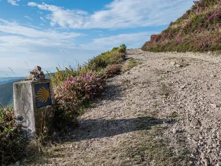
The route is waymarked as the GR13, using red-and-white Grande Rota markings. Waymarking is helpful, but it should not be the only navigation system carried.
Long stretches have no mobile-network coverage, so offline mapping is essential. Carry downloaded maps or a GPS track, plus enough battery capacity for long days where navigation, emergency calls and accommodation contact may all depend on the same device.
A paper backup or a second offline device is sensible on this route. The terrain is not technical, but missed turns on dirt tracks or quiet lanes can add unwelcome distance when accommodation and daylight are already fixed.
Transport and access
Public transport works best at the two ends of the route. The usual approach to the start is by train to Vila Real de Santo António, then bus to Alcoutim. From the finish, plan to leave via the Sagres / Cabo de São Vicente area to Lagos, then onward by train along the Algarve line.
Transport in the middle of the route is much thinner. Several inland villages have sparse or no scheduled bus service, so buses should not be treated as an easy daily bailout option. Current timetables should be checked before travelling.
If section hiking, build each section around places with realistic access rather than simply choosing attractive map points. The official network includes 12 linear “Connections” linking the GR13 to towns and transport, which can help with access, but each connection still needs a practical plan for getting in and out.
Shortening, extending and section hiking
Shortening the full route is possible only with planning. Skipping a long sector usually means arranging transport from a small inland village, and that may not be available at short notice. This should be checked before travelling.
Extending the route is easier if the extra time is used for rest or recovery days rather than new overnight stops between sectors. Silves and Monchique are the most obvious places to add time because they are larger, significant stops on the route and break up the harder middle and western stages.
Section hiking is practical for walkers who do not want the full 300 km in one trip, but it is not as straightforward as splitting a coastal path by railway stations. The start, finish and larger towns are the easiest access points; the smaller Caldeirão and western inland villages require more careful transport planning.
Weather, fire risk and seasonal planning
The route is best planned for the cooler walking window from September to May. February to April is particularly attractive for wildflowers, but spring and autumn can still bring strong sun, so water and shade remain serious considerations.
High summer should be avoided. Heat, fire risk and poor visibility can make the route hazardous, especially on exposed tracks with little shade and long distances between villages.
Before starting, check current fire-risk alerts and any hunting-area information. These are more important practical constraints than permits for most walkers, and they can affect whether a planned day is safe or sensible.
Optional Fóia detour
The main GR13 climbs Picota, around 774 m, in the Serra de Monchique. Fóia, at 902 m, is the highest summit in the Algarve, but it is reached by a short detour from the main route near Monchique rather than by the standard line itself.
Decide before reaching Monchique whether to include Fóia. It should be treated as an optional add-on requiring extra time, energy and weather judgement, not as an automatic part of a tight 14-day schedule.
Towns, Villages and Overnight Stops
Accommodation planning is one of the main constraints on the Via Algarviana. The route is designed around 14 official sector ends, but many of these are small inland villages with limited beds, limited evening food options and little or no useful public transport.
Book every night before starting, especially from Alcoutim through Barranco do Velho and again across the western inland stages. Do not assume that a café, shop or restaurant will be open when you arrive; opening days, meal times and seasonal closures should be checked before travelling.
| Place | Route role | Overnight usefulness |
|---|---|---|
| Alcoutim | Start | Essential pre-walk overnight for most hikers |
| Balurcos | Stage 1 end | Useful but small; book ahead |
| Furnazinhas | Stage 2 end | Useful but small; book ahead |
| Vaqueiros | Stage 3 end | Practical sector stop; limited services likely |
| Cachopo | Stage 4 end | Key stop before a long Caldeirão stage |
| Barranco do Velho | Stage 5 end | Key stop after a long remote day |
| Salir | Stage 6 end | Useful stop on the transition towards the Barrocal |
| Alte | Stage 7 end | Attractive and practical village stop |
| São Bartolomeu de Messines | Stage 8 end | Useful overnight before the long stage to Silves |
| Silves | Stage 9 end | Best-established historic town on the route |
| Monchique | Stage 10 end | Important mountain stop and possible rest point |
| Marmelete | Stage 11 end | Small western stop before another long stage |
| Bensafrim | Stage 12 end | Practical stop before Vila do Bispo |
| Vila do Bispo | Stage 13 end | Last proper overnight before Cabo de São Vicente |
| Sagres | Near the finish | Useful post-walk base and transport point |
| Cabo de São Vicente | Finish | Finish point, not a normal overnight stop |
Alcoutim
Alcoutim is the official start of the GR13, on the bank of the Rio Guadiana opposite Sanlúcar de Guadiana in Spain. The trail begins in the riverside village below the castle, so staying here the night before avoids a rushed first morning.
It is the most important place to get the start logistics right. Public transport access is by train to Vila Real de Santo António, then bus to Alcoutim; current times should be checked before travelling, as onward options into the interior are limited.
Use Alcoutim to arrive with a full water carry, food for the first stage and all accommodation already arranged. Once the route leaves the Guadiana, the walk quickly becomes a chain of small inland settlements rather than towns with easy back-up options.
Balurcos
Balurcos is the first official overnight stop after the 24 km stage from Alcoutim. It sits early in the eastern inland section, where villages are small and services cannot be treated as guaranteed.
This is a practical stop rather than a place to improvise. Accommodation should be booked in advance, and any evening meal arrangement should be agreed before arrival.
Because the next stage to Furnazinhas is shorter, some walkers may be tempted to combine days, but doing so can create awkward distances and service problems. The official stop works well for keeping the early route manageable.
Furnazinhas
Furnazinhas is the end of the short second sector from Balurcos and the staging point before the longer day to Vaqueiros. It is one of the small inland villages where the route’s limited-service character is most important for planning.
Treat Furnazinhas as a booked overnight, not as a flexible arrival point. Accommodation and food availability should be checked before travelling, and walkers should not rely on finding late-opening shops or cafés.
The shorter distance into Furnazinhas can be useful for recovery after the opening day, but it does not remove the need to carry water and food. Several Via Algarviana sectors have no refreshments en route.
Vaqueiros
Vaqueiros is the official end of the third stage from Furnazinhas and the start of the shorter stage to Cachopo. It lies in the eastern hill country before the route reaches the deeper Serra do Caldeirão section.
As with the preceding villages, the main issue is certainty. Book accommodation ahead, confirm whether food is available, and arrive prepared if there is no evening shop or restaurant option.
Transport should not be relied upon here without checking current local arrangements. The route passes through areas with sparse or no scheduled bus service and long stretches without mobile-network coverage.
Cachopo
Cachopo is a key stop in the Serra do Caldeirão, reached after the 15 km stage from Vaqueiros. It is also the overnight before the long 30 km sector to Barranco do Velho, so it has more planning importance than its size might suggest.
This is a place to sort water and food before committing to the next day. The following stage is one of the longer official sectors, and hikers should assume there may be long stretches without refreshments.
Accommodation is limited in the small villages along this part of the route. Book ahead and confirm meal arrangements, especially outside busier walking periods.
Barranco do Velho
Barranco do Velho is the official stop after the long Cachopo stage and sits within the Serra do Caldeirão landscape of cork-oak country, old tracks and scattered inland settlements. It is a welcome halt after one of the route’s more demanding service-light days.
Because arrival may be late after 30 km of hill walking, accommodation and food should be arranged in advance. Do not depend on being able to shop or find a meal after reaching the village.
The next stage to Salir is shorter, but the same inland logistics still apply. Carry enough water from the start of the day and check any local service opening times before relying on them.
Salir
Salir is reached after the shorter stage from Barranco do Velho, on the descent out of the Serra do Caldeirão towards the Barrocal. The village is noted for the ruins of a Moorish castle and is a useful pause after the eastern mountain stages.
As an official sector end, Salir is a sensible overnight stop. Accommodation and food should still be booked ahead, but it marks a change from the more remote Caldeirão villages towards the central Algarve interior.
This can be a good place to review supplies before continuing to Alte and São Bartolomeu de Messines. Transport options away from the trail should be checked before travelling rather than assumed.
Alte
Alte is the end of the stage from Salir and one of the better-known Barrocal villages on the route, with traditional whitewashed houses and the Fonte Grande and Fonte Pequena springs. For hikers, its main value is as a well-placed overnight between Salir and São Bartolomeu de Messines.
Accommodation is still limited compared with coastal Algarve towns, so booking remains important. Food and shop opening times should be checked, particularly if arriving late in the day or walking outside the main spring and autumn windows.
Alte is also a natural point to slow the pace if the early stages have been tiring. The next day to São Bartolomeu de Messines is longer than the Salir to Alte stage.
São Bartolomeu de Messines
São Bartolomeu de Messines is the official overnight after the stage from Alte and the staging point before the long 29 km day to Silves. It is a practical place to prepare for the move from the Barrocal towards the historic Rio Arade town.
Book accommodation before arrival and make sure the next day’s food and water are covered. The stage to Silves is long enough that walkers should not start under-supplied.
Any transport plans from São Bartolomeu de Messines should be checked before travelling. The Via Algarviana as a whole has much less useful public transport in the interior than at the start and finish.
Silves
Silves is the most substantial historic town on the Via Algarviana, above the Rio Arade, with its red-sandstone Moorish castle, cathedral and old quarter. It is the official end of the stage from São Bartolomeu de Messines and an important resupply and recovery point before the Serra de Monchique.
Compared with the smaller villages, Silves is the best place on the route to plan a more comfortable overnight or a short reset. Accommodation should still be booked, but hikers are less exposed here than in the smaller mountain settlements.
The next stage to Monchique is the longest official day at about 32 km. Use Silves to sort food, water, an early start and any onward accommodation confirmations before leaving town.
Monchique
Monchique is the main mountain stop of the route, reached after the long stage from Silves. It sits in the Serra de Monchique, surrounded by medronho country, and is the natural base for the route’s high-level section over Picota.
This is one of the most useful overnight stops for rest and recovery. It also gives access to the optional detour to Fóia, the Algarve’s 902 m high point, while the GR13 itself reaches Picota at about 774 m.
Accommodation should be booked ahead, especially if planning an extra night. Food, water and weather should be taken seriously here, as the following stages continue through hill country before the route turns west.
Marmelete
Marmelete is the official end of the stage from Monchique and the start point for the long 30 km sector to Bensafrim. It sits in the western inland part of the route, before the Serra do Espinhaço de Cão and the run-in towards the coast.
This is a small-stage-end stop where pre-booking is essential. Confirm both the bed and the evening meal, and do not rely on a shop being open when needed.
The following day is long and service-light, so Marmelete is a key place for water and food planning. Start the next morning with enough supplies for a full day rather than assuming easy top-ups.
Bensafrim
Bensafrim is the official end of the 30 km stage from Marmelete and the overnight before another 30 km sector to Vila do Bispo. It is a practical waypoint in the western Algarve rather than a place to leave logistics until arrival.
Accommodation and meals should be arranged before reaching the village. The back-to-back long stages in this part of the route make recovery, food and an early start more important than sightseeing time.
Any local transport or transfer options should be checked before travelling. Public transport is much more useful at the route ends than in many inland settlements.
Vila do Bispo
Vila do Bispo is the final official overnight stop before Cabo de São Vicente. It is reached after the long stage from Bensafrim and gives walkers a properly staged final day to the Atlantic headland.
This is the best place to organise the finish: accommodation, food, water for the final stage and onward travel from the Sagres or Cabo de São Vicente area. Current bus times towards Lagos should be checked before committing to a same-day departure.
The final stage is shorter than the previous two days, but it crosses open western country towards the exposed cape. Do not treat it as a formality in hot, windy or poor-visibility conditions.
Sagres
Sagres is near the finish rather than an official GR13 stage end in the 14-sector itinerary. It is useful for post-walk accommodation, food and onward transport after reaching Cabo de São Vicente.
Buses from the Sagres or Cabo de São Vicente area connect towards Lagos, with train travel onward along the Algarve line. Timetables should be checked before travelling, especially if finishing late in the day.
Many hikers will find Sagres more practical than trying to move far immediately after the final stage. Arrange any transfer, bus plan or overnight before setting out from Vila do Bispo.
Cabo de São Vicente
Cabo de São Vicente, or Cape St Vincent, is the finish of the Via Algarviana at the historic lighthouse on the Atlantic headland. It is the south-westernmost point of mainland Europe and marks the end of the inland traverse from the Guadiana.
This should be treated as a finish point, not a guaranteed overnight stop. Plan to continue to accommodation in Vila do Bispo, Sagres or another pre-booked location after completing the route.
The headland is exposed, and onward transport should not be left to chance. Check current bus times from the Cabo de São Vicente or Sagres area to Lagos before travelling, and allow enough time after the walk to make the connection.
Getting to the Start
The Via Algarviana starts in Alcoutim, a riverside village on the Rio Guadiana opposite Sanlúcar de Guadiana in Spain. The practical public-transport approach is to reach Vila Real de Santo António by train, then continue by bus to Alcoutim.
Allow enough time for the final bus leg. Alcoutim is not a large transport hub, and a missed connection can create a difficult start to the walk.
By train
The nearest useful railhead for the start is Vila Real de Santo António. From there, continue by bus to Alcoutim.
If travelling from elsewhere in Portugal, plan the journey around reaching Vila Real de Santo António first, then check the onward bus connection carefully. Train and bus times may not align neatly, especially if arriving late in the day. This should be checked before travelling.
By bus
The key bus connection is from Vila Real de Santo António to Alcoutim. This is the normal public-transport link for walkers starting the GR13.
Do not assume frequent services. The inland Algarve has limited public transport, and several villages on the route have sparse or no scheduled bus service. Current timetables should be checked before travelling, and it is sensible to arrive in Alcoutim the day before starting rather than trying to walk Stage 1 after a long transfer.
If the bus times do not work, arrange a taxi or private transfer in advance from Vila Real de Santo António or another convenient Algarve transport point. Do this before travelling, as relying on finding a last-minute ride in a small inland village is a poor plan.
By car
Driving to Alcoutim is possible in principle, but it is awkward for a point-to-point walk ending 300 km away at Cabo de São Vicente. Leaving a car at the start means arranging a return transfer across the Algarve after finishing, while leaving it near the finish means arranging transport to Alcoutim before starting.
Long-stay parking arrangements in Alcoutim are not a core trail facility and should not be assumed. This should be checked before travelling. If using a car, the cleanest plan is usually to arrange a pre-booked transfer at one end of the walk and keep the public-transport links as simple as possible.
From the nearest airport
Airport access is most practical when combined with the Algarve rail line: travel onward to Vila Real de Santo António, then take the bus to Alcoutim. Exact airport-to-rail connections, journey times and late-arrival options should be checked before travelling.
Avoid booking a flight that arrives too late to make the onward bus connection. If arrival times are tight, stay overnight near the transport corridor and continue to Alcoutim the next day, or pre-book a transfer.
Where to stay before starting
Staying in Alcoutim the night before the first stage is the best logistical choice. The GR13 starts in the village by the Rio Guadiana, below the castle, so an overnight stop removes the risk of beginning the walk late after a train-and-bus transfer.
Accommodation in small inland Algarve villages can be limited, and the Via Algarviana should not be treated as a route where beds can always be found on arrival. Book the Alcoutim night before starting, then continue with confirmed accommodation for the following stages as well.
If Alcoutim accommodation is unavailable, stay where the transport connection to Alcoutim is reliable the next morning. Bus times and any taxi transfer should be checked before travelling.
Getting Home from the Finish
The Via Algarviana finishes at the lighthouse at Cabo de São Vicente, a headland rather than a transport hub. Treat the end of the walk as a two-step journey: first get from the Cabo de São Vicente / Sagres area to Lagos, then continue by train along the Algarve line.
Timetables, seasonal service levels and last departures matter here. This should be checked before travelling, especially if you expect to finish late in the afternoon.
By train
There is no railway station at Cabo de São Vicente, Sagres or Vila do Bispo. The practical railhead for leaving the western end of the route is Lagos.
From Lagos, trains run onward along the Algarve line. Use Lagos as the point for onward rail planning rather than trying to make a same-day long-distance connection directly from the lighthouse.
If booking flights or long onward travel, build in time for the bus or taxi leg from the finish area to Lagos. A late finish at Cabo de São Vicente can easily make same-day onward train connections awkward.
By bus
The usual public-transport exit is by bus from the Sagres / Cabo de São Vicente area to Lagos, then train onward from Lagos. Services should be treated as limited rather than turn-up-and-go, and current times should be checked before committing to a final-day schedule.
If the final stage from Vila do Bispo to Cabo de São Vicente is walked in full, check whether the return bus option works from the headland itself or whether it is more practical to continue via Sagres. This should be checked before travelling.
For a smoother finish, many walkers should plan the final day around a known bus departure or stay locally after reaching the Cape. Do not assume there will be a convenient late bus after time spent at the lighthouse.
By car/taxi
A pre-arranged taxi or private transfer is the most flexible way to leave Cabo de São Vicente, particularly if finishing outside bus times or travelling with a group. Arrange it before setting out on the final stage rather than relying on mobile coverage at the end of the walk.
Useful pick-up or transfer points to plan around are Cabo de São Vicente itself, Sagres, Vila do Bispo and Lagos. Prices, availability and pick-up arrangements should be confirmed before booking accommodation or onward travel.
If being collected by car, allow for the fact that the trail ends at a popular but exposed headland, not in a town centre with full services. Agree a clear meeting point at or near the lighthouse.
From the nearest airport
For flights after the hike, first get from Cabo de São Vicente or Sagres to Lagos, then use the Algarve rail and bus network for onward travel. Airport-specific connections and journey times should be checked before travelling.
Avoid booking a tight same-day flight unless the final-stage transport has been fixed in advance. The safer plan is to finish the walk, transfer to Sagres, Vila do Bispo or Lagos, and fly the following day.
Where to stay at the finish
There is no reason to plan on sleeping at Cabo de São Vicente itself; treat the lighthouse as the walking finish, not the overnight base. The practical nearby places to look are Sagres and Vila do Bispo, with Lagos a better option if an early train or onward connection is needed.
Staying locally after the final stage is often the simplest choice. It removes pressure from the last 16 km from Vila do Bispo, gives a buffer if the weather is hot or windy, and avoids depending on the final bus of the day.
Accommodation on the Via Algarviana should be booked ahead throughout the route, and the finish is no exception. Confirm both the bed and the onward transport before starting the final stage.
Which Direction Should You Walk?
Standard direction: Alcoutim to Cabo de São Vicente
The Via Algarviana is normally walked east to west, from Alcoutim on the Rio Guadiana to Cabo de São Vicente on the Atlantic. This is also the direction used by the official 14-sector structure: Alcoutim, Balurcos, Furnazinhas, Vaqueiros, Cachopo, Barranco do Velho, Salir, Alte, São Bartolomeu de Messines, Silves, Monchique, Marmelete, Bensafrim, Vila do Bispo and Cabo de São Vicente.
For most independent walkers, this is the simplest direction to plan. It matches the published stage order, the way the route is usually described, and the natural accommodation sequence through the small inland villages.
The scenery also builds well in this direction. The walk starts quietly on the Spanish border, crosses the Serra do Caldeirão and the Barrocal, reaches the larger historic stop at Silves, then climbs into the Serra de Monchique before the final approach through the western hills to the Atlantic. Finishing at the lighthouse on Cabo de São Vicente gives the route a clear psychological endpoint rather than ending inland.
Reverse direction: Cabo de São Vicente to Alcoutim
Walking west to east is possible in principle, but it is less natural for this route. The Atlantic headland becomes the start rather than the climax, and the final days lead into the quieter eastern interior before ending at Alcoutim on the Guadiana.
The main practical issue is planning against the standard flow. Accommodation is limited in many stage villages whichever way you walk, but reversing the route means every booking, meal plan and transfer needs to be checked carefully against the reverse stage order. This is particularly important because several sectors have little or no refreshment en route and mobile coverage can be absent for long stretches.
Reverse walking does not make the Via Algarviana substantially easier. Climbs and descents are simply swapped, and the main difficulties remain the same: long 20–32 km days, rocky and gravel tracks, limited shade, heat outside the cooler seasons, and sparse services between villages.
Transport and logistics
Both ends require planning. For the standard direction, the usual access is by train to Vila Real de Santo António, then bus to Alcoutim. From the western end, walkers leave the Cabo de São Vicente / Sagres area by bus to Lagos, then continue by train along the Algarve line.
In reverse, those same connections are simply used the other way round, but inland public transport remains thin. Several villages along the route have sparse or no scheduled bus service, so reversing the trail is not a good way to make bail-outs or rest-day logistics easier. Current bus and train times should be checked before travelling.
Weather, sun and exposure
There is no strong reason to choose a direction for weather advantage. The important factor is season, not direction: the route is best planned between September and May, with summer strongly discouraged because of heat, fire risk and exposed walking.
Sun exposure is a concern both ways. Many sections have little shade, so start times, water carrying and food planning matter far more than whether the route is walked east–west or west–east.
Recommendation
Walk the Via Algarviana east to west, from Alcoutim to Cabo de São Vicente. It follows the standard sector order, fits the usual accommodation flow, gives the strongest scenic progression, and finishes with the most satisfying endpoint at the Atlantic lighthouse.
Reverse the route only if accommodation availability, transport timing or a wider itinerary makes it necessary — and only after checking every overnight stop and public-transport connection in advance.
Accommodation Along the Route
Accommodation on the Via Algarviana is workable, but it needs more planning than many better-served European long-distance trails. The route is an inland village-to-village walk, using guesthouses, rural lodgings, small hotels, a few hostels and the occasional campsite rather than a dense chain of trail hostels.
The key point is capacity. Several stage-end villages are small, and some sectors have no facilities en route, so every night should be booked before starting. Do not assume there will be a spare room on arrival, especially on weekends, public holidays or during the recommended spring and autumn walking seasons.
Best overnight strategy
The simplest plan is to follow the official 14-sector structure and sleep at or near each sector end: Alcoutim, Balurcos, Furnazinhas, Vaqueiros, Cachopo, Barranco do Velho, Salir, Alte, São Bartolomeu de Messines, Silves, Monchique, Marmelete, Bensafrim and Vila do Bispo, finishing at Cabo de São Vicente.
This is the most practical approach because the route has long sections through the Serra do Caldeirão, Serra de Monchique and Serra do Espinhaço de Cão where villages, beds and food stops are spread out. If a particular village has no suitable room, the solution is usually a pre-arranged taxi or transfer to accommodation off the line, then a return transfer to the same point the next morning.
Silves and Monchique are the most substantial overnight stops on the trail and are the best places to build in a more comfortable night, a rest period or extra resupply time. The smaller inland stops should be treated as limited-service overnights where dinner, breakfast and packed food for the next stage may need arranging in advance.
Accommodation by place
| Place | Accommodation level | Best for | Notes |
|---|---|---|---|
| Alcoutim | Limited | Starting night | Sensible place to sleep before Day 1, as public transport to the start involves reaching Vila Real de Santo António and then taking a bus to Alcoutim. Book ahead rather than arriving late and searching. |
| Balurcos | Limited | End of the first long rural stage | Small stage-end settlement; have the bed and evening meal arranged before leaving Alcoutim. |
| Furnazinhas | Limited | Quiet overnight between eastern stages | One of the small inland stops where capacity is likely to be the constraint. Check food availability as well as the room. |
| Vaqueiros | Limited | Stage-end lodging and basic recovery | A practical overnight on the official line rather than a place to rely on for wide choice. |
| Cachopo | Limited | Breaking the Serra do Caldeirão section | Important overnight before the long Cachopo to Barranco do Velho sector. Confirm dinner, breakfast and water options. |
| Barranco do Velho | Limited | End of a long 30 km sector | A critical booking because the preceding stage is long and services are thin. Do not leave this night flexible. |
| Salir | Limited | Easier overnight after the Caldeirão | Useful stop after descending towards the Barrocal. Accommodation should still be booked in advance. |
| Alte | Limited | Attractive Barrocal village stop | A good village overnight, but still not a large accommodation hub. Weekends and holiday periods need early booking. |
| São Bartolomeu de Messines | Limited | Mid-route logistics and resupply | More practical than remote hamlets, but still plan it as a booked stop rather than a turn-up-and-choose night. |
| Silves | Good | Stronger choice, rest, resupply | One of the best places on the route for a more comfortable night and extra logistics. Useful before the demanding 32 km stage to Monchique. |
| Monchique | Good | Mountain stop, recovery, optional extra night | One of the strongest overnight bases on the route. A sensible place to slow down, especially if adding the Fóia detour or wanting recovery after the Silves stage. |
| Marmelete | Limited | Western mountain overnight | Small but important stage end between Monchique and Bensafrim. Arrange the room and meals before leaving Monchique. |
| Bensafrim | Limited | End of a long western stage | Practical overnight after the 30 km Marmelete stage. Do not rely on public transport as a fallback without checking times. |
| Vila do Bispo | Good | Final trail night before Cabo de São Vicente | The natural last overnight on the official route before the final 16 km to the lighthouse. Also useful for onward planning towards the Sagres / Cabo de São Vicente area. |
| Cabo de São Vicente | None | Finish point | Treat the lighthouse headland as the trail finish, not as an overnight village. Arrange onward transport or accommodation in the Vila do Bispo / Sagres area. This should be checked before travelling. |
Booking, meals and awkward gaps
Book the full accommodation chain before setting off, then reconfirm the smaller stops close to departure. This matters because a missed booking can create a serious problem: the next official village may be 20–30 km away, and scheduled public transport is sparse or absent in several inland areas.
When booking, ask three practical questions: whether dinner is available, whether breakfast can be provided early enough, and whether a packed lunch or nearby food shop is realistic for the next stage. Several sectors have no refreshments en route, so accommodation planning and food planning are linked.
If beds are unavailable at a stage end, a pre-arranged taxi transfer to a nearby town or rural lodging can keep the itinerary intact. The transfer should return you to the same trail point the next morning, otherwise the route quickly becomes fragmented. Because there are long stretches without mobile-network coverage, transfers should be agreed before the walking day starts.
Does it work as an inn-to-inn walk?
Yes, the Via Algarviana can work as an inn-to-inn walk, but it is not a casual turn-up-and-book route. It suits walkers who are happy with simple rural accommodation, fixed reservations and some long days between small villages.
Luggage transfer may be possible through pre-arranged local transport or walking-holiday arrangements, but it should not be assumed village by village. If walking with light daypacks is essential, organise the transfer chain before committing to flights or public transport. This should be checked before travelling.
Camping and Wild Camping
The Via Algarviana is not a route to approach as a straightforward campsite-to-campsite thru-hike. Accommodation on the GR13 is mainly in village guesthouses, rural lodgings, small hotels, a few hostels and the occasional campsite, with most planning built around the official sector ends rather than formal camping infrastructure.
If camping is part of the plan, treat it as something to arrange in advance, not as a fallback. Beds and services are limited in villages such as Balurcos, Furnazinhas, Vaqueiros, Cachopo, Barranco do Velho and Marmelete, and several sectors have no facilities en route, so arriving late and hoping to solve the night locally is a poor strategy.
Campsites on or near the route
There are occasional campsites on or near the Via Algarviana, but they are not frequent enough to assume a full camping itinerary without detailed checking. Opening dates, acceptance of one-night walkers and distance from the GR13 should all be checked before travelling.
A practical camping plan should be built night by night around the official sector ends:
| Planning point | What it means on the Via Algarviana |
|---|---|
| Campsites are occasional, not continuous | Do not expect a legal campsite at every stage end. |
| Villages are small | Book or contact places ahead, especially outside the busiest tourist centres. |
| Some stages are long | A detour to a campsite can turn an already long 29–32 km day into a much harder one. |
| Public transport is sparse inland | If a campsite is off-route, do not assume an easy bus or taxi solution. This should be checked before travelling. |
Where a campsite is not available, the safer and more reliable option is usually to book a room in the stage village rather than attempt an improvised camp.
Wild camping legality and permissions
Do not assume wild camping is permitted on the Via Algarviana. The route crosses working rural landscapes, small villages, cork-oak country, mountain tracks and, near the western end, the edge of the Parque Natural do Sudoeste Alentejano e Costa Vicentina. Rules can vary by municipality, land ownership, protected-area status, fire risk and season.
If considering any night outside a formal campsite, check locally before committing to it. Ask the relevant municipality, accommodation host, tourist office or landowner, and only camp where permission is clear. This should be checked before travelling.
Avoid camping on agricultural land, near houses, beside water points used by local communities or livestock, close to roads, or anywhere that would block tracks. Much of the route passes through quiet but lived-in countryside; discretion is not a substitute for permission.
Does the Via Algarviana suit camping?
Camping can reduce dependence on scarce beds, but it adds weight on a route where heat, water carrying and long stages are already major planning factors. The official 14-sector schedule includes several demanding days of around 29–32 km, including Cachopo to Barranco do Velho, São Bartolomeu de Messines to Silves, Silves to Monchique, Marmelete to Bensafrim and Bensafrim to Vila do Bispo.
For most walkers, the Via Algarviana is better suited to pre-booked indoor accommodation with perhaps selected campsite nights where they fit naturally. A fully camping-based crossing is only sensible for hikers who have confirmed legal places to sleep, can carry extra water, and are comfortable with long, exposed days between small settlements.
Water and food when camping
Water is the main constraint. Official planning advice for the Via Algarviana is to carry plenty of water, and some sectors have no refreshments en route. A camping load increases water needs for evening cooking, breakfast and the following morning, which can be significant on exposed inland stages.
Do not build a plan around finding natural water. Refill in villages, accommodation, cafés or other confirmed services, and leave each settlement with enough for the full stage plus camp needs if camping legally before the next village. In hot weather this becomes a safety issue, not just a comfort issue.
Food planning also matters. Small villages may have limited opening hours and limited supplies, so a camping itinerary should include food for the evening and next morning before leaving each reliable resupply point.
Fire risk, stoves and seasonal concerns
Summer is strongly discouraged on the Via Algarviana because of heat, fire risk and poor walking conditions. This is especially important for campers, who are more exposed, carry more weight and may be tempted to cook outside.
Check fire-risk alerts before and during the walk. Open fires should not be used, and stove use may be restricted during high-risk periods. Any local fire ban must be followed, even at informal rest spots or where camping has been permitted.
Spring and autumn are the practical seasons for anyone carrying camping gear. Even then, exposed sections, limited shade and long distances mean water and sun protection remain more important than on many cooler European long-distance routes.
Leave No Trace on the GR13
Camping should leave no visible impact. Pack out all rubbish, food waste and hygiene products; do not bury litter; and avoid damaging cork-oak, almond, carob, olive or medronho country along the route.
Use toilets in villages and accommodation wherever possible. If a remote toilet stop is unavoidable, go well away from paths, houses, tracks and water sources, and follow proper low-impact practice.
Keep camps small, quiet and out of sight only where camping is legal or permission has been granted. Leave early, remove every trace, and avoid repeated use of the same informal spots, which quickly creates visible damage on dry ground.
Food, Water and Resupply
Food and water planning is one of the main logistical challenges on the Via Algarviana. The route links small inland villages across long hill sectors, and several stages have no refreshments en route. Accommodation, evening meals and next-day packed food should be arranged before starting each stage, not left to chance on arrival.
Do not assume that every sector village has a dependable shop, café or restaurant open when needed. Rural opening hours can be short, seasonal and reduced on Sundays or public holidays. This should be checked before travelling, especially for the smaller eastern villages between Alcoutim and Barranco do Velho, and for the long western stages after Monchique.
Resupply strategy
Treat the sector endpoints as the practical resupply points. The most useful stops for restocking are likely to be the larger settlements on the route, especially São Bartolomeu de Messines, Silves, Monchique and Vila do Bispo, but exact shop, restaurant and supermarket opening times should be checked before relying on them.
For the smaller villages — Balurcos, Furnazinhas, Vaqueiros, Cachopo, Barranco do Velho, Marmelete and Bensafrim — plan conservatively. Book accommodation well ahead, ask whether dinner and breakfast are available, and arrange a packed lunch if there may be no café or shop open on the next stage.
Carry at least a full day of walking food: lunch, high-energy snacks and an emergency reserve. On the longest stages — Cachopo to Barranco do Velho, São Bartolomeu de Messines to Silves, Silves to Monchique, Marmelete to Bensafrim and Bensafrim to Vila do Bispo — start with enough food for the full distance, as these are long days and services may be absent between endpoints.
Water planning
Start each stage with enough water to complete the walk if no refill appears. This is particularly important because the route has limited shade, exposed tracks and high heat outside the cooler seasons. Summer walking is strongly discouraged; even in the recommended September to May window, warm days can make water demand high.
Reliable refills are best planned at accommodation, cafés and shops in the stage villages. Do not depend on streams, springs, tanks or other natural water unless local signs or accommodation hosts indicate that the water is safe to drink. If using untreated natural water, it should be filtered or otherwise treated.
Alte is known for its springs, the Fonte Grande and Fonte Pequena, but they should be treated as village landmarks rather than guaranteed drinking-water sources unless potability is clear on site. The same caution applies anywhere else along the route.
Food and water by section
| Section | Food availability | Water availability | Notes |
|---|---|---|---|
| Alcoutim to Balurcos — 24 km | Eat and stock up before leaving Alcoutim; do not assume en-route food. | Fill up before departure and carry enough for the full stage. | First full day out of the Rio Guadiana valley; plan as a self-sufficient walking day. |
| Balurcos to Furnazinhas — 14 km | Limited village-based options; arrange meals with accommodation where possible. | Refill before leaving Balurcos; do not rely on mid-stage water. | Shorter distance, but still rural and service-light. |
| Furnazinhas to Vaqueiros — 23 km | Carry lunch and snacks from the start. | Carry a full stage supply. | Treat as a no-resupply day unless current local options have been checked. |
| Vaqueiros to Cachopo — 15 km | Limited village resupply; confirm food before arrival and departure. | Refill at accommodation or village services where available. | Shorter stage, but still in the thin-service eastern hills. |
| Cachopo to Barranco do Velho — 30 km | Carry all day food; do not rely on refreshments en route. | Carry enough for a long, exposed day. | One of the key resupply-risk stages in the Serra do Caldeirão. |
| Barranco do Velho to Salir — 14 km | Arrange breakfast/lunch before leaving; Salir may offer more village services, but check opening times. | Start full; refill at Salir before the next stage. | Shorter day descending towards the Barrocal, but still plan conservatively. |
| Salir to Alte — 16 km | Food is planned around the villages at each end. | Carry stage water; refill in Alte only where drinking water is clearly available. | Alte has the Fonte Grande and Fonte Pequena springs, but potability should not be assumed. |
| Alte to São Bartolomeu de Messines — 21 km | Carry lunch; São Bartolomeu de Messines is a more useful resupply stop than the smaller hill villages. | Start with a full supply and refill on arrival. | Use this stop to prepare for the longer following stage. |
| São Bartolomeu de Messines to Silves — 29 km | Stock up before leaving; Silves is the most substantial town on the route. | Carry enough for the full 29 km. | Long day with a strong reason to leave town already supplied. |
| Silves to Monchique — 32 km | Use Silves for a proper restock; carry all day food to Monchique. | Carry a full long-stage supply. | Longest official sector and a serious day into the Serra de Monchique. |
| Monchique to Marmelete — 15 km | Monchique is a key place to organise food before entering the western hills. | Refill before leaving Monchique. | If taking any detour near Fóia, increase food and water accordingly. |
| Marmelete to Bensafrim — 30 km | Carry all food from Marmelete unless current services are arranged. | Carry enough water for a long rural stage. | Long western sector through the Serra do Espinhaço de Cão area; plan for no useful mid-stage resupply. |
| Bensafrim to Vila do Bispo — 30 km | Carry lunch and snacks; restock in Vila do Bispo for the final day. | Start with a full supply. | Another long day where transport and services are not something to improvise. |
| Vila do Bispo to Cabo de São Vicente — 16 km | Buy food before leaving Vila do Bispo; do not treat Cabo de São Vicente as a resupply point. | Carry enough to reach the finish and onward transport. | The trail ends at the lighthouse on the headland; onward plans towards Sagres/Lagos should be organised separately. |
Practical checks before each stage
Before leaving each overnight stop, confirm three things: where the next evening meal will come from, whether breakfast is available early enough, and whether a packed lunch can be bought or prepared. If the answer to any of these is uncertain, carry extra food from the previous larger settlement.
Opening hours, restaurant days off and seasonal closures can change quickly in small inland villages. This should be checked before travelling, and again locally where possible, because long stretches of the Via Algarviana have little or no mobile-network coverage.
Terrain, Conditions and Difficulty in Practice
The Via Algarviana is hard in practice because it is long, exposed and often remote, not because it is technically difficult. Most fit hillwalkers will find the individual surfaces straightforward, but the combination of 14 consecutive days, several 29–32 km sectors, roughly 8,000 m of total ascent and limited services makes it a serious undertaking.
The route is waymarked as the GR13 with red-and-white Grande Rota markings, but it should not be treated as a casual village-to-village stroll. Long stretches cross inland hill country where there may be no refreshments, little shade and long gaps in mobile-network coverage.
Underfoot: tracks, lanes and rocky paths
Expect a mix of dirt and gravel tracks, forest paths, old cobbled village lanes, quiet tarmac and rocky mountain paths. Much of the walking is on broad rural tracks rather than narrow mountain singletrack, but the surface is often stony and tiring over a full day.
The roughest walking is likely to feel most demanding in the hill and mountain sections: the Serra do Caldeirão in the east, the Serra de Monchique in the middle-west and the Serra do Espinhaço de Cão on the run-in towards the coast. The Barrocal sections bring more limestone country, while the final approach towards Cabo de São Vicente becomes more open, wind-exposed and coastal in character.
Old cobbled lanes through villages can be awkward underfoot, especially at the end of a long day. Lightweight trail shoes may be adequate for some walkers in dry conditions, but footwear still needs enough grip and underfoot protection for repeated stony tracks and rocky paths.
Road walking and tarmac
There is some quiet tarmac on the Via Algarviana, mainly linking villages, lanes and rural tracks. It is not primarily a road walk, but the hard surface can add fatigue on the longer sectors, particularly when carrying several litres of water.
Road sections should be treated pragmatically rather than as rest sections. They can be fast, but they are also exposed to sun, heat and reflective glare, and they may offer little shade between settlements.
Climbs, descents and the Monchique high ground
The climbing is cumulative rather than alpine. There are no technical scrambles in the route information, but the trail repeatedly rises and falls across inland ridges, valleys and mountain tracks.
The Serra de Monchique is the highest part of the walk. The GR13 climbs Picota, about 774 m, which is the highest point on the main route; Fóia, at 902 m, is the highest summit in the Algarve but is reached by a short detour from the trail near Monchique. Treat Fóia as an optional extra, not as part of the standard line unless deliberately planned.
The longest climbing day in practical terms is likely to feel like the Silves to Monchique sector, which is also the longest official stage at about 32 km. On a hot or heavily loaded day, that distance into mountain terrain should be planned conservatively.
Long sectors that raise the difficulty
Several official sectors are long enough that pace, water and start time matter more than the raw terrain grade. These are the days most likely to catch out otherwise capable walkers.
| Sector | Approx. distance | Practical issue |
|---|---|---|
| Alcoutim to Balurcos | 24 km | A long opening day in exposed inland country |
| Cachopo to Barranco do Velho | 30 km | Long Caldeirão hill-country stage with limited margin for delays |
| São Bartolomeu de Messines to Silves | 29 km | Sustained distance before reaching the most substantial town on the route |
| Silves to Monchique | 32 km | Longest sector, with the approach into the Serra de Monchique |
| Marmelete to Bensafrim | 30 km | Remote-feeling western hill country and a full-distance day |
| Bensafrim to Vila do Bispo | 30 km | Long open approach towards the western Algarve |
These stages are manageable for fit walkers, but they leave less room for late starts, navigation errors, heat stress or slow progress on stony ground. Accommodation and food should be arranged before committing to each day, because simply stopping short is not always practical.
Heat, shade and exposure
Heat is the main condition that changes the difficulty of the Via Algarviana. Many sections have little shade and are exposed to strong sun, particularly on gravel tracks, open ridges, Barrocal terrain and the later approach towards the Atlantic.
Summer is strongly discouraged, and high summer should be treated as hazardous because of heat, fire risk and poor visibility. The official walking window is roughly September to May, with spring and autumn the most practical seasons for most hikers.
Even inside the recommended season, water carrying is a core part of the difficulty. Several sectors have no refreshments en route, so each day’s supply should be planned from the previous village rather than assumed on the trail.
Seasonal conditions
From February to April, wildflowers add interest and temperatures are generally more suitable than in summer, but exposed sections can still feel hot in direct sun. Spring is also a good reminder that shade, not altitude, is the limiting factor on many days.
Autumn can be one of the best periods for the route, provided heat and fire-risk alerts are still checked before setting off. September can still be hot, so early starts and conservative water planning remain important.
Winter walking avoids the worst heat, but days are shorter, which matters on the 29–32 km sectors. Any wet weather can also make old cobbles, rock and compacted tracks more slippery; this is a footing issue rather than a sign that the route is fundamentally boggy.
Mud, bogs, livestock and access structures
This is not a boggy mountain route in the British sense. The practical challenges are dry-country exposure, stony surfaces, distance, ascent and gaps between villages, rather than peat, marsh or regular wet ground.
Livestock fields, stiles, gates and fences are not defining features of the route information available for the GR13. Walkers should still expect normal rural access points and village-edge tracks, but the guide should not be planned around frequent stile-crossing or enclosed pasture walking.
Navigation and remoteness
The GR13 is waymarked, but long stretches with no mobile-network coverage make independent navigation important. A map, offline route file or other non-network-dependent navigation should be carried, especially through the Serra do Caldeirão, Serra de Monchique and Serra do Espinhaço de Cão.
The route passes through small villages, but many have limited services and some sectors have no facilities en route. In practice, difficulty increases sharply if accommodation, meals or water are left to chance.
Fire-risk and hunting-area information should be checked before walking. This is especially important outside the coolest, dampest periods and on remote sectors where changing route mid-day may be difficult.
Weather and Best Time to Walk
The Via Algarviana is best planned for the cooler half of the year. The official recommended walking window is roughly September to May, with spring and autumn the most practical seasons for a full 14-day traverse.
Summer is the season to avoid. The route crosses exposed inland hill country with limited shade, long 20–32 km stages and several sections with no refreshments en route, so high heat quickly becomes a safety issue rather than a comfort issue. Fire risk is also a serious summer consideration, and high summer is hazardous for this route.
Best months
| Period | Verdict for hikers | Practical considerations |
|---|---|---|
| February to April | Best overall | Cooler walking conditions and the main wildflower period. Still plan for rain, wind and cool starts, especially in the Serra do Caldeirão and Serra de Monchique. |
| September to November | Very good, with caution early on | Autumn is a strong choice once the worst heat has passed. Early September can still feel hot on exposed stages, so start early and carry extra water. |
| December to January | Realistic, but less forgiving | Winter walking is possible within the recommended season, but shorter daylight makes the 29–32 km stages more demanding. Expect colder, wetter and windier days than in spring or autumn. |
| May | Possible, but heat becomes more important | Still inside the broad recommended window, but sun exposure and water planning become more critical. Long stages should be started early. |
| June to August | Avoid | Strongly discouraged because of heat, fire risk, poor visibility and the lack of shade and services on many sections. |
Heat, sun and water
Heat is the main weather hazard on the Via Algarviana. The trail is inland for almost its entire length, crossing dirt tracks, rocky paths, open hills and exposed ridges before reaching Cabo de São Vicente. Shade is limited on many stages, and several sectors have no reliable refreshments between villages.
In warm conditions, the long days from Cachopo to Barranco do Velho, São Bartolomeu de Messines to Silves, Silves to Monchique, Marmelete to Bensafrim and Bensafrim to Vila do Bispo need particular respect because they are around 29–32 km. Early starts are sensible even in spring and autumn, and water should be planned before leaving each village.
Rain, wind and trail surface
Rain is more relevant from late autumn through winter and into early spring. The route uses dirt and gravel tracks, forest paths, old cobbled lanes and rocky mountain paths, so wet weather can make footing slower, especially on stone, cobbles and steeper mountain ground.
Wind becomes more noticeable on the higher and more exposed parts of the route, including the Serra de Monchique and the western approach towards the Atlantic. The final sector to Cabo de São Vicente finishes on an exposed headland, so carry a windproof layer even if the day starts warm inland.
Cold, fog and storms
The Via Algarviana is not a high mountain route, but it still reaches significant upland terrain. The main GR13 climbs Picota at about 774 m, while Fóia at 902 m is reached only by a short detour near Monchique. In winter and early spring, these higher areas can feel much colder than the lower villages.
Fog or low cloud can make waymarking and navigation harder on open hill sections, so a downloaded map or GPS track is useful. Long stretches have no mobile-network coverage, so navigation and weather information should not depend on live phone signal.
Daylight and stage length
Short winter days are a real planning factor. Several official sectors are close to or above 30 km, and the combination of distance, ascent, rocky tracks and limited services leaves little margin for a late start.
If walking in December or January, plan conservative start times and avoid assuming that a long stage can be comfortably completed after a slow breakfast or delayed transfer. Accommodation should be booked so that each day’s finish is realistic in daylight.
Fire risk, hunting alerts and closures
There are no routine seasonal closures to build a standard itinerary around, but walkers should check fire-risk alerts and hunting areas before setting out. This is especially important in hotter months and on remote inland sectors where escape options and phone signal may be limited.
If alerts affect a planned stage, do not rely on improvising a lift from a small village at short notice. Public transport is sparse across much of the interior, so changes to the walking plan should be arranged in advance where possible.
Accommodation by season
Accommodation is limited in the small villages along the GR13, regardless of season. Guesthouses, rural lodgings, small hotels, hostels and occasional campsites should be booked before starting, particularly because some stages have no useful intermediate options.
Opening days for small rural accommodation and food services can vary, especially outside busier travel periods. This should be checked before travelling, and evening meals should be arranged in advance where the overnight stop is a small village rather than a larger town such as Silves or Monchique.
Safety Notes
Emergency help and phone signal
Portugal uses the European emergency number 112 for ambulance, fire and police. UK walkers should note that 999 is not the emergency number in Portugal.
Do not rely on mobile coverage across the Via Algarviana. The route has long stretches with no mobile-network signal, especially through the inland hills and smaller village-to-village sectors. Carry offline maps or a GPS track, keep your phone battery protected, and make sure someone knows the day’s intended start, finish and expected arrival time.
Solo hikers should be particularly conservative with timings. Several stages are long, services are thin, and a small navigation error late in the day can become difficult if there is no signal and no nearby transport.
Heat, sun and exposure
Heat is the main safety issue on the Via Algarviana. Much of the route is on dirt and gravel tracks, rocky paths and open hill country with limited shade, and the official walking window is roughly September to May. High summer is strongly discouraged because of heat, fire risk and poor visibility.
Start early on warm days, carry more water than feels necessary, and use sun protection even outside summer. The long stages from Cachopo to Barranco do Velho, São Bartolomeu de Messines to Silves, Silves to Monchique, Marmelete to Bensafrim and Bensafrim to Vila do Bispo need particular respect because they are around 29–32 km.
Cooler-season walking reduces the heat risk, but the route still crosses exposed uplands in the Serra do Caldeirão, Serra de Monchique and Serra do Espinhaço de Cão. Pack a windproof or waterproof layer, especially for the higher ground around Picota and the optional Fóia detour.
Water and refreshments
On this route, water safety is mainly about hydration rather than river crossings. Some sectors have no refreshments en route, and villages can be small with limited services.
Fill up before leaving each stage village and check the next day’s food and water options before committing to the stage. Do not assume that a café, shop or fountain will be open when you arrive; this should be checked before travelling and again locally where possible.
Fire risk and hunting areas
Fire risk is a serious planning factor in the inland Algarve, especially in hot, dry or windy conditions. Check current fire-risk alerts before setting off each day, and do not continue into closed or restricted areas.
The route also passes through rural areas where hunting may take place. Check local hunting notices and any route alerts before walking, particularly outside villages and on forest or mountain tracks.
Road sections and village approaches
The Via Algarviana is a walking route, but it includes sections of quiet tarmac and old village lanes as well as tracks and paths. Treat road sections carefully: walk facing traffic where appropriate, be visible in poor light, and take extra care on bends and narrow rural roads.
Avoid finishing long stages in the dark. The combination of road walking, thin services and patchy mobile coverage makes late arrivals more awkward than on busier trails.
Livestock, rural properties and working land
The route crosses working rural landscapes, including cork-oak country, agricultural areas and small inland villages. Keep to the waymarked GR13 where possible, leave gates as found, and give any animals on tracks or near properties plenty of space.
Do not enter farmyards, fenced land or private tracks unless the waymarks clearly direct the route through them. If waymarks are unclear, check the map before proceeding rather than improvising across open land.
Atlantic headland and final approach
The final stage reaches Cabo de São Vicente, a cliff-bound Atlantic headland near Sagres and Vila do Bispo. Stay back from cliff edges, especially in wind or poor visibility, and do not treat the finish as risk-free simply because the walking day is shorter.
Check before setting off each day
Before leaving each overnight stop, check:
- the day’s distance, ascent and likely walking time;
- whether there are any refreshments or water points before the next village;
- current heat, wind and rain conditions;
- fire-risk alerts and any hunting-area notices;
- whether accommodation and evening food are still arranged at the next stop;
- phone battery, offline maps and backup navigation;
- expected daylight for the full stage, allowing for slow rocky or gravel tracks.
The Via Algarviana is not technically difficult, but its safety margin depends on planning. Long days, heat, limited shade, sparse services and weak mobile coverage are the hazards that matter most.
Gear Recommendations
The Via Algarviana is not a technical mountain route, but it is hard on gear because of its length, rocky and gravel tracks, exposed sun and long gaps between services. Pack for a self-reliant walking day even when sleeping indoors each night.
Footwear
Choose sturdy, well-worn trail shoes or lightweight hiking boots with good grip on loose gravel, stony tracks and rocky mountain paths. A full heavy boot is not essential for most experienced hikers, but flimsy road-running shoes are a poor choice for repeated 20–32 km days on rough surfaces.
Breathability matters in the inland Algarve, especially outside winter, but footwear still needs enough structure for long descents and cumulative fatigue. Gaiters are optional; low gaiters can be useful if walking in dry, dusty conditions or on overgrown rural tracks.
Clothing and Weather Protection
Sun protection is a core safety item, not an accessory. Carry a wide-brimmed hat or cap, sunglasses, high-factor sunscreen and light long sleeves for exposed sections through the Serra do Caldeirão, Barrocal and western plateau.
A waterproof shell should still be packed in the recommended September–May walking window. The route crosses hill country and reaches the Serra de Monchique, with Picota on the main GR13 and the optional Fóia detour higher again, so conditions can feel much cooler and windier than on the Algarve coast.
Add a warm layer for early starts, evenings in small inland villages and the exposed final approach towards Cabo de São Vicente. Lightweight gloves or a thin hat may be useful in the cooler months, particularly if starting before sunrise to avoid heat later in the day.
Water and Food Carry
Carry more water capacity than would normally be needed on a village-to-village European trail. Several sectors have no refreshments en route, shade is limited on many sections, and mobile-network coverage can be absent over long stretches.
Do not rely on topping up casually between stage ends. Start each day with enough water for the full distance ahead, especially on the longer sectors such as Cachopo to Barranco do Velho, São Bartolomeu de Messines to Silves, Silves to Monchique, Marmelete to Bensafrim and Bensafrim to Vila do Bispo.
Food carry should be planned the evening before. Small villages may have limited opening hours, so carry lunch, salty snacks and emergency calories for the next day rather than assuming there will be a café or shop on the trail.
Navigation and Electronics
The Via Algarviana is a waymarked GR route, using red-and-white Grande Rota markings, but navigation should not depend on waymarks alone. Carry offline mapping or a downloaded GPS track, plus enough battery capacity for long walking days.
A power bank is strongly recommended. Long stretches with no mobile-network coverage mean a phone may use extra battery searching for signal, and there may be limited charging opportunities if staying in simple rural accommodation.
A paper map or printed stage notes make a sensible backup, particularly for section hikers joining or leaving the GR13 via smaller inland villages. Transport and transfer details should be saved offline before leaving towns with better service.
Trekking Poles
Trekking poles are useful on this route. They help on long gravel descents, rough mountain tracks and repeated climbing across the Serra do Caldeirão, Serra de Monchique and Serra do Espinhaço de Cão.
They are especially worthwhile for hikers carrying a heavier pack or walking the full 14-day route without rest days. Fast walkers with very light packs may prefer to leave them, but they can reduce strain over the cumulative distance.
Camping and Sleeping Gear
Most hikers should plan this as an inn-to-inn walk using guesthouses, rural lodgings, small hotels, hostels and the occasional campsite. Beds are limited, so accommodation must be booked ahead rather than solved at the end of the day.
If camping, do not assume every stage has a practical campsite or suitable legal option. Campsite availability and any local restrictions should be checked before travelling, and the longer food-and-water carries become more demanding with camping weight.
A sleeping bag liner can be useful in simple accommodation, but a full camping sleep system is unnecessary for walkers using booked indoor beds throughout. Keep the pack light enough for repeated long stages on exposed terrain.
Gear by Walking Style
| Walking style | Gear priorities |
|---|---|
| Inn-to-inn hikers | Light pack, reliable footwear, sun protection, waterproof shell, warm layer, offline navigation, power bank, and enough water and food for each full stage. |
| Campers | All inn-to-inn essentials plus shelter, sleep system and cooking setup only where overnight plans make this practical. Extra care is needed with water weight and confirmed campsite options. |
| Fast or section hikers | Minimal but not underprepared: offline navigation, power bank, sun protection, emergency food and full-stage water capacity remain essential even on a single sector. |
Seasonal Extras
For the main September–May season, pack for strong sun and cool upland or coastal wind on the same trip. Spring walkers should still expect exposed heat on open tracks, while autumn walkers should be ready for shorter daylight and variable weather.
High summer is strongly discouraged because of heat, fire risk and poor visibility. Extra bottles, a sun umbrella or cooling clothing do not make the route a sensible summer objective; choose a cooler season instead.
Before starting, check fire-risk and hunting alerts, then adjust clothing colour, daily timing and route plans accordingly. This should be checked before travelling.
Budget and Costs
Portugal uses the euro (€). Exact costs on the Via Algarviana vary by season, availability and how far ahead accommodation is booked, and current prices should be checked before booking.
The main budgeting issue is not luxury versus cheap travel, but scarcity. Many overnight stops are small inland villages with limited beds, and several sectors have no facilities en route. A cheap trip is possible only if lower-cost rooms, hostels or campsites line up with the official stages; it is not a route where walkers can safely assume a bed, meal or shop will appear at the end of each day.
Main cost categories
| Cost | What to expect on this route | Planning advice |
|---|---|---|
| Accommodation | Mostly simple guesthouses, rural lodgings, small hotels, a few hostels and the occasional campsite | Book every night before starting. Limited supply can force a more expensive option or a transfer if cheaper beds are full. |
| Food | Village cafés, restaurants and small shops where available; some stages have no refreshments en route | Budget for packed lunches, extra snacks and occasional evening meals at your accommodation if there is no easy alternative. |
| Water and supplies | Several sectors are dry in practical terms, with no reliable services between villages | Carry more than a minimal bottle-and-snack budget. Buying supplies ahead is often more important than saving a few euros. |
| Transport to the start | Train to Vila Real de Santo António, then bus to Alcoutim | Timetables and fares should be checked before travelling, especially if arriving late in the day. |
| Transport from the finish | Bus from the Sagres / Cabo de São Vicente area to Lagos, then train onward along the Algarve line | Check current bus times before committing to same-day onward travel. |
| Local taxis / transfers | Useful as a contingency where accommodation is full or a stage needs to be shortened | Do not assume taxis will be instantly available in small inland villages. Arrange ahead where possible and confirm prices before booking. |
| Luggage transfer | May be possible through arranged support, accommodation help or private transfer, but should not be assumed stage by stage | If walking without a full pack, organise the whole chain in advance rather than solving it daily. |
| Guided or self-guided packages | Relevant for walkers who want accommodation and transfers arranged | Compare what is included: nights, meals, luggage, emergency support and transfers to/from Alcoutim and Cabo de São Vicente. |
Budget approach
A lower-cost Via Algarviana depends on booking early, accepting simple rooms, using hostels or campsites where they exist, and buying food from village shops whenever possible. This approach needs the most planning because the cheapest beds are also the easiest to lose.
Camping cannot be treated as the default solution for the full route. The accommodation mix includes only the occasional campsite, and the official advice is to book accommodation before starting. Any campsite-based plan should be checked village by village before travel.
Food costs can be kept down by carrying breakfasts, lunches and snacks, but this adds pack weight and requires careful resupply. On long sectors such as Cachopo to Barranco do Velho, São Bartolomeu de Messines to Silves, Silves to Monchique, Marmelete to Bensafrim and Bensafrim to Vila do Bispo, do not rely on spending less by buying food during the day; there may be no practical opportunity.
Mid-range approach
Most independent hikers should budget for private rooms or simple rural lodgings most nights, café or restaurant meals when available, and a few taxi or transfer contingencies. This is the most realistic style for the route because it matches the village-based stage structure.
A mid-range plan should also include a reserve for unplanned costs. If accommodation in a stage village is full, a transfer to and from a nearby lodging may be necessary. If heat, fatigue or injury makes a long sector impractical, paying for a taxi may be safer than forcing the day.
Comfortable approach
A more comfortable budget uses private rooms throughout, pre-arranged luggage transfers where available, restaurant meals, and planned taxis for awkward access points or rest adjustments. This reduces daily stress but needs organisation well before the start, particularly in the smaller eastern and central villages.
Comfort does not remove the need to carry water and food. Several parts of the Serra do Caldeirão, Serra de Monchique and Serra do Espinhaço de Cão remain thin on services, even if accommodation is pre-booked.
Where not to cut costs
Do not save money by leaving accommodation unbooked. Beds are limited in many stage villages, and the Via Algarviana is not a route where public transport can reliably rescue every planning gap.
Do not under-budget for water, packed food and emergency transport. The route is long, hot outside the cooler seasons, and has long stretches with no mobile-network coverage. A small contingency fund is part of sensible planning, not a luxury.
Finally, check all transport, accommodation and transfer prices before committing to dates. Public transport to Alcoutim and away from the Sagres / Cabo de São Vicente area is practical, but timings matter and services should be verified before travelling.
Luggage Transfer, Guided Tours and Support Services
The Via Algarviana can be walked independently, but support services are worth considering because accommodation is limited, public transport is sparse away from the ends, and several official sectors are long, hot and exposed. The most useful support is not luxury guiding; it is practical logistics: booked beds, reliable bag movement, pre-arranged transfers and a fallback plan for days with no mobile-network coverage.
Luggage transfer
There is no reason to assume that luggage transfer will be available spontaneously from every stage village. If walking with transported bags, arrange the whole itinerary before starting and check that every overnight stop can accept and hand over bags at the required times.
This matters most in the smaller inland stage points such as Balurcos, Furnazinhas, Vaqueiros, Cachopo, Barranco do Velho and Marmelete, where services are limited. A baggage plan that works between larger places may not automatically work across the quieter eastern and western sectors.
When booking luggage transfer, confirm:
- the exact accommodation name and address for every night;
- collection and delivery windows;
- maximum bag weight and number of bags;
- what happens if a lodging is unmanned during the day;
- whether the courier covers all official GR13 stage ends;
- emergency contact arrangements for sections with poor phone signal.
Even with luggage transfer, carry a proper day pack. Several sectors have no refreshments en route, so water, food, sun protection, waterproof layer, first aid, navigation and a power bank should stay with the walker, not in the transported bag.
Self-guided walking packages
Self-guided packages suit hikers who want to walk independently but prefer the accommodation, luggage and transfer logistics to be arranged in advance. A typical package may include pre-booked lodging, luggage transfer, route notes or GPS files, and selected taxi transfers, but inclusions vary and current details should be checked before booking.
For this route, the key question is whether the package follows the official 14-sector GR13 itinerary from Alcoutim to Cabo de São Vicente, or uses adjusted stages with off-route accommodation. Adjusted itineraries can be useful where beds are limited, but they may require vehicle transfers at the start or end of the walking day.
Self-guided support is particularly useful for walkers who do not speak Portuguese, those travelling outside the busiest walking months when small services may be irregular, and anyone wanting to avoid carrying a full overnight pack on the 30 km-plus sectors such as Cachopo to Barranco do Velho, Silves to Monchique, Marmelete to Bensafrim and Bensafrim to Vila do Bispo.
Guided tours
Guided options are best suited to walkers who want a structured trip, local interpretation and less responsibility for day-to-day decisions. On the Via Algarviana, a guide can also be useful for pacing long stages, managing heat exposure, and dealing with accommodation or transfer issues in small villages.
Full-length guided departures may be seasonal rather than continuous. Spring and autumn are the most practical periods, matching the recommended walking window; high summer should be avoided because of heat and fire risk.
Before booking a guided trip, check the group size, daily distances, whether the full Alcoutim to Cabo de São Vicente traverse is included, and whether Fóia is included as a detour or whether the route stays on the main GR13 over Picota. Also check what happens if fire-risk restrictions, hunting activity or extreme heat affect a walking day.
Taxi transfers and local backup
Taxi transfers are often the most flexible support on the Via Algarviana, especially where scheduled buses are sparse or absent. They can be used to reach off-route accommodation, shorten an exposed stage, return to a previous lodging, or leave the trail if injury, heat or fire-risk alerts make continuing unwise.
Do not rely on calling a taxi from the middle of a stage. Long stretches have poor or no mobile-network coverage, so transfer numbers, pick-up points and timings should be arranged before setting off in the morning.
For the start and finish, public transport is still the normal framework: train to Vila Real de Santo António then bus to Alcoutim, and from the Cabo de São Vicente / Sagres area by bus to Lagos then train onward. Current timetables should be checked before travelling, especially if a same-day connection is needed.
When support is unnecessary
Fit, experienced walkers who are comfortable carrying an overnight pack can complete the route without organised support, provided every night’s accommodation and meals are planned in advance. The GR13 is waymarked, and the main difficulty is logistical and physical rather than technical.
Independent hikers should still treat the Via Algarviana as a committing inland route. Carry enough water, plan food between villages, save offline maps, keep emergency contacts written down, and avoid starting a long sector without knowing where the next confirmed bed and meal will be.
Shorter Hikes and Best Sections
The Via Algarviana can be walked in shorter sections, but it is not an easy trail to dip into casually. The inland villages are small, buses are sparse or absent on several parts of the route, and some sectors have no facilities en route, so even a two-day plan needs accommodation, food and onward transport arranged before setting out.
For most hikers, the best short trips use complete official sectors rather than trying to cut stages mid-way. The red-and-white GR13 waymarks are designed around the sector villages, and those are the places most likely to have beds, meals or transfer options.
| Best for | Suggested section | Approx. distance | Why choose it | Transport notes |
|---|---|---|---|---|
| Best day walk | Vila do Bispo to Cabo de São Vicente | 16 km | A manageable final sector across open western country to the historic lighthouse at the south-western tip of mainland Europe. Good if you want the Atlantic finish without committing to the full 300 km. | Onward travel is normally via the Sagres / Cabo de São Vicente area to Lagos, then train. Times should be checked before travelling. |
| Best weekend section | Salir to São Bartolomeu de Messines via Alte | 37 km over 2 days | A lower-distance Barrocal section linking Salir, Alte and São Bartolomeu de Messines. It gives a good taste of inland villages, including Salir’s Moorish castle ruins and Alte’s springs and whitewashed streets. | Inland transport is limited. Plan a taxi, accommodation transfer or pre-arranged pick-up unless current bus times work for the exact dates. This should be checked before travelling. |
| Best 3–5 day section | Monchique to Cabo de São Vicente | 91 km over 4 days | A strong western sampler: Serra de Monchique, medronho country, the quieter Serra do Espinhaço de Cão, Vila do Bispo and the Atlantic finish at Cabo de São Vicente. | Access to Monchique and intermediate villages needs advance planning. Leaving the finish is more straightforward via the Sagres / Cabo de São Vicente area to Lagos, then train onward. |
| Best section for mountain scenery | Silves to Monchique | 32 km | A demanding single sector from the historic town of Silves towards the Serra de Monchique, the Algarve’s highest range. Choose this for the transition from the Rio Arade townscape into mountain country. | This is a long day and should not be treated as an easy day walk. Transport at Silves and Monchique should be checked before travelling. |
| Best section for villages and accommodation planning | Salir to Alte to São Bartolomeu de Messines | 37 km over 2 days | Shorter daily distances than many Via Algarviana sectors, with village stops at both ends and Alte as a particularly attractive overnight target. | Beds are still limited and should be booked ahead. Do not rely on turning up without accommodation. |
| Best for beginners to the route | Barranco do Velho to Salir, or Vila do Bispo to Cabo de São Vicente | 14 km or 16 km | These are among the shorter official sectors, making them better introductions than the 29–32 km stages. They still require water, sun protection and a plan for the finish. | Public transport may not suit a same-day walk, especially inland. Check current services or arrange a transfer before committing. |
| Best for public transport | The start and finish ends rather than the interior | Varies | The route’s public transport is strongest at the ends: Alcoutim is reached via train to Vila Real de Santo António and bus onward, while the finish links back via the Sagres / Cabo de São Vicente area to Lagos and the Algarve train line. | Several inland villages have sparse or no scheduled bus service. Short inland sections should be planned around confirmed transport, not assumed connections. |
| Best for camping | No clear campsite-based short section | — | The Via Algarviana has occasional campsites, but it is not a route to plan around camping alone without checking every night’s stopping point. | Use booked guesthouses, rural lodgings, small hotels or hostels as the default. Campsite availability and locations should be checked before travelling. |
Best day walk: Vila do Bispo to Cabo de São Vicente
The final official sector is the simplest short taste of the Via Algarviana to recommend: around 16 km from Vila do Bispo to Cabo de São Vicente. It avoids the very long inland stages and gives a clear objective — the lighthouse and Atlantic cliffs at the south-western tip of mainland Europe.
This is still exposed walking, not a casual seaside stroll. Carry enough water, expect sun and wind, and check how to return from the Cabo de São Vicente / Sagres area before setting off.
Best weekend: Salir to São Bartolomeu de Messines via Alte
For a two-day itinerary, Salir to Alte and then Alte to São Bartolomeu de Messines is one of the most balanced options: about 16 km on the first day and 21 km on the second. It gives a strong Barrocal experience without immediately committing to the hardest 30 km mountain sectors.
Salir has the ruins of a Moorish castle, while Alte is one of the route’s most appealing village stops, known for Fonte Grande, Fonte Pequena and its traditional whitewashed houses. Accommodation should still be booked ahead, and transport to the start and from the finish should be arranged before travelling.
Best 3–5 day section: Monchique to Cabo de São Vicente
A four-day western traverse from Monchique to Cabo de São Vicente covers about 91 km: Monchique to Marmelete, Marmelete to Bensafrim, Bensafrim to Vila do Bispo, and Vila do Bispo to the cape. It is a concentrated version of the Via Algarviana’s western character, moving from mountain country through quieter western hills towards open coastal heath and the Atlantic.
This is not an easy short break. The Marmelete–Bensafrim and Bensafrim–Vila do Bispo sectors are each around 30 km, so this option suits fit walkers who can handle long days with limited services.
Best section for scenery: Silves to Cabo de São Vicente
For hikers with five walking days, Silves to Cabo de São Vicente is the strongest scenic cut of the route. It links Silves, the Serra de Monchique, Monchique and medronho country, the Serra do Espinhaço de Cão, Vila do Bispo and the Atlantic finish.
The price of that variety is effort. The Silves–Monchique, Marmelete–Bensafrim and Bensafrim–Vila do Bispo sectors are all long, so this is best treated as a hard mini-thru-hike rather than a relaxed village-to-village holiday.
Best for beginners
The Via Algarviana as a whole is a poor choice for an unprepared first long-distance walk, but shorter official sectors can work for hikers testing the route. Barranco do Velho to Salir is around 14 km, and Vila do Bispo to Cabo de São Vicente is around 16 km; both are far more manageable than the route’s 29–32 km days.
Beginners should still avoid hot weather, carry plenty of water and arrange transport in advance. A short distance on this trail can still mean exposed tracks, limited shade and few services between villages.
Best for public transport
The most practical public-transport access is at the ends of the trail rather than in the middle. To reach the eastern start, use the train to Vila Real de Santo António and continue by bus to Alcoutim; from the western finish, travel from the Sagres / Cabo de São Vicente area to Lagos and then by train onward.
For inland section-hiking, do not assume there will be a useful bus at the end of the day. Several villages have sparse or no scheduled service, and transport times should be checked before travelling; where buses do not fit, arrange a taxi, transfer or accommodation pick-up in advance.
Camping on short sections
Camping is not the most reliable way to section-hike the Via Algarviana. The route has occasional campsites, but the main accommodation pattern is guesthouses, rural lodgings, small hotels, hostels and village-based stays.
A campsite-only itinerary should not be planned unless every night’s stop has been checked in advance. For most short trips, booked accommodation in the sector villages is the safer and simpler option.
Highlights and Points of Interest
The Via Algarviana is strongest as a rural inland traverse rather than a classic monument-to-monument walk. Its most memorable sections are the shifts between the frontier river, cork-oak hills, Barrocal villages, the Monchique mountains and the final Atlantic headland.
For walkers with spare time, the best places to slow down are Alcoutim, Alte, Silves, Monchique and the Cabo de São Vicente / Sagres area. These are the points with the clearest mix of scenery, history or practical reasons to avoid rushing.
Alcoutim and the Rio Guadiana
Alcoutim gives the route a distinctive start: a quiet frontier village on the Rio Guadiana, facing Sanlúcar de Guadiana across the water in Spain. The castle above the village is the key local landmark and adds context before the GR13 leaves the river and turns into the inland hills.
This is worth more than a hurried arrival if transport allows. Starting here also gives time to sort food and water before the first long stage to Balurcos, where the route begins to feel remote quickly.
Serra do Caldeirão
The eastern half of the walk is shaped by the Serra do Caldeirão: long, dry hill country of cork-oak forest, almond, carob and olive groves, linked by small inland villages. The stages through Furnazinhas, Vaqueiros, Cachopo and Barranco do Velho are not about single dramatic viewpoints so much as sustained rural Algarve walking away from the coast.
Cachopo and Barranco do Velho are good places to appreciate this landscape, but services are limited and should not be treated as flexible resupply hubs without checking ahead. The Caldeirão also contains some of the route’s more isolated walking, so the scenery is tied closely to the need for careful water and accommodation planning.
Salir and the Moorish castle ruins
Salir marks the descent out of the Caldeirão towards the Barrocal. Its main point of interest is the ruins of a Moorish castle, giving the village more historical weight than many of the smaller overnight stops.
It is a useful place to pause if the previous hill stages have been hot or slow. The surrounding terrain also begins to signal the transition from mountain tracks towards the limestone Barrocal.
Alte and the Barrocal villages
Alte is one of the most attractive villages on the Via Algarviana, known for its whitewashed houses and springs, the Fonte Grande and Fonte Pequena. It is one of the better stops for walkers who want a gentler village evening rather than simply another bed at the end of a stage.
The approach through the Barrocal gives a different feel from the cork-oak Caldeirão: lower, more settled and more village-based. If building a rest or shorter day into the itinerary, Alte is one of the more rewarding places to do it.
Silves: castle, cathedral and old quarter
Silves is the most substantial historic town on the route and one of the clearest candidates for extra time. The red-sandstone Moorish castle, the cathedral — the Sé — and the old quarter above the Rio Arade make it a major contrast with the smaller inland villages before and after it.
It is also a sensible psychological break before the long stage towards Monchique. Walkers who prefer not to rush towns should plan Silves as more than a late-arrival, early-departure stop.
Serra de Monchique, Picota and the Fóia detour
The Serra de Monchique is the route’s highest mountain area. On the GR13 itself, the key summit is Picota, at about 774 m, the Algarve’s second-highest peak.
Fóia, at 902 m, is the highest summit in the Algarve, but it is reached by a short detour from the main GR13 near Monchique. Count Fóia as the route high point only if that detour is included; otherwise the on-route high point is lower at Picota.
This is one of the best sections for high-level views, but it is also exposed enough for heat, wind and visibility to matter. In poor weather or extreme heat, the optional Fóia detour should be judged against available time, water and onward accommodation plans.
Monchique and medronho country
Monchique is the main mountain town of the route and a natural place to slow down after the long climb from Silves. It sits in a wooded area associated with medronho, the strawberry tree, whose fruit is distilled into aguardente de medronho.
The town works well as a rest point because it combines mountain setting, local character and a practical break before the western stages. Accommodation should still be booked ahead, especially because the Via Algarviana relies on small settlements with limited beds.
Serra do Espinhaço de Cão
West of Monchique and Marmelete, the route crosses the quieter Serra do Espinhaço de Cão. This section is less defined by famous individual landmarks and more by a gradual change in landscape as the walk begins to turn towards the Atlantic.
Expect hill country and mixed woodland rather than a serviced walking corridor. The long stages towards Bensafrim and Vila do Bispo make this a part of the trail where scenic enjoyment depends heavily on starting early, carrying enough water and not relying on facilities en route.
Vila do Bispo and the approach to the Atlantic
Vila do Bispo is the final village stop before Cabo de São Vicente on the official east-to-west route. By this point the Via Algarviana has left the inland ranges behind and the final walking shifts towards open plateau and windswept coastal heath.
This is a good place to make sure onward transport and weather plans are in order before the final stage. The finish is exposed, and conditions can feel very different from the sheltered inland valleys earlier in the walk.
Cabo de São Vicente
Cabo de São Vicente, or Cape St Vincent, is the route’s most dramatic endpoint: a cliff-bound Atlantic headland near Sagres and Vila do Bispo, with the trail finishing at the historic lighthouse. It is the south-western tip of mainland Europe and gives the Via Algarviana a clear, memorable finale after almost two weeks of inland walking.
Do not treat the finish simply as a photo stop if transport is tight. Buses from the Sagres / Cabo de São Vicente area connect towards Lagos, with train travel onward from there, but current times should be checked before travelling.
Best stops for extra time
| Place | Why it is worth extra time | Planning note |
|---|---|---|
| Alcoutim | Frontier setting on the Rio Guadiana, castle above the river, distinctive start opposite Spain | Useful for arriving the day before and beginning well supplied |
| Alte | Springs, whitewashed houses and one of the prettiest Barrocal village stops | A good candidate for a slower evening or shorter-feeling day |
| Silves | Major historic town with Moorish castle, Sé and old quarter above the Rio Arade | One of the best places to avoid rushing through |
| Monchique | Mountain town, medronho country and access to the Serra de Monchique high ground | Practical rest point before the western stages |
| Cabo de São Vicente / Sagres area | Atlantic cliffs, historic lighthouse and symbolic end of the route | Check onward bus connections before relying on them |
Common Mistakes and Planning Tips
The Via Algarviana is straightforward to follow in concept, but it is easy to make poor logistical decisions because the route crosses small inland villages with limited services. The main planning errors are not technical mountain mistakes; they are accommodation, heat, water, transport and stage-length mistakes.
| Common mistake | Better plan |
|---|---|
| Treating the route like a flexible village-to-village camino | Book every night before starting, especially in the smaller stage villages such as Balurcos, Furnazinhas, Vaqueiros, Cachopo, Barranco do Velho and Marmelete. Beds are limited and alternatives may be far off-route. |
| Starting in summer because the Algarve sounds like a year-round walking destination | Walk in the cooler recommended window, roughly September to May. High summer is strongly discouraged because of heat, fire risk, poor visibility and long exposed sections with little shade. |
| Assuming each stage has shops, cafés or water stops en route | Carry enough food and water for the full day unless a specific refreshment stop has been checked in advance. Several sectors have no facilities between villages. |
| Underestimating the long official sectors | Build the itinerary around the hard days: Cachopo to Barranco do Velho, São Bartolomeu de Messines to Silves, Silves to Monchique, Marmelete to Bensafrim and Bensafrim to Vila do Bispo are all around 29–32 km. These are not good days for late starts. |
| Relying on mobile signal for navigation and problem-solving | Download maps and GPX files for offline use, carry a power bank and keep written accommodation and taxi/transfer details accessible. Long stretches have no mobile-network coverage. |
| Assuming public transport is simple at both ends and along the route | Check current train and bus times before travelling. Access to Alcoutim normally involves train to Vila Real de Santo António then bus; leaving the finish normally involves bus from the Sagres / Cabo de São Vicente area to Lagos, then train onward. Inland public transport is sparse or absent in several villages. |
| Following waymarks alone without an independent map | The GR13 is waymarked with red-and-white Grande Rota marks, but a map or offline GPS track is still important on long rural tracks, through villages and where signage may be missed. Use current route information rather than an old downloaded file. |
| Counting Fóia as part of the route without allowing time and effort | The main GR13 climbs Picota, about 774 m. Fóia, at 902 m, is a short detour near Monchique rather than the on-route high point, so only include it if the day plan allows for the extra walking. |
| Booking stages mechanically without considering meals | When reserving accommodation, ask whether dinner and breakfast are available or where food can be bought nearby. In small villages, do not assume there will be an open shop or restaurant on arrival. This should be checked before travelling. |
| Ignoring fire-risk and hunting information | Check current fire-risk alerts and hunting-area notices before walking. This matters particularly in the inland forest and hill sections, where alternative transport or a changed walking plan may be needed at short notice. |
Tips that make the route easier to manage
Start early on the longer days, particularly where the stage is close to 30 km or more. The combination of rocky tracks, cumulative ascent and exposed sun makes a slow late-morning start a common reason for arriving after services have closed.
Plan water as a fixed part of each day, not as an afterthought. The inland Algarve can feel remote between villages, and shade is limited on many sections, so water carry should be based on the whole stage, the forecast and the availability of confirmed stops.
Keep contingency options realistic. On many inland sectors, there may be no practical bus service and no phone signal when it is most needed, so pre-arranged transfers, taxi numbers or accommodation contacts should be sorted before the day begins.
Use the official 14-sector structure as the planning baseline, then adjust only where accommodation and transport make sense. Adding a rest day in a larger stop such as Silves or Monchique can be more useful than trying to compress the route, especially if including the Fóia detour or recovering after the longer central and western stages.
Do not treat the final approach to Cabo de São Vicente as the end of the logistics. The trail finishes at the lighthouse on the Atlantic headland, but onward travel still needs arranging via the Sagres / Cabo de São Vicente area towards Lagos and the Algarve rail line. Current bus times should be checked before committing to same-day onward trains or flights.
Final Advice
The Via Algarviana is best suited to experienced, self-sufficient walkers who are comfortable with long days, rough tracks, limited shade and small-village logistics. It is not technically difficult, but the cumulative distance, heat exposure and thin services make it a serious undertaking rather than a casual Algarve walking holiday.
The most important planning task is not navigation — the GR13 is waymarked — but making the route workable day by day. Book accommodation before starting, carry enough water for sectors with no refreshments, and do not rely on mobile coverage to solve transport or lodging problems once inland.
The route is at its strongest when treated as an inland traverse: cork-oak hills in the Serra do Caldeirão, the Barrocal villages around Alte and Salir, the climb into the Serra de Monchique, and the gradual change towards the windier western hills and Cabo de São Vicente. Walkers expecting a coastal Algarve route will be on the wrong trail until the final approach to the Atlantic.
A full 14-day thru-hike gives the clearest sense of crossing the Algarve from the Rio Guadiana to Cape St Vincent, but section hiking is often more practical. The official sectors and connection trails make it possible to walk selected stretches, especially where accommodation, transfers and time off are limiting factors. Any section plan involving inland villages with sparse transport should be checked before travelling.
Avoid high summer. The recommended window is roughly September to May, with spring particularly attractive for wildflowers, but even in the cooler seasons strong sun, exposed tracks and long dry stretches demand conservative water planning. Before departure, check current fire-risk and hunting alerts, confirm transport to Alcoutim and from the Sagres / Cabo de São Vicente area, and treat the Fóia summit as an optional detour rather than part of the main GR13 unless it has been deliberately built into the schedule.
Starting from the riverside town of Alcoutim, the trail heads west through rolling hills covered in Mediterranean vegetation. The route traverses peaceful rural tracks, passes through traditional hamlets, and offers distant views of the Guadiana River before reaching the quiet village of Balurcos. This stage is mostly on dirt and gravel paths, with gentle elevation changes.
From Balurcos, the trail continues across the quiet landscapes of inland Algarve, following ancient pathways and stone walls. The route leads through farmland, small clusters of houses, and cork oak groves until reaching the charming whitewashed village of Furnazinhas. Expect an undulating profile with shaded stretches and occasional panoramic views.
Leaving Furnazinhas, the route meanders through narrow valleys and gentle hills, crossing streams and broadening out onto agricultural plains. You’ll pass terraced fields, wildflowers, and ancient olive trees before arriving at Vaqueiros, a remote village known for its tranquil setting.
This stage leads you through the scenic Serra do Caldeirão with more pronounced elevation changes, crossing crests and dipping into valleys. The path is a mix of dirt and rocky tracks, passing through pine forests and aromatic shrublands before entering the hillside village of Cachopo, where rustic stone houses line quiet streets.
Setting out from Cachopo, the route follows rural tracks through dense woodlands and over small streams. Hikers will enjoy both shaded forest sections and sun-exposed ridgelines. Traditional farmsteads dot the path before reaching the quiet settlement of Parizes.
This section delves deeper into the Caldeirão hills. Expect more demanding ascents and descents as the landscape becomes wilder. The trail features rocky paths and forest roads, eventually reaching the mountain village of Barranco do Velho, a great rest stop with local flavors.
Today’s walk begins with hilltop views and follows undulating forest trails through cork oak and eucalyptus groves. The trail passes historic watermills and open fields before gradually descending into the village of Salir, known for its castle ruins and welcoming atmosphere.
From Salir, the route heads southwest, crossing fertile valleys and low hills speckled with almond and fig trees. The path skirts small farms and rural lanes, eventually reaching the picturesque village of Alte, famed for its springs and traditional architecture.
Leaving Alte, the trail continues through rural Algarve, with modest ascents and a mixture of gravel and dirt paths. This section features tranquil countryside, local farms, and the scent of wild herbs. The day ends in the small town of São Bartolomeu de Messines.
The route from Messines to Silves is characterized by rolling green fields, riverside tracks, and occasional woodland sections. This stage brings you to the historic town of Silves, dominated by its impressive red-brick Moorish castle and winding cobbled streets.
This physically demanding stage includes the ascent into the Serra de Monchique mountains. Rocky tracks and forested slopes provide increasingly dramatic scenery. Passing eucalyptus forests and terraced hillsides, hikers gradually climb toward Monchique, a spa town nestled in the mountains.
Leaving Monchique, the trail heads to some of the highest points of the Via Algarviana, passing close to the summit of Fóia. The path then descends through forests and mountain valleys, with stunning vistas and scattered hamlets on the way to Marmelete.
This stage leads through the western foothills of the Algarve, with rolling farmland and mixed woodland. Winding tracks and open spaces guide you toward the village of Bensafrim, a peaceful stop before the final stage to the Atlantic coast.
The final day traverses agricultural plains and then transitions into windswept coastal landscapes. The route passes through the village of Vila do Bispo before making the dramatic approach to the lighthouse at Cabo de São Vicente, marking the end of your journey at Portugal’s spectacular southwestern tip.
Reviews
How would you rate Via Algarviana?
Tap a star to start your review — you could be the first.