Chiltern Way
How would you rate Chiltern Way?
Tap a star to share your experience and help other hikers.
Chiltern Way: A Complete Hiking Guide
HikeList Score
Chiltern Way scored 86/100 on HikeList's trail-quality metrics.
See score breakdownHide breakdown
- Ideal length 92
- Balanced challenge 100
- Scenery & wildness 78
- Varied terrain 71
- Accommodation 83
- Food & support 81
- Path quality 98
- Season flexibility 89
Computed from length, challenge, scenery & wildness, terrain variety, accommodation, food & support, path quality and season flexibility.
The Chiltern Way is a 285 km circular walk around the Chiltern Hills in southern England, crossing Bedfordshire, Buckinghamshire, Hertfordshire and Oxfordshire. Allow about 10–12 days for the full loop. It is a moderate lowland thru-hike: no mountains, but frequent ups and downs on chalk escarpment, beech woodland, farmland paths and muddy tracks. It suits reasonably fit walkers who want a well-waymarked English countryside route with villages, pubs and rail access rather than remote backpacking.
Route Overview
The Chiltern Way has no official start or finish because it is a loop; you can join anywhere and walk clockwise or anticlockwise. Hemel Hempstead railway station is the usual reference start/finish in guidebooks and LDWA listings, and many descriptions go clockwise from there. The route links places including Chalfont St Giles, Chenies, the Chess Valley, Wendover and Wendover Woods, Dunstable Downs, Sharpenhoe Clappers, Ivinghoe Beacon area, Stokenchurch, Goring/Streatley, Stonor Park, West Wycombe, Marlow’s northern hills and the Hambleden Valley. It also crosses the Ridgeway, Icknield Way and Oxfordshire Way. For comparison, see the hillier Beacons Way or the coastal Anglesey Coastal Path.
History of the Chiltern Way
The Chiltern Way was created by the Chiltern Society as its Millennium project and opened in 2000 as a 133-mile circular route. Northern and Southern extensions were added in 2003, and the Berkshire Loop followed in 2010 for the route’s tenth anniversary. A revised 2023 guidebook by Nick Moon incorporated the northern and southern extensions into the core route, giving today’s headline distance of 177 miles / 285 km. The Way is maintained and checked by Chiltern Society volunteers.
Notable highlights
- The Chiltern Summit, Haddington Hill: At 267 m, Haddington Hill in Wendover Woods is the highest point of the Chiltern Hills, marked by a stone carved “The Chiltern Summit”. The route passes through this beech woodland area near Wendover.
- Stonor Park: The Way descends through woodland to Stonor Park, a historic country house and private deer park near Henley that has been home to the Stonor family for around 850 years.
- Chenies and Chenies Manor: Chenies is a classic Chess Valley village with a 13th-century brick manor house once visited by Henry VIII and Elizabeth I, making it a memorable stop on the eastern side of the loop.
- Hambleden Valley: This quiet wooded valley of flint-and-brick villages is one of the most photographed parts of the southern Chilterns above the Thames.
- Ivinghoe Beacon and the chalk escarpment: The open northern downland around Ivinghoe Beacon, Dunstable Downs and Sharpenhoe Clappers gives broad views over the Vale of Aylesbury and Bedfordshire.
- Beech woods, bluebells and red kites: The route threads Chiltern beech woods, with bluebells in spring and copper colour in autumn. Red kites are now a common sight over the woods and downs.
Challenges to expect
The main challenge is cumulative effort rather than altitude: the Way repeatedly climbs and drops across the chalk escarpment, with 5,184 m of total ascent over the full loop. Woodland and chalk/clay paths can be slippery and muddy after rain. Navigation is helped by Chiltern Way waymarks, but carry a map or GPS. Book accommodation ahead in smaller villages; wild camping is not generally permitted in England. For a gentler inland option, compare the Amber Valley Route.
HikeList Score
Chiltern Way scored 86/100 on HikeList's trail-quality metrics.
See score breakdownHide breakdown
- Ideal length 92
- Balanced challenge 100
- Scenery & wildness 78
- Varied terrain 71
- Accommodation 83
- Food & support 81
- Path quality 98
- Season flexibility 89
Computed from length, challenge, scenery & wildness, terrain variety, accommodation, food & support, path quality and season flexibility.
 United Kingdom
 England
Show more data Show less
- Forest
- Grassland
- Dirt
- Gravel
- Muddy
- Hotels
- Guesthouses
- Campsites
- Family Friendly
- Dog Friendly On Leash
- Restrooms
- Picnic Areas
- Public Transport Access Points
Download Our Full Guide to Chiltern Way FREE!
Get our comprehensive guide to this hike for free. Save it for later reading or print out at home.

Photos from hikers
Taken on the trail by people who've reviewed Chiltern Way.
Chiltern Way: The Complete Guide
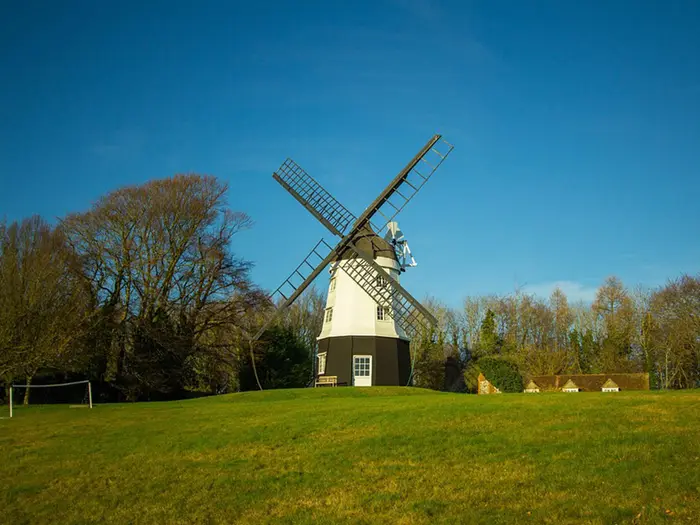 i
Image by Diego_torres
i
Image by Diego_torres The Chiltern Way is a 285 km circular walk through the Chilterns National Landscape, linking beech woods, chalk escarpment, dry valleys, farmland paths and flint-and-brick villages across Hertfordshire, Buckinghamshire, Oxfordshire and Bedfordshire. There is no official start or finish, but Hemel Hempstead railway station is the standard reference point and most itineraries run clockwise.
This is classic English lowland walking rather than wilderness trekking. Expect village pubs, railway access and frequent signs, but also long days, many stiles, muddy woodland paths after rain and repeated short climbs that add up to nearly 5,000 m of ascent.
The route’s best moments come from its variety: the Chess Valley and Chenies, Hambleden and Turville, the Thames near Goring, the Ridgeway above Ewelme, Ashridge, Whipsnade, Dunstable Downs and Sharpenhoe Clappers. Spring bluebells, autumn beech woods and red kites overhead are part of the Chiltern character.
It suits reasonably fit walkers looking for a first multi-day trail, especially those who want good transport links and the option to walk sections from London. Experienced hikers will still need to plan carefully, because accommodation and buses thin out in the quieter Oxfordshire and North Chilterns stretches.
This guide covers stages, daily distances, accommodation, food, transport, terrain and common planning mistakes.
Stage-by-Stage Guide
The stages below follow the 12-day clockwise itinerary from Hemel Hempstead, grouping the Chiltern Society’s 15 official sections into a practical through-walk. Several of these days are long for a lowland trail with nearly 5,000 m of total ascent, and Stages 11 and 12 in particular are better treated as two-day blocks by many walkers.
Stage 1: Hemel Hempstead to Chalfont St Giles — approx. 21 km
This opening stage leaves the standard reference start at Hemel Hempstead railway station and heads south into the Hertfordshire and Buckinghamshire Chilterns. It gives a good early sample of the route: field paths, quiet lanes, village edges, wooded sections and short climbs rather than any sustained hill walking.
The main line of interest is the Chess Valley. The route passes through or near Bovingdon, Flaunden and Sarratt before crossing the River Chess and continuing towards Chenies, a classic estate village close to Chenies Manor. Later, the route passes near the Chiltern Open Air Museum before reaching Chalfont St Giles.
Paths are generally straightforward but can be muddy after rain, especially through woodland and along field margins. Expect stiles, gates and occasional lane walking; the waymarking is helpful, but a map or GPS track is still useful where paths meet around villages and farmland.
Food and drink are most realistic at the start in Hemel Hempstead and in the villages along or near the route, but opening hours vary. Do not assume every village has all-day food, especially outside summer weekends; carry enough water and snacks for the full stage unless stops have been checked.
Chalfont St Giles has village services, but accommodation at the exact stage end should be booked ahead or planned nearby. Public transport is strong at Hemel Hempstead, while onward buses from Chalfont St Giles and surrounding villages should be checked before travelling.
Stage 2: Chalfont St Giles to Marlow Bottom — approx. 23 km
Stage 2 continues through the southern Chilterns, linking village paths, farmland and beech woodland. The route passes through Coleshill and Winchmore Hill before working west towards Marlow Bottom.
This is still a moderate lowland day, but the Chiltern pattern of repeated rises and dips starts to become more noticeable. After rain, shaded woodland and clay sections can be slippery, and chalky tracks may polish underfoot on descents.
There are no technical difficulties, but the navigation needs steady attention where rights of way cross field systems or enter woodland. The Chiltern Way discs should be followed carefully at junctions, and it is worth checking the onward direction before leaving each village.
Food and water are dependent on village pubs, shops or cafés where available. Services should be checked before setting off, as there can be gaps between reliable refreshment points.
Marlow Bottom is close to Marlow, one of the better accommodation and transport areas on this part of the route. Marlow has a railway station, but the exact link between the trail, Marlow Bottom and the station should be checked before booking or relying on it for a same-day exit.
Stage 3: Marlow Bottom to Stonor — approx. 20 km
This is one of the most attractive southern Chiltern stages, entering the Hambleden Valley and its chain of flint-and-brick villages. The route passes Hambleden, Skirmett, Fingest and Turville before descending towards Stonor.
The walking is classic Chiltern countryside: wooded slopes, enclosed valleys, field paths and quiet lanes. It is not high or exposed, but the repeated undulations make the day more tiring than the distance alone suggests.
Key highlights include Hambleden Valley, the village settings around Fingest and Turville, and the approach to Stonor Park. Stonor is a historic country house and private deer park near Henley, and the stage has a more rural feel than the early days from Hemel Hempstead.
Food and drink are possible in some valley villages if pubs or cafés are open, but this should be checked before travelling. Carry enough water for the full stage, particularly in warm weather, because reliable refill points cannot be assumed in the smaller villages.
Stonor is a weak point for public transport and end-of-day logistics. Accommodation and taxis should be arranged in advance; if walking this as a day section, using a car or pre-booked taxi is usually more practical than relying on buses.
Stage 4: Stonor to Sonning Common — approx. 18 km
Stage 4 is a shorter day on paper, but it still has the usual Chiltern mix of climbs, descents and enclosed rural paths. The route leaves the Stonor area and heads through the quieter Oxfordshire side of the Chilterns, passing Maidensgrove before continuing towards Sonning Common.
This section is less about big named viewpoints and more about steady countryside walking. Expect beech woods, dry valleys, farmland paths and quiet lanes, with conditions becoming muddy in wet spells.
Navigation can feel more involved where the route moves through woods and between minor settlements. Keep checking Chiltern Way discs at junctions, especially where other local paths share the same tracks or cross the route.
Food and water provision is patchier here than on the busier southern and Thames-side sections. Do not rely on finding frequent shops or cafés; plan a full day’s supplies unless specific stops have been checked.
Sonning Common is a more practical stage end than Stonor, but accommodation should still be booked ahead. Public transport from Sonning Common and nearby villages should be checked before travelling, as evening and weekend services can affect whether the stage works as a day walk.
Stage 5: Sonning Common to Woodcote — approx. 24 km
This longer stage combines the official sections from Sonning Common to Whitchurch Hill and onward to Woodcote. It is one of the more varied days on the route, with the Chiltern Way curving down towards the Thames-side country around Mapledurham, Whitchurch Hill and Goring before returning to higher ground.
The stage’s main landmark is the River Thames corridor near Goring and Streatley. The Chiltern Way also crosses the Ridgeway National Trail in this area, giving a strong sense of the wider long-distance path network around the Chilterns.
The terrain alternates between woodland, fields, lanes and open views over the Thames Valley. There are no mountain hazards, but a 24 km day over rolling ground can feel substantial, especially with mud underfoot.
Food and drink planning is easier around the larger Thames-side settlements than on some rural stages. Goring and Streatley are important service points, and Goring & Streatley railway station gives one of the best rail access options on the whole loop.
Woodcote has stage-end possibilities, but accommodation and evening food should be booked or checked ahead. If splitting the day, Goring & Streatley is the obvious transport break because of the railway station.
Stage 6: Woodcote to Ewelme — approx. 14 km
Stage 6 is a shorter, useful recovery day after the longer Thames-side stage. It runs from Woodcote to Ewelme through typical Chiltern farmland, lanes and wooded paths.
Although the distance is modest, the ground can still be slow in wet weather. Chalk and clay paths through woods and field edges can become greasy, so footwear with good grip matters even on these lower hills.
Ewelme is an important staging point because the next stage to Stokenchurch is the Chiltern Society’s Difficult section. Reaching Ewelme with time to rest, resupply and check the following day’s logistics is sensible.
Food and water should be planned conservatively. Woodcote and Ewelme are the key named settlements for this stage, but current services and opening hours should be checked before travelling.
Accommodation at or near Ewelme is not something to leave to chance. The quieter Oxfordshire sections have thinner provision, so book ahead or arrange a transfer from the trail if staying elsewhere.
Stage 7: Ewelme to Stokenchurch — approx. 19 km
This is the toughest official section of the Chiltern Way and is graded Difficult by the Chiltern Society. The route climbs the downs above Ewelme, passes near Swyncombe, and briefly shares the line of the Ridgeway National Trail through broadleaf woodland before continuing towards Ibstone and Stokenchurch.
The difficulty is not technical exposure, but the cumulative climbing, woodland terrain and potentially slippery surfaces. After rain, this stage can be notably harder than its distance suggests, and the descents require care on polished chalk or mud.
The high ground above Ewelme and the Ridgeway crossing are the main highlights. The stage has a more upland feel than many earlier days, with broadleaf woodland, downs and dry-valley country replacing the gentler village-to-village rhythm.
Food and water options should be treated as limited between Ewelme and Stokenchurch. Carry a full day’s supply unless definite stops have been checked, and do not rely on water from the landscape.
Stokenchurch is a practical road-access end point with services, but accommodation should still be arranged in advance. Public transport options and bus times should be checked before travelling, particularly for a one-way day walk.
Stage 8: Stokenchurch to Wendover Dean — approx. 24 km
Stage 8 is a long, varied Chiltern day through the central escarpment country. The route passes Radnage, Bledlow Ridge and Loosley Row before reaching Wendover Dean, threading ridges, valleys and beech woods around the Risborough Gap.
The walking is rarely severe, but the profile is constantly broken by short climbs and descents. Woodland paths can be muddy and shaded, while open chalk sections may be slippery when wet and hard underfoot in dry summer weather.
Bledlow Ridge and the Risborough Gap are the main landscape features. This is one of the stages where the Chilterns feel like a sequence of small ridges and enclosed valleys rather than a single continuous escarpment.
Services are likely to be intermittent, with villages providing the main chances for food and drink if anything is open. Carry enough water and lunch for the day unless current pub, shop or café options have been checked.
Wendover Dean is not the same as finishing in Wendover itself. Wendover has rail access in the wider area, but any connection from the trail end, as well as buses or taxis, should be checked before travelling.
This part of the route is one of the areas where HS2 construction diversions can affect the Chiltern Way. Check the current route status before setting out, especially if relying on printed directions.
Stage 9: Wendover Dean to Ashridge — approx. 18 km
Stage 9 continues north-east from Wendover Dean towards the Ashridge area. It is a shorter day than Stage 8, but still involves typical Chiltern field paths, woodland tracks, lanes and repeated undulations.
The route approaches Little Gaddesden and the National Trust’s Ashridge Estate, where beech and oak woodland become a major feature. The Bridgewater Monument is nearby, and there are views out towards Ivinghoe Beacon from the Ashridge area, although the Chiltern Way itself does not go over Ivinghoe Beacon.
Navigation deserves care around woodland edges and estate paths, where multiple tracks can make a wrong turn easy. Follow the green-on-white Chiltern Way discs and keep the map handy at junctions.
Food and water are best planned around the named settlements and Ashridge visitor area services where open, but this should be checked before travelling. Carry enough for the stage rather than depending on a single stop.
Accommodation at or near Ashridge, Little Gaddesden or nearby towns should be booked ahead. Public transport is not as straightforward as at the main railway-stage points, so arrange onward travel in advance if not staying locally.
HS2-related diversions can also affect the Wendover Dean and Ashridge sections. Check current route updates before travelling and allow time for any signed diversion on the ground.
Stage 10: Ashridge to Chalk Hill (Dunstable) — approx. 18 km
Stage 10 is one of the showcase days of the Chiltern Way. From the Ashridge area the route passes near Aldbury, continues through Studham and Whipsnade, and reaches Dunstable Downs before finishing at Chalk Hill in Dunstable.
The walking mixes woodland, village paths and the open chalk escarpment. The stage passes the boundary of Whipsnade Zoo and the Tree Cathedral before reaching the broad open ground of Dunstable Downs.
Dunstable Downs is the high point of the Chiltern Way at about 243 m and the highest point in Bedfordshire. It is a major view stage, with wide outlooks over the Vale of Aylesbury and a more open, airy feel than the enclosed beech-wood sections.
The escarpment is not technical, but it can be exposed to wind compared with the sheltered woods. In poor weather, keep close attention to the waymarks and avoid underestimating the time needed across open ground.
Food and drink may be available around the larger visitor and town areas, but opening times should be checked. Dunstable and Chalk Hill offer road access and more practical end-of-day options than some rural stages, though onward public transport still needs current checking.
Stage 11: Chalk Hill (Dunstable) to Great Offley — approx. 36 km
This is a very long day in the 12-stage itinerary and combines two substantial official sections: Chalk Hill to Barton-le-Clay, then Barton-le-Clay to Great Offley. Most walkers who prefer steady days should split it, especially if conditions are wet or daylight is limited.
The first part heads north from the Dunstable area through Chalton and Upper Sundon to Sharpenhoe Clappers. This beech-crowned Iron Age hillfort above the Bedfordshire plain is a major highlight, but the steep flight of steps down the scarp requires care, particularly in mud or after rain.
The route then continues through Barton-le-Clay and towards Pegsdon, where the North Chilterns chalk grassland and the ancient Icknield Way give the walking a more open downland character. The hills around Pegsdon are among the finest North Chilterns landscapes on the route.
Underfoot, expect a mixture of chalk paths, field tracks, woodland, grassland and lane links. The main challenge is endurance: 36 km with repeated ups and downs is demanding even though the highest ground is modest.
Food and water planning is important. Barton-le-Clay is the obvious mid-stage place to plan around, but services and opening hours should be checked before travelling; carry enough to cover long gaps.
Great Offley is a rural stage end rather than a major transport hub. Accommodation, evening food and onward travel should be arranged before arrival, or the stage should be split where logistics are easier.
Stage 12: Great Offley to Hemel Hempstead via Peters Green — approx. 50 km
The final stage in this 12-day grouping is exceptionally long and combines the official Great Offley to Peters Green section with the Peters Green to Hemel Hempstead section. At about 50 km, it is better planned as two days for most walkers, with Peters Green or Harpenden making more realistic break points depending on accommodation and transport.
From Great Offley the route passes Preston, St Paul’s Walden, Whitwell and Peters Green. The walking remains characteristic North Chiltern countryside: field paths, beech woods, lanes, village edges and rolling farmland rather than high-level terrain.
Beyond Peters Green, the route continues through or near Harpenden, Redbourn and Flamstead before returning to Hemel Hempstead. Harpenden is a major practical point on this stage because it has a railway station, making it a useful exit, entry or overnight logistics option.
The main difficulty is the distance. A 50 km day leaves little margin for mud, navigational pauses, short daylight or closed refreshment stops, and it is a poor choice for anyone carrying a heavy pack unless specifically trained for long-distance days.
Food and water can be planned around the larger settlements, especially Harpenden and the return to Hemel Hempstead, but the rural stretches between villages still require self-sufficiency. Check current services before travelling and carry enough water to avoid depending on uncertain stops.
Navigation remains important right to the end, as field paths and urban-edge rights of way can be easy to misread when tired. Hemel Hempstead railway station provides the standard loop finish and the strongest end-of-route public transport access.
Recommended Itinerary
The Chiltern Way has no official start or finish, but the most straightforward continuous itinerary uses Hemel Hempstead railway station as the reference start and walks clockwise. Distances below use the 12-day stage plan; check official mapping before booking accommodation, especially where an overnight stop is away from the exact line of the route.
This 12-day version suits fit walkers who are comfortable with repeated 20 km-plus days and two very long final days. Most walkers should consider splitting Days 11 and 12 unless they are deliberately planning an endurance schedule.
Standard 12-day itinerary
| Day | From | To | Approx. distance | Why this stage makes sense | Services/accommodation notes |
|---|---|---|---|---|---|
| 1 | Hemel Hempstead | Chalfont St Giles | 21 km | A manageable opening stage from the main reference railhead, easing into the Chess Valley, Sarratt, Chenies and the southern Chiltern villages. | Hemel Hempstead has rail access and is the easiest start point. Chalfont St Giles is a village finish, so accommodation and evening food should be arranged ahead. |
| 2 | Chalfont St Giles | Marlow Bottom | 23 km | A full but realistic day through the south-western Chilterns, keeping the itinerary moving before the more rural Hambleden and Stonor sections. | Marlow is one of the stronger service bases in this part of the route, but Marlow Bottom itself is not the same as finishing in Marlow town centre; check the exact overnight location before booking. |
| 3 | Marlow Bottom | Stonor | 20 km | A strong scenic day through the Hambleden Valley villages, including Hambleden, Skirmett, Fingest and Turville, before descending to Stonor. | Stonor has little or no public transport, so do not rely on arriving and improvising. Arrange accommodation, taxi or a pre-planned lift before walking this stage. |
| 4 | Stonor | Sonning Common | 18 km | A slightly shorter day after the awkward Stonor finish, useful if accommodation or transport logistics require a later start. | Provision is thinner in this quieter Oxfordshire section. Book ahead and carry enough food and water for the day. |
| 5 | Sonning Common | Woodcote | 24 km | A longer linking stage as the route curves towards Mapledurham, Whitchurch Hill, Goring and the Thames-side part of the loop. | Goring & Streatley has rail access and can be useful for transport planning, but the listed stage finish is Woodcote. Check how far your accommodation is from the route. |
| 6 | Woodcote | Ewelme | 14 km | A deliberately short day before the harder Ewelme-to-Stokenchurch section. It also gives some margin if the previous day has been extended by accommodation logistics. | Ewelme is a small village stop; book accommodation ahead or plan onward transport. Do not assume last-minute availability. |
| 7 | Ewelme | Stokenchurch | 19 km | This is the Chiltern Society’s Difficult section, climbing above Ewelme and briefly sharing the line with the Ridgeway through broadleaf woodland. | Treat this as a more demanding day than the distance suggests. Stokenchurch is a practical stage end, but accommodation should still be fixed in advance. |
| 8 | Stokenchurch | Wendover Dean | 24 km | A long day through ridges, valleys and beech woods around Radnage, Bledlow Ridge and the Risborough Gap, reaching the Wendover Dean area. | Wendover has rail access and services in the wider area, but Wendover Dean is a separate rural stage end. Check current HS2 construction diversions around this part of the route before travelling. |
| 9 | Wendover Dean | Ashridge | 18 km | A more moderate distance into the Ashridge section, giving time for the woods and estate landscape rather than rushing the day. | Accommodation needs planning around Ashridge and nearby villages. Check HS2-related route information before setting out. |
| 10 | Ashridge | Chalk Hill (Dunstable) | 18 km | A rewarding stage over Whipsnade, the Tree Cathedral and Dunstable Downs, the highest point on the Chiltern Way. | Dunstable is the practical service base for this stage. Chalk Hill and the downs are popular, but overnight options should be booked rather than assumed. |
| 11 | Chalk Hill (Dunstable) | Great Offley | 36 km | This combines the North Chilterns sections through Sharpenhoe Clappers, Barton-le-Clay, Pegsdon and the Icknield Way country into one long day. | This is an endurance stage. Many walkers should split it at Barton-le-Clay, the official section end, and arrange accommodation or transport there; this should be checked before travelling. |
| 12 | Great Offley | Hemel Hempstead, via Peters Green | 50 km | This combines the final two official sections, passing Preston, St Paul’s Walden, Whitwell, Peters Green, Harpenden, Redbourn and Flamstead before closing the loop at Hemel Hempstead. | This is too long for many walkers as a normal hiking day. Harpenden has rail access and is a sensible place to use for transport or to break the final leg; Peters Green is the official section end between the last two sections. |
Slower variant: 15 official sections
For most walkers who want a steadier schedule, the best slower plan is to follow the Chiltern Society’s 15 official sections rather than forcing the loop into 12 days. This keeps most days shorter and avoids the 36 km and 50 km finishes in the standard schedule.
| Day | From | To | Approx. distance | Why this stage makes sense | Services/accommodation notes |
|---|---|---|---|---|---|
| 1 | Hemel Hempstead | Chalfont St Giles | 13.0 mi | Follows the first official section from the reference start. | Good rail access at Hemel Hempstead; book the village finish ahead. |
| 2 | Chalfont St Giles | Marlow Bottom | 14.4 mi | Keeps the southern Chilterns section intact. | Use the Marlow area carefully for accommodation planning; check the exact distance from the route. |
| 3 | Marlow Bottom | Stonor | 12.6 mi | Gives time for Hambleden, Fingest, Turville and the approach to Stonor. | Stonor has little or no public transport; arrange onward logistics before walking. |
| 4 | Stonor | Sonning Common | 11.2 mi | A manageable rural stage after the awkward Stonor finish. | Accommodation and evening food should be booked ahead. |
| 5 | Sonning Common | Whitchurch Hill | 7.3 mi | A short day near the Thames-side part of the loop. | Useful where accommodation availability dictates a shorter walking day. |
| 6 | Whitchurch Hill | Woodcote | 7.6 mi | Keeps the Goring and Ridgeway-adjacent section unhurried. | Goring & Streatley rail access may help with staging, but check current train times. |
| 7 | Woodcote | Ewelme | 8.6 mi | Positions the walk neatly before the harder Ewelme-to-Stokenchurch section. | Book Ewelme logistics ahead. |
| 8 | Ewelme | Stokenchurch | 11.9 mi | The official Difficult section, best not bolted onto another long day. | Allow extra time for climbs, woodland paths and muddy conditions after rain. |
| 9 | Stokenchurch | Wendover Dean | 14.8 mi | A substantial day through the central Chiltern ridges and gaps. | Check accommodation or transfer options around Wendover Dean, and check current HS2 diversions. |
| 10 | Wendover Dean | Ashridge | 10.9 mi | A shorter day into the Ashridge Estate area. | Check HS2-related route information before travelling. |
| 11 | Ashridge | Chalk Hill / Dunstable Downs | 11.1 mi | Gives Dunstable Downs and the escarpment a full day rather than rushing through. | Dunstable is the practical service base. |
| 12 | Chalk Hill / Dunstable Downs | Barton-le-Clay | 10.8 mi | Splits the long North Chilterns stretch at the official section end. | Check accommodation or transport from Barton-le-Clay before committing. |
| 13 | Barton-le-Clay | Great Offley | 11.7 mi | Keeps the Pegsdon and Icknield Way country to a realistic day. | Rural services are limited; carry supplies. |
| 14 | Great Offley | Peters Green | 13.5 mi | Avoids combining the last two official sections into a 50 km day. | Peters Green needs advance planning for accommodation or transport. |
| 15 | Peters Green | Hemel Hempstead | 17.8 mi | A long but more realistic final day back to the Hemel Hempstead railhead. | Harpenden has rail access on this part of the route and can be used to shorten or break the final section if needed. |
Faster variant: 10 days
A 10-day completion is possible for experienced long-distance walkers, but it means averaging about 28.5 km per day before allowing for accommodation detours, mud, stiles and the route’s cumulative 4,991 m of ascent. It is not the best choice for a first multi-day walk.
The faster approach works only with pre-booked overnight stops or reliable transfers, because several useful stage ends are villages rather than major service centres. Exact stage distances should be checked on official mapping before booking; do not assume that every 28–30 km split will land at accommodation or public transport.
Wild camping should not be treated as a fallback. It is not generally permitted in England without the landowner’s permission.
Planning the Route
The Chiltern Way is unusually flexible for a long-distance walk because it is a loop with no official start or finish. Hemel Hempstead railway station is the standard reference point used by the guidebook and LDWA listing, and most written descriptions run clockwise from there, so that is the simplest option if following published notes closely.
Most walkers should plan around either the Chiltern Society’s 15 official sections or a compressed 10–12 day itinerary. The 15-section approach gives steadier days and works well for section-walking; a 10–12 day plan is possible for fit walkers, but it creates some long days unless extra accommodation, taxis or transport links are used carefully.
Choosing a pace
A relaxed end-to-end walk is best planned over 14–15 walking days, broadly matching the official sections. This keeps daily mileage more manageable and leaves time for slow ground through woodland, field paths, stiles and village detours for food or accommodation.
A 10–12 day schedule suits strong walkers who are comfortable with repeated long lowland days. The route has no mountains, but the repeated climbs over the chalk escarpment, dry valleys and beech hangers add up, especially after rain when chalk and clay paths can be slippery.
Trying to walk the Chiltern Way too quickly is rarely the most efficient plan. Accommodation is not evenly spread, and some section ends are small villages or rural points rather than service towns. It is usually better to plan around realistic overnight stops than to force a neat mileage target every day.
Official sections and practical staging
The Chiltern Society divides the current route into 15 numbered sections. These are the most useful planning framework, even if two shorter sections are combined on some days.
| Official section | Route | Distance |
|---|---|---|
| 1 | Hemel Hempstead to Chalfont St Giles | 13.0 miles |
| 2 | Chalfont St Giles to Marlow Bottom | 14.4 miles |
| 3 | Marlow Bottom to Stonor | 12.6 miles |
| 4 | Stonor to Sonning Common | 11.2 miles |
| 5 | Sonning Common to Whitchurch Hill | 7.3 miles |
| 6 | Whitchurch Hill to Woodcote | 7.6 miles |
| 7 | Woodcote to Ewelme | 8.6 miles |
| 8 | Ewelme to Stokenchurch | 11.9 miles — graded Difficult by the Chiltern Society |
| 9 | Stokenchurch to Wendover Dean | 14.8 miles |
| 10 | Wendover Dean to Ashridge | 10.9 miles |
| 11 | Ashridge to Chalk Hill / Dunstable Downs | 11.1 miles |
| 12 | Chalk Hill / Dunstable Downs to Barton-le-Clay | 10.8 miles |
| 13 | Barton-le-Clay to Great Offley | 11.7 miles |
| 14 | Great Offley to Peters Green | 13.5 miles |
| 15 | Peters Green to Hemel Hempstead | 17.8 miles |
Sections 5, 6 and 7 are the obvious candidates for combining if accommodation and daylight allow. By contrast, Section 8 from Ewelme to Stokenchurch deserves respect: it is the route’s officially difficult section, with more demanding Chiltern terrain despite its moderate mileage.
The later North Chilterns sections also need careful planning. A compressed 12-day itinerary can produce very long final days if Sections 12–15 are grouped too aggressively, so many walkers will find it more practical to add an extra night between Chalk Hill, Great Offley, Peters Green and Hemel Hempstead.
Accommodation planning
Accommodation is the main constraint on this route. Larger places such as Hemel Hempstead, Marlow, Goring, the Wendover area, Dunstable and Harpenden offer the best range of hotels, guesthouses, B&Bs and inns, but provision becomes thinner in quieter Oxfordshire and North Chilterns countryside.
Do not assume that every official section end has suitable accommodation within easy walking distance. Stonor is a particular example of a rural stop where transport and services are limited, so a taxi, lift or adjusted stage may be needed.
Book village accommodation ahead, especially if walking during popular spring, summer or autumn weekends. Pub opening hours, food service times and room availability can change, so these should be checked before travelling.
Camping is possible only where lawful sites or landowner permission are available. Wild camping is not generally permitted in England without the landowner’s permission, so it should not be treated as a fallback plan for missed accommodation.
Food and water
The Chiltern Way passes many villages and pubs, but it is still a countryside route rather than a continuous chain of services. Carry lunch or reserve food for sections where there is no guaranteed shop, café or pub at the right time of day.
Water planning is straightforward but should not be casual. Start each day with enough water for the full stage, especially in warm weather, because reliable refill points are not guaranteed between villages. Pub and café stops are useful, but opening times can be limited or seasonal.
Transport and section-hiking
The route is very well suited to section-hiking. Hemel Hempstead, Marlow, Goring & Streatley, Wendover and Harpenden all have railway stations, and local buses reach many section ends, making the loop practical to walk in stages from London and the surrounding counties.
Some rural section ends have little or no public transport. Stonor is the clearest example, and similar rural links may require a taxi, car shuttle or a revised start and finish point for the day. Current bus times should be checked before travelling.
Because there is no official start or finish, the route can be joined wherever transport is easiest. Hemel Hempstead remains the simplest full-loop start because it matches the standard guidebook itinerary, but a section-walker can equally build the walk around rail-accessible points such as Marlow, Goring & Streatley, Wendover or Harpenden.
Navigation and route updates
The Chiltern Way is waymarked with discs showing the name in green on white. Waymarking is generally one of the route’s strengths, but field-edge paths, woodland junctions, estate tracks and village exits still require proper navigation.
Carry the current Chiltern Society guide or section PDFs, plus mapping or a GPS track. A phone-only approach is risky if the battery fails or a diversion is in place.
Check for current route changes before setting out, especially around the Wendover Dean and Ashridge sections where HS2 construction diversions may affect the line of the walk. Temporary path closures and diversion signs should be followed on the ground.
Weather and ground conditions
Spring, summer and autumn are the best seasons for the Chiltern Way. Spring brings bluebells in the beech woods, summer gives the longest daylight for linked sections, and autumn is often good for woodland walking.
After rain, the chalk and clay paths through the woods can become muddy and slippery. Waterproof footwear with good grip is more useful than lightweight road-style shoes, particularly on wooded descents, field margins and the steep steps down from Sharpenhoe Clappers.
Hot weather also matters on the open chalk escarpment, including Dunstable Downs. Carry enough water, sun protection and a layer for exposed ridges, where conditions can feel different from the sheltered valleys and beech woods.
Shortening, extending and variants
Shortening the walk is simple because the loop can be left at any convenient transport point. The most practical way to reduce commitment is to walk selected official sections rather than attempt a continuous end-to-end.
Extensions and variants exist, including the Berkshire Loop and the North Chiltern Trail, but they should be treated as separate additions rather than part of the core Chiltern Way distance. Keep the main route plan based on the current 177-mile / 285 km loop, then add variants only if accommodation, transport and time still work.
Towns, Villages and Overnight Stops
The Chiltern Way is a village-to-village route rather than a wilderness trail, but overnight planning still needs care. The reliable accommodation bases are the larger towns and rail-linked places such as Hemel Hempstead, Marlow, Goring, the Wendover area, Dunstable and Harpenden; the quieter Oxfordshire and North Chilterns sections have thinner provision and should be booked ahead.
Do not assume every village has a shop, café or evening meal available. Pub and café opening hours can be limited or seasonal, so food stops and evening meals should be checked before travelling. Wild camping is not generally permitted in England without the landowner’s permission.
Hemel Hempstead
Hemel Hempstead is the standard reference start and finish for the loop, although the Chiltern Way has no official start or finish. It is the most straightforward place to begin if using the guidebook-style clockwise itinerary.
As a larger town with a railway station, it is one of the best places on the route for a pre-walk or post-walk night, last-minute supplies and public transport. It also works well for section hikers using rail access from London or the wider South East.
For most walkers, Hemel Hempstead is more of a logistics base than a scenic overnight. Its value is practical: transport, accommodation choice and the ability to start walking without needing a taxi to a rural trailhead.
Chalfont St Giles
Chalfont St Giles is the first major overnight target on the standard clockwise itinerary from Hemel Hempstead. It also marks the end of the Chiltern Society’s first official section.
It is a useful first-night stop because it gives a manageable opening day while keeping the route within classic Chiltern village country. Accommodation is likely to be more limited than in the larger towns, so book ahead rather than arriving speculatively.
The village is associated with John Milton and sits near the Chiltern Open Air Museum, but walkers should treat it primarily as a staging point. Check current food and pub opening hours before relying on it for an evening meal.
Marlow Bottom / Marlow
Marlow Bottom is the second overnight target in the 12-day itinerary and sits after the route has crossed through the southern Chilterns villages from Chalfont St Giles. For practical purposes, nearby Marlow is the stronger base, with railway access and better accommodation prospects.
This is one of the better places to plan a proper rest, resupply or shorter logistical reset before the route turns into the Hambleden Valley. If accommodation in Marlow Bottom itself is limited, using Marlow as the overnight base may be easier, but the link between the route and accommodation should be planned in advance.
Marlow is also useful for section walkers because it has a railway station. Confirm onward transport and any taxi needs before booking, especially if staying away from the exact line of the trail.
Hambleden, Skirmett, Fingest and Turville
These villages sit in the Hambleden Valley section between Marlow Bottom and Stonor. They are among the most attractive settlements on the Chiltern Way, with the route threading through a compact run of flint-and-brick villages and wooded valley walking.
They are excellent daytime stopping points, but less dependable as overnight bases unless accommodation has been arranged in advance. Food and drink options should be checked before relying on them, particularly outside peak walking hours.
This section is best planned as a through-walk to a booked overnight stop rather than a place to improvise. Carry enough food and water to avoid being dependent on one village pub or café being open.
Stonor
Stonor is a key overnight point in the standard itinerary, reached after the Hambleden Valley. It is close to Stonor Park, a historic country house and private deer park near Henley.
As a route stop, Stonor is scenically strong but logistically awkward. The brief public transport position is poor: Stonor has little or no public transport and is best linked by car or taxi if not staying directly on or near the route.
Accommodation and food should be booked and checked carefully before committing to this stage end. If no suitable overnight is available, plan a transfer to a better-served nearby base rather than assuming there will be options on arrival.
Sonning Common
Sonning Common is the next practical stop after Stonor on the 12-day plan. It sits on the approach to the Thames-side part of the route, before the Chiltern Way curves towards Mapledurham, Whitchurch Hill and Goring.
It can work as an overnight stop, but it should be treated as a village stop rather than a guaranteed full-service trail town. Accommodation may be limited, and any evening meal arrangements should be checked before travelling.
For walkers linking stages, Sonning Common is a useful place to break the quieter Oxfordshire stretch. This is one of the parts of the Chiltern Way where booking ahead matters more than on the rail-linked town sections.
Mapledurham, Whitchurch Hill and Goring
The route passes close to the River Thames near Mapledurham and Goring, crossing the Ridgeway National Trail and giving access to one of the best-connected parts of the walk. Goring, served by Goring & Streatley railway station, is one of the strongest practical bases on the whole loop.
For overnight planning, Goring is more useful than the smaller nearby settlements because it combines rail access with better accommodation prospects. It can be used to shorten or reshape the Sonning Common to Woodcote part of the itinerary.
This is also a sensible place to resupply, regroup or leave and rejoin the trail for a section walk. If staying off the exact route line, check the walking or taxi link between accommodation and the Chiltern Way.
Woodcote
Woodcote is used as an overnight stop in the 12-day itinerary after the Thames-side section. It sits before the shorter stage to Ewelme and the more demanding Ewelme-to-Stokenchurch section that follows.
It is a practical staging point, but accommodation and food should still be arranged ahead. Do not assume the same level of choice as in Goring, Marlow or Hemel Hempstead.
Woodcote is useful because it helps break the Oxfordshire part of the route into sensible walking days. It also places walkers well for an easier day to Ewelme before the tougher chalk-and-woodland section beyond.
Ewelme
Ewelme is a significant planning point because the next official section, from Ewelme to Stokenchurch, is graded Difficult by the Chiltern Society. The difficulty is still lowland walking, but the cumulative climbs, woodland paths and chalk-and-clay surfaces make it a more demanding day than the mileage alone suggests.
As an overnight stop, Ewelme is useful but should not be left to chance. Accommodation and meals in this quieter part of the route need advance planning.
Many walkers will want to start the Ewelme-to-Stokenchurch stage well fed and with enough food for the day. Check conditions after rain, as the Chiltern Way’s wooded chalk and clay paths can be slippery and muddy.
Stokenchurch
Stokenchurch is the end of the difficult Ewelme section and the start of the long onward stage towards Wendover Dean. It is therefore a natural overnight stop in a clockwise itinerary.
It is a good place to recover after the more demanding section, but accommodation should still be booked ahead. Treat it as a practical stop rather than a guaranteed large-service town.
Food arrangements are important here because the following stage towards Radnage, Bledlow Ridge and Wendover Dean is long in the 12-day schedule. Check opening times and carry enough supplies for the next day’s walking.
Radnage, Bledlow Ridge and Loosley Row
These settlements sit between Stokenchurch and Wendover Dean, in the ridges, valleys and beech woods around the Risborough Gap. They are useful landmarks and potential break points, but not the strongest overnight bases unless accommodation has been specifically arranged.
This stretch is better planned as a walking section through village country rather than a guaranteed resupply corridor. Carry food and water, and check any intended pub, café or shop before relying on it.
The terrain here is typical Chilterns: frequent short climbs and descents rather than one major ascent. In wet conditions, allow extra time for muddy woodland paths and stiles.
Wendover Dean / Wendover area
Wendover Dean is used as an overnight target in the 12-day itinerary, but the practical accommodation and transport base is the wider Wendover area. Wendover has railway access, making it valuable for both through-walkers and section hikers.
This is one of the better places to plan a break in the middle of the northern half of the loop. Accommodation in the Wendover area should still be booked in advance, especially if walking at weekends or during busy periods.
There is an important route-planning check here: current HS2 construction diversions around the Wendover Dean and Ashridge sections should be checked before travelling. Do this before finalising accommodation or taxi links, as diversions can affect where it is most convenient to leave or rejoin the trail.
Little Gaddesden, Ashridge and Aldbury
The route passes through the Ashridge area after Wendover Dean, with Little Gaddesden and Aldbury nearby on or near this part of the walk. This is one of the major landscape sections of the Chiltern Way, with beech and oak woodland on the National Trust’s Ashridge Estate and views towards Ivinghoe Beacon.
Ashridge works well as a scenic stage end, but it is not as straightforward as a rail-linked town. Accommodation and transport should be arranged before arrival, particularly if staying in or near one of the smaller villages.
This is a good area to slow the itinerary if walking the route over more than 12 days. It also makes a strong section-walk base when combined with a planned lift, taxi or public transport link checked in advance.
Whipsnade, Dunstable Downs and Chalk Hill (Dunstable)
From Ashridge the route continues towards Whipsnade, the Tree Cathedral and Dunstable Downs, the highest point on the Chiltern Way at about 243 m. Chalk Hill on the Dunstable side is used as the stage end in the 12-day itinerary.
For overnight logistics, Dunstable is the practical base in this area. It has better accommodation prospects than the smaller villages and is a useful place to reset before the long North Chilterns stages.
Dunstable Downs also has a National Trust gateway centre, which can be useful during the day, but do not rely on any single facility without checking current opening times. The open chalk escarpment can feel very different from the wooded sections, so carry layers even in otherwise settled weather.
Barton-le-Clay, Pegsdon and Great Offley
These places sit on the North Chilterns part of the route after Dunstable and Sharpenhoe Clappers. The 12-day itinerary groups this into a very long day from Chalk Hill to Great Offley, so many walkers will want to split it if time allows.
Barton-le-Clay, Pegsdon and Great Offley are useful staging points, but accommodation is more patchy than in the main towns. Book ahead and check food options carefully before deciding where to stop.
This part of the route includes chalk-grassland reserves and sections along the ancient Icknield Way around Pegsdon. It is rewarding walking, but the practical challenge is spacing: avoid creating an overlong day simply because the next confirmed bed is too far away.
Preston, St Paul’s Walden, Whitwell and Peters Green
These villages sit on the long return leg from Great Offley towards Hemel Hempstead. In the 12-day plan, Peters Green is passed on the final long day, but this area can also be used to break the route into shorter stages.
Accommodation and services should be treated as limited unless booked and checked ahead. This is not the part of the Chiltern Way to rely on spontaneous evening meals or last-minute rooms.
For walkers not wanting a 50 km final day, arranging an overnight or transfer around this section can make the finish much more comfortable. Check public transport before committing, as village bus services can be limited and timetables change.
Harpenden
Harpenden is one of the most useful transport and accommodation bases on the final part of the loop. It has a railway station and is listed among the stronger accommodation locations on or near the route.
It is particularly useful for section hikers, or for through-walkers who want to avoid an excessively long final day into Hemel Hempstead. Using Harpenden as a stop can make the last leg more manageable.
Because Harpenden is better connected than the surrounding villages, it is also a good point for resupply and travel adjustments. Check the exact link between the trail and any accommodation before booking.
Redbourn and Flamstead
Redbourn and Flamstead come late in the clockwise route before the return to Hemel Hempstead. They are useful final-stage landmarks and potential break points if the last day has been shortened.
They should be treated as village stops rather than guaranteed full-service bases. Accommodation, meals and transport need checking in advance.
The main advantage of stopping around here is pacing: it can turn a demanding final push into a more relaxed finish at Hemel Hempstead. If the aim is to finish directly in Hemel Hempstead, carry enough food and water to avoid depending on uncertain village services.
Getting to the Start
The Chiltern Way has no official start or finish. Hemel Hempstead railway station is the standard reference point used for the guidebook itinerary and is the most straightforward place to begin if walking the loop in the usual clockwise direction.
Because this is a circular route, you can also start at another convenient rail-served point such as Marlow, Goring & Streatley, Wendover or Harpenden if that suits accommodation, public transport or section-walking plans better.
By train
Hemel Hempstead railway station is the practical start for the standard itinerary. The route returns to the same station at the end, so it works well for walkers arriving by public transport and avoiding the need to retrieve a car from a different finish.
Rail access from London and the wider South East is one of the strengths of the Chiltern Way. Other useful stations around the loop include Marlow, Goring & Streatley, Wendover and Harpenden, which makes the route unusually easy to split into day walks or shorter blocks.
Train times, engineering works and first/last services should be checked before travelling, especially if planning a long first day or returning from a section end late in the day.
By bus
Local buses reach many towns and villages around the Chiltern Way, but services vary considerably by section. They are useful for day-walk logistics, shortening stages or linking accommodation away from the line of the path.
Do not assume every official section end has a usable bus service. Stonor, for example, has little or no public transport and is better treated as a pre-booked accommodation, taxi or car-supported stop.
Current bus times should be checked before travelling. Rural Chilterns services can be infrequent, reduced at weekends or unsuitable for early starts and late finishes.
By car
Driving to Hemel Hempstead can work if you are walking the full loop and returning to the same place. It is less convenient for linear day sections unless paired with a second car, taxi or public transport link.
Long-stay parking arrangements at or near Hemel Hempstead railway station are not fixed trail facilities and should not be assumed. Check current parking options, charges, restrictions and overnight rules before leaving a vehicle for multiple days.
For walkers starting elsewhere on the loop, choose a town or village with both accommodation and a reliable onward transport plan. Some rural section ends are poor places to leave a car or try to arrange an onward bus at short notice.
From the nearest airport
For overseas walkers, the simplest plan is usually to travel onward to London or another suitable rail hub, then continue by train to Hemel Hempstead or to another chosen start point on the loop. Exact airport-to-trail connections depend on arrival airport, landing time and current rail or coach services.
This should be checked before travelling, particularly for evening arrivals when onward public transport may limit the realistic first-night options.
Where to stay before starting
Hemel Hempstead is the most practical pre-walk overnight stop for the standard itinerary, with town accommodation and immediate access to the reference start at the railway station. Staying there avoids beginning the first day with an extra transfer.
Accommodation is also available in several larger towns around the loop, including Marlow, Goring, Wendover, Dunstable and Harpenden. These can be useful alternative start points for section-walkers or anyone adapting the route around rail access.
Village accommodation is patchier in the quieter Oxfordshire and North Chilterns sections, so do not rely on finding a room at short notice once committed to a stage plan. Book key stops ahead, and check taxi availability in advance where a stage end has limited public transport.
Getting Home from the Finish
The Chiltern Way is a circular route, so the practical finish is wherever you chose to begin. In the standard guidebook itinerary this is Hemel Hempstead railway station, which makes the final exit unusually straightforward for a long-distance walk.
If you started at another rail-served point such as Marlow, Goring & Streatley, Wendover or Harpenden, use that same place as the finish and plan the homeward journey around that station instead. If you started from a village or a quieter section end, onward transport may be more limited and should be checked before travelling.
By train
For the standard finish, the route returns to Hemel Hempstead railway station. From there, trains provide onward connections towards London and the wider rail network; current times, engineering works and ticket restrictions should be checked with National Rail before committing to a finish-day schedule.
This is the easiest option if you are completing the full loop without a car. It also works well for walkers who have split the route into sections, as several other places on or near the Chiltern Way have railway stations, including Marlow, Goring & Streatley, Wendover and Harpenden.
If finishing late in the day, do not assume the last train will suit a delayed arrival. The final stages include field paths, lanes and woodland sections where slow going, mud or tired legs can easily add time, so build in a margin or book accommodation at the finish.
By bus
Local buses serve many Chiltern Way section ends, but coverage is uneven. A few places on the route have little or no public transport, with Stonor specifically worth treating as a car or taxi link rather than a dependable bus finish.
For a full-route finish at Hemel Hempstead, bus travel is usually a secondary option rather than the simplest way home, because the railway station is already the standard finish point. For section walkers, bus times should be checked before travelling, especially for evenings, Sundays and public holidays.
By car/taxi
If a car has been left at the start, the circular format is convenient: finishing at the same point avoids a cross-country transfer. Parking rules, charges and overnight restrictions at the chosen start point should be checked before leaving a vehicle for multiple days.
Taxis are useful for awkward section ends, late finishes or accommodation that sits off the route. They should be booked ahead where possible, particularly in the quieter Oxfordshire and North Chilterns countryside where village transport options can be thin.
From the nearest airport
Airport transfers are not a core part of Chiltern Way logistics for most walkers, because the route is normally accessed by rail from London or by local transport within the Chilterns. If flying in or out, choose the London-area airport that best matches your rail connections to the chosen start or finish point. This should be checked before travelling.
Where to stay at the finish
Hemel Hempstead is the most practical overnight finish if using the standard itinerary, especially after a long final day or if onward trains would be tight. It also gives a buffer if bad weather, muddy paths or accumulated fatigue slow the last stage.
If finishing elsewhere on the loop, accommodation is more variable. Larger towns and rail-served stops are easier to plan around, while smaller villages may have limited rooms, so book ahead rather than relying on finding a bed at the end of the walk.
Which Direction Should You Walk?
The Chiltern Way has no official start or finish, and it can be walked in either direction. In practice, the standard and simplest choice is to start at Hemel Hempstead railway station and walk clockwise, heading south first towards Bovingdon, Sarratt, Chenies and Chalfont St Giles.
That clockwise direction matches the usual guidebook and LDWA-style description of the route, and it follows the Chiltern Society’s numbered section order. This makes planning easier: accommodation stops, section breaks, route notes and mileage are simpler to line up when using the published material.
Clockwise: the standard choice
Clockwise gives the most straightforward planning flow. From Hemel Hempstead the route builds through the Chess Valley and the southern Chiltern villages, then reaches the Hambleden Valley, Stonor, the Thames-side country around Mapledurham and Goring, and the tougher Ewelme-to-Stokenchurch section before turning north-east towards Wendover Dean, Ashridge and Dunstable Downs.
The major open escarpment moments — Ashridge, Whipsnade, Dunstable Downs, Sharpenhoe Clappers and the North Chilterns around Pegsdon — come in the second half of a full circuit. That gives the walk a good sense of progression: gentler wooded and village walking first, then broader chalk downland and higher, more exposed country later.
Clockwise also puts the steep steps down from Sharpenhoe Clappers as a descent. Some walkers will prefer that to climbing them, though after rain the steps and surrounding chalk/clay paths can still be slippery and need care.
Anticlockwise: when it makes sense
Anticlockwise is perfectly workable, especially for walkers fitting the route around accommodation availability, weekend rail access or a staged completion over many day walks. Because this is a circular route with several rail-accessible points — including Hemel Hempstead, Marlow, Goring & Streatley, Wendover and Harpenden — direction is usually less important than where beds and transport line up.
Walking anticlockwise from Hemel Hempstead sends you towards Flamstead, Redbourn, Harpenden and the North Chilterns first. This brings Dunstable Downs, Sharpenhoe Clappers and Ashridge much earlier, leaving the Thames-side and southern Chiltern sections for later in the walk.
The main downside is practical rather than scenic. Published section numbering and most route descriptions run the other way, so reversing the route can make navigation notes and day planning slightly more awkward.
Climbs, weather and logistics
There is no clear climbing advantage in either direction. The Chiltern Way is defined by frequent short climbs and descents rather than one sustained mountain ascent, and the total ascent is the same whichever way the loop is walked.
Weather is also not a strong reason to choose one direction. The exposed chalk escarpment sections around places such as Dunstable Downs and Sharpenhoe Clappers can feel windy or bleak in poor conditions, but that is a day-by-day forecast issue rather than a clockwise-versus-anticlockwise decision.
Accommodation is the bigger constraint. Provision is patchier in quieter parts of the Oxfordshire and North Chilterns countryside, and section ends such as Stonor have limited public transport. Book village stops ahead and check current bus times before building a direction around public transport.
Recommendation
For a first complete walk, choose the standard clockwise circuit from Hemel Hempstead railway station. It aligns best with the usual route descriptions, gives a natural scenic progression through the Chilterns, and finishes conveniently back at the main reference station.
Walk anticlockwise only if it solves a specific accommodation, transport or scheduling problem. The route works both ways, but clockwise is the lower-friction option for most independent hikers.
Accommodation Along the Route
The Chiltern Way works well as an inn-to-inn or B&B-to-B&B walk, but it needs more planning than the map may suggest. The route repeatedly leaves the larger towns for small Chiltern villages, wooded valleys and escarpment country, so accommodation can be strong one night and very thin the next.
The easiest places to anchor an itinerary are the larger service centres on or near the loop: Hemel Hempstead, Marlow, Goring, the Wendover area, Dunstable and Harpenden. The awkward stretches are the quieter Oxfordshire and North Chilterns sections, where village rooms and pub accommodation should be booked before committing to daily mileages.
Wild camping is not generally permitted in England without the landowner’s permission. There are some campsites in the wider area, but the Chiltern Way is better treated as a booked-accommodation route rather than a route where a camping place can be assumed at the end of each day.
Best overnight bases
| Place | Accommodation level | Best for | Notes |
|---|---|---|---|
| Hemel Hempstead | Good | Start/finish night; rail-based logistics | The standard guidebook reference point has railway access and is one of the most practical places to begin or end the loop. |
| Chalfont St Giles | Limited | First clockwise overnight stop | A useful village stop after the opening section. Book ahead rather than assuming last-minute rooms. |
| Marlow Bottom / Marlow | Good | Southern Chilterns stop with stronger services nearby | Marlow has better accommodation and rail access than many villages on the route. A short transfer or off-route adjustment may be needed depending on the chosen lodging. |
| Hambleden, Fingest, Turville and Stonor area | Limited | Breaking up the Hambleden Valley and Stonor sections | Very attractive walking country but not a place to improvise accommodation. Stonor is also awkward for public transport, so taxi planning may be needed. |
| Sonning Common | Limited | Overnight between Stonor and the Thames-side stages | A practical village stop, but availability should be checked before fixing the day’s end. |
| Goring | Good | Thames-side break, restock and rail access | One of the stronger mid-route bases, especially useful if spreading the walk over stages. The route comes close to the Thames near Goring and crosses the Ridgeway National Trail in this area. |
| Woodcote | Limited | Shorter overnight before Ewelme | Useful for keeping the Oxfordshire stages manageable. Book ahead, as this part of the route has thinner provision. |
| Ewelme | Limited | Positioning before the Ewelme-to-Stokenchurch section | The following section is graded Difficult by the Chiltern Society, so securing accommodation at both ends is sensible before setting out. |
| Stokenchurch | Limited | End of the Ewelme-to-Stokenchurch section | A key overnight point if following the common clockwise plan. Do not rely on finding spare rooms on arrival. |
| Wendover Dean / Wendover area | Limited on the route; better nearby | Breaking the long Stokenchurch-to-Ashridge part of the loop | Wendover itself has rail access and is the stronger base in this area, but the route uses Wendover Dean rather than a town-centre finish. Check current access, accommodation location and any transfer needs before booking. |
| Ashridge / Aldbury / Little Gaddesden area | Limited | Overnight before or after the Ashridge Estate | Excellent walking country but rural in feel. Pre-booking is important, especially if connecting this stage with Dunstable Downs. |
| Dunstable / Chalk Hill | Good | North Chilterns service stop | Dunstable is one of the better accommodation areas on the northern half of the loop and a useful place to reset before the next rural stages. |
| Barton-le-Clay, Great Offley and Peters Green | Limited | Breaking the long northern sections | The standard 12-day outline creates very long days here if stages are combined. Using these places as breakpoints can help, but accommodation and onward transport need arranging in advance. |
| Harpenden | Good | Rail-based section walking; final approach to Hemel Hempstead | Harpenden has railway access and is one of the most useful bases late in the route, particularly for walkers not completing the final northern-western arc in one push. |
| Redbourn and Flamstead | Limited | Final rural overnight options before Hemel Hempstead | Useful if shortening the last approach, but they should be treated as booked village stops rather than flexible accommodation hubs. |
Booking strategy
For a continuous 10–12 day walk, book the thinner village nights first, then build the easier town nights around them. The critical points are likely to be the rural stops around Stonor, Sonning Common, Woodcote, Ewelme, Stokenchurch, Ashridge and the North Chilterns villages.
Friday and Saturday nights can reduce flexibility, particularly where the only realistic options are small inns, guesthouses or B&Bs. Spring, summer and autumn are the main walking seasons for the Chilterns, so advance booking is especially sensible on weekends and around popular village stops.
Do not assume every official section end has a bed, a taxi rank and a late meal. Some section ends are villages or rural points rather than service towns, and Stonor in particular has little or no public transport. This should be checked before travelling.
Using taxis, rail and luggage transfers
Taxi transfers are a practical way to make the accommodation work, especially where the route ends a day in a small village but better lodging is available in a nearby town. Pre-booking is sensible for rural pick-ups, evening arrivals and early starts.
The strong rail access at Hemel Hempstead, Marlow, Goring & Streatley, Wendover and Harpenden also makes the route unusually easy to split into weekends or day walks from London. This can remove pressure from the accommodation plan, particularly on the longer northern stages.
Walkers wanting luggage transfer should plan this before booking the itinerary rather than assuming a dedicated end-to-end service is available. A light-pack approach using rail, taxis and fixed accommodation is often the simplest solution on this route.
Camping and Wild Camping
Camping is possible on a Chiltern Way itinerary, but this is not a natural backpacking route in the Scottish or Alpine sense. The walk passes through settled lowland England: villages, farmland, beech woods, chalk grassland, private estates and popular National Landscape countryside. Most walkers will find it easier to mix booked accommodation with the occasional campsite rather than rely on camping every night.
There are some campsites in the wider Chilterns, but they are not evenly spaced along the 285 km loop and may sit off the line of the path. If camping, build the itinerary around confirmed overnight places rather than assuming each official section end will have a pitch nearby. This should be checked before travelling.
Formal campsites
Use established campsites wherever possible. They give access to water, toilets, waste disposal and a legal overnight stop, which matters on a route that crosses so much private land.
The most practical approach is to search for campsites near the larger trail towns and transport points, then adjust walking days around them. Hemel Hempstead, Marlow, Goring, Wendover, Dunstable and Harpenden are the sort of places to check first because they have better services and onward transport than the smaller villages. Availability, opening dates and whether walkers with small tents are accepted should be confirmed before booking.
Expect some parts of the loop to be awkward for camping, especially in the quieter Oxfordshire and North Chilterns countryside where accommodation and services thin out. A campsite may require a detour, a taxi link, or a shorter/longer day than the standard section plan.
Wild camping legality and reality
Wild camping is not generally permitted in England without the landowner’s permission. That applies on the Chiltern Way, including farmland, woodland, estate land and the protected countryside of the Chilterns National Landscape.
In practical terms, the route is poorly suited to discreet wild camping. Much of it crosses working fields, enclosed woods, village edges, National Trust land around Ashridge, popular chalk downland such as Dunstable Downs, and nature-rich scarp areas such as Sharpenhoe Clappers and the North Chilterns chalk grasslands. These are not places to pitch without explicit permission.
If a landowner, pub, farm or campsite grants permission to camp, agree exactly where to pitch, whether water is available, whether a stove is allowed, and what time to leave. Do not assume that a quiet field edge, woodland ride or downland slope is acceptable simply because it is out of sight.
Water and resupply for campers
Do not plan to rely on natural water sources. The route crosses or approaches rivers such as the Chess and the Thames, but this is lowland farming and village country, and water from streams or rivers should not be treated as a dependable camping supply.
Carry enough water between known services and refill from proper taps where permission is available: campsites, booked accommodation, pubs, cafés or village facilities. In warm weather, the open chalk sections around the escarpment can feel exposed, and water planning becomes more important than the modest elevations suggest.
Fires, stoves and low-impact camping
Open fires are inappropriate on this route. Chalk grassland, beech woodland, dry leaf litter, farm edges and busy public sites are all poor places for fire use, and fires can cause lasting damage even when the ground looks robust.
Use a stove only where it is permitted by the campsite or landowner. In dry periods, even stove use may be restricted, so check local rules and keep cooking simple.
Minimum-impact practice is essential:
- camp only where legally permitted;
- arrive late and leave early if using a permission-based pitch;
- keep tents away from paths, crops, livestock and gateways;
- take all litter out, including food scraps and toilet waste where facilities are not provided;
- never damage trees, hedges, chalk grassland or bluebell woods;
- keep noise low near villages and farms;
- leave no trace of the pitch.
When camping works best on the Chiltern Way
Camping works best for walkers who are flexible about stage lengths and willing to detour or use public transport to reach legal pitches. The route’s strong rail access also makes it easy to split the loop into shorter camping trips rather than carrying full kit for the entire circuit.
A pure end-to-end camping itinerary is possible only with careful pre-booking and realistic expectations. For most independent walkers, the more reliable plan is to combine campsites with B&Bs, inns or hotels, especially through the thinner-service stretches around Stonor, the Oxfordshire sections, and parts of the North Chilterns.
Terrain, Conditions and Difficulty in Practice
The Chiltern Way is a lowland walk, but it is not flat. Its difficulty comes from repetition: short climbs out of dry valleys, descents through beech hangers, rolling farmland and escarpment paths that keep adding height over many days. Across the full 285 km / 177 miles, the route gains about 4,991 m, which is substantial for a walk with a high point of only about 243 m at Dunstable Downs.
There is no scrambling, no mountain terrain and no technical ground. Most walkers with good hill-walking fitness will find the surfaces straightforward, but the route can feel harder than its “moderate” label after rain, when chalk and clay paths become greasy and wooded descents take more care.
Typical path surfaces
Expect a classic Chilterns mix rather than one consistent trail surface. The route uses woodland paths, chalk grassland, field-edge paths, farm tracks, dry valley paths and quiet lanes, with frequent transitions between them.
Beech woodland is one of the defining surfaces of the route. In dry weather these paths are usually easy underfoot, but after rain they can become muddy and slippery, especially where chalk, clay and leaf litter combine on shaded slopes.
Chalk grassland and escarpment sections are generally firm and pleasant in settled weather. In wet conditions, chalk can polish into a slick surface, so descents need more care than the modest gradients might suggest.
Farmland paths are frequent. These can be rutted, muddy, cropped close to the right of way or awkward after ploughing, so daily pace can vary more than the map distance implies.
Climbs, descents and the cumulative effort
The Chiltern Way rarely has long mountain-style climbs, but it repeatedly drops into valleys and climbs back onto ridges. This makes the walk more tiring than a simple mileage calculation suggests, particularly on longer combined days.
The Ewelme to Stokenchurch section is the one formally graded Difficult by the Chiltern Society. It crosses hillier downland and woodland around the Ridgeway crossing above Ewelme and is a section to treat with more respect, especially in wet weather.
The northern Chilterns also contain sharper-feeling ground. Dunstable Downs gives the route its highest on-route point and a more open escarpment feel, while Sharpenhoe Clappers has a steep flight of steps down the scarp. These are not technical obstacles, but tired legs will notice them.
Mud, slipperiness and wet-weather difficulty
Mud is the main condition that changes the character of the Chiltern Way. Woodland paths through the beech hangers, shaded field paths and clay sections can become slow after prolonged rain.
The most common hazard is not depth of mud but loss of grip. Chalk descents, wet roots, leaf-covered slopes and trodden clay can all be slippery, so shoes or boots with reliable tread matter more than ankle height alone.
After a wet spell, allow extra time for stages through woodland and farmland. Stiles, gates and churned approaches to field boundaries also slow progress when the ground is saturated.
Road walking and lanes
The route is primarily a countryside footpath walk, but quiet lanes and village approaches are part of the pattern. These lane sections are generally part of linking the rights-of-way network between woods, valleys and settlements rather than long road marches.
Take normal care on narrow lanes, especially where there is no pavement, on bends, or in poor visibility. The road walking is not the defining difficulty of the Chiltern Way, but it does affect footwear choice: very soft fell shoes can feel less comfortable over a multi-day itinerary with repeated hard-surface sections.
Stiles, gates and field boundaries
Many stiles are a practical feature of the route. They make the walk feel slower than a broad-track route and can be tiring over successive long days, particularly with a heavy pack.
Walkers with dogs should plan carefully, as repeated stiles and farmland boundaries can be awkward. The route’s field and woodland character also means gates should be left as found and dogs kept under close control around livestock or sensitive countryside.
Exposed sections
Most of the Chiltern Way is sheltered by woodland, hedgerows and rolling farmland, but the open escarpment sections feel different. Dunstable Downs is the clearest example, with broad chalk downland and wide views over the Vale of Aylesbury.
In settled weather these open sections are among the easiest walking on the route. In strong wind, rain or hot sun they can feel more exposed than the surrounding wooded country, so waterproofs, sun protection and an extra layer should still be carried even though the route is low-level.
Seasonal conditions
| Season | What changes in practice |
|---|---|
| Spring | Often one of the best times for the beech woods and chalk grassland, but rain can leave woodland and field paths muddy. Bluebell woods are a highlight, though shaded paths may stay wet. |
| Summer | Generally the easiest underfoot conditions, with long daylight for bigger stages. Field edges and enclosed paths can be more overgrown, and open chalk sections can feel hot in full sun. |
| Autumn | Excellent for beech colour, but fallen leaves can hide mud, roots and uneven ground. Wet chalk and leaf litter make descents more slippery. |
| Winter | Not the main recommended season for the route. Short days, mud and slippery woodland paths make the same mileage harder, particularly on the longer stage combinations. |
What makes the Chiltern Way easier
The route is waymarked with Chiltern Way discs, with the name in green on white, and it passes regularly through villages and settled countryside. There is no remote upland navigation and no need for specialist mountain equipment in normal conditions.
The loop format and strong rail access at places such as Hemel Hempstead, Marlow, Goring & Streatley, Wendover and Harpenden also make it easier to split the walk into manageable sections. This is one reason the Chiltern Way works well as a first long-distance route for fit walkers.
What makes it harder
The total distance is the main test. A 10–12 day itinerary means several long days, and the cumulative ascent, stiles and muddy sections can make the final third feel harder than the early stages.
The 12-day grouping also creates very uneven days, including notably long later stages if followed exactly. Walkers who prefer steady daily mileage may find the official 15-section structure easier to manage than compressing the whole loop too aggressively.
Conditions around Wendover Dean and Ashridge can also be affected by HS2 construction diversions. Current diversions should be checked before travelling, as they may alter the exact underfoot experience and daily timing in that part of the route.
Weather and Best Time to Walk
Best time of year
The Chiltern Way is best planned for spring, summer or autumn, with late spring and early autumn usually offering the strongest balance of daylight, comfortable walking conditions and attractive woodland. Spring brings bluebells in the beech woods, while autumn gives the Chilterns their best colour without the highest summer heat.
Summer is entirely realistic, but the longer combined days need early starts, especially where the itinerary groups official sections into 24 km-plus days. Open chalk downland such as Dunstable Downs can feel exposed in sun and wind, while field paths and dry valleys can offer less shade than the wooded sections.
Winter is possible because this is a lowland route with no mountain terrain, but it is not the easiest season for a continuous 10–12 day walk. Short daylight, wet ground, slippery chalk and clay, and reduced flexibility with accommodation and transport make winter better suited to day-walking or a slower schedule using more of the Chiltern Society’s 15 official sections.
Seasonal trail conditions
| Season | What to expect on the Chiltern Way |
|---|---|
| Spring | Often one of the best times to walk, especially through the beech woods. Paths can still be muddy after wet spells, and grass or field-edge vegetation may grow quickly later in the season. |
| Summer | Long daylight helps with the bigger days, but carry enough water between villages and do not rely on every pub or shop being open when needed. Woodland gives shade, but open escarpment sections can be hot and exposed. |
| Autumn | Excellent walking conditions in settled weather, with strong beech woodland colour. Fallen leaves can hide roots, ruts and slippery chalk, especially on descents and in wooded valleys. |
| Winter | Walkable in principle, but slower. Expect mud, frost or ice on shaded paths, awkward stiles in wet fields, and short days that make the longest itinerary stages impractical for many walkers. |
Rain, mud and slippery ground
Rain is the main weather factor on this route. The Chiltern Way uses chalk and clay paths through woods, farmland and dry valleys, and these can become slippery and muddy after wet weather.
Allow extra time after prolonged rain, particularly on wooded slopes, beech hangers and sections with repeated short climbs and descents. The Ewelme to Stokenchurch section is graded Difficult by the Chiltern Society and is a poor place to underestimate wet ground.
Take particular care on the steep steps down from Sharpenhoe Clappers when wet, frosty or covered in leaves. Walking poles can be useful, not for technical ground, but for balance on slick chalk, clay and worn field paths.
Wind, fog and exposed escarpment
Although the highest point on the route is only about 243 m at Dunstable Downs, the open chalk escarpments can feel much more exposed than the altitude suggests. Dunstable Downs is known for wide views and wind, so pack a windproof layer even in mild weather.
Fog, low cloud or heavy rain can reduce visibility on open downland and farmland, where waymarking may be less obvious than in villages or woodland edges. Keep the map or GPS accessible rather than relying only on following the next Chiltern Way disc.
Daylight and itinerary planning
Daylight matters more than altitude on the Chiltern Way. A 10–12 day schedule includes some long days, and these become much harder outside the main walking season.
In late autumn and winter, consider splitting the route into shorter stages or using the 15 official Chiltern Society sections rather than combining them. This is especially sensible where public transport is limited, such as around Stonor, or where a missed bus would leave a long road walk or taxi transfer.
Accommodation and seasonal availability
Accommodation should be booked ahead in all seasons, especially in the quieter Oxfordshire and North Chilterns countryside where provision is thinner. Summer weekends and holiday periods can reduce choice, while some campsites and smaller places to stay may not operate year-round.
Pubs, village shops, buses and accommodation opening patterns can change by season and day of week. Current opening times, bus times and any planned diversions should be checked before travelling, particularly around the Wendover Dean and Ashridge sections where HS2 construction diversions may affect the route.
Insects and ticks
Ticks are a sensible precaution on a route with woodland, chalk grassland and field margins. In the warmer months, check skin and clothing after walking through long grass, bracken or wooded edges.
Insect repellent, long socks or trousers, and a quick tick check at the end of the day are practical additions without needing any special expedition kit.
Safety Notes
The Chiltern Way is a lowland, well-waymarked route rather than a mountain walk, but it still needs sensible planning. The main risks are long days, slippery chalk and clay after rain, road and lane sections, livestock in farmland, and exposed weather on the open downs.
In an emergency in the UK, call 999 or 112 and ask for the relevant service. Carry enough battery to make a call at the end of the day, and do not assume a phone will solve navigation problems in every wood, valley or rural section.
Navigation and phone signal
The route is waymarked with Chiltern Way discs, but waymarks can be missed at field edges, junctions, woodland exits and village lanes. Carry a map, downloaded route file or guidebook notes as well as relying on signs.
Mobile signal is generally better than on remote upland routes, but the Chilterns still have wooded valleys and quieter rural stretches where reception may be patchy. Download maps before setting off and keep accommodation addresses, taxi numbers and transport details available offline.
Weather, mud and underfoot conditions
Chalk and clay paths through the woods can become slippery and muddy after rain. This is especially important on descents, field edges, shaded beech woods and any worn steps or banks.
The route has no mountains, but the repeated climbs and descents over the chalk escarpment, dry valleys and beech hangers add up over a multi-day walk. The Ewelme to Stokenchurch section is graded Difficult by the Chiltern Society and deserves a conservative pace, particularly in wet conditions.
Open sections such as Dunstable Downs and the escarpment around the North Chilterns can feel much more exposed than the sheltered woodland. Carry windproof and waterproof layers even in fair weather, and take sun protection and enough water in summer.
Roads, lanes and crossings
The Chiltern Way uses a mix of field paths, woodland tracks, village lanes and quiet roads. Walk on the correct side of the road where there is no pavement, stay visible on bends and crests, and take extra care at dusk or in poor visibility.
Do not let waymarking create a false sense of security at road crossings. Pause, check both directions properly, and be especially cautious when emerging from hedged field paths or woodland onto lanes.
Livestock and farmland
Much of the route crosses working farmland. Keep dogs under close control, use gates and stiles properly, and give cattle, horses and other livestock plenty of space.
If cattle are gathered around a gate or stile, wait or make a calm, wide detour within the legal line where possible. Never get between cows and calves, and avoid sudden movements around animals.
Water and rivers
Water hazards are not a major feature of the Chiltern Way, but the route does pass near rivers including the River Chess and the Thames near Mapledurham and Goring. After heavy rain, avoid unstable banks, flooded path edges and slippery riverside grass.
Do not rely on natural water sources for drinking. Plan refills through villages, accommodation and pubs, and carry enough between stops, especially on quieter Oxfordshire and North Chilterns sections where services thin out.
Solo walking and long stages
The route is suitable for solo walkers with normal precautions: share the day’s plan with someone, carry a charged phone and power bank, and know where the next realistic exit point is. This matters most on longer or quieter stages, and around places with limited onward transport such as Stonor.
Some 10–12 day itineraries create very long days, particularly if official sections are combined. If daylight, fitness, heat or accommodation availability make a day feel tight, split the section rather than rushing late into the evening.
Check before setting off each day
Before leaving each morning, check:
- the day’s route, distance and likely ascent;
- the weather, including wind and heat on open downs;
- current route updates or diversions, especially around Wendover Dean and Ashridge where HS2 construction can affect the route;
- the next reliable food and water stop;
- accommodation check-in arrangements;
- current bus or train times if using public transport at the end of the day;
- phone battery, offline maps and a backup navigation option;
- daylight hours, particularly in spring and autumn.
Gear Recommendations
The Chiltern Way is not a technical mountain route, so gear can stay light and practical. The main demands are repeated short climbs, muddy chalk-and-clay paths after rain, many stiles, exposed chalk escarpment sections and long days between villages.
Footwear
Choose footwear for wet grass, woodland mud and uneven field paths rather than rocky terrain. Waterproof trail shoes work well for many walkers in dry or settled weather, but lightweight walking boots are sensible if carrying a heavier pack, walking after rain, or wanting more support over repeated stiles and short climbs.
Chalk can become greasy when wet, especially on slopes and in beech woods. A sole with good grip matters more than a stiff mountain boot. Short gaiters are useful in spring and autumn when field edges and woodland tracks are muddy.
Waterproofs and layers
Carry a proper waterproof jacket on every stage, even in summer. The route is low-level, but long field sections, the open escarpment at Dunstable Downs and exposed downland around the North Chilterns can feel bleak in wind and rain.
A light insulating layer is enough for most spring, summer and autumn itineraries, provided stops are in villages, inns or B&Bs. Add a windproof or warm mid-layer for early spring, late autumn, or slower days with long breaks.
Navigation
The Chiltern Way is waymarked with green-on-white Chiltern Way discs, but do not rely on waymarks alone. Carry the current Chiltern Society route guide or section PDFs, plus an offline map or GPS track on a phone or GPS device.
This is particularly important through farmland, woodland junctions and around villages where paths can branch frequently. Check for current diversions before travelling, especially around the Wendover Dean and Ashridge sections where HS2 works may affect the route.
A compact paper map or printed section notes are a useful backup. Phone signal and battery life should not be assumed for a full day’s navigation.
Water and food
The route passes many villages and pub stops, but services are uneven. Carry enough water to be self-sufficient between planned stops, especially through the quieter Oxfordshire and North Chilterns countryside.
For most walkers, a 1.5–2 litre capacity is a sensible starting point in mild conditions, with more in hot weather or if walking long combined stages. Do not plan on every village having a shop or open pub when needed; opening days and hours should be checked before travelling.
Pack lunch or substantial snacks for longer days, particularly where the itinerary combines official sections. The Ewelme to Stokenchurch section is one of the more demanding parts of the route, and the longer grouped days towards the north of the loop are best approached with food already carried.
Trekking poles
Poles are optional but genuinely useful on this route. They help on repeated short climbs and descents, muddy chalk slopes, field edges and the steep steps down from Sharpenhoe Clappers.
They are also helpful for walkers carrying camping gear or completing long combined days. Fast section walkers with a light pack may prefer to leave them behind unless conditions are wet.
Power and electronics
Carry a power bank if navigating by phone. The loop is well connected by rail in places, but a full walking day using mapping, GPS and photos can drain a phone before the next accommodation stop.
Download maps, route notes and accommodation details before setting off each morning. Keep transport information available offline too, as some section ends have limited public transport and taxi or bus plans may need to be checked in advance.
Sun, insects and seasonal extras
In summer, carry sun cream, sunglasses and a hat. The route includes shaded beech woods, but also open chalk grassland, field paths and exposed escarpment walking, including Dunstable Downs.
Insect repellent can be useful in warm weather, particularly on still evenings and through wooded or grassy sections. In autumn, expect wet leaves and mud underfoot; in spring, expect soft ground after rain.
Different kit approaches
| Hiker style | Best gear approach |
|---|---|
| Inn-to-inn walkers | Keep the pack light: waterproofs, spare layer, navigation, water, lunch, small first-aid kit and evening essentials. Luggage does not need to be expedition-heavy for a route with regular towns and villages. |
| Campers | Use lightweight camping gear and plan legal, booked stops. Wild camping is not generally permitted in England without the landowner’s permission, and campsites are not evenly spaced along the loop. |
| Fast or section hikers | A small daypack is usually enough: waterproof shell, warm layer, offline navigation, water, food and power bank. Check transport before committing to remote section ends such as Stonor, where public transport may be limited. |
Budget and Costs
The Chiltern Way can be planned as either a relatively economical section-walk from rail-accessible towns or as a more expensive inn-to-inn trip with overnight stops close to the line of the route. The biggest variable is accommodation: provision is good around places such as Hemel Hempstead, Marlow, Goring, Wendover, Dunstable and Harpenden, but thinner in quieter parts of Oxfordshire and the North Chilterns.
Current accommodation, rail, taxi and package prices vary too much by date and booking pattern to quote safely here. Check current prices before booking, especially for weekends, school holidays and village inns with limited rooms.
Main cost items
| Cost item | What to budget for |
|---|---|
| Accommodation | Hotels, guesthouses, B&Bs and inns in or near the larger towns and villages. Book ahead where the route passes through smaller places such as Stonor, Maidensgrove, Radnage, Bledlow Ridge, Wendover Dean, Ashridge and Great Offley. |
| Camping | Some campsites exist in the wider Chilterns, but they are not evenly spaced for a continuous end-to-end itinerary. Wild camping is not generally permitted in England without the landowner’s permission. |
| Food and drink | Village pubs are a useful part of the route, but do not assume every overnight stop has late-opening food options. Carry lunch and snacks between smaller villages, especially on quieter Oxfordshire and North Chilterns sections. |
| Transport to and from the route | Rail access is a major advantage of the Chiltern Way. Hemel Hempstead, Marlow, Goring & Streatley, Wendover and Harpenden all have railway stations, making the loop practical for staged walking from London and the surrounding counties. |
| Local buses | Buses can help link many section ends, but services should be checked before travelling. Some places, including Stonor, have little or no public transport. |
| Taxis | Budget for occasional taxi links if using off-route accommodation or if a stage end has poor public transport. This is most likely around the thinner-service rural sections rather than the rail-connected towns. |
| Luggage transfer | Availability and prices should be checked before travelling. If arranging transfer independently, confirm that each overnight stop accepts bags and is reachable by road. |
| Guidebook and mapping | The Chiltern Society publishes the current guidebook and free section-by-section Basic Guide PDFs. Many walkers will still want reliable mapping or a GPS file for field paths, woodland turns and any temporary diversions. |
Budget approach
The lowest-cost way to walk the Chiltern Way is to use it as a series of day walks, returning by rail or bus where practical. This works particularly well near Hemel Hempstead, Marlow, Goring & Streatley, Wendover and Harpenden.
For a continuous walk, a budget plan usually means mixing cheaper rooms, occasional camping where it fits the route, supermarket or packed-lunch food where available, and public transport at the start and finish. This approach needs the most planning because the cheapest accommodation may be off-route or unavailable in smaller villages.
Mid-range approach
A typical mid-range itinerary uses B&Bs, inns and small hotels close to the route, with pub meals on most evenings and packed lunches bought en route where possible. This is the most practical style for many walkers because it avoids carrying camping gear while keeping the daily logistics manageable.
Book the rural overnight stops early. On sections where accommodation is sparse, it may be cheaper and simpler to stay in a nearby larger town and use a taxi or bus link, rather than forcing an exact on-route stop.
Comfortable approach
A more comfortable plan uses better hotels or inns in the larger settlements, shorter walking days where possible, taxis for awkward section ends, and luggage transfer if available. This is easiest around the rail-served parts of the route and more dependent on taxis in the quieter countryside.
The 12-day outline includes some long days, notably the later stages from Chalk Hill to Great Offley and from Great Offley back towards Hemel Hempstead via Peters Green. Splitting these into shorter days may increase accommodation and transport costs, but can make the walk much more comfortable.
Practical budgeting tips
Do not rely on a single fixed total until the overnight stops are chosen. The same route can cost very different amounts depending on whether it is walked as rail-based day stages, a camping-and-room mix, or a fully booked inn-to-inn itinerary.
Before committing to accommodation, check how each stage end links to the next day’s start. This matters around places with limited transport, and around Wendover Dean and Ashridge where HS2 construction diversions should also be checked before travelling.
Allow a contingency for taxis. Even walkers intending to use public transport may need one or two short transfers because rural bus times do not always align neatly with walking days.
Luggage Transfer, Guided Tours and Support Services
The Chiltern Way is not a heavily packaged national trail with a single well-known baggage network. Support is still very workable, but it is usually arranged through a combination of accommodation, local taxis and careful use of the railway stations on or near the loop.
Because the route is a lowland circular walk with frequent villages and strong rail access, many walkers do not need full-service support. It is especially easy to split into day walks or long weekends from places such as Hemel Hempstead, Marlow, Goring & Streatley, Wendover and Harpenden.
Luggage transfer
There is no route-wide luggage-transfer service named for the Chiltern Way in the route information available for this guide. If walking the full 285 km route continuously and staying in hotels, guesthouses, B&Bs or inns, ask each accommodation provider before booking whether they can help with luggage forwarding, recommend a local taxi firm, or accept bags delivered earlier in the day.
This matters most on the quieter Oxfordshire and North Chilterns parts of the loop, where accommodation and public transport are patchier. Stages around Stonor, Ewelme, Stokenchurch, Wendover Dean, Ashridge and the northern sections should be planned with particular care if relying on bag movement or lifts.
For a bespoke luggage plan, the usual approach is:
- book all overnight stops first;
- check that each stop will accept luggage before walker arrival;
- arrange taxi transfers directly between consecutive accommodations where needed;
- keep bag weights reasonable, as small accommodation providers may not be set up for heavy luggage;
- carry waterproofs, food, water, medication, navigation and valuables in the daypack regardless of bag transfer.
Prices, availability and willingness to move luggage vary by provider and season. This should be checked before travelling.
Self-guided walking packages
The Chiltern Way can suit a self-guided package, but it is also very manageable independently. A self-guided arrangement is most useful for walkers who want accommodation booked in advance, daily route notes, luggage movement where available, and help shaping the 15 official sections into a practical itinerary.
The route’s flexible structure makes this important. The Chiltern Society divides the loop into 15 official sections, while many walkers combine these into 10–12 walking days; the longer combined days can be demanding, especially where accommodation is limited. A package provider should be able to adjust daily distances rather than forcing the route into over-long stages.
Before booking any self-guided option, check exactly what is included:
- whether the itinerary follows the current 285 km / 177 mile Chiltern Way route;
- whether luggage transfer is included every day or only where practical;
- whether accommodation is on the trail or requires taxi transfers;
- how stages with limited public transport, such as Stonor, are handled;
- whether HS2 construction diversions around Wendover Dean and Ashridge are reflected in the route notes;
- what support is available if a walking day has to be shortened.
Current prices and package dates should be checked when booking.
Guided walking
A fully guided end-to-end Chiltern Way trek is not essential for most competent walkers. The route is waymarked with Chiltern Way discs and is a moderate lowland walk rather than a technical mountain route.
Guided support may still be worthwhile for groups, first-time multi-day walkers, or walkers who want local interpretation of the Chilterns landscape, villages and rights-of-way network. Day-guided sections can also make sense for walkers who are less confident with navigation through farmland, woodland paths, lanes and frequent stiles.
If arranging a guide, make sure the brief is specific to the Chiltern Way rather than a general Chilterns walk. The guide should understand the current route, the 2023 distance, the open-loop start arrangement, and the practical pinch points around accommodation and transport.
Taxi transfers and rail-based support
Taxis are the most flexible support option on this route. They are particularly useful where a stage end has limited or no public transport, where accommodation is off-route, or where a long official section needs to be split.
Stonor is a key example of a place where walkers should not assume easy onward public transport. Wendover Dean, Ashridge and some of the quieter North Chilterns villages may also need pre-arranged lifts depending on the itinerary.
Rail access is one of the Chiltern Way’s biggest logistical advantages. Hemel Hempstead, Marlow, Goring & Streatley, Wendover and Harpenden all have railway stations, making it practical to walk the loop in sections, return to the same base for several days, or bail out if weather, injury or timing becomes a problem.
Local buses can help at some section ends, but timetables should not be treated as fixed planning assumptions. Confirm current bus and train times before travelling, and book taxis ahead for rural pickups rather than expecting availability at short notice.
When support is worth paying for
Paid support is most useful if walking the Chiltern Way as a continuous 10–12 day trip, carrying minimal weight, or staying in accommodation away from the route. It is also helpful for walkers who want to avoid the administrative work of joining village accommodation, taxis and public transport into one coherent itinerary.
Support is less necessary for section-walkers. With good railway access and the option to spread the Chiltern Society’s 15 sections over weekends or day walks, many walkers can complete the route using public transport, occasional taxis and a normal daypack.
Whatever support model is used, book accommodation ahead, especially in smaller villages and the quieter Oxfordshire and North Chilterns sections. Also check for current HS2 construction diversions around Wendover Dean and Ashridge before finalising transport or luggage arrangements.
Shorter Hikes and Best Sections
The Chiltern Way is particularly good for section-walking because it is a loop with no official start and several rail-served towns on or near the route. The main limitation is that some attractive section ends are villages with little or no public transport, so a taxi, lift or carefully timed bus may be needed.
The options below use the Chiltern Society’s official section breaks where possible, so distances match the published route more closely than improvised start and finish points.
| Best for | Start to finish | Approx distance | Why choose it | Transport notes |
|---|---|---|---|---|
| Best day walk for scenery | Ashridge to Chalk Hill / Dunstable Downs | 18 km / 11.1 miles | A concentrated Chilterns day: Ashridge Estate woodland, Whipsnade, the Tree Cathedral and the open chalk escarpment of Dunstable Downs, the highest point on the Chiltern Way. | Neither end is listed as a main rail-served trailhead. Use local buses, taxi or a car arrangement, and check current services before travelling. |
| Best first section for reasonably fit beginners | Hemel Hempstead to Chalfont St Giles | 21 km / 13 miles | A manageable introduction from the standard reference start, with the River Chess near Sarratt, Chenies and the approach to Chalfont St Giles. It gives a good feel for the waymarking, field paths, lanes and wooded Chiltern terrain without committing to remote logistics. | Hemel Hempstead has a railway station. Chalfont St Giles needs an onward bus, taxi or lift; current bus times should be checked before relying on them. |
| Best weekend with rail at one end or both ends nearby | Hemel Hempstead to Marlow Bottom | 44 km / 27.4 miles over 2 official sections | A practical two-day sampler combining the Chess Valley, Chenies, Chalfont St Giles, Coleshill and Winchmore Hill before reaching the Marlow area. It has more settlement and service options than the quieter Oxfordshire and North Chiltern sections. | Start at Hemel Hempstead railway station. Marlow has a railway station, but the route section ends at Marlow Bottom, so allow for the local link between the path and station. This should be checked before travelling. |
| Best 3–5 day section | Marlow Bottom to Woodcote | 76 km / 47.4 miles over 4 official sections | One of the strongest multi-day cuts of the route: Hambleden Valley, Hambleden, Skirmett, Fingest, Turville, Stonor, Sonning Common, Mapledurham, Whitchurch Hill, Goring and Woodcote. It mixes classic flint-and-brick villages, wooded valleys and the Thames-side stretch near Goring. | Marlow and Goring & Streatley have railway stations, making it easier to shorten or exit the section. Stonor has little or no public transport, and Woodcote is not listed as a rail trailhead, so book accommodation and arrange onward travel ahead. |
| Best section for villages | Marlow Bottom to Stonor | 20 km / 12.6 miles | The Hambleden Valley gives one of the route’s best strings of villages, including Hambleden, Skirmett, Fingest and Turville, before the descent to Stonor Park. This is a good choice if the aim is Chiltern villages rather than completing mileage. | Marlow has rail access nearby. Stonor is one of the less convenient section ends for public transport, so plan a taxi, lift or accommodation transfer. |
| Best chalk escarpment and open views | Ashridge to Barton-le-Clay | 35 km / 21.9 miles over 2 official sections | A high-value one- or two-day option linking Ashridge, Whipsnade, Dunstable Downs and Sharpenhoe Clappers. Expect open downland, scarp-edge views and a steep stepped descent at Sharpenhoe Clappers. | Public transport is less straightforward than on the Hemel, Marlow, Goring or Harpenden parts of the loop. Check local buses or arrange taxi/car logistics before committing. |
| Best rail-friendly way to sample the route | Hemel Hempstead to Marlow Bottom, or build sections around Hemel Hempstead, Marlow, Goring & Streatley, Wendover and Harpenden | Varies by chosen section | These are the most useful rail-served points for breaking the circular route into day walks or weekends, especially for walkers travelling from London. | The railway stations are useful anchors, but several official section ends are not at stations. Allow for local buses, taxis or walking links, and confirm current train and bus times before travelling. |
Camping and shorter trips
The Chiltern Way is not a natural wild-camping route. Wild camping is not generally permitted in England without the landowner’s permission, and the better-supported way to walk short sections is to use villages, inns, B&Bs, guesthouses or hotels.
There are some campsites in the wider route area, but no specific camping-only section stands out from the route information. If camping, plan the itinerary around confirmed legal pitches rather than assuming there will be somewhere near each section end; this should be checked before travelling.
Highlights and Points of Interest
The Chiltern Way is at its best where the route links chalk escarpment, beech woodland, dry valleys and small flint-and-brick villages. It is not a wilderness route; its interest comes from the steady succession of viewpoints, historic estates, old villages and nature-rich downland.
If time is limited, the sections most worth allowing extra time for are the Hambleden Valley, Goring and the Thames-side stretch, Ashridge, Dunstable Downs, Sharpenhoe Clappers and the North Chilterns around Pegsdon.
| Highlight | Where on the route | Why it matters for walkers |
|---|---|---|
| Chess Valley, Chenies and Chenies Manor | Early route south of Hemel Hempstead, near Sarratt and Chenies | River valley walking, an attractive estate village and a Tudor brick manor house associated with Henry VIII and Elizabeth I. |
| Chiltern Open Air Museum and Chalfont St Giles | Section 1 | A useful cultural stop near the route, followed by one of the Chilterns’ most attractive villages, long associated with John Milton. Opening times should be checked before travelling. |
| Hambleden Valley: Hambleden, Skirmett, Fingest and Turville | Section 3 | One of the classic southern Chilterns stretches: quiet wooded valley walking and a close run of traditional villages. |
| Stonor Park | Section 3, at Stonor | Historic country house and private deer park near Henley, home to the Stonor family for around 850 years. Check visitor access before planning time here. |
| Mapledurham, Goring and the Thames Valley | Sections 5–6 | The route curves close to the River Thames, crosses the Ridgeway National Trail and opens out to views over the Thames Valley. |
| Ridgeway crossing above Ewelme | Section 8 | A tougher section climbing the downs above Ewelme, briefly sharing the ancient Ridgeway National Trail through broadleaf woodland. |
| Radnage, Bledlow Ridge and the Risborough Gap | Section 9 | Ridges, valleys and beech woods on the approach to one of the broad breaks in the Chiltern escarpment. |
| Ashridge Estate | Sections 10–11 | National Trust beech and oak woodland near Aldbury, with the Bridgewater Monument nearby and views towards Ivinghoe Beacon. The route gives views towards Ivinghoe Beacon rather than crossing it. |
| Whipsnade and the Tree Cathedral | Section 11 | The path passes the boundary of Whipsnade Zoo and the grass-and-tree Tree Cathedral before reaching the escarpment. |
| Dunstable Downs | Section 11 | The highest point on the Chiltern Way at about 243 m, with wide views over the Vale of Aylesbury. A major scenic pause and a popular gliding and kite-flying spot, with a National Trust gateway centre. |
| Sharpenhoe Clappers | Section 12 | Beech-crowned Iron Age hillfort above the Bedfordshire plain, followed by steep steps down the scarp. Take care in wet or muddy conditions. |
| Pegsdon and the North Chilterns reserves | Section 13 | Chalk-grassland hills and nature reserves linked by the Icknield Way, with a more open, downland feel than much of the wooded Chilterns. |
| Beech woods, bluebells and red kites | Throughout | The recurring character of the walk: beech hangers, spring bluebells, autumn colour and frequent red kites overhead. |
Best viewpoints
Dunstable Downs is the standout viewpoint on the Chiltern Way. It is the highest point reached by the route and gives broad escarpment views over the Vale of Aylesbury. This is also one of the best places on the walk to pause rather than simply pass through.
Sharpenhoe Clappers gives another strong escarpment experience, with the added interest of an Iron Age hillfort and beech-crowned summit. The descent includes a steep flight of steps, so it is a viewpoint to enjoy before concentrating on foot placement, especially after rain.
The Ashridge section offers woodland walking with views out towards Ivinghoe Beacon. Haddington Hill, sometimes called the Chiltern Summit, is not on the Chiltern Way; the route’s own high point is Dunstable Downs.
Historic villages and estates
The early part of the walk passes through the Chess Valley landscape around Sarratt and Chenies. Chenies is worth slowing down for, particularly for the estate-village setting and Chenies Manor, a Tudor brick manor house once visited by Henry VIII and Elizabeth I.
Chalfont St Giles makes a natural place to spend time at the end of Section 1. It is one of the better-known Chiltern villages and is long associated with the poet John Milton.
Section 3 is especially strong for villages. Hambleden, Skirmett, Fingest and Turville sit close together in the wooded Hambleden Valley, giving this part of the walk a distinctive southern Chilterns character of flint, brick, lanes and enclosed valley sides.
Stonor is another obvious place to linger if timings allow. Stonor Park is a historic country house and private deer park near Henley, with around 850 years of Stonor family history. Access and opening arrangements should be checked before travelling.
Rivers, valleys and ancient routes
The River Chess is an early highlight near Sarratt and Chenies, adding a softer valley section to the opening part of the loop. Later, the route bends towards the Thames near Mapledurham and Goring, where the walking feels more open and the views widen across the Thames Valley.
The Chiltern Way intersects with older long-distance lines at key points. Above Ewelme it briefly shares the Ridgeway National Trail on the difficult Ewelme-to-Stokenchurch section. In the North Chilterns, Section 13 follows hills and reserves around Pegsdon along the ancient Icknield Way.
Woodland, chalk grassland and wildlife
Beech woodland is one of the defining features of the route. Expect long passages through Chiltern beech hangers, with bluebells in spring and strong autumn colour in settled October weather.
The open chalk sections provide contrast, especially at Dunstable Downs, Sharpenhoe Clappers and around Pegsdon. These are among the best parts of the walk for wide views, chalk grassland and a stronger sense of exposure than the enclosed woodland and farmland sections.
Red kites are now a common sight over the Chilterns after reintroduction between 1989 and 1994. They can be seen throughout the route, often circling over fields, ridges and village edges.
Common Mistakes and Planning Tips
Using an outdated distance, map or GPX file
The Chiltern Way has changed over time. Older descriptions may quote shorter distances, include former extensions separately, or give variant totals that do not match the current core route.
Fix: plan against the current 285 km / 177 mile route and the Chiltern Society’s present 15-section structure. If using a GPX file, printed map extract or older guide, check it against the current Chiltern Society route before booking accommodation or transport.
Assuming Hemel Hempstead is the only legitimate start
There is no official start or finish. Hemel Hempstead railway station is the standard reference point used in the guidebook itinerary, and most descriptions run clockwise from there, but the trail is a loop.
Fix: choose a start point that works for transport and accommodation. Hemel Hempstead, Marlow, Goring & Streatley, Wendover and Harpenden all have railway access, so the route can be started or split in several practical places.
Planning the whole route as if every day is equal
The Chiltern Way is not mountainous, but the cumulative ascent is close to 4,991 m and the walking is rarely flat for long. Short climbs through beech woods, dry valleys and chalk escarpment add up, especially on consecutive days.
Fix: build the itinerary around the official 15 sections, then combine only the sections that make sense for fitness, daylight and accommodation. The Ewelme to Stokenchurch section is graded Difficult by the Chiltern Society, so avoid treating it as just another lowland stroll.
Underestimating the long grouped stages
A 10–12 day schedule is possible for fit walkers, but it creates some big days if the official sections are grouped together. The later north-eastern part of the loop can become demanding if long mileage is combined with stiles, muddy field paths and repeated ups and downs.
Fix: use 10–12 days only if comfortable with sustained daily mileage. For a steadier trip, spread the route over more days or walk it as section hikes using the railway stations and local buses where available.
Leaving accommodation too late
The route passes useful towns and villages, but accommodation is not evenly spaced. Provision thins out in parts of the quieter Oxfordshire and North Chilterns countryside, and village stops can book up.
Fix: book key overnight stops before committing to travel dates, especially around smaller villages and rural section ends. If a preferred stop has no suitable accommodation, plan a short taxi link rather than forcing an over-long walking day.
Assuming every section end has easy public transport
The Chiltern Way is unusually good for stage-walking from London and the surrounding counties, but not every endpoint is well served. Some places, including Stonor, have little or no public transport.
Fix: check train and bus times before fixing the day’s finish. Where buses are sparse, plan a taxi, a car shuttle or a different stage split. This should be checked before travelling, especially at weekends and outside peak hours.
Relying only on waymarks
The route is waymarked with Chiltern Way discs, with the name in green on white, but waymarks are not a substitute for navigation. Field-edge paths, woodland junctions and village exits are common places to lose time.
Fix: carry the current guidebook, mapping or a reliable offline route file as well as following waymarks. Check junctions carefully after leaving villages such as Chalfont St Giles, Marlow Bottom, Goring, Stokenchurch, Dunstable and Harpenden, where urban paths, lanes and rights of way can be less obvious than open countryside.
Not checking for HS2 diversions
The Wendover Dean and Ashridge parts of the route are affected by construction activity and diversions can change.
Fix: check the latest route information before walking Sections 9–10. Do not rely on an old printed itinerary or downloaded GPX through this area without checking current access.
Treating villages as guaranteed resupply points
The route links many attractive Chiltern villages, but a village name on the map does not guarantee a shop, open pub, water refill or evening meal at the time you arrive.
Fix: carry enough food and water to complete each day without depending on a single pub or shop. Check opening times for planned meal stops and be particularly cautious on longer rural stretches through the Oxfordshire and North Chilterns sections.
Ignoring mud because it is a lowland route
Chalk and clay paths through the Chiltern woods can become slippery after rain. Field paths and shaded beech hangers can also stay muddy when roads and open ground look dry.
Fix: pack footwear with reliable grip and expect slower progress after wet weather. Walking poles can be useful on repeated short descents and on slippery woodland paths.
Forgetting how many stiles and short climbs there are
This is not technical walking, but it is physical in a stop-start way. Many stiles, field boundaries and short climbs can make daily mileage feel slower than the numbers suggest.
Fix: avoid planning tight train connections at the end of long rural days. Allow time for navigation, stiles, muddy ground and breaks rather than calculating the day from flat-path walking speed.
Taking the escarpment sections too lightly in poor weather
Dunstable Downs and other open chalk escarpment sections are exposed compared with the sheltered woods and villages elsewhere on the trail. Wind, rain and poor visibility can make these stretches feel much harsher than their altitude suggests.
Fix: check the forecast before exposed sections, especially around Whipsnade, Dunstable Downs and Sharpenhoe Clappers. Carry a proper waterproof layer and add time for the steep steps down from Sharpenhoe Clappers if conditions are wet.
Confusing the Chiltern Way high point with the Chiltern Hills summit
The highest point on the Chiltern Way is Dunstable Downs, at about 243 m. Haddington Hill, sometimes described as the Chiltern Summit, is higher but lies off the Chiltern Way route.
Fix: do not divert towards Wendover Woods or Haddington Hill unless deliberately adding an off-route detour. For the standard Chiltern Way, follow the route through Wendover Dean, Ashridge, Whipsnade and Dunstable Downs.
Overpacking as if it were a wilderness trail
The Chiltern Way is a long rural walk, not a remote backpacking route. There are towns, villages, pubs and public transport links, but they are unevenly spaced.
Fix: carry a light, practical day-to-day kit: waterproofs, warm layer, navigation, phone power, first aid basics, food and water for the day. Keep weight low enough for repeated climbs, stiles and long mileage, while still being self-sufficient between confirmed services.
Assuming wild camping will solve accommodation gaps
Wild camping is not generally permitted in England without the landowner’s permission. The Chiltern Way passes through farmland, woodland, villages, estates and protected countryside where informal camping is not a dependable plan.
Fix: use booked accommodation, campsites where available, or transport links to reach a nearby town. If camping, arrange legal overnight stops in advance rather than looking for somewhere at the end of the day.
Final Advice
The Chiltern Way is best suited to walkers who want a substantial English lowland route without committing to remote terrain. It rewards steady fitness more than technical skill: the challenge is the repeated climbing and descending through chalk valleys, beech woods, farmland and escarpment, not exposure or navigation in mountains.
The single most important planning task is making the overnight stops work. Accommodation is straightforward in and around larger places such as Hemel Hempstead, Marlow, Goring, Dunstable and Harpenden, but it becomes patchier in quieter village sections, especially through parts of Oxfordshire and the North Chilterns. Book ahead, and do not assume every section end has beds, food or transport when you arrive.
Transport is one of the route’s great strengths. With rail access at places including Hemel Hempstead, Marlow, Goring & Streatley, Wendover and Harpenden, the Chiltern Way is unusually practical as a section walk from London and the surrounding counties. That said, some stops, including Stonor, are awkward by public transport, so current bus times and taxi options should be checked before travelling.
For many walkers, the most rewarding stretches are the classic Chiltern combinations: Hambleden Valley’s villages, the Thames-side country around Goring, the beech woods and open downs near Ashridge, Dunstable Downs and Sharpenhoe Clappers. Spring brings bluebells in the woods; autumn brings some of the best colour, but both seasons can also mean slippery chalk, clay and leaf-mulch underfoot.
A full 10–12 day walk gives the route a satisfying sense of scale, but it is not necessary to treat the Chiltern Way as a single thru-hike. The 15 Chiltern Society sections make it very suitable for weekends, day walks and gradual completion, and this is often the easier approach for anyone relying on public transport or limited accommodation.
Before setting out, carry current mapping or a reliable GPX file as well as following the Chiltern Way discs. Waymarking is a major advantage, but field-edge paths, woodland junctions, diversions and village exits still need attention. HS2 construction diversions around the Wendover Dean and Ashridge sections should be checked before travelling.
The best recommendation is to plan it as a real long-distance walk, not a string of casual village rambles. Keep daily distances realistic, expect mud after rain, allow time for stiles and short sharp climbs, and secure the logistics before committing to a schedule. Done that way, the Chiltern Way is one of southern England’s most accessible and rewarding long-distance loops.
Leave Hemel Hempstead station and cross the Bovingdon plateau to the River Chess near Sarratt, passing close to Chenies with its Tudor brick manor house. Field paths and beech woods lead on past the Chiltern Open Air Museum to Chalfont St Giles, the village long associated with John Milton. Hemel Hempstead's mainline station makes the start easy to reach.
A woodland-and-common section through Coleshill and Winchmore Hill, weaving across the wooded ridges of Penn Country. The Way then works towards the Thames side of the hills to finish at Marlow Bottom, in the valley just north of Marlow. Expect plenty of stiles and some mud after rain.
One of the finest sections, threading the Hambleden Valley's flint-and-brick villages of Hambleden, Skirmett, Fingest and Turville below wooded slopes. The Way then crosses into the next valley, descending through the deer park to Stonor, seat of the Stonor family for some 850 years. Stonor has little public transport, so plan a lift or taxi if breaking the walk here.
A quieter section climbing from the Stonor valley through Maidensgrove and rolling beech woodland in the hinterland above Henley. Woods, commons and farmland paths lead south to Sonning Common, one of the larger villages on this side of the loop with shops and pubs.
The Way curves towards the Thames, passing Mapledurham's woods and valley farmland before climbing to Whitchurch Hill above the river. This is the shortest section, handy for a gentler day or for combining with the next stage. Views open over the Thames Valley as the route rounds the loop's south-western corner.
A short section along the hills above Goring, where the loop runs close to the Thames and crosses the line of the Ridgeway National Trail. Goring & Streatley station lies just off-route, the best rail access on the western side of the walk. The stage ends at Woodcote on the wooded plateau above the river.
Farmland tracks and dry valleys lead north through quiet Oxfordshire countryside to Ewelme, a flint-and-brick village at the foot of the downs. The walking is gentle by Chiltern Way standards, a breather before the toughest section. Accommodation is sparse out here, so book ahead.
The only section graded Difficult by the Chiltern Society, climbing the downs above Ewelme and briefly sharing the ancient Ridgeway National Trail through broadleaf woodland. Steep wooded ups and downs continue past Swyncombe and Ibstone before reaching Stokenchurch, back up on the main ridge. Allow extra time for the repeated climbs.
A long ridge-and-valley section through Radnage and Bledlow Ridge, threading beech woods and open valley sides before crossing the broad Risborough gap in the escarpment. Beyond Loosley Row the Way continues to Wendover Dean, south of Wendover town. Check for HS2 construction diversions on this and the next section before setting out.
From Wendover Dean the route works north-east through woods and farmland to the National Trust's Ashridge Estate, its beech and oak woods dotted with deer. The Bridgewater Monument stands nearby and views open out to Ivinghoe Beacon, with the village of Aldbury just below the estate. HS2 works can affect paths early in the section, so watch for waymarked diversions.
The scenic climax of the northern loop: past Studham and Whipsnade, where the Way passes the Tree Cathedral and the zoo boundary, to the open chalk escarpment of Dunstable Downs. At about 243 m this is the highest ground on the route and in Bedfordshire, with gliders overhead and a National Trust gateway centre. The section ends at Chalk Hill on the edge of Dunstable.
Escarpment walking continues past Chalton and Upper Sundon to Sharpenhoe Clappers, the beech-crowned Iron Age hillfort looking out over the Bedfordshire plain. A steep flight of steps drops down the scarp before the finish at Barton-le-Clay. The chalky paths here are slippery when wet.
A downland section along the line of the ancient Icknield Way, linking some of the finest North Chilterns chalk-grassland reserves around Pegsdon. The rolling open hills here feel closer to the South Downs than to the wooded southern Chilterns. The stage ends in the hilltop village of Great Offley.
Quiet Hertfordshire countryside through Preston, St Paul's Walden and Whitwell, on field paths and green lanes between villages. The section ends at Peters Green, with Harpenden and its Thameslink trains within reach. Accommodation is thin in these villages, so book ahead if staying locally.
The longest section closes the loop, passing through Harpenden, Redbourn and Flamstead on the way back to Hemel Hempstead. Field paths alternate with village streets, and Harpenden's Thameslink station comes early in the day if 28 km is too far in one go. The Way finishes where the guidebook begins, at Hemel Hempstead railway station.
Useful Links
Hand-picked external resources for planning and researching the Chiltern Way — official trail sites, maps and GPX downloads, baggage transfer and local information. Each link opens in a new tab.
Official & reference
- The Chiltern Way — Chiltern Society (official route page) chilternsociety.org.uk
The route's creator and maintainer: the Chiltern Society devised the Way as its Millennium project and its volunteers waymark and check it. Covers the current 177-mile route, its history, the optional loops and the 2023 guidebook by Nick Moon.
-
 The Chiltern Way — Chilterns National Landscape chilterns.org.uk
The protected-landscape body's page for the Chiltern Way, placing the loop in the context of the Chilterns National Landscape with mapping and route notes for the valleys, downland and villages it links.
Maps & GPX
- Chiltern Way Basic Guide — free section-by-section PDFs chilternsociety.org.uk
The Chiltern Society's free downloadable Basic Guide, splitting the loop into its 15 official sections with maps and directions for each — the simplest way to plan stages without buying the full guidebook.
-
 Chiltern Way — Walking Englishman (maps, GPS files and stats) walkingenglishman.com
Independent walker's resource with downloadable GPX files, mapping and statistics for the Chiltern Way, useful for loading the full loop onto a phone or GPS device.
Local area & national parks
-
 Chiltern Way — LDWA Long Distance Paths database ldwa.org.uk
The Long Distance Walkers Association's entry for the Chiltern Way: definitive route facts, mapping references, publications and links, the standard registry for British long-distance paths.
-
 Chiltern Way — Wikipedia en.wikipedia.org
Encyclopaedic history of the route from its opening in 2000 through the 2003 extensions, 2010 Berkshire Loop and the 2023 revision that produced today's 177-mile circuit.
External links are provided for convenience and are not affiliated with HikeList. Always check official sources for the latest trail conditions before you set out.
How long is the Chiltern Way?
The Chiltern Way is a 285 km (177-mile) circular walk around the Chilterns, crossing Bedfordshire, Buckinghamshire, Hertfordshire and Oxfordshire. The Chiltern Society divides it into 15 waymarked sections, and most walkers complete the loop in 10–12 days. The current distance dates from the 2023 guidebook, which folded the former Northern and Southern extensions into the main route.
Where does the Chiltern Way start and finish?
Nowhere officially — the Chiltern Way is a loop, so it can be joined at any point and walked clockwise or anticlockwise. Hemel Hempstead railway station is the reference start and finish used in the guidebook, and most descriptions run clockwise from there. Stations at Marlow, Goring & Streatley, Wendover and Harpenden give plenty of alternative joining points.
How hard is the Chiltern Way?
It is a moderate lowland route: there are no mountains, but around 5,000 m of ascent accumulates over the full loop through constant short climbs and descents on the chalk escarpment and wooded valleys. Expect many stiles, and chalk-and-clay paths that turn slippery and muddy after rain. Only one section, Ewelme to Stokenchurch, is graded Difficult by the Chiltern Society.
What is the highest point on the Chiltern Way?
The route's highest ground is Dunstable Downs at about 243 m, which is also the highest point in Bedfordshire, crossed on the open escarpment between Whipsnade and Chalk Hill. Haddington Hill in Wendover Woods — the 267 m summit of the Chiltern Hills as a range — lies off the Chiltern Way, which passes south of Wendover through Wendover Dean. The Downs' gliders, kite-flyers and National Trust gateway centre make the true high point a memorable one.
Is the Chiltern Way waymarked?
Yes — follow the Chiltern Way discs, with the route name in green on white, maintained and checked by Chiltern Society volunteers. Waymarking is generally reliable, but carry a map or GPS track, and watch for temporary HS2 construction diversions around the Wendover Dean and Ashridge sections. The Society publishes a free section-by-section Basic Guide as well as the full 2023 guidebook by Nick Moon.
When is the best time to walk the Chiltern Way?
Spring to autumn is ideal: bluebells carpet the beech woods in late April and May, summer brings long days for the bigger sections, and the beeches turn copper in October. Winter walking is possible, but the chalk and clay paths get very muddy. Red kites, reintroduced to the Chilterns in the early 1990s, are a highlight overhead in any season.
Where can you stay on the Chiltern Way?
Hotels, guesthouses, inns and B&Bs cluster in and near the larger stops such as Hemel Hempstead, Marlow, Goring, the Wendover area, Dunstable and Harpenden, with some campsites along the way. Provision thins out in the quieter Oxfordshire and North Chilterns sections, so book village stops ahead. Wild camping is not generally permitted in England without the landowner's permission.
Can you walk the Chiltern Way in day sections?
Yes — this is one of the easiest English long-distance walks to do in stages, especially from London. Railway stations at Hemel Hempstead, Marlow, Goring & Streatley, Wendover and Harpenden sit on or close to the route, and buses reach many other section ends. A few points, such as Stonor, have little or no public transport, so check times before travelling.
Reviews
How would you rate Chiltern Way?
Tap a star to start your review — you could be the first.