Walserweg
How would you rate Walserweg?
Tap a star to share your experience and help other hikers.
Walserweg: Graubünden Route 35 Hiking Guide
HikeList Score
Walserweg scored 78/100 on HikeList's trail-quality metrics.
See score breakdownHide breakdown
- Ideal length 77
- Balanced challenge 80
- Scenery & wildness 58
- Varied terrain 94
- Accommodation 83
- Food & support 81
- Path quality 98
- Season flexibility 76
Computed from length, challenge, scenery & wildness, terrain variety, accommodation, food & support, path quality and season flexibility.
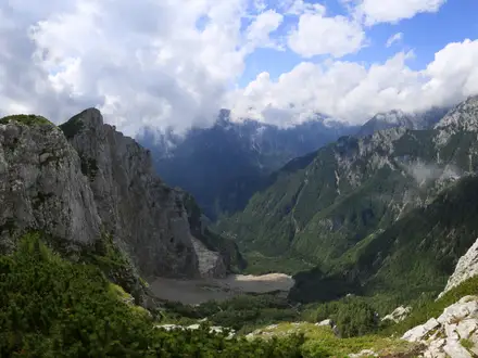
The Walserweg Graubünden is a 320 km, 19-day, hard point-to-point thru-hike across the high valleys of canton Graubünden in eastern Switzerland, finishing in Brand, Austria. Officially SchweizMobil / Kulturwege Schweiz national route 35, it follows old Walser migration and trade routes over high passes, through Walser villages and between resort hubs such as Davos, Klosters and Arosa. It suits fit, experienced mountain hikers comfortable with stony Alpine terrain, long daily ascents and village-to-village logistics.
Route Overview
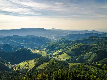
The route starts in San Bernardino and runs broadly south-to-north / west-to-east through Rheinwald, Vals, Safien, Thusis, Avers, Filisur, Lenzerheide, Arosa, Davos, Klosters and St. Antönien before crossing into Austria to finish at Brand. It is a point-to-point walk, not a loop. Major high crossings include the Valserberg (2,504 m), the Safierberg (2,486 m), and the San Bernardino and Splügen pass corridors. Stage 18 is Klosters–St. Antönien; stage 19 is St. Antönien–Brand. Davos, Klosters and Arosa are useful rail-linked hubs. For a shorter northern-Graubünden option, compare the Davos to Arosa Panorama Trail; for broader Swiss planning, see the Alpine Pass Route (Route 6) and Bernina Trek.
Walser history on the trail
The Walser were Highest Alemannic German-speaking settlers originally from the Valais. During migrations in roughly the 12th–13th centuries, they moved into high Alpine valleys across Graubünden, Vorarlberg, Liechtenstein and northern Italy. Sources note that in 1270 the first settlers crossed the San Bernardino pass and settled the Rheinwald. Many held land under “Walser right”, a system of colonist privileges giving personal freedom and hereditary tenure in exchange for dues and military service. The Walserweg follows these old settlement, trade and migration routes.
Notable highlights
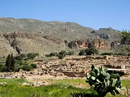
- Walser villages (Vals, Safien, Avers, St. Antönien): Scattered high-valley settlements with sun-darkened timber houses, slanted wooden fences and log-built barns. These villages are the cultural core of the route.
- Juf (~2,126 m): Reached on stage 9, Innerferrera–Juf, this Avers valley village is the highest permanently inhabited settlement in Europe.
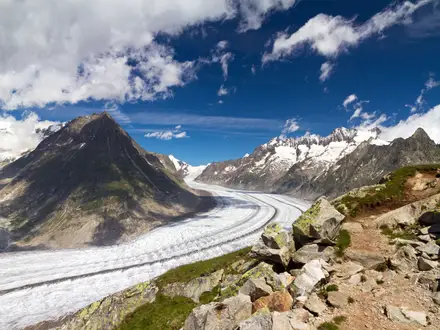
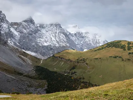
- Valserberg pass (~2,504 m): The highest pass on the Walserweg, crossing between Hinterrhein and Vals. Expect stony, scree-laced terrain on a historic north–south link between Walser valleys.
- Safierberg and historic pass corridors: The Safierberg (~2,486 m), Splügen and San Bernardino corridors link remote high valleys and reflect the trail’s trade and migration history.
- Davos, Klosters and Arosa: Walser-founded resort towns on the northern half of the route. They are practical resupply and transport points; the Davos–Arosa leg is stage 15.
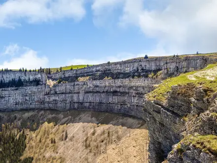
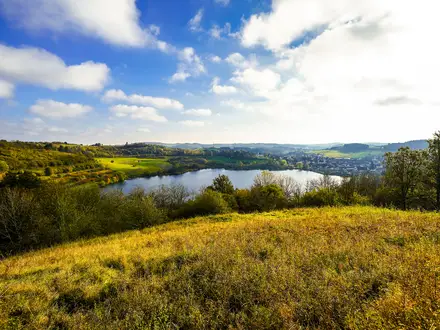
- Mountain lakes and high moorlands: The trail passes clear mountain lakes and protected raised bogs typical of the Graubünden high country.
Challenges to expect
This is a demanding Alpine trail: 19,600 m of ascent, 20,200 m of descent, high passes, exposed sections, scree, stony approaches and long mountain days. Snow can linger on passes outside the summer window, so late June to September is the usual planning season. Navigation is waymarked, but weather can change quickly. Accommodation is mainly village-to-village in inns, hotels, hostels and huts; plan ahead, as this is not a wild-camping route.
HikeList Score
Walserweg scored 78/100 on HikeList's trail-quality metrics.
See score breakdownHide breakdown
- Ideal length 77
- Balanced challenge 80
- Scenery & wildness 58
- Varied terrain 94
- Accommodation 83
- Food & support 81
- Path quality 98
- Season flexibility 76
Computed from length, challenge, scenery & wildness, terrain variety, accommodation, food & support, path quality and season flexibility.
Show more data Show less
- High Alpine
- Mountain Passes
- Scree
- Alpine Meadows
- Larch Forests
- Moorlands
- Dirt
- Rocky
- Gravel
- Hotels
- Huts
- Hostels
- Family Friendly
- Pet Friendly
- Restrooms
- Water Sources
- Shelters
Photos from hikers
Taken on the trail by people who've reviewed Walserweg.
Reviews
How would you rate Walserweg?
Tap a star to start your review — you could be the first.