Tour du Mont Lozère
How would you rate Tour du Mont Lozère?
Tap a star to share your experience and help other hikers.
Tour du Mont Lozère: GR68 Loop Hiking Guide
HikeList Score
Tour du Mont Lozère scored 94/100 on HikeList's trail-quality metrics.
See score breakdownHide breakdown
- Ideal length 93
- Balanced challenge 100
- Scenery & wildness 98
- Varied terrain 100
- Accommodation 92
- Food & support 88
- Path quality 84
- Season flexibility 89
Computed from length, challenge, scenery & wildness, terrain variety, accommodation, food & support, path quality and season flexibility.
The Tour du Mont Lozère is the GR68, a waymarked 118 km loop around the Mont Lozère granite massif in the Cévennes National Park, southern France. Usually walked in about 6 days, it is a moderate mid-mountain trek for hikers who want upland solitude, old drove roads, Cévenol villages and non-technical terrain. Expect around 4,600 m of total ascent, stony paths, forest tracks, heather moorland, peat bogs and chestnut valleys. For easier French walking, compare the Canal du Midi Towpath.
Route Overview
The GR68 is a circular route starting and finishing at Villefort, a Cévenol village beside Lac de Villefort at about 591 m. The loop can be walked in either direction and passes through or near key places including Le Pont-de-Montvert, the high Mont Lozère section near Le Bleymard / Col de Finiels, and Florac, gateway to the Cévennes. The official headline distance is about 118 km, though GPS measurements vary slightly with variants and detours. Plan access, accommodation and baggage-transfer around Villefort and the villages on the loop; the brief does not verify a specific public transport connection. For higher mountain scenery elsewhere in France, see the Cirque de Gavarnie Trails or the Chartreuse Trail GR9 segment.
Transhumance, Camisards and Stevenson’s Cévennes
Mont Lozère is a landscape shaped by transhumance: for centuries sheep were driven along drailles to summer pastures, leaving dry-stone walls, hamlets and montjoie standing stones across the uplands. This agro-pastoral heritage is part of the Causses and Cévennes UNESCO World Heritage landscape. Le Pont-de-Montvert, on the loop, was the flashpoint of the 1702 Camisard Protestant revolt. The wider massif is also linked to Robert Louis Stevenson’s 1878 journey recorded in Travels with a Donkey in the Cévennes.
Notable highlights
- Sommet de Finiels / Pic de Finiels, 1,699 m: The highest point of the Cévennes and Lozère. The GR68 itself stays lower, but a short detour from the high section near Le Bleymard / Col de Finiels reaches the summit.
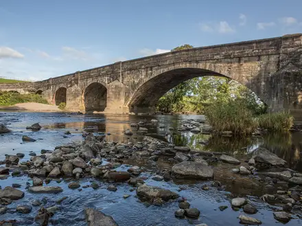
- Le Pont-de-Montvert: A granite village on the Tarn with an arched bridge and clock tower. It is a key historical stop on the route and the cradle of the 1702 Camisard uprising.
- Villefort and Lac de Villefort: The start and finish of the loop. This Cévenol village beside the lake is the practical place to build your itinerary around.
- Drailles and transhumance heritage: Ancient drove roads, dry-stone walls and montjoie standing stones mark the old sheep routes across the uplands.
- Florac: A lively small town at the foot of the limestone causses and the seat of the Cévennes National Park.
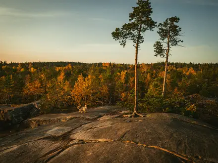
- Mont Lozère moorland and peat bogs: Open heather heath, granite uplands and Atlantic peat bogs give the route its exposed, high-country feel.
Challenges to expect
The GR68 is non-technical, but it is still a sustained multi-day walk with about 4,600 m of ascent. Expect stony mountain paths, old mule tracks, forest tracks, open moorland and exposed passes where fog, wind or snow can make navigation and progress harder. Winter and early spring are best avoided unless conditions are good and you have suitable experience. National park rules affect dogs, fires and bivouac options.
HikeList Score
Tour du Mont Lozère scored 94/100 on HikeList's trail-quality metrics.
See score breakdownHide breakdown
- Ideal length 93
- Balanced challenge 100
- Scenery & wildness 98
- Varied terrain 100
- Accommodation 92
- Food & support 88
- Path quality 84
- Season flexibility 89
Computed from length, challenge, scenery & wildness, terrain variety, accommodation, food & support, path quality and season flexibility.
 France
Show more data Show less
- Mountainous
- Moorland
- Forest
- Valley
- Rocky
- Dirt
- Gravel
- Paved
- Hotels
- Gites
- Guesthouses
- Campsites
- Family Friendly
- Pet Friendly
- Water Sources
- Campsites
- Shelters
- Picnic Areas
Download Our Full Guide to Tour du Mont Lozère FREE!
Get our comprehensive guide to this hike for free. Save it for later reading or print out at home.

In these collections
Photos from hikers
Taken on the trail by people who've reviewed Tour du Mont Lozère.
Tour du Mont Lozère: The Complete Guide
The Tour du Mont Lozère (GR68) is a quiet, about 118 km circuit from Villefort around the granite massif of Mont Lozère in the Parc national des Cévennes. It suits walkers who want sustained but non-technical upland hiking: red-and-white GR waymarks, open heather moorland and peat bogs, old drailles and mule tracks, chestnut-and-river valleys, village stops such as Le Pont-de-Montvert and Florac, and the option to detour to the Sommet de Finiels, the 1,699 m roof of the Cévennes.
The route asks for good multi-day fitness, confidence on exposed high ground in wind or fog, and careful planning because accommodation and services are limited outside the main villages. This guide covers the practical detail: stage planning, walking days, accommodation, food and water, transport to and from Villefort, terrain and navigation, weather, luggage transfer, shorter options and the common mistakes to avoid.
Stage-by-Stage Guide
Stage 1: Villefort to Le Bleymard — about 23 km
The standard counter-clockwise itinerary begins with a demanding first day, climbing away from Villefort and the Lac de Villefort towards the higher country around Le Bleymard. It is not technical, but the effort is sustained and there are no large shops between the start and finish, so this is a stage to begin fully supplied.
From Villefort, the GR68 leaves northwards on a mixture of road and path, with early views over the Lac de Villefort. The route crosses the Palhères stream and works through heathland, chestnut copses, forest paths, old mule tracks and stony or gravelly sections. The underfoot conditions are typical Cévennes mid-mountain walking: mostly clear paths and tracks, but uneven enough to make a long day feel longer.
Places passed on or close to the stage include Rabeyral, L’Habitarelle near Altier, Villespasses, Bergognon, La Prade, Pomaret and Cubières. L’Habitarelle is a useful mid-stage break point, while Cubières is a genuine possible stopping place on some itineraries, with gîte accommodation. The standard six-day schedule continues beyond Cubières, crossing the Col de Bourbon at around 1,091 m before descending to Le Bleymard.
Le Bleymard, at about 1,037 m, is the main overnight stop. It has basic village services and several accommodation possibilities, including gîte-style lodging and holiday accommodation; the Mont Lozère ski area is nearby. Book ahead, especially in summer, because the stage spacing leaves limited flexibility if beds are full.
Food and water: carry lunch and enough snacks from Villefort. There are small settlements en route, but do not rely on being able to buy supplies between Villefort and Le Bleymard. Water availability is not continuous, particularly on the upper parts of the stage; refill where possible and treat natural water if used.
Access and transport: Villefort has the strongest access on the route, with Gare de Villefort on the Ligne des Cévennes. Le Bleymard is a road-accessible village but has no railway station. Local buses, taxis or walker shuttles should be checked before travelling.
Navigation and warnings: follow the red-and-white GR balisage carefully, especially around stream crossings near the Valfournès and Lieyros area. This first stage is a long climbing day with significant height gain, so an early start is sensible in hot weather or if carrying a full pack.
Stage 2: Le Bleymard to La Fage — about 22.5 km
This is the high Mont Lozère stage and one of the defining days of the GR68. The route climbs from Le Bleymard onto open granite upland, crossing the Col de Finiels area and traversing exposed moorland before dropping towards La Fage in the Mas-d’Orcières area.
The terrain changes markedly from the previous day. Expect bare granite moorland, heather, short upland grass, Atlantic peat bogs and areas of scattered granite blocks. The GR68 itself reaches roughly 1,420–1,453 m on this high section, depending on the line and measurement used. The Sommet or Pic de Finiels, at 1,699 m, is a short optional detour from the high route and is the highest point of the Cévennes, but it is not on the main GR68 line.
In good weather, this is the most open and spacious part of the circuit, with broad views across Mont Lozère and the Cévennes. In poor weather, it is also one of the most serious sections of the route: mist, wind, snow patches in early season and sudden changes in mountain weather can make orientation difficult. A GPS track or offline mapping is strongly recommended alongside the IGN 2739 OT map or the FFRandonnée topoguide.
The stage passes transhumance features including the Fergère menhir, then descends through conifer and pine forest towards the Croix des Faux, a five-way junction on a draille at around 1,258 m. A branch then leads towards La Fage. Mas-d’Orcières is also passed on this stage.
La Fage sits high, around 1,200 m, and is a small overnight point rather than a resupply village. Accommodation is gîte-based, including the gîte de la Fage in a granite building, with meals typically arranged in advance. There are very limited services, so the overnight booking should include dinner and, ideally, breakfast or a packed lunch.
Food and water: leave Le Bleymard with a full day’s food and adequate water. Reliable refill points are limited on the exposed high ground. Streams may be present, but natural water should be filtered or treated.
Access and transport: road access exists around Le Bleymard and Mas-d’Orcières/La Fage, but public transport is limited. Any shuttle, taxi or baggage-transfer arrangement should be booked in advance.
Navigation and warnings: this is the stage where waymarking alone may not be enough in mist. Keep to the GR68, avoid drifting onto summit or ski-area tracks unless intentionally taking the Finiels detour, and give any sheep flocks guarded by patous a wide berth. Do not run, shout or cut through a flock.
Stage 3: La Fage to Florac — about 16 km
This shorter stage drops from the high country around La Fage to Florac, at about 546 m. The distance is modest by GR68 standards, but the day still demands care because of the long descent, rocky sections and possible navigation awkwardness soon after leaving La Fage.
The route follows part of the draille des menhirs through the Causses and Cévennes UNESCO World Heritage landscape, passing menhirs including the Trois Communes menhir and the Fage menhir. It then continues through the Bougès forest and via Combettes, around 991 m, before steeper sections through chestnut woodland and rocky ground on the descent towards Florac.
The Rochefort viewpoint gives a useful sense of the descent into Florac and the meeting of upland and valley terrain. After two comparatively remote days, the arrival in Florac is a major logistical reset point.
Florac, officially Florac Trois Rivières, is the main town on the route and the seat of the Parc national des Cévennes. It has the best services on the GR68: supermarket or grocery shopping, bakeries, butcher, pharmacy, restaurants, a Thursday market and a choice of gîtes, chambres d’hôtes and hotels. It is a sensible place for a rest day or a thorough resupply before the second half of the circuit.
Food and water: accommodation at La Fage should be arranged with meals or a packed lunch if needed. Florac is the key resupply point of the route, so stock up here for the following stages, where village services are much thinner.
Access and transport: Florac is an important road-accessible town, but it is not on the railway line. Local buses or onward transfers should be checked before travelling.
Navigation and warnings: take care in the first kilometres from La Fage, where waymarking can be less obvious. The descent includes rocky ground and chestnut-forest sections where fallen trees or storm debris can slow progress. Florac is also a junction area with other Grande Randonnée routes, including the GR43 and GR70, so follow the GR68 markings rather than simply following any red-and-white trail out of town.
Stage 4: Florac to Mijavols, Saint-Maurice-de-Ventalon — about 14.5 km
Although this is the shortest stage in the standard six-day outline, it is one of the hardest physically because it climbs steeply from Florac back onto the Bougès and Ventalon high ground. The ascent is roughly 1,300 m, so judge the day by height gain rather than distance.
Leaving Florac at about 546 m, the route climbs through mixed forest towards a sequence of cols and ridge points: Col de Lempezou, Col du Sapet, Baraque à Bonnal, Signal du Bougès, Col de la Planète and Signal de Ventalon before descending towards Mijavols and the Gîte les Bastides area near Saint-Maurice-de-Ventalon. The Signal du Bougès, around 1,421 m, is one of the prominent high points of the southern half of the route, with wide views across the Cévennes when conditions are clear.
The walking is mostly on forest paths, tracks and ridge routes rather than technical mountain ground, but the climb is long and sustained. After the descent into Florac the day before, this stage can feel abrupt: it starts low, gains height quickly and spends time on exposed high ground before the overnight stop.
Mijavols and the nearby gîte accommodation form a small, isolated overnight point. Services are limited, and the gîte is the practical focus for walkers. Booking ahead is essential; do not arrive without a bed or meal arranged.
Food and water: carry a full day’s food from Florac and leave with plenty of water. The climb and ridge sections have limited refill opportunities. Florac is the right place to buy snacks, lunch supplies and any essentials before leaving town.
Access and transport: Florac is road-accessible, and Mijavols/Saint-Maurice-de-Ventalon is reached by minor mountain roads. There is no rail access on this stage. Any pick-up, luggage transfer or taxi arrangement should be fixed before starting the day.
Navigation and warnings: published GPS versions and accommodation-based stage endings can vary around this section, especially where routes continue beyond Mijavols towards other gîtes. Use the booked overnight stop, the official GR68 line and an up-to-date map or GPX to avoid adding unintended distance. This should be checked before travelling. In poor weather, take extra care on the Bougès and Ventalon high ground.
Stage 5: Mijavols, Saint-Maurice-de-Ventalon to Gourdouze, Vialas — about 25 km
This is the longest stage by distance in the standard six-day schedule. It moves south through quieter Cévenol country, leaving the high ridges for wooded valleys, chestnut forest and old drailles. It is generally less exposed than the Mont Lozère plateau, but the length and limited services make it a serious day.
From Mijavols, the route descends and traverses through places including L’Aubaret and La Vialasse, continuing through chestnut-rich Cévennes valleys and mixed granite and schist terrain. The Pierre Froide area is passed before the route reaches Gourdouze, a small hamlet in the Vialas area.
This stage has a different character from the open uplands: more woodland, more shade and more enclosed valleys, with old tracks linking small settlements. The Rochers de Trenze are a notable feature in the Vialas area, although exact views and proximity depend on the route variant used.
Gourdouze is a small overnight point with gîte or chambre d’hôtes-style accommodation rather than a service village. As with La Fage and Mijavols, the bed and evening meal should be booked in advance.
Food and water: carry food from Mijavols or from supplies bought earlier in Florac. Do not rely on shops on this stage. Natural water should be treated. In hot weather, wooded sections help with shade, but the length of the day still makes water planning important.
Access and transport: road access is local and limited. Génolhac, on the southern part of the GR68 area, has a railway station on the Ligne des Cévennes and can be useful as an escape or access point depending on the exact itinerary, but it is not a substitute for planning the Mijavols–Gourdouze overnight logistics. Transfers should be arranged ahead.
Navigation and warnings: the tourist office warning for the Mas de la Barque area is important on relevant variants: from Mas de la Barque, do not take the path towards Bergerie de Bayard, which is closed for safety; follow the path to Les Bouzèdes instead. This applies where that variant is used and should be checked against the current official route before travelling. Patous may be present near sheep flocks on more open sections; slow down, keep calm and give the animals space.
Stage 6: Gourdouze, Vialas to Villefort — about 22.1 km
The final stage closes the loop back to Villefort, passing through the southern and eastern side of the massif before dropping towards the Lac de Villefort. It remains a full mountain-walking day, with a mixture of forest, moorland edges, stony tracks and descent back into the Chassezac/Villefort area.
From Gourdouze, the route works towards Concoules in the Gard, then climbs back into Lozère before the final return to Villefort. Some versions of the route use the Mas de la Barque area as a high plateau waypoint before descending. The approach to Villefort brings views back towards the dam and reservoir, giving a clear sense of the circuit closing.
Underfoot, expect more of the GR68’s typical surfaces: granite tracks, forest paths, stony descents and occasional quiet lanes. The stage is not technically difficult, but tired legs, loose stones and a long descent at the end of a six-day walk make pacing important.
Villefort has accommodation in hotels, chambres d’hôtes and gîtes, plus village services and a Thursday morning market. It is also the best place to finish the route logistically, because the railway station is in the village.
Food and water: carry enough from Gourdouze for the full day unless your accommodation can provide a packed lunch. Refill opportunities should not be assumed between small settlements. Treat natural water if used.
Access and transport: Villefort has Gare de Villefort on the Ligne des Cévennes, with TER services towards Nîmes/Montpellier and Mende/Clermont-Ferrand. Concoules and other settlements on the stage have road access, but public transport options are limited and should be checked before travelling.
Navigation and warnings: pay attention to the GR68 balisage where variants around Mas de la Barque or local tracks diverge. The final descent towards Villefort can be tiring on stony ground, particularly in wet conditions. If catching a train the same day, allow a generous margin rather than planning a tight connection after a 22 km final stage.
Recommended Itinerary
Standard 6-day itinerary
The standard counter-clockwise itinerary starts and finishes in Villefort and gives a logical six-stage circuit using the established GR68 stage stops. It is still a committing walk: several overnight places are small hamlets with limited beds, so accommodation should be booked before travel, especially at La Fage, Mijavols and Gourdouze.
| Day | From | To | Approx. distance | Why this stage makes sense | Services/accommodation notes |
|---|---|---|---|---|---|
| 1 | Villefort | Le Bleymard | 23 km | A substantial opening day that gets the main climb out of Villefort underway, passing cols such as the Col de Bourbon and Col de Sautel before reaching Le Bleymard. This is one of the bigger ascent days, so an early start is sensible. | Villefort has the SNCF station and start-point services. Le Bleymard has useful hiker services, including hotel/restaurant accommodation, gîte options, basic shops/services and a cash machine. Hôtel-Restaurant La Remise and Gîte de l’Escoutal at Bonnetès are established walker stops; opening dates and meal availability should be checked before booking. |
| 2 | Le Bleymard | La Fage | 22.5 km | This is the high Mont Lozère stage, crossing open granite uplands around the Col de Finiels area. It is the day most affected by mist, wind and poor visibility, so carry reliable mapping and do not rely only on waymarks. The Sommet de Finiels at 1,699 m is an optional detour, not part of the main GR68 line. | La Fage is a small hamlet with very limited services. Gîte de la Fage and nearby gîte options provide the main accommodation; book ahead and reserve dinner/breakfast if needed. Do not assume shops are available here. |
| 3 | La Fage | Florac | 16 km | A shorter, mostly descending stage from the high country towards Florac. It works well after the exposed Mont Lozère day and gives time for laundry, resupply and a less rushed afternoon. | Florac is the best resupply point on the route, with supermarket, restaurants, bars, pharmacy, medical services, ATM and tourist office. There are multiple hotels, gîtes and chambres d’hôtes, including options such as Hotel des Gorges du Tarn and La Carline gîte. This is the most practical place to add a rest day. |
| 4 | Florac | Mijavols, Saint-Maurice-de-Ventalon | 14.5 km | Although short on distance, this stage involves a significant climb out of Florac towards the Bougès/Ventalon uplands. It is a useful shorter day before the longer fifth stage. | Mijavols has very limited accommodation and services, mainly gîte/chambre d’hôtes style lodging. Book in advance. Le Pont-de-Montvert is nearby as a worthwhile detour or alternative service stop, but any off-route logistics should be checked before booking. |
| 5 | Mijavols, Saint-Maurice-de-Ventalon | Gourdouze, Vialas | 25 km | The longest day of the standard itinerary and one to treat seriously. It crosses quieter upland country where poor weather can slow progress. Start early and carry enough food and water for a full day. | Gourdouze is a hamlet with limited accommodation, including chambre d’hôtes/gîte-style lodging in old granite buildings. Meals and packed lunches may be available by reservation. Vialas and Génolhac can be useful for alternative planning, with Génolhac also having an SNCF station on the Ligne des Cévennes. |
| 6 | Gourdouze, Vialas | Villefort | 22.1 km | A full final stage returning north-west towards Villefort via the Concoules area. It is not just a short walk-out, so keep enough time for the return to town and onward trains. | Villefort has train access, hotels, restaurants, gîtes and camping/gîte options such as Mas des Sédariès. If catching a train the same day, check the current SNCF timetable before committing to accommodation or transport plans. |
Slower variants: 7 to 10 days
A slower itinerary suits walkers who prefer shorter days, want more time in Florac or are carrying camping gear. It is also the better approach if accommodation availability forces changes to the standard stops.
Practical ways to slow the route include:
| Option | How it changes the standard itinerary | Who it suits | Planning notes |
|---|---|---|---|
| Add a rest day in Florac | Keep the six walking days, but spend a second night in Florac after Day 3 | Walkers wanting a proper resupply, laundry stop, easier pacing or a weather buffer before the eastern half of the loop | Florac has the best choice of food, accommodation and services on the GR68, making it the most practical rest-day location. |
| Split the Villefort to Le Bleymard opening stage | Use the Altier/L’Habitarelle area to reduce the first day’s effort before continuing to Le Bleymard | Walkers arriving late in Villefort, or anyone who does not want the big first-day climb in one push | The 4-day northern-loop planning notes give Villefort to Altier as about 12.1 km and Altier to Le Bleymard as about 16.8 km. Accommodation and current services should be checked before booking. |
| Break the long Mijavols to Gourdouze stage | Divide the 25 km standard Day 5 using an alternative stop such as Génolhac or Vialas | Walkers who dislike 25 km days, or those using rail access at Génolhac to join or leave the route | Génolhac has accommodation and an SNCF station on the Ligne des Cévennes. Exact walking distances for split stages should be checked on official mapping before booking. |
| Stretch to 8–10 days | Combine shorter stages, a Florac rest day and one or more intermediate stops | Walkers prioritising easier daily distances over speed | Bed availability in small hamlets is the limiting factor. Book the accommodation chain first, then fit the walking days around it. |
Faster variant: 5 days
A 5-day itinerary is possible for fit walkers who are comfortable with repeated 22–31 km days, limited recovery time and carrying enough food between small service points. It is not the best choice for a first multi-day hike in the Cévennes, and poor weather on the Mont Lozère uplands can make the schedule feel tight.
| Day | From | To | Approx. distance | Why this stage makes sense | Services/accommodation notes |
|---|---|---|---|---|---|
| 1 | Villefort | Le Bleymard | 23–25 km | Keeps the standard opening stage and reaches a serviced village for the night. | Le Bleymard has accommodation, food options and basic services. Book ahead. |
| 2 | Le Bleymard | La Fage | 22.5 km | Crosses the main Mont Lozère high section as a self-contained day, with the optional Sommet de Finiels detour only if time, weather and energy allow. | La Fage has very limited gîte-based services. Dinner and breakfast should be reserved in advance. |
| 3 | La Fage | Mijavols, Saint-Maurice-de-Ventalon, via Florac | About 31 km | Combines the shorter La Fage to Florac and Florac to Mijavols stages into one demanding day. It saves a day but removes the natural recovery stop in Florac. | Florac is the key resupply point en route. Mijavols has limited accommodation, so a late arrival without a booking is risky. |
| 4 | Mijavols, Saint-Maurice-de-Ventalon | Gourdouze, Vialas | 25 km | Keeps the long eastern-stage crossing intact. This is a serious day after the 31 km previous stage. | Limited accommodation at Gourdouze/Vialas; meals and packed lunches should be arranged when booking. |
| 5 | Gourdouze, Vialas | Villefort | 22.1 km | Completes the loop back to the railhead at Villefort. | If leaving by train the same day, check current SNCF times before fixing the final night or return travel. |
Shorter partial itineraries
If time is limited, it is better to plan a recognised partial loop than to rush the full GR68 without accommodation certainty.
| Itinerary | Stages | Who it suits | Notes |
|---|---|---|---|
| 4-day northern loop | Villefort to Altier, Altier to Le Bleymard, Le Bleymard to Mas de la Barque via the GR7, then Mas de la Barque to Villefort | Walkers wanting a shorter Mont Lozère-focused circuit | Published planning notes give approximate stage distances of 12.1 km, 16.8 km, 22.5 km and 13.3 km. Check official mapping and accommodation before booking. |
| 3-day southern mini-loop | Génolhac to Villefort via the GR700, Villefort to Gourdouze via PR, then Gourdouze to Génolhac | Walkers using the Ligne des Cévennes rail access at Génolhac and Villefort | Approximate stage distances are 14 km, 17.2 km and 10.8 km. This is a separate short-loop option rather than the full GR68. |
For any variant, build the itinerary around confirmed accommodation rather than distance alone. The red-and-white GR waymarking is generally straightforward, but official mapping or the FFRandonnée Topoguide should be carried for the exposed upland sections and for any stage split away from the standard six-day plan.
Planning the Route
How many days to allow
Most walkers should plan the full GR68 as a 6-day walk. That is the standard split and it fits the available village stops reasonably well, but it is not a route to compress casually: the stages are often exposed, services are spread out and the longest day comes late in the walk.
A 5-day itinerary is possible for fit, efficient walkers who are comfortable with long mountain days and fewer accommodation choices. For most independent hikers, 6–7 days is the better planning range. Stretching the route to 8–10 days makes sense if you want shorter stages, extra time in Florac or Le Pont-de-Montvert, or a weather buffer for the high Mont Lozère section.
The standard counter-clockwise pattern is:
| Stage | Overnight planning notes |
|---|---|
| Villefort → Le Bleymard | A committing first day from the railhead; start early if arriving by train the same morning. |
| Le Bleymard → La Fage | High Mont Lozère country; weather and visibility matter more than the raw distance. |
| La Fage → Florac | Shorter day into the best resupply town on the route. |
| Florac → Mijavols | A shorter stage, useful after resupplying in Florac. |
| Mijavols → Gourdouze / Vialas | The longest standard stage and often the one most worth protecting with an early start and a buffer plan. |
| Gourdouze / Vialas → Villefort | Final long stage back to the station and the Lac de Villefort. |
The loop can be walked in either direction, but the usual Villefort → Le Bleymard start puts the big Mont Lozère approach early in the itinerary. Walking anticlockwise is feasible, but accommodation and transport timings should be checked carefully before committing.
Accommodation dictates the itinerary
Accommodation is the main constraint on the GR68. Some stages have only limited options, so the practical order is: book beds first, then arrange transport and baggage.
Expect a mix of gîtes d'étape, chambres d'hôtes, small hotels and campsites. Key overnight bases include Villefort, Le Bleymard, La Fage / Mas-d'Orcières, Florac, Le Pont-de-Montvert, Mijavols / Saint-Maurice-de-Ventalon, Gourdouze / Vialas and Génolhac.
Planning implications:
- July and August: book well ahead, ideally 2–3 months in advance, because accommodation pressure is high.
- Early June and September: usually quieter, but some places may have reduced opening periods. This should be checked before travelling.
- Florac: the best resupply and services stop, with multiple shops, restaurants and accommodation options.
- Le Pont-de-Montvert: a useful alternative or extra night, with village services and a municipal gîte d'étape.
- La Fage and smaller hamlets: plan as limited-service stops rather than resupply points.
If using baggage transfer, companies such as La Malle Postale and Transbagages serve the Tour du Mont Lozère. Baggage services require advance booking and usually operate to agreed stage points, so accommodation and luggage logistics need to match. Current prices, bag limits and collection rules should be checked before booking.
Food, water and resupply
The route passes through several useful villages, but there are also long gaps with no shops or cafés. Do not plan this walk as a hut-to-hut route with guaranteed daytime food stops.
Good resupply points include:
| Place | Planning value |
|---|---|
| Villefort | Full services, restaurants, shops, hotels and SNCF station; the logical start/end resupply. |
| Le Bleymard | Village services including épicerie, café, bakery and gîte. |
| Florac | Largest town on the route; excellent resupply, restaurants and Thursday market. |
| Le Pont-de-Montvert | Grocery, bakery, bar-tabac, restaurants, pharmacy, post office, ATM and tourism office. |
| Génolhac | Services and SNCF station on the Ligne des Cévennes. |
| La Fage | Water fountain, but limited services; treat it as a hamlet stop rather than a shop stop. |
Carry food for a full walking day whenever leaving a main village. This is especially important across the open Mont Lozère uplands and on the quieter Cévenol sections between Mijavols and Gourdouze.
Carry at least 2 litres of water capacity on exposed days. Natural sources exist on the massif, but availability varies with season and recent weather; ask accommodation hosts locally each morning before relying on them. Sunday closures also matter in small villages, so resupply before the weekend where possible.
Shortening, extending and section hiking
The GR68 is a loop, which makes whole-route logistics simple: start and finish at Villefort station and no end-to-end transfer is needed. It is also more section-hikeable than many rural French mountain routes because Villefort and Génolhac are both on the Ligne des Cévennes.
Practical options include:
- Full loop in 6 days: the standard choice for most walkers.
- Slower full loop: add one or more nights around Florac, Le Pont-de-Montvert or another serviced village, subject to accommodation availability.
- 3-day partial loop: Génolhac – Villefort – Gourdouze – Génolhac, covering the southern part of the circuit.
- 4-day partial loop: Villefort – Altier – Le Bleymard – Mas de la Barque – Villefort.
- Rail-assisted section: use the short train connection between Villefort and Génolhac to access the southern section.
Mid-route public transport is much better in summer than outside it. Florac is accessible by regional bus, and summer lines also serve areas such as Le Bleymard, Le Pont-de-Montvert and Mont Lozère. Outside July–August, bus options are limited and a taxi or private car may be needed. Current liO and SNCF timetables should be checked before travelling.
Navigation and maps
The GR68 is a red-and-white waymarked Grande Randonnée, and route-finding is generally straightforward in settled valleys and forest sections. The exception is the exposed high ground: the Mont Lozère / Col de Finiels area can become confusing in fog, wind or low cloud, when waymarks are harder to pick out across open granite moorland.
Carry more than a phone-only plan. Sensible navigation setup:
- FFRandonnée Topoguide FFR 631: Tours du Mont Lozère et du Causse Méjean.
- IGN maps: 2739 OT is the key sheet, with 2639E and 2740ET also relevant for route coverage.
- GPX/KML backup: available from Parc national des Cévennes route resources and major mapping platforms.
- Offline mapping: download before departure; mobile coverage is generally good but should not be relied on for navigation in poor weather.
The optional detour to the Sommet / Pic de Finiels should be treated as weather-dependent. It is the highest point of the Cévennes, but it is not the GR68’s own high point, so there is no need to force it in bad visibility or strong wind.
Transport planning
For a full circuit, the easiest plan is to arrive and leave by train at Gare de Villefort. Villefort is on the Ligne des Cévennes, with rail links towards Clermont-Ferrand, Mende, Alès, Nîmes and Montpellier. Génolhac is on the same line, which is useful for partial itineraries or emergency exits from the southern side.
Between Villefort and Génolhac there are several trains per day and the journey is short, but exact times vary by timetable. Check SNCF TER Occitanie before booking accommodation or onward travel.
Summer bus planning is useful for section hikers rather than essential for the full loop. Relevant regional services include routes linking Mende, Florac, Alès, Le Pont-de-Montvert, Mont Lozère, Le Bleymard and La Garde Guérin, with some lines operating only in July–August. This should be checked before travelling.
Weather, season and park rules
The best planning window is late May to mid-June and September: usually good walking temperatures, less pressure on accommodation than high summer, and fewer heat problems in the valleys.
Seasonal points that affect planning:
- July–August: full summer services and buses, but hotter valley walking and the highest accommodation demand.
- April–May: possible residual snow, mud or poor conditions on high sections; ask locally before setting out.
- November–March: generally best avoided unless conditions are clearly suitable; snow, ice, fog and closed accommodation can make the route impractical.
- Summer afternoons: thunderstorms can develop over the exposed uplands; start early on high stages.
The route lies within the Parc national des Cévennes, so park rules matter. Fires are prohibited. Bivouac is allowed only under strict conditions in permitted areas: normally between 7 pm and 9 am, for one night only, within 50 m of a marked GR/GRP trail, using a small lightweight shelter. Stoves are tolerated only with care and must be kept well away from woods and forest. Some sensitive sections are closed to bivouac, so the park’s current bivouac map should be checked before planning wild nights.
Dogs must be kept on a lead in the park core zone. On open grazing land, expect possible encounters with patous guarding flocks: slow down, keep distance from the animals, make a wide arc and do not run.
Towns, Villages and Overnight Stops
The GR68 has a clear planning pattern: good services at Villefort and Le Bleymard, a remote high-level section where accommodation meals matter, a proper mid-route resupply at Florac, then thinner Cévenol hamlets before the useful rail-linked southern option at Génolhac. Book ahead in summer, and do not assume that a hamlet marked on the map has a shop, café or evening meal available.
Villefort
Villefort is the natural start and finish of the loop, beside the Lac de Villefort at about 591 m. It is also the best place to arrive the day before walking, especially if travelling by train, as the Gare de Villefort sits on the Ligne des Cévennes with TER services towards Nîmes, Clermont-Ferrand and Mende. The station ticket office is listed as open Monday to Friday, 13:00–17:00; this should be checked before travelling.
For walkers, Villefort is the most useful pre-hike logistics stop on the route. The village has two supermarkets, including an 8 à Huit convenience store, plus a bakery, butcher, pharmacy, newsagent, doctor, restaurants, cafés with terraces, artisan shops and a DIY store. A Thursday morning bric-a-brac and artisan market can be useful if your timing matches it, but it should not replace a proper resupply plan.
Accommodation is varied by GR68 standards: hotels, chambres d’hôtes, a gîte rural in a 16th-century muleteers’ inn on the route, Camping Le Mas des Sédariès and other local options. It works well both as a launch pad and as a final night after returning from Gourdouze, Génolhac or the southern arc of the loop. If using baggage transfer, Villefort is also one of the easiest places to organise the first and last handover.
The first stage towards Le Bleymard passes through the eastern side of the massif, with Altier/L’Habitarelle and Cubières appearing on route descriptions. Treat Le Bleymard as the main planned overnight unless accommodation has been arranged elsewhere; any plan relying on smaller places such as Altier, L’Habitarelle or Cubières should be checked before travelling.
Le Bleymard
Le Bleymard is the usual end of the first day from Villefort, roughly 23 km into the standard counter-clockwise itinerary. It sits below the Col de Finiels and the Mont Lozère high plateau, at about 1,037 m, making it the key overnight before the big upland section.
For a small mountain village it has strong walker services: a Carrefour Express, bakery, butcher, tabac-presse, restaurant, artisan shops, post office, ATM and doctor. This is the last proper service village before the high Mont Lozère crossing, so buy the next day’s trail food here and do not leave resupply until La Fage.
Accommodation is aimed at walkers. Gîte d’étape l’Escoutal serves GR68, GR70 and GR7 walkers, with bunk rooms, private rooms, an equipped kitchen and shared bathrooms close to the shops. Gîte Chez le Poulitou offers self-catering accommodation in a central village location. Book ahead, particularly if walking during school holidays or when several GR routes are busy at the same time.
There is no railway station at Le Bleymard. Access is by road via the D901, and any bus option should be treated as limited or seasonal; check the local liO network before relying on it.
La Fage / Mas-d’Orcières
La Fage is one of the most isolated overnight points on the Tour du Mont Lozère. It lies at about 1,200 m on the granite massif, in the commune of Saint-Étienne-du-Valdonnez, after the high Mont Lozère section from Le Bleymard. Nearby Mas-d’Orcières provides another accommodation focus on this exposed part of the route.
This is a good and often necessary overnight stop, but it is not a village resupply stop. There are no shops, cafés or independent restaurants to fall back on. Dinner, breakfast and packed lunches need to come from the accommodation, and should be requested when booking.
Gîte de La Fage is a granite farmhouse gîte d’étape at 1,200 m, with bunk accommodation, showers, WC and a kitchen area. Meals use farm produce and home-grown vegetables, but reservation is required. Le Refuge at Mas-d’Orcières offers hotel-restaurant, overnight gîte and group accommodation nearby.
There is no public transport to La Fage, and road access is by mountain lanes. Walkers should arrive with some food reserve even when booked on half-board, as poor weather on the uplands can slow the day considerably.
Florac
Florac, officially Florac Trois Rivières, is the most important town on the GR68 and the best mid-route resupply. It sits where the Cévennes valleys meet the foot of the limestone causses, at the confluence of the Tarnon and Mimente with the Tarn, and is the sous-préfecture of Lozère.
This is the place to restock properly. Services include a Carrefour Market in the town centre, bakery, butcher, pharmacies, restaurants, cafés, newsagent, banks and ATMs. The tourist office shares premises with the Maison du Parc national des Cévennes on Place de l’Ancienne Gare, with hiking information, maps and park staff; high-season opening is listed as daily 09:00–12:30 and 14:00–18:30, but times should be checked before travelling.
Accommodation is broader than in the hamlets. Gîte d’étape L’Étape on Place du Saguenay is a walker-focused option with half-board, a 75-seat restaurant open to all, self-service laundry, a small shop and travellers’ bookshop, about five minutes’ walk from the centre. Florac also has hotels, chambres d’hôtes, gîtes ruraux and private rental options.
Florac has no train station. Bus services include Line 251 between Mende, Florac and Alès, plus Lines 253 and 261, but timetables should be checked before planning a start, finish or rest-day transfer around them. Reaching the nearest rail stations requires a car or taxi, with Génolhac about 30 km away and Villefort about 40 km away.
For most walkers, Florac is the best place to call ahead for the remaining nights, buy any missing supplies, use a pharmacy, do laundry and reset before the quieter western and southern sections.
Le Pont-de-Montvert
Le Pont-de-Montvert lies on the upper Tarn at about 700 m, at the GR68/GR70 junction. It is not always used as a stage end on the standard six-day split, but it is one of the best villages on or near the mid-loop line for walkers who are adjusting stages or building in a shorter day.
The village has useful services for its size: grocery, butcher, bakery, doctor, nurse, pharmacy, taxis, garage and petrol pump, a farmers’ market and a small tourist office. It is a sensible stop if the itinerary needs breaking between Florac, Mijavols and the Mont Lozère approaches.
Accommodation includes Auberge des Cévennes, with 14 rooms in the heart of the village on the banks of the Tarn, a restaurant, waterside terrace, self-service laundry, travellers’ bookshop, bike storage and wifi. Hôtel Aux sources du Tarn sits on the right bank, with further chambres d’hôtes and gîtes in the wider commune.
There is no train station. A seasonal bus runs from Florac, and the village is accessible by road, but daily public transport should not be assumed; confirm before relying on buses.
Le Pont-de-Montvert is also worth time for its Cévennes history. The arched bridge and clock tower are local landmarks, and the Musée des Vallées Cévenoles covers the Wars of Religion and the 1702 Camisard revolt.
Mijavols / L’Aubaret, Saint-Maurice-de-Ventalon
Mijavols and nearby L’Aubaret form a quiet rural overnight area in the commune of Saint-Maurice-de-Ventalon. On the standard six-day itinerary, Mijavols is the Day 4 stop after Florac, with the route moving from upland and valley terrain into the chestnut country of the Cévennes.
This is a practical stage-end rather than a service centre. There is no village shop and no café, so food depends on accommodation hosts. Book early and make the meal arrangement explicit: dinner, breakfast and any packed lunch should all be agreed in advance.
Accommodation is limited to chambres d’hôtes and small gîtes d’étape in the hamlet area. Options are thin compared with Florac, Villefort or Le Bleymard, so this is not a place to arrive speculatively in high season.
There is no public transport. Road access is via the D998/D20, which may help for taxi or support-vehicle logistics, but independent walkers should plan as though there is no easy exit from the stage.
Gourdouze, Vialas
Gourdouze is a remote hamlet in the commune of Vialas, on the southern Cévennes slopes. It is the standard Day 5 overnight on the six-day itinerary, after the long stage from Mijavols, and it sits well away from larger services.
Facilities are accommodation-based. There is no separate village shop or café, so evening meal, breakfast and packed lunch arrangements matter. Chambres d’Hôtes de Gourdouze offers rooms in granite farmhouses, with bivouac spots, water, showers, WC and electricity, plus tent camping. Dinner table d’hôtes is €25 per person, breakfast €8 and packed lunches €12, all by reservation; confirm current prices when booking.
The hamlet is isolated enough that arriving without a dinner booking can become a real problem. Carry emergency food from the previous resupply point and phone ahead if running late.
There is no public transport to Gourdouze and car access is limited. Vialas village is about two hours away on foot and has basic services; Gîte de la Viale in Vialas is an alternative for walkers adjusting the route. The GR68 line from Génolhac is about four hours’ walk away.
Génolhac
Génolhac sits in the northern Gard, at the southern foot of Mont Lozère, and the GR68 clips its territory on the final arc back towards Villefort. It is especially useful because it has an SNCF station on the Ligne des Cévennes, making it the main rail-linked option away from the Villefort start and finish.
The village works well as an alternative overnight, exit point or entry point for section hikers. Gare de Génolhac has TER services towards Nîmes and northwards on the same line as Villefort, and the station is walkable from the village centre.
Services include local commerce, the Café du Commerce with wifi, terrace, restaurant and bar, and a Saturday market on Place du Colombier. Accommodation includes small hotels, gîtes, chambres d’hôtes such as Les randonnées joyeuses and Chez Steloune, plus campsites within the commune.
For walkers not completing the full loop in one push, Génolhac is the most practical southern railhead. It can also be used to shorten the final section if weather, fatigue or accommodation availability makes the return to Villefort awkward.
Returning to Villefort
The final approach brings the loop back towards Villefort, with Concoules appearing on route descriptions of the southern return. Do not rely on smaller places on this last arc for full resupply unless arrangements have been made in advance; this should be checked before travelling.
Finishing in Villefort gives the simplest onward logistics: train access, food, accommodation and post-walk services are all available in the village. If arriving late from Gourdouze or Génolhac, book the final night before setting out rather than assuming last-minute availability.
Getting to the Start
The GR68 starts and finishes in Villefort, so access is unusually straightforward for a rural Cévennes route. The train is the best option for most walkers: Gare de Villefort is in the village and on the Ligne des Cévennes, with direct TER services from Nîmes and Clermont-Ferrand.
By train
Nearest station: Gare de Villefort, 57 Avenue de la Gare, 48800 Villefort. The station is in the village, within walking distance of the Lac de Villefort and the GR68 start waymarks.
Villefort is on the Ligne des Cévennes — the scenic railway between Nîmes and Clermont-Ferrand. Services are operated by TER Occitanie and TER Auvergne-Rhône-Alpes, and tickets/timetables are available through SNCF Connect or TER Occitanie.
| Journey | Typical routing | Approximate journey time |
|---|---|---|
| Nîmes Centre to Villefort | Direct TER via Alès, Chamborigaud and Génolhac | About 1 hr 30–1 hr 45 |
| Montpellier to Villefort | Change at Nîmes | About 2 hr 15–2 hr 30 from Montpellier station |
| Clermont-Ferrand to Villefort | Direct TER on the Cévenol line | Fastest around 3 hr 33; often longer |
| Paris Gare de Lyon to Villefort | Usually 1 change, commonly at Nîmes or Clermont-Ferrand | Fastest around 5 hr 30; often nearer 7 hr |
The Nîmes–Villefort train is the simplest rail approach from southern France, while Clermont-Ferrand–Villefort works well from central France and for walkers using the A75 corridor. From Paris, the usual pattern is a fast train south or towards Clermont-Ferrand, then the TER to Villefort.
Génolhac is also on the same railway line and lies on the southern part of the GR68, making it useful for section-hikers or for shortening the loop.
Timetables vary by season and day of the week, and the Cévenol line can be affected by engineering works, sometimes with coach replacement services. Check SNCF Connect close to departure and look carefully for the “Hors travaux” caveat. This should be checked before travelling.
Indicative TER fares on the Nîmes–Villefort leg can be low when booked in advance, with standard fares typically higher; Paris–Villefort prices vary widely depending on the long-distance train used and how early tickets are booked. Confirm current prices before booking.
By bus
Regional coach services in Lozère are operated by liO Occitanie, but buses are much less useful than the train for reaching Villefort.
The most relevant service is liO line 254: Mende – Bagnols-les-Bains – Le Bleymard – Villefort – La Garde-Guérin. It is useful if approaching from Mende, or if needing to link out from the Le Bleymard / Mont Lozère side of the route. Services are limited, with operation only on certain days of the week, so it should not be treated as a turn-up-and-go option. This should be checked before travelling.
Seasonal summer services also serve parts of the Mont Lozère area, including:
- Line 261: Florac – Pont-de-Montvert – Mont Lozère, summer only.
- Line 253: Mende – Bagnols-les-Bains – Mont Lozère, summer only.
These are more relevant for section hikes, escape plans or reaching intermediate trailheads than for the main Villefort start.
For awkward arrivals, early starts or missed connections, pre-book a local taxi rather than relying on availability on the day. Walker-focused operators and baggage-transfer companies such as La Malle Postale and Transbagages also run stage-to-stage services in the Mont Lozère area, which can help with bespoke transfers, but availability and prices should be checked directly before booking.
By car
Because the GR68 is a loop, driving to Villefort is practical: you return to the same village at the end of the walk.
Typical driving approaches are:
| Direction | Main approach | Approximate drive time |
|---|---|---|
| From Nîmes / Montpellier | A9 towards Alès, then N106 north via Alès, Génolhac and Villefort | About 2 hr from Nîmes |
| From Lyon | Via A7 and routes through Aubenas / Langogne, or via Clermont-Ferrand and the N88 | About 3–3.5 hr |
| From Paris | Via the A75 corridor through Clermont-Ferrand, then south via Brioude, Langogne and Villefort | About 6–6.5 hr |
Villefort has public parking, and leaving a car for the duration of a 6-day loop is feasible in principle. However, long-stay parking arrangements can change, especially in summer or during local events. Contact the Office de Tourisme Mont Lozère or the Villefort mairie before leaving a vehicle for several nights. This should be checked before travelling.
Useful local parking and vehicle information:
- Villefort public parking: suitable starting point for walkers, subject to current local rules.
- Aire de Service, Route de Pied-de-Borne, 48800 Villefort: motorhome service area with water and waste services.
- Prévenchères municipal campsite: has a motorhome area, with a stated 2-night maximum.
Office de Tourisme Mont Lozère, Villefort: 43 place du Bosquet, 48800 Villefort. Tel: 04 66 46 87 30. Email: [email protected].
From the nearest airport
For international arrivals, the most practical airports are Nîmes and Montpellier, with rail onward travel to Villefort. Hiring a car is also straightforward if planning to leave it in Villefort for the loop.
| Airport | Best onward option to Villefort | Notes |
|---|---|---|
| Nîmes–Alès–Camargue–Cévennes Airport (FNI) | Taxi/shuttle to Nîmes Centre station, then direct TER to Villefort | Closest airport option, but with limited routes. Hire car to Villefort is about 1 hr 15. |
| Montpellier Méditerranée Airport (MPL) | Airport shuttle/tram to Montpellier Saint-Roch, then train via Nîmes | Better-connected airport. From Montpellier station, allow about 2 hr 15–2 hr 30 to Villefort by rail. |
| Lyon Saint-Exupéry (LYS) | Rail or hire car, then connect towards Clermont-Ferrand and the Cévenol line | Useful for wider European connections; the onward journey is longer. |
| Marseille Provence (MRS) | Train to Nîmes, then TER to Villefort | A practical southern France alternative, especially if flight times are better. |
From the UK, common approaches are flying to Nîmes or Montpellier and continuing by train or hire car, or travelling by Eurostar to Paris and then taking a long-distance train plus TER to Villefort.
Where to stay before starting
Staying in Villefort the night before the walk is the simplest plan. It avoids depending on a same-day train arrival and gives time to buy food, check the weather and start the first stage towards Le Bleymard early.
Walker-friendly options in and around Villefort include:
| Accommodation | Type | Practical notes |
|---|---|---|
| Ô Dormant | Gîte d’étape and chambres d’hôtes | Near the GR68, with dormitory and private rooms; evening meals on request; parking available. |
| Camping La Palhère | Campsite and equipped rooms | Near the GR68/GR72 junction, with kitchen facilities, Wi-Fi and parking. |
| Gîte rural in Villefort | Self-catering gîte | Historic farmhouse / former muleteer’s inn on the GR68, with independent entrance and parking. |
| Villefort hotels and guesthouses | Small hotels / chambres d’hôtes | Check current listings through Lozère Tourisme or Destination Mont Lozère. |
Accommodation in Villefort and around the GR68 can be limited in peak season, so book the first night well ahead, especially if arriving by the last train of the day. If using baggage transfer, confirm that the chosen accommodation is on the operator’s accepted list before finalising the booking.
Getting Home from the Finish
The GR68 finishes back in Villefort, so departure logistics are relatively straightforward: the village has its own SNCF station on the Ligne des Cévennes. The main planning issue is not distance to transport, but frequency — trains and buses are limited, and rural timetables can change seasonally.
By train
Gare de Villefort is the practical way out at the end of the Tour du Mont Lozère. The station is on the TER Occitanie Ligne des Cévennes, the north–south railway between Clermont-Ferrand and Nîmes / Montpellier via the Cévennes. It is a short walk from the village centre and the Lac de Villefort area.
Typical onward rail options are:
| Direction | Useful destinations | Notes |
|---|---|---|
| South | Nîmes, then Montpellier, Marseille, Paris, Barcelona | Nîmes is the main southern hub. The Villefort–Nîmes TER journey is roughly 1 hr 40 min. From Nîmes, Montpellier is about 24 min by TGV/TER and Paris is around 3 hr by TGV. |
| North | Mende, Clermont-Ferrand | Useful for northern France and onward connections, but journeys are longer and less frequent. Villefort–Clermont-Ferrand is typically around 3–4 hr. |
| Via Nîmes | Montpellier-Saint-Roch | Usually reached by changing at or through Nîmes. |
Expect sparse service: around 4–5 trains per day in each direction, with slightly better provision at some times in summer. An evening train towards Nîmes has typically left Villefort at around 20:35, which can work for walkers finishing the final stage late in the day, but this should be checked before travelling.
Check live times and book through SNCF Connect or TER Occitanie before committing to accommodation, flights or onward TGVs. Rural mountain-line timetables are not dense, and engineering works have periodically affected the Génolhac–Villefort section with replacement buses.
Génolhac is also on the same railway line. If you decide not to walk the final Génolhac–Villefort leg, Génolhac can be used to return to Villefort by train for a parked car or stored bag, or to continue south towards Nîmes without going back to Villefort first.
By bus
Bus options from Villefort are much less useful than the train. liO Occitanie line 254 links Mende, Villefort and La Garde-Guérin, but it runs only on limited days — typically Tuesdays, Thursdays and Fridays, with some public-holiday services in July/August. The Villefort–Mende journey is about 80 min.
Other liO services cover parts of the wider Cévennes and Mont Lozère area, including routes serving places such as Florac and Alès, but they do not materially improve the main departure options from Villefort. Treat buses as a backup or section-hiking tool, not as the primary end-of-walk plan. Current timetables should be checked at lio-occitanie.fr before relying on them.
By car/taxi
For drivers, Villefort is the simplest possible finish: the GR68 returns to the same village where the route begins, so a car left in Villefort can be collected at the end of the walk. Long-stay parking is available in the village. Access is via the D901 / D906 from Alès, or via the N88 / D906 from Mende.
Taxis are possible but should be booked ahead, especially in summer, at weekends or for early/late transfers. Taxi Transport Jean-Louis operates from Villefort and offers personal transport as well as 8-seat minibus capacity. Broader taxi and VTC bookings may also be arranged through services listing Villefort or Gare de Villefort as pickup points, including montransport.com, allocab.com and itaxis.fr.
A taxi is most useful if you miss the last practical train, need to reach accommodation off the rail line, or want a direct transfer towards Nîmes airport. Do not assume a walk-up taxi will be available at the station.
From the nearest airport
For flying home, the most practical airport links are via Nîmes or Montpellier:
| Airport | How to reach it from Villefort | Planning notes |
|---|---|---|
| Nîmes–Alès–Camargue–Cévennes Airport | TER from Villefort to Nîmes, then taxi or bus from Nîmes centre to the airport | Closest commercial airport. The airport is modest and routes are limited, so flight schedules should be checked before planning around it. |
| Montpellier-Méditerranée Airport | TER from Villefort to Nîmes, then train onward to Montpellier and local airport transfer | Larger hub with more international options. Allow roughly 2.5–3 hr from Villefort to Montpellier-side connections, depending on train times. |
| Lyon–Saint-Exupéry Airport | Train south from Villefort to Nîmes or Montpellier, then high-speed rail connections | A longer option, useful only if flight availability is significantly better. |
For international rail travel, Nîmes is the key interchange. Paris is around 3 hr from Nîmes by TGV, and London–Nîmes journeys are possible by Eurostar plus TGV, subject to current schedules and connections.
Where to stay at the finish
Because Villefort’s train service is sparse, staying a final night is often the most sensible plan. It avoids rushing the last 22 km stage from Gourdouze / Vialas, gives a buffer for poor weather or slow progress, and makes next-morning rail connections easier.
Villefort has several practical hiker accommodation options, including:
- gîtes d'étape and rural gîtes on or near the GR68, including farmhouse-style options around the village;
- Le Mas des Sédaries, an old Cévenol farmhouse on the GR68 near Villefort;
- chambres d'hôtes such as Le Mas de l'Affenadou, a former mule-drivers’ inn with rooms, a gîte and table d'hôtes meals;
- at least one hotel with restaurant in the village centre;
- Camping Lac de Villefort, with pitches, mobil-homes and chalets by the lake.
Book ahead in July and August, when both walkers and lake visitors increase demand. The Office de Tourisme communautaire Mont Lozère can advise on current accommodation availability: +33 (0)4 66 46 87 30 or destination-montlozere.fr.
Which Direction Should You Walk?
The GR68 is most commonly walked counter-clockwise from Villefort: Villefort → Le Bleymard → La Fage → Florac → Mijavols → Gourdouze → Villefort. This is the direction used by the main route descriptions and the most straightforward one to plan around.
The reverse — clockwise from Villefort via Génolhac first — is perfectly possible, but it has fewer practical advantages unless accommodation availability forces it.
Standard direction: Villefort → Le Bleymard → La Fage → Florac → Mijavols → Gourdouze → Villefort
| Factor | What it means in practice |
|---|---|
| Convention | This is the accepted direction for the 6-day itinerary and is the easiest to match with guidebook stages, accommodation staging and baggage transfer. |
| Climbing | The hardest ascent comes immediately: Villefort, at about 591 m, to Le Bleymard, at about 1,037 m, with roughly 1,100 m of climbing on Day 1. It is a tough start, especially with a full pack. |
| High ground | Day 2 crosses the exposed Mont Lozère uplands near the Col de Finiels area. Navigation can be serious in mist, but you reach the route’s highest, wildest terrain early, before cumulative fatigue has built too much. |
| Scenery progression | The route builds quickly from the Lac de Villefort and Altier valley into granite uplands, then drops towards Florac before looping through the southern Cévennes, chestnut country and Cévenol hamlets. |
| Transport | Villefort works cleanly as both start and finish, with SNCF TER access on the Ligne des Cévennes. Génolhac, also on the same rail line, appears late in the walk, giving a useful escape point if weather, injury or fatigue becomes a problem. |
| Accommodation and bags | Gîtes d'étape, chambres d'hôtes and baggage-transfer services such as La Malle Postale and Transbagages are easiest to align with the standard stage order. Reverse transfers may be possible, but should be arranged explicitly before booking. |
| Finish | The final day returns to Villefort and its station, which makes the end logistically tidy: no shuttle is needed if onward trains are running. |
The main drawback is that the route does not ease you in. Day 1 is a proper mountain day, and Day 2 then sends you onto the exposed Mont Lozère high country. Anyone arriving late in Villefort, carrying a heavy pack or starting in poor weather should take that seriously.
Reverse direction: Villefort → Génolhac → Gourdouze → Mijavols → Florac → La Fage → Le Bleymard → Villefort
Walking clockwise can work well for experienced walkers who prefer to avoid the big Villefort-to-Le Bleymard climb on the first day, or who need to reverse the itinerary to secure accommodation. It does not change the overall effort: the GR68 still has to climb onto and off the same plateaux and cols.
The disadvantages are mostly practical:
- Waymarking and junctions can feel less natural. GR red-and-white balisage is generally easier to follow in the described guidebook direction. In reverse, some markings and junction decisions may require more attention.
- The high Mont Lozère crossing comes later. By the time you reach La Fage, Le Bleymard and the Col de Finiels area, you may already have several days’ fatigue in your legs. In mist, wind or deteriorating weather, that can make the most exposed part of the route feel harder.
- Génolhac is passed early. In the standard direction it is a useful late-route railway escape point. In reverse, that safety valve comes near the start, and there is then no comparable rail access until the finish at Villefort.
- Accommodation and baggage may need more coordination. Some providers are used to the standard stage rhythm. Reverse walking should be stated clearly when booking each night and any luggage transfer.
Weather and wind
There is no useful prevailing-wind advantage that clearly favours either direction. The Mont Lozère uplands are exposed whichever way you walk, and fog can make the open granite and moorland sections awkward to navigate.
Autumn can also bring épisodes cévenols: intense rainfall events in the Cévennes that can affect valleys and watercourses. Direction will not solve that risk; checking the forecast and being prepared to delay or shorten a stage matters more.
Recommendation
For most walkers, the best choice is the standard counter-clockwise direction from Villefort to Le Bleymard first. It matches the usual staging, works best with accommodation and baggage logistics, gives a useful late escape point at Génolhac, and finishes neatly back at Villefort station.
Choose the reverse direction only if accommodation availability, personal pacing or a specific transport plan makes it preferable — and be ready to pay extra attention to navigation and booking logistics.
Accommodation Along the Route
Accommodation on the GR68 is perfectly workable for inn-to-inn walkers, but it is not evenly spread. Villefort and Florac have the best choice; the high-country and hamlet stages rely on a small number of gîtes d'étape, chambres d'hôtes and occasional auberges. In July and August, the limiting factor is usually bed capacity rather than distance.
Advance booking is strongly advised for the whole loop. Several stage ends have only one practical hiker accommodation option, and evening meals at remote gîtes often need to be reserved ahead. Most gîtes d'étape operate from roughly mid-April to late October or early November; outside that period, availability drops sharply and winter itineraries are difficult to organise without private transfers or custom arrangements.
Prices, opening dates and meal arrangements change, so confirm current details before booking.
| Place | Accommodation level | Best for | Notes |
|---|---|---|---|
| Villefort | Good | Start/finish, pre- or post-walk night | Chambres d'hôtes, gîtes ruraux, small hotels and Camping La Palhère; SNCF station and village services make it the easiest base. |
| Altier / L'Habitarelle | Very limited | Breaking up the first day | Small settlement between Villefort and Le Bleymard; L'Arbre à Pain in Altier offers rooms, but most walkers continue to Le Bleymard. |
| Le Bleymard | Limited | End of Stage 1 | Key stop after the first long day; Gîte chez le Poulitou is on the GR68/GR70/GR7 but has only 8 places. Book early. |
| Cubières / nearby | Limited | Overflow near Le Bleymard | Options include Chalet du Mont Lozère and Les Alpiers gîte d'étape, useful if Le Bleymard is full or if adjusting the first stage. |
| La Fage | Very limited | End of Stage 2 in the high country | Gîte de la Fage has 14 places and is one of the main bottlenecks; cash/cheque payment and advance meal booking may apply. |
| Florac | Good | End of Stage 3, resupply and rest | Best accommodation choice on the loop, with gîtes d'étape, chambres d'hôtes, hotels and rentals, plus supermarket, bakeries, restaurants and pharmacie. |
| Le Pont-de-Montvert | Moderate | Alternative/split stop around Stage 4 | Historic village on the Tarn with municipal gîte, Gîte de l'Aubaret and chambres d'hôtes; check shop and restaurant opening days out of season. |
| Mijavols | Very limited | End of Stage 4 on the standard itinerary | Remote hamlet with a gîte/refuge on the GR68/GR70; essential to pre-book, including dinner and packed lunch if needed. |
| Gourdouze / Vialas | Limited | End of Stage 5 | Gourdouze has chambre d'hôtes accommodation on the GR68; La Donzelenche near Vialas offers rooms, gîtes and eco-camping on the valley route. |
| Génolhac | Limited | Variant stop, escape point or final-stage adjustment | Small Gard town on the same SNCF Ligne des Cévennes as Villefort; Tourevès gîte is 2 km west of town, with other private options nearby. |
| Concoules | Very limited | Last-night option before Villefort | L'Auberge Beau Séjour is one of the few options; many walkers continue to finish the loop in Villefort. |
Main overnight stops and practical choices
Villefort
Villefort is the simplest place to start and finish the GR68. It has a useful spread of chambres d'hôtes, gîtes ruraux, small hotels and camping, as well as shops, restaurants and the SNCF station on the Ligne des Cévennes.
Useful hiker options include Mas de l'Affenadou, a chambre d'hôtes on the GR68 with five guest rooms, an independent gîte and table d'hôtes; Mas des Sédariès, a 14-bed gîte in an old Cévennes farmhouse; and Camping La Palhère, which also offers hotel-style rooms suited to walkers. Staying in Villefort the night before the hike avoids a rushed first morning, especially because the standard first stage to Le Bleymard is long.
Le Bleymard and nearby Cubières
Le Bleymard is the usual end of Stage 1 from Villefort and one of the most important bookings to secure early. Gîte chez le Poulitou sits on the GR68/GR70/GR7 in the village centre, close to shops, and has 8 places across two double rooms and a four-bed dormitory. Facilities include a self-catering kitchen, washing machine and terrace. It is normally open from 15 April to 15 October.
Because capacity in Le Bleymard is tight, nearby alternatives can be useful. Cabane Cassiopée is around 2 km from Le Bleymard. Cubières has options including Chalet du Mont Lozère, with restaurant and bar, and Les Alpiers gîte d'étape. These are not a substitute for planning: if the first night is full in peak season, the whole itinerary may need to be reworked.
La Fage
La Fage is a classic GR68 bottleneck: an atmospheric high-country stop, but with very limited beds. Gîte de la Fage is on the GR68/GR44/GR Urbain V in a granite village at roughly 1,200 m, with 14 places. Half-board, table d'hôtes and packed lunches are available, but meals may require advance booking. Payment is by cheque or cash only.
This is not a place to arrive without a reservation in summer. If La Fage is full, the options for an easy same-day alternative are limited, and changing this night usually affects the stages before and after it.
Florac
Florac is the strongest accommodation and resupply point on the GR68. It has multiple gîtes d'étape, chambres d'hôtes, hotels and holiday rentals, along with supermarket, bakeries, restaurants and pharmacie. It is the best place on the loop to absorb a rest day, replace supplies or recover from a weather delay.
L'Étape, at 7 Place du Saguenay, is a gîte d'étape linked to the GR network around Florac, with rooms, non-mixed dormitories, half-board and a restaurant. The Grand Hôtel du Parc is a long-established hotel in town. Lower-cost gîte options also exist, including Carline-presbytère. Florac has the best buffer if a preferred gîte is full, but summer weekends should still be booked ahead.
Le Pont-de-Montvert and L'Aubaret
Le Pont-de-Montvert is not always used as the standard night stop on the 6-day itinerary, but it is one of the most useful villages for adjusting Stage 4 or building a slightly slower schedule. The municipal gîte has large capacity, common facilities, showers, laundry and storage, and is generally open from early March to early November. Gîte de l'Aubaret sits at the junction of the GR7 and GR68 in the Cévennes National Park core zone, with table d'hôtes and packed meals available.
The village has a small boulangerie/épicerie and a restaurant, but opening days matter outside peak season. Do not rely on turning up late and buying a full evening meal without checking ahead.
Mijavols
Mijavols is remote and has very little accommodation. The gîte/refuge at Mijavols is on the GR68 and GR70, with capacity for 20 people, meals and packed lunches available. It is a critical booking on the standard Florac to Mijavols stage.
This is one of the least forgiving accommodation points on the loop. If the gîte is full, there is no broad village choice to fall back on, so reservation is essential.
Gourdouze, Vialas and Génolhac
Gourdouze is a practical end point for the long fifth stage. The chambre d'hôtes at Gourdouze is on the GR68 and GR736, with six bedrooms, table d'hôtes, breakfast, packed lunches, showers, WiFi and a bivouac option. It usually opens from 15 April.
La Donzelenche, near Vialas, is another useful option on the valley route, with bedrooms, guest rooms, rural gîtes and eco-camping. Vialas mairie publishes local accommodation information, which is useful when standard hiker beds are full.
Génolhac can work as a variant stop, an emergency exit or a way to shorten or reshape the final stages. It has an SNCF station on the Ligne des Cévennes, the same railway as Villefort. Tourevès gîte d'étape, 2 km west of Génolhac, offers dormitory and guest-room places and is generally open from 1 April to 15 November.
Concoules and the return to Villefort
Concoules has very limited accommodation. L'Auberge Beau Séjour is one of the few practical options on this closing section, with bar, restaurant and terrace. Many walkers instead push on to complete the loop back to Villefort, where there is a wider choice of beds and onward rail access.
Booking pressure and seasonal issues
The tightest accommodation points are Le Bleymard, La Fage and Mijavols. These should be booked first when planning the 6-day circuit, then Florac and the remaining nights can be fitted around them. In July and August, beds can sell out weeks ahead, especially at small gîtes with fewer than 20 places.
For late spring and autumn, the issue is less crowding and more opening dates. Many gîtes operate only from late April to late October, and restaurants or village shops may have reduced hours. For remote stops, reserve dinner and breakfast when booking the bed, and ask about a packed lunch if the next stage has limited services.
Luggage transfer, taxis and package options
The GR68 works well for inn-to-inn walkers who prefer not to camp, provided every night is arranged in advance. Baggage-transfer companies such as La Malle Postale and Transbagages serve the Tour du Mont Lozère and can move luggage from stage to stage. This is useful for reducing pack weight on the long, exposed upland days, but it does not create extra beds in small villages.
Taxi or shuttle transfers can sometimes solve an awkward accommodation gap by moving walkers to an off-route bed and back again, but these arrangements need to be made before starting the route. This should be checked before travelling.
Walkers who do not want to handle individual bookings can use a self-guided package itinerary. Companies such as Chamina Voyages offer GR68 arrangements using chambres d'hôtes and small hotels, with accommodation booking handled as part of the trip. Confirm current prices, inclusions and baggage-transfer arrangements before booking.
Camping and Wild Camping
The GR68 can be walked with a tent, but it is not the easiest way to do the Tour du Mont Lozère. Established campsites are available at several useful points around the loop, especially at Villefort, Le Bleymard, Florac and Gourdouze/Vialas, but there are gaps where walkers must either use gîtes and guesthouses or follow the Parc national des Cévennes bivouac rules exactly. The route is more naturally suited to gîte-based walking than to a fully campsite-to-campsite itinerary.
Established campsites and bivouac sites on or near the GR68
Book ahead in summer. Many of these are small, seasonal sites and some have very limited tent capacity. Prices, opening dates and services change year to year, so current details should be checked before travelling.
| Area | Useful for | Camping option | Practical notes |
|---|---|---|---|
| Villefort | Night before / after the loop | Camping Sédaries; Camping Lac de Villefort / Camping La Palhère near the Lac de Villefort | Good options for starting or finishing the walk with a tent. Villefort is also the rail access point for the route. |
| Altier | Possible short first-day split | Parc Résidentiel de l’Altier | Camping/caravan pitches and mobile homes. Useful if breaking the Villefort–Le Bleymard stage, subject to your route timing. |
| Le Bleymard | End of Day 1 / start of Day 2 | Camping Municipal La Gazelle | Small municipal campsite 200 m from Le Bleymard, by the Lot. Around 11 bare-ground pitches, sanitary block, water, electricity, WiFi and laundry. Published 2026 season: 4 April–17 October. Tent pitch prices start from about €3.80; dorm/cabin option listed at €15.20/person. Check current rates before booking. |
| Florac | End of Day 3 on the 6-day split | Camping Le Pont du Tarn; Camping Le Val des Cévennes | Florac has the strongest campsite provision on the southern half of the route. Le Pont du Tarn is a large 5-star site about 2 km from Florac centre, with pool, restaurant and river access. Le Val des Cévennes is also in the Florac area and is suitable for hikers. |
| Pont-de-Montvert area | Useful on the central/southern part of the loop | Aire de Bivouac des Bastides | Tent pitches at the Auberge des Bastides, with use of inn facilities. Suited to hikers on GR68/GR7. Check access and availability before relying on it for a stage night. |
| Gourdouze / Vialas | End of Day 5 on the 6-day split | Bivouac de Gourdouze | Dedicated hiker bivouac site in the hamlet of Gourdouze, with 6 pitches and a maximum of 20 people. Facilities include water, showers, toilets, electricity, WiFi and small épicerie. Published prices include €8/adult and 2-person tent rental at €28; table d’hôtes dinner €25/person and must be booked ahead. Published 2026 season: 11 April–1 October. Access is by rough track, so it is best approached on foot as part of the GR68. |
| Vialas | Alternative in the Gourdouze/Vialas area | Camping La Rêverie | Small private “camping chez l’habitant” with 6 pitches, dry toilets, solar shower bags, drinking water, shared fridge and electric point. Season and prices should be checked direct. |
There are no established campsites on every standard stage. In particular, the Le Bleymard–La Fage and Florac–Mijavols sections require careful planning if walking with a tent, because you may need to use accommodation, a permitted bivouac, or a legal site off the main rhythm of the 6-day itinerary.
Wild camping and bivouac rules in the Parc national des Cévennes
The GR68 passes through the core zone of the Parc national des Cévennes for significant stretches. Bivouac is possible in the core zone, but only under strict conditions:
- Bivouac is allowed only within 50 m of marked GR or GRP trails.
- Use a small lightweight tent only; traditional standing-height tents are not permitted.
- Stay one night maximum in any one place.
- Bivouac hours are 7 pm to 9 am: arrive after 19:00 and leave by 09:00.
- Access must be non-motorised.
- Fires are strictly prohibited in the core zone.
- Gas/camping stoves are permitted only if used more than 200 m from woodland, forests or plantations, under local prefectoral rules.
- Dogs must be kept on a lead at all times in the core zone.
Some areas are more restricted. On the GR68, the key issue is the Finiels high plateau area near the Col de Finiels and Sommet de Finiels, where bivouac is prohibited in designated sensitive zones. Other prohibited areas in the wider park include Pont du Tarn, Lac des Pises, Aigoual summit, Saint-Guiral, Mercoire and Bellecoste–Mas Camargues. The Gorges du Tarn classified site has a complete bivouac prohibition.
Before committing to a wild-camping plan, use the Parc national des Cévennes regulations map to check exactly where bivouac is allowed and where it is banned. This is especially important for the high Mont Lozère section, where the permitted and prohibited areas are close to the GR line.
Outside the park core zone, normal French rules apply: camping sauvage on private land requires the landowner’s permission, and public/state forests may have their own restrictions. If the land status is unclear, do not pitch without local permission.
Best camping strategy on the GR68
For most tent-carrying walkers, the most practical approach is a mixed plan:
- camp at Villefort before or after the walk;
- use Camping Municipal La Gazelle at Le Bleymard after the first long day;
- use a campsite in or near Florac for the southern half of the route;
- use Bivouac de Gourdouze or a Vialas-area option for the Gourdouze stage;
- fill gaps with gîtes, guesthouses or a legal bivouac where the park rules allow it.
A purist wild-bivouac itinerary is possible only with careful route-by-route checking. It is not a route where a tent can simply be pitched anywhere at dusk. The open Mont Lozère uplands are exposed, environmentally sensitive and partly restricted, and much of the lower ground is private land.
Water for camping
Carry enough water for dry camps and for cooking. Reliable resupply is easiest in the villages rather than on the high ground.
Good potable resupply points include:
- Villefort
- Le Bleymard
- Florac
- Le Pont-de-Montvert
- Génolhac
Natural water exists on the massif, including springs on the Mont Lozère moorland and rivers such as the Lot, Tarn and Luech at lower altitude. Some upland springs are used by livestock, so purification by filter or tablets is advisable. On exposed high sections, especially the first day towards Le Bleymard and the Mont Lozère plateau section, water can be sparse; carry at least 1.5–2 litres from the last village, and more in hot weather or if planning to cook away from services.
Fire, stove and seasonal issues
Open fires are not compatible with this route. Fires are prohibited in the Parc national des Cévennes core zone, and summer fire risk often brings additional restrictions in adjacent areas. In Lozère and Gard, open fires in forests are illegal from May to September. A gas or spirit stove is the only realistic cooking option, and even stove use must respect the rule about staying more than 200 m from woodland, forests and plantations where it applies.
Campers should also account for:
- wind and fog on the Mont Lozère uplands;
- heavy dew and condensation, especially on high moorland camps;
- cold nights outside high summer;
- snow or poor ground conditions in winter and early spring;
- wild boar activity in some wooded and edge-of-forest areas — keep food packed away and never leave rubbish or food scraps outside.
Low-impact camping
Use official campsites or authorised bivouac sites wherever possible. Where a legal bivouac is used, keep it small, late and discreet: pitch after 19:00, leave before 09:00, avoid fragile boggy ground, do not move stones or cut vegetation, and leave no trace of the camp. Use toilets at villages, campsites and gîtes when available; otherwise deal with waste well away from water, paths and grazing areas. Pack out all rubbish, including food waste and toilet paper.
The GR68 crosses sensitive upland habitats, working grazing land and protected national park landscapes. A legal bivouac here is a short overnight stop, not a campsite.
Food, Water and Resupply
The GR68 needs more food and water planning than its village-to-village profile might suggest. Villefort, Le Bleymard, Florac and Génolhac are the key resupply points; between them, several stages cross high moorland, forest and small hamlets with no shop, café or guaranteed food. Gîtes d'étape and chambres d'hôtes with demi-pension are often the practical solution, but meals must be booked ahead.
Main resupply points
Villefort is the best place to start with a full food bag. The village has a bakery, a small supérette, restaurants and cafés. Boulangerie Roux is useful for bread and pastries before the first stage, and Villefort is the last guaranteed shop before Le Bleymard.
Le Bleymard is the most important shop before the high Mont Lozère section. Carrefour Express has general groceries, regional products, camping gas, an ATM and laundry facilities. It is close to the GR70 Stevenson route and just off the GR68 line; check local directions in the village. Gîte du Poulidou provides meals for guests.
Florac is the strongest resupply town on the route. Carrefour Market Florac Trois Rivières, in Quartier la Croix Blanche, is the best place for a full shop before the southern half of the loop. The town also has cafés, restaurants and boulangeries. Carrefour Market is closed on Sundays, so do not plan to arrive in Florac on a Sunday needing a major resupply.
Génolhac is the last proper resupply before returning to Villefort. It has grocery shops, a bakery, cafés and restaurants, including Épicerie Supermarché Utile, Épicerie de la Régordane and Boulangerie Gautier. Génolhac also has an SNCF station on the Ligne des Cévennes, useful if ending or breaking the walk there rather than completing the loop to Villefort.
Le Pont-de-Montvert appears in some GR68 route descriptions and stage variants. If your itinerary passes through it, it is a useful service village with a bakery, épicerie, butcher/deli, cafés, restaurants and water in the village. Do not assume it lies on every published six-day split; check your map and stage plan.
Food and water by section
| Section | Food availability | Water availability | Notes |
|---|---|---|---|
| Villefort → Le Bleymard | No shops or cafés between Villefort and Le Bleymard. Buy lunch and snacks in Villefort. | Carry 2–3 litres from Villefort. Refill in Le Bleymard from village fountains. | A long first day of about 23 km with no reliable resupply en route. Start with a full food bag. |
| Le Bleymard → La Fage | Buy a full day’s food in Le Bleymard. No shop, café or restaurant at La Fage. Gîte de la Fage offers table d'hôtes by reservation. | Carry at least 2–3 litres. Streams exist on the Mont Lozère uplands, but natural water should be treated. La Fage has a potable fountain. | One of the most exposed resupply gaps on the route. Do not rely on finding food at La Fage unless accommodation and dinner are booked. |
| La Fage → Florac | Carry food from La Fage unless your route variant passes a staffed service point. Florac has the best resupply on the GR68. | Refill at La Fage fountain before leaving. Florac has town fountains; the Tarn runs through the town. | A shorter stage, but start supplied because La Fage has no shop. |
| Florac → Mijavols / Saint-Maurice-de-Ventalon | Stock up in Florac. No reliable shop before the stage end. Les Bastides Auberge should not be used for planning. | Natural water is available in some forested and river sections, including the Tarn area, but treat it. Saint-Maurice-de-Ventalon has a potable fountain with a short detour via the D998. | Book dinner at the gîte or accommodation in Mijavols / L'Aubaret. Carry the day’s food from Florac. |
| Mijavols → Gourdouze | No reliable food resupply en route. Gourdouze accommodation can provide table d'hôtes by reservation. | Carry enough for the day. Natural sources may be present but should be filtered or purified. | This is the longest standard stage, about 25 km. Start with a full lunch, snacks and contingency food. |
| Gourdouze → Villefort via Génolhac | Génolhac has grocery shops, bakery, cafés and restaurants. Villefort has shops and cafés on return. | Refill before leaving Gourdouze if available at your accommodation. Génolhac is the key reliable refill on the day. | Génolhac is the final practical resupply point before Villefort and also an exit point by train. |
Water: fountains, streams and treatment
Reliable village water is available at Villefort, Le Bleymard, La Fage, Florac, Saint-Maurice-de-Ventalon and Génolhac. These are the refills to prioritise, especially before the high Mont Lozère uplands and the quieter southern stages.
Mont Lozère has many springs and streams, but the uplands are grazing country for cattle and sheep. Treat all natural water with a filter or purification tablets, even when it looks clear. A lightweight filter or tablets such as Micropur are sensible on this route, particularly for the Le Bleymard–La Fage high section and the stages south of Florac.
The main water-planning problem is not total absence of water, but long gaps between guaranteed potable points. In hot weather or wind on the open moorland, 2–3 litres is a realistic minimum for the longer stages; some walkers will need more.
Gîtes, demi-pension and carrying less food
Many gîtes d'étape and chambres d'hôtes around the loop offer demi-pension: bed, evening meal and breakfast. This is the simplest way to avoid carrying several dinners, but it only works if accommodation and meals are reserved in advance. Expect set meal times and a fixed menu rather than à la carte dining.
Typical demi-pension prices are around €35–55 per person, depending on the gîte and season, but current prices should be checked before booking. In small hamlets such as La Fage, Mijavols and Gourdouze, an unbooked meal may not be available at all.
Sunday and seasonal closures
Rural Lozère and Gard opening hours can be awkward for walkers. Shops often close for a long midday break, Sunday trading is limited, and hours are reduced outside the main summer season.
Key planning points:
- Florac Carrefour Market is closed on Sundays. Avoid depending on it for a major Sunday resupply.
- Génolhac has better Sunday options than many villages, including Sunday-morning opening at some food shops, but afternoon trading is limited.
- Boulangerie Gautier in Génolhac is closed Wednesdays and Sunday afternoons, except in July and August.
- Small cafés, épiceries and seasonal food stands may reduce hours or close outside July and August.
- If walking between mid-September and mid-June, current opening hours and meal availability should be checked before travelling.
Practical carry strategy
A sensible approach is to carry breakfast and lunch supplies independently, then use booked demi-pension for dinner where available. The minimum food plan for a standard six-day itinerary is:
- Start from Villefort with lunch, snacks and 2–3 litres of water for the first day to Le Bleymard.
- Resupply fully in Le Bleymard before the Mont Lozère uplands.
- Do not rely on La Fage for food unless booked into accommodation with dinner.
- Make Florac the major resupply point for the southern half of the route.
- Carry a full day’s food for Mijavols to Gourdouze, the longest standard stage.
- Use Génolhac for the final top-up before returning to Villefort.
Always carry an emergency meal or substantial spare snacks. On this route, a closed shop or missed dinner booking can mean a long walk to the next reliable food source.
Terrain, Conditions and Difficulty in Practice
The GR68 is best understood as a sustained mid-mountain circuit rather than a technical mountain route. There is no scrambling, via ferrata or glacier terrain on the main line, but the route asks for steady legs, confident navigation on open uplands, and care on rough stony descents. The difficulty comes from accumulation: around 4,600 m of ascent over the loop, several long days, exposed plateau walking, loose granite underfoot, and weather that can change quickly above 1,200 m.
Underfoot: what the GR68 is actually like
Most of the route uses a mix of old drove roads, mule tracks, forest tracks, rocky footpaths and short sections of quiet lane. The red-and-white GR balisage is the main waymarking system, but it should not be treated as a substitute for a map or GPX on the high plateau.
| Terrain type | Where it matters | Practical impact |
|---|---|---|
| Drailles | Especially across the Mont Lozère uplands, including the Draille du Languedoc | Usually broad, stony or compacted-earth tracks. Easy walking in clear weather, but very exposed and sometimes featureless. |
| Rocky granite paths | High Mont Lozère sections, cols, ridges and some descents | Not technical, but loose and embedded stones make foot placement important. Walking poles are useful on descents. |
| Open moorland / landes rases | High plateau around the Col de Finiels area and Mont Lozère | Sparse vegetation, few landmarks and strong exposure to wind, fog and sun. Navigation becomes harder in mist. |
| Forest tracks | Forêt domaniale de Bougès and lower wooded sections | Generally good underfoot, but can become muddy after rain. Shade is welcome in summer. |
| Chestnut woodland paths | Lower Cévenol valleys, especially south of Florac and around Vialas | Earthy paths with roots and leaf litter. Slippery in wet weather and autumn. |
| Quiet lanes / tarmac | Around villages and valley bottoms, including near Florac, Génolhac, Concoules and Villefort | Usually short linking sections rather than a dominant part of the route, though road walking is more frequent in the southern valley stages. |
| Peat bog margins | High plateau near the Col de Finiels area | Wet ground is possible in spring or after rain. Stay on the marked path to protect the tourbières and avoid the soggiest ground. |
The granite chaos found on parts of the high massif is not scrambling terrain: the path generally threads between or around boulders. The issue is uneven footing rather than exposure requiring hands.
Stage-by-stage terrain and effort
| Stage | Terrain and difficulty in practice |
|---|---|
| Villefort to Le Bleymard | One of the hardest days physically because of the climb out from Villefort, starting at about 591 m. The route climbs through schist and gorse uplands, chestnut woodland and open landes, with old draille sections higher up. The cols of Bourbon and Sautel are manageable rather than technical, but the day is sustained. Some sections traverse steep hillside flanks above the Altier valley; there is no scrambling, but a steady head for narrow or rough paths helps. |
| Le Bleymard to La Fage | The key high-plateau day. Expect exposed granite uplands, broad drailles, open moorland and few shelter points in poor weather. The GR68 itself reaches roughly 1,420–1,453 m on the high line; the Sommet de Finiels at 1,699 m is a short optional detour, not the main route. This stage is straightforward in settled weather, but can feel much harder in wind, fog, snow patches or heat. Wet ground is possible near the Atlantic peat bogs. |
| La Fage to Florac | Shorter in distance but demanding on the knees. The Draille des menhirs gives stony moorland walking before rougher descending ground. The drop towards Combettes and the final descent into Florac are steep and rocky, with loose stones needing attention. The Forêt domaniale de Bougès gives a longer shaded forest section on compacted tracks, muddy after rain. |
| Florac to Mijavols / Saint-Maurice-de-Ventalon | A shorter day on paper, but not an easy rest day. The route climbs steeply out of Florac through chestnut forest, then reaches exposed cols and ridges around Lempezou, Sapet, Signal de Bougès, Col de la Planète and Signal de Ventalon. Above 1,200 m the walking is open, rocky and weather-sensitive. |
| Mijavols to Gourdouze / Vialas | The longest standard stage, with long contouring sections on mountain flanks, mixed chestnut forest, schist moorland and agro-pastoral drailles. The terrain is varied rather than technical, but fatigue becomes the main difficulty. Road sections are more common in this southern Cévennes part of the route. Patous may be encountered where sheep are grazing. |
| Gourdouze / Vialas to Villefort | A long return stage with draille walking, granite blocks, ridge and contour sections, then the descent and final approach towards Villefort and the Lac de Villefort. Expect some tarmac around Génolhac, Concoules and the approach back to Villefort. The last day is not technically difficult, but tired legs make the rougher granite and road sections more noticeable. |
Climbs, descents and technical difficulty
The main GR68 line is non-technical throughout. There are no mandatory scrambles, ladders or exposed climbing moves. Most ascents are long and grinding rather than brutally steep, with the hardest work coming from repeated climbing across the loop rather than from any single obstacle.
The main physical pinch points are:
- The first day from Villefort, which climbs strongly from the valley towards higher cols before Le Bleymard.
- The high Mont Lozère day after Le Bleymard, where elevation, exposure and navigation matter more than gradient.
- The descent into Florac, the largest single drop on the route, with loose rocky ground that can punish knees and ankles.
- The climb out of Florac, short compared with some stages but steep and immediately demanding.
- The long fifth stage, where distance and accumulated fatigue are the challenge.
Trail shoes may be enough for experienced walkers in dry summer conditions, but many hikers will be happier in lightweight boots or robust trail footwear with good torsional support. The stony descents and granite paths make flimsy soles a poor choice.
Exposure, navigation and weather
The route is waymarked, but the exposed high plateau is the section that most changes the character of the walk. In clear weather, the broad drailles and open moorland are straightforward. In fog, wind or low cloud, the same ground can become disorientating: paths cross open landes with few obvious landmarks, and the red-and-white marks may be harder to pick out.
The most navigationally demanding area is the high Mont Lozère section around the Col de Finiels area and the Draille du Languedoc. A paper map, compass and offline GPX are sensible, even for walkers who normally rely on waymarks. Elsewhere, waymarking is generally good, but forest work, fallen trees or local diversions can make short sections less obvious.
Exposure is not the same as technical danger here. The issue is weather: wind, fog, cold rain, snow patches outside the main summer season, and strong sun on treeless upland. Carry an outer layer even in warm weather, and avoid assuming valley conditions will match the plateau.
Mud, bog and water crossings
The GR68 is not a wetland route, but wet ground is part of the experience in the right conditions. The peat bogs on the high plateau near the Col de Finiels area can make nearby ground soggy, particularly in spring and after prolonged rain. Forest tracks in the Forêt domaniale de Bougès and chestnut woodland paths lower down also become muddy after rain.
Small stream crossings occur along the loop, including minor watercourses such as the Pathères, Lieyros and Bramont. In normal conditions these are stepping-stone or footbridge crossings rather than serious fords. During spring snowmelt or after heavy rain, crossings and adjacent paths can be higher, wetter and slower; this should be checked before travelling if conditions have been unsettled.
Road walking and built surfaces
Road walking is not the defining feature of the GR68, but it is present. Expect short sections on quiet departmental or communal roads when linking hamlets, farms and valley-bottom settlements. It is more noticeable around Florac, Génolhac, Concoules and the final approach back towards Villefort. The high-plateau draille sections are largely off-road.
Hard tarmac can feel tiring late in the day, especially after rocky descents. If using very soft trail shoes, expect the road sections to be comfortable but the granite sections less forgiving; if using stiff boots, the reverse may be true.
Livestock, patous and field sections
Sheep grazing is part of the Mont Lozère landscape, and livestock guardian dogs, known as patous, are a real consideration on the high drailles, particularly on the Mont Lozère uplands and pastoral sections later in the route. If a patou approaches, slow down, stay calm, avoid sudden movements, do not run, and give the flock as much space as possible. Dogs should be kept on a lead, and in the core zone of the Parc national des Cévennes this is a rule as well as good trail etiquette.
The route is not especially defined by stiles or fence crossings in the way some British trails are. The more important practical obstacles are gates or livestock areas, rough stone tracks, and the need to avoid disturbing herds.
Seasonal changes in difficulty
| Season | What changes on the ground |
|---|---|
| Late spring | Often a good walking period, but snow patches can remain or return above about 1,200 m, especially on the high plateau. Streams may be higher with snowmelt, and boggy ground near the tourbières can be wet. |
| Summer | The most straightforward season for snow-free walking, but heat becomes a major factor in the lower Cévenol valleys around Florac and the southern stages. The high moorland has limited shade and can be exposed to both sun and wind. Booked accommodation and early starts matter more in July and August. |
| Autumn | Often excellent for cooler walking and chestnut woodland colour. Wet leaves, roots and forest mud make descents more slippery. Snow or severe weather is possible later in the season on the higher ground. |
| Winter and early spring | Best avoided unless conditions are clearly favourable and the walker is equipped for winter navigation. Snow, fog and wind can make the high plateau significantly harder than the moderate grade suggests. |
The best practical windows are usually late May to June and September to October, with the usual mountain caveat that current weather and snow conditions matter more than the calendar.
Weather and Best Time to Walk
The GR68 is most reliable from mid-May to mid-June and in September. These windows give the best balance of walkable high ground, manageable temperatures, longer daylight and less pressure on accommodation. The route crosses exposed upland around Mont Lozère at roughly 1,420–1,453 m on the main GR68, so conditions can be much harsher than in Villefort, Florac or Génolhac.
Winter and early spring are not recommended for a normal through-walk. Snow, fog and wind can make the open Mont Lozère plateau difficult to navigate, and many smaller gîtes and services are closed.
Best months at a glance
| Period | Verdict | What to expect |
|---|---|---|
| April | Usually too early | Valleys may be mild, but snow can persist on the Mont Lozère uplands. Some accommodation and services may not yet be open. |
| Mid-May to mid-June | Best | Mild walking conditions, good daylight, lower heat risk and fewer summer storms. Snow patches are still possible early in the period, so check conditions before travelling. |
| Late June to mid-July | Good | Warm, generally practical and with most services operating. Start early on high exposed stages as storm risk increases into summer. |
| Late July to August | Walkable but busier/hotter | Full summer operation, but accommodation pressure is high, valleys can be very hot, and afternoon thunderstorms are a serious hazard on the plateau. Book well ahead. |
| September | Best | Often the strongest choice: warm days, quieter trails, good visibility and autumn colour. Daylight remains adequate for standard stages. |
| October | Marginal | Cooler, shorter days and a much wetter pattern. Heavy rain, fog and limited accommodation can make the loop less dependable. |
| November to March | Avoid for a standard GR68 | Snow and ice on the high ground, fog, wind, obscured waymarks and widespread seasonal closures. This becomes a winter mountain outing, not a normal GR trek. |
Spring: April to May
Spring is split sharply between the valleys and the plateau. Villefort, Florac and the lower Cévenol sections can feel mild, with spring temperatures commonly in the broad 9–20°C range, but the high Mont Lozère ground may still be winter-like. Snow can remain on the plateau into April, and sometimes into May, particularly around the open uplands above Le Bleymard and near the Col de Finiels area.
By mid-May, conditions are often much more suitable for a through-walk. Paths are generally reopening, vegetation is active and the heat of high summer has not yet arrived. This is one of the best periods for walkers who want quieter accommodation and less thunderstorm pressure than in July and August.
Practical spring points:
- Carry a warm layer, hat and gloves for the high ground, even if the valley forecast looks benign.
- Expect wet ground and soft sections around peat bogs and moorland after rain or snowmelt.
- Do not assume the red-and-white GR waymarks will be easy to follow in fog or lingering snow.
- Check accommodation directly before committing to an April or early May itinerary.
Summer: June to August
Summer is the easiest season for logistics, but not always the easiest for walking. Most gîtes d'étape and services are operating, yet the GR68 has two distinct summer hazards: heat in the valleys and fast-building thunderstorms on the open plateau.
The high Mont Lozère section is cooler than the lower villages; at summit level, average maximum temperatures rise towards roughly 24°C in August. Valley floors such as Florac and Villefort can be significantly hotter, with 27–30°C+ possible in July and August. Long descents and low-level stages can feel punishing in the afternoon, especially where shade is limited.
The main summer risk is thunderstorm exposure. July and August storms can build quickly over the granite plateau. On the open ground above Le Bleymard, around the Col de Finiels area and across the Mont Lozère uplands, shelter is limited and lightning risk is real. Plan to cross exposed high sections early in the day and avoid being on open ridges, cols or high moorland in the afternoon if storms are forecast.
Summer planning essentials:
- Start early, particularly on the high Mont Lozère day and any long 20 km+ stage.
- Carry more water than the map alone might suggest; reliable refill opportunities can be spread out between villages.
- Use sun protection in the valleys and a windproof layer on the plateau.
- Book accommodation well ahead from June, and especially for July and August.
- Do not rely on a clear morning sky as proof of a stable day; mountain weather can change quickly.
Autumn: September to October
September is one of the best months for the Tour du Mont Lozère. The worst of the summer heat has usually eased, the route is quieter, and the landscapes take on heather, chestnut and autumn colours. Daytime highs can still be warm, broadly around 22–25°C in settled spells, but nights and mornings are cooler at altitude.
October is more uncertain. Temperatures drop sharply, with highs often in the 9–17°C range depending on elevation, and it is one of the wettest parts of the year. Heavy Cévenol rain can make stony tracks slippery, saturate peat and moorland sections, and turn long exposed days into serious undertakings. Fog also becomes more likely on the plateau.
For September, the standard six-day itinerary remains comfortable for daylight. In October, shorter days mean late starts can become a genuine problem, particularly if accommodation is not guaranteed at the next stop.
Autumn planning essentials:
- September is generally a better choice than October for a full loop.
- Carry a proper waterproof shell and warm mid-layer, not just a light summer jacket.
- Expect wet rock, muddy forest sections and reduced visibility after unsettled weather.
- Check gîte and food availability carefully from October onwards.
Winter and early spring: is the GR68 realistic?
For most independent hikers, November to April is best avoided. The Mont Lozère plateau holds snow well enough for winter activities around the Bleymard-Mont-Lozère area, and the GR68 crosses open ground where fog, wind and snow can make navigation difficult. In snow or thick fog, the red-and-white balisage may be hidden or hard to locate, and the broad moorland can feel featureless.
A winter traverse would require winter hillwalking judgement, appropriate equipment, reliable navigation and a fully checked accommodation and resupply plan. Smaller stops such as Altier/L'Habitarelle, Cubières, Mijavols/L'Aubaret and other hamlets may have limited or no open services outside the main walking season. Florac and Le Bleymard are more likely to have year-round options, but this should be checked before travelling.
Weather hazards that matter on this route
Fog on the Mont Lozère plateau
Fog can affect the open uplands in any season, particularly in spring and autumn. The section above Le Bleymard and around the Col de Finiels area is the key concern: the terrain is exposed, the line can be subtle, and waymarks are much harder to follow in poor visibility. A paper map and compass remain sensible; a loaded GPX track is strongly recommended for this section.
Wind on the high ground
The granite uplands are exposed and can be windy even when the valleys feel calm. A windproof layer is useful in every season, including summer, especially for rest stops and high cols.
Snow and ice
Snow and ice are most relevant from November to April, but late snow can affect spring plans. If snow is present on the plateau, the route may become slow, tiring and difficult to follow without suitable equipment.
Heat
The hottest walking is usually not on the high plateau but in the lower valleys and descents, including the Florac side of the loop and other Cévenol valley sections. In July and August, avoid long exposed low-level walking during the hottest part of the day where possible.
Thunderstorms
Thunderstorms are the key summer danger. If storms are forecast, adapt the day: start earlier, shorten the stage, wait in a village, or avoid optional high detours such as the Sommet de Finiels. Do not continue across open high ground during electrical activity.
Daylight and daily timing
Daylight is generous in the main walking season. Around the June solstice there are more than 15 hours of daylight, while April and May provide roughly 13–14 hours. September still gives around 12–13 hours, which is enough for the standard stages if starts are sensible.
October is less forgiving. Shortening days, cooler mornings and increased rain make late starts a poor strategy, particularly on the longer stages between villages.
Ticks and insects
Ticks are active across Occitanie and the Cévennes from roughly April to November. The main risk is in wooded, damp and grassy sections rather than on bare granite upland: chestnut valleys, forest edges, tall grass and shaded lower stages are the places to be most vigilant.
Practical precautions:
- Wear long trousers or gaiters through tall grass and brush.
- Check skin daily, especially behind knees, around socks, waistbands and rucksack straps.
- Carry a tick remover.
- Remove ticks promptly and monitor bites afterwards; Lyme disease is present in the region.
Accommodation seasonality
Accommodation availability is a major part of seasonal planning on the GR68. Most gîtes d'étape operate broadly from May to September or October, with some extending later, but small villages and hamlets do not have a deep accommodation base. In summer, the issue is availability; outside summer, the issue is closure.
- June to August: book ahead; July and August can fill quickly.
- May and September: still book ahead, but there is generally less pressure than peak summer.
- October: check every night’s accommodation and meal arrangements before setting out.
- November to April: the loop is not practical without detailed advance checks, especially away from larger service centres such as Florac and Le Bleymard.
For the best balance of weather, services and quieter trails, plan the full GR68 for mid-May to mid-June or September.
Safety Notes
The GR68 is a non-technical mid-mountain route, but it is not a low-risk village walk. The main hazards are exposure on the Mont Lozère uplands, sudden storms, heat in the Cévennes valleys, route-finding in mist, livestock guardian dogs, and the cumulative fatigue of roughly 4,600 m of ascent over several days.
Emergency numbers and medical help
In France, call 112 for emergency help from a mobile. This is the simplest number to use on the GR68, including for mountain or remote-area incidents. France does not have a separate UK-style Mountain Rescue number; rescue is coordinated through the emergency services, with the Gendarmerie, SAMU and fire service involved as required.
| Service | Number | Use |
|---|---|---|
| European emergency number | 112 | General emergency, mobile phone, rescue coordination |
| SAMU | 15 | Medical emergency / ambulance |
| Gendarmerie | 17 | Police / rescue coordination |
| Pompiers | 18 | Fire and rescue |
| SMS emergency | 114 | Emergency by text when a voice call is impossible |
Useful medical contacts on or near the route include:
| Place | Service | Phone |
|---|---|---|
| Mende | Centre hospitalier de Mende | +33 (0)4 66 49 49 49 |
| Alès | Centre hospitalier d'Alès | +33 (0)4 66 78 33 33 |
| Florac | Maison de santé pluridisciplinaire | +33 (0)4 66 31 31 81 |
| Florac | Pharmacy | +33 (0)4 66 45 00 49 / 07 12 |
| Le Pont-de-Montvert | Doctors | +33 (0)4 38 26 11 60 / +33 (0)4 66 80 89 62 |
| Le Pont-de-Montvert | Pharmacy | +33 (0)4 66 45 80 79 |
| Génolhac | Pharmacy | +33 (0)4 66 61 10 71 |
Opening hours, availability and out-of-hours arrangements can change; this should be checked before travelling, especially if relying on a pharmacy or doctor during a section hike.
Mobile signal and navigation
Mobile coverage is generally good for a mid-mountain route, but it should not be treated as guaranteed. The open Mont Lozère plateau near Le Bleymard and the Col de Finiels area, and the quieter southern sections around Vialas, Gourdouze and Génolhac, can still feel remote in poor weather or on a less well-covered network.
Download offline maps before setting out each day. An IGN map, the official GR68 mapping, and an offline GPX track are the safest combination. The GR is marked with red-and-white balisage, but waymarks can be harder to pick out in fog, forest, or where the ground line differs slightly from a printed itinerary. If in doubt, follow the on-the-ground GR markers rather than forcing a map line.
If a call will not connect, move a short distance uphill or onto open ground; a few metres can make a difference. The 114 SMS emergency service may work when a voice call is unreliable.
Weather exposure on Mont Lozère
The exposed uplands around Mont Lozère and the Col de Finiels are the route’s most serious weather section. The GR68 itself reaches roughly 1,420–1,453 m on open granite moorland and peat bog terrain, with little shelter. The optional detour to the Sommet de Finiels is higher, but it should not be attempted in poor visibility, thunderstorm risk or strong wind.
Mist and low cloud can make navigation difficult on the plateau. In winter and early spring, snow, fog and wind can make these high sections unsuitable for ordinary GR walking. Late spring to early autumn is the normal season, but even then waterproofs, warm layers, hat and gloves are sensible on the high ground.
Check Météo-France each morning before leaving accommodation, paying particular attention to the vigilance map for Lozère, department 48. In summer, afternoon thunderstorms are a real hazard. If thunder is audible, or dark cumulus cloud is building, leave high ground promptly. Avoid ridgelines, open summits, isolated trees and stream beds; descend towards forest or valley terrain when safe to do so.
Heat, sun and dehydration
July and August can be very hot in the valleys, particularly around Florac and the southern Gard section near Génolhac. Temperatures of 30–38°C are realistic in hot spells, while the upland plateau may still offer little shade despite being cooler.
Start early on hot days, aim to clear exposed or steep sections before the hottest part of the afternoon, and take a proper shaded break between roughly 12:00 and 15:00 when conditions demand it. A sun hat, high-factor sun cream and enough water are essential. Heat exhaustion is a practical risk on the longer stages, especially once fatigue builds on days 5 and 6.
Water safety and resupply
Do not rely on every stream as a safe drinking source. The route crosses grazing country, and natural water can be contaminated by livestock or agricultural run-off even where it looks clean. Fill at known village points, gîtes, campsites or accommodation whenever possible, and use a filter or purification tablets for natural sources.
Carry at least 1.5–2 litres when leaving each morning, and more in hot weather or before the higher, more exposed sections. Long gaps between reliable water points can occur on the uplands and in hotter southern valley stages.
After heavy rain, be cautious around streams and valley bottoms. The Cévennes can experience intense rainfall, and flash flooding is possible, particularly around watercourses such as the Tarn near Le Pont-de-Montvert and in narrower stream valleys. Do not attempt to cross swollen water.
Livestock guardian dogs and grazing areas
Sheep flocks on the uplands and in some valley pastures may be protected by patous — large white livestock guardian dogs. They are working dogs, not pets, and their job is to place themselves between walkers and the flock. Encounters are most likely during the transhumance season, broadly from mid-May to the end of October.
When approaching a flock, slow down, make your presence known calmly, and give the animals a wide berth. If a patou approaches, stop, stand still with arms at the sides, avoid direct eye contact and speak calmly. Do not run, shout, throw stones, wave poles or try to feed or touch the dog. Once the dog has assessed the situation, move away slowly. If necessary, back away facing the dog.
Dogs must be kept on a lead in the core zone of the Parc national des Cévennes. This is also the safest way to reduce conflict with livestock and guardian dogs.
Road sections
The GR68 uses quiet lanes and departmental roads in places, particularly when entering or leaving Cévenol villages and descending to valley floors. These roads are not generally busy, but drivers may not expect walkers. Walk facing oncoming traffic where possible, take care on blind bends, and use a headtorch or visible clothing in poor light.
Solo hiking
Solo hiking is feasible on the GR68, especially in the main walking season, but the route includes sections where assistance may be delayed. The high plateau around Mont Lozère and the quieter southern stages towards Gourdouze, Vialas, Génolhac and the return to Villefort are the places to be most conservative in poor weather.
Leave a day-by-day itinerary with someone reliable, and book accommodation ahead so hosts know when to expect arrival. Carry a charged phone, power bank, offline maps, emergency contact details and enough food to manage a delayed finish. If walking alone, avoid pressing on into fog, thunderstorm risk or heat stress simply to keep to schedule.
Parc national rules that affect safety
The GR68 passes through the Parc national des Cévennes, where rules are designed both for conservation and practical safety. Fires are prohibited, and summer fire risk in the Cévennes is high. Bivouacking is regulated in the park core zone, and wild camping outside permitted arrangements can cause problems for both walkers and land managers. Current park rules should be checked before travelling.
Leave gates as found, avoid disturbing livestock, and do not damage dry-stone walls, montjoies or other historic field structures.
Daily safety checklist before setting off
Before leaving each morning, check:
- Weather: Météo-France forecast and vigilance status for Lozère, especially storm warnings.
- Route: offline map, GPX, and the next day’s red-and-white GR68 line.
- Water: enough carried for the stage, with a plan for refill points.
- Heat or cold exposure: sun protection in valleys; warm and waterproof layers for the uplands.
- Accommodation: next stop booked and aware of expected arrival if appropriate.
- Phone: charged battery, power bank, emergency numbers saved, offline maps downloaded.
- Livestock: likely grazing areas approached calmly, with dogs on lead where required.
- Timing: early start for long, hot or storm-prone days, especially around Mont Lozère and the southern valleys.
Gear Recommendations
The GR68 is not a technical mountain route, but it is a rough, exposed upland walk with long rocky stages, fast-changing weather and some remote moorland where navigation and water planning matter. Gear should be chosen for six sustained days over granite, drailles, forest tracks, peat-bog edges and hot Cévenol valleys, not for a lightweight stroll between well-serviced towns.
Footwear
Stiff alpine boots are unnecessary for the GR68 and can feel heavy over the full loop. A better choice is a robust walking shoe or mid-height trail boot with a grippy sole and enough protection for rocky granite paths.
For most walkers, semi-rigid mid-height boots are the safest compromise: supportive enough for boulder-strewn upland sections around Le Bleymard, the Col de Finiels area and the Mont Lozère plateau, but not as tiring as heavy mountain boots. Trail runners can work for experienced lightweight hikers in dry conditions, but they are less forgiving on loose gravel, wet peat, stony drailles and long descents. Road-running shoes are a poor choice.
Also pack:
- blister plasters and tape — the route has repeated long days on hard surfaces;
- spare socks, preferably quick-drying;
- light sandals or hut shoes for evenings in gîtes d'étape or campsites.
Waterproofs and Layers
Do not be misled by the modest altitude. The high sections of the GR68 reach roughly 1,400 m or more, and the Mont Lozère uplands can be windy, cold and foggy even in summer. Afternoon thunderstorms can build quickly, while valley sections around Florac and Génolhac can be very hot in July and August.
A good clothing system is:
- waterproof jacket or reliable poncho — storms can arrive fast on exposed ground;
- windproof layer — especially useful on the open Mont Lozère and Signal du Bougès uplands;
- fleece or light insulated mid-layer — early mornings can drop to single figures even in mid-summer;
- synthetic or merino base layer — avoid cotton for the walking day;
- walking trousers or zip-off trousers — practical for switching between cold uplands and hot valleys;
- warm hat or buff outside high summer, and still worth carrying in summer if conditions are unsettled.
Even with baggage transfer, waterproofs and warm layers belong in the daypack, not in the transported bag. The exposed sections are not places to be caught with only a T-shirt and a rain cover on the luggage van.
Navigation
The GR68 uses standard red-and-white Grande Randonnée balisage, but navigation should not rely on paint marks alone. Fog on the open uplands can be thick, and fallen trees or indistinct tracks can make the line harder to follow in places.
Carry at least one reliable navigation backup:
- the FFRandonnée Topoguide #631, Tours du Mont Lozère et du Causse Méjean, the standard printed guide for the route;
- IGN Top 25 mapping: 2739OT Mont Lozère – Florac, 2738E/OT for the Villefort / Le Bleymard end, and 2740ET Corniche des Cévennes for the southern section;
- an offline GPX track downloaded before departure, with the phone map available offline;
- a compass for the open moorland sections, particularly if poor visibility is forecast.
The Parc national des Cévennes route page provides a free GPX file and elevation profile. Mobile signal can be patchy on the high moorland, so do not depend on live mapping or online route loading.
Water Capacity and Food Carry
A minimum 2-litre water capacity is sensible for every walker, and more may be needed in hot weather. The Le Bleymard to La Fage stage and other open upland sections have long gaps between reliable taps or fountains. Natural streams exist, but grazing livestock are present on the massif, so stream water should be filtered or treated rather than drunk untreated.
Villages such as Villefort, Florac, Le Pont-de-Montvert and Génolhac have tap water or fountains, but do not assume every hamlet or high section will provide a refill. Fill up before leaving each overnight stop.
For food, carry enough for the full walking day: lunch, snacks and an emergency reserve. Shops and cafés are limited and spread out on the loop, and opening hours in small Cévenol villages can be restrictive. If relying on packed lunches from accommodation, arrange them the evening before. Current shop and meal availability should be checked before travelling, especially outside the main summer season.
Trekking Poles
Trekking poles are not essential, but they are very useful on the GR68. The route has roughly 4,600 m of total ascent and descent, and the long rocky descents on granite tracks can be hard on knees and ankles. Poles are particularly helpful on loose descents from the high Mont Lozère sections and on the approaches into valley villages.
If using poles near livestock guardian dogs, keep movements calm and non-threatening. Patous are present around transhumant flocks on parts of the route, including the southern draille sections. Do not wave poles, run, approach the flock or try to feed the dogs; move slowly and give the animals a wide berth.
Sun, Heat, Ticks and Insects
The GR68 has a real contrast between exposed high moorland and hot southern valleys. Summer sun at around 1,400 m is strong, and there is little shade on the upland stages around the Finiels area.
Pack:
- sun hat or cap;
- sunglasses;
- factor 30+ sunscreen;
- lip balm with sun protection;
- enough water capacity for hot valley walking;
- insect repellent, ideally including DEET or another proven tick deterrent.
Ticks are present in the Cévennes and southern Massif Central, especially in grassland, heath, bracken and peat-bog areas from April to September. Long socks, trousers or gaiters reduce exposure, and a daily tick check is part of normal GR68 hygiene. Mosquitoes and other biting insects can also be irritating in lower valley sections on summer evenings.
Power and Communication
A power bank is strongly recommended if using a phone for GPX navigation, accommodation messages or emergency contact. Some smaller gîtes may have limited charging points, and a flat phone is a serious problem if the route is being followed digitally.
Carry emergency numbers offline or on paper:
- 112 — pan-European emergency number;
- 15 — SAMU medical emergency;
- 18 — pompiers / fire and rescue.
Because mobile signal can be weak on the uplands, route plans and key contacts should be downloaded or written down before setting off.
Pack Set-Ups by Hiking Style
| Hiking style | Recommended pack | Key gear priorities |
|---|---|---|
| Gîte-to-gîte, carrying all gear | Around 35 litres or more | Waterproofs, warm layer, spare clothes, hut shoes, 2 litres water, food for the day, navigation backup |
| Gîte-to-gîte with baggage transfer | 20–30 litre daypack | Waterproofs and insulation must still be carried; add water, lunch, snacks, map/GPX, power bank and first-aid basics |
| Camping or near-full autonomy | Around 65 litres | Shelter, sleep system, stove if needed, food, water treatment, warm layers and stronger weather protection |
| Fast or section hiking | Small but not minimalist | Do not drop waterproofs, warm layer, navigation backup, headtorch, power bank or water capacity on exposed stages |
A non-camping gîte pack is best kept below about 9–10 kg where possible. The route is moderate rather than technical, but long rocky days become much harder with an overloaded bag.
Camping-Specific Gear
Camping on and around the GR68 needs more planning than simply carrying a tent. Bivouac in the Parc national des Cévennes core zone is regulated and prohibited on some stretches, so current park rules must be checked before relying on wild camping as a strategy.
For campers, route-specific gear should include:
- a lightweight tent with good storm resistance;
- a groundsheet or footprint for damp peat-bog or moorland ground;
- a sleeping bag with a comfort rating of at least around 5°C;
- a sleeping mat warm enough for cool upland nights;
- water filter or treatment tablets;
- secure food storage suitable for gîtes, campsites and outdoor stops;
- extra capacity for food where village resupply is limited.
Afternoon thunderstorms and cold nights at altitude are the main camping risks in summer. In spring and autumn, add warmer sleep gear and more robust wet-weather clothing.
Seasonal Extras
| Season | Gear adjustments |
|---|---|
| April–May | Warmer layers, gloves or warm hat, better waterproofing, gaiters for mud, and caution for possible late snow patches near the Finiels area |
| June–August | Strong sun protection, extra water capacity, insect and tick precautions, and storm-ready waterproofs despite the heat |
| September–October | Excellent walking conditions, but carry warmer morning layers and check accommodation availability as some gîtes may close from mid-October |
| Winter | Not recommended for normal GR68 walkers; snow, ice, fog and closed accommodation make it a very different undertaking |
Budget and Costs
Costs on the GR68 vary sharply depending on whether you camp, use gîtes d'étape on demi-pension, or book private rooms. The route passes through small villages with limited accommodation and few shops, so the cheapest theoretical approach is not always the most practical. In July and August, book beds and meals ahead rather than relying on turning up.
All prices below are in euros and should be checked before booking, especially outside the main April/May–October walking season.
Typical 6-day budget
These estimates assume the standard 6-day / 5-night loop from Villefort, excluding travel from your home country to southern France.
| Style | What it usually means | Likely total per person |
|---|---|---|
| Budget | Camping where available, self-catered lunches, selected gîte meals, no baggage transfer | €230–320 |
| Mid-range | Gîtes d'étape, mostly demi-pension, picnic lunches, possible baggage transfer | €420–520 |
| Comfortable | Chambres d'hôtes / hotels, restaurant meals where available, full baggage transfer | €675–940 |
| Self-guided package | Booked itinerary with accommodation, demi-pension, packed lunches, maps and baggage transfer | from about €750 |
Add extra nights in Villefort, Florac or elsewhere if train times, weather delays or a slower itinerary require them.
Accommodation costs
Gîtes d'étape are the standard hiker accommodation on the GR68. They are usually the best balance of cost, food logistics and location, particularly on the quieter upland sections where shops are scarce.
| Accommodation type | Typical cost | Notes |
|---|---|---|
| Gîte d'étape dorm bed | €20–35 per person | Simple hiker lodging; examples on or near the route include Gîte de la Fage from €21 bed-only and Escoutal gîte d'étape at €33 including sheets. |
| Gîte demi-pension | €50–70 per person | Bed, dinner and breakfast. This is the most practical option for many walkers. Meals often need to be booked in advance, sometimes 48 hours ahead. |
| Chambre d'hôtes | €60–90 per person | More comfortable, often breakfast included. Availability is limited in small villages. |
| Hotel room | €60–100 per room | Mostly useful in Villefort and Florac; limited elsewhere. Prices are usually per room, not per person. |
| Campsite pitch | about €10–14 per tent pitch | Municipal and other campsites are available in places such as Villefort, Florac and Le Pont-de-Montvert. |
For a 5-night walking itinerary, accommodation alone is roughly:
- Camping: about €50–70 per tent for five nights, before food.
- Gîte dorms, bed-only: about €100–175 per person, but this only works if meals and food supplies are planned carefully.
- Gîte demi-pension: about €275–350 per person for five nights.
- Private rooms / hotels: about €350–500 per person is a realistic working range, depending on sharing and availability.
Accommodation is sparse on some sections, especially around the higher and more remote stages. Booking ahead is a cost issue as well as a comfort issue: if the only convenient gîte is full, the alternative may be a taxi transfer or a much longer day.
Food and resupply costs
Food planning matters on the GR68 because shops are unevenly spaced. Florac has the best resupply on the loop, including a Carrefour Market. Villefort has basic provisions and local produce. Le Pont-de-Montvert and Génolhac have small shops, but opening hours should be checked before travelling. On intermediate stages such as La Fage and Mijavols / Saint-Maurice-de-Ventalon, do not assume reliable shopping.
Typical food costs:
| Item | Typical cost |
|---|---|
| Gîte breakfast | €9–10 |
| Packed lunch from a gîte or chambre d'hôtes | €10–11 |
| Table d'hôtes dinner | about €22–25 |
| Basic self-catered lunch and snacks from shops | €8–12 per day |
| Simple restaurant meal in Florac | from about €15.50 at lunch; €20.50–24 evening/weekend |
A practical daily food budget is:
- Budget: €25–35 per day, mixing self-catered lunches with gîte dinners and breakfasts where necessary.
- Mid-range: €40–55 per day if buying breakfast, packed lunch and dinner through accommodation.
- Comfortable: €70–100 per day including accommodation and food is realistic when using chambres d'hôtes or hotels and eating in restaurants in Villefort or Florac.
Many gîtes require meal reservations in advance. If walking outside high season, check whether accommodation kitchens, dinners and local shops are operating before relying on them.
Transport to and from the route
Villefort is the main access point and has an SNCF station on the Ligne des Cévennes. Génolhac, on the southern part of the loop, is on the same rail line and can be useful for section-hikers.
| Journey / service | Typical cost | Notes |
|---|---|---|
| Nîmes – Villefort TER | about €15–22 one way | Around 1 hr 30 min; advance booking is usually cheaper. |
| Villefort – Nîmes TER | from about €16 one way | Journey time is typically around 1 hr 28 min–1 hr 39 min. |
| Clermont-Ferrand – Villefort TER | about €35–40 one way | Around 3 hr 30 min. |
| Montpellier access | Variable | Usually change at Nîmes for the Ligne des Cévennes. |
| liO regional bus | €2 per journey in July–August | Seasonal and rural services vary; check times before travelling. |
| Local taxi transfer | roughly €40–80 | Useful for remote stages, missed connections or Génolhac–Villefort logistics. Ask accommodation owners to help arrange where needed. |
For a return rail journey between Nîmes and Villefort, budget roughly €30–44. From Clermont-Ferrand, allow about €70–80 return. Train and bus times can be limited, especially at weekends and outside summer.
Baggage transfer costs
Baggage transfer is available and can be useful if the full 6-day loop, exposed upland stages or hot weather make a heavy pack unattractive. It is also common among walkers booking gîtes and chambres d'hôtes.
| Operator | Typical price | Key conditions |
|---|---|---|
| Transbagages | €7.50 per bag per stage | Max 15 kg; bags ready at 8am; delivered by 6pm; book by the day before. Groups of 5+ bags may pay €7.00 per bag per stage. |
| La Malle Postale | from €9.80 per bag per stage | Max 13 kg; soft bags only; bags ready at 8am; reserve by 6pm the day before. Last-minute booking may carry a surcharge. |
For the full 6-stage loop, expect approximately:
- Transbagages: €45 per bag.
- La Malle Postale: about €58.80 per bag.
Check the current stage list, bag limits and delivery arrangements before booking, especially if using variants, extra rest nights or a non-standard itinerary.
Self-guided packages
A self-guided package is more expensive than arranging the walk independently, but can simplify a route where accommodation is spread out and meal planning matters. Cévennes Évasion offers a 6-day / 5-night Tour du Mont Lozère package from €750 per person, including demi-pension accommodation, packed lunches, baggage transfer up to 13 kg, IGN maps and a travel journal. Drinks, insurance and registration fees are not included. A single supplement of €125 applies, and the season is listed as 15 April–15 October, with a minimum of two people.
Other walking holiday operators may offer similar arrangements, but the GR68 is less heavily packaged than routes such as the GR70 or Tour du Mont Blanc. Independent booking is usually straightforward if planned early.
Money-saving tips specific to the GR68
- Use gîte demi-pension strategically. It can look dearer than bed-only, but on stages with no reliable shop it often prevents expensive taxi or restaurant workarounds.
- Make Florac the main resupply stop. It has the strongest shop choice on the loop and is the best place to stock lunches and snacks for quieter stages.
- Carry cash. Small gîtes and village services may not always take cards; many French establishments accept Chèques Vacances, but overseas walkers should not rely on them.
- Check meal deadlines. Some gîtes require dinner or packed lunch orders 48 hours ahead.
- Do not assume wild camping is a free fallback. The route crosses the Parc national des Cévennes, where camping and bivouac are restricted. Use official campsites or check the current Parc rules before planning to sleep outside formal accommodation.
- Book trains early where possible. TER fares between Nîmes, Clermont-Ferrand and Villefort can be noticeably cheaper in advance.
Luggage Transfer, Guided Tours and Support Services
The GR68 is very workable as an independent hike, but support services are useful because accommodation is limited in several villages and the standard stages include long, exposed upland days. Most walkers who use support on this route book either luggage transfer between pre-booked accommodation or a self-guided walking package that bundles accommodation, route notes and optional baggage transport.
Luggage transfer on the GR68
Two established baggage operators cover the Tour du Mont Lozère. These services suit walkers who want to carry only a daypack, or who are staying in gîtes d'étape, chambres d'hôtes or small hotels booked independently.
| Provider | What it offers | Key practical details |
|---|---|---|
| Transbagages | Luggage transfer stage to stage on the Tour du Mont Lozère; passenger shuttles; vehicle conveyance | €7.50 per bag per stage, or €7.00 per bag for groups of at least 5 bags; maximum 15 kg per bag; bags ready by 08:00; all standard GR68 stages fall within its stated 35 km maximum stage distance; next-day service can be booked the day before; vehicle conveyance is about €225 and should be booked at least one week ahead; optional accommodation pick-up/drop-off supplement €2. Contact: +33 (0)4 66 65 27 75 / +33 (0)6 80 06 32 19, [email protected]. |
| La Malle Postale | Luggage transfer, passenger transport and vehicle conveyance on the Tour du Mont Lozère | Covers the GR68 / Mont Lozère area from its Massif Central and Cévennes operations. Contact directly for current stage coverage, prices and operating dates: +33 (0)4 71 04 21 79, [email protected]. |
Prices, bag limits and collection rules can change, so confirm current details before booking. Luggage services on Cévennes walking routes typically operate in the main spring-to-autumn hiking season; check availability carefully for early spring, late autumn or low-season starts.
Practical points before using baggage transfer:
- Book accommodation first. Couriers need clear overnight addresses, and some GR68 stopping points have few options.
- Label bags clearly with name, phone number, destination accommodation and walking date.
- Keep essentials in the daypack: waterproofs, warm layer, water, food, medication, phone, map/GPS and any valuables. Do not put anything essential for the day in the transferred bag.
- Respect weight limits. Transbagages sets a 15 kg maximum; Chamina’s package luggage option uses a 10 kg per person limit.
- Allow for route variants. If changing stages, adding a rest day in Florac or taking a shorter 3- or 4-day version, check that the operator can serve the revised itinerary.
Self-guided walking holidays
A self-guided package is the easiest way to remove the main booking work: accommodation, meals, maps and stage notes are arranged for you, while the walking remains independent.
Chamina Voyages offers a self-guided “Le tour du Mont-Lozère en 7 jours” itinerary following the GR68 loop from Villefort. The package is listed as 7 days / 6 nights, with a 2026 season from 18 April to 11 October and prices from €695 per person. It typically includes half-board accommodation, packed lunches, IGN 1:25,000 mapping with the trail marked, daily route notes, access to the My Chamina app with offline GPS traces and accommodation taxes. Luggage transfer is available as an optional extra, with a maximum transported bag weight of 10 kg per person.
This option suits walkers who want the GR68 experience without separately coordinating every gîte, hotel and transfer. It is less necessary for confident independent hikers who are happy to book accommodation directly and use the official mapping, GPX and topoguide resources.
Before booking a package, check:
- whether luggage transfer is included or optional;
- meal arrangements, especially any evening meal not included in the itinerary;
- the exact accommodation standard and room-sharing basis;
- cancellation and insurance terms;
- how the package handles route changes caused by bad weather on the Mont Lozère uplands.
Guided walking and local specialist support
The GR68 is not a technical route, so a guide is not essential for most competent walkers in settled weather. A guide becomes more useful for walkers who want local interpretation, wildlife and heritage knowledge, or support with navigation on the open uplands in poor conditions.
Local guided options include:
- Sentiers Vagabonds — an accompagnateur en montagne service in the Cévennes–Mont Lozère area, offering guided walks focused on wildlife, flora, Cévenol heritage, legends and stargazing. Group and private formats are available. Contact via the Office de Tourisme des Cévennes au Mont Lozère: +33 (0)4 66 45 81 94.
- Naturaloha — small-group nature walks with a focus on geology, landscape, biodiversity, local history and starlight experiences in the Cévennes.
These are especially relevant for day walks or selected sections around Mont Lozère, rather than for hikers who simply need point-to-point logistics on the full GR68. For full-route logistics, a self-guided package or baggage-transfer arrangement is usually the more practical choice.
Taxis, shuttles and vehicle conveyance
Villefort and Génolhac are both on the Ligne des Cévennes, which gives the GR68 better rail access than many rural French long-distance walks. Even so, taxis and shuttles can be useful for missed connections, shortening a stage, reaching accommodation away from the trail, or dealing with injury or bad weather.
The Office de Tourisme des Cévennes au Mont Lozère keeps details of partner taxis and transporters by reservation and can advise on local hiking organisers. Central contact: +33 (0)4 66 45 81 94.
For walkers driving to the area, vehicle conveyance may be more useful than a taxi at the end of the route. Transbagages offers a vehicle transfer service for around €225, to be booked at least one week ahead. La Malle Postale also offers vehicle conveyance; check current terms directly.
When support is unnecessary
Fit, self-sufficient walkers can complete the GR68 without paid support by carrying their own kit, booking accommodation directly and using the red-and-white GR balisage with a map or GPX track. The official FFRandonnée topoguide, MonGR interactive map and Destination Cévennes GPX/KML resources are sufficient for most experienced hikers.
Support becomes worthwhile if any of the following apply:
- carrying a full pack would make the 20–25 km days less enjoyable;
- accommodation bookings are proving difficult to coordinate;
- the group includes mixed fitness levels;
- a vehicle needs moving while the route is walked as a loop or partial loop;
- local knowledge, nature interpretation or guided navigation is part of the aim of the trip.
Shorter Hikes and Best Sections
The GR68 works well as a section hike, but the planning is uneven: Villefort and Génolhac have railway stations, Florac has year-round bus access, and most other trailheads need summer buses, taxis or a car. For short trips, build the itinerary around transport first, then accommodation.
Best day walk: high Mont Lozère from Le Bleymard / Finiels
| Detail | Practical notes |
|---|---|
| Start / end | Le Bleymard as the service base; the commonly used circular walk from the Finiels side returns to its start |
| Approximate distance | Around 15 km for the Mont Lozère circuit from Finiels; allow about 6 hours and roughly 600 m of ascent |
| Best for | A single-day taste of the open granite uplands, heather moorland and high views |
| Transport | Le Bleymard is served by liO line 254 from Mende in July–August only. Outside that period, use a car or pre-booked taxi. This should be checked before travelling. |
This is the best short option for walkers who want the “roof of the Cévennes” feel without committing to the full loop. Le Bleymard is a useful base at about 1,037 m, with a gîte d'étape, hotel, bakery, shop and restaurant. From the high section near the Col de Finiels, the GR68 reaches its own high ground at roughly 1,420–1,453 m. The Sommet de Finiels / Pic de Finiels, at 1,699 m, is an optional short detour of about 1–1.5 km from the GR68 line, not the main trail’s high point.
Carry food and water before leaving Le Bleymard. There are no shops between Le Bleymard and La Fage, and the plateau can be exposed in wind, fog or poor weather.
Best weekend section: Le Bleymard to Le Pont-de-Montvert
| Detail | Practical notes |
|---|---|
| Start | Le Bleymard |
| End | Le Pont-de-Montvert |
| Approximate distance | About 19 km; around 5 hours 45 minutes walking time |
| Best for | The most concentrated high-mountain scenery on the route |
| Transport | Le Bleymard has summer liO access from Mende on line 254. Le Pont-de-Montvert has summer liO access on line 261 towards Florac. Outside July–August, plan on taxis or private transport. This should be checked before travelling. |
For a short trip, this is the strongest scenic section of the GR68. The route climbs from Le Bleymard across the Chaumette plateau, reaches the Col Santel area at about 1,200 m, then crosses the open Mont Lozère plateau before descending to Le Pont-de-Montvert. It gives the clearest impression of why the GR68 is worth walking: granite high country, open moorland, peat bogs, long views and a memorable arrival into one of the most characterful villages on the loop.
Le Pont-de-Montvert has shops, cafés, accommodation and tourist information, making it a practical finish as well as a scenic one. It is also a major cultural stop, with its arched bridge over the Tarn, clock tower and links to the 1702 Camisard Protestant uprising.
Best 3-day high-section trek: Villefort to Florac
| Day | Section | Approximate distance |
|---|---|---|
| 1 | Villefort to Le Bleymard | 23 km |
| 2 | Le Bleymard to La Fage | 22.5 km |
| 3 | La Fage to Florac | 16 km |
| Total | About 61.5 km |
This is the best short linear trek for experienced walkers who want the northern and high part of the GR68 without walking the full six-day circuit. It starts conveniently at Villefort SNCF station, climbs through the first long stage to Le Bleymard, then crosses the Mont Lozère high section before descending towards Florac.
La Fage is not a large service village, so accommodation and meals must be arranged in advance. The Mas de la Barque area is a known high-section accommodation and outdoor base, but availability and opening periods should be checked before travelling. Florac is the most useful finish on this itinerary: it is the largest town on the route, with full services and year-round liO line 251 connections towards Mende and Alès.
This is not the easiest short itinerary. The first two days are long, and the second day crosses exposed upland ground where fog, wind or snow patches can make navigation and timing more serious than the map distance suggests.
Best public-transport section: southern Villefort–Génolhac loop
| Stage | Section | Approximate distance |
|---|---|---|
| 1 | Génolhac to Villefort via GR700 | 14 km |
| 2 | Villefort to Gourdouze via GR72 / PR / GR68 | 17.2 km |
| 3 | Gourdouze to Génolhac via GR68 / PR | 10.8 km |
| Total | About 42 km |
This is the most practical short loop for non-drivers. Villefort and Génolhac both have SNCF stations on the Ligne des Cévennes, with TER services linking the wider Clermont-Ferrand / Mende and Nîmes corridors. The train journey between Villefort and Génolhac is short, making the logistics much easier than on the higher northern half of the route.
The walking is lower and generally less exposed than the Mont Lozère plateau, passing through Cévenol chestnut valleys and the southern slopes of the massif. It is a good choice for walkers who want a self-contained 3-day trip, especially when the high ground is less appealing.
Accommodation is the limiting factor. Gourdouze is a hamlet, not a service village, with chambres d'hôtes rather than a choice of shops and hotels; book well ahead and arrange meals or packed lunches. Vialas is the main services hub in this corner, with a grocery, bakery, bar-tabac, restaurant and post office, but it is not the same as staying in Gourdouze.
Best section for villages and culture: Florac to Le Pont-de-Montvert to Mijavols
| Detail | Practical notes |
|---|---|
| Start | Florac |
| End | Mijavols / Saint-Maurice-de-Ventalon |
| Approximate distance | About 16 km from Florac to Le Pont-de-Montvert, then about 14.5 km onward to Mijavols |
| Best for | Historic villages, Cévenol architecture, chestnut-and-schist landscapes and easier access to services |
| Transport | Florac is served year-round by liO line 251 between Mende and Alès. Le Pont-de-Montvert has summer liO line 261 access from Florac in July–August. Mijavols has no regular public transport; arrange a taxi or onward walking. |
This is the best short choice if villages and cultural interest matter more than high-level exposure. Florac has the most complete services on the GR68 and is the seat of the Parc national des Cévennes. Le Pont-de-Montvert is the key historic village of the loop, with its bridge over the Tarn, clock tower and Camisard history. The route also overlaps the wider Stevenson country around the GR70 corridor.
The walking is more sheltered than the Mont Lozère uplands, though it is still hill country and should not be treated as an easy lowland stroll. Mijavols is a quiet hamlet rather than a transport hub, so this itinerary needs careful accommodation and exit planning.
Best option for beginners: Génolhac–Villefort–Gourdouze–Génolhac
The southern 3-day triangle is the most beginner-friendly short itinerary, mainly because it avoids the highest and most exposed part of the massif while still giving a proper multi-day Cévenol walking experience. The stages are shorter than the standard GR68 days, the terrain is generally lower, and both Génolhac and Villefort have rail access.
It is still not a casual beginner route. Accommodation must be booked in advance, there are small hamlets with limited services, and hot weather can make the southern slopes demanding. Beginners should avoid relying on finding food or beds on arrival.
Best section for accommodation and services: Villefort to Le Bleymard, or Florac to Le Pont-de-Montvert
For the easiest short booking logistics, choose sections that start and finish in real service centres:
- Villefort to Le Bleymard — about 23 km, with rail access at Villefort and good walker services at Le Bleymard.
- Florac to Le Pont-de-Montvert — about 16 km, linking the largest town on the route with one of its best-served mid-loop villages.
These are better choices than trying to build a short trip around La Fage, Mijavols or Gourdouze without reservations. Those smaller places can work well, but they need advance booking and clear meal arrangements.
Camping and bivouac options for shorter hikes
Camping is possible around the GR68 where campsites or authorised accommodation exist in the villages, but it is not the simplest way to section-hike the route. The practical short-trip approach is usually to use gîtes d'étape, chambres d'hôtes, small hotels or pre-booked village accommodation.
Wild camping and bivouac plans must respect Parc national des Cévennes rules, including restrictions on fires, dogs and where overnight stops are allowed. These rules should be checked before travelling, especially if planning to sleep near the Mont Lozère uplands rather than in a village.
Highlights and Points of Interest
The GR68 is strongest on quiet, place-specific interest rather than set-piece tourist sights. The best extra time is usually spent in Florac, Le Pont-de-Montvert, the Mont Lozère high section and, if transport or timings allow, Génolhac or the megalithic landscape near Les Bondons.
Best places to build in extra time
| Place / section | Why it matters | Extra-time value |
|---|---|---|
| Villefort and Lac de Villefort | Start/finish village with rail access, Cévenol history and the reservoir beside the trailhead | Useful for pre-walk supplies, post-walk recovery and an easy lakeside start or finish |
| Mont Lozère / Col de Finiels area | The defining high-country section: granite, heather moorland, peat bogs and broad views | Best area for a slower day, clear-weather photography and the optional Sommet de Finiels detour |
| Florac Trois Rivières | Largest service town on the loop and headquarters of the Parc national des Cévennes | The most practical resupply stop; also good for park information, maps and a proper rest |
| Le Pont-de-Montvert | Historic granite village on the Tarn and cradle of the 1702 Camisard uprising | Worth allowing time for the bridge, clock tower and Camisard history before moving on |
| Génolhac | Medieval village in the Gard with rail access, chestnut culture and Protestant heritage | Good for a slower overnight, market timing, or a possible exit point via the Ligne des Cévennes |
| Cham des Bondons / Les Bondons | Major megalithic landscape close to the route, with around 150 menhirs | A worthwhile detour for prehistory, but access and timing should be checked before travelling |
Villefort and Lac de Villefort
Villefort is more than a convenient start. It is a typical Cévenol village-street at the foot of Mont Lozère, sitting at an important walking crossroads where the GR44, GR68, GR72 and GR700 Régordane Way meet. The practical advantage is obvious: the Gare de Villefort is on the Ligne des Cévennes, so the loop begins and ends close to the train.
The Lac de Villefort gives the first and final stage a strong sense of place. This 137-hectare reservoir was created by EDF for hydroelectricity and inaugurated in 1964; the former village of Bayard now lies beneath its waters. Villefort also has deep Protestant and Huguenot associations from the Wars of Religion, including the 1629 siege by Henri de Rohan. For walkers, it is also one of the more sensible places to stock up before committing to the quieter upland stages.
The Mont Lozère high section and Col de Finiels
The high section around Le Bleymard, the Col de Finiels and the open Mont Lozère uplands is the route’s most memorable landscape. This is where the GR68 feels least like a village-to-village walk and most like a true mid-mountain circuit: exposed granite moorland, Atlantic peat bogs, open heather heath, wild bilberry slopes and granite boulder fields spread across a broad plateau.
The GR68 itself reaches roughly 1,420–1,453 m on these uplands, depending on the line and source used. This should not be confused with the Sommet de Finiels / Pic de Finiels, at 1,699 m, which is the highest point of the Cévennes and of Lozère but is not on the main GR68 line. It is a short optional detour from the Col de Finiels area and is well worth considering in settled weather for the 360-degree views across the Massif Central. Allow around 30–40 minutes return for the detour.
This is also one of the sections where conditions matter most. The openness that makes the views so good can make the walking bleak in fog, wind or early-season snow patches. In clear weather, slow down here rather than rushing through; in poor visibility, treat it as a navigation stage, not just a scenic one. The La Pelouse interpretation trail near Finiels is also worth noting for walkers interested in the natural environment of the moorland plateau.
Drailles, transhumance and the UNESCO landscape
Much of the GR68’s character comes from old drailles: drove roads used for sheep transhumance between lowland winter pastures and summer grazing on the uplands. These are not just historic tracks; they shaped the plateau landscape and remain one of the main reasons the walking feels so direct and ancient in places.
Look out on the open sections for montjoies — upright stone markers around 1.5–2 m high, placed along the drailles to guide herders in fog or snow. Dry-stone granite walls, shepherd huts, béals irrigation channels and bancels terraced fields also appear through the route. The GR68 passes through the heart of the Causses and Cévennes UNESCO World Heritage cultural landscape, recognised for its living Mediterranean agropastoral traditions.
Traditional transhumance still continues, with herds moving up in June and down in September. Where flocks are guarded by patous — Pyrenean Mountain Dogs — walkers should slow down, keep distance from the animals, avoid sudden movements and never run through a flock.
Florac Trois Rivières
Florac Trois Rivières is the natural pause point of the loop. It is the largest town on the GR68 and the best resupply stop, with restaurants, bakeries, a supermarket, pharmacy and a wider spread of accommodation than the smaller upland villages.
The town’s name is literal: the Tarnon and Mimente meet at the southern end of Florac, then join the Tarn at the northern end, while the Vibron runs through the old village. Florac sits beneath the limestone escarpment of Mont Lempézou, marking a clear change of atmosphere between the limestone causses to the north and the chestnut-and-river Cévenol valleys to the south.
The Château de Florac, a 17th-century building, houses the headquarters and visitor centre of the Parc national des Cévennes. It is a useful stop for walkers wanting current park information, wildlife context and mapping before continuing. The GR68 also briefly meets the GR70 Chemin de Stevenson here, adding a literary thread to the route.
Le Pont-de-Montvert and Camisard history
Le Pont-de-Montvert is the most historically charged village on the GR68. It sits on the upper Tarn, below Mont Lozère, with a distinctive 17th-century arched humpback bridge and clock tower that form the classic image of the village.
Its importance lies in the events of 24 July 1702. At this bridge, Protestants led by Abraham Mazel and Esprit Séguier killed the repressive Abbé Langlade du Chayla, who had imprisoned and tortured Huguenots. The act sparked the Camisard War, a Protestant guerrilla uprising against persecution under Louis XIV after the revocation of the Edict of Nantes in 1685. The Centre Historique du Pont-de-Montvert tells this story and is the obvious stop for walkers interested in the religious and political history of the Cévennes.
Le Pont-de-Montvert is also a meeting point of trails, including the GR68 and the GR70 Chemin de Stevenson. Robert Louis Stevenson passed through the area in 1878 with his donkey Modestine, and the Protestant memory he wrote about remains central to the identity of these valleys.
Stevenson country
The GR68 is not the Chemin de Stevenson, but it crosses the same wider landscape described in Travels with a Donkey in the Cévennes, published in 1879 after Stevenson’s 1878 journey. Around Florac, Le Pont-de-Montvert and the southern massif, the overlap with the GR70 makes the connection explicit.
For English-speaking walkers, this adds context rather than changing the logistics: the value is in understanding the wild upland atmosphere, Protestant villages and Camisard memory that shaped Stevenson’s account. Hikers with time in Florac or Le Pont-de-Montvert may want to treat these stops as the best places to connect the route with the book.
Cham des Bondons and Les Bondons
The Cham des Bondons, near Les Bondons, is one of the most important prehistoric landscapes close to the GR68. It has around 150 menhirs, plus dolmens and burial mounds, making it the second greatest concentration of menhirs in France. The granite stones, erected on limestone around 2500–3000 BC, are sometimes described as the “Carnac of Mont Lozère”.
This is not directly on the main GR68 line, so it needs to be treated as a detour rather than an automatic trail highlight. It is best suited to walkers with a flexible schedule, an interest in prehistory, or an extra day based nearby. Access from the route should be checked before travelling.
Génolhac and the southern Cévenol valleys
The southern part of the loop drops into a different Cévenol atmosphere, with chestnut country, river valleys and older village streets replacing the open plateau. Génolhac, in the Gard, is a compact medieval village at the foot of Mont Lozère and a useful point because it has an SNCF station on the same Ligne des Cévennes as Villefort.
The historic core includes a castral tower, the Romanesque church of Saint-Pierre, medieval ramparts and the Grand’Rue. Its former Dominican convent, later a Protestant temple, reflects the same deep Protestant and Camisard heritage found elsewhere on the loop. Génolhac also sits in strong chestnut country: the chestnut was the traditional “bread tree” of the Cévennes. If timings coincide, the Saturday market is a good place for local pelardons, honey, olives and charcuterie.
Wildlife to watch for
The GR68 crosses a national park landscape, so wildlife interest is part of the walk rather than a separate attraction. In quiet river sections, particularly along the Tarn, European beaver may be present. Forested areas can hold red kite, goshawk and Eurasian eagle-owl, while roe deer and red deer are common in the Forêt Domaniale du Bougès. The reintroduced capercaillie is very secretive and should not be expected, but it is part of the broader forest ecology.
Wolves are present in the Cévennes after natural recolonisation from Italy via the Alps and Rhône corridor, though sightings are rare. Above the high sections, there is also the possibility of bearded vulture in the wider reintroduction area. As with all wildlife on this route, the best approach is quiet observation from a distance.
Because the GR68 is largely within the Parc national des Cévennes, responsible behaviour matters. In the core zone, bivouac is restricted to one night, with arrival after 7pm and departure before 9am; fires are strictly prohibited; dogs must be kept on a lead. These rules should be followed carefully throughout the national park sections.
Common Mistakes and Planning Tips
Leaving accommodation too late
The GR68 feels remote because it is remote in places. Several overnight stops are small hamlets or scattered settlements rather than towns, and some stages have only one or two realistic places to sleep. The tightest points are typically Altier / L'Habitarelle, La Fage / Mas-d'Orcières, Mijavols in Saint-Maurice-de-Ventalon, and the smaller stops between Florac and Le Pont-de-Montvert.
Fix: book the whole loop before committing to travel dates, especially in July and August. For summer departures, aim for at least 4–6 weeks ahead, earlier if possible. When booking a gîte d'étape or chambre d'hôtes, also confirm dinner, breakfast and packed-lunch options rather than assuming they are available.
Assuming every village has a shop, café or bakery
Many GR68 place names on the map are tiny hamlets, not service centres. Altier / L'Habitarelle, La Fage, Mijavols and Gourdouze / Vialas should not be treated as reliable resupply points. The high Mont Lozère section between Le Bleymard and La Fage has no services for a full day of walking.
The most useful resupply points are Villefort and Génolhac for basic provisions, Le Bleymard for some village services, and Florac for the best-stocked stop on the loop, including a Carrefour Market. Le Pont-de-Montvert has limited but useful village services.
Fix: carry a full day's food between main service points, plus an emergency meal. Treat gîte dinners and packed lunches as part of the route logistics, not an optional extra.
Underestimating water on the Mont Lozère uplands
The exposed granite heathland around Le Bleymard, the Col de Finiels area and La Fage can be dry and hot in summer. Streams exist on the massif, but flow can be low in July and August, and livestock graze the upland pastures.
Fix: leave Le Bleymard with enough water for the open section. As a baseline, carry at least 1.5–2 litres onto the high plateau, and more in heat. A filter or purification tablets are sensible backup, particularly if relying on natural water.
Relying only on the red-and-white waymarks from the first step
The GR68 is a waymarked Grande Randonnée, but the start out of Villefort is a known weak point: the balisage can be hard to follow for roughly the first 4 km. There are also possible route divergences in forested sections near Villefort and Génolhac, and around Mas de la Barque, where walkers need to stay alert to the correct line.
On the open plateau, fog can make otherwise straightforward moorland disorientating very quickly.
Fix: download an up-to-date GPX before setting off, ideally from Destination Cévennes or MonGR.fr, and carry an offline map. Cross-check digital navigation with the physical red-and-white paint on the ground; where an old GPX and the current balisage differ, the waymarked route should normally take priority. Pay particular attention leaving Villefort and around Mas de la Barque.
Ignoring the forecast for the exposed high sections
The GR68 is not technically difficult, but the high Mont Lozère ground is exposed. The route reaches roughly 1,420–1,453 m on the main line, and weather can change fast: summer thunderstorms, fog, wind, heat and shoulder-season snow or ice can all affect the plateau.
Fix: check Météo-France before the Villefort–Le Bleymard and Le Bleymard–La Fage high stages. In hot weather, start early and avoid doing the most exposed ground in the hottest part of the afternoon. Carry waterproofs and a warm layer even in summer.
Treating May, June, September and October as fully serviced months
Late spring and early autumn are excellent walking seasons, but rural services do not always run to the same pattern as high summer. Many gîtes d'étape, chambres d'hôtes, cafés and transport options operate seasonally, and some bus services in the Cévennes are July–August only.
Fix: contact each accommodation directly before finalising the itinerary. Do not rely only on an old web listing or booking calendar. Bus timetables and seasonal local transport should be checked before travelling.
Confusing the GR68 high point with the Sommet de Finiels
The Sommet or Pic de Finiels at 1,699 m is the highest point of the Cévennes, but it is not on the main GR68 line. It is a short optional detour from the high section near the Col de Finiels. The GR68 itself tops out lower, around 1,420–1,453 m on the Mont Lozère uplands.
Fix: decide in advance whether to include the Finiels detour. In clear weather it is a worthwhile addition, but it should be planned as extra time, not assumed to be part of the standard stage. In fog, storms or strong wind, staying on the main GR68 may be the safer choice.
Meeting patous without knowing how to behave
Sheep and cattle graze the drailles and summer pastures on and around Mont Lozère, including areas such as the Col de Salidès. Patous, the large livestock guardian dogs used with flocks, may approach walkers who get too close or move through the middle of animals.
Fix: give flocks a wide berth. Do not run, shout, wave poles or try to stroke the dog. If a patou approaches, stop, stay calm, avoid direct eye contact and allow it to assess the situation. Keeping a rucksack between you and the dog can help create space. Current local advice is available from tourist offices and Parc national des Cévennes information points.
Misjudging transport at the end of the loop
The GR68 returns to Villefort, which is convenient because the village has an SNCF station on the Ligne des Cévennes. The trap is assuming this means frequent departures. Villefort is a small station on a regional mountain line, with modest daily TER services rather than an hourly timetable. Génolhac, useful for some partial itineraries, is on the same line and has the same need for timetable planning.
Fix: check the current SNCF timetable before the final day, not after arriving tired in Villefort. Build in enough time for the last stage, and avoid depending on the final evening train unless there is a clear backup plan.
Booking baggage transfer after fixing an awkward itinerary
Baggage-transfer operators such as La Malle Postale and Transbagages serve the Tour du Mont Lozère, but they need a workable village-by-village itinerary and confirmed accommodation at both ends of each transfer. La Malle Postale requires the precise itinerary with all stops booked at least one week before the start. Transbagages may accept later requests, but availability is not guaranteed in peak season.
Fix: contact the baggage operator before finalising accommodation if walking with luggage support. Check that every chosen overnight stop is covered, and book early for July and August. Also check current bag-weight limits and prices before booking.
Forgetting Sunday and lunchtime closures
Rural opening hours matter on this route. Small boulangeries, épiceries and village shops may close on Sunday, close on Sunday afternoon, or shut for a long lunch break around midday. This is especially important in smaller places such as Villefort, Génolhac and Le Pont-de-Montvert, where there may be only limited options.
Fix: if Sunday falls on a resupply day, buy food the previous day where possible. Florac is the safest place to plan a more substantial resupply. Carrying one extra emergency meal prevents a closed bakery becoming a serious problem.
Trying to make the six-day schedule fit every walker
The usual six-day GR68 schedule includes several long days, including stages of about 22–25 km, and the loop totals roughly 4,600 m of ascent. The walking is moderate rather than technical, but the combination of distance, ascent, heat and exposed terrain can make the standard schedule feel harder than the headline difficulty suggests.
Fix: choose the itinerary to match fitness, season and pack weight. The loop can be stretched towards a longer schedule, and 3-day or 4-day partial loops also exist. If carrying a full pack in hot weather, or if accommodation availability forces awkward stage lengths, adding time is usually better than overloading the day.
Final Advice
Who the GR68 suits best
The Tour du Mont Lozère is best for walkers who already know they are comfortable with several consecutive days of walking, limited services and exposed upland terrain. It is not technical, and the red-and-white GR balisage is generally reliable, but the route still asks for sound judgement: roughly 115–118 km, about 4,600 m of ascent, long open sections and weather that can change quickly on the Mont Lozère plateau.
It suits hikers looking for quiet, high-country walking rather than a busy classic trail. Solo walkers should find the route manageable with normal mountain precautions, and fit families can also tackle it with careful stage planning, but it is not the best choice for a first multi-day hike.
Plan accommodation, food and water first
Accommodation is the main constraint. Gîtes d'étape, chambres d'hôtes, small hotels and campsites are spread around the loop, but options are limited and should be booked ahead in summer, especially from June to September. Some gîtes change management, so always contact accommodation directly before setting out.
Food and water also need more planning than the moderate grade might suggest. There are long gaps between supply points, particularly on the moorland and upland stages, and the high section between Le Bleymard and La Fage should not be underestimated in warm, windy or foggy conditions. Carry enough water for the full day when leaving a village, rather than relying on finding it en route.
Baggage transfer is available on this route through operators such as La Malle Postale and Transbagages, but it should be arranged well ahead in high season.
The best reason to walk it
The route’s strongest appeal is the contrast between open granite uplands and lived-in Cévenol valleys. The Mont Lozère plateau gives the walk its wild character: heather moorland, Atlantic peat bogs, drailles, montjoie stones and long sections where the landscape feels far more remote than the altitude suggests.
Le Pont-de-Montvert is the cultural high point for many walkers, with its setting on the Tarn and its Camisard history. Florac is the most useful town on the circuit and a good place to slow the pace. If conditions are clear, the short detour to the Sommet de Finiels is worth considering, but remember that the 1,699 m summit is not on the main GR68 line.
Full loop or section hike?
The GR68 works best as a continuous circuit from Villefort. The logistics are simple: arrive by train, walk the loop, and return to the same station. The terrain also builds well over a full six-day itinerary, with no single section that replaces the experience of the whole route.
Section hiking is still possible because Villefort and Génolhac are both on the Ligne des Cévennes, but transport beyond those access points becomes more local and should be checked before travelling. For most walkers, the full loop is the cleaner and more satisfying plan.
Final checks before departure
Carry the FFRandonnée Topoguide for the GR68 / Tours du Mont Lozère et du Causse Méjean and a suitable IGN map, with a GPX track as backup. Navigation is usually straightforward, but fog on the open uplands can make wayfinding much harder. Mobile coverage is good in many places, but remote sections can lose signal.
Late May to September is the most practical season. Winter and early spring should be avoided unless conditions are known to be suitable, as snow, wind and poor visibility can make the high plateau hazardous.
Respect Parc national des Cévennes rules on dogs, fires and bivouac. Bivouacking in the core zone is restricted, so use gîtes d'étape and designated campsites unless current local regulations clearly allow otherwise. On upland pasture, take patous seriously: get local advice before approaching flocks, keep calm, slow down and give working dogs space.
One final navigation note: the GR68 shares a section with the GR44 until Croix des Faux, so follow the GR68 markings and route line rather than assuming every shared waymark leads around the Mont Lozère loop.
Useful Links
Hand-picked external resources for planning and researching the Tour du Mont Lozère — official trail sites, maps and GPX downloads, baggage transfer and local information. Each link opens in a new tab.
Official & reference
-
 FFRandonnée – GR 68, Tour du Mont Lozère ffrandonnee.fr
The official page from the French walking federation (FFRandonnée), the body that waymarks and manages the GR network. It gives the route overview, the relevant Topoguide reference and links to the interactive map on MonGR.fr.
-
 Wikipedia – Sentier de grande randonnée 68 (GR 68) fr.wikipedia.org
The Wikipedia article for the GR 68, with the 118 km loop, start at Villefort, the towns it passes (Florac, Le Bleymard, Cubières) and background on who created and waymarked the trail.
Maps & GPX
-
 Destination Cévennes (Parc national des Cévennes) – GR 68 destination.cevennes-parcnational.fr
The Cévennes National Park's own trek page for the GR 68, with free GPX and KML downloads, an elevation profile, the full circuit, public-transport and parking notes for Villefort, and 25 documented heritage points along the way.
-
 komoot – Tour du Mont Lozère (GR 68) komoot.com
An interactive komoot route for the full GR 68 loop with map, elevation profile, surface/way-type breakdown and waypoints; useful for previewing the route and exporting a GPX track for your GPS or phone.
Planning & logistics
-
 La Malle Postale – baggage transfer, Tour du Mont Lozère lamallepostale.com
A well-known Cévennes/Massif Central logistics operator offering luggage transfer and passenger shuttles stage-by-stage along the Tour du Mont Lozère, so you can walk light between gîtes.
-
 Transbagages – baggage transport, Tour du Mont Lozère transbagages.com
Baggage-transfer service covering the Tour du Mont Lozère (English-language page) with transparent per-bag pricing, plus optional passenger shuttle and vehicle-transfer options for arranging the start/finish at Villefort.
Local area & national parks
-
 Office de Tourisme des Cévennes au Mont Lozère – GR 68 itinerary cevennes-montlozere.com
The local tourist office's GR 68 planning page covering the area the trail crosses: sample 3-, 4- and 6-day stage splits, accommodation guidance, best seasons, and train/bus access via Villefort and Génolhac.
External links are provided for convenience and are not affiliated with HikeList. Always check official sources for the latest trail conditions before you set out.
Reviews
How would you rate Tour du Mont Lozère?
Tap a star to start your review — you could be the first.