Forth to Farne Way
How would you rate Forth to Farne Way?
Tap a star to share your experience and help other hikers.
Forth to Farne Way: A Coastal Pilgrim Route to Lindisfarne
HikeList Score
Forth to Farne Way scored 89/100 on HikeList's trail-quality metrics.
See score breakdownHide breakdown
- Ideal length 96
- Balanced challenge 100
- Scenery & wildness 64
- Varied terrain 100
- Accommodation 100
- Food & support 81
- Path quality 92
- Season flexibility 89
Computed from length, challenge, scenery & wildness, terrain variety, accommodation, food & support, path quality and season flexibility.
The Forth to Farne Way is a 115 km / 72 mile waymarked pilgrim route from North Berwick in East Lothian to Holy Island, Lindisfarne, on the Northumberland coast. Walked north to south over 5 to 7 days, it is a moderate point-to-point trail with farmland, beaches, dunes, clifftops and tidal logistics at the finish. It suits hikers who want a coastal long-distance walk with strong early Christian history. See more routes on our Scotland hiking page.
Route Overview
The route starts in North Berwick on the Firth of Forth and runs south via Whitekirk, Dunbar, Cockburnspath, St Abb's Head, Coldingham / St Abbs and Berwick-upon-Tweed before finishing on Holy Island / Lindisfarne. It is a point-to-point walk, not a loop, and stitches together core paths plus sections of the John Muir Way, Berwickshire Coastal Path and Northumberland Coast Path. The final approach is tidal: walkers use the Pilgrims' Way across the sands, or the parallel tidal road causeway, only inside safe crossing times. For comparison with other coastal walks, see the Arran Coastal Way, Ayrshire Coastal Path and Anglesey Coastal Path.
Pilgrimage history of the Forth to Farne Way
Officially launched in October 2017, the Forth to Farne Way revives a medieval pilgrimage corridor between St Andrews, Lindisfarne and Durham. Pilgrims once crossed the Firth of Forth by ferry from North Berwick before continuing south. The route links places associated with early Celtic saints including Baldred, Cuthbert, Aidan and Ebba. Its finish, Lindisfarne, is central to Northumbrian Christianity: St Aidan founded the monastery there in AD 635.
Notable highlights
- St Abb's Head National Nature Reserve: A volcanic headland with a working lighthouse, sea cliffs and summer seabird colonies including guillemots, razorbills and kittiwakes. It is one of the most dramatic coastal sections of the walk.
- Coldingham Priory: A Benedictine priory with medieval origins, long regarded as one of Scotland's important monasteries. It remains in use as a parish church.
- Dunbar: A historic East Lothian harbour town and the 1838 birthplace of John Muir. The route shares ground with the John Muir Way here.
- Berwick-upon-Tweed: England's northernmost town, known for Elizabethan ramparts and bridges over the River Tweed. The trail crosses the Anglo-Scottish border in this section.
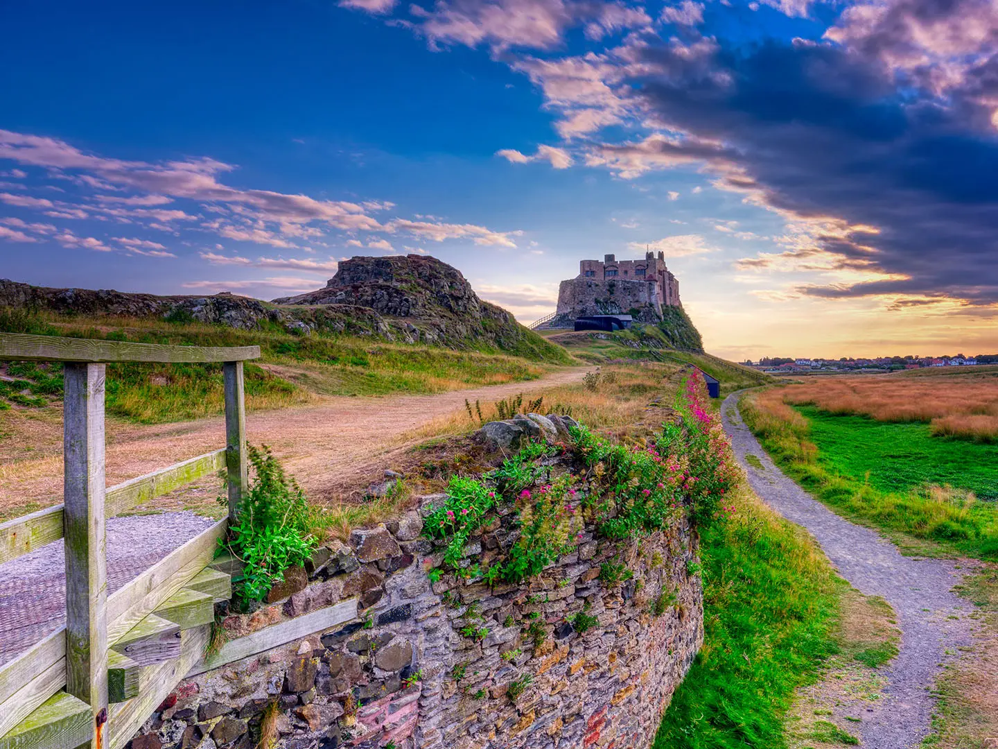
- Holy Island / Lindisfarne: The finish and a major early Christian site, reached only at low tide by the Pilgrims' Way across the sands or the tidal road causeway.
- Whitekirk: A red-sandstone 12th-century church beside a medieval holy well, recorded as a pilgrimage site after a healing in 1295.
Challenges to expect
Difficulty depends on pace: the route is moderate, but 12–16 mile days can feel demanding. Expect mixed surfaces including beaches, dunes, clifftop paths, field paths, tarmac lanes and minor roads. Coastal weather and exposed cliff sections need respect. The key logistical challenge is the Holy Island finish: check safe tide windows before committing to the Pilgrims' Way or road causeway.
HikeList Score
Forth to Farne Way scored 89/100 on HikeList's trail-quality metrics.
See score breakdownHide breakdown
- Ideal length 96
- Balanced challenge 100
- Scenery & wildness 64
- Varied terrain 100
- Accommodation 100
- Food & support 81
- Path quality 92
- Season flexibility 89
Computed from length, challenge, scenery & wildness, terrain variety, accommodation, food & support, path quality and season flexibility.
 United Kingdom
 Scotland
 England
Show more data Show less
- Farmland
- Countryside
- Coastal
- Beaches
- Dunes
- Clifftop
- Sea Cliffs
- Core Paths
- Coast Paths
- Beaches
- Minor Roads
- Field Paths
- Tarmac Lanes
- B&Bs
- Guesthouses
- Inns
- Hostels
- Family Friendly
- Pet Friendly
- Restrooms
- Water Sources
- Campsites
Download Our Full Guide to Forth to Farne Way FREE!
Get our comprehensive guide to this hike for free. Save it for later reading or print out at home.
Photos from hikers
Taken on the trail by people who've reviewed Forth to Farne Way.
Forth to Farne Way: The Complete Guide
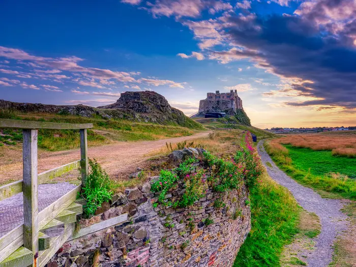 i
Image by Julian Gazzard
i
Image by Julian Gazzard The Forth to Farne Way is a cross-border pilgrim walk from North Berwick on the Firth of Forth to Holy Island / Lindisfarne on the Northumberland coast. It suits walkers who want a manageable long-distance route with coastal scenery, early Christian history and a finish that feels properly purposeful.
The route begins in East Lothian, passing Whitekirk and East Linton before reaching Dunbar, then turns into a more sustained coastal journey through Berwickshire. St Abb's Head, Coldingham, Eyemouth and Berwick-upon-Tweed give the walk its mix of cliffs, fishing towns, priory sites and border history.
This is not a mountain route, and the high point is only around 181 m on the Coldingham Moor section. The challenge is steadier and more practical: repeated 25 km days, mixed surfaces, exposed clifftop paths, rural gaps between services and the need to keep accommodation and transport lined up.
The ending is the detail that must shape the whole plan. Holy Island can only be reached within safe crossing times, whether using the road causeway or the Pilgrims' Way posts across the tidal sands, so the final day needs stricter timing than most UK coastal walks.
This guide covers stages, daily planning, accommodation, food, transport, terrain and the common mistakes to avoid.
Stage-by-Stage Guide
Distances below use the five practical long-day stages commonly used for accommodation planning. The route is also published as 11 shorter stages, so walkers wanting easier days can split the longer legs where accommodation and transport allow.
Stage 1: North Berwick to Dunbar — approx. 26 km
The route begins in North Berwick, around St Andrew Blackadder Church and the harbour area, before leaving the Firth of Forth coast for an inland East Lothian stage. This first day is not yet the sustained clifftop walking that defines the later route; expect low-level countryside, field paths, core paths, lanes and some tarmac underfoot.
Key places on this stage include Whitekirk and East Linton before the route reaches Dunbar. Whitekirk is an important pilgrimage stop, with the red-sandstone medieval Church of St Mary beside a holy well. The approach to Dunbar brings the route into a historic harbour town closely associated with John Muir, and the Forth to Farne Way shares ground with the John Muir Way around this part of the route.
North Berwick has the best start-of-day facilities and its own railway station on the ScotRail branch line from Edinburgh. East Linton is a useful mid-stage place to plan around, and this North Berwick–Dunbar leg is commonly split there by walkers wanting a shorter first day. Food, water and opening times between the larger settlements should be checked before travelling, especially if walking outside the main season or on a Sunday.
Dunbar is a practical overnight stop with accommodation and transport options, including its East Coast Main Line railway station. Book ahead in busy periods, as this is one of the key service towns on the route.
Navigation is generally straightforward if the waymarks are followed carefully through the mixture of paths, field edges and lanes. The main practical issue is not height or exposure, but keeping track of the stitched route where it changes between core paths, minor roads and shared long-distance-trail sections. After rain, field paths can be muddy, so waterproof footwear is useful even though the stage is low-level.
Stage 2: Dunbar to Cockburnspath — approx. 25 km
This stage continues south-east from Dunbar towards the Berwickshire end of East Lothian and the village of Cockburnspath. The walking remains moderate rather than mountainous, but the day is a full-length long-distance stage and should not be underestimated if carrying a pack.
The route uses a mix of coastal and rural walking, with farmland, minor roads, tarmac lanes and path sections. Conditions can vary noticeably with recent weather: dry lanes and firm tracks can make progress quick, while wet field paths can become slow and muddy.
Dunbar is the place to leave with food and water for the day unless current services further along the route have been checked. Cockburnspath has accommodation nearby only in limited quantities compared with the larger towns, so overnight arrangements should be made in advance.
Cockburnspath is a significant path junction village, known as a meeting point for several long-distance routes, including the eastern end of the Southern Upland Way. For walkers linking trails or section-walking, this makes it a useful logistical point, but onward public transport details should be checked before travelling.
Navigation becomes more important on this stage than on a simple coast path, because the Forth to Farne Way is a stitched pilgrim route rather than a single-purpose engineered trail. Watch for waymarks at junctions, field exits and lane crossings, and carry mapping or a GPX file rather than relying only on signs.
Warnings are mainly practical: expect exposed weather in open countryside, muddy surfaces after rain and some road or lane walking. Use standard care on narrow roads, especially where verges are limited.
Stage 3: Cockburnspath to St Abbs / Coldingham — approx. 25 km
This is one of the most varied stages of the route, moving from Cockburnspath towards the Berwickshire coast and the St Abb’s Head area. It includes the modest high point of the whole walk, around 181 m on the inland moorland crossing of Coldingham Moor, before returning towards the coast.
Although the height is modest, the Coldingham Moor section can feel more remote than the opening East Lothian stages. Expect open ground, rural paths and tracks, with exposure to wind and weather. This is not technical hillwalking, but mist, rain or poor visibility would make map-and-compass or GPS navigation more important.
The coastal reward is St Abb’s Head National Nature Reserve, a major highlight of the Forth to Farne Way. The volcanic headland has a working lighthouse, high sea cliffs and large summer seabird colonies including guillemots, razorbills and kittiwakes. In good conditions this is one of the finest viewpoints on the whole route, but it is also one of the more exposed sections.
The stage finishes at or near St Abbs and Coldingham. Coldingham Priory is a key pilgrimage landmark, with medieval Benedictine origins and continuing use as a parish church. Coldingham Bay is close by on the coastal line south of St Abbs.
Food and water should be planned carefully from the start of the day, as the rural Berwickshire stretch has thinner services than North Berwick, Dunbar or Berwick-upon-Tweed. St Abbs and Coldingham have accommodation options in the wider village area, but capacity is limited compared with the larger towns and should be booked ahead.
Buses serve Berwickshire coastal villages, but routes and timetables should be checked before travelling. This matters if using St Abbs or Coldingham as a section-walk start or finish, or if accommodation requires a short transfer off the line of the walk.
Navigation is important on the inland crossing and around the headland. Keep to waymarked and established paths on cliff sections, avoid cutting corners near cliff edges, and allow for slower progress in strong winds. Summer seabird season can make St Abb’s Head especially busy, so accommodation and transport planning should not be left late.
Stage 4: St Abbs / Coldingham to Berwick-upon-Tweed — approx. 25 km
From St Abbs or Coldingham the route follows the Berwickshire coast south through Coldingham Bay, Eyemouth and Burnmouth before continuing towards Berwick-upon-Tweed. This is a classic coastal day, with beaches, dunes, clifftop paths, fishing-town history and the gradual transition from Scotland towards England.
The walking is low-level but not flat all day. Expect repeated changes of surface between cliff paths, field paths, lanes and settlement edges. Clifftop sections can be exposed to wind, and wet grass or mud can make short ups and downs more tiring than the map suggests.
Eyemouth is the main settlement on the stage and a useful planning point for food, water and possible public transport. Burnmouth is passed further south before the route continues towards Berwick-upon-Tweed. Service availability in smaller coastal villages should be checked before travelling, particularly outside the main walking season.
Berwick-upon-Tweed is the most important service and transport hub near the finish of the route. It has accommodation, road access and a railway station on the LNER London–Edinburgh line. Its Elizabethan ramparts and bridges over the River Tweed are major landmarks, and reaching the town also marks the route’s cross-border progression from Scotland into England.
Navigation is generally helped by the established coastal-path character of this stage, but do not assume the line is always obvious through villages, around field margins or where paths meet minor roads. Carry mapping and check waymarks carefully at junctions.
The main warnings are cliff exposure, wind and mud. Stay on the path near sea cliffs, give yourself extra time in poor weather, and avoid treating this as a short transfer day simply because the highest ground is already behind you.
Stage 5: Berwick-upon-Tweed to Holy Island / Lindisfarne — approx. 25 km
The final stage leaves Berwick-upon-Tweed and heads down the Northumberland coast towards Holy Island. It is a long coastal day in its own right, but the defining challenge is timing the finish across the tidal flats to Lindisfarne.
The route uses low-level coastal walking, with beaches, dunes, field paths, lanes and sections associated with the Northumberland Coast Path and St Cuthbert’s Way. Underfoot conditions can include sand, firm path, grass and mud depending on weather and tides. Wind exposure is common on the open coast.
Holy Island can be reached by the Pilgrims’ Way posts across the sands or by the parallel road causeway. The Pilgrims’ Way crossing is roughly three miles across tidal sand and usually takes about 1.5–2 hours, but it must only be attempted within safe conditions. Some pilgrims walk it barefoot, but footwear choice should be based on conditions, temperature and personal safety rather than tradition.
The road causeway has official safe crossing times published by Northumberland County Council. The Pilgrims’ Way sands do not have separate published safe times of their own and must be judged from the tide; never start across on a rising tide, and allow extra time for slow walking over wet sand. The Holy Island crossing times should be checked before booking the final day and again before walking.
Berwick-upon-Tweed is the place to stock up before starting. Holy Island has limited accommodation and must be booked well ahead if finishing there overnight. If not staying on the island, onward travel depends on the tide-dependent 477 bus to Berwick-upon-Tweed or a taxi; both should be planned around the causeway times.
Navigation along the coast is generally straightforward with proper mapping, but the final approach needs particular care. Follow the marked Pilgrims’ Way posts if using the sands, do not improvise a line across the flats, and do not continue if the tide window is insufficient. In poor visibility, high winds or marginal timing, the causeway within the official safe crossing period is the more conservative option.
The finish on Holy Island is one of the great moments of the route, with Lindisfarne Priory and Lindisfarne Castle close to the end point. Its significance as the place where St Aidan founded the monastery in AD 635 makes it a fitting conclusion, but the tide controls the schedule completely; the final stage should be planned backwards from the safe crossing window, not treated as a normal walking day.
Recommended Itinerary
Standard 5-day itinerary
The practical standard itinerary follows the route’s five recommended daily stages, each around 25–26 km. It suits reasonably fit walkers who are comfortable with consecutive full coastal days and who can book accommodation in the main stopping places.
| Day | From | To | Approx. distance | Why this stage makes sense | Services/accommodation notes | |---|---|---:|---|---| | 1 | North Berwick | Dunbar | 26 km | A full but logical opening day across East Lothian, linking the rail-served start at North Berwick with the harbour town of Dunbar. This stage can feel long for a first day, so start early and avoid arriving tired before food and check-in. | North Berwick and Dunbar are the strongest service points on the northern part of the route. Dunbar is on the East Coast Main Line and has accommodation, making it a useful bail-out or section-walking point. | | 2 | Dunbar | Cockburnspath | 25 km | This keeps the route moving south into Berwickshire and ends at Cockburnspath, a recognised meeting point for several long-distance paths. Expect a quieter, more rural feel than Day 1. | Accommodation and services are thinner than in the larger towns. Book ahead and check exactly where the overnight stop is in relation to the trail. | | 3 | Cockburnspath | St Abbs / Coldingham | 25 km | One of the key transition stages, crossing inland moorland around Coldingham Moor before returning towards the coast. The high point of the whole route is modest, but this is still a committing rural day. | St Abbs and Coldingham are the practical overnight targets. Check availability before fixing the itinerary, especially outside the main walking season. | | 4 | St Abbs / Coldingham | Berwick-upon-Tweed | 25 km | A strong coastal stage passing Coldingham Bay, Eyemouth and Burnmouth before reaching Berwick-upon-Tweed. Ending in Berwick makes sense because it is the main transport and accommodation hub before the Holy Island finish. | Berwick-upon-Tweed has the best rail connections near the southern end of the route, on the London–Edinburgh line. It is the safest place to pause if the next day’s Holy Island crossing times do not work. | | 5 | Berwick-upon-Tweed | Holy Island / Lindisfarne | 25 km | The final day must be planned around the tide, not just distance. The route finishes on Holy Island, reached by the Pilgrims’ Way posts across the sands or by the parallel road causeway only within safe crossing times. | Holy Island has limited accommodation and should be booked well ahead. Check the official Holy Island safe crossing times before booking the final day, and allow enough time for the Pilgrims’ Way sands crossing. |
Slower 6–8 day variant
A slower schedule is the better choice for walkers who want shorter days, more time at the pilgrimage sites, or extra flexibility around weather and tides. It is also sensible if carrying full camping or overnight kit.
The route is also published as 11 shorter stages, and the 5-day itinerary can be broken by using intermediate places such as East Linton, St Abbs / Coldingham, Eyemouth or Burnmouth where logistics allow. The North Berwick to Dunbar day is commonly split at East Linton, making a gentler first section before continuing to Dunbar.
Do not assume every listed village has suitable accommodation on the required date. Accommodation thins out on the rural Berwickshire stretch, so each split should be checked before travelling and fixed around confirmed beds, campsites or transport.
Faster variant
The 5-day itinerary is already the fast, practical version for most independent walkers. Compressing the walk into fewer than five days would mean combining long coastal stages and is only suitable for very fit walkers with light packs, secure accommodation plans and a favourable Holy Island tide window.
For most hikers, it is better to keep Berwick-upon-Tweed as the final overnight stop before Holy Island rather than trying to force a longer penultimate day. The finish is tide-dependent, so the last day should be arranged around the safe crossing window rather than treated as an ordinary walking stage.
Planning the Route
How many days to allow
Most walkers should plan the Forth to Farne Way as a 5–8 day walk. The five-day schedule is practical for fit walkers who are comfortable with repeated 25 km coastal days, but it leaves limited margin for poor weather, long breaks, sightseeing or an awkward Holy Island tide window.
A 6–7 day itinerary is often the better fit for independent walkers. It gives more room to split the longer days, spend time at places such as Dunbar, St Abb's Head, Coldingham and Berwick-upon-Tweed, and avoid having to force the final crossing to Lindisfarne into a tight schedule.
The route is also published as 11 shorter stages. That format suits pilgrims, first-time long-distance walkers, or anyone wanting shorter days with more time at churches, priory sites and coastal villages.
Natural stage points
Daily planning is shaped by accommodation hubs rather than by the terrain. The route passes through several useful towns and villages, but accommodation becomes thinner on the rural Berwickshire sections and on Holy Island itself.
The standard five-day structure is:
| Day | Stage | Approx. distance | Planning notes |
|---|---|---|---|
| 1 | North Berwick to Dunbar | 26 km | Can be broken at East Linton if a shorter first day is preferred. |
| 2 | Dunbar to Cockburnspath | 25 km | A longer rural day, with Cockburnspath a key path junction and practical overnight point. |
| 3 | Cockburnspath to St Abbs / Coldingham | 25 km | Includes the more exposed Berwickshire coast and the inland crossing around Coldingham Moor. |
| 4 | St Abbs / Coldingham to Berwick-upon-Tweed | 25 km | Coastal walking via Coldingham Bay, Eyemouth and Burnmouth before reaching the main rail hub. |
| 5 | Berwick-upon-Tweed to Holy Island / Lindisfarne | 25 km | Must be planned around safe Holy Island crossing times, not just walking pace. |
Booking the finish well ahead is important. Holy Island has limited accommodation, and the tide can make arrival and departure times awkward; staying in Berwick-upon-Tweed and travelling to or from the island by the tide-dependent 477 bus or by taxi may be more practical for some itineraries. This should be checked before travelling.
Fast, steady or slow?
A fast five-day walk works best for hikers carrying light packs, already used to 12–16 mile days, and willing to keep moving through mixed farmland, minor roads, clifftop paths, dunes and beaches. It is not technically hard, but long exposed days can feel harder in wind or rain.
A steadier 6–7 day plan is usually more resilient. It reduces the pressure on the St Abb's Head and Berwickshire coast sections, makes the first East Lothian stages less rushed, and gives more flexibility if the Holy Island tide window falls early or late in the day.
A slower itinerary makes particular sense if the pilgrimage theme matters. The route links places such as Whitekirk, Coldingham Priory and Lindisfarne, and a rushed schedule can turn those stops into brief detours rather than part of the journey.
Shortening, extending and section hiking
Shortening individual days is most straightforward by using the published shorter-stage approach, especially on the opening section where North Berwick to Dunbar is commonly split at East Linton. Elsewhere, options depend heavily on accommodation availability and local transport, so bookings should be built around real overnight places rather than an ideal mileage plan.
Section hiking is practical. North Berwick has a railway station on the ScotRail branch line from Edinburgh Waverley, Dunbar is on the East Coast Main Line, and Berwick-upon-Tweed is the main rail hub near the finish. Buses also serve the Berwickshire coastal villages, but services and timetables should be checked before travelling.
Extending the route is usually a matter of adding time at the start or finish rather than adding extra trail mileage. North Berwick, Dunbar, Berwick-upon-Tweed and Holy Island are the most obvious places to build in an extra night.
The planning priorities
Accommodation: book early, especially for St Abbs / Coldingham, the rural Berwickshire stretch and Holy Island. The larger towns give more flexibility, but the route is not one where every stage end can be improvised safely in busy periods.
Food and water: plan resupply around the larger towns and do not assume every village has what is needed on the day. Carry enough food and water for long coastal and rural stretches, particularly between overnight stops.
Navigation: the route is waymarked and follows established paths including sections of the John Muir Way, Berwickshire Coastal Path, Northumberland Coast Path and St Cuthbert's Way. Even so, carry a map, guidebook or GPX track, as the route stitches several path networks together and includes field paths, minor roads and coastal options. The recommended OS mapping is Landranger 66, 67, 74 and 75, or Explorer 340, 346 and 351.
Weather: the route is low-level, but exposed cliff and headland sections can be windy, and paths can be muddy after rain. Spring, summer and autumn are the normal walking seasons; in any season, allow for rapid changes in coastal weather.
Transport: rail access is strongest at North Berwick, Dunbar and Berwick-upon-Tweed. Holy Island has no railway, so the final approach and any onward travel must be planned around the causeway tides and the local bus or taxi options.
Tides: the Holy Island finish is the most important planning constraint on the whole route. The road causeway has published safe crossing times from Northumberland County Council, but the Pilgrims' Way across the sands has no separate published crossing times and must be judged from the tide. Never cross on a rising tide, allow extra time for the roughly three-mile sands crossing, and check the official Holy Island safe crossing times before committing to a final-day plan.
Towns, Villages and Overnight Stops
Accommodation planning on the Forth to Farne Way is shaped by a few clear hubs: North Berwick, Dunbar, St Abbs / Coldingham, Berwick-upon-Tweed and Holy Island / Lindisfarne. The rural sections between them have fewer beds, so walkers using the 5-day itinerary should book ahead rather than rely on finding accommodation at the end of each day.
The route can also be split into shorter days, especially on the opening North Berwick to Dunbar stage, which is commonly broken around East Linton. Food, transport and baggage logistics are easiest in the larger towns; the Berwickshire coast and the Holy Island finish need more careful timing and pre-booking.
North Berwick
North Berwick is the start of the route, with the walk beginning around St Andrew Blackadder Church and the harbour area on the Firth of Forth. It is a practical place to stay the night before setting off, particularly if travelling from elsewhere in the UK.
The town has accommodation suitable for the start of a multi-day walk, including guesthouse and B&B-style options. As a seaside town, it is also one of the better places on the route for pre-walk supplies, evening food and last-minute kit checks, though opening hours should still be checked before travelling.
North Berwick has its own railway station on the ScotRail branch line from Edinburgh Waverley, with an hourly service taking around 34 minutes. This makes it the most straightforward rail access point for the start of the trail.
Whitekirk
Whitekirk lies on the inland East Lothian opening section between North Berwick and Dunbar. Its main significance for walkers is St Mary’s Church, a red-sandstone medieval church beside a holy well and one of the early pilgrimage points on the route.
It is not one of the main accommodation hubs for the Forth to Farne Way. Anyone considering it as an overnight stop should check current accommodation, food and transport options before committing to a stage plan.
For most walkers, Whitekirk is a daytime stop rather than a night halt. It is useful as a place to pause, orientate and understand the pilgrimage thread of the route before continuing towards East Linton or Dunbar.
East Linton
East Linton is the key practical break point on the first long day between North Berwick and Dunbar. The North Berwick to Dunbar stage is often split here, creating a shorter first day of roughly 9 miles followed by about 7 miles into Dunbar.
This can be a sensible option for walkers who want a gentler start, are arriving late into North Berwick, or prefer not to begin with a full 26 km day. Accommodation and food availability should be checked before travelling, as the main established overnight hub for this section remains Dunbar.
East Linton is most useful for walkers designing a 6- to 8-day itinerary rather than the compressed 5-day version. It also gives more time for the inland East Lothian section before the route becomes more consistently coastal.
Dunbar
Dunbar is the first major overnight stop for many walkers and the end of the standard first 26 km stage from North Berwick. It is a historic harbour town and the 1838 birthplace of conservationist John Muir, with the route sharing ground with the John Muir Way in this area.
This is one of the better service points on the trail. Expect a stronger choice of accommodation than in the smaller villages, with B&Bs, guesthouses and inns forming the typical long-distance walking mix.
Dunbar is also important for transport. It is on the East Coast Main Line, making it a useful access, exit or section-walking point if the full route cannot be completed in one trip.
Food and resupply are most straightforward in the larger towns, and Dunbar is a good place to reset before the more rural stretch towards Cockburnspath and the Berwickshire coast. Check specific opening hours before relying on evening meals or early breakfasts.
Cockburnspath
Cockburnspath is the usual stop between Dunbar and the St Abbs / Coldingham area on the 5-day itinerary. It is a Berwickshire village and a meeting point for several long-distance paths, including the eastern end of the Southern Upland Way.
Accommodation is thinner here than in Dunbar, Berwick-upon-Tweed or the larger coastal settlements. Book ahead and avoid assuming there will be spare rooms, particularly in busy walking periods.
Food and shop options should be checked before travelling. If staying in or near Cockburnspath, confirm dinner, breakfast and packed-lunch arrangements with the accommodation provider in advance.
Cockburnspath is strategically useful because it breaks the long transition from East Lothian towards the Berwickshire coast. It also positions walkers for the next day’s inland moorland crossing around Coldingham Moor, where the route reaches its modest high point of about 181 m before returning towards the coast.
St Abb's Head
St Abb’s Head is a major route highlight rather than a village stop. The trail passes the dramatic volcanic headland and National Nature Reserve, with sea cliffs, a working lighthouse and large summer seabird colonies including guillemots, razorbills and kittiwakes.
There is no reason to plan this as an overnight base unless accommodation nearby has been arranged in St Abbs or Coldingham. Treat it as an exposed coastal walking section: wind, rain and clifftop conditions can make progress slower than the map suggests.
The headland is a place to allow time, but not a place to rely on for services. Carry food and water for the day and continue to the established village options for accommodation.
St Abbs
St Abbs is one of the main practical stopping areas after the Cockburnspath stage, often paired with nearby Coldingham in itineraries. It sits on the Berwickshire coast close to St Abb’s Head, making it well placed for walkers finishing the day after the headland section.
Accommodation exists in the St Abbs / Coldingham area, but it should be booked ahead because this part of the route has less capacity than the larger towns. It is a logical overnight for walkers following the 5-day schedule from Cockburnspath.
Food and local services should be confirmed before arrival, especially outside peak visitor periods. Buses serve the Berwickshire coastal villages, but timetables and stops should be checked before using public transport to shorten or rejoin a stage.
Coldingham
Coldingham is an important alternative or companion overnight stop to St Abbs. It is slightly inland from the coast and is significant for Coldingham Priory, a Benedictine priory of medieval origins that remains in use as a parish church.
For many walkers, Coldingham is the practical end point of the Cockburnspath to St Abbs / Coldingham stage. It can also work well for those who want to spend more time at St Abb’s Head without rushing on to Eyemouth or Berwick-upon-Tweed.
Accommodation is available in the wider St Abbs / Coldingham area, but capacity is still limited compared with Berwick-upon-Tweed. Book early and confirm evening meal options, breakfast times and packed lunches when arranging a stay.
Coldingham Bay
Coldingham Bay sits on the coastal stretch south of St Abbs and north of Eyemouth. It is known on the route as a sandy bay and can be a useful pause between the St Abbs / Coldingham area and the fishing town of Eyemouth.
It is not one of the principal overnight hubs listed for the trail. Anyone planning to stop here overnight should check current accommodation and food options before travelling.
For most walkers it functions as a scenic waypoint rather than a logistical base. Carry enough food and water to continue comfortably to the next confirmed stop.
Eyemouth
Eyemouth is a historic Berwickshire fishing town on the coastal section south of Coldingham Bay. It is one of the more useful intermediate settlements on the St Abbs / Coldingham to Berwick-upon-Tweed stage.
Depending on the chosen itinerary, Eyemouth may work as a lunch stop, a short-stage overnight, or a bail-out point using local buses. Buses serve the Berwickshire coastal villages, but timetables should be checked before relying on them.
Accommodation and food options are more likely here than in the smallest coastal settlements, but specific availability should still be checked before travelling. Eyemouth can be especially useful for walkers spreading the Berwickshire coast over more than one day.
Burnmouth
Burnmouth lies south of Eyemouth on the approach towards Berwick-upon-Tweed. It is a smaller coastal settlement and should be treated as a passing point unless accommodation has been specifically arranged.
Do not assume full walker services here. Food, accommodation and transport options should be checked before travelling if planning to end or start a stage at Burnmouth.
For most walkers on the standard itinerary, Burnmouth comes late in the day between St Abbs / Coldingham and Berwick-upon-Tweed. Keep enough time and energy for the onward approach to Berwick, rather than treating Burnmouth as a guaranteed service stop.
Berwick-upon-Tweed
Berwick-upon-Tweed is the largest and most important service hub near the southern end of the route. It is England’s northernmost town, reached after the route crosses the Anglo-Scottish border, with the trail passing the town’s Elizabethan ramparts and the bridges over the River Tweed.
This is the best place to reset before the final Holy Island stage. Accommodation choice is stronger than in the smaller Berwickshire villages, and it is the most practical base for walkers who need rail access, rest, laundry, replacement supplies or a flexible finish plan.
Berwick-upon-Tweed is on the LNER London–Edinburgh line and is the main rail hub near the finish. It is also the practical connection point for reaching Holy Island by the tide-dependent 477 bus or by taxi.
Because the final stage is governed by Holy Island tide times, Berwick is a sensible place to build in flexibility. If the safe crossing window is awkward, it may be better to stay an extra night here or adjust the walking day rather than risk a rushed or unsafe crossing.
Holy Island / Lindisfarne
Holy Island / Lindisfarne is the finish of the Forth to Farne Way and the most time-sensitive overnight stop on the route. The island is reached only within published safe crossing times, either by the road causeway or, for walkers following the traditional pilgrim option, across the tidal sands by the Pilgrims’ Way posts.
Accommodation on Holy Island is limited and must be booked well ahead. This is especially important because missing the safe crossing window can prevent arrival or departure until the next available tide window.
There is no railway on Holy Island. Access is from Berwick-upon-Tweed by the tide-dependent 477 bus or by taxi, then by the causeway or Pilgrims’ Way within safe crossing times.
The finish is a major early Christian site, associated with St Aidan’s monastery founded in AD 635, Lindisfarne Priory and Lindisfarne Castle. The practical priority, however, is timing: check the official Holy Island safe crossing times before travelling, allow a generous margin, and never attempt the sands on a rising tide.
Getting to the Start
By train
North Berwick is the easiest start point to reach by public transport. The town has its own railway station on the ScotRail branch line from Edinburgh Waverley, with trains roughly hourly and a journey time of about 34 minutes.
From North Berwick station, allow time to walk across town to the St Andrew Blackadder Church / harbour area, where the route begins. If starting the first full stage to Dunbar on the same day, build this town crossing and any food shopping into the morning plan.
For walkers travelling from further afield, Edinburgh Waverley is the main rail gateway for the start. Berwick-upon-Tweed is useful later in the trip as the main rail hub near the finish, but it is not the start of the trail.
Timetables, engineering works and Sunday services should be checked before travelling.
By bus
Bus travel can be useful for local access around East Lothian, but North Berwick’s train link from Edinburgh is normally the simplest public transport option for starting the Forth to Farne Way. Specific bus routes and evening or Sunday services should be checked before travelling.
Buses also serve some of the Berwickshire coastal villages used later on the route, but they are less relevant for reaching the official start at North Berwick.
By car
Driving to North Berwick is possible, but it creates a point-to-point logistics problem. The route finishes on Holy Island / Lindisfarne, which has no railway, and onward travel from the finish normally involves the tide-dependent 477 bus or a taxi back to Berwick-upon-Tweed before using rail services.
Do not assume that parking close to the harbour or St Andrew Blackadder Church is suitable for several days. Long-stay parking rules, charges and restrictions in North Berwick should be checked before travelling.
For many walkers, the cleaner plan is to travel to North Berwick by train and avoid leaving a car at the start. If a car is left in North Berwick, the return from the finish will usually need to be planned around Holy Island crossing times, transport back to Berwick-upon-Tweed, rail to Edinburgh Waverley and the onward train to North Berwick.
From the nearest airport
For walkers arriving by air, plan the journey around getting into Edinburgh and then taking the ScotRail service from Edinburgh Waverley to North Berwick. Airport-to-city transfer options, journey times and late-evening connections should be checked before travelling.
If landing late, staying in Edinburgh and taking the morning train to North Berwick can work, but it makes the first walking day more dependent on train times. The first recommended stage to Dunbar is a long coastal-and-country day, so an overnight stay in North Berwick is the more straightforward option.
Where to stay before starting
North Berwick is the best place to stay before beginning the route. It puts you close to the official start area and avoids relying on a morning connection from Edinburgh before a long first day to Dunbar.
Accommodation in North Berwick includes typical town options such as B&Bs, guesthouses and inns. Book ahead in busy periods, especially if starting at a weekend or during the main spring-to-autumn walking season.
Edinburgh can be used as a backup base because of the regular rail connection to North Berwick, but it is less convenient for an early start. If staying in Edinburgh, check the first suitable train and allow enough time in North Berwick before setting off.
Getting Home from the Finish
Holy Island / Lindisfarne is a rewarding but logistically awkward finish. The island has no railway station, and all road access is controlled by the tide, so the journey home needs to be planned around the published Holy Island safe crossing times rather than ordinary end-of-day convenience.
The practical railhead is Berwick-upon-Tweed, on the East Coast Main Line between London and Edinburgh. From Holy Island, walkers usually leave by the tide-dependent 477 bus or by pre-booked taxi, using the road causeway only when it is open.
By train
The nearest station is Berwick-upon-Tweed. It is the main rail hub for the finish of the Forth to Farne Way and sits on the LNER London–Edinburgh line, giving onward connections south into England and north to Edinburgh.
There is no train service from Holy Island itself. To catch a train, first get off the island by bus or taxi across the causeway during the official safe crossing window, then continue from Berwick-upon-Tweed station.
Do not book a tight rail connection immediately after finishing the walk. The final stage is tide-dependent, and any delay on the approach to Holy Island can affect whether there is still enough time to leave the island safely the same day.
By bus
The 477 bus links Holy Island with Berwick-upon-Tweed, but it is tide-dependent. Times vary with the safe crossing windows, so the current timetable must be checked before travelling.
This is not a service to rely on casually at the end of a long walking day. If the bus does not fit the day’s tide window, the options are to book a taxi, stay on Holy Island, or adjust the final stage so that the finish and onward travel line up properly.
By car/taxi
Any vehicle leaving Holy Island must use the road causeway, which is only safe within the published crossing times. Check the official Holy Island safe crossing times from Northumberland County Council before committing to a taxi pick-up, lift or onward journey.
Taxis should be booked in advance, especially if a specific tide window is needed. Give the operator the date, planned pick-up point on Holy Island and your intended onward connection from Berwick-upon-Tweed.
If leaving a car near the finish, the same rule applies: the causeway dictates when the island can be reached or left. This should be checked before travelling.
From the nearest airport
There is no airport on or near Holy Island itself in practical walking terms. For flights after the hike, first travel from Holy Island to Berwick-upon-Tweed, then use the main-line rail connection towards larger cities such as Edinburgh or destinations further south on the London–Edinburgh line.
Airport transfer details, rail connections and same-day feasibility should be checked before booking flights. The tide window at Holy Island can make an early or late flight unrealistic unless an overnight stop is added.
Where to stay at the finish
Staying overnight on Holy Island / Lindisfarne is often the simplest way to avoid a rushed finish, especially if the safe crossing window falls late in the day or does not align with the 477 bus. Accommodation on the island is limited and should be booked well ahead.
A second practical option is to finish the route, leave the island during the safe crossing window, and stay in Berwick-upon-Tweed before taking a train the next morning. This gives more flexibility for rail departures and avoids building the whole final day around a tight evening connection.
If the final tide window is awkward, consider staying in Berwick-upon-Tweed before the last stage, walking to Holy Island at the correct time, and treating the finish as its own tide-planned day rather than forcing a long walk and onward travel into the same schedule.
Which Direction Should You Walk?
The Forth to Farne Way is best treated as a north-to-south route: North Berwick to Holy Island / Lindisfarne. That is the standard direction, follows the route’s pilgrim logic, and gives the walk its strongest finish on the tidal crossing to Holy Island.
Walking it in reverse is possible, but it changes the feel of the route and makes the most time-critical logistical feature — the Holy Island crossing — a starting problem rather than a finale.
North Berwick to Holy Island: the standard direction
This is the natural and most common direction for the route. It begins at North Berwick on the Firth of Forth, passes through East Lothian and the Berwickshire coast, crosses the Anglo-Scottish border, and finishes at Lindisfarne, one of the major early Christian sites in Britain.
The scenery also builds well in this direction. The opening stages are more inland and pastoral around Whitekirk, East Linton and Dunbar, before the route becomes increasingly coastal through Cockburnspath, St Abb's Head, St Abbs, Coldingham Bay, Eyemouth, Burnmouth and Berwick-upon-Tweed. The final approach across the sands or causeway to Holy Island gives the route a clear psychological endpoint.
Transport at the start is straightforward. North Berwick has its own railway station on the ScotRail branch line from Edinburgh Waverley, so most walkers can arrive without complicated transfers. The finish needs more planning because Holy Island has no railway, but Berwick-upon-Tweed is the main rail hub nearby, with onward travel by tide-dependent bus or taxi.
The main disadvantage of this direction is that the final day is governed by tide times. The causeway must be crossed only within published safe crossing times, and the Pilgrims' Way across the sands needs careful tide calculation. This should be checked before travelling, and accommodation on Holy Island should be booked well ahead.
Holy Island to North Berwick: the reverse direction
The reverse direction can work for experienced walkers who have a specific reason to finish in North Berwick, especially if onward rail travel at the end is the priority. Finishing at North Berwick is logistically simple because of the station and regular connection to Edinburgh.
However, starting on Holy Island is less convenient. You still have to reach the island within safe crossing times, whether by bus, taxi, road causeway or the Pilgrims' Way, and the first stage is immediately tide-dependent. If the crossing window is awkward, it can disrupt the very start of the trip.
The reverse direction also front-loads the route’s strongest symbolic moment. Beginning at Lindisfarne and then walking away from it makes the final days through East Lothian feel less climactic than arriving there at the start of a pilgrimage-style route.
Are the climbs easier in either direction?
There is no major climbing advantage either way. The Forth to Farne Way is a low-level coastal and farmland walk, with a modest high point of around 181 m on the Coldingham Moor section rather than a mountain pass or summit.
Daily effort is shaped more by stage length, underfoot conditions, coastal exposure and wind than by ascent profile. Mud after rain, exposed clifftop sections and long 25 km days will matter more than whether the route is walked northbound or southbound.
Wind and weather considerations
This is an exposed coastal route in places, especially on the Berwickshire and Northumberland sections. A strong wind can make clifftop walking feel much harder in either direction, and there is no direction that reliably avoids poor weather.
Check the forecast before committing to exposed coastal days, and be prepared to adjust pace or stage plans if conditions are rough. The final Holy Island crossing should never be treated as just another path section; tide and weather timing matter more than direction preference.
Accommodation flow
The standard north-to-south direction fits the usual accommodation hubs: North Berwick, Dunbar, St Abbs / Coldingham, Berwick-upon-Tweed and Holy Island. Accommodation thins out on the rural Berwickshire stretch and on Holy Island itself, so booking ahead is important whichever way the route is walked.
In the standard direction, Holy Island works as a booked finish. In reverse, it becomes a booked start, which can be less flexible because arrival depends on the tide as well as transport availability.
Recommendation
Walk the Forth to Farne Way from North Berwick to Holy Island unless there is a strong logistical reason to do otherwise. This direction gives the best progression of landscape, the clearest pilgrim narrative, the simplest start by rail, and the most satisfying finish on Lindisfarne.
The reverse direction is viable, but it is a practical compromise rather than the best version of the route.
Accommodation Along the Route
The Forth to Farne Way works well as an inn-to-inn walk, but it is not a route where every village has a deep pool of beds. The easiest plan is to use the main overnight hubs: North Berwick, Dunbar, Cockburnspath, St Abbs or Coldingham, Berwick-upon-Tweed and Holy Island / Lindisfarne.
Accommodation is strongest at the larger towns, especially North Berwick, Dunbar and Berwick-upon-Tweed. It becomes thinner through the rural Berwickshire section and at the finish on Holy Island, where booking ahead is essential.
Main overnight stops
| Place | Accommodation level | Best for | Notes |
|---|---|---|---|
| North Berwick | Good | Night before starting | A practical start base with B&Bs, guesthouses, inns and rail access from Edinburgh via North Berwick station. Staying here avoids a rushed first morning. |
| East Linton | Limited | Breaking the first day | Useful if splitting the North Berwick to Dunbar stage into shorter walks. Availability should be checked before travelling. |
| Dunbar | Good | First main overnight stop | One of the strongest accommodation hubs on the route and a sensible place to stop before the more rural stretch towards Cockburnspath. Dunbar is also on the East Coast Main Line. |
| Cockburnspath | Limited | End of the Dunbar stage / start of Berwickshire coast | A key stage point, but not a large accommodation centre. Book before committing to a five-day itinerary, or be prepared to use a transfer if beds are full. |
| St Abbs / Coldingham | Limited | Overnight after Cockburnspath | The usual base for the stage after Cockburnspath. Coldingham also works well for walkers wanting to stay close to Coldingham Priory and the Berwickshire coast section. Book ahead in busy periods. |
| Eyemouth / Burnmouth | Limited | Alternative break on the coastal stage to Berwick-upon-Tweed | Potentially useful for shortening or reshaping the St Abbs / Coldingham to Berwick-upon-Tweed day, but accommodation should not be assumed. This should be checked before travelling. |
| Berwick-upon-Tweed | Good | Final mainland overnight stop | The strongest base near the end of the route, with rail connections on the East Coast Main Line. A practical place to stay before timing the final walk to Holy Island. |
| Holy Island / Lindisfarne | Limited | Finish-night stay | The most important place to book early. Accommodation is limited and access depends on safe crossing times, so the finish date should be planned around both bed availability and the tide. |
Booking strategy
For a standard five-day walk, accommodation needs to be fixed before travel rather than improvised day by day. The critical nights are Cockburnspath, St Abbs / Coldingham and Holy Island, where smaller supply can quickly constrain the itinerary.
North Berwick, Dunbar and Berwick-upon-Tweed give the most flexibility. These are the best places to add rest time, recover from travel delays, or adjust the schedule before and after the thinner rural sections.
Spring, summer and autumn are the main walking seasons, and weekends can be tighter in the coastal towns and villages. Holy Island should be treated separately from the rest of the route: its tidal access compresses arrival and departure options, and accommodation must be secured well ahead.
If Holy Island is full
If no bed is available on Holy Island, the finish can still work, but the transport plan becomes more important. Berwick-upon-Tweed is the main practical base near the end, with onward access to Holy Island by the tide-dependent 477 bus or by taxi.
Any plan to leave Holy Island on the same day must fit the published safe crossing times for the road causeway. The Pilgrims’ Way across the sands also requires careful tide planning and should never be treated as a casual alternative if the timing is wrong.
Camping, baggage transfer and awkward gaps
There are some campsites along the route, but camping provision is not continuous enough to assume a simple campsite-to-campsite itinerary. Anyone planning to camp should identify suitable overnight stops in advance and check current availability before travelling.
Baggage transfer can make the route easier, particularly on the longer 25–26 km stage days. Walking holiday companies such as Contours Walking Holidays offer itineraries and baggage-transfer support for the Forth to Farne Way.
Taxi transfers can also help if a limited overnight stop is full, especially around the larger hubs such as Dunbar and Berwick-upon-Tweed. These should be arranged in advance rather than left until the end of the walking day.
Camping and Wild Camping
Camping can work on the Forth to Farne Way, but it needs more planning than a simple inn-to-inn itinerary. The route passes through several useful towns and villages, and the brief route corridor includes some campsites, but camping provision is not dense enough to assume there will be a pitch at every natural stage end.
The most reliable approach is to plan each night in advance, especially on the rural Berwickshire section and for the Holy Island finish, where accommodation is limited and tide times control the final crossing. Do not build an itinerary around speculative camping spots unless local permission or a booked pitch is already arranged.
Campsites and planned camping
Use campsites as part of a booked itinerary rather than as an afterthought. The practical overnight hubs on this route are North Berwick, Dunbar, St Abbs / Coldingham, Berwick-upon-Tweed and Holy Island / Lindisfarne, but campsite availability, opening seasons and walker policies should be checked before travelling.
The five-day version of the route uses long days of roughly 25–26 km, so a camping itinerary may need adjustment around where pitches are actually available. The 11 shorter-stage version of the route can be easier to adapt if campsite locations do not line up neatly with the standard daily stages.
Holy Island needs particular care. It has no railway access, onward travel is tide-dependent, and overnight options are limited, so any campsite or accommodation plan for the finish should be booked well ahead and matched to the official safe crossing times.
Wild camping: Scotland and England
The route crosses from Scotland into England, so wild-camping expectations change along the way. In Scotland, lightweight responsible wild camping is generally more accepted under access rights, but this does not mean camping anywhere without judgement. On farmland, near houses, around settlements, beside roads, in enclosed fields, or in sensitive coastal and nature reserve areas, permission and restraint matter.
In England, wild camping is generally only lawful with the landowner’s permission. South of the border, including the Northumberland approach to Holy Island, do not assume that pitching discreetly is permitted. If in doubt, use a campsite or arrange permission in advance.
Rules and local restrictions can change, especially around protected land, managed estates and nature reserves. This should be checked locally before relying on any wild-camping plan.
Where wild camping is least suitable
Wild camping is a poor fit for several parts of this route:
- St Abb's Head National Nature Reserve — a protected coastal headland with sensitive habitats, cliffs and seabird colonies; use proper facilities elsewhere rather than camping in or around the reserve.
- Clifftop sections — exposed, windy and often close to paths, livestock fencing or unstable edges.
- Farmland and enclosed fields — much of the route uses field paths and core paths; do not pitch without permission.
- Near villages, harbours and roads — North Berwick, Dunbar, St Abbs, Coldingham, Eyemouth, Burnmouth, Berwick-upon-Tweed and Holy Island are not suitable places to improvise a pitch.
- The Holy Island sands and causeway area — the finish is tidal and must be treated as a timed crossing, not as a camping zone.
Does the route suit carrying camping gear?
The Forth to Farne Way is physically moderate, but a tent, sleeping system and cooking kit make the 12–16 mile coastal days harder. The route has no high mountains, but it does have exposed clifftop walking, muddy sections after rain, minor roads, field paths and a tide-critical final day. A lighter pack is noticeably easier, especially in wind.
Camping suits walkers who are happy to plan carefully around booked pitches and carry enough food and water between settlements. It is less suitable for anyone hoping to wild camp spontaneously each night.
Water, food and stove use
Plan water around towns and villages rather than assuming natural sources will be usable. The route passes places such as East Linton, Dunbar, Cockburnspath, St Abbs, Coldingham, Eyemouth, Burnmouth and Berwick-upon-Tweed, but opening hours and services should be checked before travelling.
Do not rely on coastal burns, field troughs or beach-adjacent water. Carry enough for the day, and leave the final Holy Island crossing with sufficient water already packed, as the tide window is the priority once committed.
Use a stove only where it is safe and permitted. Open fires are not appropriate on this route: the coast is exposed, much of the land is farmed or protected, and fire risk or local restrictions may apply in dry weather.
Leave No Trace on this route
If camping is used at all, keep impact extremely low:
- arrive late, leave early and keep tents out of sight from homes, roads and busy paths where permission allows;
- never camp on crops, in enclosed livestock fields or in protected nature areas;
- pack out all rubbish, food waste and sanitary items;
- use toilets in towns, campsites and accommodation where possible;
- avoid disturbing livestock and nesting or roosting birds;
- do not light fires;
- leave no visible trace of the pitch.
The safest and most sustainable camping plan for the Forth to Farne Way is a booked-campsite itinerary, with any wild camping limited to places where it is clearly lawful, locally appropriate and genuinely low impact.
Food, Water and Resupply
Food and water planning on the Forth to Farne Way is straightforward in the larger towns, but should not be left to chance on the rural and coastal stages. North Berwick, Dunbar and Berwick-upon-Tweed are the most practical places to start a stage fully stocked, while the smaller villages and coastal settlements should be treated as useful but not guaranteed resupply points unless opening times have been checked.
Most walkers should carry a full day’s lunch and snacks on each 25–26 km stage, even when passing through villages such as Whitekirk, East Linton, Cockburnspath, St Abbs, Coldingham, Eyemouth and Burnmouth. Rural opening hours, Sunday trading and seasonal café hours can make otherwise easy-looking resupply unreliable.
Practical resupply strategy
Start each day with breakfast arranged through accommodation, or bought the evening before. Carry lunch from the start of the day rather than relying on finding food mid-stage, especially between Dunbar and Cockburnspath, Cockburnspath and St Abbs / Coldingham, and on the final approach to Holy Island.
The safest pattern is:
- Buy the next day’s lunch the evening before in North Berwick, Dunbar, St Abbs / Coldingham or Berwick-upon-Tweed where possible.
- Carry emergency food for one missed meal: bars, oatcakes, nuts, dried fruit or similar.
- Check Sunday and seasonal hours for village shops, cafés and pubs before committing to a no-carry plan.
- Do not assume Holy Island services will be open or accessible when you arrive, as the finish is governed by safe crossing times as well as business hours.
Water planning
Fill bottles before leaving accommodation each morning. There are settlements along the route, but the clifftop, beach, dune, field-path and moorland sections can feel remote once between villages, and water taps should not be assumed.
For typical stages, most walkers should start with enough water for a full day’s walking, adjusted for heat and wind. On exposed coastal days, dehydration can be easy to underestimate because sea breezes cool the skin while the effort remains steady.
Natural water should not be relied on as a primary source. The route passes through farmland, coastal ground and tidal environments, so streams, burns, ditches and standing water may be affected by livestock, agricultural run-off or saltwater influence. If natural water must be used in an emergency, it should be filtered or treated.
Section-by-section food and water notes
| Section | Food availability | Water availability | Notes |
|---|---|---|---|
| North Berwick to Dunbar | Best planned from North Berwick before setting out. Whitekirk and East Linton are possible mid-stage settlements, but current services and opening hours should be checked before travelling. Dunbar is the main end-of-day resupply point. | Fill in North Berwick before leaving. Do not rely on guaranteed refills between settlements. | This is a long first day at about 26 km, often broken at East Linton. Carry lunch unless a specific stop has been checked in advance. |
| Dunbar to Cockburnspath | Stock up in Dunbar. Food options between Dunbar and Cockburnspath should be treated as limited. | Leave Dunbar with full bottles. Refill opportunities may be sparse away from accommodation or open businesses. | Carry a complete lunch and snacks. This is not a stage to depend on rural opening hours. |
| Cockburnspath to St Abbs / Coldingham | Cockburnspath is a small village, so do not assume full resupply without checking. St Abbs and Coldingham are the practical end-of-stage food points. | Fill before leaving Cockburnspath. The Coldingham Moor and coastal sections should be treated as carry-your-own-water terrain. | This stage includes the modest high ground around Coldingham Moor and exposed coastal walking near St Abb’s Head. Carry enough food and water for the full day. |
| St Abbs / Coldingham to Berwick-upon-Tweed | St Abbs / Coldingham are useful starting points. Coldingham Bay, Eyemouth and Burnmouth are named settlements on the route, but individual cafés, pubs or shops should be checked before relying on them. Berwick-upon-Tweed is the strongest resupply point before the final stage. | Start full. Refill only where open services are available; do not count on clifftop or beach sections for water. | This is the easiest day to plan around coastal settlements, but closures can still disrupt plans. Berwick is the place to buy final-stage food. |
| Berwick-upon-Tweed to Holy Island / Lindisfarne | Stock up in Berwick-upon-Tweed before leaving. Food on Holy Island should not be relied on for arrival-day essentials because timing depends on the tide and services may be limited. | Leave Berwick with enough water to reach Holy Island comfortably. Carry extra if walking the Pilgrims’ Way sands in warm weather. | The final stage is about 25 km and the finish must fit safe crossing times. Eat before the crossing if timing is tight, and carry food in case arrival is outside normal service hours. |
Final-day caution: food, water and tides
The Holy Island finish is a logistics stage as much as a walking stage. The Pilgrims’ Way across the sands and the parallel road causeway can only be used within safe crossing times, so meal stops must not push the crossing into an unsafe window.
Carry food that can be eaten without stopping for a long café break, and keep enough water for the crossing itself. The safe crossing times for Holy Island should be checked before travelling, and again before committing to the final day.
Terrain, Conditions and Difficulty in Practice
The Forth to Farne Way is moderate because of day-after-day distance, mixed coastal surfaces and the tidal finish, not because of altitude or technical ground. There is no high mountain terrain and no scrambling, but the route still asks for steady fitness, good footwear, weather awareness and disciplined timing for Holy Island.
Total ascent is about 1,917 m over the full route, with a modest high point of around 181 m on the inland moorland crossing of Coldingham Moor between Cockburnspath and the coast. Most climbing comes as repeated small rises and falls through farmland, lanes, coastal paths and headlands rather than one major hill day.
Underfoot: what the walking is really like
Expect a varied mix of field paths, core paths, minor roads, tarmac lanes, beaches, dunes, clifftop paths and sea-cliff walking. The opening from North Berwick towards Dunbar is more inland and agricultural, while the later sections become increasingly coastal through Berwickshire and Northumberland.
After rain, the field paths and rural sections can be muddy. Waterproof footwear is sensible outside dry summer spells, and lightweight trail shoes may feel inadequate if several wet days have softened the ground.
There is some road and lane walking, but the route is not primarily a road walk. Tarmac sections are most useful for progress and navigation, but they can be tiring on feet over 25 km days, especially when carrying a full pack.
The coastal sections are more varied: dunes and beaches can slow the pace, clifftop paths can be narrow or exposed to wind, and sea-cliff walking demands attention even in good weather. The route is waymarked, but a map or offline GPX remains useful because it stitches together several existing paths and rural rights of way.
Stage-by-stage terrain character
| Section | Terrain and difficulty in practice |
|---|---|
| North Berwick to Dunbar | A long opening day through East Lothian countryside via places such as Whitekirk and East Linton. Expect field paths, core paths, lanes and agricultural ground rather than sustained coast. Mud after rain is the main underfoot issue. |
| Dunbar to Cockburnspath | A continued rural and coastal transition, using established long-distance path sections including ground associated with the John Muir Way. The difficulty comes from another full day’s mileage rather than major height gain. |
| Cockburnspath to St Abbs / Coldingham | One of the more varied sections, including the modest high ground of Coldingham Moor and then the coast around St Abb’s Head. The moorland crossing can feel more remote than the height suggests, and the headland/cliff terrain is exposed in wind. |
| St Abbs / Coldingham to Berwick-upon-Tweed | A coastal day through Coldingham Bay, Eyemouth and Burnmouth towards Berwick-upon-Tweed. Expect clifftop and sea-coast paths mixed with field paths and lanes; weather and wind can have a bigger effect than ascent. |
| Berwick-upon-Tweed to Holy Island / Lindisfarne | Physically similar in distance to the other long days, but logistically the most serious because the finish depends on the tide. Beaches, dunes and the final tidal crossing can be slow, so pace must be planned around safe crossing windows rather than ambition. |
Exposure, wind and weather
The exposed sections are mainly on the Berwickshire and Northumberland coast, especially around sea cliffs and headlands such as St Abb’s Head. Strong wind can make these sections feel significantly harder and colder than the map suggests.
Poor visibility is less of a problem than on mountain routes, but mist, rain or sea fret can still make clifftop navigation less comfortable. In wet or windy conditions, keep well back from cliff edges and do not treat the coastal path as a fast, all-weather pavement.
Mud, fields, gates and livestock
Because the route crosses farmland and field paths, expect gates, field boundaries and potentially livestock in rural sections. Dogs should be kept under close control, especially around farm animals and on narrow paths.
Mud is most likely after prolonged rain and in the lower agricultural sections. The trail is not a boggy upland route overall, but soft fields and churned gateways can slow progress and make gaiters useful in wetter months.
The Holy Island crossing is the key difficulty
The final approach to Holy Island is the one part of the route where conditions can become genuinely hazardous if mistimed. The island is reached either by the Pilgrims’ Way posts across the tidal sands or by the parallel road causeway, and both must only be used within safe crossing times.
The Pilgrims’ Way across the sands is roughly three miles and typically takes about 1.5–2 hours. It has no separate published crossing timetable of its own, so timing must be calculated from the tide, and the official Holy Island causeway crossing times should be checked before committing to the finish.
Never start the sands on a rising tide or at the edge of a crossing window. Allow extra time for soft sand, tired legs, navigation between posts and slower progress if walking barefoot or carrying a heavy pack.
Seasonal conditions
Spring, summer and autumn are the sensible seasons for this route. Spring can bring wet ground and cool winds, while summer generally offers longer daylight but does not remove the need for windproof and waterproof layers on the coast.
Autumn can be an excellent walking season, but daylight becomes a more important planning factor on 25 km days. Shorter days leave less margin for delays, especially on the Berwick-upon-Tweed to Holy Island stage where tide times control the finish.
Winter is not the usual season for this walk. The route remains low-level, but short daylight, cold coastal wind, wet fields and tighter transport/accommodation logistics make it less forgiving.
What makes it feel easier or harder
The route feels easier when broken into the published shorter stages or when accommodation allows a shorter first day around East Linton. It feels harder when walked as five consecutive 25 km days, particularly with a full pack and wet ground underfoot.
The hardest practical combination is long mileage, headwind, mud and a fixed Holy Island crossing window. Fitness matters, but the real skill is conservative planning: start early, keep realistic pace estimates, protect feet on tarmac and sand, and leave generous time for the final tidal section.
Weather and Best Time to Walk
The practical walking season for the Forth to Farne Way is spring, summer and autumn. The route is low-level and has no technical mountain ground, but its exposed coast, muddy field paths and tide-dependent finish mean weather still affects safety and timing.
For most walkers, the best period is from late spring to early autumn, when daylight is long enough for the 25–26 km daily stages used by many itineraries. Summer gives the easiest daylight margins, but accommodation in places such as St Abbs / Coldingham, Berwick-upon-Tweed and especially Holy Island should be booked well ahead.
Seasonal conditions
| Season | What to expect | Planning advice |
|---|---|---|
| Spring | A good walking season, with improving daylight but still-changeable weather. Field paths, farm tracks and the Coldingham Moor area can be muddy after rain. | Carry full waterproofs and warm layers. Do not assume dry underfoot conditions just because the route is low-level. |
| Summer | The most straightforward season for daylight and tide planning. Exposed clifftop and coastal sections can still be windy, and there is limited shelter on some open farmland and coast. | Book accommodation early, particularly on Holy Island. Carry sun protection as well as waterproofs; the route has long open sections. St Abb's Head has large summer seabird colonies. |
| Autumn | Often still practical, but daylight shortens and unsettled, windy weather becomes more of a planning issue. Mud is more likely after prolonged rain. | Start early on longer days and keep the Holy Island crossing timing conservative. Check accommodation availability before committing to dates. |
| Winter | Possible in principle because the route is low-level, but it is not the best season for a first through-walk. Short daylight, cold rain, strong coastal winds, muddy paths and limited margins for the Holy Island finish make planning harder. | Realistic only with flexible timing, good navigation and a willingness to alter plans. Accommodation, buses and safe crossing times should be checked before travelling. |
Wind, rain and surface conditions
Wind is the main weather factor on the coastal half of the route. The Berwickshire and Northumberland sections include exposed clifftop and sea-cliff paths, where strong gusts can make walking tiring and, near edges, hazardous. In poor visibility or high winds, keep well back from cliff edges and do not rely on waymarks alone.
Rain affects the route more through mud than flooding. The East Lothian opening, field paths, core paths and minor rural tracks can become slow and slippery after wet weather, while the modest inland crossing around Coldingham Moor can feel more exposed than its height suggests.
Snow is not a regular defining challenge on this route, as the high point is only around 181 m, but winter ice or sleet can still make lanes, steps, rockier coastal paths and clifftop sections awkward. Footwear with reliable grip is more useful than lightweight town shoes, even in good weather.
Fog, storms and poor visibility
Coastal fog can make navigation and cliff awareness more difficult, particularly around headlands and open shore sections. Carry mapping or a reliable offline route line rather than depending only on signs, especially if walking in shoulder seasons.
Stormy weather should be treated seriously. This is not a high route, but a long coastal day in driving rain and wind can be as draining as a hill day, particularly on the 25 km stages between Dunbar, Cockburnspath, St Abbs / Coldingham, Berwick-upon-Tweed and Holy Island.
Daylight and the Holy Island finish
Daylight matters because the commonly used five-day itinerary has several days of about 25 km. In summer this gives comfortable margins; in autumn and winter, late starts can quickly become a problem, especially if the day ends with onward transport or a fixed accommodation booking.
The final approach to Holy Island is the key timing constraint. The island is tidal, and the Pilgrims' Way across the sands must only be walked within safe conditions and never on a rising tide. The parallel road causeway also has published safe crossing times, which must be checked on the official Northumberland County Council crossing-times page before travelling and again close to the day.
The Pilgrims' Way sands do not have their own simple published walking timetable, so the crossing needs conservative tide planning rather than guesswork. If the weather is poor, visibility is low or the tide window is tight, adjust the day rather than trying to force the finish.
Safety Notes
The Forth to Farne Way is a moderate, low-level route, but it should still be treated as a proper long-distance walk. The main risks are not altitude or technical ground: they are exposure on the coast, long rural stages, clifftop paths, road sections, livestock, and the tide-dependent finish to Holy Island.
Emergency help
In the UK, call 999 or 112 in an emergency and ask for the appropriate service. On coastal sections, this may include the coastguard; on inland paths, ask for police and request mountain rescue if needed.
Do not rely on continuous mobile signal, especially on rural Berwickshire sections, open coastline and the Holy Island approach. Carry a charged phone, a power bank, and offline mapping or paper maps rather than depending on live data.
Holy Island tide safety
The finish to Holy Island / Lindisfarne is the single most important safety issue on this route. The island is reached either by the road causeway or by the posted Pilgrims’ Way across the tidal sands, and both must only be attempted within safe conditions.
Check the official Holy Island safe crossing times before travelling and again before the final stage. The Pilgrims’ Way sands do not have separate published crossing times in the same way as the road causeway, so timing must be treated conservatively and matched to the tide; never start across on a rising tide.
Allow far more time than the bare walking estimate, especially if walking barefoot, in poor visibility, into wind, or with a tired group at the end of a long day from Berwick-upon-Tweed. If the timing does not work, use accommodation, bus or taxi plans that avoid pressure to cross late.
Clifftops, beaches and coastal exposure
The route includes exposed clifftop and sea-cliff paths, particularly on the Berwickshire coast around St Abb’s Head, St Abbs, Eyemouth and Burnmouth. Keep well back from cliff edges, take extra care in strong winds, and avoid stepping onto undercut or crumbling margins.
Rain can make grassy cliff paths, field edges and earth tracks slippery. In poor visibility, slow down and use the waymarks, map and GPS together rather than following worn ground too close to the edge.
On beach and dune sections, sand can make progress slower than expected. Treat cold water, surf and slippery rocks with caution, and do not take shortcuts across tidal ground unless it is clearly part of the planned route and safe for the tide state.
Road walking and lanes
The Forth to Farne Way uses minor roads and tarmac lanes as well as paths and tracks. Some rural roads may have no pavement, narrow verges or fast local traffic.
Where there is no pavement, walk facing oncoming traffic unless visibility, bends or local conditions make the other side safer. Use bright clothing or a visible pack cover in dull weather, and take particular care near bends, crests and farm access points.
Livestock and farmland
The route crosses farmland and field paths, so expect livestock, gates and working farm access. Keep dogs under close control, follow local signs, and give cattle, sheep and horses plenty of space.
Close gates behind you unless they are clearly fastened open. Avoid blocking farm tracks when stopping, and take extra care where machinery may be moving between fields and yards.
Weather, heat and cold
Although the high point is only around 181 m on Coldingham Moor, the trail is exposed for long periods. Wind, rain and low cloud can make a moderate day feel much harder, especially on the coast and across open farmland.
Carry waterproofs and an insulating layer even in settled seasons. In spring and autumn, wet clothing plus coastal wind can quickly become a cold-weather problem; in summer, open beaches, dunes, lanes and fields can mean long stretches with little shade.
Start early enough for the planned stage, especially on the common 25–26 km days. Fatigue increases the risk of slips near cliffs, poor road judgement and mistakes with the final tide window.
Solo walking
Solo hikers should be comfortable navigating independently and making conservative decisions about weather, daylight and tides. Leave a route plan with someone, including the intended overnight stop and the planned Holy Island crossing window.
If conditions deteriorate, use the towns and villages on the route as safe stopping points rather than pushing on to keep a schedule. Accommodation is thinner on the rural Berwickshire stretch and on Holy Island, so changes to plans can be harder without advance options.
Daily pre-walk checks
Before setting off each morning, check:
- the day’s weather forecast, especially wind, rain, temperature and visibility;
- daylight available for the planned distance;
- the route line, maps, guidebook or GPX for any confusing junctions;
- food and water for the next rural section;
- phone charge and offline access to maps;
- accommodation, check-in arrangements and any evening transport;
- bus or taxi options if shortening the day becomes necessary;
- for the final stage, the official Holy Island safe crossing times and the tide plan for the Pilgrims’ Way or causeway.
If any of these checks create uncertainty, adjust the day before starting. The route is accessible and well waymarked, but the safest walkers on the Forth to Farne Way are those who keep the schedule flexible around weather, tiredness and the tide.
Gear Recommendations
The Forth to Farne Way is not a mountain route, but it is a multi-day coastal walk with long stages, exposed clifftops, muddy field paths and a tide-dependent finish. Pack for changeable weather, wet ground and self-sufficient days between accommodation hubs, rather than for technical terrain.
Footwear
Waterproof trail shoes or lightweight walking boots are the best fit for most walkers. The route mixes tarmac lanes, field paths, beaches, dunes, clifftop paths and muddy core paths, so footwear needs enough grip for wet grass and mud without being so heavy that it becomes tiring over repeated 25 km days.
Full leather boots are not essential unless preferred for ankle support or poor-weather walking. In spring and autumn, or after sustained rain, boots or waterproof mids can be more comfortable on the inland East Lothian sections and the muddier farmland paths.
For the Holy Island finish, plan separately. If walking the Pilgrims' Way across the sands, footwear may get wet and sandy; some pilgrims walk barefoot, but that is a personal choice and should only be done within safe crossing conditions. Carry a small towel and dry socks, and keep warm layers accessible for the wait or onward walk on Lindisfarne.
Low gaiters can be useful in wet grass, mud and sand, but they are optional rather than essential.
Waterproofs and warm layers
A proper waterproof jacket is essential in all seasons. The Berwickshire and Northumberland coastal sections can be windy and exposed, especially around clifftop paths and headlands such as St Abb's Head.
Waterproof trousers are strongly recommended outside settled summer weather. They also help on long wet-grass sections, where trousers can become soaked even when it is not raining.
Carry a warm mid-layer and a wind-resistant outer layer or shell. The route is low-level, with a high point of only about 181 m around Coldingham Moor, but coastal wind can make rest stops cold quickly.
Navigation
The route is waymarked, but it stitches together core paths and sections of the John Muir Way, Berwickshire Coastal Path, Northumberland Coast Path and St Cuthbert's Way. Do not rely on waymarks alone, especially where the route leaves one named trail for another or passes through farmland and village edges.
Recommended mapping for the full route is OS Landranger 66, 67, 74 and 75, or OS Explorer 340, 346 and 351. A downloaded offline map or GPX track is also useful, particularly on the longer rural stages between Dunbar, Cockburnspath, St Abbs / Coldingham and Berwick-upon-Tweed.
The Rucksack Readers guidebook is the dedicated guide to the route and is a practical supplement to maps. A phone-only navigation setup should include offline mapping and a power bank.
Water and food carry
Carry enough water for a full day of walking, especially on the 25–26 km stage options. Services are concentrated in the towns and villages, and there can be long rural stretches where shops and cafés are not guaranteed exactly when needed.
A simple approach is to start each day with a full bottle or bladder and top up whenever a reliable opportunity appears in places such as Dunbar, St Abbs / Coldingham, Eyemouth or Berwick-upon-Tweed. Availability, opening hours and seasonal facilities should be checked before travelling.
Pack lunch and emergency snacks rather than assuming food can be bought mid-stage. This is particularly important on the rural Berwickshire stretch and on the final day to Holy Island, where tide timing may dictate the walking schedule more than normal meal stops.
Trekking poles
Trekking poles are optional but useful. They help on long tarmac and lane sections, muddy field paths, repeated small climbs and descents, and exposed coastal paths where a steady rhythm reduces fatigue.
They can also help with balance on sand, but they are not a safety tool for judging the Holy Island crossing. Tide timing and the official safe crossing information matter far more than equipment.
Power and weather protection
A power bank is strongly recommended for anyone using a phone for maps, accommodation details, transport information and tide checks. Long days, wind, rain and navigation use can drain batteries quickly.
Use a waterproof phone case or dry bag for electronics, guidebook pages and spare clothing. Even on a low-level route, coastal rain and wind-driven spray can soak unprotected kit.
Sun, wind and insects
Sun protection is still needed on this route, particularly across beaches, dunes and open clifftops where there is little shade. Pack sunglasses, sunscreen and a cap or brimmed hat in late spring, summer and early autumn.
A warm hat or buff is useful even in summer if the forecast is windy. Lightweight gloves are sensible in spring and autumn, especially for early starts or exposed coastal sections.
Insect repellent is a minor but worthwhile seasonal extra for still, warm days on inland field paths and sheltered sections. It should not take priority over waterproofs, warm layers or navigation.
Camping gear
Camping is possible in places along the route, but this is not a trail with continuous camping provision at every stage. Campsites and pitch availability should be checked before travelling, especially on the rural Berwickshire stretch and near Holy Island.
Campers should pack a robust three-season tent or shelter capable of handling coastal wind, plus a warm sleep system suitable for damp UK conditions. A stove may be useful where evening food options are limited, but gas and resupply points should be planned in advance.
Keep pack weight realistic. The route has no high mountains, but repeated 25 km days over mixed surfaces become much harder with a heavy camping load.
Inn-to-inn hikers
Inn-to-inn walkers can travel relatively light, but should still carry full waterproofs, warm layers, lunch, water, navigation, a first-aid kit and a power bank each day. Baggage transfer may reduce pack weight, but the daypack still needs enough kit for a long, exposed coastal day if weather changes.
Dry socks, blister treatment and footwear care matter more than technical equipment. The combination of tarmac, mud, sand and repeated daily mileage is a common cause of foot problems on this route.
Fast and section hikers
Fast walkers and section hikers should not strip the kit list too aggressively. The route is accessible, but several stages are around 25 km and the coastal sections can feel committing in poor weather.
A lightweight waterproof, insulation layer, offline map, food, water and power bank should still be carried. For the Berwick-upon-Tweed to Holy Island section, timing kit around the tide is essential: phone charge, tide information, spare warm layer and dry socks are all more important than shaving a few grams from the pack.
Budget and Costs
The Forth to Farne Way is a UK route, so budget in pounds sterling (GBP, £). Costs vary sharply with season, room type, how far ahead you book and whether the Holy Island finish requires an overnight stay rather than a same-day transfer back to Berwick-upon-Tweed.
The biggest cost is accommodation. North Berwick, Dunbar, Berwick-upon-Tweed and Holy Island / Lindisfarne can be expensive in busy periods, while the rural Berwickshire section has fewer beds, so cheaper choices may not sit exactly where a 25 km stage needs to end.
Typical daily allowances
These are practical planning ranges, not fixed route prices. Check current prices before booking, especially for Holy Island accommodation, taxis and any luggage-transfer service.
| Style | Accommodation | Food and drink | Likely daily spend, excluding travel to/from the route |
|---|---|---|---|
| Budget | Campsites, hostels where available, simple rooms, occasional self-catering | Supermarket lunches, basic evening meals | £45–£90 |
| Mid-range | B&Bs, guesthouses and inns | Café stops, packed lunch, pub or restaurant meal | £100–£170 |
| Comfortable | Better rooms, more single occupancy, taxis to simplify logistics | More meals out, fewer self-catering savings | £170+ |
A 5-day itinerary is cheaper in accommodation nights but harder to make work if low-cost beds are unavailable at the correct stage ends. A 7- or 8-day itinerary may increase accommodation cost, but can make it easier to use towns and villages with more services, such as Dunbar, St Abbs / Coldingham and Berwick-upon-Tweed.
Accommodation costs
For a low-cost trip, camping and hostels can reduce the total spend, but they are not evenly spaced along the route. Accommodation thins out on the rural Berwickshire stretch and on Holy Island itself, so a budget plan still needs early booking and may require short taxi or bus connections.
For most walkers, the realistic default is B&Bs, guesthouses and inns in North Berwick, Dunbar, St Abbs or Coldingham, Berwick-upon-Tweed and Holy Island / Lindisfarne. Solo walkers should expect a higher per-person cost than two walkers sharing a twin or double room.
Holy Island is the place most likely to affect the budget. Staying on the island can be memorable and logistically useful, but beds are limited and tide times restrict arrivals and departures. If prices or availability are poor, many walkers finish the route and return to Berwick-upon-Tweed by bus or taxi within the safe crossing window instead.
Food and supplies
Food costs depend on how often you eat out. North Berwick, Dunbar and Berwick-upon-Tweed are the easiest places to resupply; smaller villages along the Berwickshire coast need more careful planning.
Carry lunch and snacks each day rather than relying on finding food exactly on the route. This is particularly sensible on the longer rural or coastal stages and on the final approach to Holy Island, where tide timing matters more than café opening hours.
Transport costs
Main access is by rail: North Berwick has its own station on the ScotRail branch line from Edinburgh Waverley, Dunbar is on the East Coast Main Line, and Berwick-upon-Tweed is the main rail hub near the finish. Advance rail tickets can be much cheaper than last-minute fares, but prices vary by operator, date and ticket type.
Holy Island has no railway. From Berwick-upon-Tweed, the tide-dependent 477 bus or a taxi is used to reach or leave the island area, depending on the walking plan and safe crossing times. Current bus times, fares and taxi availability should be checked before travelling.
Local taxis can be useful if accommodation is off-route, if a stage is shortened, or if the Holy Island tide window does not line up with public transport. They can also become one of the larger extra costs on the trip, so do not assume a budget itinerary can rely on taxis every day.
Luggage transfer and packages
Luggage transfer is relevant on this route because the standard days are around 25 km and include exposed coast, mixed surfaces and the tide-dependent finish. Companies such as Contours offer Forth to Farne Way itineraries and baggage-transfer arrangements, with prices depending on itinerary length, accommodation standard and group size.
A self-guided package usually costs more than booking independently, but can save time where accommodation is scarce and stage logistics are awkward. Check exactly what is included: accommodation, baggage transfer, route notes, emergency support, transfers to off-route accommodation and any Holy Island transport are not always bundled in the same way.
Overall trip budget
As a broad planning guide, excluding travel from home to the route and any major sightseeing admissions, allow roughly:
| Approach | 5-day / 6-night trip | 7-day / 8-night trip | Notes |
|---|---|---|---|
| Budget | £270–£540 | £360–£720 | Depends heavily on camping, hostels and cheap rooms being in the right places |
| Mid-range | £600–£1,020 | £800–£1,360 | Typical B&B/guesthouse approach with meals out |
| Comfortable | £1,020+ | £1,360+ | Higher room standards, single occupancy, taxis and luggage support can push this up quickly |
The safest budgeting method is to book the Holy Island finish first, then fill in the preceding nights backwards through Berwick-upon-Tweed, St Abbs / Coldingham, Cockburnspath and Dunbar. That prevents a cheap-looking itinerary being undermined by an unavailable or very expensive final night.
Luggage Transfer, Guided Tours and Support Services
Luggage transfer
Luggage transfer is useful on the Forth to Farne Way because the standard itinerary involves several 25 km days, exposed coastal walking and a tidal finish where timing matters. Walking with only a daypack makes the longer stages from Dunbar to Cockburnspath, Cockburnspath to St Abbs / Coldingham, and Berwick-upon-Tweed to Holy Island noticeably easier to manage.
Companies such as Contours Walking Holidays offer self-guided Forth to Farne Way itineraries with baggage transfer. Current prices, available start dates, baggage limits and overnight stops should be checked when booking.
Baggage services normally suit walkers staying in B&Bs, guesthouses, inns or hotels rather than those camping. They are less necessary for experienced lightweight walkers taking the route over more days, especially if using the shorter 11-stage approach rather than the 5-day schedule.
Book luggage transfer at the same time as accommodation. This is particularly important on the rural Berwickshire section and on Holy Island / Lindisfarne, where accommodation is limited and the finish is governed by safe crossing times.
Self-guided walking packages
A self-guided package is the simplest supported way to walk the route. Packages commonly take care of accommodation booking and luggage movement, leaving walkers to navigate independently on the waymarked route.
This option suits walkers who want the independence of walking alone or in a private group, but do not want to piece together beds, baggage logistics and stage planning themselves. It is also useful for anyone travelling from outside the area who wants a fixed itinerary from North Berwick to Holy Island.
Check carefully which itinerary is being sold. The route is published in both shorter stages and longer daily stages, while many walkers use practical accommodation hubs such as Dunbar, Cockburnspath, St Abbs / Coldingham and Berwick-upon-Tweed.
Guided options
The Forth to Farne Way is well waymarked and does not require a guide for navigation in normal conditions. Most walkers will be comfortable completing it independently with a guidebook, mapping and sensible tide planning for Holy Island.
A guide may still be worthwhile for groups interested in the route’s pilgrimage history, including places such as Whitekirk, Coldingham Priory and Lindisfarne. Current guided-walk availability is variable and should be checked before travelling.
Taxis and local transfers
Taxis are most useful for filling gaps rather than replacing the whole route. They can help with reaching accommodation away from the line of the trail, shortening a stage, returning to Berwick-upon-Tweed after finishing on Holy Island, or dealing with poor weather or missed tide windows.
The key taxi planning point is the final approach to Holy Island. Holy Island has no railway station, and access is controlled by the tide; the 477 bus from Berwick-upon-Tweed is also tide-dependent. If using a taxi to or from the island, agree timings around the official safe crossing times rather than treating it like a normal road transfer.
For the inland and Berwickshire coastal sections, taxis should be booked ahead where possible, especially for early starts, evening pickups or accommodation transfers from smaller villages. Availability, prices and operating hours vary, so these should be checked before travelling.
Shorter Hikes and Best Sections
The Forth to Farne Way works well as a section walk because several of its natural breaks are real towns or villages rather than remote trailheads. The easiest short sections are those using North Berwick, Dunbar or Berwick-upon-Tweed, where rail access is strongest; the Berwickshire coast is more scenic but needs more careful bus, taxi and accommodation planning.
Any section finishing on Holy Island / Lindisfarne must be planned around the official safe crossing times. The Pilgrims’ Way across the sands is roughly three miles and takes about 1.5–2 hours; never treat it as a normal beach walk, and do not cross on a rising tide.
| Best for | Start → finish | Approx distance | Why choose it | Transport and planning notes |
|---|---|---|---|---|
| Best single day walk | Berwick-upon-Tweed → Holy Island / Lindisfarne | About 25 km | The most memorable one-day version of the route, with the pilgrimage finish across the tidal approach to Holy Island. It gives the strongest sense of arrival, ending at Lindisfarne’s early Christian sites. | Berwick-upon-Tweed is the main rail hub. Holy Island has no railway; return options are the tide-dependent 477 bus or taxi back towards Berwick. Check the official Holy Island crossing times before committing. |
| Best beginner taster | East Linton → Dunbar | About 7 miles | A shorter way to sample the inland East Lothian opening without taking on the full North Berwick to Dunbar day. It finishes in Dunbar, a practical town with rail access and services. | Dunbar is on the East Coast Main Line. Transport to East Linton should be checked before travelling, or arranged by taxi/drop-off. |
| Best public transport section | North Berwick → Dunbar | About 26 km | A straightforward station-to-station day with a clear start and finish, passing the pilgrimage stop at Whitekirk and ending in historic Dunbar. It is long for a day walk but logistically simple. | North Berwick has ScotRail services to Edinburgh Waverley; Dunbar is on the East Coast Main Line. The leg is commonly broken at East Linton, but onward transport from there should be checked before travelling. |
| Best weekend section | Cockburnspath → St Abbs / Coldingham → Berwick-upon-Tweed | About 50 km over 2 days | This is the strongest two-day slice for coastal scenery: Coldingham Moor, St Abb’s Head, St Abbs, Coldingham Bay, Eyemouth, Burnmouth and the approach to Berwick-upon-Tweed. | Berwick-upon-Tweed gives the easiest rail exit. Buses serve the Berwickshire coastal villages, but timetables and Cockburnspath access should be checked before travelling. Book St Abbs / Coldingham accommodation ahead. |
| Best 3–5 day section | Dunbar → Holy Island / Lindisfarne | About 100 km over 4 days | This skips the opening North Berwick stage but keeps the main coastal journey: Dunbar, Cockburnspath, St Abb’s Head, the Berwickshire coast, Berwick-upon-Tweed and the tide-dependent Holy Island finish. | Start at Dunbar by rail. Finish logistics depend on Holy Island tides, the 477 bus or taxi, and return travel via Berwick-upon-Tweed. Holy Island accommodation is limited and should be booked well ahead. |
| Best section for scenery | Cockburnspath → St Abbs / Coldingham | About 25 km | A varied and exposed stage with the inland moorland crossing near the route’s modest high point, followed by the dramatic St Abb’s Head National Nature Reserve and its sea cliffs. Summer brings large seabird colonies. | Public transport is thinner than at the railway towns. Buses serve coastal villages, but exact connections should be checked before travelling. |
| Best for villages and end-of-day services | St Abbs / Coldingham → Berwick-upon-Tweed | About 25 km | A sociable coastal day linking Coldingham Bay, Eyemouth and Burnmouth before finishing in Berwick-upon-Tweed, the best-served town near the southern end of the route. | Accommodation is most practical at St Abbs / Coldingham and Berwick-upon-Tweed. Buses can help with section logistics along the coast, but current timetables should be checked. |
Camping short sections
Camping is possible on parts of the route, but the Forth to Farne Way is easier to plan around booked accommodation than as an improvised camping walk. Campsites are not evenly spaced, accommodation thins on the rural Berwickshire stretch, and Holy Island needs especially early planning.
For a first camping-style outing, the most practical section is North Berwick → Dunbar, about 26 km, because both ends have rail access and proper town services. Only use it as a camping itinerary if a suitable campsite or booked pitch is available for the chosen date; campsite locations, seasonal opening and prices should be checked before travelling.
Highlights and Points of Interest
The Forth to Farne Way has a strong sense of progression: an inland East Lothian opening, then increasingly dramatic Berwickshire coast, a cross-border approach to Berwick-upon-Tweed, and finally the tidal pilgrimage crossing to Holy Island. These are the places most worth building extra time around, especially if accommodation or tide timings force a shorter walking day.
North Berwick and the Bass Rock views
North Berwick is more than a convenient rail-served start point. The route begins around St Andrew Blackadder Church and the harbour area, with open views across the Firth of Forth to the Bass Rock offshore.
The Bass Rock is known for its gannet colony, and it gives the opening miles a strong coastal identity even before the route turns inland across East Lothian. If arriving the day before starting, North Berwick is one of the better places on the route to allow unhurried time before the walk begins.
Whitekirk and the early pilgrimage thread
Whitekirk is one of the key historic stops on the first stage. The red-sandstone medieval Church of St Mary stands beside a holy well and is recorded as a pilgrimage site after the reported healing of the Countess of Dunbar in 1295.
This is a good place to slow down rather than treat the early inland miles as simple transit to the coast. It also introduces the route’s wider pilgrimage theme, which later connects with Coldingham Priory and Lindisfarne.
East Linton and the inland East Lothian section
East Linton sits on the common break point between North Berwick and Dunbar, and is useful for walkers splitting the first day. The early part of the route is not the cliff-and-beach walking that defines later stages; it is more rural, using countryside paths and lanes through East Lothian.
That contrast is part of the route’s character. Walkers with limited time may be tempted to focus only on the coast, but the Whitekirk–East Linton–Dunbar section gives the route its quieter inland beginning.
Dunbar and the John Muir connection
Dunbar is a natural place to spend extra time, both logistically and historically. It is a harbour town, the 1838 birthplace of conservationist John Muir, and the Forth to Farne Way shares ground here with the John Muir Way.
For many itineraries, Dunbar is the first overnight stop. It is also one of the better-supported towns on the route, making it a sensible place to pause, restock, or adjust plans before the more rural Berwickshire stretch.
Cockburnspath and the meeting of long-distance paths
Cockburnspath is a small but important trail junction. It is a meeting point for several long-distance routes, including the eastern end of the Southern Upland Way.
Its value is less about a single landmark and more about its role in the wider walking network of southern Scotland. It is also the transition point before the route climbs towards the modest inland high point around Coldingham Moor and then returns to the coast.
Coldingham Moor and the route’s high point
The highest ground on the Forth to Farne Way is around 181 m on the inland moorland crossing of Coldingham Moor between Cockburnspath and the coast. This is not a summit day, but it is one of the few sections where the route feels away from the sea and villages.
In poor weather this can feel more exposed than the height suggests. It is worth treating it as a real moorland crossing, even though the trail as a whole is low-level.
St Abb's Head National Nature Reserve
St Abb's Head is one of the standout natural highlights of the route. The volcanic headland has a working lighthouse, high sea cliffs and large summer seabird colonies, including guillemots, razorbills and kittiwakes.
This is a place where extra time is particularly well spent, especially in the seabird season. The cliff paths are also among the more exposed parts of the route, so strong wind or poor visibility can change the feel of the day quickly.
St Abbs, Coldingham and Coldingham Bay
St Abbs and Coldingham are among the most attractive stopping areas on the Berwickshire section. Coldingham Priory is a major historic point on the route: a Benedictine priory of medieval origins, long regarded as one of Scotland’s important monasteries, and still used as a parish church.
Nearby Coldingham Bay adds a softer coastal contrast after the cliffs around St Abb's Head. This cluster of village, priory and bay is one of the best parts of the walk for combining history, coast and a practical overnight stop.
Eyemouth and the Berwickshire fishing coast
South of Coldingham Bay, the route continues through Eyemouth, a historic Berwickshire fishing town. It is a useful place to pause on the coastal stage between St Abbs / Coldingham and Berwick-upon-Tweed.
The coast through this part of the route is more than scenery: harbours, fishing communities and clifftop paths give the day a varied rhythm. Burnmouth follows later on the approach towards the border and Berwick-upon-Tweed.
Berwick-upon-Tweed, the River Tweed and the border
Berwick-upon-Tweed is the major town near the end of the route and a highlight in its own right. It is England’s northernmost town, with Elizabethan ramparts and bridges over the River Tweed.
This is also where the walk’s cross-border character becomes most tangible, after travelling south from Scotland into England. With rail connections and more services than the smaller coastal villages, Berwick-upon-Tweed is a practical place to build in flexibility before the tide-dependent final day.
The Pilgrims' Way across the sands to Holy Island
The final approach to Holy Island is the route’s defining moment, but it is also the point that demands the most care. The Pilgrims' Way follows waymarking posts across roughly three miles of tidal sands and typically takes about 1.5–2 hours; some pilgrims walk it barefoot.
This crossing must only be attempted within safe conditions and never on a rising tide. The parallel road causeway has published safe crossing times, while the sands require careful tide judgement; check the official Holy Island crossing times before committing to the final stage.
Holy Island / Lindisfarne
Holy Island is the finish and the spiritual focus of the route. St Aidan founded the monastery here in AD 635, and the island is home to Lindisfarne Priory and Lindisfarne Castle.
It is worth allowing time here rather than arriving at the last possible safe crossing window. Accommodation on Holy Island is limited and should be booked well ahead if staying after the walk.
Common Mistakes and Planning Tips
The Forth to Farne Way is not technically difficult, but it is easy to make it harder than necessary through poor timing, optimistic staging or loose end-to-end logistics. The main traps are practical rather than athletic: accommodation gaps, exposed coastal weather, rural services and the tidal finish on Holy Island.
| Common mistake | Better plan |
|---|---|
| Treating the 5-day itinerary as suitable for everyone | Use the published 11 shorter stages, or break long days at places such as East Linton where accommodation and transport make it practical. The 5-day version means repeated days of about 25–26 km, which is a lot with a multi-day pack. |
| Leaving Holy Island planning until late | Book the finish well ahead, or plan a night in Berwick-upon-Tweed and cross to Holy Island as a day section when the tide allows. Accommodation on Holy Island is limited and the crossing controls the whole final day. |
| Checking only the road causeway times and assuming the Pilgrims’ Way is automatically safe | Use the official Holy Island safe crossing times as the starting point, then allow extra time for the Pilgrims’ Way sands. The posted route across the sands takes roughly 1.5–2 hours and must never be attempted on a rising tide. |
| Assuming transport from the finish is simple | Plan the exit before booking the final night. Holy Island has no railway; onward travel normally involves the tide-dependent 477 bus or a taxi to Berwick-upon-Tweed, where there is mainline rail. This should be checked before travelling. |
| Booking only the first night or two | Reserve the rural Berwickshire section and the Holy Island finish early, especially in busier walking months. North Berwick, Dunbar, Berwick-upon-Tweed and Holy Island are the obvious hubs, but accommodation thins out between them. |
| Relying entirely on waymarks | Carry the official guidebook, downloaded mapping or OS mapping as a back-up. The route stitches together core paths and sections of the John Muir Way, Berwickshire Coastal Path, Northumberland Coast Path and St Cuthbert’s Way, so junctions can be easy to misread. |
| Underestimating food and water gaps | Start each day with enough food and water to reach the next reliable stop, rather than assuming every village has an open shop or café. Rural services and opening days can vary; this should be checked before travelling. |
| Treating the route as a gentle seaside stroll throughout | Expect mud after rain, field paths, minor roads, tarmac lanes, beaches, dunes and clifftop sections. The high point is modest at around 181 m, but repeated coastal days and exposed wind can still be tiring. |
| Ignoring the forecast on St Abb’s Head and the cliff sections | Check wind, rain and visibility before exposed coastal stages. In poor weather, keep extra margin in the day and avoid committing to tight onward transport or tide windows. |
| Using an old GPX without sense-checking the day plan | Compare any GPX with the current official route information and the guidebook before setting off. The route is waymarked, but small variations in measured distance are normal, and day-stage distances can differ from the official 11-stage split. |
Tips that make the route easier
Build slack into the final two days. The Berwick-upon-Tweed to Holy Island stage is not just another walking day: the safe crossing window decides when it can be done, and transport off the island is also tide-dependent.
If the 5-day schedule looks tight, shorten the early days rather than hoping fitness will improve later. North Berwick to Dunbar can be broken via East Linton, and the official route is also published as 11 shorter stages.
Keep a separate plan for accommodation and transport on each side of the border. North Berwick has rail to Edinburgh, Dunbar and Berwick-upon-Tweed are rail-connected, but several intermediate coastal villages depend on bus links or taxis.
Carry layers suited to open coast rather than just lowland walking. The route is low-level, but clifftops around the Berwickshire and Northumberland coast can be windy and exposed, even outside bad weather.
Treat the Holy Island crossing as a safety-critical part of the walk, not a scenic add-on. Check the official Northumberland County Council crossing times before committing, and do not cross the sands unless there is enough time to complete the route comfortably within the safe window.
Final Advice
The Forth to Farne Way is best suited to reasonably fit walkers who want a coastal long-distance route with a strong pilgrimage thread, rather than a remote mountain challenge. The walking is generally moderate and low-level, but the repeated 25 km days, exposed clifftop sections, muddy field paths after rain and mixed road/path surfaces make it more demanding than the height profile suggests.
The single most important planning point is the Holy Island finish. The causeway can only be crossed within the published safe crossing times, and the Pilgrims’ Way across the sands must be treated with even more caution: never commit to the crossing on a rising tide, allow generous time, and check the official Holy Island crossing times before travelling.
The most rewarding part of the route is the way the landscape and history build together: East Lothian churches and holy sites, Dunbar and the John Muir connection, the Berwickshire cliffs around St Abb’s Head, the crossing into England at Berwick-upon-Tweed, and the final approach to Lindisfarne. Walkers drawn to early Christian history will get more from the route by allowing time for places such as Whitekirk, Coldingham Priory and Holy Island rather than treating each day as a mileage exercise.
As a full thru-hike, the route works well over 5 to 7 days if accommodation is booked carefully, especially around the rural Berwickshire stretch and Holy Island. It also makes a practical section hike because North Berwick, Dunbar and Berwick-upon-Tweed have useful rail links, with buses serving some coastal villages; however, local bus times and taxi availability should be checked before travelling.
For most walkers, the best plan is to book the finish first, work backwards from the tide window, then set the daily stages around available beds rather than rigid mileage. Carry proper waterproofs, wind protection and navigation backup, and treat the final tidal crossing as a fixed appointment rather than an optional flourish. Done with that discipline, this is an accessible, varied and memorable cross-border pilgrimage walk.
Start on the Firth of Forth and walk inland via Whitekirk before reaching the harbour town of Dunbar. This stage can be split at East Linton into about 9 mi and 7 mi sections.
Follow the East Lothian coast south from Dunbar, sharing ground with the John Muir Way before reaching Cockburnspath, a meeting point for several long-distance paths.
Continue along the Berwickshire coast, passing the cliffs, lighthouse and seabird colonies of St Abb's Head National Nature Reserve before finishing around St Abbs or Coldingham.
Walk south towards the border and the River Tweed, finishing in the walled town of Berwick-upon-Tweed with its ramparts and bridges.
Follow the Northumberland coast to the tidal approach to Holy Island. Time the final Pilgrims' Way sands crossing, or the road causeway, strictly to the published safe tide window.
Reviews
How would you rate Forth to Farne Way?
Tap a star to start your review — you could be the first.