Tour des Dents du Midi
How would you rate Tour des Dents du Midi?
Tap a star to share your experience and help other hikers.
Tour des Dents du Midi: Hut-to-Hut Circuit in Valais
HikeList Score
Tour des Dents du Midi scored 84/100 on HikeList's trail-quality metrics.
See score breakdownHide breakdown
- Ideal length 70
- Balanced challenge 80
- Scenery & wildness 98
- Varied terrain 83
- Accommodation 75
- Food & support 88
- Path quality 98
- Season flexibility 76
Computed from length, challenge, scenery & wildness, terrain variety, accommodation, food & support, path quality and season flexibility.
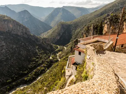
The Tour des Dents du Midi is a hard 46 km hut-to-hut loop in the Chablais Alps of south-west Switzerland, circling the Dents du Midi above the Val d’Illiez and Rhône valley near Champéry and Monthey. The classic pace is 3 days, with about 3,200 m of ascent and a high point at Col de Susanfe, 2,494 m. It suits fit, experienced hikers comfortable with long climbs, rocky scree, exposed passes and high-alpine Swiss white-red-white mountain trails.
Route Overview
This is a loop with no fixed start point, so you return to where you began. Common starts include Champéry / Bonavau and Mex. The circuit links Cabane de Susanfe, Col de Susanfe, Lac de Salanfe and Auberge de Salanfe, Mex, Auberge de Chindonne / Chindonne, Cabane d’Antème and the Signal de Soi viewpoint. The verified brief does not fix a walking direction or day-by-day distances. Logistics are simpler than a point-to-point trail because the route comes back to its start, but huts and alpine auberges should be booked ahead in summer. For longer Swiss mountain traverses, compare the Alpine Pass Route (Route 6) or the Bernina Trek.
History of the Tour des Dents du Midi
The circuit was inaugurated in 1972 and built a strong reputation through the Tour des Dents du Midi mountain marathon, which ran for roughly 40 years. Today it is one of Switzerland’s best-known multi-day hikes, combining a compact hut-to-hut format with serious mountain terrain around the seven-summit limestone crest of the Dents du Midi.
Notable highlights
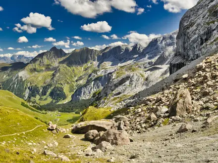
Col de Susanfe (2,494 m): The highest point on the main circuit, a stony saddle between the Haute Cime and the Tour Sallière. The approach past Cabane de Susanfe is one of the route’s major mountain sections.
Lac de Salanfe: A turquoise artificial reservoir at about 1,925 m beneath the south faces of the Dents du Midi. Its 1947 dam flooded chalets, a church and two hotels in what had been regarded as exceptional alpine pasture.
Haute Cime (3,257 m): The highest peak of the Dents du Midi massif and of the French-Swiss Pre-Alps. It is an optional, strenuous side-ascent from Col de Susanfe / Salanfe, not part of the main waymarked loop.
Signal de Soi / Lac Léman views: Northern balcony sections open towards Lake Geneva, the Chablais and Mont Blanc peaks. This is the big-view side of the circuit.
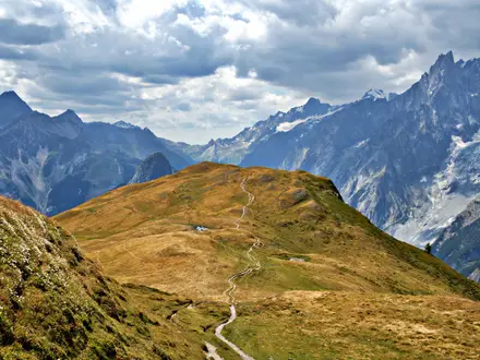
Dents du Midi skyline: The trail circles a 3 km limestone wall, giving constantly changing views of the seven-summit crest. For another Swiss route focused on big mountain scenery, see the Aletsch Glacier Panorama Trail.
Challenges to expect
Expect a hard mountain circuit: long days, about 3,200 m of total ascent, steep descents, scree, talus, exposed passes and high-alpine terrain. Some sections can hold snow early in the season, especially around the passes. Navigation is on marked Swiss white-red-white T2/T3 paths, but conditions still matter. Book huts in advance in summer, and watch for livestock-guardian dogs on alpine pastures. For a shorter Swiss circular option, see the Creux du Van Circular Trail.
HikeList Score
Tour des Dents du Midi scored 84/100 on HikeList's trail-quality metrics.
See score breakdownHide breakdown
- Ideal length 70
- Balanced challenge 80
- Scenery & wildness 98
- Varied terrain 83
- Accommodation 75
- Food & support 88
- Path quality 98
- Season flexibility 76
Computed from length, challenge, scenery & wildness, terrain variety, accommodation, food & support, path quality and season flexibility.
 Switzerland
Show more data Show less
- Mountainous
- Forest
- Alpine
- Rocky
- Dirt
- Gravel
- Huts
- Hotels
- Campsites
- Pet Friendly
- Restrooms
- Water Sources
- Campsites
- Shelters
In these collections
Photos from hikers
Taken on the trail by people who've reviewed Tour des Dents du Midi.
The first day of the Tour des Dents du Midi begins in the alpine village of Champéry, gradually ascending through forested slopes and pastures. The route offers sweeping views of the Rhone Valley as you traverse trails toward the village of Mex, passing mountain chalets and traditional grazing areas. Continuing from Mex, the trail climbs toward the tranquil Lac de Salanfe, where you will find Refuge de Salanfe for an overnight stay beside the lake. The path on this section alternates between dirt and rocky terrain, with steady elevation gain throughout the day.
Day two starts with a challenging ascent over the Pas d'Encel, a dramatic and rocky mountain pass requiring careful footing. The route descends into the wide Susanfe valley, where alpine meadows and distant glacier views create a breathtaking backdrop. A steady but less steep climb brings you to Refuge de Susanfe, a popular hut among trekkers. Expect varied terrain with rocky passes and open meadows, and take opportunities to spot alpine wildlife along the way.
The final day ascends toward the Col de Susanfe before a dramatic descent back toward Champéry. This section passes under the towering Dents du Midi peaks, with rapid shifts between rocky trails, alpine pasture, and forest. Panoramic vistas spur the final kilometers as you return to Champéry, completing the circuit. Depending on conditions and energy, this day also offers optional detours to high viewpoints or a summit bid on Haute Cime for experienced trekkers.
Reviews
How would you rate Tour des Dents du Midi?
Tap a star to start your review — you could be the first.