Waterford Greenway
How would you rate Waterford Greenway?
Tap a star to share your experience and help other hikers.
Waterford Greenway: 46 km Traffic-Free Trail Guide
HikeList Score
Waterford Greenway scored 68/100 on HikeList's trail-quality metrics.
See score breakdownHide breakdown
- Ideal length 59
- Balanced challenge 50
- Scenery & wildness 71
- Varied terrain 76
- Accommodation 100
- Food & support 68
- Path quality 37
- Season flexibility 100
Computed from length, challenge, scenery & wildness, terrain variety, accommodation, food & support, path quality and season flexibility.
The Waterford Greenway is an easy 46 km point-to-point walking and cycling trail in County Waterford, south-east Ireland. Also called the Deise Greenway, it runs from Waterford City to Dungarvan on a sealed former railway trackbed, so gradients are gentle and navigation is straightforward. Walkers usually complete it in one long day or split it over two days, often overnighting at Kilmacthomas. It suits families, first-time multi-day walkers, cyclists and anyone wanting a low-level, traffic-free route with river, viaduct and coastal sections.
Route Overview
The route starts around the Bilberry / quays area of Waterford City and heads south-west to Dungarvan. It passes Mount Congreve, Kilmeaden, Kilmacthomas, Durrow and Clonea before reaching the Copper Coast and Dungarvan Bay. The official six sections are Waterford to Killoteran, Killoteran to Kilmeaden, Kilmeaden to Kilmacthomas, Kilmacthomas to Durrow, Durrow to Clonea Road, and Clonea Road to Dungarvan. It is a linear, fully waymarked trail, so plan a return transfer, shuttle or bike-hire drop-off at one end. For another Irish rail-trail option, compare the Great Western Greenway; for rougher long-distance walking, look at the Blackwater Way or the coastal Causeway Coast Way.
From Railway Line to Greenway
The trail follows the former Waterford, Dungarvan & Lismore Railway, opened in 1878 as a difficult engineering route with three viaducts, a tunnel and a long causeway crossing. The Ballyvoyle Viaduct was destroyed during the Irish Civil War in 1922 and rebuilt in 1924. Passenger services ended in 1967, while freight continued until 1982. The disused trackbed was later converted into the Waterford Greenway, reopened to walkers and cyclists in March 2017, and now forms part of the EuroVelo 1 Atlantic Coast Route.
Notable highlights
- Ballyvoyle Tunnel (400 m): A brick-lined railway tunnel from 1878 and one of the most atmospheric parts of the route. Recessed alcoves in the walls were used by railway workers sheltering from passing trains.
- Kilmacthomas Viaduct (eight arches): A stone viaduct from 1878 carrying the greenway over the Mahon River valley near the midpoint. It sits beside the old Workhouse and is a natural pause point for walkers.
- Mount Congreve Gardens: Woodland gardens on the River Suir, known for rhododendrons, azaleas and magnolias. They are reached early on the Waterford end of the trail.
- Copper Coast Geopark: A UNESCO Global Geopark of cliffs, coves and copper-mining heritage. The greenway skirts this coastal landscape as it approaches Dungarvan.
- Durrow, Ballyvoyle and Clonea: The later sections include further 1878 viaducts, the Ballyvoyle Tunnel area and sea views by Clonea Strand and Dungarvan Bay.
Challenges to expect
The Waterford Greenway is technically easy: smooth tarmac, gentle railway gradients and clear waymarking. The main challenge is distance if walking the full 46 km in one day, especially on a hard sealed surface. It is a shared path, so expect cyclists, families and buggies in busy periods. Coastal wind and rain can still make conditions uncomfortable, and because it is point-to-point you need to arrange a return shuttle, transfer or overnight stop.
HikeList Score
Waterford Greenway scored 68/100 on HikeList's trail-quality metrics.
See score breakdownHide breakdown
- Ideal length 59
- Balanced challenge 50
- Scenery & wildness 71
- Varied terrain 76
- Accommodation 100
- Food & support 68
- Path quality 37
- Season flexibility 100
Computed from length, challenge, scenery & wildness, terrain variety, accommodation, food & support, path quality and season flexibility.
Show more data Show less
- Railway Path
- River Valley
- Coastal
- Paved
- Tarmac
- Hotels
- Guesthouses
- B&Bs
- Self Catering
- Wheelchair Accessible
- Stroller Accessible
- Family Friendly
- Pet Friendly
- Restrooms
- Picnic Areas
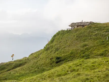
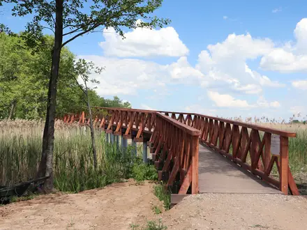
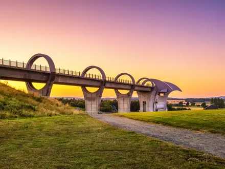
Photos from hikers
Taken on the trail by people who've reviewed Waterford Greenway.
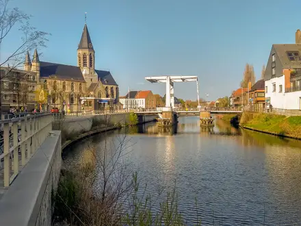
Leave the Bilberry / quays area of Waterford City and follow the greenway south-west through the Waterford to Killoteran, Killoteran to Kilmeaden and Kilmeaden to Kilmacthomas sections. Mount Congreve lies early on the route, and Kilmacthomas is the natural midpoint for an overnight stop.
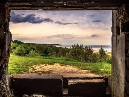
Continue from Kilmacthomas to Durrow, then on to Clonea Road and Dungarvan. This half includes Kilmacthomas Viaduct, Durrow and Ballyvoyle viaducts, Ballyvoyle Tunnel, the Clonea coastal stretch and the approach to Dungarvan Bay.
Reviews
How would you rate Waterford Greenway?
Tap a star to start your review — you could be the first.