The Union Canal Path
How would you rate The Union Canal Path?
Tap a star to share your experience and help other hikers.
The Union Canal Path: Easy Towpath Walking from Edinburgh to Falkirk
HikeList Score
The Union Canal Path scored 72/100 on HikeList's trail-quality metrics.
See score breakdownHide breakdown
- Ideal length 63
- Balanced challenge 50
- Scenery & wildness 58
- Varied terrain 94
- Accommodation 100
- Food & support 88
- Path quality 80
- Season flexibility 63
Computed from length, challenge, scenery & wildness, terrain variety, accommodation, food & support, path quality and season flexibility.
The Union Canal Path is an easy 50 km point-to-point towpath walk in central Scotland, following the flat Union Canal from Edinburgh’s Lochrin Basin to the Falkirk Wheel. It is usually walked in 2 days, with Linlithgow the natural overnight stop, but frequent ScotRail stations make shorter sections simple. The route suits first-time long-distance walkers, mixed-ability groups and anyone wanting a low-level, traffic-free trail: surfaced towpath, negligible ascent, clear waymarking and plenty of towns for food and beds.
Route Overview
Most walkers go west from Edinburgh to Falkirk, though the Union Canal Path works in either direction. From Lochrin Basin near Fountainbridge and Tollcross, the towpath passes Slateford, Wester Hailes, Ratho, Broxburn, Winchburgh, Linlithgow, the Avon Aqueduct, Polmont and the Falkirk Tunnel before reaching the Falkirk Wheel. The standard split is Edinburgh to Linlithgow, then Linlithgow to Falkirk. Edinburgh, Linlithgow, Polmont and Falkirk all have ScotRail stations on or near the canal, so section walking and return travel are straightforward. For another canal-based route, compare the Ashby Canal Trail; for longer Scottish options, see the Annandale Way or Ayrshire Coastal Path.
History of the Union Canal
The Union Canal, originally the Edinburgh and Glasgow Union Canal, was designed by Hugh Baird with advice from Thomas Telford and built between 1818 and 1822. It was a lock-free contour canal carrying coal, lime and other minerals towards Edinburgh, while linking the capital to Glasgow via the Forth & Clyde Canal. Traffic declined after the Edinburgh and Glasgow Railway opened in 1842, and the canal closed to navigation in 1965. It was restored through the Millennium Link project, reopened in 2001 and reconnected at Falkirk in 2002.
Notable highlights
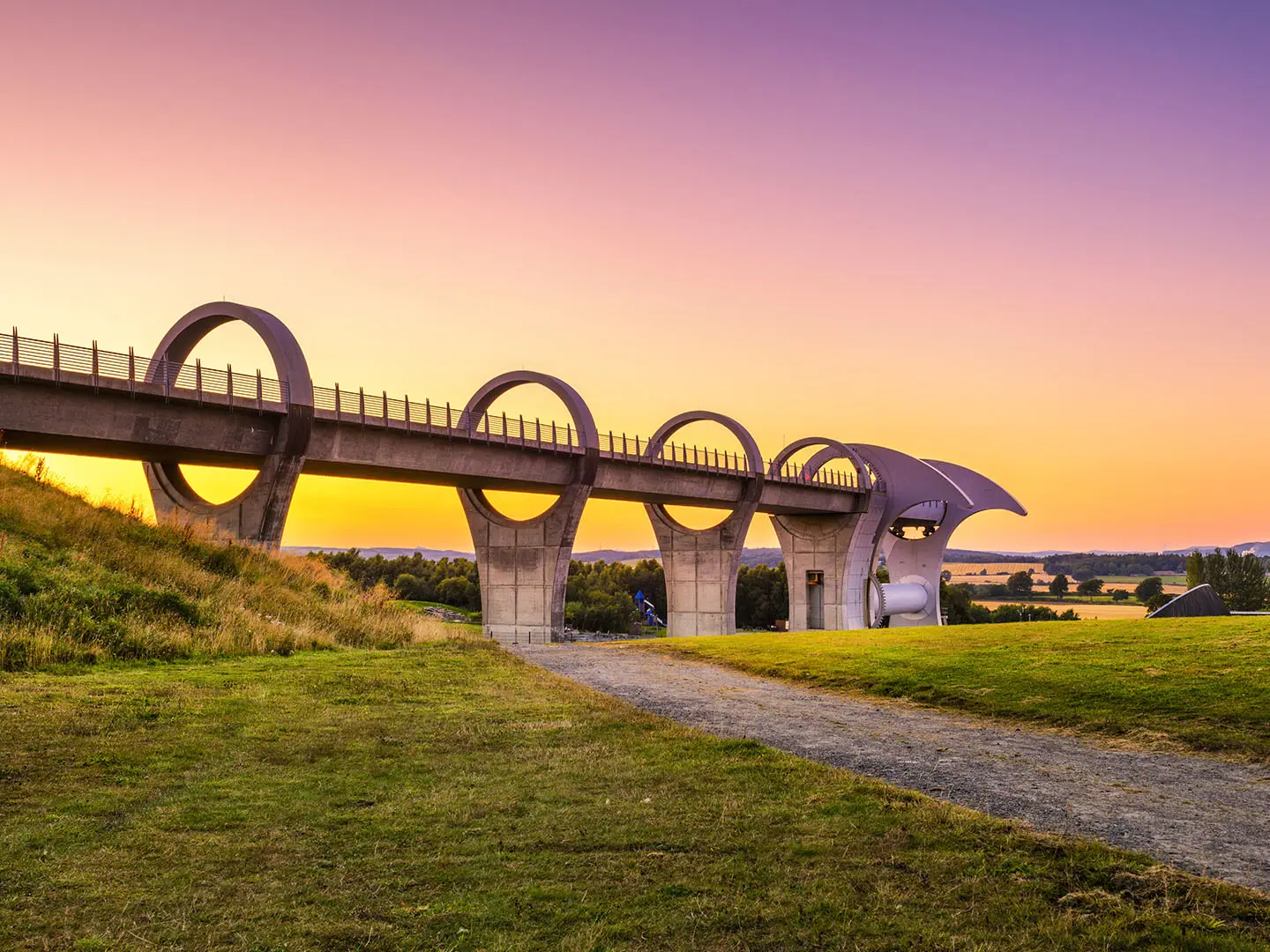
- Falkirk Wheel: The dramatic western finish of the walk and the rotating boat lift that connects the Union Canal with the lower Forth & Clyde Canal.
- Avon Aqueduct: A major canal engineering highlight near Linlithgow, carrying the canal across the deep River Avon valley on twelve arches.
- Falkirk Tunnel: Scotland’s only surviving canal tunnel, cut through Prospect Hill and now lit and walkable along the towpath.
- Slateford Aqueduct: An eight-arched aqueduct on the western edge of Edinburgh, carrying the canal over the Water of Leith close to the Water of Leith Walkway.
- Linlithgow: The main midway stop, with Linlithgow Palace above Linlithgow Loch and the Linlithgow Canal Centre on the towpath.
- Contour canal heritage: The Union Canal holds a constant 73 m level for its whole length, giving the walk its unusually flat, lock-free character.
Challenges to expect
This is an easy walk, but the distances still matter: 27 km and 23 km days are long if you are new to multi-day walking. The towpath is shared with cyclists, and some dirt or rougher sections can become muddy after rain. Navigation is straightforward and altitude is not an issue, but expect urban edge sections as well as quieter farmland, woodland and open countryside.
HikeList Score
The Union Canal Path scored 72/100 on HikeList's trail-quality metrics.
See score breakdownHide breakdown
- Ideal length 63
- Balanced challenge 50
- Scenery & wildness 58
- Varied terrain 94
- Accommodation 100
- Food & support 88
- Path quality 80
- Season flexibility 63
Computed from length, challenge, scenery & wildness, terrain variety, accommodation, food & support, path quality and season flexibility.
 United Kingdom
 Scotland
Show more data Show less
- Canal
- Urban
- Farmland
- Woodland
- Countryside
- Paved
- Gravel
- Dirt
- Hotels
- B&Bs
- Inns
- Hostels
- Campsites
- Family Friendly
- Pet Friendly
- Stroller Accessible
- Restrooms
- Water Sources
- Campsites
- Picnic Areas
Photos from hikers
Taken on the trail by people who've reviewed The Union Canal Path.
Start at Lochrin Basin in Fountainbridge/Tollcross and follow the level towpath west through Slateford, Wester Hailes, Ratho, Broxburn and Winchburgh to Linlithgow. Linlithgow has accommodation, rail access, Linlithgow Palace, Linlithgow Loch and the Linlithgow Canal Centre.
Continue west from Linlithgow past the Avon Aqueduct, Polmont and the Falkirk Tunnel, finishing at the Falkirk Wheel where the Union Canal meets the Forth & Clyde Canal. Falkirk has rail connections for the return journey.
Reviews
How would you rate The Union Canal Path?
Tap a star to start your review — you could be the first.