Tour des Aiguilles Rouges
How would you rate Tour des Aiguilles Rouges?
Tap a star to share your experience and help other hikers.
Tour des Aiguilles Rouges: High Alpine Loop Above Chamonix
HikeList Score
Tour des Aiguilles Rouges scored 79/100 on HikeList's trail-quality metrics.
See score breakdownHide breakdown
- Ideal length 78
- Balanced challenge 74
- Scenery & wildness 98
- Varied terrain 83
- Accommodation 58
- Food & support 65
- Path quality 98
- Season flexibility 76
Computed from length, challenge, scenery & wildness, terrain variety, accommodation, food & support, path quality and season flexibility.
The Tour des Aiguilles Rouges is a hard 4-day, roughly 50 km high-mountain loop in Haute-Savoie, France, above the Chamonix valley. It crosses the Aiguilles Rouges massif opposite Mont Blanc, linking Lac Blanc, Le Brévent, high cols and staffed refuges. With about 4,200 m of ascent, rocky paths, exposed traverses and short protected ladder/handrail sections, it suits fit, experienced mountain walkers rather than first-time trekkers.
Route Overview
The standard circuit starts and finishes at the Col des Montets / Argentière, reached from Chamonix-Mont-Blanc by road or train, and is usually walked anticlockwise. The loop passes the Lacs des Chéserys and Lac Blanc, Refuge du Lac Blanc, Le Brévent, Refuge de Bellachat, Col du Brévent, Refuge de Moëde-Anterne, Col de Salenton and the Vallon de Bérard before returning via Refuge de la Pierre à Bérard, Le Buet and Vallorcine. It shares ground with classic Chamonix balcony routes and parts of the Tour du Mont Blanc. For other French mountain options, compare the Chartreuse Trail GR9 segment, the Cirque de Gavarnie trails or the lower Ballons des Vosges Park trails.
Aiguilles Rouges: Chamonix’s Protected Mont Blanc Viewpoint
The Aiguilles Rouges form the rugged granite chain opposite Mont Blanc and have long been used as the classic viewpoint over the Chamonix valley. Lac Blanc and Le Brévent are especially well-known balcony viewpoints. The Aiguilles Rouges National Nature Reserve was created by decree on 23 August 1974, protecting the peaks between the Col des Montets and the Buet massif; the name “red needles” refers to the reddish rock glowing at sunrise.
Notable highlights
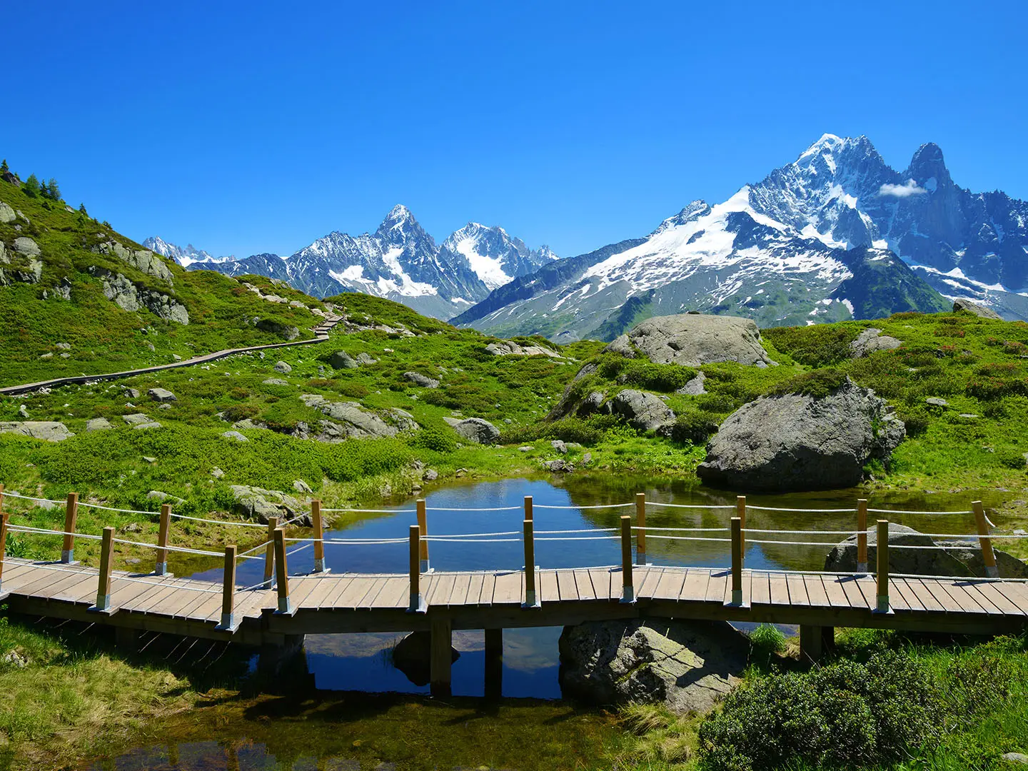
- Lac Blanc and the Lacs des Chéserys (~2,352 m): Turquoise alpine tarns facing the Mont Blanc massif. The Refuge du Lac Blanc area is one of the most recognised viewpoints on the route.
- Le Brévent (2,525 m): A high balcony summit directly opposite Mont Blanc, the Aiguille du Midi and the Bossons glacier. It is the high point of its stage.
- Aiguilles Rouges National Nature Reserve: A protected alpine reserve with ibex, chamois, marmots and golden eagle. Interpretive trails near the Col des Montets help explain the local flora, wetlands and geology.
- Col de Salenton (2,526 m): The highest point of the standard circuit. From here the route drops into the wilder Vallon de Bérard, with an optional extension to Mont Buet.
- Mont Blanc panoramas: The loop stays on the sunny side of the Chamonix valley, keeping Mont Blanc, the Mer de Glace and nearby glaciers in view for much of the trek.
Challenges to expect
Expect sustained high-mountain walking: often 1,000 m or more of ascent in a day, 6–7 hour stages, rocky paths, scree, airy traverses and two short protected sections with ladders, handrails or chains. Snow can linger near the high cols early in the season. Refuges should be booked ahead in summer, and bivouac is regulated inside the nature reserve.
HikeList Score
Tour des Aiguilles Rouges scored 79/100 on HikeList's trail-quality metrics.
See score breakdownHide breakdown
- Ideal length 78
- Balanced challenge 74
- Scenery & wildness 98
- Varied terrain 83
- Accommodation 58
- Food & support 65
- Path quality 98
- Season flexibility 76
Computed from length, challenge, scenery & wildness, terrain variety, accommodation, food & support, path quality and season flexibility.
 France
Show more data Show less
- Mountainous
- Alpine
- Forest
- Rocky
- Dirt
- Scree
- Huts
- Wild Camping Spots
- Pet Friendly
- Water Sources
- Campsites
- Shelters
Photos from hikers
Taken on the trail by people who've reviewed Tour des Aiguilles Rouges.
Reviews
How would you rate Tour des Aiguilles Rouges?
Tap a star to start your review — you could be the first.