The Ridgeway
How would you rate The Ridgeway?
Tap a star to share your experience and help other hikers.
The Ridgeway: A Complete Hiking Guide
HikeList Score
The Ridgeway scored 92/100 on HikeList's trail-quality metrics.
See score breakdownHide breakdown
- Ideal length 93
- Balanced challenge 100
- Scenery & wildness 85
- Varied terrain 83
- Accommodation 100
- Food & support 88
- Path quality 98
- Season flexibility 89
Computed from length, challenge, scenery & wildness, terrain variety, accommodation, food & support, path quality and season flexibility.
The Ridgeway is a 139 km waymarked National Trail in southern England, running north-east from Overton Hill near Avebury to Ivinghoe Beacon in Buckinghamshire. Usually walked in 6 days, it is a moderate, low-level point-to-point route suited to hikers who want long daily distances, open chalk downland, ancient sites and the wooded Chiltern Hills without mountain terrain. For other UK long-distance ideas, compare Beacons Way, Anglesey Coastal Path and Arran Coastal Way.
Route Overview
The classic direction is west to east: start at Overton Hill, close to the Avebury stone circles in Wiltshire, and finish at Ivinghoe Beacon on the National Trust’s Ashridge Estate near Tring. The western half crosses the North Wessex Downs via Barbury Castle, Ogbourne St George, Liddington Castle, Foxhill, Uffington White Horse, Wayland’s Smithy and Segsbury Camp before reaching Goring and Streatley. The River Thames crossing at the Goring Gap is the natural midpoint. East of the Thames the trail enters the Chiltern Hills via Nuffield, Grim’s Ditch, Watlington, Aston Rowant, Princes Risborough, Wendover, Wendover Woods/Tring and Pitstone Hill. It is a linear point-to-point walk, so arrange transport back separately.
Britain’s oldest road
The Ridgeway is popularly called “Britain’s oldest road” because people have used this high chalk route for at least 5,000 years. The dry ridge offered firmer, safer travel than the wooded and marshy valleys below, linking the Dorset coast towards the Wash in Norfolk. The modern route follows prehistoric monuments including Avebury, Wayland’s Smithy, the Uffington White Horse and hillforts at Barbury, Liddington, Uffington and Segsbury. It was designated by the Government in 1972 and opened as a National Trail in 1973.
Notable highlights
- Avebury and Overton Hill: The western start sits within the Avebury UNESCO World Heritage Site, known for its prehistoric stone circle. Overton Hill also has Bronze Age round barrows beside the start of the ancient track.
- Barbury Castle: A large Iron Age hillfort on the Marlborough Downs early in the walk. The trail crosses the country park, with broad views over open chalk downland.
- Liddington Castle: An early Iron Age hillfort near Swindon and, at about 277 m, the highest point on the Ridgeway National Trail. It is a scheduled monument on the exposed western downs.
- Uffington White Horse and Wayland’s Smithy: The chalk hill figure lies below the trail near Uffington Castle, while Wayland’s Smithy is a Neolithic chambered long barrow in a beech grove beside the path.
- Goring Gap and the River Thames: The Thames cuts through the chalk between Goring and Streatley, marking the route’s midpoint and the change from open downland to the wooded Chilterns.
- Ivinghoe Beacon: The eastern finish is a grassy chalk hill on the Ashridge Estate, with an Iron Age hillfort and views across the Vale of Aylesbury.
Challenges to expect
The Ridgeway is not technically hard, but 6 days means long average daily distances and repeated gentle climbs and descents. The western chalk downs are exposed to wind, sun and rain; the eastern Chilterns are more wooded. Chalk and clay can become muddy and slippery after rain, especially in winter. Navigation is helped by National Trail acorn waymarks, with yellow footpath arrows and blue bridleway arrows, but plan accommodation carefully around the larger settlements.
HikeList Score
The Ridgeway scored 92/100 on HikeList's trail-quality metrics.
See score breakdownHide breakdown
- Ideal length 93
- Balanced challenge 100
- Scenery & wildness 85
- Varied terrain 83
- Accommodation 100
- Food & support 88
- Path quality 98
- Season flexibility 89
Computed from length, challenge, scenery & wildness, terrain variety, accommodation, food & support, path quality and season flexibility.
 United Kingdom
 England
Show more data Show less
- Grassland
- Hills
- Forest
- Dirt
- Gravel
- Chalk
- Guesthouses
- Hotels
- Hostels
- Campsites
- Family Friendly
- Dog Friendly On Leash
- Restrooms
- Established Campsites
- Picnic Areas
- Public Transport Access Points
Download Our Full Guide to The Ridgeway FREE!
Get our comprehensive guide to this hike for free. Save it for later reading or print out at home.
In these collections
Photos from hikers
Taken on the trail by people who've reviewed The Ridgeway.
The Ridgeway: The Complete Guide
 i
Image by JohanKootstra
i
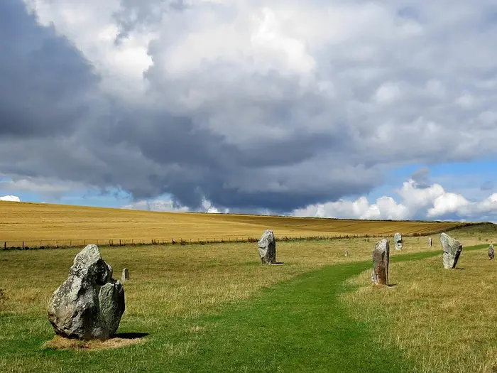
Image by JohanKootstra The Ridgeway is a 139 km National Trail across southern England’s chalk country, running west to east from Overton Hill near Avebury to Ivinghoe Beacon in Buckinghamshire. It suits fit walkers who want a serious long-distance route without mountain terrain, technical scrambling or complicated navigation.
The western half is the big, open part: broad ancient trackways, exposed downs, long horizons and prehistoric landmarks including Barbury Castle, Liddington Castle, the Uffington White Horse and Wayland’s Smithy. This is where the walk feels most remote, especially in wind, sun or poor weather.
At Goring-on-Thames and Streatley, the River Thames cuts through the chalk at the Goring Gap and the character changes. The eastern half moves into the wooded Chilterns, with beech woods, chalk grassland, more frequent villages and a hillier feel towards Wendover and Ivinghoe Beacon.
The challenge is not altitude, but consistency. Standard stages run up to around 28 km, surfaces can be muddy and slippery after rain, and much of the accommodation sits off the ridge rather than directly on the path.
This guide covers the stages, daily planning, accommodation, food, transport, terrain and common mistakes that matter on The Ridgeway.
Stage-by-Stage Guide
Stage 1: Overton Hill (Avebury) to Ogbourne St George — ~15 km / ~9.3 miles
The Ridgeway starts at the official National Trail marker beside the A4 at Overton Hill, within the Avebury World Heritage Site. The walking is immediately characteristic of the western Ridgeway: broad chalk track, open downland, big skies and little shelter.
The path climbs gradually north onto the downs, passing arable fields, grazed chalk grassland and small clumps of beech woodland planted as shelter on exposed hilltops. Underfoot it is generally grassy or chalky, but sections around Round Hill Downs can become muddy and slippery after rain, especially where narrow grassy strips run between parallel furrows.
Barbury Castle is the main landmark of the day. The route makes a rough, steep climb onto the double banks and ditches of this large Iron Age hillfort, with wide views across the Marlborough Downs. After Barbury Castle, Smeathe's Ridge gives an excellent high-level walk of roughly 2 km before the route eventually drops into the Og Valley.
Hackpen White Horse can be seen from parts of the route, and Avebury stone circle, West Kennet Avenue and Silbury Hill are close to the start if you want to add time before beginning the trail. The stage finishes in Ogbourne St George, a small chalk village with thatched cottages and limited services.
Food and water: Avebury has a pub and café a short detour from the start. There are no shops or reliable service stops on the stage itself, so carry enough water and food from Avebury. Ogbourne St George has two pubs, including The Parklands Hotel, but no dedicated supermarket.
Accommodation: Ogbourne St George has pub accommodation and guesthouses, with more limited options in nearby Ogbourne Maizey. Choice is small, so booking ahead matters. Some walkers instead stay in Marlborough or Swindon and use taxis, but those are off-route options.
Transport and access: Ogbourne St George has no railway station. Swindon and Pewsey are the practical railheads for this area, with taxis the most useful option if ending or joining the walk here. Bus links are limited and should be checked before travelling.
Navigation and warnings: Waymarking is straightforward, with National Trail acorn markers and broad open track for much of the day. The main issue is exposure: in poor visibility the open downs can feel disorientating, and in hot or windy weather there is little shelter.
Stage 2: Ogbourne St George to Sparsholt Firs — ~26 km / ~16 miles
This is one of the most remote stages of the Ridgeway and needs to be treated as a long, exposed hill day despite the modest height. The day begins with a steep climb out of the Og Valley on a narrow, sunken, tree-lined track, then settles onto high ground for a long traverse east.
The route stays fairly level until the M4 crossing, after which the walking becomes more undulating. Much of the stage follows hedge-lined tracks across large arable landscapes, with spring-line villages visible below the ridge but usually off-route.
The surface is often chalk, dirt or limestone-surfaced track, added in places to counter mud on the clay cap above the chalk. In wet weather this stage can be very muddy and slow, especially where the track is churned or enclosed between hedges.
Liddington Castle, near Swindon, is the key landmark. The trail passes very close to the Iron Age hillfort, and the short detour is worthwhile: at around 275–277 m it is the highest point on the Ridgeway National Trail. Near Foxhill the route crosses the M4 by following a road over a bridge, walking on a narrow verge beside fast traffic. It is not a navigational problem, but it is a short section to treat with care rather than rush.
Foxhill is the most important place on the stage because the Shepherds Rest pub sits directly on the Ridgeway. It is the only pub directly on the western Ridgeway route in the first half of the walk, so opening times should be checked before relying on it.
Food and water: Carry substantial water from Ogbourne St George. The Shepherds Rest at Foxhill is the key refreshment stop, while the Peter Wren memorial water tap and Ridgeway Farm water tap provide useful drinking-water points for walkers. These should still be checked before depending on them, particularly in dry spells or outside the main walking season.
Accommodation: Sparsholt Firs is not a village; it is a wooded road junction area with no meaningful services. Most walkers descend off the ridge for the night, commonly towards Court Hill Centre near Wantage, or into Wantage itself for town accommodation and food. Wantage is around 5 km south of the route, so plan the extra distance or arrange a taxi.
Transport and access: There is no useful public transport directly at Sparsholt Firs. Taxis from Wantage or Swindon are the practical access option. This is not a convenient stage to improvise at the end of the day.
Navigation and warnings: Waymarking is generally good, but the long hedge-lined stretches can feel repetitive and featureless. A GPX track or detailed map is useful for checking field junctions and keeping the day moving. The combination of distance, exposure and limited services makes this one of the stages where carrying enough food and water matters most.
Stage 3: Sparsholt Firs to Streatley — ~28 km / ~17.4 miles
This is the longest stage in the standard itinerary and carries the Ridgeway from the open western downs to the Thames at the Goring Gap. Expect another long day on broad ridge tracks, with hedgerows, open downland and occasional woodland before the final descent to the river.
The path often runs close to the escarpment edge, with views down towards Vale villages. Racehorses from local trainers are often seen exercising on the gallops in this part of the route, especially around the Lambourn and East Ilsley area.
The A34 underpass is a distinctive mid-stage landmark, taking the trail beneath the busy dual carriageway. Later, the route drops towards the River Thames, where Goring-on-Thames and Streatley mark the physical and psychological midpoint of the walk.
The main prehistoric highlights are outstanding. Uffington Castle and the Uffington White Horse lie just south of the route and are worth the detour if time and weather allow. Wayland's Smithy, a Neolithic chambered long barrow set in a beech grove, is directly on the trail and should not be missed.
The final approach to Streatley passes South Stoke, where The Perch & Pike country pub is on the route. The crossing into the Thames corridor is a major change in character: after days of open chalk ridge, Goring and Streatley provide the best concentration of services so far.
Food and water: There are no services for a long early section, so start with enough water and food. A water tap at Sparsholt Down is marked on a fingerpost. Letcombe Bassett is a short detour off the ridge with limited facilities, while South Stoke has The Perch & Pike directly on the route.
Goring-on-Thames, just across the bridge from Streatley, is the main resupply point. It has a Tesco Express, Goring Grocer, cafés, pubs and restaurants. Streatley also has riverside and village pub options.
Accommodation: Streatley and Goring together offer one of the strongest overnight stops on the whole trail, with hotels, inns, B&Bs and pub rooms. The Swan at Streatley and the Bull Inn are established local options, and Goring has further rooms across the river. Streatley Youth Hostel should have its current operating status checked before booking plans are built around it.
Transport and access: Goring & Streatley station is a major advantage for section walkers. It is a short walk from the trail and has GWR services towards London Paddington and Reading, making this the best mid-trail access or exit point.
Navigation and warnings: The route is well waymarked, but pay closer attention on the descent through meadows towards the Thames where the line can be less obvious than on the ridge. The day is long, and the temptation to add detours at Uffington can make it longer still; start early if including the White Horse and Uffington Castle.
Stage 4: Streatley to Watlington — ~25 km / ~15.3 miles
This stage crosses the Thames and enters the Chilterns proper. The route changes noticeably from wide, open downland to narrower paths, woodland, enclosed tracks and sharper little climbs and descents.
The early section includes water meadows near South Stoke and North Stoke before the trail moves into wooded Chiltern country. For a considerable distance the path follows Grim's Ditch, an ancient earthwork running through woodland. In spring, this section can be rich with bluebells and wood anemones.
The walking is not mountainous, but it is more intricate than the western stages. Several short, steep climbs and descents replace the long, gentle undulations of the downs, and the enclosed woodland can make progress feel slower.
Nuffield is an important stop, with the former Crown pub now operating as a café. The route also crosses Huntercombe Golf Club near Nuffield; it is well signed, but walkers need to stay on the marked path and be aware of golfers.
Swyncombe is one of the quieter hamlets on the route, with St Botolph's Church and a particularly secluded Chiltern feel. The final approach towards Watlington follows the Upper Icknield Way, a broader hedge-lined track, with Watlington Hill and its National Trust chalk grassland nearby.
Food and water: Carry enough from Streatley to reach Nuffield comfortably. Nuffield is the best lunch stop on the stage, while Swyncombe has no facilities. Watlington has a Co-op supermarket, The Granary Café and The Fat Fox pub and hotel.
Accommodation: Watlington has walker-friendly accommodation, including The Fat Fox. White Mark Glamping is on or near the trail at Watlington Hill and is useful for those camping or using lighter overnight options. Availability should be checked before travelling, especially at weekends.
Transport and access: Watlington has no railway station. Cholsey and Goring & Streatley are the nearest rail options given for this part of the route, but they are not directly on the trail at Watlington. Bus services from Wallingford should be checked before travelling; taxis are often the simplest connection.
Navigation and warnings: Grim's Ditch is one of the sections where close attention to waymarks matters, as paths and tracks thread through dense woodland. The golf course crossing is signed, but do not wander off the marked line. After rain, woodland paths and chalky slopes can be slippery.
Stage 5: Watlington to Wendover — ~27 km / ~17 miles
This is the most strenuous stage of the standard itinerary. National Trails describes it as the most undulating section, and it has repeated climbs in and out of wooded Chiltern valleys rather than the steady ridge walking of the western half.
The route initially follows the ancient Icknield Way along the base of the Chilterns scarp, then climbs repeatedly into beech woodland. The M40 underpass is the major road crossing of the day, comparable in feel to the M4 crossing earlier on the trail.
Aston Rowant National Nature Reserve and Chinnor Hill Nature Reserve give excellent chalk grassland walking and views. Old Kiln Lake by Chinnor Quarry is a distinctive landmark before the route continues towards Princes Risborough.
Princes Risborough is the key mid-stage town. It sits directly on the route and has proper resupply, cafés, pubs and a railway station, making it the best place on the day to pause, shorten the itinerary or leave the trail.
Beyond Princes Risborough, the route continues through more Chiltern terrain, including Lodge Hill, before reaching Wendover. Wendover is the only town of any size that the Ridgeway actually walks through, and it is a strong overnight stop with shops, pubs and rail access.
Food and water: Chinnor has village facilities on or near the route. Princes Risborough is the main resupply point, with shops, cafés and pubs, including a Co-op. Wendover has a Budgens supermarket, Whitewaters Deli and pubs, including The Shoulder of Mutton on the approach.
Accommodation: Wendover has some of the best accommodation provision directly on the trail east of Streatley, including B&Bs, guesthouses and pubs with rooms. It is a sensible place to book ahead, especially if walking the standard six-day schedule.
Transport and access: Princes Risborough station is a valuable mid-stage access or escape point, with Chiltern Railways services towards London Marylebone. Wendover station also has Chiltern Railways services and makes the stage end straightforward for section walkers.
Navigation and warnings: This is the most complex navigation stage of the route. Woodland sections, multiple path junctions and nature reserve paths require careful attention to acorn markers and a map or GPX track.
An HS2 works diversion near Wendover has affected the Ridgeway route. The alternative line follows roads between Wendover station and the entry to Bacombe Hill off Ellesborough Road, with signage in place. Check the National Trails website for the current diversion status before walking this stage.
Stage 6: Wendover to Ivinghoe Beacon — ~19 km / ~11.8 miles
The final stage is shorter than the previous two, but it still has varied walking and a strong finish. The first half is the most wooded part of the Ridgeway, while the last section opens dramatically onto chalk grassland for the approach to Ivinghoe Beacon.
The route leaves Wendover on the Heron Path, beside parkland and the disused Wendover Arm of the Grand Union Canal. It then passes through Wendover Woods, managed by Forestry England, using a mix of broad forestry tracks and narrower woodland paths.
The path descends through Tring Park on a long, fairly level woodland line before crossing the A41 by footbridge. It then crosses the operational Grand Union Canal and the Chiltern Main Line near Tring.
After the Tring area, the route continues through Duchies Piece nature reserve and Aldbury Nowers wood. Aldbury village is just off-route and can be a useful refreshment detour before the final hills.
The character changes sharply at Pitstone Hill. The enclosed woodland gives way to open chalk grassland, springy turf and wide views, with the final miles leading across the downs to Ivinghoe Beacon. The Beacon, on the National Trust's Ashridge Estate, is an Iron Age hillfort site and a fitting high, open finish with views across the Vale of Aylesbury.
Food and water: Wendover is the last reliable place to stock up before the stage. Aldbury, near Tring and just off-route, has The Greyhound pub and a small shop. Ivinghoe Beacon itself has no facilities, so do not plan to finish there needing water, food or onward arrangements.
Accommodation: There is limited accommodation in Ivinghoe village itself. Tring, around 3 miles from Ivinghoe Beacon, has better choice, including pubs, B&Bs and hotel options. Many walkers finish at the Beacon and continue to Tring station for the journey home.
Transport and access: Tring station on the West Coast Main Line is about 3 miles from Ivinghoe Beacon. Red Eagle 61/61A buses link the Beacon area and Tring station, but current timetables should be checked before travelling. A taxi to Tring station is sensible if buses do not fit your finish time; walking to the station is possible but feels long after completing the trail.
Navigation and warnings: The route is well signed through Wendover Woods, but woodland junctions still need attention. Once the path emerges onto Pitstone Hill the line to Ivinghoe Beacon is much clearer across open downland, with the Beacon visible ahead. The final summit has no shelter or services, so carry layers and finish-day logistics should be settled before leaving Wendover.
Recommended Itinerary
Distances below use the official National Trail stage lengths. Accommodation on The Ridgeway often sits below the ridge rather than directly on the line of the trail, so allow extra distance for village, pub, B&B or campsite detours.
Standard 6-day itinerary
This is the most straightforward way to walk The Ridgeway end to end. It suits fit walkers who are comfortable with several 15–17 mile days on broad tracks, field paths and undulating Chiltern terrain.
| Day | From | To | Approx. distance | Why this stage makes sense | Services/accommodation notes |
|---|---|---|---|---|---|
| 1 | Overton Hill, near Avebury | Ogbourne St George | 9.3 miles / 14.8 km | A short opening day, useful if travelling to the start in the morning. The route begins on open chalk downland and passes Barbury Castle before dropping towards one of the few viable overnight stops in this western section. | Overton Hill itself has no services. Avebury village is about 1 mile from the start, with a pub, shop and café. Ogbourne St George is a small village with limited accommodation and no shop, so book ahead and carry what is needed. |
| 2 | Ogbourne St George | Sparsholt Firs | 16 miles / 25.6 km | A long, exposed downland stage and one of the most remote days of the walk. It crosses broad chalk tracks and passes near Liddington Castle, the highest point of the National Trail at about 275 m. | Services are sparse, so carry food and enough water for the day. Accommodation is limited at or near Sparsholt Firs; many walkers use nearby off-route options such as Letcombe Regis or Court Hill Centre. |
| 3 | Sparsholt Firs | Streatley | 17.4 miles / 27.9 km | The longest standard day, but also one of the classic Ridgeway stages, with Uffington White Horse, Uffington Castle and Wayland's Smithy before the route reaches the Thames at Goring and Streatley. This is the natural midpoint of the trail. | Goring and Streatley form the best services hub on the route, with shops, pubs, accommodation including YHA Streatley, and a railway station. This is the easiest place to join, leave or pause the walk mid-route. |
| 4 | Streatley | Watlington | 15.3 miles / 24.6 km | This stage marks the shift from the open western downs into the more wooded Chilterns. Expect more enclosed paths, woodland and historic earthworks such as Grim's Ditch. | Watlington is a small but useful overnight stop with a Co-op, pubs, restaurants and camping at White Mark Farm. Accommodation is still limited compared with a large town, so reserve ahead. |
| 5 | Watlington | Wendover | 17 miles / 27.2 km | Often the most strenuous stage despite not being the longest, with more rolling Chiltern ground, woodland and chalk grassland. The route crosses the M40 corridor and passes through a more varied eastern landscape. | Wendover has accommodation, pubs and a Chiltern Railways station for London Marylebone. HS2 works have affected the route near Wendover, so check the current National Trails diversion information before travelling. |
| 6 | Wendover | Ivinghoe Beacon | 11.8 miles / 18.8 km | A shorter final day through wooded Chiltern country before the trail opens onto the chalk turf of Ivinghoe Beacon. The finish gives a clear sense of arrival without requiring another long mileage day. | Ivinghoe Beacon has no full town services at the finish. Aldbury is a popular nearby finish-night village, and Tring station is about 3 miles / 5 km from the Beacon; Red Eagle 61/61A buses link the Beacon area and Tring, but current timetables should be checked before travelling. |
Slower 8-day variant
Choose this if daily mileage above 16 miles is unattractive, if accommodation availability forces extra stops, or if more time is wanted for the prehistoric sites in the western half. The main challenge is that services are still unevenly spaced, especially between Watlington and Wendover.
| Day | From | To | Approx. distance | Why this stage makes sense | Services/accommodation notes |
|---|---|---|---|---|---|
| 1 | Overton Hill, near Avebury | Ogbourne St George | 9.3 miles / 14.8 km | Keeps the first day short and avoids rushing the start from Avebury and Overton Hill. | Book Ogbourne St George early; options are limited and there is no village shop. |
| 2 | Ogbourne St George | Woolstone / Uffington area | Roughly 14–15 miles on the trail, plus any detour | Splits the long exposed western section and avoids pushing all the way to Sparsholt Firs in one day. | Woolstone is an off-route option and involves a detour; The White Horse inn is a known accommodation possibility. Check exact walking distance and availability before booking. |
| 3 | Woolstone / Uffington area | Letcombe Regis or Court Hill Centre | Roughly 13–14 miles, depending on the overnight stop | Gives more time around Uffington White Horse, Uffington Castle and Wayland's Smithy, then breaks the approach towards Goring and Streatley. | Letcombe Regis is about 1 mile off route, with options including the Greyhound Inn and Quince Cottage B&B. Court Hill Centre is about 2 miles off route near Wantage and offers hostel, camping and walker facilities. |
| 4 | Letcombe Regis or Court Hill Centre | Streatley | About 15 miles; check official mapping before booking | Completes the western half and finishes at the Thames, where services are much stronger. | Goring and Streatley have shops, pubs, accommodation and a railway station, making this a practical place for laundry, resupply or a rest evening. |
| 5 | Streatley | Nuffield area | Roughly 12–14 miles; check official mapping before booking | Splits the Streatley to Watlington stage rather than making a single longer Chiltern day. | Accommodation availability around Nuffield is limited and must be arranged before committing to this split. Wallingford can also be considered as a bigger-town detour around the Goring/Streatley stage if services are the priority. |
| 6 | Nuffield area | Watlington | About 12 miles; check official mapping before booking | Leaves a manageable day into Watlington and keeps the transition through the Chilterns less compressed. | Watlington has useful services for walkers, including a Co-op, pubs and White Mark Farm campsite, but it is not a large accommodation hub. |
| 7 | Watlington | Wendover | 17 miles / 27.2 km | This remains the hard day to split because services between Watlington and Wendover are sparse. Most slower itineraries still keep it as a full stage. | Start with food and water. Wendover has accommodation and rail access, but check the current HS2 diversion near Wendover before setting off. |
| 8 | Wendover | Ivinghoe Beacon | 11.8 miles / 18.8 km | A shorter final day, allowing time to reach onward transport from the Beacon. | Plan the finish carefully: Aldbury and Tring are the practical post-walk bases, and bus or taxi arrangements should be checked before travelling. |
Faster 5-day variant
This is for experienced long-distance walkers, fastpackers or trail runners who are happy with one very long opening day and do not need much margin for bad weather, muddy chalk or accommodation detours. It is usually more practical than a 4-day walking itinerary, which pushes the route into very big-mile territory.
| Day | From | To | Approx. distance | Why this stage makes sense | Services/accommodation notes |
|---|---|---|---|---|---|
| 1 | Overton Hill, near Avebury | Sparsholt Firs | About 25 miles / 40 km | Combines the official first two stages, removing one overnight in the accommodation-scarce western half. This is a long exposed day and should not be treated as an easy start. | Carry enough food and water from the outset. Accommodation around Sparsholt Firs, Letcombe Regis or Court Hill Centre must be secured before relying on this plan. |
| 2 | Sparsholt Firs | Streatley | 17.4 miles / 27.9 km | Keeps the major prehistoric highlights in one day and finishes at the Thames services hub. | Goring and Streatley are the best resupply and transport point on the route, with shops, pubs, accommodation and a railway station. |
| 3 | Streatley | Watlington | 15.3 miles / 24.6 km | A moderate middle day after the heavy opening mileage, moving into the Chilterns without overextending the itinerary. | Watlington is functional but small; confirm accommodation or camping before fixing the schedule. |
| 4 | Watlington | Wendover | 17 miles / 27.2 km | Keeps the most undulating Chiltern stage intact and ends in a town with rail access and accommodation. | Check the National Trails website for the current Wendover diversion before travelling. Wendover is a useful exit point if the final day needs to be delayed. |
| 5 | Wendover | Ivinghoe Beacon | 11.8 miles / 18.8 km | A short final day makes the overall 5-day schedule more realistic and leaves time for onward travel from the finish. | Ivinghoe Beacon is not a services hub. Plan onward travel via Tring, Aldbury or pre-booked transport, and check bus times in advance. |
Planning the Route
The Ridgeway is not difficult to follow, but it does need proper logistical planning. The main work is arranging accommodation, carrying enough food and water across the western downs, and making sure the finish at Ivinghoe Beacon does not leave you stranded without transport.
The route is usually walked west to east, from Overton Hill near Avebury to Ivinghoe Beacon. That direction works well because it puts the more exposed and thinly served North Wessex Downs first, then finishes through the better-connected Chilterns.
How many days to allow
Six days is the standard schedule and matches the National Trail stage structure. It gives long but realistic days for fit walkers, with several stages in the mid-to-high 20 km range.
A slower 7–9 day plan is often better if you want time at Avebury, Uffington White Horse, Wayland's Smithy, Goring and the Chiltern villages. The Ridgeway is not a route that rewards rushing: many of its best stops sit slightly off the walking line or deserve more than a quick photo break.
A 4–5 day completion is possible for strong walkers, trail runners and experienced long-distance hikers, but it becomes a mileage exercise. Expect long days, fewer detours and less flexibility if weather, mud or transport causes delays.
| Plan | Best for | Planning implications |
|---|---|---|
| 4–5 days | Fast walkers, trail runners, lightweight hikers | Long days, little time for sites, accommodation must line up precisely |
| 6 days | Most fit walkers | Standard structure; still requires advance booking, especially in the west |
| 7–9 days | First-time multi-day walkers, slower groups, heritage-focused trips | Easier days, more time for Avebury and prehistoric sites, but more accommodation bookings |
| Section hiking | Walkers using weekends or public transport | Very practical in the east; harder in the west without a car or lifts |
The two halves need different planning
The key planning distinction is the split at the Goring Gap, where the route crosses the River Thames at Goring-on-Thames and Streatley. This is roughly the midpoint and marks a clear change from open downland to the wooded Chilterns.
The western half from Overton Hill to Goring and Streatley is the more awkward half logistically. The trail stays high on broad chalk trackways while most villages sit below the ridge, so food, beds and water often involve detours or careful timing.
Ogbourne St George is a useful first-night stop but has limited services, with no shop and the pub closed since 2024. Treat it as a place where accommodation must be booked and food plans made in advance, not as a reliable resupply stop.
The Ogbourne St George to Sparsholt Firs section is one of the least serviced parts of the route. Accommodation around Sparsholt Firs and the Wantage area is limited, so this stage often dictates the shape of the whole western itinerary.
The eastern half from Goring and Streatley to Ivinghoe Beacon is easier to adapt. Watlington, Princes Risborough, Wendover and Tring give more options for accommodation, shops and rail connections, although weekend pressure can still make advance booking sensible.
Accommodation drives the itinerary
Accommodation is the single biggest planning constraint on the Ridgeway. This is especially true west of Goring, where beds are fewer and the trail is often some distance from settlements.
Book the western stages first, then build the rest of the itinerary around them. In July and August, accommodation should be arranged weeks or months ahead; in spring and autumn, the western section still benefits from at least 2–4 weeks' notice.
Budget options are limited. Streatley has a youth hostel and the Court Hill Centre near Wantage is a useful bunkhouse option for walkers trying to break the western half more affordably, but both need advance booking.
Accommodation on this route is often more expensive than on many northern long-distance trails. Southern England prices, limited supply and weekend demand can all affect availability, particularly in the Chilterns and around Wendover.
Most accommodation is not directly on the ridge. Check how far each overnight stop is from the trail, whether evening meals are available, and whether a taxi or lift is needed to return to the route the next morning.
Shortening or extending daily stages
The standard six-stage plan is sound, but not equally flexible throughout. In the western half, the lack of accommodation means walkers are often constrained by where beds actually exist rather than by ideal daily mileage.
The longer western days can be split by using accommodation around Wantage or Letcombe Bassett. Breaking the Ogbourne St George to Sparsholt Firs stage with a detour or taxi connection to Wantage is a common way to make the route more manageable.
From Goring and Streatley eastwards, shorter or longer days are easier to arrange. Watlington, Princes Risborough and Wendover give more practical choices, and the rail links in the Chilterns make it easier to leave or rejoin the trail.
If walking a slower 7–9 day itinerary, the extra time is best spent reducing the longest western stages and allowing more time around the prehistoric sites. If compressing the walk into 4–5 days, make sure accommodation, food and water plans still work for the exposed western ridge.
Section hiking the Ridgeway
The Ridgeway is well suited to section hiking, but the eastern half is much easier than the western half. The best natural split is Goring and Streatley, where the rail station gives access towards Oxford and London Paddington.
A practical approach is to walk Overton Hill to Goring and Streatley as one dedicated long weekend or midweek trip, then complete the Chilterns in shorter sections. This avoids repeated awkward access to the western downs.
Princes Risborough and Wendover are useful eastern split points because both are on the Chiltern Line. They make the Chilterns section realistic as a series of weekends from London or the surrounding area.
The western half is harder to section-hike without a car. Swindon is the main rail hub for reaching the start via Avebury, but there are no convenient rail stations between Swindon and Goring, so taxis, lifts or careful bus planning may be needed.
Food and resupply
Do not rely on regular on-trail shops in the western half. There are long stretches with no shops, cafés or ATMs on the ridge, and some villages below the trail have limited or changing services.
Goring is the first major resupply point for many walkers coming from the west. Watlington has a Co-op, and Wendover has a Budgens, making both useful places to restock in the Chilterns.
Carry enough food for the full day before leaving each overnight stop, especially between Overton Hill, Ogbourne St George, Sparsholt Firs and Goring. Sunday opening hours and village shop closures can make improvised resupply unreliable.
Water planning
Water is a serious planning point on the western half. The open chalk ridge can feel dry and exposed, and reliable public taps are not frequent.
Known refill points include farm taps at Idstone Hill and Sparsholt Firs, and Nuffield church, but these should not be treated as guaranteed year-round supplies. Carry at least 2 litres, and more in hot weather or if walking the longer stages quickly.
In the Chilterns, villages and accommodation make water easier to manage, but there are still stretches of woodland and ridge walking where no immediate refill is available. Start each day full rather than assuming the next village will solve the problem.
Navigation and route finding
The Ridgeway is well waymarked with the National Trail acorn, with yellow footpath arrows and blue bridleway arrows. Navigation is generally straightforward, especially compared with upland routes.
A map or GPX file is still worth carrying. On the broad western trackways, maintenance works, diversions, farm access tracks and shared bridleway sections can occasionally make the correct line less obvious than expected.
The trail is not mountainous, but poor visibility and rain can still make exposed downs feel disorientating. In the Chilterns, woodland paths and lanes create more junctions, so keep checking the waymarks rather than walking on autopilot.
Transport planning
Getting to the start is usually done via Swindon by rail, then the Stagecoach 49 bus to Avebury, or by taxi from Swindon or Pewsey. Bus timetables should be checked before travelling, especially if starting early or walking on a Sunday.
The finish at Ivinghoe Beacon needs particular attention. Tring railway station is about 3 miles from the Beacon, and Red Eagle 61/61A buses link the area with Tring, but services are timetable-dependent.
Many walkers arrange a taxi from Ivinghoe Beacon to Tring station rather than relying on a bus at the end of a long day. This is especially sensible if finishing late, walking outside peak season or needing a specific train home.
Weather, surfaces and exposure
The western downs are open and exposed, with little shelter from wind, sun or rain. Even though the route is low-level, bad weather can make a long chalk stage feel harder than the elevation suggests.
Chalk, dirt and gravel surfaces can become muddy and slippery after rain. Good grip matters, particularly on descents, field edges and shaded Chiltern paths.
In summer, the main issue is heat and water. In spring and autumn, shorter daylight, wet chalk and cooler exposed ridges should be allowed for when choosing daily distances.
Permits, access and shared use
No permit is needed to walk the Ridgeway and there is no fee to use the National Trail. It follows public rights of way throughout.
Some western bridleway sections are shared with horse riders, cyclists, motorcycles and 4WDs. Walkers should expect occasional mixed use on the broad tracks and keep to the signed line where restrictions or seasonal management apply.
Wild camping should not be relied on as a formal accommodation plan. Discreet overnighting on the broad western verges may be tolerated in places, but campsites, booked accommodation or landowner permission are the safer planning choices.
Towns, Villages and Overnight Stops
The Ridgeway is not a trail where accommodation appears reliably at the end of each day. The western half, from Overton Hill to Streatley, stays high on open chalk ridge for long stretches, so most beds involve dropping off the trail into villages below. East of Goring-on-Thames and Streatley, the Chilterns bring more towns, rail links and resupply options.
Book accommodation well ahead, especially for summer, Bank Holiday weekends and the standard six-day itinerary. Two to four months ahead is sensible for the popular overnight stops, and more flexibility is needed if walking shorter days.
| Best overnight / logistics stops | Why they matter |
|---|---|
| Avebury or Marlborough | Practical pre-walk bases for the Overton Hill start |
| Ogbourne St George | Common first night, close to the trail, but no pub or shop |
| Court Hill Centre / Letcombe Regis / Wantage area | Key walker accommodation and resupply option on the sparse western half |
| Goring-on-Thames / Streatley | Midpoint, rail station, best resupply point on the trail |
| Watlington | Good Chiltern overnight stop with pubs, shops and accommodation |
| Princes Risborough | Useful rail-connected town and section-walk access point |
| Wendover | Excellent penultimate stop with rail, food and accommodation |
| Tring or Aldbury | Practical bases after finishing at Ivinghoe Beacon |
Overton Hill and Avebury
Overton Hill is the official western start of the Ridgeway, beside the A4 within the Avebury World Heritage Site. It is a roadside trailhead rather than a village, with no accommodation, shop or café at the start point itself.
Avebury village is about 1.5 miles west of Overton Hill and is the nearest useful pre-walk base. It has the Red Lion pub, the Circles Café beside the National Trust car park, a National Trust shop and the Manor Farm shop.
Accommodation in Avebury includes rooms at the Red Lion and several B&Bs in and around the village. Availability is limited, so it is worth booking early if starting directly from Avebury the next morning.
For a wider choice, Marlborough is often the more practical base before starting. It is about 6 miles east of Avebury and has multiple hotels and B&Bs, cafés, restaurants, supermarkets and a broad high street with a Saturday market.
There is no railway station at Avebury. The usual public transport approach is by rail to Swindon, then the Stagecoach 49 bus to Avebury, or by taxi from Swindon or Pewsey; bus times should be checked before travelling.
Barbury Castle
Barbury Castle is an early ridge-top landmark rather than an overnight stop. It sits on the Marlborough Downs and is useful as a progress marker between the start and Ogbourne St George.
Do not rely on it for accommodation or resupply. Most walkers starting at Overton Hill continue to Ogbourne St George for the first night, or arrange a shorter day using off-route accommodation.
Ogbourne St George
Ogbourne St George is the standard first overnight stop on the six-day itinerary, about 15 km from Overton Hill. The village sits in the River Og valley, roughly 0.7 miles off the Ridgeway, reached by descending east from the ridge.
It is a practical stop because it is close to the path and its B&Bs are used to Ridgeway walkers. Accommodation includes The Well Guesthouse, in the former village pub, and other local B&B options including The Sanctuary B&B nearby.
The important planning point is food. The Inn with the Well closed permanently in December 2024 and has been converted to The Well Guesthouse, so Ogbourne St George no longer has a working pub. There is also no village shop or café.
When booking, ask whether the host can provide an evening meal, packed lunch, breakfast and any local lift arrangements. This is often the difference between a comfortable first night and arriving with nowhere to eat.
Foxhill
Foxhill is a scattered hamlet around the M4 corridor and is not a strong overnight choice for most walkers. It has minimal facilities and should be treated as a waypoint rather than a service stop.
An Indian restaurant is nearby, but there are no reliable all-round walker services. Without a car or a pre-arranged lift, it is generally better to continue with the planned stage or use accommodation in villages set up for Ridgeway walkers.
Liddington Castle and the Swindon side
The Ridgeway passes Liddington Castle, the highest point on the National Trail at about 275 m, but it does not pass through Swindon. Swindon is visible to the north and is useful mainly as a transport hub rather than a trail town.
Swindon has a mainline Great Western Railway station and is a practical place to join or leave the route by taxi or local bus connections. Walkers should not assume easy on-trail resupply in this area; the trail remains largely on open downland.
Ashbury and the Wayland's Smithy area
Ashbury is a small off-route village near the Wayland's Smithy part of the western Ridgeway. It can be useful if breaking the long second stage, but services are limited.
The Rose & Crown pub is the main known walker service in the village, and opening should be checked before relying on it. There are some B&Bs in and around Ashbury, but this is not a large accommodation hub.
This area suits walkers who want to shorten the long exposed western stages, provided accommodation and meals are arranged in advance. Do not count on spontaneous beds or late-evening food.
Sparsholt Firs, Letcombe Bassett and Court Hill Centre
Sparsholt Firs appears as the end point for the standard second stage, but the practical overnight planning is usually around the Letcombe Regis, Letcombe Bassett and Wantage area. The ridge here is still rural, and accommodation is not clustered directly on the path.
Court Hill Centre, near Letcombe Regis, is one of the most useful walker facilities on the western half of the Ridgeway. It is about 1 mile south of the trail and offers hostel-style accommodation, camping, dormitory beds and private rooms in converted barns.
The centre also provides evening meals, breakfasts and picnic lunches, making it particularly valuable on a section where village shops and pubs are not always conveniently placed. Bunk beds are around £22.50 per night, with lower prices for under-18s and private rooms available; current prices should be confirmed before booking.
Wantage, about 2 miles from Court Hill, is the main resupply town in this area. It has supermarkets including Tesco and Waitrose, cafés, pubs and a Thursday market, but it has no railway station; the nearest stations are Didcot Parkway or Swindon.
Goring-on-Thames and Streatley
Goring-on-Thames and Streatley form the key midpoint stop on the Ridgeway. The River Thames cuts through the chalk here at the Goring Gap, and the two villages sit on opposite banks linked by a bridge.
This is the most important resupply and recovery point on the route. It is a natural place to pause, replace food, post items home, receive a resupply parcel or split the walk into two separate halves.
Accommodation is much better here than on the western ridge. Options include multiple B&Bs and guesthouses, The Swan at Streatley with riverside hotel accommodation, and YHA Streatley for budget hikers when available.
Food and drink are also straightforward. There are several pubs, including The Bull at Streatley and The Catherine Wheel at Goring, plus riverside cafés, a well-stocked village store, a baker and small independent shops.
Goring & Streatley station is a major advantage for section walkers. It is on the Great Western Main Line, with direct trains to London Paddington, Reading and west towards Swindon and Bristol.
Nuffield and Swyncombe
Between Streatley and Watlington, the route crosses quiet Chiltern farmland and woodland with fewer services than the map might suggest. Nuffield is close to the trail, but facilities are limited.
The Crown at Nuffield is the main known pub option in this area, and opening times should be checked before depending on it. Swyncombe is a small hamlet with no walker services, though its church of St Botolph is a notable local landmark.
Carry enough food and water out of Goring-on-Thames or Streatley for this stretch. It is not the place to improvise lunch or assume a shop will appear on route.
Watlington
Watlington is a small South Oxfordshire market town and one of the most useful overnight stops in the Chiltern half. It lies about 0.5–1 mile off the Ridgeway, so allow time and energy for the short detour at the end of the day.
The Fat Fox Inn on Shirburn Road is a well-known Ridgeway accommodation stop, with pub food and en-suite rooms. It is popular with walkers and should be booked well ahead.
The town has a small high street with pubs, cafés, independent shops and convenience-store resupply. It is a good place to restock before the next stage towards Princes Risborough and Wendover.
Watlington has no railway station. The nearest rail options include Princes Risborough, about 8 miles north, and Cholsey, so onward or bail-out transport should be planned rather than assumed.
Aston Rowant and Chinnor
Aston Rowant and Chinnor sit in the Chilterns between Watlington and Princes Risborough. They are more useful as local access and minor service points than as essential overnight stops on the standard itinerary.
Chinnor is a small town with some services and at least one pub, so it can help if adapting the stage plan. The Chinnor & Princes Risborough Railway is a heritage railway rather than a frequent everyday transport link, so it should not be treated like a mainline station.
For most through-walkers, Watlington, Princes Risborough or Wendover are easier places to build an overnight plan around. Use Chinnor only if accommodation and onward arrangements are settled in advance.
Princes Risborough
Princes Risborough is a proper Buckinghamshire market town and one of the best mid-Chiltern access points. The Ridgeway passes through or very close to the town, and the station is less than half a mile from the trail.
The town has a full high street with cafés, pubs, restaurants, specialist shops, a regular Thursday street market and farmers' markets. It is a sensible resupply point and a good place to break the longer Watlington-to-Wendover section.
Accommodation includes B&Bs and small hotels, but weekend and summer availability can be tight. Book ahead if using Princes Risborough as an overnight stop rather than just a rail access point.
Princes Risborough station is on the Chiltern Railways network, with direct trains to London Marylebone and connections towards Aylesbury and Banbury. It is an excellent start, finish or bail-out point for section walkers.
Wendover
Wendover is the standard fifth-night stop on the six-day itinerary and one of the easiest towns to use on the whole trail. The Ridgeway descends into the town, so there is no major off-route detour at the end of the day.
Accommodation includes The Red Lion, a 17th-century inn popular with walkers, plus B&Bs and guesthouses. Summer rooms can book up months ahead, particularly at weekends.
The town has a strong range of pubs, cafés and restaurants for its size. The high street also has independent shops and a Co-op supermarket, making Wendover a reliable final resupply point before the last day to Ivinghoe Beacon.
Wendover station is on the Chiltern Railways network, with direct trains to London Marylebone. The station is close to both the town centre and the trail, which makes Wendover a very practical base for splitting the Ridgeway over two weekends.
Tring and Aldbury
Tring is not on the official finish itself, but it is the most important transport town for completing the Ridgeway at Ivinghoe Beacon. The town is about 3 miles from the Beacon and has hotels, B&Bs, pubs, shops and supermarkets.
Tring station is on the West Coast Main Line, with direct trains to London Euston. Many walkers finish at Ivinghoe Beacon and then walk or take a taxi to Tring station; the Red Eagle 61/61A buses link the Ivinghoe and Tring area, but current timetables should be checked before travelling.
Aldbury is a quieter rural alternative for a final night, roughly 3 miles from Ivinghoe Beacon across the Ashridge Estate (check the exact walking distance before relying on it). It has a village pond, stocks, two pubs — The Greyhound and The Valiant Trooper — and some B&B accommodation.
Choose Tring for the easiest onward transport and services. Choose Aldbury if a quieter village finish is preferred and accommodation is available.
Ivinghoe Beacon and Ivinghoe
Ivinghoe Beacon is the official eastern end of the Ridgeway, but it is not a service point. The summit is a grassy chalk hill on the National Trust Ashridge Estate, with no accommodation, no shelter and no café on the hill itself.
A small café or kiosk operates seasonally at the Beacon car park, but it should not be relied on for essential food or drink. Carry enough water and snacks from Wendover or the last confirmed stop.
Ivinghoe village lies about 1.5 miles north of the Beacon and has the Rose & Crown pub, which is a popular place for finishers. It is off-route, so factor in the extra distance if heading there before onward travel.
There is no public transport directly from the summit. The usual practical finish is to descend towards Tring station, arrange a taxi, or use the Red Eagle 61/61A buses in the Ivinghoe and Tring area after checking current timetables.
Getting to the Start
The official western start of The Ridgeway is at Overton Hill, beside the A4 Bath Road, about 4.5 miles / 7 km west of Marlborough and 13 miles / 21 km south of Swindon. There are no facilities at the trailhead: no shop, pub, toilets or accommodation. Most walkers stay in Avebury, then use the signed link route to Overton Hill on the morning of Day 1.
By train
Swindon is the most practical railhead for the start. It is on the Great Western Railway main line, with direct trains from London Paddington, Bristol Temple Meads, Bath Spa, Cardiff and Reading.
Typical train times are:
| Rail journey | Typical time |
|---|---|
| London Paddington to Swindon | about 50–55 minutes |
| Bristol Temple Meads to Swindon | about 45–50 minutes |
| Bath Spa to Swindon | about 35 minutes |
From Swindon station, continue by Stagecoach West bus 49 to Avebury, or take a taxi direct to Avebury or Overton Hill. The bus is usually the simplest public transport option if the timetable fits.
Pewsey is an alternative railhead south of the trailhead, on the London Paddington–Westbury–Taunton line. London Paddington to Pewsey takes about 75–80 minutes, but onward public transport is less convenient: it normally requires the Salisbury Reds X5 to Marlborough, then Stagecoach bus 42 towards Avebury or West Kennett. There is no Sunday service on this bus connection, so Pewsey is best avoided on Sundays unless using a taxi.
By bus
The main bus approach is via Avebury, not directly to Overton Hill. From Avebury, the National Trail link route to the official start is about 1.5 miles / 2.4 km and passes through the Avebury World Heritage Site.
| Bus | Useful for | Key details |
|---|---|---|
| Stagecoach West 49 | Swindon to Avebury | Swindon Bus Station → Wroughton → Avebury Red Lion → Devizes → Trowbridge. Swindon to Avebury takes about 30–35 minutes. |
| Stagecoach 42 | Marlborough / Calne to Avebury or West Kennett | Useful if approaching via Marlborough. For Overton Hill, alight at West Kennett Telephone Box and walk about 600 m east along the A4 to the trailhead. |
| Salisbury Reds X5 + Stagecoach 42 | Pewsey to Avebury via Marlborough | Requires a change at Marlborough. No Sunday service in this chain. |
The Stagecoach 49 normally runs approximately hourly Monday–Friday, with reduced services on Saturdays and Sundays. Timetables change periodically and seasonally. This should be checked before travelling.
Buses usually accept payment on board and do not require pre-booking. Allow enough time at Avebury to walk the link route to Overton Hill before starting the first stage to Ogbourne St George.
A taxi from Swindon to Avebury or Overton Hill takes about 18–20 minutes and is often the most straightforward option for late arrivals, early starts, Sundays or small groups. Expect roughly £20–35 depending on operator and time of day; fares should be confirmed before booking. Pewsey to Overton Hill is also a short taxi journey, usually around 15–20 minutes.
By car
There is a small informal free car park at Overton Hill, on the north side of the A4 beside the official trailhead at grid ref SU119681. It is useful for drop-offs and short visits, but spaces are limited and it can fill quickly during summer weekends and around the summer solstice.
Leaving a car at Overton Hill for the full six-day walk is not recommended. The Ridgeway is a linear route, so the return from Ivinghoe Beacon to Overton Hill involves multiple public transport legs or a long taxi transfer.
Common long-stay options are:
- Avebury village: the National Trust car park is often used by walkers starting from Avebury and taking the link route to Overton Hill.
- Accommodation parking: some accommodation providers, including in Ogbourne St George, may allow car storage for walkers staying with them. This should be arranged in advance.
- Swindon: rail station car parks can be used for longer stays, with bus or taxi onward to Avebury or Overton Hill.
Approximate driving times are about 1.5 hours from London via the M4, about 50 minutes from Bristol via the M4 and A419/A346, and about 40 minutes from Bath via the A4. These are best treated as planning estimates rather than guarantees, especially on summer weekends.
From the nearest airport
Heathrow is the most practical major airport for most international arrivals. Take the Heathrow Express or Elizabeth line connection to London Paddington, then a Great Western Railway train to Swindon, followed by the Stagecoach 49 bus to Avebury or a taxi to the trailhead. The rail-and-bus journey is typically around 2 hours with good connections.
A direct taxi transfer from Heathrow to Avebury is a long-distance option and may suit groups. Expect roughly £110–130, but fares vary and should be agreed before travelling.
Bristol Airport is closer by road, but usually involves a transfer into Bristol for rail services. From Bristol Temple Meads, trains to Swindon take about 45–50 minutes, then continue by bus 49 or taxi.
Gatwick is less convenient. The usual route is by train into London, across to Paddington, then Great Western Railway to Swindon and onward by bus or taxi. Allow around 2.5 hours of travel, plus connection time.
Where to stay before starting
There is no accommodation at Overton Hill, so Avebury is the most convenient overnight base. It has the advantage of putting you on the official link route to the start, rather than requiring a morning road transfer.
Options in Avebury include B&Bs such as Avebury Lodge, The Lodge Avebury, Avebury Life and Dorwyn Manor, plus Manor Farm campsite. Availability changes, so accommodation should be booked well ahead for weekends and peak summer dates.
Marlborough, about 4.5 miles / 7 km east of Overton Hill, has a wider choice of hotels and pubs with rooms. Ogbourne St George, the first standard overnight stop on the trail, can also work logistically if accommodation offers a lift back to Overton Hill for the start; this should be arranged when booking.
The Avebury to Overton Hill link route is about 1.5 miles / 2.4 km and uses permissive National Trust paths through the Avebury landscape, passing the stone circle, The Avenue, Silbury Hill and The Sanctuary. It can be wet or muddy after rain, so treat it as part of Day 1 rather than as a pavement approach.
Getting Home from the Finish
Ivinghoe Beacon is a hilltop finish, not a village finish. The official endpoint is the summit trig point on the National Trust’s Ashridge Estate, with no station, shop or pub at the top, so every exit option starts with descending from the Beacon.
Allow time after the final photo to get down to the road or onward to Ivinghoe, Aldbury or Tring. This matters if you are aiming for a specific bus or train, especially on Sundays or in the evening.
By train
The most practical railhead for most walkers is Tring station on the West Coast Main Line, served by London Northwestern Railway. It is about 3 miles / 4–5 km by road from Ivinghoe Beacon, or about 5.7 km on foot using footpaths.
Tring has direct trains towards London Euston and Milton Keynes Central. Typical journey times are around 40–45 minutes to London Euston and around 30 minutes to Milton Keynes Central, but train times should always be checked before travelling.
| Station | Usefulness from Ivinghoe Beacon | Typical onward links |
|---|---|---|
| Tring | Best all-round option; closest well-connected station | London Euston, Milton Keynes Central |
| Cheddington | Useful if descending towards Ivinghoe/Pitstone and connecting by local bus | London Euston, Milton Keynes Central |
| Berkhamsted | Possible from the Ashridge side by taxi or local transport | London Euston |
| Aylesbury | Reached by Red Eagle bus from the Ivinghoe area | London Marylebone and regional connections |
| Leighton Buzzard | Reached by Red Eagle bus from the Ivinghoe area | London Euston and Milton Keynes Central |
For returning to the western end of the Ridgeway, the usual public-transport logic is Tring → London Euston, cross London to Paddington, then train to Swindon for onward taxi or bus connections towards Avebury and Overton Hill. This is a long transfer at the end of a walking holiday, so build in time for missed connections and food.
By bus
The key local bus link is the Red Eagle 61 / 61A / X61 corridor, running between Aylesbury, Tring, Pitstone, Ivinghoe, Eaton Bray and Dunstable, with some services extending towards Luton. Services are timetable-dependent and should be checked before travelling.
The bus stop for Ivinghoe Beacon is not on the summit. You need to descend to the roadside stop at the base of the hill; allow 10–15 minutes from the summit, more if the chalk is slippery or you are carrying a full pack.
The 61/61A is the usual bus option for reaching Tring station from the Beacon area, with the journey taking roughly 13 minutes when the service is running. It is not a turn-up-and-go urban service: expect limited frequency, especially on Sundays and in the evening.
If you descend into Ivinghoe village instead, the village green stop gives more local options than the Beacon stop. The Red Eagle 63 service links the Cheddington–Pitstone–Tring Station–Tring corridor at peak times and can be useful for reaching Cheddington station or Tring station, but this should be checked before travelling.
For late finishes, do not rely on a bus from the Beacon. The 61 does not run late into the evening, and Sunday provision can be limited or absent, so a pre-booked taxi or an overnight stay is the safer plan.
By car/taxi
A taxi is the simplest way to leave Ivinghoe Beacon if the bus timing does not work. The short hop to Tring station is the most common transfer, but taxis should be booked ahead rather than assumed to be waiting locally.
Taxi firms covering the Ivinghoe, Tring, Aylesbury and Leighton Buzzard area include operators such as Globe Taxis, Falcon Taxis, AA Taxis Leighton Buzzard, Sterling Cabs, Dialacar Taxis, D&R Taxis Plus Ltd, Speedline Taxis and Bovingdon Taxi. Availability and fares vary, so confirm the pick-up point, price and luggage space when booking.
If arranging a pick-up, give the driver a precise meeting point below the Beacon rather than simply saying “Ivinghoe Beacon”. Mobile signal and exact road access can be awkward around rural hilltop finishes, and a clear roadside meeting point avoids confusion.
Driving logistics are less convenient because the Ridgeway is a linear walk. Leaving a car at the finish only works if someone can collect you, or if you are prepared to spend time returning to the start by rail and taxi after the walk.
One workable option is to leave a vehicle at or near Tring station, where long-stay parking is available, then travel to the start before the walk. Parking rules, charges and availability should be checked before travelling.
From the nearest airport
The nearest useful airport to the finish is London Luton Airport, around 20 km north-east of Ivinghoe Beacon. Red Eagle buses from the Ivinghoe area run towards Dunstable/Luton, and a taxi or rideshare transfer is also feasible, typically around 25–30 minutes by road depending on traffic.
For London Heathrow, allow a more involved transfer via Tring and London, or by coach connections; a journey time of around 1.5–2 hours is a realistic planning range. For London Gatwick, expect to travel via London, usually taking around 2–2.5 hours.
Airport transfers should be planned around the time you expect to leave the Beacon, not just the nominal end of the walking day. A late summit finish can quickly remove the bus option and make a pre-booked taxi essential.
Where to stay at the finish
Staying locally after finishing is often the most relaxed option, especially if the last day ends in the late afternoon or the weather slows the descent. It also avoids rushing for an infrequent bus from a rural stop.
Aldbury is the most useful nearby village for a celebratory finish, with pub accommodation and onward access to Tring station. The village is around 3.5 miles / 5.6 km from Ivinghoe Beacon across the Ashridge Estate, and Tring station is about 1 mile from Aldbury by field footpath.
Common finish-area options include:
| Place | Best for | Notes |
|---|---|---|
| The Greyhound Inn, Aldbury | Classic pub finish and overnight stop | Pub with rooms; popular with Ridgeway finishers; convenient for Tring station next morning |
| Pendley Manor Hotel, near Tring station | Comfortable final night close to rail | Country-house hotel about half a mile from Tring station |
| Town Farm Camping, Ivinghoe | Camping close to the Beacon | Campsite at the foot of Ivinghoe Beacon |
| Chiltern Yurts, Gubblecote | Glamping near Tring | Useful if wanting a softer finish without staying in a town |
| Ivinghoe and Tring B&Bs / self-catering | Flexible local accommodation | Availability varies; book ahead in busy walking months |
If continuing home the same day, aim to leave the summit with enough daylight to descend safely and enough buffer for the bus or taxi connection. If finishing late, staying in Aldbury, Ivinghoe or near Tring station is usually more reliable than forcing an onward journey.
Which Direction Should You Walk?
The standard and most popular direction for The Ridgeway is west to east, from Overton Hill near Avebury to Ivinghoe Beacon. This is the traditional way to walk the National Trail, the direction used by the official guidebook, and the direction followed by most end-to-end walkers.
Walking east to west is still completely viable. The route is waymarked in both directions and there is no major climbing penalty either way, but the logistics, wind exposure and overall feel of the journey generally favour the traditional west-to-east line.
West to east: Overton Hill to Ivinghoe Beacon
This direction gives the best practical flow for most walkers. The more awkward transport leg is at the start, when time and energy are easier to manage, and the finish has better rail options for getting home.
Overton Hill and Avebury have no railway station. Most walkers reach the western end via Swindon, then use the Stagecoach 49 bus to Avebury or take a taxi from Swindon or Pewsey. Current bus times should be checked before travelling.
Finishing at Ivinghoe Beacon is usually simpler. Tring station on the West Coast Main Line is about 3 miles from the Beacon, with fast London Euston connections, and Red Eagle 61/61A buses link the Beacon area and Tring, though services can be infrequent. Wendover and Aylesbury also give additional onward transport options from the eastern end.
The weather argument is also strong. Britain’s prevailing winds are south-westerlies, so walking west to east often puts the wind broadly behind you across the exposed western downs. That matters most on the open, shadeless North Wessex Downs, where long sections offer little shelter.
Scenically, west to east has a satisfying progression. The walk begins in the prehistoric landscape around Avebury and Overton Hill, then follows broad chalk tracks past sites such as Barbury Castle, Liddington Castle, the Uffington White Horse and Wayland’s Smithy. At the Goring Gap, the trail crosses the River Thames and shifts into the more wooded Chilterns.
The final approach to Ivinghoe Beacon also works well psychologically. After the wooded Chilterns and the later hills around Wendover, the route opens out onto a proper grassy summit finish with wide views over the Vale of Aylesbury. Walking towards the Beacon gives a stronger sense of arrival than walking away from it on day one.
Accommodation flow also favours this direction. The western half has fewer services directly on the ridge, with villages and accommodation often reached by short detours. By the eastern half, especially through the Chilterns, more villages, pubs and B&Bs are accessible close to the route, which can feel easier as tiredness builds.
East to west: Ivinghoe Beacon to Overton Hill
Walking east to west has genuine appeal, especially for walkers who want to finish at Avebury Stone Circle. Ending among one of the most important prehistoric landscapes in Britain can feel more atmospheric than starting there, particularly for those drawn to the archaeology of the route.
This direction also lets you begin with the Chilterns. Some walkers prefer having fresh legs for the more varied eastern half, with its wooded paths, villages and repeated gentle climbs and descents. It can feel like a more sheltered introduction than starting immediately on the exposed western downs.
The main drawback is wind. Walking east to west means the exposed North Wessex Downs are more likely to be taken into the prevailing south-westerly wind. In poor weather, that can make the final open days feel much harder than the gradients alone suggest.
Transport is also less convenient at the end. Starting near Ivinghoe Beacon gives relatively good access from Tring, Wendover or Aylesbury, but finishing at Overton Hill means arranging the onward bus or taxi connection back towards Swindon or Pewsey after the walk. This should be checked before travelling, especially if finishing late in the day.
Navigation needs a little more attention in reverse. The National Trail acorn waymarking is set up with the standard west-to-east direction in mind, so east-to-west walkers should expect a few junctions where signs are less immediately obvious from the reverse angle.
Is one direction easier underfoot?
There is no decisive climbing advantage either way. The Ridgeway is a low-level National Trail rather than a mountain route, and the total climbing is effectively the same whichever direction it is walked.
The practical difference is more about exposure and timing. West to east puts the highest and most exposed western sections early, including the downs around Liddington Castle, but usually with the prevailing wind more favourable. East to west saves those open chalk downs for the end, which can feel either triumphant in good weather or tiring in wind and rain.
Direction comparison
| Direction | Main advantages | Main drawbacks |
|---|---|---|
| West to east: Overton Hill to Ivinghoe Beacon | Traditional direction; prevailing wind often behind you on the exposed western downs; easier transport at the finish via Tring; strong scenery progression; satisfying summit finish on Ivinghoe Beacon | More awkward access at the start via bus or taxi to Avebury/Overton Hill; first half has fewer services directly on the ridge |
| East to west: Ivinghoe Beacon to Overton Hill | Finish at Avebury can be highly atmospheric; Chilterns make a more sheltered opening; fresh legs for the more varied eastern half | More likely to face prevailing winds on the exposed downs; weaker transport logistics at the finish; reverse waymarking can require more care |
Recommendation
For most walkers, walk The Ridgeway west to east, from Overton Hill to Ivinghoe Beacon. It is the traditional direction, it fits the official guidebook, it usually gives the best wind advantage, and it leaves the stronger public transport connections for the end of the walk.
The reverse direction is a valid choice if finishing at Avebury is important, or if starting with the Chilterns feels more appealing. For a first end-to-end Ridgeway walk, however, west to east is the more practical and better-balanced option.
Accommodation Along the Route
Accommodation is one of the main planning constraints on The Ridgeway. The trail often keeps to open ridge, especially in the western half, so the best beds are frequently in villages or towns below the escarpment rather than directly on the line of the National Trail.
Booking ahead is strongly recommended for the whole route and essential between Overton Hill and Streatley, where choice is thin and some stage ends have very few practical options. Summer weekends, bank holidays and school holidays are the tightest periods; for July and August, book well in advance rather than relying on same-week availability.
The route works well as an inn-to-inn walk if accommodation is planned carefully. It is less forgiving for spontaneous walkers than better-served National Trails, particularly if walking the standard six-day itinerary with long days and fixed overnight points.
Accommodation at a glance
| Place | Accommodation level (good/limited/none) | Best for | Notes |
|---|---|---|---|
| Overton Hill / Avebury | Limited | Pre-walk night, short transfer to the start | There is no accommodation at the official trailhead. Avebury has limited provision; Marlborough has more choice a few miles off-route. |
| Ogbourne St George | Limited | End of Day 1 on the standard itinerary | A small number of B&B/guesthouse options. Book early, as this is a natural first overnight stop. |
| Liddington / Foxhill | None or very limited | Passing through only | Very exposed and isolated ridge walking; do not rely on finding accommodation here. |
| Uffington / Woolstone | Very limited | Alternative split of the western section | Usually requires a detour off the ridge. Check current pub and B&B availability before building an itinerary around this area. |
| Letcombe Regis / Wantage / Sparsholt | Limited | End of Day 2 or a shorter western itinerary | Sparsholt Firs is a remote stage point, so most walkers descend to villages or Wantage-area accommodation. Court Hill Centre is a useful hostel/camping option. |
| Streatley / Goring-on-Thames | Good | Midpoint stop, rest day, resupply | The strongest accommodation hub on the western/central route, with YHA Streatley-on-Thames, hotels, pubs, B&Bs, food and shops. |
| Nuffield / Watlington | Limited | End of Day 4 | Watlington is a small market town about 0.6 miles off the Ridgeway. Options exist but should be booked ahead. |
| Lewknor / Aston Rowant area | Limited | Useful intermediate stop in the Chilterns | The Lambert Arms is about half a mile from the path and is a key practical stopover in this section. |
| Princes Risborough | Moderate | Alternative eastern overnight, rail access nearby | A few miles north of the Ridgeway depending on line taken; Ridgeway Lodge is on the Ridgeway itself about 1 mile south of Princes Risborough. |
| Wendover | Good | End of Day 5, bail-out, final-night base | The Ridgeway passes through the town. Pubs with rooms, B&Bs, shops, restaurants and a railway station make it one of the easiest stops. |
| Aldbury / Tring | Moderate | Finish logistics after Ivinghoe Beacon | Ivinghoe Beacon has no accommodation. Aldbury and Tring are the practical overnight bases after finishing. |
| Ivinghoe Beacon | None | Finish point only | Exposed hilltop finish with no beds or services; arrange onward transport or accommodation in advance. |
Best overnight stops on the standard six-day itinerary
Ogbourne St George is the usual first-night stop after starting at Overton Hill. Accommodation in the village is limited, so reserve early and check whether the property can provide dinner, packed lunch or a lift arrangement if needed.
The Sanctuary B&B is a well-known walker-friendly option in Ogbourne St George, with three rooms and a free taxi to Overton Hill or Avebury for guests staying two or more nights. The Well Guest House is another local option, but opening days can vary; this should be checked before travelling.
Sparsholt Firs / Wantage area is the awkward accommodation stage. Sparsholt Firs itself is not a village stop with a range of beds; most walkers drop off the ridge to Sparsholt, Letcombe Regis, Wantage-area B&Bs or Court Hill Centre.
The Star at Sparsholt is a practical inn option for this stage end. Letcombe Regis has the Greyhound Inn and Quince Cottage B&B, while Court Hill Centre near Wantage offers dormitory and bunk-room accommodation, a self-catering kitchen, campsite and walker’s cafe.
Streatley and Goring-on-Thames are the easiest and most useful midpoint base. The Ridgeway meets the Thames here, and the two settlements provide the best concentration of accommodation, food and rest-day facilities before the Chilterns.
YHA Streatley-on-Thames is the only YHA hostel on the Ridgeway and sits close to the Thames Path and Ridgeway crossing. The Swan at Streatley offers hotel accommodation beside the river, while Goring has inns and village facilities including The Miller of Mansfield.
Watlington / Nuffield is more limited than Streatley or Wendover. Watlington is about 0.6 miles off the Ridgeway and works well as a standard overnight stop, but availability is not deep, so it should not be left until late.
White Mark Farm near Watlington is a camping option, with rates and opening dates to be checked before booking. Nuffield has limited provision, and Lewknor’s Lambert Arms can be a valuable alternative on this stretch.
Wendover is the strongest eastern stop and a sensible place to secure early if walking in a busy period. The trail passes directly through the town, so it avoids the off-ridge transfers that complicate parts of the western half.
Options include pubs with rooms such as the Red Lion and Bell and the Dragon, as well as B&Bs including Hale House. Wendover also has shops, restaurants, pubs and a railway station, making it useful for late starts, section walking or changing plans.
Ivinghoe Beacon / Aldbury / Tring needs advance thought because the official finish is not a settlement. Most walkers either stay in Wendover and complete the final stage as a day walk, or continue to accommodation in Aldbury or Tring after reaching the Beacon.
The Greyhound at Aldbury is a common final-night inn option, with Aldbury about 3.5 miles from Ivinghoe Beacon by footpath. Tring is about 3 miles from the Beacon by road and has broader accommodation, including B&Bs and hotels, plus the railway station for onward travel.
Hostels, camping and budget options
Budget accommodation exists, but it is not evenly spread. YHA Streatley-on-Thames is the key hostel on the route, and Court Hill Centre near Wantage is the most useful independent hostel-style option on the western half.
Camping is possible at selected points, including Court Hill Centre, White Mark Farm near Watlington and Hill Farm near the Tring/Ivinghoe area. Most campsites close between October and March, and walkers should check opening dates, booking rules and current prices before relying on them.
Glamping and self-catering options appear in some off-ridge locations, including Green Circle Hideaways at Sheepdrove Organic Farm near Lambourn. These can work for slower itineraries or groups, but they may require extra transfer planning.
Booking strategy
For a six-day walk, accommodation should be booked in route order before transport is fixed. The hardest nights to secure are usually Ogbourne St George, the Sparsholt Firs/Wantage area and Watlington, because there are fewer properties within easy reach of the trail.
Ask each accommodation provider three practical questions when booking: whether evening meals are available nearby, whether packed lunches can be provided, and whether lifts to or from the Ridgeway are possible. On this trail, a short vehicle transfer can make the difference between a smooth stage and an awkward extra road walk at the end of a long day.
Smaller B&Bs may ask for deposits and may have stricter cancellation terms than larger hotels. Card payment is not universal at small rural properties, so payment method should be checked at the time of booking.
Luggage transfer and package options
Luggage transfer is particularly useful on The Ridgeway because several overnight stops sit below the ridge or away from the path. Move My Bags is listed by the National Trail as a baggage-transfer provider for the route.
Self-guided package companies such as Contours, Macs Adventure, Absolute Escapes, Celtic Trails, Let’s Go Walking and Embark arrange accommodation and often include luggage transfer. This can be a good choice for first-time long-distance walkers, solo walkers who want certainty, or anyone walking in peak season when the limited western accommodation fills quickly.
Independent walkers should still use the National Trails accommodation map and the Friends of the Ridgeway accommodation list when planning. Openings, ownership, prices and meal availability change in small rural accommodation, so current details should be checked before travelling.
Camping and Wild Camping
Camping on The Ridgeway is possible, but it needs more planning than on many British long-distance trails. There are only a handful of formal campsites along the 139 km / 87 mile route, and several useful places are off the ridge rather than directly on the line of the National Trail.
The western half, from Overton Hill to Streatley, is the hardest section for campers: open chalk downland, few services on the crest, limited formal camping and long dry stretches. The eastern half, from Streatley to Ivinghoe Beacon, has a better spread of options around Watlington, Wendover and Ivinghoe, though detours are still likely.
Formal campsites on or near the route
Book campsites ahead where possible, especially in summer, at weekends and during school holidays. Opening dates, prices and walker arrangements change, so current details should be checked before travelling.
| Campsite / area | Best for | Position relative to The Ridgeway | Key points |
|---|---|---|---|
| Ridgeway Campsite, East Kennett | Groups near the western start | Near Overton Hill / Avebury | Private group bookings only, up to 20 people. Facilities include compost loos, hot outdoor showers, camp kitchen and fire pit. Not a practical option for most solo Ridgeway walkers. |
| Court Hill Centre, Letcombe Regis | Western-half camping stop | Steps from the National Trail, near Wantage / Letcombe Regis | One of the most useful Ridgeway camping stops. Flat campsite, 24-hour toilet block, water, café / tea room, meals and breakfasts available. Walker- and cyclist-friendly. Check booking and prices with Court Hill Centre before setting off. |
| Bridge Villa Camping & Caravan Park, Crowmarsh Gifford / Wallingford | Midpoint / Goring Gap | Less than 0.5 mile from where the Thames Path meets The Ridgeway at the Goring Gap | Useful for walkers breaking the trail around Goring-on-Thames and Streatley. Toilets, showers, small shop and many pitches. Prices vary by season and pitch type; check before booking. |
| White Mark Farm, Watlington | Watlington / Stage 4–5 | The Ridgeway runs directly alongside the site | Very convenient for the eastern chalk / Chilterns transition. Facilities include toilets, showers, washing-up sinks, fridge, microwave, kettle and phone charging. A water tap near the entrance is a useful Ridgeway refill point. 2026 adult tent prices are listed at £10 for Camping and Caravanning Club members and £12 for non-members; check current rates and opening dates. |
| Hill Farm Campsite, near Wendover | Wendover / Stage 5–6 | About 2 miles off The Ridgeway by foot via woodland path | Small campsite with 10 tent pitches. Facilities include toilets, power shower, drinking water and dishwashing area. Standard rate listed at £15 per person per night, with a Ridgeway walker rate of £10 per person per night using the campsite’s booking code; confirm before booking. |
| Town Farm Camping & Caravanning, Ivinghoe | Final night or night after finishing | Less than 1 mile from Ivinghoe Beacon | Useful at the eastern end of the trail. Facilities include toilets, showers, laundry, fridges, freezer, kettle, microwave and wi-fi. Water taps are available but set some distance from the entrance. Open spring to autumn; check current season before relying on it. |
Ridgeway View Campsite near Wallingford is another possible option close to the route, with tent and campervan pitches, but details should be checked directly before building it into an itinerary.
Does The Ridgeway suit a camping itinerary?
The Ridgeway can be walked with camping gear, but it is not a naturally campsite-to-campsite trail. The standard six-day itinerary does not line up neatly with formal camping every night, so most camping itineraries require at least one of the following:
- longer or shorter walking days than the standard stages;
- detours off the ridge to reach campsites, villages or water;
- a mix of campsites, inns, B&Bs or hostels;
- careful water carrying, especially on the western downs.
Court Hill Centre is the key formal camping option in the western half. From Streatley eastwards, the route becomes easier to plan around campsites, with useful options around the Goring Gap, Watlington, Wendover and Ivinghoe.
Wild camping: legal position and practical reality
There is no general right to wild camp in England, including on open access land. Wild camping without the landowner’s permission is civil trespass rather than a criminal offence in the general sense, but it is still not a legal right and walkers should seek permission wherever possible.
The Ridgeway also passes through an exceptionally rich archaeological landscape. Do not camp on or beside ancient monuments, hillforts, barrows, earthworks or scheduled sites. This includes places such as Barbury Castle, Liddington Castle, Uffington Castle, Segsbury Camp / Letcombe Castle and other prehistoric features along the route. Camping on ancient monuments can be a criminal offence and can damage archaeology just below the surface.
Some backpackers use very discreet, low-impact overnight stops on the downs, but this should never be treated as permission. If challenged, pack up politely and move on. Large groups, visible tents, fires, litter, noise or camping in crops or livestock fields are not acceptable.
The National Trail’s wild-camping guidance for The Ridgeway should be checked before travelling. Its practical advice is to keep groups very small, seek permission, arrive late, leave early, avoid monuments, use a stove rather than a fire and leave no trace.
Best and hardest sections for camping
| Section | Camping suitability | Planning notes |
|---|---|---|
| Overton Hill to Streatley | Possible but hardest | Open and exposed, with few formal sites and very limited water on the ridge. Court Hill Centre is the main formal option. Wild camping is complicated by private land, archaeology and lack of water. |
| Streatley to Watlington | More practical | The route enters the Chilterns and has better access to settlements. Bridge Villa around the Goring Gap and White Mark Farm at Watlington are useful options. |
| Watlington to Wendover | Practical with detours | White Mark Farm and Hill Farm can be used, but check walking access and availability. Woodland and private estate land make informal camping less straightforward. |
| Wendover to Ivinghoe Beacon | Good for a final camp | Hill Farm is useful before or around Wendover, and Town Farm near Ivinghoe works well for the final night or after finishing. |
Water for campers
Water is one of the main challenges for camping on The Ridgeway. The trail follows a chalk ridge, while many villages and reliable water supplies sit below the spring line. Natural water on the ridge is scarce, and dew ponds or standing water should not be used for drinking.
Carry at least 2 litres from the last known refill point on the western downs, and more in hot weather or if camping away from services. A filter or water-treatment tablets are sensible, especially where water comes from farm taps or uncertain sources near livestock.
Useful known refill points include:
| Area | Water point |
|---|---|
| Near Ogbourne St George | Fox Lynch Farm yard tap — ask permission. |
| Idstone Hill | Tap near farm buildings around SU263835. |
| Hill Farm area | Water tap around SU338854. |
| Court Hill Centre | Water available to walkers and campers. |
| Ilsley Barn Farm | Tap present but easily missed. |
| Streatley / Goring-on-Thames | Settlement facilities around the Thames crossing. |
| Grimsdyke Cottage crossing | Tap around SU660871. |
| Nuffield | Holy Trinity Church exterior wall tap around SU667873. |
| White Mark Farm, Watlington | Water tap near the side of the entrance road. |
| Aston Rowant area | Tap near a building before the minor road after the M40 underpass. |
| Wendover | Crumbs Sandwich Bar offers water refills. |
| Town Farm, Ivinghoe | Taps available, though some distance from the entrance. |
Do not rely on every tap being accessible at all times. Farm, church and private-site water points can be unavailable, changed or dependent on permission, so carry a reserve and check locally where possible.
Leave No Trace rules for The Ridgeway
The Ridgeway’s open chalk downland and archaeological sites make low-impact behaviour especially important.
- Camp only with permission where possible.
- Keep groups small; wild-camping guidance for the trail refers to no more than 2–3 people.
- Pitch late, leave early and stay out of sight of paths, roads and homes.
- Never camp on hillforts, barrows, earthworks or other ancient monuments.
- Do not light fires. Use a stove, and avoid any flame risk in dry grass or woodland.
- Pack out all rubbish, including food waste.
- Avoid fields with crops or livestock.
- Pack out toilet paper.
- Burying human waste is not always appropriate on The Ridgeway because archaeology can lie close to the surface. Where burial is not safe or responsible, pack waste out.
- If burying waste is appropriate, do it well away from watercourses and paths.
Camping gear notes
A lightweight three-season tent is suitable for most Ridgeway camping itineraries. A freestanding or semi-freestanding tent can be useful where ground conditions make pegging awkward, but the more important requirement is good wind stability on the exposed western ridge.
Even in summer, nights on the open downs can feel cold after a warm day. Carry a warm enough sleeping bag or quilt, waterproof layers, and enough capacity to carry water between reliable points.
Food, Water and Resupply
The Ridgeway has a clear food-and-water divide at the Goring Gap. The western half from Overton Hill/Avebury to Goring and Streatley is open chalk ridge walking with long gaps between services; the eastern half through the Chilterns has more villages, pubs, cafés and shops, though many are still a short detour from the path.
Do not treat the western stages as casual village-to-village walking. On some days there is no dependable on-trail food at all, and water is mainly from isolated taps rather than shops or pubs.
Resupply summary
| Section | Food availability | Water availability | Notes |
|---|---|---|---|
| Overton Hill / Avebury to Ogbourne St George | Avebury has the Red Lion pub, National Trust café and small shops; Ogbourne St George has no shop and no pub as of 2024 | Carry from Avebury; a tap near Southend is noted but should not be relied on | Leave Avebury with food for the evening if staying in Ogbourne St George, unless meals are arranged with accommodation |
| Ogbourne St George to Sparsholt Firs / Court Hill | No guaranteed on-trail food; possible detours to Letcombe Regis or Wantage; Court Hill Centre tea room/café near the A338 crossing | Important taps at Idstone Hill and Sparsholt Firs / Hill Barn | This is the hardest resupply stage. Carry a full day’s food and top up water whenever possible |
| Sparsholt Firs to Goring-on-Thames / Streatley | Possible pub detours include Woolstone, East Ilsley and Aldworth; major resupply at Goring and Streatley | Limited until settlement taps and services; use pubs/cafés where open | Goring and Streatley are the best midpoint resupply stop on the whole trail |
| Streatley to Watlington | Better village access: Nuffield, Stoke Row and Nettlebed have useful facilities nearby; Watlington has a Co-op, cafés, pubs and pharmacy | Church/farm taps around Nuffield and White Mark Farm; village facilities thereafter | Services improve, but not every village is directly on the trail |
| Watlington to Wendover | Chinnor, Princes Risborough, Lacey Green and Cadsden provide options; Wendover has a Budgens, deli, pubs and cafés | Tap near Aston Rowant/M40 area; cafés and pubs in settlements | The Plough at Cadsden is one of the few pubs directly on the Ridgeway |
| Wendover to Ivinghoe Beacon | Limited on the direct final approach; Tring and Ivinghoe village are off-route options; Brownlow Café near Ashridge is useful | Brownlow Café may allow a water refill (check first); taps at Town Farm; no facilities on Ivinghoe Beacon summit | Fill up before the final climb. Do not rely on an ice cream van at the finish |
Best places to stock up
Avebury is the practical starting resupply point. The official start at Overton Hill is outside the village, so buy food before walking out to the trailhead or carry supplies from earlier in the journey.
Goring-on-Thames and Streatley are the strongest resupply stop on the route. Goring has a Tesco supermarket near the railway station, plus pubs and cafés including The Catherine Wheel, The John Barleycorn and Pierreponts Café. Streatley has pub and restaurant options, including The Swan at Streatley, and the YHA may offer meals depending on arrangements.
Watlington is the next good resupply town, with a Co-op supermarket, The Granary Café, The Fat Fox and a pharmacy. It is a useful place to reset food supplies before the longer Chiltern stage to Wendover.
Wendover is the final strong resupply town, with a Budgens in the town centre, Whitewaters Deli, pubs and independent shops. It is the best place to buy food for the last day to Ivinghoe Beacon.
Western half: carry more than looks necessary
The western half is where most Ridgeway food and water mistakes happen. The path stays high on the chalk downs, while many villages and springs sit below the ridge, so facilities are often off-route and require a descent and re-climb or a time-consuming detour.
From Avebury to Ogbourne St George, there are services at Avebury but no resupply at Ogbourne St George itself as of 2024. The former village pub has closed, and walkers staying overnight should bring dinner or arrange meals with accommodation.
The stage from Ogbourne St George to Sparsholt Firs / Court Hill is the key gap. There are no guaranteed shops, pubs or cafés directly on the trail, so leave with a full day’s food. The old Shepherd’s Rest at Foxhill is now The Burj Indian Restaurant, which should not be treated as a standard walking resupply stop.
Useful detours on this western section include Letcombe Regis, with The Greyhound Inn and a small village shop with limited hours, and Wantage, a larger market town further off-route. Court Hill Centre near the A338 crossing has a small tea room/café and is a valuable stop, but seasonal opening should be checked before relying on it.
Midpoint resupply: Goring and Streatley
The Goring Gap is the natural place to restock heavily. If walking the standard six-day itinerary, this is the end of Day 3 and the best opportunity to buy proper trail food rather than relying on pub meals.
The Tesco in Goring is the most useful supermarket on the route. Stock up here before leaving for the Chilterns, especially if walking on a Sunday or bank holiday when smaller village shops may have reduced hours or be closed.
Eastern half: easier, but still rural
East of the Thames, food and water become more frequent, but the route still does not pass through a major town every few hours. Some services are in villages slightly off the trail, and pub opening hours can be limited outside evenings and weekends.
Between Streatley and Watlington, Nuffield, Stoke Row and Nettlebed are useful service points or detours. Nettlebed has a pub and shop roughly 1 km north of the trail, and Stoke Row has The Cherry Tree Inn nearby.
Between Watlington and Wendover, Chinnor has pubs and small shops off-route, and Princes Risborough is a strong resupply point with shops, cafés and a railway station. Lacey Green has The Whip Inn, while The Plough at Cadsden is directly on the Ridgeway and is a useful food-and-drink stop before Wendover.
The final day from Wendover to Ivinghoe Beacon has fewer direct facilities. Tring has shops, pubs and cafés but is not on the direct trail; Ivinghoe village is 1–2 km from the Beacon and has The King’s Head pub/inn. There are no facilities on the summit of Ivinghoe Beacon itself.
Water sources and how much to carry
On the western half, carry at least 2 litres whenever leaving a known water point, and more in hot weather. The white chalk track is exposed and can feel intensely hot in July and August, with little shade on the downs.
On the eastern half, 1–1.5 litres is usually enough between villages in normal conditions, provided cafés, pubs or taps are open and accessible. In summer heat, or when walking long stages without detouring, carry more.
Useful tap locations include:
- near Southend, around SU198734 — uncertain and may be hard to locate; do not rely on this as the only source;
- Idstone Hill, SU263835 — farm tap signed from the path, but easy to miss in high summer vegetation;
- Sparsholt Firs / Hill Barn, SU338854 — tap on the right-hand side just before Hill Barn, easily missed;
- near Grimsdyke Cottage / Nuffield approach, around SU660871;
- Holy Trinity Church, Nuffield, SU667873 — exterior wall tap;
- White Mark Farm, SU697939 — tap at the campsite entrance;
- near Aston Rowant / M40 area, around SU727976 and SU737937 — taps noted near buildings and minor-road crossings;
- Brownlow Café, Ashridge Estate — an outdoor National Trust café near the Bridgewater Monument that some walkers use to refill water; check before relying on it, as café opening and any outside tap can change;
- Town Farm, SP949165 — taps available, though not immediately obvious from the entrance.
Dew ponds along the Ridgeway are not drinking-water sources. They are used by livestock and are likely to be contaminated with animal waste; even with a filter, they are a poor choice compared with carrying enough tap water.
Opening hours, Sundays and seasonal stops
Rural opening hours matter on the Ridgeway. Village pubs may close at lunchtimes on some weekdays, small shops may shut early, and Sunday trading can leave fewer options than expected.
The Bell at Aldworth is a worthwhile pub stop when open, but daytime hours have historically been limited. Court Hill Centre tea room/café and village shops should be checked before travelling if they are central to the day’s food plan.
Brownlow Café at Ashridge is useful on the final day and normally operates as a daytime National Trust kiosk near the Bridgewater Monument. Some walkers use it to refill water, but this should be checked before relying on it; the café should be treated as a bonus, not a guaranteed meal or water stop.
Terrain, Conditions and Difficulty in Practice
The Ridgeway is a moderate long-distance walk because of distance, exposure and repeated climbing, not because of technical terrain. There is no scrambling, no hands-on ridgeline walking, no bog or moorland, and no unavoidable river crossing. Navigation is also comparatively straightforward on the waymarked National Trail.
The cumulative ascent is about 2,269 m, but it is spread across 139 km. The western half has longer, gentler climbs over open downs; the eastern Chilterns bring shorter, steeper climbs and descents, especially between Watlington and Wendover.
The Two Halves Feel Very Different
The route changes character at the Thames between Goring-on-Thames and Streatley. This is not just a scenic midpoint: it marks a practical shift in surface, shelter, gradient and trail use.
| Section | Character in practice | What makes it harder |
|---|---|---|
| Overton Hill to Streatley | Broad, open chalk downland across the North Wessex Downs. Much of the walking is on ancient trackway, often very wide and exposed. | Little shade or shelter, long dry-weather glare, wind and rain exposure, hard chalk and limestone surfaces, vehicle ruts on byway sections after wet weather. |
| Streatley to Ivinghoe Beacon | More enclosed Chiltern walking: beech woodland, field paths, chalk grassland, narrow hedged paths and sections near Grim's Ditch. | More stiles and gates, muddier enclosed woodland in wet periods, and more frequent climbs and descents, particularly Watlington to Wendover. |
West of the Thames, the trail often feels remote because villages sit below the ridge rather than on it. On hot days this matters: there can be long stretches with no shade, no shelter and no immediate facilities directly on the line of the trail.
East of the Thames, the walking is more varied and sheltered. It is also less rhythmical: woodland paths, field edges, reserves, lanes and chalk slopes break up the day more than the long, open western trackways.
Path Surfaces and Underfoot Conditions
Most of the route is on chalk, compacted earth, grass, gravel or surfaced track. In dry weather, the walking is generally straightforward and fast, especially on the broad western ridge tracks.
After rain, chalk becomes slippery and polished, particularly on slopes and chalk grassland. Clay-capped sections over the chalk can hold water, and byway sections can become churned by wheels and hooves.
A practical issue on the western half is rutting. Some byway sections can develop deep wheel ruts after wet weather, which makes the walking slower and can be awkward on ankles. Limestone-chipped sections help in places but can feel hard underfoot over a long day.
Good cushioning matters more than many walkers expect. The Ridgeway is not rocky, but repeated kilometres on firm chalk, gravel and limestone surfacing can be unforgiving, particularly on the longer 25–28 km stages.
Stage-by-Stage Terrain Notes
| Stage | Terrain and conditions |
|---|---|
| Overton Hill to Ogbourne St George | Classic open chalk downland with broad natural track, compacted earth and grass. Smeathe's Ridge is excellent in dry weather but can be slippery in wet conditions. Road walking is limited. |
| Ogbourne St George to Sparsholt Firs | One of the most exposed and remote days. There are fairly steep initial climbs from Ogbourne, then long undulating ridge walking. Surfaced limestone sections occur towards Liddington Castle where clay over chalk can otherwise become muddy. Near Foxhill the route crosses the M4 on a road bridge, walking along a narrow verge beside fast traffic, so take care here. |
| Sparsholt Firs to Streatley | Broad, open track with limited enclosure and long views. The path passes through horse-racing country near Sparsholt Firs and the Lambourn area, where walkers should keep strictly to the path near gallops. The A34 is crossed by underpass. |
| Streatley to Watlington | The character changes after the Thames: water meadows, woodland, Grim's Ditch, smaller paths and more enclosed walking. Woodland and narrow paths can be muddy in wet seasons. The Upper Icknield Way gives broader track walking approaching Watlington. |
| Watlington to Wendover | The most strenuous section in practice. The route has repeated climbs in and out of Chiltern valleys, with steeper gradients than the western half. Expect a mix of woodland, chalk grassland and reserves such as Aston Rowant National Nature Reserve. The M40 is crossed by underpass. |
| Wendover to Ivinghoe Beacon | The most wooded section, with beech woodland around Wendover and the Ashridge Estate. The A41 is crossed by footbridge, and the route also crosses the Grand Union Canal and a railway. The final approach to Ivinghoe Beacon opens onto chalk grassland, with springy turf in dry weather and slippery going when wet. |
Climbs, Descents and Physical Difficulty
The highest point is Liddington Castle at about 275 m, so there is no mountain terrain. The climbs are generally modest, but the cumulative effect matters over consecutive days.
The western climbs tend to be long and gradual, with the effort often coming from distance, wind and exposure rather than gradient. The eastern Chilterns feel more demanding underfoot because the trail repeatedly drops into and climbs out of valleys.
Watlington to Wendover is the key day to respect. It is not technical, but it is the most undulating section and can feel much harder late in a six-day schedule than the elevation figures alone suggest.
Exposure, Shade and Weather
The western Ridgeway is highly exposed. Between Overton Hill, Ogbourne St George, Liddington Castle, Sparsholt Firs and Streatley, expect long stretches on open downland with limited shade and little shelter from wind or rain.
In summer, heat and sun exposure can be the main difficulty on the long western stages. Carrying enough water is important because the trail often stays on the ridge while settlements and services sit below it.
In poor weather, the same openness makes the western half feel harsher than its low altitude suggests. Waterproofs, warm layers and secure hat management are still relevant on a route whose high point is only around 275 m.
Mud, Slippery Chalk and Winter Conditions
The Ridgeway drains better than peat or clay moorland, but it is not immune to mud. The worst conditions are usually on clay-capped sections, enclosed woodland paths and churned byway sections.
Winter and early spring bring the poorest underfoot conditions. Vehicle ruts are worse, chalk slopes are more slippery, woodland paths hold mud, and short daylight makes the standard long stages less forgiving.
Early spring can still be muddy, especially in the Chiltern woods. By late spring and summer, surfaces are usually firmer, though dry chalk and hard limestone can be tiring on feet.
Road Walking, Crossings and Shared Use
Major road crossings are mostly managed by underpasses or footbridges, including the A34, M40 and A41. The exception is the M4 near Foxhill, where the trail follows a road over a bridge along a narrow verge beside fast traffic, which needs care.
There are short sections of minor lane and village road walking, including around Ogbourne St George, some Chiltern villages and parts of the Wendover to Ivinghoe Beacon stage. These are generally brief but still require care, especially where lanes are narrow.
The western half is a multi-use trail in many places. Walkers share sections with cyclists and horse riders, and some byway open to all traffic sections can legally be used by motor vehicles. Expect horse droppings, occasional churned surfaces and faster-moving bikes on broad tracks.
Stiles, Gates, Fences and Livestock
The western half has relatively few stiles because much of it follows bridleways, restricted byways and byways. Gates and open gaps are more common there.
The eastern half has more stiles and gates as the path crosses farmland, woodland edges and managed reserves. This slows the pace compared with the open western trackway, especially in wet weather or with a heavy pack.
Livestock fields occur on both halves, including sheep and cattle. Dogs should be kept under close control throughout, and extra care is needed around gates, young animals and enclosed fields.
Seasonal Difficulty
| Season | Conditions in practice |
|---|---|
| Spring | Often one of the best times for the Chiltern woodlands, with bluebells and wood anemones in places. Early spring can still be muddy, especially in woods and on churned byways. |
| Summer | Generally firmer underfoot, with long daylight for the 25–28 km stages. The main issue is exposure on the western downs, where heat, sun and lack of shade can make the easy gradients feel harder. |
| Autumn | Usually a strong season for the route, with good walking temperatures and beech woodland colour in the eastern half. Wet spells can quickly make chalk slopes and wooded sections slippery. |
| Winter | The hardest season for most walkers. Short days, slippery chalk, muddy woods, deeper ruts and possible accommodation closures make the standard six-day schedule much less practical. |
Weather and Best Time to Walk
The Ridgeway is usually at its best from spring to autumn, with the most practical walking conditions in May, June, September and October. National Trails recommends the March–November window for better views, wildlife and underfoot conditions, but the experience varies sharply between the exposed western downs and the more sheltered Chilterns.
For most independent walkers, May is the strongest all-round choice: days are long enough for the standard stages, temperatures are usually manageable, and the chalk and earth paths are often drying after winter. September is the other reliable option, with cooler walking than high summer and generally firm surfaces after the dry months.
Seasonal planning at a glance
| Season | What to expect | Practical implications |
|---|---|---|
| Spring: March–May | Cool to mild days, changeable weather, improving path surfaces. Bluebells in the Chiltern woods in early May; cowslips and orchids on chalk grassland. | A good time to walk, especially May. Carry waterproofs and expect some mud in the Chiltern woodland sections after wet spells. |
| Summer: June–August | Long daylight hours and peak chalk grassland flowers and butterflies. The western downs can be hot, bright and very exposed. | Start early, carry plenty of water and use sun protection. Accommodation is busier, especially around bank holidays and school holidays. |
| Autumn: September–November | September is often excellent; October brings strong Chiltern woodland colour. November is colder, wetter and much shorter. | September and October are good choices. By November, mud, short days and reduced rural accommodation availability make planning more important. |
| Winter: December–February | Short days, cold conditions and significantly worse surfaces after rain. Snow is uncommon but possible on higher chalk ridges. | Walkable for experienced, well-equipped walkers, but not the best season for a first end-to-end Ridgeway. Long stages are harder to complete safely in daylight. |
Exposure: west and east feel different
The western half, from Overton Hill to Goring-on-Thames, is the most exposed part of the route. It follows open chalk downland with little shade or shelter, so wind, sun and rain are felt more strongly here than the route’s modest altitude might suggest.
The eastern half, from Goring-on-Thames to Ivinghoe Beacon, passes through the Chiltern Hills and is more wooded and sheltered. It can feel easier in hot weather, but woodland tracks hold mud for longer and autumn leaf litter can hide slippery roots.
The usual west-to-east direction has one useful weather advantage: the prevailing wind is from the south-west, so walkers often have the wind broadly behind them on the open western stages. This is not guaranteed, so check the forecast before each day, especially before committing to the longer exposed sections.
Heat, sun and water in summer
High summer can be harder than the low elevation suggests. The chalk downs west of Goring have very little shade, and pale chalk surfaces can reflect heat and glare back at walkers.
On hot days, the open western stages are best tackled with an early start, a brimmed hat, sunglasses, sun cream and enough water to cover long gaps between services. Carrying 2 litres or more is sensible on the western half in warm conditions, with more needed by some walkers depending on pace and forecast.
June to August has the advantage of long daylight, with around 16.5 hours of daylight near the summer solstice in southern England. That makes the standard long stages easier to fit into the day, but it does not remove the need to manage heat and hydration.
Rain, mud and slippery chalk
The Ridgeway’s chalk, earth, grass and gravel surfaces are pleasant when dry but can become slippery after rain. Chalk descents and compacted earth tracks deserve particular care in wet weather, especially with a full pack.
Mud is most likely in winter and early spring, and it can linger in the Chiltern woodland sections. Multi-use bridleway sections also suffer from rutting by vehicles, horses and bikes; this is worst during and after wet periods, but can affect the route at any time of year.
Some sections have been surfaced with limestone where clay sits over the chalk, but many parts of the trail remain natural. Waterproof footwear or fast-drying trail shoes with dependable grip are more important than heavy mountain boots for most seasons.
Cold, wind, fog and winter conditions
The Ridgeway is not a mountain route, but the open western downs can feel raw in cold wind and rain. Liddington Castle, at about 275 m, is the high point of the trail, and exposed chalk ridges can be unpleasant in poor visibility or strong winds.
Snow is rare but possible in winter, and ice on chalk or compacted mud can make descents slippery. Fog can also make navigation slower on the broad open sections, even though the trail is waymarked; carry a map or offline navigation rather than relying only on visibility between signs.
Mid-winter gives only about 8 hours of daylight, which makes the standard itinerary’s longer days harder to complete without rushing. Winter end-to-end walks are realistic for fit, experienced walkers with flexible plans, but they require earlier starts, spare warm layers and accommodation booked with limited daylight in mind.
Wildlife, insects and ticks
Ticks are a practical consideration from April to October, particularly in long grass, chalk grassland and Chiltern woodland. The risk is not unique to the Ridgeway, but the route passes through habitats where ticks are present.
Use repellent if walking through long grass or bracken, check skin and clothing at the end of the day, and remove ticks promptly with a tick tool. This is most relevant in late spring, summer and early autumn.
Accommodation and seasonal availability
Accommodation is available along the route throughout the year, but the practical choice changes by season. Rural B&Bs and campsites may have seasonal opening patterns, and many campsites operate roughly from Easter to October; this should be checked before travelling.
The busiest walking periods are May bank holidays, June to August, and late October around autumn half-term in the Chilterns. Book well ahead if walking the standard six-day itinerary in these periods, because much of the accommodation is off-route in nearby villages rather than directly on the ridge.
November to March is quieter and can offer more flexibility in some places, but some rural accommodation may close or reduce availability. Winter walkers should book each night rather than assuming a bed, pitch or evening meal will be available on arrival.
Best and worst times in practice
For a first full Ridgeway walk, choose May, June, September or October if possible. May offers the best balance of daylight, flowers and improving surfaces; September gives cooler walking and fewer school-holiday pressures.
Avoid the hottest part of July and August unless prepared for early starts, strong sun and long exposed sections with limited water. Winter is possible, but mud, cold, short days and reduced services make it a much more committing version of an otherwise moderate National Trail.
Safety Notes
The Ridgeway is a lowland, non-mountainous National Trail, but it should still be treated as a serious long-distance walk. The main risks are exposure on the western downs, long gaps between services, road and byway traffic, slippery chalk after rain, and the cumulative fatigue of consecutive long days.
Emergency contacts
For emergencies in the UK, call 999 or 112. Use this for life-threatening incidents, serious injury, fire, or if someone is lost and at immediate risk.
For non-emergency trail issues, the Ridgeway Officer can be contacted on 01865 810224 or at [email protected]. This is for route problems, damage, access issues and similar matters, not urgent rescue.
Mobile signal and remoteness
Mobile coverage is not guaranteed across the route. It is generally more patchy on the western downs between Overton Hill and Streatley, where the path can run for long stretches along open ridge with few nearby settlements.
The Chiltern sections from Streatley to Ivinghoe Beacon are closer to villages and towns, so signal is usually less of a concern, but it should not be relied on. Download offline maps before setting off each day and keep enough battery for navigation and emergency calls.
Solo walkers should leave a daily plan with someone reliable, including the intended start, finish and accommodation. A simple check-in message at the end of each day is sensible, especially on Stages 1–3.
Exposure, heat and cold
The western half is the most exposed part of the Ridgeway. Open chalk downland around Barbury Castle, Liddington Castle, Uffington and the Berkshire Downs has little shelter from wind, rain or sun.
The Sparsholt Firs to Streatley stage is particularly exposed, with long open sections and limited shade. In summer, chalk tracks can feel hot and reflective; in early spring and late autumn, wind on the ridge can make conditions feel much colder than the forecast temperature.
Carry sun cream, a hat and enough water in warm weather. In colder or wet conditions, pack a windproof layer and waterproofs even though the trail is not mountainous.
Water and dehydration
The practical water risk on the Ridgeway is not river crossing or tides; it is running short of drinking water on long, open sections. Services are sparse on the western half, and accommodation is often off-route rather than directly on the trail.
Start each day with enough water for the full stage unless a reliable resupply point has been planned. This matters most on Days 1–3, where the route spends long periods away from larger settlements.
Do not rely on finding water at historic sites, hillforts, car parks or open downland locations. In hot weather, increase carrying capacity rather than assuming a refill will appear.
Road walking and crossings
Most major road crossings are managed by bridges or underpasses, including the A34, M40 and A41. These are generally straightforward, but still require care with wayfinding and traffic noise.
The most awkward road section is near the M4 crossing between the B4192 and the Roman Road near Foxhill, south of Swindon. This is a short but unpleasant section with fast traffic and narrow or absent pavement; stay alert, use the safest available verge, and do not rush road crossings.
Around Wendover, the Ridgeway has been affected by HS2 engineering works, with a signed diversion between Wendover station and Bacombe Hill active in recent years. Check the current National Trails diversion information before walking the Wendover section.
Byways, cyclists and horse riders
Parts of the western Ridgeway use byways legally open to motor vehicles, mainly off-road motorbikes and 4WDs. Around 17 miles of the route west of the Thames are on byways where motorised vehicles may be encountered, although some sections are restricted by Traffic Regulation Orders.
This is usually more unpleasant than dangerous, but it can churn up mud and create sudden encounters on narrow or sunken lanes. Keep to the side where safe, stay visible, and be alert for vehicles approaching from behind.
The Ridgeway is also used by cyclists and horse riders on bridleway sections. Keep dogs under close control, step aside where appropriate, and avoid sudden movements around horses.
Livestock and dogs
Cattle and sheep graze across parts of the western route, with occasional pig farming near Ogbourne St George. Most livestock is in fenced fields, but there are places where walkers share the same space as animals.
Give cattle plenty of room, do not get between cows and calves, and do not run through a herd. If cattle threaten a walker with a dog, release the dog lead and move calmly to the nearest safe boundary.
Near Lambourn and the Berkshire Downs, racing gallops run close to the trail. Strings of racehorses may be exercising early in the morning on adjacent grass gallops, so keep dogs on leads and do not step onto horse tracks unless the right of way clearly uses them.
Navigation hazards
The Ridgeway is generally well waymarked with the National Trail acorn, alongside yellow footpath and blue bridleway arrows. Even so, mist or fog can make the broad open downland disorientating, especially where waymarks are more widely spaced.
Carry an offline map or GPX track and know how to use it. The final approach to Ivinghoe Beacon from the south has less clear signposting in the last few hundred metres, so check the route carefully rather than relying solely on visible markers.
Mud, chalk and underfoot conditions
Chalk, clay-capped chalk, dirt and gravel can become slippery after rain. Descents and polished chalk sections need care, particularly with tired legs late in the day.
In dry conditions, hard flint and compacted track can be tough on feet. Well-fitted footwear and blister prevention matter on this route because the difficulty comes as much from repeated long days as from steep climbing.
Ticks and seasonal checks
Ticks are possible in long grass, bracken and woodland, particularly in the Chiltern sections from Streatley to Ivinghoe Beacon. Check skin and clothing after walking through wooded or overgrown areas.
The trail can be walked in winter, but ice on chalk paths can be hazardous and the western ridge is very exposed. Accommodation and services may also be reduced outside the main walking season, so winter itineraries need more checking in advance.
Before setting off each day
Check the following before leaving accommodation or the start point:
- Weather: look at the forecast for the specific section, especially on the exposed western downs.
- Diversions: check current National Trails updates, particularly around Wendover and HS2 works.
- Water and food: carry enough for the full day where services are uncertain, especially on Days 1–3.
- Navigation: download offline maps or GPX files before entering low-signal areas.
- Phone battery: start with a charged phone and consider a power bank for multi-day walking.
- Check-in plan: tell someone the day’s intended route and expected overnight stop.
- Road awareness: note any road sections or crossings before starting, rather than discovering them tired at the end of the day.
Gear Recommendations
The Ridgeway does not need mountain equipment, but it does punish poor kit choices. The key issues are long daily distances, hard flint and chalk underfoot, exposed western downland, muddy rutted tracks after rain, and limited water on the high ridge between Overton Hill and Goring-on-Thames.
Footwear
National Trails advise sturdy footwear, and that is sensible for the Ridgeway. The route is low-level and non-technical, so heavy mountain boots are not required, but the surfaces are often hard, uneven and flinty.
In dry conditions, lightweight hiking shoes or trail shoes can work well, especially for fit walkers carrying a light pack. The chalk can bake rock-hard, and long 25–28 km days can be tough on feet, so cushioning matters more than aggressive mountain grip.
After rain, waterproof boots are the safer choice. Chalk, earth and vehicle ruts can become very muddy and slippery, particularly in the Chilterns and on shared bridleway sections churned by bikes, horses and 4x4s.
Carry a proper blister kit from the start, not just a couple of plasters. Hard flint tracks and repeated long days make hot spots and blisters one of the most common preventable problems on this trail. Pack at least three pairs of walking socks for a multi-day itinerary.
Waterproofs and Layers
Carry a waterproof jacket and waterproof trousers on any full Ridgeway walk, including in summer. The western half from Overton Hill towards Goring runs over open chalk downland with little shelter from wind or rain.
A fleece or merino mid-layer is worth carrying even in warm months. The ridge can feel cold in wind, and exposed sections around Barbury Castle, Liddington Castle and Uffington have limited places to get out of the weather.
In spring, autumn and winter, add a warm hat and gloves. In summer, a brimmed hat and high-factor sunscreen are just as important, as the open downs offer little shade and chalk reflects heat.
Water Capacity
Water carrying is one of the most important gear decisions on the Ridgeway. The western half, especially between Overton Hill and Goring-on-Thames, runs along chalk downs where water drains quickly and reliable refill points on the high route are limited.
For the western stages, carry at least 2 litres. A good practical setup is a 2-litre hydration bladder plus a 750 ml bottle, giving enough capacity for exposed sections and a visible reserve.
In the eastern Chilterns, villages and pubs make resupply easier, but do not start a section under-supplied. Carry at least 1.5 litres between known refill points, and more in hot weather.
If camping or walking in high summer, increase capacity further. Fill up before committing to overnight stops or long high-level sections, as taps and farm sources should not be relied on without prior arrangement.
Food Carry
The Ridgeway passes through or near settlements, but the path often stays on the ridge while accommodation and services sit off-route. Do not assume there will be food exactly when needed.
Carry lunch, high-energy snacks and an emergency meal for each day. Some stretches between towns or villages can run to 10–20+ km, and opening hours can be limited in smaller places.
For a six-day walk, plan food around the actual overnight stops rather than the line of the trail. If relying on pubs, shops or accommodation packed lunches, check availability before each stage.
Navigation
The Ridgeway is well waymarked with National Trail acorn markers, footpath arrows and bridleway arrows. It is suitable for walkers with limited navigation experience, but a backup is still essential.
Carry either paper mapping or a reliable offline navigation setup. Signs can be missed, damaged or obscured, and the broad tracks on the western downs can make wrong turns easy in poor visibility.
Useful paper options include:
| Map option | Coverage |
|---|---|
| OS Explorer 157 | Marlborough & Savernake Forest, including Avebury / Overton Hill to Liddington Castle |
| OS Explorer 170 | Abingdon, Wantage & Vale of White Horse, including Liddington Castle to Goring |
| OS Explorer 171 | Chiltern Hills West, including Goring to the Bledlow Ridge / Princes Risborough area |
| OS Explorer 181 | Chiltern Hills North, including the Princes Risborough area to Ivinghoe Beacon |
| Cicerone Ridgeway map booklet | A dedicated 1:25,000 map booklet for the full trail |
For phone navigation, OS Maps, AllTrails or Komoot can be used, but download maps and GPX files offline before starting. Mobile signal can be patchy on the open western downs.
Power and Electronics
A power bank is strongly recommended for any multi-day Ridgeway walk, especially if using a phone for maps, GPX tracking, accommodation details and transport checks. Cold, wet weather and long screen-on navigation days can drain batteries quickly.
Keep the phone and power bank in waterproof protection. A small dry bag or waterproof pouch is enough for most walkers.
A headtorch is useful year-round for late arrivals, early starts and accommodation detours after dark. It becomes essential in winter or on any short-daylight itinerary.
Trekking Poles
Trekking poles are optional rather than essential. The Ridgeway has no technical mountain descents, but poles can help on long 26–28 km days, muddy ruts and the steeper Chiltern sections around Wendover and Pitstone Hill.
They are more useful for campers carrying heavier packs. They may also be needed if using a trekking-pole shelter.
Fit inn-to-inn walkers with light packs may prefer to leave them behind in dry conditions. If rain is forecast, poles are a useful balance aid on slippery chalk and churned bridleways.
Sun, Ticks and Insect Protection
Summer walkers should treat sun protection as core safety kit, not an optional extra. The western downs have long exposed sections with little shade, and the reflected heat from chalk can make hot days feel harder than the elevation suggests.
Carry sunscreen, sunglasses and a sun hat. Start early on hot days and carry extra water, especially before the long open stretches in the western half.
Ticks are active from April, so pack repellent if normally used and check skin and clothing after walking through grass, field margins and woodland. This is particularly relevant in spring and summer.
Pack Size by Walking Style
| Walking style | Recommended pack | Ridgeway-specific notes |
|---|---|---|
| Inn-to-inn with luggage transfer | 15–25 L daypack | Carry waterproofs, warm layer, water, food, first aid, navigation and power bank. Do not go too small: western stages need real water capacity. |
| Inn-to-inn carrying all kit | 30–45 L | Enough for clothing, toiletries, waterproofs, food and water without overpacking. Keep weight low for the long hard-surface days. |
| Camper | 55–70 L | Lightweight shelter, sleeping kit, stove, fuel, food and extra water capacity are required. Campsites are limited, so camping plans must be made carefully. |
| Fastpacker / section hiker | Running vest or small pack | Trail runners or light hiking shoes are suitable in dry conditions. Carry offline navigation, compact waterproofs, nutrition and enough water for exposed sections. |
As a general rule, keep pack weight well below what would be used for a mountain expedition. The Ridgeway’s difficulty comes from distance, exposure and repetitive hard surfaces rather than altitude or technical terrain.
Camping-Specific Kit
Campers need to be more self-sufficient than inn-to-inn walkers. Official campsites along the trail are scarce, and the first established camping option is at Sparsholt Firs, over half a mile from the trail, so every camping stage needs careful planning. This should be checked before travelling.
Use a lightweight tent or shelter, a warm enough sleeping bag for the season, an insulated mat, stove and fuel. Fires are not appropriate; use a stove and follow Leave No Trace practice strictly.
Extra water storage is essential. Fill bottles and bladders before leaving reliable services, especially before spending a night on or near the high chalk ridge where water sources may be absent.
Seasonal Adjustments
| Season | Gear priorities |
|---|---|
| Spring | Waterproofs, warm layer and spare socks. Paths may still be wet from winter, and ticks become active from April. |
| Summer | Maximum water capacity, sun hat, high-factor sunscreen and early starts on exposed western stages. Trail shoes can work well if conditions are dry. |
| Autumn | Waterproof boots become more useful as mud develops, especially from late October. Add gaiters if the forecast is wet. |
| Winter | Full waterproofs, insulating layers, gloves, hat, headtorch and gaiters. Chalk tracks can be deeply muddy and slippery, and short daylight hours reduce margin for delays. |
Budget and Costs
The Ridgeway is not a high-permit or technical-expedition walk, but it is not the cheapest National Trail to walk end-to-end. The main cost is accommodation, especially around the Berkshire and Chilterns sections, where B&Bs and inns can be noticeably pricier than on more remote northern trails.
There are no trail permits, tolls or compulsory entrance fees for walking the route. Budget pressure comes from the limited number of cheap places to sleep, the need to detour off the ridge for services, and occasional taxis if buses do not line up with walking times.
Prices below are realistic planning ranges in GBP. Accommodation, bus timetables and luggage-transfer charges change, so check current prices before booking.
Typical total budgets
These estimates are for a continuous six-day Ridgeway walk, using the standard west-to-east itinerary from Overton Hill to Ivinghoe Beacon. They assume independent travel and normal trail expenses, but not major new gear purchases.
| Style | Likely total | What it usually includes |
|---|---|---|
| Budget camper / hosteller | £260–£380 | Campsites, Court Hill Centre or YHA-style beds where available, mostly self-catered food, public transport |
| Mid-range DIY inn-to-inn | £790–£1,000 | B&Bs or pubs with rooms, pub dinners, café lunches, optional baggage transfer, rail/bus/taxi links |
| Self-guided package | From about £940–£1,115+ | Usually B&B accommodation, baggage transfer, route pack and some logistics arranged for you |
| Comfortable independent trip | £980–£1,210+ | En-suite inns or hotels, good pub meals, drinks, baggage transfer and more taxi flexibility |
Solo walkers should budget more cautiously than couples sharing rooms. Single occupancy supplements are common in B&Bs, inns and self-guided packages.
Accommodation costs
Accommodation is the biggest variable on The Ridgeway. The trail follows open downland and wooded ridges for long stretches, so most accommodation is in villages or towns just off the line rather than directly on it.
The western half has fewer choices and fewer shops; the eastern Chilterns has more settlements, but accommodation is often more expensive. Book early for Goring-on-Thames, Streatley, Watlington, Wendover and other key overnight stops on the six-day schedule.
| Accommodation type | Typical cost | Notes for The Ridgeway |
|---|---|---|
| Basic campsite | £5–£15 per person | Small sites such as Down Barn Farm, White Mark Farm and Hill Farm are useful, but facilities can be basic and detours may be needed |
| Bunkhouse / hostel dorm | £22.50–£35 per person | Court Hill Centre near Letcombe Regis and YHA Streatley-on-Thames are important budget options |
| Hostel private room | About £39–£60 | Availability and price vary by room size and season |
| B&B / guesthouse / inn | £70–£110 per person | A common Ridgeway choice; single occupancy can cost more per person |
| Goring-on-Thames / Streatley inns | £80–£120 per person | The midpoint is convenient and well served, but not usually cheap |
| Comfortable hotel or premium inn | £100–£120+ per person | The Swan at Goring is a premium option; expect higher rates than standard B&Bs |
| Chain hotel pre- or post-walk | £60–£100 per room | More likely in larger places such as Swindon before the walk or Tring/Aylesbury after it |
Wild camping is not legal in England without the landowner’s permission. Plan all camping around authorised sites, and do not assume there will be a campsite at the end of every stage.
Food and drink
Food costs depend heavily on how often you eat in pubs. Several sections have few or no services for 15–25 km, so even walkers using inns should carry lunch, snacks and enough water for the day.
| Item | Typical cost |
|---|---|
| Pub main course | £12–£18 |
| Two-course pub meal | £20–£30 per person |
| Pint of beer | £4.50–£6 |
| Café lunch, coffee and cake | £8–£12 |
| Frugal self-catering day | About £10–£18 |
| Inn-to-inn food budget | £25–£45 per day |
Goring-on-Thames, Wendover and Princes Risborough are useful resupply points, with small supermarkets or shops. Wendover also has cafés and shops, while Goring-on-Thames has a small Co-op. Many smaller villages on or near the route have limited supplies, so do not rely on buying food late in the day.
A realistic six-day food budget is around £80–£120 for a frugal camper or hosteller using groceries, or £180–£240 for a walker buying café lunches and eating pub dinners most nights. Add more if drinks, desserts and packed lunches from pubs are part of the plan.
Transport to and from the trail
Public transport can keep costs low, but the start and finish both need a little planning. The official start at Overton Hill is near Avebury rather than at a railway station, and Ivinghoe Beacon is about 3 miles from Tring station.
| Journey | Typical cost | Notes |
|---|---|---|
| Stagecoach 49 bus, Swindon to Avebury | £3–£5 single | Useful for reaching the western start; check the current timetable |
| Taxi, Swindon station to Avebury / Overton Hill | £27–£38 | Useful for early starts or if bus times do not fit |
| Taxi, Pewsey station to Overton Hill | £15–£25 | Often a shorter taxi approach than Swindon |
| Red Eagle 61/61A bus, Ivinghoe / Pitstone area to Tring station | A few pounds | Rural bus services change; check before travelling |
| Taxi, Ivinghoe Beacon to Tring station | £8–£15 | Sensible if finishing late or outside bus hours |
| Train, Tring to London Euston | From about £10–£20 off-peak advance | Walk-up fares can be higher |
| Rail return, Tring to Swindon via London | About £30–£60 | Varies widely by booking time and route |
If leaving a car at one end, factor in the cost and time of returning to it. National Trust car parks are free for National Trust members, but non-members should expect modest charges in the Avebury area.
Luggage transfer
Baggage transfer is widely used on The Ridgeway because accommodation is often off-route and daily distances are long. It is not essential, but it can make a six-day itinerary much more comfortable, especially on the 25–28 km stages.
Ridgeway Luggage Transfers advertises prices from about £4.95 per piece per move. Other operators charge more structured rates, such as around £30 for one bag per move or about £35 for two bags per move, sometimes with an additional booking fee. Move My Bags also covers the route and provides prices by quote.
For planning, allow roughly £50–£90 for one bag over a six-day walk, depending on provider, number of moves and accommodation locations. Confirm the luggage weight limit, collection time and delivery point before booking.
Self-guided package costs
Self-guided packages suit walkers who want the route, accommodation and baggage logistics arranged in advance. They cost more than a tightly managed DIY trip, but can be good value where accommodation is scarce.
| Operator / style | Typical price |
|---|---|
| Contours Walking Holidays | From about £985 for 7 nights / 6 walking days; longer itineraries from about £1,669 |
| Celtic Trails | From about £1,115 for an 8-night Ridgeway itinerary |
| Let’s Go Walking | About £1,246 per person for twin/double occupancy on a 10-day / 9-night trip; higher for singles or solo travellers |
| Absolute Escapes / Walk With Williams style packages | From about £940 per person for a 9-night B&B trip, based on two sharing |
Package prices are usually per person and commonly include B&B accommodation, baggage transfer and route notes. Single supplements can add several hundred pounds, so solo walkers should compare package prices against booking B&Bs directly.
Where to save money
Book the scarce budget beds first: Court Hill Centre near Letcombe Regis and YHA Streatley-on-Thames are two of the most useful low-cost options on the route. Campsites can reduce costs sharply, but there are too few to rely on without careful stage planning.
Carry lunches from resupply points rather than depending on pub lunches. The Ridgeway has long service-free sections, and buying snacks in advance is usually cheaper than improvising in small villages.
Use the bus links at the start and finish where the timetable works. A taxi from Swindon to Overton Hill or from Ivinghoe Beacon to Tring station is not ruinous, but several short taxi hops during the walk can quickly erase the savings from camping or hostelling.
Luggage Transfer, Guided Tours and Support Services
The Ridgeway is one of the better-supported English National Trails, and most walkers do not need to carry full overnight kit unless they specifically want to. The main support choice is between booking a standalone baggage courier while arranging accommodation independently, or using a self-guided walking-holiday company that packages accommodation, luggage transfer and route notes together.
Support is particularly useful on this trail because much of the route follows open ridge and ancient trackway, while accommodation is often down in nearby villages rather than directly on the path. On longer days between places such as Ogbourne St George, Sparsholt Firs, Streatley, Watlington and Wendover, having luggage moved ahead can make the daily distances much more manageable.
Luggage transfer for independent walkers
Standalone baggage transfer suits walkers who want to book their own B&Bs, inns, hotels or campsites but do not want to carry a heavy pack. The usual arrangement is simple: leave your labelled bag at your accommodation in the morning and it is delivered to your next booked stop later that day.
Book baggage transfer as soon as your accommodation sequence is fixed, especially for May to August and bank holiday weekends. Most services require clear accommodation addresses, walking dates, bag numbers and mobile contact details.
| Provider | What it offers | Useful details |
|---|---|---|
| Move My Bags | Ridgeway baggage transfer for independent walkers | Collects bags from accommodation each morning and delivers to the next stop. Quotes are requested direct via movemybags.com or [email protected]. |
| Walking.Holiday baggage service | Baggage transfer on The Ridgeway, including for walkers who have not booked a full holiday through them | Operates from Easter Monday to the end of October. Pricing listed at £30 for one bag per move, £35 for two bags per move, extra bags £5 each, plus a £12.50 one-off booking fee. 20 kg limit per bag. Collection from 9am and delivery before 4pm, with text updates at pickup and delivery. |
Prices, operating dates and payment terms can change, so confirm current details before booking. Winter, very early spring and out-of-season crossings may have fewer baggage options; for those dates, be prepared either to carry your kit or to arrange bespoke transfers.
When luggage transfer is worth it
Baggage transfer is worth considering if you are walking the standard six-day itinerary, because several days are around 25–28 km and the chalk tracks can feel tiring after rain. It is also useful if your accommodation is off-route and you want to keep the walking day focused on the trail rather than adding extra miles with a full pack.
It is less necessary for strong walkers travelling light, trail runners using minimal overnight kit, or anyone splitting the route into shorter sections with easy transport each day. Day-walkers based in one place may find local buses, trains and taxis more useful than baggage transfer.
Pack the day bag properly even when using a courier. Waterproofs, warm layer, food, water, first-aid basics, phone power, map or GPX, and any medication should stay with you, not in the transferred luggage.
Self-guided walking-holiday packages
Self-guided packages are the most common supported way to walk The Ridgeway. These holidays normally include pre-booked accommodation, daily luggage transfer and a route pack, while you still walk independently each day.
They suit walkers who want the logistics handled, those visiting from overseas, and anyone who would rather not spend time matching accommodation availability to the trail stages. They are also useful on The Ridgeway because some operators arrange transfers between the trail and accommodation where lodging is not within a reasonable walking distance.
| Operator | Typical Ridgeway offer | Best suited to |
|---|---|---|
| Contours Walking Holidays | Multiple itineraries from 4 to 12 nights, with partial and full-trail options. Full-route options include 7 nights / 6 walking days from £985 pp, 8 nights / 7 days from £1,119 pp, 9 nights / 8 days from £1,260 pp, and 12 nights / 11 days from £1,669 pp. Includes accommodation, daily luggage transfer and a custom holiday pack. Dog-friendly variants are available. | Walkers wanting a well-established UK operator, flexible trip lengths or dog-friendly options. |
| Celtic Trails Walking Holidays | Self-guided Ridgeway holidays over 8, 9 or 12 nights, with 8 nights listed from £1,115 pp and 12 nights from £1,710 pp. Includes accommodation, breakfast, luggage transfers, trail-to-lodging transfers where needed, and a walk pack with maps, guides and dining recommendations. | Walkers who want a bespoke itinerary and practical help where accommodation sits away from the trail. |
| Let’s Go Walking | 10-day package with 9 nights and 8 walking days. Pricing listed at £1,246 pp twin/double, £1,957 pp single with others, and £2,317 pp solo. Includes B&B accommodation, daily luggage transfers, detailed itinerary and route support. | Walkers who prefer shorter daily distances and a more relaxed full-trail schedule. |
| Footpath Holidays | 9 nights and 8 walking days from £1,080 pp based on two sharing, with a single supplement of £75 per night and group discounts for 3 or more. The itinerary notes around 97 miles of walking because of descents to valley accommodation. | Walkers happy with a longer practical mileage than the headline National Trail distance. |
| Maximum Adventure | 8-night self-guided Ridgeway holiday with accommodation, luggage transfers, full itinerary details and support. | Walkers wanting a concise supported crossing with operator backup. |
| Embark Walking Holidays | Luggage transfers between accommodations, plus personal transfers where accommodation is not within reasonable walking distance of the path. | Walkers concerned about off-route lodging and end-of-day transfers. |
| Absolute Escapes | Self-guided Ridgeway packages, with a popular full-route itinerary of around 7 days. Includes accommodation, baggage transfers and a personalised information pack, with transfers when staying away from the trail. | Walkers wanting a packaged trip with accommodation and transfer logistics handled together. |
Package prices vary by room type, season, single occupancy, accommodation standard and itinerary length. Always check current rates, inclusions and cancellation terms before booking.
Guided walks and group support
The Ridgeway is usually offered as a self-guided rather than a fully guided walking holiday. The trail is waymarked, non-mountainous and logistically straightforward enough that most fit walkers do not need a guide if they are comfortable following signs, maps or GPX.
A guided option may still be useful for private groups, charities, corporate challenges or walkers who want interpretation of the prehistoric sites and landscapes along the route. Fully guided scheduled departures are less common, so this should be checked before travelling.
For faster participants, Contours Trail Running offers a Ridgeway running holiday option. This is aimed at runners and fast movers rather than conventional hiking parties.
Taxi transfers and local support
Taxis are useful at both ends of the walk and for filling gaps where bus times do not match your schedule. At the western end, a taxi from Swindon to Avebury is around £30 and takes about 20 minutes, making it a practical alternative to the Stagecoach 49 bus if arrival times do not work.
At the eastern end, Ivinghoe Beacon is around 3 miles from Tring railway station. A taxi from the Beacon to Tring town or station is often the simplest finish-day transfer, especially with luggage or after a long final stage; local taxi numbers are available from Tring and Berkhamsted area firms.
If using taxis for off-route accommodation, book ahead rather than assuming availability at the end of the day. This matters most on Sundays, bank holidays, evenings and in smaller villages away from the larger settlements.
What to arrange in advance
- Accommodation first, because baggage companies and package operators need fixed overnight stops.
- Luggage transfer next, including bag count, weight limits and pickup instructions.
- Any trail-to-accommodation transfers where your lodging is away from the route.
- Start transport from Swindon, Pewsey or Avebury, depending on your arrival plan.
- Finish transport from Ivinghoe Beacon to Tring station or onward accommodation.
- Dog-friendly rooms and dog-friendly luggage/package arrangements, if relevant.
For the standard six-day walk, support services are not essential, but they can make the Ridgeway much more comfortable. The best value option is usually independent accommodation plus a baggage courier; the easiest option is a self-guided package where one company handles the full chain of bookings, transfers and route information.
Shorter Hikes and Best Sections
The Ridgeway works well as a section walk because it has a clear natural split at Goring-on-Thames and Streatley, where the River Thames cuts through the chalk. The western half is the open North Wessex Downs; the eastern half is the wooded, more settled Chilterns.
For easy logistics, the Chilterns sections are usually simpler. Goring & Streatley, Princes Risborough, Wendover and Tring all have rail access, while the western downs feel more remote and often require taxis, buses or longer off-route detours to accommodation.
Best options at a glance
| Best for | Section | Approx distance | Why choose it | Transport notes |
|---|---|---|---|---|
| Best day walk | Wendover to Ivinghoe Beacon | 18.8 km / 11.8 miles | A full final-stage taster: woodland, Pitstone Hill and the open Beacon finish | Wendover has a railway station; from Ivinghoe Beacon use Red Eagle 61/61A buses towards Tring station or a taxi. Check current timetables |
| Easier train-based day | Princes Risborough to Wendover | 12.5 km / 7.8 miles | Chiltern beech woods, chalk grassland, Whiteleaf Hill and Coombe Hill | Both ends are on Chiltern Railways, but not necessarily on the same ticketing flow; check train times and ticket options |
| Best weekend | Watlington to Ivinghoe Beacon | About 46 km / 29 miles | The strongest two-day Chilterns section, with the most undulating terrain and the Beacon finish | Start transport to Watlington is less direct; finish via Tring station. Check buses and taxis before booking |
| Best 3–4 day section | Goring/Streatley to Ivinghoe Beacon | About 70 km / 44 miles | The accessible eastern half: woodland, villages, escarpments and better resupply | Start at Goring & Streatley station; finish near Tring station |
| Best for prehistory and open views | Overton Hill to Goring/Streatley | About 68 km / 42 miles | Avebury, Barbury Castle, Liddington Castle, Uffington White Horse and Wayland's Smithy | Start via Swindon and the Stagecoach 49 bus to Avebury, or taxi; finish at Goring & Streatley station |
| Best introductory walk | Goring-on-Thames circular | 9.5 km / 5.9 miles | Gentle Thames-side walking plus a short Ridgeway section in the Goring Gap | Start from Goring, close to Goring & Streatley station |
Best day walk: Wendover to Ivinghoe Beacon
Start: Wendover
Finish: Ivinghoe Beacon
Distance: 18.8 km / 11.8 miles
This is the best single-day version of the Ridgeway for walkers who want a proper point-to-point hike rather than a short loop. It gives a strong sense of the Chilterns: woodland out of Wendover, old earthworks around Grim's Ditch, the open chalk of Pitstone Hill and the final climb to Ivinghoe Beacon.
It is not the easiest day on the trail. The eastern end of the Ridgeway is more undulating than the western downs, so allow time for repeated climbs and descents rather than judging the day only by distance.
Wendover has a railway station on Chiltern Railways. From Ivinghoe Beacon, Red Eagle 61/61A buses link towards Tring station, with taxis as a fallback; check current timetables before travelling.
Best shorter train-based day: Princes Risborough to Wendover
Start: Princes Risborough
Finish: Wendover
Distance: about 12.5 km / 7.8 miles
This is one of the most convenient Ridgeway day walks by rail. It is short enough for a relaxed day but still includes classic Chiltern scenery: beech woods, chalk grassland, Whiteleaf Hill and Coombe Hill.
Most fit walkers can treat it as a half-day to three-quarter-day walk, depending on stops. It is also a good option if the full Wendover to Ivinghoe Beacon section feels too long.
Both Princes Risborough and Wendover have Chiltern Railways services, making this one of the simplest linear sections. Check current train times and ticketing, as the two stations may not suit a standard open-return ticket.
Best easy taster: Goring-on-Thames circular
Start/finish: Goring-on-Thames
Distance: 9.5 km / 5.9 miles
This is the best gentle introduction to the route. It starts in Goring, follows the River Thames and then uses part of the Ridgeway on the Chiltern side, giving a compact sample of the Goring Gap without needing end-to-end transport.
The walk is especially useful for beginners, families or anyone testing footwear and day-pack weight before committing to longer Ridgeway stages. Goring & Streatley station has GWR services, with trains towards London Paddington and Oxford; check current timetables.
Best prehistoric short walk: Uffington White Horse and Wayland's Smithy
Start/finish: Woolstone or the White Horse Hill area
Distance: about 9.1 km / 5.7 miles for the Woolstone circular
For archaeology and landscape, this is the standout short Ridgeway walk. The route links the Uffington White Horse, Uffington Castle and Wayland's Smithy, placing several of the trail's major prehistoric sites into one manageable outing.
It is much less convenient by public transport than the Chilterns walks. Access is easiest by car; the nearest rail options involve onward taxi or bus connections, so this should be checked before travelling.
Best weekend section: Watlington to Ivinghoe Beacon
Start: Watlington
Finish: Ivinghoe Beacon
Distance: about 46 km / 29 miles over two days
This combines the standard Watlington to Wendover and Wendover to Ivinghoe Beacon stages. It is the best weekend version for experienced walkers who want the most strenuous and scenic Chilterns walking on the trail.
Expect a more demanding profile than the western downs. The section takes in the Aston Rowant area, Coombe Hill, Wendover, beech woods, Pitstone Hill and the final open climb to Ivinghoe Beacon.
Wendover makes the practical overnight stop, with a better choice of accommodation and food than many smaller trail-side places. Watlington transport is less direct, with options involving bus connections or a taxi from a railhead such as Princes Risborough; check current timetables before fixing accommodation.
Best 3–4 day section: Goring/Streatley to Ivinghoe Beacon
Start: Goring-on-Thames or Streatley
Finish: Ivinghoe Beacon
Distance: about 70 km / 44 miles
This is the best multi-day Ridgeway section for walkers who want good scenery but easier logistics than the full trail. It covers the Chilterns half: woodland, chalk escarpments, villages, Wendover, Pitstone Hill and the Beacon.
The walking is more varied than the open western ridge, with more frequent settlements and better chances to resupply. It also suits hikers who prefer accommodation-based walking, because the eastern half has more practical rail access and service villages.
Start at Goring & Streatley station. From the finish, Tring station is about 3 miles from Ivinghoe Beacon, with Red Eagle 61/61A buses or taxis linking the area; check current timetables.
Best 3–4 day section for open downland: Overton Hill to Goring/Streatley
Start: Overton Hill, near Avebury
Finish: Goring-on-Thames or Streatley
Distance: about 68 km / 42 miles
Choose the western half for the Ridgeway's broadest open-country feel. This side of the trail crosses the North Wessex Downs and includes Avebury, Barbury Castle, Liddington Castle, Uffington White Horse and Wayland's Smithy.
It is the better half for solitude and big chalk-downland views, but it is also less forgiving for services. Shops, pubs and accommodation are often off the ridge, so daily food, water and accommodation planning matter more here.
Access to the start is usually via Swindon station and the Stagecoach 49 bus to Avebury, or by taxi from Swindon or Pewsey. The finish is straightforward at Goring & Streatley station; bus times and taxi availability at the western end should be checked before travelling.
Best sections by interest
| Interest | Best section | Approx distance | Notes |
|---|---|---|---|
| Scenery and prehistory | Overton Hill to Sparsholt Firs | 40.4 km / 25.3 miles | The strongest concentration of open downs, hillforts and prehistoric sites, with Liddington Castle around 275 m |
| Woodland and Chilterns character | Watlington to Ivinghoe Beacon | About 46 km / 29 miles | Beech woods, chalk hills, escarpment views and the final Beacon finish |
| Public transport | Goring/Streatley to Wendover, or Princes Risborough to Wendover | Varies | The eastern half is easier to section-hike by rail than the western downs |
| Villages and accommodation | Goring/Streatley to Ivinghoe Beacon | About 70 km / 44 miles | More practical for inns, B&Bs, food stops and shorter transfers than the open western ridge |
| Beginners and families | Goring-on-Thames circular or Aston Rowant Discovery walk | 9.5 km / 5.9 miles; 5.3 miles | Both avoid committing to a long linear day; the Aston Rowant Discovery walk is stile-free and waymarked |
| Camping-based itineraries | Overton Hill to Goring/Streatley | About 68 km / 42 miles | The western downs suit more self-contained walking, but legal overnight options and campsite availability should be checked before travelling |
Practical section-walking notes
The western half is the more committing choice despite the lack of mountains. It has long open stretches, fewer immediate services on the ridge and more exposure to wind, rain and sun.
The eastern half is better for shorter trips, public transport and accommodation-based walking. It is also the more undulating half, so do not assume it is easier simply because there are more villages.
For any linear day walk, plan the return journey before setting off. Bus services around the trail ends and smaller villages can be limited, and current timetables should always be checked before travelling.
Highlights and Points of Interest
The Ridgeway is unusually rich in prehistoric sites, open chalk viewpoints and useful trail towns. If time is limited, the places most worth building slack into the itinerary are Avebury/Overton Hill, the Uffington White Horse and Wayland’s Smithy area, Goring and Streatley, Coombe Hill, and Ivinghoe Beacon.
Avebury and Overton Hill
The western end of the trail sits within the Avebury UNESCO World Heritage Site, so it is worth arriving early rather than treating Overton Hill as only a start point. Avebury stone circle is the largest stone circle in the British Isles, dating to around 2500 BC, with the village of Avebury standing inside the monument.
The wider landscape matters as much as the stones themselves. West Kennet Avenue leads from Avebury towards Overton Hill and the Sanctuary, while Bronze Age round barrows are visible on the skyline beside the ancient track. This is one of the best places on the route to understand why the Ridgeway feels like an old route from the first kilometre.
Barbury Castle and the Marlborough Downs
Barbury Castle is one of the first major high points on the trail, reached early in the western section. It is a large Iron Age hillfort with a double bank-and-ditch enclosure, now set within a Wiltshire country park.
The main reason to pause here is the view. In clear weather there are broad panoramas across the Marlborough Downs, and views can extend towards the Cotswolds and the River Severn. The open, exposed character of this stretch also gives a clear sense of the western Ridgeway: big skies, chalk grassland and long lines of track rather than enclosed footpaths.
The surrounding unimproved chalk grassland is important habitat. Look for chalk-loving plants and butterflies in season, including Adonis blue, chalkhill blue and silver-spotted skipper.
Liddington Castle — the high point of the trail
Liddington Castle, near Swindon, is the highest point associated with the Ridgeway National Trail at approximately 275 m, with some sources rounding it to 277 m. The trail passes close to the hillfort rather than directly over the summit, so a short detour is needed to stand on the top.
The reward is a strong viewpoint over the western downs, with views north towards Swindon and south across the Vale of White Horse. It is a practical place to pause on a long stage because the climb is not severe, but the exposure can make wind and rain feel much more serious than the height suggests.
Uffington White Horse, Uffington Castle and Dragon Hill
The Uffington White Horse is one of the defining sights of the Ridgeway. The Bronze Age chalk figure is around 110 m long and dates to approximately 1380–550 BC, making it Britain’s oldest chalk hill figure with a confirmed prehistoric origin.
Its stylised shape is best appreciated from a distance in the vale below; from the trail and the hilltop it is more a series of chalk cuts than a complete picture. The figure faces north and is maintained by periodic scouring.
Immediately above is Uffington Castle, an Iron Age hillfort with visible earthwork ramparts. Below the White Horse is Dragon Hill, a flat-topped mound associated with the legend of St George and the dragon. This cluster of sites is worth extra time if the day’s mileage allows, as it combines archaeology, folklore and some of the best open downland scenery on the route.
Wayland’s Smithy
Wayland’s Smithy is one of the most atmospheric stops on the entire walk: a Neolithic chambered long barrow set in a beech grove beside the Ridgeway. It lies close to the Uffington White Horse area, so the two are easy to treat as a single extended stop.
The monument was built in two main phases, with the earlier mortuary structure dating to around 3590–3555 BC and the later stone-chambered barrow to around 3460–3400 BC. The entrance stones and shaded setting make it feel very different from the open hillforts and chalk slopes nearby.
The name comes from Saxon legend: Wayland the invisible smith was said to reshoe a horse left here overnight with a silver coin. The site is managed by English Heritage and is free, open access year-round.
Chalk grassland and wildlife on the western Ridgeway
The western half of the Ridgeway crosses the North Wessex Downs National Landscape, where chalk grassland is one of the route’s key natural features. This habitat is among the most biodiverse in the UK, but it is also fragile, so staying on the line of the path is important where the trail crosses sensitive slopes.
In season, the best interest is often at ground level rather than on the skyline. Plants associated with these grasslands include early gentian, field fleawort, musk orchid, burnt orchid and bastard toadflax. Butterflies can include Adonis blue, chalkhill blue, silver-spotted skipper, Duke of Burgundy fritillary and marsh fritillary.
Goring Gap and the River Thames
Goring and Streatley mark one of the clearest changes in the whole walk. Here the River Thames cuts through the chalk between the Berkshire Downs and the Chilterns, forming the Goring Gap and separating the open western downland from the more wooded eastern hills.
The Ridgeway crosses the Thames between Goring-on-Thames in Oxfordshire and Streatley in Berkshire, linked by a road bridge. A timber bridge was first built here in the 1830s, and the present bridge dates from the 1920s. The Thames Path National Trail also passes through here, making it a useful junction for walkers combining routes or planning section hikes.
This is also the most practical place to linger. Goring has shops, pubs, restaurants, accommodation and a railway station on the Great Western Mainline, making it a strong overnight stop, rest point or bail-out location. Riverside pubs in both villages make the Thames crossing feel like a natural midpoint break rather than just another road-and-river crossing.
Grim’s Ditch and the Nuffield area
On the eastern half of the route, near Mongewell and Nuffield, the Ridgeway passes close to Grim’s Ditch, an Iron Age linear earthwork. Around 5 miles / 8 km of earthwork in this area is thought to have served as a territorial boundary.
This is a subtler point of interest than the major hillforts and long barrows, but it adds another layer to the route’s prehistoric character. It is most relevant to walkers who enjoy spotting earthworks and old landscape boundaries rather than visiting obvious monument sites.
Chequers and the Chilterns estate landscape
Near Ellesborough, the Ridgeway passes close to Chequers, the official country residence of the UK Prime Minister. The trail does not go through the house or grounds, but it skirts the estate boundary and nearby elevated paths give views across the surrounding parkland.
Chequers is not open to the public, so this is a point of passing interest rather than a place to plan a long stop. Keep to the National Trail and public rights of way in this area.
Coombe Hill and Wendover
Coombe Hill is one of the best viewpoints in the Chilterns and a major highlight of the eastern half. At 260 m, it is the highest open viewpoint in the Chiltern Hills, with wide views over the Vale of Aylesbury and, on clear days, towards the Cotswolds.
The summit is marked by the Boer War memorial, erected in 1904. The surrounding area is also designated SSSI for chalk grassland and acid heathland, with more than 30 species of wildflower and 28 species of butterfly.
Wendover below the hill is a practical and attractive overnight stop, with pubs, cafés, accommodation and a railway station on the Chiltern Railways network. For many walkers, this is the best place to recover before the final section towards Ivinghoe Beacon.
Wendover Woods
Wendover Woods brings a different character to the later trail, with Forestry England-managed woodland replacing the more open feel of the western downs. The area includes Haddington Hill, the highest point in the Chilterns at 267 m, although Coombe Hill is the more prominent open viewpoint for walkers.
This is a useful contrast on hot or windy days: the woods provide shelter and shade, but paths can feel busier because the area is popular for walking, cycling and family activities.
Pitstone Hill and Pitstone Windmill
The final approach towards Ivinghoe passes close to Pitstone Hill, with the landscape opening again before the finish. Pitstone Windmill is a notable landmark near Ivinghoe and is owned by the National Trust.
The post mill is one of the oldest surviving windmills in Britain, with timbers dated to the winter of 1595/96 and spring 1597. It is generally a seasonal visitor attraction, with summer Sunday opening in typical years, but current opening dates should be checked before travelling.
Ivinghoe Beacon
Ivinghoe Beacon is a fitting finish: a grassy chalk summit on the National Trust’s Ashridge Estate, 233 m above sea level, with Iron Age hillfort earthworks on the top. The views take in the Vale of Aylesbury, the Chiltern escarpment and the surrounding downs and woodland.
The final approach along the ridge from Pitstone Hill is one of the strongest endings on an English National Trail, especially in clear weather. The Beacon is also where the Ridgeway meets the start of the Icknield Way Path, which continues north-east towards Norfolk, so it feels like a junction of old routes rather than simply an endpoint.
There are no major facilities on the summit itself, so plan food, water and onward transport before reaching the final climb. Tring railway station is about 3 miles away, with bus links in the area; current timetables should be checked before travelling.
Common Mistakes and Planning Tips
1. Planning from the 87-mile figure and forgetting accommodation detours
The Ridgeway is 139 km / 87 miles on the trail itself. That figure does not include the regular walks down from the ridge to accommodation, then back up the next morning.
This matters most in the western half, where the route stays high on open chalk downland while many beds sit in valley villages below. A day that looks like 15 miles on the itinerary can become 17–18 miles once detours, village visits and wrong turns are included.
Fix: budget at least one extra mile per overnight stop, and treat six days as the minimum sensible schedule for most fit walkers. If long days with a pack are not appealing, plan seven or eight days rather than trying to force the route into a tight itinerary.
2. Leaving accommodation too late
Accommodation is one of the main constraints on The Ridgeway. The trail often avoids larger settlements, and the western section between Overton Hill and Streatley has especially sparse options.
Budget beds are limited: there is one bunkhouse on the route at Court Hill Centre near Wantage, one Youth Hostel at Streatley, and only a small number of campsites. B&Bs, inns and guesthouses can book up months ahead in popular periods, especially spring bank holiday weekends and the summer school holidays.
Fix: book every night before leaving home. Useful overnight planning points include Ogbourne St George, Wantage or Letcombe Bassett, Goring-on-Thames or Streatley, Watlington and Wendover, but availability should drive the final itinerary.
3. Underestimating water on the western downs
The western half follows open chalk ridges above the villages. There are no dependable natural water sources on the ridge itself, and the chalk tracks can feel hotter than expected in summer.
Known taps include Idstone Hill, Sparsholt Firs and Holy Trinity Church at Nuffield, but they are isolated and easy to miss if they are not marked in advance. Their current status should be checked before travelling.
Fix: carry at least 2 litres of water on the western section, more in hot weather. Mark water points before each stage and use the National Trails interactive map to check current information rather than assuming the next village will be directly on the route.
4. Assuming every village has a shop or pub
Services are not evenly spaced. In the western half, many pubs and shops are down in valley villages rather than on the ridge, and some require a worthwhile but time-consuming detour.
The first sit-down food option on the Ridgeway itself is at Foxhill, around 16 miles / 26 km into the walk, and even there it is an Indian restaurant rather than a general shop. Village pubs may have reduced hours, and Monday, Tuesday and Sunday opening can be particularly awkward.
East of the Thames, services improve. Goring-on-Thames has a Tesco a short walk from the trail, Watlington has a Co-op, and Wendover has a Budgens.
Fix: start each day with a full day of snacks and emergency food. Treat Goring/Streatley as a deliberate resupply point, and check pub and shop opening hours before relying on them for dinner or breakfast.
5. Choosing footwear for an easy lowland path, not for flint
The Ridgeway is not mountainous, but the western chalk downs can be hard underfoot. Long stretches use loose or compacted flint, which is tougher on feet than grass or soft woodland trail.
This is a common cause of foot fatigue and blisters, particularly over Days 1–3. Lightweight trainers may feel fine on shorter Chiltern walks but can be less forgiving on repeated flint tracks with a multi-day pack.
Fix: wear trail shoes or boots with a supportive midsole, and test them on hard surfaces before the trip. Carry blister treatment from Day 1 rather than relying on buying it en route.
6. Misreading the finish at Ivinghoe Beacon
Ivinghoe Beacon is a hilltop finish, not a transport hub. There is no bus stop at the Beacon itself.
After finishing, walkers either face a walk of about 3 miles to Tring railway station, or a shorter walk down to Ivinghoe village for Red Eagle 61/61A buses. Those buses should be checked before travelling, as services can be infrequent.
The road walk from the Beacon has sections without a pavement or footway, which is a poor place to be in failing light after a long final day. Wendover station is roughly 10 miles back along the trail, so some walkers arrange a taxi from the Beacon instead.
Fix: plan the finish-day transport before starting the hike. Check the current Red Eagle 61/61A timetable, know the route to Tring station if walking out, and consider pre-booking a taxi to Tring, Wendover or Aylesbury if a late finish is possible.
7. Misreading the start at Overton Hill
The official western start is Overton Hill, beside the A4, not Avebury village. Avebury is about 1.5 miles away.
From Swindon railway station, the Stagecoach 49 bus serves Avebury village at the Red Lion stop, not Overton Hill itself. Sunday services are more limited, with no Sunday evening bus, so a casual same-day start can unravel if the timetable has not been checked.
Fix: check the current Stagecoach 49 timetable before booking trains. Allow extra time to get from Avebury to Overton Hill, or arrange a taxi from Swindon or Pewsey if the bus timing does not work.
8. Walking east to west without a reason
The usual direction is west to east, from Overton Hill to Ivinghoe Beacon. This is how most guidebook descriptions and many itineraries are structured, and it puts the open western downs at the start and the better-served Chilterns later in the walk.
Transport also tends to work better this way: reaching Avebury from Swindon is a clearer start-day connection than trying to begin from the hilltop at Ivinghoe Beacon. The prevailing south-westerly wind in southern England may also make west-to-east walking more comfortable.
Fix: walk west to east unless there is a specific reason to reverse the route. If walking east to west, reverse all food, water and transport assumptions rather than relying on standard stage notes.
9. Relying only on waymarks through towns
The Ridgeway is generally well waymarked with National Trail acorns, yellow footpath arrows and blue bridleway arrows. The weak spots are usually in settlements, where signs are smaller and easier to miss.
Goring-on-Thames is a particular place to stay alert, as town-centre turns can be less obvious than open-country waymarks. The final approach to the trig point on Ivinghoe Beacon also has limited signage.
Fix: download the National Trails GPX or use a reliable mapping app before setting off. Keep the phone handy through towns, and carry a paper Ordnance Survey backup; OL3, OL2 and Landranger 174/175 cover the relevant areas.
10. Forgetting that the western Ridgeway is shared-use
Parts of the western trail are bridleway, shared with cyclists and horse riders. Some sections are also legally accessible to motor vehicles, and 4WD vehicles or motorbikes may use the track, particularly in dry summer conditions.
Around the Lambourn area, racehorses in training can be encountered early in the day on or near the route. This is especially important for walkers with dogs.
Fix: stay alert on the broad western tracks, especially around bends and dips. Keep dogs under close control, step aside for horses, and speak calmly as they pass.
11. Treating both halves of the route the same
The character changes sharply at the Goring Gap and the River Thames. West of the Thames, the walk is open, exposed, high above villages and service-poor; east of the Thames, it becomes more wooded, with more villages, pubs and road crossings through the Chilterns.
Walkers who carry too little food and water in the west often struggle early, while those who keep carrying unnecessary surplus after Goring may make the later days harder than needed.
Fix: plan the western half as the self-sufficient section. Use Goring/Streatley as a reset point for resupply, food weight, water strategy and any foot-care problems before continuing into the Chilterns.
12. Rushing the Avebury start
Overton Hill is the official start, but it is a modest roadside prehistoric site rather than the full Avebury experience. Avebury henge, Silbury Hill and West Kennet long barrow are nearby, but they require extra time or an optional longer start.
Walkers who arrive just in time to begin often miss the wider World Heritage landscape that gives the western start its context.
Fix: if time allows, arrive in Avebury the evening before Day 1 and explore the village and henge before starting. Alternatively, consider the longer off-road start via Silbury Hill and The Sanctuary, using the National Trails route options and checking the extra distance before committing.
Final Advice
The Ridgeway is one of the more approachable National Trails in Britain, but it should not be underestimated. Its challenge is not altitude or technical terrain; it is the combination of long daily distances, exposed chalk downland, limited western-half services and end-to-end logistics that need sorting before the first step.
For fit walkers who want a first multi-day National Trail without mountains, it is an excellent choice. It also suits trail runners, dog owners and walkers who want archaeology and landscape history to be part of the route, not just scenery between overnight stops.
Who The Ridgeway suits best
The trail is strongest for walkers who are comfortable covering 20–30 km days on broad tracks, field paths, bridleways and quiet lanes. The standard 6-day itinerary is realistic for fit walkers, while 7–8 days makes the route more forgiving and gives more time for detours to accommodation and services.
The western half is the wilder-feeling section: open chalk downland, big skies, prehistoric sites and fewer facilities. The eastern half through the Chilterns is more enclosed, wooded and better served by villages, though paths can be muddier after rain.
It is less ideal for anyone trying to keep costs very low. Accommodation is often off-route and can be limited in the smaller places, especially on the western half, so early booking is more important than on trails with regular towns directly on the line.
The main thing to plan carefully
Transport at both ends needs particular attention. Overton Hill is the official start beside the A4 near Avebury, but it is not a place to reach casually by frequent public transport; the usual public transport approach is rail to Swindon and the Stagecoach 49 bus to Avebury, with taxi options from Swindon or Pewsey. Current timetables should be checked before travelling.
The finish is also easy to misjudge. Ivinghoe Beacon is a hilltop finish on the Ashridge Estate, not a transport hub; Tring railway station is about 3 miles away, and Red Eagle 61/61A buses link Ivinghoe village and Tring but are not something to rely on without checking. Plan the final-day exit before starting from Wendover, particularly if arriving late in the day.
Accommodation and resupply are the other key planning points. Do not assume every village near the route has a shop, pub, cash machine or evening food. On the western downs in particular, the trail often stays high on the ridge while services sit down in the valleys, so overnight stops and food carries need matching carefully to the itinerary.
The most rewarding sections
The western opening stages give The Ridgeway its distinctive character. From the Avebury World Heritage Site and Overton Hill through the open downs towards Uffington, Wayland's Smithy and the surrounding prehistoric landscape, the route has a concentration of ancient sites that few British long-distance walks can match.
The Goring Gap is the natural emotional and practical midpoint. Goring-on-Thames and Streatley sit at the River Thames crossing, with Goring & Streatley station on the Didcot–Oxford–Reading line, making this the best place to pause, split the route or build in a shorter day.
The final climb to Ivinghoe Beacon gives a proper ending. It is not high by mountain standards, but the grassy chalk summit and views across the Vale of Aylesbury provide a clear sense of completion after 139 km / 87 miles.
Thru-hike or section hike?
A full west-to-east thru-hike is the classic way to walk The Ridgeway. This direction starts in the more open and exposed North Wessex Downs, finishes in the Chilterns, and generally works with the prevailing south-westerly wind rather than against it.
Section hiking is also unusually practical for a National Trail. Goring-on-Thames sits at roughly the halfway point, about 43 miles in, with rail access close to the trail, so the route divides neatly into a western half and an eastern half without awkward return logistics.
Walkers short on time should not dismiss a half-route. The western half is best for open downland and prehistoric monuments; the eastern half is better for woodland, villages and more sheltered walking.
Final warnings and recommendations
Carry proper navigation even though the trail is well waymarked with National Trail acorns, yellow footpath arrows and blue bridleway arrows. A GPX file from the National Trails website plus an OS paper map is a sensible combination, especially on the western open tracks where mist and broad junctions can make choices less obvious.
Expect shared use on the western sections. Cyclists, horse riders and vehicles on legal byway sections can leave ruts and churned surfaces, especially in winter or after prolonged rain. The eastern Chiltern footpath sections are more walker-focused but can become muddy and slippery in wet conditions.
Spring and autumn are the best overall seasons. May–June and September–October usually give a good balance of daylight, conditions and accommodation availability, with the Chiltern bluebells a bonus in May. July and August can work well, but accommodation should be booked early, particularly around weekends and bank holidays.
No permit is required, and the route follows public rights of way, but that does not remove the need for careful booking and realistic day planning. The Ridgeway rewards walkers who treat it as a long, exposed, service-sparse journey rather than an easy string of day walks.
Starting at Overton Hill near Avebury, the first section follows a broad ancient trackway across open downland and arable fields. The trail passes by the impressive Neolithic site of Avebury and then onward past East Kennet Long Barrow, offering sweeping southern views. You’ll cross the Marlborough Downs, traverse Barbury Castle hillfort, and descend to the village of Ogbourne St. George. This section is a mix of open ridge walking and gently rolling countryside.
Departing Ogbourne St. George, the Ridgeway continues northeast across remote and scenic chalk uplands. The trail ascends through airy, open landscapes before passing Liddington Castle and heading toward the hamlet of Foxhill. Enjoy broad vistas over surrounding farmland and distant hills before passing the famed Uffington White Horse and the ancient burial site of Wayland's Smithy. The day finishes near Sparsholt Firs, where a cluster of trees marks the high ground.
From Sparsholt Firs, continue east across the downs, traversing quiet farmland and open ridges. The route leads towards Letcombe Bassett and continues past Segsbury Camp, an Iron Age hillfort, before gradually descending off the open downs. The trail then cuts through rural villages and fields before entering the picturesque Thames-side villages of Goring and Streatley, offering a pleasant end to the day's section.
Leaving Streatley, the Ridgeway climbs gently into the wooded Chiltern Hills, offering shady paths and occasional open viewpoints over the Thames Valley. The trail goes through quiet woodlands, passes Nuffield, and weaves among arable fields. Continuing onwards through several small villages, the route reaches Watlington at the foot of the Chiltern escarpment, marking the day’s end.
From Watlington, follow the Ridgeway over rolling hills and through beech woodlands typical of the Chilterns. The path offers varied terrain, with gentle climbs, ancient hedgerows, and panoramic vistas. Villages such as Chinnor and Princes Risborough are passed nearby, with plenty of rural scenery along the way. This section ends at the vibrant market town of Wendover, known for its traditional charm.
The final section departs Wendover, crossing the wooded heart of the Chilterns with steady ascents and descents. The trail winds through Tring Park, passes close to Pitstone Hill, and climbs steadily to the prominent endpoint at Ivinghoe Beacon. This iconic hilltop offers extensive views over the Vale of Aylesbury and the surrounding countryside—a fitting conclusion to the Ridgeway journey.
Useful Links
Hand-picked external resources for planning and researching the The Ridgeway — official trail sites, maps and GPX downloads, baggage transfer and local information. Each link opens in a new tab.
Official & reference
-
 The Ridgeway - National Trails (official site) nationaltrail.co.uk
The official National Trail hub for the Ridgeway, managed by the Ridgeway Officer at Oxfordshire County Council. It is the authoritative starting point for route information, accommodation, trail alerts and downloadable leaflets.
-
 The Ridgeway - Wikipedia en.wikipedia.org
A thorough, well-referenced overview of the 87-mile (140 km) trail from Overton Hill to Ivinghoe Beacon, covering its history as 'Britain's oldest road', the archaeology along the route, and how it splits at the Thames between the North Wessex Downs and the Chilterns.
Maps & GPX
- The Ridgeway - Map, GPX & Trail Information (National Trails) nationaltrail.co.uk
The official interactive map plus a downloadable walking GPX of the full route, with filters for accommodation, water points, transport and circular walks. The best single source for planning your stages and loading the track onto a GPS or phone.
-
 Ridgeway National Trail Directory - Walking Englishman walkingenglishman.com
A free GPX and Google Earth route file for the whole Ridgeway alongside a tidy directory of planning links, baggage-transfer options and walk reports. A handy free alternative if you want the track without an account.
-
 Ridgeway National Trail - Long Distance Walkers Association ldwa.org.uk
The LDWA's reference entry for the trail, with an accurate route description, distance and ascent figures, a zoomable map and the relevant OS Explorer/Landranger and Harvey map sheets to carry.
Planning & logistics
-
 Move My Bags - Ridgeway baggage transfer movemybags.com
A luggage-transfer service that explicitly covers the Ridgeway, moving your bags between each night's accommodation so you can walk the long daily stages with just a daypack.
Local area & national parks
-
 Ridgeway National Trail - Chilterns National Landscape chilterns.org.uk
The official protected-area body for the trail's wooded eastern half (Goring to Ivinghoe Beacon). Good context on the Chilterns landscape, nature reserves and viewpoints the path crosses, plus a GPX file and the start postcode.
-
 North Wessex Downs National Landscape northwessexdowns.org.uk
The official site for the protected chalk-downland area covering the Ridgeway's open western half (Avebury to the Thames), with background on its geology, wildlife, ancient sites and how to enjoy the landscape responsibly.
External links are provided for convenience and are not affiliated with HikeList. Always check official sources for the latest trail conditions before you set out.
Reviews
How would you rate The Ridgeway?
Tap a star to start your review — you could be the first.