Swiss National Park Loop
How would you rate Swiss National Park Loop?
Tap a star to share your experience and help other hikers.
Swiss National Park Loop: Margunet Day Hike Guide
HikeList Score
Swiss National Park Loop scored 80/100 on HikeList's trail-quality metrics.
See score breakdownHide breakdown
- Ideal length 55
- Balanced challenge 100
- Scenery & wildness 98
- Varied terrain 64
- Accommodation 66
- Food & support 81
- Path quality 98
- Season flexibility 76
Computed from length, challenge, scenery & wildness, terrain variety, accommodation, food & support, path quality and season flexibility.
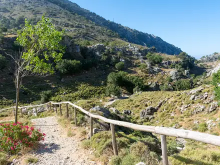
The Swiss National Park Loop is a moderate half-day mountain walk in the Lower Engadine, canton of Graubünden, Switzerland. The real route is the Margunet nature trail, SwitzerlandMobility route 812: about 8 km officially, with roughly 600 m of ascent and a high point at Margunet, 2328 m. It suits hikers wanting a short but properly alpine T2 route through pine forest, meadow and stony terrain, with strong wildlife interest and strict national-park rules.
Route Overview
Start at Hotel Parc Naziunal Il Fuorn (P6) on the Ofenpass road, or use the signed start at the Stabelchod PostBus stop (P8). The loop climbs via Alp Stabelchod and Val da Stabelchod through Ofenpass mountain-pine forest to the panoramic saddle of Margunet, then descends through Val dal Botsch back towards Il Fuorn. It is waymarked as SwitzerlandMobility national hiking route 812 with standard Swiss signs and red-white-red T2 markers. PostBus access runs along the Ofenpass road from the Zernez direction. For longer Swiss mountain routes, compare the Bernina Trek, Diavolezza Glacier Trail and Davos to Arosa Panorama Trail.
Swiss National Park history
The Swiss National Park was founded on 1 August 1914 on land around the Ofenpass leased from Engadine communes including Zernez, S-chanf and Scuol. It follows a strict “let nature take its course” approach: no hunting, farming, logging, camping or leaving marked paths. The park is also a long-term scientific reserve and a UNESCO biosphere reserve. The Stabelchod and Margunet area is especially linked to the Alpine bearded-vulture reintroduction programme, with releases made here between 1991 and 2007.
Notable highlights
- Margunet panorama (2328 m): The saddle is the high point of the loop, reached after the main climb. It gives wide views across the Swiss National Park and the Ofenpass peaks.
- Stabelchod marmot colony: Alp Stabelchod is one of the park’s best-known places to see and hear Alpine marmots in summer. Chamois, ibex and red deer also use the surrounding slopes.
- Bearded vultures of Val da Stabelchod: This valley was a key release site for the Alpine reintroduction of the bearded vulture. Watch the sky here for bearded vultures and golden eagles.
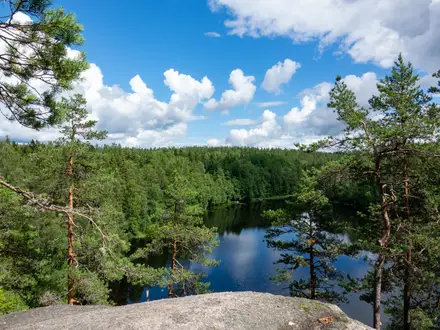
- Ofenpass mountain-pine forests: The trail passes through natural Pinus mugo woodland left to develop without intervention, with standing and fallen deadwood.
- Val dal Botsch scree and rock: The descent crosses debris cones and rocky ground, showing the active erosion and geology of the Engadine landscape.
- Oldest national park in the Alps: Founded in 1914, the Swiss National Park is the oldest national park in the Alps and the only Swiss national park.
Challenges to expect
This is a moderate T2 mountain hike, not a hard full-day trek, but it is still alpine. Expect a steady climb to Margunet, rocky and uneven sections, scree in Val dal Botsch and possible snow outside the June–October walking season. There is no accommodation or resupply on the loop. Park rules are strict: stay on the marked path, and no dogs, bikes, camping, fires or plant picking.
HikeList Score
Swiss National Park Loop scored 80/100 on HikeList's trail-quality metrics.
See score breakdownHide breakdown
- Ideal length 55
- Balanced challenge 100
- Scenery & wildness 98
- Varied terrain 64
- Accommodation 66
- Food & support 81
- Path quality 98
- Season flexibility 76
Computed from length, challenge, scenery & wildness, terrain variety, accommodation, food & support, path quality and season flexibility.
 Switzerland
Show more data Show less
- Mountainous
- Forest
- Dirt
- Rocky
- Hotels
- Huts
- Family Friendly
- Restrooms
- Water Sources
- Shelters
Photos from hikers
Taken on the trail by people who've reviewed Swiss National Park Loop.
Reviews
How would you rate Swiss National Park Loop?
Tap a star to start your review — you could be the first.