Skalnaté Pleso to Zamkovského Hut
How would you rate Skalnaté Pleso to Zamkovského Hut?
Tap a star to share your experience and help other hikers.
Skalnaté Pleso to Zamkovského Hut: Short High Tatras Descent
HikeList Score
Skalnaté Pleso to Zamkovského Hut scored 76/100 on HikeList's trail-quality metrics.
See score breakdownHide breakdown
- Ideal length 55
- Balanced challenge 100
- Scenery & wildness 98
- Varied terrain 71
- Accommodation 49
- Food & support 65
- Path quality 98
- Season flexibility 76
Computed from length, challenge, scenery & wildness, terrain variety, accommodation, food & support, path quality and season flexibility.
Skalnaté Pleso to Zamkovského Hut is a 3.9 km point-to-point descent in the High Tatras of Slovakia. It follows the red-marked Tatranská Magistrála from the cable-car station above Tatranská Lomnica to Zamkovského chata in Malá Studená dolina. Allow about 50 minutes one-way. The walking is easy to moderate: mostly downhill, but on rocky mountain path with changeable high-alpine weather. It suits families, hut walkers and anyone wanting a short Tatras route without committing to Kriváň Summit Trail-level effort.
Route Overview
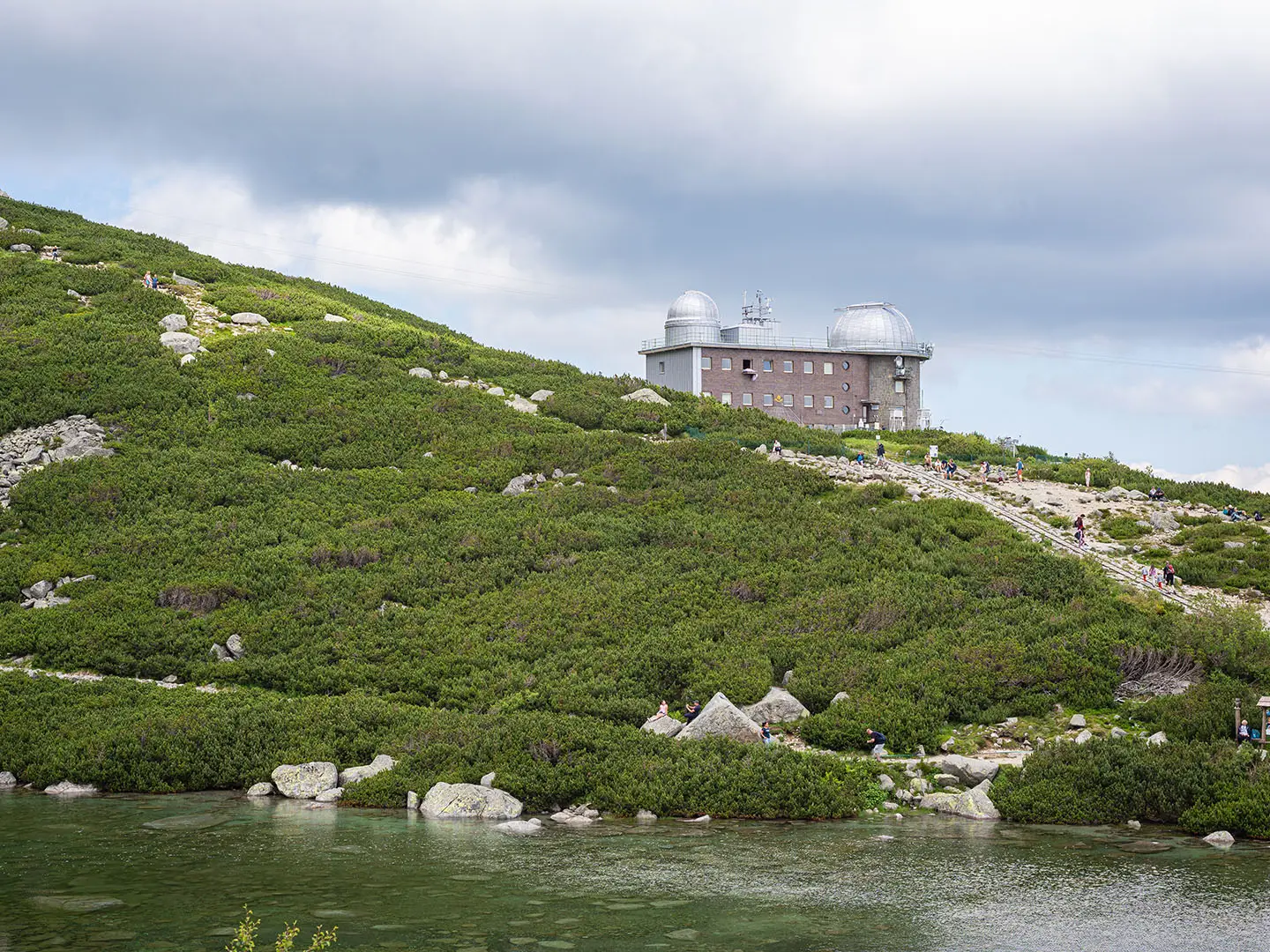
Start at Skalnaté pleso, the glacial lake and upper station of the Tatranská Lomnica cable car, at 1,751 m. The red-marked Tatranská Magistrála drops from open mountain ground past the area of Skalnatá chata, then descends into spruce forest in Malá Studená dolina. The walk ends at Zamkovského chata, 1,475 m, where food, drinks and hut beds are available. This is a one-way leg, though many hikers make it an out-and-back using the cable car, or continue down towards Hrebienok and the Studený potok waterfalls. For another short Slovak route with a very different gorge setting, see the Kláštorská Gorge Trail.
Zamkovského Chata: A Hut with a Complicated 20th-Century Story
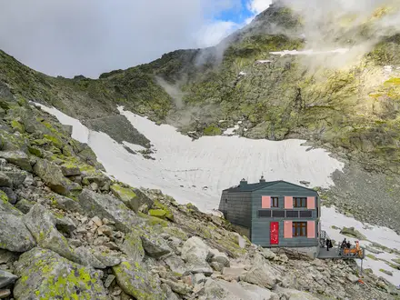
Zamkovského chata was built in 1942–43 by Štefan Zamkovský, a mountain guide and ranger closely linked with the growth of High Tatras tourism. After 1948 the Communist regime confiscated the hut and renamed it after Captain Ján Nálepka. Following the political changes after 1989, it was returned to the Zamkovský family and regained its original name. That history makes the hut more than a refreshment stop: it is one of the better-known traditional chaty on the Tatranská Magistrála.
Notable highlights
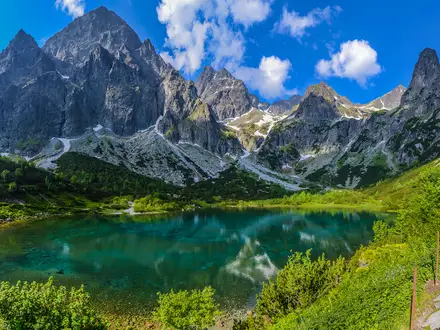
- Skalnaté pleso (1,751 m): A glacial tarn beneath the Lomnický štít massif and the airy starting point for the walk. The cable-car access makes this one of the easiest ways to begin high in the Tatras.
- Skalnatá chata (1,725 m): A mountain refreshment stop a few minutes from the lake. It is useful for food or drinks before committing to the descent.
- Tatranská Magistrála: The red-marked long-distance High Tatras trail. This short section is its gentle final descent rather than a remote expedition stage.
- Malá Studená dolina: The Small Cold Valley, where the route leaves open mountain terrain and enters spruce forest. It gives the walk a clear alpine-to-forest transition.
- Zamkovského chata (1,475 m): A historic hut in the valley and the endpoint of the walk. It is also linked with the route down to Hrebienok and the Studený potok waterfalls.
- Studený potok waterfalls: The Waterfalls of the Cold Stream lie below the hut towards Hrebienok. They make a popular short extension if you are not returning to Skalnaté pleso.
Challenges to expect
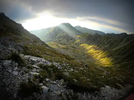
This is a short descent, not a hard mountain day, but do not treat it as a town path. Expect rocky and stony sections, dirt trail, wooden footbridges lower down and slippery footing in wet or winter conditions. Weather can change quickly at High Tatras altitude. In winter the path and hut may still be open, but proper winter equipment is needed. Navigation is simple if you stay on the red-marked Magistrála.
HikeList Score
Skalnaté Pleso to Zamkovského Hut scored 76/100 on HikeList's trail-quality metrics.
See score breakdownHide breakdown
- Ideal length 55
- Balanced challenge 100
- Scenery & wildness 98
- Varied terrain 71
- Accommodation 49
- Food & support 65
- Path quality 98
- Season flexibility 76
Computed from length, challenge, scenery & wildness, terrain variety, accommodation, food & support, path quality and season flexibility.
 Slovakia
Show more data Show less
- Mountainous
- Forest
- Rocky
- Dirt
- Wooden Footbridges
- Huts
- Family Friendly
- Pet Friendly
- Restrooms
- Water Sources
- Shelters
In these collections
Photos from hikers
Taken on the trail by people who've reviewed Skalnaté Pleso to Zamkovského Hut.
From Skalnaté pleso at the Tatranská Lomnica cable-car upper station, follow the red-marked Tatranská Magistrála downhill. The path leaves open high-alpine terrain, passes near Skalnatá chata, then drops through spruce forest into Malá Studená dolina. Finish at Zamkovského chata, with the option to continue towards Hrebienok and the Studený potok waterfalls.
Reviews
How would you rate Skalnaté Pleso to Zamkovského Hut?
Tap a star to start your review — you could be the first.