Stenshuvud National Park Trail
How would you rate Stenshuvud National Park Trail?
Tap a star to share your experience and help other hikers.
Stenshuvud National Park Trail: 4 km Coast and Hill Loop
HikeList Score
Stenshuvud National Park Trail scored 87/100 on HikeList's trail-quality metrics.
See score breakdownHide breakdown
- Ideal length 55
- Balanced challenge 100
- Scenery & wildness 98
- Varied terrain 94
- Accommodation 83
- Food & support 88
- Path quality 98
- Season flexibility 89
Computed from length, challenge, scenery & wildness, terrain variety, accommodation, food & support, path quality and season flexibility.
The Stenshuvud National Park Trail is a short 4.0 km loop on the Österlen coast of south-east Skåne, Sweden. It is a 1-day or half-day walk, rated moderate because the path climbs Stenshuvud hill and includes rocky, uneven coastal ground. The listed route matches the Yellow trail, the longest everyday colour-coded loop in the park. It suits walkers who want Baltic Sea views, broadleaf forest, meadows and a compact national-park hike without multi-day logistics.
Route Overview
Start and finish at Naturum Stenshuvud visitor centre, the main trailhead for the park’s colour-coded loops just south of Kivik. The Yellow trail circles Stenshuvud through hornbeam and beech forest, meadows and a rocky seaward section by Hanöbukten, with access to the hill’s summit viewpoints. The wider park network also includes shorter Blue, Red, Orange and Purple loops, including the Kortelshuvud viewpoint route. Stenshuvud is a day-trip hike with no in-park accommodation; visitors usually base themselves in Kivik or Simrishamn, and the park is reachable by SkåneExpressen 3 bus. For longer south Swedish walks, compare the Blekingeleden and Hallandsleden.
History of Stenshuvud
Stenshuvud has long been a maritime landmark on the Baltic coast and appears in folklore as “Sten’s head”, named after a giant. Near the summit are the remains of a 5th-6th century hillfort, showing the headland’s strategic importance. North of the main hill, Hällevik arboretum was planted by Carl Ekenstam in the late 1800s. The area became Stenshuvud National Park in 1986 and covers about 3.9 km², including a marine area.
Notable highlights
- Stenshuvud summit (97 m): The northern peak is the highest of the hill’s three summits and gives open views over Hanöbukten and the Österlen coast.
- Ancient hillfort ruins (5th-6th century): Remains near the top add historical interest to the short climb and show the headland’s long strategic role.
- Naturum Stenshuvud visitor centre: The park gateway and start point for the colour-coded loops, with exhibitions on local nature; it is closed from December to February.
- Sandy beach and hornbeam forest: The Yellow loop links broadleaf woodland with a Baltic bathing beach, giving varied terrain in a short distance.
- Rich flora and rare wildlife: Around 600 vascular plant species grow here, including orchids, alongside species such as hazel dormouse, sand lizard and European tree frog.
- Hällevik arboretum: North of the main hill, this 19th-century arboretum is noted for exotic trees and May carpets of ramsons on the Green and Yellow trails.
Challenges to expect
The walk is short and well waymarked, but it is not completely flat or smooth. Expect a climb to the 97 m hill, uneven forest paths and a very rocky seaward section on the Yellow trail. Wet meadows and alder marsh are part of the park landscape, so footwear with grip is sensible. There is no accommodation or camping in the park, and dogs must be kept on a lead.
HikeList Score
Stenshuvud National Park Trail scored 87/100 on HikeList's trail-quality metrics.
See score breakdownHide breakdown
- Ideal length 55
- Balanced challenge 100
- Scenery & wildness 98
- Varied terrain 94
- Accommodation 83
- Food & support 88
- Path quality 98
- Season flexibility 89
Computed from length, challenge, scenery & wildness, terrain variety, accommodation, food & support, path quality and season flexibility.
 Sweden
Show more data Show less
- Coastal
- Forest
- Meadow
- Wetland
- Rocky
- Dirt
- Sand
- Hotels
- Guesthouses
- Campsites
- Family Friendly
- Pet Friendly
- Restrooms
- Water Sources
- Campsites
- Picnic Areas
Download Our Full Guide to Stenshuvud National Park Trail FREE!
Get our comprehensive guide to this hike for free. Save it for later reading or print out at home.
Photos from hikers
Taken on the trail by people who've reviewed Stenshuvud National Park Trail.
Stenshuvud National Park Trail: The Complete Guide
 i
Image by Susie Hedberg
i
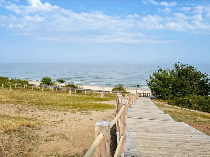
Image by Susie Hedberg The Stenshuvud National Park Trail is a short but varied day loop on Sweden’s Österlen coast, following the park’s gula leden (Yellow trail / Hällevikslingan) from Naturum Stenshuvud. In around 4 km, it links broadleaf forest, meadow, Baltic shoreline and the foot of Stenshuvud hill.
This is not a multi-day trek or a remote wilderness route. It suits walkers who want a compact national-park hike with clear waymarking, easy logistics by car, and enough terrain change to feel more substantial than a beach stroll.
The classic extra is the short detour to the northern summit of Stenshuvud, 96–97 m above Hanöbukten, with views along the Skåne coast. Near the top are the remains of an ancient hillfort, while the lower route passes Hällevik arboretum, sandy beach and rocky seaward paths.
The walk is moderate rather than difficult: the distance is small, but the climb, uneven forest tracks and rocky coastal section need proper footwear and a little care. Wet ground can also linger in the meadows and marsh after rain.
This guide covers the route stage, walking time, access, accommodation bases, food planning, transport, terrain and the common mistakes to avoid.
Stage-by-Stage Guide
Stage 1: Naturum Stenshuvud to Naturum Stenshuvud
| Stage | Distance | Typical walking time | Ascent | Finish services |
|---|---|---|---|---|
| Yellow trail / Hällevikslingan loop from Naturum Stenshuvud | about 4 km, with GPS tracks often nearer 4.3–4.5 km | about 1.5–2.5 hours | roughly 120 m | Naturum Stenshuvud when open; no accommodation or camping inside the national park |
This is a compact but varied national-park loop, using the Yellow trail, also called Hällevikslingan. It starts at Naturum Stenshuvud, the main visitor centre and trailhead below the hill, then links forest, the northern end of the park, the Baltic shore and the rocky foot of Stenshuvud before returning to the same entrance.
The route is short and well waymarked, but it should not be treated as a flat beach stroll. The climb towards Stenshuvud and the uneven seaward section make it more demanding than the distance suggests, especially after rain or with small children.
From Naturum, the trail threads into broadleaf woodland, with hornbeam and beech giving the walk a lush, southern Swedish character. In season, the surrounding habitats are a major part of the route: May brings ramsons in the Hällevik arboretum, while June is notable for orchids and other flower-rich meadow plants.
The highest viewpoint is not simply on the easiest line of the Yellow loop. The northern summit of Stenshuvud, 96–97 m above the Baltic, is reached by a short steps-and-path detour and is worth allowing time for. This is the classic view over Hanöbukten and the Österlen coast, and the nearby remains of an ancient hillfort add historical interest to the top of the headland.
The northern part of the circuit reaches the Hällevik arboretum and the park’s northern entrance area. The arboretum is a 19th-century planting with many exotic conifers and trees, and it gives this part of the loop a different feel from the native hornbeam and beech woodland closer to the hill.
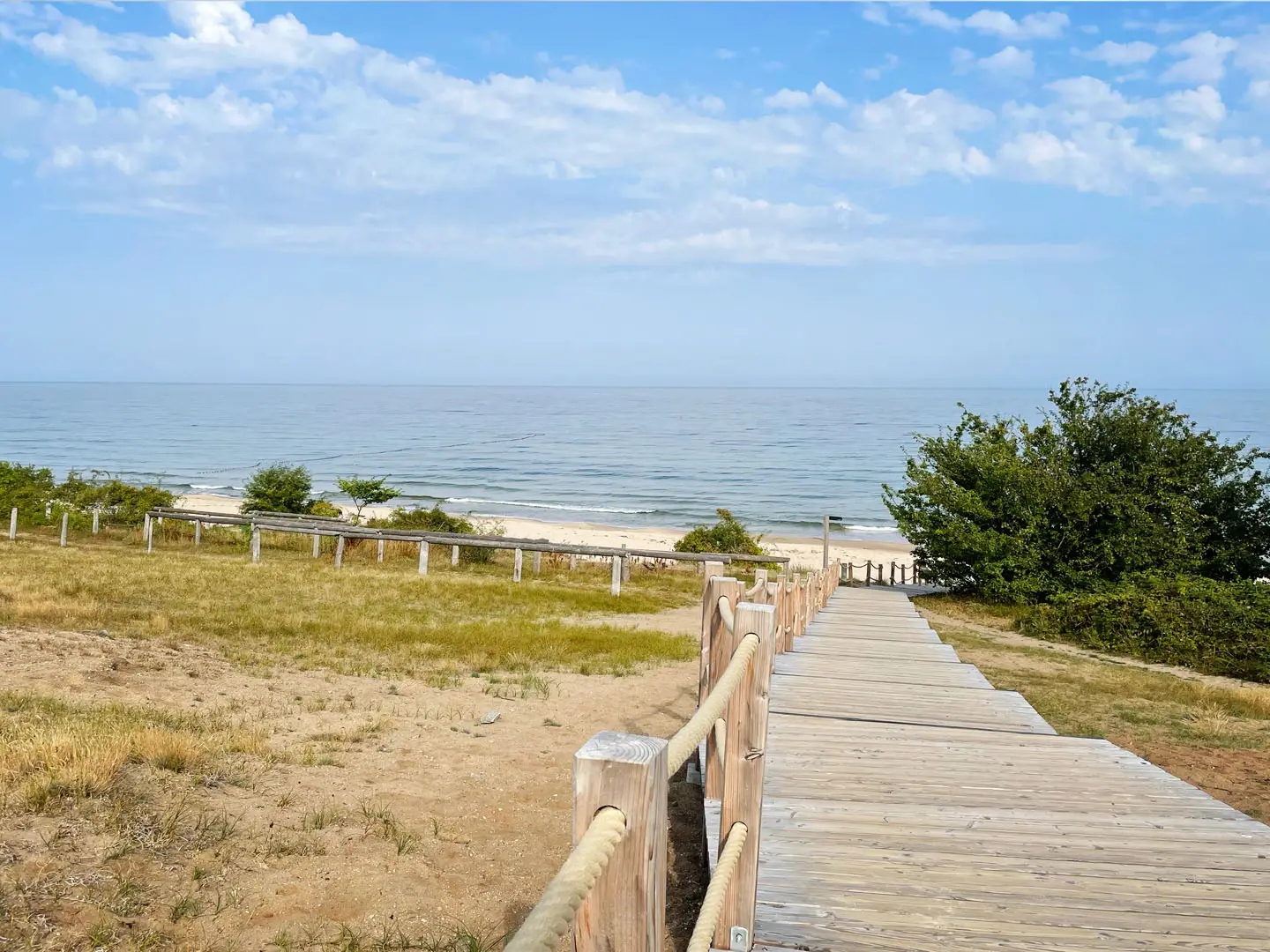
The route then works towards the Baltic side of the park, including Stenshuvud’s sandy beach. This is the easiest place on the loop to pause, but the trail soon changes character again: the Yellow trail’s rocky seaward section runs along the foot of the hill beside the sea and is the slowest, most awkward underfoot part of the walk.
Expect dirt forest paths, stony climbing, sand near the beach and rough rocks along the shore. Meadows and alder-marsh areas can be wet after rain, so footwear with decent grip is sensible even on a short summer visit.
Food and water should be sorted before starting. There are no reliable food stops around the loop itself, and walkers should carry water and snacks rather than depending on facilities inside the park. Kivik and Simrishamn are the practical bases for shops, meals and accommodation before or after the walk.
There is no accommodation or camping inside Stenshuvuds nationalpark. Overnight stays should be arranged outside the park, most commonly in or around Kivik just to the north, or Simrishamn about 15 km to the south, where there are hotels, guesthouses, B&Bs and campsites in the wider Österlen area.
By road, access is via road 9 to the signed main entrance, where there are two car parks. By public transport, SkåneExpressen 3 serves Mellby skola, from where it is roughly a 3 km walk via Svinaberga to the entrance. Bus times, onward connections and the extra walk to the trailhead should be checked with Skånetrafiken before travelling.
Navigation is straightforward, but the park has several colour-coded loops starting from Naturum, so follow the yellow markers for gula leden / Hällevikslingan. The Blue, Red, Purple and Green/Orange loops are separate shorter routes, and the Skåneleden long-distance trail also passes through the park, so do not assume every signed path is part of this circuit.
The main practical warnings are underfoot rather than exposure-related. Take care on the rocky coastal stretch, on the stony climb and on damp meadow or marsh ground after rain. Dogs must be kept on a lead, and Naturum’s opening pattern is seasonal, with closure from December to February; current opening times and any trail closures should be checked before travelling.
Recommended Itinerary
This route works best as a single half-day walk from Naturum Stenshuvud, with extra time allowed for the summit detour, the beach and the rocky seaward section. It is not a multi-day itinerary: there is no accommodation or camping inside Stenshuvuds nationalpark, so overnight planning means staying outside the park, usually in Kivik or Simrishamn.
Standard itinerary
| Day | From | To | Approx. distance | Why this stage makes sense | Services/accommodation notes |
|---|---|---|---|---|---|
| 1 | Naturum Stenshuvud | Naturum Stenshuvud, via the Yellow trail / Hällevikslingan, Hällevik arboretum, Stenshuvud beach and the rocky seaward section, with the summit detour if desired | 4 km official distance; GPS tracks may measure nearer 4.3–4.5 km | This is the park’s longest everyday colour-coded loop and gives the most complete short circuit of Stenshuvud: broadleaf forest, the northern end of the park, the sandy Baltic shore and the rougher rocky section below the hill. The summit detour adds the classic viewpoint over Hanöbukten without turning the walk into a long day. | Start and finish at Naturum Stenshuvud. Naturum is closed December–February and opening days vary outside summer, so this should be checked before travelling. No accommodation or camping is available inside the national park; stay in Kivik or Simrishamn if overnighting nearby. |
Slower option: nature-and-beach day
Use the same Yellow trail loop, but treat it as a relaxed day rather than a short walk. This suits families, photographers, botanists and anyone relying on bus access, where the walk in from Mellby skola via Svinaberga adds time before and after the park circuit.
Build in time for Naturum Stenshuvud, the summit viewpoint, the beach and careful footing on the rocky coastal section. In May, the Hällevik arboretum is especially worth allowing time for ramsons; in June, the orchid meadow and wider flora are a good reason not to rush.
Faster option: short park visit
Fit walkers with limited time can complete the Yellow trail as a compact half-day outing, provided conditions are dry and the rocky seaward section is taken carefully. The official loop is only 4 km, but the climb, uneven forest paths, sand near the beach and rocky shoreline make it slower than a simple urban or gravel path of the same length.
If time is very tight, the park also has shorter colour-coded loops, including the Red trail of about 2 km to the summit and the Blue trail of about 1 km towards the sea. These are alternatives to the full Yellow loop rather than stages of the same itinerary.
Planning the Route
How long to allow
Plan this as a single outing rather than a staged hike. Most walkers should allow a half day for the Yellow trail / Hällevikslingan, with extra time if visiting Naturum Stenshuvud, taking the summit detour, spending time on the beach or moving carefully through the rocky seaward section.
It is a route that rewards being walked slowly. The distance is short, but the interest comes from the changes in terrain: broadleaf forest, meadow, marshy ground, the Baltic shore and the climb towards Stenshuvud’s northern summit. Rushing it turns the walk into a brief park loop and gives little margin for the uneven coastal stretch.
Stages and accommodation
There are no natural overnight stages on this route. It starts and finishes at Naturum Stenshuvud, and there is no accommodation or camping inside the national park.
Base planning is therefore simple: stay outside the park, most practically in Kivik or Simrishamn, then travel in for the walk. Accommodation should be booked as coastal Österlen accommodation, not as trail-stage accommodation. Campsites, where used, are outside the park area; camping inside Stenshuvuds nationalpark should not be assumed.
| Planning item | Practical approach |
|---|---|
| Walking time | Allow a relaxed half day rather than treating it as a quick fitness loop. |
| Overnight stops | None on the trail; stay in Kivik, Simrishamn or elsewhere nearby. |
| Start/finish logistics | Use Naturum Stenshuvud as both the start and finish point. |
| Main time risks | Rocky coastal walking, summit detour, beach stops and transport timing. |
Shortening, extending and route choices
The park’s colour-coded trail network makes it easy to choose a shorter walk if conditions, time or group ability require it. The Yellow trail is the longest everyday loop in the park, while shorter signed options include the Blue trail, Red trail, Purple trail and Green/Orange arboretum loop.
For a shorter visit, the Red trail is the more direct classic summit option, while the Blue trail gives an accessible route towards the sea. The Purple trail reaches the Kortelshuvud viewpoint, and the Green/Orange loop covers the Hällevik arboretum area. Exact route choice should be made at the park information boards or Naturum before setting off.
Extending the Yellow loop usually means combining it with other park loops, taking the summit detour, or spending longer at the beach and arboretum. The Skåneleden long-distance trail also passes through the park, but it is a separate route and should not be confused with the Yellow loop.
Section hiking
Section hiking is not really relevant here. The Yellow trail is a compact circular day walk with no intermediate trail towns, no accommodation stages and no need to split the route.
For walkers using public transport, the more useful planning question is not how to section the trail, but whether the bus times leave enough margin for the walk plus the approach on foot from Mellby skola.
Transport planning
Transport is the main logistical detail to get right. By car, use road 9 and the signed main entrance to the park, where there are two car parks. Arrival time can matter in busy seasons because the park is a popular coastal destination.
By public transport, SkåneExpressen 3 can be used to reach Mellby skola, followed by roughly a 3 km walk via Svinaberga to Naturum Stenshuvud. Current bus times should be checked with Skånetrafiken before travelling, especially if relying on a same-day return.
Simrishamn is the nearest larger town and has bus links and a regional rail connection. Kivik is closer to the park and is a practical base if staying just north of Stenshuvud.
Food, water and facilities
Treat the walk as self-contained. Carry enough water, snacks and any lunch needed for the time in the park, because the route itself is a nature trail rather than a village-to-village walk with resupply points.
Naturum Stenshuvud is the key visitor facility and trailhead, with exhibitions on the park’s nature and culture. It is closed December–February, open daily in summer and open Tuesday–Sunday in spring and autumn; current opening should be checked before travelling.
For meals, shopping and overnight services, plan around Kivik or Simrishamn rather than the trail itself.
Navigation and underfoot conditions
Navigation is straightforward in normal conditions because the route is waymarked as the Yellow trail / gula leden. Even so, carry a simple map, downloaded route or phone navigation, particularly if combining loops or taking detours to the summit and viewpoints.
The main planning issue is not route-finding but footing. Expect dirt forest paths, a stony climb, sand near the beach, wet ground in meadows and marsh after rain, and a rocky, uneven seaward section at the foot of the hill. Footwear should be chosen for grip rather than for distance.
The summit is reached by a short steps-and-path detour from the loop. Allow time for this if the viewpoint over Hanöbukten is part of the plan.
Weather, season and access rules
Spring, summer and autumn are the main walking seasons. May is notable for ramsons in the arboretum, and June for the orchid meadow, but wetter ground is possible after rain at any time.
Wind and weather on the Baltic side can make the shore section feel more exposed than the forested parts of the loop. After rain, the rocky coastal section and stony climb deserve extra care.
The national park is free to enter. Dogs must be kept on a lead. Any current trail closures or local access notices should be checked before travelling.
Towns, Villages and Overnight Stops
This is a short national-park day loop, so the practical overnight planning is simple: stay outside Stenshuvuds nationalpark and travel in for the walk. There is no accommodation or camping inside the park itself, and the route is not designed around stage-by-stage overnight stops.
The useful bases are Kivik, just north of the park, and Simrishamn, about 15 km south. Naturum Stenshuvud is the trailhead, not a settlement, and the summit, arboretum and beach are route points rather than places to stay.
| Place | Role for hikers | Overnight use | Transport / access |
|---|---|---|---|
| Kivik | Nearest village north of the park | Good nearby base | Local onward access should be checked before travelling |
| Naturum Stenshuvud | Main entrance and trailhead | No overnight stay | Road 9 to signed entrance; bus to Mellby skola then about 3 km walk via Svinaberga |
| Stenshuvud summit | Viewpoint detour | No | Reached on foot from the park trails |
| Hällevik arboretum / northern entrance | Northern route point | No | Reached on the Yellow trail / park path network |
| Stenshuvud beach | Beach stop on the loop | No | Reached on foot within the park |
| Simrishamn | Nearest town, about 15 km south | Good base with wider services | Bus links and regional rail connection at Simrishamn |
Kivik
Kivik is the nearest village to Stenshuvuds nationalpark, sitting just north of the park on the Österlen coast. For most walkers it is the most convenient small-place base if staying close to the trailhead without being in the park itself.
Accommodation in the surrounding Kivik area includes hotels, guesthouses, B&Bs and campsites. Availability and seasonal opening vary, so book ahead in summer and check current options before travelling.
Use Kivik for pre- and post-walk logistics rather than expecting facilities on the route. Specific shops, cafés and restaurant opening times should be checked locally, especially outside the main summer season.
No specific direct public-transport stop at the park entrance is available from the route information. If relying on buses, plan around Skånetrafiken services and be prepared for a walk-in from Mellby skola via Svinaberga, or check local onward connections before travelling.
Naturum Stenshuvud
Naturum Stenshuvud is the main visitor centre, the southern entrance and the start and finish of the Yellow trail / Hällevikslingan. All the colour-coded loops in the park begin and end here, so it is the key orientation point for the walk.
This is not an overnight stop. There is no accommodation or camping at Naturum or elsewhere inside Stenshuvuds nationalpark, so do not plan to sleep in the park.
By car, access is from road 9 to the signed main entrance, where there are two car parks. By public transport, use SkåneExpressen 3 to Mellby skola, then allow for the roughly 3 km walk via Svinaberga to the entrance; current times should be checked with Skånetrafiken before travelling.
Naturum has exhibitions on the park’s nature and culture and is useful for route orientation before setting out. It is open daily in summer, Tuesday–Sunday in spring and autumn, and closed December–February; current opening should be checked before travelling.
Stenshuvud summit
The northern summit of Stenshuvud is the route’s main high point, at about 96–97 m above the Baltic. It is reached by a short steps-and-path detour from the loop rather than being on the easiest line of the Yellow trail itself.
This is a viewpoint, not a serviced stop. There is no accommodation, camping, food or shop provision at the summit, so treat it as a short side trip within the walk.
The summit is worth allowing time for because it gives the classic view over Hanöbukten and the Österlen coast. The ancient hillfort remains near the top add historical interest, but the practical point is simple: take the detour only if the extra climb and steps suit the group.
Hällevik arboretum / northern entrance
Hällevik arboretum sits at the northern end of the park and is one of the key points on the Yellow trail. It is also associated with the park’s short accessible Green/Orange arboretum loop.
This is not a village base and should not be treated as an overnight stop. There is no camping or accommodation inside the national park, including at the northern entrance area.
The arboretum is a useful place to understand where the loop sits within the wider park path network, especially if combining the Yellow trail with one of the shorter marked routes. In May, the arboretum is known for ramsons beneath the trees, but walkers should still plan food, water and onward transport independently.
Stenshuvud beach
Stenshuvud beach is the sandy Baltic shore section reached on the seaward side of the loop. It is a natural rest point on the walk, especially in warm weather, but it is not a settlement or service stop.
There is no overnight accommodation or camping at the beach. The national-park no-accommodation rule applies here as much as in the forest and hill sections.
The beach is followed by, or linked with, the rockier seaward section of the Yellow trail at the foot of the hill. If using the beach as a longer break, keep enough time and energy for the uneven rocky ground before returning to Naturum.
Simrishamn
Simrishamn is the nearest town, about 15 km south of Stenshuvuds nationalpark. It is the more practical base for walkers who want broader town services or who are arriving by public transport.
Accommodation in and around Simrishamn includes hotels, guesthouses, B&Bs and campsites on the Österlen coast. As with Kivik, current availability, prices and seasonal opening should be checked before booking.
Simrishamn has bus links and a regional rail connection, making it the strongest public-transport base named for this route. From there, plan onward travel towards the park using Skånetrafiken, with SkåneExpressen 3 to Mellby skola and the final walk via Svinaberga where appropriate.
For food and supplies, Simrishamn is the sensible place to organise what is needed before heading to the trailhead. Do not rely on finding services during the loop itself.
Getting to the Start
The trail starts at Naturum Stenshuvud, the main visitor centre and southern entrance to Stenshuvuds nationalpark. All the park’s colour-coded loops, including gula leden (the Yellow trail / Hällevikslingan), begin and end here.
By train
The nearest useful rail access is Simrishamn, about 15 km south of the park, which has a regional rail connection. From Simrishamn, continue towards the park by bus and on foot, or use a taxi for the final approach to Naturum Stenshuvud.
Train times, connections and onward bus timings should be checked before travelling, especially outside the main summer visitor season.
By bus
Public transport is possible, but the bus does not stop at Naturum Stenshuvud itself. Use SkåneExpressen 3 with Skånetrafiken to Mellby skola, then walk roughly 3 km via Svinaberga to reach the national park entrance and visitor centre.
This extra approach walk matters on a short route: it can add a meaningful amount of time before and after the 4 km loop. Check the Skånetrafiken journey planner for current bus times, return options and seasonal service patterns before travelling.
By car
Drivers should use road 9 and follow signs to the park’s main southern entrance below Stenshuvud hill. There are two car parks serving the main entrance and Naturum Stenshuvud.
This is the simplest access option for a half-day visit, particularly if combining the walk with time at the beach or Naturum. The national park is free to enter, but any current parking arrangements or restrictions should be checked before travelling.
From the nearest airport
No airport functions as a direct trailhead for this walk. Fly-in visitors should plan to reach the Skåne regional transport network first, then continue to Simrishamn or Kivik before travelling on to Naturum Stenshuvud by bus, taxi or car.
Airport-to-park journey times will depend heavily on flight times, rail connections and the SkåneExpressen 3 timetable. This should be checked before travelling.
Where to stay before starting
There is no accommodation or camping inside Stenshuvuds nationalpark. For an early start, base yourself outside the park in Kivik, just north of Stenshuvud, or Simrishamn, about 15 km south.
Both are better bases than trying to treat the park as an overnight stop. Kivik is closest to the trailhead, while Simrishamn is the more useful public-transport base because of its regional rail connection and bus links.
Getting Home from the Finish
This route is a loop, so the finish is the same as the start: Naturum Stenshuvud at the park’s main southern entrance. That makes exit logistics simple if travelling by car, but public transport still requires the same walk out to the bus stop used on the way in.
By train
There is no railway station at Stenshuvuds nationalpark. The nearest useful rail connection is at Simrishamn, about 15 km south of the park, which has regional rail services and onward bus links.
To leave by train, first get from Naturum Stenshuvud to Simrishamn by bus or taxi. Public-transport routing and connections should be checked with Skånetrafiken before travelling, especially outside the main daytime period.
By bus
Buses do not stop directly at Naturum Stenshuvud. The usual public-transport option is to walk roughly 3 km from the visitor centre via Svinaberga to the Mellby skola stop, then use SkåneExpressen 3.
Build this extra road-and-lane walk into the end of the day. After rain, the trail itself may be slower underfoot, and the rocky seaward section can take longer than the distance suggests, so avoid planning around a tight final bus connection.
Bus times are timetable-dependent and should be checked with Skånetrafiken before setting out. If finishing late in the day, do not assume there will be a convenient bus from Mellby skola; arrange a taxi in advance or return by car.
By car/taxi
For drivers, the walk finishes back at the main entrance below Stenshuvud hill, off road 9, where the park has two car parks. This is the simplest way to visit the trail, as there is no need for a shuttle or point-to-point transfer.
If using a taxi, book or arrange the return pick-up in advance rather than relying on finding one at the visitor centre. This is particularly important outside peak visitor hours, in the shoulder seasons, or if the walk is combined with a long stop at the beach or summit.
From the nearest airport
There is no airport connection at the trailhead. The practical approach is to travel first to the Österlen area, then use Simrishamn or Kivik as the local base before reaching the park by car, taxi or bus-and-walk.
The best airport and onward route will depend on where the journey starts. This should be checked before travelling.
Where to stay at the finish
There is no accommodation or camping inside Stenshuvuds nationalpark, so do not plan to finish and stay in the park. Overnight bases are in the surrounding Österlen area, especially Kivik just north of the park and Simrishamn to the south, where walkers can find hotels, guesthouses, B&Bs and campsites outside the national park.
Staying overnight nearby is sensible if using public transport, arriving without a car, or visiting outside the main summer period when Naturum opening and bus options are more limited. Naturum is closed December–February, open daily in summer and generally Tuesday–Sunday in spring and autumn; current opening times should be checked before travelling.
Which Direction Should You Walk?
This is a short loop from Naturum Stenshuvud, so direction is a matter of walking quality rather than logistics. Transport, parking, toilets, visitor-centre access and any onward travel are the same whichever way round you go, because the Yellow trail starts and finishes at the same trailhead.
There is no accommodation flow to manage inside the park, and no advantage for walkers staying in Kivik or Simrishamn. The decision comes down to when you want to tackle the climb, the summit detour and the rocky seaward section.
Standard direction: forest and summit first, coast later
The most practical approach is to follow the Yellow trail from Naturum in the signed loop sequence via the forest, the northern side of the park around Hällevik, the beach and the rocky shore. This gives a good progression: broadleaf woodland first, the optional steps-and-path detour to Stenshuvud’s northern summit early in the walk, then the Baltic shore and the rougher coastal ground later.
This direction has two advantages. The climb is dealt with while legs are fresh, and the rocky seaward section comes after you have settled into the walk rather than immediately after leaving the visitor centre. For most walkers, that makes the short route feel more balanced.
It also works well scenically. The summit viewpoint over Hanöbukten gives the walk its high-level context early on, while the beach and rockier shoreline keep the second half interesting before returning to Naturum.
Reverse direction: coast first, climb later
Walking the loop in reverse puts the rocky shore and beach earlier and leaves the climb and summit detour until later. This can suit walkers who want to reach the sea quickly, or who are mainly visiting for the beach and coastal section.
The drawback is that the rougher ground comes before the easier forest rhythm, and the climb towards the summit area is saved for the latter part of the walk. On a hot day, or with children, that may feel less comfortable than doing the hill first.
Reverse direction can be sensible if the weather looks likely to deteriorate and you want to complete the exposed, uneven shoreline section before rain or stronger wind arrives. Current local conditions should be judged at the trailhead.
Recommendation
For most walkers, start from Naturum Stenshuvud and walk the Yellow trail in the standard forest-and-summit-first direction, then continue towards Hällevik, the beach and the rocky coastal section before returning to Naturum. It gives the best scenery progression, handles the climb early and saves the most distinctive coastal walking for the second half.
Walk it in reverse only if reaching the Baltic shore quickly is the priority, or if the day’s weather makes it wiser to tackle the rocky seaward stretch first.
Accommodation Along the Route
This is not an inn-to-inn hike. The Yellow trail / Hällevikslingan is a short loop inside Stenshuvuds nationalpark, and there is no accommodation or camping inside the national park. Plan to sleep outside the park and travel in for the walk.
The practical bases are Kivik, just north of the park, and Simrishamn, about 15 km south. Both sit on the Österlen coast and offer the types of accommodation most walkers need: hotels, guesthouses, B&Bs and campsites. Simrishamn is the larger town and is the stronger choice if public transport, food options and onward travel matter.
| Place | Accommodation level | Best for | Notes |
|---|---|---|---|
| Stenshuvuds nationalpark / Naturum Stenshuvud | None | Day visitors only | No accommodation or camping inside the park. Start and finish the walk here, then leave the park for the night. |
| Kivik | Good | Nearest overnight base | Convenient if you want to stay close to the park and keep travel time short. Accommodation includes hotels, guesthouses, B&Bs and campsites in the surrounding Österlen area. |
| Simrishamn | Good | Best all-round base, especially without a car | Larger town about 15 km south, with accommodation and onward public-transport links, including a regional rail connection. A sensible base if combining the walk with other Österlen travel. |
| Mellby skola / Svinaberga approach | None as a trail base | Public-transport access only | Relevant mainly for walkers arriving by SkåneExpressen 3 to Mellby skola and walking roughly 3 km via Svinaberga to the park entrance. Do not rely on this as an overnight stop. This should be checked before travelling. |
Booking advice
Accommodation should be booked outside the national park, not at the trailhead. For summer, weekends and holiday periods on the Österlen coast, booking ahead is strongly recommended, especially if you need a specific room type, a campsite pitch, or accommodation within easy reach of the park.
Prices and availability vary by season, and some services may operate differently outside the main visitor season. Confirm current accommodation availability, cancellation terms and check-in arrangements before booking.
Camping
Camping is not permitted as an overnight solution inside Stenshuvuds nationalpark. If camping, use campsites in the surrounding Kivik or Simrishamn area and travel into the park for the walk.
Do not plan a wild-camp style itinerary through the park. The route is too short for that to be necessary, and the park should be treated as a day-walk destination.
Luggage, taxis and transfers
Luggage transfer is not relevant for this route. Since the walk starts and finishes at Naturum Stenshuvud, most walkers leave overnight bags at their accommodation in Kivik or Simrishamn and carry only a daypack.
Taxi transfers are only useful if public transport times do not work, or if the extra walk from Mellby skola to the entrance is inconvenient. Local taxi availability and costs should be checked before travelling.
Camping and Wild Camping
Camping inside Stenshuvuds nationalpark
There is no camping or overnight accommodation inside Stenshuvuds nationalpark. Treat the Yellow trail / Hällevikslingan as a short day walk, not as a route to camp on or beside.
Do not pitch a tent in the forest, meadows, by the beach, at the arboretum, on the summit area or along the rocky shore. The park is a protected area with its own rules, and camping should be planned outside the national-park boundary.
Campsites nearby
Walkers who want to camp should base themselves outside the park, most practically around Kivik or Simrishamn. Both are on the Österlen coast and have visitor accommodation, including campsites, with access to the park by car or by local public transport and walking.
No campsite sits directly on the Yellow trail itself. If travelling without a car, check the campsite location carefully against Skånetrafiken connections and the extra walk from Mellby skola via Svinaberga to Naturum Stenshuvud. Current opening dates, prices and pitch availability should be checked before booking, especially outside the main summer season.
Wild camping and the right of public access
Sweden’s general outdoor-access tradition does not override national-park regulations. For this route, the practical rule is simple: do not wild camp inside Stenshuvuds nationalpark.
Outside the park, any camping plans need to respect local rules, private land, crops, gardens and protected areas. If considering a pitch elsewhere in the Österlen area, check local restrictions first and avoid assuming that a quiet-looking coastal or woodland spot is automatically suitable.
Water, fires and low-impact practice
Carry the water needed for the walk from the start. The route passes forest, marsh, beach and the Baltic shore, but these are not reliable drinking-water sources and should not be treated as campsite water supplies.
Fire rules can change with season and wildfire risk, particularly in dry summer weather. Do not light fires unless local park or municipal rules clearly allow it in a designated place; this should be checked before travelling.
Keep the route impact-free: take all litter out, stay on marked paths where required, avoid trampling meadow and marsh vegetation, and keep dogs on a lead. The short distance makes lightweight day-walking logistics far more appropriate than carrying overnight camping kit through the park.
Food, Water and Resupply
This is a short national-park day loop, so resupply is not a meaningful issue on the trail itself. Plan to start from Naturum Stenshuvud with the food and water needed for the full walk, especially outside the main summer visitor season.
Kivik, just north of the park, and Simrishamn, about 15 km south, are the practical places to organise food before or after the walk. Exact shops, cafés, restaurant hours and Sunday opening should be checked before travelling, particularly in spring and autumn when coastal services may be more limited.
What to carry
For the Yellow trail / Hällevikslingan, most walkers only need a light day-walk supply: water, a snack or packed lunch, and a little extra if planning long stops at the summit viewpoint, beach or Naturum. The route is only around 4 km, but the rocky seaward section can slow progress and there is no reason to depend on finding food once on the loop.
In warm summer weather, carry enough water from the start for the whole walk. The beach and Baltic shore are not drinking-water sources, and water from marshy or coastal ground should not be used unless properly treated; in practice, it is better not to rely on natural water at all on this route.
Food and water by section
| Section | Food availability | Water availability | Notes |
|---|---|---|---|
| Kivik / Simrishamn before travelling to the park | Best places to arrange food before the walk; check current shop, café and restaurant opening times | Fill bottles before leaving accommodation or town | Use these bases for breakfast, packed lunch and post-walk food. Rural and seasonal hours should be checked before travelling. |
| Naturum Stenshuvud / main entrance | Do not rely on buying food at the trailhead unless current facilities have been checked | Do not rely on a refill unless current visitor-centre facilities have been checked | Naturum is the main trailhead and visitor centre, but it is closed December–February and has seasonal opening outside summer. Bring what you need from the start. |
| Yellow trail through forest, summit detour, Hällevik arboretum, beach and rocky shore | No on-trail resupply | No dependable treated water on the loop | Carry water and snacks for the full circuit. The Baltic shore, marshy ground and any natural water should not be treated as ready-to-drink water. |
| Return to Naturum / onward to Kivik or Simrishamn | Food after the walk is easiest back in Kivik or Simrishamn | Refill after the walk where available in town or at accommodation | If using SkåneExpressen 3 from Mellby skola, allow for the extra walk between the bus stop and park entrance and carry water for that approach as well. |
Practical resupply advice
There are no long food gaps in the normal hiking sense, but there can be a practical gap if arriving by bus, walking in from Mellby skola via Svinaberga, completing the loop and then returning the same way. In that case, treat the outing as longer than the 4 km park circuit and carry water and food for the approach and return as well.
Naturum opening is seasonal: daily in summer, Tuesday–Sunday in spring and autumn, and closed December–February. This should be checked before travelling, along with Skånetrafiken bus times if using public transport.
Terrain, Conditions and Difficulty in Practice
The Yellow trail / Hällevikslingan is short, well waymarked and starts from a managed national-park trailhead, but it is not a flat surfaced stroll. Its moderate grade comes from the combination of a compact climb onto Stenshuvud, uneven woodland paths, wet ground after rain and a genuinely rocky stretch beside Hanöbukten.
Most walkers should find the distance straightforward. The places that slow the pace are the summit detour and the seaward section at the foot of the hill, where careful foot placement matters more than fitness.
Path surfaces underfoot
| Section / terrain | What to expect in practice |
|---|---|
| Forest paths | Dirt paths through hornbeam and beech woodland, generally easy to follow but uneven in places. Roots, stones and damp leaf litter can make the going slower after rain. |
| Climb towards Stenshuvud | A short, stony ascent with steps and path on the summit detour. The high point is only 96–97 m, but the climb is enough to raise the effort level above an easy beach-and-forest walk. |
| Meadows and alder marsh areas | Wet ground is possible after rain, especially on the inner side of the hill and in lower meadow or marshy sections. Waterproof footwear is useful outside dry summer spells. |
| Beach area | Sand near Stenshuvud beach gives an easy break from the woodland terrain, though soft sand can slow the pace. |
| Rocky seaward section | The roughest part of the Yellow trail. The path runs along the foot of the hill by the Baltic shore, with uneven stones and rocky ground requiring balance and concentration. |
The climb and summit detour
The total ascent is modest at roughly 120 m, but it comes in short, noticeable bursts rather than as a long gradual hill walk. The northern summit of Stenshuvud is reached by a short steps-and-path detour from the loop, rather than being on the lowest line of the Yellow trail itself.
The detour is worth allowing time for because it is the classic viewpoint over Hanöbukten and the Österlen coast. It also adds the most hill-walk-like element of the route, so anyone treating this as an easy family stroll should allow for a slower climb and descent.
The rocky coastal section
The rocky seaward stretch is the main reason the route deserves a moderate rating despite being only about 4 km. It is not technical mountaineering terrain, but it is uneven enough that trainers with poor grip or flimsy sandals are a poor choice.
Progress here is naturally slower than in the forest. After rain, or when stones are damp, the section should be taken carefully, especially with children or anyone less confident on rough ground.
Mud, wet ground and seasonal conditions
The route can be much wetter after rain than its short distance suggests. The meadow and alder marsh parts of the park are the areas most likely to feel soft underfoot, while the forest paths can hold damp leaf litter and slippery roots.
Spring and autumn are likely to make the uneven ground more noticeable, particularly after wet weather. Summer generally gives the easiest underfoot conditions, though the beach and summit viewpoints may encourage longer stops than the walking time alone suggests.
Naturum Stenshuvud is closed December–February, and the main walking season is spring to autumn. If planning a winter visit, current access, trail conditions and visitor-centre opening should be checked before travelling.
Exposure, navigation and practical difficulty
Navigation is one of the easier parts of the walk: this is a colour-coded national-park loop starting and finishing at Naturum Stenshuvud. The main practical risk is not getting lost, but underestimating how slow the rocky shore and short climb can feel compared with the distance on paper.
There is no meaningful road-walking on the Yellow loop itself. The route is a park trail through woodland, meadow, shore and beach terrain; any extra walking from public transport, such as the approach from Mellby skola via Svinaberga, is separate from the signed loop and should be planned in addition.
The open summit and the Baltic shoreline are more exposed to wind and weather than the forest sections. Carry an extra layer if lingering at the viewpoint or beach, even on a short walk.
Who will find it easy — and who should take care
Fit walkers used to uneven paths will usually find the route short and manageable. Families and casual walkers can also enjoy it, but the rocky coastal section and stony climb make sturdy footwear and unhurried pacing important.
The walk is less suitable for anyone expecting a fully accessible surfaced loop. For a gentler alternative within the same park network, the shorter colour-coded routes from Naturum Stenshuvud may be more appropriate, while the Yellow trail is the longest everyday loop and the roughest all-round option.
Weather and Best Time to Walk
The most practical walking season for the Stenshuvud National Park Trail is spring to autumn. The route is short, but its rocky shore section, stony climb and wet ground near the meadows and alder marsh make conditions matter more than the distance suggests.
May and June are especially good if the aim is to see the park’s flora: ramsons carpet the Hällevik arboretum in May, and the orchid meadow is at its best in June. Summer is the easiest season for combining the walk with Naturum Stenshuvud, the beach and public transport planning, as Naturum is open daily in summer.
Seasonal conditions
| Season | What to expect | Planning advice |
|---|---|---|
| Spring | Broadleaf woodland comes into leaf, the arboretum has ramsons in May, and Naturum normally opens Tuesday–Sunday. Paths can still be wet after rain, especially around meadows and marshy ground. | A good time for quieter walking and flowers. Wear footwear with grip rather than smooth-soled trainers if the ground is damp. |
| Summer | Best all-round convenience: Naturum is open daily, the beach is most appealing, and long daylight makes timing easy. The park can be busier, particularly around the beach, summit detour and main car parks. | Start earlier or later in the day if you want a quieter loop. Carry water, as the walk is short but includes a climb and exposed shore sections. |
| Autumn | Often a good walking season for the beech and hornbeam forest, with Naturum normally open Tuesday–Sunday. Wet leaves, rain and darker afternoons can make the rocky and stepped parts slower. | Allow extra time if the forecast is wet. The seaward rocky stretch deserves care after rain. |
| Winter | Naturum is closed December–February. The route may still be walkable in suitable conditions, but ice, snow, short daylight and slippery rock can make the short loop more awkward than expected. | Treat winter as an off-season walk rather than the standard choice. Check current park information, weather and any trail closures before travelling. |
Rain, wind and underfoot conditions
After rain, the meadows and alder-marsh side of the hill can be wet underfoot, and the rocky Baltic shoreline section becomes the slowest part of the Yellow trail. Waterproof footwear is more useful here than heavy mountain boots, but grip matters.
The forest sections give shelter, but the beach, summit viewpoint and exposed shore below the hill are more affected by Baltic wind. In poor weather, the summit detour and rocky shore can feel much less casual than the 4 km distance implies.
Fog or low cloud can reduce the value of the Stenshuvud summit viewpoint over Hanöbukten. If the forecast is changeable, it is worth keeping the summit detour flexible and using the waymarked loop rather than relying on views for navigation.
Daylight and timing
In spring, summer and early autumn, the loop is easy to fit into a half day, even with the summit detour, beach stop and time at Naturum. In late autumn and winter, shorter daylight makes it sensible to start earlier, especially if arriving by bus and walking the extra distance from Mellby skola via Svinaberga.
The route is not long enough to require expedition-style planning, but it should not be rushed in wet or icy conditions. The rocky seaward section is the part most likely to slow walkers down.
Seasonal services and booking
There is no accommodation or camping inside Stenshuvuds nationalpark, so overnight stays need to be arranged outside the park, usually in Kivik or Simrishamn. Summer is the period when the area is most convenient for visitors, but accommodation and local service availability should be checked before booking.
Naturum Stenshuvud is closed December–February, open daily in summer, and normally open Tuesday–Sunday in spring and autumn. Current opening times, bus times with Skånetrafiken, and any temporary trail closures should be checked before travelling.
Safety Notes
Stenshuvud is a short, waymarked national-park loop, but the Yellow trail is not a fully surfaced stroll. The main safety issues are uneven ground, wet or slippery rock, short steep sections around the hill, and sensible planning for weather, transport and daylight.
Emergency help and mobile phones
In Sweden, call 112 for police, ambulance or fire. Be ready to give your location as Stenshuvuds nationalpark, with the nearest clear landmark: Naturum Stenshuvud, the northern summit, Hällevik arboretum / northern entrance, Stenshuvud beach or the rocky shore below the hill.
Do not rely on a phone alone for navigation. The route is colour-waymarked, but a downloaded map or offline GPS track is useful if signs are missed in the forest or if you decide to link with another park trail.
Underfoot hazards
The most awkward ground is the rocky seaward section where the Yellow trail runs along the foot of Stenshuvud beside Hanöbukten. Take particular care on wet rock, loose stones and uneven coastal ground; walking poles can help, but hands may be more useful than poles on short awkward steps.
The climb towards Stenshuvud and the optional summit detour include stony paths and steps. After rain, expect mud or soft ground in the meadows and alder-marsh areas, and slippery leaves or roots in the beech and hornbeam forest.
Weather, heat and cold
The forest gives shelter, but the summit viewpoint, beach and open shore are more exposed to wind off the Baltic. Carry a windproof or waterproof layer even on a short walk if the forecast is unsettled.
In warm weather, the short distance can make the route feel easy to underestimate. Carry water, use sun protection on the beach and open sections, and allow extra time if walking with children or stopping to bathe.
Naturum is closed December–February, and winter conditions are outside the main recommended season for most visitors. If walking in colder months, expect fewer facilities, shorter daylight and a higher chance of slippery paths; this should be checked before travelling.
Water and beach safety
The Yellow trail passes Stenshuvud’s sandy Baltic beach and a rocky shoreline. Treat the sea as a cold-water environment, supervise children closely, and avoid climbing around wet shoreline rocks if waves, algae or rain have made them slippery.
This is not a river-crossing route, and tides are not a key planning issue here. The practical concern is footing on rocks and sensible behaviour around open water.
Road access and transport
The trail itself starts and finishes at Naturum Stenshuvud, but walkers arriving by bus need to reach the park from Mellby skola via Svinaberga, roughly 3 km from the entrance. Take care with traffic on the access walk and make sure the return bus time still works before setting off.
If driving, use road 9 to the signed main entrance and the park car parks. Do not assume late-day transport will be convenient from the park entrance; current Skånetrafiken times should be checked before travelling.
Dogs, wildlife and livestock
Dogs must be kept on a lead in the national park. This protects wildlife and reduces conflict with other visitors on narrow forest and coastal paths.
Livestock is not a defining hazard on this loop, but the route passes meadows and managed natural areas. Follow local signs, keep dogs controlled, and leave gates as found if any are encountered.
Solo walking and before-you-go checks
Solo walkers should have no special difficulty on this compact, well-used day loop, provided normal precautions are taken. Tell someone the plan if walking late in the day, carry enough battery for navigation and emergency calls, and avoid rushing the rocky shore section.
Before setting off, check:
- Current weather and wind conditions for the Österlen coast.
- Daylight, especially outside summer.
- Any temporary trail closures or park notices at Naturum or the official park information.
- Skånetrafiken bus times if using public transport.
- Whether Naturum Stenshuvud is open, if relying on visitor-centre facilities or advice.
- That everyone in the group has suitable footwear for rock, roots, sand and wet ground.
Gear Recommendations
This is a short national-park day loop, so the right kit is about comfort and footing rather than expedition load. The main gear mistake is treating the Yellow trail (gula leden / Hällevikslingan) as a flat beach stroll: the climb to Stenshuvud, uneven forest paths, wet ground after rain and the rocky seaward section all justify proper walking footwear.
Footwear
Wear grippy walking shoes or lightweight boots with a firm sole. Trail trainers can be fine in dry conditions if they handle rock well, but smooth-soled casual shoes are a poor choice for the stony coastal section and the steps-and-path detour towards the 96–97 m summit.
After rain, expect damp ground in meadows and alder-marsh areas, plus potentially slippery rock and roots in the forest. Waterproof footwear is useful in spring and autumn, though in warm summer conditions many walkers may prefer breathable shoes and accept some dampness.
Clothing and weather protection
Carry a waterproof jacket even on a short walk. The route mixes sheltered hornbeam and beech forest with more exposed ground near the beach, shoreline and summit viewpoint, where wind off Hanöbukten can make conditions feel cooler.
A light warm layer is sensible outside high summer, especially if stopping at the summit, beach or Naturum. In summer, prioritise breathable clothing, a sun hat and sunglasses for the open shore and sandy beach sections.
Navigation
The Yellow trail is colour-coded and starts and finishes at Naturum Stenshuvud, so navigation is straightforward in normal conditions. Still, carry a phone with the route map available offline or take a photo of the trail information at the start, particularly if also using the other park loops or detouring to the summit.
A dedicated GPS device is not necessary for most walkers on this route. A small power bank is useful if relying on a phone for bus times, maps or photography, especially when travelling by public transport from Mellby skola via Svinaberga.
Water and food
Carry enough water from the start for the full loop, plus the approach walk if arriving by bus. The trail itself is short, but the rocky shoreline, beach stops and summit detour can easily stretch the outing beyond a quick walk.
A snack or packed lunch is enough for most walkers. There is no need for multi-day food planning, but do not rely on finding food once on the loop; plan supplies before entering the park or use services outside the park in places such as Kivik or Simrishamn.
Trekking poles
Trekking poles are optional. They can help on the uneven rocky seaward section, the short climb towards Stenshuvud and any wet forest paths, but many walkers will find them unnecessary for a 4 km loop with modest ascent.
If using poles, fit rubber tips where appropriate to reduce impact on hard surfaces and rock. They are most worthwhile for walkers who prefer extra stability rather than for load-carrying.
Camping and overnight gear
Do not carry overnight camping gear for this walk unless continuing elsewhere outside the national park. There is no accommodation or camping inside Stenshuvuds nationalpark; the route is planned as a day walk from Naturum Stenshuvud.
Campers should base themselves outside the park, for example in the wider Österlen area around Kivik or Simrishamn, and visit the trail with a light day pack. Current campsite availability and rules should be checked before travelling.
Sun, insects and seasonal extras
In spring and summer, take sun protection for the beach, meadow and viewpoint sections. Insect repellent can be useful in warm, still weather, particularly around woodland and damp ground.
In autumn, add a warmer mid-layer and expect wetter, leaf-covered paths. Naturum is closed December–February, and this route is primarily a spring, summer and autumn walk; any winter visit should be planned more self-sufficiently, with current access and trail conditions checked before travelling.
Gear by walking style
| Walking style | Recommended approach |
|---|---|
| Accommodation-based walkers | Stay outside the park in Kivik, Simrishamn or elsewhere on the Österlen coast, and walk with a light day pack: waterproof, warm layer, water, snack, phone/map and basic first aid. |
| Campers | Leave camping gear at the campsite outside the national park. Carry only day-walking kit on the Yellow trail, as there is no camping inside Stenshuvuds nationalpark. |
| Fast or section walkers | Minimal kit is fine in settled weather, but do not skip grippy footwear, water and a waterproof. If linking multiple park loops or using public transport, carry offline navigation and enough phone battery for onward travel. |
Budget and Costs
Stenshuvuds nationalpark is a low-cost hike by Swedish standards because it is a short day loop with no hut fees, no luggage transfer and no overnight requirement on the trail. The national park itself is free to enter; the real costs are transport, food and any accommodation in Kivik or Simrishamn.
Use Swedish krona (SEK / kr) for budgeting. Accommodation, public-transport fares and taxi prices change seasonally, so current prices should be checked before booking.
Main cost items
| Cost item | What to budget for |
|---|---|
| Park entry | Free entry to Stenshuvuds nationalpark. |
| Accommodation | None inside the national park. Stay outside the park in Kivik or Simrishamn if an overnight is needed. |
| Camping | No camping inside the national park. Campsites may be available in the wider Österlen area around Kivik or Simrishamn; check current availability and prices before travelling. |
| Food | Bring snacks, water and a picnic from your base. Do not rely on buying food on the loop itself. |
| Public transport | SkåneExpressen 3 to Mellby skola, then roughly 3 km on foot via Svinaberga to the entrance. Check Skånetrafiken for current fares and times. |
| Car access | Road 9 to the signed main entrance and its two car parks. Any current parking rules or charges should be checked on arrival. |
| Taxi / private transfer | Potentially useful from Kivik or Simrishamn if bus times do not suit, but fares and availability should be checked locally before relying on this. |
| Luggage transfer | Not relevant for this route. It is a short loop returning to Naturum Stenshuvud. |
| Guided or self-guided packages | Not necessary for most walkers. The Yellow trail is waymarked and can be walked independently. |
Budget approach
The cheapest plan is to visit as a day trip, use Skånetrafiken to reach Mellby skola, walk the extra approach to the park, and carry all food and drink. With free park entry and no accommodation inside the route, this keeps spending mainly to bus fares and picnic supplies.
This option works best if bus times line up well with the planned start and finish. Allow for the extra walking between Mellby skola and Naturum Stenshuvud when judging whether a late return service is realistic.
Mid-range approach
A practical mid-range plan is to stay in Kivik or Simrishamn, travel in by bus or car, and carry a packed lunch. This gives more flexibility than a same-day public-transport trip from farther away and avoids needing an early start.
Kivik is closest to the park, while Simrishamn has wider transport links, including a regional rail connection. Accommodation prices on the Österlen coast vary by season, so compare hotels, guesthouses, B&Bs and campsites before booking.
Comfortable approach
The comfortable option is to stay in a hotel or guesthouse in Kivik or Simrishamn and use a car or taxi/private transfer to reach the Naturum Stenshuvud trailhead. This removes the 3 km walk from Mellby skola and makes timing easier, especially outside peak summer bus periods.
If using a taxi or arranged transfer, book ahead rather than assuming one will be available at short notice near the park. Current fares should be confirmed before travelling.
Costs that do not apply here
There are no mountain huts, stage-to-stage transfers, baggage services or compulsory permits for this walk. The route is a compact 4 km loop, so budget planning is closer to a national-park day visit than a long-distance hiking itinerary.
Luggage Transfer, Guided Tours and Support Services
Luggage transfer
Luggage transfer is not normally relevant for the Stenshuvud National Park Trail. This is a short loop from Naturum Stenshuvud, so most walkers leave overnight bags at accommodation in Kivik, Simrishamn or elsewhere on the Österlen coast and carry only a small day pack.
There is no accommodation or camping inside Stenshuvuds nationalpark, so there is no point-to-point baggage stage to arrange within the park. If Stenshuvud is being added to a longer Österlen or Skåneleden itinerary, luggage logistics should be arranged as part of that wider trip rather than for the Yellow trail itself.
Self-guided walking packages
A dedicated self-guided walking holiday is unnecessary for this route alone. The Yellow trail / Hällevikslingan is waymarked, starts and finishes at the main visitor centre, and can be walked in about 1.5–2.5 hours, with extra time for the summit detour, beach and Naturum.
For walkers staying several nights in the area, a self-guided Österlen walking break may include Stenshuvuds nationalpark as one day among other coastal walks. In that case, check exactly what is included before booking: accommodation location, transport to Naturum Stenshuvud, luggage arrangements between overnight stops, and whether the route follows the park’s Yellow trail or the separate Skåneleden passing through the park.
Guided walks and visitor support
Naturum Stenshuvud is the key on-site support point. It is the trailhead for the park’s colour-coded loops and has exhibitions on the park’s nature and culture, making it the best place to orientate before setting off.
Naturum is open daily in summer, Tuesday–Sunday in spring and autumn, and closed December–February. Current opening hours, activities and any guided nature events should be checked before travelling.
A guide is not needed for navigation on the Yellow trail, but may be worthwhile for walkers particularly interested in the park’s plants, woodland habitats, ancient hillfort remains or seasonal highlights such as the orchid meadows and ramsons in the arboretum. Any guided option should be arranged in advance, especially outside the main summer season.
Taxi and access support
By car, the simplest access is via road 9 to the signed main entrance, where there are two car parks. For walkers without a car, public transport is possible but does not stop at the trailhead: SkåneExpressen 3 runs to Mellby skola, followed by roughly a 3 km walk via Svinaberga to the entrance. Bus times should be checked with Skånetrafiken before travelling.
A taxi can be useful if staying in Kivik or Simrishamn, particularly for early starts, poor weather, reduced mobility, or if the extra walk from Mellby skola is not desirable. No specific taxi operator should be assumed for the trail; book locally in advance and agree the pick-up point as Naturum Stenshuvud or the main entrance, not just “Stenshuvud”, as the park has more than one access point.
What to book ahead
For this short day loop, the main bookings are outside the trail itself:
- accommodation in Kivik, Simrishamn or elsewhere on the Österlen coast;
- any taxi transfer to or from Naturum Stenshuvud;
- public transport timings via Skånetrafiken if relying on SkåneExpressen 3;
- current Naturum opening hours and any guided activities;
- arrangements for luggage only if Stenshuvud forms part of a longer walking itinerary.
The national park itself is free to enter, and no luggage-transfer or walking-package arrangement is needed simply to complete the Yellow trail.
Shorter Hikes and Best Sections
Stenshuvud is already a short national-park loop rather than a route that needs sectioning. The most practical way to shorten it is to choose one of the park’s colour-coded loops from the same trail network, or to use the Yellow trail as the full half-day version.
Best short options in the park
| Best for | Route | Start and end | Approx. distance | Why choose it | Transport notes |
|---|---|---|---|---|---|
| Best full experience and best scenery | Yellow trail / Hällevikslingan, with the summit detour if conditions suit | Naturum Stenshuvud to Naturum Stenshuvud | 4 km officially; GPS tracks often measure nearer 4.3–4.5 km | This is the main circuit: broadleaf forest, the northern end near Hällevik, sandy beach, the rocky seaward section and the option to climb to the 96–97 m summit viewpoint over Hanöbukten. | By car, use road 9 to the signed main entrance and its two car parks. By bus, use SkåneExpressen 3 to Mellby skola, then walk roughly 3 km via Svinaberga to the entrance; check Skånetrafiken times before travelling. |
| Beginners wanting the shortest sea walk | Blue trail | Naturum Stenshuvud to Naturum Stenshuvud | About 1 km | The least committing way to reach the sea from the visitor-centre area, suitable when time, weather or energy is limited. | The public-transport approach from Mellby skola is much longer than the loop itself, so this option works best by car or as part of a longer visit from the bus stop. |
| Short summit walk | Red trail | Naturum Stenshuvud to Naturum Stenshuvud | About 2 km | The classic shorter route for reaching Stenshuvud hill and its viewpoint, with the ancient hillfort remains near the summit adding interest. | Same access as Naturum: road 9 by car, or SkåneExpressen 3 to Mellby skola plus the roughly 3 km walk-in. |
| Medium-length viewpoint option | Purple trail | Naturum Stenshuvud to Naturum Stenshuvud | About 3 km | A useful compromise if the Yellow trail feels too rocky or too long, with a route to the Kortelshuvud viewpoint. | Same access as Naturum. Check current waymarking and any closures at Naturum before setting off. |
| Very short arboretum and flora option | Green/Orange arboretum loop | Hällevik arboretum / northern entrance area | About 0.5 km | Best for a brief, gentle walk among the arboretum plantings; May is notable for ramsons beneath the trees. | The clearest general access for most visitors is the main entrance at Naturum. Access details for the northern entrance should be checked before travelling. |
Best option by public transport
The most sensible public-transport version is to treat Mellby skola as the walking start and finish, then continue via Svinaberga to Naturum before choosing a park loop. Doing the Yellow trail this way makes the total walking roughly 10 km: about 3 km to the park, the 4 km loop, and about 3 km back.
This is still a day walk, not an overnight stage. Check Skånetrafiken for current SkåneExpressen 3 times, and allow enough margin for the walk back to the bus stop after visiting the beach, summit or Naturum.
Best weekend use
There is no meaningful weekend section within the national park itself. A practical weekend plan is to stay outside the park in Kivik or Simrishamn, walk the Yellow trail on one day, then return for a shorter loop such as the Red, Purple, Blue or Green/Orange route if more time is available.
Kivik is the nearest village just north of the park, while Simrishamn is about 15 km south and has bus links and a regional rail connection. There is no accommodation inside Stenshuvuds nationalpark, so all overnight planning should be based outside the park.
Best 3–5 day section
Stenshuvud National Park Trail is not a 3–5 day route. The Skåneleden long-distance trail passes through the park, but it is a separate route and should be planned with its own stage information.
For this HikeList route, the relevant walking options are the 0.5–4 km colour-coded national-park loops. Do not book several nights expecting a continuous multi-day trail inside Stenshuvuds nationalpark.
Camping-based option
Camping is not permitted as an overnight option inside the national park. If camping is part of the trip, use campsites outside the park in the wider Kivik or Simrishamn area, then visit Stenshuvud as a day walk.
For campers without a car, the same public-transport limitation applies: buses do not stop at Naturum, so the Mellby skola approach adds roughly 3 km each way on foot. This should be built into the day’s timing before choosing the Yellow loop or one of the shorter alternatives.
Highlights and Points of Interest
The Yellow trail is short, but it packs most of Stenshuvuds nationalpark’s main landscapes into one loop: broadleaf forest, a summit viewpoint, historic remains, arboretum planting, sandy Baltic shore and a rough rocky coastal traverse. If time is limited, the summit detour, Hällevik arboretum and Stenshuvud beach are the places most worth allowing extra time for.
Stenshuvud summit viewpoint
The northern summit of Stenshuvud is the classic viewpoint of the walk, rising 96–97 m above the Baltic. It is reached by a short steps-and-path detour from the loop rather than by simply following the lowest line of the Yellow trail, so do not miss the signed turn if views are a priority.
From the top, the outlook takes in Hanöbukten and the Österlen coast. This is the most obvious place to pause on a clear day, especially as the rest of the route spends much of its time in woodland or close to sea level.
Ancient hillfort remains
Near the summit are the remains of an ancient hillfort, or fornborg, dating from the 5th–6th century. The ruins are low-key rather than a reconstructed monument, but they add useful context to why this headland mattered long before it became a national park.
Combine the hillfort with the summit detour rather than treating it as a separate objective. It is best appreciated slowly, with time to look around rather than hurrying back down to the loop.
Hornbeam and beech forest
Much of the Yellow trail threads through lush hornbeam and beech woodland, a notably southern-feeling habitat for Sweden. The forest sections are not just linking paths: they are one of the defining features of the park and provide shade, shelter and a clear contrast with the exposed coast.
Underfoot, expect dirt paths with some uneven sections and a stonier climb towards the summit. After rain, parts of the lower woodland, meadow and marsh edges can be wet.
Hällevik arboretum
At the northern end of the park, Hällevik arboretum is a 19th-century planting with many exotic conifers and trees. It gives the loop a different character from the native broadleaf forest elsewhere in the park.
May is a particularly good time to linger here, when ramsons, or wild garlic, carpet the ground beneath the trees. The arboretum is also a useful slower-paced section for anyone wanting a botanical focus rather than just a quick circuit.
Orchid meadow and rich flora
Stenshuvuds nationalpark supports around 600 vascular plant species, including several orchids. June is the key month for orchid interest, when the meadow flora is at its most rewarding.
Stay on marked paths through sensitive meadow and marsh areas. These habitats are part of what makes the park unusually varied for such a compact walk.
Stenshuvud beach
The sandy Baltic beach on the seaward side of the loop is the main place to stop if you want a longer break. It provides a complete change of pace after the forest and summit sections, with open views across Hanöbukten.
Allow extra time here in warm weather, but remember that the walk is not finished once the beach is reached. The Yellow trail still includes the rougher rocky coastal section below the hill.
Rocky seaward section
The stony stretch where the Yellow trail runs along the foot of Stenshuvud beside the sea is the most adventurous part of the route. It is not technically long, but it is uneven enough to slow progress and is the section most likely to feel more than a simple park stroll.
Good footwear is useful here, especially if the rocks are damp. This is also one of the best parts of the walk for appreciating how abruptly the wooded hill meets the Baltic shore.
Naturum Stenshuvud
Naturum Stenshuvud is both the trailhead and the main orientation point for the walk, with exhibitions on the park’s nature and culture. It is worth visiting before setting out if you want context for the forest, meadow, shore and hillfort landscapes encountered on the loop.
Opening varies by season: it is open daily in summer, Tuesday–Sunday in spring and autumn, and closed December–February. This should be checked before travelling.
Nearby bases: Kivik and Simrishamn
Kivik, just north of the park, and Simrishamn, about 15 km south, are the practical nearby places to spend time before or after the walk. They are not part of the Yellow trail itself, but they are the logical bases for accommodation, food and onward transport on the Österlen coast.
For walkers arriving by public transport, Simrishamn is the larger access town, with bus links and a regional rail connection. Bus times and connections should be checked with Skånetrafiken before travelling.
Common Mistakes and Planning Tips
The Stenshuvud National Park Trail is short, but it catches people out when it is treated either as a fully equipped long-distance route or as a flat beach stroll. Plan it as a half-day national-park loop with a rocky shoreline, a short hill climb and limited services at the trailhead.
| Common mistake | Why it matters here | Better plan |
|---|---|---|
| Expecting a multi-day hike | This route is the Yellow trail / Hällevikslingan, a loop of about 4 km starting and finishing at Naturum Stenshuvud. There is no accommodation or camping inside the national park. | Treat it as a day walk. Stay outside the park, typically in Kivik or Simrishamn, and travel in for the walk. |
| Assuming camping is available in the park | Stenshuvuds nationalpark is not a place to pitch overnight. Campsites are in the wider Österlen area, not on the trail itself. | Book accommodation or a campsite outside the park before arrival, especially in the main visitor season. |
| Underestimating the rocky seaward section | The Yellow trail is moderate because of terrain, not distance. The section along the foot of the hill beside Hanöbukten is stony and uneven, and can be slow with children, dogs or unsuitable footwear. | Wear proper walking shoes or grippy trainers, allow more than the map distance suggests, and do not plan this as a quick flat beach loop. |
| Skipping the summit by accident | The northern summit of Stenshuvud, 96–97 m above the Baltic, is reached by a short steps-and-path detour rather than by simply staying on the lowest line of the Yellow trail. | Watch for the summit turn-off and allow time for the detour. It is one of the main viewpoints on the route. |
| Confusing the colour-coded trails | Several loops start at Naturum Stenshuvud, including the Blue, Red, Purple, Green/Orange and Yellow trails. The Skåneleden also passes through the park but is a separate long-distance route. | Follow gula leden (Yellow trail) / Hällevikslingan for this route. Check the mapboard at Naturum before setting off and keep an eye on the colour markers at junctions. |
| Relying on the bus as if it stops at the trailhead | Public transport is possible, but the bus stop is not at the entrance. SkåneExpressen 3 serves Mellby skola, followed by roughly a 3 km walk via Svinaberga to the main entrance. | Build the approach walk into the day, especially for the return journey. Check Skånetrafiken times before travelling. |
| Turning up out of season expecting full visitor-centre facilities | Naturum Stenshuvud is closed December–February, with seasonal opening outside winter. | Check current Naturum opening hours before travelling, particularly in spring, autumn and winter. Carry what is needed for the walk rather than relying on the visitor centre being open. |
| Treating the official 4 km as an exact GPS distance | The official Yellow-trail length is about 4 km, but GPS tracks commonly come out nearer 4.3–4.5 km, especially with the summit detour and short stops. | Plan by time rather than distance. Most walkers should allow about 1.5–2.5 hours, longer for the beach, rocky shore, summit and Naturum. |
| Assuming the whole route is accessible | The park has shorter accessible options, but the Yellow trail includes uneven forest paths, a stony climb, sand near the beach and a rocky coastal section. | Choose the Yellow trail only if the party is comfortable with rougher ground. For an easier outing, consider one of the shorter park loops instead. |
| Ignoring wet ground after rain | Meadows and alder-marsh areas can become wet, and forest paths can be muddy after rain. | Use footwear that can cope with mud and damp vegetation. In wet conditions, expect a slower pace through the inland sections. |
| Forgetting dog restrictions | Dogs are allowed only on a lead in the national park. The rocky sections also make loose or poorly controlled dogs a practical problem. | Keep dogs on a lead throughout and allow extra time on the uneven shore section. |
| Leaving all checks until arrival | The essentials that change are transport times, Naturum opening, parking conditions and any temporary trail closures. | Check Skånetrafiken, current Naturum opening and park notices before setting off. This should be checked before travelling. |
Final Advice
Stenshuvud National Park Trail is best treated as a compact national-park day walk, not a long-distance hike. It suits walkers who want a short but varied route with forest, meadow, summit views, beach and rocky Baltic shoreline in one outing, including families and casual hikers who are comfortable on uneven ground.
The main planning point is access. Drivers have the simplest approach via road 9 to the signed main entrance and car parks; public-transport users need to allow for the bus to Mellby skola and the additional walk of roughly 3 km via Svinaberga to Naturum Stenshuvud. Skånetrafiken times should be checked before travelling, especially outside the main summer season.
Do not underestimate the route just because it is only about 4 km. The climb to the Stenshuvud summit is short, but the seaward section of the Yellow trail is genuinely rocky and uneven, so grippy footwear is a better choice than sandals or smooth-soled trainers. After rain, expect wetter ground in the meadows and marshier parts of the park.
The most rewarding version of the walk includes the summit detour to the northern top of Stenshuvud, the highest point at about 96–97 m, for views over Hanöbukten and the Österlen coast. The beach and rocky shore then give the loop its distinctive coastal character, while Hällevik arboretum and the broadleaf woodland make the inland half worthwhile rather than just a return leg.
There is no reason to split this route into sections. It is a single half-day loop from Naturum Stenshuvud, with enough time to stop at the visitor centre, linger on the beach and take the summit detour without needing an overnight plan. Accommodation and camping must be arranged outside the national park, typically around Kivik or Simrishamn.
For the best experience, go in spring, summer or autumn, carry water and a light layer for the exposed shore, keep dogs on a lead, and check current Naturum opening times before setting off. The park is free to enter, but the practical details — buses, seasonal visitor-centre hours and any temporary trail closures — should be checked before travelling.
Reviews
How would you rate Stenshuvud National Park Trail?
Tap a star to start your review — you could be the first.