Mount Hotaka Traverse
How would you rate Mount Hotaka Traverse?
Tap a star to share your experience and help other hikers.
Mount Hotaka Traverse: Expert Japan Alps Loop
HikeList Score
Mount Hotaka Traverse scored 67/100 on HikeList's trail-quality metrics.
See score breakdownHide breakdown
- Ideal length 63
- Balanced challenge 38
- Scenery & wildness 68
- Varied terrain 100
- Accommodation 58
- Food & support 72
- Path quality 98
- Season flexibility 76
Computed from length, challenge, scenery & wildness, terrain variety, accommodation, food & support, path quality and season flexibility.
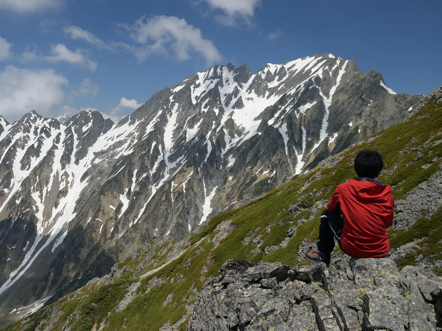
The Mount Hotaka Traverse is a 24.8 km, 2-day expert alpine loop in Japan’s Northern Alps, inside Chubu-Sangaku National Park on the Nagano/Gifu border. Starting and ending at Kamikochi, it crosses Mae-Hotakadake (3,090 m) and Oku-Hotakadake (3,190 m), Japan’s third-highest mountain. This is for experienced alpine hikers only: expect sustained exposure, ladders, chains, loose rock, scree and around 2,300 m of ascent. A helmet, stable weather and a head for heights are essential.
Route Overview
The classic clockwise loop starts at Kamikochi Bus Terminal / Kappa Bridge, follows the Azusa River, then climbs to Dakesawa Hut and the steep Juntaro Shindo trail. From Kimikodaira it reaches Mae-Hotakadake, crosses the exposed Tsurione ridge to Oku-Hotakadake, then descends past Hotakadake Sanso and the Zaitengrat ridge into Karasawa Cirque. The return follows the valley via Yokoo, Tokusawa and Myojin to Kamikochi. Kamikochi is reached by bus or taxi only; private cars are banned beyond Sawando/Hirayu. If you are comparing Northern Alps routes from the same gateway, see the Kamikochi to Mount Yari Trail and the Kurobe Gorge Trail.
Mountaineering history of Oku-Hotakadake
Oku-Hotakadake’s first recorded ascent was by Gunji Abe in 1906. Walter Weston, the English missionary often called the father of Japanese mountaineering, climbed widely in the range and summited Oku-Hotaka in 1912 after publishing Mountaineering and Exploration in the Japanese Alps in 1896. The route lies within Chubu-Sangaku National Park, designated in 1934, and Hotaka is included in Kyuya Fukada’s Nihon Hyakumeizan — the 100 Famous Japanese Mountains.
Notable highlights
- Oku-Hotakadake summit (3,190 m): The high point of the traverse and Japan’s third-highest mountain, marked by a small stone shrine. In clear weather it gives wide Northern Alps views, including Yari-ga-take’s spear-like summit.
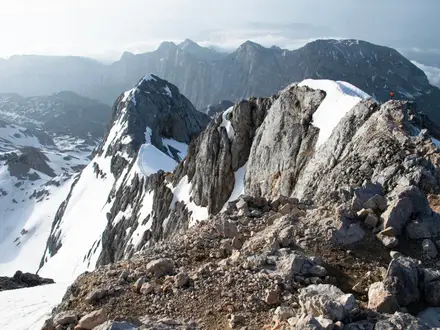
- Tsurione, the Hanging Ridge: The narrow rock ridge between Mae-Hotakadake and Oku-Hotakadake. It is the exposed crux of the route, with steep drops on both sides and no margin for careless footwork.
- Karasawa Cirque: A large U-shaped glacial bowl below the Hotaka peaks. It holds snow for much of the year and is especially known for autumn colour in early October.
- Juntaro Shindo trail: The steep ladder-and-chain climb above Dakesawa Hut. In places the rock feels close to vertical, so this section is physically and mentally demanding.
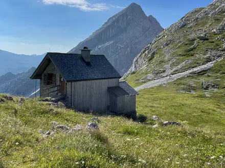
- Hotakadake Sanso hut: A large staffed mountain hut at about 2,996 m below Oku-Hotaka. It is the usual overnight base on the standard 2-day traverse.
- The Jandarme: A dramatic rock tower west of Oku-Hotaka. It is a famous landmark of the Hotaka range and an objective only for experienced alpine scramblers.
Challenges to expect
This is a genuinely technical hiking route, not a normal hut trek. The Juntaro Shindo climbs steep rock with ladders and chains; Tsurione is sustained exposed scrambling; and the Zaitengrat descent has chains, scree and loose rock. Snow can linger into June and on north-facing slopes such as Karasawa. Outside mid-July to mid-October, winter mountaineering skills and equipment are required.
HikeList Score
Mount Hotaka Traverse scored 67/100 on HikeList's trail-quality metrics.
See score breakdownHide breakdown
- Ideal length 63
- Balanced challenge 38
- Scenery & wildness 68
- Varied terrain 100
- Accommodation 58
- Food & support 72
- Path quality 98
- Season flexibility 76
Computed from length, challenge, scenery & wildness, terrain variety, accommodation, food & support, path quality and season flexibility.
 Japan
JapanShow more data Show less
- Mountainous
- Forested Valley
- Alpine Ridge
- Cirque
- Dirt
- Gravel
- Rocky
- Scree
- Boulders
- Ladders And Chains
- Huts
- Campsites
- None
- Restrooms
- Water Sources
- Campsites
- Shelters
Photos from hikers
Taken on the trail by people who've reviewed Mount Hotaka Traverse.
Start at Kamikochi Bus Terminal / Kappa Bridge and follow the Azusa River before climbing to Dakesawa Hut. Continue up the steep Juntaro Shindo trail to Kimikodaira, reach Mae-Hotakadake, then traverse the exposed Tsurione ridge to Oku-Hotakadake. Overnight at Hotakadake Sanso near the summit.
Descend from the Hotaka ridge via the chained Zaitengrat into Karasawa Cirque, passing Karasawa Hut / Hyutte. Continue down the valley through Yokoo, Tokusawa and Myojin, then return to Kamikochi Bus Terminal to complete the loop.
Reviews
How would you rate Mount Hotaka Traverse?
Tap a star to start your review — you could be the first.