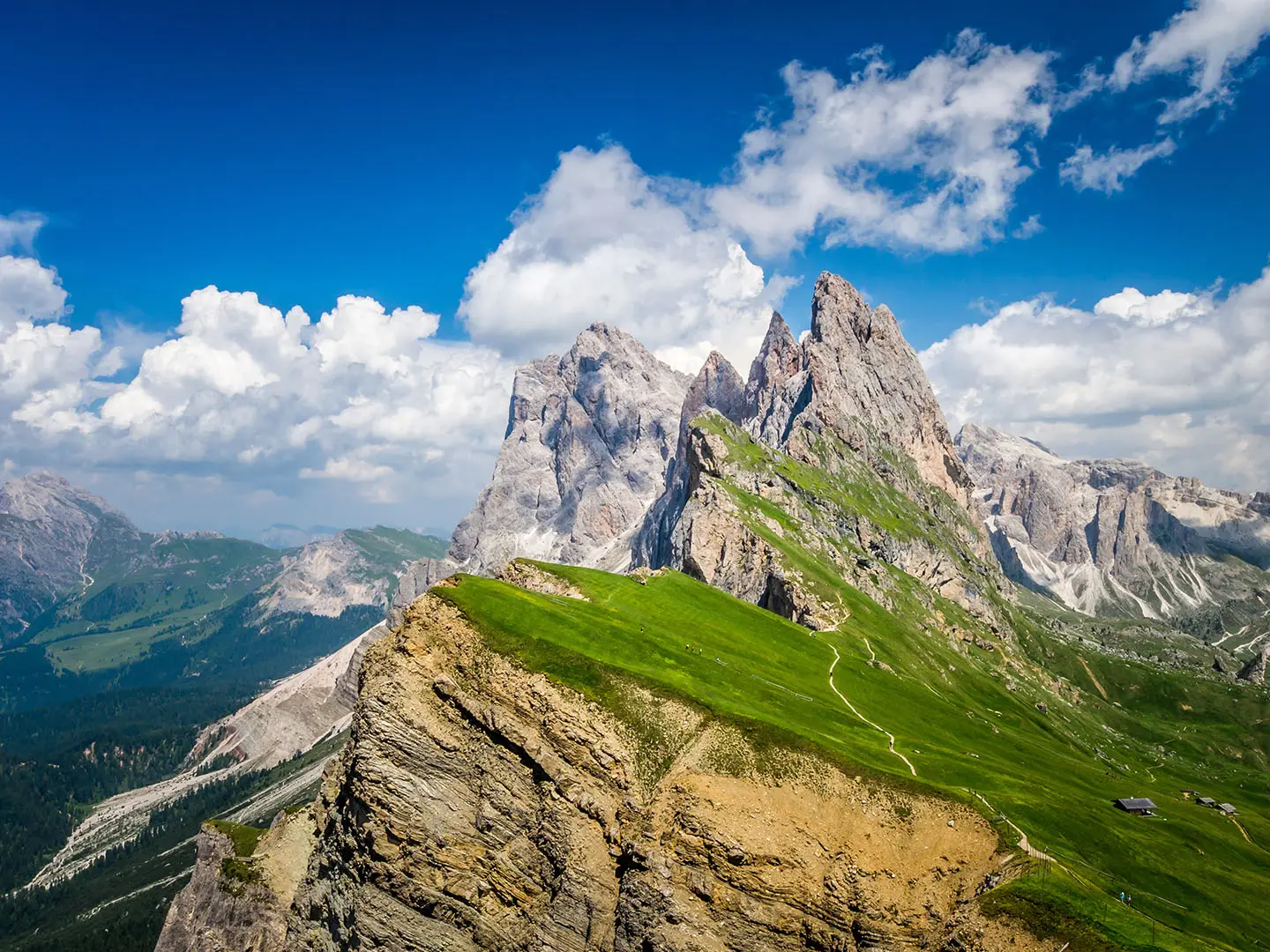
Seceda to Rifugio Firenze
How would you rate Seceda to Rifugio Firenze?
Tap a star to share your experience and help other hikers.
Seceda to Rifugio Firenze: Short Dolomites Day Hike
HikeList Score
Seceda to Rifugio Firenze scored 72/100 on HikeList's trail-quality metrics.
See score breakdownHide breakdown
- Ideal length 55
- Balanced challenge 100
- Scenery & wildness 78
- Varied terrain 71
- Accommodation 49
- Food & support 65
- Path quality 98
- Season flexibility 76
Computed from length, challenge, scenery & wildness, terrain variety, accommodation, food & support, path quality and season flexibility.
The Seceda to Rifugio Firenze hike is a 6 km high-alpine day walk in Val Gardena, South Tyrol, Italy. It descends from the Seceda mountain station to Rifugio Firenze / Regensburger Hütte beneath the Odle/Geisler peaks in the Puez-Odle Nature Park. Allow about 1.75–2 hours one way on the direct route. It suits hikers wanting big Dolomites views without a technical route, though the final rocky descent makes it easy to moderate rather than a simple stroll.
Route Overview
Start at the Seceda mountain station, reached by the Ortisei-Furnes-Seceda cableway from Ortisei in Val Gardena. From the Seceda ridge, the point-to-point route crosses open alpine meadows towards the Odle/Geisler skyline, following waymarked path no. 1, also signed 2 in places. It passes the Pieralongia rock spires and grazing pastures before dropping on rockier ground into the hollow holding Rifugio Firenze at about 2040 m. Many hikers turn this into a longer circuit back towards a lift station. For multi-day Dolomites planning, compare this short walk with Alta Via 1 or the tougher Alta Via 2.
Rifugio Firenze and the Regensburger Hütte
Rifugio Firenze is the Italian name for the Regensburger Hütte, built in 1888 by the Regensburg section of the German and Austrian Alpine Club. The hut is one of the early mountain huts in Val Gardena and still works as a practical refuge for walkers crossing the Puez-Odle Nature Park. Its position beneath Mount Stevia makes it the natural rest point or turnaround for this Seceda descent.
Notable highlights
- Seceda ridgeline panorama: The walk begins at one of the Dolomites’ most recognisable viewpoints, with the tilted Seceda ridge dropping away above Val Gardena.
- Odle / Geisler peaks: The route heads towards the sawtooth Odle/Geisler group, part of the Puez-Odle Nature Park and the UNESCO World Heritage Dolomites.
- Pieralongia rock spires: These isolated rock towers rise from the meadows beside the trail and make a clear landmark between Seceda and the hut.
- Rifugio Firenze / Regensburger Hütte: This 1888 mountain hut at about 2040 m serves meals and offers overnight beds in rooms and dormitories.
- Puez-Odle Nature Park meadows: The route crosses grazed high pastures framed by limestone peaks, with alpine flora in the summer season.
Challenges to expect
The route is non-technical, with no via ferrata sections, but it is still a mountain path. Expect boulder-studded pasture, stone-pitched or cement-block sections, and a short stretch that can feel semi-exposed. The final descent to Rifugio Firenze is rocky and uneven, so trekking poles are useful. Snow can linger outside the June to mid/late October season, and the Seceda cableway only runs in the summer/autumn season.
HikeList Score
Seceda to Rifugio Firenze scored 72/100 on HikeList's trail-quality metrics.
See score breakdownHide breakdown
- Ideal length 55
- Balanced challenge 100
- Scenery & wildness 78
- Varied terrain 71
- Accommodation 49
- Food & support 65
- Path quality 98
- Season flexibility 76
Computed from length, challenge, scenery & wildness, terrain variety, accommodation, food & support, path quality and season flexibility.
 Italy
ItalyShow more data Show less
- Mountainous
- Alpine Pasture
- Rocky
- Grass
- Stone Pitched
- Huts
- Family Friendly
- Pet Friendly
- Restrooms
- Water Sources
- Shelters
In these collections
Photos from hikers
Taken on the trail by people who've reviewed Seceda to Rifugio Firenze.
Reviews
How would you rate Seceda to Rifugio Firenze?
Tap a star to start your review — you could be the first.