Rhodope Mountains Trail
How would you rate Rhodope Mountains Trail?
Tap a star to share your experience and help other hikers.
Rhodope Mountains Trail: Western Rhodopes Walking Guide
HikeList Score
Rhodope Mountains Trail scored 90/100 on HikeList's trail-quality metrics.
See score breakdownHide breakdown
- Ideal length 100
- Balanced challenge 100
- Scenery & wildness 98
- Varied terrain 71
- Accommodation 74
- Food & support 81
- Path quality 98
- Season flexibility 89
Computed from length, challenge, scenery & wildness, terrain variety, accommodation, food & support, path quality and season flexibility.
The Rhodope Mountains Trail is best understood as a 7-day, moderate walking week in the Western Rhodopes of southern Bulgaria, not one official signed trail. The often-quoted 150 km should be treated as an approximate cumulative distance across day walks or inn-to-inn stages, not a measured point-to-point route. It suits hikers who want forested mountains, limestone gorges, caves and village guesthouses around Smolyan, Shiroka Laka, Devin and Trigrad, with route planning or a self-guided provider.
Route Overview
There is no fixed official trailhead or terminus. Most itineraries start from Smolyan or Shiroka Laka and make circuits or inn-to-inn links through the Western Rhodopes, typically taking in Trigrad Gorge, Devil’s Throat Cave, Yagodina Cave, Devin, the Smolyan Lakes and sometimes the Wonderful Bridges. The walking is on marked paths, dirt tracks and macadam roads, but signage is inconsistent away from popular routes. A whole-range traverse would run broadly from Yundola in the west to Mezek in the east, but that is a different, longer undertaking. For a shorter local walk, see the Eco Trail to Shiroka Laka.
Thracian Heritage and the Land of Orpheus
The Rhodopes are strongly associated with Thracian heritage and the myth of Orpheus, the legendary musician and poet of Greek myth; this is why walking holidays here are often branded as the “Land of Orpheus”. In the Eastern Rhodopes, ancient Thracian sites such as Perperikon point to the range’s long human history. The mountains later passed through Byzantine, Bulgarian medieval and Ottoman rule, shaping the area’s Bulgarian, Pomak and Turkish communities.
Notable highlights
- Trigrad Gorge: A dramatic karst canyon where the Trigradska/Chairska River cuts between steep limestone walls before disappearing underground. It is one of the key walking objectives in the Western Rhodopes.
- Devil’s Throat Cave (Dyavolsko Garlo): A cave at the end of Trigrad Gorge, linked in local legend with Orpheus descending to the underworld. Visits are usually as a paid show-cave tour.
- Yagodina Cave: A large three-level karst cave system near Yagodina village, known for stalactites, stalagmites and guided tourist sections.
- Wonderful Bridges (Chudnite Mostove): Natural marble rock arches in pine forest, carved by the Erkyupriya River. They make a memorable detour in the Western Rhodopes.
- Shiroka Laka: A protected architectural and folklore reserve village with white-stone-and-timber houses and a strong Rhodope gaida music tradition.
- Smolyan Lakes: A group of glacial-karst lakes above Smolyan, useful as an easier scenic walking objective near the regional hub.
Challenges to expect
Navigation is the main challenge. Only the busiest paths are reliably marked, and similar-looking forest ridges make it easy to drift off route; carry a map and GPS. Expect undulating dirt roads, rocky paths, gravel/macadam tracks, long forest sections and some steep gorge terrain. Summer afternoons can bring thunderstorms. This is less alpine than the Central Balkan Ridge Trail or Bezbog to Popovo Lake Trail, but it still needs careful planning.
HikeList Score
Rhodope Mountains Trail scored 90/100 on HikeList's trail-quality metrics.
See score breakdownHide breakdown
- Ideal length 100
- Balanced challenge 100
- Scenery & wildness 98
- Varied terrain 71
- Accommodation 74
- Food & support 81
- Path quality 98
- Season flexibility 89
Computed from length, challenge, scenery & wildness, terrain variety, accommodation, food & support, path quality and season flexibility.
 Bulgaria
Show more data Show less
- Mountainous
- Forest
- Dirt
- Rocky
- Gravel
- Guesthouses
- Hotels
- Family Friendly
- Pet Friendly
- Water Sources
- Campsites
- Shelters
Download Our Full Guide to Rhodope Mountains Trail FREE!
Get our comprehensive guide to this hike for free. Save it for later reading or print out at home.
In these collections
Photos from hikers
Taken on the trail by people who've reviewed Rhodope Mountains Trail.
Rhodope Mountains Trail: The Complete Guide
 i
Image by mitzo_bs
i
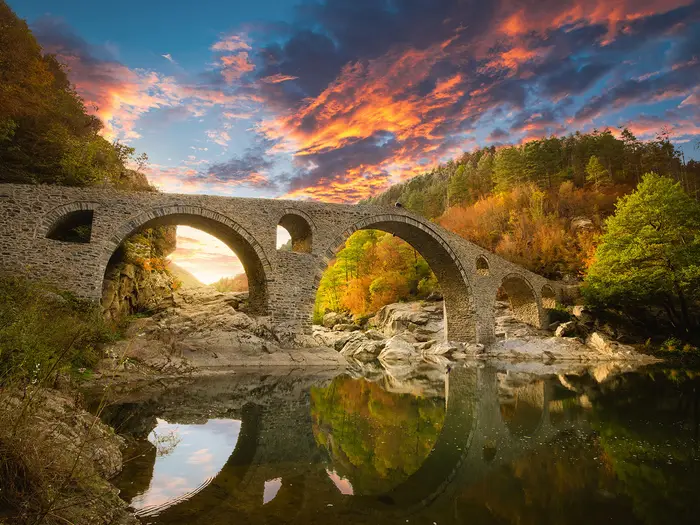
Image by mitzo_bs The Rhodope Mountains Trail is best understood as a Western Rhodopes walking week rather than a single signed trail: an inn-to-inn journey through southern Bulgaria’s forested limestone and marble mountains. It suits walkers who want gorge villages, caves, spa towns and high pastures more than exposed summits or technical terrain.
Most itineraries use Plovdiv as the gateway, then link places such as Devin, Yagodina, Trigrad, Shiroka Laka, Gela and Smolyan before returning north, often via Bachkovo Monastery. The strongest days are around Trigrad Gorge, Devil’s Throat Cave, Yagodina Cave, the Smolyan Lakes and the natural arches of Chudni Mostove.
This is moderate walking, but not a waymarked promenade. Expect forest paths, dirt and macadam tracks, steep gorge sections, long undulating days and occasional navigation gaps away from the best-known routes.
The headline distance is approximate because there is no official fixed line; many week-long versions include transfers and around 70–90 km of actual walking, while fuller circuits can add more. Book village accommodation ahead, carry reliable mapping or GPS, and plan transport carefully because public links between the smaller Rhodope villages are limited.
This guide covers stages, walking days, accommodation, food, transport, terrain and the common mistakes to avoid.
Stage-by-Stage Guide
This itinerary is best understood as a Western Rhodopes walking week, not a single fixed waymarked trail. Distances and overnight stops vary between operators and self-guided versions, so the stage notes below follow the common 7-day structure while flagging where transfers, optional cave visits and route variants affect the day.
Stage 1: Plovdiv to Devin
Approx. distance: 0 km walking in the standard itinerary; this is normally an arrival and transfer day.
This stage gets you from the gateway city into the Western Rhodopes. Plovdiv is the practical access point for the range, with onward travel by road because there is no railway into the Western Rhodopes.
Most itineraries use Devin as the first overnight base, putting you within reach of the gorge villages around Yagodina and Trigrad. Devin has small hotels and spa-style accommodation, so it is one of the easier places on the route to find beds and evening food, though booking ahead is still sensible in the walking season.
Public transport is limited once you leave the main Plovdiv–Smolyan axis. Direct buses between Plovdiv and Smolyan run roughly three times daily and take about three hours, but links onward to smaller villages are infrequent, so many walkers use an arranged transfer, taxi, hire car or self-guided package logistics. Current bus and transfer times should be checked before travelling.
There is no navigation challenge on this day unless an optional local walk is added. Use the evening to check GPS files, paper mapping and the next day’s route notes, because waymarking away from the best-known gorge paths can be inconsistent.
Stage 2: Devin / Yagodina to Trigrad
Approx. distance: 16 km.
This is usually the first proper walking day and introduces the limestone-and-marble gorge country that defines the western part of the week. The day is commonly arranged around Yagodina and the approaches to Trigrad, with forest paths, dirt tracks, sections of macadam road and steeper gorge terrain.
Yagodina Cave and the Eagle’s Eye viewpoint above the Buynovo and Trigrad gorges are the key possible highlights on or near this stage, depending on the exact variant used. Yagodina Cave is a guided show cave, so tour times and seasonal opening should be checked before travelling if it is part of the day’s plan.
The walking is moderate rather than technical, but the terrain can feel slow where paths climb out of the gorge or run through enclosed forest. Rocky sections and shaded paths can be slippery after rain, and summer thunderstorms are a genuine afternoon risk in the Rhodopes.
Food and water should be planned conservatively. Devin and Yagodina are the sensible places to arrange supplies or a packed lunch, but services between the villages should not be assumed. Carry enough water for the full stage, especially if visiting viewpoints or caves adds time.
Trigrad is a small gorge village with family-run guesthouses and pensions rather than large hotel capacity. Book ahead, particularly if walking independently, because beds in the gorge villages are limited.
Road access exists to Yagodina and Trigrad, which makes transfers possible if needed, but local bus links are sparse. Navigation needs attention: carry a GPS track and the Western Rhodopes map, and do not rely on continuous waymarking to link the villages cleanly.
Stage 3: Trigrad to Trigrad via the Zhrebevo circuit and Trigrad Gorge
Approx. distance: 18 km.
This is a circuit day from Trigrad, so it is logistically easier than the point-to-point stages: luggage can usually remain at the same accommodation. The walking explores the Trigrad Gorge area and the Zhrebevo circuit, combining gorge scenery with forested mountain paths and tracks.
Trigrad Gorge is the defining feature of the day. The Trigradska River cuts through a deep marble canyon, with sheer walls rising up to around 300–350 m, and Devil’s Throat Cave sits at the foot of the gorge.
Devil’s Throat Cave is a timed guided visit rather than a walk-through attraction. If the cave is part of the itinerary, allow for tour times, possible waiting time and seasonal restrictions; this should be checked before travelling.
Underfoot, expect a mix of footpaths, forestry tracks, macadam and steeper rocky sections around the gorge. The main gorge area is more obvious than some forest links, but waymarking can still be patchy once away from the popular visitor routes.
Trigrad is the main base for meals, water refills and the night’s accommodation. Carry lunch and enough water for the whole circuit, as there is no reliable sequence of services once the walk leaves the village.
Because the day returns to Trigrad, it is one of the easier stages to shorten if weather deteriorates. Thunderstorms are most likely later in the day in summer, so an early start is sensible if the route includes high viewpoints or exposed gorge-rim sections.
Stage 4: Trigrad to Shiroka Laka via Gela
Approx. distance: 17 km.
This stage moves from the gorge villages into the high pastoral and forested country around Gela before finishing in Shiroka Laka. It is one of the more satisfying inn-to-inn links of the week, with a clear change in character from enclosed gorge walking to broader mountain village landscapes.
The route uses a mixture of marked paths, dirt roads and forest tracks. Expect sustained undulation rather than technical climbing, with long wooded sections that can be disorientating if visibility is poor or markings are missed.
Gela is the key village en route, traditionally associated with Orpheus and known for its mountain setting. The route then continues towards Shiroka Laka, a protected architectural and folklore reserve with white-stone-and-timber Rhodope houses and a strong gaida music tradition.
Food and water planning is important on this stage. Trigrad is the safest place to leave with a full day’s food and water, and any village services en route should be treated as a bonus unless pre-arranged through accommodation or an operator.
Shiroka Laka has village guesthouses and small-scale accommodation, but capacity is limited compared with Devin, Smolyan or Pamporovo. Book before arrival rather than expecting to find a room on the day.
Road access at both Trigrad and Shiroka Laka makes transfers possible, but public transport between the smaller Rhodope villages is infrequent. Navigation is one of the main challenges of the day: use GPS alongside a paper map, and pay particular attention at forest-road junctions where several tracks may look equally well used.
Stage 5: Shiroka Laka to Smolyan Lakes
Approx. distance: 15 km.
This stage links the architectural villages west of Smolyan with the lake and resort area above the regional capital. The day typically crosses forest, meadow and track terrain, with the higher ground around the Smolyan Lakes and the nearby Pamporovo area giving a more open mountain feel than the gorge stages.
Smolyan Lakes are the main objective: a scattered group of glacial-karst lakes set in forest above Smolyan. Depending on the exact itinerary, the stage may also run through or near settlements such as Stoykite and the Pamporovo/Smolyan area.
The walking is moderate but can still be tiring because of repeated ascent and descent. Paths and forestry tracks may be indistinct in places, and long forest sections can make progress feel less obvious than the map suggests.
Shiroka Laka is the last reliable place to organise breakfast, water and a packed lunch before setting out. Do not count on regular food stops during the walk unless they are built into confirmed route notes.
Accommodation at the end is usually in or near Smolyan Lakes, Smolyan or Pamporovo. This part of the route has more hotel-style options than the gorge villages, including small hotels and 3–4 star spa/resort accommodation, but the exact overnight base affects the next day’s transfer or start point.
Smolyan has better road access than the smaller villages, and direct buses connect Smolyan with Plovdiv, though times should be checked before travelling. Navigation remains important around forest tracks and ski/resort infrastructure; do not assume every local path is part of the walking route.
Stage 6: Smolyan Lakes / Lyaskovo to Wonderful Bridges (Chudni Mostove)
Approx. distance: 17 km.
This stage heads towards one of the Western Rhodopes’ major natural landmarks: Chudni Mostove, the Wonderful Bridges. The route is commonly arranged from the Smolyan Lakes or Lyaskovo area towards the marble rock arches in pine forest on the Erkyupriya River.
The walking is mostly mountain-forest terrain, using paths, forestry roads and gravel or macadam tracks. It is not technical, but it can be a long and relatively remote-feeling day because settlements and services are sparse between the start and finish.
Chudni Mostove is the clear highlight, with natural marble arches rising to roughly 45 m in a forested setting. The feature is a popular visitor site, but that does not make the approach walk automatically easy to navigate.
Carry food and water for the full day. Services at the start and finish depend heavily on the exact itinerary, season and transport arrangements, so this should be checked before travelling.
Accommodation logistics at the end need particular care. Some versions overnight near Wonderful Bridges or Kosovo, while others use a transfer to a pre-booked guesthouse or hotel; do not leave this stage unplanned.
Road access makes vehicle support possible, but public transport is not something to rely on for flexible timing in this part of the range. The main warning is navigation: forest-road junctions, inconsistent waymarking and similar-looking tracks make a loaded GPS route highly advisable.
Stage 7: Wonderful Bridges / Kosovo to Bachkovo Monastery and Plovdiv
Approx. distance: 8 km walking, plus transfer back to Plovdiv.
The final day is normally shorter and combines a last walk from the Wonderful Bridges or Kosovo area with the road journey back towards Plovdiv. Many itineraries include Bachkovo Monastery on the return, rather than treating the whole day as a continuous walking stage.
The walking remains in wooded limestone-and-marble country, with tracks and paths rather than high-alpine terrain. After the longer middle stages, the main planning issue is not difficulty but coordinating the walk with transfers and onward travel.
Bachkovo Monastery, founded in 1083, is Bulgaria’s second-largest monastery and a frequent stop at the northern foot of the range on the way back to Plovdiv. Opening arrangements and any visit timing should be checked before travelling if it is a key part of the day.
Food and water needs are lighter than on the longer stages, but still carry enough for the walk itself. Do not rely on finding services exactly where the walking section ends unless transport and lunch stops have been arranged in advance.
Plovdiv has the widest choice of accommodation and onward transport at the end of the route. Walkers flying from Sofia or Plovdiv should leave enough margin for road transfers, as journey times from the Rhodope villages to airport departures can vary.
Navigation is usually less demanding than on the main mountain stages if the day is mostly transfer-based, but the walking section still needs a route note or GPS track. As throughout the Western Rhodopes, treat waymarks as helpful where present, not as a complete navigation system.
Recommended Itinerary
The Rhodope Mountains Trail is best planned as an inn-to-inn walking week rather than a single fixed waymarked line. The schedule below follows the standard Western Rhodopes pattern: start and finish logistics through Plovdiv, with walking concentrated around Devin, Yagodina, Trigrad, Shiroka Laka, Smolyan Lakes and Chudni Mostove.
The page headline distance of about 150 km should be treated as a broad cumulative figure for a fuller walking week with transfers and optional routes. A typical booked itinerary is more likely to involve around 70–90 km of actual walking, depending on route choices, cave visits, viewpoints and transfer use.
Standard 7-day itinerary
| Day | From | To | Approx. distance | Why this stage makes sense | Services/accommodation notes |
|---|---|---|---|---|---|
| 1 | Plovdiv | Devin | 0 km walking | Use the first day for the road journey into the Western Rhodopes. Devin is a practical first base for the gorge and cave section of the route. | Devin has hotels and spa accommodation. There is no railway into the Western Rhodopes, so arrive by bus, private transfer, hire car or package transfer. Plovdiv–Smolyan buses run roughly three times daily and take about 3 hours; onward village links are more limited and should be checked before travelling. |
| 2 | Devin / Yagodina | Trigrad | 16 km | This is the natural first walking day, linking the Yagodina area with Trigrad and placing the route in the main gorge country early in the week. It can be combined with Yagodinska Peshtera or the Eagle’s Eye viewpoint if timings and transfers allow. | Trigrad has village guesthouses, but beds are limited compared with Devin or Smolyan. Book ahead, especially in peak walking months. Guided tour times for Yagodina Cave should be checked before travelling. |
| 3 | Trigrad | Trigrad, via the Zhrebevo circuit and Trigrad Gorge | 18 km | A circular day avoids moving accommodation and gives time for Trigrad Gorge and Dyavolsko Garlo without forcing a rushed point-to-point stage. It also gives a useful buffer if cave tour times, weather or transport affect the previous day. | Stay a second night in Trigrad. Dyavolsko Garlo runs timed guided visits and opening arrangements can change seasonally; check before travelling. Carry navigation for the circuit, as waymarking away from the most popular gorge paths can be inconsistent. |
| 4 | Trigrad | Shiroka Laka, via Gela | 17 km | This stage moves from the gorge villages into the higher village-and-pasture landscapes around Gela and Shiroka Laka. It is one of the key cultural stages of the week, linking two of the best-known Rhodope villages. | Shiroka Laka has guesthouses and small hotels, but it is a protected architectural village with finite accommodation. Book ahead. Gela is a high village rather than a major service centre, so do not rely on extensive resupply en route. |
| 5 | Shiroka Laka | Smolyan Lakes | 15 km | The route shifts towards the Smolyan side of the range, using a moderate day that leaves time for the lake area above Smolyan. This is a sensible transition before the longer Chudni Mostove section. | Accommodation may be around Smolyan Lakes, Smolyan or nearby resort areas such as Pamporovo, depending on the version booked. Smolyan and Pamporovo offer more hotel choice than the smaller villages. |
| 6 | Smolyan Lakes / Lyaskovo | Wonderful Bridges / Chudni Mostove | 17 km | This is the main westward crossing towards one of the signature limestone-marble landmarks of the route. The stage works best with careful transfer planning, as the start and finish points are not linked by frequent public transport. | Overnight arrangements may be near Chudni Mostove or in Kosovo, depending on transfers and accommodation availability. Local bus options are limited; most walkers use a self-guided package, taxi, arranged transfer or hire car logistics for this part. |
| 7 | Wonderful Bridges / Kosovo | Bachkovo Monastery and Plovdiv | 8 km | A shorter final walking day allows time for Chudni Mostove, the descent/transfer towards Bachkovo Monastery and the return to Plovdiv. It is a practical ending because Plovdiv is the main onward transport hub. | Finish logistics normally involve a road transfer back to Plovdiv, often with a stop at Bachkovo Monastery. Confirm transfer times before booking onward travel from Plovdiv or Sofia Airport. |
Slower variant
A slower version suits walkers who want more time for cave visits, village stays and weather flexibility, or anyone relying partly on public transport rather than pre-arranged transfers.
The simplest way to slow the route is to add extra nights in the places where logistics or sightseeing can easily absorb time:
- Devin or Yagodina: useful before the first walking day if arriving late from Plovdiv or Sofia.
- Trigrad: allows separate time for Trigrad Gorge, Dyavolsko Garlo and the surrounding circuit walking.
- Shiroka Laka or Gela: good for reducing the pressure on the Trigrad–Shiroka Laka stage and spending more time in the village landscape.
- Smolyan / Smolyan Lakes: useful if adding the Canyon of the Waterfalls eco-trail or if weather affects the higher forest sections.
Do not assume that every small village has spare beds on arrival. In Trigrad, Yagodina, Gela, Shiroka Laka and around Chudni Mostove, accommodation should be booked before committing to the walking order.
Faster variant
A faster version suits fit walkers who are comfortable with long days, map-and-GPS navigation and pre-arranged transfers. It is usually done by reducing sightseeing time rather than by making the trail itself more direct.
The most realistic faster approach is to compress the programme into 5–6 walking days by:
- using an early transfer from Plovdiv and walking the Devin/Yagodina to Trigrad section the same day, if arrival times allow;
- shortening or omitting the Trigrad circular day;
- using transfers to position the start of the Smolyan Lakes / Lyaskovo to Chudni Mostove stage;
- keeping the final Chudni Mostove / Kosovo to Bachkovo and Plovdiv day short and transfer-supported.
This version leaves less margin for thunderstorms, cave tour timings and navigation errors. Distances and ascent vary by chosen tracks and transfers, so check mapping, accommodation positions and current transport before booking.
Planning the Route
Treat it as a walking week, not a single line on the map
The most important planning point is that the Rhodope Mountains Trail is a Western Rhodopes walking itinerary rather than one continuous, officially waymarked trail. In practice, you build a week from linked village-to-village walks, circular gorge routes, short road transfers and overnight stops in places such as Devin, Yagodina, Trigrad, Shiroka Laka, Gela, Smolyan and the Smolyan Lakes area.
The headline distance of around 150 km should be treated as a loose cumulative figure for a fuller Western Rhodopes circuit with optional additions. A typical inn-to-inn week is closer to around 70–90 km of actual walking, with the rest handled by transfers between trailheads, villages and Plovdiv.
How many days to allow
Most walkers should allow 7–8 calendar days. That normally gives 5–6 walking days, arrival and departure time via Plovdiv, and enough flexibility for cave visits, gorge viewpoints and weather delays.
Trying to compress the route into fewer days is rarely efficient unless transport is pre-arranged. The walking itself is moderate, but village transport is sparse, waymarking is inconsistent away from the best-known routes, and some highlights such as Devil’s Throat Cave and Yagodina Cave depend on timed guided tours. Cave opening hours and tour times should be checked before travelling.
A slower itinerary works well here. Extra time can be usefully spent around Trigrad and Yagodina, Shiroka Laka and Gela, or Smolyan and the Smolyan Lakes, rather than simply adding distance for its own sake.
Natural stage planning
Daily stages are shaped more by accommodation and road access than by a fixed long-distance trail structure. Small villages have limited beds, so the overnight plan should be set before committing to daily distances.
A practical week often follows this broad shape:
| Planning block | Practical role in the itinerary |
|---|---|
| Plovdiv to Devin / Yagodina / Smolyan | Gateway transfer into the Western Rhodopes; no walking required on the transfer day unless arrival is early |
| Devin, Yagodina and Trigrad | Gorge and cave walking, including the Trigrad and Yagodina areas |
| Trigrad to Shiroka Laka / Gela | Inn-to-inn mountain link through high villages and forested terrain |
| Shiroka Laka to Smolyan Lakes | Village-to-mountain walking with access towards the Smolyan area |
| Smolyan Lakes / Lyaskovo to Chudni Mostove | Longer transfer-linked or point-to-point day towards the Wonderful Bridges area |
| Chudni Mostove / Kosovo to Bachkovo and Plovdiv | Short final walking section and road return towards Plovdiv, often with Bachkovo Monastery included |
Do not assume each day starts directly from the previous night’s door. Many versions of the route use short transfers to reach the next trailhead or to avoid unhelpful road walking.
Shortening the route
The route is easy to shorten because it is a network itinerary. The simplest way is to base yourself in one area and walk selected day routes rather than attempting the whole week.
The most useful short-trip bases are Devin, Trigrad or Yagodina for the gorge-and-cave section; Shiroka Laka or Gela for high village walking; and Smolyan or the Smolyan Lakes area for forest, lakes and nearby eco-trails. This approach reduces the need for luggage transfers and makes poor-weather changes easier.
If time is limited, the Chudni Mostove and Bachkovo end of the itinerary can also be treated as a separate day or transfer-linked add-on from the main walking week. Exact local transport and taxi options should be checked before travelling.
Extending the route
The best extensions are local rather than linear. Around Yagodina and Trigrad, extra time can be used for Eagle’s Eye, Yagodina Cave, Devil’s Throat Cave and additional gorge-rim walking. Around Smolyan, the Smolyan Lakes and the Canyon of the Waterfalls are natural add-ons.
Golyam Perelik should not be treated as a normal summit objective for this itinerary. It is the 2,191 m high point of the Rhodope range, but standard walking weeks do not summit it, and the actual summit area is a restricted military zone.
For experienced long-distance walkers, the European E8 provides the only continuous long-distance line through the Rhodopes, running across Bulgaria from the Rila side via the Avramovo / Yundola area and on towards Mezek near Svilengrad. That is a different undertaking from the Western Rhodopes walking week: waymarking is only partial and inconsistent, and it should be planned as a serious independent traverse rather than an extension of a guesthouse itinerary.
Section hiking
Section hiking is practical, but it depends heavily on road logistics. There is no railway into the Western Rhodopes, and local buses between villages such as Devin, Trigrad, Yagodina, Shiroka Laka and Smolyan are infrequent.
Plovdiv is the most useful access hub, with direct buses to Smolyan taking about 3 hours and running roughly three times daily. For smaller villages and one-way day sections, arranged transfers, taxis, a hire car or a self-guided package with luggage transfer are usually more reliable than trying to improvise local buses each morning.
What to book first
Accommodation should be planned before the walking days are finalised. Beds are limited in the smaller gorge and architectural-reserve villages, especially places such as Trigrad, Yagodina, Shiroka Laka and Gela, so booking ahead matters more here than on a hut-to-hut route with a formal reservation system.
Transport is the second key booking. Decide early whether the trip will be self-drive, taxi-supported, fully self-guided with luggage transfer, or mostly public transport. The last option is possible for the main towns but much less convenient for linking smaller villages and trailheads.
Cave visits should also be built into the schedule rather than left as an afterthought. Devil’s Throat Cave and Yagodina Cave run guided show-cave visits, and opening arrangements can vary by season. This should be checked before travelling.
Navigation planning
Navigation deserves more attention than the route’s moderate grading might suggest. Popular local trails can be straightforward, but waymarking across the wider Western Rhodopes network is patchy, and long forest tracks can be disorientating.
Carry offline mapping and GPS tracks for each day rather than relying on signs alone. The Domino 1:100,000 Western Rhodopes map is a useful planning map, but it should be paired with more detailed digital navigation for day-to-day route finding.
Route notes from a self-guided operator can be valuable because the itinerary often combines footpaths, forestry roads, gravel tracks, macadam lanes and short transfers. Where a day includes a gorge route or viewpoint spur, check whether it is an out-and-back, circuit or transfer-linked finish before setting off.
Food, water and daily supplies
Plan each walking day as a full day between reliable services. Villages and guesthouses are part of the itinerary, but long forest and gorge sections should not be treated as service-rich walking.
Carry lunch, snacks and enough water from the start of the day unless the next reliable stop is certain. Guesthouses and small hotels are normally the practical anchors for breakfast and evening meals, but lunch arrangements should be made the evening before, especially when leaving smaller villages.
Weather and timing
Spring, summer and autumn are the normal walking seasons. Summer afternoons can bring thunderstorms, so start early on longer days, especially where the route climbs to open pasture, gorge rims or higher ground above Smolyan and Pamporovo.
The standard walking week reaches roughly 1,800–1,900 m rather than the 2,191 m range high point, but weather can still change quickly. A waterproof layer, warm layer and reliable navigation are worth carrying even on days that begin in settled village weather.
Permits and access
Permits are not usually the main planning issue for the standard Western Rhodopes walking week. The important exception is access around Golyam Perelik, where the summit area is restricted and should not be planned as part of a normal route.
For the main gorge, village and Smolyan-area walks, practical checks matter more: current access conditions, cave tour times, accommodation availability, local transport and any seasonal closures should all be checked before travelling.
Towns, Villages and Overnight Stops
Overnight planning in the Western Rhodopes is different from a fixed hut-to-hut trail. There is no single official line with a guaranteed chain of stops, so accommodation should be chosen around the version of the route being walked, any luggage transfers, and the availability of beds in small villages.
The most reliable bases are Devin, Trigrad, Shiroka Laka, Smolyan and, where an itinerary uses it, Pamporovo. Yagodina, Gela and Kosovo can work well on the right itinerary, but beds are more limited and should be booked ahead. For smaller intermediate villages, do not assume food, shops or transport will be available on arrival.
Plovdiv
Plovdiv is the practical gateway for most Western Rhodopes walking weeks rather than a walking stop. It is commonly used for the first night, airport arrival, bus connections, or arranged road transfers into the mountains.
There is no railway into the Western Rhodopes, so onward travel is by road. Direct buses from Plovdiv to Smolyan run roughly three times daily and take about three hours, but current timetables should be checked before travelling.
For independent walkers, Plovdiv is the best place to finalise provisions, cash, maps and transfers before entering the smaller gorge and mountain villages. It is also the usual return point after Bachkovo Monastery at the end of the week.
Devin
Devin is one of the main spa towns and access bases on the western side of the walking area. Many itineraries begin the first walking day around Devin, Yagodina or the Trigrad/Yagodina gorge area after a road transfer from Plovdiv.
Accommodation is more plentiful here than in the smaller villages, with small hotels and spa hotels available. It is a sensible overnight stop if the itinerary starts in the Devin area, or if a hiker wants a more serviced base before moving into the gorge villages.
Food and basic supplies are easier to organise in Devin than in the smaller settlements beyond it. Local bus links within the range are limited, so taxis, arranged transfers or a self-guided package are often the more practical way to connect Devin with Yagodina, Trigrad, Shiroka Laka or Smolyan.
Yagodina
Yagodina is a gorge village commonly used either as a start point for the first walking day or as an overnight stop before crossing towards Trigrad. It sits near Yagodinska Peshtera and below the high viewpoints above the Buynovo and Trigrad gorge country.
Accommodation is typically in village guesthouses rather than large hotels. Book ahead, especially if the route depends on staying here rather than transferring in from Devin or Trigrad.
Yagodina is useful for walkers visiting Yagodina Cave and, on suitable itineraries, Eagle’s Eye (Orlovo Oko). Show-cave opening hours and guided tour times should be checked before travelling, as relying on a late arrival can disrupt the walking day.
Public transport should not be treated as dependable for flexible day-to-day movement. If walking independently, pre-arrange any onward transfer or be prepared to walk the planned link with full navigation.
Trigrad
Trigrad is one of the key overnight bases of the route and is commonly used for two nights. It sits at the head of Trigrad Gorge, close to Devil’s Throat Cave (Dyavolsko Garlo), and works well for circuits around the gorge, Zhrebevo and nearby viewpoints.
Accommodation is mainly in family-run guesthouses and small pensions. Because Trigrad is a small gorge village with finite beds, booking ahead is strongly advised.
Food is generally organised through guesthouses or local village options rather than a wide choice of restaurants. Carry trail food for the next day before leaving larger settlements, as the walking between villages can be long and services sparse.
Trigrad is not a place to rely on frequent public transport. Most walkers reach or leave it by arranged transfer, taxi, self-guided package logistics, or on foot via Yagodina, Gela or Shiroka Laka depending on the itinerary.
Kesten
Kesten is a smaller settlement on some route variants between the Trigrad area and the Shiroka Laka/Gela side of the mountains. Treat it primarily as a waypoint unless accommodation has been specifically arranged.
Do not assume reliable shops, meals or onward transport here. If an itinerary passes through or near Kesten, carry food and water for the full day and check any planned transfer before travelling.
Gyovren
Gyovren is another small village used on some links through the Western Rhodopes. It may be useful as a navigation point or local transfer reference, but it is not one of the main serviced overnight bases for most walking weeks.
Accommodation, food and public transport options should be checked before relying on them. For most independent walkers, the practical overnight choices remain Trigrad, Yagodina, Shiroka Laka or Smolyan, depending on the day’s route.
Beden
Beden appears on some Western Rhodopes walking circuits as a village in the Devin–Shiroka Laka–Smolyan wider area. It is best treated as an intermediate settlement rather than a guaranteed stop.
Use Beden only as an overnight base if accommodation and evening food have been booked in advance. Public transport and village services should be checked before travelling.
Lyaskovo
Lyaskovo is relevant on itineraries linking the Smolyan Lakes area with the western part of the route or with longer transfers towards Chudni Mostove. It is not one of the main accommodation hubs.
Some route versions start a walking stage from Smolyan Lakes or Lyaskovo towards the Wonderful Bridges area. If Lyaskovo is used as a pick-up, drop-off or overnight point, confirm the exact logistics in advance, as local public transport between these villages is limited.
Shiroka Laka
Shiroka Laka is one of the best overnight stops on the route. It sits between the Trigrad/Gela side of the mountains and the Smolyan Lakes/Pamporovo area, making it a natural staging point on inn-to-inn itineraries.
Accommodation is usually in village guesthouses and small hotels. Beds can be limited during busy periods or local events, so advance booking is important.
Food is normally arranged through guesthouses or village mehana-style dining, but do not plan around late shopping opportunities unless checked. Shiroka Laka is also a useful place to pause because it is a protected architectural and folklore reserve, known for Rhodope houses and gaida music traditions.
Transport links are by road only. Local buses in this part of the range are infrequent, so many walkers use pre-booked transfers between Shiroka Laka, Trigrad, Smolyan or Plovdiv.
Stoykite
Stoykite is a smaller settlement near the Shiroka Laka–Pamporovo–Smolyan part of the walking area. It may appear on route variants or transfers rather than as a standard overnight base.
It can be useful as a road access point, but accommodation and food should not be assumed without a booking. Check any transfer or public transport plan before travelling.
Gela
Gela is a high mountain village between the Trigrad/Shiroka Laka side of the route and the upper Rhodope pastures. Some itineraries pass through or near it on the walking day from Trigrad to Shiroka Laka.
It can be an attractive overnight stop where an itinerary is deliberately paced to stay there, but capacity is limited compared with Devin, Smolyan or Pamporovo. Book beds and evening meals in advance.
Walkers stop here for its setting, its association with Orpheus traditions, nearby early-Christian basilica ruins, and its role in Rhodope bagpipe culture. From a logistics point of view, it is still a small mountain village: carry day food, keep navigation tight, and do not rely on turning up without arrangements.
Smolyan
Smolyan is the regional capital and one of the most useful service centres on the route. It sits below the Smolyan Lakes and the higher ground around Pamporovo, and is commonly used as a base or transfer point for walks in the eastern part of a Western Rhodopes week.
Accommodation is more varied here than in the smaller villages, including small hotels and spa-style options. It is a good place to restock, reorganise transport, or build in a more comfortable overnight stop after several village nights.
Smolyan has the strongest public transport relevance within the range: direct buses connect Plovdiv and Smolyan roughly three times daily in about three hours. For links onwards to Trigrad, Shiroka Laka, Devin, the Smolyan Lakes or Chudni Mostove, arranged transfers or taxis are often more practical than relying on local buses.
Smolyan is also a useful base for the Canyon of the Waterfalls eco-trail on the Elenska River and for walks to the Smolyan Lakes. If using it as a hub, check start-point transfers carefully, as some trailheads sit above or outside the town.
Smolyan Lakes (Smolyanski ezera)
The Smolyan Lakes are a scenic walking area above Smolyan rather than a town. They are commonly used as a walking objective or stage endpoint on itineraries linking Shiroka Laka with the Smolyan/Pamporovo side of the route.
Accommodation may be arranged nearby on some itineraries, but Smolyan itself is the safer service base if a hiker needs a wider choice of beds, food and transport. If staying near the lakes, confirm evening food and onward transfer arrangements before travelling.
This area is useful for walkers who want a shorter, less remote day among forest lakes before moving on towards higher pasture, Pamporovo or the Wonderful Bridges approach. Navigation should still be taken seriously, as forest tracks and paths can be confusing away from obvious waymarked sections.
Pamporovo
Pamporovo sits near the higher walking ground above Smolyan and is a more developed resort-style base than the villages. Some route versions pass near Pamporovo or use it for access to the Snezhanka/Mechi Chal area, where typical walking weeks reach some of their higher ground.
Accommodation is generally easier to find here than in the small gorge villages, with hotel-style options. It can be a practical overnight stop if an itinerary is built around the Smolyan–Pamporovo high ground, though it is not essential for every route version.
Food and road access are more straightforward than in remote villages, but onward walking routes still need careful navigation. Do not confuse Pamporovo’s resort infrastructure with a fully signed long-distance trail network.
Wonderful Bridges / Chudni Mostove
Chudni Mostove, the Wonderful Bridges, is a natural rock-arch area in pine forest on the Erkyupriya River. It is a major walking highlight and a common late-stage objective before the route turns back towards Kosovo, Bachkovo Monastery and Plovdiv.
It should be treated primarily as a walking objective and transfer point unless accommodation has been specifically booked nearby. Do not assume the same range of services available in Devin, Smolyan or Pamporovo.
The site is often reached by a walking stage from the Smolyan Lakes/Lyaskovo side or by a transfer-supported itinerary. Confirm pick-up times, food availability and onward transport in advance, especially if ending the day here.
Kosovo
Kosovo is a small village used on some final-stage itineraries between Chudni Mostove and Bachkovo Monastery/Plovdiv. It can provide a quieter village stop where the route is paced over an extra night, but it is not a major transport hub.
Accommodation and meals should be booked ahead. If Kosovo is used only as a walking or transfer waypoint, confirm the exact pick-up point and timing before setting out from Chudni Mostove.
Bachkovo Monastery
Bachkovo Monastery is a frequent final visit on the road transfer back towards Plovdiv rather than a standard hiking overnight. It sits at the northern foot of the Rhodopes and is often paired with the short final walking section from the Chudni Mostove/Kosovo side.
The monastery is important as a cultural stop, but most walkers continue to Plovdiv afterwards for accommodation, transport connections and onward departure. If planning to eat or spend time here, check current visitor arrangements and transfer timing before travelling.
Returning to Plovdiv
Most walking weeks finish by road back in Plovdiv, often after visiting Bachkovo Monastery. This makes Plovdiv the most practical final overnight if flying from Plovdiv, connecting to Sofia, or taking onward buses.
Allow enough time between the final walk, monastery visit, road transfer and any airport or long-distance connection. Mountain transfers can be straightforward when arranged in advance, but they should not be left to chance at the end of the route.
Getting to the Start
There is no single official trailhead for the Rhodope Mountains Trail as a Western Rhodopes walking week. Most itineraries use Plovdiv as the access hub, then transfer by road to the first walking base around Devin, Yagodina, Trigrad or Smolyan.
If treating the route as part of the much longer E8 traverse, the Rhodope crossing begins further west after Rila, around the Avramovo / Yundola pass. That is a different, more complex access plan and should be checked before travelling.
By train
There is no railway into the Western Rhodopes walking area. Devin, Yagodina, Trigrad, Shiroka Laka and Smolyan are all reached by road.
Plovdiv is the practical rail-and-road gateway for most walkers, but onward travel from there is by bus, taxi, hire car or arranged transfer. Current rail and onward bus timings should be checked before travelling, especially if arriving late in the day.
By bus
Plovdiv is the main bus hub for the standard walking week. Direct buses between Plovdiv and Smolyan run roughly three times daily and take about 3 hours, making Smolyan the most straightforward public-transport entry point into the range.
Reaching smaller start villages such as Devin, Yagodina or Trigrad is less simple. Local buses within the Western Rhodopes are infrequent, and links between Devin, Trigrad, Yagodina, Shiroka Laka and Smolyan may not line up conveniently with long-distance arrivals.
For an independent itinerary, plan the first transfer carefully rather than assuming a same-day connection will work. Bus times, stops and seasonal changes should be checked before travelling.
By car
A car is one of the simplest ways to start this route independently, because the walking week uses scattered villages and short transfers rather than one continuous waymarked line. Driving also makes it easier to reach Yagodina, Trigrad, Gela, Chudni Mostove and other smaller places where public transport is limited.
The main planning issue is what to do with the vehicle during an inn-to-inn itinerary. If walking from village to village, either arrange a return transfer back to the car, use a circular version of the route, or book accommodation/transfer logistics that solve this in advance.
Long-stay parking should be arranged directly with the first hotel or guesthouse. This should be checked before travelling, as parking arrangements in small villages can be informal and space may be limited.
From the nearest airport
Plovdiv Airport is the closest practical airport for the standard Western Rhodopes walking week, with Plovdiv also serving as the usual transfer hub. From Plovdiv, continue by bus to Smolyan or by arranged road transfer to Devin, Yagodina, Trigrad or your first accommodation.
Sofia Airport is the main international gateway for Bulgaria. Road transfers from Sofia Airport to the Rhodope villages typically take about 2.5–4 hours, depending on the exact destination and transfer plan.
Many walkers use a pre-booked transfer from Sofia or Plovdiv, particularly for starts in the smaller gorge villages. This is often more practical than trying to combine flights, intercity buses and local village transport on the same day.
Where to stay before starting
Plovdiv is the easiest place to stay before the walking week if arriving by public transport or flight. It gives the widest margin for delays and makes it easier to take a morning bus or booked transfer into the mountains.
For a faster start on the first walking day, stay in or near the first trail area instead: Devin, Yagodina, Trigrad or Smolyan are the most relevant bases, depending on the itinerary. Devin and Smolyan have a broader spread of hotels, while Yagodina and Trigrad are smaller gorge villages with more limited guesthouse capacity.
Book ahead in the smaller villages, especially in the main walking season and around local events. If using luggage transfer or a self-guided package, the first-night location and morning transfer should be fixed before arrival.
Getting Home from the Finish
For the standard Western Rhodopes walking week, the practical finish is Plovdiv, usually after the final short walk around Wonderful Bridges / Chudni Mostove, Kosovo and a visit or transfer via Bachkovo Monastery. Treat Bachkovo or Chudni Mostove as scenic end-points, not reliable onward-transport hubs: most walkers should have a transfer, taxi or pre-arranged lift back to Plovdiv.
If walking a much longer E8-style traverse, the far-eastern finish is Mezek near Svilengrad, by the Bulgarian–Turkish border. That is a different logistical proposition from the standard week and should be planned separately; onward transport from Mezek should be checked before travelling.
By train
There is no railway into the Western Rhodopes, so trains are not useful for leaving the mountain villages themselves. For the standard itinerary, the sensible rail point is Plovdiv, reached first by road transfer from the final walking area.
Onward rail options from Plovdiv are timetable-dependent and should be checked before travelling, especially if connecting with an evening flight or an international journey. Do not assume that a late finish at Bachkovo Monastery or Chudni Mostove will leave enough time for a same-day train connection unless the transfer and timetable have been fixed in advance.
By bus
Plovdiv is the main bus hub for this route. The most useful established connection in the region is the Plovdiv–Smolyan bus corridor, with direct buses running roughly three times daily and taking about 3 hours; current times should be checked before relying on them.
Local bus links between Rhodope villages such as Devin, Trigrad, Yagodina, Shiroka Laka and Smolyan are infrequent. They are not a dependable way to improvise a finish from Chudni Mostove, Kosovo or Bachkovo late in the day.
If finishing independently rather than on a self-guided package, plan the last road leg to Plovdiv before starting the hike. For many walkers, the practical answer is to book a transfer for the final afternoon and use Plovdiv for onward buses, trains, airport connections or an overnight stay.
By car/taxi
A car, taxi or arranged transfer is the simplest way to leave the finish area. This is particularly true if the last walking day ends around Wonderful Bridges / Chudni Mostove, Kosovo or Bachkovo Monastery, where public transport cannot be treated as frequent or flexible.
Self-guided operators commonly build short transfers into Rhodopes itineraries because the route is a network of village walks rather than a single linear trail. Independent walkers should arrange the final pickup in advance, including the exact meeting point and a fallback time if the walk or monastery visit runs late.
If using taxis locally, arrange them through accommodation, a local operator or the previous night’s guesthouse where possible. Do not leave this until the end of the final stage in small villages or at isolated scenic sites.
From the nearest airport
For most walkers, the airport choice is either Plovdiv Airport or Sofia Airport. Plovdiv is the closest practical city hub for the standard finish, while Sofia is the main international gateway.
Sofia Airport is about 2.5–4 hours by road or transfer from the Rhodope villages, depending on the exact start or finish point and road conditions. From a normal Plovdiv finish, allow generous connection time rather than booking a tight same-day flight after walking.
If the itinerary ends with an afternoon transfer via Bachkovo Monastery, an overnight in Plovdiv is usually the safer option before flying, particularly when using public transport onward. Airport transfer times, bus times and flight schedules should all be checked before travelling.
Where to stay at the finish
Plovdiv is the best place to stay after the standard route. It has the most practical onward transport choices and removes pressure from the final walking day, especially if the day includes Chudni Mostove, Kosovo or Bachkovo Monastery.
Staying in the mountains on the final night can work if the itinerary is built that way, but beds in small villages are limited and should be booked ahead. For independent walkers finishing away from Plovdiv, it is usually better to secure both accommodation and the next day’s transfer before setting out.
If finishing late, do not count on finding onward local transport from the smaller villages. Stay locally if accommodation has been arranged, or pre-book a road transfer back to Plovdiv.
Which Direction Should You Walk?
There is no official start-to-finish direction because the Rhodope Mountains Trail is a Western Rhodopes walking week rather than a single continuous waymarked trail. In practice, the most common flow is from Plovdiv into the Devin / Yagodina / Trigrad area, then onwards through Shiroka Laka, Smolyan Lakes and Chudni Mostove before returning to Plovdiv, often via Bachkovo Monastery.
That standard direction is the simplest choice for most independent walkers because it matches the usual accommodation and transfer pattern. It also gives a logical progression: gorge villages and show-caves first, the architectural villages of Shiroka Laka and Gela mid-route, then the Smolyan Lakes / Pamporovo side of the range, the marble arches of Chudni Mostove and a cultural finish at Bachkovo Monastery before returning to Plovdiv.
| Direction | Best for | Main drawbacks |
|---|---|---|
| Standard: Plovdiv → Devin/Yagodina/Trigrad → Shiroka Laka → Smolyan Lakes → Chudni Mostove → Bachkovo/Plovdiv | Easiest logistics, most natural accommodation flow, strongest finish back towards Plovdiv | Requires an initial road transfer into the mountains |
| Reverse: Plovdiv/Bachkovo side → Chudni Mostove → Smolyan/Shiroka Laka → Trigrad/Yagodina/Devin | Walkers with fixed accommodation or transport that works better this way | Less common, transfer planning is more awkward, and route notes/packages may not be set up for it |
Transport and accommodation
The standard direction works well because Plovdiv is the practical gateway, with road access into the Western Rhodopes and bus links towards Smolyan. Once in the range, local public transport between Devin, Trigrad, Yagodina, Shiroka Laka and Smolyan is infrequent, so the order of villages matters more than on a trail with regular trains or buses.
Reversing the route is perfectly possible with arranged transfers or a hire car, but it needs more deliberate planning. Do not assume that village-to-village buses will line up with walking stages; this should be checked before travelling.
Accommodation does not strongly favour one walking direction, but beds are limited in smaller villages such as Trigrad, Yagodina, Shiroka Laka and Gela. If using a self-guided operator, follow the direction their route notes and luggage transfers are built around unless there is a clear reason to change it.
Gradients and walking difficulty
Direction does not make a major difference to overall difficulty. The route uses undulating forest paths, dirt roads, macadam tracks and steep gorge sections rather than a single sustained pass crossing.
Some climbs and descents will feel sharper in the gorge areas whichever way they are walked. Because there is no fixed official line and total ascent varies by itinerary, choosing the standard direction should be based on logistics and flow rather than any promise of easier gradients.
Weather and navigation
There is no useful prevailing-wind advantage for this route. Weather planning is more about heat, forest shade and summer afternoon thunderstorms than walking eastbound or westbound.
Navigation is also direction-neutral. Waymarking can be patchy away from the popular routes, so carry a proper map and GPS whichever way the itinerary is walked.
Recommendation
For most walkers, the best direction is the standard Plovdiv → Devin/Yagodina/Trigrad → Shiroka Laka → Smolyan Lakes → Chudni Mostove → Bachkovo → Plovdiv flow. It fits the usual transfer pattern, gives the most coherent sequence of landscapes and villages, and ends neatly with Bachkovo Monastery and the return to Plovdiv.
Walk it in reverse only if accommodation availability, a booked package, private transport or fixed travel dates make that direction clearly easier.
Accommodation Along the Route
Accommodation on a Rhodope Mountains walking week is one of the route’s strengths, provided the itinerary is planned around the right overnight stops. This is not a hut-to-hut trail: most walkers use family-run village guesthouses, small hotels and, in the larger spa/resort towns, 3–4 star hotels.
The most practical bases are Devin, Yagodina, Trigrad, Shiroka Laka, Gela, Smolyan, the Smolyan Lakes/Pamporovo area, and the final northern-ridge area around Chudni Mostove / Kosovo before returning to Plovdiv. Smaller villages on linking stages may have few beds or may be better treated as lunch stops rather than reliable overnight bases.
| Place | Accommodation level | Best for | Notes |
|---|---|---|---|
| Plovdiv | Good | Gateway night before/after the walk | The practical transfer hub for the Western Rhodopes. Useful if arriving late, leaving early, or arranging a private transfer into Devin, Yagodina or Smolyan. |
| Devin | Good | First mountain base; spa-hotel start | One of the stronger accommodation choices on the route, with small hotels and spa-style hotels. Works well before walking towards Yagodina or Trigrad. |
| Yagodina | Limited | Gorge and cave access | A small gorge village, useful for Yagodinska Peshtera and the Buynovo/Yagodina area. Book ahead, especially if the itinerary requires a specific overnight here. |
| Trigrad | Limited to moderate | Trigrad Gorge, Devil’s Throat Cave, two-night walking base | A key overnight stop for many itineraries. Guesthouse-style accommodation is the normal pattern; availability is more limited than in Devin or Smolyan, so advance booking matters. |
| Kesten, Gyovren, Beden, Lyaskovo | Limited / not normally used as main bases | Linking villages on walking or transfer days | Treat these as small-route villages rather than dependable accommodation hubs. If planning an independent variant with an overnight in one of them, this should be checked before travelling. |
| Shiroka Laka | Limited to moderate | Architectural-reserve village overnight | One of the most attractive overnight stops, but bed numbers are not on the scale of a town. Reserve ahead rather than arriving without a booking. |
| Gela | Limited | High-village stay; walking between Trigrad/Shiroka Laka/Smolyan area | A small mountain village and a good atmospheric stop where included. Availability can be tight around local events and weekends; this should be checked before travelling. |
| Stoykite | Limited | Link between Shiroka Laka, Gela and the Smolyan/Pamporovo side | More useful as a route point or transfer location than as a default overnight base. Check current options before building a stage around it. |
| Smolyan | Good | Strong service base; flexible overnight | One of the easiest places to secure accommodation, with a better spread of hotels and services than the villages. A good fallback if smaller places are full. |
| Smolyan Lakes / Smolyanski ezera | Limited to moderate | Forest/lake walking base above Smolyan | Useful for itineraries staying near the lakes rather than in central Smolyan. Check exact location carefully, as accommodation choice and transfers affect the next day’s start. |
| Pamporovo area | Good | Hotel-based comfort; higher-ground walking | A resort-style option near the Smolyan Lakes and Snezhanka/Mechi Chal side of the route. More hotel capacity than the small villages. |
| Chudni Mostove / Wonderful Bridges | Limited | Natural-arch visit and final walking section | Accommodation is not as straightforward as in Devin, Smolyan or Plovdiv. Many itineraries solve this section with a transfer or an arranged overnight nearby. |
| Kosovo | Limited | Final village overnight before Bachkovo/Plovdiv | A possible overnight area on some versions of the route, but not a large accommodation centre. Book in advance and arrange onward transport. |
| Bachkovo Monastery / Bachkovo area | Limited | Visit on the return to Plovdiv | Often treated as a stop on the final transfer rather than a full walking-night base. If staying locally, current options should be checked before travelling. |
Booking ahead
Advance booking is strongly recommended for the small gorge and reserve villages, especially Trigrad, Yagodina, Shiroka Laka and Gela. These are the places where the route is most rewarding to stay, but they do not have the spare capacity of a larger resort town.
Smolyan, Devin, Pamporovo and Plovdiv offer the most flexibility. If an independent itinerary starts to look awkward, these larger bases can be used with taxi transfers to reach or leave trailheads.
Weekend and holiday demand can reduce availability in the more popular villages and spa/resort towns. Local festival periods in places such as Shiroka Laka and Gela can also affect beds; this should be checked before travelling.
Inn-to-inn practicality
The route works well as an inn-to-inn walking week, but only if accommodation and transfers are planned together. The Western Rhodopes are a network of village paths, forestry tracks and road-linked settlements rather than a single line of evenly spaced trail accommodation.
Self-guided operators commonly make this easier by booking guesthouses and hotels, moving luggage, and adding short transfers where the walking line does not naturally connect to a suitable overnight stop. Independent walkers can do the same with pre-booked taxis or private transfers, particularly around the Devin/Yagodina/Trigrad start, the Smolyan Lakes/Pamporovo section, and the Chudni Mostove/Kosovo finish.
Do not rely on finding a bed spontaneously in the smaller villages. Public transport between villages is infrequent, so a full accommodation plan should include how to reach the next trailhead if a night is spent off-route.
Camping and huts
This is not a classic Bulgarian mountain-hut route. There may be occasional shelters or campsites in the wider Western Rhodopes, but they should not be treated as a dependable chain for completing the walk.
For most hikers, the practical accommodation model is guesthouse-to-guesthouse, with hotels in Devin, Smolyan, Pamporovo and Plovdiv used for comfort, logistics and recovery nights.
Camping and Wild Camping
The Rhodope Mountains Trail is best planned as an inn-to-inn walking week, not as a camping trek. The normal route links villages such as Devin, Yagodina, Trigrad, Shiroka Laka, Gela and Smolyan, where family guesthouses and small hotels are the practical accommodation base.
There is no reliable chain of campsites, staffed mountain huts or formal trekking shelters along the standard Western Rhodopes itinerary. Occasional campsites or simple shelters may exist in the wider area, but they should not be treated as stage-to-stage infrastructure unless booked or checked locally in advance.
Campsites and organised camping
Do not assume that every overnight stop has a formal campsite. In the gorge villages and architectural-reserve villages, accommodation is much more likely to mean a guesthouse, pension or small hotel than a tent pitch.
If you want to camp, plan each night individually before travelling. Ask accommodation owners, local tourist offices or transfer operators whether there is a legal pitch, garden camping option or nearby campsite for the exact village or trailhead being used. This should be checked before travelling.
Camping may be more workable if you are travelling with a hire car or arranged transfers, because you can use accommodation bases and campsite options away from the walking line. It is less convenient for a pure point-to-point backpacking itinerary, especially where village-to-village public transport is sparse.
Wild camping
Wild-camping rules and local enforcement in the Western Rhodopes are not simple enough to rely on without local confirmation. Do not pitch in or around villages, monastery grounds, show-cave areas, gorge attractions, marked visitor sites, private meadows or forestry work areas unless permission has been given.
Much of the walking passes through forest, pasture, gorge country and small settlements where land ownership and local restrictions may not be obvious. The safest approach is to ask locally before pitching, especially around Trigrad Gorge, Yagodina, Smolyan Lakes, Chudni Mostove and Bachkovo Monastery.
If permission is granted, keep the camp discreet, late and low-impact: one night only, no fire, no noise, no litter, and leave before walkers, forestry vehicles or livestock activity begins. If permission cannot be obtained, use a guesthouse instead.
Where camping is most and least suitable
The route’s village pattern means camping is rarely necessary on the standard week. Devin, Trigrad, Shiroka Laka, Smolyan and the spa/resort areas around Smolyan Lakes and Pamporovo are better treated as accommodation bases rather than places to search for informal pitches.
The least suitable places to camp are the narrow gorge sections, show-cave access areas, popular viewpoints, monastery surroundings and any signed or managed visitor site. These places see visitor traffic, have safety constraints and may have local rules that are not obvious on arrival.
More remote forest and meadow sections may look tempting, but they still require caution: waymarking can be inconsistent, long forest tracks can be disorientating, and summer thunderstorms can arrive quickly. A legal and safe pitch should never depend on improvising at the end of a long day.
Water, fires and low-impact practice
Villages and rivers are frequent features of the Western Rhodopes landscape, but camping water should still be planned carefully. Carry enough for the evening and morning, and treat or filter natural water unless a safe drinking source is clearly identified locally.
Do not rely on gorge rivers as easy camping water sources. Access can be awkward, paths may be steep or rocky, and water levels can change after storms.
Open fires are a poor choice in the forested Rhodopes and should be avoided. Use a stove only where it is allowed and safe, keep it away from dry grass, leaf litter and pine needles, and follow any seasonal fire restrictions in force locally. This should be checked before travelling.
Use strict Leave No Trace practice: pack out all rubbish, bury toilet waste well away from water and paths where permitted, avoid washing directly in streams or lakes, and never damage trees or stone walls to make a pitch more comfortable.
Practical verdict
For most walkers, camping adds weight and uncertainty without solving a real logistics problem. The Western Rhodopes are better enjoyed with pre-booked village accommodation, route notes or GPS, and transfers where needed.
Camping only makes sense for hikers deliberately building a more independent or extended route through the range, and even then it needs local permission, flexible plans and a willingness to switch to guesthouses when a legal pitch is not available.
Food, Water and Resupply
General approach
This is easiest to manage as an inn-to-inn route: eat breakfast and dinner where you sleep, then carry lunch and snacks for the walking day. The dependable resupply points are the larger towns and resort areas — especially Plovdiv, Devin, Smolyan and Pamporovo — while the gorge and mountain villages should be treated as limited-service places.
Do not assume there will be a shop, café or open mehana in every village on the route. Trigrad, Yagodina, Shiroka Laka, Gela, Kosovo and the smaller settlements are useful overnight bases, but opening hours can be rural, seasonal and irregular, especially outside summer or on Sundays and public holidays. If a packed lunch is needed, arrange it with the guesthouse the night before.
Plovdiv is the best place to buy anything specialised before travelling into the mountains. Once in the Western Rhodopes, Devin and Smolyan are the most sensible places to restock properly; between them, carry enough food for a full day even when the map shows villages on the line.
Water
Refill from accommodation each morning and top up in towns, guesthouses, cafés or hotels where available. The route passes through a wet, forested karst landscape with rivers, gorges and lakes, but natural water should not be treated as automatically drinkable.
Use a filter, purifier or purification tablets for streams, springs and river water, particularly near villages, pasture, roads and popular cave or gorge sites. Karst terrain can move water quickly underground, so clear-looking water is not a guarantee of safety.
For most stages, start with enough water to walk several hours without a refill. In warm summer weather, 1.5–2 litres is a sensible minimum for many walkers, with more needed on hot days, long climbs, or if relying on an uncertain village stop. Thunderstorms are a summer issue, but they do not solve drinking-water logistics: refill before setting out, not after water has become urgent.
Section-by-section resupply notes
| Section | Food availability | Water availability | Notes |
|---|---|---|---|
| Plovdiv to Devin | Best pre-walk resupply in Plovdiv; Devin is a practical town base for meals and restocking. | Fill before leaving Plovdiv or on arrival in Devin. | This is normally a transfer day rather than a walking stage, so use it to buy trail snacks and any items not easily found in small villages. |
| Devin / Yagodina to Trigrad | Limited once away from the starting village; carry lunch and snacks. | Refill before setting out; natural water in the gorge landscape should be filtered or treated. | Do not rely on Yagodina or Trigrad having exactly what is needed at the time you pass through. Arrange food with accommodation where possible. |
| Trigrad circuit, Zhrebevo and Trigrad Gorge | Trigrad is the base, but carry food for the day’s circuit. | Start with full bottles from accommodation; treat natural water. | Cave and gorge areas can be busy in season, but show-cave facilities and opening times should not be relied on for walking-day food. This should be checked before travelling. |
| Trigrad to Shiroka Laka via Gela | Food is limited between overnight bases; carry a packed lunch. | Fill in Trigrad and again at accommodation in Shiroka Laka; any spring or stream water should be treated. | This is one of the stages where village names on the map should not be mistaken for guaranteed resupply. Gela is a small mountain village, not a supermarket stop. |
| Shiroka Laka to Smolyan Lakes | Shiroka Laka should be treated as the morning meal/packed-lunch point; Smolyan area gives better onward resupply. | Fill before leaving; refill at accommodation near Smolyan Lakes/Smolyan where available. | Smolyan is one of the better places on the route for proper shopping and meal options before the next stages. |
| Smolyan Lakes / Lyaskovo to Wonderful Bridges | Carry a full day’s food from Smolyan or your overnight base. | Start full; filter or treat natural water in forest and river areas. | Services are sparse once away from Smolyan. The Wonderful Bridges area is a natural landmark rather than a reliable resupply hub. |
| Wonderful Bridges / Kosovo to Bachkovo Monastery and Plovdiv | Carry snacks for the short final walk/transfer section; Plovdiv has full resupply and meal options at the end. | Fill before leaving the overnight base; refill after returning to settled areas. | If visiting Bachkovo Monastery on the way back, do not plan the day’s food around unconfirmed opening hours or stalls. This should be checked before travelling. |
Practical carrying strategy
For a standard walking week, carry one day of trail food at a time rather than loading up for the full route. A good daily pattern is breakfast at the guesthouse or hotel, packed lunch arranged the evening before, and dinner at the next accommodation or in the overnight village.
Keep an emergency snack reserve for missed meals, closed village shops or delayed transfers. This is especially useful on the Trigrad–Gela–Shiroka Laka and Smolyan–Wonderful Bridges parts of the route, where services are more scattered and navigation delays are realistic.
Vegetarian or dietary requirements should be arranged with accommodation in advance, particularly in smaller villages. In Devin, Smolyan, Pamporovo and Plovdiv there is more flexibility; in the gorge villages and architectural-reserve settlements, the safest approach is to book meals ahead and carry backup food.
Terrain, Conditions and Difficulty in Practice
The Rhodope Mountains Trail is moderate in a practical rather than technical sense. The walking is on a mix of forest paths, forestry dirt roads, gravel tracks, macadam/asphalt lanes and steeper rocky gorge paths, with no high-alpine scrambling on a standard Western Rhodopes week.
What makes it harder than the headline grade suggests is the combination of long, undulating days, repeated climbs and descents, and inconsistent waymarking away from the best-known sites. A typical walking week usually gives around 70–90 km of actual walking, although longer cumulative versions can be described as around 150 km when optional routes and fuller circuits are included.
Underfoot: forest, tracks, gorges and village links
Much of the route crosses forested karst country, with long sections through coniferous and beech woodland. These paths can be pleasant and sheltered, but they can also feel repetitive, especially where the waymarking is weak and junctions on forestry tracks are not obvious.
Expect a fair amount of dirt-road and track walking. This is normal for the Western Rhodopes, where village-to-village routes often use forestry access roads, gravel tracks and macadam lanes rather than narrow footpaths throughout.
The roughest walking is usually in and around the gorge sections, especially near Trigrad Gorge, Yagodina and the cave areas. Here the ground can be steeper, rockier and more confined, with short sharper climbs to gorge rims, viewpoints and village approaches.
| Terrain type | What it means in practice |
|---|---|
| Forest paths | Often shaded and non-technical, but junctions can be confusing and some sections feel samey. |
| Dirt and gravel forestry roads | Generally easy underfoot, though tiring over distance and less clearly waymarked than tourist paths. |
| Macadam/asphalt tracks | Found on some village links and access sections; not difficult, but harder on feet than soil paths. |
| Rocky gorge paths | The main places where footing matters; take care after rain and on steeper descents. |
| Meadow and pasture ridges | More open walking, usually straightforward, but navigation can still require attention. |
Climbs, descents and daily effort
The route is not a summit-bagging traverse, but it is rarely flat. Daily stages commonly sit around 9–21 km, with repeated height gain and loss between gorge villages, forest ridges and spa towns.
Individual walking days on operator-style itineraries can involve roughly 400–1,160 m of ascent, depending on the chosen variant. That spread matters: two routes with similar daily distance can feel very different if one includes a long climb out of a gorge or up to a ridge viewpoint.
The standard walking week does not summit Golyam Perelik, the 2,191 m high point of the Rhodope range, and the summit area is a restricted military zone. Most walkers top out nearer 1,800–1,900 m around high ground such as the Snezhanka/Mechi Chal area above Pamporovo and Smolyan, or at gorge-rim viewpoints around 1,450 m and above.
Exposure and technical difficulty
There is no technical mountaineering, glacier travel or sustained exposed ridge walking on the normal inn-to-inn version. The route is suitable for reasonably fit walkers who are comfortable on uneven mountain paths rather than for climbers or alpinists.
The gorges can still feel dramatic. Trigrad Gorge has very steep marble walls, and viewpoints such as Eagle’s Eye above Yagodina are airy, but these are scenic features rather than technical climbing objectives.
The main hazard is simple footing: loose stones, wet rock, steep path gradients and tired legs late in the day. Walking poles are useful on long descents and on slippery forest or gorge paths after rain.
Mud, water and weather effects
This is not primarily a boggy route, and there are no major river-ford logistics to plan around on the standard walking week. However, forest paths and dirt tracks can become muddy or greasy after rain, and rocky gorge paths can be slippery.
Summer afternoons can bring thunderstorms. This is important on open meadow ridges, high viewpoints and longer days where a late start leaves walkers exposed to deteriorating weather.
In wet conditions, the easier-looking track sections can become the most tiring parts of the day, especially where mud collects on forestry roads. Good grip matters more than heavy mountain boots; sturdy trail shoes or lightweight boots are usually more useful than stiff alpine footwear.
Navigation: the real difficulty
Navigation is one of the main reasons the route should not be underestimated. The Rhodopes are crossed by marked paths, local trails, forestry roads and the wider E8 line, but this is not one continuous, consistently waymarked official trail.
Away from the popular cave, gorge and eco-trail areas, markings can be patchy. Long woodland sections make it easy to miss a turning, and several tracks may look equally plausible at junctions.
A GPS track, offline mapping and a paper map are strongly recommended. The Domino 1:100,000 Western Rhodopes map is a useful planning map, but walkers should still carry route notes or digital navigation for the exact day route being followed.
Road walking and transfers
Some walking on hard surfaces is part of the experience, especially on macadam lanes, village access roads and short links between trailheads, guesthouses and sights. This is not a wilderness traverse where every kilometre is on footpath.
Many itineraries use short transfers to avoid dull or impractical road sections and to connect places such as Devin, Yagodina, Trigrad, Shiroka Laka, Smolyan, Chudni Mostove and Kosovo. If walking independently, check each day carefully rather than assuming there is a continuous signed footpath between overnight stops.
Livestock, fields, gates and access
Open pasture and meadow sections occur, especially around higher villages and ridges, but livestock fields, stiles and fenced access are not the defining difficulty of this route. The bigger access issue is choosing the correct track or path through a network of forest roads and village links.
Where routes pass through working rural areas, leave gates as found and avoid relying on fences or field boundaries as navigation features unless they are clearly marked on the day’s map or notes.
Seasonal conditions
Spring, summer and autumn are the normal walking seasons. Each changes the difficulty more through weather and underfoot conditions than through technical terrain.
Spring can mean wet paths, greener vegetation and slippery forest or gorge sections after rain. Summer gives the longest practical walking days, but heat and afternoon thunderstorms need to be built into start times and route choices.
Autumn is often well suited to forest walking, but shorter daylight makes navigation delays more consequential. Outside the normal walking season, conditions on higher ground and around caves or gorge attractions should be checked before travelling.
Weather and Best Time to Walk
The practical walking season for the Rhodope Mountains Trail is spring, summer and autumn. This is not a high-alpine trek, but the standard Western Rhodopes walking week still reaches forested and open ground around 1,800–1,900 m in places, with steep gorge paths, long woodland sections and exposed meadow ridges where weather can affect navigation and pace.
Best time to go
For most hikers, the best window is late spring to early autumn, when village guesthouses, small hotels, caves and local transfer services are more likely to fit a walking itinerary. The route is especially well suited to walkers who want green forest, gorge trails and village-to-village days rather than snow travel.
Summer is workable but needs an early-start approach. Afternoon thunderstorms are a known issue in the Western Rhodopes, so plan to be off open ridges, gorge rims and higher forest tracks before storms build. Carry waterproofs even if the day starts clear.
Autumn can be one of the most comfortable periods for walking, with cooler conditions on the longer forest and track sections. The trade-off is shorter daylight, so the 15–18 km days between Trigrad, Shiroka Laka, Smolyan Lakes and Chudni Mostove need realistic start times.
When to avoid
Winter is not the normal season for this itinerary. The standard walking weeks are designed for spring to autumn, and winter brings the complications of snow or ice on forest tracks, steep gorge paths and higher ground. Waymarking is already inconsistent in places; snow cover makes navigation harder and can hide minor paths and track junctions.
Winter can also affect logistics. Devil’s Throat Cave and Yagodina Cave operate as guided show caves, and tour times or access can change seasonally. This should be checked before travelling.
Weather hazards that matter on this route
- Thunderstorms: summer afternoons are the main concern, especially above Smolyan, Pamporovo, Gela and on gorge-rim viewpoints such as Eagle’s Eye.
- Wet rock and mud: rain makes the rocky gorge paths, wooden or metal eco-trail structures and steep woodland descents slower and more slippery.
- Fog and low cloud: long forest sections can feel samey and disorientating, particularly where waymarking is patchy. A map and GPS are important in poor visibility.
- Heat: the route is forested, but there are exposed pasture and track sections. Start early in hot spells and carry enough water between villages.
- Cold on higher ground: even outside winter, conditions can be noticeably cooler around the higher Smolyan Lakes, Pamporovo and Mechi Chal/Snezhanka areas than in Plovdiv or Devin.
Trail surfaces by season
In dry weather, most days are straightforward underfoot: forest paths, dirt roads, gravel and macadam tracks, with rockier sections in the gorges. After rain, expect slower progress on steep woodland paths and gorge trails, particularly where limestone or marble has been polished by foot traffic.
The long forested sections are the main navigation challenge rather than the technical terrain. In summer vegetation can obscure smaller path junctions; in autumn fallen leaves can do the same. Do not rely on waymarks alone.
Accommodation and booking season
Beds in the smaller gorge and reserve villages — including Trigrad, Yagodina, Shiroka Laka and Gela — are limited compared with Devin, Smolyan and Pamporovo. Book ahead during the walking season, especially if following a fixed inn-to-inn plan with luggage transfers.
Local festivals and holiday periods can tighten availability in villages such as Shiroka Laka and Gela. If the itinerary depends on staying in a specific village rather than using transfers, accommodation should be arranged before committing to dates.
Insects and ticks
The route crosses forest, pasture and meadow, so normal tick precautions are sensible in the warmer months: use repellent, avoid brushing through long grass where possible, and check skin and clothing at the end of the day. Insects are more likely to be a nuisance around meadows, livestock areas and damp woodland than on open tracks.
Safety Notes
The Rhodope Mountains Trail is not technically difficult, but it does require sensible mountain judgement. The main safety issues are navigation on a non-continuous route, summer thunderstorms, steep gorge paths, slippery limestone and marble, and the remoteness of some forest and pasture sections between villages.
Emergency help and communication
Dial 112 in Bulgaria for emergency services. Save it before travelling, and keep accommodation addresses, transfer contacts and the day’s finish point available offline.
Mobile coverage should not be relied on in deep gorges, dense forest or away from the larger settlements such as Devin, Shiroka Laka and Smolyan. Download offline maps and GPX tracks, carry a charged power bank, and make sure someone knows the day’s intended route and expected arrival time.
Navigation and route-finding
This is a walking network rather than one continuous, consistently waymarked trail. Waymarking can be patchy away from the popular gorge and cave routes, and long forest tracks can be disorientating when junctions look similar.
Carry a proper map, such as the Western Rhodopes 1:100,000 map, plus an offline GPS route. Do not depend only on paint marks or phone signal. If using an operator’s route notes, check the day’s directions before leaving the village, not once already in the forest.
The range high point, Golyam Perelik, is not part of the standard walking week, and the summit area is a restricted military zone. Do not treat it as an informal detour unless access and route legality have been checked before setting off.
Weather, heat and exposure
Summer afternoons can bring thunderstorms, especially on higher meadow ridges, gorge rims and open ground above Smolyan, Pamporovo or the Trigrad/Yagodina area. Start early on longer days, avoid exposed viewpoints if thunder is building, and leave metal-railed platforms, bridges and open ridges promptly in electrical weather.
Spring and autumn can be cool at height, even when villages are mild. A waterproof jacket, warm layer and hat are sensible on every walking day, particularly where the route reaches around 1,800–1,900 m on typical itineraries.
In summer, heat can build on macadam tracks, dirt roads and south-facing open sections. Carry more water than needed for a short village walk, refill only where water is known to be safe, and do not assume that every hamlet or roadside stop will have open services.
Gorges, caves and wet rock
Trigrad Gorge, Buynovo/Yagodina area, the Canyon of the Waterfalls and Chudni Mostove all involve steep-sided limestone or marble terrain. Paths, bridges, steps and rock can be slippery after rain or in shaded damp sections.
Stay on marked paths and fenced areas at gorge rims, cave entrances, waterfall trails and viewing platforms such as Eagle’s Eye. Do not shortcut around barriers or descend towards river channels for photographs.
Devil’s Throat Cave and Yagodina Cave operate as guided show-caves with timed access. Opening hours, tour times and seasonal restrictions should be checked before travelling, and cave visits should not be improvised outside official access.
Roads, tracks and village approaches
Some linking sections use dirt roads, gravel tracks and macadam lanes. On quiet mountain roads, walk facing traffic where there is no pavement, stay alert on bends, and use high-visibility clothing or a headtorch if arriving late.
Transfers and public transport between Devin, Trigrad, Yagodina, Shiroka Laka and Smolyan are limited. Missing a planned bus or transfer can leave a long road walk or an expensive taxi, so confirm timings before starting each day.
Livestock and rural land
Open pasture and meadow sections are part of the route’s character. Give livestock plenty of space, pass calmly, and leave gates as found. Avoid walking directly through herds where a wider line is available.
Dogs may be present around farms, villages and grazing areas. Do not run, shout or wave poles aggressively; slow down, keep together if in a group, and move steadily away from the animals’ territory.
Solo hiking
Solo walking is realistic for experienced hikers, but the combination of patchy waymarking, forest junctions and limited transport makes preparation more important than on a fully signed national trail. Carry offline navigation, spare battery capacity, enough food and water for delays, and a warm layer even on short stages.
Tell the guesthouse or transfer provider where you are heading, especially on days between Trigrad, Gela, Shiroka Laka, Smolyan Lakes and Chudni Mostove. If the weather deteriorates or navigation becomes uncertain, turning back to the last known village or track junction is safer than pressing on into forest without a clear line.
Daily safety checklist
Before leaving each morning, check:
- the day’s GPX route, map sheet and any route notes;
- the local weather forecast, especially thunderstorm risk;
- daylight available for the full stage plus delays;
- water and food for the whole route, not just the next village;
- cave, monastery or attraction opening times if they affect the schedule;
- bus, taxi or transfer arrangements for the finish;
- accommodation booking and arrival instructions in small villages;
- phone battery, power bank and offline emergency contacts.
Gear Recommendations
The Rhodope Mountains Trail is best packed as a flexible inn-to-inn walking week rather than a wilderness expedition. The main gear priorities are reliable navigation, footwear that copes with mixed surfaces, and protection from fast-changing mountain weather, especially summer thunderstorms.
Footwear
Choose lightweight hiking boots or robust trail shoes with good grip. The route mixes forest paths, dirt roads, gravel and macadam tracks with steeper, rockier gorge sections around places such as Trigrad, Yagodina and Smolyan.
Waterproof footwear is useful in spring, after rain and on damp forest tracks, but heavy high-mountain boots are not essential for most walkers. If using trail shoes, make sure they are stable enough for long descents, rough limestone paths and wet wooden or metal eco-trail structures.
Waterproofs and warm layers
Carry a proper waterproof jacket every day, even in summer. Afternoon thunderstorms are a known issue in the Western Rhodopes, and long forest sections can leave few quick escape options once weather builds.
A lightweight waterproof overtrouser is sensible for spring and autumn, or for anyone walking with fixed accommodation bookings where days cannot easily be moved. Add a warm mid-layer for higher ground around the Smolyan Lakes, Pamporovo and Mechi Chal area, where typical walking weeks can reach roughly 1,800–1,900 m even though they do not summit Golyam Perelik.
A hat and light gloves are worth carrying outside high summer. Conditions in shaded gorges and high villages can feel markedly cooler than in Plovdiv or the lower valleys.
Navigation
Navigation is one of the most important gear categories on this route. This is not a single continuous official waymarked trail, and waymarking away from popular paths can be inconsistent.
Carry offline GPS mapping on a phone or dedicated GPS device, plus a paper map as backup. The Domino 1:100,000 Western Rhodopes map is a relevant overview map for the area, but it should be paired with route notes, downloaded GPX tracks or detailed app mapping for day-to-day walking.
Do not rely on signposts alone in long forest sections, where tracks can feel repetitive and junctions may be unclear. A compass is a useful backup, and every walker should know how to locate their position without mobile signal.
Water and food carry
Carry enough water for the full walking day unless a definite refill point is planned. Villages and accommodation are the most reliable places to fill bottles; do not assume that every forest stream, gorge or picnic area provides safe drinking water.
For most days, a capacity of around 1.5–2 litres is a sensible starting point, with more in hot summer weather or on longer undulating stages. Exact needs depend on temperature, pace and whether transfers shorten the day.
Carry lunch and snacks from the previous overnight stop, especially before leaving smaller gorge or reserve villages such as Trigrad, Yagodina, Gela and Shiroka Laka. Services can be limited outside Devin, Smolyan and the larger resort areas, and opening hours should not be relied on without checking locally.
Trekking poles
Trekking poles are useful rather than essential. They help on steep gorge approaches, long forest descents, gravel tracks and muddy sections after rain.
They are particularly worthwhile for walkers carrying a full pack or anyone with knee issues. Fast hikers using a small daypack may prefer to carry lightweight folding poles for the rougher sections only.
Power and electronics
Carry a power bank if navigating by phone. GPS use, photos and poor signal in forested valleys can drain a battery quickly, and missing a turn on this route can mean a long correction on forestry tracks.
Download maps, GPX files, accommodation details and transfer contacts before leaving Plovdiv or the larger towns. A waterproof phone pouch or dry bag is sensible in thunderstorms.
A small headtorch is recommended, even for inn-to-inn walkers. It is useful for early starts, delayed finishes, dark village lanes and emergencies on forest tracks.
Sun and insect protection
Pack sun cream, sunglasses and a brimmed cap for open pasture, meadow ridges and exposed viewpoints such as Eagle’s Eye above Yagodina. Forest cover is common, but the route is not continuously shaded.
Insect repellent is worth carrying in warmer months, especially around woodland, meadows and lake areas such as the Smolyan Lakes. Lightweight long sleeves also help with both sun and insects.
Inn-to-inn hikers
Most walkers should aim for a comfortable daypack of roughly 20–30 litres, assuming luggage transfer or short transfers are arranged. Daily essentials should still include waterproofs, warm layer, water, lunch, navigation, power bank, first-aid basics and a headtorch.
Do not send all spare clothing in the main luggage. A dry layer, insulation and rain protection need to stay with you, as transfers and accommodation are not useful if weather changes mid-stage.
A small packable towel and indoor footwear can be useful in family-run guesthouses and pensions, but avoid overpacking. The route is moderate, and unnecessary weight makes the longer 15–18 km days more tiring.
Campers
Camping is not the normal style for this Western Rhodopes walking week. Accommodation is usually in guesthouses, small hotels and spa hotels, and there is no continuous chain of staffed mountain huts comparable with Bulgaria’s higher ranges.
Anyone planning to camp should carry a full independent shelter, sleeping system and cooking setup, and should plan legal or accepted overnight stops in advance. Campsites and shelters should be treated as occasional rather than dependable stage infrastructure. This should be checked before travelling.
A camper’s pack will make the steep gorge paths and long undulating forest tracks noticeably harder. Strong footwear, poles, extra food capacity and reliable offline navigation become more important with the additional weight.
Fast and section hikers
Fast hikers can travel light, but should not strip out navigation or weather gear. The route’s main risk is not technical terrain; it is losing time through missed turns, thunderstorms or sparse village transport.
For single-day sections, carry a compact waterproof, warm layer, 1.5–2 litres of water, food for the whole day, offline maps, power bank and headtorch. Public transport between Devin, Trigrad, Yagodina, Shiroka Laka and Smolyan can be infrequent, so a pre-arranged pickup or taxi plan is part of the day’s safety system.
Trail-running shoes are suitable only for walkers comfortable on rocky gorge paths, gravel roads and wet forest surfaces. After heavy rain, a more protective hiking shoe is the safer choice.
Budget and Costs
Budgeting for the Rhodope Mountains Trail is less straightforward than for a single official long-distance path, because this is normally planned as a Western Rhodopes walking week with a mix of village nights, road transfers, optional cave visits and occasional spa-hotel stays. Costs should be planned in euros (€). Older Bulgarian prices may still be quoted in lev in some places, but current bookings should be checked in euros before paying.
Main cost drivers
The largest variable is how much logistics you outsource. Independent walkers can keep costs down by booking guesthouses directly and using buses where they work, but the weak point is transport between Devin, Trigrad, Yagodina, Shiroka Laka, Smolyan and the Wonderful Bridges area, where local buses are infrequent and taxis or arranged transfers may be needed.
Self-guided packages cost more upfront but usually solve the hard parts: accommodation sequencing, luggage transfer, route notes, GPX files and the awkward road transfers between walking stages. For this route, that can be worth more than on a continuously waymarked trail, because waymarking is patchy and the walking week is built from linked day walks rather than one official line.
Typical budget styles
| Style | Best suited to | Cost profile | Practical notes |
|---|---|---|---|
| Budget independent | Walkers happy to plan every transfer and stay in simple guesthouses | Lowest accommodation cost, but taxis can quickly raise the total | Works best if using Plovdiv–Smolyan buses where practical and keeping the itinerary flexible around transport. Book small-village beds ahead. |
| Mid-range independent | Most capable hikers wanting comfort without a full package | Moderate overall cost, with a mix of guesthouses, small hotels and paid transfers | Usually the most realistic independent approach. Allow for several pre-arranged taxis or guesthouse transfers, especially around Trigrad, Yagodina, Shiroka Laka and Chudni Mostove. |
| Self-guided package | Walkers who want route notes, luggage transfer and fixed accommodation | Higher upfront cost, fewer logistical surprises | Well suited to the Rhodopes because there is no single official trail, no hut chain and limited local public transport between villages. Confirm exactly which transfers, meals, luggage moves and cave visits are included. |
| Comfortable / guided | Walkers prioritising ease, spa hotels, guiding or private transport | Highest cost | Expect the budget to be driven by private transfers, higher-grade hotels in places such as Devin, Smolyan or Pamporovo, and guide services. |
Accommodation costs
Accommodation ranges from family-run village guesthouses and mehana-style pensions to small hotels and 3–4 star spa hotels in larger resort or thermal towns such as Devin, Smolyan and Pamporovo. The cheapest nights are usually in village guesthouses; the most expensive are spa-hotel nights and packaged itineraries using higher-comfort hotels.
Beds are limited in smaller places such as Trigrad, Yagodina, Gela, Shiroka Laka and Kosovo, so price is not the only issue: availability can dictate the itinerary. Book ahead rather than arriving late and expecting a choice of rooms.
Check whether breakfast and dinner are included. In village accommodation, half-board can be more practical than trying to find a separate evening meal after a long walking day.
Food and drink
Food costs are generally easiest to control by staying in guesthouses that provide breakfast and dinner, then carrying a simple packed lunch or buying supplies where shops are available. Do not assume every small village has reliable late-opening food shops.
Plovdiv, Smolyan, Devin and Pamporovo offer the broadest choice of restaurants and supplies. In gorge and reserve villages, eating is more dependent on the guesthouse, a local mehana or pre-arranged meals.
Transport costs
There is no railway into the Western Rhodopes, so transport budgeting should focus on road travel. Plovdiv is the practical gateway, with direct buses to Smolyan taking about 3 hours and running roughly three times daily. Sofia Airport is often used for international arrivals, but onward road transfer to the Rhodope villages is longer and can add significantly to the budget.
Within the range, public transport is the weak link. Local buses between Devin, Trigrad, Yagodina, Shiroka Laka, Smolyan and nearby walking points are infrequent, so many walkers need taxis, guesthouse transfers, a hire car, or a self-guided operator’s transfer package.
For an independent trip, ask each accommodation in advance whether it can arrange the next transfer and what the current fare is. Taxi and transfer prices should be confirmed before booking, especially for remote points such as Chudni Mostove / Wonderful Bridges or trailheads away from the main road.
Luggage transfer and packages
Luggage transfer is highly relevant on this route. Because the itinerary is a network of linked walks and transfers rather than a single continuous waymarked path, luggage movement is usually easiest through a self-guided operator or locally arranged transfers between guesthouses.
When comparing package prices, check the detail rather than just the headline cost. Important inclusions are:
- airport or Plovdiv transfers;
- daily or occasional luggage transfer;
- route notes and GPX files;
- accommodation grade;
- breakfasts and dinners;
- transfers to and from walk starts;
- support if weather, waymarking or transport plans change.
Show-cave visits, monastery stops and local attraction transfers may or may not be included. Devil’s Throat Cave and Yagodina Cave run timed guided tours, so current opening times, tour times and entry arrangements should be checked before travelling.
Camping and low-cost alternatives
This is not a classic hut-to-hut or campsite-to-campsite route. Occasional campsites or shelters may exist in the wider area, but there is no dependable chain of staffed mountain huts comparable with Bulgaria’s higher ranges.
For most walkers, guesthouses are the realistic low-cost accommodation model. Anyone planning to camp should check legal access, site availability, water, food supply and transport links before committing to that plan. This should be checked before travelling.
Practical budgeting advice
Build a budget around 7–8 calendar days, even though typical operator versions include around 70–90 km of actual walking rather than walking every kilometre between Plovdiv and the Rhodope villages. Transfers are part of the normal cost of this route, not an optional luxury.
The best way to avoid budget surprises is to price the trip in this order:
- nights in Plovdiv, Devin, Trigrad / Yagodina, Shiroka Laka, Smolyan / Smolyan Lakes and the final transfer area;
- arrival and departure transport via Plovdiv or Sofia;
- local taxis or arranged transfers between villages and trailheads;
- meals not included with accommodation;
- cave visits, monastery stops and local sightseeing;
- luggage transfer, if not included in a package.
For independent walkers, the cheapest itinerary on paper can become expensive if several private transfers are needed at short notice. For this route, a slightly higher accommodation or package cost may be better value if it removes difficult transport gaps and includes reliable luggage movement.
Luggage Transfer, Guided Tours and Support Services
The Rhodope Mountains Trail is best treated as a supported walking week rather than a classic waymarked long-distance trail with a fixed baggage network. There is no single official route operator or standard trail-wide luggage-transfer service; support is normally arranged through a walking-holiday company, guesthouse contacts or local taxi transfers between the villages.
This matters more here than on many European inn-to-inn routes. Public transport between Devin, Trigrad, Yagodina, Shiroka Laka, Smolyan and the smaller mountain villages is limited, waymarking is inconsistent away from the popular gorge and eco-trail sections, and some days involve short road transfers as well as walking.
Self-guided packages
Companies such as The Natural Adventure, World Walks and InnWalking offer self-guided walking holidays in the Western Rhodopes. These are usually the simplest option for independent walkers who want to walk without carrying full luggage but do not want a guide with them each day.
A typical self-guided package may include:
- pre-booked guesthouses and small hotels;
- luggage transfer between overnight stops;
- route notes, maps or GPS material;
- airport or city transfers, often using Plovdiv as the practical gateway;
- local transfers where the day’s walk does not start or finish directly at the accommodation.
Exact inclusions vary by company and departure, so check what is covered before booking. In particular, clarify whether transfers to Devin, Yagodina, Trigrad, Shiroka Laka, Smolyan Lakes, Chudni Mostove and the return to Plovdiv are included, or charged separately.
Self-guided support is especially useful on this route because the “trail” is a network of linked walks rather than one continuous, consistently marked line. Good route notes and a pre-arranged driver remove much of the uncertainty around village-to-village logistics.
Guided tours
Guided options are available through operators such as Walks Worldwide, which runs guided walking in the Rhodope Mountains. A guided trip suits walkers who prefer not to manage Bulgarian-language transport, cave visiting logistics, accommodation bookings or navigation through forest tracks and patchily marked paths.
A guide is also useful if the itinerary includes interpretive stops such as Trigrad Gorge, Devil’s Throat Cave, Yagodina Cave, Shiroka Laka, Gela, Smolyan Lakes, Chudni Mostove and Bachkovo Monastery. Cave visits run as timed guided tours and opening arrangements can change, so current times should be checked before travelling.
Guided groups are less necessary for experienced hikers who are comfortable using GPS, paper mapping and pre-arranged taxis. However, the route is not a good place to rely on waymarks alone, especially in long forest sections.
Luggage transfer
Do not assume there is a dedicated luggage-transfer courier operating across the Western Rhodopes in the way found on some major European trails. On this route, bag movement is normally bundled into a self-guided package or handled by accommodation owners and local drivers.
If arranging the hike independently, contact each guesthouse or hotel well ahead and ask whether they can organise luggage movement to the next overnight stop. This is most important for the smaller villages and gorge bases, where accommodation capacity is limited and transport choices are fewer.
For an independent itinerary, confirm these points in advance:
- the exact pick-up and drop-off accommodation names;
- whether luggage can be left before check-in;
- the latest time bags must be ready each morning;
- whether payment is per bag, per transfer or by private taxi journey;
- what happens if weather, injury or navigation delays change the day’s plan.
Prices are not standardised and should be checked when booking. Keep luggage compact: small guesthouses and taxis are not set up for oversized expedition loads.
Taxi and private transfers
Private transfers are a normal part of Rhodope walking logistics. They are commonly used from Plovdiv to the first walking base, between villages where buses are infrequent, and back to Plovdiv at the end of the week, often via Bachkovo Monastery.
Sofia Airport is also a possible international gateway, but road transfers into the Rhodope villages are longer than from Plovdiv. If using Sofia, arrange onward transport before arrival rather than assuming a same-day public-transport connection will fit the walking schedule.
For village transfers, book through the accommodation or walking-holiday operator where possible. Local drivers are more likely to know the smaller roads to Trigrad, Yagodina, Gela, Smolyan Lakes, Chudni Mostove and Kosovo than a city-based taxi company.
When support is unnecessary
Strong, self-sufficient hikers can arrange the route independently with booked accommodation, a GPS track, the Western Rhodopes map and occasional taxis. This works best for walkers who are happy to carry their own kit and adapt the itinerary around local transport.
Support becomes much more valuable if walking point-to-point with only a daypack, travelling in a group, arriving outside the main season, or trying to link the gorge villages, Shiroka Laka, Smolyan and Chudni Mostove in a fixed week. Book transfers, beds and any package arrangements well ahead, particularly in the smaller villages.
Shorter Hikes and Best Sections
Because the Rhodope Mountains Trail is a network-style walking week rather than a single official through-trail, it is easy to shorten. The most practical approach is to pick one of the established village-to-village stages and arrange road transfers at either end, rather than trying to improvise around the sparse local buses.
Distances below use the standard stage distances from the walking-week route. Exact mileage can change with the chosen trailhead, cave visits, viewpoints and accommodation location.
| Best for | Section | Approx. distance | Why choose it | Transport notes |
|---|---|---|---|---|
| Best day walk | Trigrad circuit via Zhrebevo and Trigrad Gorge | 18 km | A strong single-day taste of the Western Rhodopes: gorge scenery, steep-sided marble landscapes and a return to the same village, so no baggage move is needed. | Base in Trigrad. Local buses are infrequent; arrange a taxi or transfer from Devin, Smolyan or as part of a Plovdiv-based trip. |
| Best gorge-and-cave day | Yagodina / Devin area to Trigrad | 16 km | Links the Yagodina and Trigrad gorge area, with access to Yagodinska Peshtera, Eagle’s Eye and Devil’s Throat Cave depending on the exact variant and timings. | Needs careful logistics because it is not a loop. Cave tour times and seasonal opening should be checked before travelling. |
| Best weekend section | Yagodina / Devin area to Trigrad, then Trigrad circuit | About 34 km over 2 walking days | The highest-value short break: one linear gorge stage plus a full Trigrad-based circuit, with no need to move accommodation on the second day. | Spend two nights in or near Trigrad. Book beds ahead and arrange transfers in and out; public transport between the gorge villages is limited. |
| Best 3–5 day section | Yagodina / Trigrad to Shiroka Laka and Smolyan Lakes | About 48 km over 3 walking days, or about 66 km with the Trigrad circuit added | This is the most complete shortened version: gorges, forest tracks, Gela, Shiroka Laka and the Smolyan Lakes without committing to the full week. | Start access normally needs a transfer. Smolyan is the easiest finish because direct buses run from Smolyan to Plovdiv roughly three times daily and take about 3 hours. |
| Best for village stays | Trigrad to Shiroka Laka via Gela | 17 km | A good inn-to-inn stage for walkers who want Rhodope villages, guesthouses and cultural stops rather than a purely scenic day. Shiroka Laka and Gela are among the most distinctive village stops on the route. | Accommodation is limited in the smaller villages, so book ahead. Arrange onward travel rather than relying on same-day local buses. |
| Best for beginners | Wonderful Bridges / Kosovo to Bachkovo Monastery and Plovdiv | 8 km walking | The shortest listed walking day, often used as the final stage of the week, with a major natural feature and the option to finish with Bachkovo Monastery before returning to Plovdiv. | Works best with a pre-arranged transfer because the walking is short but the road logistics are not simple. |
| Best for public transport | Smolyan-based walks around Smolyan Lakes or the Canyon of the Waterfalls | Variable by chosen route | Smolyan is the most practical public-transport base in the range, and these local walks give a straightforward way to sample the area without a village-to-village itinerary. | Plovdiv–Smolyan buses run roughly three times daily and take about 3 hours. Local trailhead access, onward buses and taxi availability should be checked before travelling. |
If you only have one day
Choose Trigrad if the priority is dramatic gorge walking, or Smolyan if the priority is simpler transport. Trigrad gives the stronger mountain-and-gorge experience, but Smolyan is easier to reach by bus from Plovdiv.
For Trigrad, the 18 km circuit is the neatest walking day because it starts and ends in the same village. Add Devil’s Throat Cave only if the day’s timing works with the guided-tour schedule.
If you have a weekend
The best two-day version is Yagodina or the Devin area to Trigrad, followed by the Trigrad circuit. It keeps the focus on the most recognisable gorge scenery and avoids spreading a short trip too thinly across transfers.
This is not a public-transport-friendly weekend unless timetables line up. Most walkers should plan private transfers, a hire car or a self-guided package.
If you have three to five days
A compact, satisfying line is Yagodina / Trigrad to Shiroka Laka, then on to Smolyan Lakes, with the Trigrad circuit added if there is an extra day. This gives the best balance of caves, gorges, forest, high villages and accommodation stops.
Finishing near Smolyan is useful because it has the clearest onward link to Plovdiv. Starting in the gorge villages still needs planning, as village buses are sparse and accommodation can be limited.
Camping and hut-based short trips
Camping is not the natural format for this route. The Western Rhodopes walking week is built around guesthouses, small hotels and occasional spa-town hotels, not a continuous chain of staffed mountain huts.
There may be occasional shelters or campsite-style options in parts of the region, but they should not be relied on as a complete itinerary. For short sections, booking village accommodation is the safer and more practical plan.
Highlights and Points of Interest
The strongest reason to allow spare time in the Western Rhodopes is that the main sights are not arranged on one fixed line. A standard walking week usually links the gorge villages, Shiroka Laka, Gela, the Smolyan Lakes area, Chudni Mostove and Bachkovo, but the best cave visits, viewpoints and cultural stops often need timed tours, short transfers or small detours.
Trigrad Gorge and Devil's Throat Cave
Trigrad Gorge (Trigradsko Zhdrelo) is one of the defining natural features of the route: a roughly 7 km marble canyon cut by the Trigradska River, with sheer walls rising up to about 300–350 m. The walking here is more enclosed and dramatic than the forest tracks elsewhere in the week, and it is one of the places where taking extra time pays off.
At the foot of the gorge, Dyavolsko Garlo — Devil's Throat Cave — is the main underground sight. The river drops 42 m into the bell-shaped Hall of Thunder, forming the largest underground waterfall on the Balkan Peninsula. The cave is also tied to the Orpheus underworld legend, which gives the Trigrad area much of its local mythology.
Cave visits run as guided tours and timings can affect the day's walking plan. Opening hours and tour times should be checked before travelling, especially outside the main summer season.
Yagodina Cave and Eagle's Eye
Yagodinska Peshtera, near Yagodina village, is another major karst highlight. It is a multi-level cave system and one of Bulgaria's longest, with stalactites, stalagmites and cave-pearl formations on the guided show-cave route.
Above the Yagodina and Buynovo area, Orlovo Oko — Eagle's Eye — is a glass viewing platform at around 1,500 m. It gives a high panorama over the Buynovo and Trigrad gorges and is one of the clearest viewpoint objectives in this part of the Western Rhodopes.
As with Devil's Throat, Yagodina Cave should be treated as a scheduled stop rather than an always-open wayside attraction. Check current tour times before fixing transfers or accommodation around it.
Shiroka Laka
Shiroka Laka is one of the most rewarding overnight villages on the walking week. It is a protected architectural and folklore reserve, known for its white-stone-and-timber Rhodope houses and its gaida, or bagpipe, music school.
The village is worth more than a quick pass-through if the itinerary allows. It is one of the best places on the route to appreciate the cultural side of the Rhodopes rather than only the gorges and forest walking. The Sirni Zagovezni / Kukeri festival is associated with the village, but festival dates and visitor arrangements should be checked before planning a trip around it.
Gela and the Perelik high country
Gela is a high mountain village above the Shiroka Laka area, traditionally linked with the mythical singer Orpheus. Early-Christian basilica ruins nearby and the village's annual bagpipe festival add to its local interest.
This area also puts the route close to the higher Western Rhodopes. Golyam Perelik, at 2,191 m, is the highest summit of the whole Rhodope range, but it is not normally climbed on the standard inn-to-inn walking week and the summit area is a restricted military zone. Treat it as part of the mountain backdrop rather than a practical objective on the route.
Smolyan Lakes and the Canyon of the Waterfalls
The Smolyan Lakes (Smolyanski ezera) are a scattered group of glacial-karst lakes in forest above Smolyan. They make an accessible scenic objective near the regional capital and break up the longer forest and ridge sections with calmer lake-and-woodland walking.
Another worthwhile Smolyan-area stop is the Canyon of the Waterfalls (Kanyona na vodopadite), a popular eco-trail on the Elenska River. It follows metal and wooden bridges past a chain of waterfalls above Smolyan. It is best treated as an add-on or route variant, depending on where the itinerary places the overnight and transfer.
Wonderful Bridges / Chudni Mostove
Chudni Mostove, the Wonderful Bridges, is one of the most distinctive limestone-and-marble features in the Western Rhodopes. The site consists of natural marble rock arches, reaching roughly 45 m high, set in pine forest on the Erkyupriya River.
It works well as a major end-of-week highlight because it is visually different from the Trigrad and Yagodina cave-and-gorge section. Allow time to look around the arches rather than treating the stop purely as a transfer point.
Bachkovo Monastery
Bachkovo Monastery is a frequent final stop on the return towards Plovdiv. Founded in 1083, it is Bulgaria's second-largest monastery and sits at the northern foot of the range.
For most walkers it is not a hiking objective in the same sense as the gorges or lakes, but it is a strong cultural finish to the week. If flights or onward travel are tight, build in enough margin here rather than relying on a rushed visit during the transfer back to Plovdiv.
Where to spend extra time
| If you have extra time | Best bases or stops | Why it is worth slowing down |
|---|---|---|
| Caves and gorge scenery | Trigrad, Yagodina | Trigrad Gorge, Devil's Throat Cave, Yagodina Cave and Eagle's Eye are close enough to justify a flexible day, especially because cave tours are timed. |
| Village culture | Shiroka Laka, Gela | Traditional architecture, folklore links, gaida music and Orpheus associations make this the strongest cultural stretch of the walking week. |
| Easier scenic walking near services | Smolyan / Smolyan Lakes | The lakes and nearby waterfall eco-trail give good options without committing to another long point-to-point stage. |
| A distinctive natural landmark | Chudni Mostove | The marble arches are one of the clearest single-site highlights and deserve time on foot, not just a roadside stop. |
| A cultural finish before returning to Plovdiv | Bachkovo Monastery | A practical and worthwhile final visit on the transfer route out of the mountains. |
Common Mistakes and Planning Tips
| Common mistake | Practical fix |
|---|---|
| Treating the Rhodope Mountains Trail as one official, continuously waymarked path | Plan it as a Western Rhodopes walking week built from local paths, dirt roads, gorge trails and short transfers. Carry the Domino 1:100,000 Western Rhodopes map, offline GPS mapping and any operator route notes rather than relying on paint marks alone. |
| Taking the headline distance too literally | The page headline of around 150 km is a loose cumulative figure for a fuller circuit. Most standard inn-to-inn weeks involve roughly 70–90 km of actual walking, with transfers filling the gaps; check the walking distance and ascent for each day before booking. |
| Assuming the E8 is the same route | The European E8 is the only continuous long-distance line through the Rhodopes, but it is separate from the usual Devin–Trigrad–Shiroka Laka–Smolyan walking-week format and is only partially and inconsistently waymarked. Do not use E8 descriptions to plan a standard guesthouse-based week unless that is specifically the itinerary being followed. |
| Booking village accommodation too late | Reserve beds ahead in smaller places such as Trigrad, Yagodina, Shiroka Laka and Gela, where accommodation is mainly guesthouses and small pensions rather than large hotels. Devin, Smolyan and Pamporovo have more hotel capacity, but rural overnights should still be fixed before committing to stages. |
| Underestimating transport inside the range | There is no railway into the Western Rhodopes, and local buses between villages such as Devin, Trigrad, Yagodina, Shiroka Laka and Smolyan are infrequent. Build the itinerary around arranged transfers, taxis, a hire car, or a self-guided package with luggage movement rather than assuming spontaneous village-to-village public transport will work. |
| Forgetting that Plovdiv is the practical hub | Plovdiv is the simplest gateway for most itineraries, with road access into Smolyan Province and direct buses to Smolyan taking about 3 hours, roughly three times daily. Sofia Airport is useful for international arrivals, but onward travel to the Rhodope villages still needs a road transfer of about 2.5–4 hours. Timetables should be checked before travelling. |
| Relying only on waymarks in the forest | Long forest sections can be disorientating, especially where paths, forestry tracks and macadam lanes intersect. Download offline maps, keep a paper map accessible, and check the day’s route at every junction rather than waiting until the path feels wrong. |
| Planning over-long days because the terrain is not high-alpine | The route is moderate, not technical, but days of 9–21 km can still be tiring on undulating woodland tracks, steep gorge paths and rocky sections. Allow extra time for navigation, cave visits, viewpoints and summer afternoon weather rather than scheduling every day to the limit. |
| Treating Golyam Perelik as a normal summit objective | Golyam Perelik is the highest point of the Rhodopes at 2,191 m, but it is not normally climbed on the standard walking week and the summit area is a restricted military zone. Expect the usual itineraries to reach nearer 1,800–1,900 m around the Smolyan/Pamporovo high ground instead. |
| Not checking show-cave times | Devil’s Throat Cave and Yagodina Cave operate as guided show-cave visits with timed access, and opening arrangements can change by season. Check current tour times before building a walking day around either cave, especially outside the main summer period. |
| Leaving no margin for thunderstorms | Summer afternoons can bring thunderstorms in the Western Rhodopes. Start longer days early, avoid lingering on exposed viewpoints or gorge rims in deteriorating weather, and keep waterproofs accessible even in warm conditions. |
| Assuming every settlement solves food and supplies | This is a rural mountain route with small villages, guesthouses and occasional spa-town services rather than a continuous line of shops. Arrange packed lunches through accommodation where needed, carry snacks between villages, and do not leave essential supplies until the next hamlet. This should be checked before travelling. |
| Expecting a hut-to-hut mountain system | Accommodation is mainly family-run guesthouses, mehana-style pensions and small hotels, with spa hotels in Devin, Smolyan and Pamporovo. Occasional shelters or campsites should not be treated as a reliable hut chain for the route. |
| Using old price assumptions or the wrong currency | Bulgaria uses the euro, so accommodation, transfers, cave tickets and packages should now be budgeted in €. Confirm current prices before booking, particularly during the euro changeover period and for private transfers. |
| Skipping the transfer details on the final day | Many week-long itineraries finish the walking around Wonderful Bridges, Kosovo or Bachkovo Monastery and then return by road to Plovdiv. Make sure the final transfer is arranged in advance rather than assuming the route naturally ends at a transport hub. |
Final Advice
The Rhodope Mountains Trail is best approached as a flexible Western Rhodopes walking week, not as a classic thru-hike. It suits reasonably fit walkers who want forest paths, gorge scenery, caves, village guesthouses and spa-town comforts more than exposed summits or high-alpine terrain.
The single most important planning job is logistics between villages. Public transport within the range is limited, waymarking is inconsistent away from the popular gorge and eco-trail routes, and small places such as Trigrad, Yagodina, Shiroka Laka and Gela have finite beds. Book accommodation ahead, carry offline mapping or GPS, and arrange transfers where a bus connection is uncertain. This should be checked before travelling.
The most rewarding part of the week is the combination of the Trigrad and Yagodina gorge country with the cultural villages around Shiroka Laka and Gela. This is where the route feels most distinctive: marble canyons, cave visits, forested ridges, Rhodope architecture and traditional guesthouses all fit naturally into a moderate walking itinerary.
For most walkers, this route works better as an inn-to-inn itinerary or a series of linked day walks than as an independent end-to-end line. The full E8 crossing of the Rhodopes is a different undertaking: longer, less consistently marked, and not the same as the standard Devin–Trigrad–Shiroka Laka–Smolyan walking week.
Do not over-focus on the headline high point. Golyam Perelik is the highest summit of the Rhodopes, but the normal walking week does not summit it, and the top is in a restricted military zone. Expect the practical challenge to be navigation, weather timing and transfers rather than altitude.
Start early in summer to reduce exposure to afternoon thunderstorms, check Devil’s Throat and Yagodina cave tour times before building a day around them, and avoid assuming that every village link can be improvised on arrival. With those details handled, the Western Rhodopes make one of Bulgaria’s most satisfying moderate walking weeks: varied, culturally rich and logistically manageable with proper preparation.
Useful Links
Hand-picked external resources for planning and researching the Rhodope Mountains Trail — official trail sites, maps and GPX downloads, baggage transfer and local information. Each link opens in a new tab.
Official & reference
-
 Rhodope Mountains – Wikipedia en.wikipedia.org
Encyclopedic overview of the range the trail crosses, covering the Western/Eastern Rhodopes, the karst gorges and caves (including Trigrad Gorge), and the highest peak Golyam Perelik (2,191 m). The trail has no single managing body, so this is the most authoritative reference page.
Maps & GPX
-
 Hiking in the Rhodope Mountains – komoot guide komoot.com
Curated komoot guide to the best Rhodope walks with interactive maps and GPX-downloadable tours, including the Smolyan waterfall/Orpheus loop — a good starting point for planning day stages on this network of routes.
- Hiking in Smolyan Region – komoot guide komoot.com
Komoot guide focused on the Smolyan area at the heart of this walking week, listing dozens of routes with maps and GPX export for navigation — useful where local signage is inconsistent.
-
 Map of the Western Rhodopes 1:100,000 (Domino) – Bulguides bulguides.com
Printed topographic walking map (Bulgarian/English) covering exactly this trail's area — Trigrad Gorge, Yagodina, Devin, the Wonderful Bridges, Smolyan, Shiroka Laka, Gela and Mount Perelik — with hiking routes, huts and campsites marked.
Planning & logistics
-
 Rhodope Mountains Explorer – self-guided walk (The Natural Adventure) thenaturaladventure.com
Bookable self-guided itinerary through the Western Rhodopes (Yagodina, Trigrad/Devil's Throat, Shiroka Laka, Smolyan Lakes) with daily luggage transfer and all internal transfers included — a practical way to walk this route inn-to-inn.
-
 The Rhodopes – Land of Orpheus, self-guided walk (World Walks) worldwalks.com
Alternative self-guided week covering Shiroka Laka, Trigrad Gorge and the Chairi Lakes with luggage transfers included — useful for hikers who want the route pre-arranged with bag transport between guesthouses.
Local area & national parks
- Trigrad Gorge – Wikipedia en.wikipedia.org
Background on the trail's signature objective: the marble canyon of the Trigradska River that plunges into the Devil's Throat Cave, including its geology, dimensions and visiting history.
External links are provided for convenience and are not affiliated with HikeList. Always check official sources for the latest trail conditions before you set out.
Reviews
How would you rate Rhodope Mountains Trail?
Tap a star to start your review — you could be the first.