Llŷn Coastal Path
How would you rate Llŷn Coastal Path?
Tap a star to share your experience and help other hikers.
Llŷn Coastal Path: Gwynedd’s Peninsula Coast Walk
HikeList Score
Llŷn Coastal Path scored 91/100 on HikeList's trail-quality metrics.
See score breakdownHide breakdown
- Ideal length 97
- Balanced challenge 100
- Scenery & wildness 66
- Varied terrain 100
- Accommodation 100
- Food & support 94
- Path quality 87
- Season flexibility 89
Computed from length, challenge, scenery & wildness, terrain variety, accommodation, food & support, path quality and season flexibility.
The Llŷn Coastal Path is a 146 km point-to-point coastal hike around Penrhyn Llŷn, the Llŷn Peninsula in Gwynedd, north-west Wales. It runs from Caernarfon to Porthmadog and is commonly walked in 7–10 days; 7 days is a fit, brisk schedule. Expect a moderate route with some challenging clifftop sections, frequent ups and downs, beaches, dunes, farmland paths and quiet lanes. It suits walkers who want a quieter Welsh coast walk with real villages, exposed headlands and flexible accommodation.
Route Overview
Most walkers go north to south from Caernarfon, by the medieval castle on the Menai Strait, to Porthmadog, looping anticlockwise around the western tip of the peninsula. Key places on the line include Trefor, Nant Gwrtheyrn, Nefyn and Morfa Nefyn, Porth Dinllaen, Tudweiliog, Porthor, Porth Iago, Aberdaron, Rhiw, Abersoch, Llanbedrog, Pwllheli, Criccieth and Black Rock Sands / Morfa Bychan. The trail is a waymarked point-to-point path and now forms part of the Wales Coast Path. Public transport, including the local Llŷn Coastal Bus, helps with stage logistics. For nearby trip planning, compare the Anglesey Coastal Path or add the short Aber Falls Walk.
Pilgrimage Coast and Wales Coast Path Heritage
The Llŷn Coastal Path opened in 2006 after being devised and implemented by Gwynedd County Council and the Countryside Council for Wales. It also follows a much older cultural line: Penrhyn Llŷn was the final stage of a medieval pilgrimage route to Bardsey Island, with small churches linked to that tradition. In 2012 the path was incorporated into the Wales Coast Path, the 870-mile / 1,400 km route around the Welsh coast.
Notable highlights
- Bardsey Island (Ynys Enlli): Visible from the western tip near Aberdaron, Bardsey is the “Island of 20,000 Saints” and the historic goal of medieval pilgrims crossing from Llŷn.
- Yr Eifl and Tre’r Ceiri: Near Trefor, the route passes below the three peaks of Yr Eifl. Tre’r Ceiri, on the inland summit, is a well-preserved Iron Age stone hillfort with remains of around 150 hut circles.
- Porth Dinllaen and the Tŷ Coch Inn: This small National Trust headland has a sheltered sandy harbour and the beachside Tŷ Coch Inn, a classic walker’s stop on the north coast.
- Porthor (Whistling Sands): A sheltered cove where pale quartz sand can squeak or “whistle” underfoot, one of the few European beaches known for this effect.
- Wildlife: Atlantic grey seals, bottlenose dolphins, porpoises and seabird colonies may be seen from cliffs and offshore, especially around the western headlands.
- Criccieth Castle: A 13th-century clifftop castle on the south coast, begun by Llywelyn the Great and later taken and rebuilt by Edward I, overlooking Tremadog Bay.
Challenges to expect
The main challenge is repeated coastal ascent and descent: total ascent is about 3,100–3,200 m despite a highest point of only around 300 m. Clifftop paths can be narrow, rough, muddy or exposed, with steep sections around Yr Eifl and Nant Gwrtheyrn. Weather changes quickly and wind can be strong on headlands. Some remote stretches have limited facilities, so book accommodation and plan food, water and bus links ahead.
HikeList Score
Llŷn Coastal Path scored 91/100 on HikeList's trail-quality metrics.
See score breakdownHide breakdown
- Ideal length 97
- Balanced challenge 100
- Scenery & wildness 66
- Varied terrain 100
- Accommodation 100
- Food & support 94
- Path quality 87
- Season flexibility 89
Computed from length, challenge, scenery & wildness, terrain variety, accommodation, food & support, path quality and season flexibility.
 United Kingdom
 Wales
WalesShow more data Show less
- Coastal
- Hilly
- Clifftop
- Farmland
- Dunes
- Dirt
- Grass
- Sand
- Mud
- Paved
- B&Bs
- Guesthouses
- Inns
- Hotels
- Campsites
- Family Friendly
- Dog Friendly On Leash
- Restrooms
- Potable Water Sources
- Established Campsites
- Picnic Areas
- Public Transport Access Points
Download Our Full Guide to Llŷn Coastal Path FREE!
Get our comprehensive guide to this hike for free. Save it for later reading or print out at home.
In these collections
Photos from hikers
Taken on the trail by people who've reviewed Llŷn Coastal Path.
Llŷn Coastal Path: The Complete Guide
 i
Image by Christian
i
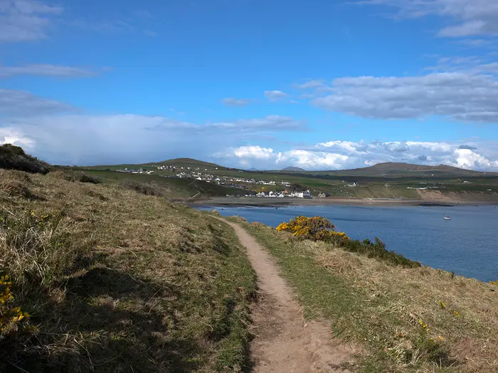
Image by Christian The Llŷn Coastal Path is a 146 km coast walk from Caernarfon Castle to Porthmadog, tracing Penrhyn Llŷn around one of Wales’s most distinctive peninsulas. It suits walkers who want a waymarked long-distance route with real coastal character, good village stops in places and quieter headlands where planning matters.
The route begins on the Menai Strait, leaves Caernarfon over the Aber Swing Bridge, then works south-west along the coast before turning around the exposed western tip near Aberdaron. Along the way it passes places such as Nant Gwrtheyrn, Nefyn, Morfa Nefyn, Porthdinllaen, Porthor / Porth Oer (Whistling Sands), Porth Neigwl (Hell’s Mouth), Abersoch, Pwllheli and Criccieth.
This is not a high mountain route, but it is far from a flat seaside stroll. The path repeatedly climbs and drops along cliffs, fields, beaches, lanes and headlands, with the main inland rise over Bwlch yr Eifl below Yr Eifl reaching roughly 350 m.
Most walkers will find it moderate rather than technical: the waymarking is good, but the cumulative ascent, rough or muddy cliff paths, exposed winds and sparse facilities on the western headlands demand proper kit and sensible daily distances. Accommodation is straightforward in the larger towns, but the quieter sections around Tudweiliog, Aberdaron and Rhiw need booking well ahead.
This guide covers stages, itinerary choices, accommodation, food and water, transport, terrain, mapping and the common mistakes to avoid.
Stage-by-Stage Guide
Distances on the Llŷn Coastal Path vary by mapping source and by any accommodation or beach detours, so treat the stage lengths below as planning distances rather than exact GPS measurements. The route is well waymarked as part of the Wales Coast Path, but OS mapping and current diversion notices are still essential, especially on exposed cliff sections and around the quieter western headlands.
Stage 1: Caernarfon to Trefor — approx. 20 km
The route begins at Caernarfon Castle on the Menai Strait and leaves town across the Aber Swing Bridge over the Afon Seiont. This is the easiest-feeling opening day of the walk: the coast south-west of Caernarfon is relatively low-lying, with a mix of coastal paths, field edges, beachside walking, quiet lanes and flatter ground before the hills of Yr Eifl begin to dominate the view ahead.
Dinas Dinlle lies near the line of the route, and the path continues towards Clynnog Fawr, Aberdesach and Trefor. The day is a useful warm-up, but it should not be treated as a rest day: it is still a full 20 km stage and can feel long in poor weather or after a late arrival in Caernarfon.
Food and water are best planned around Caernarfon at the start and Trefor at the end, with intermediate options not to be relied on without checking opening times. Carry enough water and food for the whole day, particularly outside the main holiday season.
Accommodation is more plentiful in Caernarfon than at the smaller settlements along the coast, so Trefor should be booked ahead if using it as the overnight stop. If accommodation in Trefor is limited, a local transfer or bus option may be needed; this should be checked before travelling.
Caernarfon has no National Rail station. The usual access is by bus from Bangor on the North Wales Coast main line, including TrawsCymru T2 / Sherpa’r Wyddfa services and local buses. Public transport around the north coast is useful but should be checked carefully against the walking schedule.
Navigation is straightforward out of Caernarfon, but do not rely on the waymarks alone where the route switches between coast, fields and lanes. The main warning on this stage is exposure to wind on open coastal sections rather than technical ground.
Stage 2: Trefor to Nefyn / Morfa Nefyn — approx. 18 km
This is one of the defining stages of the Llŷn Coastal Path. West of Trefor the route becomes hillier and more remote, climbing over Bwlch yr Eifl below Yr Eifl (the Rivals), the high point of the path at roughly 350 m.
The climb over Bwlch yr Eifl is not technical, but it is the biggest upland effort on the route and a sharp change from the lower coast. Expect rougher ground, exposed slopes and a more sustained ascent and descent than on the opening day.
The path passes through Nant Gwrtheyrn (Vortigern’s Valley), the dramatic former granite-quarrying valley below Yr Eifl, now a Welsh-language and heritage centre. Tre’r Ceiri, the Iron Age hillfort on the south-eastern peak of Yr Eifl, is a major landmark in the area but sits off the main coast-path line; only include it if deliberately adding time and distance.
After the Yr Eifl crossing, the route continues towards Nefyn and Morfa Nefyn. Views open along the north coast of Penrhyn Llŷn, with the day’s terrain shifting from upland pass back towards clifftop and coastal walking.
Food and water should be carried from Trefor unless current options at Nant Gwrtheyrn or elsewhere have been checked in advance. Nefyn and Morfa Nefyn are much better end-of-day bases, with more accommodation than the smaller northern villages.
Public transport on this side of the peninsula is based on local bus services and the seasonal/on-demand fflecsi Llŷn coastal bus. Routes 8/8B link Pwllheli with Nefyn, Tudweiliog and Aberdaron, but times and operating details should be checked before travelling.
Navigation around Bwlch yr Eifl needs more care than the easier coastal sections, especially in low cloud, wind or heavy rain. This is also a stage where waterproofs, warm layers and secure footwear matter: it may be a coastal walk, but this day has a genuine upland feel.
Stage 3: Nefyn / Morfa Nefyn to Tudweiliog — approx. 16 km
This stage follows the north coast through one of the best-known sections of the route, linking Morfa Nefyn with Porthdinllaen before continuing west towards Tudweiliog. It is shorter than several other days, but the coast-path rhythm of short climbs, drops and uneven clifftop walking still takes time.
Porthdinllaen is the standout landmark. The National Trust headland, sheltered sandy harbour and beachside Tŷ Coch Inn make this one of the classic stops on the whole Llŷn coast.
Beyond Porthdinllaen the route becomes quieter as it heads towards Edern and Tudweiliog. Expect a mixture of clifftop paths, field paths, grassy ground and occasional lanes, with rough or muddy sections after rain.
Food and water are more realistic at the start around Nefyn / Morfa Nefyn and at known visitor spots such as Porthdinllaen, but opening hours should not be assumed. Carry enough for the whole stage, especially if walking outside summer or if aiming to finish in Tudweiliog without detours.
Accommodation becomes thinner on this part of the peninsula. Tudweiliog is a useful stopping point, but it is not a large resort, so beds and any camping options should be arranged well ahead.
Bus access is possible in principle using local services around Nefyn, Tudweiliog and Pwllheli, including routes 8/8B, with fflecsi Llŷn as a seasonal/on-demand option. This should be checked before travelling, particularly if using the bus to shorten the day or reach accommodation away from the path.
Navigation is generally simple where the coast is obvious, but pay attention where the route leaves beaches or small coves and returns to field or clifftop paths. The main warnings are wind exposure on headlands, slippery mud after rain and the cumulative strain of repeated small ascents and descents.
Stage 4: Tudweiliog to Aberdaron — approx. 19 km
This is a remote and rewarding north-western stage, moving from Tudweiliog through the quieter headlands and coves towards Aberdaron. It has fewer built-up places than the earlier north-coast stages, so it needs more deliberate food, water and accommodation planning.
The route passes the area around Porth Iago and Porthor / Porth Oer (Whistling Sands), a sheltered National Trust cove known for its pale quartz sand that can squeak or “whistle” underfoot. The coast here is exposed and open, with excellent sea views but little shelter in poor weather.
Further west, the path continues towards Methlem and Uwchmynydd before reaching Aberdaron. Around the western tip, views towards Ynys Enlli (Bardsey Island) are one of the major rewards of the stage.
Carry food and water from Tudweiliog unless specific stops have been checked in advance. This is one of the sections where relying on casual cafés or shops is a poor plan, particularly outside the main season.
Aberdaron is the natural overnight stop and has more visitor infrastructure than the smaller settlements before it, but it is still on the remote western end of Penrhyn Llŷn. Accommodation should be booked early, especially in summer.
Public transport is limited but useful for planning, with year-round local services such as routes 8/8B serving Aberdaron from Pwllheli via the north-western side of the peninsula, and fflecsi Llŷn operating seasonally/on demand. Current times and booking requirements should be checked before travelling.
Navigation is usually aided by clear Wales Coast Path waymarking, but the headlands require attention in poor visibility and strong winds. Some cliff and beach sections may be affected by diversions or local conditions, so check the official Wales Coast Path notices before setting out.
Stage 5: Aberdaron to Abersoch — approx. 24 km
This is the longest stage in the standard eight-day schedule and should be treated as a serious day. It takes the route from the western tip of the peninsula around to the south coast, linking Aberdaron, Rhiw, Porth Neigwl (Hell’s Mouth) and Abersoch.
Aberdaron itself is an important place on the route, with St Hywyn’s Church on the shore and the historic association with medieval pilgrims heading for Ynys Enlli. Leaving the village, the path soon returns to exposed coastal walking with wide views from the western and southern edge of Penrhyn Llŷn.
The coast around Rhiw and Porth Neigwl is wilder in character than the gentler resort sections further east. Porth Neigwl (Hell’s Mouth) is a long, surf-pounded bay with a reputation in its name alone; conditions can feel very exposed in wind and rain.
Because of the length and the quieter terrain between Aberdaron and Abersoch, carry a full day’s food and water. Do not assume reliable mid-stage resupply unless it has been checked before travelling.
Abersoch is one of the larger and livelier bases on the route, with a broad choice of accommodation compared with the western headlands. Even so, summer demand can be high, so booking ahead remains sensible.
Public transport planning is easier at either end than in the middle. Aberdaron is served by local bus links from Pwllheli, while Abersoch sits on the better-served south coast side of the peninsula; exact times should be checked before travelling.
Navigation is not technically difficult, but fatigue is the main issue. Start early, expect repeated ups and downs, and be prepared for narrow, rough or muddy cliff paths, especially after rain.
Stage 6: Abersoch to Pwllheli — approx. 18 km
This stage continues along the gentler south coast from Abersoch towards Llanbedrog and Pwllheli. Compared with the western headlands, it usually feels less remote, though the path still mixes beaches, dunes, fields, lanes and clifftop sections rather than offering a flat promenade walk.
Abersoch and Llanbedrog are the main places of interest. Abersoch is a well-known sailing and watersports centre, while Llanbedrog has a sheltered beach and the wooded headland of Mynydd Tir-y-Cwmwd.
The walking is generally more forgiving than the Yr Eifl and western stages, but do not underestimate the distance. Sandy sections, wet field paths and short climbs can all slow progress.
Food and water are easier to organise on this stage than on the remote north-western days, with Abersoch, Llanbedrog and Pwllheli acting as the main practical points. Opening times still vary by season, so carry enough to avoid depending on a single stop.
Pwllheli is a key logistics town on the route, with a good range of accommodation and services compared with the smaller villages. It also has a railway station on the Cambrian Coast line, making it a useful place to start, finish or split a section walk.
Local buses serve parts of the peninsula from Pwllheli, including routes towards Nefyn, Tudweiliog and Aberdaron, and the Cambrian Coast railway provides onward travel towards Criccieth, Porthmadog and the wider network via Machynlleth. Train and bus times should be checked before travelling.
Navigation is generally straightforward, but take care where the route alternates between beach, dune, lane and field sections. In poor weather, exposed beach and headland walking can still be tiring despite the lower terrain.
Stage 7: Pwllheli to Criccieth — approx. 16 km
This is a shorter and more settled stage along the south-eastern side of Penrhyn Llŷn, moving from Pwllheli towards Penychain and Criccieth. It is a useful recovery after the longer western and south-coast stages, but the same coastal mix of sand, fields, lanes and uneven paths remains.
The route works its way along the coast towards Tremadog Bay, with views increasingly influenced by the broader bay and the approach to Eryri beyond the end of the peninsula. Penychain is the key named point between Pwllheli and Criccieth.
Criccieth is the main highlight of the day. Its 13th-century clifftop castle, begun by Llywelyn the Great and later taken and rebuilt by Edward I, overlooks Tremadog Bay and makes a strong end point for the stage.
Food and water are easiest at Pwllheli and Criccieth. Intermediate availability should be checked rather than assumed, so carry enough for the walking day even though this is not one of the remotest stages.
Criccieth has more accommodation than the smaller coastal villages and is a logical overnight stop before the final stage to Porthmadog. It is still worth booking ahead during busy periods.
Both Pwllheli and Criccieth have stations on the Cambrian Coast line, making this one of the easiest stages to reach by rail. This also makes it a practical day-walk section for anyone splitting the route.
Navigation is comparatively simple, but do not become casual at the end of the route. Check for any coast-path diversions and be prepared for muddy or waterlogged sections after rain.
Stage 8: Criccieth to Porthmadog — approx. 15 km
The final stage follows the coast from Criccieth towards Morfa Bychan / Black Rock Sands, Borth-y-Gest and Porthmadog. It is the shortest stage in the standard schedule, but it still deserves a normal walking day’s planning rather than being treated as a short transfer.
Leaving Criccieth, the route continues along the edge of Tremadog Bay. Morfa Bychan / Black Rock Sands and Borth-y-Gest provide the main coastal landmarks before the path reaches Porthmadog harbour.
The terrain is generally lower and less severe than the western headlands, with a mix of beach, dune, coastal path, lanes and built-up approaches. After rain or in strong wind, exposed sand and open coastal sections can still be slow and uncomfortable.
Food and water are easiest to organise at Criccieth and Porthmadog, with more options at the finish than on most intermediate stages. Carry enough for the stage, as seasonal openings and exact route-side stops can vary.
Porthmadog is the official end of the Llŷn Coastal Path and a good overnight base, with onward transport by rail. The route also links here into the Eryri stretch of the Wales Coast Path.
Criccieth and Porthmadog both have Cambrian Coast line stations, so the final stage is straightforward to access or shorten by public transport. Wider rail connections require changing at Machynlleth.
Navigation into Porthmadog is not difficult, but stay alert where the coast path threads between beach, settlement edges and harbour-side sections. As on the rest of the walk, check current Wales Coast Path diversion notices before relying on a printed itinerary.
Recommended Itinerary
Standard 8-day itinerary
This is the cleanest schedule for most fit walkers: long enough to avoid racing the harder western headlands, but still compact enough for a one-week walking holiday plus travel days. Distances on the Llŷn Coastal Path vary by mapping source and by accommodation detours, so use these as planning figures and check official mapping before booking.
| Day | From | To | Approx. distance | Why this stage makes sense | Services/accommodation notes |
|---|---|---|---|---|---|
| 1 | Caernarfon | Trefor | 20 km | A straightforward opening day from Caernarfon Castle, leaving over the Aber Swing Bridge and following the easier, lower coast south-west before the route becomes hillier. | Caernarfon has the strongest start-point services, but no railway station. Trefor is a much smaller overnight stop, so accommodation should be booked ahead. |
| 2 | Trefor | Nefyn / Morfa Nefyn | 18 km | One of the key hill days: the path climbs over Bwlch yr Eifl below Yr Eifl, the high point of the route at about 350 m, then passes Nant Gwrtheyrn before continuing towards the north coast settlements. | Nefyn and Morfa Nefyn are among the better overnight bases on the north coast. This is a sensible place to recover after the Yr Eifl section. |
| 3 | Nefyn / Morfa Nefyn | Tudweiliog | 16 km | A manageable coastal stage with time for Porthdinllaen and the Tŷ Coch Inn without making the day too long. It also positions you before the more remote western section. | Services thin out west of Morfa Nefyn. Tudweiliog has less choice than the larger towns, so book accommodation and evening food arrangements early. |
| 4 | Tudweiliog | Aberdaron | 19 km | A remote and exposed headland day, passing the western side of Penrhyn Llŷn via places such as Porth Iago, Porthor / Porth Oer and Uwchmynydd before reaching Aberdaron. | This is one of the sections where carrying food and water matters. Aberdaron is the natural overnight stop at the western tip, but accommodation can be limited in busy periods. |
| 5 | Aberdaron | Abersoch | 24 km | The longest standard stage, crossing from the far west to the south coast via Rhiw and Porth Neigwl. It is a good fit for strong walkers but should not be underestimated after several exposed days. | Facilities are sparse between Aberdaron and Abersoch. Book Abersoch accommodation early, especially in peak holiday season. |
| 6 | Abersoch | Pwllheli | 18 km | A more settled south-coast day through Llanbedrog towards Pwllheli, giving a useful change after the wilder western peninsula. | Pwllheli is a practical resupply and transport point, with a railway station on the Cambrian Coast line and more accommodation choice. |
| 7 | Pwllheli | Criccieth | 16 km | A moderate stage towards Tremadog Bay, with the route continuing past the Penychain area before reaching Criccieth. | Criccieth is a good final-night stop with accommodation and the clifftop castle close to the route. It also has a Cambrian Coast line station. |
| 8 | Criccieth | Porthmadog | 15 km | A short final day via Morfa Bychan / Black Rock Sands and Borth-y-Gest into Porthmadog, leaving time for onward travel. | Porthmadog has a railway station on the Cambrian Coast line and links into the Eryri section of the Wales Coast Path. |
Slower 9–10 day variant
A slower itinerary suits walkers who want shorter days, more time for the headlands, or a safer margin for poor weather on exposed cliff paths. It is also the better choice if accommodation availability forces a less tidy stopping pattern.
The most useful place to add time is the western half of the route, especially between Nefyn / Morfa Nefyn, Tudweiliog, Aberdaron and Abersoch. The Aberdaron to Abersoch day is the longest standard stage at about 24 km, and splitting it around Rhiw or the Porth Neigwl area can make the schedule feel much easier, but accommodation is thinner there and must be arranged before committing to the plan.
Another slower option is to add a rest or short day at Aberdaron, Abersoch or Pwllheli. These are more practical bases than the smaller headland settlements because they give better access to accommodation, food and onward transport options.
| Variant | Best for | How to structure it |
|---|---|---|
| 9 days | Most walkers wanting more breathing room | Follow the standard itinerary, but split the 24 km Aberdaron to Abersoch stage if accommodation or transport allows. This should be checked before travelling. |
| 10 days | Walkers carrying camping gear, travelling in shoulder season, or wanting shorter stages | Add an extra night in the western section and/or a rest or short day at Aberdaron, Abersoch or Pwllheli. Use local buses or the fflecsi Llŷn service where available to manage awkward accommodation gaps. Current services should be checked before travelling. |
Faster 7-day variant
A 7-day crossing is realistic only for fit walkers who are comfortable with repeated coastal ascent and longer days. It leaves less room for bad weather, path diversions, slow going on muddy cliff paths or accommodation detours.
The simplest faster plan is to keep the harder western stages intact and combine the final two standard days into one long finish from Pwllheli to Porthmadog, using the Pwllheli–Criccieth and Criccieth–Porthmadog stages together.
| Day | From | To | Approx. distance | Why this stage makes sense | Services/accommodation notes |
|---|---|---|---|---|---|
| 1 | Caernarfon | Trefor | 20 km | A full but manageable start on the easier opening coastline. | Book Trefor ahead. |
| 2 | Trefor | Nefyn / Morfa Nefyn | 18 km | Keeps the Yr Eifl and Nant Gwrtheyrn section as a standalone day. | Nefyn / Morfa Nefyn make a practical recovery stop. |
| 3 | Nefyn / Morfa Nefyn | Tudweiliog | 16 km | Avoids overloading the approach to the remote west. | Accommodation is thinner; book early. |
| 4 | Tudweiliog | Aberdaron | 19 km | A logical full day around the exposed western headlands. | Carry food and water; services are limited. |
| 5 | Aberdaron | Abersoch | 24 km | The longest main stage, suitable only if conditions and fitness are good. | Sparse facilities between the two; do not rely on finding last-minute options. |
| 6 | Abersoch | Pwllheli | 18 km | Brings the route to a town with rail access and stronger services. | Pwllheli is useful for resupply and accommodation. |
| 7 | Pwllheli | Porthmadog | 31 km | Combines the two gentler southern finishing stages via Criccieth into one long final day. | This is a long day despite the easier finish-side logistics. Criccieth is the obvious fallback overnight if the distance proves too much. |
Planning the Route
How many days to allow
Most walkers should plan the Llŷn Coastal Path over 8–10 walking days. An 8-day itinerary is a practical fit for a fit, steady walker, while 9–10 days gives more room for weather, shorter days on the rougher headlands and time in places such as Nefyn, Aberdaron, Abersoch, Pwllheli and Criccieth.
A 7-day schedule is possible but brisk. It leaves little margin for slow cliff paths, strong winds, muddy ground or accommodation detours, and is best suited to walkers already comfortable with consecutive hilly coastal days.
Self-guided walking companies commonly package the route over 9–12 nights, often adding rest time or using accommodation slightly off the line. That can make the practical walking distance longer than the headline figure, so check the daily mileage between your actual booked stops rather than relying only on the trail total.
Let the overnight stops shape the itinerary
Daily stages are strongly influenced by where accommodation exists. The larger and easier overnight bases are Caernarfon, Nefyn / Morfa Nefyn, Abersoch, Pwllheli, Criccieth and Porthmadog. These are the places where walkers generally have the most choice of B&Bs, guesthouses, inns, hotels and campsites.
The planning pinch points are the quieter stretches around Tudweiliog, Porth Iago, Porthor / Porth Oer, Aberdaron, Rhiw and the western headlands. Accommodation and services are thinner here, so these nights should be booked first, especially in the main walking season.
A sensible 8-day structure uses the natural settlements along the route:
| Stage | Usual overnight stop | Planning note |
|---|---|---|
| Caernarfon to Trefor | Trefor | A manageable opening day, leaving Caernarfon and the lower north coast before the hills begin in earnest. |
| Trefor to Nefyn / Morfa Nefyn | Nefyn / Morfa Nefyn | Includes the major climb over Bwlch yr Eifl, the highest point on the path. Allow extra time. |
| Nefyn / Morfa Nefyn to Tudweiliog | Tudweiliog | Shorter on paper, but plan around limited accommodation and food options. |
| Tudweiliog to Aberdaron | Aberdaron | Remote, exposed headland walking; carry what you need for the day. |
| Aberdaron to Abersoch | Abersoch | One of the longer standard days, including the south-western coast and Porth Neigwl (Hell’s Mouth) area. |
| Abersoch to Pwllheli | Pwllheli | Easier to support with services at both ends. |
| Pwllheli to Criccieth | Criccieth | A useful split before the final approach to Tremadog Bay. |
| Criccieth to Porthmadog | Porthmadog | Shorter final day, with onward rail options from Porthmadog. |
This table is best treated as a planning framework rather than a fixed rule. If accommodation is unavailable in a smaller village, you may need to use a taxi, bus, baggage-transfer operator or an off-route stay. This should be checked before travelling.
Fast, comfortable or slow?
The Llŷn Coastal Path rewards a steady pace more than a fast schedule. The route is not technical, but the constant climbing and descending on cliff paths makes daily progress slower than the map may suggest, especially west of Trefor and around the more exposed headlands.
A faster itinerary works best if carrying light kit and using booked accommodation or baggage transfer. A slower itinerary is better for walkers who want to absorb the coastal sections, visit places just off the main line, or leave room for bad weather on exposed sections.
The climb over Bwlch yr Eifl is the key stage to plan carefully. It is not high by mountain standards, but it is the path’s major inland climb and can feel very different from the lower coastal sections in wind, rain or poor visibility.
Shortening, extending and section hiking
The route is practical to section-hike, but public transport is uneven. The southern end is the easiest to manage because Pwllheli, Criccieth and Porthmadog are on the Cambrian Coast line, with wider connections via Machynlleth.
Caernarfon has no National Rail station. For the start, plan to reach Caernarfon by bus from Bangor, which is on the North Wales Coast main line. The TrawsCymru T2 / Sherpa’r Wyddfa services and local buses connect Bangor and Caernarfon; current timetables should be checked before travelling.
On the peninsula, local services including routes 8 / 8B from Pwllheli to Nefyn, Tudweiliog and Aberdaron can help with shorter sections. The fflecsi Llŷn coastal bus can also be useful, but it is seasonal and on-demand, so it must be booked and checked in advance.
Shortening the route usually means skipping or bussing a stage rather than cutting inland, because the interest of the walk lies on the coast. Extending is straightforward if you continue on the Wales Coast Path beyond Porthmadog towards the Eryri section, but onward stages should be planned separately.
What to prioritise before booking
Accommodation is the first priority. Book the remote western and north-western nights before fixing travel to and from the trail. If using baggage transfer, confirm which settlements and accommodation providers the service will cover.
Food and water need day-by-day planning. Larger towns and resorts are the safer places to resupply, but the more remote headland stages have fewer options. Carry lunch, snacks and enough water for a full day whenever walking between smaller villages or exposed coastal sections.
Transport must be planned around the point-to-point shape. The start and finish are not equally served by rail: Caernarfon is bus-only for National Rail access, while Porthmadog has a railway station. If splitting the route, check bus and train times before committing to accommodation.
Navigation is usually straightforward, but do not rely only on waymarks. The route follows Wales Coast Path waymarks, with older Llŷn Coastal Path discs appearing in places, but cliff diversions, field paths, lanes and beach approaches can still cause confusion. Carry mapping for the whole route; OS Explorer 253 and 254 cover the Llŷn Peninsula, with OL17 / OL18 relevant around the Eryri end.
Weather matters more than altitude. Strong wind, rain and low cloud can make the exposed headlands and narrow cliff paths significantly harder. After wet weather, expect rough, muddy or waterlogged sections and allow more time than the distance alone suggests.
There is no permit or trail fee. Budget instead for accommodation, food, public transport, possible taxis and optional baggage transfer, all in GBP. Any prices, bus times, train times, diversions and baggage-transfer arrangements should be checked before travelling.
Towns, Villages and Overnight Stops
Accommodation is easiest at the larger settlements: Caernarfon, Nefyn / Morfa Nefyn, Abersoch, Pwllheli, Criccieth and Porthmadog. The north-western and western headlands are much thinner for beds and services, especially around Tudweiliog, Aberdaron and Rhiw, so these stages need earlier booking and more careful food planning.
For a standard 8-day walk, the practical overnight line is usually Caernarfon, Trefor, Nefyn / Morfa Nefyn, Tudweiliog, Aberdaron, Abersoch, Pwllheli, Criccieth and Porthmadog. Shorter or longer itineraries are possible, but changing the schedule can create long gaps between reliable accommodation.
Caernarfon
Caernarfon is the official start, with the route beginning at Caernarfon Castle on the Menai Strait before leaving over the Aber Swing Bridge across the Afon Seiont. It is the best place to arrive the day before starting, particularly if travelling by public transport.
Accommodation choice is among the best on the route, with hotels, guesthouses, inns and B&Bs. Food, evening meals and last-minute supplies are far easier here than on the early rural coast.
Caernarfon has no National Rail station. The usual rail approach is to travel to Bangor on the North Wales Coast main line, then continue by bus; TrawsCymru T2, Sherpa’r Wyddfa services and local buses link Bangor and Caernarfon. Current bus times should be checked before travelling.
Dinas Dinlle, Clynnog Fawr and Aberdesach
These places fall on or near the low-lying opening section south-west of Caernarfon before the route reaches the hillier coast towards Trefor. They are useful as reference points on the first day rather than obvious overnight bases for most end-to-end walkers.
Do not rely on this stretch for flexible accommodation unless it has been booked in advance. Food, cafés, pubs and shops should also be checked before travelling, especially outside the main holiday season.
Trefor
Trefor is the usual first-night stop on an 8-day itinerary, reached after the opening stage from Caernarfon. It sits below Yr Eifl (the Rivals), before the route climbs steeply over Bwlch yr Eifl to the path’s high point.
It is a practical staging point because the next section is more demanding and more exposed. Accommodation is more limited than in the larger towns, so book ahead rather than assuming a same-day room will be available.
Food and evening-meal options should be checked before travelling. If using baggage transfer or a self-guided package, Trefor is one of the places where pre-arranged logistics are particularly useful.
Nant Gwrtheyrn and Llithfaen
Nant Gwrtheyrn (Vortigern’s Valley) lies directly on the route below Yr Eifl, in a dramatic former granite-quarrying valley now used as a Welsh-language and heritage centre. It is an important mid-stage point between Trefor and Nefyn / Morfa Nefyn rather than a standard overnight stop for most itineraries.
Llithfaen is inland from this section and may be relevant if accommodation or transport arrangements pull you away from the coast path. Any detour, food stop or onward transport from here should be checked before travelling.
Nefyn and Morfa Nefyn
Nefyn and Morfa Nefyn are among the most useful overnight bases on the north coast. They work well after the Trefor–Yr Eifl stage and also give access to the Porthdinllaen headland section.
Accommodation is generally more plentiful here than on the remote western headlands, with a mix of B&Bs, guesthouses, inns, hotels and campsites in the wider route corridor. Food, pubs, cafés and supplies are more realistic here than at the smaller coves and headlands, though opening times still need checking outside peak periods.
Public transport is better here than in the far west. Year-round local buses, including routes 8 / 8B from Pwllheli to Nefyn, Tudweiliog and Aberdaron, can help with section walking; current timetables should be checked before travelling.
Porthdinllaen
Porthdinllaen is a National Trust headland near Morfa Nefyn, with a sheltered sandy harbour and the beachside Tŷ Coch Inn. It is one of the classic walkers’ stops on the north coast and a natural place to pause during the day.
For overnight planning, Nefyn or Morfa Nefyn are usually the more practical bases. Treat Porthdinllaen primarily as a lunch, drink or scenic stop, and check opening times before relying on the Tŷ Coch Inn for food.
Edern and Tudweiliog
Edern lies inland of the north-coast route corridor between Morfa Nefyn and Tudweiliog. It may be useful where accommodation or bus logistics require a short inland adjustment, but any detour and services should be checked before travelling.
Tudweiliog is a standard overnight stop on the 8-day schedule, sitting between Nefyn / Morfa Nefyn and Aberdaron. It is on one of the quieter sections, where accommodation and food options are noticeably thinner than in the larger towns.
Book Tudweiliog well ahead, particularly in holiday periods. Local bus routes 8 / 8B link Pwllheli with Nefyn, Tudweiliog and Aberdaron, which can help if splitting or shortening stages, but current times should be checked before travelling.
Porth Iago, Porthor / Porth Oer, Methlem and Uwchmynydd
This is one of the more remote western sections of the Llŷn Coastal Path, between Tudweiliog and Aberdaron. Porthor / Porth Oer (Whistling Sands) is the best-known point, a National Trust cove north of Aberdaron with pale quartz sand that can squeak underfoot.
These places are important for navigation and day planning, but they should not be treated as reliable service stops without checking first. Carry enough food and water for the stage, and have accommodation fixed at Tudweiliog, Aberdaron or another pre-booked stop.
Uwchmynydd is near the western tip, with views towards Ynys Enlli (Bardsey Island). It is a memorable part of the walk, but exposed weather can make it feel much more committing than the map distance suggests.
Aberdaron
Aberdaron is the key village at the western end of the peninsula and the usual overnight stop after Tudweiliog. It has strong route logic: it breaks the remote north-western headland section before the long day towards Rhiw, Porth Neigwl (Hell’s Mouth) and Abersoch.
Accommodation exists but is much thinner than in the larger resort towns, so this is one of the most important places to book early. Food and evening meals should also be planned in advance, especially outside the main visitor season.
Aberdaron is served by local bus links from Pwllheli via routes including 8 / 8B. Timetables, seasonal changes and any fflecsi Llŷn options should be checked before travelling.
Rhiw and Porth Neigwl (Hell’s Mouth)
Rhiw and Porth Neigwl (Hell’s Mouth) sit on the south-western side of the peninsula between Aberdaron and Abersoch. This is a long, exposed-feeling stage on a standard itinerary, with Porth Neigwl forming the major coastal feature before the route reaches the busier south coast.
Rhiw is one of the areas where accommodation and services are notably sparse. Most walkers should carry what they need from Aberdaron and aim for a confirmed overnight in Abersoch, unless a specific booking has been made locally.
Transport and food options in this section should be checked before travelling. It is not a place to improvise at the end of a wet or windy day.
Abersoch
Abersoch is one of the best resupply and overnight points on the southern coast. It is a lively sailing and watersports resort and marks the return to a more developed part of the route after the quieter western headlands.
Accommodation is generally more plentiful here than around Rhiw or Tudweiliog, with B&Bs, guesthouses, inns, hotels and campsites in the wider area. It is a good place to reset after the long Aberdaron–Abersoch stage, arrange meals and prepare for the easier logistics towards Pwllheli.
Public transport options should be checked before travelling, particularly if using Abersoch to join, leave or shorten the route. The seasonal and on-demand fflecsi Llŷn coastal bus may be useful on this part of the peninsula, but it must not be assumed without checking current operation and booking requirements.
Llanbedrog
Llanbedrog lies between Abersoch and Pwllheli on the gentler south coast. It is a useful mid-stage point, known for its sheltered beach village setting and wooded headland at Mynydd Tir-y-Cwmwd.
Most end-to-end itineraries continue through to Pwllheli rather than overnighting here. If using Llanbedrog to shorten the Abersoch–Pwllheli day, accommodation, food and transport should be arranged before travelling.
Pwllheli
Pwllheli is one of the main logistics hubs on the route and a standard overnight stop before the final two days. It has plentiful accommodation compared with the smaller villages and is the first railway town encountered on the walk.
Pwllheli is a strong place to resupply, reorganise baggage arrangements or adjust an itinerary. It is also useful for section walkers because both rail and bus connections are available from here.
The railway station is on the Cambrian Coast line, with onward connections via Machynlleth for the wider network. Local buses, including routes 8 / 8B towards Nefyn, Tudweiliog and Aberdaron, make Pwllheli important for accessing the north and west sides of the peninsula; current timetables should be checked before travelling.
Penychain
Penychain lies between Pwllheli and Criccieth and is relevant both as a coastal reference point and because it has a station on this part of the route corridor. It can be useful for section walkers or anyone needing to break up the Pwllheli–Criccieth stage.
It is not usually a main overnight base on standard itineraries. Accommodation, food and train times should be checked before planning a stop here.
Criccieth
Criccieth is the usual overnight before the final stage to Porthmadog. It is one of the better-served towns on the route, with a wider accommodation choice than the smaller villages and a railway station on the Cambrian Coast line.
It is also a practical place for food and evening arrangements before the last day. Criccieth Castle, on the clifftop above Tremadog Bay, is the main local landmark and an easy add-on around the overnight stop.
For transport, Criccieth works well for section walking because it sits on the same rail corridor as Pwllheli and Porthmadog. Train times and any planned service changes should be checked before travelling.
Morfa Bychan / Black Rock Sands and Borth-y-Gest
Morfa Bychan / Black Rock Sands and Borth-y-Gest sit on the approach to Porthmadog from Criccieth. They are useful final-day waypoints rather than essential overnight stops for most walkers.
If using either place to shorten the final stage, book accommodation and confirm food options in advance. The proximity to Porthmadog makes it more practical to finish there unless a specific reason exists to stop short.
Porthmadog
Porthmadog is the finish of the Llŷn Coastal Path on Tremadog Bay, where the route links into the Eryri stretch of the Wales Coast Path. It is the best end-point for onward transport and post-walk accommodation.
Accommodation is plentiful by Llŷn standards, with hotels, guesthouses, B&Bs, inns and campsites in the wider area. It is also the most practical place at the finish for food, recovery time and onward travel planning.
Porthmadog has a railway station on the Cambrian Coast line. Trains connect via Machynlleth for the wider network, and current train times should be checked before booking fixed onward travel.
Getting to the Start
The Llŷn Coastal Path starts in Caernarfon, at Caernarfon Castle on the Menai Strait. Caernarfon has no National Rail station, so most walkers arrive via Bangor and continue by bus or taxi.
By train
The nearest practical railhead for the start is Bangor, on the North Wales Coast main line. From Bangor, continue to Caernarfon by bus or pre-booked taxi.
Plan the rail journey to arrive with enough time for the onward road connection to Caernarfon, especially if starting the walk the same day. Evening and Sunday connections can be more limited, so this should be checked before travelling.
Porthmadog, at the finish, does have a railway station on the Cambrian Coast line, with connections via Machynlleth for the wider rail network. This makes it sensible for many walkers to travel to Caernarfon by public transport, then return from Porthmadog by train at the end.
By bus
Caernarfon is reached by bus from Bangor. The main services to look for are the TrawsCymru T2, Sherpa’r Wyddfa services and local buses linking Bangor and Caernarfon.
Bus times should be checked close to departure, particularly outside the main season, on Sundays and if arriving late in the day. Caernarfon is a practical place to start, but it is not a rail-connected trailhead, so the Bangor–Caernarfon leg needs to be planned rather than treated as an afterthought.
The fflecsi Llŷn coastal bus and local services such as routes 8/8B are more useful later for splitting stages around Pwllheli, Nefyn, Tudweiliog and Aberdaron than for reaching the official start. The fflecsi Llŷn service is seasonal and on-demand, and should be booked and checked before relying on it.
By car
Drivers can reach Caernarfon and begin at the castle, but the route is a point-to-point walk ending in Porthmadog. Leaving a car at the start means either returning from Porthmadog to Caernarfon after the walk, arranging a taxi, or using public transport where available.
Long-stay parking arrangements in Caernarfon should be checked before travelling. Do not assume that short-stay town-centre parking near the castle will be suitable for a multi-day hike.
An alternative is to park at or near the finish and travel to Caernarfon before starting, so the car is waiting in Porthmadog at the end. This can work well, but the Caernarfon transfer still needs to be planned around current bus or taxi availability.
From the nearest airport
There is no airport access directly at the start of the trail. Most flight-based itineraries will need an onward rail journey to Bangor, followed by bus or taxi to Caernarfon.
The best airport will depend on flight availability and onward rail connections into north Wales. This should be checked before travelling, allowing enough time for the final Bangor–Caernarfon connection.
Where to stay before starting
Caernarfon is the most convenient place to stay before beginning the Llŷn Coastal Path. It has a stronger accommodation base than the smaller settlements on the early part of the route, and staying in town lets you start directly from Caernarfon Castle without a morning transfer.
Booking ahead is still recommended in busy periods. If arriving late by public transport, choose accommodation that is practical for both the bus arrival point and the castle start, rather than focusing only on the cheapest available bed.
Starting from Bangor is possible only if the morning bus or taxi connection to Caernarfon fits the walking schedule. For most walkers, spending the night in Caernarfon removes one piece of logistics from the first day.
Getting Home from the Finish
The Llŷn Coastal Path finishes in Porthmadog, which is one of the easier places on the route to leave by public transport. Unlike Caernarfon, Porthmadog has a National Rail station, so most walkers should plan their journey home from there rather than trying to return first to the start.
Timetables on the Cambrian Coast line and local buses can be limited, especially outside the main daytime window. If the final stage from Criccieth runs late, staying in Porthmadog is often the safest and least stressful option.
By train
Porthmadog railway station is on the Cambrian Coast line. Trains from Porthmadog connect into the wider rail network via Machynlleth, where you change for onward services.
The same rail corridor also serves Pwllheli and Criccieth, which is useful if you finish early, shorten the route, or split the final section differently. For the full Caernarfon to Porthmadog walk, Porthmadog is the natural departure station.
Allow generous time between finishing the walk and catching a booked train. The final day from Criccieth is relatively short compared with some earlier stages, but the coastal path still includes beach, lane and path sections where weather, diversions or tired legs can slow progress.
Train times should be checked before travelling, particularly for evening departures and Sunday or seasonal services.
By bus
Local buses operate around Penrhyn Llŷn and can be useful for stage-walking or for reaching rail-served towns such as Pwllheli, Criccieth and Porthmadog. Services are not as straightforward as using the train from the finish, and some routes on the peninsula are limited.
The seasonal/on-demand fflecsi Llŷn coastal bus can help with sections of the route, but it should not be treated as a guaranteed way home from Porthmadog without checking current availability and booking requirements. It is booked via the fflecsi app.
If returning towards Caernarfon, remember that Caernarfon has no National Rail station. Public-transport journeys back to the start generally involve combining rail and bus services, with Bangor acting as the main rail-connected gateway for Caernarfon. This should be checked before travelling.
By car/taxi
For a point-to-point walk, the simplest car plan is usually to leave the car at or near the finish and travel to Caernarfon at the start, rather than trying to retrieve a vehicle after several days on foot. If the car is left in Caernarfon, the return journey from Porthmadog needs careful planning because there is no direct rail option back to Caernarfon.
A taxi from Porthmadog may be practical for local transfers or for returning to nearby accommodation, but long transfers around or across the peninsula should be pre-booked. Do not assume that late-evening taxis will be readily available at the end of the walk.
Self-guided walking companies may also be able to arrange baggage transfers and some local logistics as part of a package, but vehicle movements and pick-up times should be confirmed before booking.
From the nearest airport
Porthmadog is not an airport-finish trailhead in practical hiking terms. The normal way to leave the route is by rail from Porthmadog on the Cambrian Coast line, changing at Machynlleth for the wider network, then continuing towards the relevant airport by mainline train or onward connection.
Airport choice, rail connections and late-arrival options should be checked before travelling. For most walkers, the key planning point is to secure the Porthmadog-to-mainline rail connection first, then build the flight journey around that.
Where to stay at the finish
Porthmadog has a better choice of accommodation than the remoter western and north-western parts of the route, with B&Bs, guesthouses, inns, hotels and campsites available in the wider town area. It is a sensible place to book a final night if there is any risk of missing the last useful train or bus.
Staying overnight also gives more flexibility if the final day from Criccieth is affected by bad weather, slow going on coastal sections, or a late start. Criccieth and Pwllheli are also rail-served alternatives if the route is being section-walked rather than completed in one continuous journey.
Accommodation at the finish should still be booked ahead in busy periods, especially in spring, summer and early autumn.
Which Direction Should You Walk?
The standard direction for the Llŷn Coastal Path is Caernarfon to Porthmadog, following the official start at Caernarfon Castle and walking anticlockwise around Penrhyn Llŷn. This is the direction to choose unless there is a specific reason to reverse the route.
Standard direction: Caernarfon to Porthmadog
Walking from Caernarfon gives the route a practical build-up. The first stretch out of Caernarfon is relatively low-lying and straightforward, before the path becomes hillier and more remote west of Trefor and climbs to Bwlch yr Eifl below Yr Eifl.
This direction also puts the hardest height gain early enough that most walkers are still fresh. The cumulative ascent remains substantial whichever way you walk, but tackling Bwlch yr Eifl in the first half of the walk is generally preferable to saving it for the closing stages.
Transport is another strong reason to walk this way. Caernarfon has no National Rail station, so most walkers reach the start by bus from Bangor. Finishing in Porthmadog is simpler for onward travel because Porthmadog has a railway station on the Cambrian Coast line.
The scenery progression works well too: Caernarfon Castle and the Menai Strait at the start, the rugged north coast and western headlands through the middle, then the south coast through Abersoch, Pwllheli and Criccieth before the finish at Porthmadog on Tremadog Bay.
Reverse direction: Porthmadog to Caernarfon
Walking from Porthmadog to Caernarfon is entirely possible. It may suit walkers who want to start directly from the Cambrian Coast line, or who are linking the route with another section of the Wales Coast Path.
The main drawback is the finish. Ending in Caernarfon is satisfying because of the castle, but onward public transport usually means taking a bus connection to Bangor rather than simply boarding a train at the end of the trail.
The reverse direction also puts the more rugged north-western and northern sections later in the walk. By the time you reach the exposed headlands, Nant Gwrtheyrn and the climb around Bwlch yr Eifl, fatigue and weather can feel more significant.
Wind, weather and exposure
Direction is not a reliable way to avoid bad weather on this route. The path is exposed on the headlands whichever way you walk, and cliff paths can be rough, muddy or waterlogged after rain.
Check the forecast before each stage, especially around the western headlands, Porth Neigwl and Bwlch yr Eifl. Strong wind can matter more than the walking direction, particularly on narrow or exposed cliff paths.
Accommodation flow
The standard Caernarfon to Porthmadog direction fits the usual staging well, with larger service centres at Caernarfon, Nefyn / Morfa Nefyn, Abersoch, Pwllheli, Criccieth and Porthmadog. The thinner accommodation areas around Tudweiliog, Aberdaron and Rhiw need early booking in either direction.
Reverse itineraries can work just as well, but they may require more careful stage planning so that the remote western and north-western sections do not fall awkwardly against booked accommodation or limited bus options.
Recommendation
For most walkers, walk the Llŷn Coastal Path from Caernarfon to Porthmadog. It follows the official direction, gives a better build-up from easier coastal walking into the wilder middle sections, places the main high-level crossing before the final days, and ends with the most convenient rail connection.
Accommodation Along the Route
The Llŷn Coastal Path works well as an inn-to-inn or B&B-to-B&B walk, but it is not evenly supplied throughout. The strongest choice is at the two ends and on the more developed south coast: Caernarfon, Nefyn / Morfa Nefyn, Abersoch, Pwllheli, Criccieth and Porthmadog. These are the easiest places to build a flexible itinerary around.
The awkward section is the remote north-western and western peninsula, especially around Tudweiliog, Aberdaron and Rhiw. Accommodation exists in this part of Penrhyn Llŷn, but the choice is much thinner and gaps between places are less forgiving. These nights should be booked first, then the easier town nights can be fitted around them.
Most walkers on a comfortable 8-day schedule use overnight stops broadly like: Caernarfon, Trefor, Nefyn / Morfa Nefyn, Tudweiliog, Aberdaron, Abersoch, Pwllheli, Criccieth and Porthmadog. A 7-day schedule usually means combining stages or using transfers, while 9–10 days gives more room to shorten the longer western and southern days.
Booking strategy
Book ahead for the whole route if walking in spring, summer or autumn, and especially for weekends, school holidays and the main summer season. The Llŷn coast has popular holiday villages as well as quiet walking settlements, so late availability can be poor even where there is normally a good range of B&Bs, guesthouses, inns, hotels and campsites.
The most important nights to secure early are Tudweiliog, Aberdaron and anywhere around Rhiw or the western headlands. If those places are full, the practical solution is often to stay off-stage and use a taxi or local bus to return to the path, rather than forcing an overlong day.
Self-guided walking companies package the Llŷn Coastal Path with pre-booked accommodation and baggage transfer, usually over a longer 9–12-night itinerary. This is a good option for walkers who want the logistics handled, but current baggage-transfer coverage and pick-up arrangements should be checked before booking.
Accommodation by place
| Place | Accommodation level | Best for | Notes |
|---|---|---|---|
| Caernarfon | Good | Start night; arriving by bus from Bangor; stocking up before the trail | One of the best places on the route for choice. The official start is at Caernarfon Castle, so staying in town keeps the first morning simple. |
| Dinas Dinlle / Clynnog Fawr / Aberdesach | Limited | Possible shorter first-stage planning | These are smaller places on the opening coast. Do not rely on them as major accommodation hubs; check availability before building an itinerary around them. |
| Trefor | Limited | Standard first overnight on an 8-day schedule | A useful stage end before the climb over Bwlch yr Eifl and the Yr Eifl section. Book ahead, as it is not a large resort town. |
| Nant Gwrtheyrn / Llithfaen | Limited | Breaking the Yr Eifl / Bwlch yr Eifl area | Useful for planning around the hillier north coast section, but accommodation choice is not comparable with the larger towns. This should be checked before travelling. |
| Nefyn / Morfa Nefyn | Good | Strong overnight base; restocking; flexible stage lengths | One of the better accommodation areas on the north coast, with a good position before or after Porthdinllaen. A practical place to shorten or lengthen nearby stages. |
| Porthdinllaen / Edern | Limited | Short-stage adjustments near Morfa Nefyn | Porthdinllaen is a classic walkers’ stop, but it should not be assumed to be a main overnight base. Use Nefyn / Morfa Nefyn as the stronger accommodation anchor. |
| Tudweiliog | Limited | Essential remote-stage overnight | A key stopping point between Morfa Nefyn and Aberdaron, but one of the areas where choice is noticeably thinner. Book this night early. |
| Porth Iago / Porthor / Porth Oer / Uwchmynydd | None / very limited | Daytime route points, not dependable overnight bases | These are remote beach and headland sections. Plan to carry food and water and do not assume nearby accommodation or evening services. This should be checked before travelling. |
| Aberdaron | Limited | Western-tip overnight; staging before the south coast | A logical and attractive overnight stop, but still part of the thinner western accommodation belt. Secure this booking early, especially in summer. |
| Rhiw / Porth Neigwl | Limited | Splitting the long Aberdaron–Abersoch leg | Useful if reducing the 24 km Aberdaron to Abersoch stage, but accommodation and services are sparse. Transfers may be needed if nothing suitable is available. |
| Abersoch | Good | Strong south-coast overnight; services; recovery after the western section | One of the main resort bases on the route and a practical place to reset after the remoter western days. Book ahead in busy holiday periods. |
| Llanbedrog | Limited / moderate | Shortening Abersoch–Pwllheli | A useful intermediate village on the gentler south coast. It can help create a shorter day, but Pwllheli has the stronger transport and accommodation position. |
| Pwllheli | Good | Major overnight base; rail access; itinerary flexibility | One of the best logistical stops on the route, with a railway station on the Cambrian Coast line and good options for splitting or joining the walk. |
| Penychain | None / limited | Route point between Pwllheli and Criccieth | Useful for transport planning because it has a station, but not a primary overnight base. This should be checked before travelling. |
| Criccieth | Good | Final-stage overnight; castle visit; shorter finish into Porthmadog | A strong and sensible overnight stop before the last stage. It also avoids making Pwllheli to Porthmadog one long day. |
| Morfa Bychan / Black Rock Sands / Borth-y-Gest | Limited | Adjusting the final day into Porthmadog | Useful places near the finish, but most walkers will find Porthmadog or Criccieth simpler for accommodation logistics. |
| Porthmadog | Good | Finish night; onward rail travel | The best end-point base, with a railway station on the Cambrian Coast line and onward links via Machynlleth. Staying here avoids rushing transport after the final stage. |
Using transfers to solve gaps
The route is practical without camping, but the western peninsula can force compromises if accommodation is full. Taxi transfers can let you finish a day at the path, sleep in a better-served village or town, and return the next morning. This is particularly useful around Tudweiliog, Aberdaron, Rhiw and Porth Neigwl.
Local buses, including services linking Pwllheli with Nefyn, Tudweiliog and Aberdaron, can also help with section-walking and off-route accommodation. The fflecsi Llŷn coastal bus is seasonal and on-demand, so it should not be treated as a guaranteed fallback without checking and booking in advance.
Camping and baggage transfer
Campsites form part of the accommodation mix on Penrhyn Llŷn, but they do not remove the need to plan. Remote headlands and small villages may have long gaps between reliable services, and cliff-top weather can be exposed even in settled seasons. Current campsite opening dates and facilities should be checked before travelling.
Baggage transfer makes this route significantly easier, because the repeated climbs and descents are tiring with a full pack. It is commonly offered as part of self-guided packages, alongside pre-booked accommodation. Independent walkers arranging baggage transfer separately should confirm which settlements can be served before committing to stage ends.
Camping and Wild Camping
Camping can work well on the Llŷn Coastal Path, but it needs more planning than the map may suggest. The route passes through beach settlements, holiday areas and larger towns where campsites are likely to be the most practical option, but the western and north-western headlands are much thinner for facilities and should not be left to chance.
The path is also more tiring with a camping load than its modest height suggests. The repeated clifftop ups and downs, exposed headlands, muddy cliff paths after rain and the climb over Bwlch yr Eifl make pack weight a real consideration.
Campsites and where to plan nights
Expect the easiest camping logistics around the larger settlements and busier coastal areas: Caernarfon, Nefyn / Morfa Nefyn, Abersoch, Pwllheli, Criccieth and Porthmadog are the most useful planning anchors. These places also give better access to shops, pubs, transport and fallback accommodation if weather or fatigue changes the plan.
The more remote stretch around Tudweiliog, Porthor / Porth Oer, Uwchmynydd, Aberdaron, Rhiw and Porth Neigwl needs particular care. Facilities are more spread out here, and campsites or other accommodation should be booked well ahead in busy periods. This should be checked before travelling.
A camping itinerary usually works best if it is built around known campsite locations rather than the standard walking stages. Some accommodation detours can add distance, and on a coast path with this much cumulative ascent those extra kilometres matter.
Wild camping on the Llŷn Coastal Path
Wild camping in Wales should be treated as permission-only unless a landowner has clearly allowed it. The Llŷn Coastal Path crosses farmland, dunes, beaches, cliff paths, National Trust areas such as Porthdinllaen and Porthor / Porth Oer, and the Llŷn National Landscape, so it is not a route where walkers should assume they can pitch freely.
Do not camp on beaches, dunes, cliff edges, grazing land, access tracks, near houses, or in obvious visitor hotspots without permission. Apart from the legal issue, the coast is exposed to wind, some cliff ground is unstable or narrow, and dunes and coastal vegetation are easily damaged.
If a landowner-approved wild camp is arranged, keep it discreet: arrive late, leave early, use a small tent, stay one night only, and leave no visible trace. Where local signs restrict camping, fires or overnight stays, follow them.
Water and resupply
For campers, potable water should be planned around settlements, cafés, shops, pubs and campsites. Do not assume that beaches, coves or headlands will have drinking water, and do not rely on streams or outdoor taps unless they are clearly marked as safe to drink.
Carry extra water on the quieter western and north-western stages, especially between Tudweiliog, Porthor / Porth Oer, Uwchmynydd, Aberdaron, Rhiw and Porth Neigwl. These are also the stages where a missed shop or closed café can have the biggest impact.
Fires, stoves and coastal conditions
Open fires are inappropriate on this route. They damage turf and dunes, create wildfire risk in dry weather, and are not acceptable on farmland, beaches, National Trust land or protected coastal habitats. Use a small camping stove only where it is permitted and safe to do so, and never on dry grass, heather, dunes or close to fences.
The main seasonal issue for campers is exposure rather than cold. Spring, summer and autumn are the normal walking seasons, but the headlands can be windy, and cliff paths can become muddy or waterlogged after rain. A low-profile tent, strong pegs, a waterproof shelter system and the ability to change plans are more useful than an ultralight setup that cannot cope with coastal wind.
Practical verdict
The Llŷn Coastal Path is suitable for camping if nights are planned carefully around established campsites and services. It is less suitable for an unplanned wild-camping approach, because much of the route crosses private or protected land and the remotest sections have sparse facilities.
Book campsites ahead in summer and around popular coastal settlements, carry enough food and water for the quieter headlands, and have a backup plan using buses or accommodation if weather makes an exposed camping night impractical.
Food, Water and Resupply
Overall resupply strategy
Food and water planning on the Llŷn Coastal Path is straightforward in the larger towns, but needs more care on the western and north-western headlands. Do not assume that every village or beach on the map has an open shop, café or pub when you arrive.
The safest approach is to start each day with lunch, high-energy snacks and enough water to reach the next reliable settlement or your accommodation. This matters most between Tudweiliog, Aberdaron, Rhiw and Abersoch, where facilities are thinner and the walking is more exposed.
Caernarfon, Nefyn / Morfa Nefyn, Abersoch, Pwllheli, Criccieth and Porthmadog are the best places to plan meals and resupply. Smaller places such as Trefor, Tudweiliog, Uwchmynydd, Rhiw, Penychain, Morfa Bychan / Black Rock Sands and Borth-y-Gest should be treated as possible stops rather than guaranteed resupply points unless current opening hours have been checked.
Rural and coastal opening hours can be short, seasonal and changeable. Sunday closures, out-of-season reductions and pubs or cafés closing between meal services can all affect a walking itinerary. This should be checked before travelling, especially if camping or arriving late in the day.
Water on the route
Plan to refill from accommodation, cafés, pubs and other staffed stops where available. There is no reason to rely on untreated natural water as part of a normal itinerary.
The coast path crosses farmland, beaches, cliff paths and headlands, so streams and drainage channels should not be treated as safe drinking water without filtration or purification. If carrying a filter as backup, still leave each overnight stop with enough water for the next stage, particularly in warm weather or strong wind.
For most stages, 1.5–2 litres is a sensible starting load for many walkers, with more needed in hot conditions, if camping, or if you drink heavily. On the longer and more remote stages — especially Tudweiliog to Aberdaron and Aberdaron to Abersoch — carrying 2 litres or more is prudent unless a definite refill point has been arranged.
Stage-by-stage resupply notes
| Section | Food availability | Water availability | Notes |
|---|---|---|---|
| Caernarfon to Trefor | Best stocked before leaving Caernarfon. Smaller settlements on the way should not be relied on without checking. | Fill up in Caernarfon; refill where services are open. | The opening day is not the remotest, but it is still wise to carry lunch rather than depend on a mid-stage stop. |
| Trefor to Nefyn / Morfa Nefyn | Better options at the end in Nefyn / Morfa Nefyn. Treat the hilly section over Bwlch yr Eifl and through Nant Gwrtheyrn as a carry-what-you-need day. | Start full from Trefor. Refill only where services are definitely open. | This is one of the more physically demanding sections, with the route climbing to its high point near Bwlch yr Eifl. Carry enough food and water for the climb and descent. |
| Nefyn / Morfa Nefyn to Tudweiliog | Nefyn / Morfa Nefyn are the main resupply points. Porthdinllaen has the Tŷ Coch Inn, a notable walkers’ stop, but opening times should be checked. | Fill before leaving Nefyn / Morfa Nefyn; do not depend on informal water sources. | Good place to top up before moving into quieter north-western stages. |
| Tudweiliog to Aberdaron | Limited and remote. Carry a full day’s food from Tudweiliog unless a definite stop has been checked. | Carry a full water load from the start. | This stage passes exposed headlands and coves including Porth Iago, Porthor / Porth Oer and Uwchmynydd before Aberdaron. It is one of the key sections where self-sufficiency matters. |
| Aberdaron to Abersoch | Start with a full day’s food. Facilities around Rhiw and Porth Neigwl should not be assumed. | Carry plenty from Aberdaron; refill only where known services are open. | This is the longest stage in the standard breakdown and crosses a sparse stretch around Rhiw and Porth Neigwl before reaching Abersoch. |
| Abersoch to Pwllheli | Better options at both Abersoch and Pwllheli. Llanbedrog is a useful named settlement en route, but current services should still be checked. | Fill in Abersoch; refill in settlements where possible. | Resupply becomes easier again on the south coast, but do not set off without lunch if walking outside peak season. |
| Pwllheli to Criccieth | Pwllheli is a key resupply point. Criccieth is a good overnight and food stop at the end of the stage. | Fill in Pwllheli and top up at the end in Criccieth. | A practical stage for restocking before the final day. |
| Criccieth to Porthmadog | Stock up in Criccieth or wait until Porthmadog if walking light. Intermediate places such as Morfa Bychan / Black Rock Sands and Borth-y-Gest should not be relied on without checking. | Fill in Criccieth; Porthmadog has services at the finish. | A shorter final stage, but still carry enough water for exposed coastal walking. |
Practical food tips
Book accommodation with food in mind, not just bed availability. In the quieter western section, check whether your overnight stop provides evening meals, breakfast or packed lunches; if not, carry food in from the previous larger settlement.
A simple daily system works well: buy breakfast supplies or take breakfast at accommodation, carry lunch and snacks, then eat an evening meal in the overnight village or town. Campers need a more robust plan, as small rural villages may not have reliable evening shopping.
Always keep an emergency food reserve in the pack. The coast path is well waymarked, but rough cliff paths, mud, wind and cumulative ascent can slow progress, and arriving after kitchens or shops have closed is an avoidable problem.
Terrain, Conditions and Difficulty in Practice
The Llŷn Coastal Path is not technically difficult, but it is more tiring than its modest high point suggests. The challenge comes from repeated short climbs and descents, exposed headlands, rough or muddy cliff paths, and the cumulative ascent of about 3,197 m over the full route.
Underfoot, expect a changing mix of grass, dirt, sand, dune paths, field paths, beach sections, paved stretches and quiet lanes. The waymarking is generally good, using Wales Coast Path markers, but concentration is still needed where the route leaves a beach, crosses farmland or threads through small settlements.
What the ground is like
The opening miles south-west from Caernarfon are among the easier parts of the walk: lower-lying coast, gentler gradients and less exposed terrain. This can give a misleading impression of the route as a whole, because the walking becomes more demanding west of Trefor.
The north and western sides of Penrhyn Llŷn bring the most sustained coastal walking: clifftop paths, headlands, coves, rough grass and narrower sections where the path can feel exposed in wind. After rain, cliff paths can become muddy or waterlogged, and progress can be slower than the map distance suggests.
Beach and dune sections add variety but can also slow pace, particularly where sand is soft. Porthor / Porth Oer (Whistling Sands), Porth Neigwl (Hell’s Mouth), Abersoch, Llanbedrog, Morfa Bychan / Black Rock Sands and the approach towards Borth-y-Gest all involve coastal terrain where footing and route choice can vary with conditions.
There are also quiet lane and paved sections. These are useful for quicker progress and navigation, but they do not remove the need for proper walking footwear: the next section may return quickly to grass, mud, sand or a rough cliff path.
Climbs, descents and exposure
The main inland climb is over Bwlch yr Eifl, between Trefor, Nant Gwrtheyrn and the shoulder of Yr Eifl. This is the highest point on the path at roughly 350 m and the most obvious place where the route feels more like a hill walk than a low-level coast path.
The summits of Yr Eifl, including Garn Ganol, are off-route, so the official path does not require a mountain ascent. Even so, the climb to Bwlch yr Eifl is steep enough to affect timing, especially with a full pack or in poor weather.
Elsewhere, the route is a classic coastal switchback. Many ascents are short, but they repeat all day: down to a cove, up over a headland, down again, then back up across fields or cliffs. This is why the walk often feels harder than a simple 146 km / 91 mile coastal route might appear on paper.
The most exposed sections are on the open headlands, especially around the more remote western and north-western parts of the peninsula. Strong wind can make these sections slower and more tiring, and extra care is needed on narrow cliff paths.
Farmland, fields and enclosed paths
The route uses low farmland and field paths in several places. Follow waymarks carefully through these sections, as the coast path may not always take the most obvious line across open ground or around field edges.
No special technical skills are required, but farmland walking can involve uneven grass, mud after rain and slower navigation than on lanes or beaches. Treat enclosed land as working countryside: keep dogs under control, close gates where used, and avoid blocking access.
How conditions change by season
Spring, summer and autumn are the main practical seasons for walking the Llŷn Coastal Path. In spring and autumn, the main issues are mud, waterlogged cliff paths, wind exposure and shorter daylight, particularly on the longer or more remote stages around Tudweiliog, Aberdaron, Rhiw and Uwchmynydd.
Summer usually gives the longest daylight and the best chance of drier ground, but exposed headlands can still be windy and beaches can be tiring underfoot. The route also passes through popular coastal villages such as Morfa Nefyn, Abersoch, Llanbedrog, Pwllheli and Criccieth, so accommodation and services should be planned rather than assumed.
After prolonged rain, allow for slower progress on grass and dirt paths, especially on cliff sections. Some beach and cliff sections can also be affected by tides or diversions; current route notices should be checked before travelling.
What makes it easier or harder in practice
| Factor | Practical effect |
|---|---|
| Repeated coastal ascent and descent | The main source of fatigue; daily distance alone understates the effort. |
| Bwlch yr Eifl | The steepest and highest-feeling section of the route, reaching about 350 m. |
| Narrow or rough cliff paths | Slower going, especially in wind or after rain. |
| Mud and waterlogging | Most likely on grass, dirt and cliff paths after wet weather. |
| Sand and dunes | Low-gradient but energy-sapping, especially on longer beach sections. |
| Quiet lanes and paved sections | Easier underfoot, but intermittent rather than continuous. |
| Remote western headlands | Fewer facilities and more exposed walking; carry food, water and weatherproof kit. |
Overall, this is a moderate long-distance walk for a reasonably fit hiker rather than a technical route. The best preparation is not scrambling ability, but reliable waterproofs, footwear that handles mud and sand, realistic daily distances, and enough stamina for repeated ups and downs over several consecutive days.
Weather and Best Time to Walk
The Llŷn Coastal Path is best planned for spring, summer or autumn. The route is low by mountain standards, with the highest point on the path at about 350 m at Bwlch yr Eifl, but it is very exposed: wind, rain, low cloud and wet ground matter more than altitude.
Best months
Late spring to early autumn gives the best balance of daylight, accommodation choice and underfoot conditions. Summer is the most forgiving season for daylight, especially on longer stages such as Aberdaron to Abersoch, but it is also when accommodation in the main coastal towns and villages is most in demand.
Spring and autumn can be excellent for quieter walking, but expect more unsettled conditions. Waterproofs, warm layers and reliable navigation should still be carried, particularly for the north-western and western headlands around Tudweiliog, Porthor / Porth Oer, Uwchmynydd, Aberdaron and Rhiw.
| Season | What to expect | Planning notes |
|---|---|---|
| Spring | Changeable weather, cooler winds, potentially muddy paths after rain | Good walking season, but do not rely on summer-like conditions |
| Summer | Longest daylight and generally easiest logistics | Book accommodation well ahead, especially around the quieter western sections |
| Autumn | Quieter trail, shorter days, more risk of wind and wet ground | Start early on longer days and allow time for slower cliff-path walking |
| Winter | Short days, stronger weather risk, wet or waterlogged paths | Possible for experienced, well-equipped walkers, but not the best season for a full end-to-end walk |
Wind, rain and exposure
The route spends long stretches on clifftop and headland paths, so wind can be the main weather hazard. Exposed sections are especially important around the western half of the peninsula and on the climb over Bwlch yr Eifl above Trefor and Nant Gwrtheyrn.
After prolonged rain, expect rougher progress. The path uses grass, dirt, sand, lanes and field paths, and some cliff sections can become muddy or waterlogged. Walking poles can be useful for steep descents, slippery field edges and the repeated coastal ups and downs.
Fog, low cloud and visibility
Poor visibility can make the route feel more serious than its modest height suggests. The waymarking is generally good, but on exposed clifftops, rough headlands and the Bwlch yr Eifl crossing, mist or low cloud can make it harder to judge distance, terrain and escape options.
Carry map-based navigation as well as a phone or GPS. Do not depend solely on a visible coastline as a handrail in fog, especially where the path leaves the shore or climbs inland.
Daylight and stage timing
The standard route can be walked in 7–10 days, but the terrain is rarely flat once the path reaches the hillier west. Short winter daylight makes a fast schedule much less forgiving, particularly if paths are wet or visibility is poor.
In autumn, winter or early spring, avoid late starts on the longer and more remote stages. The quieter sections around Tudweiliog, Aberdaron, Rhiw and Porth Neigwl have fewer easy bail-out options than the busier towns such as Nefyn, Abersoch, Pwllheli, Criccieth and Porthmadog.
Accommodation and seasonal logistics
Accommodation is most straightforward in the larger places, including Caernarfon, Nefyn / Morfa Nefyn, Abersoch, Pwllheli, Criccieth and Porthmadog. It is thinner on the remote western and north-western headlands, especially around Tudweiliog, Aberdaron and Rhiw, so these nights should be booked well ahead in the main walking season.
Some transport and support services vary by season. The fflecsi Llŷn coastal bus is seasonal and on-demand, and this should be checked before travelling. Current Wales Coast Path diversion notices should also be checked before setting out, as some beach or cliff sections can be affected by conditions or temporary route changes.
Is the Llŷn Coastal Path realistic in winter?
Winter walking is possible on individual sections for experienced walkers with full waterproofs, warm layers, good navigation and conservative timing. A full end-to-end winter crossing is less advisable for most hikers because the path is exposed, daylight is short, and wet ground can slow progress significantly.
Snow is not the main planning issue on this coastal route; wind, rain, poor visibility and slippery cliff paths are the bigger concerns. If planning a winter attempt, build in shorter stages, check transport in advance and avoid committing to exposed headlands in poor weather.
Safety Notes
The Llŷn Coastal Path is a non-technical, waymarked coast walk, but it should still be treated as a serious long-distance route. The main risks are cumulative fatigue, exposed headlands, rough or muddy cliff paths, sparse facilities on the western side of Penrhyn Llŷn, and the steep inland climb over Bwlch yr Eifl below Yr Eifl.
Emergency help
In an emergency in the UK, call 999 or 112 and ask for the appropriate service. On cliff, coastal or beach incidents, ask for the Coastguard; for inland injuries where evacuation may be difficult, the emergency operator will coordinate the relevant rescue response.
Carry a charged phone, but do not rely on continuous mobile signal, especially around the quieter western and north-western headlands near Tudweiliog, Porthor / Porth Oer, Uwchmynydd, Aberdaron and Rhiw. A power bank is sensible on multi-day stages, particularly if using a phone for mapping.
Weather and exposure
The route is very exposed in places. Headlands and clifftop sections can be windy even when inland conditions feel calm, and rain can make grass, mud and narrow coast paths slippery.
Check the forecast before setting off each day, not just the general forecast for Gwynedd. Pay particular attention to wind strength and direction, heavy rain, poor visibility and temperature changes. In strong winds, keep well back from cliff edges and avoid unnecessary detours onto exposed viewpoints.
Cold, wet conditions can become a problem quickly on open ground, especially on longer stages with few facilities. Carry waterproofs, an insulating layer and enough spare food to cope with delays. In warm weather, exposed coastal walking can also be dehydrating; carry sufficient water between villages, particularly on the remoter western stages.
Cliffs, beaches and tides
Much of the route follows clifftops, headlands, beaches and dunes. Stay on the waymarked Wales Coast Path where possible, keep back from cliff edges, and avoid cutting corners on eroded or muddy sections.
Some beach and cliff sections can be affected by tides or temporary diversions. This should be checked before travelling, and again locally if a stage includes beach walking or a low-level coastal section. If in doubt, use the signed coast path alternative rather than attempting to force a beach route.
Do not enter the sea to bypass an awkward section of path. The route is designed as a walking trail, not a wading route, and surf-exposed beaches such as Porth Neigwl (Hell's Mouth) should be treated with caution.
Remote sections and daily planning
Facilities are much thinner on the remote western and north-western headlands than in towns such as Caernarfon, Nefyn, Abersoch, Pwllheli, Criccieth and Porthmadog. Carry enough food and water for the full stage, plus a margin for missed buses, closed cafés or slower progress.
The section west of Trefor is hillier and more remote, and the climb over Bwlch yr Eifl is the highest point on the path at roughly 350 m. In poor weather, allow extra time for this section and avoid starting late in the day.
Before leaving each morning, check:
- the weather forecast, especially wind, rain and visibility;
- the day’s distance, ascent and likely escape points;
- accommodation check-in arrangements;
- food and water availability before the next village;
- current bus or train times if relying on public transport;
- any Wales Coast Path diversion notices;
- tide information where a stage may use beaches or low-level coastal sections.
Road walking and lanes
The path includes quiet lanes and short road sections. Walk facing oncoming traffic where there is no pavement, use verges where safe, and take extra care on bends, narrow lanes and in poor visibility.
A small flashing light or bright clothing is useful in mist, rain or late-day walking. Do not assume drivers expect walkers on rural lanes.
Livestock and farmland
The route crosses farmland and field paths. Keep dogs under close control, close gates behind you, and give livestock plenty of space.
Do not walk between cattle and calves, and avoid lingering in fields with animals. If cattle become unsettled and a dog is present, release the dog if necessary rather than trying to hold it at close quarters.
Solo hiking
Solo walkers can complete the Llŷn Coastal Path safely with sensible planning, but the remoter stages require more margin. Share the day’s route and expected finish point with someone reliable, and update them if plans change.
Avoid pushing on when tired late in the day, especially on narrow or muddy clifftop paths. If transport, weather or accommodation plans depend on tight timing, build in a fallback option before starting the stage.
Gear Recommendations
The Llŷn Coastal Path is not a technical mountain route, but it is a serious coastal walk: repeated cliff-path climbs and descents, exposed headlands, rough grass, mud after rain, sand, lanes and the high crossing at Bwlch yr Eifl all affect kit choices. Pack for wind, wet ground and limited facilities on the quieter western and north-western headlands, even in settled weather.
Footwear
Waterproof walking shoes or lightweight boots are the best default for most walkers. The route mixes grass, dirt, sand, farm paths, cliff paths and quiet lanes, so overly stiff mountain boots are usually unnecessary, but flimsy trainers are a poor choice once the clifftop paths are muddy or waterlogged.
Ankle support is useful if carrying a camping load or if you are less confident on narrow, uneven cliff paths. In dry summer conditions, experienced fast walkers may prefer grippy trail shoes, but they should still cope with wet grass, mud and long descents.
Gaiters are worth considering outside high summer. They help keep mud, wet grass and blown sand out of footwear, especially on the exposed headland sections west of Trefor and around the more remote western coast.
Waterproofs and wind protection
Carry a proper waterproof jacket every day. The route is highly exposed in places, especially on headlands and around the Bwlch yr Eifl crossing, and wind can make moderate weather feel much colder than expected.
Waterproof trousers are strongly recommended for multi-day walkers. They are useful not just in rain, but also for wet vegetation, muddy field paths and prolonged wind exposure.
A windproof layer is valuable in spring, summer and autumn. On this route, wind management matters as much as warmth: long open sections give little shelter, and the cliff paths can feel bleak when conditions turn.
Warm layers
Pack a warm mid-layer even in summer. A fleece or light insulated jacket is enough for most inn-to-inn walkers, but it should be accessible during the day rather than buried at the bottom of the bag.
Hat and gloves are sensible in spring and autumn, and still worth carrying for exposed days in unsettled summer weather. The path’s high point is only around 350 m at Bwlch yr Eifl, but the combination of elevation, sea wind and poor weather can make it feel much higher.
Navigation
The Llŷn Coastal Path is waymarked as part of the Wales Coast Path, using the blue-and-yellow dragon-shell roundel, with older Llŷn Coastal Path discs appearing in places. Waymarking reduces the navigational burden, but it should not replace a map or offline route plan.
Carry offline mapping on a phone and a paper backup. The relevant Ordnance Survey Explorer maps are 253 for the western Llŷn and 254 for the eastern Llŷn; OL17 and OL18 are relevant around the Eryri end. A Cicerone guide and the Kittiwake Press Llŷn Coastal Path guidebook are also available.
A GPX track is useful where the route crosses farmland, dunes, beaches or lanes, and where cliff-path diversions may complicate the line. Check Wales Coast Path diversion notices before travelling, especially if relying on a saved route file.
Water and food carry
Carry more water than the day’s distance alone suggests. The larger towns and villages have better services, but facilities are thinner around the remote western and north-western headlands, including the stretches around Tudweiliog, Aberdaron and Rhiw.
A capacity of around 1.5–2 litres is a sensible baseline for most days, with more in hot weather or if walking long stages such as Aberdaron to Abersoch. Do not assume every beach, hamlet or inland lane has a convenient refill point.
Carry lunch and emergency snacks on the quieter stages. The route passes several towns and villages, but the exposed headland days are not well suited to improvising food stops, especially outside the busiest season.
Trekking poles
Trekking poles are useful rather than essential. They help on the repeated short climbs and descents, muddy cliff paths and the climb over Bwlch yr Eifl, and they reduce strain over a week of cumulative ascent.
Poles are less pleasant on long sandy or paved sections, so collapsible poles are ideal. Keep them stowed where paths are narrow and cliff-edge exposure makes hand balance more important.
Power, phone and emergency kit
Carry a power bank if using a phone for navigation, accommodation details, bus times or the fflecsi Llŷn service. Long days, wind, cold and constant mapping use drain batteries quickly.
A small first-aid kit, blister treatment and an emergency shelter or survival bag are sensible for every multi-day walker. The trail is not remote in a mountain-wilderness sense, but some headland sections have few immediate escape options and limited shelter.
Sun, insects and seasonal extras
Sun protection is important on open coastal sections: sunglasses, sun cream and a brimmed cap are all useful. There is little shade on many headlands, and wind can mask sun exposure.
Insect repellent can be worthwhile in still, damp conditions, particularly around grassy paths and campsites. It is not usually the defining gear issue on this route, but it weighs little and can make evenings more comfortable.
In spring and autumn, add a warmer hat, gloves and a more substantial insulation layer. In summer, prioritise water capacity, sun protection and foot care, but do not drop waterproofs.
For inn-to-inn hikers
Keep the daypack light but not minimalist. A waterproof jacket and trousers, warm layer, map or offline navigation, water, lunch, snacks, headtorch, power bank and blister kit should stay with you even if using baggage transfer.
Use dry bags or a waterproof pack liner. Accommodation-to-accommodation walking still involves exposed rain and wet ground, and spare clothing is only useful if it stays dry.
If luggage transfer is booked, carry enough kit to be self-sufficient until the evening. Weather delays, transport changes or route diversions can turn a comfortable stage into a long day.
For campers
Campers need to be more selective than on flatter coastal trails. The route’s cumulative ascent, rough cliff paths and windy exposure make a heavy pack tiring, especially west of Trefor and around the longer western stages.
Choose a tent that handles wind well, not just a fair-weather shelter. Campsites are part of the accommodation mix on the Llŷn, but availability varies by place and season, and this should be checked before travelling.
A compact stove and reliable food carry are useful where evening food options are sparse. Plan resupply around the larger settlements such as Nefyn / Morfa Nefyn, Abersoch, Pwllheli, Criccieth and Porthmadog rather than assuming small places will have what you need.
For fast and section hikers
Fast walkers can go lighter, but should not strip out weather protection. The route is well waymarked and non-technical, yet exposed cliffs, mud and wind make a waterproof jacket, warm layer, water and navigation essential even on a single stage.
Trail shoes can work well in dry conditions if they have strong grip. After rain, the narrow grass and dirt cliff paths can become slippery, so road-running shoes are a poor match.
For section hiking by public transport, carry a power bank and offline timetable information. Caernarfon has no railway station, while the southern end is served by the Cambrian Coast line at Pwllheli, Criccieth and Porthmadog; local and seasonal/on-demand bus options should be checked before travelling.
Budget and Costs
There is no fee or permit cost to walk the Llŷn Coastal Path. The real budget is accommodation, food, transport to and from North Wales, any local transfers, and optional baggage transfer.
Current prices vary by season, room type and availability, especially in the busier coastal towns and during school holidays. Confirm current prices before booking, and budget more carefully for the thinner accommodation sections around Tudweiliog, Aberdaron and Rhiw.
Main cost items
| Cost item | What to budget for |
|---|---|
| Trail access | £0 — the route is a public, waymarked coast path. |
| Accommodation | Usually the largest cost. B&Bs, guesthouses, inns, hotels and campsites are available, but choice is uneven along the peninsula. |
| Food and drink | Easier to manage in Caernarfon, Nefyn / Morfa Nefyn, Abersoch, Pwllheli, Criccieth and Porthmadog. Carry food and water on the more remote western and north-western headlands. |
| Transport to the start | Caernarfon has no National Rail station, so most walkers need a bus connection from Bangor, which is on the North Wales Coast main line. |
| Transport from the finish | Porthmadog has a railway station on the Cambrian Coast line; Pwllheli and Criccieth are also on this line. Change at Machynlleth for the wider rail network. |
| Local buses | Useful for section-hiking and for joining/leaving stages, including services such as the 8/8B between Pwllheli, Nefyn, Tudweiliog and Aberdaron, plus the seasonal/on-demand fflecsi Llŷn coastal bus. Timetables and booking arrangements should be checked before travelling. |
| Taxis | A useful fallback where accommodation is off-route or buses do not fit the day. Repeated taxi use can quickly become a major cost, especially on the western peninsula. |
| Baggage transfer | Optional. Self-guided operators offer baggage transfer and accommodation booking, commonly over 9–12 nights with rest days. Compare what is included before booking. |
Budget approach
The lowest-cost version is usually a camping-led walk, using public transport at each end and buying supplies in the larger towns. This needs more planning than a B&B itinerary because campsites and services are not evenly spaced along the route.
A budget walker should avoid assuming that every stage end has cheap accommodation available at short notice. The quieter sections around Tudweiliog, Aberdaron and Rhiw need early booking, or a plan to use buses or taxis to reach accommodation elsewhere.
Food costs can be kept down by carrying lunches and snacks from larger places such as Caernarfon, Nefyn / Morfa Nefyn, Abersoch, Pwllheli, Criccieth and Porthmadog. On the remote headlands, carrying food is not just cheaper; it is the sensible option.
Mid-range approach
Most independent walkers will fall into a mid-range budget: B&Bs, guesthouses or inns most nights, pub or café meals where available, and occasional taxis if accommodation is not exactly at the stage end.
This is usually the most practical style for an 8–10 day itinerary. It reduces pack weight compared with camping, but still requires early reservations where accommodation is thin.
For this style, the biggest cost risk is not the path itself but availability. If the only remaining room in a small place is more expensive than planned, there may be no easy alternative without using transport.
Comfortable or packaged approach
A more comfortable budget uses hotels or higher-grade guesthouses, shorter walking days, rest days, and baggage transfer. This suits walkers who want to avoid carrying a full pack or who prefer the security of pre-booked accommodation.
Self-guided packages are available on the Llŷn Coastal Path and commonly include accommodation booking and baggage transfer. Check exactly what is included: number of nights, meal arrangements, luggage limits, single supplements, rest days, and whether transfers are provided where accommodation is off-route.
Guided or self-guided package prices change by season and itinerary length, so current prices should be checked before booking.
Where costs can rise unexpectedly
Accommodation is the main pressure point. The route has plenty of options in the bigger towns, but fewer choices on the remote western and north-western sections, so late booking can force longer transfers or more expensive rooms.
Transport can also add up if buses do not match the day’s walking plan. The fflecsi Llŷn coastal bus is seasonal and on-demand, and local services should not be treated as a guaranteed fallback without checking times in advance.
Bad weather can create extra costs if a walker chooses to shorten a day, skip an exposed headland section, or move accommodation by taxi. A small contingency budget is sensible on this route, particularly for the hillier and more remote stretch west of Trefor and around Aberdaron.
Luggage Transfer, Guided Tours and Support Services
The Llŷn Coastal Path is straightforward to walk independently, but support services can make the route much easier to organise. The most useful paid extras are luggage transfer, pre-booked accommodation and occasional taxi or bus links for awkward stage ends.
Luggage transfer
Luggage transfer is particularly useful on this route because the path is hillier than its low coastal profile suggests. The repeated climbs and descents, exposed headlands, rough cliff paths and the high crossing at Bwlch yr Eifl are all more manageable with a daypack rather than full luggage.
Self-guided walking-holiday companies can arrange baggage movement between overnight stops, usually alongside accommodation booking. Companies such as Contours Walking Holidays offer Llŷn Coast Path self-guided packages, and local operators such as Edge of Wales Walk market the route as a supported long-distance walk. Exact itineraries, inclusions, baggage limits and prices should be checked directly when booking.
Luggage transfer is most valuable on the quieter western and north-western sections, where accommodation is thinner around Tudweiliog, Aberdaron and Rhiw. These areas are not places to rely on finding a last-minute bed or an easy onward taxi at the end of a long day.
Before booking baggage transfer, check:
- whether every overnight stop accepts luggage drops;
- the daily bag weight limit and labelling requirements;
- pick-up and delivery times;
- whether campsites are included, if camping;
- what happens if weather, diversions or transport problems change a stage.
Self-guided walking holidays
Self-guided packages suit walkers who want to walk independently but do not want to stitch together accommodation, luggage transfers and daily logistics. Packages commonly work well on an 8–10 day walking schedule, while some operators package the route over 9–12 nights with rest days or shorter stages.
A self-guided arrangement is especially useful if walking in spring, summer or early autumn, when the bigger stops such as Nefyn / Morfa Nefyn, Abersoch, Pwllheli, Criccieth and Porthmadog may be easier to organise than the more remote western headlands. Booking ahead matters most where accommodation is sparse, not in the larger towns.
These packages are less necessary for walkers carrying light luggage, using public transport to split stages, or happy to book accommodation directly. The route is waymarked as part of the Wales Coast Path, so a guide is not required for navigation, though map and route-planning skills are still important in poor weather or on exposed cliff sections.
Guided options
The Llŷn Coastal Path is primarily a self-guided route rather than a trail that demands a guided group. It is waymarked, non-technical and suitable for competent walkers who can manage long coastal days, exposed cliff paths and changeable weather.
Dedicated guided departures are not essential for most hikers. If a led walk, private guide or fully escorted holiday is preferred, availability should be checked before travelling, especially outside the main walking season.
Taxis, buses and stage support
Taxi transfers can be useful for shortening stages, reaching accommodation away from the coast, or escaping a poor-weather day on the exposed headlands. They are best booked in advance, particularly around Tudweiliog, Aberdaron, Rhiw and the quieter western side of Penrhyn Llŷn.
Public transport can also support section walking. Caernarfon has no National Rail station, so walkers usually reach the start by bus from Bangor, while the southern end has rail access at Pwllheli, Criccieth and Porthmadog on the Cambrian Coast line. Local buses, including services such as routes 8/8B from Pwllheli towards Nefyn, Tudweiliog and Aberdaron, can help with splitting stages.
The fflecsi Llŷn coastal bus can be useful for walkers, but it is seasonal and on-demand. It should be booked through the fflecsi app, and current operation should be checked before travelling.
What to book ahead
Book accommodation first, then luggage transfer, then any taxis needed for non-standard stage ends. On this route, the main risk is not the walking difficulty but being caught without a bed or onward transport in the quieter parts of the peninsula.
Confirm current prices before booking. Costs vary with season, room type, single supplements, luggage arrangements and whether the package includes accommodation, transfers and route materials.
Shorter Hikes and Best Sections
You do not need to walk the full Caernarfon-to-Porthmadog route to get the best of the Llŷn Coastal Path. The easiest sections to arrange without a car are either on the south-eastern end, where the Cambrian Coast line serves Pwllheli, Criccieth and Porthmadog, or on the north-western side where local buses such as routes 8/8B link Pwllheli with Nefyn, Tudweiliog and Aberdaron.
Bus coverage on Penrhyn Llŷn is useful but should not be treated like an urban service. The fflecsi Llŷn coastal bus is seasonal and on-demand, and current bus and train times should be checked before travelling.
| Best for | Start → End | Approx. distance | Why choose it | Transport notes |
|---|---|---|---|---|
| Best day walk for fit walkers | Tudweiliog → Aberdaron | 19 km | A strong one-day taste of the wilder western coast, passing the Porth Iago and Porthor / Porth Oer area before finishing at Aberdaron near the western tip of the peninsula. | Tudweiliog and Aberdaron are served by local buses from Pwllheli, including routes 8/8B. Check current times before committing to a linear day walk. |
| Best weekend section | Nefyn / Morfa Nefyn → Aberdaron, overnight at Tudweiliog | 35 km | Combines Porthdinllaen, the Tŷ Coch Inn area, exposed north-coast walking and the approach to the remote western headlands. It gives a proper Llŷn feel without needing a full week. | Nefyn, Tudweiliog and Aberdaron can be linked by local bus services from Pwllheli. Accommodation around Tudweiliog is thinner than in the larger towns, so book ahead. |
| Best 3–5 day section | Nefyn / Morfa Nefyn → Pwllheli | 77 km over 4 walking days | The most complete short version of the trail: north-coast coves, Porthdinllaen, the western tip around Aberdaron, Porth Neigwl (Hell’s Mouth), Abersoch, Llanbedrog and a rail finish at Pwllheli. | Start by bus from Pwllheli to Nefyn / Morfa Nefyn; finish at Pwllheli railway station on the Cambrian Coast line. The Aberdaron-to-Abersoch day is a long 24 km stage, so accommodation and food planning matter. |
| Best section for scenery | Trefor → Aberdaron | 53 km over 3 days | The most dramatic stretch: Bwlch yr Eifl, Nant Gwrtheyrn, the north-coast headlands, Porthdinllaen, Porthor / Porth Oer and the approach to Aberdaron. This is also where the path feels most remote and rugged. | Transport to or from Trefor needs careful planning and should be checked before travelling. Aberdaron has bus links to Pwllheli. |
| Best for beginners | Criccieth → Porthmadog | 15 km | A manageable final section with useful settlements, a clear finish at Porthmadog and less commitment than the remote western headlands. Criccieth Castle also makes this one of the most rewarding short walks on the route. | Criccieth and Porthmadog both have railway stations on the Cambrian Coast line. Check train times, especially outside the main season. |
| Best for public transport | Pwllheli → Porthmadog via Criccieth | 31 km over 2 days | The simplest linear weekend without a car, using railway stations at the start, midpoint and finish. It is also a good option if poor weather makes the exposed western headlands unattractive. | Pwllheli, Criccieth and Porthmadog are all on the Cambrian Coast line. Change at Machynlleth for the wider rail network. |
| Best for villages and accommodation | Abersoch → Porthmadog | 49 km over 3 days | A more settled section through Llanbedrog, Pwllheli, Criccieth, Morfa Bychan / Black Rock Sands, Borth-y-Gest and Porthmadog. This is the easiest part of the trail for accommodation choice compared with the remote west and north-west. | Pwllheli, Criccieth and Porthmadog have rail access. Abersoch requires bus, fflecsi or taxi arrangements; check current options before booking. |
| Best for camping logistics | Abersoch → Porthmadog | 49 km over 3 days | Campsites are part of the accommodation mix on the Llŷn Coastal Path, and the southern/eastern end has more settlements and services than the remote western headlands. This makes it the most practical area for a camping-based short trip. | Book established campsites in advance and do not assume every stage has a pitch available. Rail access at Pwllheli, Criccieth and Porthmadog helps if the plan needs shortening. |
For a first visit, the choice is mainly between scenery and logistics. The western and north-western sections around Tudweiliog, Porthor / Porth Oer, Uwchmynydd and Aberdaron give the strongest sense of wild Penrhyn Llŷn, but they need more careful transport and accommodation planning. The Pwllheli-to-Porthmadog end is less remote and much easier to split by train, making it the safest choice for a first short linear walk.
Highlights and Points of Interest
The Llŷn Coastal Path is strongest where coast, history and remoteness overlap: the high ground around Yr Eifl, the former quarrying valley of Nant Gwrtheyrn, the pilgrim landscape around Aberdaron and the long south-coast beaches towards Abersoch and Criccieth. If time allows, the places most worth slowing down for are Caernarfon, Nant Gwrtheyrn, Porthdinllaen, Porthor / Porth Oer, Aberdaron, Abersoch/Llanbedrog and Criccieth.
Caernarfon Castle and the Menai Strait
The route begins at Caernarfon Castle, the great Edwardian fortress and World Heritage Site on the Menai Strait. It is the clearest built-history landmark on the whole trail and worth allowing time for before setting off, especially if arriving the previous afternoon.
From Caernarfon the path leaves town over the Aber Swing Bridge across the Afon Seiont before heading south-west along the coast. The opening stretch is comparatively low-lying and straightforward, so the castle is the main reason to build extra time into the start rather than rushing straight onto the path.
Yr Eifl, Bwlch yr Eifl and Nant Gwrtheyrn
The most mountainous-feeling part of the walk comes above Trefor, where the coast path climbs towards Bwlch yr Eifl below Yr Eifl (the Rivals). This is the high point of the path at roughly 350 m and a significant contrast with the lower coastal sections either side.
Yr Eifl’s central summit, Garn Ganol, is the highest point of Penrhyn Llŷn at 561 m, but it lies off-route. Tre’r Ceiri, the Iron Age stone hillfort on the south-eastern peak of Yr Eifl, is also off the main line of the coast path but is a major archaeological highlight for walkers with spare time, settled weather and enough energy for an additional climb.
Below the hills, Nant Gwrtheyrn (Vortigern’s Valley) is one of the most distinctive places on the route. The path passes straight through this dramatic former granite-quarrying valley, now a Welsh-language and heritage centre, making it a natural pause point between the tougher ground around Yr Eifl and the onward walk towards Nefyn.
Nefyn, Morfa Nefyn and Porthdinllaen
Nefyn and Morfa Nefyn are useful places to linger because they combine coastal scenery with more services than the remoter western headlands. The standout nearby stop is Porthdinllaen, a National Trust headland with a sheltered sandy harbour.
The Tŷ Coch Inn at Porthdinllaen, serving since 1823, is a classic walkers’ stop directly associated with this section of coast. It is the sort of place where many walkers choose to build in a longer lunch or a shorter stage, rather than treating the north coast as a simple transit day.
Tudweiliog to Aberdaron: coves, headlands and Whistling Sands
The stretch from Tudweiliog towards Aberdaron is one of the quieter and more committing parts of the route, with fewer facilities and a more remote feel. It is also rich in small coastal features, including Porth Iago and the headlands around the western end of the peninsula.
Porthor / Porth Oer (Whistling Sands) is the best-known beach on this section. Its fine pale quartz sand can squeak or ‘whistle’ underfoot, a rare natural effect and a good reason not to hurry this part of the day.
Facilities are thinner on this western side of Penrhyn Llŷn, so extra time here needs to be planned carefully. Carry food and water, and check any intended transport or accommodation before relying on it.
Uwchmynydd, Aberdaron and Ynys Enlli
Aberdaron is the key village at the western tip of the route and one of the best places for an overnight stop with extra time. St Hywyn’s Church, a 12th-century pilgrim church on the shore, links the village directly with the medieval pilgrimage to Ynys Enlli (Bardsey Island).
Ynys Enlli lies about 3 km off the western tip near Uwchmynydd and is known as the ‘Island of 20,000 Saints’. It was the historic goal of the pilgrimage and is now a National Nature Reserve; from the cliffs around Aberdaron, it forms one of the defining views of the whole walk.
This is also a good section for watching the sea and cliff edges for wildlife. Atlantic grey seals, bottlenose dolphins and porpoises may be seen offshore, while seabirds including the red-billed chough are associated with the western headlands.
Rhiw and Porth Neigwl (Hell’s Mouth)
After Aberdaron, the path turns onto the south coast and reaches the long bay of Porth Neigwl (Hell’s Mouth) below Rhiw. The bay is known for surf and for its reputation as a trap for sailing ships, giving this part of the walk a wilder, more exposed character than the resort sections further east.
This is a natural feature rather than a service hub, so it is better treated as a scenic and atmospheric part of the stage than a place to depend on for resupply. Wind can be a real factor on these exposed coastal sections.
Abersoch and Llanbedrog
Abersoch marks a noticeable change of tone on the south coast, with a livelier sailing and watersports character. It is one of the more practical places to slow down, especially for walkers who want a shorter day after the western headlands.
Llanbedrog adds a gentler coastal contrast, with a sheltered beach village setting and the wooded headland of Mynydd Tir-y-Cwmwd. Together, Abersoch and Llanbedrog are among the most comfortable places on the route for an easier-paced day, provided accommodation is booked ahead in busy periods.
Pwllheli, Criccieth and Tremadog Bay
Pwllheli is a major south-coast town on the route and a practical point for accommodation, transport and section walking. From here the path continues towards Penychain and Criccieth, with the walking gradually shifting towards Tremadog Bay.
Criccieth Castle is the major historic landmark near the finish. The 13th-century clifftop castle was begun by Llywelyn the Great and later taken and rebuilt by Edward I, and its position overlooking Tremadog Bay makes Criccieth one of the strongest final overnight stops before Porthmadog.
The last section continues via Morfa Bychan / Black Rock Sands and Borth-y-Gest to Porthmadog. This ending has a more settled feel than the remote western stages, and Porthmadog provides the onward link into the Eryri stretch of the Wales Coast Path.
Where to spend extra time
| Place | Why it is worth extra time |
|---|---|
| Caernarfon | Caernarfon Castle, the World Heritage Site start point of the trail. |
| Nant Gwrtheyrn | Former granite-quarrying valley below Yr Eifl, now a Welsh-language and heritage centre. |
| Porthdinllaen | Sheltered harbour, National Trust headland and the Tŷ Coch Inn. |
| Porthor / Porth Oer | Whistling Sands and one of the most distinctive beaches on Penrhyn Llŷn. |
| Aberdaron | Pilgrim history, St Hywyn’s Church and views towards Ynys Enlli. |
| Abersoch or Llanbedrog | Easier south-coast bases with a gentler feel after the remoter western headlands. |
| Criccieth | Clifftop castle and a strong final stop before Porthmadog. |
Common Mistakes and Planning Tips
Mistake: treating the Llŷn Coastal Path as an easy beach walk
The route is well waymarked and never technical, but it is not flat. The repeated clifftop climbs and descents add up to about 3,197 m of ascent, with the path reaching roughly 350 m at Bwlch yr Eifl above Trefor and Nant Gwrtheyrn.
Fix: plan by effort, not just kilometres. The 18 km day from Trefor to Nefyn / Morfa Nefyn is likely to feel harder than its distance suggests because it includes the Yr Eifl section, while exposed headlands and rough or muddy cliff paths can slow progress elsewhere.
Mistake: booking too late on the quieter western side
Accommodation is plentiful in larger places such as Caernarfon, Nefyn / Morfa Nefyn, Abersoch, Pwllheli, Criccieth and Porthmadog. It becomes much thinner around Tudweiliog, Aberdaron and Rhiw, where stage choices can be dictated by available beds rather than ideal mileage.
Fix: book the remote middle section first, then build the rest of the itinerary around it. If walking in the main season, secure Tudweiliog, Aberdaron and any Rhiw-area accommodation well ahead, or use a self-guided operator that includes baggage transfer and pre-booked nights.
Mistake: assuming Caernarfon has a railway station
The trail starts at Caernarfon Castle, but Caernarfon has no National Rail station. The nearest main-line rail access is via Bangor, with onward buses to Caernarfon.
Fix: plan the start and finish as two different transport problems. Reach Caernarfon by bus from Bangor, then use the Cambrian Coast line at the southern end, with stations at Pwllheli, Criccieth and Porthmadog. Cambrian Coast journeys connect with the wider rail network via Machynlleth.
Mistake: relying on the coastal bus without checking how it is running
Local buses can be very useful for section-hiking and for shortening stages, especially around Pwllheli, Nefyn, Tudweiliog and Aberdaron. The fflecsi Llŷn coastal bus is seasonal and on-demand, so it should not be treated like a simple turn-up-and-go service.
Fix: check current bus times before travelling and book fflecsi Llŷn through the fflecsi app where required. Year-round local services, including routes 8 / 8B from Pwllheli to Nefyn, Tudweiliog and Aberdaron, can help with logistics, but current timetables should still be checked before relying on them.
Mistake: carrying too little food and water on the western headlands
The route passes several towns and villages, but services are not evenly spaced. The western and north-western headlands around Tudweiliog, Porth Iago, Porthor / Porth Oer, Uwchmynydd, Aberdaron and Rhiw feel much more remote than the resort sections further east and south.
Fix: do not assume every named place has a shop, café or reliable opening hours. Carry enough food and water for a full walking day on the quieter stages, especially between Tudweiliog and Aberdaron and between Aberdaron, Rhiw and Abersoch.
Mistake: planning the whole route as seven hard days without margin
Seven days is possible for fit walkers, but it makes the Llŷn Coastal Path a brisk schedule. Most walkers are better served by 8–10 days, and many packaged itineraries run over 9–12 nights to allow easier stages or rest time.
Fix: use the standard split through Trefor, Nefyn / Morfa Nefyn, Tudweiliog, Aberdaron, Abersoch, Pwllheli, Criccieth and Porthmadog as a realistic starting point. The Aberdaron to Abersoch stage is around 24 km and should not be underestimated, particularly in poor weather or with a full pack.
Mistake: taking the published distance too literally
The headline distance used here is 146 km / 91 miles, but route length varies depending on mapping, minor coastal options, accommodation detours and whether the wider Wales Coast Path section is being counted. Some itineraries quote longer totals once off-path overnight detours are included.
Fix: allow slack in the daily plan rather than calculating every day to the last kilometre. If accommodation is inland, such as around Llithfaen or other places set back from the coast, build that extra walking into the day rather than treating it as incidental.
Mistake: relying only on waymarks
The Llŷn Coastal Path is waymarked with Wales Coast Path blue-and-yellow dragon-shell roundels, and older Llŷn Coastal Path discs also appear in places. Waymarking is helpful, but cliff paths, field edges, beaches, lanes and diversions can still make navigation less obvious in poor visibility or after bad weather.
Fix: carry proper mapping as well as any GPX. OS Explorer 253 covers the western Llŷn and OS Explorer 254 covers the eastern Llŷn; OL17 / OL18 are relevant near the Eryri end. Check the official Wales Coast Path information for current diversion notices before setting off.
Mistake: using old GPX tracks without checking for changes
Coast paths are especially prone to temporary diversions, erosion-related changes and local access adjustments. A downloaded track can be useful, but it should not override signs on the ground or current official notices.
Fix: update digital route files shortly before travelling and follow current Wales Coast Path waymarks and posted diversion signs. If a cliff section is closed or signed away from the edge, use the signed alternative rather than trying to follow an older line.
Mistake: underestimating wind and exposure
The route is low compared with mountain trails, but it is exposed. Headlands around the north-west and west of Penrhyn Llŷn can be windy, and narrow or muddy cliff paths feel much more serious when visibility drops or gusts are strong.
Fix: check the forecast for wind as well as rain, and carry full waterproofs and warm layers even in the main walking season. If conditions are poor, avoid over-committing to long exposed stages and use bus links or an extra night where available.
Mistake: adding Yr Eifl summits without allowing time and effort
The Llŷn Coastal Path crosses Bwlch yr Eifl, but the summits of Yr Eifl are off-route. Garn Ganol, the highest point of the peninsula at 561 m, is not part of the official coast path, and Tre'r Ceiri is also an additional objective rather than a required stage point.
Fix: treat any Yr Eifl or Tre'r Ceiri detour as an extra hill walk, not a quick viewpoint stop. Add time, water and weather margin, especially if continuing the same day to Nefyn / Morfa Nefyn.
Mistake: assuming baggage transfer removes the need for careful stage planning
Baggage transfer can make the walk more comfortable, but it does not solve sparse accommodation, long gaps in services or awkward transport at the start and finish. It also usually depends on fixed accommodation bookings and agreed collection points.
Fix: arrange baggage transfer only after the overnight stops make sense. Confirm current baggage-transfer details, pick-up requirements and any accommodation access arrangements before booking non-refundable travel.
Mistake: leaving the final logistics until the last day
Porthmadog is a practical finish because it has a station on the Cambrian Coast line, but onward rail journeys may require a change at Machynlleth. If finishing late in the day, transport choices can be more limited.
Fix: check train times from Porthmadog before deciding the final stage length. If needed, Criccieth and Pwllheli also have stations on the same line, which can help with shorter final walking days or section-hiking plans.
Final Advice
The Llŷn Coastal Path is best suited to reasonably fit walkers who want a full Welsh coastal journey without technical mountain terrain. It is well waymarked and accessible in character, but it should not be underestimated: the repeated climbs and descents, rough cliff paths, exposed headlands and the climb over Bwlch yr Eifl make it a stamina walk rather than a beach stroll.
The main planning priority is accommodation and onward transport, especially around Tudweiliog, Aberdaron, Rhiw and the western headlands. Book the quieter overnight stops early, carry enough food and water for the more remote days, and check current bus, train, fflecsi Llŷn and Wales Coast Path diversion information before travelling.
The most rewarding stretch for many walkers is the wilder north-west and western side of Penrhyn Llŷn: Yr Eifl and Nant Gwrtheyrn, Porthdinllaen, Porthor / Porth Oer, Uwchmynydd and Aberdaron give the route its strongest sense of place. The gentler south coast through Abersoch, Llanbedrog, Pwllheli and Criccieth then makes a practical and scenic run-in to Porthmadog.
As a continuous thru-hike, the route works particularly well over 8–10 days, giving enough time for the hills, weather and logistics without rushing. It also sections well, especially from the southern end where Pwllheli, Criccieth and Porthmadog are served by the Cambrian Coast line; the more remote north-western sections need more careful bus planning.
Take proper waterproofs, grippy footwear and a realistic daily schedule. In good weather this is one of the finest long coastal walks in Wales; in wind, rain or poor visibility the exposed cliff sections demand patience, caution and a willingness to shorten or adjust a day.
Starting at the historic walled town of Caernarfon, the route follows the Menai Strait before passing through the outskirts of the town and across flat marshland. Moving along the coastline, hikers traverse low-lying farmland and rural paths, gradually ascending to the small village of Clynnog Fawr, known for its ancient church. The day concludes with a scenic stretch alongside the sea before reaching the harbor village of Trefor, nestled against the backdrop of hills rising from the coast.
Leaving Trefor, the path climbs steeply towards Yr Eifl, offering expansive sea views and rugged heather moorland. The route then descends towards the coast, passing through the remote hamlet of Nant Gwrtheyrn and its dramatic valley setting. The trail continues along cliffs and undulating terrain before dropping into the coastal resort of Nefyn, with its sweeping sandy beach and local amenities.
From Nefyn, hikers skirt the edge of Nefyn Bay before heading west along winding clifftop paths. The trail weaves through the charming fishing village of Porthdinllaen, known for its sandy beach and historic inn. Continuing west, the path follows undulating farmland and sandy coves, culminating in the rural village of Tudweiliog. This stage features a blend of isolated sections and active farming landscapes.
Departing Tudweiliog, the route hugs the remote northwestern coastline, offering wild scenery and occasional glimpses of seals or seabirds. The path skirts around the northernmost tip of the peninsula, including the prominent headland of Pen y Cil, before gradually curving southward into Aberdaron. This picturesque village marks the western extreme of the Llŷn and is famed for its sandy beach and historic church.
The journey from Aberdaron traces the southern coastline of the peninsula, characterized by high cliffs, secluded bays, and panoramic sea views. Passing the remote hamlet of Rhiw, hikers experience a mixture of wild headlands and small inlets before reaching the lively seaside village of Abersoch, renowned for its beaches, watersports, and cafes.
Leaving Abersoch, the route continues along sandy beaches, sand dunes, and low cliffs. The path passes through the hamlets of Llanbedrog and Penychain, offering pleasant woodlands and excellent views across Cardigan Bay. As you approach the bustling market town of Pwllheli, the landscape shifts to a mixture of residential and coastal scenery, marking the penultimate destination on the route.
The final stage departs from Pwllheli, following the south-eastern curve of the peninsula through marshes, coastal plains, and long stretches of open beach. The path skirts alongside the famous Black Rock Sands before winding through Morfa Bychan and ending at the harbor town of Porthmadog, with its vibrant waterfront and connections to the Snowdonia National Park.
Useful Links
Hand-picked external resources for planning and researching the Llŷn Coastal Path — official trail sites, maps and GPX downloads, baggage transfer and local information. Each link opens in a new tab.
Official & reference
-
 Llŷn Coastal Path – Wikipedia en.wikipedia.org
Encyclopaedic overview of the 146 km waymarked path from Caernarfon to Porthmadog, covering its route, the seven main sections, wildlife, history and its integration into the Wales Coast Path.
-
 Wales Coast Path – Llŷn Peninsula walescoastpath.gov.uk
The official Wales Coast Path (Natural Resources Wales) page for the Llŷn Peninsula section, with recommended walks, things to do and public-transport guidance for the trail.
-
 Llŷn AONB – The Coastal Path ahne-llyn-aonb.org
The Llŷn Area of Outstanding Natural Beauty's own page on the coast path, describing the protected landscape, wildlife (seals, choughs, seabirds) and coastal heritage the route passes through.
Maps & GPX
-
 Llyn Peninsula Coastal Path – Walking Englishman (map & GPS files) walkingenglishman.com
Detailed route guide with a downloadable GPX route file and Google Earth (KMZ) file, an interactive map, distance/elevation statistics and recommended Ordnance Survey maps for the full Caernarfon–Porthmadog walk.
Planning & logistics
- Wales Coast Path – Public transport on the Llŷn Peninsula walescoastpath.gov.uk
Official getting-there and getting-around hub linking Traveline Cymru, Gwynedd Council bus timetables, National Rail and the cycle network — useful for splitting the point-to-point route into stages.
-
 Llŷn Coast Path self-guided holiday – Contours Walking Holidays contours.co.uk
Self-guided walking-holiday package around the Llŷn Peninsula with pre-booked accommodation, luggage transfer between stops and a custom navigation pack, for walkers who want the logistics handled.
External links are provided for convenience and are not affiliated with HikeList. Always check official sources for the latest trail conditions before you set out.
Reviews
How would you rate Llŷn Coastal Path?
Tap a star to start your review — you could be the first.