West Highland Way

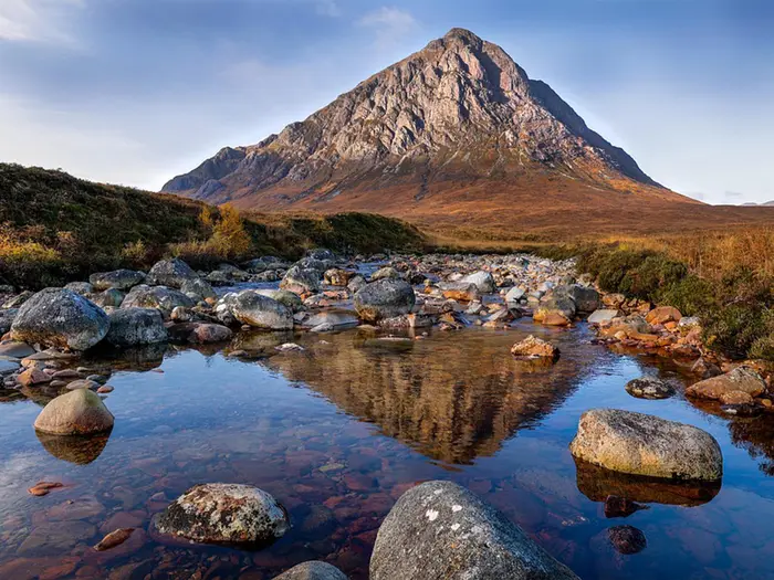
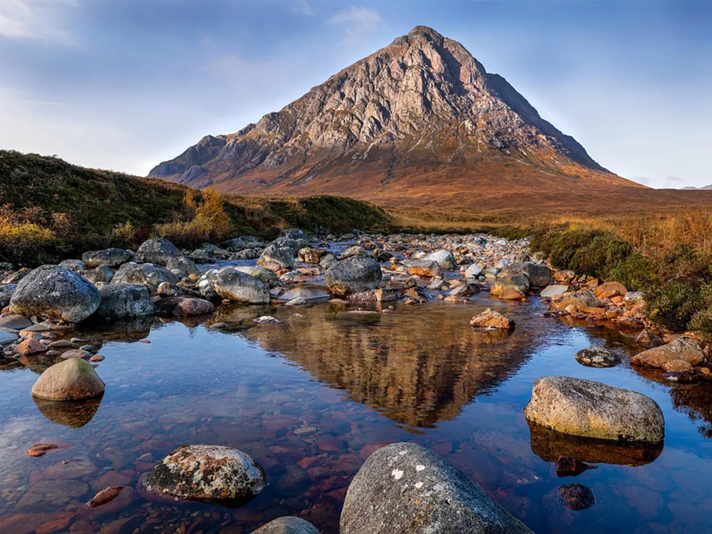
i Image by Derek Muller

1 hiker has reviewed this — add yours

Tap a star to share your experience and help other hikers.

West Highland Way: Scotland’s Classic Long-Distance Walk

Published 30 April 2025 Updated 10 June 2026
67
Ranked #67 of 974
See the Top 100 →

HikeList Score

West Highland Way scored 91/100 on HikeList's trail-quality metrics.

91
Great Hike
See score breakdownHide breakdown
  • Ideal length 100
  • Balanced challenge 100
  • Scenery & wildness 85
  • Varied terrain 83
  • Accommodation 75
  • Food & support 94
  • Path quality 98
  • Season flexibility 89

Computed from length, challenge, scenery & wildness, terrain variety, accommodation, food & support, path quality and season flexibility.

The West Highland Way is Scotland’s first official long-distance route and its most popular multi-day walk: 154 km / 96 miles from Milngavie, near Glasgow, to Fort William. Most hikers walk it south-to-north over 7 days. The route is moderate, with 4,800 m of total ascent, rocky and gravel sections, and a highest point at the Devil’s Staircase around 548 m. It suits fit walkers wanting a well-established point-to-point trail through Scotland, with hotels, campsites and wild-camping options.

Route Overview

The West Highland Way is a point-to-point trail usually walked south-to-north from Milngavie to Fort William. It passes the east shore of Loch Lomond, crosses the open ground of Rannoch Moor, reaches Glen Coe and Kingshouse, climbs the Devil’s Staircase, then descends to Kinlochleven before finishing through Glen Nevis into Fort William. The route mixes mountainous terrain, forest and grassland on dirt, gravel and rocky surfaces. Because it is not a loop, plan your start and finish logistics before setting off. If you are comparing Scottish long-distance routes, also look at the Cape Wrath Trail, Speyside Way and John Muir Way.

Historic Roads of the West Highland Way

The West Highland Way opened in 1980 as Scotland’s first official long-distance footpath. Much of the route follows older lines through the Highlands, including historic drovers’ roads used for moving livestock and 18th-century military roads. That history is part of the walk’s character: long, practical routes through glens, moorland and passes rather than a purpose-built mountain traverse.

Notable highlights

  • Loch Lomond: The route follows the loch’s east shore, giving a long waterside section early in the walk and a clear shift from lowland approach to Highland terrain.
  • Rannoch Moor wilderness: A broad, exposed moorland crossing that feels remote and is one of the route’s defining landscape changes.
  • Glen Coe: A dramatic Highland glen on the route near Kingshouse, important for both scenery and the sense of entering bigger mountain country.
  • Old military and drovers’ roads: Historic trackways give the walk a practical, old-route feel underfoot, especially where the trail uses gravel and rocky surfaces.
  • Devil’s Staircase: The highest point of the West Highland Way, at around 548 m, and the main named climb before Kinlochleven.
  • Finish under Ben Nevis: The final approach through Glen Nevis brings you into Fort William beneath one of Scotland’s best-known mountains.

Challenges to expect

Expect a moderate but sustained 7-day walk rather than a technical mountain route. The main challenges are cumulative ascent, rocky and gravel surfaces, exposed sections on Rannoch Moor, and the climb to the Devil’s Staircase. Spring, summer and autumn are the stated walking seasons, but Highland weather can make navigation, pacing and clothing choices important.

Distance
154 kilometres
Duration
7 days
Difficulty rating
Moderate
Trail type
Point to point
Elevation gain/loss
4800 metres
Highest point altitude
548 metres
When to hike
Best months: Apr–Nov
Climate: NASA POWER · location © OpenStreetMap
Show more data Show less
Permits & Fees
No permits or fees
Terrain & Landscape
  • Mountainous
  • Forest
  • Grassland
Trail surface
  • Dirt
  • Gravel
  • Rocky
Accommodation
  • Hotels
  • Campsites
  • Wild Camping Spots
Average daytime temperature
15°C
Chance of rainfall
Moderate
Estimated cost
$$
Optimal hiking season
Spring
March to May
Summer
June to August
Autumn
September to November
Accessibility
  • Family Friendly
  • Dog Friendly On Leash
Facilities
  • Restrooms
  • Potable Water Sources
  • Established Campsites
  • Shelters
  • Public Transport Access Points

Download Our Full Guide to West Highland Way FREE!

Get our comprehensive guide to this hike for free. Save it for later reading or print out at home.

Check out our library of free hiking guides

Report an issue

Spotted a mistake on West Highland Way? Tell us what's wrong and we'll fix it.

Hiker reviews

Written by HikeList users who have walked the trail — the most helpful first.

Cain★★★★☆
Difficulty: HardCompleted Took 5 days

Good route to get into more walking in Scotland

I did the West Highland Way over five days in May 2026. Positives: -It's a very scenic route, particularly after Loch Lomond -It's not technical, except for one fiddly bit towards the end of Loch Lomond -It has plenty of accommodation (of all kinds) along the way. The best ones for me were the 'wild' campsites at Bridge of Orchy and Kingshouse. -It was busy enough - there weren't too many people walking at any point, and on some days we would only see a couple What I'd do differently: -I did it in five days with a friend - this was too quick. I would definitely do no more than 10 miles on the first day, and therefore I would wild camp in the wood just before Drymen. -Similarly, the bit between Inversnaid and Inverarnan is fiddly, with lots of queues for certain bits. Together these make it tiring and time-consuming. I would account for this by making sure to have this bit as a single day. I'll be doing it again at some point, maybe in the Autumn or Winter to mix it up!

👍 1 found this helpful

Photos from hikers

Taken on the trail by people who've reviewed West Highland Way.

West Highland Way: The Complete Guide

West Highland Way i Image by Derek Muller

The West Highland Way is Scotland’s classic long-distance walk: 154 km from Milngavie, just north of Glasgow, to Fort William beneath the Ben Nevis range. It suits reasonably fit first-time multi-day walkers, but still has enough wild ground, rough path and Highland weather to keep experienced hikers fully engaged.

The route begins gently through parkland, farmland and forest before reaching Loch Lomond, where the eastern shore becomes slower, rockier and more demanding. Conic Hill gives the first proper sense of entering the Highlands, with the loch and its islands spread out below.

North of Loch Lomond, the Way opens into glens, old drove roads and military tracks through Tyndrum and Bridge of Orchy. Rannoch Moor and the edge of Glen Coe bring the walk’s most exposed country, followed by the climb over the Devil’s Staircase and the high traverse towards Kinlochleven and Glen Nevis.

The challenge is not technical mountaineering, but sustained walking over consecutive days. Good planning matters: accommodation is limited, May to September beds can book out many months ahead, and weather on Rannoch Moor or the Devil’s Staircase can make a moderate route feel serious.

This guide covers stages, day choices, accommodation, food, transport, terrain and common mistakes.

Stage-by-Stage Guide

The stages below follow the standard 8-section breakdown from Milngavie to Fort William. Distances are approximate, and many walkers recombine the shorter Highland stages or split the longer Loch Lomond and final-day sections depending on accommodation availability.

Stage 1: Milngavie to Drymen — 19 km

The walk begins at the granite obelisk on Douglas Street in the centre of Milngavie, with thistle waymarks leading north out of town. This is the gentlest stage of the West Highland Way: parkland, farmland, forest tracks and lowland paths rather than mountain terrain.

Mugdock Country Park is the main early landmark, and the day gives a useful warm-up before the rougher Loch Lomond section. Underfoot conditions are generally straightforward, but expect mud after wet weather and take care not to underestimate the cumulative distance at the start of a multi-day walk.

Food and water are easiest to arrange at Milngavie before setting off and at Drymen at the end. Do not rely on frequent resupply between settlements; carry enough water and snacks for the day, especially if starting later than planned.

Drymen is one of the key accommodation stops on the southern half of the route, with beds often booked far ahead in the main walking season. Milngavie has frequent ScotRail services from Glasgow Queen Street and Glasgow Central, making it the simplest access point on the trail.

Navigation is usually uncomplicated thanks to the waymarks, but the first day has several changes of path type through country park, woodland and farmland. Keep following the West Highland Way markers rather than assuming the broadest track is always the route.

Stage 2: Drymen to Rowardennan — 22 km

This is the first stage where the route begins to feel like Highland walking. From Drymen, the trail crosses Conic Hill before dropping to Balmaha and then continuing along the eastern side of Loch Lomond to Rowardennan.

Conic Hill is the first real climb of the West Highland Way and sits on the Highland Boundary Fault. In clear weather it gives the classic view down Loch Lomond and over its islands, but the hill can be windy, wet and slippery underfoot in poor conditions.

After Balmaha, the character changes to lochside walking, with woodland, undulating paths and views across Britain’s largest loch by surface area. This section marks the transition from the lower, more settled opening stages into wilder country.

Drymen, Balmaha and Rowardennan are the main places to plan food, water and accommodation around. Rowardennan is a small trail stop, so accommodation should be booked well in advance and opening times for food should be checked before travelling.

Navigation is generally clear, but pay attention where paths and tracks meet around Balmaha and the Loch Lomond shore. The day is not technically difficult, yet the climb over Conic Hill followed by lochside undulations makes it more tiring than the distance alone suggests.

Stage 3: Rowardennan to Inverarnan — 22 km

This is one of the most demanding stages of the West Highland Way underfoot. The route continues along the wooded eastern shore of Loch Lomond, passing Inversnaid and Rob Roy’s Cave before reaching Inverarnan.

The key difficulty is the rough, rocky and root-tangled path, especially on the Inversnaid to Inverarnan section. Progress can be slow, and this is not a stage for judging time purely by distance; wet rock, tree roots and short, awkward rises and drops all add effort.

The views across Loch Lomond are excellent where the woodland opens, but much of the attention on this day needs to stay on foot placement. In wet weather the shore path can feel significantly harder, and tired walkers carrying heavy packs often find this stage more taxing than the hillier days.

Food and water options are clustered at Rowardennan, Inversnaid and Inverarnan, with long stretches between them where you should be self-sufficient. Carry enough food and water for a slow day, and treat any natural water if used.

Accommodation at Inverarnan is limited and should be booked early. Public transport is less straightforward than at the rail-served stops farther north, so any plan to leave or join the route around this stage should be checked before travelling.

Waymarking remains helpful, but the main navigation issue is not losing concentration on the shoreline path. Allow extra time, avoid rushing, and expect the final kilometres into Inverarnan to feel slow if the path is wet or the pack is heavy.

Stage 4: Inverarnan to Tyndrum — 19 km

From Inverarnan the route leaves Loch Lomond behind and heads north through Glen Falloch towards Tyndrum. The walking becomes more open, with old military and drovers’ roads forming part of the day’s character.

Crianlarich lies near the route on a spur, and Tyndrum is the main end-of-stage settlement. This is a useful logistical stage because both Crianlarich and Tyndrum are important accommodation and transport points compared with the smaller stops on either side.

Terrain is generally less awkward than the Loch Lomond shore, but it can still be wet, stony and tiring in poor weather. The route is progressively more Highland in feel, with open glens replacing the enclosed woodland of the loch.

Food and water planning should focus on Inverarnan, the Crianlarich area if using the spur, and Tyndrum. Tyndrum is one of the better places on the route for arranging accommodation, resupply and onward transport, but beds still need booking early in season.

Crianlarich and Tyndrum are served by the West Highland Line and by Citylink coaches, making this one of the most practical sections for breaking the walk. If leaving the main trail for Crianlarich, take care to note how the spur rejoins the route rather than treating it as the through-line of the West Highland Way.

Stage 5: Tyndrum to Inveroran — 14 km

This is a shorter stage, often used to position walkers for the crossing of Rannoch Moor the following day. The route continues north through increasingly open Highland terrain, passing Bridge of Orchy before reaching Inveroran.

Underfoot, expect a mix of tracks and old routeways rather than the rough Loch Lomond shoreline. The stage is not long, but it should not be treated as a rest day if the weather is poor or if accommodation is some distance from the trail.

Bridge of Orchy is the main landmark and logistical point between Tyndrum and Inveroran. It is also one of the intermediate places on the route with rail and coach access, so it can be useful for joining, leaving or reshaping an itinerary.

Food, water and accommodation planning needs care on this stage. Tyndrum has the best starting-point services, Bridge of Orchy is the key mid-stage stop, and Inveroran is a small end point with limited capacity, so bookings and opening times should be checked before travelling.

Navigation is usually straightforward on the waymarked route, but do not drift into road-based assumptions simply because Bridge of Orchy and Inveroran are accessible places. Stay with the West Highland Way line and keep foul-weather kit accessible, as the landscape is becoming more exposed.

Stage 6: Inveroran to Kingshouse — 16 km

This is the Rannoch Moor stage, one of the defining days of the West Highland Way. The route crosses a wide, exposed expanse of heather, bog and lochans on the line of an old military or Parliamentary road, with mountains surrounding the moor.

The walking is not technically difficult, but the exposure is serious in bad weather. Wind, rain, low cloud and waterlogged ground can make this a committing section, and there are no meaningful mid-stage settlements to rely on once out on the moor.

Views across Rannoch Moor are among the great rewards of the route, but they depend heavily on weather. In poor visibility the waymarks and the old road line are still important, and a map, compass and reliable offline navigation should be carried rather than relying solely on phone signal.

Carry a full day’s food and water from Inveroran, and treat any natural water if used. Accommodation at Kingshouse and around the Glen Coe end of the stage is limited and should be booked far in advance.

There is no rail access on this stage. Any road-based pick-up, drop-off or alternative transport plan around Kingshouse should be checked before travelling, especially if bad weather might affect timing.

Stage 7: Kingshouse to Kinlochleven — 14 km

This short but memorable stage crosses the highest point of the West Highland Way. From Kingshouse, the route passes near Altnafeadh and climbs the zig-zag old military road over the Devil’s Staircase before descending to Kinlochleven.

The Devil’s Staircase reaches roughly 548–550 m and is a pass rather than a summit. The climb is steep by West Highland Way standards, but it is not technical mountaineering; the main demands are sustained effort, exposure and weather.

In clear conditions the stage gives major views back towards Glen Coe and Buachaille Etive Mòr, and onward towards the Mamores and the Blackwater Reservoir area. In wind, rain or low cloud it can feel much more serious, so waterproofs, warm layers and gloves should be easy to reach even on a short-distance day.

There should be no assumption of food or water availability between Kingshouse and Kinlochleven. Start with enough supplies for the full stage, especially if walking slowly over the pass or in poor weather.

Kinlochleven is a key trail village with accommodation, but capacity is limited and demand is high during the main West Highland Way season. The descent into Kinlochleven can feel hard on tired legs, so allow time rather than rushing the climb and drop in one push.

Navigation is usually clear on the old road line, but poor visibility on the high ground can still cause problems. Stay on the waymarked route over the pass and avoid being drawn onto other hill paths in bad weather.

Stage 8: Kinlochleven to Fort William — 24 km

The final stage is one of the longest days on the standard itinerary. It climbs out of Kinlochleven onto the Lairigmor, traverses high ground below the Mamores, then drops towards Glen Nevis and finishes in Fort William beneath Ben Nevis.

The opening climb out of Kinlochleven is a sharp start, especially after seven days of walking. Once high, the route feels broad and remote before the long approach towards Glen Nevis and the final entry into Fort William.

The key landmarks are the Lairigmor, the Mamores, Glen Nevis and the Ben Nevis range above the finish town. The traditional end point is the West Highland Way Walker statue, often called the “Man with Sore Feet”, in Gordon Square.

Carry enough food and water for a long day from Kinlochleven, as services are concentrated at the start and finish rather than reliably spread through the high middle of the stage. If using natural water, treat it before drinking.

Fort William has the strongest finish-line logistics on the route, with accommodation, ScotRail services on the West Highland Line to and from Glasgow Queen Street, the Caledonian Sleeper to and from London Euston, and Scottish Citylink and Ember coach services. Transport times should still be checked before booking onward travel, particularly if aiming for a same-day departure after walking the stage.

Navigation is generally manageable on the waymarked route, but fatigue is the main hazard. The final day is long, exposed in places and easy to underestimate after the Devil’s Staircase, so start early enough to complete the walk without rushing the descent and town approach.

Planning the Route

The West Highland Way is best planned around overnight stops rather than purely around mileage. The route is well waymarked and usually straightforward to follow, but accommodation, food access and weather exposure dictate the shape of the walk more than navigation does.

Most walkers should allow 7–8 days. The official route is divided into 8 sections, and that is the cleanest planning template for a first crossing. A 7-day itinerary is very common, but it usually means combining or reshaping at least one section and accepting one longer day.

How many days to allow

An 8-day itinerary gives the most balanced structure, especially if this is a first long-distance trail or if accommodation is being booked independently. It keeps daily distances mostly moderate and avoids turning the rough Loch Lomond shore or the final Kinlochleven–Fort William stage into unnecessary endurance tests.

A 7-day itinerary suits fit walkers who are comfortable with repeated long days and a loaded pack, or those using baggage transfer. The key is not just distance: the section between Rowardennan, Inversnaid and Inverarnan is slow underfoot, and the later Highland stages can feel much harder in poor weather.

A 6-day itinerary is possible for strong walkers, but it is a fast schedule for this route. It leaves less room for bad weather on Rannoch Moor or the Devil’s Staircase and makes accommodation logistics more awkward.

A 9-day itinerary is sensible if you want shorter days, are camping, or are building in flexibility around limited beds. It can also make the Loch Lomond section more manageable, provided suitable overnight stops are available.

Use the official 8 sections as the planning baseline

The official 8-section pattern is the simplest framework to start from:

Section Typical overnight stop
Milngavie to Drymen Drymen
Drymen to Rowardennan Rowardennan
Rowardennan to Inverarnan Inverarnan
Inverarnan to Tyndrum Tyndrum
Tyndrum to Inveroran Inveroran
Inveroran to Kingshouse Kingshouse
Kingshouse to Kinlochleven Kinlochleven
Kinlochleven to Fort William Fort William

Many walkers adjust this pattern using places such as Balmaha, Crianlarich, Bridge of Orchy and Inveroran, but every change depends on what beds, camping pitches or transport options are actually available. Do not plan an elegant mileage chart first and accommodation second; on the West Highland Way that often fails in peak season.

Accommodation drives the itinerary

Accommodation is limited and clustered in the main trail settlements: Drymen, Balmaha, Rowardennan, Inverarnan, Crianlarich, Tyndrum, Bridge of Orchy, Kinlochleven and the smaller stops between them. For May to September, beds should be booked far in advance — often 9–12 months ahead for popular dates.

This is especially important for smaller places where there are few alternatives if a stop is full. If one key night is unavailable, it may force a different stage split across several days, not just a single adjustment.

Options range from hotels, inns and B&Bs to hostels, bunkhouses, pods, campsites and wild camping. If camping, check whether the intended pitch is legal and practical before relying on it, particularly along the Loch Lomond section.

Camping and permits

Wild camping is part of how some walkers complete the route, but it is not a way to avoid planning. In Loch Lomond & The Trossachs National Park, camping byelaws apply in some management zones on the east side of Loch Lomond, typically from 1 March to 30 September, and permits may be required for informal camping.

Current byelaw zones, permit requirements and seasonal rules should be checked before travelling. This matters most around the Loch Lomond part of the route, where the trail passes through the National Park and accommodation pressure is high.

Food, water and resupply

Food planning should be tied to overnight stops. The route passes through several villages and trail settlements, but there are also long stretches where services are limited or absent, particularly once the walk moves into the Highlands.

Carry enough food for the day rather than assuming frequent resupply. Opening hours can change, and smaller trail services may not suit early starts or late arrivals. This should be checked before travelling.

Water planning is especially important on exposed sections such as Rannoch Moor and around the Devil’s Staircase. Start those stages with enough water for the conditions, and do not rely on being able to buy supplies until the next serviced stop.

Navigation and route-finding

The West Highland Way is generally well waymarked with the thistle-in-a-hexagon markers, and much of the route follows clear tracks, old military roads, forest paths and established trail. Navigation is not usually the main challenge in settled conditions.

That said, proper navigation backup is still essential. Mist, rain, fatigue and poor visibility can make the exposed crossings over Rannoch Moor, around Altnafeadh and over the Devil’s Staircase feel very different from the waymarked lowland sections.

Carry an offline map or GPX and know how to use it. The route spans multiple Ordnance Survey sheets, so anyone using paper mapping should check coverage before buying or printing maps.

Weather and seasonal planning

The route becomes progressively more exposed as it heads north. Bad weather matters most on the open Highland sections: Rannoch Moor, the approach to Kingshouse, the climb over the Devil’s Staircase, and the high ground between Kinlochleven, the Lairigmor and Glen Nevis.

Waterproofs, warm layers and gloves are not optional just because the route has no technical mountaineering. Conditions can change quickly, and strong wind or heavy rain can make otherwise straightforward walking slow and tiring.

Midges are a serious practical issue from roughly June to early September, especially in still, damp and warm conditions. A head net and effective repellent are worth packing for summer dates, particularly around lochs, woods, campsites and sheltered evening stops.

Baggage transfer and pack strategy

Many walkers use baggage transfer, which suits the West Highland Way well because the route has established overnight stops. Companies such as Travel-Lite and Sherpa Van offer West Highland Way baggage services, but terms, cut-off times, accepted accommodation and luggage rules should be checked before booking.

Even with baggage transfer, carry full day-walking essentials: waterproofs, insulation, food, water, first aid, navigation, phone power and any medication. There are sections where returning to a dropped bag is not realistic during the day.

Without baggage transfer, keep pack weight disciplined. The rough Loch Lomond shore and the climbs later in the route feel significantly harder with an overloaded rucksack.

Shortening, extending and section hiking

The West Highland Way is practical to section-hike because public transport serves both ends and some intermediate points. Milngavie has frequent ScotRail services from Glasgow, while Fort William is on the West Highland Line and is also served by coach services.

Intermediate access is best around places such as Tyndrum, Crianlarich and Bridge of Orchy, where the West Highland Line and Citylink coach services can make it possible to split the route. Timetables should be checked before travelling, especially if walking outside the main season or trying to connect transport on the same day as a long stage.

Shortening the route mid-walk is possible in planning terms, but not always convenient on the ground. Once beyond the more settled southern sections, exits are concentrated at specific villages and road/rail points rather than appearing every few miles.

Extending the trip is easiest by adding rest time in key settlements or by allowing a spare weather day. If planning to climb Ben Nevis after finishing in Fort William, treat that as a separate mountain day rather than an extension of the West Highland Way itself.

Towns, Villages and Overnight Stops

Accommodation on the West Highland Way is clustered in small trail settlements, with long sections where there is little or no fallback if a bed, meal or campsite is unavailable. For May–September dates, book beds well in advance — often 9–12 months ahead — especially at Rowardennan, Inverarnan, Inveroran and Kingshouse, where the next practical stop may be a long walk away.

The route has a good range overall — hotels, inns, guesthouses, B&Bs, hostels, bunkhouses, pods/wigwams, campsites and wild camping — but not every stop has every type. Food opening times, accommodation meal policies, baggage-transfer acceptance and camping rules should all be checked before travelling.

Place Role on the route Overnight usefulness Transport notes
Milngavie Official start Useful pre-walk night Frequent ScotRail trains from Glasgow Queen Street and Glasgow Central
Drymen First main village stop Strong first-night option Local onward transport should be checked before travelling
Balmaha Loch Lomond-side village after Conic Hill Useful shorter-stage stop This should be checked before travelling
Rowardennan Official section end on Loch Lomond Important overnight stop before rough Loch Lomond shore This should be checked before travelling
Inversnaid Small Loch Lomond stop Possible split point, very limited This should be checked before travelling
Inverarnan Official section end north of Loch Lomond Important overnight stop after the rough lochside section This should be checked before travelling
Crianlarich Near the route via spur Useful transport/accommodation alternative West Highland Line and Citylink coaches call here
Tyndrum Official section end and key service stop One of the most practical resupply/overnight stops West Highland Line and Citylink coaches call here
Bridge of Orchy Small stop before/after Inveroran Useful alternative to Inveroran West Highland Line and Citylink coaches call here
Inveroran Official section end before Rannoch Moor Strategic but very limited This should be checked before travelling
Kingshouse Glen Coe-side stage stop Strategic before the Devil’s Staircase This should be checked before travelling
Kinlochleven Main settlement before the final stage Important overnight stop This should be checked before travelling
Fort William Official finish Best end-of-walk base West Highland Line, Caledonian Sleeper, Scottish Citylink and Ember coaches

Milngavie

Milngavie is the official start, marked by the granite obelisk on Douglas Street in the town centre. It is the easiest place to reach at the beginning of the walk, with frequent ScotRail trains from Glasgow Queen Street and Glasgow Central taking roughly 25 minutes.

A pre-walk overnight here suits anyone arriving late, starting early, or wanting to avoid carrying extra food out of Glasgow. The thistle waymarks lead north from the town centre through Mugdock Country Park, so there is no need for a transfer to the trailhead once in Milngavie.

Food and last-minute supplies are best dealt with before leaving the town centre. Specific shop and café opening times should be checked before travelling.

Mugdock Country Park

Mugdock Country Park is passed soon after leaving Milngavie and is part of the lowland approach rather than a normal overnight stop. It is useful mainly as the point where the route leaves the Glasgow fringe and settles into tracks, parkland and woodland.

Do not plan on Mugdock as a resupply or accommodation stop unless a specific arrangement has been made. This should be checked before travelling.

Drymen

Drymen is the first main overnight village on the standard south-to-north itinerary, reached after the opening stage from Milngavie. It is a practical first-night stop because it breaks the walk before Conic Hill, Balmaha and the start of the Loch Lomond section.

Accommodation is part of the route’s main village cluster, but it still books up quickly in the walking season. Expect limited capacity compared with a town, and avoid assuming that late availability will exist in May–September.

Food and pub/café options make Drymen a sensible place to eat properly before the more constrained Loch Lomond stretch. Current opening times and booking requirements should be checked before travelling.

Conic Hill

Conic Hill is crossed between Drymen and Balmaha and is not an overnight stop. Its importance is practical: it is the first real climb of the route and sits immediately before the descent to Loch Lomond.

There are no reliable trail services on the hill itself. Carry water and snacks from Drymen or Balmaha, and avoid treating the climb as a place where poor weather can be ignored; the route becomes more exposed here than on the opening lowland stage.

Balmaha

Balmaha sits on Loch Lomond after the crossing of Conic Hill. It is a useful stopping point for walkers who prefer a shorter day out of Drymen or who want to split the Loch Lomond approach before continuing to Rowardennan.

Accommodation is available in the broader cluster of trail villages, but capacity is limited and should be booked early. Balmaha is also a sensible place to check food and water before committing to the long eastern shore of Loch Lomond.

Transport details from Balmaha are not part of the main rail/coach break points listed for the route. This should be checked before travelling.

Rowardennan

Rowardennan is the official section end after Drymen on the standard eight-section itinerary. It is a key overnight stop because it places walkers at the start of the most rugged part of the Loch Lomond shore.

Beds here are limited and demand is high, particularly in the main walking season. If accommodation is unavailable, changing the stage plan may be necessary rather than simply walking on and hoping for another option.

Food and evening meal arrangements should be checked when booking accommodation. The following section towards Inversnaid and Inverarnan is rough, rocky and root-tangled in places, so starting fed, rested and with supplies is more important here than on the easier southern stages.

Inversnaid

Inversnaid is a small stop on the eastern shore of Loch Lomond between Rowardennan and Inverarnan. It can be useful for walkers who want to break up the demanding lochside stage, but it should be treated as a limited-service location rather than a guaranteed fallback.

Accommodation, food availability and any onward transport arrangements must be checked before relying on them. This part of the route is slow-going underfoot, so time estimates based only on distance can be misleading.

Inverarnan

Inverarnan is the standard overnight stop after the rough Loch Lomond shore when walking the official Rowardennan–Inverarnan section. It is an important logistical point because it marks the transition from the lochside stage into Glen Falloch and the approach towards Crianlarich and Tyndrum.

Accommodation is limited and should be booked well ahead. This is not a place to arrive without a plan in high season.

Food and drink arrangements should be tied to the accommodation booking or checked separately. After Inverarnan the route becomes less technically awkward than the Loch Lomond shore, but services are still spaced out and weather can deteriorate quickly.

Crianlarich

Crianlarich is near the West Highland Way rather than a standard stage end in the official eight-section breakdown. It is useful because the West Highland Line and Citylink coaches call here, making it one of the better places for joining, leaving or breaking the walk.

Walkers may use Crianlarich as an accommodation alternative if nearby trail beds are full, or as a transport point for a section-hike. Any spur distance, accommodation transfer, taxi or baggage-transfer arrangement should be confirmed before booking around it.

Food and shop details should be checked before travelling. Crianlarich is more useful logistically than many smaller trail stops, but it still needs advance planning.

Tyndrum

Tyndrum is an official section end and one of the most practical service points on the West Highland Way. It sits after the Inverarnan stage and before the shorter official day towards Inveroran.

Accommodation is part of the main trail cluster, with more planning flexibility than the smallest stops, but advance booking remains important. It is also one of the best places to organise resupply before the route becomes more remote towards Bridge of Orchy, Inveroran and Rannoch Moor.

Tyndrum is served by the West Highland Line and Citylink coaches, making it a strong place to split the walk or leave the route if needed. Current train and coach times should be checked before travelling.

Bridge of Orchy

Bridge of Orchy is a small but useful stop between Tyndrum and Inveroran. Although the official section in this itinerary ends at Inveroran, Bridge of Orchy is often a practical alternative because it has transport links.

The West Highland Line and Citylink coaches call here, which makes it valuable for section-hikers and for walkers adjusting plans around accommodation availability. Beds and meals are still limited, so it should not be treated like a large service town.

Bridge of Orchy is also a sensible point to reassess weather before the more exposed ground ahead. Opening times, accommodation meals and baggage-transfer arrangements should be checked before travelling.

Inveroran

Inveroran is the official stage end before the crossing of Rannoch Moor. It is strategically placed, but very small, so accommodation and food options are limited and must be arranged in advance.

This is one of the stops where booking failure can create a serious staging problem. If no bed or pitch is available, Bridge of Orchy or a revised itinerary may be more realistic than relying on a last-minute solution.

The next stage crosses exposed, boggy moorland on the line of an old military/Parliamentary road. Start from Inveroran with adequate food, waterproofs and an honest weather assessment.

Rannoch Moor

Rannoch Moor is a major route section, not an overnight service stop. The crossing between Inveroran and Kingshouse is remote and exposed, with heather, bog, lochans and mountain weather shaping the day.

Do not plan on resupply, shelter or easy escape once committed to this section. Carry what is needed for the full stage and check the forecast carefully before leaving Inveroran or Bridge of Orchy.

Altnafeadh

Altnafeadh sits below the Devil’s Staircase between Kingshouse and Kinlochleven. It is a route landmark and staging reference rather than a place to rely on for accommodation or food.

The practical significance is that the climb begins here. Treat it as the point to adjust layers, eat, drink and prepare for the steep zig-zag ascent to the high point of the West Highland Way.

Kingshouse

Kingshouse, near the mouth of Glen Coe, is the standard overnight stop after the Rannoch Moor stage in this itinerary. It is also the key base before the climb over the Devil’s Staircase to Kinlochleven.

Accommodation is strategically important and should be booked very early. If it is unavailable, the itinerary may need to be changed around Bridge of Orchy, Inveroran, Kinlochleven or arranged transport; this should be checked before travelling.

Food and breakfast arrangements matter here because the next day includes the trail’s highest pass. Confirm meal times, packed-lunch options and baggage-transfer acceptance directly with the booked accommodation.

Devil’s Staircase

The Devil’s Staircase is the high point of the route, reached on the old military-road climb above Altnafeadh between Kingshouse and Kinlochleven. It is not a summit and it is not an overnight stop, but it is one of the main weather-sensitive sections of the walk.

There are no services on the pass. Carry waterproofs, warm layers, food and water from Kingshouse, and allow for slower progress in wind, rain or poor visibility.

Kinlochleven

Kinlochleven is the main overnight stop after the Devil’s Staircase and before the final stage to Fort William. It is one of the key accommodation clusters on the route and a practical place to recover before the longest official day in this itinerary.

Beds should still be booked early for May–September dates. Food, pubs, cafés and shop arrangements should be checked before arrival, especially if reaching Kinlochleven late after poor weather over the pass.

The final stage climbs out of Kinlochleven onto the Lairigmor and traverses high ground below the Mamores before dropping towards Glen Nevis and Fort William. Leave with enough food and water for a long day.

Lairigmor

The Lairigmor is the high, open section after Kinlochleven on the way to Fort William. It is not a settlement and should not be treated as a service point.

Its planning role is simple: it makes the final day more than a walk-in to town. Carry full hillwalking kit, food and water from Kinlochleven, and do not rely on services until the approach to Fort William.

Glen Nevis

Glen Nevis is the final approach area before Fort William, beneath the Ben Nevis range. For most West Highland Way walkers it is part of the finishing day rather than a separate overnight stop.

If planning to stay in or around Glen Nevis instead of Fort William, accommodation and transport details should be checked before travelling. Otherwise, continue into Fort William for the official finish and the strongest onward transport links.

Fort William

Fort William is the official finish, traditionally at the West Highland Way Walker statue in Gordon Square. It is the best place to plan an end-of-walk night, collect baggage, eat properly and organise onward travel.

The town has the strongest transport links on the northern end of the route. ScotRail trains run on the West Highland Line to and from Glasgow Queen Street, the Caledonian Sleeper links Fort William with London Euston, and Scottish Citylink and Ember coaches serve the town.

Accommodation should still be booked ahead in the walking season, particularly if finishing at a weekend or connecting with other Highland plans. Current rail, sleeper and coach times should be checked before travelling.

Getting to the Start

The West Highland Way starts in Milngavie, just north of Glasgow. The official start is the granite obelisk on Douglas Street in the centre of Milngavie, with thistle waymarks leading north out of town through Mugdock Country Park.

By train

Train is the simplest way to reach the start. Milngavie is on the suburban ScotRail network, with frequent trains from both Glasgow Queen Street and Glasgow Central; the journey is roughly 25 minutes.

From Milngavie station, head into the town centre for Douglas Street and the West Highland Way start obelisk. Allow enough time before setting off to find the marker, buy any last-minute food, and deal with baggage-transfer arrangements if using them.

Train times and platform arrangements should be checked before travelling, especially for early starts, Sunday services, public holidays and any planned engineering works.

By bus

Bus is generally less useful than the train for reaching Milngavie from central Glasgow, because the rail link is direct and frequent. Local bus options may still suit some itineraries, particularly if staying elsewhere around Glasgow or East Dunbartonshire.

Current bus routes, stops and evening/Sunday services should be checked before travelling. If arriving late, a taxi from Glasgow or from local accommodation may be the more practical fallback, but fares and availability should be checked in advance.

By car

Driving to Milngavie is possible, but it is not usually the cleanest option for a point-to-point walk ending in Fort William. Leaving a car at the start means returning from Fort William to Glasgow by West Highland Line train or coach, then taking the suburban train back out to Milngavie.

Long-stay parking arrangements in Milngavie are not something to leave to chance. Availability, restrictions, costs and security should be checked before travelling, particularly for a 7–8 day itinerary.

If a group has two vehicles, the end-to-end logistics can be made easier by placing one car at Fort William and one at Milngavie, but this adds a long road transfer at one end of the trip. For most walkers, public transport at both ends is simpler.

From the nearest airport

For walkers flying in, the practical approach is to route into Glasgow, transfer to the city centre, then take a ScotRail train from Glasgow Queen Street or Glasgow Central to Milngavie. Airport-to-city transfer times and onward train times should be checked before booking a same-day start.

A late flight arrival can make Milngavie a better overnight stop than trying to begin walking immediately. The first day to Drymen is a full walking day, so starting tired or late is a poor trade-off unless the itinerary has been deliberately shortened.

Where to stay before starting

Milngavie is the most convenient place to stay the night before starting, because it puts you close to the official obelisk on Douglas Street and avoids a morning transfer across Glasgow. Glasgow itself is also practical, provided an early train to Milngavie fits the first day’s walking schedule.

Accommodation on and near the West Highland Way books out early in the main season. For May to September starts, beds should be booked well in advance, and often 9–12 months ahead for the most popular dates.

If using baggage transfer, check where the operator requires bags to be left on the first morning and whether the service works with the chosen accommodation. Companies such as Travel-Lite and Sherpa Van offer West Highland Way baggage transfer, but current terms, labels, cut-off times and coverage should be checked before booking.

Getting Home from the Finish

The West Highland Way finishes in Fort William town centre, traditionally at the West Highland Way Walker statue in Gordon Square. Fort William is one of the easier Highland trail finishes for onward travel, but services are still timetable-dependent and should be checked before travelling, especially after a long final stage from Kinlochleven.

By train

Fort William is on the West Highland Line, with direct ScotRail services to Glasgow Queen Street taking about 4 hours. The line is scenic but not a high-frequency commuter route, so do not assume there will be a convenient train shortly after finishing.

Fort William is also served by the Caledonian Sleeper to London Euston. This can be a useful option for walkers heading south without spending another night in Glasgow, but sleeper berths and seats should be booked well ahead.

If returning to the start at Milngavie, the usual rail approach is Fort William to Glasgow Queen Street, then onward by ScotRail to Milngavie. Milngavie trains run from Glasgow Queen Street and Glasgow Central, with a journey of roughly 25 minutes from Glasgow, but the exact connection depends on the day and time.

By bus

Scottish Citylink coaches serve Fort William, including services such as the 914, 915 and 916. Ember coaches also serve Fort William.

Coaches can be useful if train times do not fit, and Citylink services also call at some intermediate West Highland Way access points such as Tyndrum, Crianlarich and Bridge of Orchy. This makes the bus network useful for walkers leaving the route early or returning to a missed section.

Book ahead where possible and check the current timetable before relying on an evening departure. Highland coach services are practical, but they are not turn-up-and-go city services.

By car/taxi

Because the West Highland Way is a point-to-point route, leaving a car at the start in Milngavie usually means arranging public transport back via Glasgow after the walk. A taxi from Fort William all the way back to Milngavie would be a major journey rather than a normal finish-day transfer.

Local taxis in Fort William are more useful for short transfers: reaching accommodation, connecting to the station or coach stop with tired legs, or moving between Glen Nevis and the town centre if needed. If finishing late, book or arrange a taxi in advance rather than assuming one will be immediately available.

From the nearest airport

For flights after the walk, the practical public-transport hub is Glasgow, reached from Fort William by train or coach. From there, onward airport arrangements should be made separately and checked against current train, coach and flight times.

Avoid booking a tight same-day flight after the final stage. The Kinlochleven to Fort William stage is a long mountain day, and a late finish, poor weather or a missed connection can quickly make an onward flight unrealistic.

Where to stay at the finish

Staying overnight in Fort William is often the simplest finish-day plan. It removes pressure from the final 24 km stage from Kinlochleven, gives a buffer for bad weather or slower walking, and makes it easier to take a morning train, coach or sleeper connection the next day.

Fort William is a major Highland trail town, but accommodation can still be busy in the main walking season. Book ahead for May to September rather than relying on finding a bed after arriving at the finish.

Which Direction Should You Walk?

The West Highland Way is traditionally walked south to north, from Milngavie to Fort William. This is the official direction of the route and the way most walkers experience it: a gradual transition from the edge of Glasgow through Loch Lomond, then into Rannoch Moor, Glen Coe, the Mamores and finally Fort William beneath Ben Nevis.

Walking it in reverse is entirely possible, but it changes the feel of the journey and can make some planning less straightforward. For most first-time West Highland Way walkers, south to north is the better choice.

South to north: Milngavie to Fort William

This is the standard and recommended direction. The start is logistically easy: Milngavie is on the suburban rail network, with frequent ScotRail trains from Glasgow Queen Street and Glasgow Central taking roughly 25 minutes. That makes it simple to arrive in Glasgow the day before, or even travel to the start on the morning of Day 1.

The scenery also builds in the right order. The early stages through Mugdock Country Park, Drymen, Conic Hill and Balmaha ease you into the walk before the rougher eastern shore of Loch Lomond. After that, the route becomes progressively more open and Highland in character, with Glen Falloch, Tyndrum, Bridge of Orchy, Rannoch Moor, Kingshouse, the Devil’s Staircase and the final high traverse towards Glen Nevis.

The finish has a clear psychological pull. Reaching Fort William and the West Highland Way Walker statue in Gordon Square, with Ben Nevis above the town, feels like a natural end point after several days of increasingly mountainous walking. It is a much stronger finale than completing the route by walking back towards the Glasgow suburbs.

Transport from the finish is also practical. Fort William is served by the West Highland Line to Glasgow Queen Street, Scottish Citylink and Ember coaches, and the Caledonian Sleeper to London Euston. Train and coach times should be checked before travelling, especially if finishing late in the day.

North to south: Fort William to Milngavie

Walking north to south can work for experienced walkers, repeat visitors or anyone whose accommodation availability forces a reverse itinerary. Fort William has good long-distance transport links, so reaching the northern end is not difficult, but it usually involves a longer initial journey than starting at Milngavie.

The main drawback is the loss of the route’s natural progression. In reverse, the biggest Highland landscapes come early: Glen Nevis, the Lairigmor, Kinlochleven, the Devil’s Staircase, Glen Coe and Rannoch Moor are encountered before the Loch Lomond stages and the lower-level approach to Milngavie. That can make the final days feel less climactic.

Reverse walkers also meet the rough Loch Lomond shore later in the trip, when cumulative fatigue may be higher. The section between Rowardennan, Inversnaid and Inverarnan is rocky, rooty and slow-going in places, and it should not be treated as an easy lowland finish simply because it sits earlier in the standard itinerary.

Finishing in Milngavie is convenient for onward travel to Glasgow, but it is a quieter ending than Fort William. The granite obelisk on Douglas Street is the official start marker rather than the traditional emotional finish of the route.

Does direction affect the difficulty?

The overall difficulty is broadly similar in either direction. The West Highland Way has no technical mountaineering, but it is a sustained long-distance walk with rough ground, cumulative ascent and exposed Highland sections whichever way it is walked.

South to north gives a more gradual build-up. You reach Conic Hill early, tackle the Loch Lomond shore after a couple of days, and only later cross Rannoch Moor and climb the Devil’s Staircase. That progression suits most walkers better than starting with the northern mountain stages immediately.

Weather exposure is not removed by choosing a direction. Rannoch Moor, the Devil’s Staircase and the higher ground before Fort William are exposed in poor conditions either way, so forecasts and kit matter more than walking direction.

Accommodation and baggage logistics

Accommodation is limited and clustered around small trail settlements such as Drymen, Balmaha, Rowardennan, Inverarnan, Tyndrum, Bridge of Orchy, Kingshouse and Kinlochleven. Direction does not change that constraint: beds still need to be booked far in advance, especially for May to September dates.

Because the route is most commonly walked south to north, many itineraries, guidebooks and stage plans are easiest to follow in that direction. Baggage transfer is commonly used on the West Highland Way, but terms, coverage and direction should be checked with the operator before booking.

Section-hikers have more flexibility. The West Highland Line and coach services call at intermediate points such as Crianlarich, Tyndrum and Bridge of Orchy, so shorter trips can be planned in either direction around public transport.

Recommendation

Walk the West Highland Way south to north, from Milngavie to Fort William, unless there is a specific reason to reverse it. This direction gives the best scenery progression, the easiest start from Glasgow, the most natural accommodation and itinerary flow, and the most satisfying finish beneath Ben Nevis in Fort William.

Accommodation Along the Route

Accommodation is one of the main planning constraints on the West Highland Way. The route is popular, the overnight stops are small, and beds are concentrated in a limited number of villages rather than spread evenly along the trail.

Most walkers use a mix of hotels, inns, guesthouses, B&Bs, hostels, bunkhouses, pods/wigwams, campsites and, where permitted, wild camping. For May to September dates, accommodation should normally be booked far in advance — often 9–12 months ahead for the best choice, especially if walking fixed stages.

Where to stay

The standard 8-section itinerary uses Drymen, Rowardennan, Inverarnan, Tyndrum, Inveroran, Kingshouse and Kinlochleven as overnight stops before finishing in Fort William. Many walkers adjust this by stopping at Balmaha, Bridge of Orchy or Crianlarich, or by using transfers where a direct on-trail bed is unavailable.

The biggest pinch points are the smaller and more isolated stops, particularly around Loch Lomond, Inveroran and Kingshouse. These are not places to reach late in the day expecting spare rooms.

Place Accommodation level Best for Notes
Milngavie Good Night before starting Official start town. Many walkers also stay in Glasgow and take the train to Milngavie, but train times should be checked before travelling.
Drymen Good by route standards First overnight on the classic south-to-north itinerary A key early stop with more choice than the smaller Loch Lomond settlements, but still books up in season.
Balmaha Limited Shorter first day or adjusted Loch Lomond itinerary Useful if splitting the Drymen–Rowardennan section differently. Availability is limited, so do not rely on last-minute beds.
Rowardennan Limited Standard stop before/along the Loch Lomond shore Important overnight point on the eastern shore of Loch Lomond. Book early, especially if following fixed stages.
Inversnaid Limited Alternative Loch Lomond shore stop Isolated and useful only if it fits the day plan. This should be checked before travelling.
Inverarnan Limited End of the rough Loch Lomond shore stage A common stopping point after the demanding Rowardennan–Inverarnan section. Accommodation should be secured well ahead.
Crianlarich Limited Off-route/spur option or itinerary adjustment The route passes near Crianlarich rather than through the centre. Use only if the extra access, transfer or onward plan works. This should be checked before travelling.
Tyndrum Good by route standards Mid-route services and overnight stop One of the more practical accommodation hubs on the route, also useful for breaking or rejoining the walk. Still busy in peak season.
Bridge of Orchy Limited Alternative to Inveroran or transport-linked stop Served by the West Highland Line and coach links, making it useful for section walkers. Beds are limited.
Inveroran Very limited Short official-stage stop before Rannoch Moor One of the tightest accommodation points. If no bed is available, adjust the stage plan rather than assuming an easy fallback.
Rannoch Moor None Day crossing only No accommodation hub on the crossing. Start with enough food, water and clothing for an exposed moorland stage.
Kingshouse Very limited Overnight after Rannoch Moor / before Devil’s Staircase A key strategic stop between Inveroran and Kinlochleven. Book as early as possible or plan a transfer/alternative stage.
Kinlochleven Good by route standards Final overnight before Fort William A practical last stop before the long final stage over the Lairigmor towards Glen Nevis and Fort William.
Fort William Good Finish night, onward travel and recovery Best place to book a post-walk night if onward train, sleeper or coach times do not line up with the finish.

Booking strategy

For a fixed-date inn-to-inn walk, book accommodation before committing to travel. It is usually easier to adjust walking dates than to force a full itinerary into a week when Rowardennan, Inverarnan, Inveroran, Kingshouse or Kinlochleven are already full.

A sensible approach is to secure the constrained nights first, then fill in the easier towns. Kingshouse, Inveroran and the Loch Lomond-side stops should be treated as priority bookings.

If walking in May to September, avoid assuming that midweek will solve availability problems. Seasonal pressure is the main issue, and weekend dates can be especially tight; current availability should be checked before booking trains or baggage transfer.

Inn-to-inn walking and baggage transfer

The West Highland Way works well as an inn-to-inn route if accommodation is booked early. Baggage transfer is common, with companies such as Travel-Lite and Sherpa Van serving the route, allowing walkers to carry a day pack between pre-booked stops.

Baggage transfer does not remove the need to book beds. Operators normally work around fixed accommodation addresses, so check their current coverage, bag limits, collection rules and delivery terms before relying on them.

Taxi or accommodation transfers can sometimes help with awkward gaps, especially where an on-route stop is full or where a walker chooses to stay off the main line at Crianlarich or another nearby base. These arrangements should be made in advance and checked before travelling.

Camping and wild camping

Camping can make the route more flexible, but it is not a complete solution to accommodation pressure. Campsites and camping facilities still need checking in advance, particularly in peak season.

Wild camping is possible in Scotland where done responsibly, but the east side of Loch Lomond has additional restrictions. Loch Lomond & The Trossachs National Park camping byelaws require permits for informal or wild camping in some management zones, typically from 1 March to 30 September; current zones and permit rules should be checked before travelling.

Do not rely on wild camping as a fallback around Loch Lomond without checking the byelaws first. This is especially important on the Rowardennan, Inversnaid and Inverarnan part of the route, where the terrain is rough and practical camping spots are not always convenient.

Camping and Wild Camping

The West Highland Way can be walked as a camping route, but it is not a casual “pitch anywhere each night” trail. The route passes through a mix of lowland farmland, busy lochside sections, protected National Park land, exposed moor and small Highland settlements where camping space and services are concentrated.

Camping works best for walkers who are already comfortable carrying a heavier pack over rough ground. The eastern shore of Loch Lomond is rocky, rooty and slow-going, while Rannoch Moor, the Devil’s Staircase and the high ground beyond Kinlochleven are exposed in poor weather.

Formal campsites and booked pitches

Campsites, camping pods, wigwams, hostels and bunkhouses form part of the normal accommodation mix on the West Highland Way. They are generally clustered around the same trail communities as other services: Drymen, Balmaha, Rowardennan, Inverarnan, Tyndrum, Bridge of Orchy, Kinlochleven and Fort William, with smaller stopping points such as Inveroran and Kingshouse also shaping stage plans.

Do not assume that every village has a pitch available on the night. May to September is very busy on the West Highland Way, and campsite cabins, pods and any indoor fallback accommodation should be booked well ahead. Tent pitches should also be reserved where possible, especially around Loch Lomond and the main stage-end villages.

A practical camping itinerary is often built around formal sites for the first half of the walk, then more flexible camping decisions north of Loch Lomond where the landscape becomes more open. Even then, weather, wind exposure and wet ground can make a planned wild-camp spot unsuitable on the day.

Wild camping and Loch Lomond restrictions

Wild camping is a real option on parts of the West Highland Way, but the most important exception is Loch Lomond & The Trossachs National Park. Camping byelaws apply in some east-Loch-Lomond camping management zones, typically from 1 March to 30 September, and informal or wild camping in those zones may require a permit.

This matters directly on the West Highland Way because the trail follows the eastern shore of Loch Lomond from Balmaha past Rowardennan and Inversnaid towards Inverarnan. Anyone planning to camp on or near this section must check the current National Park camping byelaw zones and permit rules before travelling.

Do not pitch without permission in restricted zones, enclosed fields, close to buildings, beside roads, in working farmland or anywhere that blocks access. Where the rules are unclear locally, use a formal campsite or ask locally rather than risking an illegal or disruptive camp.

Where camping is most practical

Section Camping considerations
Milngavie to Drymen Lowland, settled and farmland-influenced. Plan around formal accommodation or campsites rather than looking for an informal pitch close to villages or working land.
Drymen, Conic Hill, Balmaha and Loch Lomond Busy and sensitive, especially from Balmaha north along the loch. Check Loch Lomond & The Trossachs National Park camping byelaws and permits before planning any informal camp.
Rowardennan to Inversnaid and Inverarnan The lochside path is rough, wooded, rocky and root-tangled in places. A heavy camping pack makes this one of the harder parts of the route. Use booked sites or permitted camping where required.
Inverarnan to Tyndrum and Bridge of Orchy More open glen and old-road walking, with services concentrated in settlements. Camping plans should be linked to resupply and weather rather than assuming flat, dry ground will appear exactly where needed.
Inveroran, Rannoch Moor and Kingshouse Remote, exposed and often wet or boggy underfoot. Wild camping here is only sensible with a robust tent, good judgement and a willingness to continue if the ground or wind is unsuitable.
Kingshouse to Kinlochleven The Devil’s Staircase is the high point of the route and should not be treated as a comfortable camping objective in poor weather. Aim for lower, more sheltered ground and keep enough water for the climb and descent.
Kinlochleven to Fort William The final stage crosses high ground below the Mamores before descending towards Glen Nevis. It is a long day by standard stage plans, so a camping plan needs to account for fatigue, weather and water rather than relying on a last-minute pitch.

Water and cooking

Water planning is still necessary even though the route passes lochs, burns, boggy ground and settlements. Do not rely on untreated surface water being safe to drink; carry enough between known services and treat, filter or boil any water taken from natural sources.

The most exposed sections — especially Rannoch Moor and the ground around the Devil’s Staircase — should be approached with extra water capacity in warm weather and enough fuel to cook if conditions turn wet and cold. In settled sections, refill before leaving villages rather than expecting easy, clean water exactly at a chosen pitch.

Use a stove rather than an open fire. Open fires damage vegetation, create visible fire scars and are especially inappropriate in busy lochside areas, woodland, dry conditions or peaty moorland.

Leave No Trace on the West Highland Way

Camp late, leave early and keep tents away from paths, buildings, livestock and obvious viewpoints where they affect other walkers. Choose durable ground where possible and move on if the only available ground is boggy, fragile or already heavily impacted.

Carry out all litter, food waste and used hygiene products. Human waste should be dealt with discreetly and well away from water, paths and campsites; in busy areas, use toilets in villages, campsites, hostels, pubs or other facilities where available.

The West Highland Way is heavily used, so poor camping practice is very visible. A good wild camp on this route is one that leaves no sign after the tent is packed away.

Seasonal issues for campers

Midges are a major camping issue from roughly June to early September, particularly in still, damp and warm conditions. A head net, effective repellent and a tent with reliable midge-proof mesh are not optional luxuries in peak midge season.

Highland weather can make camping difficult at any time of year. Rannoch Moor, the Devil’s Staircase and the Lairigmor are exposed to wind and rain, and wet ground can make pitching awkward even when the map suggests open space.

For many campers, May, June or September gives the best balance of daylight, weather and midge conditions, but conditions vary year to year. Current camping byelaws, campsite opening dates and permit arrangements should be checked before travelling.

Food, Water and Resupply

The West Highland Way is not a wilderness expedition, but food and water planning still matters. Services are clustered in the trail villages, and several stages have long stretches with no reliable place to buy lunch once you have set off.

Plan around Milngavie, Drymen, Balmaha, Rowardennan, Inversnaid, Inverarnan, Tyndrum, Bridge of Orchy, Inveroran, Kingshouse, Kinlochleven and Fort William, but do not assume every stop has a shop or food available all day. Rural opening hours, seasonal service and Sunday hours can be restrictive; this should be checked before travelling.

Food planning

Accommodation meals, pubs, cafés and small village food options are the usual pattern on the West Highland Way, but availability varies sharply by place and season. The safest approach is to carry a packed lunch and snacks for each stage before leaving your overnight stop, especially from Rowardennan northwards.

The most important sections for self-sufficiency are:

  • Rowardennan to Inverarnan — rough, slow Loch Lomond shore walking with limited practical resupply once committed.
  • Inveroran to Kingshouse — the Rannoch Moor crossing is exposed and remote, with no settlement between the ends of the stage.
  • Kingshouse to Kinlochleven — shorter, but includes the Devil’s Staircase and exposed high ground.
  • Kinlochleven to Fort William — a long final stage over the Lairigmor and down towards Glen Nevis before reaching town services.

For most walkers, a sensible daily food load is breakfast sorted at accommodation or camp, lunch carried from the start of the day, plus high-energy snacks that can be eaten without stopping for long. Add an emergency snack reserve in case poor weather, injury, fatigue or the rough Loch Lomond shore slows progress.

Water planning

Do not rely on finding treated drinking water between settlements. Refill at accommodation, cafés, pubs or other services where available, and leave each village with enough water for the full stage ahead.

Natural water is common in the landscape — especially around Loch Lomond, burns, boggy moorland and glens — but it should be treated if used. Carry a filter, purification tablets or another reliable treatment method if you expect to draw from streams, lochside water or moorland sources.

Most walkers will be comfortable starting ordinary stages with around 1–2 litres, adjusting upwards in warm weather, when camping, or on exposed sections where stopping to treat water may be inconvenient. On Rannoch Moor, the Devil’s Staircase section and the final Kinlochleven to Fort William stage, it is better to leave with more than to depend on an uncertain refill.

Stage-by-stage resupply notes

Section Food availability Water availability Notes
Milngavie to Drymen Best stocked before leaving Milngavie; Drymen is the next main overnight village. Fill up in Milngavie before starting; treated water is most reliable at services and accommodation. Do not start the trail assuming Mugdock Country Park will cover lunch or water needs; carry what is needed for the day.
Drymen to Rowardennan Food options are clustered at Drymen, Balmaha and Rowardennan, but exact hours vary. Refill at accommodation or services in villages where possible. Conic Hill and the Loch Lomond approach make this a day where snacks and water should be accessible in the pack.
Rowardennan to Inverarnan Limited practical resupply once on the rough eastern Loch Lomond shore; carry lunch and snacks from Rowardennan. Natural water may be encountered, but should be treated; do not rely on treated water until services at the end. This is one of the slowest-feeling stages because of rocky, root-tangled ground between Inversnaid and Inverarnan. Carry enough food for delays.
Inverarnan to Tyndrum Services are at the ends and around the main trail settlements; Crianlarich is near the route via a spur rather than directly on every itinerary. Refill before leaving Inverarnan; use treated water at villages/accommodation where available. Carry lunch rather than relying on a mid-stage purchase, unless current opening hours have been checked.
Tyndrum to Inveroran Tyndrum is the key place to organise food before this shorter stage; Inveroran has limited services. Fill up in Tyndrum before leaving. This is a shorter day on the official stage split, but onward walkers continuing beyond Inveroran need to plan for the Rannoch Moor crossing.
Inveroran to Kingshouse No settlement between Inveroran and Kingshouse; carry all food needed for the stage. Leave with sufficient water; any natural water on Rannoch Moor should be treated. Rannoch Moor is exposed and can feel remote in poor weather. Carry extra snacks and avoid depending on a quick arrival.
Kingshouse to Kinlochleven Food is available only at the stage ends unless arranged with accommodation; carry enough for the climb and descent. Refill at Kingshouse before setting off; treated water is next reliable at Kinlochleven services/accommodation. The Devil’s Staircase is the high point of the route and can be windy, cold or wet even on a short day. Keep food and water easy to reach.
Kinlochleven to Fort William Carry lunch from Kinlochleven; full town services are at Fort William after the finish. Start with enough water for the long final stage; natural sources should be treated if used. This is the longest official stage at about 24 km and crosses high ground below the Mamores before dropping towards Glen Nevis. Do not treat it as an easy town-to-town stroll.

Practical resupply strategy

Book evening meals where accommodation is remote or has limited nearby alternatives. This is particularly important in small stops such as Inveroran and Kingshouse, where turning up without a food plan can be a problem in busy season.

For camping or self-catering, carry more food than a B&B-based walker and do not assume every village has a late-opening shop. Gas canisters, stove fuel and specialist outdoor supplies should be arranged in advance or bought in larger centres before starting; availability along the route should be checked before travelling.

In May to September, when the route is busiest, cafés and pubs can be very busy at peak walking times. In poor weather, some walkers also arrive at the same places at once, so carrying a backup lunch prevents a closed kitchen or long wait becoming a serious issue.

Terrain, Conditions and Difficulty in Practice

Overall terrain character

The West Highland Way is moderate rather than technical: there is no scrambling, no mountaineering terrain and the route is well waymarked with the thistle symbol. The real difficulty comes from walking long days on varied surfaces, dealing with sustained cumulative ascent, and managing rougher ground when tired.

Underfoot, the route changes noticeably from south to north. The early stages out of Milngavie use parkland, farmland and forest tracks, while later sections move onto stony old military and drovers’ roads, forest paths, open moorland and rough lochside trail.

The hardest terrain is not the highest point. The eastern shore of Loch Lomond, especially the rougher section between Inversnaid and Inverarnan, is slow, rocky, root-tangled and undulating. Expect pace to drop here even though the route stays close to loch level.

Key terrain sections

Section What it feels like in practice Main difficulty
Milngavie to Drymen Mostly gentle parkland, farmland and forest tracks through Mugdock Country Park and onward Easy underfoot, but still a full walking day if carrying a pack
Drymen to Balmaha / Rowardennan Conic Hill gives the first proper climb before the route reaches Loch Lomond First sustained ascent; weather exposure on the hill can make it feel harder
Rowardennan to Inverarnan The eastern shore of Loch Lomond becomes rough, rocky, rooty and constantly undulating, especially around Inversnaid to Inverarnan Slow going, awkward footing and repeated short ups and downs
Inverarnan to Tyndrum Glen Falloch and the approach to Tyndrum use a mixture of tracks and old routes through more open Highland terrain Less technical than Loch Lomond, but the cumulative mileage starts to matter
Tyndrum to Bridge of Orchy / Inveroran Old military and drovers’ roads become more prominent Stony surfaces can be tiring on feet and ankles
Inveroran to Kingshouse The crossing of Rannoch Moor is wide, open, boggy and exposed Weather exposure, wet ground and limited shelter are the main issues
Kingshouse to Kinlochleven The route climbs the Devil’s Staircase from near Altnafeadh, reaching the high point at roughly 548–550 m Steepest major climb of the route; exposed in poor weather
Kinlochleven to Fort William The final stage climbs out of Kinlochleven onto the Lairigmor and traverses high ground below the Mamores before dropping towards Glen Nevis Long final day, high ground, tired legs and a sustained finish into Fort William

Rough ground and footing

The Loch Lomond section is the place most walkers underestimate. The path can be narrow, rocky, rooty and uneven, with frequent small rises and drops that interrupt rhythm. It is not technically difficult in mountaineering terms, but it is harder work than the map distance suggests.

Old military-road sections are generally easier to follow but can be hard underfoot. Stony or cobbled surfaces are efficient in dry weather, yet they can be punishing over several consecutive days, especially with a heavy pack.

Rannoch Moor is a different kind of challenge. The route crosses a broad, remote and exposed landscape of heather, bog and lochans, and poor weather can make this feel much more serious than the height alone suggests.

Climbs, descents and exposure

Conic Hill is the first climb that feels significant, and it marks the point where the route begins to leave the lowland approach behind. It is not high, but it is exposed enough for wind and rain to matter.

The Devil’s Staircase is the route’s highest point and the most obvious named climb. It rises by zig-zags on the old military road above Altnafeadh between Kingshouse and Kinlochleven, reaching roughly 548–550 m. The climb is straightforward in good conditions but should be treated seriously in poor visibility, strong wind or sustained rain.

The final day from Kinlochleven is also demanding. The route climbs out onto the Lairigmor, traverses high ground below the Mamores and then continues down towards Glen Nevis and Fort William. Its difficulty is as much about timing and fatigue as terrain.

Wet ground, mud and seasonal conditions

The West Highland Way can be wet underfoot at any time of year. Forest paths, lochside sections and moorland can become muddy or waterlogged after rain, and Rannoch Moor is especially exposed to wet conditions.

Spring, summer and autumn are the normal walking seasons. In spring and autumn, colder wet days and shorter daylight can make the exposed northern stages feel more serious. In summer, longer daylight helps with pacing, but biting midges can be a major practical problem from roughly June to early September, especially in still, damp, warm conditions.

Waterproofs, warm layers and footwear with good grip are not optional extras on this route. Trail shoes may suit some experienced walkers in settled weather, but many hikers prefer supportive boots because of the rocky Loch Lomond shore, stony military roads and wet moorland sections.

What makes the route easier — and harder

The route is made easier by clear waymarking, frequent use of established tracks, and the absence of technical mountain terrain. It is also commonly walked with baggage transfer, which can reduce strain on the rougher days.

It becomes harder when daily distances are compressed, accommodation forces long stages, or poor weather arrives on Rannoch Moor, the Devil’s Staircase or the Lairigmor. The total ascent figure varies by measurement method, but the practical reality is clear: there is enough climbing, descending and rough walking over several days for fatigue to accumulate.

Most reasonably fit walkers can complete the West Highland Way with sensible pacing and preparation. The key is not speed, but managing the slow sections properly: allow extra time for the eastern shore of Loch Lomond, avoid treating Rannoch Moor as an easy track walk in bad weather, and keep enough energy for the climb over the Devil’s Staircase and the long final approach to Fort William.

Weather and Best Time to Walk

The West Highland Way is mainly a spring, summer and autumn walk. The best balance for most walkers is May, June or September: these months usually give better daylight for full walking days, avoid the worst of the main holiday crush, and reduce — though do not remove — the midge problem.

Highland weather is the major variable. The route is well waymarked and not technical, but sections such as the eastern shore of Loch Lomond, Rannoch Moor, the Devil’s Staircase and the high ground beyond Kinlochleven become far more serious in wet, windy or low-visibility conditions.

Best months

Period What to expect Planning implications
May–June Often the best overall window: longer daylight, generally more practical conditions, and fewer midges than peak summer. Very popular. Accommodation for May–September should be booked far in advance, often 9–12 months ahead.
July–August Peak season, with the highest pressure on beds and services. Biting midges are a major issue, especially in still, damp, warm conditions. Carry midge repellent and consider a head net. Book accommodation early and avoid relying on last-minute availability in small trail villages.
September A strong late-season option, with midges usually less of a problem than in high summer and conditions still suitable for most walkers. Still a popular month, so accommodation should be booked well ahead. Days are shortening, so start times matter more.
April and October Possible for fit, well-prepared walkers, but with more variable weather and shorter daylight than the core season. Check accommodation opening dates, transport times and current conditions before committing to a schedule.
Winter Outside the normal walking season for most West Highland Way hikers. Short daylight, poor weather and exposed terrain can make the route much more serious. Realistic only for experienced, properly equipped walkers who can navigate and make conservative decisions in winter conditions.

Rain, wind and exposure

Expect wet ground at some point, even in the better months. The route crosses country that can become boggy or waterlogged, particularly on open moorland and after prolonged rain.

The most exposed section is the crossing of Rannoch Moor between Inveroran and Kingshouse. There is little shelter, and wind, rain or low cloud can make this stage feel far more remote than its distance suggests.

The climb over the Devil’s Staircase is not a mountaineering route, but it is the high point of the West Highland Way at around 548 m. In poor weather, treat it as an exposed hill pass rather than just another trail climb.

Trail surface by season

The southern stages out of Milngavie use a mix of parkland, farmland, forest track and lower-level paths. These are generally straightforward, though prolonged rain can still make sections muddy.

The eastern shore of Loch Lomond, especially the rougher section between Inversnaid and Inverarnan, is slow in any season. Wet rock, tree roots and uneven ground make it more tiring after rain, so allow time and avoid judging the day purely by distance.

Further north, old military and drovers’ roads give long stretches of firmer going, but they can be stony, hard underfoot and exposed. Waterproof footwear, reliable waterproofs and warm layers are sensible even in summer.

Midges and ticks

Midges are a practical issue from roughly June to early September, with the worst conditions usually still, damp and warm. They are most disruptive around lochside, woodland, campsites and sheltered evening stops.

Carry effective midge repellent in summer, and a head net is worth having if camping or spending time outside in the evening. Ticks can also be an issue in Scottish grass, bracken and rough vegetation, so check skin and clothing daily.

Daylight and daily timing

The standard 7–8 day schedule includes several long walking days, including the Loch Lomond shore and the final stage from Kinlochleven to Fort William. In May and June the longer daylight gives more margin for slow terrain, photos, breaks and weather delays.

By autumn, start earlier and keep the day’s realistic pace in mind. In winter, the short daylight window is one of the main reasons the route becomes unsuitable for many walkers.

Accommodation and seasonal pressure

Accommodation is limited and clustered around small trail villages such as Drymen, Balmaha, Rowardennan, Inverarnan, Tyndrum, Bridge of Orchy, Kinlochleven and Fort William. For May to September, beds should be booked well in advance — often 9–12 months ahead.

Camping gives more flexibility, but it is not a way to ignore planning. Loch Lomond & The Trossachs National Park camping byelaws require permits for informal or wild camping in some east-Loch-Lomond management zones, typically 1 March–30 September. Current zones and permit requirements should be checked before travelling.

Safety Notes

The West Highland Way is well waymarked and non-technical, but it is still a long Highland route with rough ground, exposed moorland and changeable weather. Treat it as a serious multi-day walk rather than a village-to-village stroll, especially from the northern end of Loch Lomond onwards.

Emergency help

In the UK, call 999 or 112 in an emergency. If assistance is needed in the hills, ask for Police, then Mountain Rescue.

Mobile signal should not be relied on throughout the route, particularly on the more remote Highland sections. Carry an offline map or paper mapping, keep your phone charged, and make sure someone knows your day’s intended destination if walking solo.

Main route hazards

Loch Lomond’s eastern shore is one of the slowest and most awkward parts of the West Highland Way. The section between Rowardennan, Inversnaid and Inverarnan includes rough, rocky and root-tangled path, often slippery when wet. Allow more time than the distance suggests and avoid rushing with a heavy pack.

Rannoch Moor is wide, exposed and boggy, with little shelter once committed to the crossing. Poor visibility, strong wind and persistent rain can make this section feel far more serious than its altitude suggests. Check the forecast before leaving Inveroran or Bridge of Orchy-side accommodation and carry waterproofs, warm layers and enough food and water for the full crossing.

The Devil’s Staircase is the high point of the route, a steep zig-zag climb above Altnafeadh between Kingshouse and Kinlochleven. It is not technical, but it is exposed to wind and weather. In low cloud, heavy rain or strong wind, keep to the waymarked line and avoid lingering on the high ground.

The Lairigmor and the approach to Glen Nevis form a long final stage from Kinlochleven to Fort William. It can feel remote once above Kinlochleven, and tired legs are common by this point of the walk. Start with enough daylight and do not underestimate the last day simply because Fort William is close on the map.

Weather, heat and cold

Highland weather can change quickly in any walking season. Waterproof jacket and trousers, warm layers, hat and gloves are sensible even in summer, particularly for Rannoch Moor, the Devil’s Staircase and the high ground beyond Kinlochleven.

Warm, still days bring their own risks: dehydration, sun exposure and midges. Carry enough water between services, use sun protection when needed, and in midge season take repellent and, if camping or stopping outside for long periods, a head net.

Water, bog and slippery ground

The route passes Loch Lomond, lochans, boggy moorland and wet woodland paths. Avoid stepping onto unstable banks, wet rocks or submerged ground where the depth is unclear. The Loch Lomond shore in particular can be awkward underfoot, with slips more likely on wet roots and polished rock.

Streams, lochs and burns should not be treated as automatically safe drinking water. If using natural water, it should be treated appropriately.

Roads, settlements and livestock

The West Highland Way is mainly on paths, tracks, old military roads and drovers’ routes rather than prolonged road walking. Even so, take care where the route passes through villages, accommodation areas, car parks and road crossings, especially at the start or end of a long day when attention tends to drop.

The southern stages include farmland, and open grazing may be encountered elsewhere. Give livestock space, close gates, and keep dogs under close control. If cattle are present, avoid walking directly through the middle of a group.

Solo hiking

Solo walking is common on the West Highland Way, but the remote sections require sensible margins. Do not rely on meeting other walkers for help, especially early or late in the day, outside peak season, or in poor weather.

A solo walker should carry navigation, waterproofs, insulation, food, water, a first-aid kit and a charged phone as a minimum. If using baggage transfer, keep essential safety kit with you rather than sending it ahead.

Daily checks before setting off

Before each stage, check:

  • the day’s weather forecast, including wind and visibility on exposed ground;
  • any current route diversions or access notices;
  • daylight available for the planned stage;
  • food and water availability before the next village or accommodation stop;
  • accommodation check-in arrangements and baggage-transfer requirements if used;
  • whether there is a realistic escape option if the weather deteriorates, particularly around Rannoch Moor, Kingshouse, the Devil’s Staircase and the Lairigmor;
  • phone battery, offline mapping and emergency contact arrangements.

None of these checks is complicated, but they make the difference between a straightforward long-distance walk and an avoidable problem in remote Highland terrain.

Gear Recommendations

The West Highland Way is not a technical mountain route, but it does need proper hillwalking kit. The main gear demands are wet Highland weather, rough footing on the eastern shore of Loch Lomond, exposed sections on Rannoch Moor and the Devil's Staircase, and multi-day wear on feet, knees and shoulders.

Pack lighter than for a wilderness expedition unless camping. The route passes villages and accommodation clusters, and many walkers use baggage transfer, but the long stages still require reliable day kit, food, water and spare warmth.

Footwear

Choose footwear for mixed, often wet ground rather than for speed alone. The route includes firm tracks, forest paths, stony old military roads, boggy moorland and the rough, rocky, root-tangled Loch Lomond shore between Rowardennan, Inversnaid and Inverarnan.

Waterproof walking boots or robust trail shoes both work, depending on preference and load. Boots give more ankle support on the Loch Lomond section and on long stony days, while trail shoes can be comfortable for experienced walkers carrying a light pack; in wet weather they will not stay dry for long.

Whatever footwear is chosen, it should already be broken in. Blister prevention matters on this route because the challenge is cumulative: repeated days of 14–24 km, wet socks, hard track and rough path can quickly turn minor rubbing into a trip-ending problem.

Useful foot-care items include:

  • spare walking socks, ideally enough to rotate dry pairs;
  • blister plasters or tape;
  • a small towel or cloth for drying feet at stops;
  • gaiters if walking in prolonged rain or boggy conditions.

Waterproofs and Warm Layers

Full waterproofs are essential, not optional. A waterproof jacket with a hood and waterproof trousers should be carried even in a settled forecast, particularly for Rannoch Moor, the Devil's Staircase and the high traverse beyond Kinlochleven.

Avoid relying on a single warm top. A practical layering system is better: a wicking base layer, fleece or light insulated layer, waterproof shell, hat and gloves. The route's high point is only around 548–550 m, but exposed wind, rain and low cloud can make the higher sections feel much more severe than their altitude suggests.

A dry layer for the evening is worth protecting carefully. Inn-to-inn walkers using baggage transfer should still keep one warm layer in the day pack, not in the transferred bag.

Navigation

The West Highland Way is well waymarked with thistle waymarks, and navigation is usually straightforward in clear conditions. That should not be treated as a substitute for map-and-route awareness, especially in poor visibility on Rannoch Moor, around the Devil's Staircase and on the final high ground towards Glen Nevis.

Carry at least one reliable offline navigation method. A phone with offline mapping or GPX is useful, but it should be backed up by a paper map or guidebook and enough battery reserve to last the day. OS Explorer and Landranger mapping covers the route; walkers carrying paper maps should make sure the full Milngavie to Fort William line is covered.

A compass is sensible if using paper maps. It is also worth downloading route information before setting off each morning, as mobile signal should not be assumed in the more remote Highland sections.

Water and Food Carry

Do not start each day with only a token bottle. Some stages pass through settlements, but the route also has long stretches of open moorland, lochside path and old road where services are limited or absent.

A sensible approach is to carry enough water for the full stage ahead unless a definite resupply point is part of the day's plan. This is particularly important on the Rannoch Moor crossing, the Kingshouse to Kinlochleven stage over the Devil's Staircase, and the final Kinlochleven to Fort William stage across the Lairigmor and down to Glen Nevis.

Food carry can usually be lighter than on a remote expedition, but each day pack should contain lunch, snacks and an emergency reserve. Do not depend on arriving at a village before eating; rough ground, weather and foot problems can make stages take longer than expected.

Campers should plan food more carefully than inn-to-inn walkers. Services are clustered in places such as Drymen, Balmaha, Rowardennan, Inverarnan, Tyndrum, Bridge of Orchy, Kinlochleven and Fort William, but opening times, stock and meal availability should be checked before travelling.

Trekking Poles

Trekking poles are strongly recommended for many walkers, especially with a multi-day pack. They help on the long hard tracks, the stony old military roads, the descent into Kinlochleven, and the rough Loch Lomond shore where balance and repeated small steps are tiring.

Poles are also useful in wet conditions on boggy or slippery ground. They are not essential for fit walkers carrying a light pack, but they can reduce accumulated strain over a 154 km route.

Power and Electronics

A power bank is useful even for accommodation-based walkers. Phones are often used for navigation, bookings, weather checks, photography and transport updates, and long days can drain batteries quickly in cold, wet weather.

Keep electronics in a dry bag or waterproof pouch. A small head torch is also sensible, particularly in spring and autumn, or if a stage runs longer than expected due to weather or delays.

Sun, Midges and Seasonal Protection

Scottish weather can turn from rain to strong sun quickly, so carry sun cream, sunglasses or a cap in spring and summer. Exposed sections such as Rannoch Moor and the Devil's Staircase offer little shelter from either sun or wind.

Biting midges are a major practical issue from roughly June to early September, especially in still, damp, warm conditions. Midge repellent and a head net are worth carrying during that period, particularly for campers and anyone spending time outside in the evening.

In colder spring or autumn conditions, add warmer gloves, a warmer hat and a more substantial insulation layer. Weather on the Highland sections can feel wintery even outside winter if wind and rain combine.

If Walking Inn-to-Inn or Using Baggage Transfer

Inn-to-inn walkers can keep the carried load low, but the day pack still needs to be capable of handling a full bad-weather day. Baggage transfer should not lead to sending all spare clothing, food and waterproof protection ahead.

Carry each day:

  • waterproof jacket and trousers;
  • warm layer, hat and gloves;
  • lunch, snacks and sufficient water for the stage;
  • map or offline navigation plus power bank;
  • blister kit and basic first aid;
  • phone, booking details and any essential medication.

A small dry bag inside the day pack is useful for the warm layer and electronics. Footwear for evenings is also welcome, but it can travel in the main bag rather than the day pack.

If Camping

Campers need a more robust kit plan because the route becomes progressively wilder north of Loch Lomond. A tent, sleeping bag and mat should be suitable for wet, windy Highland conditions rather than fine-weather park camping.

Keep the shelter easy to pitch in rain and wind, and use waterproof packing for sleeping kit. A stove and food carry may be needed depending on the chosen overnight stops, but open-fire assumptions and informal camping plans need care.

Loch Lomond & The Trossachs National Park camping byelaws require permits for informal or wild camping in some east-Loch-Lomond management zones, typically from 1 March to 30 September. Current zones and permit requirements should be checked before travelling.

Campers should also be stricter about midge protection. A head net, effective repellent and the ability to cook or organise kit quickly in the evening can make a major difference in summer.

If Fastpacking or Section-Hiking

Fast and section walkers can use lighter footwear and a smaller pack, but should not strip out safety basics. The route's waymarking and transport links at places such as Tyndrum, Crianlarich and Bridge of Orchy make section walking practical, yet the exposed Highland stages still require hillwalking kit.

For faster days, prioritise a waterproof shell, emergency warm layer, water capacity, food, navigation and a charged phone. The rough Loch Lomond shore is slower than many walkers expect, so ambitious timing should allow for technical ground rather than assuming easy track pace throughout.

Section hikers joining for Rannoch Moor, Kingshouse to Kinlochleven, or Kinlochleven to Fort William should kit themselves as for a full mountain day. These are not the places to rely on minimal urban walking gear.

Budget and Costs

The West Highland Way can be done fairly cheaply by camping and cooking, but it can also become expensive quickly because accommodation is limited in the smaller trail villages. The main budget decision is whether to camp, use hostels and bunkhouses, or book B&Bs, inns and hotels.

All costs are in GBP (£). Current prices should be checked before booking, especially for May–September dates, when beds on the route can be booked 9–12 months ahead.

Main cost drivers

Cost item What to budget for
Accommodation The biggest variable. Campsites and wild camping are the lowest-cost approach; hostels and bunkhouses sit in the middle; B&Bs, inns and hotels are usually the highest-cost option, especially at small stops such as Rowardennan, Inverarnan, Bridge of Orchy, Inveroran, Kingshouse and Kinlochleven.
Food Costs depend heavily on whether you self-cater or eat in pubs, hotels and cafés. Carry extra food for the more remote sections, particularly around Loch Lomond, Rannoch Moor and the approach to Kingshouse.
Transport Milngavie is easy to reach by ScotRail from Glasgow Queen Street or Glasgow Central. Fort William has ScotRail services to Glasgow Queen Street, the Caledonian Sleeper to London Euston, and Scottish Citylink and Ember coach services. Fares vary by date and booking time.
Baggage transfer Optional but common on this route. Companies such as Travel-Lite and Sherpa Van operate West Highland Way baggage transfer services. Check current prices, bag-weight limits, accommodation coverage and booking terms before relying on them.
Taxis and short transfers Useful if accommodation is off-route or if a stage needs to be shortened, but rural taxi availability can be limited and costs can rise quickly over longer distances. Book ahead where possible.
Camping permits Wild or informal camping in some Loch Lomond & The Trossachs National Park management zones requires a permit, typically from 1 March to 30 September. Current zones, rules and permit costs should be checked before travelling.

Budget approaches

Approach Best for Cost pattern
Low-budget Campers carrying their own kit, cooking most meals and using public transport Lowest accommodation cost, but requires a heavier pack unless using baggage transfer. Allow for campsite fees, any required camping permits, stove fuel and extra food carried between villages.
Mid-range Walkers using hostels, bunkhouses, simple rooms and occasional pub meals Often the best balance for independent hikers, but availability is limited at several stops. Book early and do not assume a cheap bed will be available in every village.
Comfortable Walkers booking B&Bs, inns, hotels, baggage transfer and most meals out The easiest logistically, but the most expensive and the most dependent on early booking. Small-place accommodation can sell out long before transport fares or luggage transfer need to be finalised.

Accommodation costs and booking strategy

Accommodation should be priced before committing to travel dates. The route passes through small villages where there may be only a handful of practical overnight options, so a single full stop can force a more expensive room, an off-route transfer or a changed itinerary.

For May–September, book beds as far ahead as possible. This is especially important at Rowardennan, Inverarnan, Bridge of Orchy, Inveroran, Kingshouse and Kinlochleven, where choice is more constrained than in Milngavie, Drymen, Tyndrum or Fort William.

Camping reduces accommodation spend, but it is not cost-free. Budget for campsites where used, any required Loch Lomond camping permits, and the extra food and equipment needed to stay self-sufficient.

Food and drink costs

Self-catering is the cheapest approach, but it needs planning because services are clustered. Milngavie, Drymen, Balmaha, Tyndrum, Kinlochleven and Fort William are more useful resupply points than the remoter sections around Loch Lomond, Inveroran, Rannoch Moor and Kingshouse.

Eating out each evening is convenient but can make the walk substantially more expensive. In smaller stops, check meal availability when booking accommodation; some places may require advance table bookings or have limited options nearby.

Transport costs

The cheapest transport plan is usually to use public transport at both ends: ScotRail into Milngavie from Glasgow, then ScotRail or coach from Fort William after finishing. Advance fares, railcard eligibility and coach prices can change, so compare current train and coach options before booking.

Intermediate public transport at Tyndrum, Crianlarich and Bridge of Orchy can help with section-hiking or shortening the route, but timetables should be checked before travelling. A taxi-based itinerary is possible in places, but it will usually cost more than planning around the train and coach network.

Baggage transfer and packages

Baggage transfer is a common extra cost on the West Highland Way and can be worth budgeting for if long days, rough Loch Lomond terrain or a heavier camping load would otherwise be a problem. Check whether each overnight stop is covered before booking accommodation.

Self-guided packages can simplify accommodation and baggage logistics, but they should be compared against a DIY booking. The package price may be worthwhile in peak season if it secures scarce beds, but it will usually reduce flexibility over stage lengths and accommodation type.

Luggage Transfer, Guided Tours and Support Services

Luggage transfer

The West Highland Way is very well suited to luggage transfer. Most walkers stay in booked accommodation and carry only a day pack, which makes the long stages, the rough eastern shore of Loch Lomond, Rannoch Moor and the Devil’s Staircase far more manageable.

Companies such as Travel-Lite and Sherpa Van offer West Highland Way baggage transfer between overnight stops. Services typically move one main bag per person from accommodation to accommodation each day, allowing you to walk with waterproofs, food, water, warm layers and essentials rather than a full multi-day pack.

Book luggage transfer at the same time as accommodation, especially for May–September. The key issue is not only courier availability but whether your chosen stopping places are practical: beds are limited in places such as Rowardennan, Inverarnan, Inveroran, Kingshouse and Kinlochleven, and some itineraries use slightly different stage breaks.

Check the operator’s current bag-weight limits, labelling requirements, pick-up times, delivery windows and cancellation terms before booking. Prices vary by itinerary, number of bags and season, so current costs should be checked directly with the operator.

Luggage transfer is less useful if you are wild camping or changing plans day by day. Couriers work best with fixed overnight addresses; they should not be relied on for informal camping locations or last-minute changes in remote sections.

Self-guided walking packages

Self-guided West Highland Way packages are a common choice for walkers who want the logistics handled but still want to walk independently. These packages typically include pre-booked accommodation, luggage transfer, route information and support contact details.

They suit walkers travelling in the busy season, anyone short on planning time, and those who want to avoid piecing together beds in small settlements. They can also be useful where the preferred itinerary differs from the official 8-section structure, for example by using Balmaha, Bridge of Orchy or other adjusted stopping points.

They are unnecessary for confident independent hikers who are happy to book accommodation, baggage transfer and transport separately. The route is waymarked and has strong public transport at Milngavie and Fort William, with useful intermediate rail and coach access at places such as Crianlarich, Tyndrum and Bridge of Orchy.

Guided walks

A fully guided West Highland Way trip is not essential for navigation, as the route is waymarked and widely walked. Guided options are mainly worth considering if you prefer a group structure, want the reassurance of an organised leader in poor Highland weather, or do not want to make daily decisions about pacing, timing and logistics.

For most reasonably fit walkers, a self-guided approach with accommodation booked ahead and baggage transfer arranged is the standard level of support. The main challenges are cumulative distance, rough terrain on the Loch Lomond shore, exposed weather on Rannoch Moor and the climb over the Devil’s Staircase, rather than technical route-finding.

Taxis, public transport and off-route support

Local taxis can be useful where accommodation is off the line of the trail, when breaking a stage differently, or if a walker needs to leave the route because of injury, illness or bad weather. Availability is not guaranteed in smaller settlements, so taxi transfers should be arranged in advance rather than assumed on the day.

Public transport is a practical backup on parts of the route. Milngavie has frequent ScotRail trains from Glasgow; Fort William has ScotRail services to and from Glasgow Queen Street, the Caledonian Sleeper to and from London Euston, and coach services. The West Highland Line and Scottish Citylink coaches also serve intermediate points such as Crianlarich, Tyndrum and Bridge of Orchy, making it possible to split the route or leave and rejoin at certain places.

Do not rely on transport as a daily safety net for every stage. Sections such as the eastern side of Loch Lomond, Rannoch Moor and the high ground between Kingshouse, Kinlochleven and Fort William need to be treated as proper walking days with full wet-weather kit, food, water and enough warm clothing even if luggage transfer is being used.

Shorter Hikes and Best Sections

The West Highland Way works well as a section hike, but the easiest short plans are the ones built around reliable transport points: Milngavie, Tyndrum, Bridge of Orchy and Fort William. Other endpoints can still be used, but taxis, accommodation transfers or local pick-ups may be needed; this should be checked before travelling.

Distances below use the standard stage distances and are approximate.

Best for Start → end Approx. distance Why choose it Transport notes
Best single day for classic Highland scenery Kingshouse → Kinlochleven 14 km A compact but memorable day over the Devil’s Staircase, the high point of the route, with views back towards Glen Coe and on towards the Mamores and Blackwater Reservoir. It is short by West Highland Way standards but still has a steep, exposed climb. Kingshouse and Kinlochleven logistics need planning; arrange drop-off, pick-up, taxi or an overnight stop. This should be checked before travelling.
Best easier first-timer day Milngavie → Drymen 19 km The gentlest way to sample the route: well-waymarked walking through Mugdock Country Park, farmland and forest before the trail becomes rougher and more remote further north. Milngavie is easy by frequent ScotRail trains from Glasgow Queen Street and Glasgow Central. Onward transport from Drymen should be checked before travelling.
Best weekend section Drymen → Inverarnan 44 km A two-day section with a strong sense of progression: Conic Hill, the descent to Balmaha, Loch Lomond, Rowardennan, Inversnaid and the rough eastern loch shore towards Inverarnan. This is scenic but physically harder than the mileage suggests because the Inversnaid–Inverarnan section is rocky, rooty and slow. Accommodation around Rowardennan, Inversnaid and Inverarnan is limited and should be booked early. Endpoint transport is less straightforward than at Tyndrum or Fort William, so check logistics before committing.
Best 3–5 day section Tyndrum → Fort William 68 km The strongest short version of the northern half: Tyndrum, Bridge of Orchy, Inveroran, Rannoch Moor, Kingshouse, the Devil’s Staircase, Kinlochleven, the Lairigmor, Glen Nevis and the finish in Fort William. It gives the full Highland character of the route without walking the whole 154 km. Tyndrum and Fort William are both strong public-transport points. ScotRail and Scottish Citylink serve Tyndrum, Bridge of Orchy and Fort William, allowing some itinerary flexibility; current times should be checked before travelling.
Best section for scenery Inveroran → Kinlochleven 30 km The most concentrated wild-country section: Rannoch Moor, the approach to Glen Coe, views towards Buachaille Etive Mòr, then the Devil’s Staircase and the descent to Kinlochleven. Expect exposed walking and changeable Highland weather. Bridge of Orchy is the practical public-transport anchor before Inveroran, with rail and coach services. Logistics between Bridge of Orchy, Inveroran and Kinlochleven should be planned in advance.
Best for public transport Tyndrum → Fort William 68 km This is the cleanest substantial section for walkers without a car, because the start and finish are both on major route connections and Bridge of Orchy can be used as an intermediate access point. Tyndrum, Bridge of Orchy and Fort William are served by the West Highland Line and Scottish Citylink coaches. Fort William also has direct ScotRail services to Glasgow Queen Street and the Caledonian Sleeper to London Euston.
Best for villages and accommodation choice Milngavie → Tyndrum 82 km This southern-to-mid route links the most regular run of settlements: Drymen, Balmaha, Rowardennan, Inversnaid, Inverarnan, the Crianlarich area and Tyndrum. It is still not a casual booking route, especially around Loch Lomond, but there are more accommodation clusters than on the exposed northern stages. Milngavie is easy from Glasgow by train, and Tyndrum has rail and coach links. Beds on the West Highland Way can book out 9–12 months ahead for May–September dates.
Best shorter camping itinerary Tyndrum → Fort William 68 km A good choice for experienced campers who want the wilder northern stages while avoiding the Loch Lomond east-shore camping management zones. The trade-off is exposure: Rannoch Moor, the Devil’s Staircase and the high ground beyond Kinlochleven need proper wet-weather and wind-resistant kit. Start at Tyndrum and finish at Fort William using rail or coach. If camping anywhere near the east side of Loch Lomond on other itineraries, permit requirements in the National Park’s camping management zones apply in season and must be checked before travelling.

Highlights and Points of Interest

The West Highland Way’s strongest moments come from its changing landscape: lowland parkland, the wooded shore of Loch Lomond, old drove and military roads, open Highland moor, then the final approach beneath the Mamores and Ben Nevis. If the schedule allows extra time anywhere, the most rewarding pauses are around Balmaha and Conic Hill, the Loch Lomond shore, Kingshouse and Glen Coe, and Fort William.

Milngavie, Mugdock Country Park and the Lowland Start

The official start in Milngavie is marked by the granite obelisk on Douglas Street, making it the natural place for the first photo and final kit checks before leaving the town centre. From there, the thistle waymarks lead north through Mugdock Country Park, giving the route a gentle opening before the terrain becomes more remote.

This first stretch is not the wildest part of the Way, but it is useful psychologically: easy navigation, softer scenery and regular services before the more committing sections farther north. Drymen is the first major overnight stop and a practical place to regroup before Conic Hill and Loch Lomond.

Conic Hill and the First Highland View

Conic Hill is the first real climb of the route and one of the best viewpoints on the whole trail. It sits on the Highland Boundary Fault above Balmaha, with a broad panorama down Loch Lomond and across its islands.

For many walkers, this is the point where the West Highland Way begins to feel like a Highland walk rather than a lowland approach. In poor weather, the hill is still straightforward walking rather than technical terrain, but the exposed top is worth treating with proper waterproofs and warm layers.

Balmaha and the Eastern Shore of Loch Lomond

Balmaha is one of the best places to pause on the southern half of the route, especially if the day’s plan has allowed time after crossing Conic Hill. It sits at the start of the long Loch Lomond section and is a useful transition point before the path becomes more wooded, undulating and rougher underfoot.

From Balmaha northwards, the Way follows the eastern shore of Loch Lomond for roughly a day and a half, passing Rowardennan, Inversnaid and Rob Roy’s Cave before reaching Inverarnan. This is one of the defining sections of the trail: beautiful, enclosed and atmospheric, but also slower than the map distance can suggest.

The stretch between Inversnaid and Inverarnan is especially rough, rocky and root-tangled. It is a highlight, but not an easy waterside stroll; allow time, avoid rushing it late in the day, and expect slower progress in wet conditions.

Rowardennan, Inversnaid and Rob Roy’s Cave

Rowardennan is a key stopping point on the Loch Lomond shore and a natural place to appreciate the scale of the loch before the path becomes more demanding. North of here, the walking feels wilder and more enclosed, with the wooded shore pressing close to the water.

Inversnaid and Rob Roy’s Cave add local interest to the route, but the main appeal is the setting rather than a conventional visitor-attraction stop. This is a section to enjoy at walking pace, with short pauses where the shoreline opens up.

Glen Falloch, Tyndrum and the Old Routes North

Beyond Inverarnan, the Way leaves Loch Lomond and moves into open glens, following old military and drove-road lines towards Crianlarich, Tyndrum and Bridge of Orchy. These historic routes give the middle part of the walk a distinctive underfoot character: practical, direct and built for movement through the Highlands.

Tyndrum is a useful place to spend a little extra time if resupply, food or a more comfortable overnight stop is needed. The surrounding walking is less dramatic than Rannoch Moor or Glen Coe, but it forms the important transition from lochside walking into the broader Highland stages.

Bridge of Orchy and Inveroran

Bridge of Orchy and Inveroran mark the point where the Way begins to feel more remote. The landscape opens out, services become thinner, and the walking starts to prepare you for the exposed crossing of Rannoch Moor.

Inveroran is a particularly useful quiet stop if the itinerary has been split to avoid an overlong day. It also gives an early start onto Rannoch Moor, which is a sensible advantage in unsettled weather.

Rannoch Moor

Rannoch Moor is one of the great highlights of the West Highland Way: a wide, exposed expanse of heather, bog and lochans encircled by mountains. The route crosses it on the line of an old military or Parliamentary road, so the navigation is generally clear, but the sense of space and remoteness is real.

This is a place to slow down and look around, provided the weather allows. In poor conditions it can feel bleak and committing, with little shelter, so it is also one of the sections where waterproofs, warm layers, food and navigation backup matter most.

Kingshouse, Glen Coe and Buachaille Etive Mòr

The approach to Kingshouse brings one of the most recognisable views on the route: the mouth of Glen Coe with Buachaille Etive Mòr dominating the scene. The mountain’s pyramid profile is one of Scotland’s most photographed Highland landmarks and is a major visual turning point on the Way.

Kingshouse is worth building time around if the schedule allows, especially for walkers who want to arrive early enough to enjoy the Glen Coe setting rather than simply sleep and move on. It is also the practical base before the climb over the Devil’s Staircase.

The Devil’s Staircase

The Devil’s Staircase is the high point of the West Highland Way at around 548 m, reached on a zig-zag old military-road climb above Altnafeadh between Kingshouse and Kinlochleven. It is not a summit, but it is the most notable pass on the route and one of the most memorable walking sections.

The climb is steep by West Highland Way standards, though not technical in normal conditions. The reward is the view back over Glen Coe and onwards towards the Mamores and the Blackwater Reservoir area before the descent to Kinlochleven.

Kinlochleven, the Lairigmor and the Mamores

Kinlochleven is the main settlement between Kingshouse and Fort William and a natural place to recover after the Devil’s Staircase stage. It also sits below the final day’s climb, so a well-timed overnight here makes the last long stage more manageable.

The final section climbs out of Kinlochleven onto the Lairigmor and traverses high ground below the Mamores. This is one of the best sustained landscape sections late in the walk: less iconic than Glen Coe, but spacious, high and rewarding before the long approach to Glen Nevis.

Glen Nevis, Ben Nevis and Fort William

The final approach through Glen Nevis brings the route towards Fort William beneath the Ben Nevis range. Ben Nevis, Britain’s highest mountain, gives the finish a strong sense of arrival even though the West Highland Way itself does not climb it.

The traditional finish is at the West Highland Way Walker statue — often called the “Man with Sore Feet” — in Gordon Square, Fort William. It is worth allowing enough time at the end for the finish itself rather than planning a rushed departure immediately after the final descent.

Best Places to Linger

Place / section Why spend extra time here? Practical note
Conic Hill and Balmaha First major viewpoint over Loch Lomond and its islands Best enjoyed without rushing the descent into Balmaha
Loch Lomond eastern shore Wild wooded lochside walking, Rowardennan, Inversnaid and Rob Roy’s Cave Rough underfoot north of Inversnaid; progress can be slow
Inveroran / Rannoch Moor A quieter, more remote Highland atmosphere Starting early helps on the exposed moor stage
Kingshouse and Glen Coe Views towards Buachaille Etive Mòr and the Glen Coe mountains A good place to arrive with daylight to spare
Devil’s Staircase Highest point of the Way and a classic pass crossing Exposed in poor weather; carry layers and waterproofs
Kinlochleven to Glen Nevis High final-stage walking below the Mamores The last day is long, so avoid underestimating it
Fort William Traditional finish beneath the Ben Nevis range Leave time for the finish at Gordon Square

Common Mistakes and Planning Tips

Common mistake Practical fix
Leaving accommodation too late Book beds as soon as dates are fixed, especially for May–September. Drymen, Balmaha, Rowardennan, Inverarnan, Tyndrum, Bridge of Orchy, Inveroran, Kingshouse and Kinlochleven have limited capacity, and popular dates can need booking 9–12 months ahead.
Treating the West Highland Way as a simple lowland trail Plan for a sustained 154 km / 96 mile walk with cumulative fatigue, exposed Highland weather and rough ground. The waymarking is good, but the difficulty comes from repeated long days, wet ground, rocky sections and limited escape options in the wilder northern half.
Underestimating the eastern shore of Loch Lomond Do not judge the Rowardennan–Inverarnan stage by distance alone. The Inversnaid–Inverarnan section is rough, rocky, root-tangled and slower than the map may suggest, so allow generous time and avoid stacking this day with extra mileage unless already confident on rough ground.
Planning over-long days to save one night The official 8-section structure gives a sensible baseline, but many walkers recombine stages. If compressing the route into fewer days, be particularly cautious around Rowardennan–Inverarnan, the Rannoch Moor crossing, the Devil’s Staircase and the final Kinlochleven–Fort William stage, which is around 24 km.
Assuming every named place is a full-service village Services are clustered and limited. Do not assume every stop has a shop, hot food, late opening or spare beds; plan food and overnight arrangements around the confirmed facilities at your booked accommodation and check current opening times before travelling.
Forgetting that Crianlarich is not directly on the main line of the walk Crianlarich is listed as near the route via a spur, not as a straightforward on-trail village stop. If using it for accommodation, food or transport, allow for the extra logistics and check the exact access before building it into a stage plan.
Relying only on thistle waymarks The West Highland Way is well waymarked, but poor visibility, forestry work, diversions or tiredness can still cause mistakes. Carry a map, downloaded offline mapping or a reliable GPX track, and check for current diversions before starting.
Not checking Highland weather for the exposed days Rannoch Moor and the Devil’s Staircase are the key weather-sensitive sections. Check the forecast before committing to those stages, carry waterproofs and warm layers even in summer, and avoid assuming that a good morning in Tyndrum or Kingshouse means settled conditions higher up.
Treating the Devil’s Staircase like a summit day The Devil’s Staircase is the route’s high point at roughly 548–550 m, reached by a steep zig-zag old military-road climb above Altnafeadh. It is not technical mountaineering, but it is exposed and comes late enough in the route that tired legs make it feel harder; start the Kingshouse–Kinlochleven day with enough food, water and weather protection.
Misjudging the final day into Fort William Kinlochleven–Fort William is one of the longer official stages, around 24 km, and begins with a climb out of Kinlochleven before the high traverse below the Mamores and descent towards Glen Nevis. Do not leave the final day as an afterthought just because the finish is close on the map.
Assuming wild camping is unrestricted along Loch Lomond Loch Lomond & The Trossachs National Park camping byelaws require permits for informal/wild camping in some east-Loch-Lomond management zones, typically from 1 March to 30 September. Check the current byelaw zones and permit rules before planning to camp on that section.
Ignoring midges Biting midges can be a major nuisance from roughly June to early September, especially in still, damp, warm conditions. Pack repellent and consider a head net if camping or spending evenings outside; May, June and September are often chosen for a balance of daylight, conditions and midge levels, but this varies year to year.
Assuming baggage transfer removes all kit responsibilities Baggage transfer is common on the West Highland Way, with operators such as Travel-Lite and Sherpa Van serving the route, but day packs still need proper waterproofs, warm layers, food, water, navigation and any medication. Check baggage-transfer terms, pick-up points and delivery arrangements before booking.
Leaving return transport vague until the finish Fort William has strong onward transport by the West Highland Line, the Caledonian Sleeper and coaches, but services should still be checked before travelling. If breaking the walk at Tyndrum, Crianlarich or Bridge of Orchy, confirm current ScotRail or coach times and do not rely on last-minute assumptions.
Booking the start night in the wrong place for an early departure The official start is at the granite obelisk on Douglas Street in Milngavie, reached easily by train from Glasgow. If travelling from elsewhere on the morning of Day 1, allow enough time for the rail connection and for buying any last supplies before leaving Milngavie.
Using old guidebooks or GPX files without checking changes The route is established, but diversions, accommodation availability, transport times and camping rules can change. Use current mapping and check the official West Highland Way information before relying on an old stage plan or downloaded track.

Final Advice

The West Highland Way is best suited to reasonably fit walkers who want a fully waymarked Scottish long-distance trail with real Highland terrain, but without technical mountaineering. It is a strong first multi-day route if daily distances are planned sensibly, kit is suitable for wet and windy conditions, and accommodation is secured early.

The single biggest planning task is where to sleep. Beds and camping spaces are limited in the smaller trail settlements, especially between Rowardennan, Inverarnan, Tyndrum, Bridge of Orchy, Inveroran, Kingshouse and Kinlochleven, and May–September dates can book up many months ahead. If using baggage transfer, check terms, luggage limits and accommodation access before committing to a schedule.

The most demanding parts are not the highest on paper. The rough eastern shore of Loch Lomond, especially the rocky and root-tangled ground around Inversnaid to Inverarnan, can feel slow and tiring, while Rannoch Moor and the Devil’s Staircase are exposed to poor Highland weather. Waterproofs, warm layers, reliable navigation backup and enough food between service points are essential.

For most walkers, the route works best as a continuous 7–8 day thru-hike because the landscape builds naturally from lowland tracks to Loch Lomond, Rannoch Moor, Glen Coe, the Mamores and Fort William. It is also practical to section-hike, with public transport access at Milngavie and Fort William and useful intermediate links around Tyndrum, Crianlarich and Bridge of Orchy.

The finest reward is the progression of the route: Conic Hill and Loch Lomond mark the shift into wilder country, Rannoch Moor gives the walk its remote character, and the final approach through Glen Nevis brings a memorable finish beneath Ben Nevis. Choose dates carefully, book early, take midge protection for summer, and check current transport times, camping byelaws and any trail diversions before travelling.

Day 1
Milngavie to Drymen
Approx. 19km

Beginning at the official West Highland Way obelisk in Milngavie, this first section leads you northwards through Mugdock Country Park, lush woodland, and open farmland. The path is mostly gentle on firm tracks and minor roads, passing Gartness and alongside the River Blane before reaching the village of Drymen. This stage offers a gentle introduction to the trail, with minimal elevation change and plenty of waymarkers.

Day 2
Drymen to Balmaha
Approx. 12km

Leaving Drymen, the route soon ascends the forested slopes of Conic Hill, providing panoramic views across Loch Lomond and its islands. After descending, the trail continues into the picturesque village of Balmaha on the eastern shore. The terrain involves woodland paths, grassy tracks, and the notable hill ascent, which is the first significant climb of the journey.

Day 3
Balmaha to Inverarnan
Approx. 22km

This memorable section hugs the rugged eastern shoreline of Loch Lomond, traversing dense woodland, rocky outcrops, and intermittent beach stretches. The route passes through Rowardennan, with limited road access, and continues by Inversnaid and Rob Roy’s Cave before reaching Inverarnan. Expect undulating, occasionally rough and technical paths, especially after Rowardennan, with ample scenic rewards.

Day 4
Inverarnan to Tyndrum
Approx. 20km

Departing Inverarnan, the trail moves away from Loch Lomond and follows the River Falloch valley, passing quaint farms and the small hamlet of Crianlarich. After a possible short detour into Crianlarich, the route rejoins woodland and continues north towards Tyndrum. This stage combines gentle valley walking with occasional woodland and riverside paths, offering expansive views of surrounding hills.

Day 5
Tyndrum to Inveroran
Approx. 14km

From Tyndrum, the route ascends gradually along the old military road through open moorland, flanked by the dramatic peaks of Beinn Odhar and Beinn Dorain. The path is wide and straightforward, passing the Bridge of Orchy before concluding at the remote hamlet of Inveroran. Expect sweeping Highland vistas and a well-defined track underfoot.

Day 6
Inveroran to Kingshouse
Approx. 16km

This wild and remote segment follows a stone-paved former drovers’ road, the 'Old Military Road,' across the exposed expanses of Rannoch Moor. With no settlements between the start and finish points, this famous stretch is characterized by open wilderness, distant mountain views, and often unpredictable weather. The day finishes at Kingshouse, a historic inn and lodge in Glencoe.

Day 7
Kingshouse to Kinlochleven
Approx. 14km

Departing Kingshouse, the route skirts the base of Buachaille Etive Mòr before ascending the steep Devil’s Staircase, the highest point on the West Highland Way at 550m. A panoramic traverse is followed by a long switchback descent into the wooded valley, ending in the village of Kinlochleven. This section involves a substantial climb and descent, offering dramatic scenery throughout.

Day 8
Kinlochleven to Fort William
Approx. 24km

The final day begins with a climb out of Kinlochleven and onto the Lairigmor, tracing a broad valley amidst the mountains before descending through forest plantations toward Glen Nevis. The trail culminates in Fort William’s town center, with distant views of Ben Nevis marking the journey’s end. The path includes gradual ascent, open moor, and woodland before finishing on urban streets.

Reviews

1 review so far — the average appears once a trail has 3.

Cain ★★★★☆
Difficulty: Hard Completed Took 5 days

Good route to get into more walking in Scotland

I did the West Highland Way over five days in May 2026. Positives: -It's a very scenic route, particularly after Loch Lomond -It's not technical, except for one fiddly bit towards the end of Loch Lomond -It has plenty of accommodation (of all kinds) along the way. The best ones for me were the 'wild' campsites at Bridge of Orchy and Kingshouse. -It was busy enough - there weren't too many people walking at any point, and on some days we would only see a couple What I'd do differently: -I did it in five days with a friend - this was too quick. I would definitely do no more than 10 miles on the first day, and therefore I would wild camp in the wood just before Drymen. -Similarly, the bit between Inversnaid and Inverarnan is fiddly, with lots of queues for certain bits. Together these make it tiring and time-consuming. I would account for this by making sure to have this bit as a single day. I'll be doing it again at some point, maybe in the Autumn or Winter to mix it up!

Review West Highland Way

Share your experience to help other hikers. Reviews are checked before they appear.

Photos are resized for the web. By uploading, you confirm they're yours and agree they may be used by HikeList under our Terms.

Related hikes

Other hikes in United Kingdom

Arran Coastal Way
#6
94/100
Arran Coastal Way
Glyndŵr’s Way
#17
93/100
Glyndŵr’s Way
John Muir Way
#29
92/100
Offa's Dyke Path
#151
88/100

Similar distance

Carnic High Trail (Karnischer Höhenweg)
#449
81/100
Carnic High Trail (Karnischer Höhenweg)
Austria155 km10 days
Navarre Camino Route
#192
86/100
Navarre Camino Route
Spain155 km7 days
GR128 (Flanders Trail)
#126
88/100
GR128 (Flanders Trail)
France152 km7-9 days
Rhodope Mountains Trail
#69
90/100
Rhodope Mountains Trail
Bulgaria150 km7 days

Similar difficulty

Weerribben-Wieden Trail
#118
89/100
Weerribben-Wieden Trail
Netherlands150 km8-10 days
Drava River Trail (Dravska Pot)
#322
83/100
Drava River Trail (Dravska Pot)
Slovenia145 km4 days
Trail of the Eagles' Nests
#83
90/100
Trail of the Eagles' Nests
Poland163 km7 days
Via Claudia Augusta (Bavarian Segment)
#157
87/100
Via Claudia Augusta (Bavarian Segment)
Germany165 km7 days

Join HikeList

New to HikeList? Pick a username and password — we'll email you a code to verify.