Pokljuka Plateau Trails
How would you rate Pokljuka Plateau Trails?
Tap a star to share your experience and help other hikers.
Pokljuka Plateau Trails: Alpine Pastures Loop in Triglav National Park
HikeList Score
Pokljuka Plateau Trails scored 84/100 on HikeList's trail-quality metrics.
See score breakdownHide breakdown
- Ideal length 55
- Balanced challenge 100
- Scenery & wildness 88
- Varied terrain 100
- Accommodation 74
- Food & support 88
- Path quality 98
- Season flexibility 100
Computed from length, challenge, scenery & wildness, terrain variety, accommodation, food & support, path quality and season flexibility.
The Pokljuka Plateau Trails are gentle day hikes on a forested karst plateau in the Julian Alps of north-west Slovenia. The classic route is the 18 km Alpine Pastures of Pokljuka loop from Rudno Polje, taking about 6 hours with roughly 650 m of ascent. It is easy to moderate: technically simple T1 walking on forest paths and roads, but long enough to feel like a full day. It suits families, steady walkers and hikers wanting alpine-pasture scenery without a high-mountain route.
Route Overview
Start and finish at the Rudno Polje sports and biathlon centre, the main trailhead with parking at about 1,350 m. The circular route heads first to Planina Konjscica, the highest pasture on the loop, then follows the Ribnica stream towards Planina Uskovnica before continuing to the ridge meadow of Planina Zajamniki and returning to Rudno Polje. Expect spruce forest, open meadows, gravel tracks and uneven dirt paths. Signage is generally good, but forest junctions can be confusing, so carry a map or GPS. For a more alpine Slovenian objective, compare the Bohinj to Triglav Trail or the Kranjska Gora to Trenta Trail.
Pastures, Partisans and Biathlon on Pokljuka
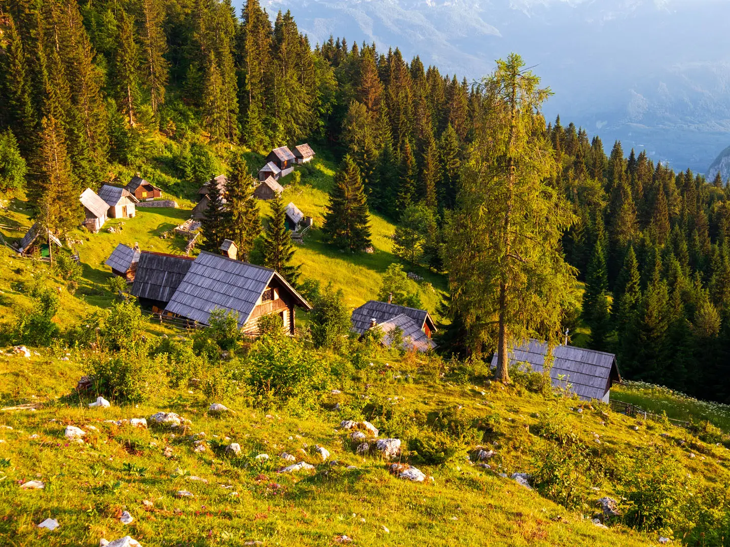
Pokljuka’s planine reflect centuries of seasonal transhumance: cattle were driven up to high summer meadows, where herders lived and made dairy products. The hut clusters at Zajamniki, Uskovnica and Konjscica still preserve that pastoral pattern, with seasonal dairy production continuing in summer. The wider Pokljuka forest also sheltered Slovene Partisans during the Second World War. Today, Rudno Polje is internationally known as a Nordic-skiing and biathlon centre.
Notable highlights
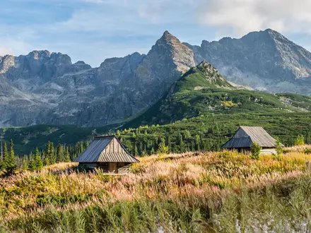
- Planina Zajamniki (c. 1,280 m): A long line of two-dozen-plus shingle-roofed wooden herders’ huts runs along this high ridge meadow. In summer, cheese, sour milk and other home-made dairy can be bought from the huts.
- Planina Uskovnica: A larger working pasture reached by following the Ribnica stream. Its open, hummock-strewn clearing makes a natural rest point between the forests and Zajamniki.
- Planina Konjscica (c. 1,440 m): The highest point of the loop, with about a dozen huts spread along a kilometre-long clearing below tall peaks.
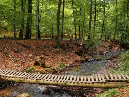
- Norway spruce forests: Much of the walk passes through Pokljuka’s dense spruce woodland, part of Slovenia’s largest unbroken block of forest.
- Sijec and Goreljek raised bogs: Protected peat-bog habitats on the plateau, with a marked bog nature trail at Goreljek/Sijec. If wetland landscapes interest you, also see the Lovrenc Lakes Trail.
- Rudno Polje biathlon centre: The loop starts at this Nordic-skiing and biathlon centre, which regularly hosts the IBU Biathlon World Cup.
Challenges to expect
The walking is not technical, but 18 km and about 650 m of ascent make it a long day. Forest junctions can mislead first-timers, so use a map or GPS rather than relying only on signs. Root-strewn sections, rocks and mud are likely after rain. Seasonal refreshments may be available on some pastures, but carry food and water. In winter the route becomes a ski or snowshoe outing.
HikeList Score
Pokljuka Plateau Trails scored 84/100 on HikeList's trail-quality metrics.
See score breakdownHide breakdown
- Ideal length 55
- Balanced challenge 100
- Scenery & wildness 88
- Varied terrain 100
- Accommodation 74
- Food & support 88
- Path quality 98
- Season flexibility 100
Computed from length, challenge, scenery & wildness, terrain variety, accommodation, food & support, path quality and season flexibility.
 Slovenia
Show more data Show less
- Forest
- Alpine
- Karst
- Hills
- Dirt
- Gravel
- Rocky
- Muddy
- Hotels
- Guesthouses
- Family Friendly
- Pet Friendly
- Restrooms
- Water Sources
- Campsites
- Shelters
- Picnic Areas
Photos from hikers
Taken on the trail by people who've reviewed Pokljuka Plateau Trails.
Reviews
How would you rate Pokljuka Plateau Trails?
Tap a star to start your review — you could be the first.