Peneda-Gerês National Park Trails
How would you rate Peneda-Gerês National Park Trails?
Tap a star to share your experience and help other hikers.
Peneda-Gerês National Park Trails: GR50 and Day Walks
HikeList Score
Peneda-Gerês National Park Trails scored 84/100 on HikeList's trail-quality metrics.
See score breakdownHide breakdown
- Ideal length 55
- Balanced challenge 100
- Scenery & wildness 90
- Varied terrain 100
- Accommodation 75
- Food & support 88
- Path quality 98
- Season flexibility 76
Computed from length, challenge, scenery & wildness, terrain variety, accommodation, food & support, path quality and season flexibility.
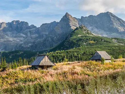
Peneda-Gerês National Park Trails are a network of waymarked walks in far northern Portugal, not one single route. The headline long trail is the GR50 - Grande Rota Peneda-Gerês, a linear ~190 km mountain route over 19 stages; shorter PR day walks are roughly 3-13 km. Difficulty ranges from easy family routes to hard summit days, with moderate a fair rating for the best-known day walks. Come for granite mountains, oak woodland, waterfalls, old stone tracks and village-based walking.
Route Overview
The GR50 runs point-to-point from Ameijoeira, near Castro Laboreiro in the north-west, to Tourém in the north-east. It crosses the Castro Laboreiro hills, Serra da Peneda, Serra do Soajo, Serra Amarela, Serra do Gerês and the Mourela plateau, following GR red-and-white waymarking. Around it is a mix of circular and out-and-back PR trails, including short waterfall walks and sections of the Geira Roman road. Logistics are village-based, with guesthouses, rural tourism houses and campsites rather than a hut chain. For other Portuguese walking ideas, compare the Arouca Geopark Trails, Paiva Walkways and the Caminho Português.
Roman Roads, Granite Villages and a National Park
These mountains have been crossed since Roman times by the Geira, or Via Nova, built in the 1st century AD between Bracara Augusta, now Braga, and Asturica Augusta, now Astorga. Later, transhumant communities used the high pastures and built granite espigueiros at Soajo and Lindoso to dry and store grain. In the 20th century, hydroelectric dams flooded valleys including Vilarinho das Furnas. The area became Portugal’s first and only national park in 1971.
Notable highlights
- GR50 - Grande Rota Peneda-Gerês (~190 km): The park’s flagship long-distance trail runs for 19 linear stages from Ameijoeira to Tourém. It links old herding, pilgrim and smuggling routes across all four main granite ranges.
- Pico da Nevosa (1,545 m): The highest point in Peneda-Gerês, in the Serra do Gerês above Terras de Bouro. Reaching it is a strenuous mountain outing rather than a casual PR walk.
- Trilho da Preguiça / PR10 TBR (~6 km): A popular, family-friendly loop from Casa da Preguiça. It visits the Laja and Leonte waterfalls and has three length variants.
- Geira / Via Nova Roman road: A national monument linking Braga and Astorga, with long stretches of old stone pavement through Terras de Bouro. For hikers, it gives the park’s woodland walking a strong historical thread.
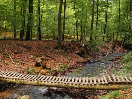
- Mata da Albergaria: One of the park’s best-preserved native oak woods, crossed by the Geira and wooden bridges. It is especially appealing in warm weather because of its shaded paths and river pools.
- Vilarinho das Furnas: A village submerged by a reservoir in the 1970s. Its stone ruins can reappear when water levels fall, making it one of the park’s most atmospheric landmarks.
Challenges to expect
Expect rough granite paths, roots, old stone pavement and slabs that can be slippery in wet weather. Spring and autumn are best; summer can be hot and busy around river pools, while winter may bring cold, fog, rain and snow on high ground. The GR50 and Pico da Nevosa are hard mountain objectives with village-based resupply, not serviced hut-to-hut trekking.
HikeList Score
Peneda-Gerês National Park Trails scored 84/100 on HikeList's trail-quality metrics.
See score breakdownHide breakdown
- Ideal length 55
- Balanced challenge 100
- Scenery & wildness 90
- Varied terrain 100
- Accommodation 75
- Food & support 88
- Path quality 98
- Season flexibility 76
Computed from length, challenge, scenery & wildness, terrain variety, accommodation, food & support, path quality and season flexibility.
 Portugal
Show more data Show less
- Mountainous
- Forest
- Moorland
- River
- Reservoir
- Rocky
- Stone Pavement
- Forest Tracks
- Granite Slabs
- Guesthouses
- Rural Tourism Houses
- Campsites
- Family Friendly
- Pet Friendly
- Restrooms
- Water Sources
- Campsites
- Shelters
- Picnic Areas
Photos from hikers
Taken on the trail by people who've reviewed Peneda-Gerês National Park Trails.
Reviews
How would you rate Peneda-Gerês National Park Trails?
Tap a star to start your review — you could be the first.