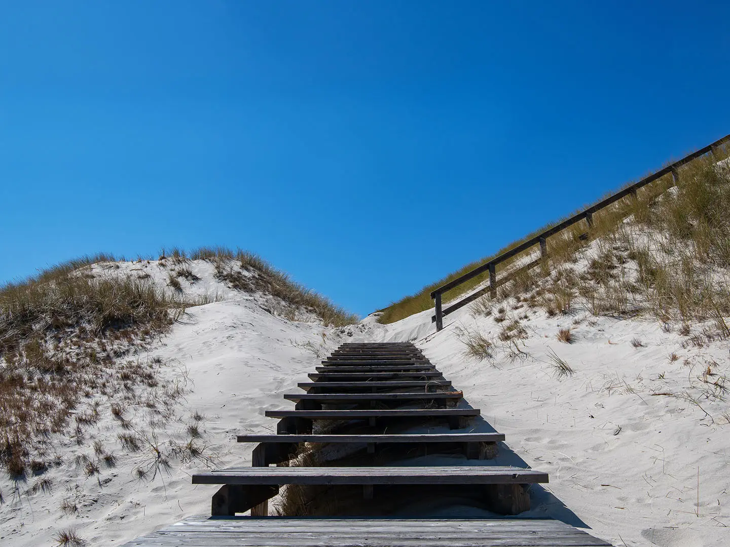
Baltic Coastal Trail
How would you rate Baltic Coastal Trail?
Tap a star to share your experience and help other hikers.
Baltic Coastal Trail: A Complete Hiking Guide
HikeList Score
Baltic Coastal Trail scored 86/100 on HikeList's trail-quality metrics.
See score breakdownHide breakdown
- Ideal length 87
- Balanced challenge 90
- Scenery & wildness 78
- Varied terrain 94
- Accommodation 83
- Food & support 88
- Path quality 80
- Season flexibility 89
Computed from length, challenge, scenery & wildness, terrain variety, accommodation, food & support, path quality and season flexibility.
The Baltic Coastal Trail is the English name for Poland’s red-waymarked Szlak Nadmorski, the Polish coastal section of the European long-distance path E9. It runs 378 km from Świnoujście near the German border to Żarnowiec, usually taking 13–15 days. This is a moderate, mostly low-level coastal thru-hike across beaches, dunes, pine and beech forest, low cliffs, resort towns and national parks. It suits hikers who can handle long daily distances, soft sand and exposed Baltic weather. See more routes in Poland.
Route Overview
The route is a point-to-point walk from Świnoujście in the west to Żarnowiec in the east, following red waymarks rather than a loop back to the start. Key places in order include Międzyzdroje, Dziwnów, Trzęsacz, Rewal, Niechorze, Trzebiatów, Kołobrzeg, Mielno, Darłowo, Jarosławiec, Ustka, Rowy and Łeba. Accommodation is frequent through the resort belt, but the Rowy–Łeba section through Słowiński National Park has no food or lodging. Note that the Hel Peninsula, Gdynia, Sopot and Gdańsk are not on this trail; for that area, see the separate Hel Peninsula Trail. For a much broader Polish itinerary, compare the Green Velo Trail.
Coastal trade, ports and the Polish E9
The Baltic shore has long linked eastern and western Europe by sea. Ports such as Kołobrzeg and Darłowo grew through Hanseatic-era trade, leaving historic harbours, Gothic churches, castles and lighthouses along this coast. The modern Szlak Nadmorski follows that shoreline as the Polish leg of the pan-European E9 coastal path, connecting local seaside towns and protected landscapes into one continuous red-waymarked walking route.
Notable highlights
Wolin National Park: Poland’s first coastal national park, with beech forest, sea cliffs and a European bison reserve. The trail enters it east of Świnoujście.
Gosań cliff (~95 m): The highest sea cliff in Poland and effectively the route’s high point. The clifftop viewpoint looks out over the Baltic between Międzyzdroje and Wisełka.
Trzęsacz church ruins: The surviving wall of the Gothic Church of St Nicholas stands on a crumbling cliff. It is one of the clearest signs of active Baltic coastal erosion on the route.
Kołobrzeg: A large historic spa town and port with a lighthouse and long promenade. Its size and position make it a natural resupply or rest point near the middle of the walk.
Słowiński National Park: A UNESCO biosphere reserve known for shifting dunes including Wydma Łącka and Wydma Czołpińska. The 34.5 km Rowy–Łeba crossing is the wildest and hardest section.
Łeba: A lively fishing and holiday town between coastal lakes, and the main gateway to the Słowiński dunes.
Challenges to expect
The trail is low and largely flat, but not effortless. Expect long days, loose sand, open beach walking, exposed weather and occasional low cliff climbs. The toughest section is Rowy–Łeba, a 34.5 km stretch through Słowiński National Park with no food or lodging. Carry supplies there. Winter is best avoided: the coast is cold, exposed and the dune walking becomes harder.
HikeList Score
Baltic Coastal Trail scored 86/100 on HikeList's trail-quality metrics.
See score breakdownHide breakdown
- Ideal length 87
- Balanced challenge 90
- Scenery & wildness 78
- Varied terrain 94
- Accommodation 83
- Food & support 88
- Path quality 80
- Season flexibility 89
Computed from length, challenge, scenery & wildness, terrain variety, accommodation, food & support, path quality and season flexibility.
 Poland
Show more data Show less
- Coastal
- Dunes
- Forest
- Cliffs
- Paved
- Dirt
- Sand
- Hotels
- Guesthouses
- Campsites
- Family Friendly
- Pet Friendly
- Restrooms
- Water Sources
- Campsites
- Picnic Areas
Download Our Full Guide to Baltic Coastal Trail FREE!
Get our comprehensive guide to this hike for free. Save it for later reading or print out at home.
Photos from hikers
Taken on the trail by people who've reviewed Baltic Coastal Trail.
Baltic Coastal Trail: The Complete Guide
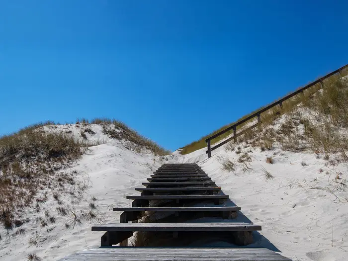 i
Image by Lizaveta
i
Image by Lizaveta The Baltic Coastal Trail is Poland’s red-waymarked walk along the Baltic Sea, running from Świnoujście near the German border to Żarnowiec beyond Łeba. It is a low-level, point-to-point route for walkers who want long beach days, pine forest, resort towns and protected dune country rather than mountain terrain.
The western stages cross Wolin island and Woliński Park Narodowy, where beech forest and low sea cliffs break up the shoreline. Góra Gosań, at roughly 95 m, is the high point of the whole trail and gives one of the clearest views over the Baltic.
Further east the route links practical coastal bases such as Kołobrzeg, Darłowo, Ustka and Łeba, with promenades, guesthouses, campsites and regular resupply in the busier resort belt. The wildest section is Słowiński Park Narodowy, where shifting dunes and open coastline make the Rowy–Łeba crossing a serious self-supported day.
This is a moderate hike because of stamina, not technical difficulty. Expect soft sand, exposed weather, repetitive flat miles and one 34.5 km stage with no food or lodging, so footwear, pacing and carrying enough water matter more than climbing ability.
This guide covers stages, daily planning, accommodation, food, transport, terrain and the common mistakes to avoid.
Stage-by-Stage Guide
Distances below are approximate and should be treated as planning distances rather than turn-by-turn measurements. The route is red-waymarked throughout, but Baltic sand, resort diversions, forestry work and national-park rules can affect the line on the ground, so carry an up-to-date map or GPX and check live access information before setting off each day.
Stage 1: Świnoujście to Międzyzdroje — approx. 15 km
The opening stage leaves the port and spa town of Świnoujście and heads east towards Wolin island. It is a gentle first day by distance, but it introduces the typical mix of coastal paths, beach sections, dunes and forest that defines the trail.
The route enters Woliński Park Narodowy (Wolin National Park) east of Świnoujście. Expect a more enclosed feel once the trail reaches the park’s beech and coastal forest, with sandy ground underfoot and limited ascent.
Międzyzdroje is one of the major resort bases on the western part of the route, so food, water and accommodation are normally straightforward here, especially in the main walking season. Outside summer, some tourist-focused businesses may reduce hours, so carry enough food for the day rather than depending on every seasonal outlet being open.
Świnoujście has rail access at Świnoujście Centrum, with connections towards Szczecin and Germany, and Międzyzdroje is a practical end point for walkers using regional transport. Current PKP and regional bus times should be checked before travelling.
Navigation is not difficult in normal conditions, but the transition from town to forest and beach can make it easy to follow local paths rather than the red trail. In poor weather, the exposed coast can feel much colder and windier than the low altitude suggests.
Stage 2: Międzyzdroje to Dziwnów — approx. 25 km
This is one of the most scenic western stages, crossing the best-known cliff and forest section of Wolin. It is not technically hard, but it has more undulation than most of the Baltic Coastal Trail and is a longer day than the opener.
Between Międzyzdroje and Wisełka, the route takes in the high coastal ground around Góra Gosań, the highest sea cliff on the Polish coast at about 93–95 m and effectively the trail’s high point. The clifftop viewpoint gives one of the strongest Baltic views on the entire walk.
Terrain alternates between beech forest, sandy paths, low cliff approaches and coastal sections. After the Wolin high ground, the route becomes easier underfoot, though soft sand and wind exposure can still slow progress.
Międzyzdroje and Dziwnów are the main service points. Wisełka is the key named place en route, but walkers should not depend on intermediate food or water without checking what is open, particularly outside the summer resort season.
Dziwnów has road and regional transport access, with accommodation typical of the coastal resort belt. Navigation through Woliński Park Narodowy should stay on marked paths; national-park access rules and any temporary closures should be checked before travelling.
Stage 3: Dziwnów to Rewal — approx. 20 km
This stage follows a busier holiday-coast character, linking Dziwnów, Dziwnówek, Pobierowo, Trzęsacz and Rewal. It is a practical, service-rich day compared with the wilder national-park sections.
Underfoot, expect a mix of sandy beach, dune-edge paths, paved resort promenades and local tracks. The walking is low and straightforward, but long stretches of soft sand can make the distance feel slower than it looks on paper.
The main cultural landmark is Ruiny kościoła w Trzęsaczu (Trzęsacz church ruins), the surviving wall of the Gothic Church of St Nicholas on the eroding cliff. It is one of the clearest visual reminders on the route that this coast is actively changing.
Food and water are usually easiest in the resort settlements: Dziwnów, Dziwnówek, Pobierowo, Trzęsacz and Rewal. In peak summer this stage is lively; in the shoulder seasons, carry lunch and do not rely on every seafront kiosk or café being open.
Rewal has accommodation and road access, making it a convenient end point. Navigation through resort areas needs attention because promenades, beach exits and local paths can pull walkers away from the red waymarks.
Stage 4: Rewal to Trzebiatów — approx. 22 km
The day begins in the Rewal–Niechorze resort strip and then shifts towards Trzebiatów, giving a contrast between coastal tourism and a more inland town finish. It is a useful stage for resetting after several beach-heavy days.
Niechorze is the main landmark, with its 45 m brick lighthouse standing above the cliffs. The coast here remains low by mountain standards, but the cliff-edge setting and open Baltic weather still require care in wind or poor visibility.
Terrain is mixed: paved resort surfaces, sandy coastal ground, dirt paths and tracks. If the day’s line turns away from the immediate shoreline towards Trzebiatów, watch the waymarks carefully, as the coast itself is no longer the only obvious guide.
Food and water are available at the start and in the Rewal–Niechorze resort area, with Trzebiatów providing the end-of-day services. Intermediate opening hours can vary seasonally, so carry enough for the full stage.
Trzebiatów gives a practical inland overnight stop before returning towards the coast on the next stage. Regional transport and road access should be checked locally before relying on same-day connections.
Stage 5: Trzebiatów to Kołobrzeg — approx. 24 km
This stage leads from Trzebiatów towards one of the most important towns on the whole route: Kołobrzeg. It is a moderate-length walking day and a natural point to plan a bigger resupply, laundry stop or rest night.
The route passes through the coastal belt around Dźwirzyno before reaching Kołobrzeg. Expect a familiar pattern of sand, dune-edge paths, forest tracks and resort approaches, with more built-up walking as Kołobrzeg gets closer.
Kołobrzeg is a major historic spa town and port, with a lighthouse, salt works and long promenade. Its size makes it one of the easiest places on the Baltic Coastal Trail to replace kit, buy food and reorganise onward bookings.
Food and water are available at Trzebiatów, Dźwirzyno and Kołobrzeg, though the same seasonal caution applies to smaller coastal outlets. Kołobrzeg has plentiful accommodation compared with the smaller villages.
Kołobrzeg has a railway station and is one of the strongest public-transport points on the trail. If splitting the hike into sections, this is one of the most practical places to start or finish a leg; current train and bus times should still be checked before travelling.
Stage 6: Kołobrzeg to Ustronie Morskie — approx. 18 km
This is a shorter recovery-style stage after reaching Kołobrzeg. It suits walkers who want time for a morning resupply or a later start, while still making eastward progress along the coast.
Leaving Kołobrzeg, the route uses the town’s promenade and coastal infrastructure before returning to lower-key beach, dune and path walking. The terrain is generally easy, with little ascent, but sand remains the main source of fatigue.
Views are broad and open rather than dramatic: Baltic shoreline, beach, low dunes and resort edges. Wind and rain can turn a short day into a more exposed walk, so waterproofs and warm layers should still be accessible.
Food and water are straightforward in Kołobrzeg and should be available again at Ustronie Morskie. Carry enough for the day regardless, especially if walking outside the main resort season.
Ustronie Morskie has accommodation in the coastal resort belt and road access. Navigation is usually simple, but promenades and beach exits can interrupt the rhythm of the red waymarks, so check the route whenever leaving the seafront.
Stage 7: Ustronie Morskie to Mielno — approx. 25 km
This is a longer, flatter coastal stage where stamina matters more than climbing ability. The walking is typical of the central Polish Baltic coast: beaches, dunes, forest strips and holiday settlements.
The main physical difficulty is sustained soft sand. Even without much ascent, walking for hours on yielding beach or dune-edge paths can be tiring, particularly with a full pack or in hot, windy weather.
Ustronie Morskie and Mielno are the key service points. Intermediate services should be treated as useful but not guaranteed unless checked in advance, especially outside July and August.
Mielno is a well-used resort stop with accommodation options in the general coastal pattern of hotels, guesthouses, apartments and campsites. Book ahead in summer, when the resort belt is at its busiest.
For navigation, keep checking the red waymarks where the route alternates between beach, promenade and inland tracks. In poor weather, an inland marked line may be preferable to forcing progress on exposed sand where the official route provides that option.
Stage 8: Mielno to Darłowo — approx. 22 km
This stage continues east through low coastal terrain towards Darłowo, with Darłówko forming the beach-resort side of the town. It is a varied day because the finish has both resort and historic port character.
Expect a mix of beach, dune paths, paved resort sections and tracks. The walking remains non-technical, but exposed weather and soft sand can still reduce pace.
Darłowo and Darłówko are the main highlights. Darłowo has Hanseatic-era port history and the 14th-century Zamek Książąt Pomorskich, while Darłówko is the coastal resort area at the beach.
Food and water are available at Mielno and at the Darłowo/Darłówko end of the stage. As with other coastal towns, summer provision is much stronger than winter or the quieter shoulder-season periods.
Accommodation is normally available in and around Darłowo and Darłówko. Road and regional transport access should be checked before relying on an onward connection, particularly if finishing late in the day.
Stage 9: Darłowo to Jarosławiec — approx. 18 km
This is a relatively short stage and can be useful before the quieter eastern part of the route. It gives time either to visit Darłowo before leaving or to arrive early in Jarosławiec and prepare for the next stages.
The terrain is low coastal walking: sandy beach, dunes, forest or dirt tracks, and sections through or near resort development. There is little climbing, so the day’s difficulty depends mainly on sand conditions and weather exposure.
Views are classic Baltic rather than high-level: broad beach, grey-blue sea, dune grass and pine-backed shore. In windy conditions, sand drift and headwinds can make even an 18 km day feel slower.
Darłowo/Darłówko and Jarosławiec are the reliable planning points for food, water and accommodation. Carry lunch and water from the start if walking outside the busiest season.
Jarosławiec has road access and coastal accommodation, but current transport options should be checked before travelling. Navigation is generally straightforward if the red waymarks are followed through any resort and beach-access junctions.
Stage 10: Jarosławiec to Rowy — approx. 20 km
This stage is best treated as the approach day to the hardest section of the whole trail. The walking itself is moderate, but the main planning task is reaching Rowy with enough food and flexibility for the long Słowiński National Park crossing that follows.
Terrain remains coastal: sand, low dunes, forest tracks and exposed shoreline. The route feels progressively less like the busy western resort belt and more like the edge of the wilder national-park landscape.
Food and water should be secured at Jarosławiec and again at Rowy. Do not leave preparations for the Rowy–Łeba stage until the morning unless shops and opening hours have been checked in advance.
Accommodation in Rowy should be booked ahead, especially in summer and especially if the next day’s early start is important. Rowy is the key overnight before the unsupported 34.5 km crossing to Łeba.
Road and regional transport options in this sector are more limited than in major towns such as Kołobrzeg or Łeba. This should be checked before travelling if Rowy is being used as a section start or finish.
Stage 11: Rowy to Łeba — approx. 35 km
This is the hardest and most committing day of the Baltic Coastal Trail. The Rowy–Łeba crossing through Słowiński Park Narodowy (Słowiński National Park) is about 34.5 km with no food or lodging, so it must be planned as a fully self-supported stage.
Słowiński Park Narodowy is a UNESCO Biosphere Reserve, famous for its shifting dunes, including Wydma Łącka (Łącka Dune) and Wydma Czołpińska. The scenery is exceptional, but the walking is slower than a normal flat 35 km because of soft sand, dune terrain and exposure.
Carry all food and enough water for the full day, plus a safety margin. In warm weather the open sand can feel hotter and drier than the map suggests; in wind or rain, the same openness can become cold and draining.
There is no accommodation or food between Rowy and Łeba, so start early and do not underestimate the time needed. This is not the stage to begin tired, under-supplied or with uncertain footwear.
Navigation must stay on the marked legal route through the protected national park. Access rules, temporary closures and any seasonal restrictions should be checked before travelling, and walkers should not cut across dunes or protected areas.
Łeba is a lively fishing and holiday town between coastal lakes Łebsko and Sarbsko, and it is the main gateway to the Słowiński shifting dunes. It has accommodation and a railway station, making it a practical recovery stop or section endpoint.
Stage 12: Łeba to Żarnowiec — approx. 30 km
The final stage leaves Łeba and continues east towards Żarnowiec and the Lake Żarnowieckie area. It is a long closing day, so the trail is not over once the Słowiński crossing has been completed.
Expect more low coastal walking with sand, dunes, forest tracks and stretches where the route gradually moves towards the inland finish. The terrain remains non-technical, but 30 km on tired legs can still be demanding.
Łeba is the main place to buy food and water before setting out. Services are less certain towards the finish than in the larger resort towns, so carry what is needed for the full day unless current stopping points have been checked.
Accommodation near the end should be arranged before arrival rather than assumed on the day. Żarnowiec is not a major transport hub, and onward travel is generally by regional bus or train links towards the Tricity area; timetables should be checked before travelling.
Navigation near the end matters because the HikeList route finishes at Żarnowiec and does not continue to the Hel Peninsula, Gdynia, Sopot or Gdańsk. Follow the red waymarks and your chosen map to the defined finish rather than assuming the coast itself leads to a larger city endpoint.
Recommended Itinerary
The schedule below is a practical 14-day plan: 12 walking days using the main stage towns, plus a mid-route rest/resupply day in Kołobrzeg and a preparation/buffer day in Rowy before the hardest unsupported crossing. Approximate distances are planning figures; check official mapping before booking accommodation, especially if changing overnight stops or following local beach/forest alternatives.
Standard itinerary — 14 days
| Day | From | To | Approx. distance | Why this stage makes sense | Services/accommodation notes |
|---|---|---|---|---|---|
| 1 | Świnoujście | Międzyzdroje | 15 km | A manageable first day out of the western trailhead, with the route leading east towards Wolin island and Woliński Park Narodowy. | Both towns are established coastal resorts with accommodation. Świnoujście has rail links via Świnoujście Centrum; verify current timetables before travelling. |
| 2 | Międzyzdroje | Dziwnów | 25 km | This is one of the more substantial early stages, taking in the Wolin coast and the area around Góra Gosań between Międzyzdroje and Wisełka. | Międzyzdroje and Dziwnów are sensible overnight bases. If 25 km is too much early in the walk, consider splitting around Wisełka; check official mapping before booking. |
| 3 | Dziwnów | Rewal | 20 km | A steady resort-to-resort stage through the busier western coastal belt, keeping the daily distance moderate. | Accommodation options are generally better in resort settlements such as Rewal, with other coastal villages nearby on the route. |
| 4 | Rewal | Trzebiatów | 22 km | This stage keeps the itinerary moving east while still leaving time for Trzęsacz and Niechorze, two of the key landmarks on this section. | Rewal has resort services; Trzebiatów is the overnight target. If lingering at Trzęsacz or Niechorze, start early rather than extending the day late. |
| 5 | Trzebiatów | Kołobrzeg | 24 km | A good approach into one of the largest service centres on the whole trail. Kołobrzeg’s position makes it the obvious place to pause. | Kołobrzeg has plentiful accommodation and resupply options and is one of the best transport-access points on the route. |
| 6 | Kołobrzeg | Kołobrzeg | Rest/resupply day | A rest day here makes the overall schedule more realistic and gives time to replace worn kit, dry gear and reset before the eastern half. | Book two nights if using this as a proper rest stop. Kołobrzeg is also a practical join/leave point for section hikers. |
| 7 | Kołobrzeg | Ustronie Morskie | 18 km | A shorter day after the rest stop, useful if the previous stages have involved tiring soft sand or poor weather. | Ustronie Morskie is a coastal resort with accommodation. Summer bookings should be made ahead. |
| 8 | Ustronie Morskie | Mielno | 25 km | A longer but logical coastal stage between well-used resort bases. | Mielno has resort accommodation and supplies. Carry enough water for exposed beach sections, especially in warm weather. |
| 9 | Mielno | Darłowo | 22 km | A moderate day linking the central coast with Darłowo, one of the key historic towns on the route. | Darłowo and the beach resort area of Darłówko provide accommodation options. Confirm the exact route line into your chosen overnight stop. |
| 10 | Darłowo | Jarosławiec | 18 km | A shorter stage that helps preserve energy before the more remote eastern section. | Jarosławiec is a suitable overnight base before continuing towards Rowy and Słowiński Park Narodowy. |
| 11 | Jarosławiec | Rowy | 20 km | This positions you at the western side of the demanding Słowiński National Park crossing. | Plan an overnight in Rowy and buy food for the next day. Services thin out sharply once the Rowy–Łeba crossing begins. |
| 12 | Rowy | Rowy | Preparation/buffer day | This buffer day is useful before the trail’s hardest stage: the 34.5 km Rowy–Łeba crossing with no food or lodging. | Use this day to check weather, pack extra food and water, and confirm national-park access rules before setting off. |
| 13 | Rowy | Łeba | 35 km | The crux day of the itinerary: a long, self-supported crossing of Słowiński Park Narodowy and its dune landscape. | There is no food or lodging on the Rowy–Łeba crossing. Start early, carry all food and water, and do not rely on being able to shorten the day inside the park. |
| 14 | Łeba | Żarnowiec | 30 km | A long final stage from the main gateway town for the dunes to the defined eastern finish near Żarnowiec and Lake Żarnowieckie. | Łeba has accommodation and transport links. The finish near Żarnowiec is not a major hub; check regional bus/train connections towards the Tricity area before committing to an onward plan. |
Slower and faster variants
| Variant | Who it suits | How to adapt the itinerary | Key cautions |
|---|---|---|---|
| Slower: 15 days or more | Walkers who prefer shorter days, families, anyone carrying heavier camping or beach-walking kit, and those hiking in hot or windy conditions. | Add one or more extra overnights in intermediate coastal settlements such as Wisełka, Pobierowo, Trzęsacz, Niechorze or Dźwirzyno where they fit your mapped line. Exact distances between these stops should be checked on official mapping before booking. | Do not plan to split the Rowy–Łeba crossing inside Słowiński Park Narodowy: there is no food or lodging on that 34.5 km section. |
| Faster: 12 walking days | Fit walkers comfortable with repeated 20–30 km days and one 35 km unsupported day. | Remove the Kołobrzeg rest day and Rowy buffer day, following the walking stages directly from Świnoujście to Żarnowiec. | This leaves little margin for bad Baltic weather, tiring soft sand or accommodation problems in the resort belt. It is a fast schedule, not the most comfortable one. |
| Section-hiking approach | Walkers using public transport to complete the trail in blocks. | Kołobrzeg, Ustka and Łeba are useful access points because they have stations, while Świnoujście is the natural western start. | Regional train and bus services vary by season and timetable; verify current PKP and local connections before fixing section start and finish points. |
Planning the Route
Choosing a realistic schedule
The 12-stage outline for this route is a brisk end-to-end schedule. Most independent walkers should allow 13–15 days, giving room for a shorter day, a rest or resupply stop, and weather disruption on exposed beach sections.
Do not plan this trail purely by map distance. Long, flat days on soft sand can be slower and more tiring than the elevation profile suggests, especially with a full pack or a headwind. A steady pace of roughly 15–25 km per day is more realistic for most walkers than trying to compress the route into consistently long stages.
A slower itinerary works particularly well because the trail passes frequent resort towns and villages. These make it easy to stop early, take a lighter half-day, or build in a rest night at places such as Kołobrzeg, Darłowo/Darłówko, Ustka or Łeba.
Let accommodation dictate the stages
Daily stages are best planned around towns with reliable accommodation rather than arbitrary kilometre targets. Hotels, guesthouses, holiday apartments and campsites are common through the resort belt, especially around Międzyzdroje, Kołobrzeg, Darłowo/Darłówko, Ustka and Łeba.
The main exception is the Rowy–Łeba crossing of Słowiński Park Narodowy. This is the critical planning day: around 34.5 km with no food or lodging on the route. It should be treated as a fully self-supported day, with an early start, enough water and food for the whole crossing, and a weather forecast checked before committing.
The final section towards Żarnowiec also needs care because the finish is not a major transport hub. Plan accommodation and onward transport before arriving rather than assuming frequent late-day options.
Section hiking and shortening the trail
This is a practical trail to walk in sections. The coast is served by regional trains and buses through the resort towns, with useful rail access at Świnoujście Centrum, Kołobrzeg, Ustka and Łeba. Current PKP and regional bus timetables should be checked before travelling.
For a shorter trip, Kołobrzeg makes a natural mid-route break point because it is a large town with strong services and transport links. Łeba is another logical access point for walkers who mainly want the Słowiński dune section, while Świnoujście and Międzyzdroje work well for shorter western sections through Wolin.
The HikeList route ends at Żarnowiec. Do not assume this itinerary continues to the Hel Peninsula, Gdynia, Sopot or Gdańsk; those lie outside this route framing and should be planned separately.
Food, water and resupply
Most days pass through or near settlements, so food resupply is usually straightforward in the resort sections. Even so, daily food and water should be planned in advance rather than left to beach kiosks or seasonal services, especially outside the busiest summer period. This should be checked before travelling.
Carry extra food and water for any long beach, dune or forest section where leaving the trail would cost time. The Rowy–Łeba stage is the only clearly unsupported day and should be packed accordingly.
Kołobrzeg is the strongest mid-walk resupply and rest point. Łeba is also important because it sits at the eastern side of Słowiński Park Narodowy and is the main gateway town for the shifting dunes.
Navigation and route access
The route follows red Polish tourist-trail waymarks and is also the Polish section of the E9, so navigation is generally straightforward. Still, an offline map or GPX track is sensible because the trail alternates between beaches, promenades, forest tracks, dunes and protected national-park terrain.
In Woliński Park Narodowy and Słowiński Park Narodowy, stay on permitted paths and check current access rules before travelling. National-park diversions, closures or seasonal restrictions can affect how a day is walked.
Beach walking can make the line feel obvious, but the marked route may move inland through forest, dunes or resort streets. Follow the waymarks rather than simply walking the shoreline from town to town.
Weather and timing
Spring, summer and autumn are the practical walking seasons. Summer gives the warmest conditions and the busiest resort services, but it is also when accommodation in popular coastal towns is most in demand.
Baltic weather is one of the route’s main variables. Wind, rain and exposed sand can make an otherwise flat stage much harder, so keep some flexibility in the schedule and avoid making the longest days dependent on a tight onward connection.
Winter is best avoided. Cold exposure, harder dune walking and reduced seasonal services make the trail less suitable for an efficient end-to-end walk.
Towns, Villages and Overnight Stops
Accommodation on the Baltic Coastal Trail is generally straightforward through the resort belt, but it is uneven. Larger towns such as Świnoujście, Międzyzdroje, Kołobrzeg, Darłowo/Darłówko, Ustka and Łeba have the broadest choice of hotels, pensjonaty, holiday apartments and campsites, while smaller villages can be seasonal and should be booked ahead, especially outside the main summer period.
The key planning trap is the Rowy–Łeba crossing of Słowiński Park Narodowy. This is a 34.5 km unsupported section with no food or lodging on the route, so Rowy and Łeba need to be treated as fixed overnight and resupply anchors.
Świnoujście
Świnoujście is the western trailhead, on Uznam/Usedom island beside the German border. It is a practical place to arrive the day before starting, sort supplies and begin with a full food carry rather than rushing straight onto the trail.
Accommodation should be readily available in the town, with the usual mix expected in a major port and spa town. Food shops, cafés and restaurants are also more dependable here than in the smaller coastal settlements ahead.
Świnoujście Centrum railway station has connections towards Szczecin and, via cross-border services, Germany, including Berlin. The town also has international ferry links; current rail, bus and ferry times should be checked before travelling.
Międzyzdroje
Międzyzdroje is the first natural overnight stop, reached after the opening stage from Świnoujście. It sits on the edge of Woliński Park Narodowy and is one of the main resort bases on the western part of the route.
This is a good place to stay, with plentiful resort accommodation and food options. It is also useful for walkers who want a short first day before tackling the longer Międzyzdroje–Dziwnów stage.
The trail east of here takes in Wolin’s beech forest and cliffs, including the Góra Gosań area between Międzyzdroje and Wisełka. Check local transport times if using Międzyzdroje as a section start or finish.
Wisełka
Wisełka lies between Międzyzdroje and Dziwnów, close to the Wolin cliff-and-forest section. It is more useful as a break point or contingency stop than as a default stage end in the standard itinerary.
Accommodation and food options are likely to be more limited than in Międzyzdroje or Dziwnów, so do not rely on arriving late without a booking. This should be checked before travelling, particularly outside summer.
Wisełka can help shorten the Międzyzdroje–Dziwnów day for walkers who prefer slower pacing through Woliński Park Narodowy. It is also a sensible place to consider if weather makes the exposed coastal walking harder than expected.
Dziwnów
Dziwnów is the second stage stop in the standard itinerary, after the longer walk from Międzyzdroje. It is a practical overnight halt before the route continues east through the chain of smaller seaside settlements towards Rewal.
As a coastal resort town, it should offer accommodation and food options in season, but availability and opening times can vary. Book ahead rather than assuming late arrival will be easy.
For transport, rely on current regional bus or local connections rather than assuming frequent services. This should be checked before travelling, especially if ending or starting a section here.
Dziwnówek
Dziwnówek sits shortly east of Dziwnów on the route towards Pobierowo and Rewal. It is best treated as a minor overnight or refreshment option rather than a main resupply base.
Accommodation, cafés and shops may be seasonal, with more dependable choice in the larger resort stops. If using Dziwnówek to split a day, book accommodation first and plan food around confirmed opening times.
It can be useful for walkers who want to avoid a full Dziwnów–Rewal stage. Local transport details should be checked before travelling.
Pobierowo
Pobierowo is another resort settlement between Dziwnów and Rewal. It is a useful place to break the day if soft sand, heat or wind make progress slower than expected.
Expect a seasonal holiday-village pattern rather than the broader services of Kołobrzeg or Świnoujście. Accommodation and food should be arranged in advance if planning to stop here.
Pobierowo is not one of the main transport hubs named for the trail. Check current regional links before using it as a section access point.
Trzęsacz
Trzęsacz lies just before Rewal when walking east. Hikers mainly know it for the Ruiny kościoła w Trzęsaczu, the surviving wall of the Gothic Church of St Nicholas on the eroding cliff.
It is better as a short stop than a primary overnight base, unless accommodation has been booked specifically. Rewal and Niechorze give more obvious nearby resort stopping options.
Allow time here if interested in the visible coastal erosion story, but do not let a sightseeing stop compromise arrival time at the night’s booked accommodation.
Rewal
Rewal is a standard overnight stop on the west-to-east itinerary, reached from Dziwnów. It is a useful resort base before the route turns towards Trzebiatów on the following stage.
Accommodation and food options should be better here than in the smaller villages immediately before it, particularly in the summer season. Outside the busiest months, opening times and room availability should still be checked.
Rewal also works well as a section end or restart for walkers not doing the full route in one push. Current regional bus connections should be checked before relying on them.
Niechorze
Niechorze sits east of Rewal and is another practical resort stop on this stretch. It is notable for Latarnia morska Niechorze, the 45 m brick lighthouse above the cliffs.
For most end-to-end walkers it will be a food or coffee stop rather than a scheduled overnight, because Rewal and Trzebiatów frame the standard day. It can still be used to shorten or reshape stages if accommodation is available.
Do not assume all services operate year-round. Check accommodation, food and local transport before planning a stop here.
Trzebiatów
Trzebiatów is the overnight stop between Rewal and Kołobrzeg in the standard itinerary. It is an important planning point because it breaks the route before the next longer walk towards the larger mid-route hub at Kołobrzeg.
As a stage town, it should be treated as a booked accommodation stop rather than a place to leave to chance. Food and basic resupply should be planned here before setting out for Kołobrzeg.
Transport options are not specified in the route information, so any rail or bus use from Trzebiatów should be checked before travelling.
Dźwirzyno
Dźwirzyno lies between Trzebiatów and Kołobrzeg. It is a useful intermediate settlement on a stage that otherwise ends at the major services of Kołobrzeg.
It may suit walkers who want to reduce the day length before reaching Kołobrzeg, but accommodation and food should be arranged in advance. Smaller coastal resorts can be very seasonal.
If using Dźwirzyno as a section start or finish, check current regional transport rather than assuming easy onward travel.
Kołobrzeg
Kołobrzeg is one of the most important stops on the whole trail. It is a large historic spa town and port, roughly central in the itinerary, and a natural place for resupply, laundry, a rest night or schedule reset.
Accommodation choice is plentiful compared with the smaller settlements, with hotels, guesthouses, holiday apartments and campsites in the resort belt. Food, cafés and shops are also more reliable here than on the quieter sections.
Kołobrzeg has a railway station and is one of the better transport access points on the Polish Baltic coast. It is the easiest place on the middle part of the walk to start or end a section, but current PKP and regional timetables should still be verified.
Ustronie Morskie
Ustronie Morskie is the next standard overnight stop after Kołobrzeg. The Kołobrzeg–Ustronie Morskie stage is shorter than many others, making this a useful recovery day after the busier town section.
Accommodation and food should be available in season, though it is still wise to book ahead. This is a practical overnight rather than a major resupply hub.
For section-hiking, check current regional transport before relying on Ustronie Morskie as an access point.
Mielno
Mielno is the standard overnight stop after Ustronie Morskie. It is a resort stop in the central part of the trail and a sensible place to secure food and accommodation before continuing towards Darłowo.
Accommodation should be more available here than in minor villages, especially in the main holiday season. Outside summer, check what is open before building a stage plan around it.
Mielno is useful for adjusting pace before the Darłowo stage. Transport links should be checked before travelling.
Darłowo
Darłowo is a major practical halt on the eastern half of the route, paired with the coastal resort area of Darłówko. It is a standard stage end after Mielno and a good place to restock before the route continues towards Jarosławiec.
Accommodation is part of the plentiful resort belt, especially when considered together with Darłówko. Food, cafés and shops should be easier to find here than in the smaller coastal villages.
Darłowo is also worth allowing time for if interested in the inland port town and Zamek Książąt Pomorskich, the 14th-century castle. Check current regional transport if using it as a section access point.
Darłówko
Darłówko is the beach-resort part of the Darłowo/Darłówko pairing. For hikers, the main value is accommodation close to the coast and straightforward food options before or after the Darłowo stage.
It can be more convenient than staying inland if the day’s walking keeps you close to the seafront. As with other resort stops, book ahead in the busy season and check opening times outside it.
Darłówko and Darłowo should be planned together rather than treated as completely separate resupply points. Local transport details should be checked before travelling.
Jarosławiec
Jarosławiec is the standard overnight stop between Darłowo and Rowy. It is a practical place to break the route before the final approach to the Słowiński National Park section.
Accommodation and food should be arranged in advance, particularly outside the main resort season. This is not the place to arrive without a plan if the next day depends on a fixed booking in Rowy.
Use Jarosławiec to check supplies and weather before moving towards Rowy. The unsupported Rowy–Łeba crossing is close enough that planning should already be firm by this point.
Rowy
Rowy is one of the most important logistical stops on the trail. It is the last overnight base before the 34.5 km crossing of Słowiński Park Narodowy to Łeba, where there is no food or lodging on the route.
Book accommodation in Rowy in advance and arrive with enough time to buy or organise food and water for the next day. Do not start the Rowy–Łeba section assuming there will be cafés, shops or places to sleep inside the national park.
This is also the place to check national-park access rules, weather and any live diversions before committing to the crossing. Conditions in the dune and open-coast section can make the day feel harder than its elevation profile suggests.
Ustka
Ustka is a significant resort town and transport point on this part of the Polish coast. It has accommodation in the resort belt and a railway station, making it useful for section-hikers even if the standard stage pattern focuses on Jarosławiec, Rowy and Łeba.
Food, cafés and shops should be more dependable here than in smaller villages. It can be a sensible access or exit point for walkers splitting the eastern part of the route into shorter trips.
Check how Ustka fits the exact itinerary being walked, as stage plans vary along this section. Current PKP and regional bus times should be verified before relying on it.
Łeba
Łeba is the essential overnight stop after the Rowy crossing of Słowiński Park Narodowy. It is a lively fishing and holiday town between Lakes Łebsko and Sarbsko, and the main gateway to the shifting dunes, including Wydma Łącka.
After the unsupported national-park day, Łeba is the first reliable place for accommodation, food and recovery. It is also the best point to reset the schedule if the Rowy–Łeba stage has taken more effort than expected.
Łeba has a railway station and is one of the better access points on the eastern part of the trail. Check current PKP and regional timetables before booking onward travel.
Żarnowiec
Żarnowiec is the eastern finish of this HikeList route, near Lake Żarnowieckie. The trail page ends here; it does not continue on this itinerary to the Hel Peninsula, Gdynia, Sopot or Gdańsk.
Plan the final Łeba–Żarnowiec day as a long finishing stage, then arrange onward travel in advance. Accommodation and food options at or near the finish should not be assumed without checking.
Żarnowiec is served mainly by regional bus and train links towards the Tricity area rather than by a major hub at the trailhead itself. This should be checked before travelling, especially if finishing late in the day.
Getting to the Start
The Baltic Coastal Trail starts in Świnoujście, a port and spa town on Uznam/Usedom island beside the German border. For most walkers, the simplest plan is to reach Świnoujście the day before starting, stay overnight, then pick up the red E9/Szlak Nadmorski waymarks heading east towards Wolin island and Międzyzdroje.
By train
Świnoujście Centrum is the key rail station for the start of the walk. It has rail connections towards Szczecin, and cross-border options link the area with Germany, including Berlin.
Use current PKP and regional rail timetables when planning the journey, especially if arriving late in the day or connecting from Germany. This should be checked before travelling.
If starting immediately after arrival, allow time to get from the station or accommodation to the marked coastal route rather than assuming the first waymark is directly outside the station. Local taxis can be useful for short transfers within Świnoujście, particularly with a full pack.
By bus
Regional buses serve coastal towns along the Polish Baltic, but services vary by season and locality. They are most useful for section-hikers joining from elsewhere on the coast rather than for a simple end-to-end start.
For a full thru-hike, bus travel to Świnoujście should be planned around current local and regional timetables. This should be checked before travelling.
Świnoujście is also an international ferry port, so walkers arriving by ferry can use the town as a practical start point. Onward transfers from the ferry area to accommodation or the trailhead should be checked locally before arrival.
By car
Driving to Świnoujście is possible, but it creates a point-to-point logistics problem: the trail ends at Żarnowiec, 378 km east along the coast. Leaving a car at the start only makes sense if returning to Świnoujście by public transport, arranging a private transfer, or walking a shorter section.
Do not rely on casual street parking for a two-week walk. Long-stay parking should be arranged directly with accommodation or a parking provider in Świnoujście, including any restrictions, security arrangements and maximum stay. This should be checked before travelling.
From the nearest airport
There is no major airport at the trailhead itself. International arrivals will usually need to connect onward by rail or bus via larger transport hubs such as Szczecin or Berlin, then continue to Świnoujście.
Flight arrivals should be planned with enough buffer for onward public transport, especially if landing late or crossing from Germany into Poland. Current airport-to-rail or airport-to-bus connections should be checked before booking non-refundable accommodation.
Where to stay before starting
Świnoujście is the most practical place to stay before day one. Starting after an overnight stop avoids the common problem of arriving by train or bus, then immediately trying to fit in the first 15 km to Międzyzdroje.
Book ahead in summer, when the Baltic resort towns are busiest. A location near the station, ferry arrival point or the seafront route can reduce morning transfer time, but the exact best area depends on how you arrive.
If transport into Świnoujście only gets in late, add a buffer night rather than rushing the first stage. The route is not technically difficult, but the opening days still involve beach, forest and coastal walking where a tired start is unnecessary.
Getting Home from the Finish
The HikeList route ends at Żarnowiec, near Lake Żarnowieckie, rather than continuing to the Hel Peninsula, Gdynia, Sopot or Gdańsk. This makes the finish less convenient than the resort towns earlier on the trail: plan the exit as part of the walk, especially if completing the final 30 km stage from Łeba late in the day.
By train
Żarnowiec is not a major rail hub. The practical rail strategy is to use regional transport from the finish area towards a station with onward connections, or to backtrack/transfer to Łeba, which has a railway station.
Łeba is the main useful rail town near the final stages of the walk and is also the last major accommodation and transport base before the Żarnowiec finish. From there, regional rail links can be used for onward travel, but timetables vary by season and should be checked before travelling.
For longer-distance journeys, expect to route via the Tricity (Trójmiasto) area or another larger regional interchange rather than travelling directly from Żarnowiec. Current PKP and regional train times should be checked before fixing accommodation or flights.
By bus
The finish near Żarnowiec is served mainly by regional bus links rather than frequent big-city services. These are likely to be the key public-transport option for reaching onward train connections towards the Tricity area.
Do not assume late-evening departures from the finish. If the final stage takes longer than expected because of sand, weather or fatigue, missing the last useful bus could leave taxi or overnight accommodation as the only practical options. This should be checked before travelling.
By car/taxi
A pre-arranged taxi or private transfer is the simplest way to make the finish predictable, particularly for groups, late finishes or anyone with a same-day train connection. Arrange this before starting the final stage rather than relying on finding a taxi on arrival in Żarnowiec.
A taxi can also be useful for reaching Łeba or another regional transport point after completing the trail. If leaving a car for the finish, check parking arrangements locally in advance; the route finishes away from the major resort transport hubs.
From the nearest airport
For flights after the hike, plan to travel first towards the Tricity area, which is the main onward transport direction from the eastern finish. Specific airport connections and journey times are timetable-dependent and should be checked before booking flights.
Avoid tight same-day flight plans from Żarnowiec unless a transfer to the airport-side transport network has been arranged in advance. The final stage from Łeba is long enough that weather, soft sand or a slow start can easily compress the rest of the day.
Where to stay at the finish
If finishing late, staying overnight near the finish or arranging a transfer back to Łeba is usually safer than relying on evening public transport. Łeba is the most practical nearby trail town for accommodation and services, and it is already used by most walkers before the final stage.
Accommodation around the smaller finish area should be booked ahead if needed. In summer, the Baltic coast is busy; outside the main season, services can be thinner and transport less convenient, so check both lodging and onward travel before committing to the final-day plan.
Which Direction Should You Walk?
Standard direction: Świnoujście to Żarnowiec
The most practical default is to walk west to east, from Świnoujście to Żarnowiec. This matches the way the route is framed here, follows the coastal place sequence naturally, and gives a sensible build-up from the better-connected western trailhead into progressively quieter eastern sections.
Starting in Świnoujście is logistically straightforward by the standards of this route. Świnoujście Centrum has rail connections towards Szczecin and cross-border links towards Germany, and the town is also a port with international ferries. That makes it an easier place to reach at the start of a long walk than the quieter eastern finish near Żarnowiec.
The west-to-east direction also places the hardest self-supported section late in the hike. The Rowy–Łeba crossing of Słowiński Park Narodowy is about 34.5 km with no food or lodging, so it is better tackled after several days of walking rather than immediately at the start.
Scenically, this direction works well. The route begins strongly with Woliński Park Narodowy, the cliffs around Góra Gosań and the coast east of Międzyzdroje, then settles into a long rhythm of resorts, promenades, forest tracks and beach walking before reaching the wild dune country of Słowiński Park Narodowy near the end.
Reverse direction: Żarnowiec to Świnoujście
Walking east to west is entirely possible, but it is usually less convenient to plan. The eastern end near Żarnowiec is served mainly by regional bus and train links towards the Tricity area, rather than by a major trailhead hub. Current regional transport should be checked before travelling.
The main disadvantage is timing. In reverse, the long Łeba–Rowy crossing through Słowiński Park Narodowy comes very early, when packs may be heaviest and trail fitness has not yet settled in. Anyone starting in the east should be ready for a demanding self-supported day almost immediately.
The reverse direction does have one advantage: it finishes in Świnoujście, which is easier for onward travel than Żarnowiec. It also gives a satisfying final section through Wolin’s forests and cliffs before ending in a larger port and spa town rather than at the quieter eastern trail end.
Does direction affect difficulty?
Not significantly. This is a low coastal route with modest total ascent, and the high point at Góra Gosań is only about 93–95 m. The few low cliff and dune climbs are not steep or technical enough to make one direction clearly easier.
Wind and weather matter more than gradient. The Baltic coast is exposed, and long beach sections can feel much harder in poor weather, but there is no reliable planning advantage in choosing a direction solely for wind. Check the forecast before each open beach or dune day.
Recommendation
For most walkers, the better choice is Świnoujście to Żarnowiec. It gives easier start logistics, a more forgiving build-up, and leaves the long unsupported Rowy–Łeba section until late in the hike.
Choose Żarnowiec to Świnoujście only if onward travel from Świnoujście is more useful, or if accommodation and transport availability make the eastern start work better for your dates.
Accommodation Along the Route
Accommodation is generally one of the easier parts of planning the Baltic Coastal Trail, provided the Słowiński National Park crossing is treated as a special case. The route passes a long chain of Baltic resort towns where hotels, pensjonaty, holiday apartments and campsites are common, especially around the main seaside hubs.
The important exception is the Rowy–Łeba stage through Słowiński Park Narodowy. That 34.5 km crossing has no food or lodging on the route, so it must be planned as a full self-supported day between booked beds.
Best overnight bases
For a straightforward inn-to-inn hike, the strongest accommodation bases are Świnoujście, Międzyzdroje, Kołobrzeg, Darłowo/Darłówko, Ustka and Łeba. These are the places where walkers are most likely to find a broader mix of hotels, guesthouses, apartments and camping options, plus better transport and resupply options.
Smaller resort stops such as Dziwnów, Rewal, Ustronie Morskie, Mielno, Jarosławiec and Rowy can work well as stage ends, but the choice may be more seasonal. Trzebiatów and Żarnowiec are more functional overnight points than major resort bases, so do not leave those bookings to chance.
| Place | Accommodation level | Best for | Notes |
|---|---|---|---|
| Świnoujście | Good | Night before starting | Port and spa town at the western trailhead; a sensible place to arrive the day before walking. |
| Międzyzdroje | Good | First night; Wolin section | Strong resort base after the walk through Woliński Park Narodowy. |
| Dziwnów / Dziwnówek | Good | Breaking the western coast into manageable days | Useful resort stop between Międzyzdroje and Rewal. Book ahead in the busy summer period. |
| Rewal / Trzęsacz / Niechorze | Good | Flexible resort-stage planning | This cluster gives options for adjusting day length around the Trzęsacz church ruins and Niechorze lighthouse. |
| Trzebiatów | Limited | Functional inland stage stop | Useful if following the standard Rewal–Trzebiatów–Kołobrzeg pattern. Secure accommodation before committing to the stage. |
| Kołobrzeg | Good | Rest day, resupply, mid-route reset | One of the strongest accommodation and services hubs on the trail. A natural place to wash kit, replace supplies or shorten a long itinerary. |
| Ustronie Morskie | Good | Shorter day after Kołobrzeg | Practical overnight stop before continuing towards Mielno. Availability is likely to be more pressured in summer. |
| Mielno | Good | Resort overnight before the Darłowo section | A useful coastal base with typical seaside accommodation options. |
| Darłowo / Darłówko | Good | Strong eastern-middle route hub | Darłowo and the beach resort of Darłówko together make one of the better overnight stops before the quieter coast towards Jarosławiec and Rowy. |
| Jarosławiec | Limited | Staging towards Rowy | Works as a practical stage end, but should be booked rather than assumed. |
| Rowy | Limited | Essential staging point before Słowiński Park Narodowy | The key place to sleep before the long Rowy–Łeba crossing. Start early and carry all food and water needed for the day. |
| Rowy–Łeba through Słowiński Park Narodowy | None | Self-supported national-park crossing | No food or lodging on the 34.5 km crossing. Do not plan to split this stage unless leaving the trail by transport; access and diversion rules should be checked before travelling. |
| Ustka | Good | Section-hike base and service stop | A strong coastal town for walkers breaking the route into sections or adjusting logistics around the central/eastern coast. |
| Łeba | Good | Recovery after Słowiński Park Narodowy | The main overnight target after the unsupported dune and national-park crossing. Book this before leaving Rowy. |
| Żarnowiec | Limited | Final night or finish logistics | The eastern finish is not a major hub. Onward regional transport and accommodation should be checked before travelling. |
Booking ahead
In summer, the Polish Baltic resorts are busy and accommodation should be booked ahead, especially for weekends and for the major hubs. The same applies to Rowy and Łeba, because a missed booking there can disrupt the hardest stage of the whole route.
Spring and autumn usually allow more flexibility, but some holiday accommodation and campsites may operate seasonally. If relying on campsites, holiday apartments or smaller pensjonaty outside the main summer period, opening dates should be checked before travelling.
Inn-to-inn practicality
This trail works well for inn-to-inn walkers. Most stages can be planned around resort towns with indoor accommodation, and the terrain does not require carrying technical mountain gear.
The main planning discipline is to avoid creating an overlong day by assuming there will be somewhere to stay in every small settlement. Build the itinerary around confirmed accommodation first, then adjust daily distances around that.
Luggage transfer and taxi options
A dedicated luggage-transfer system should not be assumed. Walkers wanting bags moved between hotels or guesthouses should arrange this directly with accommodation providers or local taxi companies in advance; this should be checked before travelling.
Taxi transfers can help solve awkward accommodation gaps by moving a walker to or from a nearby resort base, but they do not remove the need for self-sufficiency on the Rowy–Łeba crossing. There is no lodging or food stop in the middle of that national-park stage, so the practical choice is either to walk it in one day or redesign the itinerary around transport outside the park.
Camping and Wild Camping
Camping is a realistic way to walk the Baltic Coastal Trail, especially through the resort sections where campsites sit in or near many coastal towns. It suits hikers who want flexibility and lower accommodation costs, but it is not a pure wilderness camping route: much of the coast passes through resorts, private land, dunes, forest and protected national-park terrain.
The easiest approach is to use official campsites where available and book ahead in the busiest summer resort periods. Międzyzdroje, Kołobrzeg, Darłowo/Darłówko, Ustka and Łeba are the main accommodation and service hubs, with guesthouses and campsites generally easier to find than on the quieter stretches.
Where camping works best
| Section | Camping practicality |
|---|---|
| Świnoujście to Międzyzdroje | Use established accommodation or campsites around the towns. The route enters Woliński Park Narodowy, so do not plan informal camping inside protected areas unless a legal designated site is explicitly available. |
| Międzyzdroje to Kołobrzeg | Good resort-belt territory for campsite-based walking, with regular towns and services along or near the coast. Summer demand can be high. |
| Kołobrzeg to Darłowo/Darłówko | Generally practical for camping, with several coastal resort stops and regular resupply opportunities. Check exact campsite opening dates outside summer. |
| Darłowo/Darłówko to Rowy | Still workable with a camping set-up, but services become less continuous as the route approaches the wilder eastern section. Plan the next stage carefully. |
| Rowy to Łeba | The key problem section. This 34.5 km crossing of Słowiński Park Narodowy has no food or lodging, and should be treated as a self-supported day rather than a place to improvise a camp. Check current national-park access and camping rules before travelling. |
| Łeba to Żarnowiec | Camping becomes practical again if using official sites or booked accommodation around settlements. Do not assume informal pitching is acceptable on dunes, forest edge or private land. |
Wild camping
Do not treat the Polish Baltic coast as an open-access wild-camping corridor. The route crosses sensitive dunes, coastal forest, beaches, resort edges, private land and two national parks, so informal camping is often inappropriate even where it may look physically possible.
The safest planning rule is simple: use official campsites, booked accommodation, or a site where the landowner or responsible authority has clearly allowed camping. Wild-camping legality and local enforcement can vary, and this should be checked before travelling.
Woliński Park Narodowy and Słowiński Park Narodowy need particular care. Stay on permitted trails, avoid pitching in dunes or forest, and do not plan to camp inside either national park unless the park’s current rules explicitly allow it at a designated place.
Water and food for campers
For most of the trail, water and food planning is based around towns, shops, accommodation and campsites rather than natural sources. Fill up before leaving each resort or village, especially before beach and forest sections where there may be long gaps between services.
The Rowy–Łeba stage through Słowiński Park Narodowy is the critical carry. There is no food or lodging on the 34.5 km crossing, so start with enough water and food for a full exposed day, with a margin for slower progress through sand and dunes.
Do not rely on the Baltic Sea, coastal lakes or dune pools for drinking water. If using any natural source in an emergency, it must be treated, but the better plan is to carry enough from settlements.
Fires, stoves and impact
Open fires are a poor fit for this trail. The route passes through dry dune vegetation, pine forest, protected areas and busy beach zones, and fire rules should be checked locally before any overnight plan depends on them.
Use a camping stove only where it is permitted and safe, and never light fires in dunes, forest, national parks or on dry vegetation. In windy Baltic conditions, even a small stove needs careful sheltering and a stable surface.
Follow strict Leave No Trace practice: pack out all rubbish, avoid damaging marram grass and dune systems, camp only where permitted, use toilets in towns or campsites where possible, and never bury waste in sand close to beaches, lakes or paths.
Seasonal considerations
Summer gives the warmest camping conditions but also the busiest campsites and resort towns. Booking ahead is sensible around the main holiday hubs, particularly in places such as Międzyzdroje, Kołobrzeg, Darłowo/Darłówko, Ustka and Łeba.
Spring and autumn can be quieter, but exposed coastal weather matters more when camping: wind, rain and cool nights can make flat beach walking feel much harder. Check campsite opening dates outside the main season.
Winter is best avoided for a camping-based thru-hike. The route is cold, exposed and harder underfoot on dune and beach sections, with fewer seasonal services available.
Food, Water and Resupply
Food and water logistics are straightforward for most of the Baltic Coastal Trail because the route links a long chain of Polish seaside towns and resorts. The exception is the Słowiński Park Narodowy crossing between Rowy and Łeba: this is the key self-supported stage and must be planned differently from the rest of the walk.
General resupply pattern
Most stages begin and end in places where food can normally be bought, especially in the resort belt through Świnoujście, Międzyzdroje, Dziwnów, Rewal, Kołobrzeg, Ustronie Morskie, Mielno, Darłowo/Darłówko, Jarosławiec and Łeba. Expect the best choice in larger towns such as Świnoujście, Kołobrzeg, Darłowo/Darłówko, Ustka and Łeba.
Smaller coastal villages can be more seasonal. In summer, cafés, kiosks and holiday shops are much more likely to be open; outside the main holiday period, do not build a day around a beach bar or small resort shop without checking first.
Carry at least lunch and snacks each day, even when the map looks well supplied. Soft sand and exposed weather can slow progress, and some beach or forest stretches have few convenient places to stop.
Water
The simplest water strategy is to fill bottles at accommodation each morning and top up in cafés, shops or restaurants in the towns. Do not rely on natural water along the route: the Baltic Sea is not drinkable, and water from lakes, streams or wetland areas should not be used untreated.
For ordinary stages between serviced towns, most walkers should start with enough water to comfortably cover the whole day, then treat any town refill as a bonus. In hot summer weather, on long beach sections or when carrying a heavy pack, increase capacity rather than assuming frequent taps will appear.
The critical carry: Rowy to Łeba
The 34.5 km Rowy–Łeba crossing of Słowiński Park Narodowy has no food or lodging. This is the one stage where normal resort-resupply assumptions do not apply.
Start from Rowy with a full day’s food, high-energy snacks and enough water for the entire crossing. There should also be a margin for slow sand, heat, wind or delays around the dune terrain. Refill points, cafés or shops should not be expected until Łeba.
Opening hours and seasonal caution
Polish coastal resorts can feel very well supplied in July and August, but the same places may be quiet in spring and autumn. Rural opening times, Sunday trading, public holidays and end-of-season closures can affect small shops and cafés; this should be checked before travelling.
For a thru-hike, the safest routine is to buy the next day’s lunch and snacks the evening before, especially before leaving a larger town. Kołobrzeg, Darłowo/Darłówko, Ustka and Łeba are logical places to do a more substantial resupply rather than relying on smaller beach settlements.
| Section | Food availability | Water availability | Notes |
|---|---|---|---|
| Świnoujście to Międzyzdroje | Good at both ends; resort services in the start and finish towns | Fill at accommodation or town services | First stage is relatively short, but carry lunch and water before entering quieter forest/coastal stretches. |
| Międzyzdroje to Dziwnów | Good at Międzyzdroje and Dziwnów; smaller options may be seasonal | Start full and refill in towns where available | Wolin island has more natural and protected terrain, so do not assume frequent services between settlements. |
| Dziwnów to Rewal | Generally good in the resort settlements | Town refills are the practical option | Dziwnówek, Pobierowo, Trzęsacz and Rewal are part of the busy resort belt, but seasonal hours still matter. |
| Rewal to Trzebiatów | Food available at stage towns; intermediate availability may vary | Fill before leaving Rewal; refill in Trzebiatów | This stage moves away from the continuous beach-resort feel, so carry lunch rather than relying on cafés. |
| Trzebiatów to Kołobrzeg | Good at both ends, with Kołobrzeg the strongest resupply point | Fill at accommodation; refill in larger settlements | Kołobrzeg is a natural place for a larger food shop and restock. |
| Kołobrzeg to Ustronie Morskie | Good at Kołobrzeg; resort services at Ustronie Morskie | Easy to start full in Kołobrzeg | Shorter stage, but still carry water for exposed promenade and beach sections. |
| Ustronie Morskie to Mielno | Food available at both resort towns | Fill at accommodation and top up in town services | A longer day; take a proper lunch and enough water if walking in warm weather. |
| Mielno to Darłowo/Darłówko | Good at Mielno and Darłowo/Darłówko | Fill at accommodation; refill at serviced towns | Do not rely on every small coastal stop being open outside the summer season. |
| Darłowo/Darłówko to Jarosławiec | Good at the main towns; more limited between them | Carry enough for the day and refill in towns | A manageable stage, but exposed coastal walking can increase water needs. |
| Jarosławiec to Rowy | Food at the stage towns; availability between them may be limited | Fill before leaving Jarosławiec and again in Rowy | Use Rowy to prepare fully for the next day’s unsupported Słowiński Park Narodowy crossing. |
| Rowy to Łeba | No food or lodging on the 34.5 km national-park crossing | Carry all water for the full day | The key self-supported stage. Buy supplies in Rowy before starting and do not expect services until Łeba. |
| Łeba to Żarnowiec | Good resupply in Łeba; more limited towards the finish | Fill in Łeba; do not assume frequent refills later | Start with a full food and water carry for the final long stage unless onward stops have been checked. |
Terrain, Conditions and Difficulty in Practice
The Baltic Coastal Trail is physically straightforward but not effortless. It is a low-level coastal walk with modest total ascent, no technical mountain ground and red Polish tourist-trail waymarks, yet the repeated combination of soft sand, wind exposure and long daily distances makes it more tiring than the elevation profile suggests.
The route is best understood as a stamina walk rather than a navigation or scrambling challenge. Most reasonably fit walkers will find the terrain manageable, but heavy packs, hot weather, headwinds or long beach sections can make a 20–25 km day feel significantly harder.
Underfoot: beach, dunes, forest and resort paving
Expect a changing mix of surfaces rather than a single continuous beach walk. The main surfaces are sandy Baltic beach, low dunes, coastal pine and beech forest paths, dirt tracks, paved promenades and seafront sections through resort towns.
Soft sand is the main underfoot difficulty. Walking on dry, loose beach sand or dune sand is slower and more tiring than walking the same distance on a firm path, especially with a multi-day pack. Where the beach is broad, the firmer wet sand near the waterline may be easier, but route choice should always respect waymarks, protected areas and any local restrictions.
Forest sections generally give easier walking and shelter from wind. Through towns such as Międzyzdroje, Kołobrzeg, Darłówko, Ustka and Łeba, paved promenades and resort infrastructure make progress simple, though these stretches can be busy in summer.
| Terrain type | What it means in practice |
|---|---|
| Sandy beach | Easy navigation in clear weather, but slow and tiring on soft sand; exposed to wind and sun |
| Low dunes | Short, energy-sapping climbs on loose sand; stay on permitted paths in protected areas |
| Coastal forest | Usually the most sheltered and comfortable walking; dirt paths and forest tracks |
| Low cliffs, especially on Wolin | Short climbs and descents rather than sustained ascent; take care near eroding edges |
| Resort promenades and paved seafronts | Fast, easy walking with services nearby, but busier in the summer season |
Climbs, descents and exposure
This is not a high-ascent route. The trail’s high point is Góra Gosań on Wolin island, roughly 93–95 m above sea level, and the total ascent across the full route is modest at about 500 m.
The climbs that do occur are short: up onto low cliffs, through dunes, or between beach and forest. They rarely require more than steady walking, but dune climbs can feel harder than their height because the sand gives way underfoot.
Exposure matters more than altitude. Long open beach sections give little shelter from Baltic wind, rain or strong sun, and in poor weather there may be few places to sit out a break comfortably between settlements. A windproof layer, sun protection and enough water are practical essentials even though the route is low and non-technical.
The hardest section: Rowy to Łeba through Słowiński Park Narodowy
The 34.5 km Rowy–Łeba crossing of Słowiński Park Narodowy is the key difficulty on the trail. It is the longest and wildest day in the standard itinerary, with no food or lodging on the crossing, so it must be treated as a self-supported day.
The terrain here includes protected national-park ground and the famous shifting dunes, including the Łącka Dune and Czołpińska Dune area. Sand, exposure and distance combine here: even without major ascent, this is a serious walking day and should not be started late or under-supplied.
Carry all food and water needed for the day, plus a realistic margin. National-park access rules, marked-route requirements and any live diversions should be checked before travelling.
Wolin cliffs and coastal erosion areas
The western part of the route includes Woliński Park Narodowy, with beech forest, sea cliffs and the clifftop viewpoint at Góra Gosań between Międzyzdroje and Wisełka. This is one of the more varied sections underfoot, with more contour and cliff-top walking than much of the rest of the trail.
Low cliffs also appear elsewhere along the coast, including around Trzęsacz and Niechorze. The Trzęsacz church ruins are a clear reminder that this coast is actively eroding, so cliff edges should be treated conservatively and any local barriers or diversions respected.
Mud, rocks, road walking, livestock and obstacles
Rocky or technical terrain is not a feature of this hike. There is no scrambling, no high mountain path and no sustained rocky ground to plan for.
Mud and bog are not the defining conditions of the Baltic Coastal Trail. After wet weather, forest tracks and low-lying paths may be damp in places, but the main underfoot issue remains sand rather than mud.
The route is not a livestock-field, stile-and-fence style walk. It passes through coastal forest, dunes, national-park terrain and resort settlements rather than a pattern of enclosed farmland crossings. Any gates, fences or barriers encountered are more likely to relate to local access management, protected areas or urban infrastructure than to rural field boundaries.
Seasonal conditions
Spring, summer and autumn are the practical walking seasons. Summer is the warmest period and brings the busiest resort conditions, especially in the larger holiday towns and along promenades.
In summer, heat, sun exposure and soft sand are the main day-to-day challenges. Earlier starts help on long beach and dune stages, particularly where shade is limited.
Spring and autumn are usually quieter, but exposed Baltic weather becomes more important. Wind, rain and cooler temperatures can make open beach walking feel much harder than the map suggests.
Winter is best avoided for an end-to-end walk. The coast is cold and exposed, services can be less convenient, and dune or beach walking is harder in poor weather.
Why the route is rated moderate
The moderate rating comes from cumulative effort, not technical danger. A walker covering 15–25 km most days over nearly two weeks must be comfortable repeating long, flat stages on mixed surfaces, with some days made slower by sand and wind.
The trail is easier than a mountain trek in terms of ascent, navigation and technical footing. It becomes harder when daily distances are ambitious, the pack is heavy, the sand is loose, or the weather is exposed.
For most hikers, the best preparation is not hill fitness but walking endurance: long back-to-back days, efficient footwear on sand and pavement, and the ability to carry enough food and water for unsupported sections, especially Rowy to Łeba.
Weather and Best Time to Walk
The Baltic Coastal Trail is best treated as a spring, summer or autumn walk. The route is low and largely flat, but it is very exposed: long beach sections, open dunes and seafront promenades leave little shelter from Baltic wind, rain or cold.
Summer is the warmest and most convenient season for services, but also the busiest through the resort belt. Spring and autumn can be better for quieter walking, provided accommodation, food stops and transport are checked before travelling. Winter is not recommended: the coast is cold and exposed, daylight is shorter, and dune and beach walking becomes a much harder undertaking.
Season-by-season planning
| Season | What it means for hikers |
|---|---|
| Spring | A good shoulder-season option if you are prepared for changeable coastal weather. Resorts are quieter than in summer, but some services may be limited, so accommodation and food options should be checked before travelling. |
| Summer | Warmest and most practical for frequent accommodation, cafés and resort services in places such as Międzyzdroje, Kołobrzeg, Darłowo/Darłówko, Ustka and Łeba. Expect the busiest beaches and book accommodation ahead in popular towns. |
| Autumn | Often a strong choice for walkers wanting fewer crowds, but with more need to plan around shorter days and unsettled weather. Check opening dates for campsites, guesthouses and seasonal services before committing to a stage plan. |
| Winter | Best avoided. The trail has no technical altitude problem, but cold wind, exposed beaches, harder dune walking and reduced services make it a poor season for a 378 km coastal thru-hike. |
Weather hazards that matter on this trail
Wind is the main issue. On long open beach sections, a headwind can make even flat kilometres slow and tiring, especially when combined with soft sand. Plan daily distances conservatively if the forecast is poor.
Rain is not usually a technical problem, but it matters because there are extended exposed sections with limited shelter. Waterproofs, dry bags and a warm layer should be packed even in the main walking season.
Heat is most relevant in summer on open beach and dune stages. Carry enough water, especially where the route leaves resort infrastructure behind. The Rowy–Łeba crossing through Słowiński Park Narodowy is the critical section: it is about 34.5 km with no food or lodging, so start early and carry all food and water needed for the day.
Fog or poor visibility is less serious than in the mountains, but it can still make open dune and beach navigation less straightforward. Do not rely only on seeing the next red waymark; carry an offline map or GPX, particularly through Słowiński Park Narodowy.
Daylight and stage timing
The standard stages are long enough that daylight matters, particularly on the 30 km-plus days near the eastern end. In spring and autumn, start early and avoid leaving the Rowy–Łeba or Łeba–Żarnowiec stages to the afternoon.
Summer gives the easiest margin for daylight, but it also brings the greatest accommodation pressure in the resorts. If walking in peak holiday season, secure beds in advance rather than assuming space will be available on arrival.
National parks and seasonal checks
The route passes through Woliński Park Narodowy and Słowiński Park Narodowy. Access rules, marked-path requirements and any live diversions should be checked before travelling, especially before the Rowy–Łeba stage through the shifting-dune landscape.
No special winter version of the route should be assumed. If conditions are cold, windy or stormy, the safest choice is to shorten stages, use the coastal towns and transport links to pause, or postpone the walk to the normal spring-to-autumn season.
Safety Notes
The Baltic Coastal Trail is not technically difficult, but its risks are practical rather than dramatic: long exposed beach days, soft sand, changeable Baltic weather, low cliffs, dunes and one notably unsupported national-park crossing. Treat it as a long-distance walk, not a resort stroll.
Emergency help and communication
For emergencies in Poland, dial 112. Keep a charged phone, a power bank and offline mapping available, especially through forest and dune sections where relying on live data is unwise.
Mobile coverage should not be assumed to be continuous on the wilder stretches, particularly in Słowiński Park Narodowy between Rowy and Łeba. If walking solo, leave the day’s intended finish and expected arrival time with accommodation or a trusted contact.
The Rowy–Łeba crossing
The key safety planning point is the 34.5 km Rowy–Łeba section through Słowiński Park Narodowy. There is no food or lodging on this crossing, so it must be started with enough water, food, warm layers and daylight to finish comfortably.
Soft sand, shifting dunes and exposure make this day slower than the map distance may suggest. Start early, check the weather before leaving Rowy, and avoid beginning the crossing if strong wind, heavy rain, poor visibility or winter conditions would make progress uncertain.
Weather exposure, heat and cold
Much of the route is low and open, with long beach, dune and promenade sections where wind, sun and rain are felt immediately. Carry waterproofs even in settled weather, and use sun protection in summer when shade can be limited on beaches and dunes.
Winter is best avoided: the route becomes colder, more exposed and harder underfoot, especially on sand and dunes. In spring and autumn, shorter days make early starts more important on the longer stages.
Cliffs, dunes and erosion
The route includes low cliffs on Wolin island, including the Góra Gosań area, and eroding coastal ground such as the cliffs around Trzęsacz. Stay on marked paths, viewpoints and official access routes rather than cutting across cliff edges or unstable dune faces.
In the national parks, protected terrain should be treated carefully: keep to permitted paths and avoid trampling dune vegetation. Current national-park access rules and any live diversions should be checked before setting off.
Water safety
The Baltic coast may look benign, but rough surf, cold water and wind can create risk. Do not use the sea as a shortcut or rely on swimming as part of the route.
On beach sections, keep clear of breaking waves in poor weather and be prepared to move inland to a marked path, promenade or forest track where the signed route allows. This is a coastal walking route, not a water-based route.
Towns, roads and built-up sections
Through resorts such as Międzyzdroje, Kołobrzeg, Darłówko, Ustka and Łeba, the hazards are more urban: traffic at road crossings, cyclists on promenades, crowded summer seafronts and distractions around harbours and resort streets. Keep waymarking in sight, especially when leaving built-up areas where the red trail may turn back towards beach, forest or dunes.
Daily checks before walking
Before starting each stage, check:
- the day’s weather, especially wind, rain, heat and visibility;
- available daylight against the planned distance;
- water and food, particularly before Rowy–Łeba;
- accommodation or transport at the finish;
- current PKP/regional transport times if relying on trains or buses;
- national-park rules, closures or diversions;
- phone battery, offline maps and the red-waymarked route line.
The trail is well waymarked, but long flat kilometres can still be tiring. Blisters, dehydration and fatigue are more likely problems than technical mountain hazards, so manage pace, footwear and resupply conservatively.
Gear Recommendations
The Baltic Coastal Trail is not a technical mountain route, so gear should be chosen for repeated long days on soft sand, paved promenades, forest tracks and exposed beach rather than for altitude or scrambling. The main kit priorities are comfortable footwear, windproof and waterproof layers, reliable navigation, and enough food and water for the unsupported Rowy–Łeba crossing through Słowiński Park Narodowy.
Footwear
Lightweight hiking shoes or trail shoes are usually more practical than heavy boots. The route is low and mostly non-technical, but the long beach sections can be tiring, and stiff boots tend to feel clumsy in soft sand.
Choose footwear that drains or dries reasonably well, as wet sand, rain and sea spray can make shoes damp even in settled weather. Good socks matter: carry spare dry pairs, and expect sand to work into footwear during beach stages.
Gaiters are optional but useful for walkers who dislike sand getting into shoes. Low trail gaiters are usually enough; full mountain gaiters are unnecessary for most conditions on this route.
Waterproofs and wind protection
A proper waterproof jacket is essential in all seasons. The Polish Baltic coast is exposed, and shelter can be limited on open beaches, dunes and seafront promenades.
Waterproof trousers are worth carrying for a full thru-hike, especially outside high summer. Even when temperatures are mild, a wet headwind can make flat coastal walking feel much colder than expected.
A windproof layer is particularly useful because wind is one of the route’s consistent challenges. On many days it will be worn more often than a waterproof shell.
Warm layers
Pack a warm mid-layer even in summer. Long, flat stages can include extended exposed sections where there is little chance to warm up by climbing.
In spring and autumn, add a warmer insulated layer for breaks, early starts and evenings in smaller resort villages. Winter is best avoided on this trail because of cold, exposure and harder dune walking.
Navigation
The route is red-waymarked and follows the Polish coastal Szlak Nadmorski / E9, but navigation should not rely on paint marks alone. Carry an offline map or GPS track on a phone, especially where the trail moves between beach, dunes, forest and resort streets.
A power bank is strongly recommended for thru-hikers and anyone using phone navigation. Long beach and national-park sections are poor places to discover that a phone battery has failed.
Before setting out, check current national-park access rules and any live diversions, particularly in Woliński Park Narodowy and Słowiński Park Narodowy. This should be checked before travelling.
Water and food carry
Most stages pass through resort towns or villages, so normal daily food carry is straightforward through much of the walk. Do not let that create false confidence for the Rowy–Łeba stage.
The Rowy–Łeba crossing of Słowiński Park Narodowy is approximately 34.5 km with no food or lodging. Carry a full day’s food, enough water for the whole crossing, and emergency snacks in case soft sand or weather slows progress.
A larger water capacity is useful on hot summer days, particularly where beach and dune walking make progress slower. Exact water needs vary by weather and pace, so plan conservatively for the unsupported section.
Trekking poles
Trekking poles are not required, but they are helpful on this route. They reduce fatigue during repeated long beach days and give useful rhythm on soft sand.
They are also useful on low cliff and dune sections, including the more demanding Słowiński dune terrain. Choose poles with baskets that will not sink too easily into sand.
Sun, sand and insects
Sun protection matters because the route has long open sections with little shade. Carry sunglasses, a cap or sun hat, and sunscreen in spring, summer and early autumn.
Sand is unavoidable. Keep electronics, chargers and spare clothing in dry bags or sealed bags inside the rucksack, especially when walking beaches in wind.
Insect protection is sensible for forest, lake and dune-edge sections, particularly in warmer months. A small repellent and lightweight long sleeves are enough for most walkers.
Camping and sleep system
The route has a mixed accommodation pattern, with hotels, guesthouses, holiday apartments and campsites common in resort areas such as Międzyzdroje, Kołobrzeg, Darłowo/Darłówko, Ustka and Łeba. Campers should still plan each night in advance, because services thin out sharply around the Słowiński Park Narodowy crossing.
A lightweight three-season tent, sleeping mat and sleeping bag are appropriate for spring to autumn camping. Prioritise wind stability over mountain-level snow performance; the issue here is exposed coastal weather, not high altitude.
Do not assume camping is possible inside protected areas or on beaches. Current national-park rules and campsite availability should be checked before travelling.
Packing advice by hiker style
| Hiker style | Best gear approach |
|---|---|
| Inn-to-inn hikers | Keep the pack light: trail shoes, waterproofs, warm layer, spare socks, phone navigation, power bank, daily snacks and water. Add extra food and water capacity for Rowy–Łeba. |
| Campers | Add a wind-worthy lightweight tent, sleep system, cooking kit if needed, dry bags and more robust power capacity. Plan camping nights carefully around resort campsites and the unsupported Słowiński section. |
| Fast or section hikers | Trail-running-style kit works well on shorter sections, but still carry waterproofs, navigation and enough water. For Rowy–Łeba, treat the day as a full self-supported crossing rather than a quick beach walk. |
Seasonal extras
In summer, reduce weight but do not drop waterproofs or warm layers entirely. The coast can still be windy, and crowded resort sections make early starts attractive.
In spring and autumn, carry warmer gloves or a hat, a better insulating layer and more weather margin. Shorter daylight and stronger winds can make the longer stages feel more serious.
Winter kit would need to be much more protective, but winter is not the recommended season for this trail.
Budget and Costs
All costs on this route are in Polish złoty (PLN, zł). Poland is in the EU but not in the eurozone, so do not plan on paying day-to-day trail expenses in euros.
Prices along the Polish Baltic coast are highly seasonal. Summer resort prices in places such as Międzyzdroje, Kołobrzeg, Darłowo/Darłówko, Ustka and Łeba can rise sharply, while spring and autumn are usually easier for walkers booking simple rooms or campsites. Current prices should be checked before booking, especially for July and August.
Main cost drivers
| Cost | What to expect on this trail |
|---|---|
| Accommodation | The biggest variable. Resorts have hotels, pensjonaty, apartments and campsites, but prices vary heavily by season and proximity to the beach. |
| Food | Easy to manage in towns and resort villages, with the important exception of the Rowy–Łeba crossing of Słowiński Park Narodowy, where there is no food or lodging. |
| Transport | Świnoujście, Kołobrzeg, Ustka and Łeba have rail access; the finish near Żarnowiec is more dependent on regional links towards the Tricity area. Verify current PKP and regional timetables. |
| Taxis | Useful as a backup around resort towns, but not something to rely on for the wild Słowiński section. Arrange and price any taxi legs locally in advance. |
| National parks and attractions | Woliński Park Narodowy and Słowiński Park Narodowy are key parts of the route. Check current access rules, ticket requirements and any attraction fees before travelling. |
Budget approach
The lowest-cost version of the Baltic Coastal Trail uses campsites where available, simple guesthouse rooms when camping is not practical, supermarket food and public transport at the start and finish.
This approach works best outside peak summer, when accommodation is easier to find and less dominated by holiday bookings. It still requires advance planning through the resort belt, because cheap beds can disappear quickly in busy periods.
Do not under-budget food and water for the Rowy–Łeba stage. The 34.5 km crossing of Słowiński Park Narodowy has no food or lodging, so that day needs a full carry from Rowy through to Łeba.
Mid-range approach
A typical mid-range plan uses pensjonaty, private rooms or modest hotels, with some self-catering and some restaurant or café meals in the resort towns.
This is the most practical style for many independent walkers. It keeps pack weight moderate, avoids relying on campsite availability every night, and gives more flexibility in places such as Kołobrzeg, Darłowo/Darłówko, Ustka and Łeba.
Book the busier coastal towns ahead in summer. For spring and autumn, same-day or short-notice booking may be easier, but this should still be checked before travelling.
Comfortable approach
A comfortable itinerary uses hotels or better holiday apartments, private transfers where useful, restaurant meals, and possibly shorter walking days with extra nights in larger towns.
Kołobrzeg is the most obvious rest and resupply point near the middle of the route. Łeba is also a sensible place to pause after the long Słowiński Park Narodowy crossing.
This approach is more expensive in summer because the route passes through Poland’s main Baltic holiday belt. Beachfront accommodation and spa-town hotels should be booked early, and current prices should be confirmed before booking.
Campsites
Campsites can reduce costs significantly, especially in the resort sections, but availability and opening periods vary by season. Many coastal campsites are geared towards summer holidaymakers rather than long-distance walkers.
If camping, check whether campsites are open on the exact dates needed and whether they accept one-night stays. Winter is not recommended for this route, and out-of-season camping options may be limited.
Luggage transfer and guided packages
Do not assume that a standard luggage-transfer network exists for the full Świnoujście–Żarnowiec route. This is a walk that most independent hikers should plan to carry themselves unless a specific local operator has been arranged.
Guided or self-guided packages may be possible through travel companies, but availability, coverage and prices change. Any package should be checked carefully to ensure it follows this Polish Szlak Nadmorski route to Żarnowiec, not a different Baltic coastal itinerary in another country.
Luggage Transfer, Guided Tours and Support Services
How much support is available?
The Baltic Coastal Trail is straightforward to walk independently, but it is not a route with a clearly defined, route-wide baggage-transfer network built into every stage. Most walkers should plan it as an independent coastal hike using hotels, guesthouses, holiday apartments, campsites, regional transport and occasional local taxis.
Support is easiest in the resort belt, especially around larger overnight stops such as Międzyzdroje, Kołobrzeg, Darłowo/Darłówko, Ustka and Łeba. It becomes more important to plan ahead on the longer and quieter sections, particularly the Rowy–Łeba crossing of Słowiński Park Narodowy, which has no food or lodging on the trail.
Luggage transfer
If walking without a full pack is important, luggage transfer should be arranged stage by stage rather than assumed as a standard service. Before booking accommodation, ask whether the property can receive bags, store them securely, and help arrange a local taxi transfer to the next overnight stop.
This works best when overnighting in established resort towns and villages. It is less reliable if using small apartments, campsites, private rooms with limited reception hours, or very seasonal accommodation.
For the Rowy–Łeba stage, baggage should be sent separately between overnight bases while you carry a proper day pack with food, water, weather protection and navigation. Do not rely on being able to collect supplies or lodging inside the national-park crossing.
Guided and self-guided packages
Most hikers do not need a guide for navigation: the route is red-waymarked, low-level and non-technical. A guide or organised package may still suit walkers who want accommodation booked in advance, luggage arrangements handled for them, or a shorter section built around the main resort hubs.
If booking a self-guided walking holiday, check exactly what is included. Important points are accommodation standard, daily stage lengths, luggage transfer, emergency contact support, GPX/maps, and whether the itinerary covers the full Świnoujście–Żarnowiec route or only selected coastal sections.
Be especially clear that this HikeList route ends at Żarnowiec. Some coastal E9 itineraries in Poland may continue east beyond this point towards the Hel Peninsula or the Tricity area, which is outside the route described here.
Taxi transfers and bail-out options
Local taxis are the most practical ad-hoc support option for missed connections, shortened days or moving luggage. They are most useful around the larger towns and resort centres; availability can be more limited outside the main summer season or away from busy coastal settlements.
Agree the fare in PLN before travel, especially for longer inter-town transfers. Current prices, waiting times and availability should be checked when booking.
Regional trains and buses can also help with section-hiking or returning to larger transport hubs. Kołobrzeg, Ustka and Łeba have stations, and Świnoujście has rail connections towards Szczecin and Germany; current PKP and regional timetables should be checked before travelling.
What to arrange in advance
| Support need | Best approach | Key caution |
|---|---|---|
| Walking light | Ask each accommodation about luggage storage and onward transfer help before booking | Do not assume every pensjonat, apartment or campsite can handle bags |
| Full self-guided package | Use a walking-holiday operator only if it clearly covers the Polish Szlak Nadmorski route you want | Check whether the itinerary ends at Żarnowiec or continues onto a different coastal route |
| Rowy–Łeba crossing | Send luggage ahead and carry all day supplies | No food or lodging on the 34.5 km national-park section |
| Shortened stages | Use local taxis or regional transport from resort towns | Timetables and taxi availability vary by season |
| Summer walking | Book accommodation and any luggage help early | Coastal resorts are busiest in summer |
Shorter Hikes and Best Sections
The Baltic Coastal Trail is easy to break into shorter trips because many stages pass through resort towns with accommodation, food and regional transport. The main exception is the Rowy–Łeba crossing of Słowiński Park Narodowy, which is the wildest section and needs to be planned as a self-supported day.
Distances below use the route stages from the main itinerary and should be treated as approximate. Always check current PKP and regional bus timetables before fixing non-refundable accommodation.
| Best for | Start → end | Approx. distance | Why choose it | Transport notes |
|---|---|---|---|---|
| Best day walk | Świnoujście → Międzyzdroje | 15 km | A manageable introduction to the red-waymarked coastal route, with the trail leaving Świnoujście and entering Woliński Park Narodowy. Good for walkers who want forest, coast and national-park terrain without committing to a long stage. | Świnoujście Centrum has rail connections towards Szczecin and Germany. Return options from Międzyzdroje should be checked before travelling. |
| Best weekend section | Świnoujście → Dziwnów, via Międzyzdroje | 40 km over 2 days | The strongest short taste of the western trail: Woliński Park Narodowy, beech forest, low cliffs and the Gosań area between Międzyzdroje and Wisełka. The second day is longer at about 25 km, so it suits reasonably fit walkers. | Start from Świnoujście Centrum. Międzyzdroje has plentiful resort accommodation; onward/return transport from Dziwnów should be checked before travelling. |
| Best 3-day section for a big coastal experience | Darłowo → Łeba, via Jarosławiec and Rowy | 73 km over 3 days | A compact but demanding section linking the Darłowo/Darłówko coast with the approach to Słowiński Park Narodowy and the long Rowy–Łeba crossing. It gives a strong mix of resort coast, quieter shoreline and the route’s wildest dunes. | Darłowo access is by regional transport. Łeba has a station, making it the clearest exit point; check current regional services before booking. |
| Best scenery | Rowy → Łeba | 35 km | The signature wild section of the trail through Słowiński Park Narodowy, a UNESCO Biosphere Reserve known for shifting dunes including Wydma Łącka and Wydma Czołpińska. This is also the hardest single day: no food or lodging on the crossing, and soft sand can make progress slow. | Treat this as a full-day, self-supported walk. Carry food and water, check national-park access rules, and use Łeba’s station for onward travel. Transport to or from Rowy should be checked before travelling. |
| Best for beginners | Kołobrzeg → Ustronie Morskie | 18 km | A shorter, less committing stage from a major coastal town into the resort belt. It keeps logistics simple and avoids the isolated Słowiński section while still giving a proper Baltic coast walking day. | Kołobrzeg has a railway station and is one of the easiest mid-route access points. Return or onward travel from Ustronie Morskie should be checked locally. |
| Best for public transport | Kołobrzeg → Ustronie Morskie, or Kołobrzeg as a base for short sections | 18 km for the single stage | Kołobrzeg’s size, central position and station make it the most practical hub for sampling the route without complex transfers. It is also a good place to restart or finish a section hike. | Use Kołobrzeg station for main access. Local and regional services along the coast change seasonally, so check timetables before travelling. |
| Best for villages and accommodation | Dziwnów → Kołobrzeg, via Rewal and Trzebiatów | 66 km over 3 days | A comfortable section-hike through a dense resort-and-village belt, including Dziwnówek, Pobierowo, Trzęsacz, Rewal, Niechorze, Trzebiatów and Dźwirzyno before reaching Kołobrzeg. This is one of the easier parts of the trail to divide into shorter days. | Accommodation is generally plentiful through this belt in season. Kołobrzeg has a station; transport from smaller resorts should be checked before travelling. |
| Best for camping-based hikers | Rewal → Kołobrzeg, or Kołobrzeg → Mielno | 46 km or 43 km | These sections stay within the busier resort coast where campsites are part of the normal accommodation mix. They suit walkers who want flexible nights without tackling the unsupported Rowy–Łeba crossing. | Campsite opening periods can be seasonal, especially outside summer. Book or confirm availability before setting off. |
The Rowy–Łeba stage should not be treated as an easy “short highlight” despite being one of the most memorable parts of the trail. It is a long 35 km crossing with no food or lodging, so it is best saved for fit walkers with an early start, full supplies and stable weather.
Highlights and Points of Interest
Woliński Park Narodowy and the Wolin cliffs
The first major natural highlight comes soon after Świnoujście, where the red trail enters Woliński Park Narodowy (Wolin National Park). This is one of the best sections for walkers who want more than beach walking: beech forest, Baltic viewpoints and low but distinct sea-cliff terrain break up the otherwise flat coastal profile.
Góra Gosań, between Międzyzdroje and Wisełka, is the route’s highest point at roughly 93–95 m and the highest sea cliff on the Polish coast. It is not a demanding summit, but it is one of the clearest panoramic stops on the whole trail, with a clifftop view over the Baltic.
Near Międzyzdroje, the park also has a European bison (żubr) show enclosure. If adding time anywhere in the western part of the route, Międzyzdroje is the most practical base for exploring the park without rushing the main trail.
Międzyzdroje to Dziwnów: cliffs, forest and quieter coast
The stretch east of Międzyzdroje gives a good cross-section of the trail’s early character: forest paths, coastal viewpoints and resort access points. Wisełka is a useful quieter stop between the busier resort towns and sits close to the Wolin National Park section.
Dziwnów marks the shift into a more developed resort-coast rhythm, with beach, promenade and settlement sections becoming more frequent. This is a practical place to pause if the soft sand and exposed shoreline have made the first longer day harder than expected.
Trzęsacz church ruins
Ruiny kościoła w Trzęsaczu (Trzęsacz church ruins) are one of the most distinctive cultural stops on the route. The surviving wall of the Gothic Church of St Nicholas stands on a crumbling cliff and is a striking example of active Baltic coastal erosion.
This is worth allowing time for rather than treating it as a quick pass-through. It is one of the few places on the trail where the landscape’s instability is visible in a single landmark.
Niechorze lighthouse
Latarnia morska Niechorze (Niechorze lighthouse) is a major coastal landmark above the cliffs at Niechorze. The 45 m brick lighthouse dates from 1866 and is one of the most recognisable built features along this part of the Polish Baltic coast.
Together with nearby Rewal and Trzęsacz, Niechorze makes this short stretch one of the better areas for walkers who want several points of interest close together rather than a pure mileage day.
Kołobrzeg: the best mid-route service stop
Kołobrzeg is the most useful larger town in the middle of the route. It is a historic spa town and port, with a lighthouse, salt works and a long promenade, but its main value for hikers is practical: it is a natural place to resupply, take a rest day or reset before continuing east.
If the walk is being split into sections, Kołobrzeg is also one of the most logical break points because of its size and transport links. It is worth booking ahead in busy periods, especially in summer.
Darłowo and Darłówko
Darłowo and Darłówko give a useful contrast between the inland historic port and the beach resort at the coast. Darłowo has Hanseatic-era character and the 14th-century Zamek Książąt Pomorskich, while Darłówko is the seafront counterpart on the walking line.
This is one of the better places to slow down if historic town stops appeal more than resort promenades. It is also a sensible overnight area before the quieter approach towards Jarosławiec and Rowy.
Słowiński Park Narodowy: the wildest section of the trail
Słowiński Park Narodowy (Słowiński National Park) is the outstanding natural highlight of the eastern half of the route. It is a UNESCO Biosphere Reserve and is known for its shifting dunes, including Wydma Łącka (Łącka Dune), rising to around 50 m, and Wydma Czołpińska.
For hikers, this is also the most serious logistical section. The Rowy–Łeba crossing is about 34.5 km with no food or lodging, so it should be treated as a self-supported day rather than a normal resort-to-resort stage.
The dunes are the place to prioritise extra time if the schedule allows only one major natural detour or slower day. National-park access rules, route availability and any temporary restrictions should be checked before travelling.
Łeba and the coastal lakes
Łeba is the main gateway town for the Słowiński shifting dunes and a lively fishing and holiday base near the end of the hike. It sits between the coastal lakes Łebsko and Sarbsko, making it a natural place to recover after the long Rowy–Łeba crossing.
For most walkers, Łeba is the best eastern base for adding time around the national park. It is also the last major resort-style stop before the final stretch towards Żarnowiec.
Places most worth extra time
| Place | Why spend extra time here? |
|---|---|
| Międzyzdroje | Best base for Woliński Park Narodowy, Góra Gosań and the early cliff-and-forest scenery. |
| Trzęsacz / Rewal / Niechorze | Compact cluster of coastal erosion, resort stops and the Niechorze lighthouse. |
| Kołobrzeg | Strongest mid-route service town for rest, resupply and transport options. |
| Darłowo / Darłówko | Good mix of historic port, castle and beach-resort access. |
| Rowy–Łeba / Słowiński Park Narodowy | The wildest and most memorable natural section, with shifting dunes and the hardest self-supported day. |
| Łeba | Best base for time around the Słowiński dunes before continuing to Żarnowiec. |
The framed route ends at Żarnowiec, near Lake Żarnowieckie. The Hel Peninsula, Gdynia, Sopot and Gdańsk are not part of this HikeList route, so they should be planned as separate extensions rather than expected highlights on the trail itself.
Common Mistakes and Planning Tips
Mistake: treating a flat coastal trail as automatically easy
The Baltic Coastal Trail has very little ascent, but that does not make it effortless. Long sections of soft sand, exposed beach and repetitive flat walking can be harder on calves, feet and hips than the elevation profile suggests.
Fix: plan stages by underfoot conditions, not just kilometres. Keep early days conservative if coming straight from travel, use footwear that handles sand without rubbing, and allow extra time on beach and dune sections where pace drops.
Mistake: underestimating the Rowy–Łeba crossing
The Rowy–Łeba stage through Słowiński Park Narodowy is the key planning pinch point. It is around 34.5 km with no food or lodging, and it crosses the wildest dune terrain on the route.
Fix: treat Rowy–Łeba as a self-supported day. Start early, carry enough food and water for the full crossing, check the forecast, and make sure accommodation in Łeba is booked before committing to the day. National-park access rules and any live diversions should be checked before travelling.
Mistake: assuming every resort has the same services all season
The coast is well supplied in the main resort belt, especially around places such as Międzyzdroje, Kołobrzeg, Darłowo/Darłówko, Ustka and Łeba. However, availability can vary sharply by season, and smaller stops should not be treated as guaranteed resupply points.
Fix: identify firm resupply towns in advance and carry a buffer of snacks between them. In spring and autumn, check accommodation and shop opening times before relying on smaller villages. In summer, book beds early in popular resorts rather than assuming walk-in availability.
Mistake: booking stages too rigidly without a weather buffer
Much of the route is open to Baltic weather, with long beach, dune and promenade sections. Strong wind or sustained rain can make a normal 20–25 km day feel much longer, especially where there is little shelter.
Fix: build flexibility into the itinerary where possible. Kołobrzeg, Ustka and Łeba are practical places to pause, resupply or reset the schedule because they have better transport and services than smaller coastal settlements.
Mistake: relying only on red waymarks
The route is red-waymarked and generally straightforward, but waymarks alone should not be the only navigation plan. Resort promenades, forest tracks, dune paths and urban edges can all create points where the correct line is less obvious.
Fix: carry an offline map or GPX track as a backup, plus enough phone battery for a full day. Be especially careful when leaving towns, entering forest sections and crossing protected national-park terrain, where staying on the correct route matters.
Mistake: using a route description that continues beyond Żarnowiec
Some descriptions of the wider red coastal route continue east towards Władysławowo, the Hel Peninsula and the Tricity area. This HikeList route ends at Żarnowiec, near Lake Żarnowieckie, and does not include Hel, Gdynia, Sopot or Gdańsk.
Fix: make sure maps, GPX files and accommodation plans match the Świnoujście–Żarnowiec version of the trail. Do not book onward stages for the Hel Peninsula unless deliberately linking to a separate route.
Mistake: leaving finish transport vague
Świnoujście is a clear transport starting point, with rail links towards Szczecin and cross-border connections towards Germany. The eastern finish near Żarnowiec is less of a major hub and depends more on regional connections towards the Tricity area.
Fix: plan the exit from Żarnowiec before starting the thru-hike, not on the final evening. Current PKP and regional bus/train timetables should be checked before travelling, especially outside the main summer season.
Mistake: planning every day at 25–30 km because the trail is low-level
A 378 km coastal walk can look easy to compress on paper, but repeated long days on sand are wearing. The final two stages in the sample schedule — Rowy–Łeba and Łeba–Żarnowiec — are particularly long.
Fix: use 15–25 km as a realistic daily range for most walkers, then treat the longer Słowiński and eastern stages as deliberate exceptions. If time is limited, section-hiking around transport hubs is more sensible than forcing an over-tight end-to-end schedule.
Mistake: carrying too much because accommodation is plentiful — or too little because it looks civilised
The route alternates between busy resort infrastructure and quieter forest, beach and national-park sections. A heavy camping-style load is unnecessary for many walkers using guesthouses and hotels, but a daypack without proper food, water and bad-weather kit is also poor planning.
Fix: pack for a supported coastal walk with self-sufficiency on the gaps. Waterproofs, warm layers, sun protection, blister care, offline navigation and a full day’s food-and-water capacity matter more than technical mountain equipment.
Mistake: ignoring national-park constraints
The trail passes through Woliński Park Narodowy and Słowiński Park Narodowy, both protected landscapes. These are not just scenic sections; they require more careful route discipline than a town promenade or open beach.
Fix: stay on the marked route, respect local access rules and check current park information before entering, particularly for the Słowiński dune section. The official park information should be checked before travelling if closures, diversions or access arrangements may affect the route.
Mistake: starting in winter without adjusting expectations
Winter is best avoided on this route. Cold, exposure and harder dune walking remove many of the advantages of a low-level coastal trail, while seasonal services may be reduced.
Fix: plan for spring, summer or autumn. Summer gives the warmest weather and the most resort activity, but also the greatest pressure on accommodation; spring and autumn can be quieter, provided services are checked in advance.
Final Advice
The Baltic Coastal Trail is best suited to walkers who want a long, low-level route with straightforward navigation, regular resort services and a genuine sense of distance. It is not technically hard, but it rewards steady fitness, sensible footwear and the patience to deal with long stretches of soft sand, wind exposure and repetitive beach walking.
The main planning priority is the Rowy–Łeba crossing of Słowiński Park Narodowy. This 34.5 km stage has no food or lodging, so it should be treated as the committing day of the route: start early, carry enough food and water, and check current national-park access rules before setting out.
The most distinctive sections are the two national parks. Woliński Park Narodowy gives the route its best clifftop walking around Góra Gosań, while Słowiński Park Narodowy delivers the wildest and most memorable coastal terrain, with shifting dunes and long, exposed miles away from resort infrastructure.
A full thru-hike works well for walkers who can handle 13–15 consecutive days of 15–25 km stages, with one longer day through Słowiński. Section-hiking is often more practical, especially because towns such as Kołobrzeg, Ustka and Łeba have transport links and make natural start, finish or rest points.
Do not underestimate the Baltic weather just because the route is low and largely flat. Wind, cold rain, strong sun and soft sand can make easy-looking kilometres slow, so pack for exposure rather than altitude. Winter is best avoided.
Finally, be clear about the endpoint when planning onward travel: this HikeList route finishes near Żarnowiec/Lake Żarnowieckie and does not continue to the Hel Peninsula, Gdynia, Sopot or Gdańsk. Check current PKP and regional bus timetables before booking fixed accommodation or transport.
The trail starts at the German border in Świnoujście, a port and spa town with rail connections to Szczecin and Berlin plus international ferries, making arrival easy. Red waymarks lead across the Świna to Wolin island and on through beach and coastal forest to the pier resort of Międzyzdroje, on the edge of Woliński Park Narodowy and its European bison enclosure. It is a gentle warm-up with plenty of cafes and shops at both ends.
Clifftop beech forest in Woliński Park Narodowy carries the route past Góra Gosań, at about 95 m the highest sea cliff on the Polish coast and effectively the high point of the whole walk. The path drops to the beach at Wisełka and follows the narrow coastal strip to Dziwnów, where the Dziwna channel meets the sea. Keep to the waymarked path inside the national park.
Easy beach and low-cliff walking runs east through the resort of Pobierowo to Trzęsacz, where a single wall of the Gothic Church of St Nicholas teeters on the cliff edge — the most famous image of Baltic coastal erosion. From the ruins it is a short stretch on to Rewal. Facilities are frequent all day through the holiday villages.
The morning passes the 45 m brick lighthouse at Niechorze, standing above low clay cliffs since 1866, before the trail turns away from the sea. Field and forest paths lead inland to Trzebiatów, a historic brick-Gothic town a few kilometres from the coast. Enjoy the change of scene — this is one of the route's main inland interludes, with shops and a rail station.
A long day works back to the coast and follows beach and dune-back pine forest east to Dźwirzyno, a small resort squeezed between the sea and Lake Resko Przymorskie. The walking is flat but the distance and soft sand demand steady pacing. Carry water, as facilities sit in the villages rather than along the forest tracks.
A deliberately short stage rolls along beach and promenade into Kołobrzeg, the largest town on the route, with its lighthouse, pier, port and rebuilt old town. As the natural halfway hub, it is the best place on the trail for a rest morning, laundry and a full resupply. Spa culture runs deep here, so a sea-water treatment makes a fitting reward.
The route leaves Kołobrzeg along its eastern promenade and settles into relaxed beach and low-cliff walking to the resort of Ustronie Morskie. It is another moderate day that lets legs recover between the longer stages. In high summer expect busy sands around each resort and quieter stretches between them.
Beach and coastal pine forest continue east past the mid-19th-century lighthouse at Gąski to Mielno, a lively holiday town on the narrow strip between the Baltic and Lake Jamno. The terrain stays flat, with soft sand the only real work. Mielno has plentiful accommodation but books out on summer weekends.
The longest stage of the western half passes the spa village of Dąbki and Lake Bukowo on a mix of beach, dune paths and forest track. It ends in Darłowo, a Hanseatic-era port where the 14th-century Castle of the Pomeranian Dukes stands upstream from the beach quarter of Darłówko. Start early and split the day at Dąbki if the distance feels too much.
A kinder day follows dune forest and beach past Lake Kopań to Jarosławiec, a clifftop village crowned by another historic lighthouse. The shoreline here is quieter than the big resorts further west. Take the chance to rest before the trail's longest stage tomorrow.
The longest single stage on the trail crosses from West Pomerania into Pomerania, with long stretches away from the shore on forest and farmland tracks behind the dune belt. It finishes in Ustka, a fishing port and spa town with a lighthouse above the harbour mouth. Set off at first light, carry plenty of food and water, and note the regional rail link at Ustka if you would rather split the day by bus or train.
Cliff-top pine forest and beach lead past small holiday villages to Rowy, a modest resort at the mouth of the Łupawa river and the western gateway to Słowiński Park Narodowy. This is the last reliable resupply before the park crossing. Buy all food and water for tomorrow here, as the next stage has none.
The wildest day crosses Słowiński Park Narodowy, a UNESCO biosphere reserve, past viewing platforms over lakes Gardno and Łebsko, the Czołpino lighthouse and the great shifting dunes of Wydma Czołpińska and Wydma Łącka. The 34.5 km park section has no food or lodging and the loose sand is slow going, with around seven hours of walking inside the park alone. The trail there is open only from an hour before sunrise to an hour after sunset, and park entry tickets are sold in season, payable in złoty. Start at dawn with full supplies; the resort town of Łeba waits at the far end.
A short recovery stage leaves Łeba and passes Lake Sarbsko through the village of Sarbsk, then follows pine forest behind the dunes to the hamlet of Osetnik beneath the Stilo lighthouse. The walking is easy after the park crossing. Accommodation around the lighthouse is sparse, so book ahead or detour to the nearby inland villages.
The final leg runs through quiet coastal forest and the villages of Lubiatowo, Białogóra and Dębki, among the emptiest beaches on the Polish coast, before turning inland to finish at Żarnowiec near Lake Żarnowieckie. It is a long last day, so keep some energy in reserve. From the finish, regional buses and trains connect towards the Tricity; the red route deliberately ends here rather than continuing to the Hel Peninsula.
Useful Links
Hand-picked external resources for planning and researching the Baltic Coastal Trail — official trail sites, maps and GPX downloads, baggage transfer and local information. Each link opens in a new tab.
Official & reference
- Słowiński National Park — szlak nadmorski through the park (official) spn.gov.pl
The national park's own page for the trail's wildest section, the 34.5 km Rowy–Łeba crossing: around 7 hours on loose sand, open from an hour before sunrise to an hour after sunset, with the shifting dunes, lake viewing platforms and the Czołpino lighthouse. Essential reading before the one stage with no food or lodging.
- PTTK Gdańsk — Szlak Nadmorski Bałtycki trail page (official) pomorskieszlakipttk.pl
The regional PTTK board that waymarks and maintains the eastern end of the red route (renovated 2020–2022) documents the Łeba–Żarnowiec section here, including the exact course via Sarbsk, Osetnik (Stilo lighthouse), Lubiatowo, Białogóra and Dębki, and confirms it is part of the E9.
- Woliński Park Narodowy — Wolin National Park (official, English) wopn.gov.pl
Official English-language pages for the national park the trail crosses in its first days: sea cliffs, beech forest, the European bison enclosure, and current visitor rules, fees and opening hours.
Maps & GPX
-
 Szlak Nadmorski — mapa-turystyczna.pl interactive map mapa-turystyczna.pl
An interactive map of the full red line from Świnoujście to Żarnowiec (measured at 365.3 km, roughly 94 hours of walking) with elevation data and a planner for splitting it into daily sections.
- WedrujzNami — trail registry entry P-C-E9-004 (Świnoujście–Złakowo) wedrujznami.pl
The registry entry for the 239 km West Pomeranian half of the red E9 trail, broken into 21 described segments with difficulty notes and a downloadable schematic map. Useful for judging surface and waymark quality section by section.
Local area & national parks
-
 PolskieSzlaki.pl — Szlak Nadmorski route description polskieszlaki.pl
A popular Polish trail portal's town-by-town description of the full ~380 km route, confirming the red waymarking, the E9 connection and the regional names in each voivodeship. Good for pre-trip orientation.
- Szlak Nadmorski — Wikipedia (Polish) pl.wikipedia.org
The most detailed reference for the 377.8 km route, with a kilometre-by-kilometre waypoint table from Świnoujście (0 km) to Żarnowiec (377.8 km) — invaluable for working out distances between overnight towns.
External links are provided for convenience and are not affiliated with HikeList. Always check official sources for the latest trail conditions before you set out.
How long is the Baltic Coastal Trail in Poland?
The Baltic Coastal Trail — Poland's red-waymarked Szlak Nadmorski — runs 378 km from Świnoujście on the German border to Żarnowiec. A full thru-hike usually takes 13-15 days at roughly 20-30 km per day. Many walkers instead pick it off in sections, helped by the railway stations at Świnoujście, Kołobrzeg, Ustka and Łeba.
Where does the Baltic Coastal Trail start and finish?
It starts in Świnoujście, a port and spa town reached by rail from Szczecin and by cross-border connections from Germany, and finishes inland at Żarnowiec near Lake Żarnowieckie. The Hel Peninsula, Gdynia, Sopot and Gdańsk are not on this trail, though regional buses and trains link the eastern finish towards the Tricity. The route is usually described and walked west to east, from Świnoujście towards Żarnowiec.
How hard is the Baltic Coastal Trail?
It is graded moderate: the route is low and largely flat, with only about 500 m of total ascent and a high point of just 95 m at the Gosań cliff on Wolin island. The difficulty comes from long daily distances, soft sand, open beach walking and exposed Baltic weather rather than any technical ground. The hardest stretch is the 34.5 km Rowy–Łeba crossing of Słowiński National Park, which has no food or lodging.
Is the Baltic Coastal Trail the same as the Baltic Coastal Hiking Route (Jūrtaka)?
No. This trail is Poland's Szlak Nadmorski, a 378 km walk along the Polish Baltic coast from Świnoujście to Żarnowiec. The Baltic Coastal Hiking Route, or Jūrtaka, is a separate path of around 1,400 km through Lithuania, Latvia and Estonia. Both form part of the European E9 coastal path, which is why the similar names are often confused.
How is the Szlak Nadmorski waymarked?
The whole route follows red Polish tourist-trail waymarks and forms the Polish coastal section of the European long-distance path E9. In West Pomerania it is officially the Szlak Nadmorski im. dr. Czesława Piskorskiego, and in Pomerania it continues as the Szlak Nadmorski Bałtycki, maintained by the regional PTTK board in Gdańsk and renovated in 2020-2022. Waymarking is generally good, though beach stretches rely on entry and exit markers at the dune edge.
When is the best time to walk the Baltic Coastal Trail?
Late spring to early autumn is best, with summer averaging around 18°C on the coast. July and August bring the warmest sea and the busiest resorts, so book beds ahead; May, June and September offer quieter beaches and easier accommodation. Winter is best avoided, as the coast is cold and exposed and the dune walking becomes harder.
Where can you stay along the Baltic Coastal Trail?
Hotels, guesthouses (pensjonaty) and campsites are plentiful through the resort belt, including Międzyzdroje, Rewal, Kołobrzeg, Mielno, Darłowo, Ustka and Łeba, with prices paid in Polish złoty (PLN). The exception is the Rowy–Łeba crossing of Słowiński National Park, where there is no lodging at all, and the quiet final stretch beyond Łeba, where beds are sparse and worth booking. Camping is limited to designated sites — pitching wild inside the national parks is not permitted.
Do you need a permit or pay any fees to hike the trail?
No permit is needed to walk the route itself. Słowiński National Park charges an entrance fee in season, with tickets sold online at biletpark.pl and payable in złoty, and its section of the trail is open only from an hour before sunrise to an hour after sunset. Poland is in the EU but not the eurozone, so carry złoty (PLN) rather than euros for tickets, campsites and shops.
Reviews
How would you rate Baltic Coastal Trail?
Tap a star to start your review — you could be the first.