Via Alpina
How would you rate Via Alpina?
Tap a star to share your experience and help other hikers.
Via Alpina: French Alps Traverse to Monaco
HikeList Score
Via Alpina scored 86/100 on HikeList's trail-quality metrics.
See score breakdownHide breakdown
- Ideal length 75
- Balanced challenge 80
- Scenery & wildness 98
- Varied terrain 71
- Accommodation 92
- Food & support 88
- Path quality 98
- Season flexibility 76
Computed from length, challenge, scenery & wildness, terrain variety, accommodation, food & support, path quality and season flexibility.
The Via Alpina in France is the French-Alps section of a much larger trans-Alpine trail network, not a standalone 400 km named trail. This point-to-point itinerary runs for about 400 km through the French Alps to Monaco, taking around 20 days. It is hard: expect sustained mountain walking, high passes, rocky paths and heavy daily ascent/descent. It suits fit, experienced hikers who can manage GR5-style stages, book refuges, carry mountain kit and adapt plans around snow or storms.
Route Overview
Treat this as a linear French traverse of the Via Alpina Red Trail, generally from the northern French Alps around Modane/Maurienne south to Monaco, or in reverse. In France it largely follows the GR5/GR52 Grande Traversée des Alpes waymarking through the Vanoise/Maurienne, Briançon area, Ecrins massif, Queyras Regional Natural Park, Mercantour National Park and the villages above Menton, including Sospel, Peille and Peillon. The Red Trail’s official terminus is Monaco, Place du Palais. Because it is point-to-point, organise access and exit around the northern French Alps and Monaco rather than expecting a loop. For shorter French options, compare the Chartreuse Trail GR9 segment, Cirque de Gavarnie trails or Ballons des Vosges Park trails.
Via Alpina history
The Via Alpina was launched in 2000 by public and private partners from the eight Alpine countries, with EU Interreg funding from 2001 to 2008. Its aim was to link Alpine regions through long-distance walking routes while promoting sustainable tourism, cross-border cooperation and shared mountain heritage. The full network has five colour-coded routes totalling roughly 5,000 km. In France, the route reuses established GR5/GR52 paths, historic shepherds’ routes, trade corridors and high passes, and passes military heritage such as Briançon’s Vauban fortifications.
Notable highlights
- Mercantour National Park: A wild Maritime-Alps national park close to the Mediterranean end of the route. Hikers pass larch forest, glacial lakes and wildlife habitat for ibex, chamois and golden eagles.
- Briançon: The highest town in the European Union, with a UNESCO-listed old town and Vauban-designed fortifications. It sits between the Queyras and the Ecrins, making it a useful cultural and logistical landmark.
- Saint-Véran: A Queyras village often cited as one of Europe’s highest permanently inhabited settlements, around 2,040 m. Its timber-and-stone chalets and sundials are a memorable contrast to the high passes.
- Queyras Regional Natural Park: A dry, sunny high-altitude park of larch forest, traditional villages and rocky mountain terrain. It is one of the more distinctive sections between the Ubaye and Briançon.
- GR5 / GR52 overlap: Through the French Alps, the Via Alpina largely follows the GR5/GR52 Grande Traversée des Alpes. That means established waymarking, mountain refuges and regular resupply points compared with a wilder bespoke line.
Challenges to expect
Expect strenuous days with around 23,000 m of cumulative ascent across the French section, often on rocky, loose or exposed mountain paths. High passes can hold snow into early summer, especially on north-facing slopes, and alpine weather can change quickly with afternoon thunderstorms. Some stages are remote, so refuge bookings, food carries and resupply planning matter. The best season is roughly late June to mid/late September, before refuges close by autumn.
HikeList Score
Via Alpina scored 86/100 on HikeList's trail-quality metrics.
See score breakdownHide breakdown
- Ideal length 75
- Balanced challenge 80
- Scenery & wildness 98
- Varied terrain 71
- Accommodation 92
- Food & support 88
- Path quality 98
- Season flexibility 76
Computed from length, challenge, scenery & wildness, terrain variety, accommodation, food & support, path quality and season flexibility.
Show more data Show less
- Mountainous
- Forest
- Rocky
- Dirt
- Gravel
- Huts
- Hotels
- Hostels
- Campsites
- Wild Camping Spots
- Pet Friendly
- Restrooms
- Water Sources
- Campsites
- Shelters
Download Our Full Guide to Via Alpina FREE!
Get our comprehensive guide to this hike for free. Save it for later reading or print out at home.
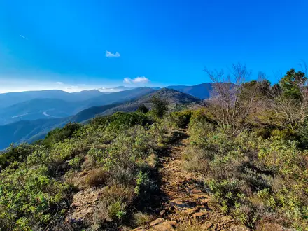
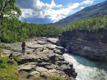
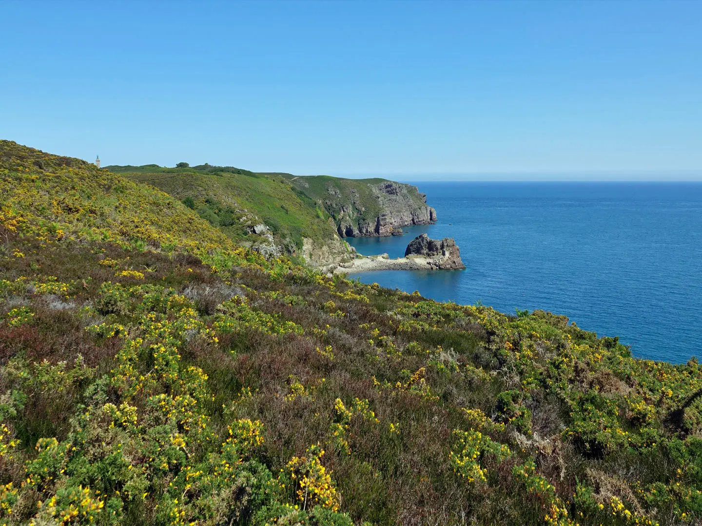
Photos from hikers
Taken on the trail by people who've reviewed Via Alpina.
Via Alpina: The Complete Guide
 i
Image by Patricia
i
Image by Patricia The Via Alpina is the Alps at full scale: a waymarked network crossing eight countries, with the flagship Red Trail running from Trieste on the Adriatic to Monaco on the Mediterranean. It is a route for experienced mountain walkers who want sustained hut-to-hut travel rather than a single packaged trek.
The full Red Trail is a multi-month undertaking, but most hikers sensibly break it into sections. This HikeList guide focuses on the French-Alps finish: roughly 400 km from the Maurienne / Modane area south through Briançon, the Queyras and the Mercantour to Monaco.
The appeal is the variety as much as the distance. High passes, rocky GR5 and GR52 paths, larch forest, glacial lakes, fortified mountain towns and the final descent towards the Mediterranean all sit within one demanding line.
What the walk asks in return is serious preparation. Expect long days, repeated climbs, remote refuges, snow lingering on some high passes into early summer, and accommodation that often needs booking well ahead.
This guide covers stages, daily planning, accommodation, food, transport, terrain and common mistakes.
Stage-by-Stage Guide
The stages below follow the HikeList stage set for the Via Alpina Red Trail highlights and French-Alps finish. They are not a substitute for the current official Via Alpina stage list, which has been modified from 2024 onward; check the latest routing before booking huts or committing to transport.
Stage 1: Muggia / Trieste to Rifugio Premuda
This opening stage leaves the Adriatic edge of the Red Trail, with stage R1 beginning at Muggia just south of Trieste. It is the least Alpine-feeling part of the route, but it is still a proper walking day of around 20 km and sets up the gradual transition inland towards the karst and the Julian Alps.
Expect a mix of village lanes, established footpaths and harder-surfaced sections rather than high-mountain terrain. Navigation is usually less about technical mountain judgement here and more about staying alert through built-up edges, minor roads and junctions where the Via Alpina logo may share space with local waymarks.
Rifugio Premuda provides the natural end-point accommodation for this stage. Food and water are more readily planned around the start and end than on later remote Alpine days, but do not assume constant services once away from Muggia / Trieste.
Trieste has rail access and an airport, making this one of the easiest points on the whole Red Trail to reach. Road access is also simpler than in the high Alps, although onward logistics should still be checked before travelling.
The main warning is not exposure but route discipline: urban-fringe paths, road crossings and multiple local tracks can be easier to misread than a single mountain pass. In hot weather, the lower elevation and harder surfaces can make this stage feel more tiring than the profile suggests.
Stage 2: Julian Alps to Koča pri Triglavskih jezerih, Triglav Lakes area
This stage moves into the Julian Alps and Triglav National Park, one of the first major high-mountain sections of the Red Trail. The destination, Koča pri Triglavskih jezerih, sits in the Triglav Lakes area beneath the wider Triglav massif, with Slovenia’s highest peak, Triglav, rising to 2,864 m nearby.
Terrain becomes much more Alpine: rocky paths, steep climbs, pasture and rougher mountain ground are all likely. Some sections can hold snow into early summer, so conditions may be very different in June from late August.
Food and accommodation are hut-based at Koča pri Triglavskih jezerih. As with all huts on this route, book ahead in the summer season and check opening dates, as many Alpine huts close by late September.
The main access settlements for this part of the route include Trenta and Bovec, but public transport into mountain valleys is seasonal and localised. This should be checked before travelling, especially if using this stage as a standalone section.
Navigation requires proper mountain preparation, not just following paint marks. Mist, lingering snow and rocky ground can obscure the line, and the consequences of a wrong turn are more serious than on the Adriatic approach.
Stage 3: Dolomites to Sexten / Tre Cime area
This stage crosses one of the route’s most distinctive landscapes: the Dolomites, with pale limestone towers and the Tre Cime di Lavaredo area among the defining landmarks. The walking is highly scenic but should not be treated as an easy sightseeing path; the terrain is rocky, steep in places and exposed enough to require good conditions.
Underfoot, expect limestone paths, scree, rough mountain tracks and occasional harder-surfaced approaches near huts or roadheads. The route generally uses established walking paths rather than via ferrata, but weather and snow can still make passes and traverses serious.
Food and water planning should be based around huts, villages and recognised mountain facilities rather than natural water. The Sexten / Sesto and Tre Cime area has well-known hiking infrastructure, but hut space is in high demand in summer and should be booked ahead.
Sesto / Sexten is the key valley area for access. Exact bus and rail connections vary by season and should be checked before travelling, particularly if starting or ending a shorter Via Alpina section here.
Navigation is helped by well-used Dolomite paths, but do not rely on popularity alone. Junctions between local trails, national routes and Via Alpina variants can be confusing, and the current official route should be checked before setting out.
Stage 4: Berchtesgaden to Kärlingerhaus and Königssee
This stage crosses the Berchtesgaden Alps and reaches the Königssee, one of the most memorable lake settings on the Red Trail. The Watzmann dominates the wider area, and the descent towards the lake gives a strong contrast between high limestone country and water-level finish.
The walking is mountainous, with rocky paths, steep gradients and sections where wet limestone can be slippery. Although the standard Via Alpina line does not require technical climbing, this is not benign lowland walking.
Kärlingerhaus is the key hut landmark on this stage, with Königssee forming the onward end point. Food and water should be planned around recognised huts and settlements rather than assumed en route.
Berchtesgaden is a practical access point for this part of the route, while Königssee is a major local landmark with road access nearby. Current public transport details should be checked before travelling.
The main hazards are weather, wet rock and snow lingering on higher ground in early summer. In poor visibility, take particular care with waymarking at path junctions and on rocky terrain where the line may not always be obvious.
Stage 5: Vaduz to Sargans / Grisons
This stage carries the Red Trail through Liechtenstein and into Switzerland, making it one of the clearest border-crossing days on the route. Vaduz and Sargans / Grisons are the key planning anchors, with the stage offering a rare through-walk of the small Alpine principality.
Terrain is likely to mix valley access, pasture, forest and mountain paths rather than the very highest Alpine passes. It is still a demanding day of around 20 km and should be planned as mountain walking, not simply a country-to-country transfer.
Food and water are more manageable here than on remote hut-only stages because the route links substantial settlements, but do not assume that services are evenly spaced. Sargans / Grisons has the strongest end-of-stage logistics for accommodation and onward travel.
This is a useful entry or exit point for section-walkers. Liechtenstein and Switzerland use Swiss francs, and local transport arrangements differ from neighbouring eurozone countries, so ticketing and currency should be checked before travelling.
Navigation is mainly about following the correct Via Alpina line through a busy border-region network of local paths and roads. Take care not to drift onto alternative valley routes unless deliberately leaving the official line.
Stage 6: Griesalp to Kandersteg via Hohtürli
This is one of the great mountain stages of the Via Alpina and crosses the route’s highest point, the Hohtürli at 2,778 m. The ascent from Griesalp is steep and includes the well-known wooden-stepped section before the pass, followed by a long descent towards Kandersteg and the Oeschinensee area.
Terrain is sustained and serious: steep mountain path, rocky ground, steps, scree and exposed-feeling high terrain. A short detour leads higher to the Blüemlisalphütte at 2,834 m, but that should only be added if time, weather and energy allow.
Food and accommodation are hut- and valley-based, with Griesalp and Kandersteg the main settlement anchors. The Blüemlisalphütte is above the pass, and hut opening dates and booking requirements should be checked before travelling.
Kandersteg is one of the stronger public-transport and resupply points on the Swiss part of the route. Griesalp access is more mountain-valley dependent and should be planned carefully rather than assumed.
Do not underestimate this stage. Snow can remain into early summer, the ascent is physically punishing, and the descent is long enough to be hard on tired knees. In poor visibility or storm conditions, the Hohtürli should be treated as a serious high-Alpine pass.
Stage 7: Chamonix / Mont Blanc area to Vanoise / Maurienne — Modane
This stage represents the French high-Alpine arc from the Mont Blanc area towards the Vanoise and Maurienne, finishing at Modane. It is part of the western Red Trail and links into the French Alpine walking network, where the Via Alpina largely shares ground with the GR5 and GR52 further south.
The terrain is classic French Alps walking: rocky mountain paths, pasture, forest approaches, steep climbs and long descents between valley settlements and high passes. The Mont Blanc region gives major glaciated views, while the Vanoise and Maurienne bring another sustained block of high mountain country.
Food, water and accommodation should be planned around refuges, valley villages and towns. Chamonix and Modane are major logistical points compared with the smaller places between them, but intermediate hut bookings remain essential in summer.
Chamonix / Mont Blanc and Modane are important access points for section-walkers. Transport is much easier at these valley towns than between high refuges, but cross-valley connections and seasonal mountain services should be checked before travelling.
Navigation is usually on established, waymarked Alpine paths, but the number of overlapping routes can create uncertainty at junctions. Carry mapping for the French section and check current Via Alpina routing, especially where GR5/GR52 alignments and local variants overlap.
Stage 8: Briançon to Saint-Véran, Queyras
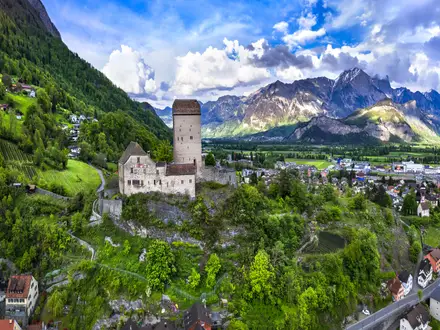
This stage moves from Briançon into the Queyras, finishing at Saint-Véran, one of Europe’s highest permanently inhabited villages at around 2,040 m. Briançon itself is a major landmark, known as the highest town in the EU and for its UNESCO-listed Vauban fortifications.
The walking is high, dry and mountain-focused, with a mixture of rocky paths, pasture, forest track and village approaches. The Queyras often feels more open and remote than the busier Mont Blanc approaches, so daily planning matters.
Food and water availability should be treated as settlement- and refuge-based. Briançon is the best resupply point at the start of the stage, while Saint-Véran offers the natural end-of-stage accommodation base; booking ahead remains sensible in the main summer season.
Briançon is one of the stronger access towns on the French section. Saint-Véran is a high mountain village, and public transport or road access arrangements should be checked before travelling.
Seasonal conditions are important here: passes can hold snow into early summer, while exposed high paths can be hot and dry later in the season. Navigation is generally straightforward on established paths in clear weather, but poor visibility on open ground can make waymarks harder to follow.
Stage 9: Refuge de Nice, Mercantour to villages above Menton
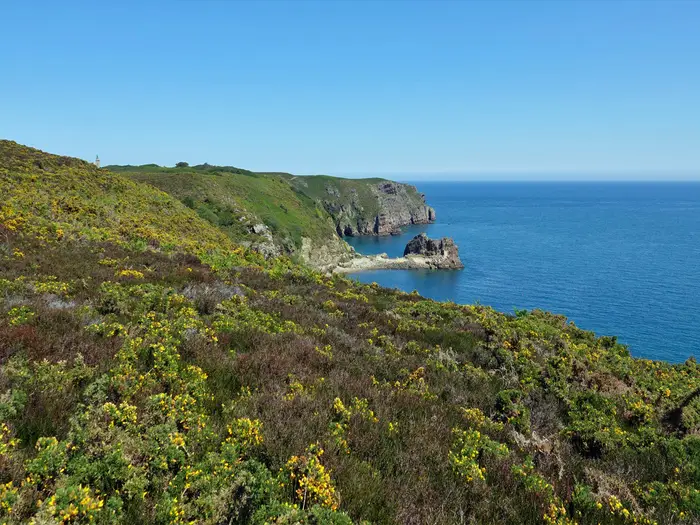
This is part of the final southern traverse through the Mercantour and Maritime Alps, where the route begins to trade the higher Alpine interior for the long descent towards the Mediterranean. Refuge de Nice is the key mountain-hut landmark, with the onward line working towards the villages above Menton.
Terrain remains rugged and should not be dismissed because the sea is getting closer. Expect rocky paths, larch forest, glacial-lake country and steep descents, with the Mercantour also known for ibex and golden eagles.
Food and accommodation are split between mountain refuges and small villages. Refuge de Nice should be booked in season, and services in the villages above Menton should be checked before relying on them for food or a bed.
Road and public-transport access become more plausible as the route drops towards inhabited villages, but the mountain start at Refuge de Nice still requires proper approach planning. This should be checked before travelling.
Navigation deserves care because the official route has seen changes from 2024 onward, including stretches incorporating the Grande Traversée du Mercantour near the Monaco finish. Check the current official Via Alpina line before setting out, and do not assume older stage numbering or GPX files are still exact.
Stage 10: Sospel / Peille to Monaco — Place du Palais
The final stage descends through the villages above Menton towards Monaco, finishing at the Place du Palais in Monaco-Ville. Sospel, Peille and Peillon are the key named settlements on this closing approach, and the day has a very different feel from the high central Alps.
The terrain is still hilly and can be rough underfoot, with village lanes, rocky paths, forested sections and steep descents. Hard surfaces and heat can be more tiring than expected after weeks of mountain walking.
Food and water are more settlement-based here than on the remote Mercantour stages, but do not assume every village service is open when needed. Monaco and the Riviera corridor provide the strongest end-point accommodation and food options, though prices and availability should be checked before booking.
This is one of the easiest parts of the Via Alpina to exit, with Monaco/Menton and nearby Nice on the French Riviera transport axis and Nice offering international air connections. Local access between Sospel, Peille, Peillon and the coast should still be checked before travelling.
Navigation can be awkward because the route passes through a denser network of village paths, lanes and local tracks. Pay close attention to waymarks at junctions, and allow extra time for the final descent rather than treating it as a simple walk into town.
Recommended Itinerary
The Via Alpina is best planned as a sectional route, not as a single fixed holiday itinerary. The full Red Trail is around 161 stages, while the HikeList French finish is about 20 days from the Maurienne / Modane area to Monaco; exact daily stops should be checked against the current Via Alpina stage list and hut opening dates before booking.
The table below uses the stage data available for this guide. These are practical route sections and planning anchors, rather than ten consecutive days across the whole Alpine arc.
Standard itinerary
| Day | From | To | Approx. distance | Why this stage makes sense | Services/accommodation notes |
|---|---|---|---|---|---|
| 1 | Muggia / Trieste (IT) | Rifugio Premuda | 20 km | A logical Adriatic start, moving from the Trieste area into the first upland walking stage without overcomplicating access. | Trieste and Muggia have the strongest pre-walk services. Rifugio Premuda should be booked or checked for current opening before travelling. |
| 2 | Julian Alps (SI) | Triglav lakes area — Koča pri Triglavskih jezerih | 18 km | A high-mountain Slovenian stage into the Triglav Lakes area, suited to a full hut-to-hut walking day. | Koča pri Triglavskih jezerih is a mountain hut; book ahead in summer and check seasonal opening. Snow can linger on higher Alpine ground into early summer. |
| 3 | Dolomites (IT) | Sexten / Tre Cime area | 20 km | A classic Dolomites day with enough distance to progress through the limestone mountain terrain without forcing an overlong stage. | Expect hut and valley accommodation in the Dolomites, but summer demand is high. Confirm hut spaces and any local transport links before booking. |
| 4 | Berchtesgaden (DE) | Kärlingerhaus → Königssee | 17 km | A compact but serious mountain stage across the Berchtesgaden Alps, finishing with a practical exit towards Königssee. | Kärlingerhaus provides hut accommodation on the mountain section. Berchtesgaden / Königssee has valley accommodation and onward transport options; check current local services. |
| 5 | Vaduz (LI) | Sargans / Grisons (CH) | 20 km | A manageable cross-border stage from Liechtenstein into Switzerland, useful for section-walkers because Sargans is a practical access and exit point. | Switzerland and Liechtenstein use Swiss francs. Vaduz and Sargans have town-based accommodation and transport links, but exact connections should be checked before travelling. |
| 6 | Griesalp (CH) | Kandersteg via Hohtürli (2,778 m) | 16 km | One of the key high-pass days of the Red Trail, crossing the Via Alpina’s main-line high point before descending towards Kandersteg and the Oeschinensee area. | Treat this as a weather-dependent Alpine day, not a short easy stage. Griesalp and Kandersteg provide valley bases; check snow conditions and hut options before committing. |
| 7 | Chamonix / Mont Blanc area (FR) | Vanoise / Maurienne — Modane | 22 km | A major French Alps transition stage, linking the Mont Blanc area with the Maurienne / Modane sector used for the HikeList French finish. | Chamonix and Modane have useful town services. Refuges and valley accommodation should be booked in advance during the main summer season. |
| 8 | Briançon (FR) | Queyras — Saint-Véran | 20 km | A strong but sensible Alpine stage from Briançon towards the Queyras, finishing in one of the highest permanently inhabited villages in Europe. | Briançon is the main service point before this section. Saint-Véran has village accommodation, but availability can be limited in peak periods; book ahead. |
| 9 | Mercantour — Refuge de Nice (FR) | Villages above Menton | 20 km | A key Maritime Alps stage, moving from high Mercantour refuge country towards the inhabited hills above the Riviera. | Refuge de Nice should be reserved in advance. Services become easier once the route reaches the villages above Menton, but do not rely on unplanned food or beds on the mountain section. |
| 10 | Sospel / Peille (FR) | Monaco — Place du Palais (MC) | 18 km | A natural final day, descending through the villages above Menton to the official western terminus at Monaco-Ville. | Sospel, Peille and Peillon are the practical last-stage settlements. Monaco, Menton and nearby Nice give straightforward onward transport options, including the Riviera rail line and Nice airport. |
Slower variant
Choose the slower variant if the aim is to reduce daily pressure, allow for weather delays, or walk the French finish as a more comfortable hut-and-village journey. Add rest or buffer days in major service points such as Chamonix, Modane, Briançon, Saint-Véran, Sospel or the Monaco / Menton area.
On the full Red Trail, the slower approach means treating the listed stages as separate building blocks within a much longer itinerary. High passes such as Hohtürli, and remote refuge stages such as the Mercantour approach to Refuge de Nice, should not be squeezed in poor weather or when snow remains on the route.
Faster variant
A faster schedule suits only very fit, experienced Alpine walkers with efficient hut bookings, light packs and stable weather. Some valley-based days may be combined where transport and accommodation allow, but this should be decided from current mapping rather than assumed in advance.
Do not compress the most committing mountain stages simply because the kilometre figures look modest. Alpine days on the Via Alpina are often limited by ascent, descent, snow, rough ground and hut logistics rather than distance alone.
Planning the Route
Decide the scope before booking anything
The first planning decision is whether you are walking the full Via Alpina Red Trail, a shorter country-by-country section, or the French-Alps finish to Monaco. These are very different commitments: the full Red Trail is a multi-month transalpine traverse, while the French finish covered by this guide is a much more realistic single-trip objective of around 20 walking days.
Most walkers should treat the Via Alpina as a section-hiking project. Planning one massif, country or transport-linked block at a time is far more practical than trying to hold accommodation, weather windows and border-region transport together across the whole Alpine arc.
For the French finish, plan around the natural line south from the Maurienne / Modane area through Briançon, the Queyras around Saint-Véran, the Ubaye and Mercantour, then down through Sospel, Peille and Peillon to Monaco. Add buffer time if travelling early or late in the season, or if relying on specific refuge bookings.
How many days to allow
For the full Red Trail, allow roughly 5–6 months if attempting an end-to-end traverse, and expect that to be unusually demanding logistically. It is not a route most hikers complete in one continuous season.
For the French section to Monaco, allow about 20 walking days. A fit and experienced mountain walker may compress some stages, but this is rarely the best approach: the limiting factors are usually high passes, refuge availability, weather and transport, rather than simple daily mileage.
A sensible plan includes rest or contingency days in larger valley towns such as Modane, Briançon or near the Riviera rail corridor at the end. Bad weather, lingering snow on passes, or a missed hut booking can otherwise force rushed decisions in terrain where rushing is a poor strategy.
Let accommodation shape the stages
Daily stages on the Via Alpina are largely dictated by where huts, refuges, valley guesthouses and transport-linked towns sit. In high-mountain sections there may be no convenient mid-stage exit, so the overnight stop often defines the day more than the distance does.
Mountain huts and refuges are typically dormitory-based and often operate on a half-board basis. Many close by late September, and summer beds should be booked ahead, especially on popular Alpine sections and around national-park areas.
Do not assume that a published stage can be split easily. Some days cross remote passes or run between valleys with limited accommodation; others end in towns where hotels, hostels, campsites or guesthouses may give more flexibility.
Shortening, extending and section hiking
The Via Alpina is well suited to section hiking because it passes through major Alpine valleys and transport-served towns. Trieste, Monaco / Menton and Nice are strong endpoint options, while places such as Tarvisio, Lienz, Berchtesgaden, Innsbruck, Vaduz, Sargans, Kandersteg, Chamonix, Modane and Briançon can work as practical access or exit points for shorter blocks.
Public transport planning should be done town by town. Regional rail, Swiss PostBus / postal-bus services and local mountain buses can be very useful, but service frequency varies by country, valley and season. This should be checked before travelling.
Extending the walk is easy in theory because the Via Alpina is a network of five colour-coded routes, not a single corridor. In practice, extensions should be planned with the same care as the main route: check current waymarking, hut availability, transport exits and whether the variant still matches the season and your fitness.
Route information and stage numbering
Use the current Via Alpina stage list rather than relying on old stage numbers. The route has been modified from 2024 onward, including changes near the Monaco finish where stretches incorporate the Green Via Alpina and the Grande Traversée du Mercantour.
On the ground, the route often follows existing national long-distance paths, including the GR5 / GR52 in France and the Swiss Alpine Pass Route in Switzerland. This is useful for navigation, but it also means signage may show local trail names as well as, or instead of, the Via Alpina logo.
Carry mapping that works without mobile signal. Waymarking helps, but it is not a substitute for being able to navigate in cloud, snow patches, forested junctions or complex village approaches.
Food, water and resupply
Plan food around overnight stops, not around continuous resupply. Huts commonly provide evening meals and breakfast, while valley towns offer the best chance to restock; smaller villages may have limited services or seasonal opening.
Carry enough food for the full day and a reserve for delays. On remote mountain stages, a slow crossing, storm detour or closed hut can quickly turn a normal day into a long one.
Water planning should be checked stage by stage. Do not assume every stream, pasture trough or refuge is available or suitable; carry enough between reliable points and ask locally where conditions are uncertain.
Weather, snow and seasonal timing
The practical season is summer into autumn, but high passes can hold snow into early July. Early-season plans need extra caution, especially on steep or exposed crossings and on shaded passes.
Late-season plans have the opposite problem: weather can still be excellent, but hut closures become a major constraint from late September. A September itinerary should be built around confirmed accommodation rather than a theoretical stage list.
Weather windows matter more than daily speed. If a stage crosses a high pass or exposed terrain, be prepared to wait, shorten, descend or use public transport rather than forcing the schedule.
Borders, money and local rules
The route crosses eight Alpine countries, so logistics change as you move. Most of the arc uses the euro, but Switzerland and Liechtenstein use the Swiss franc, and hut, shop and transport costs should be checked in the local currency before booking.
There is no single route-wide booking system for the Via Alpina. Huts, refuges, hotels, campsites and transport operators are handled locally, and opening dates, payment methods and cancellation rules vary.
Any local access rules, national-park requirements or camping restrictions should be checked for the specific section being walked. This is especially important in protected mountain areas and where the route crosses borders or uses refuges inside national parks.
Towns, Villages and Overnight Stops
Accommodation on the Via Alpina alternates between valley settlements and high mountain huts. In practice, most hikers book a chain of dormitory-based refuges / rifugi / Hütten / koče, then use larger towns for rest days, laundry, transport changes and proper resupply.
Do not assume every village has a shop, evening meal option or late-season accommodation. Many huts close by late September, high passes can hold snow into early summer, and current opening dates, meal arrangements and booking requirements should be checked before travelling.
Switzerland and Liechtenstein use the Swiss franc (CHF); Italy, Slovenia, Austria, Germany, France and Monaco use the euro (€). This matters when paying hut deposits, local transport and cash-only mountain services.
Muggia / Trieste (IT)
Muggia, just south of Trieste, is the starting area for the Red Trail’s first stage, with Trieste as the practical city base on the Adriatic. It is the best place to arrive with time in hand, buy missing kit and start with food for the first walking days.
Trieste is one of the easiest access points on the whole route, with rail connections and an airport. Accommodation and food options are city-based rather than mountain-oriented, so it works well for a pre-walk night rather than a typical hut stop.
Julian Alps / Triglav area — Trenta, Bovec (SI)
The route’s Slovenian section climbs into the Julian Alps and the Triglav area, with Trenta and Bovec acting as useful valley settlements around the mountain stages. These are logical places to pause before or after hut-based walking in Triglav National Park.
Expect a mix of valley accommodation and mountain huts such as Koča pri Triglavskih jezerih on the higher stages. Food and supplies are easier in the valley settlements than on the hut stages, where half-board and advance booking are normally the practical approach.
Transport into and out of this mountain area is more local than intercity. Timetables and seasonal services should be checked before travelling.
Tarvisio (IT)
Tarvisio is a useful Italian stop after the Slovenian mountain section and before the route pushes deeper into the eastern Alps. It is a sensible place to reset logistics, sleep in the valley and prepare for the next block of high walking.
Use Tarvisio as a resupply and accommodation stop rather than relying on small intermediate places. Current transport links and onward access should be checked before travelling.
Lienz / East Tyrol (AT)
Lienz and East Tyrol form a practical Austrian valley break on the Red Trail. For section-hikers, this type of larger valley town is often more useful than a small overnight village because it gives more options for beds, food and onward travel.
This is a good place to plan a rest night, replace supplies and reorganise for hut-to-hut stages. Local rail or bus connections may be available in the region, but specific services should be checked before travelling.
Sesto / Sexten & the Dolomites (IT)
Sesto / Sexten sits on the Dolomites part of the route, close to the Tre Cime area. It is a strong overnight base before or after the limestone high stages, especially if huts are full or weather makes a valley night preferable.
The Dolomites are one of the busiest parts of the Alpine arc in summer. Huts and valley accommodation should be booked well ahead, and walkers should not rely on turning up late in the day without a reservation.
Berchtesgaden & Königssee (DE)
Berchtesgaden is the main practical settlement for the German stage around the Berchtesgaden Alps and Königssee. It works well as a section start or finish, with valley accommodation and access to the mountain stages around Kärlingerhaus and the descent towards Königssee.
Kärlingerhaus is a hut-style overnight in the mountains, while Berchtesgaden is the better place for wider food, beds and transport planning. The Königssee stage should be planned as a mountain day, not as a casual low-level village walk.
Zugspitze / Bavarian Alps region (DE)
The Red Trail passes through the Bavarian / Wetterstein Alps region close to the Zugspitze area, but this entry is best treated as a region rather than a single overnight stop. Choose overnight places from the current official stage list rather than assuming the Zugspitze itself is part of the accommodation plan.
Expect the usual Alpine pattern: valley guesthouses or hotels below, huts on higher stages, and seasonal pressure on beds in summer. Transport and exact access points should be checked before travelling.
Innsbruck / Tyrol (AT)
Innsbruck is one of the most useful larger towns on the Alpine arc for section logistics. It is a practical place to start or end a trip, rest between mountain blocks, shop for food and replace worn gear.
Accommodation choice is broader here than in smaller villages, but summer demand can still be high. Use it as a logistics base rather than trying to carry unnecessary supplies through multiple earlier stages.
Vaduz (LI)
Vaduz gives the Via Alpina a rare crossing of Liechtenstein and is a natural overnight or short section break between the Austrian and Swiss parts of the route. Liechtenstein uses CHF, so carry or arrange suitable payment if moving straight into Swiss-stage logistics.
Accommodation and food should be planned in advance because the country section is short and there may be limited flexibility if a preferred stop is full. Local transport arrangements should be checked before travelling.
Sargans / Grisons (CH)
Sargans is the practical Swiss-side stop after Vaduz and a useful entry point into the Grisons stages. It is a good place to reorganise for longer Swiss mountain sections, where huts, passes and weather windows start to dominate planning.
Switzerland has dense mountain public transport compared with many Alpine regions, but each section still needs planning town by town. Check PostBus, regional rail and local services before committing to an itinerary.
Silvretta & Bernina region (CH)
The Silvretta and Bernina region is not one simple town stop; it is a high-Alpine block where overnight planning depends on the official stage line and the huts or valley settlements chosen. Treat this section as mountain logistics first, sightseeing second.
Huts should be booked ahead, and walkers should carry enough food to cover gaps between reliable valley services. Weather changes, snow on passes and long ascents can make short-looking stages serious.
Klosters / Davos area (CH)
Klosters and Davos are useful Swiss valley bases around the Grisons part of the route. They suit rest days, section starts and exits, especially after several hut-based stages.
Food, accommodation and transport planning are generally easier here than in the smaller high-valley stops, but prices and availability can vary sharply by season. Confirm current prices before booking.
Bernese Oberland — Griesalp, Hohtürli, Kandersteg, Oeschinensee (CH)
This is one of the most important overnight-planning areas on the Red Trail. Griesalp sits before the ascent to Hohtürli, the highest point on the main Via Alpina line at 2,778 m, while Kandersteg is the key valley stop after the descent past Oeschinensee.
The Hohtürli stage is a serious mountain day with steep ground and a major pass crossing. Many walkers also note the Blüemlisalphütte above the pass, but any detour or overnight there needs to be planned with current hut availability.
Kandersteg is the more practical recovery and resupply stop after the pass. Book accommodation in advance in busy periods, and avoid treating this as a stage where a late change of plan will be easy.
Lenk / Montreux (CH)
Lenk and Montreux sit on the western Swiss arc and are useful for breaking the route before entering the French Alpine stages. They are also sensible section endpoints for hikers not walking the Red Trail continuously.
Use these larger settlements for food, accommodation and transport connections before committing to the next mountain block. Current local rail and bus arrangements should be checked before travelling.
Chamonix / Mont Blanc area (FR)
Chamonix and the Mont Blanc area are a major transition point into the French Alps section. For many walkers, this is where the route becomes a practical sequence of French GR5 / GR52-style mountain stages towards the Maurienne, Vanoise, Queyras, Mercantour and Monaco.
Chamonix is a good place for a rest day, gear replacement and resupply before continuing south. Accommodation demand is high in the main summer season, so book ahead rather than relying on last-minute beds.
Vanoise & Maurienne — Modane (FR)
Modane and the Maurienne are the practical starting area for the French-Alps finish described in many shorter Via Alpina itineraries. If walking only the final French section to Monaco, this is the natural place to organise arrival, first-night accommodation and food for the opening stages.
The route here shares mountain terrain with the Vanoise and nearby high Alpine massifs, so hut and refuge planning matters more than village-to-village spontaneity. Local transport into Modane and onward valley services should be checked before travelling.
Briançon (FR)
Briançon is one of the most useful town stops on the French section. It is the highest town in the EU and has UNESCO-listed Vauban fortifications, but for hikers its main value is practical: beds, food, rest and a chance to reorganise before the Queyras.
Plan to resupply here rather than relying on smaller settlements immediately before or after. If using Briançon as a section start or exit, current transport arrangements should be checked before travelling.
Queyras — Saint-Véran (FR)
Saint-Véran sits high in the Queyras at around 2,040 m and is among Europe’s highest permanently inhabited villages. It is a memorable overnight stop, but its altitude and mountain setting mean availability should be treated seriously.
Book accommodation ahead in the main walking season and check whether evening meals and supplies are available on the dates required. This is not a place to assume full town-level services at all times.
Ubaye (FR)
The Ubaye section is best planned as a mountain region rather than a single named resupply town. Overnight options will depend on the current official stage line, with a mix of refuges and valley accommodation likely to shape the itinerary.
Carry enough food between dependable stops and check refuge opening dates before committing to daily distances. Transport access in and out of this section should be checked before travelling.
Mercantour — Refuge de Nice (FR)
Refuge de Nice is a key mountain overnight in the Mercantour part of the route before the final descent towards the Mediterranean side of the Alps. Treat it as a booked refuge stop, not as a village with shops or flexible services.
Expect dormitory accommodation and meal arrangements typical of Alpine refuges. Booking ahead is essential in summer, and weather or snow conditions should be checked before crossing high ground in this area.
Sospel, Peille, Peillon (FR)
Sospel, Peille and Peillon are the important final villages above Menton on the approach to Monaco. They are useful for breaking the last stages, especially if avoiding an overlong final push to the coast and Monaco-Ville.
Services can be more limited than in the larger Alpine towns, so accommodation, food and shop opening times should be checked before travelling. These stops are especially important because the final stages can feel logistically close to the Riviera but still involve real mountain and hill walking.
Monaco — Place du Palais (MC)
Place du Palais in Monaco-Ville is the western terminus of the Red Trail. It is a finish point rather than a mountain overnight stop, and many walkers will use Monaco, Menton or Nice for onward travel and post-walk accommodation.
Monaco and Menton sit on the French Riviera rail line, and Nice has an international airport. Accommodation prices and availability can vary greatly, so arrange the final night and onward transport before reaching the last village stages.
Getting to the Start
The practical start depends on which version of the route is being walked. For the full Red Trail, travel to Trieste and then on to Muggia, just south of the city, where stage R1 begins. For the HikeList French-section itinerary, the start is in the northern French Alps around Modane / Maurienne rather than at the Adriatic.
By train
For the full Red Trail, Trieste is the key rail gateway. It is the sensible arrival point before making the short final transfer to Muggia for the official eastern start; the exact local connection should be checked before travelling.
For the French section, plan rail access to Modane / Maurienne. Modane is the main practical start town for this version of the itinerary, but train times, engineering works and any required reservations should be checked before booking accommodation.
Because the Via Alpina is normally section-walked, rail planning is best done stage by stage rather than as one continuous itinerary. Many Alpine towns on or near the route have regional rail access, but not every overnight stop is directly on a railway.
By bus
Local and regional buses are useful for the final approach to many Alpine start points, especially where the trail begins above a valley town. For Muggia, expect the last leg from Trieste to be a local transfer rather than a long-distance connection; this should be checked before travelling.
In the French Alps, local mountain services may be needed if starting away from Modane itself or joining the route at another Maurienne valley point. Summer timetables can differ from shoulder-season timetables, and services may be sparse outside the main walking season.
By car
Driving is rarely the cleanest option for this route because the Via Alpina is a long point-to-point traverse, not a loop. Leaving a car at Muggia, Trieste, Modane or another start town creates a recovery problem at the end of the section.
If driving to the start, arrange either a planned return by train/bus or a second vehicle at the finish. Long-stay parking rules, security and maximum stay limits should be checked locally before leaving a car for multiple days.
Taxis can be useful for the final link to a trailhead or accommodation when local public transport does not line up with arrival times. Book ahead in smaller mountain towns, especially for early starts or late arrivals.
From the nearest airport
For the full Red Trail start, Trieste has an airport and is the obvious flight gateway before continuing to the city and Muggia. Flight schedules and onward airport-to-city transport should be checked before travelling.
For the French-section start around Modane / Maurienne, no single airport should be assumed as the default without checking onward rail and bus connections. Choose the airport based on the fastest reliable public-transport link to the selected start town, not simply by map distance.
For walkers joining the route elsewhere, airport access varies by country. Switzerland, Austria and France generally have strong mountain public transport, but the last valley connection can still be the weak link in the plan.
Where to stay before starting
For the full Red Trail, staying in Trieste or Muggia gives the simplest start. Trieste offers the broader transport base, while Muggia is closer to the first walking stage.
For the French section, stay in or near Modane / Maurienne before day one. This allows time to buy food, check the forecast, confirm onward hut or refuge bookings, and avoid starting a high-mountain stage straight after a long travel day.
Book the first night before travelling in peak summer. Many huts and refuges on the Via Alpina operate seasonally and can close by late September, so opening dates and reservations should be checked before committing to travel dates.
Getting Home from the Finish
The Via Alpina Red Trail finishes at Place du Palais in Monaco-Ville. Monaco is one of the easier Alpine finishes to leave because it sits on the French Riviera rail corridor, with Menton and Nice nearby, but onward travel still depends on the time of day and seasonal timetables.
By train
The most practical onward option is the railway from Monaco, on the coastal line linking Monaco, Menton and Nice. From Nice, you can connect onwards to wider French and international rail services.
If finishing the final descent late in the day, do not assume there will be a convenient same-evening long-distance connection. Check current train times before committing to onward tickets, especially if linking to a flight or cross-border rail journey.
For walkers ending a section before Monaco — for example around Modane, Briançon, Sospel, Peille or Peillon — plan the exit separately for that specific town or village. The Via Alpina is a long point-to-point route, and public transport works best when arranged stage by stage rather than treated as one continuous logistics chain.
By bus
Local bus options may be useful for short movements around Monaco, Menton and the nearby coastal towns, but they are more timetable-dependent than the train for onward travel. This should be checked before travelling.
For the final mountain villages above Menton and Monaco, do not rely on a late bus as the main escape plan unless the timetable has been checked for the exact day. If there is any doubt, continue to Monaco as planned or pre-arrange a taxi from a reachable roadhead.
By car/taxi
A taxi or pre-booked transfer is the simplest fallback if you finish after the last convenient public transport connection, are carrying heavy kit, or need to reach accommodation away from the rail line. Availability and prices should be confirmed locally before relying on this option.
Driving logistics are less straightforward because the hike is point-to-point. If a vehicle has been left elsewhere on the route, allow for a long rail or taxi transfer back to it; most walkers are better served by public transport at the Monaco end.
From the nearest airport
Nice has the nearest major international airport for leaving the Monaco finish. Monaco, Menton and Nice are linked by the French Riviera rail line, making Nice the natural departure hub for flights after the walk.
Leave a sensible buffer between reaching Monaco and any flight from Nice. The final day still involves mountain walking before the descent to the coast, and delays from weather, fatigue or navigation are more costly when an airport connection is booked for the same evening.
Where to stay at the finish
Staying overnight at the finish is often the lowest-stress option, particularly after the final descent from the Maritime Alps. It gives time to wash kit, deal with travel connections and leave the next morning on a planned train or airport transfer.
Accommodation can be based in Monaco itself, or nearby Menton or Nice if onward rail or airport access is the priority. Book ahead in busy periods and check cancellation terms if the final mountain stages could be affected by weather.
Which Direction Should You Walk?
Standard direction: Trieste / Modane to Monaco
The standard direction for the Red Trail is east-to-west, from Muggia / Trieste to Monaco. On the French-Alps finish covered by this guide, that means walking broadly south from the Maurienne / Modane area through Briançon, the Queyras, the Ubaye and the Mercantour before descending via Sospel, Peille and Peillon to Monaco-Ville.
This is the direction that best matches the official route logic: the Red Trail begins with stage R1 at Muggia and its final stages, R160–R161, descend through the villages above Menton to the Place du Palais in Monaco. It also fits the way most walkers think about this end of the route: high Alpine passes first, then the Maritime Alps, then the Mediterranean finish.
For the French section, the scenery progression is a strong reason to go north-to-south. The route moves from the Vanoise / Maurienne and Briançon high-country into the Queyras and Mercantour, then finally drops from mountain villages towards the coast. Finishing in Monaco gives the walk a clear endpoint rather than simply stopping in another Alpine valley.
Transport also favours this direction slightly. Monaco, Menton and nearby Nice sit on the French Riviera rail line, and Nice has an international airport, so the finish is straightforward to leave from. Modane / Maurienne and other Alpine access points are workable starting points, but mountain transport should be planned town by town and checked before travelling.
Reverse direction: Monaco to Modane / Trieste
Walking in reverse is entirely possible, but it changes the character of the opening days. Instead of descending to the sea at the end, you begin by climbing away from Monaco and the Menton-side villages towards Sospel, Peille, Peillon and the Mercantour.
The main advantage of the reverse direction is psychological for hikers who prefer to build from sea level into bigger mountains. It can also work well if accommodation availability, transport connections or a wider Alpine itinerary make Monaco the most convenient starting point.
The disadvantages are mostly practical. You are walking against the official stage sequence, so route notes, stage numbering and many trip plans will feel less natural. The big emotional finale is also lost: finishing in Modane, Briançon or another mountain town is useful logistically, but it does not have the same clarity as arriving at the Place du Palais in Monaco.
Are the climbs easier one way?
Across a route this long, there is no universally easier direction. The Via Alpina repeatedly crosses high passes and steep valleys, so one side of a pass may be steeper on one day and easier on the next.
For the French finish, the standard direction has one clear advantage: the last part trends down from the Maritime Alps towards the Mediterranean. In reverse, that same finish becomes an early sustained climb away from the coast. That does not make the whole reverse route harder, but it can make the first days feel abrupt if fitness and heat acclimatisation are not yet in place.
Weather, wind and season
Prevailing wind is not a useful reason to choose direction on this route. Alpine weather is governed more by altitude, exposure, afternoon storms, snow remaining on high passes and local conditions than by a simple one-way pattern.
Snow on high passes can remain into early summer, and many refuges close by late September. Direction will not remove those constraints; timing, hut bookings and current conditions matter more. This should be checked before travelling.
Accommodation flow
Accommodation planning is usually simpler in the standard direction because it follows the official route order and the common logic of the French GR5 / GR52 sections used by the Red Trail. Refuges, valley guesthouses and small hotels can still be booked in reverse, but each stage needs to be checked carefully so that food, bed spaces and transport exits line up.
In either direction, summer huts should be booked ahead and opening dates checked directly. The route crosses remote mountain areas where assuming a bed will be available is poor planning.
Recommendation
Walk the Via Alpina Red Trail, and especially the French-Alps finish, in the standard direction towards Monaco unless there is a strong logistical reason not to. It matches the official stage order, gives the best mountain-to-Mediterranean progression, makes the final transport easy, and provides the most satisfying finish at Monaco-Ville.
Choose the reverse direction only if accommodation availability, onward travel or a wider Alpine itinerary makes it clearly more practical.
Accommodation Along the Route
Accommodation on the Via Alpina is a mix of mountain huts, valley guesthouses, small hotels, hostels and campsites. On the high sections, expect dormitory-style refuges or Hütten with half-board; in larger valley towns, there is usually a broader choice of hotels and guesthouses.
For the Red Trail and the French-Alps finish to Monaco, accommodation planning is one of the main constraints. Many mountain huts close by late September, popular huts can fill in summer, and some stages have no realistic alternative once committed to a high pass or remote valley.
Booking strategy
Book mountain huts and refuges ahead in the main summer season, especially around the Dolomites, Berchtesgaden, the Bernese Oberland, Chamonix / Mont Blanc, the Vanoise, Queyras and Mercantour. Weekend pressure is usually higher near accessible national parks, famous viewpoints and towns with strong day-hiking demand.
Do not assume that every listed Via Alpina stage has a choice of beds at the end. Some overnight points are single-hut locations, and if that hut is full or closed the day may need to be shortened, lengthened or re-routed to a valley.
Opening dates vary by country, altitude and snow conditions. Hut opening and closing dates, meal availability and booking rules should be checked before travelling.
Where accommodation is strongest
The easiest places to pause, resupply, take a rest day or swap sections are the larger transport-linked towns: Trieste / Muggia, Tarvisio, Lienz, Berchtesgaden, Innsbruck, Sargans, Klosters / Davos, Kandersteg, Montreux, Chamonix, Modane, Briançon and Monaco / Menton area. These are the places most likely to offer several accommodation styles rather than a single hut or refuge.
The French finish has better valley options around Modane, Briançon, Saint-Véran, Sospel, Peille, Peillon and Monaco, but still includes mountain-refuge stages in the Vanoise, Queyras and Mercantour. Refuge de Nice is a key example of a high-mountain overnight where booking matters.
Where accommodation is limited
Remote mountain sections are the limiting factor: the Triglav lakes area, parts of the Dolomites, Berchtesgaden high country, Hohtürli between Griesalp and Kandersteg, and the Mercantour. In these places, the route is planned around huts rather than villages.
High passes themselves should be treated as day crossings, not overnight targets. Hohtürli is the Via Alpina’s high point at 2,778 m; walkers either stay on one side of the pass or use nearby hut options such as the Blüemlisalphütte detour above the route, where appropriate and booked.
Accommodation table
| Place | Accommodation level (good/limited/none) | Best for | Notes |
|---|---|---|---|
| Muggia / Trieste | Good | Start logistics, pre-walk night, transport connections | Broadest choice at the eastern end of the Red Trail. Useful for sorting late gear, food and onward plans before leaving the Adriatic. |
| Rifugio Premuda | Limited | First-stage mountain-style overnight | A specific hut stop on the early Red Trail. Book ahead rather than relying on arrival without a reservation. |
| Trenta / Bovec and Triglav area | Mixed | Julian Alps section planning | Valley settlements give more flexibility; high hut locations such as Koča pri Triglavskih jezerih are more constrained. |
| Koča pri Triglavskih jezerih | Limited | Triglav Lakes valley overnight | A key hut-style stop in the Slovenian mountains. Summer booking is strongly advised. |
| Tarvisio | Good | Section break, resupply, transport access | A practical valley town between the Julian Alps and the next Alpine sections. |
| Lienz / East Tyrol | Good | Rest day, section start or finish | One of the stronger accommodation and services stops on the Austrian part of the arc. |
| Sesto / Sexten and Tre Cime area | Mixed | Dolomites walking | Valley accommodation is stronger; huts and rifugi near the high route are in heavy summer demand. |
| Berchtesgaden and Königssee | Good | Section base, rest day, transport access | Stronger choice in town than on the high route. Popular area, so summer and weekend booking matters. |
| Kärlingerhaus | Limited | Berchtesgaden high-country overnight | A hut-style stop before descending towards Königssee. Treat as a booked mountain overnight, not a flexible hotel stop. |
| Innsbruck | Good | Major rest, resupply and transport hub | One of the best places on the route to pause, replace kit or join/leave a section. |
| Vaduz | Good | Liechtenstein section stop | Useful for breaking the route through the principality before continuing towards Sargans / Grisons. |
| Sargans / Grisons | Good | Transport access and Swiss section logistics | A practical place to begin or end a Swiss section, with onward mountain transport options varying by valley. |
| Klosters / Davos area | Good | Swiss Alps section base | Stronger valley accommodation than the surrounding high passes. Suitable for rest days or shorter section plans. |
| Griesalp | Limited | Night before Hohtürli | Important staging point before the steep crossing to Kandersteg. Book early in summer. |
| Hohtürli | None | Day crossing only | No accommodation should be assumed on the pass itself. Plan beds before and after the crossing; the Blüemlisalphütte is a short detour above the route and must be booked if used. |
| Kandersteg / Oeschinensee area | Good to mixed | Recovery after Hohtürli, rest day | Kandersteg is the stronger accommodation base; high or lakeside options are more constrained and seasonal. |
| Montreux | Good | Section end, rest day, transport access | A useful Swiss lowland/valley break before or after Alpine stages. |
| Chamonix / Mont Blanc area | Good | Major rest, resupply and section logistics | Strong accommodation choice, but also heavy demand in peak summer. Book ahead for weekends and holiday periods. |
| Modane / Maurienne | Good | Start of the HikeList French-Alps section, transport access | Practical valley base for the Vanoise / Maurienne part of the route. |
| Briançon | Good | Rest day, resupply, section break | One of the best service towns on the French section before continuing towards the Queyras. |
| Saint-Véran / Queyras | Limited to good | High-village overnight, Queyras section | More characterful but less flexible than a large town. Book ahead in the main walking season. |
| Ubaye | Limited | Remote southern-Alps stages | Expect fewer choices than in major towns; plan overnight stops stage by stage. |
| Refuge de Nice / Mercantour | Limited | High Mercantour overnight | A key mountain-refuge stop before the final descent towards the villages above Menton. Booking is essential in season. |
| Sospel | Good | Final-section village stop | A practical overnight before the last stages towards Peille, Peillon and Monaco. |
| Peille / Peillon | Limited | Final approach to Monaco | Small-village logistics are less flexible than coastal towns. Accommodation availability should be checked before committing to a night here. |
| Monaco / Monaco-Ville | Good | Finish, post-walk night, onward travel | Strong accommodation and transport access at the Mediterranean end, though prices and availability can vary sharply. Confirm current options before booking. |
Luggage transfer, taxis and inn-to-inn walking
The Via Alpina is not best treated as a continuous luggage-transfer holiday. It crosses eight countries and many mountain sections finish at huts or small valleys where formal baggage services may not exist.
Local taxis, valley buses and mountain transport can help shorten awkward sections or move around closed/full huts, particularly near larger towns such as Innsbruck, Kandersteg, Chamonix, Modane and Briançon. This should be planned section by section and checked before travelling.
An inn-to-inn style is realistic on some valley-based stretches and in well-served regions, but not across the whole route without altering the line. Walkers who want private rooms every night should focus on shorter sections built around larger towns, and avoid hut-dependent high crossings unless prepared to use dormitory refuges.
Camping and Wild Camping
Camping on the Via Alpina is possible, but it is not the simplest way to walk the route. This is a hut-and-valley accommodation trail first: many stages are planned around refuges, rifugi, Hütten, koče, guesthouses and small hotels, with campsites mainly in valley towns rather than beside high passes.
For the HikeList French-Alps finish from the Maurienne / Modane area to Monaco, camping can work on selected stages, but it should not be assumed every night. The route crosses high mountain terrain, national-park country and villages where local rules matter, then finishes in the much more built-up corridor above Menton and Monaco.
Formal campsites
Expect formal campsites in some towns and valley bases between mountain sections, not at every stage end. They are most useful when the route drops to larger settlements such as Modane, Briançon, Saint-Véran / the Queyras area, Sospel and the villages on the approach to the Mediterranean.
Opening dates are seasonal and should be checked before travelling, especially outside July and August. Some campsites close by early autumn, while many mountain huts also close by late September, so a tent is not a complete substitute for accommodation planning.
On the full Red Trail, the same pattern applies across the Alps: campsites are generally a valley option around towns such as Trieste / Muggia, Tarvisio, Lienz, Innsbruck, Sargans, Kandersteg, Chamonix and other transport-linked places. High stages between valleys are usually better planned around huts unless local camping or bivouac rules are clearly understood.
Wild camping and bivouacking
Wild-camping rules vary across the eight countries crossed by the Via Alpina, and often again by region, commune, canton, protected area and land ownership. There is no single Via Alpina-wide rule that makes camping legal along the route.
Do not assume that pitching a tent is allowed because the ground looks remote. Large parts of the trail pass through sensitive Alpine environments, including Triglav National Park, the Vanoise / Écrins region, the Mercantour and other protected mountain areas where camping and bivouacking can be restricted or controlled.
Before relying on wild camping, check the current local rules for the exact section being walked. This should be checked before travelling, and again locally at tourist offices, refuges, park information points or municipal offices where necessary.
Where bivouacking is permitted locally, it is usually a minimal overnight stop rather than setting up a camp for the afternoon. Keep the tent small, arrive late, leave early, avoid grazing land and water margins, and never camp close to a refuge, village, farm building or private dwelling without permission.
Does the Via Alpina suit a camping strategy?
A lightweight camping set-up can give flexibility on long transalpine sections, but it adds weight on already hard mountain days. Daily climbs often exceed 1,000 m, the paths are rocky and steep, and some stages cross high passes where carrying a heavier pack is a real disadvantage.
Camping works best as a mixed strategy: use campsites in valleys, huts in remote high terrain, and only bivouac where it is clearly allowed. A hut-only or hut-and-guesthouse plan is usually more practical for walkers doing the French section in a fixed holiday window.
The least suitable parts for casual camping are the high protected mountain sections, the approaches to popular hut areas, and the final descent towards Monaco. The finish at Monaco / Monaco-Ville should be treated as an accommodation or onward-travel night, not a place to look for a tent pitch.
Water and cooking
Water access changes constantly along the Alpine arc. Streams, springs, lakes and huts may be available on some stages, but dry ridges, karst terrain, late-season conditions and hot approaches to the Maritime Alps can leave longer gaps than expected.
Carry enough water for the full day unless the next reliable source is known. Natural water should be treated, especially near pastures, huts, villages or heavily used paths.
Stove use should be conservative and only where allowed. Open fires are inappropriate on this route and may be illegal, particularly in protected areas, forest, pasture and during dry summer conditions.
Leave No Trace on the Via Alpina
Camping pressure is a real issue on popular Alpine routes. If camping or bivouacking is legal on the section being walked, keep the impact as close to invisible as possible:
- Use formal campsites where available.
- Pitch on durable ground, not fragile alpine meadow, wetland or lakeshore vegetation.
- Keep well away from livestock, farm infrastructure and private land unless permission has been given.
- Pack out all rubbish, including food scraps and toilet paper.
- Bury human waste only where local rules allow; otherwise use refuge or village facilities.
- Do not wash directly in lakes or streams with soap, even biodegradable soap.
- Keep noise and light low near huts, villages and wildlife areas.
- Never light fires unless explicitly permitted locally.
Practical planning advice
For each stage, decide in advance whether the night is a hut, guesthouse, campsite or legal bivouac. Do not leave this to the end of the day on remote sections, as the next valley may be several hours away over difficult terrain.
Book huts and valley accommodation early in summer, even if carrying a tent. Bad weather, snow on high passes, exhaustion or local camping restrictions can force a change of plan, and a reserved bed can be the safer option.
For the French finish, pay particular attention to the Vanoise / Maurienne, Queyras, Ubaye, Mercantour and Monaco approach. These are exactly the kinds of mountain and protected-area landscapes where local bivouac rules, fire restrictions and seasonal closures must be checked before relying on a tent.
Food, Water and Resupply
The Via Alpina is normally planned as a hut-to-hut and village-to-village route, not as a wilderness food carry. On most sections, evening meals and breakfast come from booked refuges, rifugi, Hütten, koče, guesthouses or valley hotels, with lunches bought in towns or ordered from accommodation where available.
Resupply becomes more awkward on remote high-mountain stages, especially where the route stays above villages for a full day or links small seasonal settlements. Do not assume every named village has a shop, café or reliable opening hours. This should be checked before travelling.
Food availability
Large towns and valley bases are the best places to buy proper supplies. On the Red Trail and the French finish, key resupply points include places such as Trieste / Muggia, Tarvisio, Lienz, Innsbruck, Vaduz, Sargans, Klosters / Davos, Kandersteg, Chamonix, Modane, Briançon, Sospel and Monaco / Menton-side transport hubs.
Smaller mountain villages can be useful for a meal, coffee or limited groceries, but should not be treated as guaranteed resupply stops. Places such as Saint-Véran, Peille and Peillon are important route settlements, but opening times and food options may vary by season and day of week.
Mountain huts usually simplify food planning because many serve half-board. Book ahead in summer, state dietary requirements early, and do not rely on turning up late in the day expecting a meal. Many huts close by late September, which can turn a straightforward hut-to-hut food plan into a much heavier carry.
For a typical stage, carry lunch, snacks and emergency food even when a hut or village is expected at the end. On more remote Alpine days, especially through the Vanoise, Queyras, Ubaye, Mercantour and similar high sections, carrying enough food to cover a missed meal or an unplanned delay is sensible.
Water availability
Water is usually easiest at accommodation, villages, refuges and valley cafés. Refill fully before leaving each overnight stop, especially before long climbs to passes or exposed rocky sections where streams may be absent, snow-covered, dry or inconveniently off-route.
Natural water is common in many Alpine areas, but it should not automatically be treated as safe. Streams, lakes and troughs can be affected by livestock, wildlife, huts and upstream path traffic. A filter, purification tablets or another treatment method is strongly recommended if taking water away from managed taps.
In hot weather, a normal one-day carry may need to be increased substantially for long climbs, south-facing slopes and dry descents towards the Mediterranean. The final Maritime Alps and village stages above Menton can feel very different from the cooler high passes farther north, so plan water around heat as well as distance.
Closures and timing
Sunday closures, lunch breaks, public holidays and short rural opening hours are a real planning issue across the Alps. Supermarkets and bakeries in larger towns are more reliable than small village shops, but even town services can have reduced hours.
Seasonal timing matters as much as location. A refuge, café or campsite that works in July and August may be closed outside the main walking season. Check hut opening dates, meal availability and village services before committing to a food plan.
| Section | Food availability | Water availability | Notes |
|---|---|---|---|
| Large towns and valley bases: Trieste / Muggia, Tarvisio, Lienz, Innsbruck, Vaduz, Sargans, Klosters / Davos, Kandersteg, Chamonix, Modane, Briançon, Sospel, Monaco | Best resupply points for supermarkets, bakeries, cafés and full meals | Reliable from accommodation, cafés and public facilities where available | Use these stops to buy trail food before entering higher or quieter stages |
| Mountain villages, including Saint-Véran, Peille and Peillon | Often limited and seasonal; do not assume a shop or evening meal without checking | Usually better than on high passes, but public taps and services should not be assumed | Check opening days and hours before relying on them for lunch or dinner |
| Hut-to-hut high Alpine stages | Usually based on booked half-board at refuges / huts; packed lunches may be possible but should be arranged in advance | Refill at huts before departure; natural sources may need treatment | Carry lunch, snacks and backup food even when the next hut is booked |
| Remote passes and rocky high routes, including areas such as the Hohtürli and the French high-mountain sections | No food between staffed huts or valley settlements | Streams and lakes may be intermittent, snow-covered or contaminated; filter or treat natural water | Start the day with enough water for the main climb and exposed sections |
| French Alps finish: Modane / Maurienne to Briançon, Queyras, Ubaye, Mercantour and the descent towards Monaco | Good resupply in Modane and Briançon; more limited between small villages and refuges | Refill at accommodation and settlements; treat wild water in grazing and refuge areas | Plan each stage around the next confirmed meal, not just the next place name |
Terrain, Conditions and Difficulty in Practice
The Via Alpina is hard in practice because it is sustained Alpine walking, not because the standard line requires climbing equipment. Expect long hut-to-hut days, repeated high passes, steep ascents and descents, rocky ground and weather that can change the difficulty of a stage very quickly.
For the HikeList French-Alps finish from the Maurienne / Modane area south to Monaco, the character is mountain walking on established GR routes through the Vanoise, Queyras, Ubaye and Mercantour, gradually giving way to lower, drier Maritime Alps terrain before the final descent through Sospel, Peille and Peillon. The wider Red Trail has the same broad demands across the Alpine arc, but with even greater variation between countries and mountain groups.
Underfoot: rock, scree, pasture, forest and village lanes
Most of the difficulty comes from ordinary mountain-path terrain repeated day after day. Underfoot, the Via Alpina uses rocky mountain paths, scree, pasture, forest track and paved village lanes. The route largely follows existing national long-distance paths, including the GR5 / GR52 in France and the Alpine Pass Route in Switzerland, so it is generally a hiking route rather than an improvised wilderness line.
Rocky paths and loose scree slow the pace, especially on descents with a multi-day pack. Poles are useful for reducing strain on knees and for balance on loose ground, but they do not remove the need for secure foot placement.
Pasture and forest sections are usually less technical, but they are not automatically easy. Grass can be slippery when wet, forest tracks can be greasy after rain, and pasture paths can be faint where multiple livestock or service tracks cross. Mud and bog are not defining features of this route; the bigger underfoot issues are rock, gradient, snow patches and loose mountain debris.
Short stretches of paved lane through villages and valley settlements are part of the route. These sections help with resupply and accommodation access, but hard surfaces can be tiring after long descents and should not be mistaken for rest days.
| Terrain type | What it means in practice |
|---|---|
| Rocky mountain path | Slow, uneven walking; ankle support and careful footwork matter |
| Scree and loose debris | More tiring descents; poles and grippy footwear help |
| High pasture | Generally easier going, but navigation can be less obvious where tracks divide |
| Forest track | Often straightforward, though slippery after rain |
| Paved village lanes | Useful for services, but hard underfoot over long distances |
Climbs, descents and exposure
The route repeatedly crosses high passes and the main Alpine watershed. Daily ascents often exceed 1,000 m, so the difficulty is cumulative: a single stage may be manageable, but a week of long climbs and knee-heavy descents is demanding.
No technical climbing or via ferrata is required on the standard line. That said, some paths are steep, rocky and exposed enough to be serious in bad weather, snow or poor visibility. A head for mountain terrain is essential, particularly where a slip would have consequences.
The Swiss Hohtürli stage is a useful benchmark for the wider Red Trail: the pass reaches 2,778 m and involves a steep ascent with wooden steps before descending towards Oeschinensee and Kandersteg. On the French section, the page high point is lower, at about 2,650 m, but the same pattern applies: high passes, long descents and repeated elevation gain rather than one isolated crux.
Snow, weather and seasonal change
The practical season is summer into autumn, but early summer can still feel alpine rather than summery. Some passes hold snow into early summer, and high crossings should be checked before committing to a stage. Snow on a normal hiking pass can turn a non-technical walk into a route-finding and slip-risk problem.
By mid to late summer, snow is usually less of a day-to-day issue on standard lines, but heat, thunderstorms and afternoon cloud build-up become more important. Start times need to reflect the day’s height gain and exposure, not just the distance on paper.
Autumn can bring stable walking conditions, quieter huts and cooler temperatures, but the margin narrows. Many huts close by late September, daylight reduces, and an early snowfall can affect high passes. Hut opening dates, bookings and current snow conditions should be checked before travelling.
Navigation and waymarking
The Via Alpina is waymarked with its logo and commonly follows established national trails, which makes it more approachable than an unmarked traverse. In France, the route’s use of GR5 / GR52 paths is a major advantage for navigation and continuity.
Waymarking should not be treated as a substitute for mountain navigation. In cloud, snow, storm damage or at complicated junctions between pasture tracks, it is easy to lose time. Carry reliable mapping for the specific section being walked and plan exit options before each high stage.
Livestock, fences and working mountain land
Pasture sections pass through working Alpine landscapes. Gates, fencing and livestock arrangements vary by country and valley, so expect occasional barriers, grazing areas and service tracks rather than a uniform trail corridor.
Close gates where required, give animals space and avoid cutting corners across meadows where the path is unclear. These areas are rarely the technical crux of the Via Alpina, but they can affect pace and navigation, especially in poor visibility.
What makes the route easier or harder
The route feels easier where stages are on well-established GR or national trail corridors, accommodation is open and booked, weather is settled, and the day’s climb is broken by villages or refuges. Good waymarking, regular huts and valley transport in many Alpine regions make section-walking realistic.
It becomes much harder when snow lingers on passes, when huts are closed, when accommodation forces a longer day, or when poor weather arrives on exposed, rocky ground. The difficulty is also magnified by pack weight: carrying unnecessary gear up repeated 1,000 m climbs quickly becomes a serious penalty.
For most hikers, this is not a beginner’s first long-distance walk. It suits fit, experienced mountain walkers who are comfortable with long days, high passes, hut logistics and changing alpine conditions.
Weather and Best Time to Walk
The Via Alpina is a summer and early-autumn mountain route. For the French Alps finish from Modane / Maurienne to Monaco, the most reliable walking window is usually mid-July to September, when high passes are more likely to be clear, huts and refuges are generally operating, and long mountain days are still practical.
Conditions vary sharply across the route. A stage near Chamonix, the Vanoise or the Mercantour can feel fully alpine even when the Mediterranean finish is hot and dry. Plan for cold wind, rain, fog and sudden storms at height, not just warm valley weather.
Best months
| Month | Practical verdict for hikers |
|---|---|
| June | Often too early for high sections. Some passes can still hold snow, and hut/refuge opening dates vary. This should be checked before travelling. |
| July | A strong choice once snow has cleared, with long daylight and most mountain services running. Expect busier huts and a higher chance of afternoon storms. |
| August | Usually the main high-season window. Book refuges well ahead, start early on long climbs, and be prepared for heat in lower valleys and on the southern approach to Monaco. |
| September | Often excellent for experienced walkers: cooler, quieter and generally stable enough for high routes. Many huts close by late September, so accommodation dates become a key planning constraint. |
| October | Only realistic for selected lower or southern sections in settled weather. Early snow, short days and closed accommodation can make a continuous mountain itinerary difficult. |
| Winter to spring | Not a normal hiking season for the Via Alpina. Snow cover, closed huts and high-mountain conditions make the standard walking route unrealistic for ordinary long-distance hiking. |
Snow and high passes
Snow is the main seasonal limiter. The Via Alpina repeatedly crosses high Alpine terrain, and some passes hold snow into early summer; the full Red Trail reaches Hohtürli at 2,778 m in Switzerland, while the French section reaches high mountain terrain of around 2,650 m.
Do not assume a pass is walkable just because valley paths are snow-free. Early-season snowfields can make steep or exposed ground far more serious, especially on rocky passes, scree and shaded approaches. Current snow conditions should be checked before committing to any high section.
Storms, fog and wind
Summer does not mean benign weather. Thunderstorms are a major planning factor in the Alps, especially on long days with more than 1,000 m of ascent and exposed high ground.
Start early when a stage crosses a pass, and avoid being on ridges, cols or open scree slopes late in the day if storms are forecast. Fog and low cloud can also make waymarking harder to follow, so carry proper offline mapping and do not rely only on paint marks or the Via Alpina logo.
Wind and cold rain can make even midsummer stages feel wintry at altitude. Waterproofs, warm layers, gloves and a hat belong in the pack throughout the season.
Heat and lower sections
Heat becomes more important towards the southern French Alps and the descent through Sospel, Peille, Peillon and Monaco. The final approach to the Mediterranean can be much warmer than the high passes further north.
Carry enough water capacity for hot lower stages, start early, and avoid underestimating paved village lanes or exposed tracks near the end of the route. Heat can be as limiting as cold on long descent days.
Daylight and daily timing
July and August give the longest practical days for the big Alpine stages. This helps with slow ascents, refuge-to-refuge crossings and delays caused by snow patches, navigation or weather.
By September, daylight is noticeably shorter. The month can still be one of the best times to walk, but stage timing becomes less forgiving, especially where accommodation spacing forces a long day.
Accommodation season
Refuge and hut opening dates are central to the walking season. Many huts close by late September, and summer bookings can fill well ahead on popular sections such as the Mont Blanc area, Vanoise, Queyras and Mercantour.
Before fixing a stage plan, check each night’s accommodation directly and confirm opening dates, meal availability and booking requirements. This is especially important if walking in June, late September or October.
Trail surface by season
In the main summer window, expect a mix of rocky mountain paths, scree, pasture, forest track and paved village lanes. After rain, rocky steps and steep grassy sections can become slow and slippery.
Early in the season, lingering snow may cover the path on high passes and shaded slopes. Later in the season, cold nights can leave frost or icy patches on exposed ground, particularly after a weather change.
Insects and ticks
Insects are a nuisance rather than a defining feature of the Via Alpina. In warm weather, expect flies and mosquitoes around pastures, lakes, damp areas and some valley accommodation.
Ticks can be present in Alpine foothills and grassy or wooded areas, so long trousers, repellent and daily tick checks are sensible. Risk varies by country, altitude and season; local health guidance should be checked before travelling.
Bottom line
For most independent hikers, mid-July to mid-September is the safest planning window for the French Via Alpina finish and other high sections of the Red Trail. June and late September can work well for experienced, flexible walkers, but only with careful checks on snow, weather and refuge availability.
Safety Notes
The Via Alpina is a high-mountain walking route, not a technical climbing route. The standard line does not require via ferrata or mountaineering equipment, but it repeatedly crosses steep, rocky and exposed Alpine terrain where weather, snow, fatigue and poor navigation can quickly become serious.
Emergency help and communication
Use 112 for emergency assistance across the countries on the route. Mountain-rescue procedures and local emergency numbers vary by country, so save the relevant numbers for the section being walked before setting off. This should be checked before travelling.
Mobile signal is unreliable in remote valleys, high passes and forested sections. Do not rely on live mapping alone: carry offline maps, a charged phone, a power bank and a paper or backup navigation option for each stage.
Solo hikers should leave a clear plan with someone else, including the intended hut, valley exit or town for the night. On remote stages, start early enough to reach accommodation before late-afternoon weather changes or darkness.
Weather, snow and exposure
Alpine weather can change fast, even in summer. Thunderstorms, sudden temperature drops, strong wind and poor visibility are realistic hazards on open ridges, passes and high pasture.
Some passes hold snow into early summer. This is especially important on higher Alpine sections, including the Swiss passes and the French high-mountain stages through the Vanoise, Queyras and Mercantour. Snow conditions on high passes should be checked before setting off each day.
Carry layers suitable for both heat and cold. The route can move from hot valley approaches and Mediterranean-influenced stages near Sospel, Peille, Peillon and Monaco to cold, wet or windy conditions at altitude within the same trip.
Terrain and navigation
Expect rocky paths, scree, steep climbs, pasture, forest tracks and some paved village lanes. Daily ascents often exceed 1,000 m, so tired legs are a real safety factor on descents as well as climbs.
Waymarking is useful but should not be treated as a substitute for route planning. The Via Alpina uses established national paths such as the GR5/GR52 in France, and route alignments and stage numbering have been modified from 2024 onward. Check the current official stage list before relying on older GPX files, guidebooks or signs.
In poor visibility, be particularly cautious on high passes, broad scree slopes and open pasture where paths can become indistinct. If the route ahead is unclear, stop and relocate rather than continuing on a guess.
Huts, remoteness and daily decision-making
Many Alpine huts and refuges close by late September and need booking ahead in summer. Do not assume that a hut will be open, staffed or able to provide food without a reservation.
Before each stage, check:
- the weather forecast for both valley and high-altitude sections;
- snow conditions on passes and shaded traverses;
- hut or accommodation opening status and booking;
- realistic escape routes to the nearest valley, roadhead or town;
- daylight hours and expected walking time;
- water availability for the day;
- whether public transport at the end of the stage is running.
Remote stages require enough food, water and warm clothing to wait safely if delayed. A lightweight emergency shelter or bivvy bag is sensible on longer or more isolated high-mountain days.
Livestock and wildlife
The route crosses Alpine pasture in several countries. Give cattle and other livestock plenty of space, move calmly, and avoid walking between animals and their young.
If guard dogs are present, slow down, keep distance and avoid sudden movements. Do not run, shout or wave poles at dogs; wait for them to settle or for the herder to intervene if needed.
Wildlife such as ibex and birds of prey may be seen in areas including the Mercantour, but the main safety rule is simple: keep distance, do not feed animals and protect food overnight in huts or accommodation.
Roads, villages and water
The Via Alpina includes paved village lanes and short road sections between mountain paths. Walk facing traffic where there is no pavement, stay visible in poor light, and take extra care at bends and on narrow mountain roads.
Water should be planned stage by stage. Mountain streams, troughs and lakes should not automatically be treated as safe drinking water, especially in grazing areas. Carry enough capacity for long climbs and use a reliable treatment method where water quality is uncertain.
Swimming or entering cold Alpine lakes and streams is not necessary for the route and should be treated cautiously. Cold water, steep banks and remote locations increase the consequences of a simple slip or cramp.
Gear Recommendations
The Via Alpina demands mountain kit rather than ordinary lowland trekking gear. Even on the French-Alps finish towards Monaco, the route crosses high passes, rocky paths, scree, pasture, forest track and paved village lanes, with long hut-to-hut days and daily climbs that can exceed 1,000 m.
Pack for rapid weather changes, strong sun, cold wind on passes and possible lingering snow into early summer. The standard line does not require technical climbing or via-ferrata equipment, but it does require reliable footwear, waterproof protection, warm layers and independent navigation.
Footwear
Choose footwear for repeated rocky descents and long climbs rather than for speed alone. Stiff-soled trail shoes work for experienced hikers with strong ankles and a light pack, but many walkers will be better served by lightweight boots or robust approach-style walking shoes.
Waterproof footwear is useful in wet grass, snow patches and bad-weather hut approaches, but breathability matters in the warmer southern sections and on the descent towards Sospel, Peille, Peillon and Monaco. Whatever the choice, it should be well tested before the route; this is not a trail for breaking in new boots.
Gaiters are not essential for everyone, but short gaiters can help on scree, wet pasture and early-season snow patches.
Waterproofs and warm layers
Carry a proper waterproof jacket and waterproof trousers, even in settled summer weather. Alpine storms can arrive quickly, and exposed passes offer little shelter once committed between huts or villages.
A warm insulating layer is needed for cold mornings, windy cols and hut evenings. A lightweight down or synthetic jacket, a fleece or active mid-layer, gloves and a warm hat are sensible even when the valley forecast looks mild.
For the French section through the Vanoise, Queyras, Ubaye and Mercantour, do not underpack insulation just because the route ultimately finishes on the Mediterranean. The high mountain stages remain Alpine until the final descent.
Navigation
The route is waymarked with the Via Alpina logo and often follows established national trails, including the GR5/GR52 in France and the Swiss Alpine Pass Route on the Swiss section. Waymarking is not a substitute for navigation, especially in poor visibility, snow-covered sections or where routes have been modified.
Carry offline digital mapping, a charged phone, a power bank and a paper map or other independent backup for the section being walked. The official Via Alpina stage list has been modified from 2024 onward, so current routing should be checked before travelling.
A GPS track is useful, but it should not be treated as the only navigational tool. Snow, closures, weather and hut availability may all force stage changes.
Water and food carry
Plan water around full mountain days rather than assuming frequent refills. The route passes huts, villages and valley services, but long climbs and exposed ridges can still leave long dry stretches, particularly in hot weather.
Carry enough water capacity for a full day between reliable refill points. Stream water availability and safety vary by area, livestock, season and weather; water treatment is a sensible backup if relying on natural sources.
Food carry depends on accommodation style. Hut-to-hut walkers can often use half-board refuges and village shops, but should still carry emergency food for delayed arrivals, closed services or bad-weather reroutes. Campers and long section hikers need more flexible food capacity, especially where stages run between smaller mountain settlements.
Trekking poles
Trekking poles are strongly recommended. They help on the Via Alpina’s repeated 1,000 m-plus climbs, protect knees on long rocky descents and add stability on scree, wet grass and snow patches.
Poles are particularly useful on steep pass crossings such as Hohtürli on the full Red Trail, and on the sustained high-mountain terrain of the French Alps section.
Hut-to-hut and inn-to-inn kit
For walkers using refuges, gasthöfe, guesthouses, small hotels and hostels, keep the pack compact and avoid duplicating what accommodation provides. A practical hut-to-hut load should include:
- Lightweight sleeping liner, if required by booked huts or hostels — this should be checked before travelling.
- Earplugs and an eye mask for dormitories.
- Hut shoes or lightweight sandals where needed.
- Quick-drying towel and minimal wash kit.
- Cash or payment backup appropriate to the country being walked, as payment options vary in mountain areas.
- Compact emergency food, head torch and first-aid kit even when half-board is booked.
Many mountain huts close by late September and should be booked ahead in summer. Gear choices should match the actual itinerary: if a hut is closed and a longer valley diversion is needed, the day may become harder and more exposed.
Camping kit
Camping is relevant for some section hikers, as the route passes campsites in towns and valleys, but the Via Alpina is not a simple wild-camping trail. Rules vary across countries, regions, national parks and protected mountain areas; this should be checked before travelling.
If camping legally, use a lightweight but weatherworthy tent or shelter, a warm sleeping bag, an insulated mat and a stove setup appropriate to local rules. The extra weight is significant on long Alpine climbs, so camping kit should be kept efficient and tested.
Campers need more food capacity and a more conservative bad-weather plan than hut-to-hut walkers. A forced descent, closed campsite or storm-bound pass can change the day quickly.
Fast and section-hiking kit
Fast hikers tackling one-week or weekend sections can go lighter, but should not strip out core mountain safety kit. Waterproofs, insulation, navigation backup, head torch, first aid, emergency food and adequate water capacity still belong in the pack.
For short sections with reliable valley accommodation, a smaller pack and trail shoes may be appropriate for experienced walkers. On high or remote stages, especially where snow may linger, the kit should be closer to a standard Alpine day-hiking setup than a running vest.
Section hikers should also carry enough charging capacity for offline maps and transport changes. Access and exit points vary by country and valley, so a flat phone can become a genuine logistics problem.
Sun, snow and seasonal extras
Summer and early autumn are the normal seasons, but conditions vary strongly by altitude and region. Some passes hold snow into early summer, and high sections can feel wintry even when valley towns are warm.
Useful seasonal additions include:
- Sunglasses with good UV protection.
- High-factor sun cream and lip protection.
- Cap or brimmed hat for exposed climbs.
- Light gloves and warm hat for passes.
- Lightweight traction for early-season snow if current conditions make it appropriate.
- Insect protection for warm, still valley or forest sections.
If conditions require full crampons, an ice axe or technical snow travel skills, the route has moved beyond normal summer hiking conditions. In that case, alter the stage, wait for safer conditions or use an alternative valley route.
Budget and Costs
The Via Alpina is difficult to price as a single hike because it crosses eight countries, uses a mix of mountain huts, valley accommodation and local transport, and is usually walked in sections. For the French-Alps finish covered by this page, most costs are in euros (€); if extending into Switzerland or Liechtenstein, budget in Swiss francs (CHF) for those sections.
Do not plan from one fixed daily figure. Build a stage-by-stage budget around where you will sleep, whether dinner and breakfast are included, how often you need valley transport, and whether you are walking the French section only or a longer part of the Red Trail.
Main cost items
| Cost item | What to budget for | Practical notes |
|---|---|---|
| Mountain huts / refuges | Dormitory bed, usually with half-board available | Many huts close by late September and should be booked ahead in summer. Current prices should be checked before booking. |
| Valley accommodation | Guesthouses, gasthöfe, small hotels, hostels and campsites | Costs vary sharply between towns, countries and peak holiday periods. Book key valley nights early where route options are limited. |
| Food | Hut dinners and breakfasts, packed lunches, valley groceries, cafés and restaurants | Half-board reduces food-carrying weight but limits flexibility. Carry extra food for remote stages where there is no shop between huts. |
| Transport to and from sections | Rail, airport links, regional rail, PostBus/postal-bus and local mountain services | Trieste, Monaco/Menton and Nice are the main long-distance access points for the full Red Trail. Section walkers should price each entry and exit town separately. |
| Local transfers | Occasional taxis or local buses from valleys, stations or roadheads | Mountain taxis can be useful when public transport does not line up with walking stages, but should be treated as a fallback rather than a daily plan. This should be checked before travelling. |
| Campsites | Campsite pitch fees in valley towns between stages | Campsites can reduce costs where they exist, but they do not remove the need to book huts on high or remote stages. Campsite availability should be checked before travelling. |
| Luggage transfer | Usually arranged locally, if available | There is no single simple luggage-transfer system for the whole Via Alpina. Any bag movement should be planned stage by stage with accommodation or local operators. |
| Guided or self-guided packages | Route planning, accommodation booking, maps/notes and support | More realistic for popular sections than for the full Red Trail. Package inclusions vary widely, so compare whether meals, transfers and luggage movement are included. |
Budget approach
A low-cost approach means using dormitory hut beds, hostels and campsites where available, buying groceries in valley towns, and avoiding taxis. This works best for flexible section-hikers who are willing to carry more food and accept simpler accommodation.
Even on a budget, do not assume camping will solve every night. The route crosses high mountain terrain where practical overnight options may be limited to staffed huts, and opening dates need checking before committing to an itinerary.
Mid-range approach
Most independent hikers should budget for a hut-to-hut pattern with half-board on remote stages and guesthouses or small hotels in valley towns. This is the most practical balance between cost, weight and reliability.
Half-board in huts is often the simplest option because it removes the need to carry several full meals over high passes. Add a separate allowance for packed lunches, snacks and drinks, as these are not always included.
Comfortable approach
A more comfortable budget uses private rooms where available, small hotels in towns such as Modane, Briançon, Sospel, Peille, Peillon, Menton or Monaco-area access points, plus taxis where public transport is inconvenient. This reduces logistical stress but can be constrained by availability in mountain valleys.
Comfortable itineraries still need realistic mountain-stage planning. A hotel-heavy plan may require descending from the line or using local transport, which can add both time and cost.
Currency and payment planning
Use euros (€) for Italy, Slovenia, Austria, Germany, France and Monaco. Use Swiss francs (CHF) for Switzerland and Liechtenstein. If walking across borders, keep the budget split by country rather than converting everything into a single headline figure.
Card payment is common in many Alpine towns, but remote huts and smaller valley services may have limited payment options. Carry enough local cash for hut extras, packed lunches, small transport fares and contingencies. This should be checked before travelling.
Booking and cost-control tips
Book huts and key valley accommodation early for summer stages, especially where there is no obvious alternative at the end of the day. A missed booking can force an expensive taxi transfer or a major itinerary change.
Check current hut prices, half-board rates, opening dates and cancellation terms before booking. For a multi-week French section or any cross-border section, keep a separate contingency fund for weather delays, extra nights, transport changes and rest days.
Luggage Transfer, Guided Tours and Support Services
Luggage transfer on the Via Alpina
Do not plan the Via Alpina as a route with one continuous baggage-transfer chain. It crosses eight countries, uses high mountain paths, and spends many nights in refuges, Hütten, rifugi and koče where road access is limited or absent. Luggage transfer is most realistic on short, pre-arranged sections between valley hotels and guesthouses, not across the full Red Trail from Trieste to Monaco.
For the HikeList French-Alps finish from the Maurienne / Modane area south to Monaco, baggage support may be possible on some valley-to-valley legs, especially where accommodation is in towns or villages such as Modane, Briançon, Saint-Véran, Sospel, Peille or Peillon. It is much less suitable for refuge-based nights in the Vanoise, Queyras, Ubaye and Mercantour, including high mountain stops such as Refuge de Nice. Each night’s access should be checked before committing to a luggage plan.
The practical approach is to split your kit into two categories:
| Kit type | Practical use on this route |
|---|---|
| Day pack only | Works only where a luggage service or taxi can reach the next accommodation by road. Best for village and hotel-based sections. |
| Full hut-to-hut pack | The default for high-mountain stages, refuge nights and remote sections. Carry sleep-sheet, waterproofs, insulation, food reserves and navigation. |
| Stored town bag | Useful for section walkers: leave spare travel clothes in a hotel, station locker or with pre/post-walk accommodation where available. This should be arranged directly and checked before travelling. |
Where luggage transfer is offered, check exactly where the bag can be dropped, the maximum weight, collection deadline, delivery time and what happens if weather or a route change alters the day’s plan. Do not assume a courier can reach a refuge just because it appears as an overnight stop on a stage list.
Self-guided walking packages
Self-guided packages are often the most practical supported option for walkers who want to avoid building every hut, hotel and transfer booking independently. These trips normally cover a defined section of the Via Alpina rather than the whole network or full Red Trail. Typical inclusions may be accommodation booking, route notes, maps or GPX files, local support contacts and luggage transfer where road access allows.
For this route, self-guided support suits walkers who are comfortable hiking independently but want help coordinating beds across busy Alpine areas. It is particularly useful in summer, when popular huts and valley accommodation can book out well ahead.
Check the package boundaries carefully. A trip labelled “Via Alpina” may refer to the Swiss Alpine Pass Route, a French GR5/GR52 section, the Red Trail finish to Monaco, or another part of the wider five-route network. Make sure the itinerary matches the exact section intended, especially because official stage numbering and some route alignments have changed from 2024 onward.
Guided trips
Guided Via Alpina trips are best thought of as sectional mountain-walking holidays, not escorted end-to-end thru-hikes. A guide can be valuable on high, remote or complex Alpine stages where weather, snow patches, navigation and long daily ascents add risk. This is especially relevant early in the season when some high passes can still hold snow.
Guided options suit walkers who want a stronger safety margin, prefer not to manage route decisions alone, or are joining a group without a regular hiking partner. They are less necessary for experienced Alpine hikers who are confident with hut-to-hut logistics, mountain navigation and carrying their own kit.
Before booking, check whether the guide is present every walking day, whether luggage transfer is included, what happens in poor weather, and whether the route follows the official Via Alpina line or uses easier alternatives. Also check group size, hut rooming arrangements and cancellation terms.
Taxi transfers and local support
Taxis are useful as a flexible back-up rather than a core logistics system. They can help reach or leave trailheads, bridge a missed stage, connect to accommodation when huts are full, or exit quickly after injury or bad weather. In larger gateway towns such as Chamonix, Modane, Briançon, Sospel and the Riviera end near Monaco / Menton, arranging a taxi is usually more realistic than in small mountain villages.
Remote valley pick-ups should be booked ahead, especially early morning, late evening or outside the main summer season. Cross-border transfers can be expensive and may involve different currencies, with EUR (€) used through most of the route but CHF applying in Switzerland and Liechtenstein.
Public transport is often the better first option where it exists, particularly in Switzerland, Austria and France, which have strong regional rail, PostBus or local mountain services in many Alpine valleys. For any section, plan the access and exit town-by-town rather than expecting one simple transport chain along the whole Via Alpina.
What to arrange before departure
Book accommodation first, then build support services around the actual overnight stops. Many huts close by late September and summer beds should be reserved ahead, so baggage and taxi plans need to follow the confirmed itinerary rather than the other way round.
Before travelling, check:
- whether each overnight stop is road-accessible or requires carrying full kit;
- current hut opening dates, booking rules and meal arrangements;
- whether luggage transfer is available for the exact towns and dates needed;
- taxi availability for remote starts, exits or rest-day transfers;
- the current official Via Alpina stage list and any route changes;
- snow conditions on high passes, especially into early summer.
For strong, independent hikers, the simplest and most reliable support model is often minimal: carry a normal hut-to-hut pack, book refuges and valley accommodation early, and use taxis or public transport only for access, exit and contingency plans.
Shorter Hikes and Best Sections
The Via Alpina is best sampled as a section walk. Distances below are approximate planning distances for the named stages or for 3–5 normal Via Alpina days; check the current official stage list before booking, especially where stages have been updated from 2024 onward.
| Best for | Section | Approx. distance | Why choose it | Transport notes |
|---|---|---|---|---|
| Best day walk | Griesalp to Kandersteg via Hohtürli and Oeschinensee | c.16 km | The most iconic high-pass day on the main line, crossing Hohtürli at 2,778 m before descending towards the turquoise Oeschinensee. This is a hard mountain day, not a casual lake walk. | Switzerland has dense regional rail and PostBus-style mountain transport, but first/last connections to Griesalp and Kandersteg should be checked before travelling. |
| Best weekend section | Refuge de Nice to the villages above Menton, then Sospel / Peille to Monaco — Place du Palais | c.38 km over two listed stages | A compact way to experience the Mercantour-to-Mediterranean finish: high Maritime Alps, larch forest and glacial-lake country giving way to the perched villages above Menton and the final descent to Monaco. | The start is a mountain refuge, so access is more complex than a roadside trailhead and may require an approach day. The finish is straightforward: Monaco/Menton and nearby Nice are on the French Riviera rail line, with Nice also having an international airport. |
| Best 3–5 day French section | Modane / Maurienne south towards Briançon, Queyras and Saint-Véran | c.60–100 km, depending on the exact 3–5 stages chosen | The most logical short sample of the French-Alps finish: sustained high-mountain walking through the Vanoise/Écrins and Queyras area on paths shared with the GR5, with strong mountain character without committing to the full c.400 km French traverse. | Plan access and exit town by town. French Alpine transport is generally workable in main valleys and route towns, but local mountain services and seasonal timetables must be checked before travelling. |
| Best single French village-to-village stage | Briançon to Saint-Véran | c.20 km | Combines two of the strongest cultural stops on the French section: Briançon, the highest town in the EU with UNESCO-listed Vauban fortifications, and Saint-Véran in the Queyras, among Europe’s highest permanently inhabited villages. | Useful as a short hut-to-hut or guesthouse-based section, but onward transport from high villages can be limited or seasonal. This should be checked before travelling. |
| Best for big Alpine scenery | Griesalp to Kandersteg via Hohtürli | c.16 km | The route’s highest main-line pass, steep wooden-stepped ascent and descent towards Oeschinensee make this one of the most concentrated scenery sections on the whole Via Alpina. | Best planned in settled summer conditions. Snow can remain on high passes into early summer, and hut or valley accommodation should be booked ahead. |
| Best first taste for less experienced Alpine walkers | Sospel / Peille / Peillon to Monaco — Place du Palais | c.18 km for the final listed stage | This is still a real mountain walking stage, but it avoids the highest passes and gives a clear point-to-point objective: the final villages above Menton and the official finish in Monaco-Ville. Treat it as a first taste, not as a beginner’s first long-distance mountain route. | The Monaco finish has the simplest onward logistics on the French Riviera rail line. Access to the starting village and any overnight stop in Peille or Peillon should be checked before travelling. |
| Best for public transport | Final approach to Monaco from Sospel / Peille / Peillon | c.18 km for the final listed stage | The finish is the easiest part of the route to leave without complicated onward travel, making it a practical short section for walkers with limited time. | Monaco/Menton and nearby Nice are well served by rail, and Nice has an international airport. Do not assume the same level of service at the mountain start point; check local links before fixing dates. |
Camping and hut-based short sections
Camping is only partly applicable. The Via Alpina is primarily planned around mountain huts/refuges, valley guesthouses, small hotels, hostels and campsites in towns between stages.
For a tent-based short trip, choose valley-to-valley sections with named settlements at both ends, such as Briançon to Saint-Véran or the Sospel / Peille / Peillon to Monaco finish, rather than remote refuge-to-refuge high passes. Wild-camping and bivouac rules vary by country, national park and municipality; this should be checked before travelling.
Huts and refuges are still the safest default for high sections. Many close by late September and should be booked ahead in summer.
Highlights and Points of Interest
The Via Alpina’s highlights depend heavily on which colour route and section you are walking. For the French-Alps finish covered by this guide, the most useful extra-time stops are around Modane / Maurienne, Briançon, Saint-Véran, the Mercantour and the final villages above Menton. Walkers extending onto the wider Red Trail can build in major Alpine landmarks much earlier in Slovenia, Italy, Germany, Liechtenstein and Switzerland.
French-Alps finish: the key places to slow down
| Place / area | What makes it worth time | Practical note |
|---|---|---|
| Chamonix / Mont Blanc area | The Red Trail’s western arc passes through the Mont Blanc region, around Western Europe’s highest summit, Mont Blanc (4,806 m). | Relevant if joining the French section from the north-western Alpine arc rather than starting at Modane. Expect this to be a busy mountain area in peak season. |
| Vanoise & Maurienne — Modane | High French Alpine terrain, glaciated national-park country and paths shared with the GR5. | A logical place to start or break the French traverse. Hut availability and high-pass snow should be checked before travelling, especially early in the season. |
| Briançon | One of the strongest cultural stops on the French section: Briançon is the highest town in the EU and has UNESCO-listed Vauban fortifications. | A good candidate for a rest, resupply or bad-weather pause before continuing towards the Queyras. |
| Queyras — Saint-Véran | Saint-Véran, at around 2,040 m, is among Europe’s highest permanently inhabited villages. The surrounding Queyras stages give a very different feel from the busier northern Alpine resorts. | Worth allowing time for a slower overnight rather than treating it purely as a pass-through village. |
| Ubaye | A natural transition zone between the Queyras and the Maritime Alps. | Services and onward transport vary by valley and season; this should be checked before travelling. |
| Mercantour — Refuge de Nice area | One of the wildest-feeling parts of the final approach to the Mediterranean: larch forest, glacial lakes, ibex and golden eagles are all associated with the Mercantour section. | A major highlight, but still serious mountain country. Book refuges ahead and check snow and weather conditions on higher ground. |
| Sospel, Peille and Peillon | The final stages leave the high Maritime Alps and descend through the villages above Menton towards Monaco. | These villages make useful final-stage stops before the urban finish. Current accommodation and transport options should be checked before committing to a schedule. |
| Monaco — Place du Palais | The symbolic western terminus of the Red Trail, finishing in Monaco-Ville at the Place du Palais. | Monaco, Menton and nearby Nice sit on the French Riviera rail corridor, making the finish easier to leave than many mountain stage ends. |
Major Red Trail highlights beyond the French section
If planning a longer Red Trail traverse, these are the landmark sections most worth building time around:
- Julian Alps & Triglav, Slovenia — the early Red Trail climbs into Triglav National Park and the Triglav Lakes valley, beneath Triglav (2,864 m), Slovenia’s highest peak.
- The Dolomites, Italy — a UNESCO-listed landscape of pale limestone towers, including the Tre Cime di Lavaredo, one of the most recognisable groups in the Alps.
- Berchtesgaden & Königssee, Germany — the route crosses the Berchtesgaden Alps and reaches the fjord-like Königssee, below the Watzmann.
- Zugspitze region, Germany — the northern arc passes close to the Zugspitze (2,962 m), Germany’s highest mountain, in the Bavarian / Wetterstein Alps.
- Liechtenstein & Vaduz — a rare chance to walk through the tiny principality as part of a continuous Alpine crossing.
- Silvretta & Bernina, Switzerland — glaciated Grisons mountain country, with Piz Bernina (4,049 m), the easternmost 4,000 m peak in the Alps, near the route.
- Hohtürli & Oeschinensee, Switzerland — the Red Trail’s main-line high point at Hohtürli (2,778 m), with a steep wooden-stepped ascent and descent towards turquoise Oeschinensee beneath UNESCO-listed peaks. Many walkers also detour a short way up to the Blüemlisalphütte (2,834 m).
Best viewpoints and natural landmarks
For high-mountain views, the standout named points are Hohtürli, the Dolomites / Tre Cime di Lavaredo, the Mont Blanc area, and the Mercantour approach to the Mediterranean. These are not casual sightseeing detours: they sit on or near demanding mountain stages where weather, snow and hut logistics affect whether extra time is enjoyable or necessary.
For lakes and glacial scenery, prioritise the Triglav Lakes valley, Königssee, Oeschinensee and the glacial lakes of the Mercantour. These make natural places to slow the itinerary, especially for photographers or walkers who prefer shorter mountain days around the most scenic terrain.
Historic and cultural stops
The strongest historic stop named on the route is Briançon, with its UNESCO-listed Vauban fortifications. It is also practically useful because it sits on the French-Alps section rather than being a remote pass or refuge.
The most distinctive settlement highlights are Vaduz in Liechtenstein, Saint-Véran in the Queyras and the final approach through Sospel, Peille and Peillon before Monaco. Each offers a change of pace from hut-to-hut mountain walking and is worth considering when planning rest days or shorter recovery stages.
Common Mistakes and Planning Tips
Mistake: planning the wrong “Via Alpina”
The Via Alpina is not one short, single-country trail. It is a five-route Alpine network, with the Red Trail running from Trieste to Monaco and the HikeList itinerary focusing on the French-Alps finish from the Maurienne / Modane area south to Monaco.
Fix: decide exactly which route is being walked before booking anything: the full Red Trail, a national section, or the French finish. Keep distance, duration, high point and transport plans consistent with that choice.
Mistake: relying on old stage numbers or an outdated GPX
The Via Alpina route has been modified from 2024 onward, including changes near the Monaco finish where parts incorporate the Green Via Alpina and the Grande Traversée du Mercantour. Stage numbering and line choice can therefore differ between older guidebooks, web pages and downloaded tracks.
Fix: check the current official stage list on via-alpina.org before finalising an itinerary, then compare any GPX file against current maps and local waymarking. This is especially important on the French finish through the Mercantour and the villages above Menton.
Mistake: treating “no technical climbing” as “moderate walking”
The standard line does not require via ferrata or technical climbing, but the route is still hard mountain walking. Long days, repeated climbs often exceeding 1,000 m, rocky paths, scree, steep ground and exposed sections make it unsuitable as a first long-distance hike.
Fix: build the itinerary around mountain effort, not just kilometres. Allow for shorter stages, rest days and bad-weather delays, particularly around high passes and remote hut stages.
Mistake: booking huts too late
Mountain huts and refuges are central to the Via Alpina, especially away from valley towns. Many are dormitory-based, popular in summer and may close by late September.
Fix: book key huts well ahead for July, August and early September. Check opening dates, meal arrangements and cancellation terms before travelling, especially where there is no easy alternative accommodation nearby.
Mistake: starting too early and meeting snow on high passes
Some Alpine passes hold snow into early summer, and the Red Trail repeatedly crosses high mountain terrain. The Hohtürli in Switzerland reaches 2,778 m, while the French section also goes high, with the HikeList route listing a high point of 2,650 m.
Fix: treat summer and early autumn as the normal walking season, then check current snow conditions for the exact section being walked. If planning an early-season trip, be ready to change stages, wait in valleys or choose lower alternatives where available. This should be checked before travelling.
Mistake: assuming the whole route can be managed as one transport problem
The endpoints are straightforward by Alpine standards: Trieste has rail and an airport, and Monaco / Menton are on the French Riviera rail line with Nice nearby. The difficulty is the middle, where access depends on the country, valley and season.
Fix: plan each section’s access and exit town-by-town. Regional rail, PostBus or postal-bus services and local mountain buses can be excellent in places such as Switzerland, Austria and France, but timetables vary and should be checked before travelling.
Mistake: assuming every village solves food and resupply
The route passes major towns and well-known centres such as Chamonix, Modane, Briançon, Saint-Véran, Sospel, Peille and Peillon, but many walking days are hut-to-hut or through remote mountain terrain. A settlement on the map does not automatically mean a useful shop, open restaurant or late-arrival meal.
Fix: carry enough food for the day plus a reserve, and ask huts about packed lunches when booking half-board. Resupply in larger valley towns rather than relying on small villages at the end of a long stage.
Mistake: relying only on waymarks
The Via Alpina is waymarked with its logo, but it often follows existing national trails such as the GR5 / GR52 in France and the Swiss Alpine Pass Route in Switzerland. In cloud, snow patches, forest junctions or villages, the relevant signposting may not always say “Via Alpina” prominently.
Fix: carry proper mapping for the section, keep an offline GPX track available, and know the local trail names used on that stretch. Do not navigate by logos alone.
Mistake: underestimating border and currency changes
The wider Red Trail crosses eight countries. Most sections use the euro, but Switzerland and Liechtenstein use the Swiss franc, and transport, hut systems and booking habits vary by country.
Fix: check the practical rules for the exact country being walked: currency, hut payment methods, transport tickets and phone roaming. Carry a suitable payment backup for mountain huts and small valley services.
Mistake: making every stage fixed and non-negotiable
A rigid hut-to-hut schedule can fail quickly in the Alps. Weather, snow, fatigue, closed accommodation or missed valley transport can all force a change, particularly on exposed high routes and remote stages.
Fix: build flexibility into the plan. Identify bail-out valleys, transport-linked towns and possible rest points before setting off, rather than trying to solve problems from a high pass in poor weather.
Mistake: planning the Monaco finish as if the hard walking is already over
The final approach is a descent from the Maritime Alps through the villages above Menton towards Monaco / Monaco-Ville. It is easy to focus on the Mediterranean finish and underestimate the remaining heat, descent and navigation through settled terrain.
Fix: keep the final stages realistic, especially from the Mercantour through Sospel, Peille and Peillon. Leave enough time to reach Place du Palais without rushing the last mountain and village sections.
Final Advice
The Via Alpina is best suited to fit, experienced mountain walkers who are comfortable planning hut-to-hut days, crossing high passes and adapting plans when weather, snow or transport changes. It is not a beginner’s first Alpine trek, even on the French finish to Monaco, because the difficulty comes from sustained daily effort, rocky terrain, remote stages and the need to make good decisions in high-mountain conditions.
The single most important planning task is accommodation and timing. Mountain refuges and huts can book out in summer, many close by late September, and some high passes can hold snow into early summer. Check hut opening dates, reservations, current trail conditions and local transport before committing to fixed stages.
For most walkers, the Via Alpina is far better treated as a section hike than a single thru-hike. The full Red Trail from Trieste to Monaco is a multi-month undertaking of roughly 161 stages, while the French-Alps finish from the Maurienne / Modane area to Monaco is a more realistic objective for a dedicated trip of around three weeks.
The reward is the scale of the journey: a line that moves from the highest Alpine landscapes down towards the Mediterranean, linking the Vanoise, Queyras, Ubaye and Mercantour before the final descent through Sospel, Peille and Peillon to Monaco-Ville. That last contrast — high passes, larch forest, stone villages and the sea-facing finish at Place du Palais — is the reason the southern section is such a strong standalone objective.
Before travelling, check the current Via Alpina stage list, as the route has been modified from 2024 onward, including changes around the Green Via Alpina and the Grande Traversée du Mercantour near the Monaco finish. Do not rely on old stage numbering without checking it against the current official route.
Go with a flexible schedule, book key huts early, carry reliable navigation, and build in enough margin for bad weather or tired legs. Walkers who treat the Via Alpina as a serious Alpine traverse rather than a simple waymarked holiday trail will get far more from it — and are much more likely to finish safely and enjoyably.
Reviews
How would you rate Via Alpina?
Tap a star to start your review — you could be the first.