Nordkapp to Knivskjellodden
How would you rate Nordkapp to Knivskjellodden?
Tap a star to share your experience and help other hikers.
Nordkapp to Knivskjellodden: Hike to the True Northern Tip
HikeList Score
Nordkapp to Knivskjellodden scored 72/100 on HikeList's trail-quality metrics.
See score breakdownHide breakdown
- Ideal length 55
- Balanced challenge 100
- Scenery & wildness 68
- Varied terrain 100
- Accommodation 58
- Food & support 45
- Path quality 98
- Season flexibility 63
Computed from length, challenge, scenery & wildness, terrain variety, accommodation, food & support, path quality and season flexibility.
Nordkapp to Knivskjellodden is an 18 km, 1-day, moderate out-and-back hike on Magerøya in Finnmark, far northern Norway. It leads to Knivskjellodden, the true northernmost point of continental Europe, via open Arctic tundra, bog and rocky coastline. Despite the name, the walk does not start at the North Cape monument: it starts from a free, signposted E69 car park about 6 km south of the Nordkapp visitor centre. It suits fit day hikers who can handle wet ground, slippery rock and fast-changing Arctic weather.
Route Overview
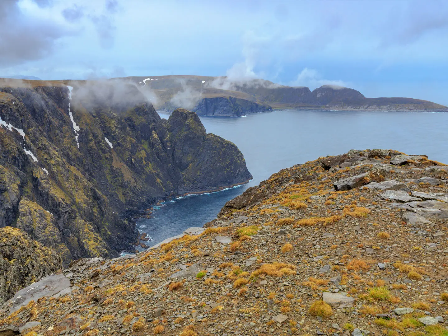
Start and finish at the signposted free car park on the E69, about 6 km south of the North Cape visitor centre. From the road, the waymarked path heads north-west across treeless tundra, crosses boggy sections and descends towards the coast before following the low, rocky Knivskjellodden peninsula to the cairn and guestbook at the tip. The North Cape cliff and globe monument are visible across the water to the east. Return by the same red-T-marked route; this is not a loop and there are no facilities once you leave the car park. Most walkers base in Honningsvåg, Skarsvåg, Kamøyvær or North Cape campsites and drive to the trailhead. Planning more Norwegian day hikes? Compare Dronningruta (Queen’s Route), Besseggen Ridge and Galdhøpiggen Summit Trail.
North Cape history and the real northernmost point
The North Cape, or Nordkapp, has been promoted as an end-of-Europe landmark for centuries and was named by the English explorer Richard Chancellor in 1553. Knivskjellodden lies further north but is reached only on foot, so it remains quieter than the famous cliff and visitor centre. Walkers come here to stand beyond the North Cape, at the actual northernmost point of continental Europe. The marker cairn at the tip dates from 2000, and the area lies in Nordkapp municipality in Finnmark, traditional Sami land.
Notable highlights
- Northernmost point of mainland Europe (71° 11' 08'' N): Knivskjellodden lies about 1,450 m further north than the North Cape cliff, making it the genuine northern extremity of continental Europe.
- Summit cairn and guestbook: A stone cairn marks the headland, with a logbook where hikers record reaching the true top of Europe.
- View back to the North Cape: From the low peninsula, you look across the sea to the North Cape plateau and its globe monument from further north than the visitors standing on it.
- Midnight sun and Arctic light: From roughly mid-May to late July, 24-hour daylight gives flexible walking hours and long low-angle light across the tundra and sea.
- Wild Magerøya tundra and coast: The route crosses treeless Arctic terrain to a rocky shoreline, with sea cliffs, seabirds and frequently grazing reindeer, and no roads or buildings beyond the car park.
Challenges to expect
The hike is moderate rather than technical, but it is still a long Arctic day. Expect bog and marsh, loose stones, a slippery descent in wet weather and smooth rock slabs near the point. Fog can make navigation serious: follow the red T marks and cairns exactly, or turn back. There is no shelter, resupply or accommodation on the trail, and weather can change fast.
HikeList Score
Nordkapp to Knivskjellodden scored 72/100 on HikeList's trail-quality metrics.
See score breakdownHide breakdown
- Ideal length 55
- Balanced challenge 100
- Scenery & wildness 68
- Varied terrain 100
- Accommodation 58
- Food & support 45
- Path quality 98
- Season flexibility 63
Computed from length, challenge, scenery & wildness, terrain variety, accommodation, food & support, path quality and season flexibility.
 Norway
Show more data Show less
- Tundra
- Coastal
- Fell
- Bog
- Rocky
- Boggy
- Boardwalk
- Unpaved
- Campsites
- Wild Camping Spots
- Pet Friendly
- Campsites
Photos from hikers
Taken on the trail by people who've reviewed Nordkapp to Knivskjellodden.
Reviews
How would you rate Nordkapp to Knivskjellodden?
Tap a star to start your review — you could be the first.