National Blue Trail (Országos Kéktúra)
How would you rate National Blue Trail (Országos Kéktúra)?
Tap a star to share your experience and help other hikers.
National Blue Trail (Országos Kéktúra): Hungary’s Classic Thru-Hike
HikeList Score
National Blue Trail (Országos Kéktúra) scored 82/100 on HikeList's trail-quality metrics.
See score breakdownHide breakdown
- Ideal length 52
- Balanced challenge 84
- Scenery & wildness 98
- Varied terrain 77
- Accommodation 92
- Food & support 88
- Path quality 84
- Season flexibility 89
Computed from length, challenge, scenery & wildness, terrain variety, accommodation, food & support, path quality and season flexibility.
The National Blue Trail, or Országos Kéktúra (OKT), is a 1,170 km point-to-point hike across northern and Transdanubian Hungary, from Írott-kő on the Austrian border to Hollóháza on the Slovak border. A continuous thru-hike takes about 50 days and is best treated as a hard route: the walking is rarely technical, but the distance and roughly 31,000 m of ascent add up. It suits experienced long-distance hikers who want forested hills, towns, stamps and a major European waymarked trail.
Route Overview
The OKT runs west to east from the summit of Írott-kő in the Kőszeg Mountains to Hollóháza in the Zemplén Mountains. It crosses Kőszeg, Sárvár, the Bakony, Lake Balaton and the Balaton Uplands, the Vértes and Gerecse hills, the Pilis and Buda Hills, Budapest, the Danube Bend, the Börzsöny, Cserhát, Mátra, Bükk, Aggtelek karst and Zemplén ranges. The route is linear, fully waymarked with the blue horizontal stripe, and forms part of the European Long-Distance Trail E4 for much of its length. The stamp system, with checkpoints at huts, shops, stations and restaurants, makes section hiking practical.
History of the Országos Kéktúra
The National Blue Trail was first waymarked in 1938, originally at about 910 km, and is widely cited as Europe’s oldest long-distance marked trail. The national walk was formally organised from 1952 by the Nature Rambler Section of Budapest’s Lokomotív Sport Club, with management passing to the MTSZ in 1961. Pál Rockenbauer’s 1980s television series Másfélmillió lépés Magyarországon helped make it a national institution and gave it the “one and a half million steps” nickname.
Notable highlights
- Írott-kő lookout tower (882 m): The western start of the OKT stands on the Austria-Hungary border in the Kőszeg Mountains. Its stone lookout tower is a clear symbolic launch point for the full crossing.
- Lake Balaton and the Balaton Uplands: The route skirts the northern shore of Central Europe’s largest lake and crosses volcanic uplands, vineyards and the Tapolca basin. Hikers wanting more time here can also look at the Balaton Uplands Trail.
- Budapest crossing: Roughly halfway, the trail passes through the Hungarian capital and the Buda Hills. It is the only major city on the route and gives a rare urban reset on a mainly rural hike.
- Kékestető (1,014 m): The trail’s high point is also Hungary’s highest peak, in the Mátra Mountains. The summit is topped by a TV tower with a public viewing deck.
- Hollókő: This UNESCO World Heritage Palóc village in the Cserhát hills preserves traditional rural architecture close to the trail line.
- Aggtelek karst and Baradla Cave: The north-eastern section enters a UNESCO-listed karst area. Baradla Cave is one of Europe’s major stalactite cave systems, with tours requiring separate admission.
Challenges to expect
Expect a hard hike because of scale rather than technicality: about 1,170 km, roughly 31,000 m of cumulative ascent and many weeks on foot. Terrain is mostly forest dirt, gravel and rocky hill paths, with paved sections through towns and Budapest. Summer can be hot on plains and open basins; winter snow can affect the Mátra, Bükk and Zemplén. Carry the Kéktúra logbook if you want official completion.
HikeList Score
National Blue Trail (Országos Kéktúra) scored 82/100 on HikeList's trail-quality metrics.
See score breakdownHide breakdown
- Ideal length 52
- Balanced challenge 84
- Scenery & wildness 98
- Varied terrain 77
- Accommodation 92
- Food & support 88
- Path quality 84
- Season flexibility 89
Computed from length, challenge, scenery & wildness, terrain variety, accommodation, food & support, path quality and season flexibility.
 Hungary
Show more data Show less
- Mountainous
- Forest
- Dirt
- Rocky
- Gravel
- Paved
- Hotels
- Hostels
- Huts
- Campsites
- Wild Camping Spots
- Family Friendly
- Pet Friendly
- Restrooms
- Water Sources
- Campsites
- Shelters
- Picnic Areas
Photos from hikers
Taken on the trail by people who've reviewed National Blue Trail (Országos Kéktúra).
Your journey begins at Hungary’s western border atop Írott-kő, the highest point in the Kőszeg Mountains. Descend through forested slopes and rolling hills, following well-marked blue blazes to the historic town of Kőszeg. Today’s route passes observation points and nature reserves before reaching the medieval old town center.
Leaving Kőszeg, follow the countryside trails past vineyards and forested ridges toward Sárvár. Encounter small villages, old farms, and peaceful meadows. Sárvár welcomes you with its spa traditions and the impressive Nádasdy Castle at the close of the day’s hike.
Trek eastward from Sárvár through open fields, forest patches, and across streams as you approach the Bakony foothills. The highlight of today’s walk is the dramatic arrival in Sümeg, dominated by its hilltop castle overlooking the town.
Begin in Sümeg and traverse rural roads and rolling farmlands headed for Tapolca, a town famed for its subterranean lake. The day’s track weaves through picturesque villages and gentle hills with clear views of volcanic outcrops.
Climb from Tapolca towards the basalt-topped Badacsony Hill, making your way through vineyards with sweeping panoramas of Lake Balaton. Today’s route is notable for its wine heritage and views over Hungary’s largest lake.
Continue along the northern slopes above Lake Balaton, crossing ancient lava fields, pine forests, and charming lakeshore villages. Zánka is your gateway to the Balaton Uplands.
Venture away from Balaton as the path gently rises into the Bakony Hills. Hike through forests and remote hamlets before reaching the historical stronghold of Nagyvázsony, famous for its medieval castle.
This stretch brings you deeper into the Bakony forest, known for its tranquility and rare wildlife. The quiet, monastic village of Bakonybél is a peaceful endpoint for today.
Follow forested ridgelines, passing streams and glades toward the historical town of Zirc. Visit the impressive baroque abbey and enjoy the surrounding botanical gardens.
Navigate hilly terrain through the Bakony, reaching the dramatic ruins of Csesznek Castle perched above a narrow valley. Enjoy frequent woodland paths and the serenity of less-traveled trails.
Descend through mixed forests and low hills toward the town of Várpalota. This section features castle ruins, wildflower meadows, and sweeping vistas of the open Hungarian countryside.
Walk past the Vértes Hills, transitioning into limestone ridges and broadleaf forests. The small settlement of Szárliget marks today’s tranquil endpoint.
Hike rolling terrain and wooded hills with expansive views. Historic villages dot the route towards Óbarok. Expect peaceful footpaths interspersed with stretches of low mountains.
Follow quiet country roads and gentle hills into the edge of the Pilis region. Today’s walk ends in Piliscsaba, gateway to the Pilis Mountains and just outside Budapest’s urban area.
Ascend into the Pilis Mountains on forested paths. Features today include scenic overlooks above the Danube and the famous monastery town of Pilisszentlászló.
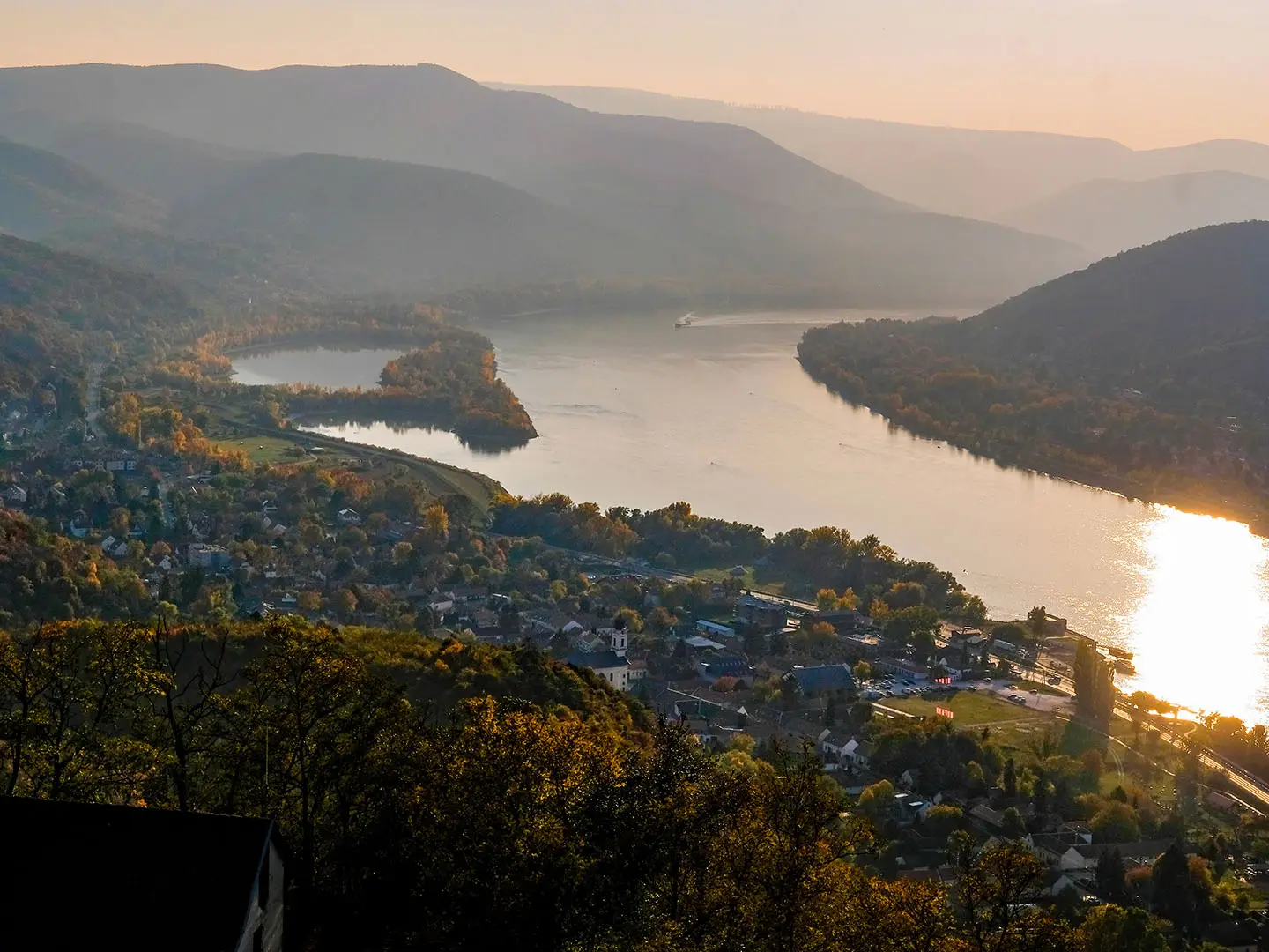
Descend forested ridges into the legendary town of Visegrád with its medieval fortress overlooking the Danube Bend. Enjoy sweeping riverside views to close out the day.
Cross the mighty Danube, following the riverbank briefly before scaling bluffs and wooded slopes en route to Nagymaros. This section features postcard-perfect river panoramas.
Travel along the Börzsöny Mountains, where the Blue Trail weaves through lush forests and upland meadows. The route finishes near the historical border town of Hont.
Cross rolling hills dotted with ruined castles and ancient churches. Today’s section ends in Nógrád, home to a well-preserved medieval fortress.
A route of contrasting scenery, from open agricultural countryside to the foothills of the Mátra Mountains. Pass through tranquil villages and reach Mátraverebély at the foot of the country’s highest range.
Climb through deep forested valleys to ascend Kékestető, Hungary’s highest mountain at 1,014 meters. The strenuous ascent is rewarded with sweeping views over the Mátra range.
Descend from the summit through pine forests, gradually reaching the atmospheric Sirok. Highlights are the mountain trails and the fortress ruins overlooking the valley.
Traverse the hidden gems of the Bükk foothills with rugged paths, forest tracks, and panoramic viewpoints. Arrive in the small mountain village of Szarvaskő.
Continue along ridgelines and through woodland before descending into Eger, one of Hungary’s most historic and famous wine towns, renowned for its baroque architecture and castle.
Head northwards out of Eger, entering the wilds of the Bükk Mountains. Today’s route features forested ridges and remote settlements before arriving in the small town of Putnok.
Journey through the Aggtelek karst region, a UNESCO World Heritage area known for dramatic limestone landscapes. End your day in the village of Aggtelek, gateway to the famous cave systems.
Explore the subterranean wonders of Aggtelek National Park. Tour the monumental Baradla Cave if time allows before hiking gentle forest trails to Jósvafő.
Wander through rolling hills, ancient agricultural landscapes, and quiet villages as you journey northeastward. Reach the rural hamlet of Szalonna by evening.
Today’s stage passes through forests and low mountains, with opportunities to visit small churches and local cultural sites in the northern Hungarian countryside, ending in Felsővadász.
Pass through hilly terrain and remote farmland, moving closer to Hungary’s northeastern border regions. Encs provides modern amenities and a welcome rest stop.
Proceed through rural landscapes and scattered villages toward Boldogkőváralja. Today’s highlight is the dramatic Boldogkő Castle, perched atop a narrow rocky ridge.
Walk further into the Zemplén Mountains, traversing quiet woodlands and valleys. Remote trails lead to Regéc and its striking castle ruins in the heart of the hills.
Climb and descend among forested ridges, with peaceful trails leading past historic mining remnants as you approach Telkibánya.
The final leg takes you through the protected forests of the Zemplén region, rich with wildlife and quiet beauty. Reach Hollóháza and celebrate the completion of the National Blue Trail at Hungary’s northeastern frontier.
Reviews
How would you rate National Blue Trail (Országos Kéktúra)?
Tap a star to start your review — you could be the first.