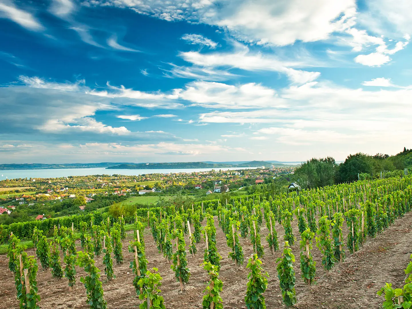
Balaton Uplands Trail
How would you rate Balaton Uplands Trail?
Tap a star to share your experience and help other hikers.
Balaton Uplands Trail: Hiking the National Blue Trail by Lake Balaton
HikeList Score
Balaton Uplands Trail scored 89/100 on HikeList's trail-quality metrics.
See score breakdownHide breakdown
- Ideal length 94
- Balanced challenge 100
- Scenery & wildness 78
- Varied terrain 100
- Accommodation 83
- Food & support 88
- Path quality 84
- Season flexibility 89
Computed from length, challenge, scenery & wildness, terrain variety, accommodation, food & support, path quality and season flexibility.
The “Balaton Uplands Trail” is not a separate waymarked thru-hike; it means hiking the Balaton Uplands region of western Hungary, mainly on the National Blue Trail (Országos Kéktúra / OKT). The route area follows the northern shore of Lake Balaton through volcanic hills, vineyards, forest and stone villages. There is no verified single distance or fixed duration. Expect moderate, non-technical walking, with short steep climbs and hot exposed sections in summer.
Route Overview
There is no fixed start or end for a standalone Balaton Uplands Trail. For a linear multi-day walk, use the National Blue Trail through the Balaton Highlands, roughly linking Keszthely, Tapolca, the Badacsony area and Nagyvázsony before continuing towards the Bakony. Keszthely, Tapolca, Badacsonytomaj, Balatonfüred and Tihany work well as bases because buses and trains along Lake Balaton make section hiking practical. The OKT is marked with a blue horizontal stripe on white; many side routes are local circuits around Salföld, the Káli Basin, Hegyestű and Tihany. For a focused basalt-hill day, see the Badacsony Volcano Trail; for onward upland walking, compare the Bakony Hills Trail.
Volcanoes, Wine Country and the National Blue Trail
The Balaton Uplands landscape was shaped by late Miocene/Pannonian volcanic activity, leaving the basalt buttes, columns and “witness hills” that dominate the northern shore of Lake Balaton. The area has long been farmed, especially for wine. Protection developed in stages: Tihany became Hungary’s first landscape protection area in 1952, the Káli Basin followed in 1984, and Balaton Uplands National Park was created in 1997. The National Blue Trail was first waymarked in 1938 and is regarded as Europe’s oldest long-distance footpath.
Notable highlights
- Tihany Peninsula and Abbey: A volcanic peninsula known for lavender fields, geyserite cones and views over Lake Balaton. The Benedictine abbey was founded in 1055, and its foundation charter contains the oldest known written Hungarian words.
- Badacsony: A flat-topped basalt witness hill above the lake, ringed by vineyards and basalt cliffs. It is one of the signature viewpoints of the Balaton Uplands and can be explored in more detail on the Badacsony Volcano Trail.
- Tapolca Basin witness hills: Szent György-hegy, Csobánc, Gulács and Tóti rise sharply from the basin floor. Their basalt columns, castle ruins and open slopes give some of the most distinctive walking in the region.
- Káli Basin: A protected rural basin of meadows, stone-built villages and weathered “stone seas” around places such as Salföld, Köveskál and Szentbékkálla. Marked circular walks make it easy to sample without committing to a long linear route.
- Hegyestű Geological Visitor Site: A former basalt quarry exposing a fan of basalt columns in cross-section. It is a useful short detour for understanding the volcanic geology you see across the uplands.
- Keszthely and Festetics Palace: The usual western gateway for the OKT’s Balaton Highlands section. Keszthely is a major lakeside town and home to the Baroque Festetics Palace.
Challenges to expect
The walking is non-technical, but not flat. Expect repeated short, steep climbs onto basalt hills, rocky sections, forest tracks, vineyard lanes and some asphalt near villages. Summer heat is the main difficulty: open south-facing slopes can be exposed, with limited shade. Navigation is straightforward on the OKT waymarks, but do not look for a separate “Balaton Uplands Trail” marker. For a different Hungarian blue-route landscape, see the Alföld Blue Trail.
HikeList Score
Balaton Uplands Trail scored 89/100 on HikeList's trail-quality metrics.
See score breakdownHide breakdown
- Ideal length 94
- Balanced challenge 100
- Scenery & wildness 78
- Varied terrain 100
- Accommodation 83
- Food & support 88
- Path quality 84
- Season flexibility 89
Computed from length, challenge, scenery & wildness, terrain variety, accommodation, food & support, path quality and season flexibility.
 Hungary
Show more data Show less
- Hilly
- Volcanic
- Forest
- Vineyards
- Dirt
- Rocky
- Gravel
- Paved
- Hotels
- Guesthouses
- Campsites
- Family Friendly
- Pet Friendly
- Restrooms
- Water Sources
- Campsites
- Shelters
- Picnic Areas
Download Our Full Guide to Balaton Uplands Trail FREE!
Get our comprehensive guide to this hike for free. Save it for later reading or print out at home.
In these collections
Photos from hikers
Taken on the trail by people who've reviewed Balaton Uplands Trail.
Balaton Uplands Trail: The Complete Guide
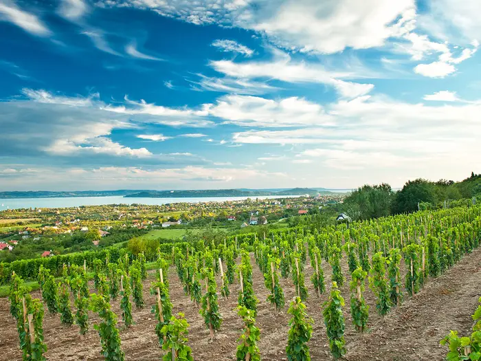 i
Image by Horváth Botond
i
Image by Horváth Botond The Balaton Uplands Trail is a walk through Hungary’s Balaton-felvidék on the National Blue Trail, following the blue-stripe OKT waymarks rather than a separate named thru-hike. It suits fit independent walkers who want volcanic hills, vineyard tracks, old stone villages and good public-transport access rather than remote wilderness.
From Sümeg, or the shorter gateway start at Keszthely, the route works east through the Keszthely Hills, Tapolca Basin and Káli Basin to Nagyvázsony. Lake Balaton is often close, but the walking is inland as much as lakeside, climbing repeatedly onto basalt witness hills and crossing open rural basins.
The best sections are sharply distinctive: Badacsony above the vineyards, Szent György-hegy with its basalt columns, Csobánc with its castle ruins, and the stone-built villages around Szentbékkálla and Balatonhenye. Keszthely, Tapolca, Badacsonytördemic and the northern-shore railway make this one of the easier OKT sections to split into shorter trips.
The route is moderate rather than technical, but it should not be treated as a casual lakeside stroll. The cumulative ascent, rocky summit paths, exposed south-facing slopes and summer heat all reward early starts, realistic day lengths and careful water planning.
This guide covers stages, days, accommodation, food, transport, terrain and the common mistakes to avoid.
Stage-by-Stage Guide
The stages below split the Balaton-felvidék section of the Országos Kéktúra into practical walking days. Distances are approximate and should be checked against the current OKT GPX, stamp list and any forestry notices before setting out.
Stage 1: Sümeg to Zalaszántó — approx. 21 km
This first day leaves Sümeg, the western end of the Balaton-felvidék OKT section, and heads into the western Keszthely Hills. It is a good introduction to the route: not technically difficult, but already more demanding than a lakeside walk because the path uses wooded upland, forest tracks and stony sections rather than flat shoreline paths.
The main places on this stage are Sümeg, Sarvaly forestry house and Zalaszántó. The OKT-03 section between Sümeg and Keszthely is also the part of the route associated with the Tátika and Rezi castle ruins, so expect a day shaped by forested hills, historic hilltops and occasional open views rather than continuous lake panoramas.
A major landmark near the end of the stage is the Zalaszántó Buddhist Stupa, the Békesztúpa, on Kovácsi-hegy above Zalaszántó. It sits directly on the OKT line and is one of the most distinctive sights of the western section.
Underfoot, expect a mix of forest road, earth track, rocky path and some village asphalt. After rain, shaded woodland tracks can be slower than the distance suggests, while in hot weather the open sections above Zalaszántó can feel exposed.
Food and water should be treated conservatively. Sümeg is the reliable place to start provisioned, and Zalaszántó is the planned overnight stop, but do not assume frequent refreshments between them. Carry enough water for the full day, especially from late spring to early autumn.
Accommodation at Zalaszántó is in the inland-village category, where options are much thinner than on the Balaton shore. Book ahead rather than arriving and looking for a room. If accommodation is not available in the village, onward bus connections or a transfer may be needed; this should be checked before travelling.
Sümeg has a railway station, which makes it a straightforward starting point for the full route. Zalaszántó is served by inland road and bus connections rather than rail, so any section-hiking plan should be built around current Volánbusz times.
Navigation is by the standard OKT blue horizontal stripe on white. Pay attention leaving Sümeg and around forest-road junctions, where it is easier to drift onto local tracks than on the more open lake-facing stages.
Stage 2: Zalaszántó to Keszthely — approx. 24 km
This stage continues through the Keszthely Hills before dropping towards Keszthely, the main western gateway town on Lake Balaton. It is the day where the route begins to feel more directly connected to the lake, but much of the walking is still inland, wooded and rolling.
The stage passes through the Rezi area and near Hévíz before reaching Keszthely. Rezi is part of the castle-landscape of this section, while Keszthely brings the first major lakeside-town finish of the itinerary.
Keszthely’s key landmark is the Festetics Palace, although the walking day should still be planned around completing the OKT stage rather than sightseeing time. If the palace or lakeside are priorities, allow a shorter walking day before or after, or stay an extra night in town.
Terrain remains varied: forest tracks and paths in the hills, with more lanes and asphalt as the route approaches settled areas. The cumulative climbing is less dramatic than on the later witness-hill stages, but 24 km still makes this a full day with a pack.
Start with enough food and water for the day. Keszthely is the reliable end-of-stage resupply point, but intermediate opening times and seasonal services should not be relied on without checking locally.
Accommodation is far easier in Keszthely than in the inland villages. Hotels, guesthouses and private rooms are typical of the lakeside towns, but July and August are busy and prices rise, so advance booking is still sensible in summer.
Keszthely has a railway station and is one of the most practical access points for hikers who want to walk only the lakeside-focused section from Keszthely to Nagyvázsony. This stage also works well as a section hike because the start and finish can be linked by road and public transport, but current bus and train times should be checked before travelling.
Navigation is generally straightforward on the OKT waymarks, with extra care needed on the approach to Keszthely where urban edges, lanes and local paths can be more distracting than in open countryside.
Stage 3: Keszthely to Tapolca — approx. 27 km
Keszthely to Tapolca is the longest day in this six-stage schedule and should not be underestimated. It forms the OKT-04 section and links the western lakeside gateway with the Tapolca Basin, setting up the more volcanic, witness-hill walking of the following stages.
The character of the day is transitional: leaving the built-up lake gateway, moving through mixed Balaton-felvidék countryside, then approaching Tapolca with the basalt hills becoming increasingly important in the skyline. The route is still moderate rather than technical, but the length, heat and hard surfaces near settlements can make it tiring.
Expect a mixture of tracks, lanes, field or vineyard-edge walking, forest sections and asphalt around settlements. On south-facing and open ground, shade can be limited, so an early start is useful in warm weather.
There are no specific intermediate service stops to rely on in the stage outline. Carry lunch and enough water from Keszthely, then resupply at Tapolca at the end of the day.
Tapolca is a practical stage town and transport hub on the northern Balaton rail network. Accommodation should still be booked in advance, particularly in the main walking season or if arriving late after the 27 km day.
Public transport access is good at both ends compared with the inland stages. Keszthely has a railway station, and Tapolca is on the Balaton-side rail network with links towards the northern shore and inland connections.
Navigation is by the OKT blue stripe, but this is a stage where distance management matters as much as wayfinding. Keep an eye on time, water and heat rather than treating it as an easy town-to-town stroll.
Stage 4: Tapolca to Badacsonytördemic — approx. 17 km
This is a shorter but more scenic and hill-focused stage through the Tapolca Basin witness-hill landscape. It is the OKT-05 section and includes Szent György-hegy before reaching the Szigliget and Badacsonytördemic area.
Szent György-hegy is one of the defining basalt hills of the route, known for its organ-pipe basalt columns and vineyard cellars. The stage also passes Szigliget, a lakeside village below its hilltop castle ruin, with wide views across the western end of Lake Balaton.
Although only around 17 km, the terrain is more demanding than the distance suggests. Expect climbing and descending on volcanic slopes, vineyard lanes, stony paths and some asphalt near villages. Rocky or root-laced sections can be awkward underfoot, particularly on descents.
Views are a major part of this day: the Tapolca Basin, Szent György-hegy, Szigliget and the western end of Lake Balaton all come into play. In clear weather this is one of the most rewarding stages, but there is little reason to rush it unless transport or accommodation timing demands it.
Carry enough water from Tapolca. There are settlements on or near the route, but opening hours can be seasonal around the lake and hills, so food and drink should not be left to chance.
Badacsonytördemic is on the northern Balaton shore rail corridor, making it a useful end point for section walkers. Accommodation is generally more available along the lakeside than inland, with Badacsonytomaj and the Badacsony area also relevant for overnight planning, but summer availability should be booked ahead.
Navigation is usually clear on the OKT, but this is a landscape with many attractive local paths, vineyard lanes and hill routes. Stay with the blue stripe unless deliberately making a side trip.
The main warning is heat and exposure. The basalt hills and vineyard slopes can be very hot in summer, and the climbs are short but steep enough to punish a late start.
Stage 5: Badacsonytördemic to Szentbékkálla — approx. 23 km
This is the showcase volcanic stage of the route and one of the hardest days in the schedule. It links Badacsony, Káptalantóti, the Gulács area, Csobánc and Szentbékkálla, combining the route’s highest point with several of its most memorable views.
From Badacsonytördemic the OKT crosses Badacsony, the 437 m high point of the Balaton-felvidék section. The hill’s flat basalt top, vineyard slopes and Kisfaludy-kilátó lookout tower make it a highlight, but the climb and descent should be treated as real walking, not just a viewpoint detour.
Beyond Badacsony, the route continues through the Tapolca Basin witness-hill landscape. Gulács is nearby and prominent in the scenery, but the OKT passes near it rather than summiting it. Csobánc, by contrast, is climbed by the route, with castle ruins and an official OKT stamp station on the summit.
Terrain is varied and tiring: basalt and dolomite underfoot, rocky summit paths, vineyard lanes, grassy tracks, forest sections and asphalt around villages. The stage gains and loses height repeatedly rather than climbing once, which is why it can feel more demanding than its distance alone.
The views are exceptional, especially from Badacsony and Csobánc across Lake Balaton, the Tapolca Basin and the surrounding tanúhegyek, or witness hills. In poor visibility, the stage still has strong terrain interest, but the rocky paths require more care.
Food and water planning is important. Káptalantóti and other settlements break up the day, but services should not be assumed to be open when needed. Leave Badacsonytördemic or the Badacsony area with enough water for exposed climbs, and refill only where current local availability is clear.
Szentbékkálla is an inland Káli Basin village, not a large lakeside resort. Accommodation is much more limited than on the shore, so book before committing to this day’s end point. If staying off-route, plan the bus or transfer in advance.
Public transport in this part of the route is based on a combination of the nearby Balaton rail line and Volánbusz village services. Badacsonytördemic has rail access; Szentbékkálla is an inland village, so onward movement depends on bus timings.
Navigation needs attention because this area has many local paths to hills, vineyards and viewpoints. Follow the OKT blue stripe and treat side tracks to nearby hills or cellars as separate choices, not the through-route.
The key warnings are exposure, heat and rough footing. In high summer this stage is best started early, with more water than a map distance might suggest.
Stage 6: Szentbékkálla to Nagyvázsony — approx. 24 km
The final stage crosses the Káli Basin and finishes at Nagyvázsony, where the OKT leaves the Balaton-felvidék and continues towards the Bakony. It is less dominated by the dramatic basalt summits than the previous day, but it is still a substantial 24 km walk through open basin landscapes, villages and upland edges.
The route passes through or near Köveskál, Balatonhenye, Monoszló, Csicsói erdészház and Nagyvázsony. The Káli Basin is known for meadows, stone-built villages and weathered sandstone stone seas, giving this stage a different character from the vineyard-and-volcano walking around Badacsony and Csobánc.
Hegyestű Geological Visitor Site, near Monoszló, is a short signed detour off the OKT rather than part of the main line. It exposes a striking fan of basalt columns in a former quarry, but adding it increases the day and should be planned deliberately, not treated as an automatic stop.
Underfoot, expect rural tracks, lanes, village asphalt, open paths and some woodland or forestry sections. The stage is moderate, but the distance and limited shade can make it tiring, especially after the climbing of the previous day.
Views open across the Káli Basin and back towards the volcanic hills already crossed. The appeal here is the wider landscape and village pattern rather than a single summit objective.
Food and water need careful planning. Szentbékkálla is the start point, Nagyvázsony is the finish, and inland services between them are more limited than on the lakeshore. Carry enough water and food for a full day unless specific opening times have been checked.
Accommodation at Nagyvázsony should be arranged ahead. The village has the Kinizsi vár castle, but it is not a large resort town and inland accommodation is sparse compared with Keszthely or the Badacsony shore.
Nagyvázsony has no railway station. The practical public transport links are by bus to Veszprém and Tapolca, so finish-day timing should be checked before travelling, especially at weekends or outside the summer season.
Navigation is straightforward in principle on the OKT blue stripe, but pay attention around village exits, forestry tracks and the Hegyestű detour near Monoszló. The main warning is logistical rather than technical: this is an inland finish with fewer services, so accommodation, onward transport and water should all be sorted before the final day starts.
Recommended Itinerary
Distances on the OKT can vary slightly between mapping sources, and overnight stops sometimes require a short walk or bus transfer off the line. Use the official OKT mapping and current public transport times before booking, especially for inland villages.
Standard itinerary: 6 days from Sümeg to Nagyvázsony
This is the most balanced full-route plan for walkers who want to cover the Balaton-felvidék section without turning the volcanic hill stages into very long days. It uses practical overnight stops at Sümeg, Zalaszántó, Keszthely, Tapolca, Badacsonytördemic, Szentbékkálla and Nagyvázsony.
| Day | From | To | Approx. distance | Why this stage makes sense | Services/accommodation notes |
|---|---|---|---|---|---|
| 1 | Sümeg | Zalaszántó | ~21 km | A manageable first day from Sümeg railway station into the western uplands, with the OKT passing the Tátika and Rezi castle area before reaching Zalaszántó. | Sümeg has rail access. Zalaszántó is an inland village stop, so accommodation should be booked ahead. |
| 2 | Zalaszántó | Keszthely | ~24 km | Continues through the western Keszthely Hills and gives a clear finish in Keszthely, the main lakeside gateway town. | Keszthely has a railway station and a much wider choice of hotels, guesthouses and private rooms than the inland villages. |
| 3 | Keszthely | Tapolca | ~27 km | A longer walking day that moves from the lakeside gateway into the Tapolca Basin, setting up the volcanic witness-hill section. | Tapolca is a useful transport and accommodation stop, with rail links on the northern Balaton side. Book ahead in peak summer. |
| 4 | Tapolca | Badacsonytördemic | ~17 km | A shorter but scenic hill day over the Szent György-hegy and Szigliget area, finishing before the next, tougher Badacsony and Csobánc stage. | Badacsonytördemic and nearby Badacsony / Badacsonytomaj sit on the lakeside transport corridor, with rail access and more accommodation than the inland basin villages. |
| 5 | Badacsonytördemic | Szentbékkálla | ~23 km | One of the strongest scenic days: Badacsony, vineyard slopes, the Tapolca Basin witness hills and Csobánc before entering the Káli Basin. | Szentbékkálla is inland and smaller than the lakeside towns. Guesthouses are limited, so this night should be arranged early. |
| 6 | Szentbékkálla | Nagyvázsony | ~24 km | Crosses the Káli Basin landscape through the Köveskál, Balatonhenye and Monoszló area before finishing at Nagyvázsony, where the OKT leaves the Balaton-felvidék towards the Bakony. | Nagyvázsony has no railway; onward travel is by bus towards Veszprém or Tapolca. Accommodation around the finish is relatively sparse, so book ahead and check bus times before travelling. |
Slower variant: 7 days with a split in the volcanic hills
This suits walkers travelling in hot weather, carrying heavier packs, or wanting more time around Badacsony, Csobánc and the Káli Basin. The most useful split is the Badacsonytördemic to Szentbékkálla section, using an inland overnight around Káptalantóti if accommodation is available.
| Day | From | To | Approx. distance | Why this stage makes sense | Services/accommodation notes |
|---|---|---|---|---|---|
| 1 | Sümeg | Zalaszántó | ~21 km | Keeps the opening day at a moderate length. | Book Zalaszántó accommodation ahead. |
| 2 | Zalaszántó | Keszthely | ~24 km | Reaches the main western lakeside base. | Keszthely has rail access and the broadest service choice on the western part of the walk. |
| 3 | Keszthely | Tapolca | ~27 km | The longest standard day remains intact, but it finishes in a well-connected town. | Tapolca is a sensible place for resupply and an overnight stop. |
| 4 | Tapolca | Badacsonytördemic | ~17 km | Shorter day over Szent György-hegy and towards Szigliget, with time to manage heat and exposed slopes. | Lakeside rail and accommodation options make this a practical stop. |
| 5 | Badacsonytördemic | Káptalantóti | Check official mapping before booking | Breaks the demanding Badacsony–Csobánc section rather than forcing all the major volcanic climbs into one day. | Káptalantóti is an inland village, not a large resort. Accommodation and any bus backup should be checked before travelling. |
| 6 | Káptalantóti | Szentbékkálla | Check official mapping before booking | Leaves time for Csobánc and the western Káli Basin without rushing. | Szentbékkálla accommodation is limited; book ahead. |
| 7 | Szentbékkálla | Nagyvázsony | ~24 km | Finishes the route across the Káli Basin and the eastern edge of the Balaton-felvidék. | Nagyvázsony has bus connections but no railway. Check onward transport before committing to the finish-day timing. |
If accommodation around Káptalantóti is not available, a simpler relaxed option is to keep the six walking stages and add a rest or sightseeing night in Keszthely, Tapolca or Badacsony / Badacsonytomaj.
Faster variants
A faster schedule is possible, but the heat, repeated short climbs and exposed vineyard slopes make early starts important. These options suit fit walkers with light packs and firm accommodation bookings.
Faster full-route option: 5 days from Sümeg
| Day | From | To | Approx. distance | Why this stage makes sense | Services/accommodation notes |
|---|---|---|---|---|---|
| 1 | Sümeg | Zalaszántó | ~21 km | Keeps the first day controlled rather than starting with an overlong push. | Zalaszántó accommodation should be booked ahead. |
| 2 | Zalaszántó | Keszthely | ~24 km | Reaches the main western gateway and lakeside service centre. | Keszthely has rail access and plentiful accommodation compared with inland stops. |
| 3 | Keszthely | Tapolca | ~27 km | A long but logical stage into the Tapolca Basin. | Tapolca is the best service stop before the main volcanic hill sequence. |
| 4 | Tapolca | Szentbékkálla | ~40 km | Combines the standard Tapolca–Badacsonytördemic and Badacsonytördemic–Szentbékkálla days, taking in Szent György-hegy, Badacsony and Csobánc in one hard push. | Only sensible for strong walkers. Badacsonytördemic and the Badacsony area provide the main mid-stage transport and accommodation fallback. |
| 5 | Szentbékkálla | Nagyvázsony | ~24 km | Finishes through the Káli Basin to Nagyvázsony. | Check Nagyvázsony accommodation and bus times to Veszprém or Tapolca before travelling. |
Shorter Keszthely-start option: 4 days
Many walkers skip the Sümeg to Keszthely approach and begin at Keszthely railway station for a more lakeside-focused Balaton-felvidék walk. This removes the western OKT-03 section and keeps the itinerary to the main Tapolca Basin, Badacsony and Káli Basin highlights.
| Day | From | To | Approx. distance | Why this stage makes sense | Services/accommodation notes |
|---|---|---|---|---|---|
| 1 | Keszthely | Tapolca | ~27 km | Starts at a major rail-access town and reaches the Tapolca Basin in one day. | Keszthely and Tapolca are both practical transport and accommodation bases. |
| 2 | Tapolca | Badacsonytördemic | ~17 km | Shorter stage over the Szent György-hegy and Szigliget area. | Lakeside rail access gives good flexibility if weather or heat slows progress. |
| 3 | Badacsonytördemic | Szentbékkálla | ~23 km | Covers Badacsony, Csobánc and the transition into the Káli Basin. | Book Szentbékkálla early; inland accommodation is much thinner than on the shore. |
| 4 | Szentbékkálla | Nagyvázsony | ~24 km | Completes the eastern Balaton-felvidék section of the OKT. | Nagyvázsony has no railway, so onward bus times should be checked before travelling. |
Planning the Route
Choose the right start point
Plan this as a section of the Országos Kéktúra (OKT), not as a separate waymarked trail. The waymark to follow is the blue horizontal stripe on white, and the relevant OKT stages are OKT-03 to OKT-06.
Starting at Sümeg gives the full Balaton-felvidék traverse, including the western Keszthely Hills, Zalaszántó, Rezi and the approach to Keszthely. Starting at Keszthely is the cleaner option for a shorter, more lake-focused itinerary, with better onward transport and immediate access to the Balaton transport corridor.
Ending at Nagyvázsony is natural if the aim is to complete the Balaton-felvidék section. The OKT continues east into the Bakony, so extending the walk is simple in route terms, but accommodation and transport beyond the highlands need separate planning.
How many days to allow
Most reasonably fit walkers should plan 5–7 days from Sümeg to Nagyvázsony, or 4–6 days from Keszthely to Nagyvázsony. The route is not technically difficult, but the repeated climbs onto basalt witness hills, hot vineyard slopes and rocky summit paths make over-ambitious daily distances feel harder than they look on paper.
A fast schedule is possible, especially outside summer, but this is not a route that rewards rushing. The best planning rhythm is to keep the longer mileage days for the more connected western and lakeside sections, then allow enough time through Badacsony, Csobánc and the Káli Basin, where short climbs, viewpoints and heat can slow progress.
A relaxed 8–10 day version makes sense if using lakeside bases, adding short detours, or walking in very hot weather. It is on the slow side for the standard through-route, but it can work well for hikers who want shorter days and more time in Keszthely, Tapolca, Szigliget, Badacsony / Badacsonytomaj and the Káli Basin villages.
Practical stage planning
The official OKT stages do not always make ideal hiking days because some are long and accommodation is uneven away from Lake Balaton. In practice, most walkers split the route around towns, rail stations and inland villages where beds or transport are available.
| Practical day | Section | Planning notes |
|---|---|---|
| 1 | Sümeg to Zalaszántó | A logical first day if walking the full western approach. Accommodation and onward options are more limited inland, so book ahead. |
| 2 | Zalaszántó to Keszthely | Brings the route to the main lakeside gateway town, with much better accommodation and transport options. |
| 3 | Keszthely to Tapolca | A longer day, but it links two useful transport hubs and works well for walkers starting at Keszthely. |
| 4 | Tapolca to Badacsonytördemic | Shorter in distance, but allow time for Szent György-hegy, Szigliget and the approach towards the Badacsony area. |
| 5 | Badacsonytördemic to Szentbékkálla | A demanding-feeling day despite moderate mileage, with Badacsony, open slopes and the transition towards the Káli Basin. |
| 6 | Szentbékkálla to Nagyvázsony | A natural final day through the eastern Balaton-felvidék, finishing in a village without a railway station. Bus connections should be checked before travelling. |
This six-day pattern is a good baseline, but it is not the only sensible itinerary. In high summer, splitting one of the longer days or starting early to avoid the hottest hours is often more practical than trying to keep a strict schedule.
Accommodation drives the itinerary
Accommodation is densest along the lakeshore, especially in Keszthely, Tapolca, Badacsonytomaj, Révfülöp, Zánka and Balatonfüred. These places work well as overnight stops or as bases for section hiking, particularly where rail and bus links allow a return after each walking day.
The inland sections need more care. Around Zalaszántó, Szentbékkálla, Balatonhenye and Nagyvázsony, options are thinner than on the shore, and some useful stops are small villages rather than towns. Inland nights should be booked ahead, especially if walking without a tent or travelling in July–August.
Lakeside accommodation is busiest and usually dearest in July and August. If walking in peak season, secure the key nights before fixing train or bus plans; if walking in spring or autumn, still check opening dates and availability in smaller villages.
Food and water planning
Food planning is straightforward in the larger towns, but should not be left until the end of each inland day. Keszthely and Tapolca are the most useful resupply points on the route, while smaller villages may have limited or variable services. This should be checked before travelling.
Water matters more than the modest elevations suggest. The south-facing vineyard slopes, open witness hills and exposed sections around Badacsony, Szent György-hegy, Csobánc and the Káli Basin can be very hot, with little permanent shade. Carry enough water for the full hill section ahead rather than assuming there will be regular taps or shops between villages.
In summer, start early, refill whenever there is a reliable opportunity, and avoid planning the steepest exposed climbs for the hottest part of the afternoon. The terrain is not remote in a wilderness sense, but dehydration and heat are the main avoidable problems on this route.
Navigation and OKT logistics
Navigation is usually simple if following the OKT waymarks, but the important point is to follow the blue stripe on white, not a separate “Balaton Uplands Trail” marker. Carrying the official OKT GPX or the KÉKTÚRA app is sensible, especially through village edges, vineyard lanes and forest junctions where several local paths may cross.
Cartographia / Szarvas 1:40,000 Balaton-felvidék tourist maps are the appropriate paper-map style for this area. The official OKT stage pages and current stamp-station list on kektura.hu should be checked before travelling, particularly if collecting stamps for the National Blue Trail logbook.
Some highlights require attention to whether they are on the line or a detour. Badacsony, Szent György-hegy, Csobánc, Szigliget, Zalaszántó Stupa, Tátika and Rezi are part of, or directly accessed from, the OKT route described here. Hegyestű near Monoszló is a short signed detour off the OKT, not on the main line, so add time if including it.
Shortening, extending and section hiking
This is one of the easier Hungarian long-distance sections to break into pieces because the northern shore of Lake Balaton has strong public transport. The railway along the Budapest–Tapolca corridor serves lakeside stops including Balatonfüred, Badacsonytomaj, Badacsonytördemic, Szigliget and Tapolca, while Keszthely and Sümeg also have railway stations.
Nagyvázsony has no railway station, so the finish needs bus planning. Buses link Nagyvázsony with Veszprém and Tapolca, but current times should be checked before booking onward travel.
For a shorter through-walk, start at Keszthely and finish at Nagyvázsony. For a weekend or day-hiking approach, base in a lakeside town and use train or Volánbusz services to reach the start and end of each section. This works particularly well around Keszthely, Tapolca, Badacsonytördemic and the Badacsony area.
Extending the walk is simplest by continuing on the OKT beyond Nagyvázsony into the Bakony. Adding local circuits around individual witness hills or villages is also possible, but those are side walks rather than part of the Balaton-felvidék through-route.
What to check before committing
The most important pre-trip checks are current public transport times, accommodation availability away from the shore, and the latest OKT route and stamp information. Train and bus timetables are especially important if using a lakeside base or if finishing in Nagyvázsony.
Also check for any temporary forestry or access notices affecting the OKT. The route passes through the Balaton Uplands National Park area, and local closures or diversions can affect otherwise straightforward forest and hill sections.
No complex permit planning is a defining feature of the standard walk, but that does not remove the need for current route checks. For most hikers, successful planning comes down to booking the sparse inland nights early, carrying enough water for exposed hill sections, and building the itinerary around real transport links rather than arbitrary daily mileage.
Towns, Villages and Overnight Stops
Accommodation planning is straightforward on the Lake Balaton shore and noticeably more fragile inland. Keszthely, Tapolca, Badacsonytördemic, Badacsony / Badacsonytomaj and other lakeside settlements have the best spread of guesthouses, private rooms, hotels and campsites, while the Káli Basin villages and Nagyvázsony need earlier booking.
In July and August, lakeside accommodation is busiest and usually most expensive. Inland food stops can also be limited outside main season, so opening times and evening meals should be checked before relying on a village stop.
Sümeg
Sümeg is the western start for the full Balaton-felvidék section of the OKT, with the route beginning at Sümeg vasútállomás. It is the logical overnight before day one if starting the full Sümeg–Nagyvázsony traverse rather than joining at Keszthely.
As a town with a railway station, Sümeg is much easier to use than the smaller inland villages that follow. It is also useful for resupply before the first stage to Zalaszántó, which passes through more rural terrain and the Sarvaly forestry area.
Transport is by rail, with connections via Celldömölk / Tapolca. Current train times should be checked before travelling, especially if aiming to start walking the same day.
Sarvaly forestry house
Sarvaly sits on the first stage between Sümeg and Zalaszántó and is best treated as a route landmark or rest point rather than a dependable overnight base. It lies on the wooded upland section where services are sparse.
Do not plan food or accommodation here without checking current availability in advance. Carry enough water and food from Sümeg for the day’s walking to Zalaszántó.
Zalaszántó
Zalaszántó is the natural overnight stop after the first day from Sümeg, around 21 km into the full route. It sits below Kovácsi-hegy, with the Zalaszántó Buddhist Stupa directly on the OKT stage.
Accommodation is more limited than in the lakeside towns, so this is one of the stops to book ahead. Food options should also be checked before arrival; it is not a place to reach late in the day assuming a full range of services.
Zalaszántó works well because it breaks the long OKT-03 Sümeg–Keszthely stage into two manageable days. If accommodation is unavailable, the alternative is to adjust the itinerary around Keszthely or use bus links, but current Volánbusz services should be checked before relying on that plan.
Rezi
Rezi is on the second walking day between Zalaszántó and Keszthely, in the western Keszthely Hills section of the OKT. The route also passes the Rezi castle area, one of the notable upland points before dropping towards the Balaton gateway towns.
It can be useful as a short rest or bail-out point, but it is not as convenient an overnight base as Keszthely. Accommodation and food are limited compared with the lakeside, and any plan to stop here should be arranged in advance.
Local buses link inland villages with the wider Balaton transport network, but timetables vary by day and season. This should be checked before travelling.
Hévíz (near)
Hévíz lies near this part of the route rather than being a necessary stop on the OKT line. It may be useful for hikers who want an off-route accommodation base between Zalaszántó, Rezi and Keszthely.
Because it is not the through-route itself, using Hévíz normally means adding a transfer or road link. Bus connections and the practical walking link back to the OKT should be checked before booking it as a base.
Keszthely
Keszthely is the major lakeside gateway town and the most common start for a shorter Balaton-focused version of the walk. It has a railway station, good accommodation choice and the services needed for a proper resupply.
This is one of the easiest places on the route for hotels, guesthouses, private rooms, shops and restaurants. It is also a good reset point after the more rural Sümeg–Zalaszántó–Keszthely section.
Keszthely works well as either the end of a two-day western approach from Sümeg or as day zero for hikers beginning with OKT-04. Rail access is on the Budapest–Keszthely line, with journey times and current timetables to be checked before travelling.
Tapolca
Tapolca is the next key overnight after Keszthely, reached after the Keszthely–Tapolca stage of roughly 27 km. It is one of the most useful logistical towns on the whole route.
Accommodation and food options are much stronger here than in the inland villages. It is a sensible place to stock up before the witness-hill section through Szent György-hegy, Szigliget, Badacsonytördemic and Badacsony.
Tapolca has railway links on the northern Balaton network and is also an important bus hub for inland villages. It is a strong base for section-hikers because it allows walkers to return from nearby stage ends by public transport, subject to current timetables.
Szent György-hegy
Szent György-hegy is a hill and vineyard area rather than a conventional overnight stop. The OKT climbs through this area on the approach towards Szigliget and Badacsonytördemic, and the walking is steeper and more exposed than the basin floor suggests.
Do not depend on finding accommodation or full resupply directly on the hill. Treat it as a scenic but physical section between better-served settlements, carrying water for hot weather.
The reason to pause here is the basalt-column landscape and views over the Tapolca Basin. For overnight logistics, Tapolca before it and Badacsonytördemic / Badacsony after it are usually more practical.
Szigliget
Szigliget is a lakeside village below its hilltop castle ruin, reached after the Szent György-hegy area. It is useful for a pause, a shorter walking day, or a section-hike link with the northern-shore railway.
The village sits in the better-served Balaton belt, though accommodation still needs booking early in peak summer. Food and café options are more plausible here than in the upland villages, but opening hours should still be checked outside the main visitor season.
Szigliget has rail access on the Budapest–Tapolca lakeside line. This makes it useful for walkers who want to shorten the Tapolca–Badacsonytördemic stage or return to a base in Tapolca, Keszthely or another lakeside town.
Badacsonytördemic
Badacsonytördemic is the official end of OKT-05 from Tapolca and the start of OKT-06 towards Nagyvázsony. It is one of the most useful overnight points because it sits between the Tapolca Basin witness hills and the longer Káli Basin / Nagyvázsony stage.
Accommodation is available in the wider lakeside area, with more choice around Badacsony and Badacsonytomaj as well. In July and August, book early and expect strong competition for rooms.
Badacsonytördemic has a railway stop on the northern Balaton shore, making it very practical for section hiking. It is also the place to prepare for the Badacsony climb: start with water, especially in summer, as the exposed vineyard slopes and basalt paths can be hot.
Badacsony / Badacsonytomaj
Badacsony and Badacsonytomaj form the main accommodation and service area around the Badacsony hill. The OKT crosses the Badacsony plateau, the high point of this Balaton-felvidék traverse, so this is both a scenic highlight and a useful logistics stop.
This is one of the better places for guesthouses, private rooms, food and lakeside services. It can be used instead of, or alongside, Badacsonytördemic depending on accommodation availability and the chosen day split.
Badacsonytomaj is on the northern Balaton railway line, which makes the area particularly convenient for weekend walkers. The main local caution is peak-season pressure: book ahead in summer and do not leave evening accommodation to chance.
Káptalantóti
Káptalantóti lies after the Badacsony area on the route towards the Káli Basin. It is a smaller inland settlement, so it is less dependable for last-minute accommodation than the lakeside towns.
It can be a useful rest point or a way to shorten the Badacsonytördemic–Szentbékkálla day if suitable lodging is available. Food and shop availability should be checked before relying on it.
This section sits among the witness hills, with Gulács nearby and Csobánc ahead. Carry water across this part of the route in hot weather, as the open slopes and vineyard tracks offer limited shade.
Gulács (near)
Gulács is a nearby witness hill in the Tapolca Basin skyline, but the OKT passes in its vicinity rather than using it as a practical overnight stop. It is best understood as a landmark between Badacsony, Káptalantóti and Csobánc.
Do not plan services around Gulács itself. Use the neighbouring villages or the lakeside towns for accommodation, meals and transport.
Csobánc
Csobánc is a major route highlight rather than a settlement stop: the OKT climbs to the castle ruins on the summit, where there is an official OKT stamp station. The climb is short but steep enough to matter in a full walking day.
There should be no assumption of food, water or accommodation on the hill. Plan this as an exposed upland section between Káptalantóti / Badacsony-side services and Szentbékkálla.
The summit is worth time for the view over the Tapolca Basin, but it can be hot and shadeless in summer. An early start from Badacsonytördemic or Badacsony makes the day more comfortable.
Szentbékkálla
Szentbékkálla is the usual overnight stop after the Badacsonytördemic–Káli Basin day, around 23 km from Badacsonytördemic in the sample itinerary. It is one of the most useful inland stops on the eastern half of the route.
Accommodation exists in the Káli Basin villages, but supply is far thinner than on the lakeshore. Book ahead, particularly for weekends and the summer season.
Food options and shop hours should be checked before arrival. Szentbékkálla is well placed for the final stage towards Balatonhenye, Monoszló / Hegyestű area, Csicsói erdészház and Nagyvázsony.
Köveskál (near)
Köveskál is near the OKT line in the Káli Basin and can be useful for accommodation or meals if it fits the day’s walking plan. It is not as straightforward as a railway-served lakeside town, so logistics need more care.
For hikers struggling to find a bed in Szentbékkálla, Köveskál may be part of the inland accommodation search. Distances from the marked OKT and any connecting walking or transfer should be checked before booking.
The wider Káli Basin is attractive but rural, with services spread between small villages. Do not assume late-opening shops or spontaneous rooms.
Balatonhenye
Balatonhenye is an inland village on the final stage towards Nagyvázsony. It can help break up the day, but it should not be treated as a guaranteed resupply point without checking current services.
Accommodation is likely to be limited compared with the Balaton shore. If planning a shorter itinerary with an overnight here or nearby, book ahead and confirm evening meal options.
This is part of the quieter upland end of the route, where public transport is less immediate than along the railway corridor. Current Volánbusz links should be checked before building a section-hike plan around the village.
Monoszló (near, for Hegyestű)
Monoszló is near the OKT in the Hegyestű area. Hegyestű Geological Visitor Site is a short signed detour off the OKT rather than being on the through-line itself.
This area is more useful for a planned side visit than as a default overnight stop. If adding Hegyestű, allow time for the detour and do not let it compromise the final approach to Nagyvázsony.
Accommodation and food in the area should be checked in advance. The practical overnight choices for most walkers are still Szentbékkálla before this section and Nagyvázsony at the end.
Csicsói erdészház forestry house
Csicsói erdészház is a forestry-house point on the final stage towards Nagyvázsony. It is useful as a route reference in the less settled upland section, but it should not be assumed to provide public accommodation or meals.
Carry enough food and water for the Szentbékkálla–Nagyvázsony day unless definite arrangements have been made elsewhere. Any forestry rest-stop access or services should be checked before travelling.
Nagyvázsony
Nagyvázsony is the eastern end of the Balaton-felvidék section of the OKT, where this walk finishes before the National Blue Trail continues into the Bakony. The village is known for Kinizsi vár, but for hikers its main role is as the finish point and exit from the highlands.
Accommodation is thinner here than in the lakeside towns, so book ahead if staying overnight after finishing. Do not assume the same room choice or late-season availability as Keszthely, Tapolca or Badacsony.
Nagyvázsony has no railway station. Exit is by bus, with services to Veszprém and Tapolca; current Volánbusz times should be checked before fixing the final day, especially if connecting to a train the same evening.
Getting to the Start
The practical start point is Sümeg vasútállomás for the full Balaton-felvidék section of the OKT. Many hikers shorten the walk by starting at Keszthely vasútállomás, the main lakeside gateway at the start of OKT-04.
By train
Sümeg has a railway station and is the western end of this Balaton-felvidék section of the National Blue Trail. It sits on the rail line via Celldömölk and Tapolca, so journey planning usually involves changing trains rather than expecting a simple direct service. This should be checked before travelling.
Keszthely is the easier rail gateway for walkers starting the shorter lakeside-focused version. Trains from Budapest to Keszthely take around 2.5 hours, making it a straightforward first-night base before joining the OKT.
For section hiking, the northern Balaton railway is useful throughout the route. The Budapest–Tapolca line serves lakeside towns and halts including Balatonfüred, Badacsonytomaj, Badacsonytördemic, Szigliget and Tapolca, allowing walkers to base themselves near the lake and reach several stages by train. Current train times and stopping patterns should be checked before travelling.
By bus
Volánbusz services link the lakeside towns with inland villages across the Balaton-felvidék. This is useful if starting from Keszthely, reaching accommodation away from the railway, or positioning for individual stages.
Bus services are particularly important at the eastern end of the walk, because Nagyvázsony has no railway station. It is served by buses to Veszprém and Tapolca, which makes a public-transport finish possible, but onward connections should be planned before committing to accommodation or return tickets. This should be checked before travelling.
For the full route, avoid assuming that every inland village has frequent buses throughout the day. Services can be workable for section hiking, but timings may not suit a late finish after a hot, hilly stage.
By car
Driving to the start is possible, but this is a point-to-point walk, not a loop. Leaving a car in Sümeg or Keszthely means returning there from Nagyvázsony at the end, usually by bus connections towards Veszprém or Tapolca and then onward by rail or bus.
Long-stay parking details are not fixed planning information for this route. If arriving by car, arrange parking through accommodation or check local long-stay options in Sümeg or Keszthely before travelling.
A practical alternative is to use a lakeside base and walk selected stages by public transport. The rail line along the northern shore and Volánbusz links to inland villages make this much easier than on many upland routes.
Taxis can help with awkward first- or last-mile links, especially for inland accommodation, but do not rely on finding one at short notice in smaller villages. Pre-book locally and agree the fare before setting out.
From the nearest airport
The route is most commonly approached by onward public transport via Budapest, using the Budapest–Keszthely rail line for the shorter start or rail connections via Celldömölk/Tapolca for Sümeg. Exact airport-to-station transfers, train times and ticketing should be checked before travelling.
If flying in and starting the same day, Keszthely is the safer first target than a smaller inland village, because it is a major lakeside town with a railway station and more accommodation options. Sümeg is still a valid full-route start, but its rail access is less direct.
Where to stay before starting
For the full walk, stay in Sümeg the night before if possible so the first stage can begin directly from the railway station area. The first day to Zalaszántó is a proper walking day, so a late arrival into Sümeg is best treated as a travel day rather than combined with a long stage.
For the shorter version, Keszthely is the most convenient pre-start base. It has the best gateway logistics on the western side of Lake Balaton, with rail access from Budapest and a broad choice of lakeside accommodation.
Accommodation is densest in lakeside towns such as Keszthely, Tapolca, Badacsonytomaj, Révfülöp, Zánka and Balatonfüred. Inland options are thinner, and lakeside places are busiest and most expensive in July–August, so booking ahead is strongly advised in summer.
Getting Home from the Finish
Nagyvázsony is an inland village, not a railhead, so the finish needs more planning than the lakeside stages. Do not assume there will be a convenient late connection after a full final day from Szentbékkálla; check current Volánbusz times before committing to an onward train or flight.
By train
There is no railway station in Nagyvázsony. The practical rail connection is to take a bus out of the village, most commonly towards Tapolca for the Budapest–Tapolca line, or towards Veszprém for onward travel.
Tapolca is also useful if returning to the northern Lake Balaton shore, with rail links serving the Balaton corridor including places such as Badacsonytomaj, Badacsonytördemic, Szigliget and Balatonfüred. Current train times should be checked before travelling, especially outside the summer season and if finishing on a Sunday or public holiday.
If the plan is to return to the start at Sümeg or Keszthely, expect to combine bus and train rather than make a simple direct rail journey from the finish. Build in slack: Nagyvázsony is the weak link in the public-transport chain, not the lakeside railway.
By bus
Nagyvázsony is served by Volánbusz services to Veszprém and Tapolca. These are the key exits from the finish and should be treated as part of the walking plan, not something to improvise at the roadside after arrival.
For many hikers the simplest strategy is:
| Destination after the hike | Practical route from Nagyvázsony | Notes |
|---|---|---|
| Tapolca / northern Balaton shore | Bus from Nagyvázsony to Tapolca | Good for connecting with the Budapest–Tapolca rail line and lakeside towns. |
| Veszprém | Bus from Nagyvázsony to Veszprém | Useful for onward regional connections. This should be checked before travelling. |
| Budapest | Bus to Tapolca, then train on the Budapest–Tapolca line | Allow connection time; do not rely on the last bus of the day. |
| Sümeg or Keszthely | Bus plus onward train/bus via regional hubs | Feasible, but timetable-dependent and slower than a simple out-and-back day stage. |
Services to inland villages are more limited than the frequent transport along the Lake Balaton shore. If finishing late, missing the final useful bus can mean needing a taxi or an unplanned night at the finish.
By car/taxi
If using a car, the easiest logistics are usually to base yourself on the Balaton side and use buses/trains to reach and leave individual stages. Leaving a car at Nagyvázsony and retrieving it later is possible in principle, but the village finish still leaves the problem of getting back to the start at Sümeg or Keszthely by public transport.
A taxi can be useful from Nagyvázsony to Tapolca, Veszprém or a pre-booked lakeside base, particularly after a long final stage. Do not rely on finding one at short notice in the village; arrange it ahead if the day depends on it.
From the nearest airport
For international travel, Budapest is the main practical gateway used with the Balaton rail network. From the finish, the usual public-transport sequence is bus from Nagyvázsony to Tapolca or Veszprém, then onward travel towards Budapest.
Airport transfers, late arrivals and same-day flight connections are timetable-sensitive. If flying out, it is safer to finish the walk a day earlier, stay overnight near a transport hub, and travel to the airport with a margin rather than trying to connect directly from Nagyvázsony after the final stage.
Where to stay at the finish
Accommodation around Nagyvázsony is much thinner than in the lakeside towns, so book ahead if planning to sleep at the finish. This is especially important in July and August, when Balaton-area accommodation is busiest and prices are highest.
Staying overnight at or near Nagyvázsony is the safer option if the final stage is likely to finish late, if the weather is hot, or if onward buses do not line up cleanly. Otherwise, an early finish can allow a bus out to Tapolca or Veszprém the same day, with more accommodation choice and better onward transport.
Which Direction Should You Walk?
Standard direction: west to east
The most straightforward direction is Sümeg → Keszthely → Tapolca → Badacsonytördemic → Nagyvázsony, following the official OKT stage order through the Balaton-felvidék. If walking the shorter version, the same logic applies from Keszthely → Nagyvázsony.
This direction is simplest at the start because both Sümeg and Keszthely have railway stations. It also follows the natural sequence of the route: western uplands and castle hills, the Keszthely gateway, then the Tapolca Basin witness hills, Badacsony, the Káli Basin and finally Nagyvázsony.
The main drawback is the finish. Nagyvázsony has no railway station, so onward travel depends on bus connections to Veszprém or Tapolca. This should be checked before travelling, especially if finishing late in the day or outside the main summer season.
Reverse direction: east to west
Walking Nagyvázsony → Sümeg or Nagyvázsony → Keszthely is entirely practical because the OKT waymarking can be followed in either direction. The advantage is logistical at the end: finishing at Keszthely or Sümeg puts you directly back on the railway network.
The compromise is that the route starts with the least rail-connected point. You need to reach Nagyvázsony by bus before beginning, normally via Veszprém or Tapolca. Current bus times should be checked before committing to a first-day start.
Reverse direction also changes the feel of the walk. It front-loads the Káli Basin and the major volcanic hills, then works back towards Keszthely and the western OKT-03 country around Zalaszántó, Rezi, Tátika and Sümeg. That can work well if the priority is a railway finish, but it gives a less natural sense of moving deeper into the Balaton Uplands.
Is one direction easier?
There is no major difficulty advantage either way. The hard work comes from repeated short climbs and descents over basalt witness hills, vineyard slopes, forest tracks and rocky summit paths, rather than from one sustained mountain ascent.
Whichever direction you choose, expect exposed south-facing slopes, limited shade on open hills and rougher footing on some summit and descent sections. In hot weather, early starts matter more than direction.
Accommodation flow
West to east works well if accommodation is planned around the larger lakeside and basin towns: Keszthely, Tapolca, Badacsonytomaj / Badacsonytördemic and nearby shore settlements have more options than the inland uplands. The final inland stretch towards Szentbékkálla, Balatonhenye and Nagyvázsony needs more careful booking.
Reverse direction puts the accommodation-sensitive section at the beginning. That is not a problem if nights are booked ahead, but it gives less flexibility on the first one or two days.
Recommendation
For most walkers, the best direction is west to east, either Sümeg to Nagyvázsony for the full Balaton-felvidék section or Keszthely to Nagyvázsony for the shorter lakeside-focused version. It follows the official OKT stage order, starts conveniently from a railway town, and gives a satisfying progression through the main volcanic and basin landscapes.
Choose the reverse only if a railway finish at Keszthely or Sümeg is more important than a simple start. In either direction, check current train and Volánbusz times before booking fixed accommodation.
Accommodation Along the Route
Accommodation is one of the main planning constraints on the Balaton-felvidék section of the OKT. The lakeside towns have the strongest choice, while the inland upland villages are much thinner and should not be treated as turn-up-and-find-something stops.
For most inn-to-inn walkers, the simplest pattern is to sleep in or near the main stage towns: Sümeg, Zalaszántó, Keszthely, Tapolca, Badacsonytördemic / Badacsony, Szentbékkálla and Nagyvázsony. Keszthely and Tapolca are the most useful service hubs; the shore around Badacsony / Badacsonytomaj also has a better spread of hotels, guesthouses and private rooms than the inland Káli Basin villages.
July and August are the pressure months. Lakeside accommodation is busiest and usually dearest then, especially at weekends, so book well ahead if walking in high summer. Spring and autumn are easier, but inland rooms can still be scarce simply because there are fewer of them.
Best Overnight Stops
| Place | Accommodation level | Best for | Notes |
|---|---|---|---|
| Sümeg | Limited | Starting the full Sümeg–Nagyvázsony section | Railway station and practical western start for OKT-03. Book ahead rather than relying on late arrival choice. |
| Zalaszántó | Limited | Splitting the long Sümeg–Keszthely official stage | Useful inland overnight between Sümeg and Keszthely. Accommodation is not dense, so secure a room before committing to this split. |
| Rezi | Limited | Alternative inland stop or short-stage adjustment | Inland village option on the western part of the route. This should be checked before travelling. |
| Keszthely | Good | Strongest western hub; starting the shorter lakeside-focused itinerary | Major lakeside gateway town with railway station and a broad accommodation base. Good choice for a first or rest night. |
| Tapolca | Good | Mid-route hub and flexible section-hiking base | One of the best practical overnight stops, with rail access and links towards the surrounding witness hills and villages. |
| Szigliget | Limited | Scenic lakeside stop or shorter day around the Tapolca Basin | Useful if adjusting the Tapolca–Badacsony area stages, but do not assume the same depth of choice as Keszthely or Tapolca. |
| Badacsonytördemic | Limited | End of the Tapolca–Badacsonytördemic OKT stage | Convenient for the official stage end, but nearby Badacsony / Badacsonytomaj generally gives more choice. |
| Badacsony / Badacsonytomaj | Good | Lakeside overnight below Badacsony | Stronger accommodation area with hotels, panzió and private rooms. Very busy in summer because it is also a major Balaton holiday area. |
| Káptalantóti | Limited | Breaking the Badacsony–Káli Basin section | Inland village stop where availability should be checked before building a schedule around it. |
| Szentbékkálla | Limited | Natural overnight before the final stage to Nagyvázsony | A useful Káli Basin stop for the standard six-day itinerary, but rooms are limited and should be booked ahead. |
| Köveskál | Limited | Alternative Káli Basin base near the route | Practical for walkers using nearby village accommodation to split OKT-06. Availability varies by season; book ahead. |
| Balatonhenye | Limited | Inland Káli Basin stop | Useful for shorter-stage planning, but accommodation is sparse compared with the lakeshore. |
| Monoszló | Limited | Hegyestű side-trip area | Best treated as an alternative village base near the route rather than an assumed stage end. This should be checked before travelling. |
| Csicsói erdészház | None | Daytime landmark only unless separately arranged | A forestry house/rest-stop area is not a substitute for booked accommodation. Do not rely on it for an overnight without current arrangements. |
| Nagyvázsony | Limited | Finish night or transfer point | Village finish at the eastern edge of the Balaton-felvidék. Accommodation around the finish is limited, so book ahead or plan an onward bus transfer. |
| Révfülöp, Zánka, Balatonfüred | Good | Off-route lakeside bases for section hiking | These shore towns have better accommodation depth and transport links. They can work well as bases if using bus/train connections rather than sleeping exactly on the OKT each night. |
Booking Strategy
The route works well for inn-to-inn walking, but it needs a more deliberate booking plan than the dense Balaton resort belt might suggest. The easy mistake is to assume that every village in the hills has the same choice as the lakeshore; it does not.
Book inland nights first: Zalaszántó, Szentbékkálla, Köveskál / Balatonhenye, and Nagyvázsony are the places most likely to shape the itinerary. Once those are secured, Keszthely, Tapolca and Badacsony / Badacsonytomaj are usually easier to fit around them.
If no suitable room is available at an inland stage end, use the transport network rather than forcing an awkward day. The northern Balaton shore railway and Volánbusz village services make it realistic to sleep in Keszthely, Tapolca, Badacsony / Badacsonytomaj, Révfülöp, Zánka or Balatonfüred and travel to or from the trailhead for a day section. Current bus and train times should be checked before travelling, especially for evening returns from smaller villages.
Campsites, Luggage and Transfers
Campsites are concentrated along the Lake Balaton shore. They can be useful for walkers keeping close to the lakeside transport corridor, but they do not solve every inland stage, particularly across the Keszthely Hills and Káli Basin sections. Do not build an inland camping plan without checking exact current sites and access.
There is no need to carry camping gear if using guesthouses and public transport intelligently. A lightweight inn-to-inn setup is practical, provided inland accommodation is booked and long exposed summer days are managed with early starts.
Do not assume a dedicated luggage-transfer system exists for this route. If walking with luggage support, arrange it privately with accommodation providers or local taxi operators and confirm the details before booking non-refundable rooms. Taxi transfers can also solve awkward gaps where the best bed is off the OKT line, but availability and prices should be checked before travelling.
Camping and Wild Camping
Camping is possible on the Balaton Uplands Trail, but it works best as a planned campsite-and-guesthouse trip rather than a fully self-sufficient wild-camping route. The OKT here repeatedly crosses protected upland, vineyard slopes, forested hills and small villages, while formal camping is concentrated around the Lake Balaton shore.
The lakeside towns are the practical camping hubs. Keszthely, Badacsony / Badacsonytomaj, Révfülöp, Zánka and Balatonfüred are the main places to look for established campsites, with the best choice and transport links along the northern shore railway and bus network. Inland accommodation is much thinner, especially towards Szentbékkálla, Balatonhenye and Nagyvázsony, so a pure camping itinerary needs careful stage planning.
Wild camping and protected land
Do not assume wild camping is allowed. Much of the route lies in or around Balaton Uplands National Park (Balaton-felvidéki Nemzeti Park), and the walk also passes private vineyards, cultivated land, forestry areas, village margins, lookout points and castle ruins. Rules can vary by land manager and protected area status; this should be checked before travelling.
A safe planning rule is to use official campsites, booked accommodation, or a pitch only where explicit permission has been given by the landowner or site manager. The basalt hills such as Badacsony, Szent György-hegy and Csobánc are not good places to look for a discreet camp: they are exposed, often rocky, popular with walkers, and include sensitive viewpoints, vineyards and protected landscapes.
Open fires should only be made in clearly designated places where they are permitted at the time. Summer heat and dry vegetation make fire risk a real issue in the Balaton Uplands, and temporary restrictions may apply. This should be checked before travelling.
Where camping fits best
| Route section | Camping practicality | Notes |
|---|---|---|
| Sümeg to Zalaszántó | Limited | Mostly an inland stage. Plan accommodation or permission-based camping rather than assuming a campsite will be available at day’s end. |
| Zalaszántó to Keszthely | Better at the end | Keszthely is a major lakeside gateway town and a sensible place to use formal campsites or other accommodation. |
| Keszthely to Tapolca | Mixed | Long day with upland ground and village sections. Camping is more straightforward if the stage is adjusted around lakeside or town accommodation. |
| Tapolca to Badacsonytördemic | Good near the lake | The route reaches the Badacsony area, where lakeside services and transport make camping logistics easier than in the inland hills. |
| Badacsonytördemic to Szentbékkálla | Limited inland | The Káli Basin is rural and protected in character. Do not rely on finding an informal pitch; arrange accommodation or permission in advance. |
| Szentbékkálla to Nagyvázsony | Limited | One of the more important sections to plan ahead. Nagyvázsony has fewer options than the lakeside towns and no railway, so do not arrive assuming camping will be easy. |
Water and supplies for campers
Water planning matters more than the modest elevations suggest. The witness hills and south-facing vineyard slopes can be hot, exposed and dry, especially in July and August, and there is little reliable shade on some climbs.
Do not rely on streams or natural water sources for overnight camping. Refill in towns, villages, campsites and accommodation where possible, and carry enough to cover the next exposed climb plus cooking and evening needs. On hot days, an early start is often the best way to reduce water demand.
Food resupply is easiest in the larger towns such as Keszthely, Tapolca and the lakeside settlements. Inland villages are useful for breaking the route, but services can be more limited and seasonal, so campers should avoid running food and water stocks too low before leaving the shore.
Seasonal considerations
July and August are the most difficult months for camping logistics. Campsites and lakeside accommodation are busiest and dearest, the shore is crowded, and the open hills can be punishingly hot. Booking ahead is strongly advised in high summer.
Late April to June and September to October are usually more comfortable for a camping-based itinerary, with cooler walking conditions and less pressure on lakeside campsites. Spring and autumn still require normal weather protection, as exposed hilltops and lookout areas can feel much cooler than the villages below.
Leave No Trace on this route
Keep any camp strictly low-impact and legal. Use established campsites wherever possible, avoid trampling vineyard margins or meadow grass, and never camp on castle ruins, lookout platforms, geological sites or marked viewpoints.
Pack out all rubbish, including food scraps and hygiene waste. Use campsite toilets where available, and keep washing, soap and cooking waste away from natural water sources. The route passes popular, lived-in landscapes rather than remote wilderness, so good camping etiquette is essential.
Food, Water and Resupply
Resupply on the Balaton-felvidék section is uneven rather than difficult. The larger lakeside and gateway towns — especially Keszthely and Tapolca, with useful options around Badacsony / Badacsonytomaj and Badacsonytördemic — are the places to stock up properly. Inland villages and forestry-house areas are much less dependable, so do not build a day around finding food at Sarvaly or Csicsói erdészház.
The safest routine is simple: buy breakfast and lunch supplies the evening before, start each stage with snacks, and treat cafés, village shops and seasonal lakeside businesses as bonuses unless their hours have been checked. Rural opening hours can be short, Sundays and public holidays can be awkward, and July–August brings both crowds and seasonal variation around Lake Balaton. Specific supermarket, petrol-station, café and restaurant hours should be checked before travelling.
Water planning
Carry enough water to complete each stage without relying on an unplanned refill, especially in summer. The route has repeated exposed climbs on south-facing vineyard slopes and basalt hills, where heat and reflected sun can make water demand much higher than the modest elevations suggest.
For spring and autumn, most walkers should still leave each morning with a solid reserve. In high summer, capacity for several litres is sensible, and on the hotter exposed stages a full day’s supply may be needed between reliable refills. Refill at accommodation, cafés, shops or staffed services where available; do not assume every small village has a convenient public tap.
Natural water should not be treated as a dependable drinking source on this route. If taking water from any spring, stream, trough or other natural source, filter or treat it first, and do not assume it will be flowing or potable. Lake Balaton itself should not be planned as a normal drinking-water source for a walking stage.
Stage-by-stage resupply notes
| Section | Food availability | Water availability | Notes |
|---|---|---|---|
| Sümeg → Zalaszántó | Stock up before leaving Sümeg. Zalaszántó is the next sensible place to plan around, but village hours should be checked. | Start with enough for the day; refill at accommodation or services where available. | Do not rely on Sarvaly forestry house for supplies. This is an inland stage, so carry lunch and snacks from the start. |
| Zalaszántó → Keszthely | Limited and rural until Keszthely, which is a major gateway town and a good resupply point. | Carry a full stage supply unless a planned refill has been checked. | Buy the evening before if leaving early. Keszthely is one of the best places on the route to restock properly. |
| Keszthely → Tapolca | Good planning points at both ends; Tapolca is another major resupply stop. | Fill up before leaving Keszthely; refill again in Tapolca. | This is one of the longer walking days in the suggested itinerary, so carry lunch rather than depending on a convenient midday stop. |
| Tapolca → Badacsonytördemic | Tapolca is the reliable morning resupply point. Food options may be available around Szigliget and the Badacsony area, but hours are seasonal and should be checked. | Carry enough for the climb over Szent György-hegy and the exposed vineyard sections. | A shorter stage, but heat can make it demanding. Start watered even if planning a café stop later. |
| Badacsonytördemic → Szentbékkálla | Better options are around the lakeside and Badacsony / Badacsonytomaj area; inland availability becomes more limited through Káptalantóti and towards Szentbékkálla. | Refill before committing to Badacsony and the inland section beyond. | This stage crosses some of the most exposed, hot terrain on the route. Carry lunch and do not assume a full-service stop in the middle of the day. |
| Szentbékkálla → Nagyvázsony | Inland village resupply is limited and should be checked in advance. Nagyvázsony is the finish village, but onward food plans should not depend on late opening. | Carry most or all of the day’s water from the start unless a refill has been specifically planned. | The route passes through the Káli Basin and by forestry-house country near Csicsói erdészház. Treat this as a self-sufficient day. |
If starting at Keszthely rather than Sümeg, use Keszthely as the first proper stock-up point and follow the later-stage advice from there. For section hiking from a lakeside base, it is still worth carrying a packed lunch: transport access is good, but the OKT often leaves the shore for hills, vineyards and inland basins where food and water are less predictable.
Terrain, Conditions and Difficulty in Practice
The Balaton-felvidék section of the OKT is moderate in technical terms, but more tiring than its modest altitudes suggest. The high point is only Badacsony at 437 m, yet the route accumulates around 3,900 m of ascent between Sümeg and Nagyvázsony through repeated climbs and descents over volcanic hills, ridges and basins.
The walking is not scrambling or alpine terrain. The practical difficulty comes from heat, exposure, loose or rocky surfaces, and the way the route repeatedly drops to villages or basin floors before climbing again.
Underfoot: what the paths are like
Expect a varied mix of surfaces rather than a uniform trail. Forest tracks and woodland paths are common in the Keszthely Hills and on the more wooded upland sections, while the witness hills bring rockier, root-laced paths, basalt and dolomite stones, and occasional scree-like footing.
Open vineyard lanes and grassy tracks are a major part of the character of the walk, especially around the Tapolca Basin and the hills above Lake Balaton. There is also some asphalt on approaches to towns and villages such as Keszthely, Tapolca, Badacsonytördemic, Szentbékkálla and Nagyvázsony, plus stone-built village lanes.
| Terrain type | Where it matters | Practical effect |
|---|---|---|
| Forest track and woodland path | Keszthely Hills, wooded uplands, approaches to inland forestry houses | Generally straightforward, but roots and wet leaves can slow descents |
| Rocky basalt and dolomite paths | Badacsony, Szent György-hegy, Csobánc, Tátika and Rezi areas | Good footwear is useful; descents can feel harder than climbs |
| Vineyard and grassy lanes | Around the witness hills and lakeside slopes | Usually easy walking, but often exposed and hot |
| Asphalt and village lanes | Near settlements and transport points | Fast but tiring on feet over consecutive days |
| Open basin tracks | Tapolca Basin and Káli Basin | Navigation is usually simple, but shade can be limited |
Climbs and descents
The route is defined by short, repeated climbs rather than one long mountain day. The basalt witness hills rise abruptly from the surrounding basins, so ascents can feel steep even though the absolute height gain is modest.
Badacsony, Szent György-hegy and Csobánc are the key places where the terrain becomes more physical. The climbs are manageable for fit walkers, but the combination of rock, roots, heat and frequent elevation change makes a full rucksack noticeably harder work.
Descents deserve as much attention as the climbs. Loose basalt or dolomite underfoot, dry dust in summer, or damp leaves after rain can all make the steeper paths slippery. Trekking poles are useful if knees or balance are a concern.
Exposure, heat and shade
Summer heat is one of the main difficulty factors on this route. South-facing slopes, vineyards, open basin tracks and the exposed flanks of the witness hills can be shadeless for long stretches, and the heat reflected from pale tracks, stone and volcanic rock can make modest climbs feel much harder.
Oak and beech woodland provides relief on some inland and upland sections, but shade is not continuous. In July and August, early starts are strongly recommended, especially on days crossing Badacsony, Szent György-hegy, Csobánc or open Káli Basin terrain.
Water planning matters more than the map altitude suggests. Villages and lakeside towns provide resupply opportunities, but exposed climbs between them should not be treated casually in hot weather.
Mud, wet ground and slippery rock
This is not a boggy route in the way many northern European upland walks are. The main wet-weather problems are more likely to be slick rock, clay or mud on forest tracks, wet roots, and slippery leaves on shaded descents.
After rain, the rocky hill paths can take more concentration, particularly on descents from basalt summits and wooded ridges. In dry summer conditions, loose stones and dust can be just as awkward.
Road walking, fences and field obstacles
Asphalt is part of the route near towns, villages and lakeside settlements, but the walk is not primarily a road route. The harder surfaces are still worth factoring into footwear choice, as several consecutive days on a mix of stone, track and asphalt can be tiring.
The main practical obstacles are terrain, heat and cumulative ascent rather than stiles, livestock fields, river fords or technical barriers. Any gates encountered should be left as found, but this route should not be planned as a stile-heavy pasture walk.
Seasonal conditions
Late April to June and September to October are the most comfortable walking windows. Spring brings milder temperatures and more forgiving conditions for the exposed climbs, while autumn is usually better suited to full-day walking than high summer.
High summer is fully walkable but significantly harder in practice. Heat, shadeless slopes and busy lakeside towns can all affect pace, accommodation choices and how early each day needs to start.
In wet weather, allow extra time for the rocky witness hills and wooded descents. In hot weather, allow extra time for rests, water stops and slower climbing speeds on open slopes.
How difficult is it really?
For a reasonably fit walker, the Balaton Uplands section of the OKT is a solid moderate hike. The waymarking is established, the terrain is non-technical, and transport access makes it easy to shorten or split stages.
The route becomes more demanding when walked as a continuous 5–7 day journey with a full pack. The cumulative ascent, exposed volcanic hills, rocky footing and summer heat are what turn a scenic low-altitude walk into a proper long-distance hike.
Weather and Best Time to Walk
Best months
Late April to June and September to October are the best windows for the Balaton Uplands section of the OKT. These months give the most comfortable balance for a route with repeated climbs, open vineyard slopes and long sections with little permanent shade.
Spring and autumn are especially good for the basalt witness hills such as Szent György-hegy, Badacsony and Csobánc. The climbs are short but steep, and cooler conditions make the cumulative ascent far less punishing than in high summer.
Month-by-month planning
| Period | What it means for hikers |
|---|---|
| Late April–June | One of the best times to walk. Expect more manageable temperatures on the exposed south-facing slopes, with enough daylight for normal day stages. Wet weather can still make rocky summit paths, roots and basalt or dolomite sections slippery. |
| July–August | Walkable, but the hardest time physically. The open hills, vineyard lanes and shadeless slopes can become very hot, so early starts, extra water and shorter stages are strongly advised. Lakeside towns such as Keszthely, Badacsonytomaj, Révfülöp, Zánka and Balatonfüred are also at their busiest and most expensive. |
| September–October | Another excellent window. Heat is usually less of a problem than in midsummer, and the route is well suited to a steady 5–7 day itinerary. Daylight becomes more limiting later in the season, so avoid overlong stages into Nagyvázsony or the inland villages. |
| November–March | Not the normal season for this route. The OKT waymarks remain the same, but short daylight, cold conditions and the possibility of mud, ice or snow on rocky and root-laced paths make it less suitable as a through-hike. Accommodation and transport connections should be checked carefully before committing to a winter itinerary. |
Heat and exposure
Heat is the main weather hazard on this route. The Balaton-felvidék is not high mountain terrain, but many of the hardest sections climb exposed basalt hills rising sharply from the Tapolca and Káli basins.
In July and August, start early and avoid planning the steepest climbs for the middle of the day where possible. This is particularly relevant around Szent György-hegy, Badacsony, Csobánc and the open vineyard approaches near the lake.
Carry more water than the map distance alone suggests. The route passes towns and villages, but exposed upland sections and inland stretches do not always offer frequent services exactly when needed.
Rain, mud and trail surface
The route is technically straightforward, but rain changes the feel of the walking. Basalt and dolomite stones, roots in forest, grassy lanes and vineyard tracks can all become slippery after wet weather.
The witness hills are the sections most likely to slow progress in poor conditions. Allow extra time for the rocky summit paths and descents, especially on Badacsony, Szent György-hegy and Csobánc.
After prolonged rain, avoid relying on optimistic stage timings. A 20–25 km day with repeated short climbs can take noticeably longer when the ground is greasy.
Storms, wind and visibility
The trail repeatedly climbs open hills with lookouts and exposed rims above Lake Balaton and the basins. If storms are forecast, do not linger on high, open viewpoints or lookout towers.
Fog or low cloud is less of a route-finding issue than on unmarked mountain terrain because the OKT is waymarked, but it can reduce visibility on open hilltops and make junctions easier to miss. Carry an offline map or the official KÉKTÚRA app rather than relying only on painted waymarks.
Accommodation by season
July and August are the peak accommodation months along Lake Balaton. Lakeside places are busiest and dearest then, so book ahead in Keszthely, Badacsonytomaj, Badacsonytördemic and other shore towns if walking in high summer.
Inland accommodation is thinner in all seasons, particularly around village stops and near Nagyvázsony. If the itinerary depends on staying away from the lakeshore, book those nights before finalising the walking stages.
Outside the main holiday season, do not assume every guesthouse, campsite or restaurant will be operating on the day required. This should be checked before travelling.
Is winter realistic?
A winter traverse is possible only for walkers comfortable with short days, cold starts, potentially slippery ground and more limited services. The route is not technical, but the rocky witness-hill paths and forest sections are less forgiving in ice, snow or freeze-thaw mud.
For most hikers, winter is better treated as a time for individual day walks from transport-linked towns such as Keszthely, Tapolca or Badacsonytördemic rather than a full point-to-point walk to Nagyvázsony.
Safety Notes
Emergency help and communication
In Hungary, call 112 for emergency assistance. The UK emergency number 999 does not apply here.
Do not rely on continuous mobile data throughout the route, especially on wooded upland sections, around forestry houses and away from the lakeside towns. Download the relevant OKT stage maps or GPX files before setting off, carry a power bank, and keep a paper or offline map available as a back-up.
Solo hiking is realistic on this route, but inland stretches can feel quiet once away from Keszthely, Tapolca, Badacsonytomaj and the lakeside rail corridor. Leave a simple plan with accommodation or a contact, and avoid pushing late into the day on the more isolated sections towards Csicsói erdészház and Nagyvázsony.
Heat, sun and exposure
The main safety issue on the Balaton Uplands section is heat and exposure, not technical terrain. The open vineyard slopes, south-facing witness hills and shadeless tracks can become very hot in high summer, particularly on climbs such as Szent György-hegy, Badacsony and Csobánc.
Start early in July and August, carry more water than a normal woodland walk, and plan breaks in villages rather than assuming there will be shade on the hills. A hat, sunglasses and sun protection are essential in hot weather.
Spring and autumn are generally better walking seasons, but conditions can still change quickly on exposed hilltops and open basins. Carry a light waterproof and an extra layer outside midsummer, especially if starting early or finishing late.
Water and services
There are no major ford or river-crossing hazards on the through-route; water safety here is mainly about drinking-water planning. Services are frequent in the lakeside towns, but thinner on inland upland days and around forestry-house sections.
Check each day’s next reliable village, shop or accommodation before leaving. Do not assume cafés, vineyard cellars or small village facilities will be open when needed, particularly outside the main summer season.
Lake Balaton is close to parts of the route, but swimming is a separate activity rather than part of the hike. If swimming after a stage, use normal local bathing areas and do not treat the lake as a substitute for carrying drinking water.
Underfoot hazards
The OKT through the Balaton-felvidék is not technical, but it is not always smooth. Expect rocky basalt and dolomite paths, root-laced woodland sections, grassy lanes, vineyard tracks and occasional scree-like footing on and around the witness hills.
Take care on descents from the basalt hills, where tired legs and loose stone can make slips more likely. Walking poles are useful if carrying a multi-day pack, especially across the repeated short climbs and descents.
Road walking and villages
Some asphalt and lane walking is unavoidable near villages and between trail sections. Keep to the side of the road, stay visible, and take extra care where the route leaves or enters settlements.
In vineyard areas and small villages, expect a mix of walkers, local traffic, cyclists and agricultural vehicles. Dogs may also be present around houses and farms; give properties space and keep moving calmly.
Livestock and rural land
Livestock is not the defining hazard of this route, but the OKT crosses rural basins, meadows, vineyards and village edges. Give animals plenty of space, do not enter enclosed land unless the waymarked route clearly does so, and close gates where they are found.
Stay on the marked OKT line in Balaton Uplands National Park and on the witness hills. This protects sensitive ground and also reduces the chance of ending up on private vineyard or forestry tracks that do not lead through.
Checks before setting off each day
Before leaving accommodation each morning, check:
- the day’s weather, especially heat, storms or strong wind on exposed hilltops;
- how much water is needed before the next reliable resupply point;
- the current OKT line, stamp locations and any forestry or closure notices;
- bus and train times if planning to exit to a lakeside base;
- accommodation access and arrival arrangements for inland villages and Nagyvázsony;
- phone battery, offline maps and a back-up navigation option.
The route is well waymarked with the OKT blue stripe on white, but the safest approach is to treat each day as a self-contained hill walk with its own water, weather and transport plan.
Gear Recommendations
The Balaton Uplands section of the OKT is not technical, but it is harder on kit than its modest altitude suggests. Expect repeated short climbs, rocky basalt and dolomite underfoot, vineyard tracks, forest paths, grassy lanes and some asphalt near villages. Summer heat and exposed south-facing slopes are often a bigger gear issue than cold.
Footwear
Choose footwear for grip and heat management rather than high-mountain protection. Lightweight hiking shoes or trail shoes with a firm sole are suitable for most walkers, provided they grip well on loose stone, basalt scree, roots and dry vineyard tracks.
Boots are still a good choice for hikers carrying a camping load or anyone who prefers ankle support on the rocky witness hills such as Badacsony, Szent György-hegy and Csobánc. Very soft road-running shoes are less suitable, as the rocky summit paths and dolomite sections can feel sharp over a long day.
In dry summer conditions, breathable footwear is valuable. In spring and autumn, waterproof shoes or boots are more useful on wet forest tracks and muddy lanes, but avoid over-heavy footwear if the forecast is hot.
Waterproofs and warm layers
A light waterproof jacket should be carried even in the main hiking season. The route crosses exposed hilltops and open basins where weather changes are felt quickly, even though the highest point is only Badacsony at 437 m.
Full heavy mountain waterproofs are usually unnecessary for settled summer trips, but a packable shell and a dry bag or pack liner are sensible. In spring and autumn, add a warmer mid-layer for early starts, windy lookout points and cooler evenings in inland villages.
A sun hoodie or light long-sleeved shirt often works better than walking all day in a T-shirt. Much of the route crosses open vineyard slopes and shadeless south-facing hills, where sun exposure can be constant.
Navigation
The route follows the Országos Kéktúra / OKT, marked by a blue horizontal stripe on white. There is no separate “Balaton Uplands Trail” waymark, so navigation should be based on the OKT line, not on a locally named trail.
Carry offline navigation. The official KÉKTÚRA app and the Cartographia / Szarvas 1:40,000 Balaton-felvidék tourist maps are the most relevant tools for this area. A phone-only setup should include downloaded maps, spare battery capacity and the ability to navigate when mobile signal is weak.
The waymarking is generally good, but junctions in vineyards, village lanes and forest tracks still need attention. If collecting OKT stamps, check the current stamp-station list on kektura.hu before travelling.
Water capacity and heat management
Water planning is one of the main gear priorities on this route. The climbs are not long by alpine standards, but the exposed slopes around the Tapolca Basin, Badacsony, Szent György-hegy, Csobánc and the Káli Basin can be very hot in summer.
Most hikers should carry enough capacity for a full half-day between reliable resupply points. In hot weather, a 2–3 litre capacity is a sensible starting point, with more for slower walkers, campers or anyone starting late.
Use bottles or a bladder that make it easy to monitor consumption. Do not rely on every small village, cellar or seasonal facility being open when needed; this should be checked before travelling.
Food carry
Inn-to-inn walkers do not need expedition-style food carries, but should still carry lunch and high-energy snacks for each day. Lakeside towns such as Keszthely, Tapolca, Badacsonytomaj, Révfülöp, Zánka and Balatonfüred have more services, while inland stretches and the approach to Nagyvázsony are thinner.
A simple cold lunch is often more reliable than planning around a midday restaurant stop. In July and August, lakeside services are busy; inland options may be limited or seasonal. Opening times should be checked before relying on them.
Campers need a more deliberate food plan, especially if leaving the shore for inland stages. A compact stove may be useful where staying at campsites, but do not assume cooking facilities or shop access without checking the specific site or village beforehand.
Trekking poles
Trekking poles are not essential, but they are genuinely useful here. The route’s difficulty comes from cumulative ascent and repeated short climbs rather than one major pass, so poles can reduce fatigue over several days.
They are particularly helpful on loose, rocky descents from basalt hills, root-laced forest paths and long days with a heavier pack. Fast section hikers may prefer to leave them behind, but anyone with knee issues or a camping load should consider them.
Power and electronics
Carry a power bank if using a phone for navigation, transport checks, accommodation contact and OKT stamp information. This is especially important for section hikers returning by bus or train after a stage, and for walkers using downloaded GPX tracks.
A small headtorch is worth carrying even on short days. Late finishes can happen if heat slows progress, if a bus connection is missed, or if extra time is spent on hilltop viewpoints such as Badacsony or Csobánc.
Sun and insect protection
Sun protection is essential from late spring through early autumn. Carry a brimmed cap or sun hat, sunglasses, high-factor sunscreen and clothing that covers the shoulders and neck.
The most exposed sections are often on vineyard slopes, open grassland and basalt hills where shade is limited. Early starts are a practical heat-management strategy, but they do not remove the need for sun protection.
A small insect repellent is worth packing in warm months, especially for evenings near the lake, campsites and vegetated basin areas. It does not need to be a major item, but it is easy to carry and useful if accommodation windows or terraces are open in summer.
Camping gear
Camping is most practical along the Lake Balaton shore, where campsites are part of the accommodation mix. Away from the lakeshore, accommodation and camping options are thinner, so do not build an inland itinerary around assumed camping spots.
A lightweight three-season tent or compact shelter is adequate for normal spring-to-autumn conditions, provided the forecast is suitable. Prioritise ventilation in summer: hot, still nights near the lake can make heavy, poorly ventilated shelters uncomfortable.
Campers should also carry a proper sleeping mat, a season-appropriate sleeping bag or quilt, a headtorch, power bank and enough water storage for dry camps or late arrivals. Campsite opening dates and facilities should be checked before travelling.
Gear by hiking style
| Hiking style | Best gear approach |
|---|---|
| Inn-to-inn hikers | Keep the pack light: breathable footwear, waterproof shell, warm layer, sun protection, offline navigation, power bank, lunch and a generous water capacity. Book inland nights ahead so gear does not have to compensate for uncertain accommodation. |
| Campers | Add a light shelter, sleep system, cooking setup if needed, extra water capacity and more robust footwear. Plan camps around known lakeside campsites and check openings before travelling; inland options are sparse. |
| Fast or section hikers | A small daypack is enough for many stages, but do not strip it too far. Carry offline maps, waterproof layer, sun kit, food, water, power bank and a headtorch, especially when relying on buses or trains after the walk. |
Seasonal extras
For late April to June and September to October, carry a warm layer and waterproof shell even if the forecast looks settled. Paths can be wet in forested areas, and exposed lookouts can feel cool in wind.
For July and August, reduce heat load wherever possible: breathable clothing, sun sleeves or a light long-sleeved top, extra water capacity, electrolytes if normally used, and an early-start routine. Heavy dark clothing and oversized packs make the exposed hills much harder.
In colder shoulder-season weather, add gloves and a warmer hat if starting early or finishing late. Winter-specific kit is outside the normal season for this route and conditions should be checked carefully before planning a winter traverse.
Budget and Costs
Hungary uses the Hungarian forint — HUF, written locally as Ft. Budget in forints rather than euros, and check current prices before booking, especially for July–August accommodation around Lake Balaton.
No fixed “trail budget” applies to the Balaton Uplands Trail because this is a section of the National Blue Trail (OKT), not a packaged hut-to-hut route. Costs depend mainly on whether you sleep in lakeside towns such as Keszthely, Tapolca, Badacsonytomaj, Révfülöp, Zánka or Balatonfüred, or in smaller inland villages where choice is thinner and advance booking matters more.
Main cost factors
| Cost item | What to expect on this route |
|---|---|
| Accommodation | The biggest variable. Lakeside towns have the widest choice of hotels, panzió, private rooms and campsites, but are busiest and dearest in July–August. Inland stops such as Zalaszántó, Szentbékkálla, Balatonhenye and Nagyvázsony have fewer options, so book ahead. |
| Food | Self-catering and simple meals keep costs down. The lakeside towns are easiest for resupply and eating out; inland sections require more planning and carrying snacks or lunch. |
| Public transport | A strong point of the route. Trains along the northern Balaton shore and buses to inland villages make it realistic to section-hike or return to a lakeside base. Check current train and Volánbusz fares before travelling. |
| Taxis | Useful as a back-up for awkward inland starts, missed buses or reaching accommodation away from the OKT. They should not be assumed to be instantly available in small villages; book ahead where possible and agree the fare before travelling. |
| Campsites | Campsites are mainly a lakeshore option rather than a guaranteed end-of-stage solution inland. They can reduce costs if your itinerary is built around the shore towns, but may add transport or extra walking. |
| Luggage transfer | There is no standard official luggage-transfer system for this OKT section. If needed, arrange it privately through accommodation providers or local taxi operators; availability and price should be checked before booking. |
| Guided or self-guided packages | This is not primarily sold as a dedicated commercial “Balaton Uplands Trail” package. Most hikers organise it independently using the OKT waymarks, public transport and pre-booked accommodation. |
Budget approaches
| Style | Best suited to | Practical approach |
|---|---|---|
| Budget | Walkers happy with simple rooms, campsites and public transport | Use campsites where they fit the route, choose private rooms or basic panzió accommodation, buy food in larger towns, and avoid taxis unless necessary. Starting at Keszthely rather than Sümeg shortens the walk and removes one or two nights from the full route. |
| Mid-range | Most independent hikers | Book panzió or private-room accommodation in each overnight stop, eat a mix of shop-bought lunches and evening meals, and use trains or buses for access and exit. This is the most practical balance for the 5–7 day Sümeg–Nagyvázsony walk. |
| Comfortable | Walkers prioritising private rooms, flexibility and easier logistics | Stay in better-located guesthouses or hotels where available, build in rest or shorter days around Keszthely, Tapolca or Badacsony / Badacsonytomaj, and use taxis for awkward transfers to or from inland accommodation. Costs rise sharply in peak summer on the lakeshore. |
Where to save money
The easiest saving is transport: the Budapest–Keszthely and Budapest–Tapolca rail links, the northern Balaton shore railway, and Volánbusz services to inland villages make public transport a realistic alternative to car hire or repeated taxi use. This also helps if you base yourself in one lakeside town and walk selected stages as day hikes.
Food costs can be kept down by resupplying in larger towns such as Keszthely and Tapolca, then carrying lunch for the more rural sections. Do not rely on every village having convenient opening hours, particularly away from the lakeshore.
Accommodation is usually cheaper and easier to control outside July–August. Late April–June and September–October are also better walking seasons, with less pressure on beds and less heat on the exposed witness hills.
Costs that need checking before booking
Accommodation prices, campsite tariffs, local taxi fares, public transport fares and any private luggage arrangements change by season and provider. Current prices should be checked before booking, especially for lakeside stays in July–August and for scarce inland accommodation around Szentbékkálla, Balatonhenye and Nagyvázsony.
Luggage Transfer, Guided Tours and Support Services
Luggage transfer
There is no official route-wide baggage-transfer system attached to the Balaton Uplands Trail name. This walk is the Balaton-felvidék section of the Országos Kéktúra (OKT), so baggage support is best arranged privately rather than assumed as part of the trail infrastructure.
For most independent walkers, the simplest low-risk approach is to pack light and use the strong Balaton transport network. Keszthely, Tapolca, Badacsonytomaj, Badacsonytördemic and other lakeside settlements are linked by rail and bus, making it practical to base yourself in one town for two nights and walk with a day pack.
If walking point-to-point with larger luggage, ask each accommodation in advance whether they can help arrange a taxi transfer to the next night’s stop. This is especially important for inland overnights such as Zalaszántó, Szentbékkálla, Balatonhenye and Nagyvázsony, where accommodation and transport options are thinner than on the lakeshore.
Do not rely on arranging same-day baggage moves once already on the trail. Rural taxi availability can be limited, particularly outside the main lakeside towns and during the busy July–August holiday period. Prices, availability and payment methods should be checked before booking.
Self-guided walking packages
A formal self-guided package is not essential for confident hikers. The OKT is waymarked with the blue horizontal stripe on white, the official KÉKTÚRA app and stage information support navigation, and public transport makes section hiking realistic.
A package can still be useful if you want accommodation pre-booked, daily luggage transfers, taxi links from inland villages, or help dealing with Hungarian-language logistics. When enquiring, specify the actual route as the OKT stages through the Balaton-felvidék: Sümeg or Keszthely to Nagyvázsony via Keszthely, Tapolca, Badacsonytördemic and the Káli Basin.
Check carefully that any itinerary follows the through-route rather than a collection of Balaton day walks. Many attractive local circuits around Badacsony, Szent György-hegy, Szigliget, Hegyestű and the Káli Basin are worthwhile, but they are not automatically the same as walking the OKT end to end.
Guided walking
A guide is not normally needed for navigation on this section. The trail is waymarked, non-technical and passes through towns and villages often enough for a prepared hiker to manage independently.
Guided support is more useful for walkers who want interpretation of the volcanic witness hills, the Káli Basin, vineyards, castle ruins and protected landscapes of Balaton Uplands National Park. It can also help if you are less comfortable using rural buses, arranging taxis, or handling accommodation communication in smaller villages.
For a fully guided through-walk, agree the exact stage plan, daily distances, luggage arrangements and transport back-up before paying a deposit. For a lighter option, consider using a guide for a single day on the more feature-rich sections around Badacsony, Szent György-hegy, Csobánc or the Káli Basin, while walking the rest independently.
Taxis, buses and practical back-up
Public transport is often the most useful support service on this route. The northern Balaton railway connects key lakeside points including Keszthely, Tapolca, Badacsonytomaj, Badacsonytördemic and Szigliget-side stops, while Volánbusz services link many inland villages with the lakeside towns.
Nagyvázsony has no railway station, so the finish needs a bus connection, typically towards Veszprém or Tapolca. This should be checked before travelling, especially if finishing late in the day or outside the main summer season.
Taxis are most useful for short transfers between inland accommodation and the trail, for luggage moves arranged through guesthouses, or for shortening a hot exposed day. Book these ahead where possible; a village guesthouse is often the best first point of contact for a local driver.
What to book ahead
- Inland accommodation, especially around Zalaszántó, Szentbékkálla, Balatonhenye and Nagyvázsony.
- Any luggage transfer or taxi move between overnight stops.
- Lakeside accommodation in July and August, when Balaton is busiest and prices are highest.
- Finish transport from Nagyvázsony if you have an onward train or long-distance connection.
- Current OKT stamp-station details if collecting the National Blue Trail stamps.
For walkers happy to carry overnight kit, support needs are modest. For walkers wanting luggage-free days, the key is not finding a branded trail service, but building a practical plan around rail-linked lakeside bases, pre-arranged taxis and carefully chosen inland accommodation.
Shorter Hikes and Best Sections
All options below follow the blue-striped National Blue Trail (OKT) unless a side detour is specifically mentioned. Distances are approximate and should be checked against the current OKT stage data and local transport times before booking accommodation.
| Best for | Start → end | Approx. distance | Why choose it | Transport notes |
|---|---|---|---|---|
| Best day walk | Tapolca → Badacsonytördemic | 17 km | A compact but rewarding day across the Tapolca Basin, with Szent György-hegy, Szigliget and the approach to the Badacsony area. | Tapolca and Badacsonytördemic are on the northern Balaton rail corridor. Szigliget also has rail access on this side of the lake. |
| Best weekend section | Tapolca → Szentbékkálla, via Badacsonytördemic | 40 km | Two strong days linking the witness hills with the edge of the Káli Basin. It gives a good sample of the route without needing the full week. | Start by rail at Tapolca. Badacsonytördemic is a practical overnight or exit point by train. From Szentbékkálla use Volánbusz village services; this should be checked before travelling. |
| Best 3-day section | Tapolca → Nagyvázsony | 64 km | The most concentrated highlands section: Szent György-hegy, Szigliget, Badacsony, Csobánc, Szentbékkálla and the Káli Basin before the finish at Nagyvázsony. | Tapolca has rail access. Nagyvázsony has no railway, but buses run to Veszprém and Tapolca. Check current bus times before committing to the final day. |
| Best 4–5 day section | Keszthely → Nagyvázsony | 109 km | The best shorter thru-hike version if Sümeg and the western OKT-03 approach are being omitted. It still includes the Keszthely gateway, Tapolca Basin, Badacsony and the Káli Basin. | Keszthely has a railway station and is a major lakeside gateway. Nagyvázsony is bus-only, with services towards Veszprém and Tapolca. |
| Best for scenery | Badacsonytördemic → Szentbékkálla | 23 km | The densest single scenic stage, crossing Badacsony and passing through the volcanic hill country around Káptalantóti, Gulács and Csobánc before reaching the stone-built villages and meadows of the Káli Basin. | Badacsonytördemic is on the railway. Szentbékkálla relies on village bus connections; check times in advance. |
| Best for beginners | Tapolca → Badacsonytördemic | 17 km | Short enough for a first sample of the OKT here, but still representative: open slopes, basalt hills, vineyard tracks and village sections. Start early in hot weather, as the climbs are exposed. | Good rail access at both ends makes this the easiest section to bail out from or turn into a one-way day walk. |
| Best for public transport | Tapolca → Badacsonytördemic or Keszthely → Tapolca | 17 km or 27 km | These are the simplest rail-based sections. The 17 km Tapolca–Badacsonytördemic day is easier to manage; Keszthely–Tapolca is longer and better for fit walkers wanting a full day. | Use the Balaton rail network and check current Budapest–Tapolca and Budapest–Keszthely services before travelling. |
| Best for villages and accommodation | Keszthely → Badacsonytördemic, via Tapolca | 44 km | A practical 2–3 day section with better access to towns, guesthouses and lakeside services than the inland eastern end. It suits walkers who want a lighter logistics burden. | Keszthely, Tapolca and Badacsonytördemic all have rail access. Lakeside accommodation is busiest in July–August and should be booked early. |
| Best for camping | Rail-based days from the northern shore, especially Tapolca → Badacsonytördemic | 17 km per day section | Camping is most practical along the lakeshore rather than deep in the inland uplands. Use a shore campsite as a base and walk rail-served sections with a day pack. | Campsites are concentrated along Lake Balaton. Opening dates, availability and access from the trail should be checked before travelling. |
Best Day Walk: Tapolca to Badacsonytördemic
This is the cleanest one-day sample of the Balaton-felvidék section. At about 17 km, it is short by OKT standards but still includes the distinctive ingredients of the region: volcanic hills, open vineyards, village edges and wide views over the western end of Lake Balaton.
The walking is not technical, but it is not a flat lakeside stroll. Szent György-hegy and the exposed slopes around the basin can feel hard in summer heat, so carry enough water and avoid a late start in July or August.
Transport is the main reason this section works so well as a day walk. Tapolca and Badacsonytördemic are both rail-served, and the northern Balaton line also gives options around Szigliget and the Badacsony area.
Best Weekend Section: Tapolca to Szentbékkálla
For a two-day trip, Tapolca to Szentbékkálla gives far more of the trail’s character than a single hill circuit. Walk Tapolca to Badacsonytördemic on day one, then continue through the Badacsony and Csobánc country to Szentbékkálla on day two.
The total is roughly 40 km, with repeated short climbs rather than one big mountain day. It is best suited to walkers comfortable with back-to-back moderate days, especially if carrying overnight kit.
Badacsonytördemic is the obvious midpoint because it has rail access and sits close to the lakeside accommodation belt. Szentbékkálla is an inland village, so onward bus times should be checked before travelling.
Best 3–5 Day Section: Tapolca to Nagyvázsony, or Keszthely to Nagyvázsony
Tapolca to Nagyvázsony is the strongest 3-day version, at about 64 km. It takes in the core volcanic and basin landscapes without needing to include the longer western approach from Sümeg or Keszthely.
The usual sequence is Tapolca to Badacsonytördemic, Badacsonytördemic to Szentbékkálla, then Szentbékkálla to Nagyvázsony. This gives manageable daily distances of about 17 km, 23 km and 24 km, though the heat and cumulative ascent still matter.
For a 4–5 day walk, Keszthely to Nagyvázsony is the better compressed thru-hike. At about 109 km, it starts from the main western lakeside gateway and covers OKT-04 to OKT-06, including Tapolca, Badacsony and the Káli Basin.
Nagyvázsony has no railway, so the finish must be planned around buses to Veszprém or Tapolca. This should be checked before travelling, especially at weekends or outside the main summer period.
Best Section for Scenery: Badacsonytördemic to Szentbékkálla
Badacsonytördemic to Szentbékkálla is the most concentrated scenic stage. It includes Badacsony, the highest point of this section at 437 m, and continues through the volcanic witness-hill landscape towards Káptalantóti, Csobánc and the Káli Basin.
Csobánc is especially worth allowing time for, with castle ruins and a summit OKT stamp station. Gulács is a nearby landmark on the skyline, but the OKT passes near it rather than summiting it.
This 23 km day is best in clear, cooler weather. In midsummer, the open south-facing slopes and vineyard tracks can be very hot, and shade is limited away from the woods.
Best for Beginners and Public Transport
Beginners should start with Tapolca to Badacsonytördemic rather than an inland end-to-end section. It is short enough to complete in a day, has strong rail logistics, and gives a proper taste of the terrain without committing to sparse inland accommodation.
Keszthely to Tapolca is another transport-friendly option, but at about 27 km it is a long day. It suits fit walkers more than first-time long-distance hikers.
For section hiking, the northern Balaton railway is the key planning tool. Rail-served starts and finishes reduce the need for taxis and make it possible to base in a lakeside town while walking one-way sections.
Best for Villages, Accommodation and Camping
Keszthely to Badacsonytördemic, via Tapolca, is the easiest multi-day section for accommodation. It keeps you close to Keszthely, Tapolca and the lakeside settlements around Badacsony, where guesthouses, hotels and private rooms are more plentiful than in the inland villages.
The eastern inland stretch from Szentbékkálla to Nagyvázsony is quieter and more thinly supplied. Accommodation around Nagyvázsony and the smaller upland villages should be booked ahead.
Camping works best as a lakeside-based plan rather than a continuous wild-feeling backpacking itinerary. Campsites are found along the shore, while inland options are much thinner; check campsite opening dates and whether public transport allows a practical return from the day’s endpoint.
Highlights and Points of Interest
The strongest parts of this route are the basalt witness hills, the views over Lake Balaton, and the old stone villages of the Káli Basin. If time is limited, the most rewarding places to slow down are Badacsony, Szent György-hegy, Csobánc, Szigliget, Keszthely and the Káli Basin villages around Szentbékkálla.
Best viewpoints on the route
| Place | Why it matters | Route note |
|---|---|---|
| Badacsony, 437 m | The highest and most iconic Balaton-felvidék witness hill, with basalt cliffs, vineyards and broad views over Lake Balaton from the Kisfaludy-kilátó lookout tower. | On the OKT; the route crosses the plateau. |
| Szent György-hegy, around 414 m | Famous for its “organ-pipe” basalt columns and vineyard slopes, with strong views across the Tapolca Basin. | On the approach to Szigliget. |
| Csobánc, around 376 m | A steep, prominent basalt hill topped by the ruins of Csobánc Castle, with one of the finest panoramas over the Tapolca Basin. | On the OKT; the summit is also an official OKT stamp point. |
| Szigliget | Lakeside village beneath Szigliget vára, a hilltop castle ruin with panoramic views across the western end of Lake Balaton. | Directly relevant to the OKT line through this part of the route. |
| Hegyestű, around 337 m | A former basalt quarry exposing a dramatic fan of basalt columns in cross-section. | A short signed yellow-marked detour near Monoszló, not on the OKT itself. |
Sümeg to Keszthely: castles, forested hills and the Zalaszántó Stupa
The western approach from Sümeg crosses the quieter inland side of the Balaton-felvidék before reaching the lake at Keszthely. This is the part of the walk where the highlights are more scattered, so allow time rather than treating it as a simple transfer into the main volcanic hills.
Tátika and Rezi castle ruins are the main historic points on this section, standing on basalt- and dolomite-topped hills above the western Keszthely Hills. They give this first stretch a more wooded, fortress-and-ridge character before the route opens towards the lake.
Above Zalaszántó, the Békesztúpa is one of the most distinctive cultural landmarks on the whole route. It is the largest Buddhist peace stupa in Europe and sits directly on the OKT-03 stage on Kovácsi-hegy, making it an easy highlight to include without a detour.
Keszthely is the best place on the western half of the route for an extra half-day or overnight pause. The town is the main lakeside gateway for many walkers and is home to the Baroque Festetics-kastély as well as the lakeshore services that are harder to find on the inland sections.
Tapolca Basin: the classic volcanic skyline
The Tapolca Basin is the landscape most walkers associate with the Balaton Uplands: flat basin floor, vineyards and isolated volcanic buttes rising abruptly above it. The route passes through the cluster of witness hills including Szent György-hegy, Csobánc, Gulács and Tóti, although not every hill is summited by the OKT.
Szent György-hegy is especially worth time because of its basalt columns and cellar-lined vineyard slopes. The climb is not technical, but the open volcanic slopes can be hot and exposed in summer, so it is best enjoyed early or late in the day where the itinerary allows.
Szigliget is a good place to slow down if the schedule allows, particularly for the castle ruin and lake views. It also works well as a scenic stop between the Tapolca Basin hills and the Badacsony area.
Gulács is part of the skyline rather than a summit objective on the OKT. The trail passes near it, so it is best appreciated as one of the basin’s defining volcanic forms unless following a separate local route.
Badacsony: the signature high point
Badacsony is the high point of the Balaton-felvidék OKT section and one of the route’s essential stops. The hill’s flat-topped profile, basalt cliffs and vineyard terraces make it the most recognisable landmark above the northern shore of Lake Balaton.
The Kisfaludy-kilátó lookout tower is the key viewpoint, giving wide views over the lake and surrounding witness hills. Because the OKT crosses the Badacsony plateau, this is not a side attraction: it is built into the main walking line.
This is also one of the places where timing matters. The climb and open slopes can be punishing in high summer heat, and the lakeside area is busiest in July and August, so an early start gives a better walking day and more time on the summit without rushing.
Káli Basin: stone seas and old villages
East of the Badacsony area, the route moves into the Káli Basin, a protected rural landscape of meadows, weathered sandstone “stone seas” and traditional stone-built villages. This section has a quieter feel than the lakeside towns and is one of the best places to appreciate the Balaton-felvidék away from traffic and resort activity.
Szentbékkálla is the most important village stop for the stone-sea landscape and makes a natural place to pause. Köveskál and Balatonhenye add to the same rural character, with lanes, old stone buildings and open basin walking rather than high summits.
Near Monoszló, Hegyestű Geológiai Bemutatóhely is the best geological side-trip. It is not on the OKT line itself, but the exposed basalt columns make it one of the clearest places to understand the volcanic structure behind the whole region. Opening times should be checked before travelling.
Nagyvázsony: the eastern finish in the highlands
Nagyvázsony marks the eastern edge of the Balaton-felvidék section before the OKT continues towards the Bakony. The main point of interest is Kinizsi vár, the village castle, which makes the finish more satisfying than a simple road-end.
Accommodation is thinner around Nagyvázsony than along the lakeshore, so it is worth deciding in advance whether to stay there, continue by bus, or connect out towards Veszprém or Tapolca. This should be checked before travelling.
Common Mistakes and Planning Tips
| Common mistake | Practical fix |
|---|---|
| Treating the Balaton Uplands Trail as a separate waymarked route | Follow the Országos Kéktúra / OKT blue horizontal stripe on white. There is no separate “Balaton Uplands Trail” waymark, so maps, GPX files, stamp points and stage planning should all be based on OKT stages OKT-03 to OKT-06. |
| Planning from the wrong distance | Use roughly 136 km for the full Sümeg–Nagyvázsony section, or roughly 109 km from Keszthely to Nagyvázsony. Distances vary slightly between mapping sources, but a 220 km plan does not match this Balaton-felvidék OKT section. |
| Underestimating the ascent because the hills look low | The high point is only Badacsony at 437 m, but the route still gains about 3,900 m over the full section. The repeated climbs onto Szent György-hegy, Badacsony, Csobánc and the other upland ridges are the tiring part, especially with a full pack. |
| Starting too late in summer | Begin early on hot days, especially on the exposed vineyard slopes and south-facing hillsides. Shade is limited on open basalt hills and in the Tapolca and Káli basins, so long midday climbs can feel much harder than the map suggests. |
| Assuming every village solves food and water | Carry enough water and food between reliable resupply points, particularly on inland stages away from the busy lakeshore. Do not plan a day around a single village shop, café or seasonal facility without checking opening times before travelling. |
| Leaving inland accommodation too late | Book ahead for nights in smaller inland places such as Zalaszántó, Szentbékkálla and around Nagyvázsony. Accommodation is much denser around Keszthely, Tapolca, Badacsonytomaj, Révfülöp, Zánka and Balatonfüred, but July–August can be busy and more expensive along the lake. |
| Assuming the finish has a train station | Nagyvázsony has no railway station. Plan the exit by bus to Veszprém or Tapolca, and check current Volánbusz times before travelling. |
| Forgetting that public transport is useful for section hiking | The northern shore railway and Volánbusz village services make it practical to base yourself in a lakeside town and walk stages using public transport. This works best if train and bus times are checked before each walking day, especially for inland villages and the finish at Nagyvázsony. |
| Relying only on paint marks | The OKT is well waymarked, but carry an offline map or GPX as a backup. Forest tracks, vineyard lanes and village edges can be confusing, and an outdated GPX should be checked against the current OKT route and stamp-station list on kektura.hu. |
| Planning over-long days on paper | The terrain is not technical, but rocky summit paths, root-laced woodland, basalt and dolomite underfoot, heat and repeated climbs slow progress. Splitting the route into 5–7 days from Sümeg, or 4–6 days from Keszthely, is more realistic for most walkers than forcing very long daily distances. |
| Confusing on-route highlights with side trips | Badacsony, Szent György-hegy, Csobánc, Szigliget, the Tapolca Basin, the Káli Basin, Tátika and Rezi castles, Zalaszántó Stupa and Keszthely sit on or directly by the OKT line. Hegyestű is a short signed detour near Monoszló, and Tihany is an optional excursion, not part of the main through-route. |
| Not checking the OKT stamp system before starting | If collecting OKT stamps for the official route record, check the current stamp-station list and logbook requirements on kektura.hu before setting off. Csobánc has an official summit stamp, and missing a stamp can be frustrating if completing the Blue Trail formally. |
| Treating high summer like a quiet walking season | July and August bring heat, exposure and peak demand around Lake Balaton. For easier accommodation, cooler walking and less crowded lakeside towns, late April–June and September–October are usually better planning windows. |
Final Advice
The Balaton Uplands are best suited to walkers who want a scenic, well-waymarked long-distance route with strong public transport backup, rather than a remote wilderness trek. The walking is moderate, but it should not be underestimated: the repeated climbs onto the basalt witness hills, rocky summit paths and hot open slopes can make short days feel harder than their distance suggests.
The main planning priority is where to sleep inland. Lakeside towns such as Keszthely, Tapolca, Badacsonytomaj, Révfülöp, Zánka and Balatonfüred have far more accommodation and transport options, while inland villages and the Nagyvázsony finish are much thinner. Book those nights ahead, especially in July and August.
For most hikers, the strongest section is the volcanic middle of the route: Szent György-hegy, Szigliget, Badacsony, Csobánc and the Káli Basin. This is where the trail’s character is clearest — vineyard slopes, basalt columns, castle ruins, open lake views and abrupt climbs between quiet villages.
The route works very well as a section hike. The northern Balaton railway and Volánbusz links make it practical to base yourself in a lakeside town and walk individual stages, returning by public transport. A full Sümeg to Nagyvázsony traverse is still worthwhile if accommodation is arranged sensibly and the daily ascent is respected.
Before setting off, check current train and bus times, the latest OKT stamp-station information on kektura.hu, and any forestry or closure notices. In warm weather, start early, carry enough water for the exposed hills, and do not rely on shade across the vineyard and basalt slopes.
The key final point is simple: treat this as the Balaton-felvidék section of the National Blue Trail, not as a separate waymarked trail. Follow the blue stripe on white, plan around the OKT stages and stamp points, and the route becomes a highly manageable, rewarding crossing of one of Hungary’s best walking landscapes.
Useful Links
Hand-picked external resources for planning and researching the Balaton Uplands Trail — official trail sites, maps and GPX downloads, baggage transfer and local information. Each link opens in a new tab.
Official & reference
-
 Országos Kéktúra – Official National Blue Trail site (MTSZ) kektura.hu
The official site of Hungary's National Blue Trail (OKT), run by the Hungarian Hikers' Association. Covers all stages, the stamping logbook/badge system, the KÉKTÚRA app and an interactive map portal; the Balaton Uplands route follows the OKT and is the authority for waymarking and route facts.
-
 National Blue Trail – Wikipedia en.wikipedia.org
English-language encyclopaedia article on the OKT, with a dedicated Balaton Highlands section (Szent György-hegy, Badacsony, Gulács, Tapolca Basin) listing distances, climb and stamping checkpoints — useful background and orientation before walking.
Maps & GPX
- OKT-05: Tapolca – Badacsonytördemic (official stage page + GPX) kektura.hu
Official MTSZ stage page for the core Balaton Uplands section past Szent György-hegy and the Tapolca Basin witness hills, with a downloadable GPX track, elevation profile and stage description.
- OKT-06: Badacsonytördemic – Nagyvázsony (official stage page + GPX) kektura.hu
Official MTSZ page for the signature Balaton Uplands stage over Badacsony, Csobánc and the Káli Basin, with a downloadable GPX track, eight sub-section profiles, stamp stations and public-transport notes.
Local area & national parks
-
 Balaton Uplands National Park Directorate (official, English) bfnp.hu
Official English site of the national park the trail crosses, with information on the protected areas (Tihany, Káli Basin, Tapolca Basin, Badacsony), nature trails, visitor centres and study trails — the authoritative source for the protected landscape.
-
 Adventures and discoveries on the Hungarian Blue Trail – VisitHungary visithungary.com
Official Hungarian Tourism Agency feature on hiking the Blue Trail, describing the Balaton Uplands stage (Badacsony, Csobánc, the Káli Basin villages) plus the stamping/badge system and what to see — a good plain-English planning read.
External links are provided for convenience and are not affiliated with HikeList. Always check official sources for the latest trail conditions before you set out.
Is the Balaton Uplands Trail a single waymarked trail?
No. The Balaton Uplands Trail is the usual name for hiking the Balaton-felvidék region of western Hungary rather than a separately waymarked route, and there is no dedicated trail sign to follow. Walkers use the National Blue Trail (Országos Kéktúra), which crosses the uplands along the northern shore of Lake Balaton, together with local marked circuits around places such as the Káli Basin, Salföld and Tihany.
How long does it take to hike the Balaton Uplands Trail?
There is no single official distance, because this is a region to hike rather than one fixed route. Allow around 10 days and roughly 220 km of walking for a thorough exploration of the uplands, while the National Blue Trail's Balaton Highlands section alone covers about 130 km between Sümeg and Nagyvázsony. Frequent buses and trains along Lake Balaton also make one-day and weekend sections easy to arrange.
Where does the Balaton Uplands Trail start and finish?
There is no fixed start or finish. For a linear multi-day walk, the National Blue Trail crosses the uplands from Keszthely through Tapolca and the Badacsony wine country to Nagyvázsony, before continuing into the Bakony hills. Keszthely, Tapolca, Badacsonytomaj, Balatonfüred and Tihany all work well as bases, with public transport along the lakeshore linking the trailheads.
How hard is the Balaton Uplands Trail?
The walking is moderate and non-technical: repeated short, steep climbs onto basalt hills, rocky paths, forest tracks, vineyard lanes and some asphalt near the villages. Nothing rises above Badacsony at 437 m, so the ascents are sharp rather than long, with neighbouring witness hills such as Szent György-hegy and Csobánc climbed in under an hour. The main difficulty is summer heat, as the open south-facing slopes above Lake Balaton offer little shade.
Is the Balaton Uplands Trail waymarked?
Navigation relies on the National Blue Trail's marking, a blue horizontal stripe on a white field, on a route first waymarked in 1938 and regarded as Europe's oldest long-distance footpath. There is no separate Balaton Uplands Trail marker, so follow the blue stripes and the coloured local waymarks on side circuits. The Hungarian Hikers' Association publishes official stage maps, GPX tracks and the Kéktúra app, and stamping points along the way count towards the Blue Trail badge.
When is the best time to hike the Balaton Uplands?
Spring and autumn are the most comfortable seasons, bringing wildflowers or vine colours and mild temperatures on the open slopes. Summer is popular thanks to Lake Balaton's resort towns, but the exposed basalt hillsides get hot, so early starts and plenty of water are essential. The modest altitude means paths stay walkable later into the autumn than in Hungary's higher ranges.
Where can you stay when hiking the Balaton Uplands?
Hotels and guesthouses are plentiful in the lakeside towns such as Keszthely, Tapolca, Badacsonytomaj, Balatonfüred and Tihany, with further rooms in the upland villages, and campsites along the Balaton shore in season. Because trains and buses run the length of the northern shore, many walkers keep one base for several days and do linear sections of the Blue Trail from it. Booking ahead is sensible in high summer, when the lake is at its busiest.
Do you need a permit or fee to hike the Balaton Uplands Trail?
No permit or fee is required; the marked trails, including the National Blue Trail, are free to walk. Much of the area lies within Balaton Uplands National Park, created in 1997, so keep to the waymarked paths, and expect entrance charges only at managed sights and visitor centres. The region is dog-friendly, and the trails suit families used to short, steep climbs.
Reviews
How would you rate Balaton Uplands Trail?
Tap a star to start your review — you could be the first.