Mercantour National Park Trails
How would you rate Mercantour National Park Trails?
Tap a star to share your experience and help other hikers.
Mercantour National Park Trails: GR52 Alpine Traverse
HikeList Score
Mercantour National Park Trails scored 88/100 on HikeList's trail-quality metrics.
See score breakdownHide breakdown
- Ideal length 96
- Balanced challenge 80
- Scenery & wildness 98
- Varied terrain 71
- Accommodation 92
- Food & support 81
- Path quality 98
- Season flexibility 63
Computed from length, challenge, scenery & wildness, terrain variety, accommodation, food & support, path quality and season flexibility.
Mercantour National Park Trails cover a high-alpine hiking network in southern France, on the French-Italian border in Provence-Alpes-Côte d’Azur. The park has around 600 km of waymarked footpaths; the flagship traverse is the GR52, a 95 km route from Saint-Dalmas-Valdeblore to Menton, usually walked in 6-7 days. This is a hard, non-technical mountain hike for experienced walkers: expect repeated high passes, rocky paths, scree, refuge logistics and fast-changing Alpine weather.
Route Overview
This is a park-wide trail network rather than one single route, but the classic line is the GR52 point-to-point traverse, generally walked north/inland to south/coast from Saint-Dalmas-Valdeblore to Menton. Key places include Le Boréon, Madone de Fenestre, Refuge de Nice, Refuge de la Valmasque, Vallée des Merveilles, Refuge des Merveilles, Fontanalbe, the Roya valley and Sospel before the long descent to the Mediterranean. Sections of the GR5, the Grande Traversée des Alpes, also cross the park. Transport details are not specified in the brief, so plan start and finish logistics separately. For comparison, see the Cirque de Gavarnie Trails, Chartreuse Trail GR9 Segment or the gentler Canal du Midi Towpath.
Mercantour history and the Vallée des Merveilles
Mercantour National Park was created on 18 August 1979 to protect the high Maritime Alps along the French-Italian frontier, adjoining Italy’s Alpi Marittime Natural Park. Its best-known cultural landscape is the Vallée des Merveilles beneath Mont Bégo, where Bronze Age engravings were cut into rock over roughly four millennia. The park is also associated with the natural return of wolves to France from Italy in the early 1990s and protects more than 2,000 plant species, including rare and endemic plants.
Notable highlights
- Vallée des Merveilles: A regulated prehistoric open-air site beneath Mont Bégo, known for tens of thousands of Bronze Age rock engravings. Hikers must stay on the GR52 or marked paths unless with a park-approved guide.
- Cime du Gélas (3,143 m): The highest summit in Mercantour National Park and a separate objective for strong walkers. It is not on the GR52 itself.
- Refuge des Merveilles & Lac Long Supérieur: A classic overnight stop beside Lac Long Supérieur and a base for exploring the Vallée des Merveilles area.
- Madone de Fenestre & Le Boréon: Route bases set among larch forest, high pasture and pastoral valley hamlets; Le Boréon is also near the Alpha wolf park.
- Mercantour wildlife: Look for chamois, ibex, mouflon, golden eagles and bearded vultures; wolves recolonised the massif in the early 1990s.
- Menton finish: The GR52 ends with a long descent from Alpine terrain into Mediterranean garrigue, olive country and the Riviera coast.
Challenges to expect
The GR52 is strenuous rather than technical: no climbing or scrambling is required, but the route has about 6,463 m of cumulative ascent, repeated high passes, rocky paths, scree and boulder fields. The park’s high point is Cime du Gélas at 3,143 m, while the GR52 itself tops out lower. Snow can linger into early summer, afternoon thunderstorms are common, and refuge or bivouac rules need planning.
HikeList Score
Mercantour National Park Trails scored 88/100 on HikeList's trail-quality metrics.
See score breakdownHide breakdown
- Ideal length 96
- Balanced challenge 80
- Scenery & wildness 98
- Varied terrain 71
- Accommodation 92
- Food & support 81
- Path quality 98
- Season flexibility 63
Computed from length, challenge, scenery & wildness, terrain variety, accommodation, food & support, path quality and season flexibility.
 France
Show more data Show less
- Mountainous
- Forest
- Rocky
- Dirt
- Gravel
- Huts
- Lodges
- Campsites
- Hotels
- Wild Camping Spots
- Pet Friendly
- Water Sources
- Campsites
- Shelters
Download Our Full Guide to Mercantour National Park Trails FREE!
Get our comprehensive guide to this hike for free. Save it for later reading or print out at home.
Photos from hikers
Taken on the trail by people who've reviewed Mercantour National Park Trails.
Mercantour National Park Trails: The Complete Guide
 i
Image by Fairy-Tale-Utopia
i
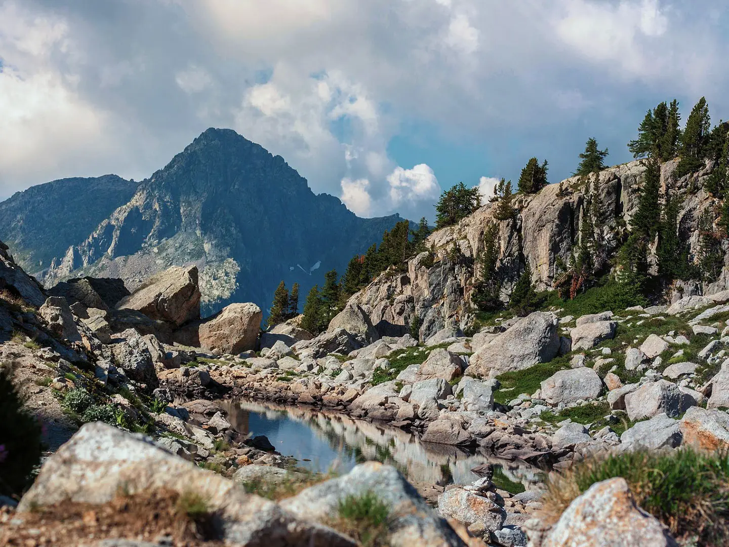
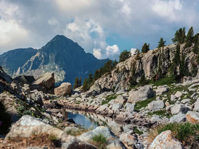
Image by Fairy-Tale-Utopia The GR52 through Mercantour National Park is a hard, high-level traverse of the Maritime Alps, linking Saint-Dalmas-Valdeblore with Menton on the Mediterranean. It suits fit, experienced mountain walkers who want a proper Alpine journey without technical climbing.
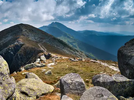
The route threads together larch valleys, granite cirques, glacial lakes and repeated rocky cols, including the Baisse du Basto at 2,693 m. It then changes character sharply, dropping through garrigue, olive terraces and Riviera foothills to the sea.
Its most distinctive section is the Vallée des Merveilles, a protected archaeological landscape beneath Mont Bégo where the GR52 passes Bronze Age rock engravings. Access rules matter here: stay on the marked path, do not touch or step on engravings, and use a park-approved guide for off-trail engraving areas.
This is a strenuous but non-technical walk, with long ascents, rough stony paths, scree, boulder fields and high-mountain weather to manage. Refuge bookings, snow lingering on cols into early summer, and afternoon thunderstorms are part of the planning, not minor details.
This guide covers stages, timing, accommodation, food, transport, terrain and the common mistakes to avoid.
Stage-by-Stage Guide
Stage 1: Saint-Dalmas-Valdeblore to Le Boréon — 18 km
The opening stage leaves Saint-Dalmas-Valdeblore, the correct start for this classic GR52 line, and climbs into the upper Vésubie/Tinée mountain country towards Le Boréon. Do not confuse this with Saint-Dalmas-le-Selvage, which belongs to the much longer Grande Traversée du Mercantour variant.
Expect a proper mountain start rather than a gentle valley warm-up. The walking is on waymarked GR red-and-white balisage through a wider network of paths, so follow the GR52 carefully at junctions and carry the relevant IGN mapping or GR52 topo-guide rather than relying only on signs.
Le Boréon is a forested valley hamlet with a lake and waterfall, and makes a practical first overnight before the higher refuge stages. Accommodation should be arranged in advance, especially in the staffed summer season when walkers are moving through on fixed itineraries.
Carry the day’s food from the start unless current local services have been checked. Water and meals should be planned around your accommodation rather than assumed en route; refill before leaving Saint-Dalmas-Valdeblore and check with the overnight stop at Le Boréon about drinking water and packed lunches.
Saint-Dalmas-Valdeblore has no railway. Access is by valley bus from Nice towards the Tinée/Vésubie and Valdeblore/Saint-Martin-Vésubie area, but current routes and timetables should be checked before travelling. Le Boréon is a valley base rather than a high hut, so it is one of the easier points for road access on the route, but onward public transport should still be checked before relying on it.
Seasonal issues begin immediately: snow can linger higher up into early summer, and afternoon thunderstorms are common in the Mercantour in high summer. Start early enough to avoid being committed to exposed ground late in the day.
Stage 2: Le Boréon to Madone de Fenestre — 11 km
This shorter stage moves deeper into the high Mercantour, linking the Le Boréon valley with the pastoral basin of Madone de Fenestre beneath the Gélas massif. Although the distance is modest, it should be treated as a mountain day, with rocky paths, sustained climbing and changeable weather.
Madone de Fenestre is both a route base and a long-established pilgrimage site, with its sanctuary chapel in a high basin of larch forest and pasture. It is a useful place to reset before the wilder central stages towards Refuge de Nice and the Baisse du Basto.
Underfoot, expect stony Alpine path rather than smooth walking. The route is non-technical, but sure-footedness matters on rough ground, especially if early-season snow patches remain or cloud reduces visibility near the higher ground.
Food and water are mainly a refuge/accommodation planning issue on this stage. Arrange the night at Madone de Fenestre ahead of time, ask about half-board and packed lunch options when booking, and leave Le Boréon with enough food and water for the day.
Navigation is generally by GR red-and-white waymarks, but the Mercantour path network includes many signposted alternatives and variants. Stay on the GR52 line unless deliberately changing itinerary, and avoid assuming that every onward mountain path is part of the through-route.
Public transport options at Madone de Fenestre should not be assumed. This should be checked before travelling if you intend to start, finish or bail out here.
Stage 3: Madone de Fenestre to Refuge de Nice — 11 km
This is one of the classic high-Mercantour stages, moving from the Madone de Fenestre basin into the granite and lake country around Refuge de Nice. The day is not long in kilometres, but the terrain is serious: rocky paths, high mountain weather and no village services between the two ends.
Refuge de Nice sits in a glacial cirque of peaks and tarns below the main Mercantour crest. It is one of the key overnights on the GR52, and booking is essential in the staffed season; half-board is the usual arrangement in mountain refuges.
Carry a packed lunch and enough water from Madone de Fenestre. Do not plan this stage around finding shops, cafés or reliable treated water en route; check drinking-water availability with the refuge when booking and refill whenever there is a confirmed safe source.
The path conditions are typical of the central Mercantour: stony, rough and sometimes slow, with scree or boulder-strewn sections possible in the high basins. Trekking poles are useful, but the next stage enters the protected Vallée des Merveilles area where pole use is restricted on engraved rock, so rubber tips or the ability to carry poles may be needed.
Navigation can become more demanding in mist, snow patches or poor weather. The GR52 is waymarked, but a map, compass/GPS and the ability to identify the correct col or basin are important; this is not a stage to tackle with phone navigation alone.
There is no convenient public transport at Refuge de Nice. Treat it as a remote high-mountain overnight and make a conservative plan for weather, arrival time and refuge booking.
Stage 4: Refuge de Nice to Refuge des Merveilles over the Baisse du Basto — 11 km
This is the crux stage of the classic GR52. It crosses the Baisse du Basto, the trail’s high point at 2,693 m, between the Refuge de Nice basin and the Valmasque/Merveilles side of the range. The Cime du Gélas is the highest summit in Mercantour National Park, but it is not on the GR52.
The day is short on paper, but it is high, rocky and exposed to weather. Expect granite and schist mountain terrain, scree, boulder fields and possible lingering snow patches into early summer. In poor visibility, this stage can feel significantly more serious than the distance suggests.
The descent from the high col leads towards the Valmasque lakes and the Vallée des Merveilles area, with Mont Bégo dominating the archaeological landscape. Refuge de la Valmasque is part of the wider refuge network in this sector, while the listed stage continues to Refuge des Merveilles beside Lac Long Supérieur.
Refuge des Merveilles is a key overnight and a major base for visiting the prehistoric engraving area. Book well ahead in the staffed season and arrange half-board or packed lunches at the time of booking. Carry all food needed for the walking day from Refuge de Nice unless refuge-to-refuge lunch provision has been arranged.
The Vallée des Merveilles is a regulated open-air archaeological site. Walkers on the GR52 must stay on the marked path, must not touch or step on engravings, must not use pointed trekking-pole tips on the engraved rock, and may only explore engraving zones off the marked route with a park-approved guide. Current park regulations should be checked before travelling.
Bivouac is restricted in this area and is allowed only in designated zones beside the Merveilles and Fontanalbe refuges. Do not plan an informal wild camp in the archaeological zone.
There is no straightforward public transport access on this stage. Treat the crossing of the Baisse du Basto as a committed mountain link between refuges, and avoid setting off if thunderstorms, snow conditions or timing make the crossing unsafe.
Stage 5: Refuge des Merveilles to Sospel via Camp d’Argent / Col de Turini — 27 km
This is the longest stage in the standard six-day itinerary and the day where many walkers will feel the cumulative fatigue of the route. It leaves the high Merveilles sector, passes through the Camp d’Argent / Col de Turini area, and continues down to Sospel in the Roya/Bévéra valley country.
The character changes during the day from high rocky Mercantour terrain towards lower mountain country. The distance alone makes this a demanding stage, and the descent into Sospel should not be underestimated after several days of rough paths and refuge nights.
There are no intermediate service details reliable enough to plan around. Carry a full day’s food from Refuge des Merveilles, arrange a packed lunch if available, and take enough water to cover a long stage unless specific refill points have been checked in advance.
Sospel is the first substantial town after the central mountain section, with gîtes, small hotels and valley services. It is the logical place to break the journey before the final descent to the Mediterranean and a sensible point to build in flexibility if earlier weather has delayed progress.
Navigation remains important because the GR52 is part of a larger signed path network and the stage crosses a named pass/route area at Camp d’Argent / Col de Turini. Keep checking that signs and waymarks match the intended GR52 direction towards Sospel, especially if other local paths or road crossings appear.
Public transport and road access for Camp d’Argent / Col de Turini and Sospel should be checked before travelling if they are part of a bail-out plan. Do not assume a same-day onward connection without verifying current timetables.
Stage 6: Sospel to Menton — 17 km
The final stage leaves Sospel and descends to Menton on the Mediterranean, trading the high Alpine terrain for garrigue, scrub, olive terraces and the Riviera edge of the Maritime Alps. It is still a real walking day, with a long descent at the end of an already strenuous route.
Sospel is a useful final resupply point and overnight base, known for its medieval toll bridge and painted facades. Leave town with food and water for the day; do not assume intermediate services on the descent unless they have been checked locally.
The terrain becomes drier and more Mediterranean as the trail approaches the coast. Rocky paths and rough stony ground can remain tiring, and the lower hills may feel hot in settled summer weather, so an early start is sensible.
Navigation can become more fiddly near the coast, where tracks, terraces, local paths and built-up edges increase. Continue to follow the GR red-and-white balisage carefully until the finish in Menton, rather than simply aiming downhill towards the sea.
Menton is the easiest transport point on the whole route. The town has mainline railway stations at Menton and Menton-Garavan on the Marseille–Nice–Ventimiglia line, with frequent trains towards Nice and into Italy. Accommodation is also much broader here than in the mountain refuges, but summer demand on the Riviera means booking ahead is still sensible.
The main warnings are fatigue, heat, water management and the cumulative effect of descending on tired legs. Keep enough time in hand for a slower-than-expected final day rather than treating it as a short coastal walk.
Recommended Itinerary
The classic Saint-Dalmas-Valdeblore to Menton line is normally planned as a 6-day hut-to-valley traverse. Distances below use the standard stage figures for this route; exact daily totals vary with the precise GR line, any refuge access paths and local variants, so check official mapping before booking fixed accommodation.
Standard 6-day itinerary
| Day | From | To | Approx. distance | Why this stage makes sense | Services/accommodation notes |
|---|---|---|---|---|---|
| 1 | Saint-Dalmas-Valdeblore | Le Boréon | 18 km | A full opening mountain day that gets you from the Valdeblore start into the Boréon valley, setting up the higher refuge stages without making the first night too remote. | Saint-Dalmas-Valdeblore is the practical pre-walk base; there is no railway, so arrive by valley bus from Nice and verify current timetables. Le Boréon is a recognised first-night base with mountain accommodation options; book ahead in season. |
| 2 | Le Boréon | Madone de Fenestre | 11 km | A shorter but still serious high-valley stage, useful after the longer first day and before the more remote central Mercantour section. | Madone de Fenestre is a key mountain base below the Gélas massif. Treat accommodation here as part of the refuge-style booking chain and reserve early for summer dates. |
| 3 | Madone de Fenestre | Refuge de Nice | 11 km | Keeps the route at a sensible Alpine pace before the highest and rockiest section. Refuge de Nice places you well for the following crossing towards the Valmasque and Merveilles basins. | Refuge de Nice is a staffed mountain refuge in season, with half-board normally the simplest option. Opening dates and booking conditions should be checked before travelling. |
| 4 | Refuge de Nice | Refuge des Merveilles, over the Baisse du Basto | 11 km | This is the key high-mountain stage of the traverse, crossing the Baisse du Basto at 2,693 m, the actual high point of the GR52. It is short on paper but slow underfoot because of rock, scree, boulders and high-pass exposure. | Refuge des Merveilles is the main overnight base for the Vallée des Merveilles. The engraving area is protected: stay on the marked GR52 unless with a park-approved guide, and do not touch or step on engravings. |
| 5 | Refuge des Merveilles | Sospel, via Camp d’Argent / Col de Turini | 27 km | The longest stage of the standard itinerary, taking the route out of the high Mercantour and towards the lower Roya/Bévéra country. Start early and treat this as a major endurance day, not a simple descent. | Sospel is the next main service stop, with village accommodation. Any plan to break this day around Camp d’Argent / Col de Turini depends on current accommodation and transport options; this should be checked before travelling. |
| 6 | Sospel | Menton | 17 km | A final point-to-point stage from the last inland town to the Mediterranean finish. The terrain changes from mountain country into drier garrigue, olive terraces and the Riviera approach. | Menton has strong onward transport, with mainline railway stations at Menton and Menton-Garavan on the Marseille–Nice–Ventimiglia line. Book Menton accommodation early in busy Riviera periods. |
Slower variant: 7 days or more
A 7-day plan suits walkers who want more margin for weather, refuge logistics and the protected Vallée des Merveilles section. The most obvious pressure point in the 6-day itinerary is Day 5 from Refuge des Merveilles to Sospel, which is around 27 km and comes after several high-mountain days.
A slower plan can break the traverse where accommodation and current access allow, commonly by inserting an extra night between Refuge des Merveilles and Sospel around the Camp d’Argent / Col de Turini part of the route, or by using Refuge de la Valmasque to ease the central high section. Exact distances and availability depend on the chosen stopping point, so check official mapping and bookable accommodation before committing.
This version is best for walkers who are fit enough for the GR52 but do not want to rely on long days in unstable mountain weather. It is also the more forgiving option if you want time for the Vallée des Merveilles regulations, guided visits or a slower pace over rocky ground.
Faster variant: 4–5 days
A 4- or 5-day crossing is only sensible for very fit, efficient mountain walkers who are comfortable carrying long days back-to-back over rocky Alpine terrain. The route is non-technical, but combining stages increases exposure to weather, fatigue and late arrivals at refuges.
The usual way to shorten the itinerary is to combine some of the shorter central stages, such as linking Le Boréon, Madone de Fenestre and Refuge de Nice more aggressively, or to compress the final approach towards Sospel and Menton. Do not plan this purely from the kilometre totals: the high cols, scree, boulder fields and refuge meal times matter as much as distance.
For a faster itinerary, book every night before setting off and check that each proposed stage is realistic on current maps. If snow remains on the high cols or thunderstorms are forecast, the standard or slower itinerary is the safer planning basis.
Planning the Route
The GR52 is best planned around accommodation and weather windows rather than mileage alone. The high section has a clear refuge-to-refuge rhythm, while the final approach to the coast includes a much longer day into Sospel before the last descent to Menton.
Most walkers should allow 6 or 7 days. A 6-day itinerary is efficient but includes one notably long stage from Refuge des Merveilles to Sospel via Camp d’Argent / Col de Turini; a 7-day plan gives more room for weather, slower descents on rocky ground and possible time around the Vallée des Merveilles.
How many days to allow
A 6-day schedule suits fit mountain walkers who are comfortable with full days on rough Alpine paths and who have all refuge bookings fixed in advance. It is not a relaxed itinerary, especially if afternoon thunderstorms force early starts and disciplined pacing.
A 7-day schedule is the safer default for many independent hikers. It reduces the pressure to keep moving through poor weather, gives more margin on high cols such as the Baisse du Basto and makes the protected Merveilles area easier to visit without rushing.
Fast walkers sometimes complete the route in 4–5 days, but that turns the walk into a demanding physical push and leaves little flexibility if a refuge booking, storm or lingering snow patch causes delay. Slower 8–9 day plans are possible, but they require more careful accommodation planning because the route is not lined with frequent villages.
Accommodation largely dictates the stages
The practical stages are shaped by where you can sleep. In the high Mercantour, staffed refuges are the key overnight points; later, Sospel and Menton provide the main valley-town stops.
| Section | Usual planning issue |
|---|---|
| Saint-Dalmas-Valdeblore to Le Boréon | Start logistics matter because Saint-Dalmas-Valdeblore has no railway. Arrive early enough for the first mountain stage rather than treating the bus transfer as an afterthought. |
| Le Boréon to Madone de Fenestre | A shorter day on paper, but still mountain terrain. It is useful for settling into the refuge rhythm before the higher passes. |
| Madone de Fenestre to Refuge de Nice | A high-mountain refuge stage where weather and underfoot conditions matter more than distance. Book ahead and carry enough food for the day. |
| Refuge de Nice to Refuge des Merveilles | The key high stage over the Baisse du Basto, the GR52 high point at 2,693 m. Do not confuse this with the Cime du Gélas, which is the highest summit in the national park but is not on the GR52. |
| Refuge des Merveilles to Sospel | The longest standard day, normally via Camp d’Argent / Col de Turini. If breaking this stage, intermediate accommodation or transport options must be checked before travelling. |
| Sospel to Menton | A lower but still significant final day, descending from the mountains into Mediterranean terrain before finishing at the coast. |
Refuges are typically staffed from mid-June to late September and should be booked ahead, especially in the core summer season. Half-board is the normal arrangement, so the essential food planning is usually lunches, snacks and emergency supplies rather than carrying full multi-day rations.
Shortening, extending and section hiking
This is not an especially easy route to shorten once committed to the high section. The refuge chain gives good natural stopping points, but it does not give frequent roadheads or rail stations.
The most practical extension is to slow the itinerary through the high refuge section or allow extra time for the Vallée des Merveilles and Fontanalbe areas. Off-trail exploration of the engraving zones requires a park-approved guide, and the current access rules should be checked before travelling.
Section hiking is possible in principle, but it is less straightforward than on a lowland trail with regular public transport. The start at Saint-Dalmas-Valdeblore is reached by bus from Nice through the Tinée/Vésubie valleys, while the finish at Menton is straightforward because Menton and Menton-Garavan are on the Marseille–Nice–Ventimiglia railway line. Intermediate access, onward buses or taxis should be checked before travelling.
Be careful with the name when booking, navigating or discussing the route locally. This page covers the classic Saint-Dalmas-Valdeblore to Menton GR52 line; the longer GR52-GTM Grande Traversée du Mercantour is a different 200 km-plus traverse starting much farther north.
Planning priorities
Refuge bookings: reserve the high-stage refuges early and build the itinerary around confirmed beds. Check opening dates before committing to travel, as staffed seasons are limited and weather can affect access.
Food: expect to rely on refuges for evening meals and breakfasts where booked half-board, but carry lunches, snacks and a reserve. Do not assume easy resupply between the high refuges and Sospel.
Water: water availability should be planned conservatively. Fill where reliable sources are available at refuges or settlements, and ask locally about conditions during hot or dry periods.
Navigation: the route is waymarked with red-and-white GR balisage, but it runs through a wider network of Mercantour paths where variants and side routes can cause confusion. Carry proper mapping, such as the relevant IGN TOP25 sheets 3741OT, 3741ET and 3841OT, or the FFRandonnée GR52 topo-guide, plus a charged GPS or mapping app.
Weather and snow: the most reliable season is roughly mid-July to mid-September. In early summer, high cols can still hold snow; in high summer, afternoon thunderstorms are common, so early starts and flexible stage planning are important.
Protected areas: in the Vallée des Merveilles, stay on the marked path, do not touch or step on engravings, and do not use pointed trekking-pole tips on the engraved rock. Bivouac in the Merveilles and Fontanalbe areas is restricted to designated zones beside the refuges, and the current regulations should be checked before travelling.
Transport: plan the start and finish as a one-way journey. Getting to Saint-Dalmas-Valdeblore depends on current regional bus services from Nice, while leaving from Menton is much easier by mainline train towards Nice or Italy.
Towns, Villages and Overnight Stops
The GR52 is not a village-to-village walk for most of its length. The middle of the route is planned around staffed mountain refuges, usually taken on half-board, with limited scope for buying extra food between overnight stops.
Book the high refuges before committing to travel dates, especially between mid-July and mid-September. Refuges are typically staffed from mid-June to late September only, and opening dates, meal arrangements and bivouac rules should be checked before travelling.
Saint-Dalmas-Valdeblore
Saint-Dalmas-Valdeblore is the start of this GR52 itinerary, in the Valdeblore commune above the Tinée valley. It is a sensible place to stay the night before starting, particularly if arriving by public transport and wanting an early start towards Le Boréon.
Accommodation is in the valley-village style rather than high-refuge style: expect gîtes, small hotels and campsites in and around the Valdeblore area, but book ahead in the main walking season. Food supply should be treated cautiously; do not assume a late arrival will leave enough time to buy trail food for the first stage.
There is no railway station at Saint-Dalmas-Valdeblore. Access is by valley bus from Nice towards the Tinée/Vésubie and Valdeblore area, using regional Zou!/Lignes d’Azur services; current routes and timetables should be checked before travelling.
Check the place name carefully when booking transport or accommodation. Saint-Dalmas-Valdeblore is not Saint-Dalmas-le-Selvage, which is associated with the longer Grande Traversée du Mercantour variant further north.
Le Boréon
Le Boréon is the usual first overnight stop after the climb out from Saint-Dalmas-Valdeblore. It is a forested valley hamlet with a lake and waterfall, and it works well as a first base before the route moves into higher Mercantour terrain.
Accommodation here is mountain-oriented, with refuge-style overnight options used by walkers. As with the other mountain stops, plan on booking ahead and confirm whether half-board, packed lunches or any food service are available for the date required.
Le Boréon is not a major resupply town. Treat it as an overnight stop rather than a place to rebuild food supplies, unless current local services have been checked in advance.
Madone de Fenestre
Madone de Fenestre is a high pastoral basin beneath the Gélas massif and is commonly used as the second overnight stop. It has a sanctuary chapel and serves as a route base before the walk continues into rougher, higher ground towards Refuge de Nice.
This is a refuge stop rather than a village stop. Half-board is the normal pattern, and walkers should not rely on shops or broad catering choice here.
Its position makes it important for pacing: leaving Madone de Fenestre well rested helps with the following high-mountain stages, where weather, snow patches early in the season and rocky ground can slow progress.
Refuge de Nice
Refuge de Nice is one of the key high-mountain overnights on the GR52. It sits in a glacial basin of lakes and granite peaks below the main Mercantour crest, before the route crosses towards the Valmasque and Merveilles area.
This is a staffed mountain refuge in season, typically used on half-board. Book in advance, and confirm opening dates, meal times, packed-lunch options and payment requirements before travelling.
There are no village services here. Arrive with enough snacks and bad-weather margin for the next stage, which includes the highest point of the GR52 at the Baisse du Basto.
Baisse du Basto
Baisse du Basto is not an overnight stop, but it is a crucial planning point between Refuge de Nice and the Valmasque/Merveilles basin. At 2,693 m it is the high point of the GR52, and conditions here can dictate the pace of the day.
There is no accommodation, food or transport at the col. Start early enough to cross in stable weather, as afternoon thunderstorms are common in high summer and snow can linger on the high cols into early summer.
Do not confuse this with the Cime du Gélas. The Cime du Gélas is the highest summit in Mercantour National Park, but it is not on the GR52.
Refuge de la Valmasque
Refuge de la Valmasque is a mountain-refuge option in the Valmasque lakes area and can be relevant for itineraries that split or adjust the high stages around the Baisse du Basto and Vallée des Merveilles. It is not the standard overnight in the six-day outline that goes from Refuge de Nice to Refuge des Merveilles, but it can be useful when building a slower or more flexible schedule.
Treat it as a staffed refuge stop, with advance booking required in season. Opening dates and whether it offers meals or packed lunches for a particular date should be checked before travelling.
There are no conventional village services here. Any plan using Refuge de la Valmasque should be matched carefully against the next day’s distance, ascent and the protected-zone rules around the Merveilles and Fontanalbe sectors.
Vallée des Merveilles
The Vallée des Merveilles is a protected archaeological zone rather than a settlement. The GR52 passes through this area beneath Mont Bégo, but overnight planning is centred on nearby refuges, especially Refuge des Merveilles.
Walkers must stay on the GR52 or other marked paths, must not touch or step on the engravings, and must not use pointed or shod trekking-pole tips on the engraved rock slabs. Leaving the marked route to explore engraving zones requires a park-approved guide.
Bivouac is restricted to designated zones beside the Merveilles and Fontanalbe refuges. Current Vallée des Merveilles access rules and bivouac conditions should be checked before travelling, as this is one of the most regulated parts of the route.
Refuge des Merveilles
Refuge des Merveilles is the main overnight base for the Vallée des Merveilles section and is commonly used after crossing the Baisse du Basto from Refuge de Nice. It sits by Lac Long Supérieur and is one of the most important booking points on the route.
This is a staffed refuge in season, normally used on half-board. Reserve early, particularly in peak summer, because it serves both through-walkers and visitors to the engraving area.
Do not treat the refuge as a shop. Confirm meals, packed lunches and any bivouac arrangements in advance, and carry enough food to handle delays caused by weather or slow going on rocky ground.
Fontanalbe
Fontanalbe, also written Fontanalba, is an engraving area off the main GR52 line rather than a standard overnight village. It is relevant if adding a guided visit or adjusting plans around the protected archaeological zones.
Access rules are similar in spirit to the Vallée des Merveilles: stay on authorised paths, protect the engraved rock surfaces and use a park-approved guide where required for off-trail engraving areas. Current regulations should be checked before travelling.
Bivouac is allowed only in designated zones beside the Merveilles and Fontanalbe refuges. Do not assume informal camping is acceptable in this sector.
Camp d’Argent / Col de Turini
Camp d’Argent and Col de Turini come on the long stage between Refuge des Merveilles and Sospel in the standard six-day itinerary. This is an important pacing point because that day is substantially longer than the preceding high-refuge stages.
The area can be useful when planning a slower itinerary or looking for a way to break the descent towards Sospel, but accommodation, food and transport options should be checked before travelling. Do not rely on turning up without a booking or current information.
For many walkers, the practical decision is whether to keep the long Refuge des Merveilles–Sospel stage intact or split it. That choice should be based on fitness, forecast, refuge availability and how much descent the knees can realistically handle in one day.
Sospel
Sospel is the last main inland town before the final descent to Menton. It sits in the Roya/Bévéra valley area and is a natural overnight stop after the long stage from Refuge des Merveilles via Camp d’Argent and Col de Turini.
Accommodation is more varied than in the high mountains, with gîtes, small hotels and campsites available in the town area. This is the best place before the coast to recover, wash kit properly and reset for the final day.
Food and basic town services are more realistic here than at the refuges, but opening hours should still be checked if arriving late after a long mountain day. Sospel is also the point where the route starts to feel less Alpine and more Mediterranean in character.
Menton
Menton is the finish of the GR52, on the Mediterranean coast at the Italian border. After the final descent through garrigue, scrub and olive country, it is the easiest place on the route for onward travel and post-walk accommodation.
Accommodation and food options are much broader than in the mountain stages, but booking ahead is still sensible in busy holiday periods. Menton is a practical place to add a recovery night rather than trying to travel immediately after the final descent.
The transport link is strong: Menton and Menton-Garavan stations are on the Marseille–Nice–Ventimiglia railway line, with frequent trains towards Nice and into Italy. This makes the route straightforward to leave without returning to the start.
Getting to the Start
The GR52 starts at Saint-Dalmas-Valdeblore in the Alpes-Maritimes, above the Tinée valley. Be careful with the name when booking transport: this is Saint-Dalmas-Valdeblore, not Saint-Dalmas-le-Selvage, which is linked with the longer Grande Traversée du Mercantour variant.
By train
There is no railway station at Saint-Dalmas-Valdeblore. The usual rail-and-bus approach is to travel to Nice, then continue by valley bus towards the Vésubie/Valdeblore area.
If arriving in France by train, plan Nice as the practical gateway rather than trying to reach the trailhead by rail. Allow a buffer between train arrival and the onward bus, as mountain-valley services are much less frequent than coastal trains. This should be checked before travelling.
By bus
Saint-Dalmas-Valdeblore is reached by bus from Nice using regional Zou! / Lignes d’Azur services running up the Tinée and Vésubie valleys, including services towards Saint-Martin-Vésubie / Valdeblore. Current route numbers, stopping points and seasonal timetables should be checked before travelling.
Do not leave this connection to chance on the morning of Day 1. The first stage to Le Boréon is a proper mountain day, so arriving late at Saint-Dalmas-Valdeblore can put pressure on daylight, weather windows and refuge check-in times.
For many walkers, the cleanest plan is to travel to Nice the day before, take the bus up to Saint-Dalmas-Valdeblore, and sleep near the start. If the bus timetable does not fit, a pre-booked taxi or private transfer from Nice or from a valley town may be the fallback, but availability and price should be confirmed in advance.
By car
Driving to Saint-Dalmas-Valdeblore is possible, but this is a point-to-point route ending in Menton, not a circular walk. Leaving a car at the start creates a return-transport problem after finishing on the coast.
Menton has strong rail connections on the Marseille–Nice–Ventimiglia line, so the public-transport finish is straightforward. Returning from Menton to a car left at Saint-Dalmas-Valdeblore would still require working back via Nice and then onward by valley transport or a taxi. This should be checked before travelling.
Long-stay parking arrangements at or near the trailhead are not specified, so do not assume secure multi-day parking in Saint-Dalmas-Valdeblore. Check locally before committing to a car-based plan.
From the nearest airport
For international arrivals, Nice is the practical access city for the GR52 start. From Nice, continue by the same valley bus connection towards Saint-Martin-Vésubie / Valdeblore, or arrange a private transfer if public transport does not align with your arrival time.
Build in slack if flying in on the same day. A delayed flight or missed bus can easily compromise the first refuge night, and high-stage accommodation on this route should be booked ahead.
Where to stay before starting
The most useful pre-walk base is Saint-Dalmas-Valdeblore itself, because it removes the risk of a same-day bus connection before the first climb. The village area has mountain accommodation options such as gîtes, small hotels and campsites, but opening dates and availability should be checked before booking.
Staying in Nice the night before is simpler for long-distance train or flight arrivals, but it means relying on the morning bus to the mountains. That can work if the timetable is favourable, but it leaves less margin for delays.
Before finalising accommodation, line up the first walking day with the onward night at Le Boréon and check refuge or lodging check-in expectations. The start logistics, bus timing and first-night booking need to fit together rather than being planned separately.
Getting Home from the Finish
The GR52 finishes in Menton, which is much easier to leave than the mountain start at Saint-Dalmas-Valdeblore. Menton is on the coast at the Italian border and has rail access, so most walkers should plan onward travel from the finish rather than arranging a vehicle shuttle.
By train
Menton has two railway stations: Menton and Menton-Garavan. Both are on the Marseille–Nice–Ventimiglia line, giving straightforward onward travel west towards Nice or east into Italy.
Trains are frequent by mountain-trail standards, especially compared with the bus-dependent start of the route. Exact departure times, first and last trains, engineering works and ticket rules should be checked before travelling, particularly if finishing late in the day.
For most hikers, the simplest plan is:
- finish the walk in Menton;
- go to Menton or Menton-Garavan station;
- take the train towards Nice for French onward connections, or towards Ventimiglia for Italy.
If returning to the start area, expect a multi-leg journey: train from Menton towards Nice, then onward valley transport towards Saint-Dalmas-Valdeblore. Current bus routes and timetables to Saint-Dalmas-Valdeblore should be checked before relying on this as a same-day connection.
By bus
Local and regional bus options may be available from Menton, but the railway is the main practical public-transport option from the finish. Bus services, stop locations and evening/Sunday timetables are timetable-dependent and should be checked before travelling.
Do not assume a late bus connection will work after the final stage from Sospel to Menton. If the day runs long, the train or an overnight stay in Menton is usually the more reliable plan.
By car/taxi
A taxi from Menton can be useful for local transfers, accommodation access or a late finish, but it is not the natural solution for returning all the way to the mountain start. The GR52 is a point-to-point route ending far from Saint-Dalmas-Valdeblore, and a private transfer back into the upper valleys is likely to be expensive and should be arranged in advance if needed.
Leaving a car at the finish can work well if a driver or pre-arranged logistics allow it. Leaving a car at the start is less convenient, because getting back from Menton to Saint-Dalmas-Valdeblore by public transport involves travelling via Nice and then using valley bus services; this should be checked before travelling.
From the nearest airport
For flights, Nice is the logical gateway for this route because Menton has direct rail links towards Nice. Airport transfer details from Nice should be checked before booking flights, as they depend on current train, tram, bus or taxi arrangements.
When booking a flight out, allow a sensible buffer after the final walking day. The last stage from Sospel to Menton is a full mountain-to-coast descent, and delays from heat, tired legs or afternoon weather are possible.
Where to stay at the finish
Menton has accommodation options, including small hotels and campsites, making it a practical place to stop after the trail. Staying overnight is recommended if finishing late, if onward trains are tight, or if travelling with a flight the next day.
Booking ahead is sensible in the main summer walking season. Menton is a Riviera town as well as a trail finish, so accommodation availability and prices can vary sharply by date; current prices and cancellation terms should be checked before booking.
Which Direction Should You Walk?
The GR52 is normally planned from Saint-Dalmas-Valdeblore to Menton. That is the standard direction used for the classic Valdeblore–Menton traverse, and it fits the natural logic of the route: start high in the Mercantour valleys, cross the main Alpine passes, then finish by descending towards the Mediterranean.
Walking it in reverse is possible, but it is usually less convenient unless accommodation availability forces the issue.
Saint-Dalmas-Valdeblore to Menton: the standard direction
This direction gives the best overall flow. The route begins in mountain country, moves quickly into the high Mercantour around Le Boréon, Madone de Fenestre, Refuge de Nice and the Baisse du Basto, then gradually drops through the Vallée des Merveilles, Col de Turini, Sospel and finally Menton.
Transport also works better this way. Saint-Dalmas-Valdeblore has no railway, so reaching the start requires a bus from Nice up the Tinée/Vésubie valley system; current routes and timetables should be checked before travelling. Once the walk is finished, Menton has mainline railway stations with frequent trains towards Nice and Ventimiglia, making onward travel much simpler.
The scenery progression is a major advantage. You get the full high-mountain section while still relatively fresh, then the route’s final change from Alpine terrain into garrigue, olive country and the Riviera coast gives a strong sense of completion.
The psychological finish is also hard to beat. Ending a demanding high-level traverse at the sea in Menton is far more satisfying than finishing at a road-access mountain village and then working out a valley-bus connection.
Menton to Saint-Dalmas-Valdeblore: the reverse direction
The reverse direction starts easily from a transport point of view, because Menton is on the railway. The drawback is at the end: Saint-Dalmas-Valdeblore has no train service, so the final day must be matched to bus timings out of the mountains. This can make the last stage feel more constrained.
Reverse walkers also lose the classic sea-finish. Instead of descending from the Mercantour to the Mediterranean, the route begins at the coast and works back into increasingly remote mountain terrain.
In practical walking terms, the reverse direction can feel more abrupt. The standard final stages from Sospel to Menton become an initial climb away from the coast, and the long Refuge des Merveilles–Sospel stage is tackled in the opposite direction as a major ascent towards the high country. That may suit very fit walkers, but it is not the easiest introduction to the route.
Accommodation is workable in either direction if refuges and valley stops are booked in advance. However, the standard direction follows the usual stage sequence more naturally: Saint-Dalmas-Valdeblore, Le Boréon, Madone de Fenestre, Refuge de Nice, Refuge des Merveilles, Sospel and Menton.
Weather and timing
There is no strong direction choice based on prevailing wind. The more important weather issue is timing each high pass early enough in the day, especially in high summer when afternoon thunderstorms are common.
This applies whichever way you walk. Snow can also linger on the high cols into early summer, including around the Baisse du Basto, so direction does not remove the need to check conditions before setting out.
Recommendation
Walk the GR52 from Saint-Dalmas-Valdeblore to Menton unless there is a specific accommodation or transport reason to reverse it. It gives the better logistics, the more satisfying landscape progression, the standard refuge flow and the strongest finish: a long descent from the high Maritime Alps to the Mediterranean.
Accommodation Along the Route
Accommodation on the GR52 is a genuine mountain-hut-and-valley-village mix. The high central section is built around staffed refuges, while the first and last nights can use village accommodation, gîtes, campsites or small hotels.
Do not treat this as a flexible inn-to-inn route where beds can be arranged casually on arrival. The key refuges are limited-capacity mountain bases, usually staffed only from mid-June to late September, and should be booked ahead, especially in July, August and at weekends.
Half-board is the normal refuge arrangement. Expect dormitory-style sleeping, shared facilities and simple mountain meals rather than hotel standards. Carry a sleeping liner and check each refuge’s current requirements before travelling.
Main overnight options
| Place | Accommodation level | Best for | Notes |
|---|---|---|---|
| Saint-Dalmas-Valdeblore | Good | Pre-walk night | Valley-village base before starting the GR52. Accommodation is easier here than once you enter the high refuge section, but summer availability should still be booked ahead. |
| Le Boréon | Limited | First night on the standard 6-day itinerary | A practical first-stage base in the forested valley above Saint-Martin-Vésubie. Choice is more limited than in larger towns, so reserve before committing to onward refuge dates. |
| Madone de Fenestre | Limited | High-stage overnight before crossing towards Refuge de Nice | A key mountain stop beneath the Gélas massif. Treat it as a refuge-style night rather than a village-hotel stop. |
| Refuge de Nice | Limited | High-mountain overnight before the Baisse du Basto section | One of the essential refuge nights on the GR52. Book early in the staffed season and check opening dates, meal arrangements and any winter-room rules if walking near the edge of the season. |
| Refuge de la Valmasque | Limited | Alternative staging or variant planning near the Valmasque lakes | Useful for itineraries that adjust the high section around the Valmasque/Merveilles basin. Exact routing and availability should be checked before travelling. |
| Refuge des Merveilles | Limited | Overnight for the Vallée des Merveilles section | A key refuge beside the Merveilles lakes and the main base for the protected engraving area. This is a popular stop and should be booked well ahead in peak season. |
| Sospel | Good | Last valley night before Menton | The strongest accommodation choice after the high mountains. Suitable for a hotel, gîte or campsite night before the final descent to the coast. |
| Menton | Good | Finish night, onward travel, rest day | The easiest place on the route for hotels and services, with mainline rail access at the end of the walk. Book ahead in the Riviera summer season. |
Where accommodation is tight
The most constrained nights are the high refuge stages: Madone de Fenestre, Refuge de Nice, Refuge de la Valmasque and Refuge des Merveilles. These are not places where a walker should rely on finding a spare bed late in the day.
The practical walking season overlaps with the staffed refuge season, roughly mid-June to late September. Outside this window, refuges may be unstaffed, high cols may still hold snow, and a normal hut-to-hut itinerary may not be realistic without winter mountaineering experience and a different accommodation plan.
The Refuge des Merveilles area also sits within a protected archaeological landscape. Bivouac is only allowed in designated zones beside the Merveilles and Fontanalbe refuges, and this should be checked before travelling.
Splitting the long Refuge des Merveilles to Sospel stage
The standard 6-day version has a long day from Refuge des Merveilles to Sospel via Camp d’Argent / Col de Turini. Walkers who prefer shorter stages sometimes look for ways to break this section, but accommodation options on or near the exact line should not be assumed.
If planning to split that day, check current accommodation and transport possibilities around Camp d’Argent / Col de Turini before booking the rest of the route. Do this early, because a missing bed in the middle of the itinerary can force a major reshuffle of refuge dates.
Does the GR52 work for inn-to-inn walkers?
It works well for walkers who are comfortable with staffed mountain refuges, dormitories and half-board. It does not work well as a purely hotel-to-hotel walk through the high central Mercantour, because the route crosses remote cols and lake basins where refuges are the normal accommodation.
Luggage-transfer style walking is also not something to assume on the high stages. The route’s terrain, passes and refuge locations make it much less straightforward than lower-level village-to-village trails. Any taxi support, bag transfer or off-route accommodation plan should be arranged directly and checked before travelling.
For most independent walkers, the simplest plan is to carry normal hut-to-hut kit, book every night in sequence, and keep the itinerary conservative enough to cope with afternoon thunderstorms, lingering early-season snow and the long descent stages towards Sospel and Menton.
Camping and Wild Camping
Camping is possible on a GR52 itinerary, but this is not a route where you can simply pitch wherever the day ends. The trail crosses the Parc national du Mercantour, including the highly protected Vallée des Merveilles and Fontanalbe archaeological areas, so bivouac rules matter and must be planned before departure.
Most walkers use staffed refuges for the high stages and campsites or other accommodation in the valley settlements. Carrying a tent gives flexibility only if the overnight places line up with legal, permitted camping or bivouac locations.
Campsites and valley camping
The practical camping opportunities are in or near the lower settlements: Saint-Dalmas-Valdeblore at the start, Sospel near the end, and Menton on the coast. These are the places where campsites and valley services are most relevant.
No specific campsite should be assumed without checking current opening dates, booking rules and location. This should be checked before travelling, especially outside the main summer walking season.
The high central section is different. Between Le Boréon, Madone de Fenestre, Refuge de Nice, Refuge de la Valmasque and Refuge des Merveilles, overnight planning is dominated by refuges and park rules rather than conventional campsites.
Wild camping and bivouac rules
Do not treat the Mercantour as unrestricted wild-camping country. It is a national park with protected habitats, regulated archaeological zones and local rules that can change by sector and season.
In the Vallée des Merveilles and Fontanalbe sectors, bivouac is allowed only in the designated zones beside the Merveilles and Fontanalbe refuges. Walkers must stay on the GR52 or marked paths, must not touch or step on the engravings, and may only leave the marked route in the engraving areas with a park-approved guide.
For other parts of the route, current Parc national du Mercantour bivouac rules should be checked before travelling. If a legal bivouac is not certain, book a refuge or descend to an established accommodation point instead.
Does the GR52 suit a camping itinerary?
A fully camping-based itinerary is possible only with careful rule-checking and a willingness to use designated areas rather than choosing wild pitches freely. The route is hard enough without an overloaded pack: it crosses repeated high cols, rocky paths, scree and boulder fields, with around 6,463 m of ascent over the full Saint-Dalmas-Valdeblore to Menton line.
For most hikers, the most practical approach is mixed: campsite or valley accommodation at the beginning and end, staffed refuges through the high mountains, and a legal designated bivouac only where it fits the day’s route. This keeps pack weight lower and avoids forcing illegal or unsuitable camps in fragile terrain.
The best sections for conventional camping are the lower valley stops at Saint-Dalmas-Valdeblore, Sospel and Menton. The central high route is better treated as refuge country unless a permitted bivouac has been planned in advance.
Water and campcraft
Water is available at villages and staffed refuges, but do not rely on every stream, lake or mapped watercourse as a safe or reliable camping supply. High mountain water should be treated or filtered, and lower Mediterranean sections towards Sospel and Menton can feel much drier and hotter.
Carry enough water for the day’s stage, especially after leaving the high lake basins and before the final descent to the coast. Refill points, refuge services and any seasonal shortages should be checked locally.
Use a stove only where permitted and avoid any open fire. This route passes through protected alpine terrain and, lower down, dry garrigue and scrub where fire risk can be serious in summer.
Leave No Trace on this route
Camp only where it is legal and durable, never on archaeological rock slabs, engraving zones, fragile alpine turf or private land. In the Vallée des Merveilles and Fontanalbe areas, stay strictly on the marked path unless with an approved guide.
Pack out all rubbish, including food scraps and sanitary waste. Keep food secured from wildlife, do not wash directly in lakes or streams, and keep noise low around refuges and bivouac zones.
The GR52 crosses one of the most sensitive landscapes in the Maritime Alps. Good camping practice here is not just courtesy — it is part of keeping the route open and protecting the park’s wildlife, water and prehistoric heritage.
Food, Water and Resupply
Food planning on the GR52 is mainly a refuge-logistics problem rather than a shop-to-shop resupply problem. The high central stages run between staffed mountain refuges and remote basins, with little dependable food available during the walking day unless it has been pre-arranged or carried.
Most walkers use half-board in the refuges at Le Boréon, Madone de Fenestre, Refuge de Nice, Refuge de la Valmasque and Refuge des Merveilles. These refuges are typically staffed only from mid-June to late September, must be booked ahead, and seasonal opening dates should be checked before travelling.
Food strategy
Carry enough trail food for each day before leaving the overnight stop. Even on short-looking 11 km stages, the route crosses rocky Alpine ground, high cols and slow boulder or scree sections, so snacks and lunch need to be available without relying on finding a café or shop en route.
Saint-Dalmas-Valdeblore, Sospel and Menton are the places where food planning is easiest. Sospel is the last main stop before the final descent to the coast, so it is the key place to reset food before the Sospel–Menton stage.
Do not assume rural shops, cafés or small services will be open when needed, especially on Sundays, public holidays, early mornings or late afternoons. Opening hours in mountain villages and seasonal hamlets can be limited; this should be checked before travelling.
If relying on refuge meals, book half-board in advance and ask directly about breakfast times and whether a packed lunch is available. This should be checked before travelling, as refuge services vary by season, staffing and supply conditions.
Water strategy
Reliable water should be expected at overnight stops and settlements, but the high mountain sections should be planned as self-sufficient walking days. Refill before leaving each refuge or village, then carry enough to reach the next dependable point.
Natural water is present in the Mercantour’s lake basins, streams and pastoral valleys, but it should not be treated as automatically drinkable. Use a filter, purifier or other treatment if taking water from streams, lakes or runoff, particularly near refuges, grazing areas or busy paths.
On most stages, carrying around 1.5–2 litres from the start is a sensible baseline in normal summer conditions. Carry more on hot days, during the long Refuge des Merveilles–Sospel stage, and on the exposed final descent towards Menton, where Mediterranean heat can make the walking feel much drier than the high-Alpine stages.
| Section | Food availability | Water availability | Notes |
|---|---|---|---|
| Saint-Dalmas-Valdeblore to Le Boréon | Start in a mountain village; rely on carried food during the stage unless services have been checked in advance. Evening food depends on booked accommodation or refuge arrangements at Le Boréon. | Fill before leaving Saint-Dalmas-Valdeblore. Natural sources may exist in the mountains, but treat any water taken from streams or runoff. | Do not start the route without the first day’s lunch and snacks. Check any local shop or café hours before travelling. |
| Le Boréon to Madone de Fenestre | Food is mainly through booked refuge/accommodation meals; carry lunch and snacks. | Refill before leaving Le Boréon and again at the overnight stop. Treat natural water if used during the day. | A shorter stage on paper, but still mountain terrain; do not rely on finding food between stops. |
| Madone de Fenestre to Refuge de Nice | Food is limited to what is carried and what has been booked at the refuges. | Refill at Madone de Fenestre before setting out. Treat any water taken from lakes, streams or runoff. | High, rocky terrain means slow progress; keep food accessible during the day. |
| Refuge de Nice to Refuge des Merveilles via Baisse du Basto | No dependable food between refuges; carry the full day’s lunch and snacks. | Refill at Refuge de Nice. Natural water in the lake basins should be treated before drinking. | This is the highest part of the GR52, crossing the Baisse du Basto; bad weather can lengthen the day, so carry spare calories. |
| Refuge des Merveilles to Sospel via Camp d’Argent / Col de Turini | Longest standard stage. Carry a full day’s food unless any intermediate service has been checked in advance. Sospel is the next main food stop. | Start with a full water carry from Refuge des Merveilles. Treat natural sources if used. | Plan conservatively: this is a long 27 km day with major descent and few guaranteed resupply options. |
| Sospel to Menton | Food is easiest at the start in Sospel and at the finish in Menton; carry lunch and snacks for the walking day. | Fill in Sospel before leaving. Carry enough for the descent to the coast, especially in hot weather. | The terrain changes to garrigue, scrub and olive country above Menton; heat and sun exposure can increase water needs. |
Terrain, Conditions and Difficulty in Practice
The GR52 from Saint-Dalmas-Valdeblore to Menton is hard because it is sustained Alpine walking, not because it involves climbing. There is no required scrambling, but the route links repeated high cols, long descents, rough underfoot conditions and refuge-to-refuge days where turning back or shortening a stage is not always straightforward.
The trail’s high point is the Baisse du Basto at 2,693 m. The Cime du Gélas, at 3,143 m, is the highest summit in Mercantour National Park but is not on the GR52.
Underfoot: mostly rocky mountain path
Expect stony, rocky and often uneven paths for much of the traverse through the high Maritime Alps. Granite and schist terrain, glacial cirques, lake basins, scree and boulder fields are part of the normal walking, especially between Madone de Fenestre, Refuge de Nice, the Baisse du Basto, Refuge de la Valmasque and the Vallée des Merveilles.
This is not a soft trail where distance alone describes the effort. An 11 km stage over rough rock and a high pass can take much longer than the same distance on a valley path, especially with a multi-day pack.
Mud and bog are not the main difficulty on this route. After rain or snowmelt, slabs, stones and compacted path can become slippery, but the dominant character is rocky rather than muddy.
Climbs, descents and daily effort
The route packs roughly 6,463 m of ascent into about 95 km. That means the physical load comes from repeated climbing and descending rather than one single big ascent.
The hardest walking days are usually the high mountain stages where the route crosses cols between refuge basins. The day from Refuge de Nice towards Refuge des Merveilles over the Baisse du Basto is the clearest example: short in distance, but high, rocky, exposed to weather and slow underfoot.
The later stages are not simply an easy run to the sea. The long stage from Refuge des Merveilles to Sospel via Camp d’Argent / Col de Turini is the longest day in the standard 6-day outline, and the final descent from Sospel to Menton still demands care, particularly as the terrain changes into drier Mediterranean garrigue, scrub and olive country.
Exposure and technical difficulty
The GR52 is strenuous but non-technical. It does not require ropes, climbing equipment or planned scrambling, but it does require sure-footedness on loose stone, scree, boulders and high mountain paths.
Exposure is mostly the practical exposure of Alpine terrain: high passes, open basins, changing weather, and long stretches where shelter and services are limited to refuges. Walkers uncomfortable on rocky ground or steep descents may find the route much harder than the headline distance suggests.
Trekking poles are useful for long descents and loose ground, but take care in the Vallée des Merveilles. In the protected engraving areas, walkers must stay on the marked path, must not touch or step on the engravings, and must not use pointed trekking-pole tips on the rock.
Stage-by-stage terrain character
| Stage | Terrain and practical difficulty |
|---|---|
| Saint-Dalmas-Valdeblore to Le Boréon | A long first day from a mountain village into the Boréon area. Treat it as a full mountain approach day rather than a gentle warm-up. |
| Le Boréon to Madone de Fenestre | Shorter on paper, but increasingly Alpine in feel, moving into higher pastoral and mountain terrain beneath the Gélas massif. |
| Madone de Fenestre to Refuge de Nice | High mountain walking with rocky ground, lakes and cirque terrain. Weather and underfoot conditions matter more than the modest distance. |
| Refuge de Nice to Refuge des Merveilles via Baisse du Basto | One of the most demanding sections: the route reaches the GR52 high point at 2,693 m and crosses rough, rocky terrain between lake basins. Snow patches can linger into early summer. |
| Refuge des Merveilles to Sospel via Camp d’Argent / Col de Turini | The longest standard stage, with a major change in character as the route leaves the highest Mercantour terrain and heads towards lower country. Fatigue is often the main difficulty here. |
| Sospel to Menton | A final descent towards the Mediterranean through garrigue, scrub and olive country. It is lower and warmer, but still a real walking day after several strenuous stages. |
Seasonal conditions
The best practical window is roughly mid-July to mid-September, when the high passes are usually clear and the refuges are operating. The wider staffed-refuge season is generally mid-June to late September, but early in that window snow can still affect the cols.
Outside the normal summer season, high passes such as the Baisse du Basto can be snow-choked and the route becomes a winter mountaineering proposition rather than a standard long-distance hike. That requires different skills, equipment and judgement.
In high summer, afternoon thunderstorms are common in the mountains. Early starts are important on high-pass days, especially where the route is open and exposed with limited shelter between refuges.
What makes it easier or harder in practice
The route feels easier with light, disciplined packing, booked refuges, early starts and enough mountain fitness to handle several consecutive days of ascent and descent. It becomes much harder if accommodation gaps force long days, if storms delay progress, or if lingering snow slows the high cols.
Road walking, stiles and enclosed-field navigation are not defining features of this hike. The main challenge is classic Alpine foot travel: rough rock, loose ground, high passes, long descents, weather exposure and the need to move efficiently between limited overnight bases.
Weather and Best Time to Walk
The best period for the GR52 from Saint-Dalmas-Valdeblore to Menton is roughly mid-July to mid-September. This gives the best balance of staffed refuges, mostly clear high passes and enough daylight for the long, rocky stages.
The wider practical season is mid-June to late September, but the edges of that window need caution. Refuges are typically staffed only during this period and must be booked ahead; current opening dates should be checked before travelling.
Seasonal conditions
| Period | What to expect | Planning advice |
|---|---|---|
| Mid-June to early July | Refuges may be opening, but snow can linger on high cols and shaded approaches. Passes such as the Baisse du Basto can still hold awkward snow patches. | Suitable only if you are confident assessing snow on steep mountain paths. Check refuge opening dates and current conditions before committing. |
| Mid-July to mid-September | The main walking season. High passes are usually in summer condition, refuges are staffed, and the route is at its most straightforward logistically. Afternoon thunderstorms are common in high summer. | The best choice for most walkers. Start early, aim to be over the highest cols before storms build, and keep waterproofs accessible. |
| Late September | Still possible in good conditions, but the season is closing down. Days are shorter, nights are colder, and refuge staffing becomes less reliable. | Book and check every overnight stop carefully. Carry a headtorch and avoid planning over-ambitious late starts, especially on the longer Refuge des Merveilles to Sospel stage. |
| October to mid-June | Not a normal hiking season for this route. High cols can be snow-choked and the staffed-refuge chain cannot be assumed. | Realistic only for parties with winter mountaineering skills, equipment and independent logistics. This is not a winter walking route. |
High-mountain weather
This is a Maritime Alps traverse, not a low-level Riviera walk until the final descent. Several days cross rocky passes between roughly 2,400 m and 2,700 m, with the GR52 topping out at the Baisse du Basto, 2,693 m. Weather can change quickly at this height, and wind, cold rain or cloud can make otherwise non-technical ground feel serious.
Afternoon thunderstorms are a major summer consideration. Plan early starts from places such as Madone de Fenestre, Refuge de Nice and Refuge des Merveilles, and avoid being committed to exposed cols or boulder fields late in the day when storms are building.
Low cloud can also make navigation more demanding on the bare, rocky sections around the high lakes and the Vallée des Merveilles. The route is waymarked with GR red-and-white balisage, but a map, compass or reliable offline navigation remains important.
Snow and trail surface
The route is strenuous but non-technical in normal summer conditions. The difficulty comes from sustained ascent and descent, stony paths, scree, boulder fields and repeated high passes.
Early in the season, lingering snow patches can make the cols more serious, particularly where snow lies across steep or rocky ground. If the high passes are still snow-covered, the route moves beyond ordinary summer hiking and may require winter skills and equipment.
After rain or storms, rock slabs and boulders can be slow and slippery, especially in the high basins around Refuge de Nice, Valmasque and the Vallée des Merveilles. Allow extra time rather than treating the map distance as the main measure of difficulty.
Heat on the descent to Menton
The final stage from Sospel to Menton drops out of the mountains into Mediterranean garrigue, scrub and olive country. In high summer this can feel much hotter and more exposed than the refuge stages, despite being lower.
Carry enough water for the day, start early, and do not underestimate the heat simply because the hardest cols are behind you. The contrast between cool high refuges and the Riviera finish is one of the route’s main practical weather challenges.
Daylight and daily timing
A 6-day itinerary includes some compact high-mountain stages, but also a notably long day from Refuge des Merveilles to Sospel via Camp d’Argent / Col de Turini. In late season, shorter daylight makes this stage less forgiving.
For most walkers, the safest rhythm is to leave refuges early, cross the high ground before the afternoon, and arrive with enough margin for weather delays. A headtorch is essential even in summer, especially if walking the route in six days rather than spreading it over seven or more.
Safety Notes
The GR52 through the Mercantour is a serious Alpine walking route: non-technical, but remote, rocky and repeatedly above 2,400 m. The main safety issues are weather, snow on high cols, long rocky descents, refuge logistics and the consequences of being caught between staffed places late in the day.
For emergency help in France, call 112. Mobile signal should not be relied on in the high basins, cols and forested valleys, so carry offline mapping, a paper map or topo-guide, and enough battery to navigate without reception.
Weather, altitude and thunderstorms
The practical season is mid-June to late September, with the best conditions usually from mid-July to mid-September. Even then, the route crosses high passes such as the Baisse du Basto at 2,693 m, where wind, cold, poor visibility and sudden weather changes can make navigation and footing much harder.
Afternoon thunderstorms are common in high summer. Start early on days over exposed cols, especially the stages around Madone de Fenestre, Refuge de Nice, Baisse du Basto, Valmasque and the Vallée des Merveilles, and avoid being on open ridges, cols or bare slabs late in the day if storms are forecast.
Snow can linger on the high passes into early summer. Outside the normal summer window, cols may be snow-choked and the route becomes a winter mountaineering proposition rather than a long-distance hike.
Rocky ground, scree and fatigue
The GR52 is hard largely because it strings together big ascents and descents on stony mountain paths, scree and boulder fields. Falls are more likely when tired, particularly late in the day on descents to refuges or valley villages.
Use footwear with good edging and grip, and keep trekking poles under control on rocky sections. Do not underestimate short-looking stages: an 11 km day over a rough Alpine col can take far longer than the same distance on valley tracks.
Heat, cold and water
The high route can be cold and exposed even in summer, while the final descent towards Sospel and Menton moves into much hotter Mediterranean terrain of garrigue, scrub and olive country. Pack for both: sun protection and enough water for the lower, hotter days, plus warm layers and waterproofs for the cols.
There are lakes and mountain streams in the Mercantour, but the safe approach is to plan water around refuges, villages and known refill points rather than assuming every natural source is drinkable or running. Carry enough between staffed places, especially on the longer Refuge des Merveilles to Sospel stage.
Remote sections and solo walking
The most committing part of the route is the high central section between Le Boréon, Madone de Fenestre, Refuge de Nice, Baisse du Basto, Valmasque and Refuge des Merveilles. Once committed to a pass, escape options may be slow and weather-dependent.
Solo walkers should be particularly conservative with forecasts, timings and snow conditions. Leave the day’s plan with accommodation where possible, avoid late starts, and turn back or wait rather than crossing a high col in thunder, dense mist or unstable snow.
Vallée des Merveilles rules
The Vallée des Merveilles is a protected archaeological zone as well as a mountain route. Stay on the GR52 and marked paths, do not touch or step on the engravings, and do not use pointed or shod trekking-pole tips on the rock.
Exploring engraving areas away from the marked path requires a park-approved guide. Bivouac rules are also restricted in this area, with bivouac allowed only in designated zones beside the Merveilles and Fontanalbe refuges; current regulations should be checked before travelling.
Livestock, wildlife and road sections
Expect pastoral ground around places such as Madone de Fenestre. Give livestock plenty of space, pass calmly, and avoid getting between animals and their young.
Wildlife such as chamois, ibex, marmots, eagles and vultures is part of the Mercantour, but it should be observed from a distance. Wolves are present in the massif, though they are not a normal direct hazard to walkers.
Road walking is not the defining risk on this route, but take care where the GR52 enters or crosses roads around access points, villages and the Col de Turini / Sospel / Menton approach. Visibility can change quickly in poor weather, and tired walkers are less alert near the end of long stages.
Daily pre-start checks
Before setting off each morning, check:
- the mountain weather forecast, especially thunderstorm timing and wind on high cols;
- whether snow remains on the next pass, particularly early in the season;
- that the next refuge, gîte or hotel booking is secure and that arrival by daylight is realistic;
- water and food requirements for the full stage, not just the map distance;
- the current rules for the Vallée des Merveilles if entering the protected engraving area;
- battery level, offline maps and a paper back-up;
- the final transport plan if finishing at Menton or exiting early via a valley village.
Gear Recommendations
The GR52 is a summer Alpine walking route, not a technical mountaineering route, but the kit needs to match repeated high cols, rocky paths, scree, boulder fields and sudden weather changes. Pack for exposed ground above 2,400 m as well as the hot final descent through garrigue and olive terraces towards Menton.
Footwear
Choose footwear with a secure sole and good edging on rock. Lightweight road-running shoes are a poor match for the stony paths, scree and boulder fields around the high passes, especially between Refuge de Nice, Baisse du Basto and the Valmasque/Merveilles basin.
Most walkers will be best served by either lightweight mountain boots or robust trail shoes with a protective sole and reliable grip. Ankle support is useful if carrying a heavier refuge or camping pack, but sure-footedness and traction matter more than boot height alone.
Gaiters are optional in high summer, but can help if snow patches linger on the cols in early season or if the route is wet and gritty underfoot.
Waterproofs and warm layers
Carry a proper waterproof jacket, not just a wind shell. Afternoon thunderstorms are common in high summer, and several stages cross open passes where there is little shelter once committed.
A warm mid-layer, hat and gloves are sensible even in July and August. The GR52 tops out at the Baisse du Basto at 2,693 m, where wind, rain or cloud can make conditions feel much colder than in the valleys.
For the final stages to Sospel and Menton, also pack for heat: a sun hat, sunglasses and high-factor sun cream are essential. The route moves from high Alpine terrain into Mediterranean scrub, where shade can be limited and temperatures can feel much higher than at the refuges.
Navigation
The GR52 is waymarked with red-and-white GR balisage, but do not rely on paint marks alone. Carry offline mapping and a physical map, especially for poor visibility around the cols, rocky basins and refuge approaches.
Useful map coverage is provided by IGN TOP25 3741OT, 3741ET and 3841OT, and the FFRandonnée GR52 topo-guide is the natural guidebook for the route. A phone with offline maps should be backed up by a power bank; a paper map and compass remain important if batteries fail or weather closes in.
Water and food carry
Plan water capacity around full mountain stages rather than short village walks. Reliable refilling points should be checked at each refuge or overnight stop before setting out, particularly before the longer Refuge des Merveilles to Sospel stage and the warmer descent from Sospel to Menton.
Refuges are commonly used on a half-board basis, so breakfast and dinner may be covered where booked. Lunches, snacks and emergency food still need planning, and it is unwise to assume that every high refuge can supply everything needed at short notice. Ask about packed lunches when booking.
The high section between Le Boréon, Madone de Fenestre, Refuge de Nice and Refuge des Merveilles is not a place to depend on casual resupply. Carry enough food to cover delays caused by weather, slow progress on rocky ground or an enforced change of stage.
Trekking poles
Trekking poles are useful on the GR52 because of the sustained ascents and long descents, especially with a multi-day pack. They are particularly helpful on scree and loose stony paths.
There is one important exception: in the Vallée des Merveilles and Fontanalbe archaeological areas, walkers must protect the engraved rock surfaces. Do not use pointed trekking-pole tips on the rock; fit rubber protectors or carry poles where required by signs, wardens or marked-route rules.
Refuge-to-refuge hikers
For a booked refuge itinerary, keep the pack compact but not minimalist. Essential items include waterproofs, warm layers, headtorch, offline navigation, power bank, personal first-aid kit, water capacity for full stages and food for the day.
Check each refuge’s current requirements before travelling, including bedding or sleeping-liner rules, payment arrangements and whether packed lunches are available. Refuges are typically staffed from mid-June to late September and should be booked ahead.
Do not strip out safety kit just because accommodation is booked. Bad weather on a high col can still force a long, slow day between staffed refuges.
Campers and bivouac hikers
Camping gear should be light enough for repeated Alpine ascent, but warm and weather-resistant enough for nights near high refuges and lakes. A stable shelter, suitable sleeping bag, insulated mat and reliable stove plan are more important than comfort extras.
Bivouac rules matter in the Mercantour. In the Vallée des Merveilles and Fontanalbe areas, bivouac is allowed only in designated zones beside the Merveilles and Fontanalbe refuges, and the protected engraving rules still apply. Current national park regulations should be checked before travelling.
Campers should not assume they can freely pitch wherever a stage ends. The route mixes national park terrain, staffed refuges, valley villages, gîtes, small hotels and campsites, so overnight plans need to be fixed before the start.
Fast and section hikers
A fast schedule does not remove the need for Alpine kit. Even if walking the route in fewer stages or tackling individual sections, carry waterproofs, insulation, navigation, headtorch, food, water and a charged phone with backup power.
The long Refuge des Merveilles to Sospel stage and the Sospel to Menton finish reward a lighter pack, but they still involve rough ground, large descent and heat exposure. Fast hikers should prioritise grip, water capacity and sun protection over unnecessary spare clothing.
For section hiking, match gear to the section rather than the valley weather at the start. A short transfer into the high route can quickly put you on rocky, exposed ground where cloud, wind or thunderstorms are the main risk.
Seasonal extras
The best walking window is roughly mid-July to mid-September, with a broader practical season from mid-June to late September when refuges are normally staffed and the high passes are usually becoming clear. Snow can linger on cols such as the Baisse du Basto into early summer.
If snow remains on the high passes, the route can require winter mountaineering judgement and equipment rather than normal hiking kit. This should be checked before travelling.
In high summer, prioritise thunderstorm avoidance, sun protection and hydration. Insect repellent is useful around forested valleys and lake basins, but it is secondary to weather protection, footwear and navigation on this route.
Budget and Costs
Costs on the GR52 are driven mainly by accommodation style. A classic 6-day itinerary uses staffed mountain refuges through the high section, then valley accommodation in Sospel and/or Menton, with half-board common in the refuges.
Exact tariffs change by season and by operator, so current prices should be checked before booking. Budget in euros (€).
Main cost items
| Cost item | What to budget for | Planning notes |
|---|---|---|
| Mountain refuges | Dormitory bed, usually with half-board | Le Boréon, Madone de Fenestre, Refuge de Nice, Refuge de la Valmasque and Refuge des Merveilles are the key high-stage options. Refuges are typically staffed from mid-June to late September and should be reserved early. |
| Valley accommodation | Gîtes, small hotels or campsites | Saint-Dalmas-Valdeblore, Sospel and Menton have more conventional options than the high mountain stages. Menton is a Riviera town, so prices can rise sharply in summer. |
| Food | Refuge meals, packed lunches, snacks and restaurant meals in towns | Half-board reduces the amount of food to carry, but packed lunches and snacks still need to be planned. Resupply is limited between the valley villages and refuges. |
| Transport | Bus to the start; train from Menton | Saint-Dalmas-Valdeblore has no railway, so the usual approach is by bus from Nice via the Tinée/Vésubie valley network. Menton has mainline rail services towards Nice and Italy. Current routes and timetables should be checked before travelling. |
| Taxis | Optional contingency or missed-connection cost | Useful as a backup for the start, for an exit from a valley, or if bus times do not match flights/trains. Availability and fares should be checked locally before relying on this. |
| Camping / bivouac | Campsites in valley settlements; restricted bivouac in protected areas | Camping can reduce costs in the lower valleys where campsites are available. In the Vallée des Merveilles / Fontanalbe area, bivouac is restricted to designated zones by the refuges; current park rules should be checked before travelling. |
| Guides | Only needed for specific protected engraving areas off the marked route | The GR52 itself does not require a guide, but leaving the marked path to explore engraving zones in the Vallée des Merveilles requires a park-approved guide. Check current prices and availability before booking. |
| Luggage transfer | Do not assume it is available stage-to-stage | This is a high-mountain refuge route, not a simple inn-to-inn valley walk. If baggage transfer is essential, arrange it in advance with a specialist operator or accommodation provider. This should be checked before travelling. |
Budget approaches
Budget approach: keep nights in paid accommodation to the minimum practical level, use campsites in valley settlements where available, self-cater where possible, and use public transport rather than taxis. This is cheapest but less flexible, and it requires careful compliance with national park bivouac restrictions.
Mid-range approach: book dormitory places in staffed refuges on half-board for the high stages, use a gîte or simple hotel in Sospel, and take the train out from Menton. This is the standard cost profile for most independent walkers because it balances pack weight, safety and logistics.
Comfortable approach: add private rooms where available, hotel nights before and after the walk, restaurant meals in Sospel and Menton, taxis for awkward connections, and a guided visit if exploring the protected engraving zones beyond the marked GR52. This is the most flexible option, but summer availability in the refuges and in Menton can still be tight.
Practical budgeting advice
Book refuges before committing to flights or trains. On this route, accommodation availability can shape the itinerary more than distance, especially between Madone de Fenestre, Refuge de Nice and the Merveilles/Valmasque area.
Allow a contingency for transport. The start at Saint-Dalmas-Valdeblore is less straightforward than the finish, so missed buses, late arrivals or weather-related changes can create taxi costs.
Do not over-plan around cheap wild camping. The route crosses protected national park terrain and the Vallée des Merveilles has specific access and bivouac rules, so legal low-cost camping options are more limited than on some long-distance trails.
Luggage Transfer, Guided Tours and Support Services
Luggage transfer on the GR52
Do not assume that this route works like a classic inn-to-inn luggage-transfer trail. The central GR52 crosses high, rocky Mercantour terrain between staffed mountain refuges such as Refuge de Nice, Refuge de la Valmasque and Refuge des Merveilles, where access is not comparable with valley hotels.
Most independent walkers should plan to carry their own overnight kit, spare clothing, waterproofs, warm layers, food for the day and any required refuge items. Half-board in the refuges reduces the amount of food needed, but it does not remove the need for a proper mountain pack.
A baggage service may be possible for selected lower or road-accessible points, particularly around Saint-Dalmas-Valdeblore, Le Boréon, Camp d’Argent / Col de Turini, Sospel and Menton, but continuous bag transfer for the full high traverse should not be relied on unless it is explicitly included by a booked operator. This should be checked before travelling.
Self-guided walking packages
Self-guided packages can be a good fit for walkers who are confident on Alpine paths but want the accommodation and transport logistics arranged. A typical package may include refuge and hotel bookings, half-board where available, route notes or GPS tracks, and advice on getting to Saint-Dalmas-Valdeblore and leaving from Menton.
Check carefully what is included before booking. Key questions are whether luggage movement is offered at all, whether it covers only valley stages, which refuges are booked, whether dormitory or private-room options are used, and what happens if snow, storms or a full refuge requires an itinerary change.
Self-guided support is most useful in the staffed-refuge season, roughly mid-June to late September, with the best practical walking window usually mid-July to mid-September. Refuge opening dates, availability and cancellation terms vary, so current details should be confirmed when booking.
Guided hiking and specialist support
A fully guided GR52 traverse suits walkers who want professional help with route choice, pacing, weather judgement and high-mountain decision-making. The route is non-technical, but the repeated 2,400–2,700 m passes, rocky ground, scree, lingering early-season snow patches and afternoon thunderstorms make local mountain judgement valuable.
Guided groups are also useful if the aim is to understand the Mercantour’s wildlife, geology and protected areas rather than simply walk point to point. Group sizes, language, accommodation standard and included meals vary by operator, so the itinerary should be checked in detail before committing.
The Vallée des Merveilles has a separate guiding issue. The GR52 passes through this protected archaeological landscape, but walkers must stay on the marked path, must not touch or step on the engravings, and may only explore engraving zones off the trail with a park-approved guide. Anyone wanting more than the through-walk should arrange this in advance, especially in peak summer.
Taxis and road transfers
Taxis are mainly useful at the beginning, end and lower road-accessible points rather than as a daily support system through the high mountains. They can help with late arrivals into Nice, missed valley buses, a private transfer to Saint-Dalmas-Valdeblore, or a return from Sospel or Menton.
For the start, there is no railway at Saint-Dalmas-Valdeblore, so most car-light itineraries use buses from Nice towards the Tinée/Vésubie valleys. Current regional bus routes and timetables should be checked before travelling, particularly for weekends, public holidays and late-day arrivals.
The finish is much easier logistically. Menton and Menton-Garavan are on the Marseille–Nice–Ventimiglia railway line, giving straightforward onward travel towards Nice or Italy without needing a pre-booked road transfer.
What to book ahead
Book refuge places before relying on any itinerary, especially for Refuge de Nice, Refuge de la Valmasque and Refuge des Merveilles. Half-board is the normal arrangement, and summer spaces can fill quickly.
Also book any guided Vallée des Merveilles visit in advance if leaving the GR52/marked paths to see the engraving areas properly. For baggage, taxi or self-guided support, get the inclusions in writing: pick-up points, delivery points, missed-transfer procedure, luggage limits and what happens on weather-disrupted days.
Shorter Hikes and Best Sections
The GR52 is not the easiest trail to break into neat short sections. The middle of the route is a high refuge-to-refuge traverse, so many shorter itineraries need careful transport planning at one or both ends, and refuge bookings still matter.
For any section that starts or finishes away from Menton or Saint-Dalmas-Valdeblore, check current valley buses, taxi options, road access and refuge opening dates before committing. Menton is the simplest exit point because it has mainline rail services towards Nice and Italy.
| Best for | Suggested section | Approx. distance | Why choose it | Transport notes |
|---|---|---|---|---|
| Best day walk | Sospel to Menton | 17 km | The most practical single-stage taste of the GR52, with the final descent from the inland hills into Mediterranean garrigue, olive country and the Riviera finish at Menton. It avoids the highest cols, but it is still a proper mountain-to-coast day with a long descent. | Menton has strong rail links. Access to Sospel should be checked before travelling. |
| Best weekend section | Saint-Dalmas-Valdeblore to Madone de Fenestre, via Le Boréon | 29 km over 2 days | A compact introduction to the northern end of the route: mountain village start, the forested Le Boréon valley, then the high pastoral basin of Madone de Fenestre beneath the Gélas massif. It gives the character of the Mercantour without committing to the full high traverse. | Saint-Dalmas-Valdeblore is reached by valley bus from Nice; current routes and timetables should be checked. Onward transport from Madone de Fenestre should be checked before travelling. |
| Best 3–5 day section | Madone de Fenestre to Menton | 66 km over 4 days on the standard stages | The strongest shortened version of the full GR52: Refuge de Nice, the Baisse du Basto, the Vallée des Merveilles, Sospel and the Mediterranean finish. It includes the route’s highest and most distinctive mountain terrain, then keeps the satisfying end at the sea. | Access to Madone de Fenestre should be checked before travelling. Menton is the easiest finish, with mainline trains. Refuge bookings are essential in season. |
| Best section for scenery | Madone de Fenestre to Refuge des Merveilles, via Refuge de Nice and the Baisse du Basto | 22 km over 2 days | This is the high Alpine core: glacial lakes, granite cirques, rocky cols and the crossing of the Baisse du Basto, the GR52’s high point at 2,693 m. It is the best short choice for walkers who want the route’s most dramatic mountain scenery rather than the full coast-to-coast feel. | This works best as a hut-to-hut section. Access to Madone de Fenestre and exit from Refuge des Merveilles should be checked before travelling. |
| Best for less experienced walkers | Sospel to Menton | 17 km | This is the least committing section in altitude terms and has the simplest finish logistics. It is not an easy stroll: expect a full day, rough ground in places and a sustained descent, especially in hot weather. | Finish at Menton railway station. Access to Sospel should be checked before travelling. |
| Best for public transport | Sospel to Menton | 17 km | For a short section, ending in Menton is the main advantage. The high refuge stages are much harder to link cleanly by public transport, while Menton gives a straightforward rail exit. | Menton and Menton-Garavan are on the Marseille–Nice–Ventimiglia line. Transport to Sospel should be checked before travelling. |
| Best for villages and accommodation | Sospel to Menton | 17 km | This section links the last main inland stop with the coastal finish, giving the best mix of village character, services and conventional accommodation rather than relying on high refuges. Sospel is the last major stop before the coast; Menton has the widest choice at the finish. | Menton is straightforward by train. Access to Sospel should be checked before travelling. |
| Best for bivouac/camping | Vallée des Merveilles / Fontanalbe area | Distance depends on the exact marked itinerary | The GR52’s camping options are tightly constrained in the protected high valleys. Bivouac is allowed only in designated zones beside the Merveilles and Fontanalbe refuges, so this is not a free-camping route. | Check the current Parc national du Mercantour rules before travelling. In the engraving areas, stay on marked paths, do not touch or step on engravings, and use a park-approved guide for any off-trail exploration. |
Highlights and Points of Interest
The GR52 is strongest in its high-mountain middle section: granite cirques, lakes, rough cols and the protected archaeological landscape around Mont Bégo. The final two stages then change character quickly, dropping from Alpine terrain through Sospel and into Mediterranean scrub above Menton.
Le Boréon
Le Boréon makes a practical and scenic first overnight base after the climb from Saint-Dalmas-Valdeblore. The valley has forest, a lake and a waterfall, giving it a softer feel before the route commits to the higher, rockier Mercantour stages.
The Alpha wolf-discovery park near Saint-Martin-Vésubie is the main local-interest stop in this area. It is not a reason to compromise the walking schedule, but it may suit hikers arriving early or adding time before the high stages.
Madone de Fenestre
Madone de Fenestre is one of the key high basins on the route, set among larch forest, pasture and the mountains below the Gélas massif. The sanctuary chapel gives the place more character than a simple refuge stop, and the basin works well as a pause point before the harder rocky ground beyond.
This is also where the route starts to feel properly Alpine. Weather, remaining snow patches and the next day’s refuge booking matter more from here onwards.
Refuge de Nice and the glacial lakes
The Refuge de Nice area is one of the classic high-Mercantour overnight settings, with granite peaks, tarns and a glacial cirque below the main crest. It is worth allowing time here rather than treating the stage as only a transfer between huts.
Photographers and slower walkers will get more from this section by arriving with daylight in hand. The terrain around the refuge is high, rocky and exposed to weather, so extra wandering should stay within conditions and daylight.
Baisse du Basto — the GR52 high point
The Baisse du Basto is the highest point of this GR52 line, at 2,693 m. It is the watershed between the Refuge de Nice lakes and the Valmasque / Merveilles basin, with a view west towards the pyramid of Mont Bégo.
This point is sometimes confused with the Cime du Gélas, which at 3,143 m is the highest summit of the Mercantour National Park. The GR52 does not go over the Cime du Gélas; the trail’s high point is the Baisse du Basto.
Valmasque lakes and Refuge des Merveilles
Beyond the Baisse du Basto, the route enters the Valmasque and Merveilles lake country. This is one of the most memorable parts of the traverse: bare rock, high lakes and a noticeably austere mountain atmosphere.
Refuge des Merveilles, beside Lac Long Supérieur, is the main base for the Vallée des Merveilles. If adding an extra night anywhere on the high route, this is one of the most logical places, especially for hikers who want time for the archaeological zone rather than simply passing through.
Vallée des Merveilles
The Vallée des Merveilles is the standout cultural site of the GR52: a regulated open-air prehistoric landscape beneath Mont Bégo, with tens of thousands of Bronze Age rock engravings. The trail passes through the area, but this is not a free-roaming sightseeing zone.
Walkers must stay on the marked path, must not touch or step on the engravings, and must avoid damaging the rock with trekking poles. Exploring engraving areas off the marked trail requires a park-approved guide. Current access rules should be checked before travelling, especially if planning a guided visit or bivouac.
Fontanalbe
Fontanalbe is another engraving area associated with the Merveilles landscape, but it sits off the main line described here. It is best treated as a possible add-on for hikers deliberately building extra time into the itinerary, not as something to squeeze into a full walking day.
Bivouac in this protected sector is restricted to designated zones beside the Merveilles and Fontanalbe refuges. This should be checked before travelling, as regulations and seasonal arrangements can change.
Wildlife of the Mercantour
The route crosses good habitat for Mercantour wildlife, including chamois, ibex, mouflon, marmots, golden eagles and reintroduced bearded vultures. Wolves also recolonised the massif from Italy in the early 1990s, although sightings are unlikely for most walkers.
The best chances for wildlife are usually in quieter high sections, early or late in the day. Keep distance, do not feed animals, and avoid cutting corners across fragile ground in pursuit of a view or photograph.
Camp d’Argent and Col de Turini
The section through Camp d’Argent and Col de Turini marks the transition from the high Mercantour into more wooded and southern terrain before the descent towards Sospel. It is less dramatic than the Basto–Merveilles section, but important for pacing: the Refuge des Merveilles to Sospel stage is long in the standard itinerary.
This is not usually the place to add sightseeing time unless the itinerary has been deliberately shortened or split. Treat it as a demanding linking section between the high park and the lower valleys.
Sospel
Sospel is the main settlement stop before the final descent to the coast. Its medieval toll bridge and painted facades make it the most attractive town break on the route, and it is a sensible place to recover, resupply and reset before the Menton stage.
Hikers wanting a less rushed finish may prefer to spend a night here rather than push straight through from the high country to the Mediterranean. It also provides a clear psychological break between the mountain traverse and the final Riviera descent.
Menton and the Mediterranean finish
The final stage drops through garrigue, scrub and olive country towards Menton, ending at the Mediterranean on the Italian frontier. The contrast is one of the defining pleasures of the GR52: high Alpine passes early in the route, then a full descent to the sea.
Menton is worth allowing time for at the end, not least because onward transport is straightforward from its railway stations. After several days of refuge logistics and rocky mountain walking, finishing with a night on the coast is the most comfortable way to close the traverse.
Best places to spend extra time
| Place | Why add time here | Planning note |
|---|---|---|
| Le Boréon | Forested valley, lake, waterfall and nearby wolf-discovery park | Useful if starting gently or arriving late into the mountains |
| Madone de Fenestre | Pastoral high basin, sanctuary chapel and Gélas massif setting | Good buffer before the rougher high-pass stages |
| Refuge de Nice | Granite cirque, tarns and classic high-Mercantour scenery | Book the refuge ahead; weather can limit local wandering |
| Refuge des Merveilles | Best base for the Vallée des Merveilles and Lac Long Supérieur | Ideal for a guided engraving visit; regulations should be checked before travelling |
| Fontanalbe | Additional prehistoric engraving area off the main line | Requires deliberate itinerary time, not a casual detour on a long stage |
| Sospel | Historic valley town with medieval bridge and painted facades | Sensible rest or recovery stop before the final descent |
| Menton | Mediterranean finish, Riviera coast and easy onward rail travel | Worth a night if travel plans allow |
Common Mistakes and Planning Tips
| Common mistake | Why it causes problems on the GR52 | Better plan |
|---|---|---|
| Booking refuges late | The high stages depend on staffed refuges such as Le Boréon, Madone de Fenestre, Refuge de Nice, Refuge de la Valmasque and Refuge des Merveilles. They are typically staffed only from mid-June to late September and places fill. | Reserve beds early, expect half-board, and check current opening dates before committing to travel. |
| Starting from the wrong Saint-Dalmas | Saint-Dalmas-Valdeblore is the start of this 95 km GR52 line to Menton. Saint-Dalmas-le-Selvage is associated with the longer Grande Traversée du Mercantour variant. | Check every ticket, GPX file and accommodation booking uses Saint-Dalmas-Valdeblore, not Saint-Dalmas-le-Selvage. |
| Assuming there is a train to the start | Saint-Dalmas-Valdeblore has no railway station. | Plan the approach from Nice by valley bus towards the Tinée/Vésubie valleys, such as services towards Saint-Martin-Vésubie/Valdeblore. Current routes and timetables should be checked before travelling. |
| Treating the finish transport like the start | Menton is much easier to leave than Saint-Dalmas-Valdeblore. It has mainline stations at Menton and Menton-Garavan on the Marseille–Nice–Ventimiglia line. | For a car-light trip, it is usually simpler to travel out from Menton by train and put the transport planning effort into reaching the start. |
| Underestimating the route because it is “non-technical” | The GR52 does not require climbing or scrambling, but it is still a hard Alpine traverse with repeated 2,400–2,700 m passes, scree, boulder fields and roughly 6,463 m of ascent. | Train for consecutive mountain days, not just distance. Strong legs, sure-footedness on loose rock and comfort on exposed high passes matter more than road-walking pace. |
| Planning the six-day version too tightly | The standard six-day outline includes a long Refuge des Merveilles to Sospel stage via Camp d’Argent / Col de Turini, followed by the final descent to Menton. Fatigue often builds before these lower but still demanding stages. | Use seven days if unsure, especially if carrying bivouac kit or wanting time in the Vallée des Merveilles. If changing the stage pattern, check accommodation availability before relying on any intermediate stop. |
| Confusing the route high point with the park high point | The Cime du Gélas at 3,143 m is the highest summit in Mercantour National Park, but it is not on the GR52. The route high point is the Baisse du Basto at 2,693 m. | Plan for a high Alpine col, not a 3,000 m summit ascent. Do not add the Cime du Gélas unless deliberately planning a separate, harder objective with the right skills and conditions. |
| Choosing early summer without allowing for snow | Snow patches can linger on high cols into early summer, including the Baisse du Basto area. Outside the practical summer window, the route can require winter mountaineering skills. | The safest planning window is roughly mid-July to mid-September. In June or late September, check current snow and refuge conditions carefully before travelling. |
| Ignoring afternoon thunderstorms | High summer brings a real risk of afternoon storms on exposed cols and bare rocky ground. | Start early, check the mountain forecast daily, and avoid being committed to high passes such as the Baisse du Basto late in the day if storms are forecast. Carry proper waterproofs and warm layers even in settled weather. |
| Treating the Vallée des Merveilles like an ordinary path | The Vallée des Merveilles is a protected archaeological area with Bronze Age rock engravings. Walkers must stay on the GR52/marked paths, must not touch or step on engravings, and need a park-approved guide to explore engraving zones off the trail. | Read the current Parc national du Mercantour rules before arrival. Keep to the marked line, avoid using pointed trekking-pole tips on protected rock, and book a guide if visiting engraving areas away from the GR52. |
| Assuming bivouac is possible anywhere | The Merveilles and Fontanalbe areas have specific restrictions. Bivouac is allowed only in designated zones beside the Merveilles and Fontanalbe refuges. | If carrying a shelter, plan nights around permitted zones and refuge rules. Current bivouac regulations should be checked before travelling. |
| Relying only on red-and-white waymarks | The GR52 is waymarked, but it runs through a wider network of Mercantour paths and variants, including the Valmasque, Merveilles and Fontanalbe areas. Poor visibility, snow patches or a missed junction can make waymarks insufficient. | Carry proper navigation: IGN TOP25 3741OT, 3741ET and 3841OT cover the route, and the FFRandonnée GR52 topo-guide is useful. Download offline mapping as a backup rather than relying on mobile signal. |
| Using a GPX track without checking which GR52 it describes | Some route files and descriptions refer to the longer GR52-GTM Grande Traversée du Mercantour, a 200 km-plus journey from the upper valleys to Menton, not the classic Saint-Dalmas-Valdeblore to Menton line. | Check that the trace starts at Saint-Dalmas-Valdeblore, passes Le Boréon, Madone de Fenestre, Refuge de Nice, the Baisse du Basto, Refuge des Merveilles and Sospel, and finishes at Menton. |
| Assuming every named stop has easy resupply | The high route is built around refuges, not frequent village shops. Once above the valleys, food planning depends on booked accommodation and what can be carried between stages. | Arrange half-board at refuges, carry lunches and snacks for each day, and do not depend on buying food at every overnight stop. Any valley-shop opening times should be checked before travelling. |
| Forgetting that the final day is still a mountain descent | The Sospel to Menton stage drops from inland mountain country through garrigue, scrub and olive terraces to the Mediterranean. It can feel hot and exposed after several high Alpine days. | Keep enough energy, water and sun protection for the last descent. Do not treat Menton as “already reached” until the walking day is complete. |
Final Advice
The GR52 from Saint-Dalmas-Valdeblore to Menton is best suited to fit, experienced mountain walkers who are already comfortable with long Alpine days, rocky ground, scree, high cols and refuge-based logistics. It is not technically a climbing route, but the difficulty is real: the cumulative ascent, repeated 2,400–2,700 m passes and fast-changing mountain weather make it a serious undertaking.
The single most important planning task is securing the high-stage accommodation and matching the itinerary to the staffed refuge season. Refuges such as Madone de Fenestre, Refuge de Nice, Refuge de la Valmasque and Refuge des Merveilles should be booked ahead, especially in the main summer window, and current opening dates should be checked before travelling.
Treat the route as a high-mountain summer hike, not a Mediterranean walking holiday with a few hills attached. Snow can linger on the cols into early summer, afternoon thunderstorms are common in high summer, and the final descent to Menton can feel very different underfoot and in temperature from the granite basins around Baisse du Basto.
The most memorable section for many walkers will be the high core between Refuge de Nice, Baisse du Basto and the Vallée des Merveilles. This is where the GR52 feels most distinctly Mercantour: lakes, bare rock, big passes, views towards Mont Bégo and the protected prehistoric engraving landscape. In the Vallée des Merveilles, stay on the marked path, do not touch or step on engravings, and use a park-approved guide if exploring engraving zones away from the GR52.
As a full thru-hike, the route works very well: it has a clear mountain-to-sea progression, a logical refuge chain and an easy railway exit at Menton. Section-hiking is possible, but the high central stages are more constrained by refuge access and weather, so short trips need careful transport and accommodation planning rather than assuming simple valley escape options.
Do not confuse this classic 95 km Saint-Dalmas-Valdeblore–Menton line with the much longer GR52/GTM variants starting farther north, and do not plan around the Cime du Gélas as if it were on the trail. The GR52’s high point is Baisse du Basto at 2,693 m; the Cime du Gélas is the highest summit of the national park, not part of this route.
For a strong hiker with the right kit, early refuge bookings and a flexible attitude to weather, this is one of the great compact Alpine traverses: demanding, logistically serious and highly rewarding, with the rare finish of walking out of high mountain country all the way to the Mediterranean.
Reviews
How would you rate Mercantour National Park Trails?
Tap a star to start your review — you could be the first.