Solent Way
How would you rate Solent Way?
Tap a star to share your experience and help other hikers.
Solent Way: A Complete Hiking Guide
HikeList Score
Solent Way scored 83/100 on HikeList's trail-quality metrics.
See score breakdownHide breakdown
- Ideal length 93
- Balanced challenge 50
- Scenery & wildness 79
- Varied terrain 100
- Accommodation 100
- Food & support 81
- Path quality 84
- Season flexibility 89
Computed from length, challenge, scenery & wildness, terrain variety, accommodation, food & support, path quality and season flexibility.
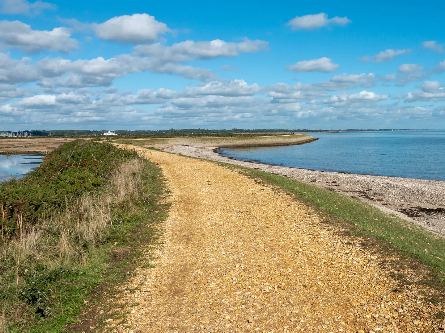
The Solent Way is a 96 km waymarked coastal footpath across Hampshire, England, from Milford on Sea to Emsworth. It is an easy, low-level point-to-point walk, usually taking 4-8 days, with Solent views towards the Isle of Wight for much of the route. Expect seafronts, harbours, salt marshes, country parks, urban sections through Southampton and Portsmouth, and a short inland leg through the southern New Forest. It suits walkers who want coastal variety without big climbs.
Route Overview
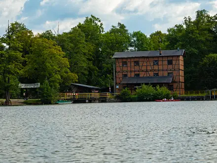
The usual direction is west to east: Milford on Sea to Emsworth. From Milford the route follows Hurst Spit towards Hurst Castle, crosses the Lymington-Keyhaven marshes to Lymington, then turns inland through the southern New Forest via Sowley Pond, Buckler's Hard and Beaulieu to Hythe. The Hythe Ferry links to Southampton; the route then crosses the Itchen Bridge and continues via Netley, Royal Victoria Country Park and Hamble-le-Rice. A small pedestrian ferry crosses to Warsash before the path runs through Titchfield Haven, Lee-on-the-Solent, Gosport, Portsmouth, Southsea, Langstone Harbour and Farlington Marshes to Emsworth. For other coastal routes, compare the Anglesey Coastal Path and Arran Coastal Way.
Maritime history on the Solent Way
The Solent Way was devised by Hampshire County Council in the 1980s as a recreational long-distance route linking the county's Solent coastline. The coast itself has long been strategically important: Henry VIII fortified the Solent at Hurst and Southsea Castles, Buckler's Hard built ships for the Royal Navy, Portsmouth developed into a major naval base, and the Victorians built the Royal Victoria Military Hospital at Netley. Today the route is also part of the E9 European Coastal Path and the King Charles III England Coast Path.
Notable highlights
- Hurst Castle and Hurst Spit: Hurst Castle is an artillery fort at the end of the shingle spit, guarding the western approach to the Solent. Walk the spit or use the seasonal Keyhaven ferry when running.
- Lymington and the Keyhaven marshes: Lymington is a Georgian sailing town reached across lagoons and salt marsh. The reserve is a strong birdwatching section, especially for waders and wildfowl.
- Buckler's Hard and Beaulieu: Buckler's Hard is an 18th-century shipbuilding village on the Beaulieu River. The route continues to Beaulieu in the southern New Forest, near the ruins of Beaulieu Abbey.
- Netley Abbey and Royal Victoria Country Park: Netley Abbey is a substantial ruined Cistercian abbey close to Southampton Water. Nearby Royal Victoria Country Park occupies the grounds of the former military hospital, with its chapel tower still prominent.
- Portsmouth Historic Dockyard and Southsea: Portsmouth is the naval centrepiece of the walk, with historic warships and the Spinnaker Tower close by. The route then follows Southsea seafront past Southsea Castle.
- Langstone and Chichester Harbours: The eastern end skirts tidal harbours, Farlington Marshes and RSPB-managed shores rich in Brent geese and waders, before passing Warblington Castle on the approach to Emsworth.
Challenges to expect
The Solent Way is easy in gradient, with only about 340 m of total ascent, but it is not challenge-free. Long exposed coastal sections can feel tiring in wind or rain, shingle on Hurst Spit is slow underfoot, and urban navigation needs attention. Check ferry times before committing to a stage: the Hurst-Keyhaven ferry is seasonal, and the Hamble pink ferry can affect your day. For a rougher coastal contrast, see the Assynt Coastal Path.
HikeList Score
Solent Way scored 83/100 on HikeList's trail-quality metrics.
See score breakdownHide breakdown
- Ideal length 93
- Balanced challenge 50
- Scenery & wildness 79
- Varied terrain 100
- Accommodation 100
- Food & support 81
- Path quality 84
- Season flexibility 89
Computed from length, challenge, scenery & wildness, terrain variety, accommodation, food & support, path quality and season flexibility.
Show more data Show less
- Coastal
- Urban
- Wetlands
- Forest
- Paved
- Gravel
- Dirt
- Boardwalk
- Hotels
- Guesthouses
- Campsites
- Hostels
- Family Friendly
- Dog Friendly On Leash
- Restrooms
- Picnic Areas
- Public Transport Access Points
In these collections
Photos from hikers
Taken on the trail by people who've reviewed Solent Way.
Reviews
How would you rate Solent Way?
Tap a star to start your review — you could be the first.