Lago Ritom to Piora Valley
How would you rate Lago Ritom to Piora Valley?
Tap a star to share your experience and help other hikers.
Lago Ritom to Piora Valley: Ticino’s High-Lake Walk
HikeList Score
Lago Ritom to Piora Valley scored 80/100 on HikeList's trail-quality metrics.
See score breakdownHide breakdown
- Ideal length 55
- Balanced challenge 100
- Scenery & wildness 98
- Varied terrain 71
- Accommodation 67
- Food & support 72
- Path quality 98
- Season flexibility 76
Computed from length, challenge, scenery & wildness, terrain variety, accommodation, food & support, path quality and season flexibility.
Lago Ritom to Piora Valley is an 8.5 km, 1-day alpine walk in Val Piora, Leventina, Canton Ticino, Switzerland. Most hikers take the Ritom funicular from Piotta to Lago Ritom, then follow waymarked Swiss hiking paths and gravel tracks past Lago di Tom and Lago Cadagno. It is best treated as a moderate half- to full-day route: gradients are mostly gentle, but the altitude, rocky sections and fast-changing mountain weather deserve respect.
Route Overview
Start at the Lago Ritom dam / Ritom funicular upper station, reached from Piotta in the Leventina valley. From there the classic line heads east and north into the Piora Valley, using well-trodden alpine paths and gravel service tracks beside Lago Ritom, then onward towards Lago di Tom, Lago Cadagno, the Alpe Piora dairy and the Centre for Alpine Biology near Capanna Cadagno. The described route is point-to-point through the valley, though signed loop variants around Lago Ritom and Lago Cadagno are also used. For another short Ticino mountain option, compare the Cardada Cimetta Panorama Trail; for a bigger Swiss objective, see the Alpine Pass Route.
Transhumance, Hydropower and Alpine Science
The Piora Valley has long been shaped by summer transhumance, with cattle grazing the high pastures that produce Piora alpine cheese. In 1917, Lago Ritom was dammed as a hydro reservoir to generate power for the Gotthard railway’s Piotta power station. The Ritom funicular was built for that same project and opened to the public in 1921. Since 1994, the Centre for Alpine Biology has made the valley a research site focused especially on Lake Cadagno.
Notable highlights
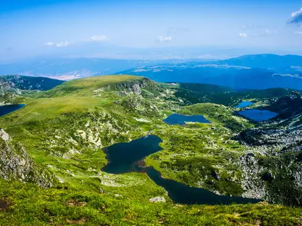
Lago Ritom: The largest lake in the valley and an early-20th-century reservoir near the trailhead. Its blue-green water and dam give the walk an immediate alpine-lake setting.
Ritom funicular: A famously steep public funicular from Piotta, with a maximum gradient of 87.8% and a 785 m vertical rise. It was built in 1917 for the dam works and is the usual access to the start.
Lago di Tom (2,022 m): The highest lake on the standard route and the approximate high point of the walk. It sits in open pasture beneath the surrounding ridges.
Lago Cadagno (1,921 m): A rare meromictic lake whose layers do not fully mix. Its unusual chemistry supports purple sulphur bacteria and makes it important for alpine research.
Alpe Piora dairy and Centre for Alpine Biology: High summer pastures produce prized Piora alpine cheese, while the nearby research station studies Lake Cadagno from restored Alpe Piora buildings.
Wildlife and flora: Summer meadows bring wildflowers, and marmots and chamois are present in the wider valley.
Challenges to expect
This is a short route, but it is still an alpine walk. Expect gravel roads, dirt paths, rocky and uneven sections, and exposed high-valley weather. Navigation is helped by Swiss waymarking and SwitzerlandMobility signage, but variants around the lakes can change distance and time. Check the Ritom funicular operating season, carry layers, and do not treat the paid funicular as a trail permit or fee.
HikeList Score
Lago Ritom to Piora Valley scored 80/100 on HikeList's trail-quality metrics.
See score breakdownHide breakdown
- Ideal length 55
- Balanced challenge 100
- Scenery & wildness 98
- Varied terrain 71
- Accommodation 67
- Food & support 72
- Path quality 98
- Season flexibility 76
Computed from length, challenge, scenery & wildness, terrain variety, accommodation, food & support, path quality and season flexibility.
 Switzerland
Show more data Show less
- Mountainous
- Forest
- Dirt
- Rocky
- Gravel
- Huts
- Lodging
- Campsites
- Family Friendly
- Pet Friendly
- Restrooms
- Water Sources
- Campsites
- Shelters
- Picnic Areas
Photos from hikers
Taken on the trail by people who've reviewed Lago Ritom to Piora Valley.
Reviews
How would you rate Lago Ritom to Piora Valley?
Tap a star to start your review — you could be the first.