Tarnica Summit Trail
How would you rate Tarnica Summit Trail?
Tap a star to share your experience and help other hikers.
Tarnica Summit Trail: A Short, Steep Bieszczady High Point
HikeList Score
Tarnica Summit Trail scored 85/100 on HikeList's trail-quality metrics.
See score breakdownHide breakdown
- Ideal length 55
- Balanced challenge 100
- Scenery & wildness 98
- Varied terrain 89
- Accommodation 83
- Food & support 75
- Path quality 98
- Season flexibility 100
Computed from length, challenge, scenery & wildness, terrain variety, accommodation, food & support, path quality and season flexibility.
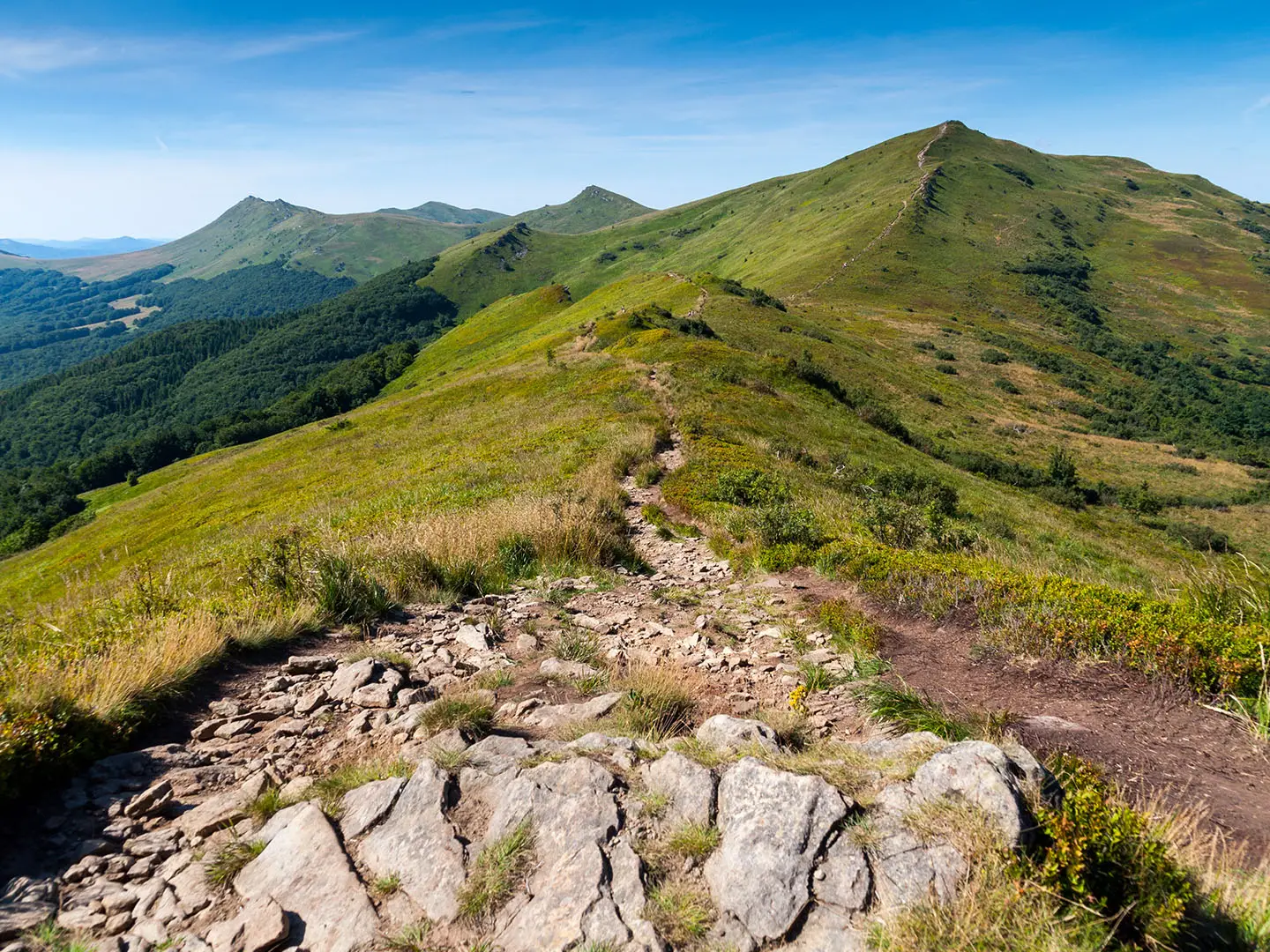
The Tarnica Summit Trail is an 8.5 km out-and-back day hike from Wołosate to Tarnica (1346 m), the highest peak in the Polish Bieszczady Mountains. It is a moderate route: short, well-marked and accessible, but with about 600 m of ascent and a steep, exposed final climb. The standard line follows the blue trail from Wołosate, then a short yellow link to the summit. It suits hikers planning a compact mountain day in Poland, not a hut-to-hut trek.
Route Overview
Start at the Wołosate trailhead, where there is a ticket office, paid car park and toilets. The route climbs on the blue waymarked trail through lower beech woodland and open połoniny meadows towards Przełęcz pod Tarnicą, the pass below the summit. From there, a short yellow section with wooden steps tackles the final steep cone to Tarnica’s summit cross. The listed hike then retraces the same route back to Wołosate. A longer variant can continue over Szeroki Wierch to Ustrzyki Górne, but that is not the standard out-and-back described here. For other Polish mountain days, compare the Giewont Summit Trail and Five Lakes Valley Trail.
Tarnica, John Paul II and the Summit Cross
Tarnica is the symbolic high point of the Polish Bieszczady. Karol Wojtyła, later Pope John Paul II, is recorded as visiting the summit in 1954. A small cross was first placed there in 1979, replaced by a larger one in 1987, and then by the present 8.5 m steel cross in 2000 to mark the Jubilee year and John Paul II’s pontificate. The mountain lies within Bieszczady National Park, established in 1973.
Notable highlights
- Tarnica summit (1346 m): The highest point in the Polish Bieszczady, marked by a tall metal cross and benches. In clear weather, the summit gives wide views over nearby ridges and towards Ukraine and Slovakia.
- Summit cross (8.5 m): The current steel cross was erected in 2000 for the millennium Jubilee and the pontificate of John Paul II. Earlier summit crosses stood here from 1979 and 1987.
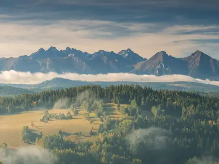
- Połoniny meadows: These open grassy ridge-top pastures are a defining feature of the Bieszczady. They give long views and a bald-summit feel that contrasts with Poland’s more forested mountain ranges.
- Przełęcz pod Tarnicą: The pass below Tarnica is the key junction before the final yellow summit link. Expect the walk to feel steeper and more exposed above this point.
- Szeroki Wierch ridge (1315 m): This broad grassy ridge is used by the alternative red-trail approach from Ustrzyki Górne and is one of the scenic ridge options in the range.
- Bieszczady National Park wildlife: The park is one of Poland’s wildest protected areas, with brown bears, wolves, lynx and European bison recorded in the wider region.
Challenges to expect
The main challenge is gradient: around 600 m of ascent is packed into a short route, and the final yellow section to the summit is steep and exposed. Paths can be muddy or slippery in wet weather, with rockier ground and wooden steps near the top. Winter ascents are possible but can involve deep snow, ice and wind; crampons are recommended. For a longer Polish ridge objective, see the Karkonosze Ridge Trail.
HikeList Score
Tarnica Summit Trail scored 85/100 on HikeList's trail-quality metrics.
See score breakdownHide breakdown
- Ideal length 55
- Balanced challenge 100
- Scenery & wildness 98
- Varied terrain 89
- Accommodation 83
- Food & support 75
- Path quality 98
- Season flexibility 100
Computed from length, challenge, scenery & wildness, terrain variety, accommodation, food & support, path quality and season flexibility.
Show more data Show less
- Mountainous
- Forest
- Meadows
- Dirt
- Grass
- Rocky
- Wooden Steps
- Guesthouses
- Hostels
- Campsites
- Family Friendly
- Pet Friendly
- Restrooms
- Campsites
- Shelters
Photos from hikers
Taken on the trail by people who've reviewed Tarnica Summit Trail.
Reviews
How would you rate Tarnica Summit Trail?
Tap a star to start your review — you could be the first.