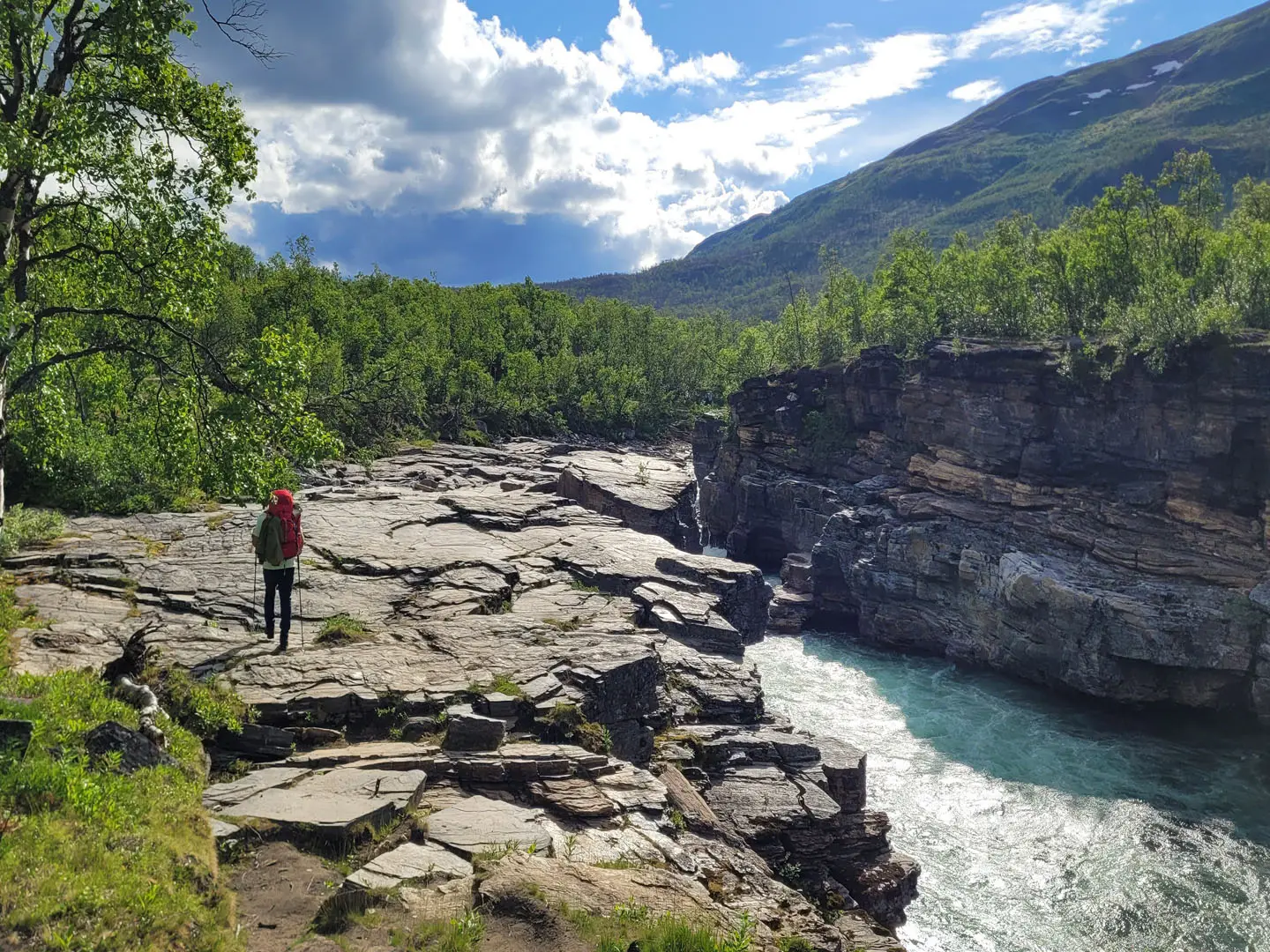
Kungsleden (Abisko to Hemavan)
How would you rate Kungsleden (Abisko to Hemavan)?
Tap a star to share your experience and help other hikers.
Kungsleden (Abisko to Hemavan): A Complete Hiking Guide
HikeList Score
Kungsleden (Abisko to Hemavan) scored 78/100 on HikeList's trail-quality metrics.
See score breakdownHide breakdown
- Ideal length 73
- Balanced challenge 80
- Scenery & wildness 88
- Varied terrain 94
- Accommodation 58
- Food & support 72
- Path quality 98
- Season flexibility 63
Computed from length, challenge, scenery & wildness, terrain variety, accommodation, food & support, path quality and season flexibility.
The Kungsleden is a roughly 440 km point-to-point trek through the mountains of Swedish Lapland, from Abisko to Hemavan. Most end-to-end hikers allow about 21 days, though many walk it in sections. It is rated hard: the path is generally well marked, but the length, remoteness, lake crossings, mosquitoes and fast-changing sub-Arctic weather demand solid multi-day experience. If you want the busiest, most accessible taste of the route, consider the northern Abisko to Kebnekaise section.
Route Overview
The classic direction is north to south, starting at Abisko and finishing in Hemavan. STF divides the trail into five main sections: Abisko–Nikkaluokta, Nikkaluokta/Kebnekaise–Saltoluokta, Saltoluokta–Kvikkjokk, Kvikkjokk–Ammarnas and Ammarnas–Hemavan. Key places on or near the route include Abiskojaure, Alesjaure, Tjaktja, Salka, Singi, Kebnekaise, Vakkotavare, Aktse and Kvikkjokk. This is a point-to-point trail, so plan travel to Abisko and onward travel from Hemavan, plus several lake crossings en route. For another remote northern thru-hike, compare it with Greenland’s Arctic Circle Trail; for a Swedish alternative farther south, see the Höga Kustenleden.
History of the Kungsleden
The Kungsleden was created and developed by the Swedish Tourist Association, STF, which was founded in 1885 by scientists in Uppsala to open up the Swedish mountains. The northern Abisko-to-Vakkotavare section was marked in 1926–27, and the name “Kungsleden” first appeared in 1928. The route was then extended south in stages, reaching Hemavan in 1975 with the creation of the Vindelfjallen Nature Reserve.
Notable highlights
- Tjaktja Pass (about 1,150 m): The highest point on the Kungsleden and the main climb of the northern section. It is a mountain saddle north of Salka with an emergency wind shelter and broad alpine views.
- Kebnekaise massif: Sweden’s highest mountain rises beside the popular northern section near the Kebnekaise mountain station. Many hikers use this area for a side trip or summit attempt.
- Abisko National Park: The northern trailhead sits in Sweden’s oldest national park, known for birch forest, alpine flowers and the Abiskojakka canyon. It is also a well-known northern lights area.
- Sarek National Park and Aktse: The trail skirts Sarek, part of the UNESCO World Heritage Laponian Area and a roadless mountain wilderness. Around Aktse, hikers get classic views towards the Rapadalen valley.
- STF huts and allemansratten: STF huts and mountain stations give shelter and limited resupply along the route, while Sweden’s right of public access allows wild camping in most places.
- Sami culture and reindeer: The trail crosses Indigenous Sami lands and active reindeer-herding country. Reindeer are a common sight in summer, so keep distance and avoid disturbing herds.
Challenges to expect
Expect a long, remote trek rather than a technical mountain route. The path is marked and often bridged or boardwalked, but terrain includes birch forest, wetland, heath, rocky ground and open tundra. Several lakes require rowing or paid motorboat crossings. Weather can change quickly, summer temperatures are cool, mosquitoes can be intense, and resupply and hut space need planning.
HikeList Score
Kungsleden (Abisko to Hemavan) scored 78/100 on HikeList's trail-quality metrics.
See score breakdownHide breakdown
- Ideal length 73
- Balanced challenge 80
- Scenery & wildness 88
- Varied terrain 94
- Accommodation 58
- Food & support 72
- Path quality 98
- Season flexibility 63
Computed from length, challenge, scenery & wildness, terrain variety, accommodation, food & support, path quality and season flexibility.
 Sweden
Show more data Show less
- Mountainous
- Forest
- Wetland
- Tundra
- Dirt
- Rocky
- Boardwalk
- Huts
- Wild Camping Spots
- Family Friendly
- Pet Friendly
- Restrooms
- Water Sources
- Campsites
- Shelters
Download Our Full Guide to Kungsleden (Abisko to Hemavan) FREE!
Get our comprehensive guide to this hike for free. Save it for later reading or print out at home.
In these collections
Photos from hikers
Taken on the trail by people who've reviewed Kungsleden (Abisko to Hemavan).
Kungsleden (Abisko to Hemavan): The Complete Guide
 i
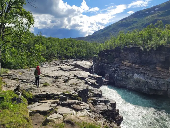
Image by Max
i
Image by Max Kungsleden is Sweden’s great long-distance fell trail: a roughly 440 km point-to-point journey from STF Abisko Turiststation to Hemavan through the mountains of Swedish Lapland. It suits experienced multi-day hikers who want a remote Arctic and sub-Arctic trek that is waymarked, hut-supported in places, but still genuinely committing.
The route begins inside Abisko National Park, with views towards Lapporten, then runs south through open tundra, birch forest, lake country, mire and high glacial valleys. The northern section crosses Tjäktja Pass, the highest point of the trail at about 1,150 m, before continuing past the Kebnekaise area and towards the transport break at Vakkotavare, Kebnats and Saltoluokta.
Further south, Kungsleden skirts the edge of Sarek and passes classic mountain viewpoints near Aktse, then reaches Kvikkjokk before the loneliest part of the walk. The hut-free stretch towards Ammarnäs is the section that turns this from a hut-to-hut trek into a serious backcountry undertaking.
This is not a technical mountain route, but the difficulty comes from length, remoteness and logistics. Expect lake crossings, bus and boat links, limited resupply, boggy ground, rocky trail, fast-changing weather, mosquitoes in high summer and the need to carry a tent and food on key sections.
This guide covers stages, days, accommodation, food, transport, terrain and the common mistakes to avoid.
Stage-by-Stage Guide
The stages below follow the 21-day Abisko → Hemavan schedule used on this guide. Treat it as an ambitious continuous itinerary: boat times, hut opening dates, weather delays and food carries can all force changes, especially south of Kvikkjokk.
Across the whole route, the Kungsleden is waymarked with cairns, red-painted markers and posts, with boardwalks and bridges where provided. In poor visibility above the treeline, do not rely on waymarks alone; carry proper mapping and know how to use it.
Stage 1: Abisko Turiststation to Abiskojaure — 15 km
The opening stage leaves STF Abisko Turiststation, beside the Malmbanan railway, and heads into Abisko National Park. This is a relatively forgiving start by Kungsleden standards, with a clear marked trail, birch forest sections and views back towards Lapporten / Tjuonavagge.
Underfoot, expect a mix of firm path, occasional wet ground and boardwalk where the trail crosses mire. The stage is not technically difficult, but it is the first day of a remote route, so it is worth starting with a full mountain kit rather than treating it as a valley walk.
Abiskojaure is within the northern STF hut chain, so most walkers plan either hut accommodation or camping nearby. Food services and hut opening dates vary by season; this should be checked before travelling. Water is generally frequent in this lake-and-river landscape, but carry enough between reliable sources and treat water if preferred.
Public transport access is excellent at the start: the train stops opposite Abisko Turiststation. Once on the trail, there is no simple road-access bailout before Abiskojaure, so navigation should still be taken seriously if cloud, rain or early-season snow patches affect visibility.
Stage 2: Abiskojaure to Alesjaure — 21 km
This is a longer northern-stage day, moving deeper into open fell country. The route gradually leaves the more sheltered feel of Abisko and enters broader Arctic valleys with bigger views, lakes and exposed weather.
The walking is generally on a marked mountain path with stretches of wet ground and boardwalk. It is not a steep stage, but 21 km with a multi-day pack can feel substantial, particularly in headwinds or heavy rain.
Alesjaure is another key STF hut stop on the Abisko section. It is a practical overnight point for hut users and campers, but do not assume unlimited space or a full resupply; check current STF services before travelling and carry enough food for the next stages.
There is no routine road access on this stage. In clear weather the route is straightforward to follow, but the openness means poor visibility can make distance judgement and waymark spotting harder.
Stage 3: Alesjaure to Tjäktja — 13 km
This shorter stage positions you below the highest part of the whole Kungsleden. The terrain becomes stonier and more exposed as the trail approaches the Tjäktja area, with the character shifting from valley walking towards high-pass terrain.
The path remains marked, but underfoot conditions can be rougher than the first two days. Snow can linger in this northern section into early summer, especially near higher ground, so early-season walkers should allow extra time and carry appropriate equipment.
Tjäktja is part of the STF hut network, making it the logical stop before crossing Tjäktja Pass. Hut capacity, seasonal opening and any food provision should be checked before travelling; camping remains an important fallback throughout the route.
There is no road access. Navigation is usually simple in clear weather, but this is a stage where the consequences of bad visibility and cold wind begin to increase.
Stage 4: Tjäktja to Sälka — 12 km
This is one of the defining days of the northern Kungsleden. The route crosses Tjäktja Pass / Tjäktjapasset, the highest point on the entire trail at about 1,150 m, before descending towards Sälka.
Expect rockier, more exposed ground than on the earlier stages. The pass has an emergency wind shelter at the top, but it should be treated as emergency infrastructure, not as a planned rest stop or accommodation.
Lingering snow is possible early in the season, and weather can change quickly on the pass. In strong wind, low cloud or cold rain, this short distance can take longer than expected, so start with spare food, warm layers and a realistic turnaround mindset.
Sälka is a major overnight point in the STF hut chain. It is also a natural place to regroup after the pass, but hut services and availability should be checked before travelling, especially in peak season.
Stage 5: Sälka to Singi — 13 km
From Sälka the trail continues through open mountain country towards Singi. The walking is generally less dramatic than Tjäktja Pass but remains remote, exposed and weather-dependent.
The path is waymarked and usually clear, with a mixture of dirt trail, stones and wet sections. Reindeer may be encountered throughout this part of Sápmi; keep distance, avoid approaching animals and stay on the marked route.
Singi is an important junction area. The main Kungsleden continues south, while the Kebnekaise / Nikkaluokta area is the key side route and exit corridor associated with Sweden’s highest mountain; the Kungsleden itself does not summit Kebnekaise.
Accommodation is normally planned around the STF hut or camping. For walkers leaving via Nikkaluokta, bus 92 links Nikkaluokta with Kiruna, but current timetables should be checked before travelling.
Stage 6: Singi to Kaitumjaure — 14 km
This stage commits to the main southbound Kungsleden rather than the Kebnekaise/Nikkaluokta exit. It is a quieter-feeling mountain day through broad fell and lake country, with fewer casual walkers than the Abisko–Kebnekaise corridor.
The route is marked and not especially steep, but conditions can be boggy, rocky and slow in places. Boardwalks help over some wet ground, but should not be assumed everywhere.
Kaitumjaure is an STF hut stop, with camping commonly used as part of the same overnight pattern. Food and hut services are limited compared with a town or mountain station, so carry planned meals and confirm what is available before relying on it.
There is no road access on this stage. In poor visibility, keep checking the line rather than following worn side tracks or reindeer paths.
Stage 7: Kaitumjaure to Teusajaure — 9 km
This is a short stage on paper, which makes it useful for recovery, weather management or aligning with lake-crossing logistics. The country remains remote and open, with lake and fell views typical of the central-northern Kungsleden.
Short distance does not mean trivial conditions. Wet ground, rocky tread and bad weather can still slow progress, and mosquitoes can be intense in summer, especially near water and sheltered vegetation.
Teusajaure is both an overnight point and an important lake-crossing location on the route. The Kungsleden includes unavoidable boat crossings, and Teusajaure is one of the crossings that must be planned rather than treated as a minor detail.
Accommodation is normally hut or tent based. Boat arrangements, operating dates and any motorboat options should be checked before travelling, as a missed crossing can affect the next day’s plan.
Stage 8: Teusajaure to Vakkotavare — 15 km
This stage links the Teusajaure area with Vakkotavare, the end of the walking section before the road-and-boat transfer to Saltoluokta. It is a classic Kungsleden logistics day: mountain walking first, then transport planning becomes the main issue.
The trail remains waymarked through remote fell terrain, with the usual mixture of path, wet ground and rocky sections. After the lake-crossing logistics around Teusajaure, allow enough time to reach Vakkotavare without rushing.
Vakkotavare sits by the transport gap that connects this section with Saltoluokta. From here, walkers use the road link towards Kebnats and then the M/S Langas passenger boat across Lake Langas to Saltoluokta.
Check bus and boat timetables before relying on this connection. If timings do not align, Vakkotavare may become an enforced overnight or waiting point, so carry enough food and flexibility.
Stage 9: Vakkotavare to Saltoluokta — 17 km including bus and M/S Langas boat
This is not a normal continuous walking stage. The Kungsleden is interrupted here by the Vakkotavare–Kebnats road section and the M/S Langas boat crossing to Saltoluokta, on the edge of Stora Sjöfallet National Park.
Plan the day around transport first, walking second. A scenic bus runs the road section from Vakkotavare to Kebnats, then M/S Langas crosses Lake Langas to Saltoluokta; bus 93 is the relevant connection for the train–Saltoluokta/Vakkotavare corridor.
Saltoluokta is a major STF mountain station and one of the most useful reset points on the trail. It is a logical place for food, laundry, a rest day or a change of plan, but booking rules, prices and services should be checked before travelling.
Because this day depends on fixed transport, delays or missed connections can have more impact than a slow walking day. Keep food reserves until Saltoluokta is actually reached, not merely until Vakkotavare.
Stage 10: Saltoluokta to Sitojaure — 20 km
South of Saltoluokta the trail returns to open walking, leaving the relative comfort of a mountain station for the quieter Saltoluokta–Kvikkjokk section. Expect a proper full day with broad fell terrain, wet ground and lake country.
The route is marked and part of the established Kungsleden, but 20 km is still a demanding pack-carrying day. Boardwalks help across some mire, while other sections may be rough or muddy depending on weather.
Sitojaure is both an overnight point and a lake-crossing area. Boat logistics are a defining feature of this part of the trail, so check current arrangements and carry enough cash/card options as appropriate; exact payment arrangements should be checked before travelling.
Accommodation is hut or tent based, not town based. Do not leave Saltoluokta under-supplied simply because this section has huts: food availability is limited and seasonal.
Stage 11: Sitojaure to Aktse — 13 km
This stage continues through lake-and-fell terrain towards Aktse, one of the most important locations on the Kungsleden because of its proximity to Skierffe and the Rapadalen viewpoint. The marked route runs near the edge of Sarek National Park; it does not cross Sarek on the main line.
The walking distance is moderate, but the day can be shaped by boat arrangements around Sitojaure and the approach to Aktse. Wet ground, boardwalks and uneven path are all part of the normal underfoot mix.
Aktse is a key overnight stop, with hut/camping planning and potential side-trip interest. The Skierffe viewpoint is the classic highlight near here, giving views over Rapadalen and towards the Pårte massif, but it should be treated as an additional mountain objective, not an automatic part of a short day.
Food and hut services should be checked before travelling. If planning Skierffe as well as the main route, build in spare time for weather and do not underestimate the exposed nature of higher ground.
Stage 12: Aktse to Pårte — 22 km
This is one of the longer stages in the 21-day schedule and should be treated as a serious mountain day. It moves through the wilderness borderland beside Sarek, with large-scale scenery and limited escape options.
The route includes the practical complications of lake-country travel, including the Laitaure area near Aktse. Boat times and arrangements must be checked before travelling, as they can determine how early and how efficiently the day begins.
Underfoot, expect typical Kungsleden variety: dirt path, bog, boardwalk, rocky sections and bridges. After rain, progress can be slower than the distance suggests, and mosquitoes may be a real nuisance in sheltered wet areas during summer.
Pårte is the overnight point before the final approach to Kvikkjokk. Hut or tent planning applies, but carry sufficient food to reach Kvikkjokk even if services are limited or the day takes longer than expected.
Stage 13: Pårte to Kvikkjokk — 18 km
The route continues south to Kvikkjokk, a major psychological and logistical milestone. This is the final stage before the least-serviced part of the Kungsleden, so it is more than just another walking day.
Terrain remains mixed, with forest, wet ground and mountain-path sections. Compared with the high passes of the north, the challenge is less about altitude and more about distance, pack weight, damp ground and cumulative fatigue.
Kvikkjokk has a mountain station and is the last STF resupply point before the long hut-free stretch towards Ammarnäs. Use it to reassess food, fuel, footwear, weather and timings; the next section demands a much higher level of self-sufficiency.
Bus 94 links Kvikkjokk with the Murjek night-train station. Anyone ending or starting a section here should check current timetables before travelling, as missed buses can disrupt onward plans.
Stage 14: Kvikkjokk to Tsielekjåkk — 17 km
South of Kvikkjokk the character of the trail changes sharply. This is the start of the remote Kvikkjokk–Ammarnäs section, which has no STF huts and requires a tent, food-carrying and more independent judgement.
The stage heads into quieter country associated with Pieljekaise National Park and the long wilderness gap. Expect fewer walkers, less infrastructure and a more committing feel than the hut-linked northern stages.
Tsielekjåkk is not part of the STF hut chain. Accommodation planning should be based on tenting or any non-STF cabin arrangements that have been checked before travelling; do not assume the hut-to-hut rhythm continues here.
Navigation remains on the Kungsleden, but the consequences of a mistake or delay are greater because support is sparse. Carry enough food for the wider Kvikkjokk–Ammarnäs crossing, not just this single stage.
Stage 15: Tsielekjåkk to Vuonatjviken — 16 km
This stage continues through the least-hiked part of the Kungsleden. The walking is not technical, but the remoteness, reduced hut infrastructure and food-carrying make it one of the more demanding parts of the full trail.
The route crosses a mix of forest, mire, fell and lake-influenced terrain. Path conditions can be slower than the distance implies, particularly where ground is wet or overgrown compared with the more popular northern sections.
Vuonatjviken is one of the useful named places on this hut-free section, but it should not be treated like an STF mountain station. Accommodation, food and onward boat arrangements in this area should be checked before travelling.
The wider Kvikkjokk–Ammarnäs section includes important lake crossings, including Lake Sakkat, Lake Riebnes and Kapellströmmarna. Some crossings need advance booking, so this part of the itinerary should be fixed before leaving Kvikkjokk.
Stage 16: Vuonatjviken to Ammarnäs — 21 km
This stage brings the itinerary to Ammarnäs, the key resupply and reset point before the final southern section to Hemavan. In practice, the broader Kvikkjokk–Ammarnäs traverse is a long, hut-free undertaking, and this stage should be fitted into a realistic multi-day plan rather than viewed in isolation.
Jäkkvik and Adolfström are important planning names on the wider stretch between Kvikkjokk and Ammarnäs. Any accommodation, shop, boat or transport options around these settlements should be checked before travelling.
The terrain remains varied, with forest, mires, lake crossings and open mountain sections. After several days without the STF hut network, food management, stove fuel and dry sleeping kit become central safety considerations.
Ammarnäs is a historic Sami village and a major Kungsleden staging point on the edge of the Vindelfjällen Nature Reserve. It is the place to restock, dry kit, check weather and reset for the final Ammarnäs–Hemavan section.
Stage 17: Ammarnäs to Serve via Aigert — 20 km
From Ammarnäs the trail enters the southern Kungsleden through Vindelfjällen, one of Europe’s largest protected areas and an active South Sami mountain landscape. The route begins to feel more structured again after the hut-free central wilderness.
The itinerary passes via Aigert before continuing to Serve. Combining these places into one day makes for a meaningful stage, so start early and allow for slow ground or bad weather.
The path is waymarked, with open fell, heath, wet ground and boardwalked sections where provided. As throughout Sápmi, give reindeer space and avoid disturbing herds or working dogs if encountered.
Serve is part of the southern hut-stage pattern. Hut accommodation and camping are the normal planning options, but opening dates, capacity and food availability should be checked before travelling.
Stage 18: Serve to Tärnasjö / Tärnasjön — 14 km
This is a moderate-distance day through the Vindelfjällen section, moving towards the Tärnasjö / Tärnasjön area. The landscape is typically open and water-rich, with mountain heath, mires and lake views.
The walking is waymarked and generally non-technical, but wet ground can still make it tiring. Boardwalks reduce the worst bog in places, though they can be slippery when wet or frosty.
Tärnasjö is the overnight target and sits within the southern hut-and-camp rhythm of the trail. Food supplies should still be treated as limited and seasonal; confirm hut services before relying on them.
Road access is not a normal feature of this stage. In mist or rain, stay alert to marker spacing across open ground and avoid drifting onto informal tracks.
Stage 19: Tärnasjö / Tärnasjön to Syter — 14 km
The route continues south through the Vindelfjällen mountains towards Syter. This is a manageable-distance stage, but the remoteness and weather exposure remain real.
Expect a mix of path, wetland crossings, heath and rocky mountain trail. The ground can be tiring after rain, and mosquitoes may still be present in summer around wet or sheltered areas.
Syter is the overnight point before the approach to the Syterskalet / Viterskalet landscape. Hut or tent accommodation is the normal basis, with services to be checked before travelling.
Navigation is usually straightforward on the marked line, but the southern fells can still become disorientating in low cloud. Keep map position updated rather than waiting until visibility deteriorates.
Stage 20: Syter to Viterskalet — 12 km
This is one of the scenic highlights of the southern Kungsleden, leading into the Syterskalet / Viterskalet area below Norra Storfjället. The U-shaped valley is among the finest mountain scenery on the southern half of the trail.
Although the distance is short, the terrain is exposed and mountain weather can dominate the day. Wind, rain or low cloud can make the valley feel far more serious than the kilometre figure suggests.
The path is marked, with rocky sections and open fell walking. Take care on wet stone and boardwalk where present, and avoid being pushed into a late finish by spending too long on viewpoints in deteriorating weather.
Viterskalet is the final overnight point before Hemavan. Accommodation and food services should be checked before travelling, particularly at the beginning or end of the hut season.
Stage 21: Viterskalet to Hemavan — 11 km
The final stage descends from the mountains to Hemavan and STF Hemavan Fjällstation, the southern trailhead of the full Kungsleden. It is short by the standards of the route, but still deserves normal mountain attention until the village is reached.
The day starts in fell terrain and gradually transitions towards the ski village environment of Hemavan. Path conditions can include rocky trail, wet ground and boardwalk, depending on the exact line and recent weather.
Hemavan is the best-served finish point on the southern end, with accommodation, onward transport options and Hemavan Tärnaby airport nearby. Buses and flights to Stockholm Arlanda should be checked before booking a finishing itinerary.
Do not plan tight onward connections on the same day unless there is enough buffer for weather, sore feet or a delayed start from Viterskalet. The Kungsleden may be well marked, but the final kilometres are still part of a remote mountain route until the trailhead is reached.
Recommended Itinerary
The 21-day itinerary below is a fast, continuous end-to-end schedule for fit, experienced walkers. It works best as a planning skeleton rather than a rigid booking plan: boat crossings, hut availability, bus links and weather can all force changes, especially outside the busier summer period.
Build in spare days if possible. The Kvikkjokk–Ammarnäs section needs particular care because there are no STF huts for the hut-free wilderness stretch and food, camping and boat arrangements become much more important.
Standard 21-day itinerary
| Day | From | To | Approx. distance | Why this stage makes sense | Services/accommodation notes |
|---|---|---|---|---|---|
| 1 | Abisko / STF Abisko Turiststation | Abiskojaure | 15 km | A straightforward first day from the northern trailhead, giving time to arrive by train and settle into the rhythm of the marked route. | STF accommodation at Abisko Turiststation before starting; hut/camping-style mountain accommodation on the route. Book or check current hut arrangements before travelling. |
| 2 | Abiskojaure | Alesjaure | 21 km | A longer northern-stage day through open Arctic fell terrain, still within the well-used hut network. | STF hut network continues, but places are limited and can be busy in peak season. Carry food rather than relying on hut shops alone. |
| 3 | Alesjaure | Tjäktja | 13 km | A shorter day positions you below the highest part of the Kungsleden before crossing Tjäktja Pass. | Hut/camping options in the STF system. This is a useful place to pause if conditions are poor before the pass. |
| 4 | Tjäktja | Sälka | 12 km | Crosses Tjäktja Pass, the highest point of the trail at about 1,150 m, then drops towards Sälka. The shorter distance is sensible because the pass is rockier, exposed and can hold snow early in the season. | Emergency wind shelter at Tjäktja Pass. Do not treat this as accommodation; it is for bad-weather safety. STF hut/camping options at Sälka. |
| 5 | Sälka | Singi | 13 km | A moderate stage through classic northern Kungsleden terrain, with good spacing between huts. | STF hut network. Kebnekaise and Nikkaluokta are linked to this northern area, but the main end-to-end line continues towards Kaitumjaure. |
| 6 | Singi | Kaitumjaure | 14 km | Keeps to the main Kungsleden rather than exiting towards Nikkaluokta, maintaining progress south into quieter country. | STF hut/camping style accommodation. Check current services if planning to buy provisions. |
| 7 | Kaitumjaure | Teusajaure | 9 km | A deliberately short stage, useful for managing lake-crossing logistics and recovery after the first week. | STF hut network. Teusajaure is one of the key lake-crossing areas; current rowing-boat and motorboat arrangements should be checked before travelling. |
| 8 | Teusajaure | Vakkotavare | 15 km | Completes the walking section to the road at Vakkotavare, setting up the transport link to Saltoluokta. | STF hut/camping options are available around the northern network, but Vakkotavare is a transport point as much as an overnight stop. Check bus times before committing to the next day. |
| 9 | Vakkotavare | Saltoluokta | 17 km | This is the logistical link day: bus from Vakkotavare towards Kebnats, then the M/S Langas passenger boat across Lake Langas to Saltoluokta. | Not a normal walking-only stage. Bus and M/S Langas timetables are seasonal and must be checked before travelling. Saltoluokta is a useful rest, food and reset point. |
| 10 | Saltoluokta | Sitojaure | 20 km | Re-enters the fell route south of Saltoluokta and makes a solid start on the Saltoluokta–Kvikkjokk section. | STF hut network resumes. Expect lake and boat logistics in this part of the trail, including Sitojaure. |
| 11 | Sitojaure | Aktse | 13 km | A shorter stage gives time for boat arrangements and positions you near one of the finest areas beside Sarek. | STF hut/camping options. Aktse is the base area for the Skierffe/Rapadalen viewpoint; allow extra time if adding that side objective. |
| 12 | Aktse | Pårte | 22 km | One of the longer standard days, crossing more remote terrain between established stopping points. | STF hut/camping options. Start early and keep food and wet-weather layers accessible. |
| 13 | Pårte | Kvikkjokk | 18 km | Reaches Kvikkjokk, a major psychological and logistical breakpoint before the hardest planning section of the trail. | Kvikkjokk is the key place to reorganise before the hut-free stretch to Ammarnäs. Stock up and check boat arrangements before leaving. |
| 14 | Kvikkjokk | Tsielekjåkk | 17 km | Begins the least-hiked and most self-reliant part of the Kungsleden. The day is moderate, but the commitment level rises sharply. | No STF hut chain on the Kvikkjokk–Ammarnäs wilderness section. Tent, stove and sufficient food are essential. |
| 15 | Tsielekjåkk | Vuonatjviken | 16 km | Continues through the hut-free southern wilderness block, where progress depends more on self-sufficiency than on fixed hut spacing. | Limited non-STF cabins/villages exist in this broader section. Boat crossings such as those around Sakkat, Riebnes and Kapellströmmarna may require advance booking. This should be checked before travelling. |
| 16 | Vuonatjviken | Ammarnäs | 21 km | Reaches Ammarnäs, the key resupply and reset point before the final STF-served southern section. | Treat the whole Kvikkjokk–Ammarnäs block as the section most likely to need extra days. Many walkers use intermediate stops around Jäkkvik and Adolfström; exact distances and arrangements should be checked on official mapping before booking. |
| 17 | Ammarnäs | Serve, via Aigert | 20 km | Starts the final Ammarnäs–Hemavan section through Vindelfjällen, with the route becoming more structured again after the wilderness gap. | STF hut network returns, including the Aigert/Serve area. Ammarnäs is the place to resupply before committing to the final section. |
| 18 | Serve | Tärnasjö / Tärnasjön | 14 km | A moderate hut-to-hut day across the southern mountains, easier to manage after the long central wilderness section. | STF hut/camping options. Check current hut opening dates, especially near the start or end of the season. |
| 19 | Tärnasjö / Tärnasjön | Syter | 14 km | Keeps the final section steady and leaves time to handle weather or slower ground without overreaching. | STF hut/camping options. Continue carrying enough food for delays rather than relying on perfect hut spacing. |
| 20 | Syter | Viterskalet | 12 km | A shorter day through the Syterskalet/Viterskalet area, one of the strongest scenic sections near the southern end. | STF hut/camping options. Exposed weather can still matter this close to the finish. |
| 21 | Viterskalet | Hemavan / STF Hemavan Fjällstation | 11 km | A short final stage into Hemavan, leaving time for onward bus or flight logistics if timetables align. | Finish at STF Hemavan Fjällstation in Hemavan. Hemavan has bus connections and Hemavan Tärnaby airport; onward transport should be checked before travelling. |
Slower variant
A slower itinerary is the better choice for most independent hikers walking the full Abisko–Hemavan route. Plan closer to four weeks by adding rest, resupply and weather days at natural breakpoints such as Saltoluokta, Kvikkjokk and Ammarnäs.
This variant particularly suits walkers carrying heavier camping gear, anyone new to Arctic hut-and-tent travel, and hikers who want time for the Skierffe viewpoint near Aktse or for weather delays around Tjäktja Pass. It also gives more realistic flexibility through the Kvikkjokk–Ammarnäs stretch, where the absence of STF huts, limited services and boat bookings make a rigid 21-day schedule risky.
Faster variant
A faster itinerary is only sensible for very fit, experienced mountain hikers who are comfortable linking stages, carrying food efficiently and wild camping when hut spacing or availability does not work. It leaves little margin for storms, missed boats, full huts or transport delays.
For most walkers, the standard 21-day plan is already ambitious. Any faster schedule should be built from official maps and current boat, bus and hut information rather than by simply compressing the table above.
Planning the Route
Plan Kungsleden as a series of linked mountain sections rather than as a simple continuous footpath with a bed every night. The marked trail is generally clear, but the itinerary is controlled by hut spacing, lake crossings, the Vakkotavare–Saltoluokta road-and-boat link, food carries and the long hut-free stretch between Kvikkjokk and Ammarnäs.
A 21-day end-to-end schedule is an ambitious continuous thru-hike. Most walkers should allow closer to 3–4 weeks for the full Abisko to Hemavan route, especially if relying on public transport, boats, hut places or a weather window for the higher and more exposed northern sections.
Choosing a pace
The Kungsleden is rarely technically steep, so daily planning is less about big climbs and more about how far it is safe and realistic to move through remote fell terrain. Bog, boardwalk, rocky ground, wind, rain, mosquitoes and boat timings can all make a nominally moderate day feel slow.
The STF hut chain naturally sets many stages in the north and south, with huts generally spaced around 10–20 km apart. This makes a steady hut-to-hut rhythm possible on sections such as Abisko–Saltoluokta, Saltoluokta–Kvikkjokk and Ammarnäs–Hemavan, provided the huts are open and have space.
The exception is Kvikkjokk–Ammarnäs. There are no STF huts on the long wilderness section, only a few non-STF cabins or villages such as Tsielekjåkkstugan, Vuonatjviken, Jäkkvik and Adolfström. This part needs separate planning for tent nights, food, boat bookings and longer self-reliant carries.
Planning by section
STF divides the Kungsleden into five main sections. This is the most practical way to plan the full trail, even for a continuous end-to-end walk.
| Section | Planning notes |
|---|---|
| Abisko–Nikkaluokta | The most popular northern section, with regular STF huts and access by train to Abisko. Tjäktja Pass is the high point of the whole trail and can hold snow early in the season. |
| Nikkaluokta–Saltoluokta | A more logistically involved section, with bus links around the road gap and the M/S Langas passenger boat across Lake Langas to Saltoluokta. |
| Saltoluokta–Kvikkjokk | Hut-supported mountain and lake country, including key boat crossings and the approach towards the Sarek borderland near Aktse and Pårte. |
| Kvikkjokk–Ammarnäs | The committing section. No STF huts, limited services, major food-carrying and boat logistics, including crossings around Lake Sakkat, Lake Riebnes and Kapellströmmarna that need advance planning. |
| Ammarnäs–Hemavan | A strong final section through Vindelfjällen, again with STF huts and a natural hut-to-hut rhythm via Aigert, Serve, Tärnasjö, Syter and Viterskalet. |
Section hiking is very practical and is how many walkers experience the Kungsleden. Abisko, Nikkaluokta, Saltoluokta, Kvikkjokk, Ammarnäs and Hemavan are the key planning points for joining, leaving or splitting the route, but onward transport should always be checked before fixing dates.
Accommodation and food strategy
A tent is strongly recommended for the full route and is essential for the Kvikkjokk–Ammarnäs section. Sweden’s right of public access, allemansrätten, makes wild camping a core part of Kungsleden planning, but camping must still be done responsibly and with care around huts, villages, reindeer and protected areas.
STF operates a chain of mountain huts and mountain stations on much of the trail, with 16 huts on the route. They are limited, first-come in many contexts and busy in peak season, so hut-based walkers need a backup plan rather than assuming a bed will always be available.
Food planning should be section-based. Manned STF huts and mountain stations can reduce the amount carried on the hut-supported parts, but the range, prices and opening dates vary and should be checked before travelling. Kvikkjokk is the last STF resupply before the long hut-free stretch to Ammarnäs, so that section demands the most careful food carry.
STF membership may be worthwhile for hut users, depending on the number of nights and current pricing. Current hut opening dates, booking options and prices should be checked before committing to an itinerary.
Boats, buses and transport gaps
The Kungsleden is not walked continuously on foot from Abisko to Hemavan without interruptions. Boat crossings and public transport links are part of the route logistics, not optional extras.
Important planned links include the bus from Vakkotavare to Kebnats and the M/S Langas boat across Lake Langas to Saltoluokta. Bus 92 links Nikkaluokta and Kiruna, bus 93 connects with the Stockholm train for the Saltoluokta/Vakkotavare area, and bus 94 links Murjek night-train station with Kvikkjokk.
Lake crossings such as Teusajaure, Laitaure, Sitojaure and the Kaskajaure/Kåbtajaure lakes are unavoidable. Some crossings use rowing boats, others have paid motorboat options, and southern crossings such as Lake Sakkat, Lake Riebnes and Kapellströmmarna need advance booking. Timetables and availability are seasonal and should be checked before travelling.
Reaching the northern trailhead is comparatively straightforward: the Malmbanan / Iron Ore Line train stops opposite STF Abisko Turiststation. Leaving Hemavan is possible by bus or by flying from Hemavan Tärnaby airport to Stockholm Arlanda, but schedules should be checked before booking accommodation or return travel.
Weather, season and flexibility
The main hiking season is roughly mid-June to the end of September, with STF huts typically operating from late June to mid-September. Early season can bring lingering snow around Tjäktja Pass, while July is busier and brings intense mosquitoes. Late August and September usually mean fewer insects and autumn colour, but also shorter days and a greater need to watch weather windows.
Build flexibility into the plan. A tight end-to-end schedule can be disrupted by poor weather, a missed boat, a full hut, a bus connection or slower-than-expected ground through bog and rock. The more remote the section, the less margin there is for improvising food, shelter or transport.
Navigation is helped by cairns, red-painted markers, posts, bridges and boardwalks, but this remains an Arctic and sub-Arctic mountain route. Carry proper maps, a reliable navigation method and the ability to continue safely if mist, snow patches, rain or wind make the waymarks harder to follow.
Permits are not the main planning constraint for most walkers; logistics are. The important checks are hut openings, food availability, boat and bus timetables, current prices, weather conditions and any local rules in national parks, nature reserves or reindeer-herding areas. This should be checked before travelling.
Towns, Villages and Overnight Stops
On the Kungsleden, many “overnight stops” are mountain huts rather than towns. The main planning distinction is between STF mountain stations, STF huts, and the hut-free Kvikkjokk–Ammarnäs section, where a tent and a longer food carry are essential.
STF huts are self-catering, seasonal and limited in capacity. Opening dates, prices, food availability, boat links and booking requirements should be checked before travelling, especially outside the main summer season.
Abisko (STF Abisko Turiststation)
Abisko is the northern trailhead, with the Kungsleden starting beside STF Abisko Turiststation in Abisko National Park. It is the most straightforward place to spend the night before starting, as the Malmbanan / Iron Ore Line train stops opposite the tourist station.
Use Abisko for final packing, weather checks and any last-minute logistics before committing to the northern huts. Food and other services at the station can change by season, so current availability should be checked before relying on it.
Abiskojaure
Abiskojaure is the first regular overnight stop south of Abisko and a useful first-day target. It sits within the STF hut chain, making it a natural introduction to the hut-to-hut rhythm of the northern Kungsleden.
There is no road access or wider village service here. Treat it as a mountain hut or camping stop, with self-catering food plans rather than a place to shop properly.
Alesjaure
Alesjaure is one of the key hut stops on the popular northern section. It breaks the longer early stages between Abiskojaure and the higher ground towards Tjäktja.
This is a practical overnight rather than a resupply town. Expect basic hut/camping logistics, and check current STF opening and any limited provisions before building a food plan around it.
Tjäktja
Tjäktja is the hut stop before the high crossing of Tjäktjapasset, the highest point on the Kungsleden. It is a useful place to stop before committing to the rockier, more exposed pass.
There are no settlement services or transport links. In poor weather, staying here rather than pushing over the pass can be the sensible decision.
Sälka
Sälka sits south of Tjäktja Pass and is a common overnight after the highest section of the trail. It is part of the STF hut network and works well as a recovery stop after a rough or snowy crossing early in the season.
Plan on self-catering. Do not assume full food resupply unless current STF hut services have been checked.
Singi
Singi is an important junction area for walkers deciding whether to continue south on the main Kungsleden line or head towards the Kebnekaise/Nikkaluokta area. It is a logical overnight before the route continues towards Kaitumjaure.
Accommodation is hut/camping based. There are no road or town services at the hut itself, so food and transport decisions need to be made before reaching this point.
Kebnekaise (STF Kebnekaise Fjällstation) / Nikkaluokta
Kebnekaise Fjällstation and Nikkaluokta are the main off-line service option for walkers using the classic Abisko–Nikkaluokta section rather than staying on the continuous Abisko–Hemavan line at Singi. Kebnekaise is also the base area for the separate Kebnekaise summit objective; the Kungsleden itself does not summit the mountain.
Nikkaluokta is linked to Kiruna by bus 92, making it a useful access or exit point for section hikers. Kiruna is the northern regional hub for onward trains and flights, so this is one of the most practical places to leave or join the northern Kungsleden.
Kaitumjaure
Kaitumjaure is a remote STF hut stop on the continuation south from Singi. It provides a useful overnight between the Kebnekaise/Singi area and Teusajaure.
There are no village services or public transport links here. Treat it as a self-catering mountain stop, with camping as a backup if huts are busy or full.
Teusajaure
Teusajaure is both an overnight stop and a lake-crossing point. The Kungsleden’s boat crossings are part of the route logistics, and Teusajaure is one of the places where timing can affect the day’s plan.
Accommodation is hut/camping based. Boat arrangements, operating season and any costs should be checked before travelling, as missing a crossing can disrupt the next stage to Vakkotavare.
Vakkotavare
Vakkotavare is a significant route break at the end of the Teusajaure–Vakkotavare stage, near the road by the Suorva/Akkajaure area. It is the point where walkers leave the footpath temporarily and use transport to continue towards Saltoluokta.
The onward link is by bus to Kebnats, followed by the M/S Langas passenger boat across Lake Langas to Saltoluokta. Bus and boat times are critical here and should be checked before travelling.
Kebnats
Kebnats is primarily a transfer point rather than a hiking destination. It connects the road journey from Vakkotavare with the M/S Langas boat across Lake Langas.
Do not plan on Kebnats as a dependable overnight or resupply stop unless current local arrangements have been checked. Its main importance is making the Vakkotavare–Saltoluokta transport gap work smoothly.
Saltoluokta
Saltoluokta is one of the most useful stops on the full trail. It sits on the edge of Stora Sjöfallet National Park and is reached after the road-and-boat link from Vakkotavare via Kebnats and Lake Langas.
STF Saltoluokta is a natural rest, resupply and reset point before the Saltoluokta–Kvikkjokk section. Bus 93 connects this area with the Stockholm train, so Saltoluokta is also a practical start or finish for section hikers.
Sitojaure
Sitojaure is an STF hut stop south of Saltoluokta and another lake-crossing area on the Kungsleden. It is a normal overnight on the way towards Aktse.
Keep food plans conservative and check boat details before departure. There are no wider village services to fall back on if timings change.
Aktse
Aktse is a key overnight stop for walkers heading towards the Sarek borderland and the classic Skierffe/Rapadalen viewpoint. It is one of the most useful places to build in time if planning that side objective.
Accommodation is hut/camping based, and the area is affected by lake-crossing logistics, including Laitaure. Boat timings and STF hut arrangements should be checked before committing to a fixed schedule.
Pårte
Pårte is the final STF hut stop before Kvikkjokk on the Saltoluokta–Kvikkjokk section. It helps break the longer approach into Kvikkjokk after the Aktse area.
This is still a remote mountain stop, not a village. Carry enough food to reach Kvikkjokk even if hut provisions are limited or unavailable.
Kvikkjokk
Kvikkjokk is one of the most important planning points on the entire Kungsleden. It has a mountain station and is the last STF resupply before the long hut-free stretch towards Ammarnäs.
This is the place to rest, repack and prepare for a more self-reliant part of the trail. South of Kvikkjokk there are no STF huts for the roughly 130 km wilderness stretch, so carry a tent and enough food.
Kvikkjokk is linked by bus 94 to the Murjek night-train station, making it a major access and exit point for section hikers. Boat crossings on the Kvikkjokk–Ammarnäs section, including Lake Sakkat, Lake Riebnes and Kapellströmmarna, need careful planning and may require advance booking.
Tsielekjåkk
Tsielekjåkk is one of the few named overnight possibilities on the hut-free Kvikkjokk–Ammarnäs stretch. It should not be treated as part of the STF hut chain.
A tent remains essential through this section. Any cabin access, food availability or local arrangements at Tsielekjåkk should be checked before travelling.
Vuonatjviken
Vuonatjviken is a practical staging point in the otherwise sparse Kvikkjokk–Ammarnäs section. It is one of the few places named on this part of the route, but it does not remove the need for full wilderness planning.
Accommodation, food and boat arrangements in this area should be checked before travelling. Do not assume STF-style hut services between Kvikkjokk and Ammarnäs.
Jäkkvik
Jäkkvik is one of the villages on the long middle-southern section between Kvikkjokk and Ammarnäs. It can be important for breaking up the route, but it sits within the section where STF huts are absent.
Any accommodation, supplies and local transport should be checked before travelling. A tent and food-carrying plan are still required through this stretch.
Adolfström
Adolfström is another named village on the Kvikkjokk–Ammarnäs section. It can help with staging, but should not be treated as a guaranteed full-service trail town without checking current arrangements.
This part of the Kungsleden is the least forgiving for poor resupply planning. Build the schedule around self-sufficiency, with villages and cabins as useful support rather than the basis of the whole plan.
Ammarnäs
Ammarnäs is a major resupply and reset point after the hut-free wilderness section from Kvikkjokk. It is a historic Sami village and the northern end of the final Ammarnäs–Hemavan section through the Vindelfjällen area.
Most walkers should plan at least a substantial stop here before continuing south. Food, accommodation and any onward transport should be checked before travelling, but Ammarnäs is the key place to reorganise after the longest remote stretch.
Aigert
Aigert is the first STF hut stop south of Ammarnäs and marks the return to the hut network. It is a useful short-stage option if leaving Ammarnäs late or easing back into the mountain stages.
Some schedules continue via Aigert towards Serve, but that depends on pace, weather and hut availability. Treat Aigert as a self-catering hut/camp stop rather than a resupply village.
Serve
Serve is a regular STF hut stop on the Ammarnäs–Hemavan section. It is a practical overnight between Aigert and Tärnasjö.
There are no town services or transport links here. Carry enough food from Ammarnäs or earlier resupply points to cover the southern section, allowing for weather delays.
Tärnasjö (Tärnasjön)
Tärnasjö is an STF hut stop in the southern Kungsleden stages. It provides a logical overnight between Serve and Syter.
Plan on hut or tent accommodation and self-catering. Current hut opening, capacity and any limited supplies should be checked before relying on them.
Syter
Syter is an STF hut stop before the route heads towards the Syterskalet/Viterskalet area. It is a useful place to wait out poor weather before the final high-valley scenery of the southern section.
There are no settlement services. Keep enough food in hand for a delayed finish into Hemavan.
Viterskalet (Syterskalet)
Viterskalet is the last mountain overnight before Hemavan and sits near the dramatic Syterskalet valley. It is a strong final hut stop if not walking straight through to the finish.
Because Hemavan is close in route terms, some walkers may be tempted to push on, but weather and energy levels should decide that. Treat Viterskalet as the final hut/camping option before returning to village services.
Hemavan (STF Hemavan Fjällstation)
Hemavan is the southern trailhead and finish, with STF Hemavan Fjällstation in the ski village on the edge of the Vindelfjällen Nature Reserve. It is the natural place to spend a final night, dry kit and sort onward travel.
Hemavan has bus connections and its own small airport, Hemavan Tärnaby, with flights to Stockholm Arlanda. Flight and bus schedules should be checked before booking the final stages, especially if finishing close to the end of the hiking season.
Getting to the Start
The Kungsleden starts at STF Abisko Turiststation in Abisko, Norrbotten. This is one of the easier trailheads on the route to reach: the railway station is directly opposite the tourist station, so there is no long road transfer before the first walking day.
By train
Train is the most straightforward way to reach the northern trailhead. Abisko is on the Malmbanan / Iron Ore Line, with services from Kiruna and Narvik, and night trains from Stockholm reaching this part of northern Sweden.
Use Abisko Turiststation as the relevant stop for the trailhead, not just Abisko village. The platform is opposite STF Abisko Turiststation, putting you beside the start of the marked Kungsleden.
Long-distance train timings, sleeper availability and seasonal changes matter on this route, especially if connecting directly into a first hiking day. This should be checked before travelling.
By bus
For the start at Abisko, the train is the key public-transport link. Bus logistics become more important later on the Kungsleden, particularly around the section breaks at Nikkaluokta, Vakkotavare/Kebnats/Saltoluokta and Kvikkjokk, but they are not usually the main way to begin from Abisko Turiststation.
If planning to start at a different point on the northern section — for example by approaching via Kiruna or Nikkaluokta — current bus timetables and connections should be checked before travelling.
By car
Driving to the start is usually a poor fit for a full Abisko to Hemavan thru-hike. The route is point-to-point and finishes far to the south in Hemavan, so leaving a vehicle at Abisko creates a difficult end-of-walk retrieval problem.
If using a car for a section hike, check current parking rules, long-stay options and any charges with STF Abisko Turiststation or the relevant local operator before committing. This should be checked before travelling.
From the nearest airport
Kiruna is the main northern hub for reaching the Abisko end of the trail, with onward rail connections on the Malmbanan / Iron Ore Line. From Kiruna, take the train towards Abisko Turiststation rather than arranging a road transfer unless the timetable does not work.
Taxi or private transfer may be possible if arriving outside useful public-transport hours, but distances in this part of Sweden are large and availability should not be assumed. Pre-booking and current prices should be checked before travelling.
Where to stay before starting
The simplest place to stay before setting off is STF Abisko Turiststation, because it sits at the northern trailhead and beside the railway stop. This makes it practical for late train arrivals, final food sorting and an early start towards Abiskojaure.
Accommodation at the trailhead can be in high demand in the summer hiking season. Book ahead where possible, and check current STF opening dates, facilities and meal or shop options before relying on them.
Getting Home from the Finish
The Kungsleden finishes at STF Hemavan Fjällstation in Hemavan, a ski village on the edge of the Vindelfjällen Nature Reserve. Transport out is possible, but it is much more timetable-dependent than arriving at Abisko, so do not assume there will be a same-day connection after the final walk from Viterskalet.
By train
There is no direct train from Hemavan. Anyone wanting to continue by rail will first need to leave Hemavan by bus or flight and connect onwards from a larger transport hub. The relevant rail connection and transfer point should be checked before travelling.
This is a key difference from the northern trailhead at Abisko Turiststation, where the train stops opposite the station. At Hemavan, build the homeward journey around bus or air connections first, then add any onward train leg separately.
By bus
Hemavan can be left by bus, but services should be treated as limited and timetable-dependent. Check the current timetable before fixing the final hiking day, especially outside the main summer season or if finishing late in the afternoon.
A sensible plan is to reach Hemavan with enough margin for an overnight stay, then travel the following day. This avoids rushing the final stage from Viterskalet and gives a buffer for poor weather, tired legs or delays earlier in the Ammarnäs–Hemavan section.
By car/taxi
Hemavan is road-accessible, but a full end-to-end Kungsleden walk is not well suited to leaving a car at the finish unless a separate vehicle-shuttle plan has been arranged. The route starts far away at Abisko, so returning to a parked car involves a long cross-country transfer rather than a simple loop.
Taxi availability in small mountain communities can be limited and should not be assumed on arrival. Any taxi or private transfer from Hemavan should be booked in advance; this should be checked before travelling.
From the nearest airport
Hemavan has its own small airport: Hemavan Tärnaby Airport (HMV). Flights operate from Hemavan Tärnaby to Stockholm Arlanda, making flying the most direct long-distance exit option from the southern trailhead.
Flight schedules, baggage rules and seasonal frequency can change, so book only after checking the current timetable. Allow extra time if travelling with trekking poles, stove equipment or other items that may need specific packing or cannot be carried on board.
Where to stay at the finish
STF Hemavan Fjällstation is the natural finishing base, as the southern trailhead is at the fjällstation itself. Staying there at the end of the walk is often the simplest option if bus or flight times do not line up with the final stage.
An overnight stop in Hemavan is strongly recommended if onward transport is early in the morning, infrequent, or dependent on a flight connection. It also provides a useful buffer after the final days through Syter, Viterskalet and the approach into Hemavan.
Which Direction Should You Walk?
Standard direction: Abisko to Hemavan
The standard direction for the full Kungsleden is north to south, from STF Abisko Turiststation to STF Hemavan Fjällstation. This is the direction used by most route descriptions and it fits the way the trail is usually introduced: starting in Abisko National Park, then moving south through the long chain of fell huts, lake crossings, transport links and increasingly remote central sections.
It is also the most straightforward direction psychologically and logistically for many walkers. The Malmbanan / Iron Ore Line train stops opposite Abisko Turiststation, so you can step off the train almost at the northern trailhead. At the far end, Hemavan has bus connections and its own small airport, Hemavan Tärnaby, for onward travel.
Southbound also gives a sensible progression in difficulty. The northern section has regular STF huts and mountain stations, so the first days allow you to settle into the rhythm of Swedish fell walking before the more committing sections further south. The hut-free Kvikkjokk–Ammarnäs stretch still needs serious planning, but it comes after you have already built trail fitness and refined food, weather and camp routines.
Scenically, walking southbound starts strongly: Abisko, the Lapporten view, Tjäktja Pass and the Kebnekaise area all arrive early. The route then shifts into bigger lake-and-wilderness country around Sarek’s edge and the long, quieter middle, before finishing through Vindelfjällen and the Syterskalet / Viterskalet valley into Hemavan.
Reverse direction: Hemavan to Abisko
Walking Hemavan to Abisko is entirely possible and can be a good choice if transport, hut availability or section plans work better that way. It gives a different emotional shape to the route, with Abisko National Park and the Lapporten view as the final reward rather than the opening scene.
The reverse direction does not make the trail substantially easier. The Kungsleden is rarely steep, and the main challenges are length, remoteness, boggy or rocky ground, weather, lake crossings and food logistics rather than big sustained climbs. Tjäktja Pass remains the highest and most exposed point whichever way it is crossed.
Reverse walkers should be especially clear about early logistics. From Hemavan, the first major block leads north through the southern huts towards Ammarnäs, then into the long Kvikkjokk–Ammarnäs section where there are no STF huts and a tent and food-carrying are needed. Boat crossings and transport gaps still have to be timed carefully; current boat and bus timetables should be checked before travelling.
Finishing at Abisko has one major practical advantage: the train station is beside Abisko Turiststation, making the exit clean once the walk is complete. For hikers who prefer to end with the most famous northern scenery and a direct train connection, the reverse direction has real appeal.
Transport, huts and weather considerations
Neither direction removes the awkward logistics. The route still includes lake crossings by rowing boat or paid motorboat, the Vakkotavare–Kebnats road link and M/S Langas crossing to Saltoluokta, and the wider bus links serving Nikkaluokta, Saltoluokta/Vakkotavare and Kvikkjokk. These should be planned around current timetables, not assumed to run at convenient times every day.
Accommodation flow is usually smoother southbound for first-time Kungsleden walkers because the northern hut network comes first. Reverse walkers also have STF huts in the Hemavan–Ammarnäs section, but they reach the demanding central planning problem — the hut-free stretch between Ammarnäs and Kvikkjokk — relatively early in the walk.
There is no reliable reason to choose a direction based on wind. This is Arctic and sub-Arctic mountain terrain with fast-changing conditions, and either direction can involve headwinds, rain, cold snaps or exposed walking above the treeline.
Recommendation
For a first full Kungsleden thru-hike, walk Abisko to Hemavan. It is the standard direction, the start is exceptionally easy by train, the early hut-supported stages help you settle in, and the route builds naturally towards the more remote central sections before a strong mountain finish through Vindelfjällen to Hemavan.
Choose Hemavan to Abisko only if it gives better personal transport or accommodation logistics, or if ending in Abisko National Park is especially important. The trail works both ways, but for most independent walkers the north-to-south direction is the cleaner and more practical plan.
Accommodation Along the Route
Accommodation on the Kungsleden is practical rather than luxurious: STF mountain stations at key access points, a chain of simple manned STF huts through much of the route, a handful of non-STF cabins or village stops, and extensive wild camping under Sweden’s right of public access, allemansrätten.
This is not a normal inn-to-inn walk. A full Abisko to Hemavan traverse requires carrying sleeping kit, cooking kit and enough food for remote sections, especially the long hut-free stretch between Kvikkjokk and Ammarnäs.
How the accommodation pattern works
STF operates 16 huts on the trail, generally spaced around 10–20 km apart on the serviced sections. These huts are self-catering, limited in capacity and should be treated as backcountry accommodation, not guaranteed beds.
The best places for a proper reset are the larger mountain stations and villages: Abisko, Saltoluokta, Kvikkjokk, Ammarnäs and Hemavan. Kebnekaise Fjällstation and Nikkaluokta are also important accommodation and transport points for walkers using that northern variant or taking time near the Kebnekaise massif.
The weakest accommodation section is Kvikkjokk to Ammarnäs. There are no STF huts for roughly 130 km of the core wilderness stretch, only a few non-STF cabins or village stops such as Tsielekjåkkstugan, Vuonatjviken, Jäkkvik and Adolfström. A tent and a full food plan are essential here.
Booking and seasonal pressure
Book fixed accommodation ahead wherever booking is possible, especially at Abisko, Saltoluokta, Kvikkjokk, Ammarnäs, Hemavan and any village accommodation on the Kvikkjokk–Ammarnäs section. July is the busiest period, with the northern Abisko–Kebnekaise area under the most pressure.
STF huts are limited and can be busy in peak season, so a tent is the safest backup even on hut-served sections. STF hut opening dates, prices, booking rules and food availability change by season; these should be checked before travelling.
Late August and September are usually quieter than high summer, but services may become more constrained as the season closes. Outside the normal summer hut season, the accommodation plan becomes much more specialist and should not be based on summer logistics.
Accommodation table
| Place | Accommodation level (good/limited/none) | Best for | Notes |
|---|---|---|---|
| Abisko / STF Abisko Turiststation | Good | Start night, rail arrival, final packing | The northern trailhead is beside the tourist station, with the Malmbanan train stopping opposite. Book ahead in peak season. |
| Abiskojaure, Alesjaure, Tjäktja, Sälka, Singi | Limited | Hut-to-hut walking on the northern section | Part of the STF hut chain. Good stage spacing, but huts are simple, self-catering and limited; carry a tent as backup. |
| Kebnekaise Fjällstation / Nikkaluokta | Good | Rest stop, access to Kiruna, Kebnekaise side objective | Useful if taking the Kebnekaise/Nikkaluokta variant or exiting to Kiruna by bus 92. The Kebnekaise summit is separate from the Kungsleden. |
| Kaitumjaure, Teusajaure, Vakkotavare | Limited | Continuing south towards the Vakkotavare transport gap | Hut-based stages, with lake and road logistics affecting timing. Do not rely on arriving late and finding unlimited space. |
| Kebnats / Saltoluokta | Good at Saltoluokta | Transport break, rest, resupply planning | The route connection uses bus from Vakkotavare to Kebnats and the M/S Langas boat across Lake Langas to Saltoluokta. Accommodation should be booked ahead. |
| Sitojaure, Aktse, Pårte | Limited | Saltoluokta–Kvikkjokk hut stages | STF hut section with boat crossings affecting daily plans. Aktse is the natural base for walkers adding time for the Skierffe/Rapadalen viewpoint. |
| Kvikkjokk | Good | Major rest and resupply before the wilderness gap | A key planning point and the last STF resupply before the long hut-free stretch towards Ammarnäs. Book accommodation and allow time to reorganise food. |
| Kvikkjokk–Ammarnäs wild sections between formal stops | None | Wild camping | There are no STF huts on this long middle section. Expect to camp, carry food and plan around boat crossings such as Lake Sakkat, Lake Riebnes and Kapellströmmarna. |
| Tsielekjåkk / Tsielekjåkkstugan | Limited | First part of the Kvikkjokk–Ammarnäs crossing | Non-STF accommodation is limited and should not replace carrying a tent. Current availability should be checked before travelling. |
| Vuonatjviken | Limited | Break in the hut-free middle section | One of the few named stopping points between Kvikkjokk and Ammarnäs. Treat it as a limited service point, not a guaranteed hotel stop. |
| Jäkkvik | Limited | Village stop within the Kvikkjokk–Ammarnäs section | Useful as a route break where available, but services and accommodation should be checked before travelling. |
| Adolfström | Limited | Late-stage break before Ammarnäs | Another limited village option on the southern part of the wilderness gap. Carry camping kit regardless. |
| Ammarnäs | Good | Resupply, rest, start of the southern hut chain | A key village and resupply point before the Ammarnäs–Hemavan section through Vindelfjällen. Book ahead in season. |
| Aigert, Serve, Tärnasjö, Syter, Viterskalet | Limited | Hut-to-hut walking towards Hemavan | STF hut sequence on the southern section. Distances are manageable, but capacity is limited and a tent remains a sensible safety margin. |
| Hemavan / STF Hemavan Fjällstation | Good | Finish night, onward travel buffer | The southern trailhead is at STF Hemavan Fjällstation. Hemavan has bus links and Hemavan Tärnaby airport, so an overnight buffer is useful before travel. |
Camping and backup plans
A tent is strongly recommended for the full Kungsleden and effectively required between Kvikkjokk and Ammarnäs. It also gives flexibility if a hut is full, a boat connection is missed, weather slows progress, or a stage needs to be shortened.
Wild camping is widely possible under allemansrätten, but the route crosses Sápmi and active reindeer-grazing land. Camp discreetly, avoid disturbing reindeer, and do not block paths, hut areas or boat landing points.
Luggage transfer, taxis and inn-to-inn walking
The Kungsleden should be planned as a self-carried trek. Luggage transfer is not a practical way to complete the full route because long sections run through roadless fell country, with huts, lakes and boat crossings rather than daily road access.
Buses and boats solve specific route gaps, such as Vakkotavare to Kebnats and the Lake Langas crossing to Saltoluokta, but they do not remove the need to carry overnight equipment. Private taxis may help at access villages or section ends, but they do not turn the route into a hotel-to-hotel walk; this should be checked before travelling.
A hut-to-hut style is realistic on the northern and southern STF-served sections if conditions, hut space and timings line up. A full inn-to-inn itinerary is not realistic for the end-to-end Kungsleden.
Camping and Wild Camping
Camping is a normal and practical way to walk the Kungsleden. The route has a mix of STF mountain huts and mountain stations, some organised campsites or tent areas where available, and extensive wild camping under Sweden’s right of public access, allemansrätten.
A tent is strongly recommended for the full Abisko to Hemavan route. It gives essential flexibility around weather, boat timetables, busy huts and long food carries, and it is effectively required on the hut-free Kvikkjokk–Ammarnäs section.
Camping options on the route
The simplest model is to mix wild camps with hut or mountain-station nights. STF operates 16 huts on the trail, generally spaced around 10–20 km apart on the serviced sections, but huts are limited and can be busy in peak season. Carrying a tent means you are not dependent on getting an indoor bed every night.
At STF huts, mountain stations and settlements such as Abisko, Kebnekaise, Saltoluokta, Kvikkjokk, Ammarnäs and Hemavan, use signed tent areas or managed campsites where these are provided. Exact camping availability, access to hut facilities, opening dates and fees change by season, so this should be checked before travelling.
Do not assume every hut or village will allow informal camping wherever there is flat ground. Near buildings, boat landings, roads and private property, follow local signs or ask the operator responsible for the site.
Wild camping and allemansrätten
Sweden’s allemansrätten makes wild camping widely possible on the Kungsleden, provided you camp responsibly, avoid damage and do not disturb people, wildlife or reindeer. In practice, this is one of the route’s great advantages: there is usually space on open fell, heath or in birch forest to stop between huts when weather, fatigue or boat schedules dictate.
The trail passes through or beside protected areas including Abisko National Park, Stora Sjöfallet National Park, Pieljekaise National Park and the Vindelfjällen Nature Reserve, while the marked route also runs along the edge of Sarek. Local rules in national parks and nature reserves can be stricter than general public-access rights. Check information boards, hut notices and park guidance locally; where local rules differ, the local rule wins.
Wild camping should be low-impact: pitch away from the main path, boardwalks, hut approaches, bridges and boat jetties. Avoid camping close to reindeer, and give animals space if they move through the area.
Best sections for camping
| Section | Camping reality | Planning note |
|---|---|---|
| Abisko to Singi / Kebnekaise area | Good tent-and-hut combination, with STF huts relatively frequent. | This is one of the busier parts of the Kungsleden, especially in peak summer, so do not crowd hut surroundings unless using a designated tent area. |
| Singi to Vakkotavare | Camping gives useful flexibility around the Teusajaure crossing and the road link beyond Vakkotavare. | Boat and bus timetables still control progress; camping does not remove the need to plan transport links. |
| Saltoluokta to Kvikkjokk | Strong tenting section with huts, lakes, mires and exposed fell ground. | Plan camps around the Sitojaure and Laitaure crossings, and avoid pitching on or beside boat landing areas. |
| Kvikkjokk to Ammarnäs | The key camping section of the whole trail. There are no STF huts on the long wilderness stretch, only a few non-STF cabins or villages such as Tsielekjåkkstugan, Vuonatjviken, Jäkkvik and Adolfström. | Carry a tent and enough food. Boat crossings on this southern middle section need particular planning and some require advance booking. |
| Ammarnäs to Hemavan | Good wild-camping terrain through the Vindelfjällen Nature Reserve, with a mix of open fell, lakes and valleys. | Expect exposed pitches and fast weather changes, especially around the higher, open sections before Hemavan. |
Water and pitch selection
Water is generally not the limiting factor on the Kungsleden. The route crosses a landscape of lakes, rivers, streams, mires and mountain valleys, so most camps can be planned near water without difficulty.
Choose flowing water where possible, and treat water if there is any doubt about quality. Avoid washing, toileting or disposing of food waste close to streams, lakes or hut water points.
Good pitches are usually found on firm, durable ground rather than in bog, deep vegetation or fragile wetland. Boardwalks cross many mire sections; do not camp on the edge of boardwalks or force new paths through wet ground just to reach a marginal pitch.
In exposed fell country, wind matters as much as flatness. A slightly sheltered pitch on durable ground is usually better than a perfect-looking platform on an open ridge or beside a lake shore in rising weather.
Fire, fuel and cooking
Do not plan to cook over open fires. Much of the route is above or near the treeline, usable wood is limited, and fire restrictions or bans can apply in dry conditions.
A camping stove is the practical option for an end-to-end Kungsleden hike. Fuel availability should be planned around the main resupply points and STF facilities, and current supplies should be checked before relying on them.
If local rules allow fires, use only established places and leave no trace. In windy Arctic and sub-Arctic fell conditions, a small mistake can spread quickly, so a stove remains the safer default.
Seasonal camping issues
The normal hiking season is summer into early autumn, roughly from mid-June to the end of September, with STF huts generally operating from late June to mid-September. Exact dates vary, so hut and campsite opening times should be checked before travelling.
July brings long daylight, wildflowers and the heaviest mosquito pressure. A fully enclosed tent with reliable mesh is essential, and camping in still, boggy areas can be miserable when insects are bad.
Late August and September usually mean fewer mosquitoes and stronger autumn colours, but colder nights and more unsettled weather. Snow can linger early in the season around Tjäktja Pass, the highest point of the trail, and high exposed camps should be chosen conservatively.
Inside the Arctic Circle, summer daylight can make sleep difficult. An eye mask is a small but useful camping item on the northern half of the route.
Leave No Trace on the Kungsleden
Pack out all rubbish, including food scraps. Cold fell environments recover slowly, and discarded food attracts animals around huts and popular camps.
Keep camps small and unobtrusive. Use existing durable tent spots where appropriate, but avoid expanding bare patches or creating new fire rings.
Toileting should be well away from water, the trail, camps and hut areas. Near huts or staffed sites, use the provided facilities where available.
The Kungsleden crosses Sápmi, active reindeer-herding land. Stay on the marked trail where practical, camp away from reindeer, and never block animals’ movement for the sake of a convenient pitch.
Food, Water and Resupply
Food planning is one of the main logistical challenges on the full Kungsleden. The route has manned STF huts and mountain stations across much of the northern and southern trail, but it is not a village-to-village walk with regular supermarkets, cafés, pubs or petrol stations.
The key rule is simple: carry enough food to be self-sufficient between reliable resupply points, and treat hut supplies as useful but limited. Opening dates, stock, payment arrangements and seasonal services change, so current STF hut information, village services and transport timetables should be checked before travelling.
Food availability
STF mountain stations and manned huts are the backbone of food logistics on most of the route. They are useful for topping up, reducing pack weight and buying basic trail food, but choice can be limited and popular items may run low in peak season.
Kvikkjokk is the critical planning point. South of Kvikkjokk there are no STF huts for the long wilderness stretch towards Ammarnäs, only a few non-STF cabins and villages such as Tsielekjåkk, Vuonatjviken, Jäkkvik and Adolfström. Do not leave Kvikkjokk assuming hut-to-hut resupply will continue.
Ammarnäs is the next major resupply point before the southern section through Vindelfjällen towards Hemavan. Hemavan, as the finish village and ski resort, is the logical place to eat properly, restock if section-hiking in reverse, or travel onwards.
For a full end-to-end trek, plan food in blocks rather than as one continuous carry:
| Section | Food availability | Water availability | Notes |
|---|---|---|---|
| Abisko / STF Abisko Turiststation to Nikkaluokta / Kebnekaise area | Best-supported part of the route, with STF huts and the STF Kebnekaise Fjällstation on or near the trail corridor. | Frequent natural water from lakes, streams and rivers. | Still carry meals between huts; do not rely on buying every meal as stock and opening times vary. |
| Nikkaluokta / Kebnekaise area to Vakkotavare, then bus and M/S Langas to Saltoluokta | STF huts continue through the section to Vakkotavare; Saltoluokta is a major mountain station after the road-and-boat link. | Frequent natural water in the fell valleys and lake country. | The Vakkotavare–Kebnats bus and M/S Langas boat are part of the logistics; avoid running food down to nothing before a transport connection. |
| Saltoluokta to Kvikkjokk | STF huts and mountain-station infrastructure make this a manageable resupply block. | Regular natural water from lakes, streams, rivers and wetland areas. | Boat crossings and hut opening dates affect timing, so carry a food buffer. Kvikkjokk is the last STF resupply before the long hut-free section. |
| Kvikkjokk to Ammarnäs | Limited. No STF huts on the long wilderness stretch; only a few non-STF cabins/villages such as Tsielekjåkk, Vuonatjviken, Jäkkvik and Adolfström. | Natural water is generally available, but treatment may be sensible where water is slow-moving, near settlements, near livestock/reindeer activity or in warm weather. | This is the main food-carry of the trail. Leave Kvikkjokk with enough food for the full stretch to Ammarnäs unless specific intermediate services have been checked before travelling. |
| Ammarnäs to Hemavan | STF huts return on the southern section, with Ammarnäs and Hemavan as the main settlement-based resupply points. | Frequent mountain water from lakes and streams. | Aigert, Serve, Tärnasjö, Syter and Viterskalet break the section into hut-to-hut stages, but food still needs planning rather than assumption. |
How much food to carry
On the hut-supported sections, many walkers carry several days of meals at a time and use STF huts or mountain stations to top up where possible. This gives flexibility if a hut is busy, under-stocked, closed for the season or if weather delays progress.
For the Kvikkjokk–Ammarnäs section, carry enough food for the whole committing stretch unless intermediate arrangements have been made in advance. This part is remote, has no STF hut chain, and is not the place to depend on finding meals or provisions casually along the way.
Always include an emergency food margin. Boat crossings, bad weather, tiredness, mosquitoes, wet ground and long stages can all slow progress on the Kungsleden.
Water on the trail
Water is generally easier than food. The Kungsleden crosses a landscape of lakes, rivers, streams, mires and mountain valleys, so natural water is frequent on most stages.
That does not mean every source should be treated as automatically safe. Fast-flowing upland streams are the usual preferred sources, while water near huts, villages, camping areas, reindeer activity, boat landings or slow boggy ground is more sensible to filter, boil or treat.
Most walkers do not need to carry huge quantities between sources in normal conditions, but should leave each hut or camp with enough for the next few hours and for any exposed section where stopping may be unpleasant. In hot weather, during mosquito-heavy periods, or when camping away from obvious streams, carry extra.
Seasonal and practical resupply cautions
STF huts and boat services are seasonal, broadly tied to the summer hiking period. Late June to mid-September is the main serviced season, but exact dates, food availability and payment arrangements should be checked before travelling.
Rural and mountain services can have short or irregular opening hours. Sunday trading, late arrivals, card connectivity and out-of-season services should not be assumed in small villages or remote trail facilities.
Pack food that works without refrigeration and can be cooked quickly in bad weather. A stove and self-catering plan are essential, especially for wild camping and for the Kvikkjokk–Ammarnäs wilderness stretch.
Terrain, Conditions and Difficulty in Practice
Kungsleden is hard because of its length, remoteness and conditions, not because it is technically difficult. The marked trail is generally clear, with cairns, red-painted markers, posts, bridges and boardwalks, and the walking is rarely steep by alpine standards. Fit hikers used to multi-day mountain routes should find the navigation and gradients manageable in good visibility.
The real challenge is sustaining that effort for several weeks across Arctic and sub-Arctic fell country. Long food carries, exposed high ground, wet mire, rocky sections, lake crossings and limited escape options all make the route more committing than the moderate daily distances suggest.
Underfoot: path, rock, mire and boardwalk
Expect a constant mix of surfaces rather than a uniform trail. Much of the route follows dirt path across open fell, birch forest, heath and river valleys. In wetter ground the path crosses vast mires on plank boardwalk, with bridges over many watercourses.
The boardwalks are essential but can be slow underfoot, especially when wet, uneven or broken in places. Mud and standing water are part of the route, particularly through mire and low-lying sections, so waterproof footwear or quick-drying trail shoes with good grip are more useful than lightweight footwear chosen only for dry paths.
Rockier walking is most noticeable in the higher northern valleys and around Tjäktja Pass. The pass, at about 1,150 m, is the highest point of the whole route and is more exposed than the lower stages, with lingering snow possible early in the season and an emergency wind shelter at the top.
Climbs, descents and exposure
The total ascent is modest for a walk of roughly 440 km, but it is spread across many days and comes with a full pack. The route crosses broad passes and open fell rather than sharp ridges or scrambling terrain. There is no technical climbing on the marked Kungsleden.
Exposure is mainly environmental rather than vertical. Above the treeline there may be long stretches with little shelter from wind, rain or cold, and poor visibility can make the open fell feel much more serious even where the path itself is straightforward.
The descent from passes and the approaches to huts or lake crossings can still be tiring at the end of a long day. Rocky ground, wet boards and boggy tread slow progress more than the map profile alone suggests.
Section-by-section terrain character
| Section | Terrain in practice | Main difficulty factors |
|---|---|---|
| Abisko to Nikkaluokta area | Open Arctic fell, birch forest lower down, high glacial valleys and the rocky crossing of Tjäktja Pass | Most popular and best-served northern section, but still exposed; early-season snow may affect Tjäktja Pass |
| Nikkaluokta / Vakkotavare to Saltoluokta | Fell and lake country with a road-and-boat link between Vakkotavare, Kebnats and Saltoluokta | Logistics interrupt the walking rhythm; bus and M/S Langas timings matter |
| Saltoluokta to Kvikkjokk | Mountain heath, lakes, river valleys, boardwalked wetland and the edge of Sarek country near Aktse | Wet ground, lake crossings and longer days between key places make planning important |
| Kvikkjokk to Ammarnäs | The most remote and least-hiked part of the trail, through Pieljekaise National Park and a hut-free stretch between sparse villages/cabins | No STF huts for the long wilderness section; a tent, food-carrying capacity and self-reliance are essential |
| Ammarnäs to Hemavan | Vindelfjällen fell terrain, southern mountain valleys and the Syterskalet / Viterskalet area before Hemavan | Still remote and exposed, but with a clearer end-point rhythm between Ammarnäs, the huts and Hemavan |
Bog, water and lake crossings
Wet ground is one of the defining practical difficulties. The route crosses extensive mire, and boardwalks do not remove the need for careful foot placement or slower pacing. After prolonged rain, expect muddier approaches to plank sections and wetter campsites in low ground.
The Kungsleden also includes unavoidable lake crossings, including Teusajaure, Laitaure, Sitojaure and the Kaskajaure/Kåbtajaure lakes, plus the M/S Langas crossing to Saltoluokta. Some crossings use rowing boats and others have paid motorboat options. These are part of the route’s difficulty because they affect timing, staging and contingency planning, not because they are physically hard walking.
Boat services and arrangements are seasonal and can be limited. Current timetables, booking requirements and prices should be checked before travelling.
Road walking, fences and reindeer land
Road walking is not a major terrain feature of the Kungsleden. The main non-walking interruption is the Vakkotavare to Kebnats transport link, followed by the M/S Langas boat to Saltoluokta, rather than a normal road-walking stage.
This is not a British-style rights-of-way route through livestock fields, stiles and frequent gates. The trail crosses Sápmi and active reindeer-grazing land, so the practical rule is to stay on the marked route where possible, avoid disturbing herds and give reindeer plenty of space.
Seasonal conditions
The main hiking season is summer into early autumn, with STF hut opening periods and boat operations concentrated in that window. Exact hut, boat and transport dates should be checked before travelling.
Early summer can leave snowfields on higher ground, especially around Tjäktja Pass. Rivers, mires and low paths may also feel wetter, and the combination of snow, meltwater and cold wind can make otherwise simple terrain more demanding.
July brings the busiest trail conditions, wildflowers and intense mosquitoes. Mosquitoes do not change the technical difficulty, but they strongly affect comfort during breaks, camp routines and slower boggy sections.
Late August and September generally mean fewer mosquitoes and autumn colours, but weather remains a serious mountain factor. Fast-changing conditions, cold rain and poor visibility can make exposed fell sections feel much harder than their gradients suggest.
What makes it hard in real life
The hardest parts of Kungsleden are not isolated obstacles but the accumulation of small demands: wet feet, rough tread, full-pack walking, food weight, weather, boat logistics and repeated days in remote terrain. A 12–20 km stage can take longer than expected when it includes bog, boardwalk, rock and a timed lake crossing.
The Kvikkjokk to Ammarnäs stretch raises the commitment significantly. With no STF huts for the hut-free wilderness section, hikers need shelter, food, stove capacity and enough margin to wait out bad weather or delayed crossings.
For most walkers, the route is best treated as a remote mountain trek with good waymarking rather than a hut-to-hut footpath that can be improvised day by day. Strong legs help, but careful pacing, weather judgement and conservative logistics matter more.
Weather and Best Time to Walk
The practical hiking season for the Kungsleden is roughly mid-June to the end of September, with the most straightforward planning usually falling between late June and mid-September, when STF huts and the main boat links are most likely to be operating. Exact hut opening dates, boat timetables and bus connections change by year and section; this should be checked before travelling.
This is an Arctic and sub-Arctic fell route, not a benign summer footpath. Even in the main season, expect fast-changing mountain weather: rain, strong wind, low cloud, cold nights and poor visibility can all affect exposed sections above the treeline, especially around Tjäktja Pass, the open fell stages near Sarek and the southern mountains around Vindelfjällen.
Best months at a glance
| Period | What to expect | Practical verdict |
|---|---|---|
| Mid-June to late June | Long daylight and the start of the summer season, but lingering snow can remain around higher ground such as Tjäktja Pass. Some huts, boats or services may not yet be fully operating. | Possible for experienced hikers, but less forgiving. Check every hut, boat and bus link before committing. |
| July | Peak summer, 24-hour daylight around midsummer in the northern Arctic sections, wildflowers and the busiest trail period. Mosquitoes can be intense, especially in lower, wetter and more sheltered areas. | Logistically strong, but busy in the popular northern section and insect-heavy. Book what can be booked and carry mosquito protection. |
| Late August to early September | Autumn colours, fewer mosquitoes and generally quieter huts and campsites. Weather can still be unsettled and colder than high summer. | Often the best compromise for strong, well-equipped hikers who want fewer insects and fewer people. |
| Mid-September to end of September | Late-season walking with shorter days, colder nights and a higher need for self-reliance as services wind down. | Feasible for experienced hikers, but only with careful checks on huts, boats, buses and weather. |
| October to May | Outside the normal hiking season. Snow, ice, closed services and non-operating boat links can make the summer route impractical on foot. | Not a standard hiking proposition. Treat it as a separate winter mountain journey requiring different skills, equipment and logistics. |
Weather hazards that affect planning
The main issue is not technical terrain but exposure. Large parts of the route cross open fell, tundra, broad valleys and lake country where wind and rain can make even moderate stages feel hard, particularly with a multi-day pack.
Low cloud and fog matter because the route is remote, with long distances between exit points. The trail is waymarked with cairns, red-painted markers and posts, but visibility can still make navigation slower and more serious, especially on rockier or higher ground such as Tjäktjapasset.
Snowfields are most relevant early in the season near higher passes. Tjäktja Pass, the highest point of the route at about 1,150 m, is specifically exposed and can hold snow into early summer; do not assume June conditions are the same as July or August.
Trail surface by season
Expect wet feet and slow going at times in any summer month. The Kungsleden crosses bog, mire, mountain heath, rocky trail, boardwalk and bridge sections; after rain, boardwalks can be slippery and the unboardwalked wetlands can become tiring.
Early in the season, remaining snow and saturated ground can slow progress. Later in summer and into autumn, the walking can be drier underfoot, but cold rain, wind and shorter daylight become more important planning factors.
Daylight and walking hours
The northern half of the Kungsleden lies well inside the Arctic Circle, so around midsummer there is 24-hour daylight. This gives useful flexibility for long days, late starts after bad weather, or waiting for boat crossings.
By late August and September, daylight is no longer unlimited. Stages should be planned more conservatively, especially through the hut-free Kvikkjokk–Ammarnäs section, where late finishes and bad weather leave fewer easy fall-back options.
Insects
Mosquitoes are a serious summer consideration on the Kungsleden, particularly in July and in lower, wetter areas around lakes, birch forest and mire. A headnet, repellent and the ability to cook or rest inside a tent or hut can make a major difference to comfort.
Late August and September usually mean fewer mosquitoes, which is one of the main reasons many hikers prefer the late-season window. Insect pressure should still be expected in sheltered wet areas if conditions are warm and still.
Accommodation, boats and seasonal services
Seasonal logistics are as important as weather. STF huts are generally a summer service and are usually open from around late June to mid-September, but exact dates vary; this should be checked before travelling.
The unavoidable lake crossings are also seasonal. Rowing boats and paid motorboat services, including crossings such as Teusajaure, Laitaure, Sitojaure, Kaskajaure/Kåbtajaure and the M/S Langas link, must be planned around current operating dates and timetables.
This matters most on the full end-to-end route because the trail is broken by transport links and because the Kvikkjokk–Ammarnäs section has no STF huts. In shoulder season, carry enough shelter, food and time margin to cope if a service is closed, full or weather-delayed.
Is winter realistic?
For a normal long-distance hike, no. The Kungsleden described here is a summer and autumn walking route, dependent in places on seasonal huts, boats, buses and ice-free lake crossings.
A winter traverse would be a different expedition with different hazards, equipment and route decisions. Anyone considering travel outside the hiking season should treat it as winter backcountry planning from the start and check current local arrangements before travelling.
Safety Notes
Kungsleden is a well-marked trail, but it is not a low-risk walk. The main safety issues are remoteness, fast-changing fell weather, lake crossings, long distances between services and the hut-free section between Kvikkjokk and Ammarnäs.
For emergencies in Sweden, call 112. Do not rely on being able to make a mobile call everywhere on the route, especially away from huts, villages and transport points.
Remoteness and self-reliance
The route crosses long stretches of Arctic and sub-Arctic fell where help may be a long way off. Even on the more popular northern stages, conditions can change quickly once you are above the treeline.
The most committing section is Kvikkjokk to Ammarnäs, where there are no STF huts for roughly 130 km. A tent, sufficient food, reliable navigation and the ability to look after yourself in poor weather are essential here.
Carry a map and compass as well as any digital navigation. Batteries, GPS devices and phones should be treated as useful backups, not as the only way to navigate.
Weather exposure
Much of Kungsleden is open fell, tundra, mountain heath and exposed valley walking. Wind, cold rain and poor visibility can turn a straightforward stage into a serious day, particularly on higher or more open sections.
Tjäktja Pass, the high point of the trail at about 1,150 m, is rockier and more exposed than many other parts of the route. Snow can linger here into early summer, and there is an emergency wind shelter at the pass, but it should not be used as a substitute for proper clothing, shelter and judgement.
Pack for cold, wet conditions even in summer. A waterproof shell, warm layers, hat, gloves and dry sleeping kit are sensible on a route where delays from weather, boats or transport can affect the day’s plan.
Heat, sun and mosquitoes
Summer in the Arctic Circle can bring long daylight hours, including midnight sun in the northern half of the trail. This can make it easy to walk too long, start too late, or underestimate sun exposure on open ground.
Carry enough water between reliable sources, protect yourself from sun and wind, and pace the longer stages conservatively. In July, mosquitoes can be intense; they are not usually a major danger, but they can make rest stops, cooking and sleep much harder if you are not prepared.
Lake crossings and boats
Lake crossings are part of the route, including crossings such as Teusajaure, Laitaure, Sitojaure and the Kaskajaure/Kåbtajaure lakes, plus the M/S Langas boat across Lake Langas. Some crossings use rowing boats, while paid motorboats may be available on certain lakes.
Treat every crossing as a safety decision, not just a timetable problem. Do not row in conditions beyond your ability, allow time for delays, and check boat availability, booking requirements and current timetables before relying on a crossing.
Boat services are summer-only and can be limited. This should be checked before travelling, especially on the southern sections where crossings such as Lake Sakkat, Lake Riebnes and Kapellströmmarna may need advance booking.
Roads, buses and transport gaps
Kungsleden is not one continuous footpath in the practical sense: transport links are part of the full route. The Vakkotavare to Saltoluokta connection involves a road/bus link to Kebnats and the M/S Langas boat across Lake Langas.
Use the planned buses and boats rather than assuming a road gap can simply be walked. Where you are near roads at places such as Vakkotavare, Kebnats, Kvikkjokk or Hemavan, stay visible, keep off the carriageway where possible and allow for limited onward options if you miss a connection.
Reindeer and Sami land
The whole route crosses Sápmi, the Sami homeland, and active reindeer-grazing land. Give reindeer plenty of space, do not try to approach them, and avoid disturbing animals by cutting across open ground unnecessarily.
Stay on the marked trail where possible. This is both safer for navigation and more respectful in areas used for reindeer herding.
Solo hiking
Solo hikers should be comfortable with multi-day self-reliance, poor-weather navigation and camping alone in remote terrain. The popular Abisko–Kebnekaise section is more forgiving than the full end-to-end route, but the complete Abisko–Hemavan traverse is a serious undertaking alone.
Leave a clear route plan with someone off-trail, including intended section dates and key resupply or transport points. Update that plan when possible from huts, mountain stations or villages.
Check before setting off each day
Before leaving a hut, campsite or village, check the practical details for the day rather than relying on the original plan:
- Weather forecast and likely visibility on exposed sections.
- Boat crossings, bus links and any required bookings or timetables.
- Distance to the next safe stop, hut, village or suitable camp.
- Food and fuel, especially before Kvikkjokk to Ammarnäs.
- Phone battery, offline maps and paper map access.
- Whether snow, bog, boardwalk damage or high winds could slow the stage.
- Your own condition: fatigue matters on a 3–4 week route.
The safest approach is to keep plans flexible. On Kungsleden, waiting out poor weather, taking a shorter stage or using a motorboat instead of rowing can be the difference between an enjoyable long-distance trek and a preventable incident.
Gear Recommendations
Kungsleden is not a technical mountain route, but gear choices need to reflect its length, remoteness and Arctic/sub-Arctic weather. Expect a mix of rocky path, wet boardwalk, boggy ground, open fell, birch forest and exposed passes, with unavoidable lake crossings and long gaps between proper resupply points.
The northern hut network can make the route feel approachable, but the full Abisko–Hemavan traverse still requires equipment for bad weather, self-sufficiency and delays. This is especially important between Kvikkjokk and Ammarnäs, where there are no STF huts and a tent-and-food carry is essential.
Footwear
Choose footwear that is already proven over multi-day distances. The trail is well marked but underfoot conditions vary constantly: hard rocky tread near passes such as Tjäktja, wet planks across mires, soft bog, muddy birch forest and rough fell path.
Waterproof boots or robust trail shoes can both work, but prioritise grip, stability and quick recovery after wet sections. Even where boardwalks exist, feet can still get wet from rain, boggy approaches and lake-landing areas.
Gaiters are useful for wet vegetation, mud and mosquito-heavy birch forest sections. Pack enough socks to rotate and dry between stages; foot care matters more here than shaving a few grams.
Waterproofs and warm layers
Carry full waterproofs, not just a light shower shell. The route spends long periods above the treeline where wind-driven rain and sudden weather changes can make even moderate stages feel committing.
A warm insulated layer is strongly recommended for hut stops, camps, boat waits and exposed pauses. Add a hat and gloves even in summer; the highest ground around Tjäktja Pass is exposed and snow can linger into early summer.
A simple but effective layering system works best: base layer, fleece or active mid-layer, insulated jacket, waterproof shell and waterproof trousers. Avoid relying on one heavy layer that is uncomfortable to walk in when wet or windy.
Navigation
The Kungsleden is waymarked with cairns, red-painted markers and posts, but navigation gear is still essential. Fog, rain, lingering snowfields, damaged markers or tiredness late in a long stage can make the line less obvious.
Carry offline mapping on a phone and a backup power source. A paper map and compass remain sensible for the full route, particularly on the more remote central and southern sections where help and exits are limited.
Do not depend on mobile coverage for navigation or transport decisions. Boat, bus and hut details should be saved offline before leaving each settlement or mountain station; current timetables and booking requirements should be checked before travelling.
Food carry and cooking
Food planning is one of the main gear decisions on Kungsleden. Manned STF huts and mountain stations support many northern and southern sections, but the ~130 km hut-free stretch between Kvikkjokk and Ammarnäs requires a longer food carry and more self-reliance.
A stove is recommended for campers and for anyone not fully relying on hut facilities. Fuel availability, hut shop stock and opening dates change by season, so this should be checked before travelling.
Pack food in durable, water-resistant bags. Lake crossings, rain and boggy camps make dry storage more important than on a typical lowland trail.
Water capacity
Do not overpack water by default. Much of the route follows mountain valleys, lakes and rivers, so walkers usually plan around regular natural water sources rather than carrying a full day’s supply from the start of each stage.
Carry enough capacity for exposed stretches, dry camps and delays at boat crossings. A filter, treatment tablets or another reliable water-treatment method is a sensible backup, especially where water is taken near huts, camps or busy landing points.
Trekking poles
Trekking poles are highly useful on this route. They reduce fatigue over three to four weeks, help with balance on wet boardwalks and boggy ground, and add stability on rocky sections such as the approach to and descent from Tjäktja Pass.
Campers carrying heavier food loads will benefit most. Poles are also useful when stepping in and out of small boats or moving around muddy lake shores, though they should be stowed securely during crossings.
Camping gear
A tent is strongly recommended for the full end-to-end route and essential for the Kvikkjokk–Ammarnäs section unless every available non-STF cabin or village stop has been planned and checked in advance. Wild camping is widely possible under Sweden’s right of public access, but exposed fell weather means the shelter needs to be dependable.
Use a tent that can handle wind, sustained rain and uneven ground. A solid groundsheet, reliable pegs and a dry-bag system for sleeping kit are more important than an ultralight setup that only works in calm conditions.
A warm sleeping bag and insulated mat are needed for camping. Conditions can feel cold at night even in the hiking season, particularly on open fell and near lakes.
Power and electronics
Carry a power bank with enough capacity for navigation, photos, transport information and emergency communication between charging opportunities. This matters more on the hut-free and quieter sections than on the popular Abisko–Kebnekaise corridor.
Keep electronics in waterproof protection. Rain, condensation, lake crossings and wet pack contents are routine risks on this trail.
A head torch is less critical around midsummer in the northern Arctic section because of continuous daylight, but it becomes more important later in the season and on southern or autumn stages. For a late August or September walk, pack one.
Sun and insect protection
Mosquito protection is route-critical in summer. Pack repellent, a head net and clothing that covers arms and legs; this is especially useful in birch forest, near mires and around still water.
Sun protection is still needed despite the northern latitude. Long daylight, open fell and reflection from water or lingering snow can expose walkers for many hours, so carry sunglasses, sunscreen and a brimmed cap or sun hat.
Boat-crossing and wet-weather extras
Unavoidable lake crossings are part of the Kungsleden, including rowing boats, paid motorboats and the M/S Langas crossing to Saltoluokta. Pack so that key items stay dry even if luggage is exposed to rain or spray.
Dry bags or a waterproof pack liner are strongly recommended for sleeping kit, spare clothing, electronics and documents. Keep boat booking details, cash/card arrangements and transport information accessible; requirements and timetables should be checked before travelling.
Gear priorities by hiking style
| Hiking style | Gear priorities |
|---|---|
| Hut-to-hut hikers | Still carry full waterproofs, warm layers, navigation backup, emergency food and a way to treat water. Do not treat the STF hut network as a substitute for bad-weather gear, especially on exposed passes and long days between huts. |
| Campers and full-route walkers | Prioritise a stormworthy tent, warm sleep system, stove, food storage, dry bags and a larger food-carry capacity. The Kvikkjokk–Ammarnäs stretch makes camping gear and careful resupply planning essential. |
| Fast or section hikers | Keep the pack light, but not at the expense of weather protection, navigation or warmth. For short northern sections, mosquito protection and waterproofs are still essential; for remote central sections, carry more safety margin than the daily distance alone suggests. |
Budget and Costs
Kungsleden budgeting is less about one headline price and more about controlling four variables: hut nights, food strategy, boat crossings and long-distance transport. Use SEK throughout when planning; Sweden is not in the eurozone, and current hut, boat, bus and flight prices should be checked before booking.
Costs scale strongly with pace. A fast continuous end-to-end around 21 days reduces paid nights and food days, but leaves little slack for weather, boats and tiredness. A more typical 3–4 week plan is safer and more flexible, but adds accommodation, food and contingency costs.
Main costs to budget for
| Cost area | What applies on Kungsleden | Planning note |
|---|---|---|
| Long-distance travel | Train to Abisko on the Malmbanan / Iron Ore Line; bus or flight out from Hemavan | Book early where possible and compare train, bus and flight options in SEK. |
| Local transport gaps | Buses including the Vakkotavare–Kebnats road link, M/S Langas across Lake Langas, and connections such as buses 92, 93 and 94 | Timetables and prices are seasonal. This should be checked before travelling. |
| Lake crossings | Unavoidable crossings including Teusajaure, Laitaure, Sitojaure, Kaskajaure/Kåbtajaure, and southern crossings such as Sakkat, Riebnes and Kapellströmmarna | Some can involve rowing boats; paid motorboats add cost and some crossings need advance booking. |
| Accommodation | STF huts and mountain stations, campsites, non-STF cabins/villages on the Kvikkjokk–Ammarnäs stretch, and wild camping | Hut prices vary by place, date and membership status. Check current STF and local prices before booking. |
| Food | Carried food, STF hut resupply, mountain-station meals or supplies, and resupply in places such as Kvikkjokk and Ammarnäs | Hut and remote resupply food is convenient but should be treated as a premium-cost option. |
| Contingency | Extra night, missed boat/bus, bad-weather delay, replacement fuel or food | A cash buffer in the budget is sensible on a remote Arctic route with limited alternatives. |
Budget approach
The lowest-cost way to hike Kungsleden is to wild camp most nights, self-cater heavily and use huts mainly for essential services where available. Sweden’s right of public access makes wild camping a major budget advantage, provided camping is done responsibly and away from sensitive areas.
This approach still needs a serious allowance for unavoidable logistics. The lake crossings, M/S Langas, local buses and travel to Abisko/from Hemavan cannot be ignored, and the Kvikkjokk–Ammarnäs section requires enough food-carrying capacity because there are no STF huts for around 130 km.
A budget walker should compare the cost of STF membership against the planned number of STF hut or mountain-station nights. Current membership terms and hut prices should be checked before booking.
Mid-range approach
A practical mid-range plan mixes wild camping with selected hut or mountain-station nights. This is often the best balance for the full route: camp when the weather is good, pay for huts during rough spells, and use mountain stations such as Abisko, Kebnekaise, Saltoluokta, Kvikkjokk and Hemavan for recovery, laundry, proper meals or resupply where available.
Food costs rise if relying on hut shops and mountain stations rather than carrying supermarket-bought meals from the start or section towns. For most independent hikers, the sensible compromise is to carry staple meals and buy only top-ups, treats and emergency supplies in the huts.
Paid motorboat crossings also push the budget up. Where rowing boats are available and conditions are suitable, they may reduce crossing costs, but local rules, weather and safety come first.
Comfortable approach
A more comfortable budget uses more STF huts and mountain stations, more paid boat crossings, more purchased meals and more buffer nights. This reduces pack weight and exposure to bad weather, but it is the most expensive independent style and still does not remove the need for a tent on the hut-free Kvikkjokk–Ammarnäs section.
Comfort on Kungsleden is also limited by geography. Even with a higher budget, this is not a trail with continuous hotels, luggage transfer or easy daily road access. Booking what can be booked, carrying a robust tent and allowing spare days are more important than assuming money can solve every logistical problem.
Accommodation costs
Accommodation ranges from free wild camping to paid hut beds and mountain-station stays. STF operates 16 huts on the trail, generally spaced for walking stages in the more developed sections, but they are limited and can be busy in peak season.
The key cost trap is assuming there is always a paid hut option. Between Kvikkjokk and Ammarnäs there are no STF huts, only a few non-STF cabins or villages such as Tsielekjåkk, Vuonatjviken, Jäkkvik and Adolfström. Accommodation, food and boat arrangements on this section should be planned separately and checked before travelling.
Camping near huts or organised sites may involve fees, depending on location and services. Current prices should be checked before relying on a particular hut, campsite or mountain station.
Food and resupply costs
Self-catering is the cheapest and most reliable food strategy, especially for the full end-to-end route. The northern and southern hut sections give more opportunities to top up, but the long wilderness gap south of Kvikkjokk makes food-carrying unavoidable.
Remote food is expensive in planning terms even when exact prices are unknown: every missed resupply means extra carrying, and every hut purchase replaces food that could have been bought earlier. Budget walkers should carry more from major access points; mid-range walkers can use hut resupply to reduce pack weight; comfortable walkers may choose more station meals and hut top-ups.
Fuel, snacks and emergency meals should be budgeted separately from main meals. Running short before a boat crossing, bus gap or hut-free stretch can become more expensive than carrying a small surplus.
Transport, boats and taxis
The start at Abisko is unusually convenient for a remote trail because the train stops opposite Abisko Turiststation. The finish at Hemavan is more flexible but needs planning: options include bus connections or flights from Hemavan Tärnaby airport to Stockholm Arlanda.
Internal route logistics are part of the cost, not optional extras. The Vakkotavare–Kebnats bus, the M/S Langas boat to Saltoluokta and the various lake crossings should all be listed in the budget before departure.
Taxis should not be treated as a normal Kungsleden solution. Road access is limited, distances are large and scheduled buses or boats are the usual planning tools; any taxi fallback should be priced locally in advance. This should be checked before travelling.
Luggage transfer and packages
Regular luggage transfer is not a practical planning assumption for the full Abisko–Hemavan route. The trail is remote, has boat crossings and includes a long hut-free section where hikers must be self-sufficient.
Guided or self-guided packages may be relevant for shorter popular sections, especially around Abisko, Kebnekaise or Hemavan, but full-route packages are specialist and vary widely in what they include. Compare inclusions carefully: accommodation, food, boat crossings, buses, equipment hire and emergency support can make two prices look similar while covering very different things.
Luggage Transfer, Guided Tours and Support Services
Luggage transfer
Do not plan the Kungsleden as a conventional luggage-transfer walk. Much of the route crosses roadless fell country, with STF huts, rowing-boat crossings and long off-road sections rather than roadside villages where bags can be moved on each day.
For the full Abisko–Hemavan trek, you should expect to carry your own overnight kit, weather protection and food between resupply points. This is especially important on the Kvikkjokk–Ammarnäs section, where there are no STF huts for roughly 130 km and a tent and food-carrying are part of the normal logistics.
If you are travelling with extra non-trekking luggage, arrange storage or forwarding separately with accommodation or transport providers at the start, finish or section endpoints. This should be checked before travelling, particularly if arriving by train at Abisko Turiststation and leaving via Hemavan, Hemavan Tärnaby airport or onward bus connections.
Self-guided packages
Self-guided walking-holiday packages are most useful for hikers who want help booking huts, mountain stations, buses, boats and a workable itinerary, while still walking independently. They are more commonly practical on the better-supported sections, such as Abisko–Nikkaluokta, Saltoluokta–Kvikkjokk or Ammarnäs–Hemavan, than on the full route in one continuous push.
A self-guided package should be checked carefully for what is actually included. On the Kungsleden, important inclusions are accommodation reservations where possible, clear advice on food carry, boat-crossing arrangements, bus links between disconnected sections and support if weather or transport disrupts the plan.
Do not assume that a self-guided package includes luggage transfer. On this route, a package is more likely to reduce planning complexity than to remove the need to carry a full trekking pack.
Guided options
A guide is not normally required for navigation on the marked Kungsleden, but guided trips can be valuable for hikers new to Arctic and sub-Arctic fell conditions, solo walkers who prefer a group, or anyone wanting structured support on a shorter section. Guided options are most realistic on popular sections with established hut infrastructure, especially around Abisko, Kebnekaise, Saltoluokta and Hemavan.
The Kebnekaise summit is a separate objective from the Kungsleden itself. Walkers planning to add Sweden’s highest mountain from the Kebnekaise area should treat it as a separate mountain day and consider guided arrangements if they are not confident with the conditions and route choices.
For the full end-to-end Kungsleden, a commercial guided trip is a much bigger undertaking. Check whether the itinerary includes the transport gaps, unavoidable lake crossings, the hut-free Kvikkjokk–Ammarnäs stretch and contingency days for weather.
Boats, buses and local transfers
The most important support services on the Kungsleden are not luggage couriers but the transport links that make the route possible. Several lake crossings are unavoidable, using rowing boats or paid motorboats, and some southern crossings need advance booking.
Key support links to plan around include:
| Service type | Where it matters | Planning note |
|---|---|---|
| Train access | Malmbanan / Iron Ore Line to Abisko Turiststation | The train stops opposite the northern trailhead; book long-distance travel early in peak season. |
| Bus link | Bus 92 between Nikkaluokta and Kiruna | Useful for section-hikers starting or ending via Nikkaluokta and Kiruna. |
| Road-and-boat link | Vakkotavare to Kebnats by bus, then M/S Langas across Lake Langas to Saltoluokta | This is part of the practical route between sections, not an optional extra. Timetables should be checked before travelling. |
| Bus link | Bus 93 connecting the Stockholm train with Saltoluokta/Vakkotavare | Important for joining or leaving the middle sections. |
| Bus link | Bus 94 between Murjek night-train station and Kvikkjokk | Useful for section starts/finishes at Kvikkjokk. |
| Lake crossings | Teusajaure, Laitaure, Sitojaure, Kaskajaure/Kåbtajaure and southern crossings such as Sakkat, Riebnes and Kapellströmmarna | Services are seasonal and timetable-dependent; some need advance booking. |
| Finish transport | Hemavan buses or flights from Hemavan Tärnaby airport to Stockholm Arlanda | Build in margin if connecting to flights after the final stage. |
Private taxi or transfer arrangements may be possible around road-access points such as Kiruna, Nikkaluokta, Kvikkjokk and Hemavan, but they should not be assumed as an on-demand safety net for remote sections. This should be checked before travelling.
What to book ahead
Book or check the following before committing to dates:
- STF hut and mountain-station availability where booking is possible, especially in the busy summer season.
- Guided or self-guided packages, if using one.
- Long-distance trains to Abisko and onward transport from Hemavan.
- Bus 92, 93 and 94 timetables where they affect section changes.
- M/S Langas and other lake-crossing arrangements.
- Advance-booked motorboat crossings on the Kvikkjokk–Ammarnäs section.
- Any private taxi, luggage storage or baggage-forwarding arrangement.
For experienced independent hikers, the best “support service” is often a well-built itinerary: realistic food carries, booked transport gaps, flexible hut/camping plans and enough margin for weather. The Kungsleden is well marked, but it is not a serviced inn-to-inn trail.
Shorter Hikes and Best Sections
Most walkers experience Kungsleden in sections, and the route lends itself well to that approach. The main constraint is not navigation but logistics: huts, boat crossings, buses and the long hut-free Kvikkjokk–Ammarnäs section all shape what makes a sensible shorter itinerary.
Best options at a glance
| Best for | Start → end | Approx. distance | Why choose it | Transport notes |
|---|---|---|---|---|
| Best day walk | Abisko Turiststation → towards Abiskojaure, then return | Flexible; up to 15 km one-way to Abiskojaure | The easiest way to sample the northern Kungsleden from a major trailhead, with Abisko National Park and views towards Lapporten. Turn round whenever conditions, time and fitness dictate. | The Malmbanan / Iron Ore Line train stops opposite STF Abisko Turiststation, making this the simplest access point on the whole trail. |
| Best weekend | Abisko Turiststation → Abiskojaure → Abisko Turiststation | Approx. 30 km return | A clean overnight out-and-back using the first Kungsleden stage. It gives a proper hut-to-hut or camp-based taste of the trail without committing to onward transport. | Start and finish at Abisko Turiststation for straightforward train access. Hut space and current STF arrangements should be checked before travelling. |
| Best 3–5 day section | Saltoluokta → Sitojaure → Aktse → Pårte → Kvikkjokk | Approx. 73 km | A strong short section with varied fell, lake and forest terrain, plus access to the classic Skierffe/Rapadalen viewpoint near Aktse. It feels remote without the full commitment of the Kvikkjokk–Ammarnäs wilderness gap. | Saltoluokta is reached via the M/S Langas boat from Kebnats, with bus links on the road system. Kvikkjokk is linked by bus 94 to Murjek night-train station. Boat and bus timetables should be checked before travelling. |
| Best section for scenery | Saltoluokta → Kvikkjokk | Approx. 73 km | This is the most concentrated scenic section for many walkers: the edge of Stora Sjöfallet, big lake crossings, the Sarek borderland, Aktse and the Skierffe/Rapadalen area. | Same logistics as above: M/S Langas to or from Saltoluokta, bus links at Kebnats/Vakkotavare, and bus 94 at Kvikkjokk. |
| Best for first-time long-distance trekkers | Abisko → Nikkaluokta | Approx. 105 km | The classic northern section has regular STF huts, clear waymarking and some of the route’s best-known landscapes, including Tjäktja Pass, Sälka, Singi and the Kebnekaise area. It is still a serious Arctic mountain walk, not a casual beginner route. | Train to Abisko Turiststation. Bus 92 links Nikkaluokta with Kiruna for onward trains and flights. |
| Best for public transport | Abisko → Nikkaluokta | Approx. 105 km | This is the cleanest point-to-point section logistically, with rail access at the start and a bus connection at the finish. It avoids the more awkward central and southern access arrangements. | Malmbanan / Iron Ore Line train to Abisko Turiststation; bus 92 from Nikkaluokta to Kiruna. Current bus times should be checked before booking. |
| Best for huts and mountain-station accommodation | Abisko → Nikkaluokta | Approx. 105 km | The most developed hut chain on the route, with STF Abisko Turiststation at the start, staffed mountain huts on the line, and STF Kebnekaise Fjällstation on the approach to Nikkaluokta. Useful for walkers who want less reliance on wild camping. | Train to Abisko; bus 92 from Nikkaluokta to Kiruna. STF hut opening dates, prices and booking/first-come arrangements should be checked before travelling. |
| Best for committed camping and solitude | Kvikkjokk → Ammarnäs | STF gives approx. 180 km; the hut-free core is often described as about 130 km | The least-hiked and most self-reliant part of Kungsleden, passing through the Pieljekaise area with no STF huts between Kvikkjokk and Ammarnäs. Choose this only with a tent, enough food and solid backcountry judgement. | Bus 94 links Kvikkjokk with Murjek night-train station. Boat crossings on this section, including Lake Sakkat, Lake Riebnes and Kapellströmmarna, need advance planning. Onward transport from Ammarnäs should be checked before travelling. |
Southern alternative: Ammarnäs to Hemavan
Ammarnäs → Hemavan is a good choice if the southern Kungsleden appeals more than the busy northern trail. STF lists this section at about 78 km, with stages through Aigert, Serve, Tärnasjö, Syter and Viterskalet before the finish at STF Hemavan Fjällstation.
Its main appeal is the Vindelfjällen Nature Reserve and the Syterskalet/Viterskalet valley near the southern end. It also gives a satisfying point-to-point finish in Hemavan, where walkers can leave by bus or fly from Hemavan Tärnaby airport to Stockholm Arlanda.
The access at Ammarnäs is less straightforward than Abisko or Hemavan. Current bus arrangements, hut opening dates and any boat requirements should be checked before travelling.
Final Advice
Kungsleden from Abisko to Hemavan is best suited to experienced multi-day hikers who are comfortable being self-reliant in remote Arctic and sub-Arctic terrain. The trail is well marked and rarely technically difficult, but the commitment comes from its length, exposure, limited resupply, lake crossings, weather and the need to manage transport gaps between sections.
The single most important planning point is the Kvikkjokk–Ammarnäs stretch. There are no STF huts on this roughly 130 km hut-free core, so a tent, enough food and a realistic bad-weather margin are essential. Boat crossings, hut opening dates, bus links and current costs should be checked before travelling, especially outside the busiest summer period.
For most walkers, Kungsleden is better tackled in sections than as one continuous thru-hike. The northern Abisko section gives the classic Arctic fell experience, Saltoluokta–Kvikkjokk brings the edge of Sarek and the Skierffe/Rapadalen area, and Ammarnäs–Hemavan offers a strong southern finish through Vindelfjällen and Syterskalet. A full end-to-end walk is hugely rewarding, but 21 days is an ambitious pace and leaves little room for delays.
The greatest reward is the scale and continuity of the route: days of open fell, birch forest, lake crossings, Sami reindeer-grazing land and long views across some of Sweden’s wildest mountain country. Treat the trail with the seriousness of a remote northern expedition, not a hut-to-hut holiday with guaranteed services.
Book or plan key accommodation where possible, carry enough food to be independent between resupply points, give reindeer plenty of space, and keep spare days for weather and transport. If the logistics are built carefully, Kungsleden is one of Europe’s finest long mountain journeys.
The trail departs from Abisko, quickly entering scenic Abisko National Park beneath birch forests and along the Abiskojåkka River. The terrain is gentle with clear markers, leading to the STF Abiskojaure hut near the lake. This stretch is ideal for getting accustomed to the trail and the northern wilderness.
Today’s route climbs gradually out of the forest and into the open fells, offering views of the alpine valleys. Boardwalks cover marshy sections as you approach the large lake of Alesjaure. The day ends at the STF Alesjaure hut, one of the larger accommodations along the trail.
Following the valley floor, the path becomes more rugged as you ascend towards the high plateau. You’ll pass streams and wetlands before reaching the STF Tjäktja hut, situated in an exposed mountain environment.
Begin with the ascent to Tjäktja Pass, the highest point of the trail (1150m). Enjoy expansive tundra views before descending toward the Sälka huts, passing wild moorland and rocky ground.
Today you follow the wide valley floor flanked by majestic mountains. The walk is mostly easy across grass and moss, with occasional stream crossings, arriving at the historic Singi huts.
The route leaves the high mountains, passing through open valleys and re-crossing several rivers and small bridges. The path descends into the greener Kaitum Valley, ending at the STF Kaitumjaure hut.
Traverse a mix of birch forest and marshland. The trail rolls over hills before descending to Teusajaure Lake, where you may need to row across using a boat to reach the STF hut on the far side.
A steep ascent from the lake leads to a plateau with open views before descending again towards Vakkotavare by Lake Suorva. This area is less sheltered and often more exposed to wind.
Catch a bus or hike along the road briefly before taking a boat across Lake Langas to reach Saltoluokta. The terrain returning to trail is forested and less mountainous, with excellent views over the lake.
Travel through mixed forest, open hills, and lakeshore marshes. A final boat crossing is required to reach the STF Sitojaure hut, with potential sightings of reindeer along the way.
The day includes both upland traverses and a descent to the iconic view over Lake Laitaure and Skierfe. Continue through wetlands and forests to the STF Aktse hut.
Begin with a boat crossing then hike through lush subarctic forest and over occasional rocky stretches. The route skirts close to the edge of Sarek National Park. The day ends at the STF Pårte hut.
Descend through forested terrain, crossing small streams and wetlands, before arriving in the small settlement of Kvikkjokk, a key resupply and rest point.
Leaving Kvikkjokk, follow the trail across varied ground, from forest paths to river valleys and subalpine marshes. There are fewer huts in this remote section, so campers often wild camp along the way.
Cross rivers and wetland areas while gradually ascending towards open moorland. Often quiet and solitary, this region delivers a sense of remoteness before arriving at Vuonatjviken.
Follow a rolling route through nature reserves, alpine tundra, and forest. Ammarnäs is a historic Sámi town and offers resupply, accommodation, and a chance to learn about local culture.
From Ammarnäs, the trail leads through Vindelfjällen Nature Reserve, one of Europe’s largest protected areas. Stunning river valleys, rolling mountains, and vast mires characterize the walk to Serve.
Pass through a mixture of forested sections and lakeside terrain, with multiple bridge crossings over Tärnasjön Lake’s islands. The setting is tranquil and often teeming with birdlife.
Today’s section offers open vistas across the river valley and approaches more mountainous ground again. The large STF Syter hut provides shelter for the night.
Hike through the dramatic U-shaped Syterskalet Valley, bordered by high cliffs and rocky terrain. This area can be exposed to weather but offers some of the most striking landscapes of the southern Kungsleden.
The final stage descends from the high valley through changing vegetation zones before arriving in Hemavan. Here you’ll find visitor services, transport connections, and a chance to rest and reflect on the journey.
Reviews
How would you rate Kungsleden (Abisko to Hemavan)?
Tap a star to start your review — you could be the first.