Kumano Kodo Iseji Route
How would you rate Kumano Kodo Iseji Route?
Tap a star to share your experience and help other hikers.
Kumano Kodo Iseji Route: Complete Eastern Route Guide
HikeList Score
Kumano Kodo Iseji Route scored 83/100 on HikeList's trail-quality metrics.
See score breakdownHide breakdown
- Ideal length 90
- Balanced challenge 84
- Scenery & wildness 71
- Varied terrain 100
- Accommodation 75
- Food & support 88
- Path quality 76
- Season flexibility 76
Computed from length, challenge, scenery & wildness, terrain variety, accommodation, food & support, path quality and season flexibility.
The Kumano Kodo Iseji Route is a hard, point-to-point pilgrimage walk on the east coast of Japan’s Kii Peninsula, running about 170 km from Ise Jingu in Mie Prefecture to Kumano Hayatama Taisha in Shingu. Allow roughly 11–14 days for the full through-hike, though many walkers day-hike individual passes using the JR Kisei line. It suits experienced hikers who want historic cobblestone paths, forested toge passes, fishing villages and coastal walking. For context, see the wider Kumano Kodo Pilgrimage Routes in Japan.
Route Overview
The Iseji is the Eastern Route of the Kumano Kodo, starting at Ise Jingu’s Naiku / Inner Shrine in Ise and finishing at Kumano Hayatama Taisha, one of the Kumano Sanzan. The northern section is about 70 km of river plains, valleys and mostly paved roads along the Miya-gawa plain. The central 75 km is the classic section: a chain of cobbled mountain passes linking small coastal fishing villages and inlets. The southern 25 km crosses beaches and rice paddies, with a coastal Hamakaido option or the Hongudo mountain trail via Maruyama Senmaida. The JR Kisei line shadows much of the route, making section hiking easier than on the Kumano Kodo Nakahechi Route.
History of the Kumano Kodo Iseji
The Iseji is an ancient pilgrimage road used since at least the Heian period, when pilgrims travelled between Ise and the Kumano shrines. It was most heavily walked in the Edo period, when commoners made the journey from Ise to Kumano. Today, 32.9 km of the Iseji is included in the UNESCO World Heritage listing for the “Sacred Sites and Pilgrimage Routes in the Kii Mountain Range”, recognised in 2004.
Notable highlights
- Magose-toge Pass: The Iseji’s best-known stone-paved pass, with roughly 2 km of 17th-century cobbles climbing through tall cypress forest to a summit around 324 m. A short detour to Mt Binshi’s “Elephant’s Back” rock gives views over Owase and the Kumano Sea.
- Matsumoto-toge Pass: An accessible Edo-period cobblestone pass laid using the traditional nosuraranzo-zumi technique. It is one of the most atmospheric short sections for walkers sampling the Iseji.
- Hananoiwaya-jinja: A shrine recorded in the Nihon Shoki of 720 AD and often described as one of Japan’s oldest shrines. Instead of a main hall, worship centres on a sacred rock face associated with the goddess Izanami.
- Onigajo: A wave-cut coastal formation on the Kumano coast, known as the “Devil’s Castle”. Its jagged cliffs, caves and sea-sculpted rock make it a striking break from the forested passes.
- Shichirimihama Beach: A long pebble-and-sand beach near Kumano City, followed by the southern Hamakaido coastal option. It gives the route a distinct coastal character before the final approach to Shingu.
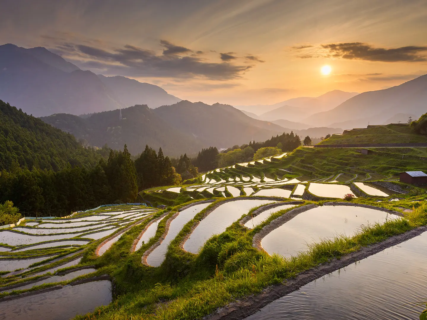
- Maruyama Senmaida: A landscape of more than a thousand small terraced rice paddies on the inland Hongudo variant. It is one of the most scenic cultural landscapes linked to the route.
Challenges to expect
The full Iseji is hard because of its length and repeated passes, not high altitude. Expect 18–20 toge, including Yakiyama, the route’s only full mountain climb. Surfaces change often: paved road in the north, wet cobblestones and forest trail in the centre, then gravel beach or road in the south. The Kii Peninsula is one of Japan’s rainiest regions, so slippery stone, humidity and weather delays matter. Resupply is easier near larger towns such as Owase and Kumano City.
HikeList Score
Kumano Kodo Iseji Route scored 83/100 on HikeList's trail-quality metrics.
See score breakdownHide breakdown
- Ideal length 90
- Balanced challenge 84
- Scenery & wildness 71
- Varied terrain 100
- Accommodation 75
- Food & support 88
- Path quality 76
- Season flexibility 76
Computed from length, challenge, scenery & wildness, terrain variety, accommodation, food & support, path quality and season flexibility.
 Japan
JapanShow more data Show less
- Coastal
- Forest
- River Valleys
- Terraced Rice Fields
- Beaches
- Forested Passes
- Paved
- Cobblestone
- Forest Trail
- Gravel
- Road
- Minshuku
- Ryokan
- Hotels
- Family Friendly
- Restrooms
- Water Sources
- Campsites
- Shelters
Photos from hikers
Taken on the trail by people who've reviewed Kumano Kodo Iseji Route.
Reviews
How would you rate Kumano Kodo Iseji Route?
Tap a star to start your review — you could be the first.