Kerlingarfjöll Hot Spring Hike
How would you rate Kerlingarfjöll Hot Spring Hike?
Tap a star to share your experience and help other hikers.
Kerlingarfjöll Hot Spring Hike: Hveradalir Day Route
HikeList Score
Kerlingarfjöll Hot Spring Hike scored 82/100 on HikeList's trail-quality metrics.
See score breakdownHide breakdown
- Ideal length 55
- Balanced challenge 100
- Scenery & wildness 85
- Varied terrain 89
- Accommodation 75
- Food & support 88
- Path quality 98
- Season flexibility 76
Computed from length, challenge, scenery & wildness, terrain variety, accommodation, food & support, path quality and season flexibility.
The Kerlingarfjöll Hot Spring Hike is a moderate highland day walk in Iceland, linking Ásgarður with the steaming Hveradalir geothermal valleys in the Kerlingarfjöll mountains on the Kjölur route. Plan on about 11 km and 4–5 hours for the full Ásgarður return, with a short marked circle through the geothermal field. It suits fit hikers who want volcanic terrain, rhyolite colours and hot-spring scenery without a multi-day trek. For longer Iceland hiking, compare the Fimmvörðuháls Trail or the remote Askja Trail.
Route Overview
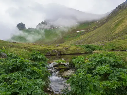
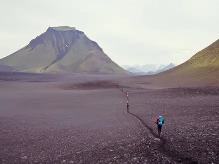
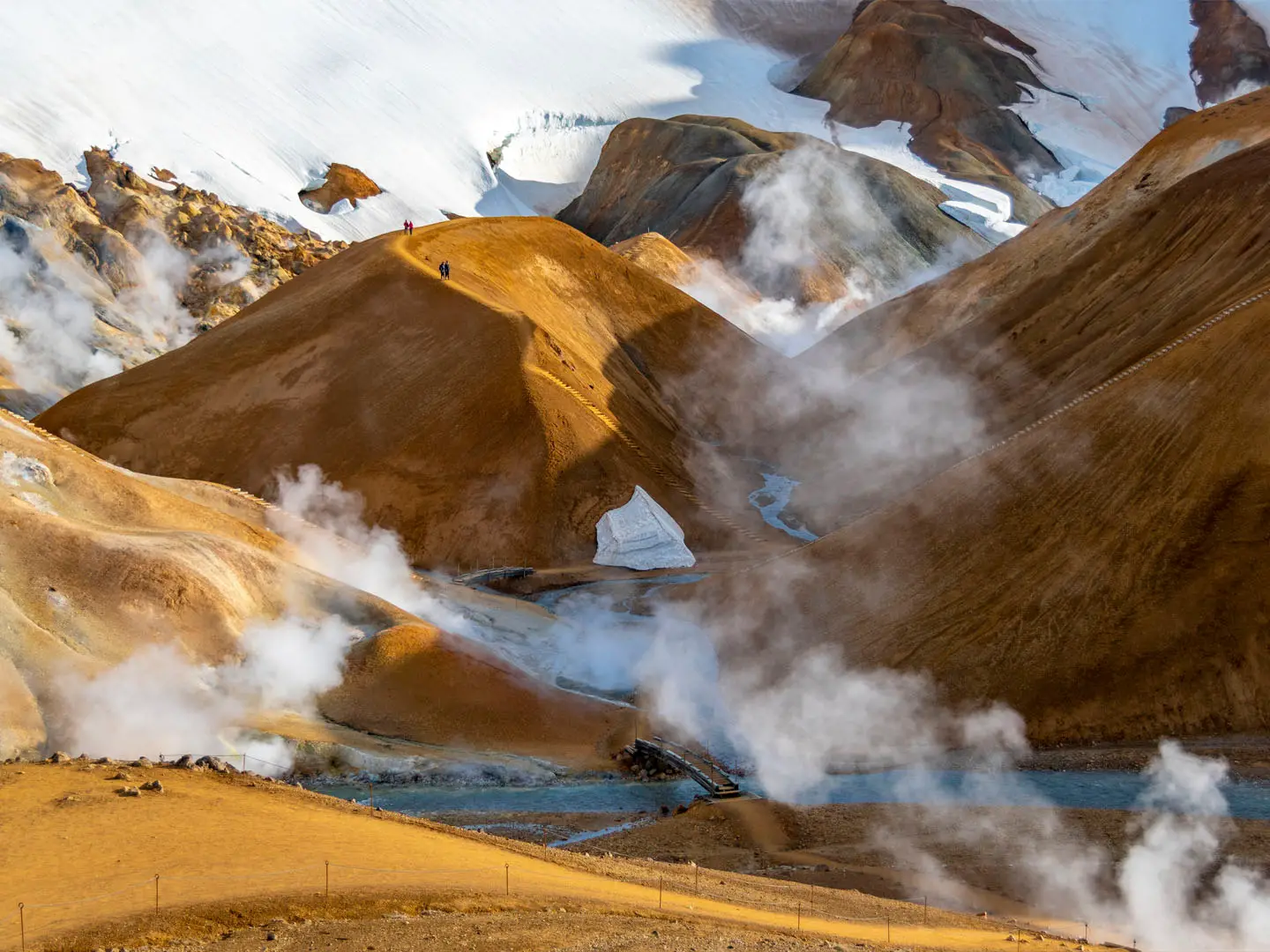
Start and finish at the Ásgarður highland base / campsite. The marked route crosses the Ásgarðsá bridge, climbs steeply for around 30 minutes up an esker and continues over high ground to a pass beside Hveradalahnjúkur, the route’s high point at nearly 1,000 m. From there it descends into Neðri-Hveradalir, where the Hveradalahringur circle uses bridges and clay steps past fumaroles, mudpots and hot pools. Return to Ásgarður the same way. This is best described as an out-and-back approach with a loop inside the geothermal field. A shorter visit is possible from the Hveradalir car park, reached by 4x4, highland bus or guided tour.
Kerlingarfjöll: From Volcanic Range to Hiking Reserve
Kerlingarfjöll is the eroded remnant of a large central volcano and caldera system active since the last Ice Age. From 1961 the area hosted a summer ski school on glacier snowfields, but it closed in 2000 as the glaciers shrank. Ásgarður later developed into a hiking and geothermal-tourism base, now Highland Base – Kerlingarfjöll. The mountain cluster is protected as a nature reserve, with an official waymarked trail network and guide published by Umhverfisstofnun, the Environment Agency of Iceland, in 2020.
Notable highlights
Hveradalir geothermal valleys: Neðri-Hveradalir is the main reason to hike here: a dense highland geothermal field of fumaroles, boiling mudpots, steam vents and hot pools coloured by sulphur and mineral deposits. Stay on the marked paths, as the vents are far too hot for bathing.
Kerlingarfjöll Hot Spring, Ásgarðsá pool: The bathable natural hot spring is not in Hveradalir. It is a separate, small walled pool of about 36–38°C in the Ásgarðsá canyon, reached by a short 1.5 km riverbank walk (around 30 minutes) from the base.
Hveradalahnjúkur pass: The route’s high point sits beside Hveradalahnjúkur at nearly 1,000 m, giving views north over Kjölur and west across Kerlingarfjöll toward Hvítárvatn before the descent into the steaming dales.
Rhyolite mountains: Kerlingarfjöll’s pale rhyolite ridges and peaks are remnants of an ancient caldera, giving the range its banded volcanic colours. Small shrinking glaciers remain on higher slopes.
Kerling rock pillar: This hyaloclastite pillar gives the range its name, linked to a folk tale of a troll woman turned to stone by daylight. It is reached by a separate marked path, not by the Hveradalir hike.
Challenges to expect
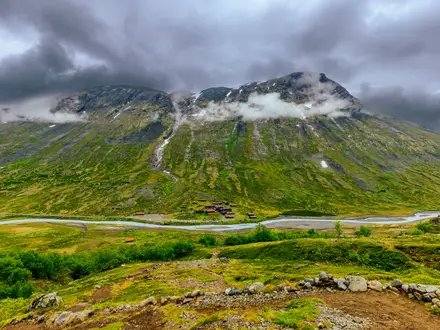
Expect a steep opening climb, exposed highland weather and slippery clay steps inside Hveradalir. Snow patches can linger into July, including on the geothermal circle, and fog is common above 600 m. The geothermal ground is fragile and dangerous off-route, so stay on marked paths and bridges. Access is also a logistics challenge: reaching Ásgarður requires a 4x4 vehicle, highland bus or guided tour. For an easier volcanic day walk elsewhere, see the Hverfjall Crater Loop.
HikeList Score
Kerlingarfjöll Hot Spring Hike scored 82/100 on HikeList's trail-quality metrics.
See score breakdownHide breakdown
- Ideal length 55
- Balanced challenge 100
- Scenery & wildness 85
- Varied terrain 89
- Accommodation 75
- Food & support 88
- Path quality 98
- Season flexibility 76
Computed from length, challenge, scenery & wildness, terrain variety, accommodation, food & support, path quality and season flexibility.
 Iceland
Show more data Show less
- Mountainous
- Highland
- Geothermal
- Dirt
- Gravel
- Rocky
- Clay
- Snow
- Hotels
- Huts
- Campsites
- Family Friendly
- Restrooms
- Water Sources
- Campsites
- Shelters
Photos from hikers
Taken on the trail by people who've reviewed Kerlingarfjöll Hot Spring Hike.
Reviews
How would you rate Kerlingarfjöll Hot Spring Hike?
Tap a star to start your review — you could be the first.