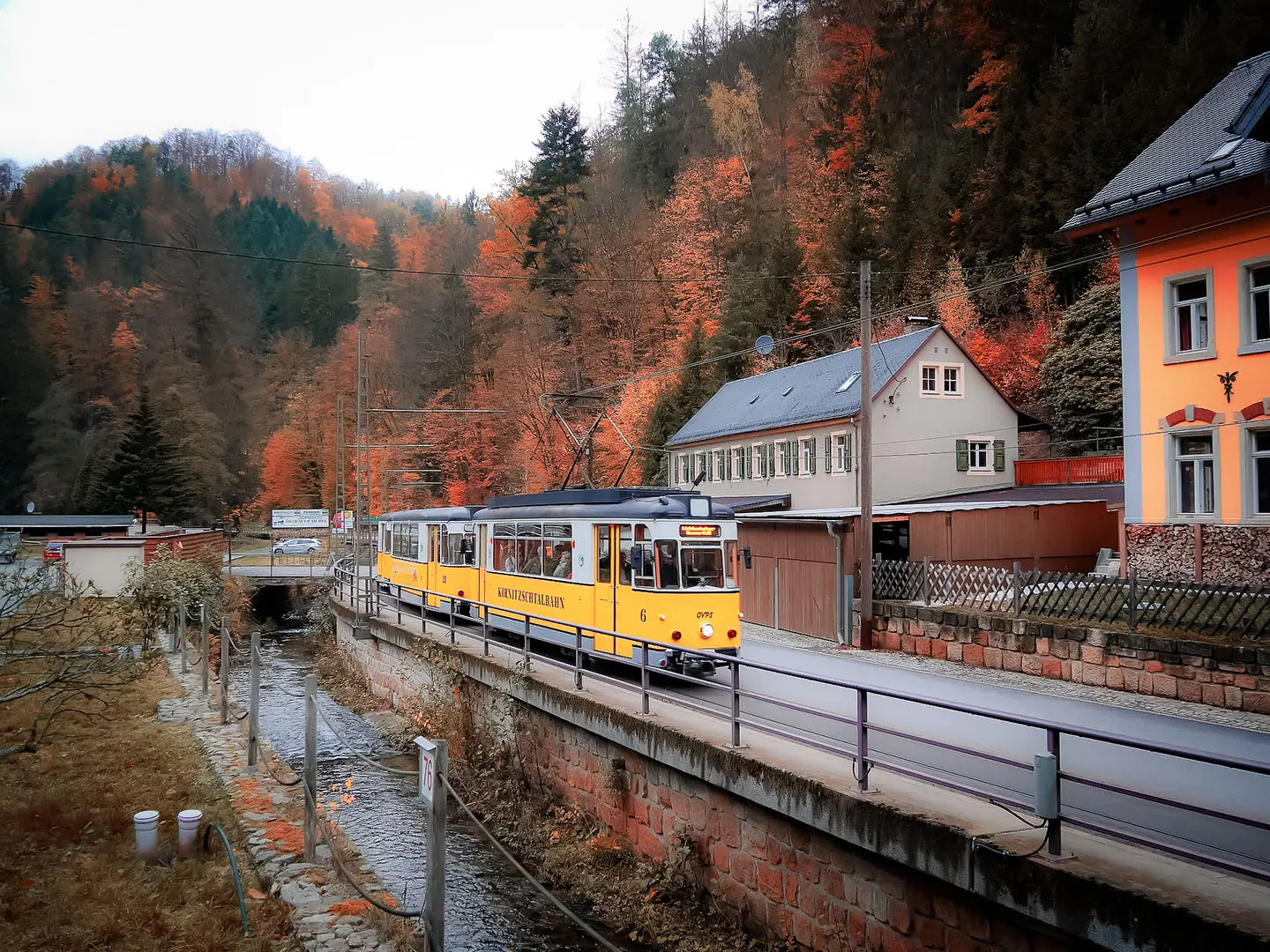
Kirnitzschtal Tramway Trail
How would you rate Kirnitzschtal Tramway Trail?
Tap a star to share your experience and help other hikers.
Kirnitzschtal Tramway Trail: Bad Schandau to Lichtenhain Waterfall
HikeList Score
Kirnitzschtal Tramway Trail scored 76/100 on HikeList's trail-quality metrics.
See score breakdownHide breakdown
- Ideal length 55
- Balanced challenge 100
- Scenery & wildness 58
- Varied terrain 89
- Accommodation 74
- Food & support 88
- Path quality 84
- Season flexibility 89
Computed from length, challenge, scenery & wildness, terrain variety, accommodation, food & support, path quality and season flexibility.
The Kirnitzschtal Tramway Trail is an 11 km day hike in Saxon Switzerland National Park, Saxony, Germany. It follows the Kirnitzsch valley from Bad Schandau to Lichtenhain Waterfall, shadowing the historic Kirnitzschtalbahn tramway and using the waymarked Floessersteig riverside path. With the Kuhstall rock-arch detour included, expect an easy-to-moderate walk: mostly level valley paths, plus a steeper stepped climb. It suits hikers who want sandstone scenery, straightforward logistics and a tram return.
Route Overview
Walk upstream from Bad Schandau, the Elbe-side spa town, towards the Lichtenhain Waterfall tram terminus. The route follows the Kirnitzsch river through the wooded gorge, passing valley hamlets and tram stops such as Ostrauer Muehle, Mittelndorfer Muehle, Nasser Grund and Beuthenfall. The standard valley section is about 8.4 km; the listed 11 km version adds the climb to the Kuhstall arch on the Neuer Wildenstein before finishing at Lichtenhain Waterfall. It is best treated as a point-to-point day hike, with the Kirnitzschtalbahn or bus making the return to Bad Schandau easy. For a longer sandstone-area trip, compare the Elbe Sandstone Mountains Trail; for another German walking option, see the Harzer Hexenstieg.
Raftsmen, Romantic tourism and the Kirnitzschtalbahn
The valley’s walking route is the Floessersteig, or Rafters’ Trail, recalling the raftsmen who once floated timber down the Kirnitzsch to the Elbe. More than 100 information plaques explain the valley’s natural and working history. The Lichtenhain Waterfall was reshaped into a visitor spectacle from the 1830s, and the Kirnitzschtalbahn, opened in 1898, turned the valley into an early Saxon Switzerland tourism corridor. The wider region gained its “Saxon Switzerland” name from 18th-century Swiss painters.
Notable highlights
Kirnitzschtalbahn tram: Opened in 1898, this 7.9 km metre-gauge tramway runs from Bad Schandau into the national park. Its vintage carriages and valley stops make it both a highlight and the practical return option.
Lichtenhain Waterfall: An artificial cascade where a weir enhances a naturally low-flow fall. The dammed water is traditionally released on the hour for spectators.
Kuhstall arch: The “Cowshed” rock gate on the Neuer Wildenstein is 11 m high, 17 m wide and 24 m deep. The Himmelsleiter tunnel-stairway leads to a viewpoint and the remains of the 15th-century Wildenstein robber-knight castle.
Kirnitzsch gorge: The river threads through a shaded wooded valley between sandstone walls and historic mills. It is the most atmospheric section of the walk and stays pleasantly cool in summer.
Sandstone cliffs: Elbe Sandstone formations rise above the valley, with tram stops giving access towards landmarks such as the Schrammsteine and Affensteine.
Challenges to expect
Navigation is straightforward on the waymarked Floessersteig, and the valley path is mostly gentle. The moderate element comes from the Kuhstall detour: expect rock steps, the narrow Himmelsleiter stairway and short steeper sections. Surfaces are largely unpaved, with some gravel, asphalt and paved stretches near hamlets. The gorge is shaded and cool, but wet rock and steps can be slippery after rain.
HikeList Score
Kirnitzschtal Tramway Trail scored 76/100 on HikeList's trail-quality metrics.
See score breakdownHide breakdown
- Ideal length 55
- Balanced challenge 100
- Scenery & wildness 58
- Varied terrain 89
- Accommodation 74
- Food & support 88
- Path quality 84
- Season flexibility 89
Computed from length, challenge, scenery & wildness, terrain variety, accommodation, food & support, path quality and season flexibility.
 Germany
Show more data Show less
- Wooded Gorge
- River Valley
- Sandstone Cliffs
- Dirt
- Gravel
- Paved
- Rock Steps
- Hotels
- Inns
- Family Friendly
- Pet Friendly
- Restrooms
- Water Sources
- Picnic Areas
- Campsites
Photos from hikers
Taken on the trail by people who've reviewed Kirnitzschtal Tramway Trail.
Reviews
How would you rate Kirnitzschtal Tramway Trail?
Tap a star to start your review — you could be the first.