GR30 (Tour of Auvergne Volcanoes)
How would you rate GR30 (Tour of Auvergne Volcanoes)?
Tap a star to share your experience and help other hikers.
GR30 (Tour of Auvergne Volcanoes): Complete Hiking Guide
HikeList Score
GR30 (Tour of Auvergne Volcanoes) scored 92/100 on HikeList's trail-quality metrics.
See score breakdownHide breakdown
- Ideal length 96
- Balanced challenge 100
- Scenery & wildness 98
- Varied terrain 71
- Accommodation 83
- Food & support 88
- Path quality 98
- Season flexibility 89
Computed from length, challenge, scenery & wildness, terrain variety, accommodation, food & support, path quality and season flexibility.
The GR30 is a 198 km waymarked Grande Randonnée loop in the Massif Central of central France, usually walked in 9 days. Officially the Tour des Lacs d’Auvergne, it circles Auvergne’s volcanic lakes inside the Parc naturel régional des Volcans d’Auvergne, entirely in the Puy-de-Dôme. This is a moderate but sustained mid-mountain trek: non-technical, with long stages, rocky paths, forest tracks, open estives and weather-sensitive high ground across the Sancy massif.
Route Overview
Most hikers start and finish in La Bourboule, a spa town below the Sancy massif; nearby Le Mont-Dore is an equally common alternative. As a loop, the GR30 can be joined anywhere and does not need an end-to-start transfer. The usual anticlockwise line links Orcival, Lac Servières, Lac de Guéry, Lac d’Aydat, Saint-Nectaire, Murol, Lac Chambon, Besse-et-Saint-Anastaise and Lac Pavin, then crosses the open Cézallier plateau via La Godivelle before returning over the Monts Dore past the Banne d’Ordanche. For other French mountain routes, compare the Chartreuse Trail GR9 segment or the Ballons des Vosges Park trails.
History of the GR30
The GR30 was created in the 1970s by the French long-distance footpath network to link the celebrated volcanic lakes of Auvergne. It lies wholly within the Parc naturel régional des Volcans d’Auvergne, created in 1977, and crosses a landscape shaped by volcanic activity over several million years. The route ties together the eroded stratovolcanoes of the Monts Dore, the younger cinder cones near the southern Chaîne des Puys and the basalt high country of the Cézallier.
Notable highlights
- Lac Pavin: A near-circular crater lake near Besse, around 92 m deep, and a rare meromictic lake whose deep water does not mix. It is one of the most distinctive volcanic features on the GR30.
- Puy de Sancy / Monts Dore: The GR30 traverses high across the Sancy massif below Puy de Sancy, the highest point of the Massif Central. The true summit is a short optional detour rather than the waymarked trail’s high point.
- Saint-Nectaire: A village known for its 12th-century Auvergne Romanesque church and AOP Saint-Nectaire cheese. It is one of the main cultural stops on the loop.
- Château de Murol: A medieval fortress on a basalt outcrop above Lac Chambon. The trail passes through the commune, giving walkers a strong visual landmark between Besse and the Chambon valley.
- Besse-et-Saint-Anastaise: A well-preserved medieval town of dark volcanic-stone houses and a gateway to Lac Pavin. It is a natural overnight stop on many GR30 itineraries.
- Lac de Guéry and the Cézallier plateau: Lac de Guéry sits below volcanic crags, while the Cézallier gives the route its broadest, most open high-plateau walking.
Challenges to expect
Expect a sustained moderate trek rather than a technical alpine route: long 17–25 km days, repeated climbs, stony mountain paths, grassy estive tracks and exposed high ground. The Sancy/Monts Dore section needs caution in fog, storms or snow. Rain is a real possibility, even in summer. Accommodation exists in villages, but free wild camping is prohibited in the park; only regulated bivouac is tolerated in limited conditions. For a more dramatic Pyrenean contrast, see the Cirque de Gavarnie trails.
HikeList Score
GR30 (Tour of Auvergne Volcanoes) scored 92/100 on HikeList's trail-quality metrics.
See score breakdownHide breakdown
- Ideal length 96
- Balanced challenge 100
- Scenery & wildness 98
- Varied terrain 71
- Accommodation 83
- Food & support 88
- Path quality 98
- Season flexibility 89
Computed from length, challenge, scenery & wildness, terrain variety, accommodation, food & support, path quality and season flexibility.
 France
Show more data Show less
- Mountainous
- Forest
- Dirt
- Rocky
- Gravel
- Hotels
- Hostels
- Campsites
- Pet Friendly
- Restrooms
- Water Sources
- Campsites
- Shelters
- Picnic Areas
Download Our Full Guide to GR30 (Tour of Auvergne Volcanoes) FREE!
Get our comprehensive guide to this hike for free. Save it for later reading or print out at home.
In these collections
Photos from hikers
Taken on the trail by people who've reviewed GR30 (Tour of Auvergne Volcanoes).
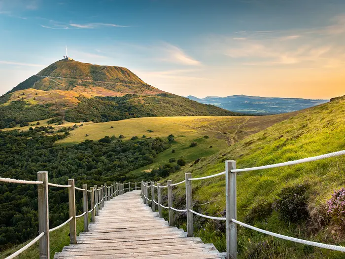
GR30 (Tour of Auvergne Volcanoes): The Complete Guide
 i
Image by nicolas
i
Image by nicolas The GR30, officially the Tour des Lacs d’Auvergne, is a 9-day loop through the volcanic heart of the Massif Central. Starting most commonly from La Bourboule or Le Mont-Dore, it links spa towns, crater lakes, high pasture and the weather-sensitive ridges of the Sancy massif.
This is a walk of changing volcanic country rather than a single mountain objective. The route moves from the rugged Monts Dore to the younger forms of the Chaîne des Puys and the wide basalt plateau of the Cézallier, with lakes such as Lac Pavin, Lac Chambon, Lac d’Aydat, Lac de Guéry and the lakes of La Godivelle giving the trail its identity.
There is a strong cultural thread as well as a landscape one. Saint-Nectaire, Besse-et-Saint-Anastaise, Château de Murol and the old burons of the estives make this a route where villages, cheese country and pastoral mountain heritage matter as much as the views.
The GR30 is moderate, not technical, but it is a real moyenne montagne trek. Expect long days, repeated climbs, rocky and grassy paths, exposed weather near the Sancy high ground, and practical planning around accommodation, meals and the regional park’s restrictions on wild camping.
This guide covers stages, day planning, accommodation, food, transport, terrain, navigation, weather, gear, support services, shorter options, highlights and common mistakes.
Stage-by-Stage Guide
Stage distances on the GR30 vary slightly between itineraries, topo-guides and GPS traces. The figures below follow the standard 9-stage outline, but allow extra time for lake circuits, village detours, accommodation access and the optional Puy de Sancy summit.
Stage 1: La Bourboule to Orcival — approx. 21 km
This is a tough opening day and one of the biggest climbing stages of the loop, with roughly 900–1,000 m of ascent. The route leaves La Bourboule with a steep forested climb towards the Murat-le-Quaire plateau, then opens onto volcanic upland with old burons and rounded volcanic mounds known as Tras.
The early views back towards the Sancy and Mont-Dore massifs are excellent, with Puy Gros and the prominent Banne d'Ordanche giving an immediate sense of the terrain to come. Lac de Guéry is the natural break point: it is the highest lake on the GR30 and sits below the striking Roches Tuilière and Sanadoire volcanic outcrops.
Beyond Lac de Guéry the trail crosses the Plateau de l'Aiguiller and the Puy de l'Ouire area before reaching Lac de Servières, then drops towards Orcival. The final descent through forest is steep enough to matter late in the day, especially on wet ground.
La Bourboule has full services at the start, including shops, accommodation and a TER coach link towards Clermont-Ferrand (the former railway no longer runs as a passenger train; this should be checked before travelling). Around Lac de Guéry there is a picnic area and a seasonal café/auberge, but opening should be checked before relying on it. Orcival has limited but useful services, including a hotel-restaurant and basic provisions.
Accommodation in Orcival is limited; Hôtel des Roches is the main named option. Book ahead in summer, as this is not a town with a large spare bed supply.
Road access is straightforward at La Bourboule and Orcival. Public-transport access is via the Clermont-Ferrand TER coach at La Bourboule rather than Orcival; any local bus or taxi connection from Orcival should be checked before travelling.
Navigation is generally straightforward and the GR waymarking is reliable across the Guéry plateau. The main practical warning is effort: this stage climbs hard almost immediately, so it is worth starting with food, water and legs ready rather than treating the first day as a gentle warm-up.
Stage 2: Orcival to Aydat — approx. 23 km
Stage 2 is gentler than the first day, though still a full walking day. The route moves through pastoral country, forest tracks and hamlets on the western edge of the Chaîne des Puys, with some quiet road walking.
For much of the day the volcanic cones of the Chaîne des Puys lie to the east, including Puy de Dôme. This is the closest the GR30 comes to that chain of extinct cinder cones, with Puy de la Vache and Puy de Lassolas visible from the route.
The stage crosses the Sioule river and passes towards Lac de la Cassière, a good rest stop before the approach to Lac d'Aydat. Lac d'Aydat is the largest natural lake in Auvergne and is a busy swimming and leisure destination in summer.
Food and drink options are more scattered than on the spa-town stages. There are small services in hamlets and more useful facilities around Aydat and the lakeside, including cafés, restaurant options and accommodation. Seasonal businesses may be closed outside July and August, so do not plan the day around an unconfirmed lakeside stop.
Accommodation options around the end of the stage include the Gîte d'étape du Château de Montlosier near Aydat, Auberge Entre Lacs et Volcans at La Cassière/Aydat and Hôtel Les Cygnes in Aydat. Availability should be checked early in the main walking season.
Road access exists at Orcival, La Cassière and Aydat, but there is no rail station on this stage. Any public-transport connection should be checked before travelling.
The waymarking is usually adequate, but village lanes and built-up sections can create missed turns. A GPS track is useful here, not because the terrain is difficult, but because the correct GR line can be easy to lose among local paths and roads.
Stage 3: Aydat to Saint-Nectaire — approx. 22 km
This is a varied stage, moving from moorland and plateau into a more dramatic gorge section before finishing in the spa and cheese town of Saint-Nectaire. The walking is moderate rather than severe, with around 526–530 m of ascent, but the day still needs a steady pace.
A key early landmark is the Cournols menhir, a prehistoric standing stone on open moorland. Later, the Gorges de la Monne provide one of the more unexpected landscape changes on the GR30, with a deeper, warmer-feeling gorge environment and distinctive vegetation.
The route also passes near Puy d'Olloix, with views from the surrounding country, before descending towards Saint-Nectaire. Saint-Nectaire is one of the stronger cultural stops on the loop, known for its Romanesque church and AOP Saint-Nectaire cheese.
Carry sufficient water before entering the gorge section, as services are not available there. Saint-Nectaire is a good resupply point, with cafés, restaurants, shops and fromageries.
Accommodation choice is broader here than in many trail villages. Saint-Nectaire has hotels, chambres d'hôtes and a campsite, so it is a sensible place to recover properly before the harder climbing on Stage 4.
Aydat and Saint-Nectaire both have road access, but no rail access is specified for this stage. Local bus or taxi options should be checked before travelling.
Navigation is generally clear, though care is needed around junctions near Olloix where missed waymarks are possible. Do not assume that an inviting bivouac-looking spot in the gorge is usable: camping and bivouac rules inside the regional park are regulated and should be checked before relying on any overnight plan.
Stage 4: Saint-Nectaire to Besse-et-Saint-Anastaise — approx. 20 km
This is one of the hardest days of the GR30 in climbing terms, with around 1,032 m of ascent. Some itineraries and variants make this stage longer than the headline distance, so plan it as a substantial day rather than a short 20 km transfer.
The route climbs and descends through a mix of forest, open plateau and lakeside terrain. The Dent des Marais area gives wide views over Puy du Tartaret, Lac Chambon and the Monts Dore, making it one of the best viewpoints on the southern arc of the loop.
Lac Chambon is a useful mid-stage break and a popular leisure lake in summer. Nearby Murol is dominated by Château de Murol, a medieval fortress on a basalt plug above the lake; visiting the castle is worthwhile if time allows, but it adds to an already demanding day.
After the Chambon and Murol area, the route climbs through the Forêt Domaniale de Besse towards the Courbanges plateau. This section can feel long in poor weather or mist, especially after the earlier ascent and descent.
Food and drink are available around Chambon-sur-Lac and Murol, with cafés, restaurants and campsite facilities near Lac Chambon. Besse-et-Saint-Anastaise is the best resupply point since Saint-Nectaire, with bakery, butcher, restaurants and a supermarché.
Besse has a good range of accommodation for a trail town, including Hôtel de la Providence et de la Poste, chambres d'hôtes and gîtes. Booking is still sensible, particularly in summer and around busy holiday periods.
Road access is available at Saint-Nectaire, Lac Chambon, Murol and Besse-et-Saint-Anastaise. Public transport should be checked before travelling, as this section should not be planned around an assumed bus connection.
Waymarking is generally good, but the forest climb to the Courbanges plateau can be confusing in mist. This is a stage where fatigue makes navigation errors more likely, so keep the topo-guide or GPS track accessible rather than packed away.
Stage 5: Besse-et-Saint-Anastaise to Brion — approx. 21 km
Stage 5 is a transition from the volcanic Monts Dore towards the open Cézallier plateau. The walking is varied, with moorland, peat bog, forest and estive pasture, and the day feels more remote after the services of Besse.
The standout landmark is Lac Pavin, one of the most distinctive volcanic features on the GR30. This near-circular maar lake is around 92 m deep and is one of France's rare meromictic lakes, with deep water that does not mix with the surface layer.
Allow time at Lac Pavin rather than rushing past it. A short circuit around the lake rim is a worthwhile detour if the day is going well, and the nearby Puy de Montchal gives wider views back towards the Sancy and ahead to the Cézallier.
The route then continues towards Lac de Montcineyre and the village of Compains before reaching Brion. The open plateau character becomes more pronounced after Compains, with grassland paths that can be less distinct underfoot.
Besse has full services at the start and is the place to buy food for the day. Compains has limited facilities and a village shop that may be seasonal; Brion is a small hamlet with very limited services, so dinner must be arranged with accommodation rather than assumed on arrival.
Accommodation options in Brion include Gîte Lapier and La Cabane du Cézallier. This is a small overnight stop, so advance booking is essential.
There is road access at Besse, Compains and Brion, but no rail access on this stage. Any public-transport escape or taxi arrangement should be checked before travelling.
Navigation is broadly reliable until the more open plateau sections after Compains, where the line through grassland can be less obvious. A GPS track is useful, and a windproof layer should be close to hand: the Cézallier is exposed even when the weather feels settled in town.
Stage 6: Brion to Égliseneuve-d'Entraigues — approx. 22 km
This is the easiest stage by ascent, with only around 279 m of climbing, but it is also one of the most remote in feel. The Cézallier is broad, open and windswept, with rolling pasture, livestock farms, peat bogs and few services.
The principal highlight is La Godivelle and its two lakes, Lac d'En-Haut and Lac d'En-Bas. The Réserve Naturelle des Sagnes de la Godivelle protects important peat-bog habitat, including rare plant life such as sundew.
The route continues through small settlements such as Espinchal before finishing at Égliseneuve-d'Entraigues. Near the end, the Cascade du Bois de Chaux makes a pleasant local landmark before the village.
This is a stage where food and water planning matters. La Godivelle has a gîte d'étape, Gîte des Sagnes, but it should be booked in advance and not treated as an open-service stop. Espinchal has minimal services, while Égliseneuve-d'Entraigues offers more facilities than the preceding Cézallier villages.
Accommodation at the end includes a gîte d'étape and chambres d'hôtes in Égliseneuve-d'Entraigues. The village is a better service stop than Brion, but availability still needs checking ahead.
Road access exists in the plateau villages, but connections are limited and should not be assumed. Any public transport, taxi pick-up or baggage arrangement should be checked before travelling.
The terrain is simple in clear weather but can become disorientating in mist because it is open and relatively featureless. Waterproof footwear is useful around the peat-bog sections near Godivelle, and carrying a GPS backup is strongly recommended on this central plateau part of the GR30.
Stage 7: Égliseneuve-d'Entraigues to Saint-Genès-Champespe — approx. 22 km
Stage 7 leaves the Cézallier and moves into the Artense, a high, rocky volcanic plateau with more forest, pasture and small lakes. The maximum altitude is modest compared with the Sancy stages, but the day is varied and feels wilder than the earlier lake-and-village sections.
At the start, the GR30 briefly shares the GR4 before separating; follow the signs carefully so that the correct GR30 line is taken. The route then passes a sequence of lakes and wetland areas, including Lac de l'Esclauze and the lakes of Taurons, Crégut and Tact.
The Sancy massif begins to reassert itself as a constant backdrop, with Puy de Sancy visible to the north in clear conditions. Lac de Saint-Genès-Champespe marks the approach to the end of the stage.
Services are minimal through this part of the Artense. Carry food and water rather than relying on small villages, and check what is actually available in Saint-Genès-Champespe before arrival.
Accommodation at the end is limited to options such as a gîte d'étape and chambres d'hôtes. Advance booking is essential, as there is little fallback if the village is full.
Road access is available at the villages, but no rail access is specified. Any public-transport link or taxi option should be checked before travelling.
Navigation needs more attention than on the better-trodden early stages. Waymarking can be less consistent in forested sections, and boggy lake margins can slow progress; a GPS track and the FFRandonnée topo-guide are the best practical safeguards.
Stage 8: Saint-Genès-Champespe to Chareire — approx. 24 km
The penultimate stage is long and still remote, crossing more of the Artense before turning back towards the southern side of the Sancy massif. The terrain is not as exposed as the final Sancy crossing, but the distance makes it a demanding day.
The route passes Lac de la Landie and then Lac Chauvet, one of the finest lakes on the loop. Lac Chauvet is a near-circular maar lake high on the Artense plateau, and the GR4 briefly intersects in this area, so keep to the GR30 blazes.
Further on, Lac et Tourbière de Gayme adds another peat-bog and maar-lake landscape before the route reaches Picherande. Picherande is the key service point of the stage and a practical place to split the day for walkers creating a 10-day itinerary.
From Picherande the route continues to Chareire, a tiny hamlet at the foot of the Sancy massif. This final section is beautiful but remote, and it is better not to arrive after dark.
Picherande has the main food and drink opportunity, with café/restaurant and provision options. Chareire has no general village services; dinner should be pre-arranged with accommodation.
The principal accommodation at Chareire is Gîte du Taraffet / Auberge du Taraffet. It is the key overnight stop before the high Sancy day and should be booked well ahead, especially in summer.
Road access exists at Picherande and Chareire, but Chareire is a very small hamlet rather than a service centre. Public transport or taxi arrangements should be checked before travelling.
A GPS trace is strongly recommended on this stage, where waymarking can be variable and the GR4 crosses the route around Lac Chauvet. If walking strongly, Picherande can be used as a shorter-stage finish; if not, treat the full stage to Chareire as a long remote day requiring early departure and firm accommodation arrangements.
Stage 9: Chareire to La Bourboule — approx. 23 km
This is the crux of the GR30: a long, exposed high-mountain day across the Chastreix-Sancy area and the Sancy massif. The waymarked route reaches roughly 1,845–1,855 m below Puy de Sancy, with an optional detour to the 1,885 m summit, the highest point of the Massif Central.
The day begins more gently through the Vallée de la Fontaine Salée, a pastoral mineral-spring valley, before the climbing becomes serious. The route then ascends towards Puy de Paillaret, crosses the Col de Couhay at 1,685 m and continues onto the high Sancy terrain near Puy de la Perdrix.
The optional summit detour to Puy de Sancy adds around 30–45 minutes return in good conditions. It is worthwhile only if the weather, visibility and footing are suitable; the final summit path is steep and can be icy.
After the Sancy high ground the route descends via the Pic du Capucin and Pré des Sagnes to Le Mont-Dore. Many walkers choose to finish there if conditions, time or tired legs make the final continuation to La Bourboule unattractive.
From Le Mont-Dore the GR30 continues over or near the Banne d'Ordanche area before returning to La Bourboule. The route also passes near the source of the Dordogne, a notable landmark on the final day.
There are no services on the high Sancy terrain, so leave Chareire with enough food, water and weather protection for a full mountain day. The cable-car station area at Mont-Dore is an important shelter and refreshment point when open, but opening should be checked before relying on it. La Bourboule has full services at the finish.
Le Mont-Dore and La Bourboule are both served by the Clermont-Ferrand TER coach (line P46), making this the best stage for public-transport access; note that the historic railway here no longer runs as a passenger train, and current times should be checked before travelling. Le Mont-Dore is also a practical bail-out or alternative finish before the final section to La Bourboule.
Navigation is straightforward only in good visibility. Fog, storms, snow or strong wind can make the Sancy crossing dangerous, and this stage should not be attempted in poor mountain conditions. Check the forecast the evening before, start early, and be prepared to wait, divert or finish at Le Mont-Dore if the weather deteriorates.
The Chastreix-Sancy Natural Reserve is a protected area with specific rules, including restrictions affecting dogs; current regulations should be checked before walking with one. The exposed section from Col de Couhay towards the Sancy high ground should not be rushed, and snow or ice can occur outside the core summer season.
Recommended Itinerary
Distances on the GR30 vary slightly with the exact line, accommodation choice and any variants around the lakes and volcanic craters. Use the figures below for planning, then check official mapping before booking beds, baggage transfer or transport.
Standard 9-day itinerary
This is the most practical schedule for most walkers: long but manageable days, generally 20–24 km, with overnight stops that match the usual accommodation pattern. The final Sancy stage is the one to protect most carefully for weather.
| Day | From | To | Approx. distance | Why this stage makes sense | Services/accommodation notes |
|---|---|---|---|---|---|
| 1 | La Bourboule | Orcival | ~21 km | A strong opening day with the steep climb out of La Bourboule, the Plateau de Guéry, Lac de Guéry, the Roches Tuilière and Sanadoire, then Lac de Servières before descending to Orcival. It gets the first major climb done early and finishes in an established village. | Stock up in La Bourboule before leaving; it has the best early-route services. Orcival has gîte and hotel options, but booking ahead is sensible. Trail marking needs attention in places. |
| 2 | Orcival | Aydat / Lac d’Aydat | ~23 km | A full but steady day across the Plateau des Monts Dômes, with views towards the Chaîne des Puys and a finish by Lac d’Aydat. It works well as a natural north-eastern arc of the loop before turning south. | Services are limited between stops and village opening days can catch walkers out. Check food availability before leaving Orcival and book accommodation around Aydat/Lac d’Aydat in advance. |
| 3 | Aydat / Lac d’Aydat | Saint-Nectaire | ~22 km | This stage links forest, pasture and heritage sites before reaching one of the route’s main service villages. It can include the Lac Chambon area and, with a diversion, Murol and Château de Murol. | Saint-Nectaire has better services, including cheese shops and a choice of chambres d’hôtes/hotels. Walkers wanting shorter days can split this part around Murol or Chambon-sur-Lac. |
| 4 | Saint-Nectaire | Besse-et-Saint-Anastaise | ~20 km | A slightly shorter listed distance, but still a proper walking day across volcanic plateau and estive country with views towards the Sancy massif. Besse is one of the best places on the route for an unhurried evening or restock. | Besse-et-Saint-Anastaise has stronger resupply than the smaller villages ahead, with supermarkets and bakeries. In summer, start early as afternoon thunderstorms are common. |
| 5 | Besse-et-Saint-Anastaise | Brion | ~21 km | A classic GR30 day, leaving Besse via Lac Pavin and continuing past Puy de Montchal and Lac de Montcineyre into the more open Cézallier. The route starts to feel more remote after this point. | Brion has very limited services, so carry food and check whether the gîte can provide an evening meal. Compains is a useful lunch stop. Some itineraries continue to La Godivelle instead; check official mapping before booking. |
| 6 | Brion | Égliseneuve-d’Entraigues | ~22 km | This is one of the broadest high-plateau days on the route, crossing the Cézallier via La Godivelle and its lakes before reaching Égliseneuve-d’Entraigues. It is less steep than the Sancy stages but more exposed and remote. | Expect sparse services and potentially wet or marshy sections around lake overflow zones. Accommodation is in gîtes/chambres d’hôtes; confirm meals before arrival. |
| 7 | Égliseneuve-d’Entraigues | Saint-Genès-Champespe | ~22 km | A continued Cézallier stage through open hills, small valleys and glacial terrain. The distance keeps the schedule balanced before the longer approach to the Sancy foothills. | Saint-Genès-Champespe is a small village with very limited options. Booking is essential, and food arrangements should be checked when reserving. |
| 8 | Saint-Genès-Champespe | Chareire | ~24 km | A longer and tougher stage, passing lake country including Lac Chauvet before approaching the Sancy foothills. It positions the route well for the high final traverse. | Picherande is the key service and accommodation alternative before Chareire. Chareire has gîte accommodation, but capacity and meal arrangements should be reserved in advance. |
| 9 | Chareire | La Bourboule | ~23 km | The hardest and most weather-dependent day, crossing the Sancy / Monts Dore high ground below Puy de Sancy before descending via Le Mont-Dore-side high country and Banne d’Ordanche towards La Bourboule. The Puy de Sancy summit is an optional detour, not the waymarked GR30 high point. | Only take this stage in suitable weather. Avoid the high traverse in fog, storms or snow; if the forecast is poor, wait or use a lower alternative via Le Mont-Dore. La Bourboule has full services at the finish. |
Slower 10–11 day options
A slower itinerary suits walkers who prefer 12–20 km days, anyone new to multi-day walking, families, or those wanting time in Besse-et-Saint-Anastaise, Saint-Nectaire or the Sancy area. It is also a good choice if the high traverse needs a spare weather day.
| Option | How to adjust the standard itinerary | Who it suits | Practical notes |
|---|---|---|---|
| Add a night around Murol / Chambon-sur-Lac | Break the Aydat to Saint-Nectaire section, or re-cut Days 3–4 around the Lac Chambon and Murol area. | Walkers who want a gentler middle section and time for Château de Murol or Lac Chambon. | Murol and Chambon-sur-Lac have accommodation options, but exact stage distances depend on the variant walked. Check official mapping before booking. |
| Add a night around Picherande | Use Picherande as an extra overnight before tackling the Sancy section, rather than forcing the long Saint-Genès-Champespe to Chareire day and the tough final stage back-to-back. | Walkers who want more margin before the final high-mountain day, or who need to wait for clear weather. | Picherande has accommodation, including hotel/gîte options. This is one of the most useful places to build flexibility into the schedule. |
| Add a rest or contingency night in Besse-et-Saint-Anastaise or La Bourboule / Le Mont-Dore | Keep the walking stages broadly the same but add a non-walking day before the remote Cézallier or before/after the Sancy high ground. | Walkers carrying full packs, those using public transport, or anyone walking in less settled shoulder-season weather. | Besse has good resupply before the quieter plateau stages. La Bourboule and Le Mont-Dore are the most convenient rail-access towns. |
Faster 7–8 day variant
A 7–8 day GR30 is for experienced, fit mountain walkers only. It means repeated 25–30 km-plus days, less tolerance for poor weather, and more careful accommodation planning because the standard overnight pattern no longer applies.
The usual way to shorten the schedule is to re-cut the Cézallier stages around Besse, Brion, La Godivelle, Égliseneuve-d’Entraigues and Saint-Genès-Champespe, rather than simply assuming every listed stop can be skipped. Services are sparse in this part of the route, and some villages have little or no evening food unless arranged through the accommodation.
Do not compress the final Sancy stage unless conditions are stable and the walker is comfortable with long exposed mountain days. The Chareire to La Bourboule section is the least forgiving place to be racing a schedule.
Planning the Route
How many days to allow
Most walkers should plan the GR30 over 9 days. This matches the natural rhythm of the route: daily stages are long enough to be satisfying, but not so long that every bad-weather delay, late breakfast or closed shop becomes a problem.
A 7–8 day itinerary is realistic for fit, efficient walkers carrying light packs or using baggage transfer. It makes several days notably harder, with longer distances and more cumulative ascent, so it suits hikers who are already comfortable with repeated mid-mountain days.
A 5-day express version exists, but it means very large days of around 40 km and substantial ascent. Treat that as a fast-hiker challenge, not a normal GR30 plan.
For most independent walkers, the best approach is not to rush. The route’s practical constraints are accommodation, food supply and weather on the Sancy / Monts Dore high ground; a slightly slower schedule gives far more flexibility.
Accommodation largely sets the stages
The GR30 is not a route where you can simply walk until tired and find a bed. Accommodation is concentrated in specific villages and spa towns, with long rural sections between them and no chain of purpose-built mountain refuges.
The standard stage pattern works because it links the main places with beds: La Bourboule, Orcival, Aydat, Saint-Nectaire, Besse-et-Saint-Anastaise, Brion, Égliseneuve-d'Entraigues, Saint-Genès-Champespe, Chareire and back to La Bourboule.
Some stops have much more choice than others. Besse-et-Saint-Anastaise and Saint-Nectaire are among the larger, easier places to book. Smaller overnight stops such as Brion, Chareire and Saint-Genès-Champespe have limited options, so do not assume there will be a spare bed on arrival.
Book ahead in summer, especially in July and August. Booking is also strongly advised from late June through mid-September, when accommodation can be filled by walkers, holidaymakers and local events.
Food and evening meals need active planning
The most common planning mistake on the GR30 is assuming every overnight stop provides dinner. Many gîtes d'étape and chambres d'hôtes offer a table d'hôtes, but not all do, and small villages may have limited or no evening food options.
When booking each night, ask directly whether dinner is available. If not, carry an evening meal from the previous resupply point.
Lunch also needs planning. Carry food from the morning village rather than relying on shops or cafés mid-stage. On the Besse-et-Saint-Anastaise to Brion stage, walkers should carry supplies from Besse, as commercial shops are not available on the stage.
Small boulangeries and village shops may close on certain weekdays, including Mondays or Wednesdays. This should be checked before travelling, especially if a stage depends on one small shop for bread or packed lunch supplies.
Water between villages
Do not plan around untreated streams. Drinking-water points between villages can be rare or absent, so the safer strategy is to fill up in villages and at accommodation.
The Sancy tourist office provides practical route material showing services such as water points, toilets and showers. Download or carry this before starting, as it is more useful on the ground than relying on memory.
In hot weather, the open estive and Cézallier plateau sections can feel exposed despite the moderate altitude. Start each day with enough water for the full stage unless a reliable source has been identified in advance.
Navigation and maps
The GR30 is a waymarked Grande Randonnée, using the standard white-and-red GR blazes, but a map or GPX track is still strongly recommended. Waymarking can be variable, and open plateau sections are less forgiving in fog or poor visibility.
Navigation matters most on the Cézallier plateau and on the final approaches over the Monts Dore back towards La Bourboule. Bad weather on the Sancy section can also make simple paths harder to follow.
Useful planning resources include:
| Resource | Use |
|---|---|
| FFRandonnée topo-guide: Volcans et lacs d'Auvergne — GR®30 · GR®4 · GR®441 | The key paper guide for detailed route notes and accommodation contacts |
| IGN Top 75 Chaîne des Puys et Massif du Sancy | Broad mapping for much of the route |
| IGN TOP25 2432ET, 2432SB and 2433SB | More detailed mapping for the Massif du Sancy, Lac Pavin and surrounding areas |
| GPX track | Strongly recommended as a backup, especially in poor visibility |
Map editions, GPX files and accommodation details should be checked before travelling.
Weather windows and the Sancy crossing
The route is officially a fair-season walk, broadly 1 May to 31 October, weather permitting. Above 1,000 m, snow can linger into May, and the high ground can change quickly in cloud, wind or storms.
The key weather-sensitive part is the Sancy / Monts Dore high traverse, including the section below Puy de Sancy and the return towards Le Mont-Dore and La Bourboule. In fog, storm conditions or snow, this should be treated as a serious mid-mountain crossing, not a routine path walk.
Build some flexibility into the final third of the route if possible. An extra night in or near Besse-et-Saint-Anastaise or Le Mont-Dore can be useful if the forecast makes the Sancy section a poor choice on the planned day.
Shortening, extending and section hiking
Because the GR30 is a loop, stopping halfway does not automatically simplify the logistics. Unless transport has been arranged, leaving the route mid-loop can be harder than finishing it.
The most practical shorter version is the northern part of the route, roughly from La Bourboule towards Besse-et-Saint-Anastaise, because it is closer to the main access points and has better settlement spacing. This can make a sensible shorter trip of several days.
The southern Cézallier section through places such as Brion, Compains, La Godivelle, Égliseneuve-d'Entraigues and Saint-Genès-Champespe is much more remote for public transport. Section hiking there usually needs a car, taxi or pre-arranged transfer.
Extensions are straightforward if time and weather allow. The most obvious addition is the optional detour to Puy de Sancy, which is not on the main waymarked GR30 line. Longer variants can also be planned using nearby GR routes such as the GR4 or GR441.
Transport and baggage planning
For walkers arriving without a car, La Bourboule and Le Mont-Dore are the easiest trailheads because both have SNCF TER access from Clermont-Ferrand. Besse-et-Saint-Anastaise and Saint-Nectaire have more limited bus or on-demand connections, while the rural Cézallier stages are much harder to access without a taxi or arranged lift.
If driving, longer-stay parking should be arranged locally. La Bourboule parking is handled through local authorities such as the gendarmerie, while Le Mont-Dore uses a form for stays over three days. This should be checked before travelling.
Baggage transfer is available through operators such as La Malle Postale, Taxi des Lacs d'Auvergne and Sancy Taxi. This can make the route much more manageable, but it does not remove the need to book accommodation in the right villages.
Permits, camping and bivouac rules
No permit is required to hike the GR30.
Free wild camping is prohibited in the Parc naturel régional des Volcans d'Auvergne. Regulated bivouac is tolerated only in specific circumstances and at designated places, including sites near Picherande, Chastreix and Super-Besse. These are not a substitute for a full accommodation plan, and some are off the main route.
Rules are stricter in sensitive protected areas. Bivouac is prohibited in the Chastreix-Sancy National Nature Reserve and the Chaudefour Valley National Nature Reserve, and also around Lac de Guéry. Dogs must be kept on a lead where allowed and are banned from the Chastreix-Sancy Nature Reserve.
Bivouac and dog-access rules should be checked before travelling, as protected-area regulations can change and are enforced locally.
Main planning priorities
For a smooth GR30, deal with the essentials in this order:
- Book accommodation first — the stages are dictated by where beds exist.
- Confirm evening meals — ask every gîte or chambre d'hôtes whether table d'hôtes is available.
- Plan food carries — take lunch from each morning stop and carry extra where shops are absent, especially towards Brion.
- Check the Sancy forecast — be prepared to delay the high crossing in fog, storms or snow.
- Carry enough water — do not depend on streams between villages.
- Use proper navigation — carry the topo-guide, IGN mapping or a GPX backup.
- Sort transport early — La Bourboule and Le Mont-Dore are the practical public-transport hubs.
Towns, Villages and Overnight Stops
The GR30 is not evenly serviced. The first half from La Bourboule through Orcival, Aydat, Saint-Nectaire and Besse-et-Saint-Anastaise has the best spread of accommodation, meals and shops. South and west of Besse, across the Cézallier and towards Chareire, villages become much smaller and overnight capacity is thin.
Book the Cézallier stages before committing to travel dates, especially in July and August. In small villages, do not assume an evening meal is available: ask specifically about demi-pension, table d’hôtes or nearby restaurants when booking.
Wild camping is prohibited in the Parc naturel régional des Volcans d’Auvergne. Only regulated bivouac is tolerated at designated sites, including Picherande and Chastreix, so accommodation planning matters on this route.
La Bourboule
La Bourboule is the usual start and finish for the loop, sitting at about 850 m in the upper Dordogne valley below the Monts Dore. It is one of the most practical places on the GR30: arrive with food sorted, fuel and any missing kit bought, and the first night booked.
Accommodation is the widest on the route, with hotels, chambres d’hôtes, gîtes and nearby campsites such as Camping Les Vernières and Camping Caravaneige les Clarines. The town has restaurants, shops and spa-town services, so it is the easiest place to recover after the walk or add a buffer night before starting.
La Bourboule is connected to Clermont-Ferrand by a TER coach (line P46); the historic railway in this valley no longer runs as a passenger train, so plan around the coach and check the current TER service before travelling. Long-stay parking should be arranged through the local authorities rather than assumed on arrival.
Orcival
Orcival is the standard first overnight after La Bourboule, following a stage of about 21 km via the Lac de Guéry and Lac de Servières area. It is a small mountain village rather than a large service centre, but it has enough accommodation and food options to work well as a first stop.
The village is dominated by the 12th-century Basilique Notre-Dame d’Orcival, one of the major Romanesque churches of Auvergne. It is also crossed by the Grande Traversée du Massif Central, so accommodation is used to walkers and cyclists.
Options include small hotels and gîtes, including Auberge du Cantou near the basilica and the gîte d’étape du Pont. Services are limited but functional; book ahead and check whether dinner is available at the property or in the village.
Aydat and Lac d’Aydat
Aydat is the usual second overnight, reached after the stage from Orcival. The village sits by Lac d’Aydat, the largest natural lake in Auvergne, formed when a lava flow dammed the valley.
This is a modest service stop rather than a major town. Hôtel Le Marius and its on-site restaurant provide a known overnight option, and the small Vival supermarket at Rouillat Bas is useful for basic resupply.
Do not rely on Aydat for a wide choice of accommodation or late shopping. It covers normal overnight needs if booked in advance, but it is not the place to fix a major planning problem.
Saint-Nectaire
Saint-Nectaire is one of the best-serviced stops on the southern half of the loop and the standard end of stage 3. It is split between Saint-Nectaire-le-Haut, around the Romanesque church on the hill, and Saint-Nectaire-le-Bas, the spa area in the valley.
Accommodation is relatively strong for the GR30, with Gîte le Panorama, hotels and campsites including Camping Flower La Vallée Verte, Camping la Clé des Champs and Camping Le Viginet. There are restaurants and food shops, including a boulangerie and épicerie, making this a sensible place to top up supplies.
The village is worth planning a little time for: the 12th-century church has 103 carved capitals, and the area is strongly associated with AOP Saint-Nectaire cheese. The Maison du Saint-Nectaire and local fromageries make this one of the more rewarding cultural stops on the route.
There is no direct mainline railway access. Transport is local, so exits or rest-day logistics normally require bus, taxi or pre-arranged transfer.
Murol, Chambon-sur-Lac and Lac Chambon
Murol and Chambon-sur-Lac are passed in the Saint-Nectaire to Besse-et-Saint-Anastaise section, rather than being the standard stage end. They are useful if the roughly 20 km Saint-Nectaire–Besse stage needs splitting, or if accommodation in Besse is full.
Murol sits above Lac Chambon and is marked by the medieval Château de Murol on its basalt outcrop. Accommodation around Murol includes Gîte O’Chambon, Logis Hôtel de Paris, Azureva group accommodation and Camping Les Fougères.
Chambon-sur-Lac also has walker-friendly options, including hotels, chambres d’hôtes and the Yelloh Village Le Pré Bas campground. Lac Chambon is popular in summer, so advance booking is sensible during holiday periods.
Besse-et-Saint-Anastaise
Besse-et-Saint-Anastaise is the key service hub before the remoter Cézallier stages. Treat it as the last major place to restock properly before Brion, La Godivelle, Égliseneuve-d’Entraigues and Saint-Genès-Champespe.
The town has multiple hotels, restaurants, fromageries, artisan shops and a supermarket. Accommodation options include Hostellerie du Beffroy, Hôtel Le Clos, Hôtel la Gazelle, Hôtel Le Sancy and Grand Hôtel de Besse, alongside other local lodging.
The old centre is a Petite Cité de Caractère, with dark volcanic-stone houses and several listed monuments. For hikers, the main practical value is the combination of beds, meals and supplies in one place.
Lac Pavin lies nearby and is one of the major volcanic features of the GR30. There is no practical overnight base at the lake itself, so Besse is the place to stay if you want time for the crater lake.
Besse has no mainline rail access. Car, taxi or arranged transfer are the most practical ways to enter or leave the route here.
Lac Pavin and Lac de Montcineyre
Lac Pavin is passed after Besse on the way into the Cézallier. It is a near-circular crater lake, about 92 m deep, and one of the most distinctive geological points on the loop.
Do not plan to stay at Lac Pavin itself. Use Besse as the overnight base before it, then continue towards Lac de Montcineyre, Brion and the open summer pastures.
Brion and Compains
Brion is the standard stage 5 overnight after Besse and is one of the most important booking points on the GR30. It is a very small settlement on the Cézallier high plateau, with minimal services and no useful shop infrastructure for walkers.
Accommodation exists in the Brion/Compains area, including gîte options, but capacity is limited. Book this night early, and check exactly what is included: evening meal, breakfast, packed lunch and any bedding requirements.
Compains is a tiny nearby village on or close to the route. It can help with accommodation planning, but it should not be treated as a reliable resupply point without checking current services before travelling.
La Godivelle
La Godivelle is one of the most isolated villages on the GR30, set in the open Cézallier between the Lacs d’En Bas and En Haut. It is a memorable place to pass through, but a difficult place to use casually as a fallback overnight.
Small-scale accommodation includes the gîte des Sagnes/former Hôtel du Lac and a rentable apartment above the mairie. Food options are very limited, and self-catering or pre-arranged meals may be necessary.
This is where poor planning can quickly create long and awkward stages. If accommodation in La Godivelle, Brion or the next villages falls through, alternatives may be far apart, so reservations should be secured before starting the route.
Égliseneuve-d’Entraigues
Égliseneuve-d’Entraigues is the standard end of stage 6 after the Cézallier crossing from Brion. It is a small southern Cézallier village near the Rhue gorges, with limited but useful accommodation.
Known options include Gîte d’étape Les Rivaux, Gîte Sougeat la Souze, Au Chalet Familial and some chambres d’hôtes. Services are quieter than in Besse or Saint-Nectaire, so check meal arrangements when booking.
In July and August, this is a stop to reserve well ahead. It is not a place to arrive late assuming there will be spare beds and an open restaurant.
Saint-Genès-Champespe
Saint-Genès-Champespe is the standard stage 7 overnight, reached after a stage of about 22 km from Égliseneuve-d’Entraigues. The route in this area runs through quiet plateau country near lakes including Lac de la Crégut and Lac de Lastioulles.
Accommodation is limited but important, with a communal gîte d’étape and Hôtel du Midi among the known options. The communal gîte is one of the simpler, lower-cost stops on the route, with dorm-style accommodation.
This is one of the more remote parts of the GR30. Carry enough food to cover the walking day, and check dinner and breakfast arrangements before arrival.
Picherande
Picherande is passed on the long stage towards Chareire and is a useful practical point in the Monts Dore foothills. It is not the standard overnight on the nine-day schedule, but it can be used to adjust the itinerary.
Accommodation includes Volcan’Hostel and Camping la Save. Picherande is also one of the designated regulated bivouac locations in the park, with facilities including toilets.
Because wild camping is otherwise prohibited in the regional park, Picherande is particularly useful for hikers building a lower-cost or more flexible schedule. The bivouac rules and opening arrangements should be checked before travelling.
Chareire
Chareire is the standard end of stage 8 and comes after one of the longer days on the route, about 24 km from Saint-Genès-Champespe. It is a hamlet, not a village with a full set of services.
Accommodation centres on Auberge du Taraffet / Gîte de Chareire and related gîte capacity in the hamlet. Half-board is strongly recommended here because there are very limited alternatives for an evening meal after a long stage.
Book Chareire early, especially in summer. If this stop is full, the surrounding options can force a major change to the itinerary.
Le Mont-Dore
Le Mont-Dore is the main alternative start and finish for the GR30 and the most substantial town on the loop after La Bourboule. The final stage from Chareire crosses the Sancy / Monts Dore high ground and passes through or close to Le Mont-Dore before returning towards La Bourboule via the Banne d’Ordanche.
As a spa and ski resort at about 1,050 m, it has extensive accommodation: hotels, chambres d’hôtes, apartments, ski chalets and camping at La Plage Verte. It also has restaurants, shops, thermal baths and other town services.
Le Mont-Dore is served by the Clermont-Ferrand TER coach (line P46), making it a practical place to start, finish, shorten or bail out. As with La Bourboule, the former railway no longer runs as a passenger train here, so check the current coach times before travelling.
If the weather is poor on the Sancy section, Le Mont-Dore is the logical place to pause rather than push on over exposed ground. It also works well for an extra night before or after the high traverse.
Final return to La Bourboule
The loop returns from the Le Mont-Dore side towards La Bourboule over the Monts Dore area past the Banne d’Ordanche. Once back in La Bourboule, services are again straightforward: hotels, restaurants, shops, transport links and onward travel are much easier than in the Cézallier villages.
For walkers using baggage transfer, La Bourboule and Le Mont-Dore are the simplest places to coordinate start and finish logistics. Operators such as La Malle Postale, Taxi des Lacs d’Auvergne and Sancy Taxi serve the route, but schedules, coverage and prices should be checked before booking.
Getting to the Start
The GR30 is a loop, so La Bourboule is the usual start and finish point. Le Mont-Dore is the common alternative start, useful if accommodation or transport timings work better there; both towns sit on the same Clermont-Ferrand connection.
By train
The main gateway is Clermont-Ferrand, reached by rail from Paris, Lyon and other French cities. From there, onward travel to La Bourboule and Le Mont-Dore is by SNCF TER coach, not by regular train, although the stops are still associated with the SNCF stations.
From Paris, Intercités services run from Paris Bercy to Clermont-Ferrand in about 3 hr 15 min to 3 hr 30 min, with several direct services per day. Some services may be shown from Paris Gare de Lyon or Paris Bercy depending on booking and operating arrangements; this should be checked before travelling.
From Lyon, take a TER to Clermont-Ferrand, then connect with the TER coach towards La Bourboule and Le Mont-Dore. From Toulouse, Bordeaux and most other cities, the simplest public-transport approach is also to change at Clermont-Ferrand.
For the final leg, SNCF TER bus line P46 runs Clermont-Ferrand → La Bourboule → Le Mont-Dore. The journey from Clermont-Ferrand to La Bourboule is about 1 hr 30 min. Coaches serve La Bourboule Centre and La Bourboule SNCF on the station forecourt.
Typical departures from Clermont-Ferrand include morning, midday, afternoon and evening coaches, but TER bus timetables change seasonally and some journeys may be schoolday-only. This should be checked before travelling, using SNCF Connect or the TER Auvergne-Rhône-Alpes timetable for the exact date.
Tickets are bookable through SNCF Connect or at the station, using TER fares. Build in connection time at Clermont-Ferrand: missing the onward coach can mean a long wait, especially outside the main holiday periods.
By bus
For reaching the start, the TER coach from Clermont-Ferrand is the main public-transport option. Région Auvergne-Rhône-Alpes regional coaches also serve the route, and these may appear alongside SNCF TER options in journey planners.
Departmental buses and on-demand transport can be useful for section hikers joining or leaving the GR30 at places such as Saint-Nectaire, Besse-et-Saint-Anastaise or Orcival. These services are not a substitute for checking stage-by-stage logistics: rural timetables can be sparse, seasonal or tied to school days. This should be checked before travelling.
By car
La Bourboule is a practical starting point by car because the GR30 is circular: leave the vehicle in town, walk the loop, and return to the same place. From Clermont-Ferrand, La Bourboule is about 48 km by road.
Common road approaches include:
| Direction | Usual approach |
|---|---|
| Paris | A71 towards Clermont-Ferrand, then local roads towards the Sancy region and La Bourboule |
| Lyon | A72 / Clermont-Ferrand approach, or via the Thiers / Ambert side depending on route planning |
| Bordeaux | A89 towards Clermont-Ferrand, then south to La Bourboule |
| Montpellier | A75 north, then local roads towards the Sancy region |
For multi-day parking in La Bourboule, options include the SNCF station car park behind the station, parking near Intermarché des Planches in the campground area, and Parking Charlannes. Long-stay arrangements and any local restrictions should be checked before leaving the car for the full route.
Local practice is to contact the La Bourboule gendarmerie before leaving a vehicle for a multi-day hike, giving a name, phone number and licence plate. This allows the car to be noted locally and gives the authorities a contact in case of a problem.
From the nearest airport
The nearest airport is Clermont-Ferrand Auvergne Airport (CFE), about 60 km from La Bourboule by road. Driving time is roughly 54 minutes in normal conditions.
There is no direct rail link from the airport to La Bourboule. The usual options are:
- Taxi from CFE to La Bourboule: about 54 minutes; expect roughly €120–160, depending on operator, time and luggage. Prices should be checked before booking.
- Airport bus to Clermont-Ferrand, then TER coach P46 to La Bourboule: allow around 2 hours overall if connections work.
- Hire car from CFE: simplest if driving to La Bourboule and parking for the loop.
Air services into Clermont-Ferrand are limited compared with major French hubs. For many international walkers, flying to Paris and taking the Intercités train to Clermont-Ferrand, then the TER coach to La Bourboule, is often the more straightforward route.
Lyon Saint-Exupéry is another possible airport for walkers already planning to enter via Lyon, but it is not the natural gateway for this hike. It involves either a longer drive or a rail journey via Lyon and Clermont-Ferrand.
Where to stay before starting
La Bourboule is a spa town with enough hotels, restaurants and services to make it the most convenient first night before starting the GR30. It has restaurants, boulangeries, a supermarket, pharmacy and other basic town facilities for final food and kit checks.
Accommodation close to arrival points can make the first morning easier. Hôtel Au Val Doré is directly opposite La Bourboule station, while Hôtel Régina and Le Parc des Fées are also established town options. Mid-range hotel prices in La Bourboule are commonly around €95–115 per night, but current rates should be checked before booking.
Le Mont-Dore, about 10 km from La Bourboule and on the same TER coach route, is an equally practical alternative start. It is a larger ski and spa resort with hotels, restaurants and sports shops, and works well if accommodation in La Bourboule is full or if the preferred itinerary starts there.
Getting Home from the Finish
The GR30 is a loop, so most walkers finish back in La Bourboule, with Le Mont-Dore also a practical finish if the route has been started there. The main point to plan around is that the historic railway to La Bourboule and Le Mont-Dore no longer operates as a train service: the former stations are now served by a TER regional bus replacement.
By train
There is no departing train from La Bourboule or Le Mont-Dore. To connect with the French rail network, take the TER bus to Clermont-Ferrand SNCF station, then continue by train from there.
Clermont-Ferrand is the regional rail hub. Intercités services run to Paris, with journey times typically around 3 hr 15 min to 3 hr 30 min and mandatory reservations on the Paris Intercités. Services also connect towards Lyon and other French cities via regional TER and longer-distance trains.
If booking onward rail the same day, leave a buffer between the bus arrival and the train departure. Mountain-stage finishes, weather delays and the bus timetable can make tight connections risky.
By bus
The key service from the finish is Line P46, run by Région Auvergne-Rhône-Alpes and branded as TER. It links Le Mont-Dore, La Bourboule and Clermont-Ferrand SNCF station.
| Direction | Main stops | Typical journey time | Current published fare |
|---|---|---|---|
| Le Mont-Dore / La Bourboule → Clermont-Ferrand | Former station stops, then Clermont-Ferrand SNCF station | About 1 hr 30 min end to end | €3.40 per person |
The current service pattern gives daily departures from Le Mont-Dore at 08:35, 11:35, 14:40, 17:40 and 21:20, with additional services on certain weekdays. La Bourboule is served shortly after Le Mont-Dore; check the exact La Bourboule stop time before relying on a specific connection.
Useful stops at the finish are:
- La Bourboule: Avenue des États-Unis, by the former station building; and Boulevard Clemenceau, by the church.
- Le Mont-Dore: Avenue Michel Bertrand, by the former station; and Place des Moulières.
The late 21:20 departure from Le Mont-Dore is useful if the final stage takes longer than expected, but do not assume it will run unchanged. Timetables and fares should be checked before travelling, especially outside the main summer season or when booking a same-day onward train from Clermont-Ferrand.
By car/taxi
Car-based walkers have the simplest exit: the GR30 returns to La Bourboule, or to Le Mont-Dore if that was chosen as the start point. Parking should still be arranged properly before departure rather than leaving a vehicle casually for more than a week.
In La Bourboule, walkers leaving a car for the duration are advised to contact the gendarmerie before setting off, giving a name, phone number and vehicle registration. Under French traffic rules, leaving a vehicle in the same public parking space for more than 7 days may lead to a ticket, so use an approved longer-stay option where possible. Some campsites, such as La Marmotte campsite, may be able to arrange parking; this should be checked with the owners in advance.
In Le Mont-Dore, itinerant hikers leaving a car for more than 3 days can use the town’s itinerant hiking parking registration system. Check the current procedure with the Le Mont-Dore tourist office before travelling.
For a taxi transfer, Taxi du Sancy operates in the La Bourboule / Le Mont-Dore area and can carry walkers with luggage; contact details are 04 73 21 68 62 and [email protected]. Taxis are useful for late finishes, groups sharing the cost, or direct transfers to Clermont-Ferrand, but prices are by quote. A private transfer from Le Mont-Dore to Clermont-Ferrand is typically around €115–€120, so confirm the fare before booking.
By road, the usual exit is from La Bourboule or Le Mont-Dore towards the A89 and Clermont-Ferrand, then onward via the major motorway network towards Paris or Lyon.
From the nearest airport
The nearest airport is Clermont-Ferrand Auvergne Airport (CFE) at Aulnat, east of Clermont-Ferrand. From the GR30 finish, take the P46 TER bus to Clermont-Ferrand, then continue to the airport by local bus or taxi.
From Clermont-Ferrand city centre, bus line 20 reaches the airport in roughly 30–40 minutes, with fares usually around €1.50–€2.50. A taxi from the city centre to the airport normally takes around 15–20 minutes and costs roughly €20–€30. These prices and timings should be checked before travelling.
CFE is convenient but has limited flight options, mainly including Paris and a small number of other routes. For many international travellers, Lyon Saint-Exupéry Airport (LYS) is more useful, reached from Clermont-Ferrand by intercity train and coach connections via Lyon.
Where to stay at the finish
Staying one night in La Bourboule or Le Mont-Dore is often the most sensible plan, especially after the final Sancy / Monts Dore stage or if onward transport requires a morning connection. Both are spa towns with hotels, gîtes, chambres d’hôtes and thermal-bath facilities.
Book ahead in summer and during busy local holiday periods. If relying on an early bus or taxi the next morning, choose accommodation close to the relevant P46 stop or arrange the transfer before arrival.
Which Direction Should You Walk?
The standard direction for the GR30 is:
La Bourboule → Orcival → Aydat → Saint-Nectaire → Besse-et-Saint-Anastaise → Brion → Égliseneuve-d'Entraigues → Saint-Genès-Champespe → Chareire → La Bourboule.
This is the default direction used by the FFRandonnée topo-guide and by most organised itineraries. It is also the most satisfying way to structure the walk, because the Sancy high ground is saved for the final day rather than dealt with immediately.
Standard direction: best for most walkers
Walking the route in the usual direction gives the GR30 a clear scenic progression. The first days move through the Monts Dore and volcanic lake country around Lac de Guéry, Lac de Servières, Orcival and Aydat, then continue through Saint-Nectaire, Murol, Lac Chambon, Besse-et-Saint-Anastaise and Lac Pavin before reaching the broader Cézallier plateau around Brion, Compains, La Godivelle and Égliseneuve-d'Entraigues.
The finish then returns to the Sancy massif, with the exposed high traverse below Puy de Sancy as the climax. This matters psychologically: for much of the loop, the Sancy skyline is a reference point, and saving the highest, most dramatic ground until the end gives the walk a stronger conclusion.
The final standard-direction stage from Chareire to La Bourboule is a demanding mountain day. It passes through the Vallée de la Fontaine Salée, climbs towards Puy de Paillaret and Col de Couhay, and offers the optional detour to Puy de Sancy at 1,885 m before descending by the Mont-Dore side and returning through the Dordogne valley to La Bourboule. In clear weather, this is the right kind of finale for the route.
Transport also works well in this direction. La Bourboule is a practical starting point with TER coach access from Clermont-Ferrand, accommodation and services, and Le Mont-Dore becomes a useful service stop during the final descent rather than the start or end of a separate transfer problem.
Reverse direction: possible, but less natural
The GR30 is a waymarked GR, so the white-and-red blazes can be followed in either direction. Reversing the loop is perfectly possible, and accommodation spacing remains broadly workable because the same villages and gîtes are used in the opposite order.
The main drawback is that the Sancy high ground comes almost immediately. That can suit strong walkers who want the biggest mountain section early, but it gives little time to settle into the rhythm of long mid-mountain days before reaching the most weather-sensitive part of the route.
The reverse direction also changes the character of the finish. Instead of ending with the Sancy traverse and the descent back towards La Bourboule, the later days move through gentler lake and plateau country. That is still attractive walking, but it is a quieter finale.
There is no strong prevailing-weather argument for reversing the GR30. The route crosses rounded volcanic uplands, forests, lakes and open estives rather than following one dominant valley system, so wind direction is less of a deciding factor than the daily forecast — especially for the Sancy section, where fog, storms or snow can make timing more important than direction.
Starting at Le Mont-Dore
Le Mont-Dore is a valid alternative start, with its own TER coach stop and substantial tourist infrastructure. It does not create a major transport advantage over La Bourboule, because both towns are served by the same Clermont-Ferrand TER coach (the former passenger railway no longer runs).
Starting at Le Mont-Dore simply shifts the loop. In the standard direction, you would first pick up the route towards the Banne d'Ordanche and La Bourboule side before continuing on the usual sequence towards Orcival. This can work well if accommodation or rail timings are better there, but it is not necessary for most itineraries.
Recommendation
For most walkers, use the standard direction from La Bourboule to Orcival, returning via Chareire, the Sancy massif, Le Mont-Dore and the Dordogne valley. It matches the topo-guide logic, keeps transport simple via the Clermont-Ferrand TER coach, gives a better scenic build-up, and saves the most memorable high-level walking for the finish.
Reverse the route only if accommodation availability, travel plans or a deliberate preference for tackling the Sancy section first make it more practical.
Accommodation Along the Route
The GR30 works well as an inn-to-inn walk, but it is not a route where every stage has several easy fall-back options. Accommodation is a mix of gîtes d'étape, chambres d'hôtes, small hotels, campsites and a few regulated bivouac areas. There is no open mountain-refuge system as on some Alpine routes.
Booking ahead is strongly advised, and is essential in July and August. It is also sensible in June and September, especially at the smaller Cézallier stops where one full gîte can disrupt the whole itinerary.
Where accommodation is easiest
The strongest accommodation bases are the resort and spa towns: La Bourboule, Le Mont-Dore, Saint-Nectaire, Murol / Chambon-sur-Lac and Besse-et-Saint-Anastaise. These places have the best mix of hotels, chambres d'hôtes, gîtes and campsites, and are the easiest points for rest days, late arrivals, laundry and meal options.
Besse-et-Saint-Anastaise is the most useful overnight on the loop before the more remote Cézallier section. Most walkers should treat it as the last major resupply and accommodation hub before Brion, La Godivelle and Égliseneuve-d'Entraigues.
Pinch points to book first
The vulnerable stops are La Godivelle, Saint-Genès-Champespe and Picherande / Chareire. These are the places where limited beds can force a much longer day, a taxi transfer, or use of a regulated bivouac area.
La Godivelle has very limited capacity, with Gîte des Sagnes offering only a few rooms. Saint-Genès-Champespe has a small gîte d'étape and Hôtel du Midi, but choices are still narrow. Picherande has Volcan'Hostel and Camping la Save, while Chareire has Auberge du Taraffet; the choice is workable, but not generous.
Accommodation by place
| Place | Accommodation level | Best for | Notes |
|---|---|---|---|
| La Bourboule | Good | Start/finish, hotels, camping, rail access | Spa-town infrastructure with a wide hotel choice. Campsites include Camping la Marmotte and Camping Caravaneige les Clarines. |
| Lac de Servières | Limited | Breaking Stage 1 | Gîte du Lac de Servières is a useful mid-stage option, with dormitory-style accommodation and half-pension available. Current prices should be checked before booking. |
| Orcival | Limited to moderate | Standard Stage 1 overnight | Options include Gîte d'étape du Pont, L'Ajasserie d'Orcival and Hôtel Notre-Dame. Book ahead rather than relying on arrival. |
| Aydat / Lac d'Aydat | Limited | Standard Stage 2 overnight | Hôtel Le Marius is a key option, with an on-site restaurant. Choice is limited, so this stop should be reserved early. |
| Saint-Nectaire | Good | Comfortable overnight, food options, shorter resupply | A spa town with broader choice than many trail villages, including Gîte le Panorama, chambres d'hôtes and campsites such as Camping Flower La Vallée Verte, Camping la Clé des Champs and Camping Le Viginet. |
| Chambon-sur-Lac / Murol | Good | Splitting Stage 4, hotels, table d'hôtes, camping | Useful intermediate area between Saint-Nectaire and Besse-et-Saint-Anastaise. Options include O'Chambon, Logis Hôtel Le Beau Site, Hôtel Le Bellevue, Hôtel Restaurant Le Grillon and Logis Hôtel de Paris Murol. |
| Besse-et-Saint-Anastaise | Good | Best-supplied overnight, resupply before Cézallier | The strongest accommodation stop on the circuit, with multiple hotels, chambres d'hôtes and gîtes. Stock up here before the remote section towards Brion and La Godivelle. |
| Between Besse and Brion | None | Carrying food and water planning | There are no commercial facilities between Besse and Brion. Do not start this stage assuming food can be bought en route. |
| Brion / Compains | Limited | Standard Stage 5 overnight | Gîte Lapier is one of the key options in the Brion / Compains area. Hôtel les Diablaires is in Compains. Evening meal arrangements should be checked before travelling. |
| La Godivelle | Very limited | Cézallier overnight or meal stop | Gîte des Sagnes is a major pinch point, with only a small number of rooms and dinner available. Book this stop early. |
| Égliseneuve-d'Entraigues | Moderate | Standard Stage 6 overnight, shops | The only place on this section with shops. Options include Hôtel de la Providence, Gîte d'étape de La Grange, Au Chalet Familial and Gîte de Sougeat la Souze. |
| Saint-Genès-Champespe | Very limited | Standard Stage 7 overnight | One of the most vulnerable stops. Options include Hôtel du Midi and a small gîte d'étape; if full, walkers may face a much longer onward day or a transfer. |
| Picherande | Limited | Shorter Stage 8 finish, campsite, bivouac | Volcan'Hostel offers dormitory/small-room accommodation with half-pension or self-catering. Camping la Save and the Aire de bivouac de Picherande add flexibility. |
| Chareire | Limited | Standard Stage 8 overnight before Sancy | Auberge du Taraffet is the key accommodation here and is a logical stop before the Sancy high traverse. Half-pension is particularly useful. |
| Le Mont-Dore | Good | Alternative start/finish, final-stage flexibility | Strong hotel and gîte choice in a resort town. Options in the wider final-stage area include Auberge du Lac de Guéry, Les Hautes Pierres gîte d'étape, Le Chalet du Sancy and La Plage Verte campsite. |
| Banne d'Ordanche area | None | Passing terrain only | Do not plan on accommodation here; continue to La Bourboule or use Le Mont-Dore depending on itinerary. |
Meals, kitchens and resupply
Do not assume that every gîte includes dinner. Some offer half-pension or table d'hôtes, some have kitchen access only, and some small villages have little or no evening meal provision beyond what has been arranged with the host.
This matters most between Besse-et-Saint-Anastaise, Brion, La Godivelle and Égliseneuve-d'Entraigues. Between Besse and Brion there are no commercial facilities, and across the Cézallier the logistics remain sparse. Carrying at least one emergency meal is sensible on these stages.
Known useful meal stops include O'Chambon at Chambon-sur-Lac, Gîte des Sagnes at La Godivelle and Hôtel de la Providence at Égliseneuve-d'Entraigues. Current opening, dinner availability and prices should be checked before booking.
Camping and bivouac
Campsites are available at La Bourboule, the Chambon-sur-Lac / Murol area, Saint-Victor-la-Rivière, Murat-le-Quaire and Picherande. These can help reduce costs, but they do not remove the need to plan carefully through the smaller inland villages.
Wild camping is prohibited in the Parc naturel régional des Volcans d'Auvergne. Regulated bivouac is tolerated only for itinerant walkers at designated sites, normally for one night, with late pitching and early departure rules.
Designated bivouac options include Picherande, Super-Besse, Chastreix and Chambon-sur-Lac. Picherande is on the GR30 and has toilets but no showers; Chastreix is around 3 km off-route via Col de Courre. Bivouac is prohibited near Lac de Guéry and in the Chastreix-Sancy and Chaudefour nature reserves.
Luggage transfer and awkward gaps
Inn-to-inn walking without a full pack is practical on the GR30. Operators such as La Malle Postale, Taxi des Lacs d'Auvergne and Sancy Taxi provide baggage transfer or taxi support between stages.
Transfers can also solve awkward accommodation gaps, particularly if Saint-Genès-Champespe, La Godivelle or Picherande is full. This should be arranged in advance rather than treated as an emergency option at the end of the day.
Self-guided packages are also available through walking-holiday operators, but independent walkers can book the same style of trip directly by reserving beds and arranging baggage movement. Always check that each accommodation accepts luggage delivery before finalising the itinerary.
Camping and Wild Camping
The GR30 can work well as a camping trek, but it is not a route for unrestricted wild camping. The loop sits inside the Parc naturel régional des Volcans d'Auvergne, where free wild camping — camping sauvage — is prohibited. Tent-based walkers should plan around commercial campsites, the few official bivouac areas and, where appropriate, strictly regulated overnight bivouac.
Campsites on or near the GR30
The route is unusually well served by commercial campsites around the spa towns and lake areas. These are the simplest legal option for hikers carrying a tent, with showers, toilets and, usually, optional electricity.
The strongest campsite clusters are:
| Area | Camping options noted near the route |
|---|---|
| La Bourboule | Camping la Marmotte, Camping Poutie, Camping les Clarines, Camping les Coux |
| Le Mont-Dore | Camping La Plage Verte, Camping Domaine de la Grande Cascade |
| Aydat / Lac d'Aydat | Camping Les Volcans, Camping et Chalets du Lac d'Aydat |
| Saint-Nectaire | Camping Flower La Vallée Verte, Camping la Clé des Champs, Camping Le Viginet |
| Murol / Lac Chambon | A major camping area, with sites at Chambon-sur-Lac and Murol including Le Pré Bas, Les Bombes, Serrette, Voissières, Les Fougères, Le Domaine du Marais, Le Repos du Baladin, La Ribeyre and l'Europe |
| Other places near the route | Campsites are also available around Rochefort Montagne, La Tour d'Auvergne, St Bonnet Orcival, St-Pierre-Colamine, Nebouzat and Besse-et-Sainte-Anastaise |
July and August are busy, especially around the lakes such as Lac d'Aydat, Lac Chambon and the Sancy resorts. Booking ahead is strongly advised in peak season. In May, September and October there is usually more flexibility, but some campsites may be closed or operating reduced facilities; this should be checked before travelling.
Not every standard stage village is equally useful for tent campers. A pure campsite-only itinerary may require adjusting stage lengths, using nearby villages off the exact line, or mixing campsites with gîtes d'étape, chambres d'hôtes or hotels.
Wild camping and bivouac rules
There is an important distinction in this part of France:
- Camping sauvage: setting up camp freely or staying as if on a campsite. This is prohibited throughout the Parc naturel régional des Volcans d'Auvergne.
- Bivouac: a light, one-night stop by an itinerant hiker, with the tent pitched close to sunset and removed by sunrise. This is tolerated only under strict conditions and is not an automatic right.
A proper bivouac means one night only, no trace left, no fire, and a low-impact pitch used as part of a through-hike. Agreement from the landowner — public or private — is required in principle. Where land ownership or local rules are unclear, this should be checked locally before pitching.
Places where bivouac is prohibited
Do not bivouac in protected or locally restricted areas. On or near the GR30, the key no-bivouac zones include:
- Réserve Naturelle Nationale de Chastreix-Sancy
- Réserve Naturelle Nationale de la Vallée de Chaudefour
- Réserve Naturelle Nationale des Sagnes de la Godivelle
- Lac de Guéry and its surroundings, classified as an Espace Naturel Sensible
- The commune of Chambon-sur-Lac, where bivouac is prohibited by municipal decree
- Volcano summits and slopes generally, under park-wide rules
Chambon-sur-Lac is worth noting carefully: it has many legitimate commercial campsites, but informal bivouac is banned there. Use an official campsite in that area.
The Cézallier plateau around La Godivelle has tempting open ground, but the Sagnes de la Godivelle peatbog reserve is strictly protected. Check boundaries carefully and do not pitch in or near sensitive wetland areas.
Official bivouac areas
There are three formal bivouac areas relevant to GR30 hikers. These are the safest option if planning a lightweight tent-based itinerary without using commercial campsites every night.
| Bivouac area | Position | Facilities and notes |
|---|---|---|
| Aire de bivouac de Picherande | Directly on the GR30, between Lac de Gayme and the tourbière de Gayme, in the commune of Picherande | Free, no reservation needed. Drinking water, toilets, waste bin, and a protected fire pit with grill. This is the exception to the general fire ban. No shower. Phone: 04 73 22 30 84. |
| Aire de bivouac de Chastreix | Around 3 km off the GR30 via Col de Courre, near Chastreix village below the Sancy massif | Free. Toilets, water point and waste bin. No shower. Useful for hikers prepared to leave the GR30 line. |
| Aire de bivouac de Super-Besse | Around 2.5 km off the GR30 via Col de Couhay then GR4, at Super-Besse ski station | Free, no reservation needed. Toilets, water point and waste bin. Seasonal opening, approximately early June to late October; current dates should be checked before travelling. Phone: 04 73 79 60 03. |
The Picherande site is especially useful because it lies directly on the trail in the later part of the loop. Chastreix and Super-Besse require off-route detours, so they need to be built deliberately into the day’s distance and timing.
Water for campers
The GR30 passes many lakes, streams and springs, and it is generally a water-rich route. Even so, water can be awkward on stretches across the Chaîne des Puys and on open plateau sections, where reliable taps or streams may be spaced further apart.
Official bivouac areas have water points. For other nights, plan water around villages, campsite taps and known services rather than assuming every lake or stream is suitable. Natural water should be filtered or treated.
Plateau sections deserve particular care. Carry enough water before leaving villages or serviced areas, especially if planning to camp or bivouac away from a formal campsite.
Fire and stove discipline
Fires are banned throughout the park except at officially designated fire pits. On the GR30, the approved fire pit at the Picherande bivouac area is the notable exception.
Everywhere else, do not light fires. This includes lake shores, forest edges, open estives, plateau ground and informal bivouac spots.
Practical camping strategy
A camping itinerary is easiest in the western and central parts of the loop where the GR30 passes close to La Bourboule, Le Mont-Dore, Aydat, Saint-Nectaire, Murol, Lac Chambon and Besse-et-Saint-Anastaise. These areas give the best access to formal campsites and services.
The more remote sections through the Cézallier and towards the Sancy high ground need more care. Commercial campsites are less evenly spaced, protected areas are more important, and water planning matters more. The official bivouac areas at Picherande, Chastreix and Super-Besse help, but they do not remove the need to understand the restrictions.
In exposed estive country, pitch selection should avoid grazing animals, farm infrastructure, water sources, paths and fragile wet ground. Use a discreet, late pitch and leave early. If a landowner or local authority asks you to move, do so without argument.
Leave No Trace on the GR30
This route crosses some of the most protected volcanic landscapes in France, including sensitive lakes, peatbogs, reserves and high pasture. Low-impact camping is not optional here.
Carry out all rubbish, including food scraps. Do not wash directly in lakes or streams. Keep well away from water sources when toileting, and bury waste only where it is appropriate to do so. Avoid trampling wetland vegetation, peat margins and fragile summit or slope habitats.
For most hikers, the best approach is a mixed plan: use commercial campsites where they fit the stage, use official bivouac areas where they suit the line, and reserve regulated bivouac elsewhere only when it is legal, discreet and genuinely part of an itinerant walking day.
Food, Water and Resupply
The GR30 is generally straightforward for food by French GR standards, but the pattern is uneven. La Bourboule, Saint-Nectaire, Besse-et-Saint-Anastaise, Égliseneuve-d'Entraigues, Le Mont-Dore and La Bourboule again are the practical resupply anchors; the Cézallier section between Besse and Saint-Genès-Champespe is much more isolated.
Plan around French rural opening hours. Small épiceries and bakeries may close on Sundays, Mondays or midweek afternoons, and off-season services can be reduced before June. This should be checked before travelling, especially if relying on a single village shop for the next stage.
Food resupply by section
| Section | Food availability | Water availability | Notes |
|---|---|---|---|
| La Bourboule → Orcival | Good stock-up in La Bourboule, including an Auchan supermarket. Orcival is small and has no dedicated supermarket; nearby Saint-Bonnet-près-Orcival has a small épicerie and bakery. | Fill in La Bourboule before leaving; village fountains are the usual refill points. | Do not rely on a large resupply at Orcival. The Saint-Bonnet-près-Orcival bakery closes on Mondays. |
| Orcival → Aydat / Lac d'Aydat | Small-shop resupply around Rouillat-Bas / Lac d'Aydat, including a Vival-style local shop. Aydat has small and sometimes seasonal services. | Refill in villages rather than from the lake. | Lac d'Aydat is a recreational lake, not a drinking-water source. |
| Aydat → Saint-Nectaire | Saint-Nectaire is a strong stop: Vival at Saint-Nectaire-le-Bas, bakery, épicerie La Musette and cheese shops. | Village fountains and accommodation refills are the safest options. | Good place to buy packed lunch food and local Saint-Nectaire cheese. |
| Saint-Nectaire → Besse-et-Saint-Anastaise | Murol has a bakery and butcher; Chambon-sur-Lac has a Spar noted near the campground. Besse-et-Saint-Anastaise is the best resupply point on the whole route, with Auchan, bakeries, cheese, charcuterie, wine and pharmacy services. | Refill in Saint-Nectaire, Murol/Chambon-sur-Lac or Besse rather than from Lac Chambon. | Stock up thoroughly in Besse before the remote Besse–Brion–Égliseneuve–Saint-Genès-Champespe section. |
| Besse-et-Saint-Anastaise → Brion | Very limited. Lac Pavin and Lac de Montcineyre have no shops. Compains has a café/bar and small services. Brion has no shops. | Carry enough from Besse; natural water is unreliable on the Cézallier approach. | Carry all food for the day plus emergency snacks. Brion should be treated as accommodation-only unless meals have been arranged. |
| Brion → Égliseneuve-d'Entraigues | No meaningful commercial resupply until Égliseneuve-d'Entraigues, which has a bakery, Vival grocery and cheese shop. La Godivelle is very small and should not be treated as a food stop. | La Godivelle has a notable large historical fountain. Otherwise carry enough and ask locally before leaving Brion. | One of the key remote stages. Arrive in Égliseneuve with enough time to shop for the next day. |
| Égliseneuve-d'Entraigues → Saint-Genès-Champespe | No resupply between the two villages. Saint-Genès-Champespe is very small, with Hôtel du Midi and Bar Tabac Chez Coco rather than a full supermarket. | Fill fully in Égliseneuve; natural sources are unreliable. | Carry a full day’s food from Égliseneuve. Do not assume Saint-Genès-Champespe can replace a proper grocery resupply. |
| Saint-Genès-Champespe → Chareire via Picherande | Picherande is the key stop, with AJ du Sancy épicerie / station-service. Chareire has no shops. | Refill in Saint-Genès-Champespe and Picherande where possible. | Picherande is a useful lifeline before the Sancy approach. Check opening times before relying on it. |
| Chareire → Le Mont-Dore → La Bourboule | Le Mont-Dore has resort-town services: supermarket, bakeries, cafés and restaurants. La Bourboule has full town services, including Auchan. | Water is generally easier in the Monts Dore than on the Cézallier, but still fill before the high traverse. | The Sancy/Monts Dore ground is exposed and weather-sensitive, so carry food and water even though Le Mont-Dore is a major stop. |
Meals, gîtes and packed lunches
Many gîtes d'étape and chambres d'hôtes on the GR30 work on a demi-pension basis: bed, evening meal and breakfast. This suits the route well, as most walkers then need only carry lunch, snacks and emergency food during the day.
Do not assume every gîte or small village provides dinner. Some hamlets have accommodation but no shop and no evening restaurant, so table d'hôtes or demi-pension should be arranged when booking. This matters most at places such as Brion, Chareire and the smaller Cézallier stops.
Packed lunches may be available from accommodation as a pique-nique or panier repas, but quality and size vary. Keep backup food in the rucksack, especially before stages 5–8. Bread, saucisson and Saint-Nectaire cheese make a practical local trail lunch and are easy to buy in the larger stops.
Restaurants and cafés are more reliable in La Bourboule, Saint-Nectaire, Murol, Besse-et-Saint-Anastaise and Le Mont-Dore. In July and August, booking ahead is sensible; outside the main season, weekday closures are common in small places.
Water: what to rely on
Treat village drinking-water fountains, gîtes, hotels and shops as the main water sources. Most villages have fontaines à eau potable, but fountains can run dry in hot, dry summers, so ask accommodation hosts about the next day’s water before setting off.
Carry at least 2 litres of capacity as standard. In summer, and especially on the Cézallier stages between Besse, Brion, Égliseneuve-d'Entraigues and Saint-Genès-Champespe, 3 litres is more prudent.
Do not drink from the lakes. Lac Pavin, Lac d'Aydat, Lac Chambon, Lac de Servières, Lac de la Crégut, Lac Chauvet and the other volcanic or reservoir lakes should be treated as scenic features, not water sources.
Natural springs and streams exist in the volcanic terrain, but they are not dependable between villages. They are especially sparse or inconvenient on parts of the Cézallier plateau. Any natural source should be filtered or purified with a proper filter or tablets.
The Monts Dore and Sancy area generally has better mountain water availability than the Cézallier, but the high traverse should still be started with full bottles. Weather, exposure and long distances make it unwise to rely on finding water high on the route.
Practical carrying strategy
For most stages, a sensible daily baseline is lunch, high-energy snacks, emergency food and 2 litres of water. If the accommodation provides dinner and breakfast, this is enough for the better-served sections.
For stages 5–7, carry more: food for the full day, emergency rations and up to 3 litres of water in warm weather. Besse-et-Saint-Anastaise and Égliseneuve-d'Entraigues are the critical stock-up points before the longest gaps.
Before leaving any small village, check three things: whether dinner is included at the next accommodation, whether a packed lunch is available, and where the next reliable water point is. On the GR30, this small routine prevents most food and water problems.
Terrain, Conditions and Difficulty in Practice
The GR30 is best understood as a sustained mid-mountain trek, not a technical alpine route. Most of the loop sits between roughly 800 m and 1,855 m, with repeated climbs and descents rather than one single big pass. The total ascent of about 5,568 m over the circuit is what makes the route tiring over several days.
The waymarked route does not require climbing skills, glacier equipment or exposed scrambling. However, the final high ground in the Sancy / Monts Dore is stony, open and weather-sensitive, and the long daily distances make this more demanding than a simple “moderate” label suggests.
Path surfaces underfoot
No single surface dominates the GR30. Expect a changing mix of natural mountain paths, forest tracks, grassy estive trails, gravel tracks and quiet lanes.
The Monts Dore and Sancy sections give the route its mountain character. Paths around La Bourboule, Lac de Guéry, Le Mont-Dore, the Sancy high traverse and the Banne d’Ordanche are often dirt or rocky mountain trails, with loose stones on some descents.
The Cézallier plateau is different: broader, more pastoral and generally gentler underfoot. Between the Besse, Brion, La Godivelle, Égliseneuve-d’Entraigues and Saint-Genès-Champespe area, the walking often uses grass or earth tracks through summer pasture, with fences, gates and livestock fields.
There is also a real amount of road and track walking. Stage 2 from Orcival to Aydat, and parts of the central stages, use small roads, unmetalled tracks and lanes linking hamlets, fields and pasture. This is not a continuous wild footpath; quiet tarmac is part of the GR30’s character.
The harder terrain zones
The most demanding terrain comes at both ends of the loop, especially where the route crosses or returns through the Monts Dore.
| Part of route | Practical terrain difficulty |
|---|---|
| La Bourboule to Orcival | A hard opening day by GR30 standards, with mountain paths, forest sections, volcanic rock and early climbing towards the Lac de Guéry area. |
| Saint-Nectaire to Besse-et-Saint-Anastaise | A tougher day with a fairly steep climb and a transition into higher, more open volcanic plateau terrain. |
| Saint-Genès-Champespe to Chareire | The route begins to build back towards the Sancy / Monts Dore high ground, with more demanding climbing than the easier Cézallier stages. |
| Chareire to La Bourboule | The toughest mountain day in practice: rocky high traverse below Puy de Sancy, exposed weather, steep sections, then descent via Le Mont-Dore and the Banne d’Ordanche area. |
The Sancy high traverse is the main section where conditions can change the character of the day very quickly. The waymarked GR30 reaches roughly 1,845–1,855 m near Puy de Sancy; the 1,885 m summit is an optional detour rather than the main line. In clear, settled weather it is a non-technical mountain path; in fog, strong wind, heavy rain or snow it becomes a serious navigation and exposure problem.
Some short rocky or awkward steps may require hands for balance, especially in poor conditions, but this is not a scrambling route in the normal sense. The greater issue is fatigue on steep, stony ground and the risk of slipping on loose stones during descents.
Mud, bog and wet ground
Wet ground is a genuine issue on the GR30, particularly around lakes, in forest and across the Cézallier estives after rain. The route links many lake basins, and paths near shorelines can become muddy or waterlogged in wet periods.
The Cézallier plateau can also be saturated in a wet spring or autumn. Grassy pasture tracks that look easy on the map may become slow, soft and tiring underfoot, especially where livestock and walkers have churned the ground near gates.
Around smaller lake and marsh areas, including the Lac Taurons area, the line may be awkward in very wet conditions. If a path is flooded, detours should be made carefully without damaging fragile wetland ground; route conditions should be checked locally after prolonged rain.
Forest tracks are usually straightforward, but they can become slick after rain. In autumn, leaf litter can hide stones, ruts and muddy patches, especially on descents.
Road walking and hard surfaces
The GR30 includes more minor-road walking than some hikers expect from a Grande Randonnée. This is most noticeable through the central part of the circuit, where the route links villages, hamlets, fields and plateau tracks.
These are generally quiet local roads or small lanes rather than major-road walking, but hard surfaces still add fatigue over a nine-day itinerary. Lightweight footwear that feels comfortable on tarmac may still need enough grip and support for the rocky Sancy sections and muddy estives.
Livestock, gates and pasture walking
Across the Cézallier, expect active summer pasture. The route passes through fields separated by fences, so gates, stiles and enclosed grazing land are normal.
Cattle and sheep may be present on the estives in summer. Gates should be left exactly as found, dogs need careful control, and walkers should give livestock plenty of space, especially around young animals.
Pasture tracks can be deceptively slow after rain. Wet grass, churned gateways and soft earth make the easier plateau stages more tiring than their gradients suggest.
Exposure and weather-sensitive sections
The GR30 is not a high-alpine route, but the Sancy / Monts Dore high ground is exposed enough to demand mountain judgement. Above roughly 1,500 m, wind, cloud and rain can make progress slower and colder than expected.
Fog is a particular concern on the high traverse near Puy de Sancy and on open plateau sections. The white-and-red GR waymarks are useful, but they are not a substitute for a map, compass or reliable offline navigation.
Thunderstorms are also a practical risk in warm weather. The open ridges and broad estives give little shelter, so the Sancy crossing should not be planned late in the day when unsettled weather is forecast.
Seasonal conditions
May and June can bring excellent walking, but snowmelt and spring rain leave muddy paths, especially on north-facing slopes in the Monts Dore and around lake basins. June is one of the best months for flowers on the estives, but waterproof footwear is still useful.
July and August usually give the firmest underfoot conditions. Heat can become an issue on exposed sections and in open valleys, while water can be scarcer across the Cézallier in dry spells. Accommodation and campsites are also busier in summer, so stage planning matters.
September and October are often good hiking months, but wet autumn weather brings back boggy ground and slippery forest descents. Leaf litter can make rocky and rooty sections less obvious underfoot.
Late autumn and winter are not suitable for treating the GR30 as a standard long-distance walk. Snow and drifting can make the Sancy high ground dangerous, including the passage between Puy de Sancy and Puy de Chabanne. A full circuit from November to April should only be considered with appropriate winter mountain experience and current local conditions; for most walkers, this should be avoided.
How difficult is it in practice?
The GR30 is achievable for reasonably fit walkers, but it is not a casual village-to-village stroll. The main difficulty is cumulative: nine days of 17–27 km stages, repeated ascent, mixed surfaces and the need to manage weather on the high ground.
The easier-feeling days are usually on the Cézallier plateau, where gradients are gentler and the landscape is more open. Even there, distance, road walking, wind, boggy pasture and limited shelter can make the day feel longer than expected.
The toughest days are the mountain stages: the opening traverse from La Bourboule towards Orcival, the climb out of Saint-Nectaire towards Besse-et-Saint-Anastaise, the approach to Chareire, and the final Sancy / Banne d’Ordanche return to La Bourboule.
Sturdy walking footwear is strongly recommended. Trail shoes may suit experienced walkers in dry summer conditions, but the full route involves enough rock, mud, wet grass and stony descent that many hikers will be better served by supportive hiking shoes or boots. The Sancy section in particular rewards good grip and ankle support.
The route is well waymarked as a GR with white-and-red blazes, but poor visibility can still complicate navigation on open high ground and plateau pasture. Carrying the relevant topo-guide, IGN mapping or offline GPX is sensible, especially for the Sancy traverse and in bad weather.
Weather and Best Time to Walk
The practical walking season for the GR30 is 1 May to 31 October, subject to favourable weather. Outside that window the route becomes a winter mountain proposition in places, and the accommodation network no longer supports a straightforward through-walk.
The best overall month is June: long daylight, wildflower-rich pastures, manageable temperatures and lighter crowds than peak summer. The other excellent window is September to early October, when paths are quieter, the forests and volcanic slopes have autumn colour, and settled sunny spells are common.
Best months at a glance
| Period | Walking conditions | Main planning issues |
|---|---|---|
| May | Possible, but still early season | Muddy paths, spring rain, snow patches possible on high ground; some services may be limited |
| June | Often the best all-round month | Residual snow can remain in early June on the Sancy and around high bowls such as Lac de Guéry; check conditions before committing to high ground |
| July–August | Warmest, busiest and fully serviced | Afternoon storms, heat on exposed sections, essential accommodation booking |
| September | Excellent for a through-walk | Cooler starts, shorter days than summer, but still enough daylight for normal stages |
| Early October | Often good for experienced walkers | Cold nights, fog risk, some accommodation beginning to reduce availability |
| Late October | Increasingly marginal | Heavy rain, possible frost, short days, gîte closures; check every stage carefully |
| November–April | Not recommended for a standard trek | Snow, ice, short days, wind, closed gîtes and ski-area restrictions on the Sancy/Super-Besse side |
Heat, cold and daylight
Expect true mid-mountain weather rather than lowland summer conditions. In June, typical walking temperatures are around 8–15°C, cooler above 1,500 m, with nights in gîtes sometimes dropping to 5–8°C.
In July and August, altitude temperatures are often around 10–18°C, while valley towns such as La Bourboule and Le Mont-Dore can reach 24–26°C. The open volcanic ridges and the Cézallier plateau can feel hot by late morning, especially where there is little shade.
In September and October, daytime temperatures are more often around 4–12°C. October nights can approach 0°C, and frost becomes possible late in the month.
Daylight is generous in early summer: around 16 hours in June and 15.5 hours in July. September still gives about 13 hours, enough for the longer stages if you start promptly. October drops to about 11 hours, so early starts become important; by November, around 9.5 hours makes multi-day walking much harder.
Rain, mud and trail surface
The GR30 is not a dry, dusty route throughout the season. Spring is wet, with April–May around 125–127 mm of rain per month, so forest tracks, grassy estive paths and shaded sections can be muddy.
June has about 71 mm of rain, often falling as short afternoon storms rather than all-day drizzle. July is the driest month, at about 41 mm, with August around 51 mm, but dryness on paper does not remove the thunderstorm risk.
Conditions deteriorate sharply in autumn. October is the wettest month at about 231 mm, with prolonged wet spells more common in the second half of the month; November is also very wet at about 224 mm, often grey, windy and unsuitable for a normal through-walk.
Storms, fog and the Sancy pinch point
The weather-critical part of the GR30 is the Sancy massif / Monts Dore high traverse, where the waymarked route reaches roughly 1,845–1,855 m below Puy de Sancy. This is exposed, stony ground with no quick shelter, and it should be treated seriously in poor visibility, strong wind or storm conditions.
In July and August, afternoon convective storms are a major practical concern across the Massif Central. On the Sancy stage, leave early — ideally by 7–8am — and aim to be off the high ridge by early afternoon.
The Cézallier basalt plateau is also exposed, with little tree cover. The same storm caution applies there: avoid committing to long open sections when thunder is forecast or when clouds are building rapidly.
Fog is common on the Sancy and the Cézallier, especially in spring and autumn. The GR is waymarked with white-and-red blazes, but visibility can fall to near-zero on open ground; carry reliable navigation, not just waymark confidence.
Snow and winter realism
High sections, particularly the Sancy traverse and the Lac de Guéry area, can hold snow into late May or early June. By mid-June the route is usually clearer, but early-season walkers should still check local conditions before setting out.
The first snowfall at altitude can arrive in November, and a light fall is possible on the Sancy high ground late in October. From December to March, winter snow and ice are likely on parts of the route.
A winter GR30 through-walk is not realistic for standard trekking. It would require winter mountain equipment, including crampons, an ice axe and strong navigation skills, and many trail-side gîtes are closed. During ski resort operating periods on the Massif du Sancy, parts of the route are inaccessible to walkers.
Accommodation seasonality
July and August have the strongest accommodation availability, but they are also the busiest months. Gîtes d'étape, chambres d'hôtes and hotels should be booked ahead, especially in small villages with limited beds.
In June and September, most accommodation is open, making these months very practical for a through-walk. A few village gîtes may have limited opening early in June, so each stage should be checked before travelling.
By late October, smaller gîtes may start closing. From November to April, most trail-side gîtes are closed, with accommodation more likely to be available only in larger places such as La Bourboule, Le Mont-Dore, Besse-et-Saint-Anastaise and Saint-Nectaire.
Even in season, evening meals are not guaranteed in every small settlement. Table d'hôtes availability follows the same seasonal pattern, so plan food carefully where a village has no obvious shop or restaurant option.
Ticks, mosquitoes and pasture walking
Ticks are a real spring-to-autumn concern on the GR30, especially in long grass, bracken, forest edges and estive pasture. Wear long trousers where practical, use tick repellent, and check carefully after each day’s walking.
There is no special insect issue beyond normal French mountain conditions. Mosquitoes can be irritating around lakeshores on warm July and August evenings, so a light repellent is useful if staying near the lakes.
Safety Notes
The GR30 is a non-technical mid-mountain route, but it should be treated as a real mountain walk. The main risks are fast-changing weather on the Sancy / Monts Dore high ground, long inter-village stages, exposed plateaux, variable waymarking, livestock, and occasional road walking.
Emergency numbers and rescue
In an emergency, call 112. This is the universal emergency number across the EU and is the best first call for mountain incidents, as dispatch can route the alert to the appropriate rescue service.
Other French emergency numbers are:
| Service | Number |
|---|---|
| Universal emergency | 112 |
| SAMU medical emergency | 15 |
| Gendarmerie | 17 |
| Pompiers fire / rescue | 18 |
Mountain rescue in the Massif Central is handled by the Pelotons de Gendarmerie de Montagne (PGM). In practice, call 112 rather than trying to contact a unit directly. Mountain rescue in France is free of charge.
For non-emergency park-related contact, the Parc naturel régional des Volcans d'Auvergne lists the Nature Guards on +33 (0)4 73 65 64 23 and the Maison du Parc on +33 (0)4 73 65 64 26.
Mobile signal and navigation
Do not rely on continuous mobile signal. Coverage can be patchy on the high plateaux, in forested valleys, across the Cézallier, and on the Sancy traverse.
Download offline mapping and the GPX before leaving each morning. Carry a paper map as backup, especially for the Sancy / Monts Dore section and the more remote southern loop around La Godivelle, Compains and Égliseneuve-d'Entraigues.
Waymarking is generally based on the white-and-red GR blazes, but it can be inconsistent at junctions. Fog, forest tracks and multiple farm paths can make mistakes easy, so check the map before committing to a descent or a long contouring track.
Weather exposure
The Sancy massif / Monts Dore is the most weather-sensitive part of the GR30. Fog can reduce visibility quickly, strong wind is common on exposed ground, and snow can remain or return on the high slopes in late spring.
Check the Météo-France forecast or mountain weather bulletin before the Sancy crossing, and treat thunderstorm warnings seriously. The volcanic summits, open ridges and treeless high ground offer little shelter from lightning.
If a major storm is forecast, delay the Sancy traverse. A lower alternative via the Le Mont-Dore valley avoids the worst exposure, but the exact line and accommodation implications should be checked before travelling.
The Cézallier plateau is also exposed despite its gentler profile. It is high, open, wet and cold, and can feel remote in poor weather; waterproofs, warm layers, gloves and a hat are sensible even in summer.
Heat, cold and daily kit
Summer heat is possible on lower, sheltered sections, but cold wind and rain are more characteristic hazards on the open ground. A safe day pack should include a waterproof jacket, warm layer, hat, gloves, first-aid kit, headtorch, spare food, offline navigation and enough water for the full stage.
The GR30 has several 20 km-plus days, so fatigue is a safety factor. Start early enough to avoid finishing in poor light, particularly on days with exposed terrain, uncertain weather, or a long final descent.
Water safety
Water can be scarce between villages and hamlets on some stages. Refill whenever there is a reliable opportunity, and do not assume that every lake, stream or spring will be suitable.
Lake water is not recommended for drinking without treatment. Crater and reservoir lakes can be affected by livestock, agricultural runoff or still-water contamination, including around some of the lake country in the southern loop.
Treat or filter natural water, even from clear streams, because cattle graze widely on the estives. Carry enough water for long inter-village sections rather than planning to improvise from lakes.
Livestock, patous and dogs
The route crosses active grazing country. Give cattle a wide berth, especially cows with calves, and avoid walking directly through a herd.
If cattle become agitated, move away calmly without running. Hikers with dogs need particular caution, as dogs can trigger defensive behaviour from both cattle and livestock guardian dogs.
Patou guardian dogs may be present in grazing areas. If approached, stop, remain calm, speak softly, avoid direct eye contact, do not run, do not make sudden movements, and do not throw objects. Bypass the herd at a distance, even if that means briefly leaving the trail.
Dogs should be kept on a lead in grazing areas. Before estive stages, the Pasto Rando website or app can be used to check current herd locations.
Road walking
Some parts of the GR30 use quiet departmental roads, including sections on roads such as the D5, D30 and D128. There is also an unavoidable road section near Lac Chauvet used to bypass wetland.
Walk in single file, face oncoming traffic where safe to do so, and be especially visible in mist, rain or poor light. Bends, hedges and rolling terrain can limit drivers' sightlines even on minor roads.
Remote sections and solo hiking
The GR30 is not an extreme wilderness route, and in season it passes regular villages and accommodation. The more serious sense of remoteness comes on the Cézallier plateau and the southern loop, where facilities and passing traffic are limited.
Solo hikers should leave an itinerary with someone at home and tell each accommodation host the next destination. A Personal Locator Beacon is worth considering for solo walkers on the more remote plateau stages.
Camping and emergency shelter
Free wild camping is prohibited in the regional park, and bivouac is particularly restricted in protected areas such as the Chastreix-Sancy Nature Reserve and the Chaudefour Valley Reserve. Regulated one-night bivouac is tolerated only at certain designated sites, including around Picherande, Chastreix and Super-Besse.
Do not plan to sleep on exposed high ground. An emergency bivouac because of immediate weather or safety danger is different from planned camping, but move on at first light and follow park rules.
Check before setting off each day
Before leaving accommodation, check:
- the Météo-France forecast, especially wind, storms, fog and snow on the Sancy / Monts Dore section;
- whether the day has long gaps between villages, shops or water points;
- that offline maps, GPX and phone battery are ready;
- the next accommodation, evening meal and arrival plan;
- current herd information on estive stages where relevant;
- whether any road walking or poor-visibility sections are expected;
- whether the planned stage still makes sense in the day’s weather and underfoot conditions.
The safest approach is to treat each stage as a mountain day rather than a village-to-village stroll, even when the profile looks moderate.
Gear Recommendations
The GR30 is not a technical alpine route, but it is a sustained mid-mountain trek: nine long days, repeated climbs, rocky volcanic paths, wet pasture, exposed high ground and fast-changing weather around the Sancy massif. Gear should be chosen for reliability in rain, wind and temperature swings rather than for fair-weather walking.
Footwear
Waterproof hiking boots are the safest default choice for this route. Lightweight mid-cut boots with ankle support suit the mix of rocky Sancy paths, forest tracks, grassy estive trails and gravel lanes, and a waterproof membrane is useful when wet grass soaks feet and lower legs quickly.
Trail runners can work for experienced, light-footed walkers carrying a small pack, especially outside wet periods. They are less forgiving on the stony Sancy section, the steep climb and descent on the final Sancy / Monts Dore traverse, and marshy ground around Saint-Genès-Champespe. Sandals are not a sensible choice for this route.
Gaiters are worth carrying in May and June, after rain, or if walking early in the morning through wet pasture. They are not essential in every season, but they make a noticeable difference on dewy estives and marshier sections.
Waterproofs and warm layers
A proper waterproof shell jacket is essential. Summer afternoon thunderstorms can be violent, and the Sancy high ground can turn quickly in fog, wind, rain or snow. A light shower jacket is not enough for a full multi-day traverse if sustained rain sets in.
Use a simple three-layer system:
| Layer | What to take | Why it matters on the GR30 |
|---|---|---|
| Base layer | Quick-dry synthetic or merino | Handles sweat and wide temperature swings better than cotton |
| Mid-layer | Fleece or similar warm layer | Frost is possible above 1,000 m even in August, and evenings can cool quickly |
| Shell | Waterproof and wind-resistant jacket | Needed for storms, exposed Sancy sections and cold wind |
Cotton is a poor choice for this route because it dries slowly and becomes cold when wet. A warm hat or lightweight gloves can also be useful outside high summer, especially if crossing the Sancy massif in poor weather.
A poncho can work as additional rain cover, but it should not replace a dependable waterproof layer in strong wind. Pack contents should be protected with dry bags or a waterproof liner, particularly if relying on a phone for navigation.
Trekking poles
Trekking poles are strongly recommended. They are especially useful on the steep Sancy massif ascent and descent below Puy de Sancy, and on repeated long descents over a nine-day itinerary.
They also help with balance on wet grass, loose volcanic paths and muddy pasture. Walkers with knee issues should treat poles as core equipment rather than an optional extra.
Pack size and weight
For an inn-to-inn itinerary using gîtes d’étape, chambres d’hôtes and hotels, a 30–40 litre pack is usually enough. There is no need to carry a tent, stove or full sleep system, so weight can be kept low while still packing robust waterproofs and warm layers.
Campers and walkers using designated bivouac sites will usually need 50–60 litres. A compact shelter, sleeping bag, mat, stove, fuel and extra food capacity take up space quickly, even with lightweight kit.
As a rough benchmark, lightweight camping walkers often aim for an empty pack of around 1–1.5 kg and a base weight around 6–7 kg before food and water. Those figures are not mandatory, but the repeated 17–27 km days make excess weight very noticeable.
Water capacity
Carry at least 2 litres of water capacity. On most stages, 1.5–2 litres is a reasonable day carry between villages, fountains and natural water sources, but the drier volcanic ground near the Chaîne des Puys makes it important to fill up before leaving settlements.
A hydration bladder plus a small bottle works well: the bladder covers steady drinking, while the bottle is useful for mixing purification tablets or checking how much water remains. Water treatment tablets or a compact filter are sensible if using streams, particularly on open plateau sections such as the Cézallier.
Do not assume every fountain or stream is drinkable without checking locally. This should be checked before travelling.
Food and cooking
Accommodation-based walkers should still carry lunch, snacks and an emergency meal. Some small villages on the loop may not have an evening meal available unless a table d’hôtes or similar arrangement has been booked in advance.
Cold lunches reduce faff and fuel needs during the day. Before leaving each overnight stop, check whether the next stage has a reliable place to buy food or eat in the evening; if not, carry what is needed from the previous village.
Self-supported walkers need a compact stove and enough fuel for the planned cooking style. For hot breakfasts and evening meals, 250 g gas cartridges are commonly budgeted at roughly one to two per person per week, depending on stove efficiency and meal choices. Fuel availability on the route should be checked before travelling.
Navigation
The GR30 is waymarked with white-and-red GR blazes and is generally straightforward to follow, but navigation can become more serious in fog on the Sancy high ground. A map-and-phone combination is the best approach.
Useful navigation options include:
- the FFRandonnée topo-guide Volcans et lacs d’Auvergne — GR30 · GR4 · GR441;
- IGN Top 75 Chaîne des Puys et Massif du Sancy;
- IGN TOP25 sheets 2432ET Massif du Sancy, 2432SB Lac Pavin and 2433SB Bort-les-Orgues;
- a downloaded GPX track from a trusted route source;
- an offline mapping app such as Geoportail or a similar GPS app.
Do not rely on mobile data alone. Download maps and GPX files before setting off, and carry enough battery capacity to navigate if visibility drops.
Power and electronics
A power bank is advisable, particularly if using a phone for GPS, accommodation details and weather checks. Mobile signal is adequate on much of the route, but charging opportunities in gîtes can vary, especially when several walkers are staying at the same place.
Keep the phone, power bank and cables in waterproof protection. Cold nights above 1,000 m can reduce battery performance, so avoid leaving electronics exposed in an outside pocket overnight.
Sun, insects and pasture hazards
Sun protection is essential from May to September. The open Cézallier plateau and Sancy traverse have long stretches without shade, and lower volcanic terrain can feel hot in summer.
Carry a sun hat, sunglasses and sunscreen. A lightweight long-sleeved layer is useful for sun, wind and insects without needing much extra pack space.
Ticks are present in pasture and estive sections, so check daily during and after the walk. Salers cattle are also encountered on estives; give them space, avoid walking between cows and calves, and keep movement calm around herds.
Camping and bivouac equipment
Free wild camping is banned in the Parc naturel régional des Volcans d’Auvergne. Only regulated bivouac at designated sites is tolerated, including areas near Picherande, Chastreix and Super-Besse. Current rules and locations should be checked before travelling.
For a camping or bivouac itinerary, take:
- a compact tent, tarp or bivouac shelter suitable for wind and rain;
- a sleeping bag rated to at least 0–5°C;
- a sleeping mat with enough insulation for cold ground;
- stove, lighter, fuel and simple cooking kit;
- extra water capacity for dry or exposed sections;
- a reliable head torch.
A light summer sleeping bag is risky because frost can occur above 1,000 m even in August. A three-season system is more appropriate unless the forecast is settled and warm.
Seasonal adjustments
| Season | Gear emphasis |
|---|---|
| May–June | Gaiters, warmer layers, waterproof boots and caution with snowmelt-saturated ground |
| July–August | Strong sun protection, 2-litre water capacity, storm-ready waterproofs and warm layer for high ground |
| September–November | Warmer insulation, gloves or hat, shorter-day planning and extra care with cold rain or early snow on the Sancy |
The route is most comfortable when the pack is light but not stripped of weather protection. On the GR30, waterproofs, warm layers, poles and suitable footwear are more important than saving the last few grams.
Gear by hiking style
| Hiking style | Best setup |
|---|---|
| Inn-to-inn walker | 30–40 L pack, waterproof boots, poles, shell jacket, fleece, liner or light sleep layer for gîtes, 2 L water capacity, lunch and snacks |
| Camper or bivouac walker | 50–60 L pack, full sleep system, shelter, stove and fuel, extra food and water capacity, warmer sleeping bag rated to 0–5°C |
| Fast or section hiker | Small pack, trail runners only if experienced, light waterproof shell, poles for descents, downloaded maps/GPX, careful resupply planning |
Even fast walkers should not omit rain protection or warm clothing. The Sancy massif is the section where underpacking becomes most obvious.
Budget and Costs
The GR30 is not an expensive Alpine trek, but costs vary sharply depending on whether you use gîte dorms, private rooms, campsites or luggage transfer. The biggest budgeting issue is not the trail fee — there is none — but the limited choice in smaller villages, where half-board at the gîte may be the only realistic dinner option.
All prices below are in euros and should be checked before booking, especially accommodation, train fares and baggage transfer rates.
Typical daily budgets
| Style | What it usually includes | Likely daily cost | 9-day trail budget* |
|---|---|---|---|
| Budget gîte walker | Dorm bed in gîte d'étape, half-board, picnic lunch | ~€50–€62/day | ~€450–€560 |
| Mid-range walker | Private room in chambre d'hôtes or hotel, restaurant dinner where available, picnic or café lunch | ~€90–€120/day | ~€810–€1,080 |
| Comfortable / supported | Private rooms or better hotels, meals out, baggage transfer | Mid-range budget + ~€90–€110 luggage transfer | Often ~€1,000+ before travel |
*Accommodation and food only, based on a typical 9-day itinerary. Add travel to/from Auvergne, maps or guidebook, extra nights before/after the walk, drinks and contingency costs.
Accommodation costs
Gîtes d'étape are usually the best-value option for walkers. A dorm bed is typically around €18–€28 per person per night, with many walkers choosing demi-pension — bed, dinner and breakfast — at roughly €40–€55 per person.
Half-board is particularly important on the quieter middle stages. In places such as Brion, La Godivelle, Compains and Égliseneuve-d'Entraigues, restaurants and shops can be limited or absent, so the gîte’s evening meal may be the practical option. Book the meal in advance, not just the bed.
Chambres d'hôtes and hotels cost more but reduce the need to carry bedding and often give a more comfortable recovery night. Around La Bourboule, Le Mont-Dore, Murol and Besse-et-Saint-Anastaise, budget hotel doubles are often around €55–€75, while mid-range doubles are more commonly €80–€120. A solo walker taking a private room should budget roughly €55–€70 per night where modest chambres d'hôtes are available.
Campsites can reduce costs, but they are not available at every stage end and wild camping is prohibited in the Parc naturel régional des Volcans d'Auvergne. Regulated bivouac is tolerated only at designated sites. Campsite pitches on or near the route are generally around €14–€25 per night for two people sharing a tent, with electricity extra where offered.
Food and drink
If staying half-board in gîtes, dinner and breakfast are bundled into the accommodation price. If paying separately, breakfast is usually around €8–€10.
A picnic lunch from village shops is usually the cheapest walking-day option at around €8–€12. A simple restaurant lunch or plat du jour is more like €13–€16, where available.
For dinner, expect a main course from roughly €15–€20, or a set menu around €21–€25 in many village restaurants. More elaborate meals can cost more. Drinks such as coffee, beer or soft drinks are commonly around €2–€4 each.
Plan food carefully after Besse-et-Saint-Anastaise, especially through the smaller settlements and high-plateau sections. Saint-Nectaire has shops and restaurants, while La Godivelle, Compains, Brion and Picherande require more caution for resupply and dinner planning.
Transport to and from the route
Many walkers reach the GR30 by train to Clermont-Ferrand, then continue by the TER coach (the former railway to La Bourboule and Le Mont-Dore no longer runs as a passenger train).
Typical costs are:
| Journey | Typical cost | Notes |
|---|---|---|
| Paris to Clermont-Ferrand | ~€21–€30 advance; ~€30–€43 standard | Intercités, around 3h30–3h40 |
| Clermont-Ferrand to La Bourboule | around €3.40 per person on the P46 coach | Paid to the driver; several services a day, but check current times |
| Le Mont-Dore to Clermont-Ferrand | around €3.40 per person on the P46 coach | Useful if joining or leaving the loop there |
Advance booking makes a significant difference on the Paris–Clermont-Ferrand leg. Fares and timetables should be checked before travelling, especially outside the main summer period.
Short taxi transfers in the Sancy area are sometimes used for missed connections, accommodation gaps or emergencies. Operators such as Sancy Taxi and Taxi des Lacs d'Auvergne serve the area; short stage-to-stage transfers commonly fall around €15–€35, but the actual fare depends on distance and availability.
Baggage transfer
Baggage transfer is available on the GR30 and is useful if the long stages are more appealing with a day-pack than a full trekking load. La Malle Postale operates on the route, alongside local taxi options.
Budget around €9–€12 per bag per transfer, or roughly €80–€110 for a full 9-stage itinerary if using one bag throughout. Soft bags are required, with a typical maximum around 13 kg. Book ahead; late bookings can attract a surcharge.
Maps, guidebooks and extras
The FFRandonnée topo-guide “Volcans et Lacs d’Auvergne — GR4/GR30/GR441” costs about €18.40 and is the main paper guide for the route.
If using paper IGN maps, allow about €12–€15 per TOP25 sheet. Buying the relevant sheets can add roughly €36–€45, though some walkers use the broader Top 75 sheet for the Chaîne des Puys and Massif du Sancy instead.
There is no entry fee for walking in the Parc naturel régional des Volcans d'Auvergne, and no national park permit is required for the GR30.
Self-guided packages
Self-guided packages are relevant on the GR30 for walkers who want accommodation, luggage transfer and route materials arranged in advance. Companies such as High Point Holidays offer Auvergne walking packages of this type.
As a broad planning figure, self-guided packages in this style are commonly around €1,200–€1,800 per person for 8–9 nights, depending on accommodation level, baggage transfer and inclusions. Check exactly what is included before comparing the price with an independent booking.
Luggage Transfer, Guided Tours and Support Services
Luggage transfer on the GR30
Baggage transfer is a realistic option on the GR30, especially for walkers staying in gîtes d'étape, chambres d'hôtes and hotels rather than carrying camping gear. The service normally works by collecting one main bag from the morning's accommodation and delivering it to the next booked overnight stop, leaving you to walk with a daypack.
It is most useful on the longer 20–24 km stages and for the high Sancy / Monts Dore section, where carrying less weight can make a significant difference in poor weather or on stony ground. It is less necessary for fit walkers used to carrying a full pack, and it can be awkward if using campsites or regulated bivouac sites unless the receiving place has agreed to accept luggage.
Book luggage transfer before finalising the whole trip, not as an afterthought. Operators will need your full itinerary, accommodation names and addresses, dates, the number of bags and any passenger-transfer requirements.
| Provider | Best for | Practical notes |
|---|---|---|
| La Malle Postale | Full-loop baggage support and passenger transfers | Covers the GR30 Tour des Volcans et Lacs d'Auvergne. Collects luggage each morning and delivers to the next accommodation. Also offers passenger transport between departure points, lodgings and return points. Contact: 04 71 04 21 79 / [email protected]. Prices are by quote, so confirm current rates before booking. |
| Taxi des Lacs d'Auvergne | Local baggage transfer and taxi support on GR30 / GR441 stages | Specialises in baggage transfer on the GR30 and GR441, with service areas including Chambon-sur-Lac, Aydat, Murol, Le Mont-Dore, Saint-Nectaire, La Bourboule, Besse-et-Saint-Anastaise, Clermont-Ferrand and Issoire. Operates 7 days per week. Contact: 07 67 97 04 65 / 06 89 56 25 94 / [email protected]. Provide itinerary, pick-up/drop-off addresses and luggage quantity when booking. |
| Sancy Tourist Office baggage providers list | Sancy / Monts Dore sections and local taxi solutions | The Sancy tourist office lists local providers including Sancy Taxi Maryline, F. Donnat - Sport et Transport, Taxi Lac and Taxi du Sancy. These are useful around La Bourboule, Le Mont-Dore, the Sancy massif and nearby stage ends. The current list should be checked before travelling. |
The more remote Cézallier part of the loop, around Brion, Égliseneuve-d'Entraigues and Saint-Genès-Champespe, has fewer locally based services than the Sancy area. For a continuous baggage transfer around the whole loop, a provider covering the full GR30 is usually the simplest arrangement.
In July and August, arrange luggage transfer well in advance. Accommodation on the GR30 is limited in some villages, and luggage logistics depend on having a fixed overnight address for every stage.
Self-guided walking packages
A self-guided package suits walkers who want to hike independently but avoid the work of booking each stage, arranging baggage transfer and assembling route documents. This is often the most straightforward option for visitors who do not speak much French or who are walking in the busy summer period.
Chamina Voyages offers a Randonnée Liberté GR30 package for the Tour des Lacs d'Auvergne. The format is self-guided: you walk at your own pace without a guide, while the operator arranges core logistics.
The Chamina GR30 package is listed from €990 per person for 9 days / 8 nights, with current prices and availability to be checked before booking. It is graded level 3/4, with stages of around 17–25 km and walking days of about 5–7 hours.
Typical inclusions are demi-pension accommodation, usually dinner and breakfast, in 2- to 3-star hotels or gîtes, route documentation, the FFRandonnée topo-guide with 1:50,000 mapping, GPS traces, app-based navigation, lodging taxes and support for trip changes or emergencies. Luggage transport is available as an add-on, and train-ticket reservation assistance may also be offered.
Lunches, drinks, personal expenses, travel to and from the trailhead, and insurance are not normally included. A single-room supplement may be available.
Guided options
Guided group trips are not essential for the GR30: the route is a waymarked GR, and competent independent walkers can plan it with the official topo-guide, maps and booked accommodation. A guide is useful for walkers who prefer a set pace, group structure, help with navigation, and someone else managing day-to-day decisions in changeable mountain weather.
Guided departures on or around the GR30 are offered by operators such as Chamina Voyages when scheduled. Dates, group size, inclusions and whether luggage transport is included should be checked directly before booking.
Taxi transfers and emergency support
Taxi support can be useful even if walking independently with no formal package. It can help with rail connections at La Bourboule or Le Mont-Dore, missed accommodation connections, bad-weather changes around the Sancy massif, or shortening a stage if injury or fatigue becomes a problem.
Do not rely on finding a taxi at short notice in the smaller villages. Where a stage-end transfer may be needed, arrange it ahead with a local taxi or baggage provider and keep contact numbers accessible offline.
For any supported itinerary, confirm the following before departure:
- exact collection and delivery times for luggage;
- maximum bag weight and labelling requirements;
- whether every accommodation can receive bags in your absence;
- arrangements for rest days, route changes or bad weather;
- payment method, cancellation terms and current prices;
- a phone number that works during the walking day.
Shorter Hikes and Best Sections
The GR30 works well as a section hike because it is a loop with useful access at La Bourboule and Le Mont-Dore, plus several villages where a shorter trip can start or finish. The most practical partial itineraries are on the northern arc, where the route has the strongest mix of rail access, accommodation, volcanic lakes and Sancy/Monts Dore scenery.
| Best for | Start → finish | Approx. distance | Why choose it | Transport notes |
|---|---|---|---|---|
| Best day walk | Besse-et-Saint-Anastaise → Lac Pavin → Besse-et-Saint-Anastaise | 8–12 km, or 3.4 km for the lake circuit only | Easy access to one of the GR30’s most distinctive volcanic lakes without committing to a full stage | Besse has limited bus connections; check current services before travelling |
| Stronger day walk | Murol → Besse-et-Saint-Anastaise via Lac Chambon | About 18 km | Castle, lake, open volcanic country and a good finish in Besse | Bus access exists at both ends from the wider Clermont-Ferrand / Issoire network; this should be checked before travelling |
| Best weekend | La Bourboule → Orcival → Aydat | About 44 km over 2 days | A compact version of the route’s northern volcanic-lake walking | TER coach to La Bourboule from Clermont-Ferrand; bus onward from Aydat towards Clermont-Ferrand should be checked before travelling |
| Best 3–5 day section | La Bourboule or Le Mont-Dore → Besse-et-Saint-Anastaise | About 86 km over 4 days | The classic northern arc: Guéry, Servières, Aydat, Saint-Nectaire, Murol, Chambon and Besse | TER coach at La Bourboule / Le Mont-Dore; bus options from Besse are limited and seasonal details should be checked |
| Best 5-day loop variant | La Bourboule → Orcival → Aydat → Saint-Nectaire → Besse → Super-Besse / GR4 → Le Mont-Dore or La Bourboule | About 100–110 km | Keeps the most dramatic northern half and returns towards the Sancy without walking the quieter Cézallier stages | Uses the GR4 connector, so carry the correct mapping and check accommodation and transport before booking |
| Best scenery | La Bourboule → Orcival, or Chareire → La Bourboule | About 21 km / about 23 km | Stage 1 gives Guéry, Servières and volcanic ridges; the final stage gives the Sancy high traverse | La Bourboule and Le Mont-Dore have the TER coach from Clermont-Ferrand; Chareire access normally needs accommodation logistics, taxi or a pre-arranged transfer |
| Best for beginners | Saint-Nectaire → Besse-et-Saint-Anastaise | About 20 km | Varied but manageable: church, cheese village, Murol, Lac Chambon and Besse | Saint-Nectaire and Besse have bus access, but frequencies and operating days should be checked |
| Best for villages and accommodation | Aydat → Saint-Nectaire → Besse-et-Saint-Anastaise | About 42 km over 2 days | One of the easiest sections to plan around gîtes, chambres d’hôtes, food stops and cultural interest | More practical than the remote plateau stages, but still book ahead in summer |
| Best for a legal bivouac plan | Saint-Genès-Champespe → Chareire, then towards the Sancy area | About 24 km for the stage | Passes the Picherande area, where regulated bivouac planning is more realistic than on much of the route | Free wild camping is prohibited in the regional park; use only formal campsites or designated bivouac areas and check rules before travelling |
Best day walk: Besse-et-Saint-Anastaise and Lac Pavin
For a short day that still feels distinctly GR30, base yourself in Besse-et-Saint-Anastaise and walk to Lac Pavin. The simple circuit of Lac Pavin is about 3.4 km, while longer loops from Besse are usually around 8–12 km; the popular Puy Montchal and Lac Pavin option is about 8.5 km and typically a moderate 3–4 hour outing.
This is the best low-commitment way to see one of the route’s signature volcanic features. Lac Pavin is a near-circular crater lake and a rare meromictic lake, so it gives a strong flavour of the wider Tour des Lacs d’Auvergne without needing a full stage.
Besse has accommodation and services, but public transport is not as straightforward as La Bourboule or Le Mont-Dore. Current bus times should be checked before travelling, especially outside the main holiday season.
Stronger day walk: Murol to Besse via Lac Chambon
For a full hiking day, the Murol to Besse-et-Saint-Anastaise section is a better choice than simply looping Lac Pavin. It is about 18 km with roughly 556 m of ascent, passing Château de Murol, Lac Chambon and the volcanic plateau approach to Besse.
This section is varied rather than extreme: cultural stops, lake views and a satisfying finish in one of the best service towns on the route. It is a good option for walkers who want a proper GR day without taking on the exposed Sancy high ground.
Bus access at Murol and Besse connects into the wider Clermont-Ferrand / Issoire transport network, but timetables and operating days change. This should be checked before travelling.
Best weekend: La Bourboule to Aydat via Orcival
The best two-day introduction is La Bourboule → Orcival → Aydat, following the first two standard stages for about 44 km. Day one climbs out of La Bourboule to volcanic ridge country around Puy Gros, Lac de Guéry and Lac de Servières before reaching Orcival.
Day two continues from Orcival towards Lac de la Cassière and Lac d’Aydat. It is gentler by GR30 standards, but still long enough to feel like a proper weekend trek rather than a casual lake walk.
This works particularly well car-free. La Bourboule has a TER coach link from Clermont-Ferrand (the former railway no longer runs as a passenger train), while Aydat has bus connections back towards Clermont-Ferrand; current timetables should be checked before booking accommodation.
Best 3–5 day section: the northern arc to Besse
The most rewarding multi-day section is La Bourboule or Le Mont-Dore → Orcival → Aydat → Saint-Nectaire → Besse-et-Saint-Anastaise. Using the standard stages, La Bourboule to Besse is about 86 km over four days.
This northern arc concentrates much of what makes the GR30 worth walking: Lac de Guéry, Lac de Servières, Lac d’Aydat, Saint-Nectaire, Murol, Lac Chambon, Besse and Lac Pavin. It also has more villages and accommodation than the quieter Cézallier plateau stages.
For a five-day circular version, continue from Besse towards the Super-Besse area and use the GR4 connector back towards the Puy de Sancy, descending to Le Mont-Dore or La Bourboule. This makes an approximate 100–110 km northern-half loop, but it is no longer purely the GR30, so the correct IGN mapping or current topo-guide matters.
The standard GR30 middle and southern plateau stages are quieter and more remote. Walkers with limited time often skip or compress the Égliseneuve-d’Entraigues to Saint-Genès-Champespe area, which has more road walking and less dramatic scenery than the northern arc.
Best section for scenery: La Bourboule to Orcival, or the Sancy final stage
La Bourboule to Orcival is the strongest scenic choice if only one standard stage can be walked. It includes high volcanic country above Lac de Guéry, views around the Roches Tuilière and Sanadoire area, Lac de Servières and a rewarding finish at Orcival.
For high-mountain atmosphere, the final stage from Chareire to La Bourboule is the other standout. It crosses the Sancy / Monts Dore high ground below Puy de Sancy, with the option of the 1,885 m summit detour in suitable weather.
The Sancy stage is more weather-sensitive than the lake and village stages. Fog, storms, snow or strong wind can make route-finding and exposure more serious, so this is not the best short section to choose in poor conditions.
Best section for beginners: Saint-Nectaire to Besse-et-Saint-Anastaise
Saint-Nectaire to Besse is the best single standard stage for fit beginners who want variety without the hardest terrain of the route. It is about 20 km and combines Saint-Nectaire’s Romanesque church and cheese heritage with Murol, Lac Chambon and a good finish in Besse.
The day is still a proper hill walk, not a stroll. Expect steady ascent, mixed paths and a full day on foot, but the logistics and rewards are more forgiving than the Sancy crossing or the long remote plateau days.
Saint-Nectaire has basic services and Besse has a stronger range of accommodation and food. Bus access exists, but current services should be checked before travelling.
Best section for public transport
The most public-transport-friendly planning is based around La Bourboule and Le Mont-Dore, both of which are served by the SNCF TER coach from Clermont-Ferrand (the former passenger railway no longer runs). This makes the northern half much easier to organise than the more remote Cézallier stages.
For a linear section, La Bourboule → Orcival → Aydat → Saint-Nectaire → Besse is the logical choice. For a loop, combine the northern GR30 stages with the GR4 connector from the Super-Besse / Sancy side back to Le Mont-Dore or La Bourboule.
Bus links around Aydat, Saint-Nectaire and Besse are useful but should not be assumed to run daily or year-round. This should be checked before travelling, and a taxi or luggage-transfer operator may be needed to close awkward gaps.
Best section for villages and accommodation
Aydat → Saint-Nectaire → Besse-et-Saint-Anastaise is the easiest two-day section to plan around villages, food and beds. It gives about 42 km over two standard stages and passes through the most culturally interesting part of the route.
Saint-Nectaire has gîtes, chambres d’hôtes and its well-known AOP cheese; Murol adds the castle and access to Lac Chambon; Besse is one of the best overnight stops on the whole GR30. This is a good choice if accommodation comfort matters more than the wildest scenery.
Even here, booking ahead is sensible in summer. Some smaller places on the full GR30 have limited evening meals, so confirm whether a table d’hôtes, restaurant or shop will be available before relying on it.
Best section for camping or bivouac planning
The GR30 is not a route where wild camping can be treated casually. Free wild camping is prohibited in the Parc naturel régional des Volcans d’Auvergne, and bivouac is only tolerated under regulation at a few designated places, including areas near Picherande, Chastreix and Super-Besse.
If a legal bivouac is part of the plan, the Saint-Genès-Champespe to Chareire stage is the most relevant standard GR30 section because it passes the Picherande area. It is about 24 km and also links towards the Sancy side of the route, where Chastreix and Super-Besse can be used in a carefully planned itinerary.
Do not plan to stop wherever the day ends. Use formal campsites or designated bivouac areas only, check the current local rules before travelling, and carry enough flexibility to continue to booked accommodation if a bivouac option is unavailable.
Highlights and Points of Interest
The GR30 is most memorable where its volcanic geology, Romanesque villages and high-pasture walking overlap. If adding spare time, the strongest candidates are Orcival for its basilica, Saint-Nectaire for church and cheese culture, Besse-et-Saint-Anastaise for Lac Pavin, and the Sancy / Le Mont-Dore area for the route’s highest ground.
| Place or section | Why it matters | Best use of extra time |
|---|---|---|
| Lac Pavin and Besse-et-Saint-Anastaise | Distinctive crater lake and one of the route’s best-preserved medieval towns | Add time at Besse to visit the lake without rushing the stage |
| Sancy massif / Puy de Sancy | Highest and most exposed mountain section of the GR30, with the optional summit detour | Keep flexibility for settled weather; do not force this section in fog, storms or snow |
| Saint-Nectaire | Major Romanesque church and AOP Saint-Nectaire cheese area | Good cultural and food stop on the Aydat–Saint-Nectaire stage |
| Orcival | Notre-Dame d’Orcival, one of the major Auvergne Romanesque churches | Worth arriving early enough to visit after Stage 1 |
| Murol and Lac Chambon | Basalt fortress above the lake, visible between Saint-Nectaire and Besse | Allow time if visiting the château rather than just passing the viewpoint |
| Cézallier plateau and La Godivelle | The broadest, loneliest high-pasture walking on the loop | Best appreciated with unhurried stages and good weather visibility |
Lac Pavin
Lac Pavin, near Besse-et-Saint-Anastaise, is one of the defining natural sights of the GR30. It is an almost perfectly circular crater lake at about 1,197 m, around 44 ha in area and 92 m deep, formed roughly 6,700 years ago by phreatomagmatic volcanic activity — making it one of the youngest volcanic features in mainland France.
Its unusual geology makes it more than a scenic lake. Lac Pavin is a rare meromictic lake: only the upper water layers mix regularly, while the deepest water remains separate because of the lake’s conical form, sheltered position and mineralised underground sources.
The forested circuit around the lake is the obvious add-on if staying in or near Besse. This is one of the best places on the route to slow down, especially because Besse itself is a useful mid-route stop.
Puy de Sancy and the Monts Dore high traverse
The Sancy massif gives the GR30 its main mountain finale. The waymarked trail crosses high, stony and exposed ground below Puy de Sancy, reaching roughly 1,845–1,855 m; the summit of Puy de Sancy itself is 1,885 m and is the highest point in the Massif Central.
The summit is an optional detour rather than the GR30 line. The walking detour is about an 8 km loop with 546 m of ascent and takes around 3h30; a cable car also serves the summit area, but operating dates and conditions should be checked before travelling.
In clear weather, the summit panorama takes in glacial valleys, sharp volcanic ridges and the wider volcanic massifs of the Cantal, Chaîne des Puys, Mézenc and Forez. In poor weather, this section is the one to treat most conservatively: fog, storms, late snow or high wind can make navigation and exposure much more serious than the route’s moderate overall grade suggests.
Orcival and Notre-Dame d’Orcival
Orcival is the first major cultural stop on the loop, reached on the La Bourboule to Orcival stage. The basilica of Notre-Dame d’Orcival was built between 1146 and 1178 and is one of the five major Auvergne Romanesque churches.
The building is imposing, with a strong octagonal tower and broad stone arches, and it remains a Marian pilgrimage site. If the first day’s timing allows, it is worth reaching Orcival with enough daylight to visit properly rather than treating the village only as an overnight stop.
Saint-Nectaire: church, cheese and volcanic hills
Saint-Nectaire combines one of the route’s key churches with one of Auvergne’s best-known food traditions. The 12th-century Romanesque church stands in Saint-Nectaire-le-Haut and looks out over the surrounding volcanic hills.
The area is also part of the Saint-Nectaire AOP cheese production zone. Traditional affineurs, ferme auberges and hillside burons give this stop more local character than a simple resupply village, making it a good place to build in a slower evening.
Murol, Lac Chambon and Besse-et-Saint-Anastaise
Between Saint-Nectaire and Besse, Château de Murol is one of the strongest landmarks on the route. The medieval fortress stands on a basalt outcrop above Lac Chambon, with construction beginning in the 12th century and later fortifications added in following centuries.
The castle’s position above the routes towards Besse and Chambon explains its visual impact from the trail. Summer visits can include medieval reenactments, falconry demonstrations and evening spectacles, but current opening times and events should be checked before travelling.
Besse-et-Saint-Anastaise is the natural overnight highlight in this part of the GR30. Its dark volcanic-stone houses, cobbled streets and belfry make it one of the most attractive towns on the loop, and it is the practical gateway to Lac Pavin.
The Cézallier plateau and La Godivelle
The Cézallier section, crossed between Besse, Brion, Compains, La Godivelle and Égliseneuve-d’Entraigues, is the GR30 at its most open and solitary. Expect rolling basalt high pasture, estives, boggy ground and long horizons rather than dramatic summits.
La Godivelle is a particularly interesting stop because of its two lakes: one volcanic crater lake and one glacial lake close together. This geological pairing is a good example of why the GR30 is also known as the Tour des Lacs d’Auvergne.
Wildlife and upland flora are part of the appeal here, including yellow gentian, marmots, mouflons and birds of prey such as peregrine falcon. The area rewards patient walking, but its exposure means wind, rain and low cloud can make it feel much more remote.
Vallée de Chaudefour
The Vallée de Chaudefour lies near the Stage 8 approach to the Sancy massif and is a classified Réserve Naturelle Nationale. It is an 820 ha glacial cirque beneath the high Sancy ground, with protected alpine and sub-alpine flora.
This is not a place to rush past if building extra time around Chareire or the Sancy crossing. Access, route choice and weather should be planned carefully, because the surrounding ridges rise into serious mid-mountain terrain.
The volcanic lake chain
The repeated lakes are not incidental scenery; they are the route’s organising theme. Across the Monts Dore, southern Chaîne des Puys and Cézallier, the GR30 links lakes of glacial, lava-dammed and crater origin in unusually high density.
Key lakes on or near the route include Lac de Guéry, Lac de Servières, Lac d’Aydat, Lac Chambon, Lac Pavin, Lac de Montcineyre, the Lacs de la Godivelle, Lac Chauvet and Lac de la Crégut. Lac de Guéry is especially striking early in the walk: at about 1,244 m it is the highest lake in Auvergne, set below the volcanic crags of Roche Tuilière and Roche Sanadoire.
Lac d’Aydat is the largest natural lake in Auvergne, at about 65 ha, and is lava-dammed; Lac Chambon is also lava-dammed. Later crater lakes such as Lac de Montcineyre, Lac Chauvet and Lac de la Crégut reinforce the sense that this is a walking route through a working volcanic landscape, not just a scenic circuit between villages.
Common Mistakes and Planning Tips
The GR30 is straightforward to follow in concept, but several planning errors can make it much harder than it needs to be. The main risks are not technical climbing; they are accommodation bottlenecks, food gaps, exposed weather on the Sancy, variable waymarking and rural transport timing.
| Common mistake | Why it matters on the GR30 | Better plan |
|---|---|---|
| Booking accommodation too late | Small stops such as Brion, Compains, La Godivelle, Picherande and Chareire may have very limited beds. If the only gîte or chambre d'hôtes is full, the alternative can mean a long extra walk or a road taxi. | In July and August, book the full route at least 6–8 weeks ahead. Early June and September are easier, but still worth booking stage by stage before committing to travel. |
| Assuming every overnight stop has a restaurant | Several villages have no reliable evening food option. A gîte table d'hôtes may be the only meal available, and it often needs to be booked 24–48 hours ahead. | When reserving beds, ask specifically about dinner, breakfast and packed lunch. This is especially important around Brion, Compains, La Godivelle, Chareire, Picherande and Égliseneuve-d'Entraigues. |
| Carrying too little water | The Cézallier plateau, open estives and parts of the Chaîne des Puys have long gaps between dependable water points. Reservoir lakes such as Taurons, Crégut and Tact should not be treated as reliable drinking-water sources. | Fill up in villages whenever possible. Carry at least 1.5–2 litres on longer high-ground stages, more in hot weather. |
| Relying only on red-and-white GR blazes | Waymarking is not equally clear throughout the loop. Open pasture and forest sections, particularly around the Cézallier and near Picherande, can be sparse or confusing. | Carry the official FFRandonnée topo-guide, relevant IGN mapping and a loaded GPX track. Check that the GPX follows the current GR30 line before leaving. |
| Underestimating the Sancy crossing | The high traverse through the Sancy massif reaches roughly 1,845–1,855 m, with Puy de Sancy as an optional detour. Fog, wind, storms or lingering snow can make this the most serious part of the route. | Check the mountain forecast before committing to the crossing. Carry warm layers and waterproofs even in summer, and have the GPX ready for navigation in mist. Do not attempt the high crossing in winter conditions. |
| Treating bivouac as free wild camping | Wild camping is banned in the Parc naturel régional des Volcans d'Auvergne. Bivouac is only tolerated under strict conditions and is prohibited in sensitive areas including the Chastreix-Sancy and Chaudefour nature reserves, and at Lac de Guéry. | Plan every night at a gîte, campsite, hotel or chambre d'hôtes unless using a specifically permitted bivouac arrangement. Pitching anywhere because the route feels remote can lead to a fine. |
| Compressing the route too aggressively | The standard 9-day split fits the available accommodation nodes and keeps daily distances manageable. Cutting to 7–8 days can force 25–30 km days across tiring plateau and mountain terrain. | Only compress the GR30 if already comfortable with repeated long mid-mountain days. Otherwise, use the 9-day structure or add time rather than trying to force awkward stage endings. |
| Forgetting Sunday and seasonal closures | Rural Auvergne keeps traditional opening hours. Shops and boulangeries in places such as Saint-Nectaire, Besse, Murol and Orcival may close on Sunday afternoons, Monday mornings or outside the main season. | Resupply before Sunday if the next section crosses the Cézallier or runs between smaller stops such as La Godivelle and Picherande. Off-season hikers should carry more food margin. |
| Leaving transport planning until the finish | La Bourboule and Le Mont-Dore are linked to Clermont-Ferrand by the TER coach (line P46), not a passenger train, and services are limited to a few per day. A late finish can easily miss the last coach. | Check current TER Auvergne-Rhône-Alpes times before booking the last night. If the final Sancy/Banne d'Ordanche stage may run late, allow an extra night in La Bourboule or Le Mont-Dore. |
| Assuming baggage transfer covers every stage automatically | La Malle Postale covers the GR30, while Taxi des Lacs d'Auvergne and Sancy Taxi serve parts of the Sancy, Chambon, Aydat and Besse area. Coverage may not be identical across the Cézallier and southern stages. | Confirm the exact village-to-village transfer coverage before booking accommodation, especially for Brion, Compains and La Godivelle. |
Two route-specific surprises worth planning for
After Lac Chauvet, the GR30 uses around 2 km of departmental road to bypass the Barthe peatland. It is not a navigation error and it is not the highlight of the route; expect a short, dull road section and keep going.
The Puy de Sancy summit is not the compulsory high point of the waymarked GR30. The trail crosses the high Sancy/Monts Dore ground below it, so add the summit only if the weather, timing and energy level make it sensible.
Final Advice
The GR30 is best suited to intermediate walkers with some multi-day experience, or fit beginners who are prepared to take the 9-day schedule seriously and book well ahead. It is not a hard technical trek, but it is a real moyenne montagne route: repeated climbs, long 20–27 km days, exposed high ground and rapid weather changes make it unsuitable for anyone who cannot handle full mountain-weather days.
It has particular appeal for walkers who want more than a physical challenge. The route links volcanic lakes, the Cézallier plateau, medieval towns such as Besse-et-Saint-Anastaise, the cultural stop at Saint-Nectaire, and strong Auvergne food traditions including Saint-Nectaire AOP cheese.
Full loop or sections?
The GR30 works best as a complete loop from La Bourboule or Le Mont-Dore. The circuit format is one of its strengths, moving from the Monts Dore to the Cézallier and returning over the Sancy massif, with good access at the start and finish via Clermont-Ferrand connections.
Section hiking is possible, especially around better-connected places such as Le Mont-Dore, Besse, Murol and Orcival. The mid-loop Cézallier section around La Godivelle, Égliseneuve-d'Entraigues and Saint-Genès-Champespe is more remote and poorly served by transport, so it is less convenient for short trips unless logistics are arranged carefully.
The main thing to get right
Accommodation is the single biggest planning priority. The thinner accommodation density on the Cézallier part of the circuit means a full or closed overnight stop can force much longer days, sometimes pushing stages towards 27–30 km.
Do not assume that every small village has an evening meal available. Book table d'hôtes where needed, check food options in advance, and carry enough supplies to bridge gaps between services.
Wild camping is banned in the Parc naturel régional des Volcans d'Auvergne. Only regulated bivouac at designated sites is tolerated, including places near Picherande, Chastreix-Sancy and the La Godivelle area, and bivouacking is prohibited entirely in the Chastreix-Sancy and Chaudefour Valley national nature reserves. This should be checked before travelling.
Water also needs thought in summer. Natural sources and village water points should not be relied on blindly between settlements; carry more than expected and treat natural water before drinking.
The most rewarding section
The final approach through the Sancy massif is the dramatic high point of the route. The waymarked GR30 reaches roughly 1,845–1,855 m below Puy de Sancy, with the 1,885 m summit available as a short optional detour in suitable conditions.
Lac Pavin is the standout lake on the circuit: a near-circular, very deep volcanic crater lake near Besse-et-Saint-Anastaise. Besse itself is the strongest medieval town on the route, while Saint-Nectaire is the key cultural and cheese stop.
Final warning and recommendation
The Sancy section deserves respect. Fog, storms and cold conditions can arrive quickly, and the high traverse is exposed; check the forecast the evening before and be ready to delay the crossing if conditions are poor.
Carry the official FFRandonnée topo-guide, Volcans et lacs d'Auvergne — GR®30 · GR®4 · GR®441, alongside a current GPX track. Waymarking is generally good, but the open Cézallier plateau can be disorientating in poor visibility, and the official guide remains the best backup for route decisions.
Useful Links
Hand-picked external resources for planning and researching the GR30 (Tour of Auvergne Volcanoes) — official trail sites, maps and GPX downloads, baggage transfer and local information. Each link opens in a new tab.
Official & reference
-
 GR 30 – Wikipédia fr.wikipedia.org
The French Wikipedia article for the GR30 (Tour des lacs d'Auvergne), giving an overview of the ~194 km loop, its volcanic-lake highlights and the full list of waymarked stages and stops.
-
 GR30 Tour des Lacs d'Auvergne – Office de Tourisme du Sancy sancy.com
The official Sancy / Mont-Dore tourist office page for the GR30, with the 9-day stage breakdown, recommended IGN map, a downloadable map of services (water, toilets) along the route, accommodation listings near the trail, and start-point parking and baggage-transfer info.
Maps & GPX
-
 GR30 Tour des volcans et lacs d'Auvergne – GR-Infos gr-infos.com
A reputable GR-route reference page for the GR30 with distance and elevation data, the elevation profile, the IGN topo maps needed, plus Google Maps/Earth and GPX download links for the loop.
-
 GR30 trip report and GPS track – i-Trekkings i-trekkings.net
A detailed first-hand stage-by-stage account of the GR30 with distances, elevation per day and accommodation notes, plus a downloadable GPS track (free account required for the GPX file).
Local area & national parks
-
 Parc naturel régional des Volcans d'Auvergne (official site) parcdesvolcans.fr
Official website of the regional natural park the GR30 runs through, with information on the volcanic massifs, protected/Natura 2000 sites, wildlife and the park's rules for hikers and bivouac.
External links are provided for convenience and are not affiliated with HikeList. Always check official sources for the latest trail conditions before you set out.
Reviews
How would you rate GR30 (Tour of Auvergne Volcanoes)?
Tap a star to start your review — you could be the first.