E8 European Long-Distance Path
How would you rate E8 European Long-Distance Path?
Tap a star to share your experience and help other hikers.
E8 European Long-Distance Path: Romania’s Carpathian Traverse
HikeList Score
E8 European Long-Distance Path scored 80/100 on HikeList's trail-quality metrics.
See score breakdownHide breakdown
- Ideal length 52
- Balanced challenge 80
- Scenery & wildness 88
- Varied terrain 100
- Accommodation 75
- Food & support 81
- Path quality 98
- Season flexibility 89
Computed from length, challenge, scenery & wildness, terrain variety, accommodation, food & support, path quality and season flexibility.
The E8 European Long-Distance Path in Romania is a 1,267 km point-to-point traverse of the Carpathian arc from Sighetu Marmației to the Iron Gates. Allow 65-70 days. It is hard: mostly non-technical, but long, remote, mountainous and occasionally exposed in ranges such as Piatra Craiului, Făgăraș and Retezat. This is a serious thru-hike for trained, self-sufficient hikers who can navigate with maps and GPS rather than relying on a dedicated E8 waymark.
Route Overview
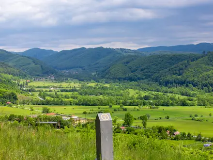
The Romanian E8 starts at Sighetu Marmației on the Ukrainian border and runs south-west to Porțile de Fier, the Iron Gates on the Danube at the Serbian border, near Băile Herculane. It crosses a long sequence of Carpathian ranges, including Rodna, Ceahlău, Bucegi, Piatra Craiului, Făgăraș, Retezat, Cerna and Mehedinți. Key places include Vatra Dornei, Predeal, Poiana Brașov, Zărnești, Păltiniș and Băile Herculane. The E8 is not separately waymarked throughout Romania; it follows existing national trail blazes, with some E8 signs. For shorter previews, see the Bucegi Plateau Circuit, Bucura Lake Circuit or Bâlea Lake to Bâlea Waterfall.
How the E8 fits into Europe’s long-distance path network
The E-paths were developed by the European Ramblers Association from 1969 to link national hiking routes into trans-European footpaths. The E8 was part of that original network, with the full route commonly described as running from County Cork in Ireland towards Bulgaria as eastern sections are extended and refined. In Romania, the E8 largely reuses established Carpathian hiking trails, shepherds’ routes and older mountain tracks rather than a wholly new dedicated path.
Notable highlights
- Făgăraș Mountains & Moldoveanu Peak (2,544 m): The route crosses the main ridge of Romania’s highest range and reaches Moldoveanu, the highest point of the Romanian E8.
- Rodna Mountains National Park: An early northern section over one of Romania’s long wild ridges, including Pietrosul Rodnei, the highest peak of the Eastern Carpathians, within a UNESCO biosphere reserve.
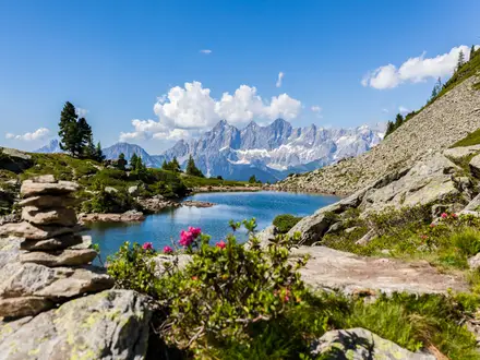
- Retezat National Park: Romania’s oldest national park, established in 1935, is known for glacial lakes including Bucura; the E8 crosses it in the Southern Carpathians. The Bucura Lake Circuit is a shorter way to sample this area.
- Piatra Craiului: A narrow limestone ridge near Zărnești with cabled scrambling sections, making it one of the more technical passages on the Romanian E8.
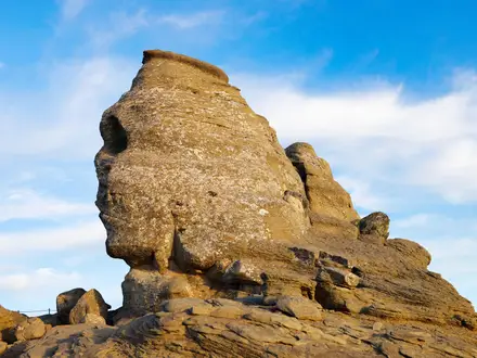
- Bucegi plateau: A high tableland above Predeal and Poiana Brașov, known for the Sphinx and Babele rock formations and the Caraiman Heroes’ Cross. The Babele to Sphinx Rock Trail focuses on this landmark area.
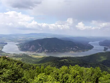
- Băile Herculane & the Iron Gates: The finish descends through the Cerna and Mehedinți mountains past the Roman thermal spa of Băile Herculane to Porțile de Fier, where the Danube forms the Iron Gates gorge.
Challenges to expect
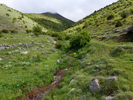
Expect sustained mountain days, long self-sufficient carries between resupply, and variable waymarking. The surface includes rocky paths, scree, forest tracks and occasional cabled or technical passages, especially in Piatra Craiului and Făgăraș. High ridges such as Rodna, Făgăraș and Retezat can hold snow into early summer and are exposed to autumn storms. Brown bear habitat is widespread, so bear-aware camping and food storage matter.
HikeList Score
E8 European Long-Distance Path scored 80/100 on HikeList's trail-quality metrics.
See score breakdownHide breakdown
- Ideal length 52
- Balanced challenge 80
- Scenery & wildness 88
- Varied terrain 100
- Accommodation 75
- Food & support 81
- Path quality 98
- Season flexibility 89
Computed from length, challenge, scenery & wildness, terrain variety, accommodation, food & support, path quality and season flexibility.
 Romania
Show more data Show less
- Mountainous
- Alpine
- Forest
- Rural
- Rocky
- Scree
- Dirt
- Gravel
- Huts
- Hotels
- Wild Camping Spots
- Family Friendly
- Pet Friendly
- Water Sources
- Campsites
- Shelters
Photos from hikers
Taken on the trail by people who've reviewed E8 European Long-Distance Path.
Reviews
How would you rate E8 European Long-Distance Path?
Tap a star to start your review — you could be the first.