Drava River Trail (Dravska Pot)
How would you rate Drava River Trail (Dravska Pot)?
Tap a star to share your experience and help other hikers.
Drava River Trail (Dravska Pot): Slovenia’s Drava Bike Route
HikeList Score
Drava River Trail (Dravska Pot) scored 83/100 on HikeList's trail-quality metrics.
See score breakdownHide breakdown
- Ideal length 78
- Balanced challenge 90
- Scenery & wildness 74
- Varied terrain 87
- Accommodation 92
- Food & support 88
- Path quality 71
- Season flexibility 89
Computed from length, challenge, scenery & wildness, terrain variety, accommodation, food & support, path quality and season flexibility.
The Drava River Trail listing refers to the 145 km Slovenian section of the Drava Cycling Route / Drava Bike, not a dedicated long-distance hiking trail. It runs point-to-point through north-east Slovenia, from Dravograd near Vič pri Dravogradu to Središče ob Dravi on the Croatian border. Expect an easy-to-moderate riverside route: mostly flat valley riding or walking, with one notable climb near Podvelka and Lovrenc na Pohorju. It suits cyclists best, but walkers can use selected sections.
Route Overview
The route follows the Drava downstream from Dravograd in Koroška towards Radlje ob Dravi, Maribor, Ptuj, Ormož and finally Središče ob Dravi at the Croatian border. The official Slovenian Drava Bike stages are Dravograd–Radlje ob Dravi, Radlje ob Dravi–Maribor, Maribor–Ptuj and Ptuj–Ormož, with the route continuing to Središče ob Dravi. It is a linear, signed cycle route using cycle paths, quiet roads and gravel tracks, with good rail links running broadly parallel for flexible stage planning. For dedicated walking routes, compare the European Long-Distance Path E7, Žiče Charterhouse Trail or the Pohorje-side Lovrenc Lakes Trail.
Drava River and Cross-Border Route History
The Drava rises in the Dolomites of South Tyrol, crosses Austria, Slovenia and Croatia, and eventually joins the Danube. Today’s Drava Bike route is a cross-border tourism project linking the river corridor through several countries. In Slovenia, the route is coordinated and promoted as part of the Drava Cycling Route, connecting Koroška, the Drava valley, Maribor, Ptuj and the south-eastern wine country around Ormož.
Notable highlights
- Maribor and the Stara Trta: Slovenia’s second city sits on the Drava, with the Lent riverside quarter as a useful stop. Growing on the Old Vine House façade here, the Stara Trta is certified the oldest living grapevine in the world at over 400 years, still producing a small annual yield.
- Ptuj: Often described as Slovenia’s oldest town, Ptuj stands above the Drava with Ptuj Castle, a compact old town and strong wine traditions. It is also known for the Kurentovanje carnival.
- Dravograd and the Koroška confluence: The Slovenian route starts where the Mežica, Mislinja and Drava valleys meet. It is the northern gateway to the route, backed by the forested Pohorje and Kozjak hills.
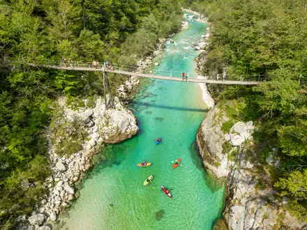
- Drava reservoirs and wetlands: The river is dammed into a chain of accumulation lakes, with kayaking, rafting, SUP and swimming in places. Wetland sections add birdlife and quieter riverside scenery.
- Ormož and the south-eastern wine country: Ormož lies close to the Croatian border, surrounded by the Jeruzalem-Ormož wine hills. The nearby Ormož lagoons are an important bird habitat.
Challenges to expect
The main caveat is activity type: this is signed for bikes, not hikers, so expect cycle-route waymarking and some road sections. Surfaces are mixed, roughly asphalt and gravel, and trekking or mountain bikes are recommended. The route is mostly flat, but the Podvelka–Lovrenc na Pohorju section includes a notable climb of about 6 km. Summer can be warm around Ptuj and Ormož; resupply and lodging are generally easy.
HikeList Score
Drava River Trail (Dravska Pot) scored 83/100 on HikeList's trail-quality metrics.
See score breakdownHide breakdown
- Ideal length 78
- Balanced challenge 90
- Scenery & wildness 74
- Varied terrain 87
- Accommodation 92
- Food & support 88
- Path quality 71
- Season flexibility 89
Computed from length, challenge, scenery & wildness, terrain variety, accommodation, food & support, path quality and season flexibility.
 Slovenia
Show more data Show less
- River Valley
- Wetlands
- Woodland
- Farmland
- Vineyards
- Paved
- Gravel
- Hotels
- Guesthouses
- Farm Stays
- Campsites
- Family Friendly
- Pet Friendly
- Restrooms
- Water Sources
- Campsites
- Picnic Areas
Photos from hikers
Taken on the trail by people who've reviewed Drava River Trail (Dravska Pot).
Start at Dravograd near the Vič pri Dravogradu border crossing, where the Mežica, Mislinja and Drava valleys meet. Follow the signed Drava Bike route downstream through the upper Drava valley towards Radlje ob Dravi.
Continue along the Drava corridor towards Maribor. This section includes the route’s notable climb of about 6 km between Podvelka and Lovrenc na Pohorju, before the route approaches Slovenia’s second city.
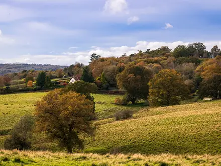
Leave Maribor’s Drava riverside and continue east towards Ptuj. The lower valley becomes more open, with farmland, riverside wetlands and wine-country scenery around the Drava.
Follow the official stage from Ptuj to Ormož, then continue downstream to Središče ob Dravi at the Croatian border. Heading downstream, Ormož comes before Središče ob Dravi.
Reviews
How would you rate Drava River Trail (Dravska Pot)?
Tap a star to start your review — you could be the first.