Dachstein Rundwanderweg
How would you rate Dachstein Rundwanderweg?
Tap a star to share your experience and help other hikers.
Dachstein Rundwanderweg: A High-Alpine Hut-to-Hut Loop
HikeList Score
Dachstein Rundwanderweg scored 85/100 on HikeList's trail-quality metrics.
See score breakdownHide breakdown
- Ideal length 98
- Balanced challenge 80
- Scenery & wildness 98
- Varied terrain 71
- Accommodation 66
- Food & support 81
- Path quality 98
- Season flexibility 76
Computed from length, challenge, scenery & wildness, terrain variety, accommodation, food & support, path quality and season flexibility.
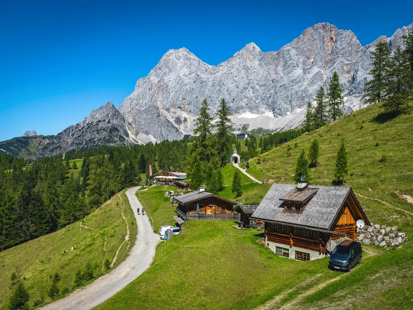
The Dachstein Rundwanderweg is a waymarked 121 km, 8-day hut-to-hut loop around the Dachstein massif in Austria, crossing Salzburg, Upper Austria and Styria. It is a hard high-alpine trek, with about 6,200 m of ascent and a highest point around 2,700 m near the Hunerkogel. Expect rocky karst, exposed glacier-edge paths, forest tracks, long stages and classic Austrian refuges. It suits fit hikers with sure-footedness, stamina and a head for exposure, rather than beginners, and works well as a tougher counterpart to the shorter Dachstein Glacier Circuit.
Route Overview
The standard loop starts and finishes at Gosau / Gosausee, usually from the Lake Gosau car park, and is walked clockwise. From the Vorderer Gosausee it runs beneath the Gosaukamm to Hofpürglhütte, follows the Linzer/Pernerweg under the Dachstein south wall to Dachstein-Südwandhütte, then crosses the high glacier-edge plateau via Hunerkogel to Guttenberghaus. The second half drops through Stoderzinken, Viehbergalm, Bad Mitterndorf and the historic Notgasse to Hallstatt, then follows the Hallstätter See towards Bad Goisern before climbing over the Goiserer Hütte back to Gosau. Optional logistics include cable cars around Hunerkogel and the Hallstatt lake ferry. Hikers after more of the eastern Alps can pair it with Tyrol's Eagle Walk (Adlerweg) or the long-distance Alpe-Adria Trail running south to the Adriatic.
Hallstatt-Dachstein history and salt routes
The route passes through the Hallstatt-Dachstein / Salzkammergut cultural landscape, a UNESCO World Heritage Site since 1997. Hallstatt is central to that history: the village gave its name to the Hallstatt period of the European Iron Age, and its salt mine is among the oldest known in the world, worked for over 7,000 years. The trail also follows older herders’, pilgrims’ and salt-trade paths, including the Notgasse gorge on Stage 6, where rock carvings survive along the historic through-route.
Notable highlights
- Gosausee and the Gosaukamm: The loop begins at Vorderer Gosausee, a glacial lake below the Dachstein. The first stage then follows the foot of the jagged limestone Gosaukamm beneath the Bischofsmütze.
- Dachstein glacier plateau / Hunerkogel: Stage 3 is the highest and hardest part of the route, crossing karst and glacier-edge terrain at around 2,700 m. Hunerkogel has cable-car access and an ice cave / ice palace area.
- Hallstatt: This UNESCO-listed lakeside village sits on the Hallstätter See and is known for its prehistoric salt mine. It is one of the major cultural stops on the loop.
- Notgasse: A narrow historic gorge on the long Stage 6. It was an old through-route and preserves centuries-old rock carvings.
- Mountain huts: Hofpürglhütte, Dachstein-Südwandhütte, Guttenberghaus, Steinerhaus and Goiserer Hütte give the trek its classic half-board hut-to-hut rhythm.
- Hallstätter See and Bad Goisern: Stage 7 follows the east-shore lakeside path, with the Hallstatt lake ferry available depending on overnight plans.
Challenges to expect
This is a hard alpine route, not just a scenic hut walk. The crux is Stage 3 from Dachstein-Südwandhütte via Hunerkogel to Guttenberghaus, graded up to T4, with exposed rocky karst and glacier-edge terrain. Lingering snowfields are possible early or late season. Some days are long, including the Bad Mitterndorf to Hallstatt stage. Huts should be booked ahead in summer, and weather can change quickly at altitude.
HikeList Score
Dachstein Rundwanderweg scored 85/100 on HikeList's trail-quality metrics.
See score breakdownHide breakdown
- Ideal length 98
- Balanced challenge 80
- Scenery & wildness 98
- Varied terrain 71
- Accommodation 66
- Food & support 81
- Path quality 98
- Season flexibility 76
Computed from length, challenge, scenery & wildness, terrain variety, accommodation, food & support, path quality and season flexibility.
 Austria
Show more data Show less
- Mountainous
- Forest
- Rocky
- Dirt
- Gravel
- Huts
- Hotels
- Pet Friendly
- Water Sources
- Campsites
- Shelters
Photos from hikers
Taken on the trail by people who've reviewed Dachstein Rundwanderweg.
Start at Gosausee and head beneath the Gosaukamm towards Hofpürglhütte, at the foot of the limestone ridge and below the Bischofsmütze.
Follow the Linzer/Pernerweg beneath the Dachstein south wall to Dachstein-Südwandhütte, staying in high mountain terrain below the massif.
The hardest stage crosses the high glacier-edge plateau around Hunerkogel, reaching about 2,700 m before continuing across the karst terrain ‘am Stein’ to Guttenberghaus.
Leave the high Dachstein terrain for alpine meadows and continue towards Steinerhaus and the Stoderzinken viewpoint.
Continue via the Viehbergalm towards Steinitzenalm or Bad Mitterndorf, depending on the stage variant and overnight booking.
A long, relatively low-ascent day via the historic Notgasse gorge, finishing at Hallstatt on the Hallstätter See.
Follow the east-shore lakeside path along the Hallstätter See towards Bad Goisern. The Hallstatt lake ferry is an option depending on where you stay.
Finish with a steep climb over the Goiserer Hütte before descending back to Gosau and closing the loop at Gosausee.
Reviews
How would you rate Dachstein Rundwanderweg?
Tap a star to start your review — you could be the first.