Cateran Trail
How would you rate Cateran Trail?
Tap a star to share your experience and help other hikers.
Cateran Trail: A Complete Hiking Guide
HikeList Score
Cateran Trail scored 91/100 on HikeList's trail-quality metrics.
See score breakdownHide breakdown
- Ideal length 85
- Balanced challenge 100
- Scenery & wildness 78
- Varied terrain 100
- Accommodation 100
- Food & support 94
- Path quality 92
- Season flexibility 89
Computed from length, challenge, scenery & wildness, terrain variety, accommodation, food & support, path quality and season flexibility.
The Cateran Trail is a 103 km circular long-distance walk from Blairgowrie through Perthshire and the Angus glens in central Scotland. It is usually walked clockwise over 4-6 days, typically 5, and is graded moderate. Expect farmland, forest, heather moorland, open hillside and old drovers' roads, with one sustained climb to An Lairig at around 650 m. It suits hikers who want a waymarked Highland-edge route with village accommodation rather than a remote mountain expedition.
Route Overview
The route starts and finishes in Blairgowrie, so logistics are simpler than on a point-to-point trail: you return to the same town rather than needing an end-to-end transfer. The usual clockwise line runs Blairgowrie - Kirkmichael - Spittal of Glenshee - Kirkton of Glenisla - Alyth - Blairgowrie, matching the five waymarked stages. The trail uses old drovers' roads, farm tracks, forest paths, riverside paths and short sections of quiet minor road. It is maintained by the Perth & Kinross Countryside Trust and designated one of Scotland's Great Trails by NatureScot. For Scottish coastal alternatives, compare the Arran Coastal Way or Ayrshire Coastal Path; another option is the Annandale Way.
Cateran Trail History: Drovers, Raids and Cattle Routes
The trail is named after the Caterans: bands of Highlanders who, from roughly the 1300s to the 1600s, raided the more prosperous lowland glens to rustle cattle. Herds were driven back into the hills using drove roads and passes across this Highland-edge landscape. Much of the modern walking route follows those old lines of movement, so the history is not just a theme: it is directly connected to the tracks underfoot.
Notable highlights
- Reekie Linn: A worthwhile short diversion to a waterfall on the River Isla, where the river drops into a deep wooded gorge. The name means 'smoking pool', referring to the spray.
- An Lairig (Lairig Gate, ~650 m): The trail's high point, a col between Ben Earb and Meall Uaine above Spittal of Glenshee. It comes on the main sustained climb and gives broad views over Glenshee.
- Spittal of Glenshee: A historic stopping place for travellers crossing the glens. The name preserves the memory of a medieval hospice, or 'spittal', in this mountain setting.
- Mount Blair (744 m): A distinctive hill overlooking the route and available as an optional detour. It marks the watershed between Glen Shee and Glen Isla.
- Drove roads: Long stretches follow old routes used to move cattle through the glens. These tracks also link the route to the Cateran raids that gave the trail its name.
- Red kites and wildlife: The Perthshire glens are strong country for red kites and other raptors, now regularly seen over moorland and farmland.
Challenges to expect
The Cateran Trail is moderate, not technical, but the daily distances can be long: two stages are around 25 km. The main physical challenge is the sustained climb to An Lairig at about 650 m. High moorland sections are exposed in poor weather, and the route mixes soft paths, tracks and short paved-road sections. Waymarking is good, but carry normal navigation backup.
HikeList Score
Cateran Trail scored 91/100 on HikeList's trail-quality metrics.
See score breakdownHide breakdown
- Ideal length 85
- Balanced challenge 100
- Scenery & wildness 78
- Varied terrain 100
- Accommodation 100
- Food & support 94
- Path quality 92
- Season flexibility 89
Computed from length, challenge, scenery & wildness, terrain variety, accommodation, food & support, path quality and season flexibility.
 United Kingdom
 Scotland
Show more data Show less
- Farmland
- Moorland
- Forest
- Open Hillside
- Drovers' Roads
- Farm Tracks
- Forest Paths
- Riverside Paths
- Paved Road
- B&Bs
- Inns
- Guest Houses
- Hostels
- Campsites
- Family Friendly
- Dog Friendly On Leash
- Restrooms
- Non Potable Water Sources
- Established Campsites
- Picnic Areas
- Public Transport Access Points
Download Our Full Guide to Cateran Trail FREE!
Get our comprehensive guide to this hike for free. Save it for later reading or print out at home.
In these collections
Photos from hikers
Taken on the trail by people who've reviewed Cateran Trail.
Cateran Trail: The Complete Guide
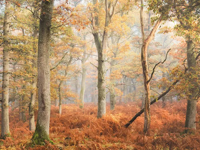 i
Image by Stephen
i
Image by Stephen The Cateran Trail is a 103 km circular walk from Blairgowrie through Perthshire and the Angus glens, sitting on the southern edge of the Highlands. It suits fit walkers who want a waymarked Scottish long-distance route with real hill country, but without committing to a remote mountain expedition.
The loop format is one of its great practical advantages: you start and finish in Blairgowrie, so there is no end-to-end transfer to arrange. Bags, cars and public transport plans all return to the same place, which makes the trail simpler to organise than many point-to-point routes.
Underfoot, the route mixes farm tracks, forest paths, riverside walking, old drove roads, moorland paths and short sections of quiet road. The character changes steadily from berry-farm country and woodland to Strathardle, Glenshee, the open crossing over An Lairig, Glen Isla, Alyth and back towards Blairgowrie.
This is also a walk with a strong historical thread. The trail follows routes used by drovers and by the caterans — Highland cattle raiders who gave the trail its name — with places such as Spittal of Glenshee, Reekie Linn and the high col at An Lairig adding clear landmarks along the way.
The walking is moderate rather than technical, but it still asks for fitness and sensible planning. Two stages are around 24–25 km, accommodation is sparse on the higher sections, and exposed moorland can feel serious in poor Scottish weather.
This guide covers stages, days, accommodation, food, transport, terrain, safety, gear, support services, shorter options and common mistakes.
Stage-by-Stage Guide
The Cateran Trail is normally walked as five waymarked stages. Waymarks use the distinctive white disc with a red heart logo, with carved drover-face posts in places, but a map or GPX should still be carried for moorland, forestry and farm sections.
Most stages have few or no food stops between overnight villages. Carry a full day’s food, and treat or filter water taken from burns, rivers or lochs, especially on open moorland and farmland.
Stage 1: Blairgowrie to Kirkmichael — 24.9 km / 15.5 miles
This is the longest day of the standard itinerary and a firm start to the trail. It begins in Blairgowrie town centre and leaves town by following the River Ericht northwards before moving into a mix of moorland, woodland, farm tracks and minor road.
The first half gives a varied introduction to the route: riverside walking out of Blairgowrie, open ground on Cochrage Moor, then a descent towards Bridge of Cally on the River Ardle. Bridge of Cally is an important waypoint because it is the only practical intermediate service point on the stage.
Beyond Bridge of Cally, the route continues through Blackcraig Forest on good forest tracks and then towards Strathardle, with broader views opening up over the valley. The walking is not technical, but the distance, exposed moorland and limited services make it a day to start early.
Blairgowrie is the place to stock up before leaving, with supermarkets, cafés, pubs and other town services. Bridge of Cally Hotel may provide food and drink partway through the day, but opening hours should be checked before relying on it. There are no other dependable food stops before Kirkmichael, so carry lunch and enough water from the start.
Kirkmichael is a small village in Strathardle with limited accommodation. Hotel/pub provision is limited; the main options are the Kirkmichael Hotel and Strathardle Lodge, though current status should be checked before booking. B&B options exist in the village area, but choice is restricted, especially in summer.
Bridge of Cally and Kirkmichael are both served by Stagecoach 71, giving useful road access or an escape option if the first day proves too long. Current bus times should be checked before travelling.
Navigation is generally straightforward on waymarked paths and tracks. The main caution is Cochrage Moor, which can feel exposed and can be wet or boggy after rain. Dogs should be kept on a short lead through livestock fields.
Stage 2: Kirkmichael to Spittal of Glenshee — 13.7 km / 8.5 miles
This is the shortest stage by distance, but it is one of the most important days to treat with respect. The route climbs from Strathardle into the high moorland around An Lairig, the trail’s high point at roughly 650 m, before descending to Spittal of Glenshee.
Leaving Kirkmichael, the trail heads north-west up Strathardle and passes Enochdhu, a small hamlet that is useful as a navigation point rather than a service stop. The route then passes through woodland sections around Kindrogan Wood and Calamanach Wood, with Tullochcurran Loch providing a scenic break before the higher ground.
The climb to An Lairig, also known as the Lairig Gate, is the defining section of the stage. The col sits between Ben Earb and Meall Uaine and gives the most exposed walking of the day. In clear weather this is one of the trail’s best upland sections; in mist, wind or rain it needs careful navigation and suitable clothing.
A small open shelter associated with Dirnanean Estate may be useful as a rest point, but it should not be treated as a substitute for proper bad-weather kit. After the col, the route descends to Spittal of Glenshee, a historic travellers’ stopping place in a remote mountain setting.
There are no food stops between Kirkmichael and Spittal of Glenshee. Carry lunch, snacks and sufficient water, and filter any water taken from burns on the moorland.
Accommodation at Spittal of Glenshee is very limited. The Spittal of Glenshee Hotel is the traditional inn option, with meals and bar facilities subject to current opening arrangements. Gulabin Lodge, a hostel/bunkhouse less than 1 km from the trail, is a useful budget option, but it can book up quickly.
Stagecoach 71 serves Spittal of Glenshee, though service patterns can be reduced outside the main season. This should be checked before travelling, especially if using the bus as a contingency plan.
The waymarking is generally good, but this is the stage where poor visibility matters most. An Lairig is open, high and exposed; do not treat the short distance as an easy lowland half-day in bad weather.
Stage 3: Spittal of Glenshee to Kirkton of Glenisla — 23.5 km / 14.6 miles
This is a long crossing from the Glenshee side towards Glen Isla, combining glen walking, estate tracks, high lochs, moorland and some road walking. It is the second-longest stage of the standard itinerary and has no intermediate food stops, so it requires careful provisioning.
From Spittal of Glenshee, the route descends south through Glen Shee, with Shee Water / River Shee running through the glen. It passes Westerton of Runavey and Dalnaglar Castle, where the trail goes through or near estate land.
The stage then crosses the watershed towards Glen Isla. Loch Beanie, Auchintaple Loch and Loch Shandra are key landscape features on or near this part of the route, while Mount Blair rises prominently above the area. The main trail passes the lower slopes of Mount Blair; the summit is a substantial optional detour and should only be added if there is enough time, energy and weather margin.
An improved off-road section near Dalnaglar replaced earlier road sections, but the main route still includes a section on the B951. This is a quiet minor road, not a main highway, but walkers should still stay alert for vehicles and walk defensively on bends.
The route continues through Glen Isla, passing near Forter Castle — a 16th-century Ogilvy stronghold, burned in 1640 and restored in the 1990s — before reaching Kirkton of Glenisla. The settlement is small, centred around the old kirk area and Glenisla Hotel.
There are no food stops between Spittal of Glenshee and Kirkton of Glenisla. Carry a full lunch, snacks and enough water for a long day. Water can be taken from burns or lochs if necessary, but it should be filtered or treated.
Glenisla Hotel is the key accommodation and meal stop at the end of the stage. Alternatives are very limited, so this overnight should be booked well ahead. Some walking-holiday operators avoid overnighting at Kirkton of Glenisla by using taxi transfers from bases such as Alyth or Kirkmichael.
There is no useful public transport at Kirkton of Glenisla. If an exit is needed, a taxi from Alyth is the main practical option, and this should be arranged in advance rather than assumed on the day.
Navigation is generally helped by waymarks, but estate land requires care: stay on the marked trail and respect shooting estate boundaries. Alternative route options via Compass Christian Centre and Glen Beanie exist, so follow the current official waymarks for the intended line.
Stage 4: Kirkton of Glenisla to Alyth — 17.4 km / 10.8 miles
This stage marks the transition from the Angus glens towards the lower, more settled country around Strathmore. It is shorter than the previous day but still varied, with moorland, farmland, woodland, river sections and a useful resupply finish in Alyth.
The route starts from the road west of Glenisla Hotel, where an iron bridge is a useful navigational cue. It then passes a string of farms through Glen Isla and Strathmore farmland, with sections near the River Isla.
Reekie Linn is the key diversion on this stage and is worth allowing time for. The waterfall lies about 1.6 km / 1 mile round trip off the main route, where the River Isla drops into a deep wooded gorge. There are no services at the waterfall area, so it is a scenic detour rather than a refreshment stop.
The route also passes over or near the Hill of Alyth, at 318 m, and the Hill of Loyal. These lower hills give broad views over Strathmore before the path drops into Alyth.
There are no food stops between Kirkton of Glenisla and Alyth, so carry lunch from the start. Alyth is the first substantial resupply point since Blairgowrie, with shops, cafés and pub facilities.
Alyth has one of the better accommodation choices on the trail, with B&Bs and guesthouses in town. It is also a common base for walkers using taxi transfers for the Glenisla stages.
Alyth is on the Stagecoach 57 route between Perth and Dundee via Blairgowrie and Alyth, making it one of the best-connected points on the trail after Blairgowrie. Current times should be checked before travelling.
Navigation is usually clear, but the farm sections approaching Alyth need attention to markers, gates and field edges. Livestock fields are common, so dogs should be kept on a lead and gates left as found.
Stage 5: Alyth to Blairgowrie — 24.1 km / 15 miles
The final stage closes the loop back to Blairgowrie and is almost as long as the opening day. It is a satisfying finish, but it should not be underestimated, particularly if the previous Glen Isla stages have left tired legs.
Leaving Alyth, the route passes near the Hill of Alyth before continuing through estate and farmland. Bamff Estate is crossed on a right of way through private estate land, so stay on the marked route and follow any local signs.
The stage includes farm tracks around Tullyfergus, plantation forestry in Drimmie Woods and terrain that eventually converges with the Bridge of Cally area. Parts of the closing day share ground with, or closely mirror, the opening stage near Bridge of Cally before returning towards Blairgowrie and the River Ericht.
A signed alternative through the Den of Alyth offers a more wooded and sheltered variant. It is also a sensible easier option on the final day if energy is low, provided the current waymarking and route conditions are followed.
Alyth is the place to stock up before setting out. Bridge of Cally Hotel may provide food and drink partway through the stage, but opening hours should be checked before relying on it. There are no other dependable food stops before Blairgowrie.
Blairgowrie has the full range of start/finish town services, including accommodation, food, shops and onward transport. The circular nature of the trail makes the finish logistically simple if accommodation, a vehicle or onward bus connections have been arranged in Blairgowrie.
Bridge of Cally gives mid-stage road access and is served by Stagecoach 71. Blairgowrie is served by Stagecoach 57 between Perth and Dundee via Blairgowrie and Alyth. Current bus times should be checked before travelling.
The route is well marked, including the Den of Alyth alternative, but estate and farm sections still require normal care with gates, livestock and waymarks. The main warning is the distance: treat the final day as a full walking day, not a short walk back to town.
Recommended Itinerary
The Cateran Trail fits best into its five waymarked stages. This keeps the longest days to around 24–25 km, gives a logical overnight pattern, and avoids unnecessary route-planning on a trail where accommodation is limited in the smaller glens.
The main planning issue is Spittal of Glenshee. Do not assume there is an overnight stop there: the former hotel has been closed since the 2014 fire, and any new development should be checked before travelling. Many walkers use a taxi transfer to or from Kirkmichael or Alyth for this stage.
Standard 5-day itinerary
| Day | From | To | Approx. distance | Why this stage makes sense | Services/accommodation notes |
|---|---|---|---|---|---|
| 1 | Blairgowrie | Kirkmichael | 24.9 km | A long but sensible first day on lower ground, following the River Ericht before continuing through Bridge of Cally and onto moorland tracks. It gets one of the biggest mileage days done before the higher interior stages. | Blairgowrie has full town amenities for the start. Bridge of Cally sits part-way through the stage. Kirkmichael is a small village with a shop and two hotels/pubs; book ahead. |
| 2 | Kirkmichael | Spittal of Glenshee | 13.7 km | The shortest day on paper, but one of the most serious. The route climbs to An Lairig, the trail’s high point at about 650 m, with open moorland and exposure in poor weather. | Spittal of Glenshee has a major accommodation gap. Unless current accommodation has been arranged, plan a taxi transfer away from Spittal, commonly back to Kirkmichael or onward to Alyth. This should be checked before travelling. |
| 3 | Spittal of Glenshee | Kirkton of Glenisla | 23.5 km | The wildest and most remote stage, continuing through high, open country before descending towards Glen Isla. The optional Mount Blair detour belongs on this day only if time, weather and fitness allow. | If sleeping off-route after Day 2, arrange a taxi back to Spittal for the start. Kirkton of Glenisla is very small, with limited accommodation; pre-book well ahead or arrange a transfer out. |
| 4 | Kirkton of Glenisla | Alyth | 17.4 km | A more forgiving day after the remote ground, moving through forest, farmland and the Hill of Alyth area towards a proper small town. | Alyth has a better choice of B&Bs, hotels, shops and places to eat, making it one of the easier overnights to organise. |
| 5 | Alyth | Blairgowrie | 24.1 km | A long final stage through moorland and farmland, returning to the start of the loop. It is a natural finish because no end-to-end transfer is needed. | Blairgowrie has full amenities, onward public transport connections, and is the logical place for a final night if needed. Car drivers return to their start point. |
Slower 6-day variant
A 6-day plan suits walkers who prefer shorter days, want more time in the villages, or do not want two 24 km-plus days in a standard schedule. The simplest extra night is usually added in Blairgowrie or Alyth as a rest or buffer night, but that does not shorten the walking stages.
To reduce the first long day, the most practical walking split is to stop at Bridge of Cally between Blairgowrie and Kirkmichael. Accommodation there is limited, and exact split distances should be checked on official mapping before booking.
| Day | From | To | Approx. distance | Why this stage makes sense | Services/accommodation notes |
|---|---|---|---|---|---|
| 1 | Blairgowrie | Bridge of Cally | Check official mapping before booking | Splits the longest opening stage and creates an easier start. | Limited accommodation; do not rely on this split without a booking. |
| 2 | Bridge of Cally | Kirkmichael | Check official mapping before booking | Completes the first official stage at a more relaxed pace. | Kirkmichael has a shop and two hotels/pubs; book ahead. |
| 3 | Kirkmichael | Spittal of Glenshee | 13.7 km | Keeps the high An Lairig crossing as a standalone day. | Arrange Spittal accommodation or taxi logistics in advance. This should be checked before travelling. |
| 4 | Spittal of Glenshee | Kirkton of Glenisla | 23.5 km | Keeps the remote moorland stage intact, which is usually simpler than trying to split it. | Kirkton of Glenisla has limited accommodation; pre-book or arrange a transfer. |
| 5 | Kirkton of Glenisla | Alyth | 17.4 km | A moderate day into a town with better services. | Alyth is one of the easier overnight stops. |
| 6 | Alyth | Blairgowrie | 24.1 km | Finishes the loop back at the transport and accommodation hub. | Blairgowrie is the best place for post-walk accommodation and onward travel. |
Faster 4-day variant
A 4-day itinerary is realistic only for fit, experienced long-distance walkers who are comfortable with 30 km-plus days and exposed upland terrain. The most logical compression is to combine the Kirkmichael–Spittal of Glenshee and Spittal of Glenshee–Kirkton of Glenisla stages, which also avoids the overnight problem at Spittal.
| Day | From | To | Approx. distance | Why this stage makes sense | Services/accommodation notes |
|---|---|---|---|---|---|
| 1 | Blairgowrie | Kirkmichael | 24.9 km | Starts with the standard long opening stage. | Kirkmichael accommodation should be booked ahead. |
| 2 | Kirkmichael | Kirkton of Glenisla, via Spittal of Glenshee | 37.2 km | Combines the short high stage over An Lairig with the long remote stage beyond Spittal. This is the crux of the 4-day plan and should not be underestimated. | Passing through Spittal avoids needing to stay there, but there are limited services on the long day. Kirkton of Glenisla accommodation or a taxi transfer must be arranged in advance. |
| 3 | Kirkton of Glenisla | Alyth | 17.4 km | Gives a shorter recovery day after the hardest section. | Alyth has the best mid-to-late route services. |
| 4 | Alyth | Blairgowrie | 24.1 km | Completes the loop with the standard final stage. | Finish in Blairgowrie, with no end-to-end transfer required. |
Planning the Route
How many days to allow
Most walkers should plan the Cateran Trail over 5 days. The five waymarked stages fit the accommodation pattern around the loop and keep the average day at about 20.5 km / 12.8 miles.
A 4-day itinerary is possible, but it is a fast plan for fit, experienced walkers. The obvious compression is to combine the short Kirkmichael to Spittal of Glenshee stage with the following stage to Kirkton of Glenisla, but that creates a demanding 37 km+ day including the climb to An Lairig.
A 6-day itinerary suits walkers who want a less pressured pace, more time in the glens, or optional detours such as Mount Blair or Reekie Linn. The main complication is that extra nights are not evenly available along the route, so a slower plan may still need taxi transfers or a repeat night in one of the better-served villages.
| Plan | Best for | Main planning issue |
|---|---|---|
| 4 days | Strong walkers comfortable with long days | Very long combined stages; exposed high ground still needs good weather |
| 5 days | Most independent walkers | Fits the standard waymarked stages and village stops |
| 6 days | A slower pace, detours, or shorter walking days | Extra accommodation may not fall exactly where needed |
Standard 5-day stage plan
The standard itinerary is not just a convenient walking rhythm; it is largely shaped by where accommodation exists. Do not assume there will be easy alternatives midway between the named stage stops.
| Day | Stage | Approx. distance | Planning notes |
|---|---|---|---|
| 1 | Blairgowrie to Kirkmichael | 24.9 km | A long first day; start early enough to avoid arriving late in a small village with limited services. |
| 2 | Kirkmichael to Spittal of Glenshee | 13.7 km | Short on distance, but important logistically because Spittal accommodation is very limited. |
| 3 | Spittal of Glenshee to Kirkton of Glenisla | 23.5 km | The longest, most remote day, crossing high open moorland towards Glen Isla; weather and navigation matter a lot here. |
| 4 | Kirkton of Glenisla to Alyth | 17.4 km | A more moderate day, ending in a small town with better services than the glen villages. |
| 5 | Alyth to Blairgowrie | 24.1 km | Another long stage, but finishes back at the trailhead, simplifying onward travel. |
Accommodation drives the itinerary
Accommodation is the main constraint on this trail. Blairgowrie and Alyth have the broadest choice of places to stay and services, while the glen settlements are much tighter.
Kirkmichael is a small village with a pub and limited accommodation, so it should be booked early. Spittal of Glenshee is especially sparse; the historic Spittal of Glenshee Hotel burned down in 2014, and only a handful of options remain nearby.
Kirkton of Glenisla is also a bottleneck, with very limited accommodation in the village itself. Some self-guided operators solve the Spittal of Glenshee and Glenisla problem by using taxi transfers, often keeping walkers for extra nights in places such as Kirkmichael or Alyth and returning them to the trail next morning.
For summer trips, booking these scarce overnight stops months ahead is sensible rather than cautious. If the exact stage-end accommodation is unavailable, the practical alternatives are usually a taxi transfer, a packaged self-guided itinerary, or changing the walking dates.
Using the loop to simplify logistics
The circular route is a major advantage. There is no end-to-end transfer to arrange: walkers return to Blairgowrie, so a car can be left at or near the start, or public transport only needs to get you to and from the same town.
Blairgowrie is the conventional start and finish, but the loop can be joined elsewhere. Starting in Alyth can make sense for some public-transport itineraries, while starting in another trail village may suit walkers using accommodation or a car shuttle.
Shortening, extending and section hiking
Shortening the full trail is possible, but it needs to be planned around transport and accommodation rather than simply stopping wherever the distance feels right. The easiest places to break the route are the larger settlements, especially Blairgowrie and Alyth.
The trail also works well as a section hike. Blairgowrie and Alyth have the best public transport links on the route, while other villages may require less frequent buses, a taxi, or a car shuttle. Timetables should be checked before travelling.
For a shorter introduction, the Cateran Mini Trail is an official 32 km / 20 mile loop from Kirkmichael. It uses part of the main Cateran Trail towards Lair/Cray and returns by an off-road link route, making it a practical two-day weekend option.
Transport planning
Car-free access is feasible but needs coordination. The trail has no railway station, so the usual approach is to travel by ScotRail to Perth or Dundee, then use the Stagecoach 57 bus to Blairgowrie; the same route also serves Alyth. Ember’s electric coach also calls at Blairgowrie on its Dundee–Aberdeen (via Braemar) route, which can be useful coming from those directions.
The Stagecoach 71 serves places including Bridge of Cally, Spittal of Glenshee and Enochdhu, which can help with section hiking or emergency changes. Rural bus routes and timetables change, so this should be checked before travelling.
Food and water between stages
Do not plan this as a trail with regular shops and cafés throughout the walking day. Services are concentrated in the settlements, and there are long stretches where nothing is available.
Stages 1 and 3 need particular attention, with stretches of 15 km+ where food and reliable drinking-water opportunities may be absent. Carry lunch, snacks and enough water for the full day, especially in warm weather or if accommodation requires an evening arrival time.
Weather and exposed ground
The route is not technical, but it does cross open, exposed country. The key day for weather planning is Kirkmichael to Spittal of Glenshee, which crosses An Lairig at about 650 m between Ben Earb and Meall Uaine; the long, remote Spittal of Glenshee to Kirkton of Glenisla stage is also exposed across high moorland.
In poor visibility, wind or heavy rain, these stages will feel much more serious than the lower farmland and riverside sections. Check the mountain forecast before committing to the high ground, carry a map and compass, and keep enough spare clothing for a slow or wet crossing.
Navigation, maps and GPX
The Cateran Trail is waymarked, but it should not be treated as a route where waymarks alone are enough. Forest tracks, farm tracks, moorland paths and minor roads can all look similar in poor weather or low light.
Useful mapping includes OS Explorer 52, 53, 380 and 381; Harvey also produces a dedicated Cateran Trail map. GPX files are available through official trail bodies, but a charged phone should be backed up with a paper map or offline mapping.
Permits and baggage transfer
No permit or fee is required to walk the Cateran Trail. Scotland’s responsible access rights apply, so walkers should follow the Scottish Outdoor Access Code and take particular care around farmland, livestock and estate tracks.
Baggage transfer can be useful on this route, less because of the terrain and more because of the accommodation pattern. Companies such as Absolute Escapes, EasyWays, Celtic Trails and other self-guided operators offer packages or luggage-transfer arrangements, often using transfers to manage the sparse accommodation around Spittal of Glenshee and Kirkton of Glenisla. Current services and prices should be checked before booking.
Towns, Villages and Overnight Stops
Accommodation is straightforward at the start and finish, but much thinner in the middle of the circuit. The critical bookings are usually Spittal of Glenshee and Kirkton of Glenisla; if those beds are full, alternatives may require a taxi or a changed itinerary.
| Place | Role on the trail | Shops / resupply | Overnight practicality |
|---|---|---|---|
| Blairgowrie | Start and finish | Full town services, including Tesco | Best pre- and post-walk base |
| Bridge of Cally | Midway option on Stage 1 | No proper resupply | Useful if splitting the first long stage |
| Kirkmichael | End of Stage 1 | Village shop | Main first-night stop |
| Spittal of Glenshee | End of Stage 2 | No shops | Essential to book ahead; very limited beds |
| Kirkton of Glenisla | End of Stage 3 | No shops | One main accommodation option; plan food carefully |
| Alyth | End of Stage 4 | Co-op and independent shops | Strong final-night stop and good bailout point |
| Blairgowrie | Finish | Full town services | Simple return logistics on a loop |
Blairgowrie
Blairgowrie is the natural place to start, finish and organise the walk. It is the largest settlement on the Cateran Trail by a wide margin, with a supermarket, independent food shops, cafés, restaurants, pubs and a broad range of accommodation.
For food before departure, Blairgowrie is the last full-service resupply point before the smaller villages. Tesco covers standard trail supplies, while the high street has useful independent options including Robertsons of Scotland, the Cateran Café, Thistle Desserts and bakeries on Allan Street.
Accommodation is plentiful compared with the rest of the route: hotels, B&Bs, guest houses, self-catering and Airbnb-style stays are all available. It works well for a night before starting and for an easier recovery night at the end, especially if arriving by public transport or leaving a vehicle locally.
Transport is strongest here. Perth is the nearest railway station, around 15 miles away, with Stagecoach 57/57A linking Perth, Blairgowrie, Alyth and Dundee. Services are roughly hourly, but current timetables should be checked before travelling.
The Perth & Kinross Countryside Trust reception centre at Boat Brae is also useful for trail logistics, with services including accommodation booking, car parking and luggage transfer. Current opening arrangements and services should be checked before relying on them.
Bridge of Cally
Bridge of Cally sits on Stage 1, roughly halfway between Blairgowrie and Kirkmichael. It is a small settlement on the A93 where the River Ardle meets the River Ericht, and it is most useful as an optional overnight stop for walkers who do not want to tackle the full first stage in one day.
The main facility is the Bridge of Cally Hotel, which the trail passes beside. It has en-suite rooms, breakfast and evening meals, a bar, Wi-Fi and parking, making it a practical stop rather than a resupply point.
There are no village shops or wider services here, so do not plan to stock up. If staying overnight, food arrangements should be based around the hotel and checked when booking.
Transport options are more limited than in Blairgowrie or Alyth. The Stagecoach 71 serves Bridge of Cally, Spittal of Glenshee and Enochdhu, but timetables and operating days should be checked before travelling.
Kirkmichael
Kirkmichael is the usual first-night stop on the five-stage itinerary, at the end of the long Blairgowrie to Kirkmichael stage. It is a small village in Strathardle Glen, but it has enough facilities to work well for walkers.
The key advantage is the village shop, which is a genuinely useful resupply point after leaving Blairgowrie. This is the place to buy food for the following stage if needed, and to think ahead before reaching the more remote stops.
Accommodation includes the Kirkmichael Hotel, a former coaching inn with en-suite rooms, bar, restaurant and drying facilities for walking gear. It is popular with Cateran Trail walkers, so booking ahead is strongly advised.
Other options include Kirkmichael House B&B and Cateran Rest, a small group of log cabins just outside the village. Cateran Rest is more self-catering or glamping-style than a traditional hiker bunkhouse, but may suit couples or groups wanting extra comfort.
Public transport is limited and Kirkmichael is not a main hub. Any bus connections in the area should be checked carefully before building them into a section-walk plan.
Spittal of Glenshee
Spittal of Glenshee is a tiny, remote overnight stop at the end of Stage 2. It is more a cluster of buildings than a village, and its mountain setting makes it one of the most important places to book before committing to dates.
There are no shops at Spittal of Glenshee. Supplies need to be carried from Kirkmichael or arranged with accommodation, and walkers should not expect to buy trail food on arrival.
The old Spittal of Glenshee Hotel burned down in 2014, so accommodation is now limited. Gulabin Lodge is the main practical walker-friendly option, directly on or very close to the trail, with bunkhouse-style accommodation, a large kitchen and dining space.
Dalmunzie Castle Hotel is another option, around 2 km from the main hamlet in Glen Shee. It is a more upmarket country-house hotel and is not immediately at the trail junction, so the extra distance and meal arrangements matter after a walking day.
Book Spittal accommodation well in advance, particularly in summer and at weekends. If Gulabin Lodge and Dalmunzie are full, the fallback options are likely to involve transport off-route.
Transport on the A93 is limited. Stagecoach 71 reaches Spittal of Glenshee, and there may be seasonal summer bus provision on the Blairgowrie–Deeside corridor, but this should be checked before travelling.
Kirkton of Glenisla
Kirkton of Glenisla is the overnight stop after the high, exposed Stage 3 from Spittal of Glenshee. It is a tiny village in Glen Isla, and its remoteness is the main planning issue.
There are no shops in the village. Carry any food needed for the day, the evening and the following morning unless meals are clearly arranged with accommodation.
The Glenisla Hotel is the key accommodation option and the only one in the village. It has en-suite rooms, bar and restaurant facilities, and direct access to the Cateran Trail from the hotel front door.
The hotel’s food arrangements need particular attention. The bar and restaurant operate Wednesday to Sunday, while Monday and Tuesday are closure days; residents on those days use pre-prepared freezer meals with a microwave in a residents-only self-catering space. Current meal arrangements should be checked when booking.
There is no regular public transport to Kirkton of Glenisla. If a pickup, bailout or off-route accommodation transfer is needed, a taxi from Alyth or Blairgowrie is the realistic option.
Because there is no easy Plan B in the village, this is one of the most important bookings on the whole trail. If the hotel is full, camping possibilities and Scottish access guidance should be checked before travelling.
Alyth
Alyth is the main service stop before the final stage back to Blairgowrie. It is a small Perth & Kinross town with much better facilities than the preceding remote glens, making it a useful place to regroup before the last long day.
For resupply, Alyth has a Co-op supermarket along with independent businesses including convenience stores, a newsagent, butcher, pharmacy and cycle shop. It is the best intermediate place on the trail for topping up food and sorting small practical needs.
Food and drink options include The Lossett Inn, The Alyth Hotel, The Singing Kettle and The Cafe in the Square. As opening days and serving times can change in small towns, evening meal plans should be checked before arrival.
Accommodation options include The Alyth Hotel, Vanora’s Cottages, Laurel Bank B&B and more rural stays such as Bamff Ecotourism. Vanora’s Cottages specifically caters for Cateran Trail walkers with pickup and drop-off arrangements, which can be useful if accommodation is slightly off the walking line.
Alyth is also the best-connected intermediate settlement on the route. Stagecoach 57/57A links Alyth with Blairgowrie, Perth and Dundee, while service 128 runs to Kirriemuir on a limited Monday to Saturday pattern. Current timetables should be checked before relying on either service.
For section walkers, Alyth is a practical access or exit point. It is only a short road journey from Blairgowrie, so it also works well as a bailout point before the final stage if weather, injury or timing becomes a problem.
Returning to Blairgowrie
The final stage returns to Blairgowrie, which keeps the end-of-walk logistics simple. There is no separate finish town to reach, no end-to-end transfer to organise, and any vehicle or stored luggage arrangements can be based around the same town used at the start.
On arrival, Blairgowrie again provides the best choice of food, accommodation and onward transport. If using buses back to Perth or Dundee, check Stagecoach 57/57A times in advance, especially on Sundays, public holidays or late in the day.
Getting to the Start
The Cateran Trail starts and finishes in Blairgowrie, so access is simpler than on a point-to-point trail: arrive in town, leave a car or stay overnight, walk the loop, and return to the same place. Blairgowrie has no railway station, so almost all car-free journeys involve a train to Perth or Dundee followed by a bus to Blairgowrie Wellmeadow.
By train
The nearest practical railway stations are Perth, about 15 miles south of Blairgowrie, and Dundee, about 20 miles east. Both have onward bus links to Blairgowrie.
| Rail route | Onward connection to Blairgowrie |
|---|---|
| Edinburgh Waverley to Perth | ScotRail direct services take about 1 hour 30 minutes, then Stagecoach 57/57A to Blairgowrie Wellmeadow, about 45 minutes. |
| Glasgow Queen Street to Perth | ScotRail direct services take about 1 hour, then Stagecoach 57/57A to Blairgowrie Wellmeadow. |
| Edinburgh Waverley to Dundee | ScotRail services take about 1 hour 20 minutes, then onward bus to Blairgowrie Wellmeadow. |
For most walkers, Perth is the simplest railhead because the bus onward to Blairgowrie is straightforward and relatively short. Dundee can also work well, especially if rail times or accommodation make it more convenient.
If arriving late in the day, a pre-booked taxi from Perth or Dundee is the usual fallback. Do not assume taxis will be waiting for a long-distance onward journey, especially in the evening or on Sundays. This should be checked before travelling.
By bus
Stagecoach services 57, 57A and 57U link Perth, Coupar Angus, Alyth, Blairgowrie and Dundee. They stop at Blairgowrie Wellmeadow, which is the town-centre start point for the trail.
The Perth to Blairgowrie bus journey takes about 45 minutes. Cash and contactless payment are accepted on Stagecoach buses, but fares, frequencies and evening services should be checked before travelling.
Stagecoach 71 is useful for reaching or leaving parts of the route beyond Blairgowrie, including Bridge of Cally, Kirkmichael, Enochdhu and Spittal of Glenshee. This is helpful for section-walking, bailing out, or arranging a shorter trip, but it is not a substitute for checking the current timetable before relying on it.
Ember also serves Blairgowrie. Its E11 electric coach route links Dundee, Blairgowrie, Braemar, Banchory and Aberdeen Airport, with a dedicated Ember stop in Blairgowrie. As services and timings can change, book and check the current timetable directly with Ember before travelling.
For public-transport planning, use Traveline Scotland, Stagecoach East Scotland and Ember’s own timetable information close to departure. Rural bus services around the glens are limited enough that a missed connection can affect the whole walking plan.
By car
Blairgowrie sits on the A93 Perth–Braemar road, about 15 miles north of Perth. By road it is roughly 30 minutes from Perth or Dundee, about 1 hour 5 minutes from Edinburgh Airport, about 90 minutes from Glasgow Airport, and about 90 minutes from Aberdeen.
Driving is logistically convenient for this trail because the route is a loop. There is no need for an end-to-end shuttle: park in Blairgowrie, complete the circuit, and return to the same place.
Parking options in Blairgowrie include the Wellmeadow area, Riverside/Wellmeadow car park, The Croft, Croft Lane, Leslie Street and Sir William Macpherson Park. Leslie Street car park has electric charging.
For a multi-day walk, do not rely on short-stay town-centre spaces without checking the signs. Riverside/Wellmeadow is the key area to investigate for longer parking, but maximum stays, overnight rules and any local restrictions should be checked before leaving a vehicle.
From the nearest airport
Dundee Airport is the closest airport to Blairgowrie, about 19 miles away by road, but it has limited scheduled services. It is useful only if its routes fit your journey.
Edinburgh Airport is usually the most practical airport for walkers flying in, with wider national and international connections and a manageable onward journey by road or via Edinburgh and Perth/Dundee by public transport. Glasgow Airport is another major option, especially for transatlantic and European arrivals, but the onward journey is longer.
Aberdeen Airport is farther away by road, but Ember’s E11 route links Aberdeen Airport with Blairgowrie. Service frequency is limited, so this should be checked before travelling.
Where to stay before starting
Blairgowrie is the best place to stay before starting the trail. It has a good range of B&Bs, hotels and guest houses, and staying in town avoids a rushed first morning before the long opening stage to Kirkmichael.
Options in Blairgowrie include Ivybank Lodge and the Angus Hotel & Spa, alongside other town accommodation. Book ahead in summer and at weekends, as the town serves both trail walkers and general visitors.
If using baggage transfer or an accommodation booking service, arrange it before arrival rather than trying to organise it on the first morning. Trail services in Blairgowrie, including around Boat Brae, should be checked before travelling.
Getting Home from the Finish
The Cateran Trail finishes back in Blairgowrie, so there is no end-to-end transfer to solve. Anyone who left a car, luggage or pre-booked accommodation in town returns to the same place they started.
For car-free walkers, the normal route home is bus from Blairgowrie to Perth or Dundee, then train onward. Stage 5 from Alyth to Blairgowrie is around 24.1 km, so check the evening timetable before setting off if a same-day connection matters.
By train
Blairgowrie has no railway station. The nearest useful stations are Perth and Dundee, both roughly 20 miles away and about 30 minutes by road from Blairgowrie.
| Station | Best for | Typical rail links |
|---|---|---|
| Perth | South and west, including Glasgow; also useful for Inverness and sleeper connections | ScotRail to Edinburgh, Glasgow, Inverness and Aberdeen; also served by LNER and the Caledonian Sleeper |
| Dundee | Edinburgh, Aberdeen and east-coast connections | ScotRail to Edinburgh, Glasgow and Aberdeen |
Perth is usually the most straightforward hub for Glasgow, Inverness and onward journeys west or south-west. Dundee is a good choice for Edinburgh, Aberdeen and east-coast rail connections.
Typical train journey times from Perth are around 1h 24m to Edinburgh, 1h 5m to Glasgow, 2h 10m to Inverness and 1h 34m to Aberdeen. From Dundee, typical times are around 1h 15m to Edinburgh, 1h 30m to Glasgow and 1h 10m to Aberdeen. These are timetable-dependent and should be checked before travelling.
For London, practical options include bus to Perth, ScotRail to Edinburgh, then LNER south; or the Caledonian Sleeper from Perth. Book long-distance rail in advance where possible, especially if travelling at weekends or during holiday periods.
By bus
Stagecoach route 57, including variants 57A and 57U, links Blairgowrie Wellmeadow with Perth bus station and Dundee bus station. Journey times are roughly 55 minutes to Perth and around 65 minutes to Dundee.
Services are broadly hourly through much of the day, with several route variants combining on the Perth–Blairgowrie–Dundee corridor. Buses operate daily, but Sunday and evening journeys need checking carefully. Use Stagecoach East Scotland or Traveline Scotland for the current timetable before committing to a same-day rail connection.
As a guide, early services towards Perth start from Blairgowrie at around 06:50, and late services on the corridor run into the evening. Exact times change by date and direction, so do not rely on a remembered timetable.
Payment is normally by contactless card or cash on board. Traveline Scotland is the most useful planner for combining the Blairgowrie bus with onward rail from Perth or Dundee.
Ember also serves Blairgowrie on its electric coach route between Dundee and Aberdeen, with stops including Braemar, Banchory, Aberdeen Airport and Aberdeen. This can be useful for walkers heading north-east or connecting through Dundee. Routes and booking should be checked at ember.to before travelling, as the network is developing.
If the final day goes wrong, Stagecoach services also link Blairgowrie with places including Alyth, Meigle, Coupar Angus, Bridge of Cally and Kirkmichael. This is useful if you need to stop short on the Alyth to Blairgowrie stage and return to town by bus.
By car/taxi
Drivers have the simplest finish logistics: the trail returns to Blairgowrie, so no shuttle or end-to-end transfer is needed. Most walkers who drive leave the car in Blairgowrie and return to it at the end of the circuit.
Blairgowrie is around 30 minutes by road from both Perth and Dundee via the A93/A923, and about 1.5 hours from Edinburgh, Glasgow and Aberdeen. Long-stay parking is available in Blairgowrie town centre in Perth & Kinross Council car parks, but restrictions and charging arrangements should be checked locally. Some central street parking is short-stay, so it is not suitable for leaving a vehicle for the whole trail.
Taxis are useful for late finishers, heavy packs, groups splitting the cost, or direct transfers to Perth or Dundee station. Local operators include:
- W Graham Taxis / Bissett Taxis: 01250 875001
- Blairgowrie Taxis: 01250 872116
- Alyth Taxis: 01828 633333
A taxi from Blairgowrie to Perth or Dundee is roughly a 30–40 minute journey. Expect an approximate fare of £30–£45 each way, but confirm the current price when booking.
From the nearest airport
Dundee Airport is the closest airport, around 30 minutes by road from Blairgowrie. It is a small regional airport with limited routes, including London Heathrow, Orkney and Shetland.
Edinburgh Airport is usually the best airport for international connections. A practical public transport route is bus from Blairgowrie to Perth, ScotRail to Edinburgh Waverley, then tram or airport bus to the terminal.
Glasgow Airport is also around 90 minutes by road from Blairgowrie and is useful for domestic and short-haul international flights. By public transport, travel first to Perth, then continue by rail and airport connection.
Aberdeen Airport is around 90 minutes by road to the north-east. Ember’s Blairgowrie service towards Aberdeen can be useful for reaching the Aberdeen area, but the current coach route and stop arrangements should be checked before travelling.
Where to stay at the finish
Staying in Blairgowrie after finishing is sensible if the last walking day runs late, if travelling on a Sunday, or if onward rail requires an early start. It also removes pressure from the long Alyth to Blairgowrie stage.
Blairgowrie has B&Bs, guest houses and hotels, including the Angus Hotel and other town-centre accommodation. Book ahead in the main walking season, especially if finishing at a weekend.
For the smoothest departure, choose accommodation within easy reach of Blairgowrie Wellmeadow for the Perth/Dundee bus, or pre-book a taxi to Perth or Dundee station for the following morning.
Which Direction Should You Walk?
Standard direction: clockwise
The Cateran Trail is normally walked clockwise from Blairgowrie: Blairgowrie → Kirkmichael → Spittal of Glenshee → Kirkton of Glenisla → Alyth → Blairgowrie. This is the direction used by the standard five-stage itinerary, most guide material and the main self-guided holiday and baggage-transfer arrangements.
Clockwise also matches the way the route is most naturally waymarked. The trail can be walked in reverse, but waymarking is generally less useful when approached from the opposite direction, so anticlockwise walkers should be more confident with map, compass and GPX navigation.
How the two directions compare
| Factor | Clockwise | Anticlockwise |
|---|---|---|
| Navigation | Best supported by waymarking, guide descriptions, GPX files and commercial itineraries | Possible, but less well supported and may require more careful navigation |
| Transport | Same start and finish in Blairgowrie, so no end-to-end transfer is needed | Same transport advantage, because it is still a loop |
| Stage rhythm | Long first day, short second day, then a big mountain stage; this gives a useful easier day after the opening leg | Starts with the Alyth stage in reverse and loses the standard long–short–long rhythm |
| High point | An Lairig comes early, as the main upland climax after the route has built from farmland and forest into open moor | An Lairig becomes a late challenge, approached from the Spittal of Glenshee side |
| Scenery progression | Lowland farmland and river paths build into moorland and Glenshee, then ease back through Glen Isla and Alyth to Blairgowrie | The same scenery, but the natural lowland-to-highland-to-lowland arc is less satisfying |
Climbing and the high point
The main directional difference is the crossing of An Lairig, the trail’s high point at about 650 m. Clockwise, it is reached on the Kirkmichael to Spittal of Glenshee stage, which is the shortest standard day at about 13.7 km. That makes the biggest climb feel more manageable within the overall itinerary.
In the clockwise direction the route climbs steadily from Kirkmichael through open moorland before crossing the col between the hills above Glenshee, then descends into Spittal of Glenshee. In reverse, the climb from Spittal of Glenshee is a more direct push up from the valley floor before the long descent towards Kirkmichael.
The going near the top can be muddy, whichever way the trail is walked. Waterproof footwear is sensible, and the crossing should be treated as an exposed upland section in poor weather.
Accommodation and baggage flow
Clockwise is the easier direction to plan because accommodation stops and baggage-transfer services are usually arranged around the standard sequence: Blairgowrie, Kirkmichael, Spittal of Glenshee, Kirkton of Glenisla, Alyth, Blairgowrie. Accommodation is sparse on the higher parts of the route, so following the common itinerary reduces the risk of awkward gaps between overnight stops.
Reverse walking is feasible if accommodation is available in the right order, but it may require more individual booking work. Any baggage-transfer arrangement should be checked before committing to an anticlockwise plan.
Wind and weather
There is no strong route-specific reason to choose one direction for prevailing wind. Scotland’s prevailing winds are broadly south-westerly, but the Cateran Trail turns through glens, farmland, forest and open moorland, so wind direction will vary in its effect from stage to stage.
The exposed crossing of An Lairig matters more than any theoretical tailwind advantage. Check the forecast before that stage and be prepared for poorer visibility and stronger winds on the open ground.
Recommendation
Walk the Cateran Trail clockwise unless there is a specific accommodation reason to do otherwise. It is the traditional and best-supported direction, the waymarking and published itineraries fit it, the stage rhythm works well, and the scenery builds naturally from Blairgowrie into the Highland-edge country before returning gradually to the lower glens.
Anticlockwise is possible, but it offers no clear practical advantage and brings extra navigation and planning friction. For most walkers, clockwise is the better choice.
Accommodation Along the Route
The Cateran Trail works well as an inn-to-inn walk, but only if accommodation is booked in advance. Blairgowrie and Alyth have the widest choice; Kirkmichael has a small but useful selection; Spittal of Glenshee and Kirkton of Glenisla are the pinch-points that shape most itineraries.
The standard 5-day walking plan uses overnight stops at Blairgowrie, Kirkmichael, Spittal of Glenshee, Kirkton of Glenisla and Alyth before returning to Blairgowrie. This is a practical sequence, but it leaves little room for improvisation in the middle of the route, especially in summer, at weekends and during school holidays.
| Place | Accommodation level | Best for | Notes |
|---|---|---|---|
| Blairgowrie | Good | Start/finish nights, resupply, recovery, parking logistics | Largest town on the loop, with B&Bs, guest houses, hotels, self-catering lodges and a holiday park. Best place to stock up before starting. |
| Bridge of Cally | None / very limited | Passing through on Day 1 | Not normally used as a main overnight stop; most walkers continue to Kirkmichael. |
| Kirkmichael | Limited but workable | End of the long first stage | Small village with a few solid options, including Kirkmichael Hotel, Strathardle Lodge and Kirkmichael House B&B. Book ahead. |
| Spittal of Glenshee | Very limited | Critical mid-route overnight | The most difficult stop to secure. Gulabin Lodge is on the trail but primarily suits groups/self-catering stays; other options may require enquiry or transfer. Book this night first. |
| Kirkton of Glenisla | Very limited | End of the long high-level stage from Spittal | Glenisla Hotel is the key walker accommodation in the village. With only a small number of rooms, this stop needs early booking. |
| Alyth | Good | Final overnight before returning to Blairgowrie | Small market town with guest houses, a pub hotel, campsite and nearby self-catering options. Useful for resupply. |
Blairgowrie: the easiest place to stay
Blairgowrie is the best-served accommodation base on the Cateran Trail and the simplest place to arrange start and finish nights. Options include hotels, B&Bs, guest houses, self-catering lodges and a holiday park, with shops, pubs and restaurants available before and after the walk.
Named options include The Angus Hotel & Spa, Kinloch House Hotel, Ivybank Lodge B&B and Ericht Holiday Lodges. Blairgowrie Holiday Park provides touring pitches, lodges and caravans, making Blairgowrie one of the few practical camping-based stops on the loop.
Because the trail is circular, returning to Blairgowrie at the end removes the need for an end-to-end transfer. Walkers leaving a car or extra luggage in Blairgowrie should arrange this directly with their accommodation before travelling.
Kirkmichael: bookable, but still a small village
Kirkmichael is the usual first overnight stop after the long stage from Blairgowrie. It has a reassuring level of accommodation for a small village, but capacity is still limited and should not be treated casually.
Kirkmichael Hotel is a former Victorian coaching inn overlooking the River Ardle, with en-suite rooms and regular use by Cateran Trail walkers. Strathardle Lodge is a licensed guest house with guest lounge, honesty bar, WiFi and breakfast included. Kirkmichael House B&B is another option in the village.
After a first day of about 24.9 km, having accommodation actually in Kirkmichael is preferable to relying on late transfers. If staying outside the village, arrange any pick-up and next-morning drop-off before booking the rest of the itinerary.
Spittal of Glenshee: the main accommodation pinch-point
Spittal of Glenshee is the hardest overnight to secure on the Cateran Trail. The former Spittal of Glenshee Hotel was destroyed by fire in 2014 and has not been rebuilt, so the accommodation pattern here is much thinner than many older itineraries imply.
Gulabin Lodge, run by Gulabin Outdoors, sits directly on the trail at Spittal of Glenshee. It is a self-catering bunkhouse-style mountain lodge at the foot of Ben Gulabin, with communal facilities and space for groups; solo walkers and pairs should enquire early about whether overnight walker places are available.
There is also limited self-catering in the wider area, including Cateran Rest log cabins, and Glenkilrie B&B on a working hill farm is sometimes used with transfer arrangements. A hotel lies approximately 2 km away on the A93 towards Braemar. Availability, access and transfer arrangements should be checked before travelling.
This is the night to book first. If Spittal cannot be secured, some self-guided operators and accommodation providers can arrange a transfer away from the trail and back again the next morning, but this must be organised in advance.
Kirkton of Glenisla: very few beds after a long stage
Kirkton of Glenisla comes after the long and exposed stage from Spittal of Glenshee over An Lairig and down into Glen Isla. It is a tiny hamlet, so accommodation choice is extremely limited.
Glenisla Hotel is the main dedicated walker accommodation in the village. It is an old coaching inn with 10 en-suite bedrooms, a bar and restaurant open Wednesday to Sunday, and dog-friendly rooms. The rooms and the bar/restaurant are run as separate businesses with different contact numbers, so the current booking details, opening days and meal service should be checked before travelling.
Because Kirkton of Glenisla has so little capacity, some package operators avoid the overnight by transferring walkers to Alyth or Kirkmichael, then back to the route the following morning. That is a practical workaround, but it changes the feel of the walk and should be planned before committing to dates.
Other small-capacity accommodation exists in the broader area, including Larch Cottage on the River Isla and CraicN off-grid shepherd’s hut. These are not a like-for-like substitute for a village inn unless the location and transport arrangements fit the walking stage.
Alyth: the second-best accommodation base
Alyth is the most useful accommodation stop after Blairgowrie. It has enough services to make the final overnight straightforward, with shops and resupply options before the last stage back to Blairgowrie.
Tigh Na Leigh Guest House is often used by Cateran Trail walkers, and The Alyth Hotel provides pub-hotel accommodation in the village centre. Alyth also has a commercial campsite, one of the only practical campsite options on the loop.
Bamff Ecotourism, near Alyth, offers self-catering cottages on a wildlife-friendly estate on the Cateran Trail. As with any out-of-town accommodation, check exactly how it fits the stage before booking.
Camping and wild camping
Commercial campsites on the Cateran Trail are limited to the Blairgowrie and Alyth areas. There are no designated serviced wild campsites in the mid-route glens, so a fully camping-based itinerary needs careful planning and a willingness to be self-sufficient.
Wild camping is permitted in Scotland under the Scottish Outdoor Access Code when done responsibly. The open moorland and glen sections can provide suitable ground, but campers must carry out all waste, avoid enclosed fields and livestock disturbance, and leave no trace.
For most walkers, camping is easiest as a partial solution rather than a full end-to-end plan. The scarce facilities around Spittal of Glenshee and Kirkton of Glenisla mean water, food and bad-weather options need particular attention.
Luggage transfer and accommodation packages
The Cateran Trail is well suited to baggage transfer because the 5-day stage pattern links recognised overnight stops. Operators offering self-guided Cateran Trail packages include Absolute Escapes, EasyWays Walking Holidays, Celtic Trails and Outdoor Explore.
Typical packages include 5 walking days, 6 nights in B&B-style accommodation, daily baggage transfer, route notes and mapping. Baggage allowances and current prices vary, so confirm current details before booking.
Baggage transfer does not remove the need to secure beds in the scarce middle stages. In peak periods, operators may adjust the itinerary, start from Alyth instead of Blairgowrie, or arrange transfers around Spittal of Glenshee or Kirkton of Glenisla.
Booking strategy
Book the route in this order: Spittal of Glenshee first, then Kirkton of Glenisla, then Kirkmichael, then Alyth and Blairgowrie. Once the scarce middle nights are secured, the rest of the itinerary is much easier to build.
Do not rely on turning up without a booking. The route passes through small villages where a single full inn can remove the only realistic overnight option for that stage.
When booking, check three things: whether evening meals are available, whether breakfast can be served early enough for the next stage, and whether the accommodation is actually on or close to the official trail. If a pick-up or drop-off is needed, agree the time and cost before travelling.
Camping and Wild Camping
The Cateran Trail is one of the more camping-friendly waymarked routes in this part of Scotland. Its open moorland, glen paths and frequent burns make a lightweight wild-camping itinerary practical, and the circular layout means campers can pace the walk independently of the five standard village-to-village stages.
Commercial camping is more uneven. Most formal campsite provision is around Blairgowrie at the start and finish, while the smaller trail settlements have fewer obvious camping options. If relying on campsites rather than wild camping, current opening dates, tent acceptance and prices should be checked before booking.
Campsites and camping-style accommodation
| Area | Options to check | Planning notes |
|---|---|---|
| Blairgowrie | Nethercraig Holiday Park, Five Roads Caravan Park, Blairgowrie Holiday Park, Corriefodly Holiday Park, GG and Belles | Blairgowrie has the main cluster of campsites, useful for the night before starting or after finishing the loop. Nethercraig Holiday Park is on or near the trail route. |
| Alyth | Limited campsite information | Alyth has accommodation, but do not assume there will be a tent campsite available. This should be checked before travelling. |
| Spittal of Glenshee / Blacklunans area | Glenshee Glamping, Blacklunans | A camping/glamping option near Spittal of Glenshee. Check whether tent pitches are available and how it fits your walking stage. |
| Glen Isla / Angus side | Eco Pods Kilry | Camping-style accommodation with direct access to the Cateran Trail reported in the Stage 3/4 area. Check current arrangements before relying on it. |
| Off-route Angus | Peel Farm, near Kirriemuir | Glamping pods rather than a trail campsite, and not on the route. Only practical if arranging transport. |
Do not rely on finding formal campsites in Kirkmichael or Spittal of Glenshee themselves. These are small settlements, and accommodation of any kind should be booked or checked well ahead, especially if walking in the main season.
Wild camping law on the Cateran Trail
Wild camping is legally possible on the Cateran Trail under Scotland’s access rights, set out in the Land Reform (Scotland) Act 2003 and the Scottish Outdoor Access Code. These rights apply across Perthshire and Angus, including the areas crossed by the route.
There are no Loch Lomond-style camping-management byelaw zones on this trail. That does not mean camping is allowed everywhere: access rights must be exercised responsibly, and some land is excluded.
Do not camp in enclosed crop or livestock fields, gardens, land attached to houses, or on historic and archaeological sites. In farmed lower sections, especially around villages and on the approaches to Alyth and Blairgowrie, choose pitches carefully and move on if asked by a land manager.
For a long-distance walker, the practical rule is simple: arrive late, leave early, keep the tent small and discreet, stay no more than one night in any place, and leave no trace.
Best sections for wild camping
The best wild-camping ground is generally away from the farmed and wooded lower sections, on the moorland and glen stages. Flat, dry ground is not guaranteed, so avoid leaving the pitch search until dark.
| Section | Camping potential | Notes |
|---|---|---|
| Blairgowrie to Kirkmichael | Mixed | The River Ardle and the area around Cultalonie can provide relatively secluded riverside options. Ground near Blackcraig Forest, around 2 km past Bridge of Cally, is used but can be lumpy and heathery. Some streams near Blackcraig run in gorges and may be awkward to reach. |
| Kirkmichael to Spittal of Glenshee | Good in the more open ground | The approach towards the higher ground gives more scope than the lower, enclosed sections. The area around An Lairig and the descent towards Spittal of Glenshee is one of the strongest wild-camping parts of the route, with flat ground and nearby streams in places. |
| Around An Lairig / Spittal of Glenshee | Very good | This is the key section to prioritise if planning one memorable wild camp. The ground between the pass and Spittal of Glenshee is exposed enough to reduce midges, but weather can be much harsher than in the glens. Glen Lochsie, north-west up from Spittal of Glenshee, also has river and flat-ground options. |
| Spittal of Glenshee to Kirkton of Glenisla | Good, but exposed | Moorland and glen terrain give practical pitch choices, with water often available across the high ground towards Glen Beanie and Glen Isla. Pitches here are exposed, so choose with weather and wind in mind. |
| Glen Isla / Kirkton of Glenisla area | Good in places | Flat grass just outside Glenisla, before the trail heads steeply uphill, is a known useful area; one approximate position is 56.726365, -3.289125. Choose discreetly and avoid enclosed or farmed ground. |
| Kirkton of Glenisla to Alyth and Alyth to Blairgowrie | More limited | These lower, more farmed sections offer fewer ideal wild-camp spots. Plan either to use accommodation, continue to better ground, or check local camping options before travelling. |
Water for camping
Water is generally not the limiting factor on the Cateran Trail. Numerous burns cross the moorland and glen sections, and water is particularly accessible in Glen Isla and around the descent from An Lairig.
Do not assume every blue line on the map is convenient from the path. Near Blackcraig Forest, some burns run through gorges and can be inaccessible from a potential pitch, so check water before committing to a campsite.
Treat water from hill burns in summer. Village stops such as Kirkmichael can also be used for top-ups, but walkers carrying a tent should still plan around natural water on the longer moorland stages.
Fires, stoves and peat moorland
Use a stove for cooking. Small campfires are permitted under the Scottish Outdoor Access Code only where they cause no damage and leave no trace, but they are a poor choice on much of this route.
The Cateran Trail crosses heather moorland and peat-influenced hill ground, including the An Lairig approaches, the ground around Glenshee and the plateau sections towards Glen Isla. Open fires should be avoided on these sections.
Never light fires during dry periods or near forestry. If a fire is ever used in a suitable place, it must be kept small, kept well away from dry grass, heather and peat, fully extinguished, and the cold ashes scattered. Fire risk can be high in late winter and early spring when dead grass is dry, as well as during summer dry spells.
Midges and seasonal issues
Midges are a normal risk on sheltered, damp and lowland camps in June, July and August. The worst pitches are usually still, shady, boggy spots near water.
Higher and more exposed pitches around An Lairig and the Glenshee stage tend to be much better for midges, though they are also more exposed to wind, rain and poor visibility. A head-net and repellent are sensible summer kit.
Autumn camps can be cold in the glens. Riverside pitches, including around the River Ardle, can see temperature inversions and frost even after a clear, sunny day.
Practical verdict for campers
A full wild-camping Cateran Trail is realistic for a fit walker with suitable lightweight gear. The strongest strategy is to use village services for food and resupply, then camp on the open moorland and glen sections rather than trying to force camps into the lower farmed parts of the route.
The main planning caution is not legality but judgement: avoid enclosed land, avoid fires on heather and peat, check water before pitching, and do not leave the search for flat ground too late on the longer stages.
Food, Water and Resupply
The Cateran Trail has good resupply at the start and finish in Blairgowrie, useful intermediate services in Kirkmichael and Alyth, and several long gaps where there is nothing on route. The main planning mistake is assuming every overnight stop has a shop or pub: Spittal of Glenshee has cafés but no pub, and Kirkton of Glenisla has no shop and depends on the Glenisla Hotel being open.
Carry lunch and snacks every day unless a stop has been checked in advance. Rural opening hours, seasonal café hours and kitchen closing times matter on this route, especially outside summer and on Sundays, Mondays and Tuesdays.
Resupply points by place
Blairgowrie is the main place to buy food before starting. It has proper supermarket choice, including Tesco, Co-op, Lidl and Sainsbury’s, plus independent shops, cafés, pubs and restaurants. Robertsons of Scotland is also useful for deli and farm-shop food.
Use Blairgowrie to buy food for Day 1, which is a long stage to Kirkmichael. Bridge of Cally is the only realistic on-route refreshment possibility that day, and it should not be treated as guaranteed.
Bridge of Cally has no general shop. The Bridge of Cally Hotel is directly on the route and can be a useful food stop on Day 1 and Day 5, with restaurant and bar food typically available, but the hotel may close its bar or restaurant if there are no overnight guests. Check before relying on it.
Kirkmichael is the best resupply stop between Blairgowrie and Alyth. Kirkmichael Village Shop sells groceries and basics suitable for trail food, has a coffee shop, and also includes a Post Office with limited hours. Usual shop hours are Mon–Thu 8am–5pm, Fri–Sat 8am–6pm and Sun 10am–4pm; this should be checked before travelling.
Kirkmichael also has food at the Kirkmichael Hotel and the Strathardle Inn. This is the key place to stock up before the more remote middle of the trail.
Enochdhu is only a very small settlement on the Kirkmichael to Spittal of Glenshee stage. There is no shop or pub, so do not plan to buy food or fill up there unless accommodation has specifically arranged something.
Spittal of Glenshee needs careful planning. The old Spittal of Glenshee Hotel burned down in 2014, so there is no hotel pub or bar in the village now.
Food options are café-based. The Wee House of Glenshee on the A93 serves home baking, soups, toasted sandwiches and light lunches; it usually operates daily in summer and Friday–Sunday in winter. Glenshee Café & Gift Shop at Spittal serves prepared food, bakes, hot drinks and farm-shop items, generally 10am–4pm daily. Both are daytime options, so late arrivals on Day 2 and early starts on Day 3 require planning.
Kirkton of Glenisla has no shop. The Glenisla Hotel is the only food option in the hamlet and is a critical booking point for walkers.
The Glenisla Hotel is closed on Mondays and Tuesdays. From April to October it normally opens Wed–Sun, with teas and coffee from 11am, lunch 12pm–4pm and dinner 5pm–8.30pm. From November to March, weekday service is much more limited, with Wed/Thu dinner only and Fri–Sun lunch and dinner. Takeaway may be available by calling 01575 582366, but book ahead because the kitchen may close early if there are no bookings.
If Day 3 finishes in Kirkton of Glenisla on a Monday or Tuesday, there is nowhere to eat in the village unless food has been arranged in advance. In that case, adjust the itinerary or carry dinner from Spittal of Glenshee or Kirkmichael.
Alyth is the best-serviced town on the trail after Blairgowrie. It has shops, cafés, takeaway options and hotels, and is the right place to restock for the final long stage back to Blairgowrie.
Useful food options in Alyth include the Barony Café, Café in the Square Alyth, and the Alyth Hotel. The town centre around Alyth Burn is the easiest place to sort evening food and next-day supplies.
Stage-by-stage food and water planning
| Section | Food availability | Water availability | Notes |
|---|---|---|---|
| Blairgowrie to Kirkmichael, ~24.9 km | Start with food from Blairgowrie. Bridge of Cally Hotel may provide a mid-stage meal or drink, but there is no shop at Bridge of Cally. Kirkmichael has the village shop, coffee shop and pub/hotel food. | Tap water at Blairgowrie and Kirkmichael accommodation. Natural water exists in the lower glens, but farmland sections should be treated as suspect. | Carry lunch unless the Bridge of Cally Hotel has been checked. This is a long first day, so leave Blairgowrie with enough snacks and drink for a full walking day. |
| Kirkmichael to Spittal of Glenshee, ~13.7 km | Buy supplies in Kirkmichael. No food at Enochdhu and no facilities between Kirkmichael and Spittal. Spittal has daytime cafés but no pub. | Tap water at accommodation. Natural sources include burns and Shee Water, but filtering or treating is recommended. | Shorter stage, but do not rely on buying anything before Spittal. Café hours at Spittal matter if arriving late. |
| Spittal of Glenshee to Kirkton of Glenisla, ~23.5 km | No shops, cafés or pubs on the stage. Kirkton of Glenisla has only the Glenisla Hotel, closed Mon/Tue. | Natural water is available from Shee Water and the burns crossing the high moorland towards Glen Isla, but treat or filter. High open moorland streams are lower risk than farmland water, but should still be made safe. | This is the most remote food stage. Carry a full day’s food and have dinner arranged at Kirkton, especially early/late season or on Mon/Tue. |
| Kirkton of Glenisla to Alyth, ~17.4 km | No intermediate food. Start with food from the Glenisla Hotel or supplies already carried. Alyth has shops, cafés, takeaway options and hotels. | Tap water at accommodation. Natural water may be encountered through farmland and open country; treat before drinking. | Straightforward distance, but there is no fallback between the two villages. Leave Kirkton with lunch and snacks. |
| Alyth to Blairgowrie, ~24.1 km | Buy supplies in Alyth. Bridge of Cally Hotel may be a mid-stage stop, but should be checked. Blairgowrie has full town resupply on arrival. | Tap water at Alyth and Blairgowrie. Natural sources in lower farmland areas should be treated. | A long final day. Carry lunch unless the Bridge of Cally Hotel has been checked and fits your timing. |
Water on the Cateran Trail
The route is well-watered, crossing or passing the River Ericht, River Ardle, Pitcarmick Burn, Shee Water, tributaries from An Lairig and Alyth Burn. There are no dedicated water refill points on the trail, so accommodation taps and cafés are the most reliable places to fill bottles.
Natural water should be filtered, purified or boiled. This is especially important on lower farmland stages, where sheep grazing and agricultural run-off are common. On the higher open ground around An Lairig, streams are generally cleaner, but treatment is still the safer habit.
Start each stage with enough drinking water to reach the next certain refill, not just the next burn. In warm weather, on the long Blairgowrie–Kirkmichael, Spittal–Kirkton and Alyth–Blairgowrie stages, carry enough for a full day unless a mid-stage food stop has been checked.
A lightweight filter or purification tablets are sensible for this route. They are most useful on the exposed Spittal of Glenshee to Kirkton of Glenisla stage, where natural water is available but commercial services are absent.
Closure and timing cautions
Sunday and out-of-season hours can affect resupply. Kirkmichael Village Shop has shorter Sunday hours, the Wee House of Glenshee is much more limited in winter, and the Glenisla Hotel is closed every Monday and Tuesday.
Late finishes are also risky. Spittal of Glenshee’s food options are daytime cafés, and the Glenisla Hotel kitchen may close early if there are no bookings. Phone ahead, book evening meals where possible, and carry an emergency meal if the day’s finish depends on a single rural food option.
Terrain, Conditions and Difficulty in Practice
The Cateran Trail is a moderate walk because of distance, exposure and wet ground rather than technical terrain. There is no scrambling and the route is mostly on old drovers’ roads, farm tracks, forest paths, riverside paths and quiet minor roads, but the middle of the loop has a much more open Highland-edge character.
The total ascent is about 2,470 m over the full circuit, though published figures vary. The highest and most exposed point is An Lairig, at roughly 650 m, reached between Kirkmichael and Spittal of Glenshee.
Underfoot: what to expect
Surfaces change frequently. Lower sections use a mixture of woodland tracks, field paths, grassy banks, riverside paths, estate tracks and short stretches of tarmac. Higher sections cross heather moorland, open hillside and wet grassy or peaty tracks.
Mud and bog are the main practical difficulty. Cochrage Moor, the climb and descent around An Lairig, the ground towards Loch Beanie, and several field and moorland sections later in the route can all be wet underfoot, especially after rain. Waterproof boots are a better choice than lightweight trail shoes for most walkers.
Tarmac appears on most stages, but the trail is not primarily a road walk. The road sections are generally on minor roads and are most noticeable on the latter parts of some stages, including the approach towards Glen Isla and around Stage 4, where there is around 4 km of road walking.
Stage-by-stage terrain notes
| Stage | Terrain in practice | Main difficulty |
|---|---|---|
| Blairgowrie to Kirkmichael | Starts on a well-made woodland path along the River Ericht, then mixes moorland, forest tracks, grassy ground and minor roads. Cochrage Moor can be boggy and peaty. | A long first day, with wet moorland slowing progress after rain. |
| Kirkmichael to Spittal of Glenshee | Forest and open hillside lead to the sustained climb to An Lairig, followed by a descent towards Spittal of Glenshee. The climb is steady overall, with a steeper final approach, and wet ground is common. | The hardest stage for elevation and exposure; poor visibility or strong wind makes this section feel much more serious. |
| Spittal of Glenshee to Kirkton of Glenisla | Open moorland, grassy tracks, loch-side ground and later minor roads towards Glen Isla. Waymarking can feel less frequent early in the stage, so navigation needs more attention. | Often the most tiring stage: long, open and among the wettest underfoot, particularly around the Loch Beanie area. |
| Kirkton of Glenisla to Alyth | A sharp start, moorland, fields, boundary fences, stiles, drystone walls and some road walking. Several sections can be muddy. | Repeated field and moorland going, livestock areas and muddy climbs rather than any technical obstacle. |
| Alyth to Blairgowrie | Begins with the climb over the Hill of Alyth, then uses estate tracks, woodland and riverside paths. Drimmie Woods can have fallen trees or storm debris, and some gate and field sections are often muddy. | A long final day where mud, woodland obstacles and accumulated fatigue can matter more than gradient. |
The An Lairig crossing
An Lairig is the key high-level section of the route. It is not a mountain scramble, but it is a real open-hillside crossing and should be treated differently from the lower farmland and woodland stages.
The final approach to the col can be steep, wet and exposed. In poor weather the ground, wind and visibility can turn a straightforward walk into the most demanding part of the trail. In winter or cold spring conditions, this section can be icy or snow-covered, and the route should not be treated as a simple low-level path.
Mud, drainage and pace
Recent rain has a large effect on the Cateran Trail. Peaty moorland, grassy quad-bike tracks and field edges can become slow and energy-sapping, even where the gradients are modest.
Drainage improvements have been made on parts of the trail, but conditions still vary by season and recent weather. Build in time for slower progress on wet moorland rather than planning only around map distance.
Stiles, gates, fences and livestock
There are numerous stiles across the route, although some older stiles are being replaced with self-closing gates. The number of stiles and field crossings is one reason the route is poorly suited to cycling.
The path crosses working farmland with sheep and cattle. Dogs should be kept on a short lead or under close control where livestock is present, especially around young animals. Cattle may be encountered on several stages, with Stage 4 having particularly notable livestock and field sections.
There are also boundary fences, drystone walls, cattle grids and minor bridge crossings. These are normal countryside obstacles rather than technical hazards, but they add time over a multi-day walk.
Navigation and waymarking
The trail is waymarked, and most of the route is straightforward in clear conditions. The open moorland sections still require proper map awareness, especially between Spittal of Glenshee and Kirkton of Glenisla where waymarkers can feel more spaced out.
Carry mapping for the full route and do not rely only on waymarks in mist, forestry work areas or after storm damage. Forest sections, including around Kingroden Wood and Drimmie Woods, can be affected by windblow, felling or temporary diversions; this should be checked before travelling.
Seasonal conditions
Spring, summer and autumn are the normal walking seasons. Summer and early autumn usually give the best chance of firmer ground, though rain can still make the moorland wet and muddy at any time.
Spring can bring soft ground, cold wind and lingering wintry conditions on the higher An Lairig section. Autumn often has good walking days, but shorter daylight and wetter ground make the longer stages less forgiving.
Winter changes the character of the route. The lower trail may still be walkable in mild conditions, but An Lairig can become icy, snowy and exposed, and the moorland stages are likely to be wetter and slower.
Weather and Best Time to Walk
The best window for the Cateran Trail is May to September, with June and September usually the strongest months for a full 5-day walk. These months give a good balance of daylight, manageable temperatures, lower midge pressure than peak summer, and fewer winter-related hazards on the higher ground around An Lairig.
Winter is not recommended for a standard multi-day itinerary. The route is not a technical mountain expedition, but it reaches about 650 m at An Lairig above Spittal of Glenshee, crosses exposed moorland, and includes two stages of roughly 24–25 km. Snow, ice, wind and short daylight can turn a moderate trail into a much more serious undertaking.
Best months at a glance
| Period | What to expect | Planning advice |
|---|---|---|
| April | Improving conditions, longer days, but paths can still be muddy after winter. Lingering snow is possible on higher ground in early April. | Feasible for fit, well-equipped walkers, but treat An Lairig as a hill-weather day rather than a lowland stroll. |
| May | One of the best months: fresher ground, spring growth, useful daylight and generally fewer midges than summer. | A strong choice for walkers who want quieter trails and less insect pressure. |
| June | Very long daylight, generally good walking conditions, midges beginning to build. | Excellent for the long Blairgowrie–Kirkmichael and Alyth–Blairgowrie stages. Carry repellent. |
| July–August | Warmest period, but also peak midge season. August can be wetter, and school holiday demand affects accommodation. Heather colour is best from late July through August. | Book accommodation well ahead. Start early on long stages, and carry midge protection. |
| September | Often the sweet spot: cooler, quieter, good autumn colour, declining midges and still enough daylight for the standard stages. | Probably the best all-round month for many independent walkers. |
| October | Can still be walkable, but daylight is shorter, weather is less settled, and some services may reduce hours. | Fine for fit walkers with efficient pacing, but the 24 km-plus stages need careful timing. |
| November–March | Short days, likely cold conditions, possible snow and ice on higher sections, and off-season accommodation limitations. | Not recommended for a normal 4–6 day Cateran Trail itinerary. |
Rain, wind and exposure
The Cateran Trail sits on the eastern side of Scotland, so it is generally drier than many west Highland routes. Even so, rain is possible in every month, and the western stages around Glenshee can feel cooler and wetter than the Angus glens.
The most exposed walking is on the open moorland and high ground. The Kirkmichael to Spittal of Glenshee stage crosses the trail’s high point at An Lairig, and the Spittal of Glenshee to Kirkton of Glenisla stage is a long, exposed moorland crossing. In poor weather these sections can be windy, wet and low-visibility, so waterproofs, warm layers and reliable navigation are essential even in summer.
After rain, moorland paths and farm tracks can become muddy and slippery. Paths south of Bridge of Cally are particularly prone to mud, so waterproof footwear with good grip is more useful than lightweight town-to-town shoes.
Temperatures and rainfall
Typical temperatures on the Angus side of the route are modest rather than hot. Summer highs are commonly in the mid-teens Celsius, while spring and autumn can be cool, especially when wind is added on higher ground.
| Month | Typical high / mean / low | Rainfall | Hiker relevance |
|---|---|---|---|
| May | 12.3 / 10.4 / 5.1°C | 15 mm | Cool but comfortable; good spring walking. |
| June | 14.6 / 13 / 7.7°C | 19 mm | Long days and generally favourable conditions. |
| July | 16.6 / 14.7 / 9.6°C | 22 mm | Warmest month, but midges are a major nuisance in still conditions. |
| August | 16.2 / 14.2 / 9.7°C | 27 mm | Heather colour, but wetter and midge-heavy. |
| September | 14.3 / 12.1 / 8.2°C | 11 mm | Excellent walking month: cool, relatively dry and fewer midges. |
| October | 10.9 / 9 / 5.9°C | 23 mm | Shorter, cooler days; still possible but less forgiving. |
These figures are most representative of the Angus/eastern side of the route. The higher and more western ground around Glenshee should be treated as colder, windier and more changeable.
Daylight and stage timing
Daylight matters on this trail because the standard itinerary includes long days: Blairgowrie to Kirkmichael is about 24.9 km, Spittal of Glenshee to Kirkton of Glenisla is about 23.5 km, and Alyth to Blairgowrie is about 24.1 km.
Around the June solstice, Perthshire has roughly 17.5 hours of daylight, giving plenty of margin for breaks, weather delays and slower going on muddy ground. July still has about 17 hours, August about 15 hours, and September about 13 hours, which remains comfortable for most fit walkers on the 5-day schedule.
By October, daylight drops to roughly 11 hours, so long stages need prompt starts and efficient pacing. In December and January, daylight is around 7.5 hours, which is not enough margin for a safe, relaxed multi-day Cateran Trail plan in winter conditions.
Midges, ticks and summer nuisances
The Cateran Trail’s Perthshire and Angus location usually means fewer midges than the west Highlands, but they are still a real consideration in sheltered glens, woodland edges and damp moorland. Midge season runs from late April to September, with the worst months usually June to August.
The worst conditions are calm, humid and overcast, especially around dawn and dusk. July and August are the peak months, while September usually sees midge numbers declining sharply.
Carry a proper midge repellent such as DEET or Smidge, wear long sleeves in still conditions, and avoid lingering unnecessarily in damp, sheltered spots at the start or end of the day. A breeze is often the best defence, as midges dislike wind.
Ticks are also a normal spring-to-autumn hazard on Scottish hill and glen walks. Heather moorland and woodland edges both occur on the Cateran Trail, so check skin and clothing after each day, carry a tick remover, and watch for symptoms associated with Lyme disease after the walk.
Winter conditions
The route is not recommended as a winter multi-day walk between November and March. The high ground around An Lairig can be icy or snowy, and the wider Glenshee area has genuine winter snow cover in some seasons.
Short daylight is the main practical problem. A 24 km stage that is straightforward in June can become a race against darkness in December, especially if snow, ice, boggy ground or navigation delays slow progress.
Accommodation can also be less predictable in the smaller trail villages in winter, particularly around Spittal of Glenshee and Kirkton of Glenisla. Opening dates, meal availability and transport links should be checked before travelling.
Accommodation and seasonal demand
Most B&Bs, inns, guest houses, hostels and campsites on or near the route are geared towards the spring-to-autumn walking season. Availability is limited in several trail villages, so booking ahead is important at any time of year.
For July and August, book early because school holidays and summer visitors increase pressure on rooms. Bank Holiday weekends can also be busy. In October and winter, some accommodation or food options may reduce hours or close seasonally, so every overnight stop should be arranged before setting out.
Safety Notes
The Cateran Trail is a moderate, waymarked route rather than a technical mountain expedition, but it crosses exposed Highland-edge terrain where poor weather, limited phone signal and long gaps between services can make small problems serious. The main safety pressure points are the higher moorland between Kirkmichael and Spittal of Glenshee, and the long, remote stage from Spittal of Glenshee to Kirkton of Glenisla.
Emergency help
In an emergency in the UK, call 999 or 112. Ask for Police, then Mountain Rescue. The route lies within the area covered by Tayside Mountain Rescue Team, which is based in Blairgowrie and covers Perth & Kinross and Angus.
Be ready to give:
- your location, ideally a six-figure grid reference
- the number of people in the party and any casualties
- the nature of the injury or emergency
- whether the casualty’s condition is worsening
- what equipment you have, such as shelter, warm layers and first-aid kit
- your phone number
Mobile signal can be weak or absent in the Perthshire and Angus glens, especially on higher moorland. Before the trip, register for the UK emergency SMS service by texting register to 999; once registered, emergency services can be contacted by text where a voice call will not work but some signal exists.
If there is no phone signal at all, use the recognised distress signal: six whistle blasts or six torch flashes, repeated every minute. A Personal Locator Beacon is a sensible additional safety device for solo walkers or groups crossing the more remote stages; it uses satellite technology rather than mobile signal and should only be activated in a genuine life-threatening emergency.
Mobile signal and navigation
Do not rely on a live data connection for navigation. Download offline maps and any GPX file before setting out, and carry the relevant OS mapping: OS Explorer 52, 53, 380 and 381 or OS Landranger 43, 44, 52 and 53.
Waymarking is generally good, with Cateran Trail posts, but on open moorland the markers can be further apart and the line on the ground can become faint. At least one person in the group should be able to navigate with a map and compass, particularly on Stages 2 and 3.
Remote and exposed sections
Stage 2: Kirkmichael to Spittal of Glenshee climbs to An Lairig, the trail’s high point at roughly 650 m. This is the most exposed part of the route, with moorland tracks, wet ground in places and a path that can be indistinct in poor visibility.
Stage 3: Spittal of Glenshee to Kirkton of Glenisla is one of the most committing days. It is a long stage with no services between the two villages, rougher moorland walking, muddy sections and stream or burn crossings.
Do not assume an easy late-afternoon exit from Spittal of Glenshee or Kirkton of Glenisla. Accommodation is limited in this part of the route, and walkers often need pre-arranged transport or a taxi transfer; this should be organised before setting out for the day.
Weather exposure
The An Lairig section is vulnerable to mist, wind, rain and occasional snow, including outside winter. A fine morning in the glens does not guarantee safe conditions on the higher ground later in the day.
For the exposed stages, check a mountain forecast rather than relying only on a general weather app. The Met Office Mountain Forecast or MWIS Eastern Highlands forecast is more useful for wind, visibility and upland conditions.
The safest walking season is generally April to October. In winter or early spring, snow, ice and poor visibility can develop quickly around An Lairig, and the route becomes a more serious undertaking.
Heat, cold and water
In summer, the open moorland has little shade, so carry enough water, wear a hat and use sunscreen on bright days. On the higher sections, wind chill can make conditions feel much colder than in Blairgowrie, Kirkmichael or Alyth; carry a warm layer and windproof even in summer.
Streams and burns occur along the route, but water may be affected by livestock, farming or moorland management upstream. Treat or filter water if using natural sources, especially near farmland.
Road walking
Short sections of minor road occur on several stages, including parts of Stages 2, 3 and 5. These roads are generally quiet, but traffic can still appear quickly on bends or narrow lanes.
Walk in single file where visibility is limited, keep dogs and children close, and face oncoming traffic unless the road layout makes this unsafe.
Livestock and farmland
The route passes through working farms and fields with livestock. Access rights in Scotland depend on responsible behaviour, so leave gates as found, avoid disturbing animals and keep to the signed line where it crosses farmland.
Dogs must be kept on a short lead around livestock. Give cattle, especially cows with calves, a wide berth and do not approach or feed animals. Take care around cattle grids and muddy farm entrances, particularly in wet weather.
Midges, ticks and clegs
Midges are active from May to October, with the worst conditions usually in mid-summer, especially on still, damp evenings and in sheltered boggy areas. Repellent, long sleeves and keeping moving all help.
Ticks are present in bracken, heather and long grass along the route during the same broad season. Check skin and clothing morning and evening, and remove ticks promptly with a tick removal tool. Ticks can transmit Lyme disease, so seek medical advice if a spreading rash or flu-like symptoms develop after a bite.
Clegs, or deer flies, can also be a nuisance in summer and can bite through thin clothing.
Solo hiking
The Cateran Trail is suitable for experienced solo walkers, but Stages 2 and 3 have limited escape options once committed. Solo walkers should leave a clear itinerary with someone at home and agree a check-in routine, such as a message or call at the end of each day.
If a planned check-in is missed, that contact should know when to raise the alarm with the police. A Personal Locator Beacon is a worthwhile addition for solo walkers on the higher and more remote sections.
Daily safety checks
Before leaving each morning, check:
- the weather forecast, including upland wind and visibility for the Eastern Highlands
- the day’s distance and ascent, especially before the longer stages
- that accommodation or any taxi transfer is arranged for the end of the day
- that phone, power bank and navigation devices are charged
- that offline maps are downloaded and a paper map is packed
- that waterproofs, warm layers, food, water and a basic first-aid kit are accessible
- that someone knows the day’s plan and expected finish point
These checks matter most before Kirkmichael to Spittal of Glenshee and Spittal of Glenshee to Kirkton of Glenisla, where the trail is more exposed and services are sparse.
Gear Recommendations
The Cateran Trail does not need technical mountain equipment, but it does need proper Scottish hillwalking kit. The combination of long stages, wet moorland, forestry tracks, exposed ground around An Lairig and changeable weather makes lightweight town-to-town walking gear too optimistic.
Footwear
Waterproof hiking boots are strongly recommended rather than trail shoes, especially if carrying a multi-day pack. The route includes muddy farm and forest tracks, wet heather, peat and boggy moorland, particularly on the higher sections towards Spittal of Glenshee and An Lairig.
Choose boots with a waterproof membrane, a supportive midsole and enough ankle support for uneven ground. The long Blairgowrie to Kirkmichael and Alyth to Blairgowrie stages are both around 24–25 km, so comfort and blister prevention matter as much as grip.
Wear good walking socks, ideally merino or a similar moisture-managing fabric. Gaiters are useful after rain and on heather moorland, where they help keep wet vegetation, mud and peat out of your boots.
Waterproofs and clothing layers
Full waterproofs are essential: carry both a waterproof jacket and waterproof overtrousers. The trail reaches about 650 m at An Lairig, and the open moorland can feel much more serious in wind, rain or poor visibility than the moderate overall grade suggests.
Use a simple layering system:
- wicking base layer, synthetic or merino; avoid cotton
- fleece or lightweight insulated mid layer
- waterproof shell jacket
- waterproof overtrousers
- spare dry layer for stops or accommodation arrival
Summer walkers still need waterproofs and a warm layer. Open moorland gives little shade in hot weather, but the same day can bring wind chill on higher ground.
Navigation
The Cateran Trail is waymarked, but do not rely on waymarks alone. On rough moorland, markers can be spaced further apart, paths can become faint, and navigation can be awkward in mist or heavy rain.
Carry a paper map and compass, and know how to use them. OS Explorer 52, 53, 380 and 381 cover the route at 1:25,000 scale; OS Landranger 43, 44, 52 and 53 also cover it. A phone app or GPS device with the GPX loaded is useful, but it should be a supplement rather than the only navigation tool, particularly around An Lairig.
A dedicated trail guidebook, such as Jacquetta Megarry’s Rucksack Readers guide, is also useful for stage notes and junction detail. Weatherproof map options are available, including Cateran Trail North and South fabric maps from SplashMaps; current prices should be checked before buying.
Water and food carry
A 1–1.5 litre water capacity is enough for many walkers on most stages, but carry more on the longer and more exposed days, especially Blairgowrie to Kirkmichael and Spittal of Glenshee to Kirkton of Glenisla. Streams and springs are present in the landscape, but water from open moorland, grazing land and farmland should be filtered or treated before drinking.
Inn-to-inn walkers can usually keep food weight low: carry lunch, snacks and an emergency ration, then eat at accommodation or village services. Blairgowrie is the best place to stock up at the start, and Alyth has a small general store.
Spittal of Glenshee has very limited provisions, with hotel/pub facilities rather than a reliable resupply point. Backpackers should leave Blairgowrie or Kirkmichael with enough food to cover the next section rather than assuming supplies will be available there.
Trekking poles
Trekking poles are very useful on this route. They reduce strain on the two longest stages, help with balance on muddy forest tracks, and add stability on boggy heather and the rougher ground around the An Lairig crossing.
Folding or compact poles work well because the route also includes easier farmland, riverside paths and short minor-road sections where poles may not always be needed.
Camping gear
Most walkers use village accommodation, but camping is relevant on the Cateran Trail. Commercial campsites are available only at Blairgowrie and Alyth, while wild camping is permitted in Scotland when done responsibly under the Scottish Outdoor Access Code.
Wild campers should carry a properly weatherproof tent or tarp system, not just fair-weather shelter. Exposed moorland pitches can be windy and wet, and a full flysheet is the sensible default.
A typical backpacking setup should include:
- 55–65 litre rucksack
- weatherproof tent or tarp with full rain protection
- sleeping bag suitable for the season
- sleeping mat for rough or uneven ground
- stove and fuel
- water filter or treatment
- 1–2 days of food between reliable resupply points
- midge protection in summer
There are no shelters on the open stages, so campers need to be self-sufficient between villages. Fuel and food are best sorted in Blairgowrie before starting.
Power and electronics
Carry a power bank if using a phone for navigation, photography or accommodation contact. Even inn-to-inn walkers should not assume every stop will offer convenient charging for multiple devices; this should be checked before travelling if it matters to the itinerary.
Keep electronics in a dry bag or waterproof pouch. A wet phone is a serious problem if it is being used for GPX navigation on a misty moorland section.
Midges, ticks and sun protection
Midges can be a real nuisance from late May through September, especially at dawn, dusk and around boggy ground. Pack repellent such as Smidge or a DEET-based product, and consider a midge head net if camping.
Ticks are also a practical concern on the Cateran Trail because the route crosses woodland, long grass, heather and moorland. Wear long trousers, consider tucking trousers into socks in tick-heavy areas, and carry a tick remover. Check skin carefully at the end of each day.
In summer, take sun cream, sunglasses and a brimmed hat or cap. The moorland sections have little shade, and sun exposure can be significant even when the air temperature feels cool.
Gear by walking style
| Walking style | Recommended setup |
|---|---|
| Inn-to-inn walkers | A 10–15 litre day pack is enough if using baggage transfer. Carry waterproofs, warm layer, water, food, first aid kit, map and compass, phone/GPS, power bank and poles. Do not downgrade footwear just because the main bag is being transferred. |
| Backpackers and wild campers | Use a 55–65 litre pack and carry full overnight kit, stove, fuel, water treatment and enough food between resupply points. Poles are strongly recommended when carrying a loaded pack over boggy or rough ground. |
| Fast walkers and section hikers | A light day pack is fine, but still carry full waterproofs, warm layer, navigation, water and emergency food. The route is waymarked, but moorland visibility can change quickly. |
Budget and Costs
All costs on the Cateran Trail are in pounds sterling (£). The route is a loop from Blairgowrie, which keeps logistics cheaper than many point-to-point walks: there is no end-of-trail transfer to pay for, and leaving a car in Blairgowrie is a practical option if parking is available.
Prices vary sharply with season, room type and single occupancy. Accommodation in the smaller trail villages is limited, so booking early is often more important than chasing the lowest price.
Typical trip budgets
For the standard 5-day / 6-night itinerary, a realistic per-person budget is:
| Style | Likely total per person | What this usually means |
|---|---|---|
| Budget independent | £600–£700 | Cheapest available B&Bs or some camping where practical, simple pub meals, bought packed lunches, public transport |
| Mid-range independent | £850–£900 | B&Bs/inns most nights, pub dinners, packed lunches arranged locally, maps or app subscription |
| Comfortable / package | £1,000–£1,400 | Self-guided package with accommodation and baggage transfer, plus evening meals, lunches and travel to/from Blairgowrie |
These estimates exclude pre-trip gear. Current prices should be checked before booking, especially for accommodation and baggage transfer.
Accommodation costs
Accommodation is the biggest cost on the Cateran Trail. Budget B&B accommodation is typically around £70–£100 per person per night, while mid-range rural inns and B&Bs are more often £100–£150 per person per night. Single occupancy can push costs up significantly, particularly in villages with only one or two practical options.
Blairgowrie has the widest choice and is usually the easiest place to find a room at the right price. Alyth also has a better range of B&Bs and small hotels than the smaller glen villages.
The pinch points are Kirkmichael, Spittal of Glenshee and Kirkton of Glenisla. Kirkmichael has limited accommodation, including village inns offering B&B and food. Spittal of Glenshee is very limited: the on-trail walker option is Gulabin Lodge, a bunkhouse-style lodge, with the more upmarket Dalmunzie Castle Hotel a short way off the route. Kirkton of Glenisla is similarly sparse, with The Glenisla Hotel effectively the key overnight stop.
A simple accommodation estimate for 6 nights is:
| Accommodation style | Approximate cost per person |
|---|---|
| Lower-cost B&B average at £70 per night | £420 |
| Mid-range B&B/inn average at £95 per night | £570 |
| Higher mid-range average at £125 per night | £750 |
Breakfast is commonly included with B&B accommodation, which helps keep daily food costs predictable.
Food and drink
Allow roughly £20–£50 per day for food beyond the included B&B breakfast. A packed lunch is typically around £8–£12 if bought from a village shop or arranged through accommodation, while an evening main course in a pub or inn is commonly around £12–£20. A fuller dinner with drinks at a rural inn can easily be £25–£40.
Some stages have little or no reliable midday food. The Spittal of Glenshee to Kirkton of Glenisla stage is a remote day, so lunch and snacks should be carried from the start of the day rather than assumed available en route.
For a 5-day walk with 6 nights, a sensible food allowance is:
| Food style | Approximate cost |
|---|---|
| Simple lunches and modest dinners | £150 |
| Pub dinners most nights plus packed lunches | £200–£250 |
| More comfortable meals and drinks | £250+ |
Transport to Blairgowrie
Car-free access is practical. Blairgowrie has no railway station, so most walkers use ScotRail to Perth or Dundee, then continue by bus.
From Edinburgh, a typical public transport budget to Blairgowrie is about £15–£35 per person each way. This can include a ScotRail fare to Perth, often around £10–£20 if booked ahead and up to about £30 walk-up, then the Stagecoach 57 bus between Perth and Blairgowrie, roughly £4–£7 single. Ember coaches to the Perth area can also be price-competitive and are worth checking.
For a return journey from Edinburgh, allow roughly £40–£70 per person. Fares change, so check current train, coach and bus prices before booking.
Driving can be economical for two or more people sharing a car. Blairgowrie has some free car parks, but long-stay suitability and any restrictions should be checked before leaving a vehicle for several days.
Local buses, taxis and contingency costs
The Stagecoach 71 reaches Bridge of Cally, Spittal of Glenshee and Enochdhu, which can be useful for section-walking or for shortening plans. Timetables should be checked before travelling, as rural services can be limited.
Taxi costs are not easy to standardise on this route and should not be treated as a cheap fallback, especially from the more remote glens. Carry a contingency budget for missed buses, bad weather changes or an unplanned transfer between villages. This should be checked before travelling.
Baggage transfer
Baggage transfer is available through self-guided operators and may also be arranged by some accommodation providers between stops. Outdoor Explore, based in the Alyth and Perth area, offers Cateran Trail baggage transfer; current prices should be requested directly.
As a standalone service, a typical planning figure for Scottish trails of this type is around £10–£20 per bag per stage, but this should be verified locally before relying on it. If baggage transfer is essential, arrange it before booking remote accommodation rather than assuming it can be organised at short notice.
Camping costs
Camping can reduce costs, but it is not the simplest way to budget the Cateran Trail because the standard stages are built around villages and accommodation is sparse in the higher sections. Campsites exist in the broader trail area, but availability, location and facilities should be checked before travelling.
A camping-based itinerary may still need at least some B&B or inn nights in the smaller villages. Do not assume there will be a convenient campsite at every stage end.
Maps and navigation
The full route is covered by OS Explorer sheets 52, 53, 380 and 381. Buying all four new can cost roughly £40–£50, though many walkers reduce this by using an OS Maps digital subscription, typically around £30 per year, or by carrying selected paper sheets plus offline mapping.
OS Landranger sheets 43, 44, 52 and 53 also cover the route at a smaller scale.
Self-guided package costs
Self-guided packages are a higher upfront cost but remove much of the booking work and usually include baggage transfer.
| Operator style | Published / typical cost | Usually includes | Usually excludes |
|---|---|---|---|
| EasyWays self-guided package | From about £755 per person, based on two sharing (check current price) | 5-day walk / 6 nights, en-suite B&Bs, breakfasts, baggage transfer, guidebook, GPS app, travel information, emergency support | Evening meals, packed lunches, travel to/from Blairgowrie |
| Celtic Trails self-guided package | From about £880 per person for 6 nights; from about £1,015 for 7 nights | Accommodation, breakfasts, luggage transfers, route notes and walk pack | Main meals and personal extras unless specified |
| Absolute Escapes | By quotation | Accommodation, door-to-door baggage transfers, guidebook and map | Depends on quote |
Package prices are generally per person based on two sharing. Solo walkers should expect a single supplement, often around £20–£50 per night, but this must be checked with the operator before booking.
Where costs can rise quickly
The main budget risks are single occupancy, last-minute accommodation in Kirkmichael, Spittal of Glenshee or Kirkton of Glenisla, and unplanned taxi use. The cheapest rooms may not line up neatly with the five standard stages, so booking the whole route before committing to travel dates is the safest approach.
The easiest savings are using public transport to Blairgowrie, carrying lunches on remote days, choosing B&Bs where breakfast is included, and taking advantage of the circular route to avoid any end-to-end transfer cost.
Luggage Transfer, Guided Tours and Support Services
The Cateran Trail is well served by self-guided walking-holiday companies. This is useful because the route has several long days, accommodation is limited in the smaller glens, and the Spittal of Glenshee stage often needs careful planning.
Because the trail is a loop starting and finishing in Blairgowrie, there is no end-to-end transfer problem. That makes DIY logistics easier than on many point-to-point trails, but luggage transfer and pre-booked accommodation can still make the walk significantly simpler.
Self-guided walking-holiday packages
Self-guided packages normally include accommodation booking, daily baggage transfer, route notes or maps, and some form of support during the trip. They suit walkers who want to carry only a daypack, avoid accommodation admin, or have help with awkward overnight logistics around Spittal of Glenshee.
Indicative prices below are usually per person based on two sharing. Single supplements, accommodation grade, start date and availability can change the cost, so current prices should be checked before booking.
| Operator | Typical Cateran Trail offer | Useful details |
|---|---|---|
| EasyWays Walking Holidays | 5 walking days / 6 nights, from about £755 pp (check current price) | Includes pre-booked hotels, guest houses and B&Bs, breakfast, baggage transfer at each stage up to 18 kg, guidebook, GPS mapping app, electronic tour pack, travel information and emergency support. Evening meals, lunches, travel insurance and travel to/from Blairgowrie are not included. |
| Celtic Trails Walking Holidays | 6-night and 7-night options, from about £880 pp and £1,015 pp | Includes accommodation, daily breakfast, luggage transfers, personal transfers between lodging and route where needed, plus a walk pack with guide, maps, itinerary, accommodation details, route notes and restaurant recommendations. The 7-night version suits walkers wanting a slower pace or extra flexibility. |
| Absolute Escapes | Popular itinerary: 5 walking days / 6 nights | Includes pre-booked accommodation, baggage transfers, a full information pack and 24/7 support. Prices vary by accommodation grade, typically budget, standard or premium. |
| Walk Across Scotland | Tour code CT1: 5 walking days / 6 nights, from about £785 pp | Includes accommodation, daily breakfasts, door-to-door baggage transfers up to 18 kg, maps, guidebooks and daily itineraries. It also includes return taxi transfers from Spittal of Glenshee, where accommodation is limited. Extra nights and single-room supplements are available. |
| Hooked on Walking | 6 nights / 7 days, from about £929 pp | Operates April to September. Includes 3- and 4-star hotels, guest houses and country inns, luggage transfers, an information pack, smartphone navigation app and GPS files on request. Single supplement applies. |
Some operators may adjust the start point in peak season, for example using Alyth with a transfer to Blairgowrie, or may include taxi transfers where accommodation is not directly available on the route. Read the itinerary carefully before booking so the walking start and finish each day are clear.
Luggage transfer without a full package
Walkers who prefer to book their own accommodation can still arrange baggage support. Outdoor Explore, based in Alyth and Perth, can arrange baggage transfers and guided walks independently, which is useful if the accommodation is already fixed but carrying a full rucksack is not desirable.
Local taxi firms can also be used for section pick-ups, accommodation shuttles or rest-day transfers. This is particularly relevant around Spittal of Glenshee, where staying elsewhere and taking a taxi back to the trail can be a practical solution. Availability should be arranged in advance rather than left until the evening before.
Guided walking and local support
Most commercial support on the Cateran Trail is self-guided rather than fully guided. For walkers wanting a guide for a day, a bespoke section, or help with local logistics, Outdoor Explore is the main named local option in the supplied trail information.
Guided support is most useful for groups, less confident navigators, or walkers who want interpretation of the glens, drove roads and Cateran history without committing to a fully escorted multi-day trip. For experienced hillwalkers, the waymarked route and good planning materials usually make a self-guided approach sufficient.
Who benefits most from support services
Luggage transfer is particularly helpful on the longer stages from Blairgowrie to Kirkmichael, Spittal of Glenshee to Kirkton of Glenisla, and Alyth back to Blairgowrie. These are all long walking days, and carrying only waterproofs, food, water and safety kit makes a noticeable difference.
Support services are also worthwhile for solo walkers who want pre-arranged accommodation and emergency backup, and for visitors who do not want to spend time coordinating small B&Bs, inns and transfers across several villages.
A full package is less necessary for experienced walkers who are happy to book direct, carry their own kit, and manage transport independently. The circular format means returning to Blairgowrie at the end, so there is no separate finish-line transport to organise.
Booking notes
Accommodation should be booked well ahead, especially for June to August and for any itinerary involving Spittal of Glenshee. The higher and more rural stages have fewer overnight options, so leaving bookings late can force long taxi transfers or a changed itinerary.
Check baggage limits before travelling; some packages specify a maximum bag weight of 18 kg. Keep essential hill kit, medication, waterproofs, food and navigation with you during the day, as transferred luggage may not be accessible until the next accommodation.
Most package operators work broadly within the spring-to-autumn walking season, commonly April or May through September or October. Exact start dates, prices, supplements and transfer arrangements should be checked directly when booking.
Shorter Hikes and Best Sections
The Cateran Trail works well as a section-hiking route because it is a loop and can be joined at several villages. The main caution is transport: Blairgowrie and Alyth are the easiest public-transport points, while the higher glen sections need more careful timetable planning.
For any one-way day walk, check current bus times before committing, especially for Sundays, seasonal services and rural connections.
Best options at a glance
| Best for | Start–finish | Approx. distance | Why choose it | Transport notes |
|---|---|---|---|---|
| Best single day walk | Kirkmichael to Spittal of Glenshee | 13.7 km | The shortest main stage and the most concentrated mountain section, climbing to An Lairig at about 650 m. | Kirkmichael has bus links with Blairgowrie, but Sunday services should not be assumed. Spittal of Glenshee is served by the Stagecoach 71 corridor; check current times before travelling. |
| Best weekend route | Cateran Mini-Trail, from Kirkmichael | About 30 km | Official two-day circuit using the northern part of the trail and the Cray–Kirkmichael link, with An Lairig, Strathardle and Glenshee scenery. | Start and finish at Kirkmichael. Bus links to Blairgowrie make this the neatest short circular option, but timetables still need checking. |
| Best 3-day section | Kirkmichael to Alyth via Spittal of Glenshee and Kirkton of Glenisla | About 54.6 km | Takes in the high pass, Spittal of Glenshee, the castles and lochs on the Glen Isla crossing, and the Reekie Linn diversion near the fourth stage. | Start at Kirkmichael and finish at Alyth, where the Stagecoach 57 connects with Blairgowrie, Perth and Dundee. Accommodation should be booked ahead, particularly around the higher stages. |
| Best for scenery | Kirkmichael to Spittal of Glenshee | 13.7 km | The clearest choice for high-level views, open moorland and the trail’s highest point at An Lairig. | Manageable as a point-to-point day if transport is arranged; otherwise use it as day one of the Cateran Mini-Trail. |
| Best for history and trail character | Spittal of Glenshee to Kirkton of Glenisla | 23.5 km | Crosses classic Cateran country, with Forter Castle, Dalnaglar Castle, Auchintaple Loch and Loch Shandra. | Spittal of Glenshee has Stagecoach 71 access; onward transport from Kirkton of Glenisla is more limited and may require a taxi or overnight stop. This should be checked before travelling. |
| Best for beginners | Kirkton of Glenisla to Alyth | 17.4 km | A shorter stage with good waymarking, moorland views and a practical finish in Alyth. Muddy sections are common, and the Reekie Linn path is rough and steep enough to need care. | Alyth is on the Stagecoach 57 route. Reaching Kirkton of Glenisla for a one-way walk is less straightforward, so arrange transport in advance. |
| Best for public transport | Alyth to Blairgowrie | 24.1 km | A long but logistically simple lowland and farmland section, finishing in Blairgowrie with the best services on the route. | Both Alyth and Blairgowrie are served by the Stagecoach 57 between Perth and Dundee via Blairgowrie and Alyth. |
| Best for villages and accommodation | Kirkton of Glenisla to Alyth, or Alyth to Blairgowrie | 17.4 km or 24.1 km | These southern sections keep you closer to settlements and services than the high moorland stages. Alyth and Blairgowrie are the strongest service points. | Book ahead rather than assuming availability, especially if walking at weekends or in peak season. |
The Cateran Mini-Trail: the best short circuit
The Cateran Mini-Trail is the most useful shorter version of the route because it keeps the circular logic of the main trail. It starts from Kirkmichael, follows the main Cateran Trail north to Spittal of Glenshee, then uses the Cray–Kirkmichael link to close the loop.
At about 30 km, it is a realistic two-day walk for fit hikers and gives a strong sample of the full trail’s mountain side. The main reward is the climb to An Lairig, with open views around Glenshee and the hills above Spittal of Glenshee.
This is the best choice for walkers who want the high moorland feel without committing to the full 103 km circuit. Overnight accommodation at Spittal of Glenshee should be arranged before setting off, and current transport to Kirkmichael should be checked before travelling.
Best one-day section: Kirkmichael to Spittal of Glenshee
For a single day on the Cateran Trail, Kirkmichael to Spittal of Glenshee is the standout section. It is relatively short at about 13.7 km, but it reaches the route’s high point at An Lairig and feels much more Highland than the lower farmland stages.
The walking is on moorland tracks and paths, with muddy ground possible. In poor weather, this is still exposed country, so it should not be treated as an easy low-level stroll just because the distance is modest.
The stage works well if accommodation is booked at either end. For a pure day walk, the key issue is getting back: rural bus services are limited, and current timetables should be checked before travelling.
Best longer short section: Kirkmichael to Alyth in three days
A strong three-day itinerary is Kirkmichael to Alyth, using the official stages through Spittal of Glenshee and Kirkton of Glenisla. The total is about 54.6 km, with each day offering a different side of the route: high pass, glen crossing, then moorland and valley walking towards Alyth.
This option includes many of the trail’s best features without walking the full loop. It covers An Lairig, Spittal of Glenshee, the historic Glen Isla section, and the chance to divert to Reekie Linn near the River Isla.
Alyth is a practical finish because it is served by the Stagecoach 57. If extending to four days, continuing from Alyth to Blairgowrie adds about 24.1 km and ends at the trail’s main transport and service hub.
Camping notes for shorter hikes
Camping is possible on the Cateran Trail, but it is not the simplest basis for choosing a short section unless specific campsites and opening dates have been checked. The practical approach is to plan around recognised campsites or booked accommodation in the trail villages rather than relying on the exposed high moorland stages.
For a camping-focused short trip, the Cateran Mini-Trail is the neatest option if suitable facilities are available at the required overnight point. The Alyth to Blairgowrie section is also practical for transport, but campsite availability and exact locations should be checked before travelling.
Highlights and Points of Interest
The Cateran Trail’s interest is spread across the whole loop rather than concentrated in one famous viewpoint. The strongest sections for extra time are the historic droving villages, the high crossing at An Lairig, the Glen Isla landmarks, Reekie Linn, and the wildlife-rich ground around Alyth and Bamff.
Historic Cateran country and drove roads
The trail is named after the caterans: armed Highland raiders whose name comes from the Gaelic ceatharn, meaning a lightly armed warrior. From the late medieval period into the 17th century, cattle-raiding was part of life in Strathardle, Glenshee and Glen Isla, where difficult upland farming conditions made livestock a vital and vulnerable resource.
Much of the route follows old drove roads and hill tracks that pre-date the military roads of the 1700s. These were not only raiding routes: legitimate drovers also used them to move large herds of cattle towards lowland markets, including markets as far away as York and London.
Kirkmichael is the key place to pause for this history. A number of old droving routes converged here, and by the eighteenth century its Michaelmas Fair was one of Scotland’s principal cattle markets.
An Lairig and the high crossing above Glenshee
An Lairig, also known as the Lairig Gate, is the trail’s high point at roughly 650 m. It sits between Ben Earb and Meall Uaine above Spittal of Glenshee and is reached on the Kirkmichael to Spittal of Glenshee stage.
This is the most mountain-like section of the Cateran Trail. Expect open, exposed ground, broad views over Glenshee and a strong sense of leaving the lower farmland behind. In clear weather, it is one of the defining viewpoints of the walk; in poor weather, it is also one of the places where navigation and clothing matter most.
Spittal of Glenshee
Spittal of Glenshee is one of the most atmospheric overnight points on the loop. The name “spittal” preserves the memory of a medieval hospice, a place of shelter for travellers using the mountain pass.
Its setting at the head of the glen gives it a more remote feel than the lower villages. If the schedule allows, this is a good place to avoid arriving too late, especially before the higher stage over An Lairig.
Reekie Linn and the River Isla
Reekie Linn is a worthwhile short diversion near the Kirkton of Glenisla to Alyth stage. Here the River Isla drops into a deep wooded gorge, with two linked falls of around 6 m and 18 m that can merge in spate into a single fall of about 24 m.
The name is descriptive: “Reekie” means smoky or misty in Scots, while “Linn” refers to a deep, dark pool. The viewing area is reached by an easy 10-minute walk from the access point, but the gorge has steep sides and sheer drops of around 45 m to the pool below, so keep well back from edges and take extra care in wet conditions.
Castles and fortified houses
Several castles and estate buildings add to the historic character of the route. Dalnaglar Castle, a Victorian-era hunting lodge, is passed on the route along Shee Water. In Glen Isla, Forter Castle was built by the Ogilvys of Airlie in 1560 as a fortified tower house, burned by the Campbells in 1640, and later restored in the 1990s.
Blackcraig Castle is passed on the A924 section and is private. Treat these as route-side points of interest rather than assumed visitor attractions unless public access is clearly signed.
Mount Blair
Mount Blair, at 744 m, is the distinctive hill overlooking the watershed between Glen Shee and Glen Isla. It is visible from the route and can be included as an optional detour or alternative line into Glenisla for stronger walkers.
The attraction is the height and the wider view across the surrounding glens. It adds effort to a trail that already has long stages, so it suits walkers with spare time, good weather and enough energy rather than anyone trying to keep strictly to the standard five-day schedule.
Bamff Estate, Alyth and wildlife
Near Alyth, the Cateran Trail passes through the woodlands and wetlands of Bamff, a 1,300-acre estate on the old Royal Forest of Alyth. Bamff is known for its beaver reintroduction, with dams and pools visible along the woodland track section of the trail.
The area is also strong for wildlife, including roe deer, red squirrels, pine martens, otters, water voles, hares, badgers, foxes and a wide range of birdlife. Free guided beaver watching is offered for summer visitors, but current arrangements should be checked before travelling.
Across the wider route, the open moorland and farmland of the Perthshire glens are good raptor country. Red kites and buzzards are among the birds to watch for, particularly where the trail opens out above the glens.
Rivers, lochs and wooded glens
The first section out of Blairgowrie follows the River Ericht, giving the loop a gentle river-valley start before the higher ground. Later, the route moves through the glens and passes loch features including Auchintaple Loch, Loch Shandra and Loch Beanie.
Near Alyth, the Den of Alyth provides a wooded ravine contrast to the more open hill and farmland sections. These quieter natural features are useful places to slow the pace, especially if walking the trail over six days rather than compressing it into four or five.
Common Mistakes and Planning Tips
Mistake: leaving accommodation until late
The Cateran Trail passes through small villages and glens where beds are limited. The main pinch point is Spittal of Glenshee: do not plan around the former Spittal of Glenshee Hotel, which is a ruin and not an accommodation option. The on-trail choice is Gulabin Lodge, with the upmarket Dalmunzie Castle Hotel a short way off the route, so treat this night as a key bottleneck rather than a guaranteed fallback.
Kirkmichael and Kirkton of Glenisla also have limited capacity, and Kirkton of Glenisla has no shop. July and August can put heavy pressure on the few rooms available.
Fix: book the whole route before committing to dates, especially if walking the standard five-stage itinerary. In peak season, aim to book 3–6 months ahead and have a clear backup plan for the Spittal of Glenshee night.
Mistake: underestimating the long stages
The trail is moderate rather than technical, but three days need proper pacing. Blairgowrie to Kirkmichael is about 24.9 km, Spittal of Glenshee to Kirkton of Glenisla is about 23.5 km, and Alyth to Blairgowrie is about 24.1 km.
The final day is a common trap: Alyth feels close to the finish on the map, but the walk back to Blairgowrie is still a full long-distance day. The first day can also feel harder than expected because it starts with fresh legs but covers the longest distance.
Fix: allow 7–8 hours for the longer stages once breaks, navigation pauses and tiredness are included. Avoid booking a tight evening train or bus connection after finishing in Blairgowrie on Day 5.
Mistake: assuming Spittal of Glenshee has village services
Spittal of Glenshee should not be treated as a resupply stop. There is no general village shop, pub or café to rely on, and Dalmunzie is a hotel and restaurant that needs advance arrangements rather than a drop-in trail café.
Kirkton of Glenisla is also not a food-shopping stop. If accommodation is providing dinner, breakfast or a packed lunch, that needs to be arranged in advance.
Fix: leave Kirkmichael with enough food for the walking days through Spittal of Glenshee and onward towards Alyth, unless meals and packed lunches have been specifically booked. Do not arrive at Spittal expecting to buy supplies.
Mistake: missing Kirkmichael shop hours
Kirkmichael is an important place to resupply before the more limited middle section of the trail. Opening hours can catch walkers out, particularly on Sundays and later arrivals.
Fix: plan the first day so there is time to reach the shop while it is open. If arriving on a Sunday afternoon, carry extra food from Blairgowrie or check the current opening hours before relying on it.
Mistake: relying only on waymarks
The Cateran Trail is waymarked, but the higher and more open sections are not the place to rely on posts alone. Waymarks can be further apart on moorland, and farm or estate sections can be less obvious underfoot.
The exposed ground around An Lairig and the moorland between Glen Shee and Glen Isla can be awkward in mist, low cloud or poor visibility. A faint path plus widely spaced waymarks is enough to slow a long day considerably.
Fix: carry a downloaded GPX file and paper mapping. The route is covered by OS Explorer 52, 53, 380 and 381; do not rely on mobile data signal for navigation.
Mistake: treating the high ground like a lowland walk
The route sits on the Highland edge, and the An Lairig area reaches roughly 650 m. The stages around Spittal of Glenshee and Glen Isla include exposed moorland where wind, rain and cold can feel very different from conditions in the villages.
Summer clothing alone is a poor bet on these sections. Bad weather can make a moderate trail feel much more serious, especially when visibility drops.
Fix: check a mountain weather forecast before the exposed days, particularly the sections into and out of Spittal of Glenshee. Carry waterproofs, warm layers, hat and gloves even in summer, and be prepared to delay or adjust plans if conditions are poor.
Mistake: planning transport as if it were a point-to-point trail
The Cateran Trail is a loop, so there is no end-to-end transfer problem: you start and finish in Blairgowrie. The main transport issue is getting to and from Blairgowrie, which has no railway station.
ScotRail services reach Perth and Dundee, with the Stagecoach 57 bus linking both cities with Blairgowrie and Alyth. Stagecoach 71 is useful for access or escape on parts of the northern side of the route, including Bridge of Cally, Spittal of Glenshee and Enochdhu.
Fix: plan the Blairgowrie connection carefully and check current bus times before travelling, especially for evenings and Sundays. If using public transport as a safety net, know which stage has a realistic bus option before starting the day.
Mistake: ignoring midges, ticks and seasonal estate activity
Heather moorland, farmland, woodland edges and river glens are good tick and midge habitat. Midges are most troublesome in calm, damp conditions in summer, while ticks are a risk through much of the walking season.
Estate activity can also affect access. Deer stalking and grouse shooting seasons overlap with popular walking months in parts of the surrounding glens.
Fix: use insect repellent, wear light-coloured long trousers in moorland and grass, and check for ticks at the end of each day. Check the Perth & Kinross Countryside Trust closures and diversions page before setting out.
Mistake: using old guidebook information without checking current details
Rural accommodation, food options and transport can change quickly on this route. Spittal of Glenshee is the clearest example: older planning material can give a misleading impression of services that are no longer available.
Fix: use a current guidebook or GPX for route planning, but cross-check accommodation, food, buses, closures and diversions against the official Cateran Trail information before booking and again shortly before travelling.
Final Advice
The Cateran Trail is best suited to fit walkers who want a self-guided Scottish long-distance walk with real upland character, but without the remoteness or technical demands of a high mountain route. It works particularly well for those who like village accommodation, baggage transfer options and a clear five-stage structure, rather than carrying full camping kit through more isolated country.
The main planning priority is accommodation. Places to stay are limited around the higher and quieter parts of the route, especially Spittal of Glenshee and Kirkton of Glenisla, and some walking-holiday operators use off-route accommodation with transfers. Book early for May to September, and confirm current availability before committing to travel dates.
Do not treat the route as an easy village stroll. Three of the five standard stages are around 23–25 km, and the crossing of An Lairig at roughly 650 m is exposed in poor weather. Waterproofs, food, water and proper navigation are essential, even though the trail is waymarked; moorland sections can have less consistent posts, so carry the relevant OS mapping.
The full 103 km loop is the most satisfying way to walk the Cateran Trail. Its circular shape is a major advantage if arriving by car, because there is no end-to-end transfer to arrange and the walk returns to Blairgowrie. The downside is that bailing out mid-route can be awkward, so choose a schedule that matches fitness and daylight rather than forcing the five-day itinerary if the long stages look marginal.
For a shorter taste, the Cateran Mini Trail gives a worthwhile two-day option using the Cray–Kirkmichael link between Kirkmichael, Enochdhu, Spittal of Glenshee and Lair. The southern section between Glenshee and Cray is rougher, boggier and less consistently waymarked than the main trail, so it still needs proper navigation and hillwalking judgement. Individual stages can also work as day walks, particularly for those based around Blairgowrie or Alyth, but the full route is generally more practical than trying to section-walk the loop by public transport.
The most rewarding part of the trail is the way its landscape and history fit together. Old drove roads, the story of the caterans, open heather moorland, Glen Shee, Glen Isla, farmland, forest and river glens all give the route a strong sense of progression. Add the short diversion to Reekie Linn if time and conditions allow, and give the An Lairig stage the respect it deserves: it is the day that turns a pleasant rural walk into a proper Highland-edge journey.
Start the clockwise loop from Blairgowrie and head through rolling Perthshire country towards Kirkmichael, using a mix of tracks, paths and minor road sections typical of the trail.
A shorter stage leading towards the mountain setting of Spittal of Glenshee, the historic resting place associated with travellers crossing the glens.
The high-level section of the trail, crossing An Lairig at around 650 m between Ben Earb and Meall Uaine before continuing towards Kirkton of Glenisla.
Continue through the Angus glens towards Alyth, with the route still following the established waymarked line of tracks, paths and quiet minor roads.
Complete the circular walk by returning from Alyth to Blairgowrie, closing the loop after the final long stage.
Useful Links
Hand-picked external resources for planning and researching the Cateran Trail — official trail sites, maps and GPX downloads, baggage transfer and local information. Each link opens in a new tab.
Official & reference
-
 Perth & Kinross Countryside Trust - The Cateran Trail pkct.org
The official site from the charity that established, waymarked and maintains the trail. The best first stop for route stages, accommodation, baggage-transfer contacts and up-to-date path conditions.
-
 Scotland's Great Trails - Cateran Trail scotlandsgreattrails.com
The official national trail-authority page (NatureScot's Scotland's Great Trails), with an interactive online map, route statistics and a curated list of guidebooks and strip maps for the 103 km circuit.
-
 Cateran Trail - Wikipedia en.wikipedia.org
Concise background on the trail's history, the five waymarked stages, elevation profile and the drovers/caterans the route is named after.
Maps & GPX
-
 Cateran Trail - LDWA Long Distance Paths ldwa.org.uk
The Long Distance Walkers Association reference entry: distance and ascent figures, the relevant OS Landranger and Explorer sheets, current guidebooks and downloadable GPX/route files.
-
 Cateran Trail - Walking Englishman (maps, GPS files, stats) walkingenglishman.com
A detailed route page with a downloadable GPX track, Google Earth (KMZ) file, mapping and full statistics (distance, ascent, recommended OS Explorer sheets) for planning the walk.
-
 Cateran Trail - OS Map and GPX (gps-routes.co.uk) gps-routes.co.uk
A one-click GPX (and Memory Map) download for the full circuit, plus elevation profile and interactive Ordnance Survey and OpenStreetMap views of the route.
Planning & logistics
-
 Cateran Ecomuseum - Getting Here cateranecomuseum.co.uk
Clear public-transport guidance for reaching the trail car-free: ScotRail to Perth or Dundee, the Stagecoach 57 bus to Blairgowrie and Alyth, and the Ember coach from Edinburgh, plus bike-hire options.
-
 Absolute Escapes - Cateran Trail Self-Guided Walking Holidays absoluteescapes.com
A reputable operator offering self-guided packages on the trail with hand-picked accommodation, daily baggage transfer and a personalised information pack - useful if you would rather not arrange logistics yourself.
Local area & national parks
-
 Visit Perthshire's Cateran Country - Walking & Hiking visitcaterancountry.com
The regional tourism site for the area the trail crosses, with walking ideas, places to stay and eat in Blairgowrie and the glens, and wider things to see in Perthshire's Cateran Country.
External links are provided for convenience and are not affiliated with HikeList. Always check official sources for the latest trail conditions before you set out.
How long does it take to walk the cateran trail?
Most hikers take 5 to 6 days to complete the full 103 km (64 mile) Cateran Trail, although fit and experienced walkers may finish in as few as 4 days. The route can also be broken up into shorter day walks for those preferring a more relaxed pace.
Where does the cateran yomp start?
The Cateran Yomp starts in the town of Blairgowrie, Perthshire, which serves as the main starting point for this annual endurance event along the Cateran Trail.
How hard is the cateran yomp?
The Cateran Yomp is considered a challenging endurance event, as participants attempt to cover up to 54 miles (87 km) of rugged terrain within 24 hours. The route includes steep climbs, uneven ground, and varying weather conditions, requiring good fitness, stamina, and preparation.
Can you run the cateran yomp?
Yes, you can run the Cateran Yomp. Many participants choose to run or jog sections of the route to complete the challenge within the 24-hour time limit, although walking is also permitted. The event encourages participants to go at their own pace, whether running, jogging, or walking.
How long does the cateran trail take?
The Cateran Trail typically takes 5 to 6 days to complete on foot, covering a total distance of approximately 103 km (64 miles). The duration can vary based on fitness level, pace, and daily itinerary.
Where does the cateran trail start?
The Cateran Trail traditionally starts in Blairgowrie, a town in Perthshire, Scotland. However, as it is a circular route, you can begin the trail at any of the main villages along the route, such as Bridge of Cally, Kirkmichael, Spittal of Glenshee, Glenisla, or Alyth.
Is the Cateran Trail suitable for beginners?
The Cateran Trail is suitable for beginners who have a reasonable level of fitness and some experience with long-distance walking. The route is well waymarked and can be completed in manageable sections, but it does include hilly and remote areas where weather can change quickly. Proper preparation, including suitable clothing, footwear, and planning rest stops, is essential for a safe and enjoyable experience.
What makes the Cateran Trail unique?
The Cateran Trail is unique for its circular route through the scenic glens and farmlands of Perthshire and Angus, rich cultural history linked to medieval cattle raiders known as Caterans, and a mix of tranquil villages, ancient woodlands, and open moorlands. Its blend of natural beauty, historical interest, and well-waymarked paths offers an immersive Scottish walking experience.
Are dogs allowed on the Cateran Trail?
Yes, dogs are allowed on the Cateran Trail. However, owners should keep dogs under close control, especially around livestock and wildlife, and always follow the Scottish Outdoor Access Code. It’s advisable to use a lead when necessary and be prepared for stiles or gates along the route.
Can you cycle the cateran trail?
Cycling the entire Cateran Trail is not recommended, as significant sections cross rough, narrow footpaths, moorlands, and farmland where cycling is difficult or unsuitable. However, some parts of the route follow quiet roads or wider tracks that may be accessible for experienced mountain bikers. If considering a cycling trip, check local guidance and be prepared for sections where bikes may need to be carried.
How hard is the Lairig ghru?
The Lairig Ghru is considered a challenging and demanding mountain pass in the Cairngorms, featuring rough, rocky terrain, a lengthy distance (about 30 km/19 miles), and exposure to rapidly changing weather. It requires good navigation skills, fitness, and preparation, and is generally suited to experienced hikers.
How hard is Cairn Gorm to climb?
Climbing Cairn Gorm is moderately challenging for most walkers, with well-marked paths starting from the Cairngorm Mountain car park. The ascent involves a steady climb over rocky terrain and can be exposed to wind and changing weather. With proper preparation and reasonable fitness, it is achievable for many hikers, but care is needed in poor conditions.
What is the Heart of Scotland trail?
The Heart of Scotland Trail is a long-distance walking route in central Scotland, designed to showcase the region’s scenic landscapes, history, and wildlife. It typically involves a network of existing paths and quiet roads, connecting towns and villages across the heart of the country. It is distinct from the Cateran Trail, though both offer opportunities to explore rural Scotland on foot.
What does the Army Benevolent Fund do?
The Army Benevolent Fund, now known as ABF The Soldiers’ Charity, is a UK-based organization that provides support and financial assistance to serving soldiers, veterans, and their families in times of need. The charity funds a wide range of projects, including welfare grants, housing support, and help with education and employment.
What is the longest hiking trail in the UK?
The longest hiking trail in the UK is the South West Coast Path, which stretches approximately 1,014 km (630 miles) along the coastline of southwest England from Minehead in Somerset to Poole Harbour in Dorset.
What is the hardest trail in Scotland?
The Cape Wrath Trail is widely regarded as the hardest trail in Scotland. It is an unofficial and unmarked route stretching about 370 km (230 miles) from Fort William to Cape Wrath, featuring rugged wilderness terrain, challenging navigation, and remote sections with limited services—making it suitable only for experienced and well-prepared hikers.
Can you ride a bike on a canal towpath?
In the UK, many canal towpaths allow cycling, but access can vary by location. It’s important to follow any posted signs and respect other users, as towpaths are shared with walkers and anglers. Cyclists should ride considerately, give way to pedestrians, and comply with local byelaws or permissions. Always check specific towpath regulations before planning your ride.
How much of the Tarka Trail can you cycle?
You can cycle approximately 48 km (30 miles) of the Tarka Trail on its dedicated, mostly traffic-free cycle path between Braunton and Meeth in North Devon. This popular section follows a former railway line and is suitable for cyclists of all abilities.
Are you allowed to cycle on the Thames Path?
Cycling is permitted on some sections of the Thames Path, mainly where it runs along shared-use routes, but much of the path is not suitable or allowed for cycling. Always check local signage and official guidance, and be prepared to dismount where cycling is restricted.
Can you cycle along the Caledonian Canal?
Yes, you can cycle along the Caledonian Canal for most of its length. The canal towpath provides a largely traffic-free route suitable for cyclists, following the canal from Fort William to Inverness and offering scenic views of the Scottish Highlands.
Reviews
How would you rate Cateran Trail?
Tap a star to start your review — you could be the first.