Camino del Norte (Cantabria Segment)
How would you rate Camino del Norte (Cantabria Segment)?
Tap a star to share your experience and help other hikers.
Camino del Norte Cantabria Segment: Coastal Pilgrimage Guide
HikeList Score
Camino del Norte (Cantabria Segment) scored 91/100 on HikeList's trail-quality metrics.
See score breakdownHide breakdown
- Ideal length 100
- Balanced challenge 100
- Scenery & wildness 69
- Varied terrain 100
- Accommodation 100
- Food & support 88
- Path quality 84
- Season flexibility 89
Computed from length, challenge, scenery & wildness, terrain variety, accommodation, food & support, path quality and season flexibility.
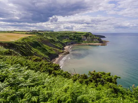
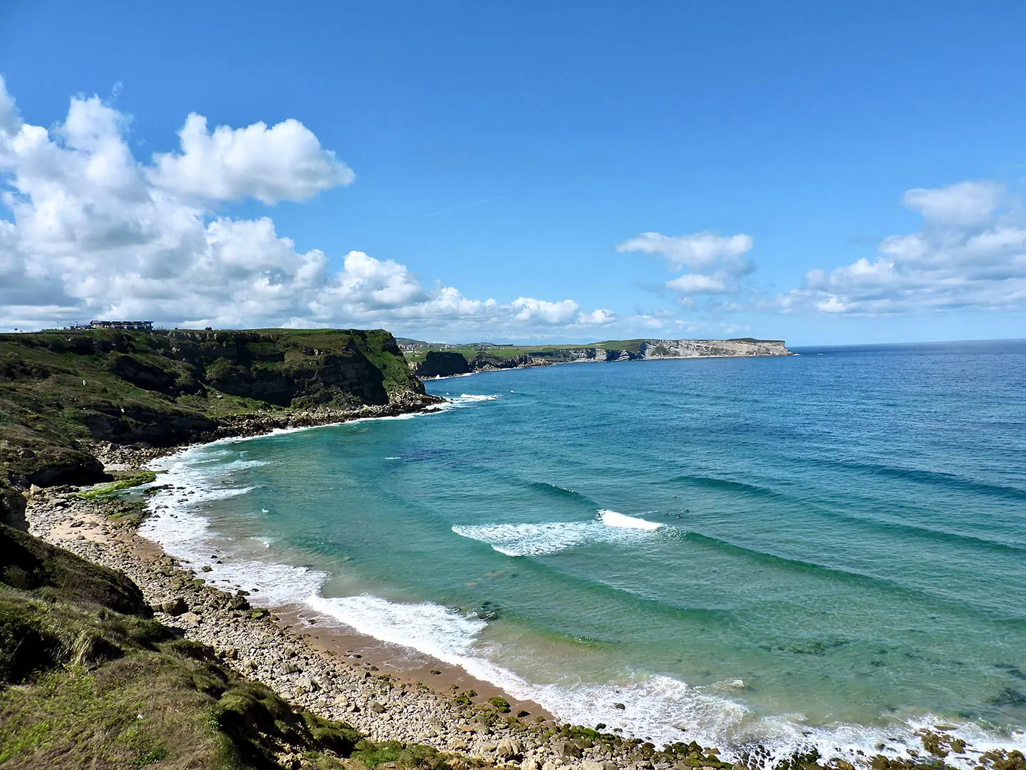
The Camino del Norte Cantabria Segment is the Cantabrian section of the coastal Camino de Santiago in Spain, running about 180 km from Castro Urdiales to Unquera near the Asturias border. Allow around 7 days. It is a moderate point-to-point walk: not mountainous, but made tiring by repeated headlands, low hills, 25–30 km stages and changeable Atlantic weather. It suits hikers and pilgrims wanting a waymarked coastal route with towns, albergues and sea-level logistics rather than high passes.
Route Overview
Walked east to west, this segment enters Cantabria from the Basque Country at Castro Urdiales and leaves near Unquera, crossing to Colombres in Asturias. Key places include Laredo, Santoña, Noja, Güemes, Santander, Santillana del Mar, Comillas and San Vicente de la Barquera. Santander is the main mid-segment hub, and some guidebooks split stages there. The route is linear, waymarked with yellow arrows and scallop shells, and forms part of the full Camino del Norte. Expect coastal headlands, beaches, estuaries, marshes, farmland, promenades and historic centres; the Laredo–Santoña estuary is traditionally crossed by a seasonal passenger boat.
A Coastal Route to Santiago
The Camino del Norte is one of the oldest routes to Santiago de Compostela, used from the early Middle Ages. The coastal way was favoured when inland meseta routes were less safe during periods of conflict with Al-Andalus, linking Cantabrian ports, fishing towns, churches, hospices and monasteries. Today it remains part of the UNESCO-listed Routes of Santiago de Compostela. Compared with the inland Camino Francés, the Northern Way is generally considered tougher overall, and pilgrims continuing west can branch off in Asturias onto the historic Camino Primitivo.
Notable highlights
- Castro Urdiales: The gateway into Cantabria, with the Gothic church of Santa María de la Asunción, a medieval castle-lighthouse and a harbour promenade.
- Laredo and the Santoña marshes: Laredo has the long Playa de la Salve and the medieval Puebla Vieja. Nearby Marismas de Santoña is a protected wetland and birdwatching area crossed on this coastal section.
- Santillana del Mar and Altamira Cave: Santillana is a preserved medieval town centred on the Romanesque Colegiata de Santa Juliana. Nearby Altamira is a UNESCO World Heritage cave-art site; general visits use the Neocueva replica and museum.
- Comillas: Known for El Capricho de Gaudí, a ceramic-clad villa designed by Antoni Gaudí, plus the Palacio de Sobrellano and former Pontifical University.
- San Vicente de la Barquera: A fishing town on tidal estuaries within Oyambre Natural Park, overlooked by the Castillo del Rey and with inland views towards the Picos de Europa.
Challenges to expect
The main challenge is endurance rather than altitude: several common stages are around 25–30 km, with repeated climbs over headlands and low hills. Surfaces change from asphalt and promenades to gravel, dirt paths and cobbles. Atlantic weather can shift quickly, so rain gear is essential. Summer is busy on this coast and albergues can fill fast. The seasonal Laredo–Santoña ferry also needs checking before you rely on it.
HikeList Score
Camino del Norte (Cantabria Segment) scored 91/100 on HikeList's trail-quality metrics.
See score breakdownHide breakdown
- Ideal length 100
- Balanced challenge 100
- Scenery & wildness 69
- Varied terrain 100
- Accommodation 100
- Food & support 88
- Path quality 84
- Season flexibility 89
Computed from length, challenge, scenery & wildness, terrain variety, accommodation, food & support, path quality and season flexibility.
 Spain
SpainShow more data Show less
- Coastal
- Farmland
- Urban
- Wetland
- Paved
- Gravel
- Dirt
- Cobblestone
- Albergues
- Hostels
- Guesthouses
- Hotels
- Campsites
- Family Friendly
- Pet Friendly
- Restrooms
- Water Sources
- Campsites
- Shelters
Download Our Full Guide to Camino del Norte (Cantabria Segment) FREE!
Get our comprehensive guide to this hike for free. Save it for later reading or print out at home.
Articles related to this hike
In these collections
Photos from hikers
Taken on the trail by people who've reviewed Camino del Norte (Cantabria Segment).
Camino del Norte (Cantabria Segment): The Complete Guide
 i
Image by fernandoguimet
i
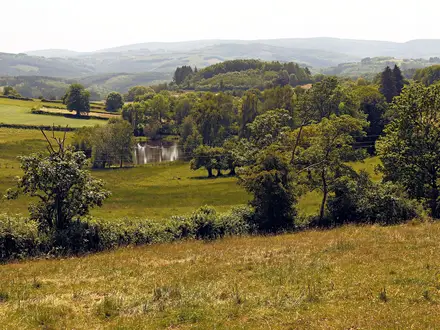
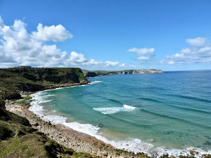
Image by fernandoguimet The Cantabria segment of the Camino del Norte is a coastal pilgrimage across northern Spain, running east to west from the Basque Country border near Ontón and Castro-Urdiales to Unquera on the Río Deva. It is a low-level route of fishing towns, beaches, estuaries, green inland valleys and historic streets rather than a mountain trek.
This is one of the most practical sections of the Northern Way to walk independently. Waymarking is strong, Santander sits naturally mid-route as a transport and rest hub, and the main stage towns offer a useful mix of albergues, guesthouses, hotels and services.
The rewards are varied: Castro-Urdiales harbour, Laredo and the Santoña marshes, the pilgrim atmosphere at Güemes, the ferry approach into Santander, medieval Santillana del Mar, Gaudí’s Comillas and the estuaries around San Vicente de la Barquera. The route feels consistently Atlantic, with sea wind, marshland, promenades and headlands shaping the walking.
The challenge is not altitude or technical ground. It is the accumulation of long 25–30 km days, occasional longer stages, hard surfaces, repeated short climbs and changeable coastal weather.
This guide covers stages, daily planning, accommodation, food, transport, terrain and the common mistakes to avoid.
Stage-by-Stage Guide
Treat the stage distances below as approximate. The Cantabrian Camino del Norte is very well waymarked with yellow arrows and scallop-shell symbols, but published distances vary and local diversions can change the walking day, especially around road works, marshland and the two boat crossings.
Stage 1: El Haya de Ontón to Castro-Urdiales — approx. 16 km
This is the formal entry into Cantabria from the Basque Country, beginning near El Haya de Ontón / Alto del Haya and finishing in Castro-Urdiales, the first practical stage town for most walkers. The day is relatively short, but it includes one of the more noticeable low climbs of the Cantabrian section as the route comes over the inland hills before dropping towards the coast.
Underfoot, expect the usual Camino del Norte mix: asphalt, lanes, tracks and hard-surfaced village approaches rather than mountain path. After rain, unpaved sections can be muddy, and the open higher ground can feel exposed in Atlantic wind and showers.
The main highlight is the arrival into Castro-Urdiales, with the church of Santa María de la Asunción, the medieval castle-lighthouse and the harbour promenade. This is a good place to settle into the rhythm of the Cantabrian stages before the longer days begin.
Food and water should not be left to chance at the border start. Carry what is needed from the previous overnight stop or from Castro-Urdiales if arranging a short positioning walk, then resupply properly in town.
Castro-Urdiales has a broad choice of pilgrim and tourist accommodation compared with the smaller villages ahead. It is also the first sensible place for late arrivals to stay rather than trying to begin exactly at the administrative boundary.
For access, Castro-Urdiales is the practical transport point, with wider links east towards the Basque Country and west towards Santander. Current public transport times should be checked before travelling, especially if attempting to reach the border start rather than beginning in Castro-Urdiales itself.
Navigation is straightforward once on the marked Camino, but the exact border start can be less convenient than the town. If the stage is being used as the first day of a Cantabria-only walk, check the access plan to El Haya de Ontón / Alto del Haya in advance rather than assuming there will be easy onward services from the boundary.
Stage 2: Castro-Urdiales to Laredo — approx. 31 km
This is a full-length Camino day and the first real test of the Cantabrian section. The route leaves Castro-Urdiales and works west through or near Allendelagua, Cerdigo, Islares, El Pontarrón de Guriezo, Oriñón, Guriezo / Rioseco and Liendo before reaching Laredo.
The terrain is low but rarely flat. Expect repeated undulations over coastal headlands and low inland hills, with a mixture of asphalt, farm tracks, gravel and dirt paths. The hard surfaces make the distance more tiring than the elevation profile suggests.
The stage has a varied feel: coast, green valleys, small settlements and the approach to Laredo. The finish is a major highlight, with Laredo’s long Playa de la Salve and the medieval Puebla Vieja close to the route.
Food and water are easiest at the two ends of the stage, with intermediate villages offering potential resupply points but not something to depend on without checking opening times. Carry enough food and water for a long walking day, especially outside the summer resort season.
Laredo is a major stage stop with pilgrim and tourist accommodation. In summer, accommodation can book out quickly, so reserve ahead or arrive early if relying on albergue places.
Road access is available at the larger settlements along the stage, making this a more manageable section for anyone needing to shorten the day. Public transport options should be checked locally before using an intermediate village as a bail-out point.
Navigation is generally uncomplicated thanks to the Camino waymarking, but the stage passes through several settlements and road sections where attention is still needed. Follow the yellow arrows carefully through village exits and do not assume the most obvious road is always the Camino line.
The main warnings are distance, hard surfaces and weather. A wet or windy day can make the exposed coastal and hill sections feel much longer, and mud is possible on unpaved stretches after rain.
Stage 3: Laredo to Güemes — approx. 29 km
This stage is shaped by the Santoña bay crossing and the marshland around the Marismas de Santoña, Victoria y Joyel. From Laredo, the standard Camino uses the seasonal passenger boat across to Santoña, then continues via Berria and Noja towards Güemes.
The Laredo–Santoña boat is a key planning point. It does not run in winter, and when it is not operating the inland variant via Colindres adds around 4 km. Ferry operation and times should be checked before travelling.
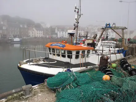
Terrain is mixed and coastal: promenades, town streets, beaches, marshland approaches, lanes and rural tracks. Santoña is a working fishing and anchovy-canning town below Monte Buciero, while Noja sits among beaches and protected marshes before the route turns inland towards Güemes.
This is one of the most distinctive Cantabrian stages, combining Laredo’s beach, the Santoña wetlands and the coastal settlements around Santoña and Noja. The marshes are an important birdwatching reserve, but the walking itself remains a pilgrim route rather than a wilderness walk.
Food and water are readily planned around Laredo, Santoña and Noja. Between the resort towns and Güemes, services are thinner, so carry enough for the later part of the day.
Güemes is known across the Camino del Norte for the donativo Albergue La Cabaña del Abuelo Peuto. As with all pilgrim accommodation, opening dates, capacity and current arrangements should be checked, particularly outside the main season.
Transport and road access are strongest at Laredo, Santoña and Noja. Güemes is a smaller rural stop, so do not rely on easy last-minute transport from the stage end without checking current options.
Navigation hinges on the boat crossing. If the boat is running, make sure the timing fits the day; if it is not, follow the marked inland variant rather than improvising around the bay. In marshland and protected areas, stay on the signed route.
The main hazards are logistical rather than technical: a missed or non-running boat, a longer-than-expected inland detour, summer accommodation pressure and exposure to wind or rain on open coastal sections.
Stage 4: Güemes to Santander — approx. 15 km
This is a short stage by Camino del Norte standards, but it includes the important bay crossing into Santander. From Güemes, the route continues through the coastal settlements of Galizano, Langre, Loredo and Somo before taking the passenger ferry across the bay to the Cantabrian capital.
The walking is low-level and varied, with rural lanes, coastal approaches and hard-surfaced sections into the bay settlements. The shorter distance makes this a useful recovery day after the longer stages to Laredo and Güemes.
The highlight is the approach to Santander across the bay from Somo or Pedreña, arriving close to the city waterfront rather than walking a long road approach into the capital. Santander itself offers major urban services, the El Sardinero beaches, the Magdalena peninsula and the Centro Botín.
Food and water are not usually difficult to plan on this stage because of the settlements before the ferry and the full range of city services in Santander. Even so, carry water from Güemes, as opening times in smaller coastal places can vary by season.
Santander has the widest accommodation choice on the Cantabrian section, from pilgrim options to hotels and hostels. It is also the natural place for a rest day, resupply, laundry or gear replacement.
Public transport access is excellent in Santander, which has Seve Ballesteros–Santander Airport and a combined rail station with Renfe and the coastal metric-gauge line. The city is the main mid-route transport hub for joining, leaving or splitting the walk.
The Somo / Pedreña–Santander ferry is the key navigation and timing issue. Check the current timetable before setting off from Güemes, especially outside peak season or in poor weather.
Warnings are mainly practical: do not assume the ferry runs exactly when needed, and allow time for the crossing if onward bookings or transport depend on reaching Santander by a fixed hour. Coastal wind and showers can also make the open approach to the bay feel more exposed than the distance suggests.
Stage 5: Santander to Santillana del Mar — approx. 36 km
This is the longest stage in the outline itinerary and should be treated as a serious endurance day. From Santander, the Camino heads west through Boo de Piélagos, Mogro, Polanco, Requejada and Barreda before finishing in Santillana del Mar.
The challenge is not altitude but distance, hard surfaces and urban-to-rural transition. Expect extended sections on asphalt, paved paths, lanes and town approaches, mixed with lower-key rural walking as the route moves away from Santander.
The day’s reward is Santillana del Mar, one of the most important cultural stops on the Cantabrian Camino. The medieval town is built around the Romanesque Colegiata de Santa Juliana, and the nearby Cave of Altamira is visited via the Neocueva replica and museum.
Food and water planning is easier than on more remote walks because the stage passes several settlements, but a 36 km day still demands an early start and enough supplies to avoid being dependent on any single bar or shop being open. Leaving Santander with food and water already sorted is sensible.
Accommodation is available in Santillana del Mar, but the town is popular with visitors as well as pilgrims. Book ahead in busy periods, particularly if arriving late after the long stage from Santander.
This stage has relatively good access compared with rural sections, with Santander as the major transport hub and several intermediate towns on or near the route. If the full 36 km is too much, splitting the day or using public transport from an intermediate point may be possible, but current services should be checked before relying on that plan.
Navigation requires care leaving the city and moving through built-up areas. Yellow arrows and Camino shell markers are still the primary guide, but urban junctions, road crossings and settlement exits deserve attention.
The main warning is simple: this stage is long. Feet, knees and shoulders often suffer more from paved surfaces than from climbing, so start early, manage breaks and avoid carrying unnecessary weight.
Stage 6: Santillana del Mar to Comillas — approx. 22 km
This is a more moderate stage after the long walk from Santander. It begins in the medieval streets of Santillana del Mar and continues west towards Comillas through the rolling, lowland Cantabrian landscape.
The walking is typical of this part of the Camino del Norte: lanes, tracks, village approaches and sections of hard surface, with no high pass or technical ground. After rain, rural tracks can be muddy, and the constant changes underfoot can still be tiring.
Santillana del Mar is worth allowing time for before leaving, especially the Colegiata de Santa Juliana and, if planned separately, the Altamira museum and Neocueva. The finish at Comillas is another major cultural stop, with Gaudí’s El Capricho, the Palacio de Sobrellano and the former Pontifical University on the hill above town.
Food and water are straightforward at Santillana del Mar and Comillas. Between the two, services are less certain, so carry enough for the walking day rather than assuming regular resupply.
Comillas has a good range of accommodation because it is both a Camino stop and a coastal visitor town. Summer demand can be high, so booking ahead is sensible.
Public transport in the western part of Cantabria includes ALSA buses and the coastal metric-gauge rail corridor serving the broader area. Exact services for Comillas and onward connections should be checked before using the town as a joining or leaving point.
Navigation is generally easy on the waymarked Camino, but be attentive through village exits and road sections. The route is not technically difficult; the main requirement is staying with the marked line rather than following unsignposted lanes.
The main cautions are hard surfaces, wet-weather mud and accommodation pressure in peak season. This is also a stage where sightseeing can take time, so plan realistically if visiting both Santillana del Mar and Comillas attractions on the same day.
Stage 7: Comillas to San Vicente de la Barquera — approx. 13 km
This is a short, scenic stage and one of the easiest places to build in a lighter day. From Comillas, the route passes through the Oyambre Natural Park area and La Revilla before reaching San Vicente de la Barquera.
The terrain is low coastal walking with paths, lanes, hard surfaces and estuary approaches. The stage includes the protected dunes, estuary and broad Playa de Oyambre, making it one of the most attractive coastal sections of the Cantabrian Camino.
San Vicente de la Barquera is a major highlight, set around tidal estuaries crossed by long bridges, with the Castillo del Rey and the church of Santa María de los Ángeles above the town. In clear conditions, the Picos de Europa rise inland, giving the stage a very different backdrop from the earlier coastal resort towns.
Food and water are easy to arrange at Comillas and San Vicente de la Barquera. Do not rely on frequent intermediate services unless they have been checked, as the stage is short enough to carry everything needed from the start.
San Vicente de la Barquera has a range of accommodation and is a logical overnight stop before the final Cantabrian stage to Unquera. As with other coastal towns, summer demand can be strong.
Transport access is good by Cantabrian standards, with ALSA buses and the coastal metric-gauge train serving western towns including San Vicente de la Barquera. Current timetables should be checked before planning a same-day arrival or departure.
Navigation is uncomplicated on the marked route, but take care around estuary approaches, roads and the protected natural park area. Stay on the signed Camino rather than cutting across dunes or informal tracks.
The main warnings are exposure to wind and showers, possible muddy stretches after rain and the temptation to underestimate the day because it is short. If combining it with the next stage, check accommodation and transport plans carefully before committing to the longer distance.
Stage 8: San Vicente de la Barquera to Unquera — approx. 15 km
The final Cantabrian stage leaves San Vicente de la Barquera and continues west through La Acebosa, Serdio and Pesués to Unquera on the Río Deva. Unquera marks the Cantabria–Asturias border; the Camino continues across the river into Bustio and Colombres.
The walking is low-level and generally rural, with the same mix of lanes, tracks, village sections and hard surfaces found throughout the Cantabrian Camino. It is not a mountain stage, but there can still be small climbs and descents as the route works between settlements and the river.
This stage has a quieter feel after the larger coastal towns. The key landmark is the Río Deva at Unquera, where the Cantabrian segment ends and the Asturias section begins.
Food and water should be arranged in San Vicente de la Barquera before setting out. Intermediate villages are useful waypoints, but do not depend on services being open without checking; Unquera is the reliable end-point for resupply and onward travel.
Accommodation at the end of the Cantabrian section is more limited than in the major resort towns, and some walkers continue into Asturias towards Bustio or Colombres. If stopping in Unquera, book or check availability in advance.
Unquera is one of the easiest finish points to leave by public transport, with ALSA buses and the coastal metric-gauge train providing onward options. Current schedules should be checked before fixing return travel.
Navigation is straightforward if following the yellow arrows west, but the administrative end of the Cantabrian segment is not the end of the Camino del Norte. If finishing at Unquera, make a deliberate stopping plan; if continuing, the route crosses the Río Deva into Asturias.
The main warnings are practical rather than technical: limited services between settlements, hard surfaces, wet-weather mud and the need to align the finish with onward transport from Unquera.
Recommended Itinerary
The most practical schedule for the Cantabrian section is an 8-day walk. It keeps the route close to the normal pilgrim stopping points while avoiding a very compressed final run across the western coast. Distances are approximate: Camino variants, town-centre accommodation and the two bay crossings can alter the day totals.
Standard itinerary — 8 days
| Day | From | To | Approx. distance | Why this stage makes sense | Services/accommodation notes |
|---|---|---|---|---|---|
| 1 | El Haya de Ontón / Alto del Haya | Castro-Urdiales | 16 km | A sensible first day from the Basque Country–Cantabria border, ending in the first major service town. It also avoids starting the route with one of the long 30 km stages. | Castro-Urdiales has the widest practical choice at the eastern end: pilgrim accommodation, guesthouses, hotels and town services. Many walkers starting in Cantabria begin here rather than at the border. |
| 2 | Castro-Urdiales | Laredo | 31 km | A full coastal Camino day through the eastern Cantabrian settlements, with enough distance to keep the overall itinerary efficient. Expect hard surfaces and repeated small climbs rather than a single major ascent. | Laredo is a strong overnight stop with accommodation, food and onward transport options. Book ahead in summer, especially if relying on lower-cost pilgrim beds. |
| 3 | Laredo | Güemes | 29 km | This is the key marshes-and-coast stage, normally using the Laredo–Santoña passenger boat before continuing through Santoña, Berria and Noja towards Güemes. It is long enough to feel committing but ends at one of the classic Camino del Norte pilgrim stops. | The Laredo–Santoña boat is seasonal and does not run in winter; the inland variant via Colindres adds roughly 4 km. This should be checked before travelling. Güemes is known for the donativo Albergue La Cabaña del Abuelo Peuto, but opening and availability should be checked before relying on it. |
| 4 | Güemes | Santander | 15 km | A deliberately shorter day after two long stages. It gives time for the coast around Galizano, Langre, Loredo and Somo before the bay crossing into Santander. | The Somo/Pedreña–Santander ferry is part of the normal line into the city, but current operating times should be checked before setting off. Santander has the best accommodation, food, rail, bus and airport connections on the Cantabrian section, making it the natural rest or reset point. |
| 5 | Santander | Santillana del Mar | 36 km | The longest standard day, suited to walkers who are comfortable with sustained distance on mixed paved, suburban and rural surfaces. It keeps the itinerary moving west without adding an extra night before Santillana del Mar. | Start early and carry food and water rather than assuming every intermediate settlement will suit a stop. Santillana del Mar has pilgrim and private accommodation, but it is a popular visitor town, so summer booking is advisable. |
| 6 | Santillana del Mar | Comillas | 22 km | A more moderate day after the long stage from Santander, finishing in one of the main cultural towns on the route. The distance leaves time for a later start or for visiting Santillana del Mar before leaving. | Comillas has a good spread of accommodation and town services. It is another busy resort and heritage stop, so do not count on turning up late in high season and finding cheap beds easily. |
| 7 | Comillas | San Vicente de la Barquera | 13 km | A short but worthwhile stage through the Oyambre area to one of the strongest overnight stops on the western Cantabrian coast. It works well as an easier day before the final push to Unquera. | San Vicente de la Barquera has pilgrim and private accommodation, food and transport links. It is a sensible place to pause rather than pushing straight through to the Asturias border if time allows. |
| 8 | San Vicente de la Barquera | Unquera | 15 km | A manageable final Cantabrian day through the western villages to the Río Deva. Unquera marks the end of the Cantabria segment before the Camino crosses into Asturias towards Bustio and Colombres. | Unquera is the practical exit point for this section, with onward travel easiest by ALSA bus or the coastal metric-gauge train. Current timetables should be checked before booking onward connections. |
Slower variant — 9 days
This suits walkers who prefer shorter days, want more time in Santander, Santillana del Mar and Comillas, or are carrying heavier packs. The simplest way to slow the route without redesigning every stage is to split the 36 km Santander–Santillana del Mar day.
| Day | From | To | Approx. distance | Why this stage makes sense | Services/accommodation notes |
|---|---|---|---|---|---|
| 1 | El Haya de Ontón / Alto del Haya | Castro-Urdiales | 16 km | Keeps the first day short and finishes in the first major Cantabrian town. | Good service base at the eastern end. |
| 2 | Castro-Urdiales | Laredo | 31 km | Retains the normal long east-coast stage. | Laredo is a practical overnight town with accommodation and food. |
| 3 | Laredo | Güemes | 29 km | Keeps the standard route via Santoña, Noja and Güemes, subject to the boat crossing. | Check the Laredo–Santoña boat; in winter the inland option via Colindres adds roughly 4 km. |
| 4 | Güemes | Santander | 15 km | Short day into the regional capital, useful for recovery and logistics. | Check the Somo/Pedreña–Santander ferry times. Santander is the best place on the route for transport, resupply and wider accommodation choice. |
| 5 | Santander | Boo de Piélagos / Mogro / Polanco / Requejada / Barreda area | Split of the 36 km Santander–Santillana leg; check official mapping before booking | Breaks up the hardest standard day and reduces the risk of arriving late in Santillana del Mar. | Accommodation is thinner between the major towns than on the coast-resort stops. Choose the stopping place only after checking current beds and transport options. |
| 6 | Boo de Piélagos / Mogro / Polanco / Requejada / Barreda area | Santillana del Mar | Split of the 36 km Santander–Santillana leg; check official mapping before booking | Completes the approach to Santillana del Mar without requiring a single 36 km day. | Santillana del Mar is busy in season; reserve private accommodation or arrive early for pilgrim options. |
| 7 | Santillana del Mar | Comillas | 22 km | Comfortable cultural stage between two major historic towns. | Comillas has good town services but can fill in summer. |
| 8 | Comillas | San Vicente de la Barquera | 13 km | Short scenic stage through the Oyambre area, leaving a relaxed final day. | San Vicente de la Barquera is a strong final-night stop before Unquera. |
| 9 | San Vicente de la Barquera | Unquera | 15 km | Finishes the Cantabrian section at the Río Deva without rushing the western end. | Check ALSA bus and coastal metric-gauge train times from Unquera before fixing onward travel. |
Faster variant — 7 days
This is for fit walkers already comfortable with repeated 25–36 km Camino days on hard surfaces. The cleanest 7-day version is to combine the two short western stages into one final day from Comillas to Unquera.
| Day | From | To | Approx. distance | Why this stage makes sense | Services/accommodation notes |
|---|---|---|---|---|---|
| 1 | El Haya de Ontón / Alto del Haya | Castro-Urdiales | 16 km | Short entry day from the border to the first practical stage town. | Castro-Urdiales is the best supported start-point town. |
| 2 | Castro-Urdiales | Laredo | 31 km | Standard long Camino stage across the eastern part of the Cantabrian route. | Book ahead in busy periods. |
| 3 | Laredo | Güemes | 29 km | Efficient stage via the Santoña marshes and the coastal settlements west of Laredo. | Check the Laredo–Santoña boat; if it is not running, the inland variant via Colindres adds roughly 4 km. |
| 4 | Güemes | Santander | 15 km | Shorter day into Santander, useful before the longest stage of the route. | Check Somo/Pedreña–Santander ferry times. Santander is the best place to resupply or adjust plans. |
| 5 | Santander | Santillana del Mar | 36 km | The demanding day of the itinerary; it keeps the route to 7 days but should not be underestimated. | Start early. Accommodation in Santillana del Mar should be secured in advance in summer. |
| 6 | Santillana del Mar | Comillas | 22 km | Moderate recovery stage after the long Santander day. | Comillas has a good range of services and accommodation. |
| 7 | Comillas | Unquera | 28 km | Combines the Comillas–San Vicente de la Barquera and San Vicente de la Barquera–Unquera stages, ending at the Asturias border in one day. | San Vicente de la Barquera is the main service point during the day. Check onward bus or coastal metric-gauge train times from Unquera before committing to same-day onward travel. |
Planning the Route
The Cantabrian Camino del Norte is easiest to plan around overnight towns rather than around mileage alone. The coast gives plenty of large service towns overall, but accommodation can be thin between them, and the standard pilgrim rhythm is shaped by albergues, ferry crossings and the larger resort towns.
Most walkers should allow 7–9 days for the Cantabrian section. A 7-day crossing is realistic for fit walkers happy with repeated long days, while 8–9 days gives more margin for weather, ferry timings, busy accommodation and cultural stops in places such as Santander, Santillana del Mar, Comillas and San Vicente de la Barquera.
Choosing a 7, 8 or 9-day plan
The main decision is whether to treat Cantabria as a fast transit section of the Camino del Norte or as a coastal pilgrimage with time for the towns. The walking is not high or technical, but hard surfaces and long daily distances make an over-ambitious schedule tiring.
A practical fast itinerary uses stages of roughly 25–36 km where necessary, especially on the long Santander to Santillana del Mar day. A steadier plan breaks the route around the established albergue and town network, which is usually the better choice for walkers carrying full packs or walking in hot, wet or windy conditions.
| Plan | Best for | Main trade-off |
|---|---|---|
| 7 days | Fit Camino walkers used to long days | Less time for Santander, Santillana del Mar, Comillas and weather delays |
| 8 days | Most independent walkers wanting a firm but manageable schedule | Still includes some long road/paved sections |
| 9 days | Pilgrims using shorter albergue-linked stages | More accommodation bookings or albergue stops to coordinate |
Per-stage distances vary depending on variants, ferry use and exactly where the stage starts or ends. Treat any kilometre figure as approximate and check a current Camino app, map or GPS profile before fixing accommodation.
Stage planning and natural stopping points
The most useful overnight stops are the recognised Camino towns with pilgrim accommodation and general services: Castro-Urdiales, Laredo, Santoña, Noja, Güemes, Santander, Santillana del Mar, Comillas, San Vicente de la Barquera and Unquera. Smaller places such as Guriezo, Liendo, Galizano, Loredo, Boo de Piélagos, Mogro, Requejada, Barreda, La Acebosa, Serdio and Pesués help with route rhythm, but should not be assumed to offer the same choice of beds, food or transport.
The HikeList stage pattern is a useful planning spine:
| Stage | Route | Approx. distance | Planning note |
|---|---|---|---|
| 1 | El Haya de Ontón / Basque border to Castro-Urdiales | 16 km | A short entry stage; many walkers begin practically in Castro-Urdiales rather than at the border. |
| 2 | Castro-Urdiales to Laredo | 31 km | A long day through the eastern Cantabrian coast and inland sections. |
| 3 | Laredo to Güemes | 29 km | Boat planning matters at Laredo–Santoña; Güemes is a key pilgrim stop. |
| 4 | Güemes to Santander | 15 km | Shorter on paper, but depends on the Somo/Pedreña–Santander ferry. |
| 5 | Santander to Santillana del Mar | 36 km | The hardest planning day for many walkers because of length and hard surfaces. |
| 6 | Santillana del Mar to Comillas | 22 km | More moderate, with a strong cultural stop at the end. |
| 7 | Comillas to San Vicente de la Barquera | 13 km | Short, scenic and easy to combine if pushing on. |
| 8 | San Vicente de la Barquera to Unquera | 15 km | A short final Cantabrian stage to the Río Deva and Asturias border. |
This creates an 8-stage structure, but it can be compressed or expanded. Fast walkers may combine shorter western stages; steadier walkers may split the long Santander–Santillana del Mar section if suitable accommodation is available. This should be checked before travelling.
Ferries and variants
Two boat crossings affect route planning more than the terrain does. The Laredo–Santoña passenger boat is part of the standard coastal line but does not run in winter; when it is not operating, the inland variant via Colindres adds roughly 4 km. Timetables should be checked before travelling.
The Somo/Pedreña–Santander bay ferry is the normal way into Santander from the east side of the bay. It is a major part of the stage from Güemes to Santander, so check operating times before fixing that day’s start time or accommodation.
If either crossing is missed, the day can become longer or logistically awkward. Build in enough time to reach the boats without needing to rush the earlier walking.
Accommodation strategy
Accommodation is the most important planning issue on this section. The route has a mix of municipal, parish/donativo and private pilgrim albergues, plus pensiones, guesthouses, hostels, hotels and campsites in the larger towns. Choice is generally better in resort towns such as Castro-Urdiales, Laredo, Santoña, Noja, Santander, Santillana del Mar, Comillas and San Vicente de la Barquera.
Between those towns, options can be limited. Do not assume that every village on the map has pilgrim beds, evening food or late check-in. In summer, coastal accommodation can book out with holiday visitors as well as pilgrims, so reserve private rooms early or arrive promptly for albergues where reservations are not used.
The donativo Albergue La Cabaña del Abuelo Peuto at Güemes is one of the best-known pilgrim stops on the Camino del Norte and is a natural anchor for the eastern half of Cantabria. Opening arrangements, capacity and donativo etiquette should be checked before travelling.
Many albergues reduce hours or close outside the main season. Winter and shoulder-season walkers should check each intended stop before committing to a stage plan.
Food, water and daily supplies
This is not a wilderness route, but supply planning still matters because the walking day can be long and services are uneven between coastal towns. Start each morning with enough water and food for several hours rather than relying on the next small settlement.
The larger towns are the reliable places to shop, eat and resupply. Santander is the natural mid-route reset point for laundry, replacement kit, transport changes and a rest night.
Even on shorter stages, Sundays, local holidays and seasonal business hours can affect cafés and shops. Carry a simple lunch and emergency snacks on the longer days, especially Castro-Urdiales to Laredo, Laredo to Güemes and Santander to Santillana del Mar.
Navigation and route-finding
The Camino is fully waymarked with yellow arrows and scallop-shell signs, so navigation is usually straightforward. The risk is less about getting lost in remote country and more about missing turns in towns, road junctions, promenades and variant sections.
Carry a current map, guidebook or Camino app as a backup, especially for ferry alternatives, urban exits and any live diversions. The approximate high point and cumulative ascent figures are useful for context, but a GPS elevation profile is better for judging the daily effort on a specific itinerary.
Section hiking and transport
Section hiking is practical because the route passes through major towns and has strong public transport links. Santander is the best split point, with the airport and the combined rail station for broad-gauge Renfe and the narrow-gauge coastal line.
The eastern end can be approached via Castro-Urdiales and the Basque border area, while the western end at Unquera is best reached or left by ALSA bus or the coastal metric-gauge train. Current Renfe Cercanías, metric-gauge and ALSA times should be checked before booking fixed accommodation or onward travel.
A common section strategy is to walk Castro-Urdiales to Santander first, then return for Santander to Unquera. This avoids forcing the whole Cantabrian section into one holiday and gives flexibility around weather and accommodation.
Weather and season planning
Spring, summer and autumn are the normal walking seasons. The Atlantic coast can bring wind, showers and rapid changes in conditions even when the route stays low, so waterproofs and pack protection are essential.
Summer gives longer days and more services, but also more pressure on beds in beach towns. Spring and autumn are often better for walking temperatures, though albergue opening and boat services become more important to check.
Credentials, luggage transfer and formalities
No hiking permit is required for the Cantabrian section itself. Pilgrims wanting to use albergues and continue towards Santiago should carry a credencial, collect stamps, and follow the current Camino requirements for the Compostela, including the stamping rules for the final 100 km.
Backpack transfer is available on the Camino through services such as Correos Paq Mochila, which can make the long paved stages easier. Availability, covered stages, booking procedure and current € prices should be checked before travelling.
Towns, Villages and Overnight Stops
The Cantabrian section is easiest to plan around the established Camino towns: Castro-Urdiales, Laredo, Güemes, Santander, Santillana del Mar, Comillas, San Vicente de la Barquera and Unquera. Resort towns have the broadest mix of albergues, pensiones, hotels, restaurants and shops; smaller villages between them can be useful for breaks, but should not be relied on for accommodation without checking ahead.
Pilgrim albergues normally require a credencial, and opening dates can vary, especially outside the main walking season. Summer brings the opposite problem: resort accommodation and popular albergues can fill quickly, so booking or arriving early is sensible.
| Place | Best use for walkers | Practical note |
|---|---|---|
| Castro-Urdiales | First practical overnight in Cantabria | Strong services and transport; good start point if not beginning exactly at the border |
| Laredo | Major stage town | Good accommodation and food; check the Laredo–Santoña boat before relying on it |
| Santoña / Noja | Alternative or shorter-stage overnights | Useful if breaking the Laredo–Güemes stretch |
| Güemes | Classic pilgrim overnight | Famous donativo albergue; fewer surrounding services than the big towns |
| Santander | Mid-route hub and rest point | Best transport, resupply and accommodation choice on the route |
| Santillana del Mar | Main overnight after Santander | Popular historic town; book ahead in busy periods |
| Comillas | Strong overnight stop | Good services and accommodation; also a natural shorter day from Santillana |
| San Vicente de la Barquera | Strong overnight stop before the border | Good place to pause before the final Cantabrian stretch |
| Unquera | Finish / onward transport point | Last Cantabrian village; bus and coastal metric-gauge rail options should be checked before travel |
El Haya de Ontón / Alto del Haya
El Haya de Ontón, also referred to as Alto del Haya, marks the Basque Country–Cantabria boundary and the official start of the Cantabrian section. It is best treated as a route point rather than a practical overnight base.
Most walkers arrange beds in Castro-Urdiales, a few kilometres further west, or start from there instead. If beginning exactly at the border, food, water and transport arrangements should be made in advance; this should be checked before travelling.
Castro-Urdiales
Castro-Urdiales is the first practical stage town in Cantabria and the usual place to begin or spend the first night. It has the strongest early-route mix of pilgrim and non-pilgrim accommodation, with albergue-style beds supplemented by pensiones, hostels and hotels.
Food is straightforward here, with town-centre bars, cafés, restaurants and shops more reliable than in the smaller villages ahead. It is also a useful place to buy anything missing from a Camino kit before the longer coastal and inland stages begin.
Transport is one of Castro-Urdiales’ advantages. The Santander–Castro-Urdiales / Basque border corridor is served by public transport, including the Renfe Cercanías C1 service noted for this end of the route; current times should be checked before travelling.
Hikers may want to stop here for a controlled start rather than trying to add the border approach onto a long day. The harbour, old town and seafront also make it a more comfortable overnight than the smaller settlements immediately west.
Allendelagua, Cerdigo and Islares
Allendelagua, Cerdigo and Islares sit on the first long westward stage after Castro-Urdiales. They are useful for pacing the day, but they are not the main planning anchors for this section.
Do not assume full services, all-day food or pilgrim beds in these smaller places without checking in advance. They are better treated as possible rest or refreshment points between larger towns rather than guaranteed overnight stops.
El Pontarrón de Guriezo, Oriñón and Guriezo (Rioseco)
This group of settlements sits around the Guriezo area between Castro-Urdiales and Laredo. The standard Castro-Urdiales to Laredo day is long, so this area is relevant for walkers who prefer to split the stage or need a shorter day.
Accommodation and food are less predictable than in Castro-Urdiales or Laredo. If planning to stop here, book or check availability before committing to the day’s schedule.
Oriñón is associated with the coastal line of the route, while Guriezo and Rioseco sit further inland on the low-hill section. The walking here is not high or technical, but it can feel slow after a town start because of the repeated ups and downs.
Liendo
Liendo comes before Laredo and is another potential service point on the long Castro-Urdiales to Laredo stretch. It is useful for walkers who are managing energy, weather or late arrival times before dropping into the larger resort town.
As with the other smaller settlements on this stage, it should not be treated as a guaranteed full-service overnight unless accommodation has been checked. Laredo remains the more dependable planning target.
Laredo
Laredo is one of the most useful overnight towns on the Cantabrian Camino del Norte. It has a broad accommodation base, including pilgrim options and conventional tourist beds, and is much better supplied than the villages on either side.
Food, cafés, bars and shops are easy to organise here, especially around the town and resort areas. Summer demand can be high, so walkers depending on a specific albergue or budget room should not leave arrangements too late.
The key route decision is the Laredo–Santoña passenger boat across the bay. This is seasonal and does not run in winter; when it is not operating, the inland variant via Colindres adds about 4 km. Boat times and operating dates should be checked before travelling.
Laredo is also a sensible place to pause if weather has made the previous coastal stage tiring. The long Playa de la Salve and the old Puebla Vieja give the town more interest than a purely functional stop, but its main value for hikers is reliable food, beds and onward route choice.
Santoña
Santoña is reached across the bay from Laredo when the seasonal passenger boat is running, or by the longer inland route when it is not. It can work as an overnight stop, particularly for walkers who want to break the Laredo to Güemes stage into shorter parts.
The town has the services expected of a working coastal centre, including food and accommodation options. It is also a practical place to regroup after the ferry crossing before continuing through Berria and Noja.
Santoña sits beside the Marismas de Santoña, Victoria y Joyel, an important protected wetland area. Walkers should allow time for route-finding around the marsh and coastal sections rather than treating this as a fast urban transfer.
Berria and Noja
Berria and Noja sit west of Santoña on the way towards Güemes. Noja is the more obvious overnight candidate, especially for walkers who want a shorter day after Laredo or Santoña.
Accommodation is linked partly to the coast and resort season, so availability can be good in busy periods but also heavily booked. Outside the main season, openings should be checked before relying on a bed.
Food and café stops are more likely around Noja than in the smaller intervening places, but hours can vary. Carry enough food and water to avoid being dependent on a single open bar.
Güemes
Güemes is one of the best-known pilgrim stops on the whole Camino del Norte because of the donativo Albergue La Cabaña del Abuelo Peuto. For many walkers, it is the natural overnight between Laredo / Santoña / Noja and Santander.
The accommodation focus here is the pilgrim albergue rather than a large spread of town hotels. Donativo does not mean free: a fair contribution and respectful use of shared facilities are part of normal Camino etiquette.
Services around Güemes are thinner than in the resort towns, so arrive with any essential food, medication or supplies already sorted. The next day to Santander is relatively short in the standard breakdown, but ferry timing at Somo still matters.
Galizano, Langre, Loredo and Somo
These settlements lie on the approach from Güemes towards Santander. They are useful for pacing the short stage and for walkers who prefer to stay outside the city before crossing the bay.
Somo is the key logistical point because of the passenger ferry across Santander Bay, also served via Pedreña. The bay ferry is part of the standard route into the Cantabrian capital, but operating times should be checked before travelling.
Loredo and Somo can have coastal accommodation and food options, but they are not as important as Santander for resupply, transport or rest-day logistics. If ferry times are awkward, staying on this side of the bay can make sense, but it should be planned rather than left to chance.
Santander
Santander is the major hub of the Cantabrian segment and the best place on the route for a rest day, gear replacement, medical needs, onward transport or a wider choice of beds. Accommodation ranges from pilgrim-oriented options to hostels, pensiones and hotels.
Food and shopping are straightforward, with far more choice than in the rural and resort sections. It is the best point to reset before the long Santander to Santillana del Mar stage, which is one of the harder days mainly because of distance and hard surfaces.
Transport links are the strongest on the route. Santander has Seve Ballesteros–Santander Airport, a combined rail station with broad-gauge Renfe and the narrow-gauge former-FEVE coastal line, and bus links; current train and bus times should be checked before travel.
Walkers short on time often use Santander as a start, finish or section-break point. It is also the safest place to build in flexibility if weather, ferry times or accommodation pressure have disrupted the earlier stages.
Boo de Piélagos, Mogro, Polanco, Requejada and Barreda
These places sit on the long stage west from Santander towards Santillana del Mar. They matter because the standard day is long, and not every walker will want to cover the full distance in one push.
They can be useful for food, rest stops, public-transport access or breaking the stage, but they are not as dependable as the larger overnight towns unless accommodation has been arranged. Anyone planning a split between Santander and Santillana del Mar should check beds and transport before setting out.
This part of the route can feel less dramatic than the open coastal sections, with more built-up and connecting terrain. Its practical role is to move walkers efficiently towards Santillana del Mar, not to provide a major Camino stop in itself.
Santillana del Mar
Santillana del Mar is the main overnight target after Santander. It has a strong accommodation base for pilgrims and visitors, plus restaurants, cafés and shops suited to a proper evening stop.
Because it is a popular historic town, accommodation can be busy in peak periods. Booking ahead is sensible if arriving late from Santander, especially after the long stage.
Walkers stop here both for practical reasons and for the town itself: the medieval centre, the Colegiata de Santa Juliana and the nearby Altamira museum / Neocueva make it one of the most worthwhile cultural stops on the Cantabrian section. From a logistics point of view, it is also a good place to prepare for the shorter onward day to Comillas.
Comillas
Comillas is another strong overnight town, with pilgrim accommodation supplemented by hotels, guesthouses and other visitor beds. It is a comfortable planning stop after the shorter stage from Santillana del Mar.
Food and resupply are usually easier here than in the smaller places between Santillana and San Vicente de la Barquera. Summer demand can be high, so budget beds should be arranged in advance where possible.
The town is also served by western Cantabrian public-transport options, including ALSA buses and the coastal metric-gauge rail network serving this side of the region; current schedules should be checked before travelling. Comillas is a practical section-break point for walkers joining or leaving the route.
Its main non-walking draw is the cluster of historic buildings including Gaudí’s El Capricho, the Palacio de Sobrellano and the former Pontifical University. These are worth allowing time for, but the town’s biggest value to hikers is the combination of beds, food and onward transport.
Oyambre and La Revilla
Oyambre and La Revilla lie between Comillas and San Vicente de la Barquera, through the protected coastal landscape of Oyambre Natural Park. This section is often planned as a shorter day, so many walkers pass through rather than sleep here.
Treat these places as route points and possible breaks rather than guaranteed overnight bases. Accommodation and food should be checked before relying on them, especially outside the main season.
The area is exposed to Atlantic weather and can feel slow in wind or rain despite the modest distance. Carrying enough water and snacks from Comillas avoids depending on limited intermediate services.
San Vicente de la Barquera
San Vicente de la Barquera is the last major overnight town before the Asturias border. It has a useful mix of accommodation, food and shops, making it the obvious place to stop before the final Cantabrian stage to Unquera.
The town is served by western transport links, including ALSA buses and the coastal metric-gauge rail line; times should be checked before travelling. This makes it a good start or finish point for hikers walking the Cantabrian segment in sections.
San Vicente is also one of the most memorable stops on the route, with long bridges across tidal estuaries, the Castillo del Rey and views inland towards the Picos de Europa. For planning, its importance is simple: it is the last reliable full-service base before the route narrows down into smaller settlements.
La Acebosa, Serdio and Pesués
La Acebosa, Serdio and Pesués sit on the final stretch between San Vicente de la Barquera and Unquera. They can help break up the day, but should not be treated as guaranteed full-service stops without checking ahead.
The San Vicente to Unquera stage is relatively short compared with the longest Cantabrian days, so most walkers continue through to Unquera. If weather, injury or late departure makes a stop necessary, accommodation and food availability should be checked before committing.
Unquera
Unquera is the final Cantabrian village on this segment, on the Río Deva at the Asturias border. The Camino continues across the river into Bustio and Colombres, but Unquera is the natural finish point for walkers completing only Cantabria.
It is a practical place to sleep, eat, or leave the route. Transport away from the finish is easiest by ALSA bus or the coastal metric-gauge train, but schedules should be checked before travelling.
For those continuing west, Unquera is also a useful resupply and reset point before crossing into Asturias. For section-hikers, it is the cleanest logistical end to the Cantabrian Camino del Norte because it sits directly on the border and has onward public-transport options.
Getting to the Start
The official Cantabrian section begins at the Basque Country–Cantabria boundary around El Haya de Ontón / Alto del Haya, on the western edge of the Castro-Urdiales municipality. In practice, Castro-Urdiales is the easiest place to aim for: it has the services, accommodation and onward local transport needed before starting, and many walkers treat it as the first practical stage town.
If you want to begin exactly at the boundary, plan the final few kilometres separately. Public transport is geared around the towns rather than the border point, so a local taxi from Castro-Urdiales may be the simplest option. This should be checked before travelling.
By train
Santander is the main rail hub for this section, with a combined station served by broad-gauge Renfe services and the narrow-gauge coastal line now operated as Renfe Cercanías AM / metric gauge. From Santander, the available route information for this trail uses Renfe Cercanías line C1 for access towards Castro-Urdiales and the Basque border end.
For most walkers, the practical rail plan is:
| Step | Practical target |
|---|---|
| Arrive in Cantabria | Santander combined rail station |
| Continue east towards the start | Castro-Urdiales / Basque border end by regional rail connection |
| Reach the exact boundary if required | Local taxi or local transport from Castro-Urdiales |
Train frequencies, stopping patterns and the best station for the exact start area can change. This should be checked before travelling, especially if arriving late in the day or on a Sunday / public holiday.
By bus
Bus is often the more straightforward way to reach Castro-Urdiales, especially if coming from Bilbao or Santander. Castro-Urdiales is the most useful bus target because it has accommodation and is only a few kilometres beyond the official boundary at El Haya de Ontón.
From Castro-Urdiales, either start walking west from the town, or arrange a taxi back to El Haya de Ontón / Alto del Haya to cover the full Cantabrian border-to-border section. If taking the exact-border option, do not assume there will be frequent local services to the start point; this should be checked before travelling.
By car
Driving to the start is possible, but this is a point-to-point walk ending at Unquera on the Cantabria–Asturias border, not a circular route. Leaving a car at the start creates a return-logistics problem after the hike, so public transport is usually the cleaner option.
If travelling by car, Castro-Urdiales is the practical place to use rather than the exposed border start. Long-stay parking rules, costs and security should be checked locally before leaving a vehicle for several days. Another workable approach is to park at a larger transport hub such as Santander, travel out to the start by public transport, then return from Unquera by bus or the coastal metric-gauge train at the end.
From the nearest airport
The nearest airport within Cantabria is Seve Ballesteros–Santander Airport (SDR). Santander is also the route’s main mid-section transport hub, with onward rail and bus connections towards Castro-Urdiales for the start.
Bilbao Airport (BIO) is the larger international gateway to the east, about an hour from this part of the coast. It is often the most convenient choice for walkers beginning at the eastern end of Cantabria, as Castro-Urdiales lies between Bilbao and Santander.
Typical arrival options are:
| Airport | Best onward plan for this hike |
|---|---|
| Santander Airport (SDR) | Transfer into Santander, then continue east towards Castro-Urdiales / the Basque border end |
| Bilbao Airport (BIO) | Travel west towards Castro-Urdiales, then start there or arrange local transport to El Haya de Ontón |
Flight arrivals, airport-city transfers and onward bus / train times should be checked together before booking a late arrival, as the exact border start is not a major transport node.
Where to stay before starting
Castro-Urdiales is the best pre-walk base for most hikers. It has the accommodation choice and town services needed before the first full stage, and avoids starting the Camino tired after a same-day airport or train transfer.
Staying in Castro-Urdiales also gives flexibility: begin walking directly from town, or take a local taxi back to El Haya de Ontón / Alto del Haya and walk the official Cantabrian section from the boundary. Accommodation can be busy in summer, so book ahead or arrive early if relying on pilgrim-style lodging.
If arriving through Santander, staying there the night before is also practical, particularly after a late flight or train. The trade-off is an early transfer east to Castro-Urdiales or the border start the next morning, so current Renfe Cercanías / metric-gauge and bus times should be checked before travelling.
Getting Home from the Finish
Unquera is a practical finish rather than a remote trailhead. The village sits on the Río Deva at the Cantabria–Asturias border and is served by both the coastal metric-gauge train and ALSA buses, making Santander the natural onward hub for most walkers.
Do not assume late-evening departures will suit a same-day journey. Train and bus times should be checked before travelling, especially outside summer, on Sundays and public holidays.
By train
Unquera is on the coastal metric-gauge rail line used for local and regional travel along this part of northern Spain. For most hikers heading home, the useful direction is back east towards Santander, where there are wider rail connections and access to Seve Ballesteros–Santander Airport.
Services on the metric-gauge line can be slower and less frequent than mainline trains. If finishing late in the afternoon, check the day’s final departures before committing to travel on the same day; staying in Unquera or moving only as far as Santander may be more reliable.
At Santander, the combined rail station gives access to broad-gauge Renfe services as well as the narrow-gauge coastal line. This makes Santander the best rail interchange after finishing the Cantabrian section.
By bus
ALSA buses serve Unquera and the western Cantabrian towns, including links back towards Santander. For many walkers this is the simplest way to leave the finish, particularly if bus times line up better than the train.
Bus services are timetable-dependent and may vary by season and day of week. Check current ALSA times before booking onward trains, flights or accommodation.
If there is no convenient same-day bus from Unquera, consider staying overnight at the finish or travelling only as far as a larger town with more onward options, such as Santander. This should be checked before travelling.
By car/taxi
A taxi can be useful for short local transfers at the end of the walk, particularly if accommodation is away from the centre of Unquera or if public transport has finished for the day. Availability should not be assumed late in the evening; arrange one in advance where possible.
For walkers leaving a car at the finish, remember that this is a point-to-point Camino section. Public transport is generally the more practical way to connect Unquera back to Santander or other transport hubs, rather than trying to shuttle a vehicle across the full route at the end.
From the nearest airport
Seve Ballesteros–Santander Airport (SDR) is the most relevant airport for leaving the Cantabrian finish. From Unquera, travel first to Santander by ALSA bus or the coastal metric-gauge train, then continue to the airport from the city.
Bilbao Airport (BIO) is the larger international gateway to the east, but from Unquera it normally means travelling back via Santander and making onward connections. Check all legs before booking a same-day flight.
For early flights, it is usually safer to spend the previous night in Santander rather than rely on a first service from Unquera. For late finishes in Unquera, build in a buffer day or book accommodation at the finish.
Where to stay at the finish
Unquera is a sensible overnight stop if arrival time is uncertain, if the weather has slowed the final stage from San Vicente de la Barquera, or if onward bus and train times do not line up. It also avoids rushing the border crossing at the end of the Cantabrian segment.
Accommodation should be booked ahead in busy periods, as the Camino del Norte combines pilgrim traffic with summer coastal demand. If continuing west rather than going home, the Camino crosses the Río Deva into Bustio and Colombres in Asturias.
Which Direction Should You Walk?
Standard direction: east to west
The Cantabria segment is normally walked east to west, from the Basque Country border near El Haya de Ontón / Castro-Urdiales to Unquera on the Río Deva. This follows the traditional Camino del Norte direction towards Santiago de Compostela and is the direction assumed by most waymarking, stage planning and pilgrim accommodation patterns.
For most walkers, this is the simplest option. Castro-Urdiales is a practical first stage town a few kilometres inside Cantabria, Bilbao Airport is the larger gateway to the east, and Santander sits conveniently mid-route as the main transport hub. At the western end, Unquera can be left by ALSA bus or the coastal metric-gauge train; current timetables should be checked before travelling.
East to west also gives the route a natural Camino logic. The walk passes through Castro-Urdiales, Laredo, Güemes and Santander before the cultural western section through Santillana del Mar, Comillas, San Vicente de la Barquera and finally Unquera, where the Camino crosses into Asturias towards Bustio and Colombres.
Walking west to east
Walking from Unquera back towards Castro-Urdiales is possible, but it is less common and less convenient for most pilgrims. You would be travelling against the normal flow of Camino walkers, and yellow arrows and scallop-shell waymarks are primarily useful when followed in the Santiago-bound direction.
Accommodation can still be used in reverse, especially in the larger towns, but the rhythm of albergues and common pilgrim stages is designed around westbound movement. In summer, when beds can fill quickly, walking against the main flow does not remove the need to plan carefully or arrive early.
Transport is workable in reverse because Unquera has bus and coastal metric-gauge rail access, and Santander remains a strong mid-route hub. However, the psychological finish is weaker: ending near the Basque Country border or in Castro-Urdiales feels more like stopping at an administrative boundary than completing a Camino section into the next region.
Terrain, weather and ferries
There is no major climbing advantage in either direction. This is a low coastal route, with the effort coming from long days, hard surfaces and repeated short climbs over headlands and inland hills rather than from a single pass. The approximate high point is only around 380 m, and the route’s cumulative ascent is modest for a long-distance walk.
Weather is not a strong reason to reverse the route. The Cantabrian coast is exposed to Atlantic wind and showers, but conditions change quickly and should not be used as the main basis for choosing direction.
The two boat crossings also favour planning rather than direction. The Laredo–Santoña passenger boat is seasonal, and the Somo/Pedreña–Santander ferry should also be checked before travel. If services are not running, the standard alternatives and detours need to be built into the day regardless of which way you walk.
Recommendation
Walk the Cantabria segment east to west unless there is a specific transport or accommodation reason to do otherwise. It follows the traditional Camino del Norte direction, makes the best use of the route’s waymarking and pilgrim infrastructure, and gives the most satisfying onward finish at Unquera, where the Camino continues into Asturias.
Accommodation Along the Route
Accommodation on the Cantabrian Camino del Norte is generally straightforward in the main coastal towns, but it is uneven. The route alternates between well-served resort towns and quieter rural stretches where beds may be scarce or concentrated in a single pilgrim albergue.
The main accommodation mix is pilgrim albergues, private hostels, pensiones, guesthouses, hotels and campsites. Pilgrim accommodation is part of the character of this route, especially at Güemes, but walkers wanting private rooms can also complete the section inn-to-inn if they plan around the larger towns and book ahead in busy periods.
Best overnight stops
For most walkers, the strongest overnight bases are Castro-Urdiales, Laredo, Santoña, Noja, Santander, Santillana del Mar, Comillas and San Vicente de la Barquera. These are the places with the broadest mix of services and the most realistic choice if an albergue is full.
Güemes is a key pilgrim stop because of the well-known donativo Albergue La Cabaña del Abuelo Peuto. It is important for stage planning because it breaks the long Laredo–Santander section into manageable days, but it should not be treated like a resort town with a wide spread of alternatives.
Between the main towns, accommodation can be thin. Villages such as Allendelagua, Cerdigo, Islares, Liendo, Galizano, Langre, Loredo, Boo de Piélagos, Mogro, Polanco, Requejada, Barreda, La Revilla, La Acebosa, Serdio and Pesués are useful for food, rest stops or route logistics, but should not be relied on for a bed without checking in advance.
Booking ahead and seasonal pressure
Booking ahead is strongly recommended in summer, at weekends and around holiday periods. This is both a Camino route and a north-coast holiday corridor, so accommodation pressure can come from pilgrims and beach tourism at the same time.
The resort towns usually give more fallback options, but they can also be the places that book out first in peak season. Laredo, Santoña, Noja, Santander, Comillas and San Vicente de la Barquera are especially worth securing in advance if using private rooms rather than albergues.
Albergue opening dates, winter closures and rules vary. Some pilgrim places are donativo, including the famous Güemes albergue, so walkers should carry the pilgrim credential, respect local etiquette and check current opening arrangements before travelling.
Accommodation table
| Place | Accommodation level | Best for | Notes |
|---|---|---|---|
| El Haya de Ontón / Alto del Haya | None | Route start only | The official Cantabrian section begins at the border area, but most walkers use Castro-Urdiales as the first practical overnight stop. |
| Castro-Urdiales | Good | First night, resupply, private rooms, albergue-style options | The most practical start town for this segment, a few kilometres into Cantabria from the border. |
| Allendelagua / Cerdigo / Islares | Limited | Breaking up the Castro-Urdiales–Laredo stretch only if pre-arranged | Do not assume a bed without checking ahead. |
| El Pontarrón de Guriezo / Oriñón / Guriezo / Liendo | Limited | Shorter-stage planning between Castro-Urdiales and Laredo | Useful if avoiding a long day, but accommodation choice is not comparable with the larger towns. |
| Laredo | Good | Major overnight stop, services, restock | One of the strongest accommodation towns on the eastern half of the Cantabrian section. Also important before the Laredo–Santoña boat option. |
| Santoña | Good | Overnight after crossing from Laredo, private rooms, services | A practical stop if splitting the Laredo–Güemes stage, especially when allowing time around the bay and marshes. |
| Berria / Noja | Good around Noja; limited outside it | Beach-town overnight, shorter stages | Noja gives better choice than the smaller surrounding places. Summer demand can be high. |
| Güemes | Limited | Classic pilgrim overnight | Home to the celebrated donativo Albergue La Cabaña del Abuelo Peuto. Treat this as a key pilgrim stop, but check opening and arrive with a backup plan in busy periods. |
| Galizano / Langre / Loredo | Limited | Shortening the approach to Somo and Santander | Possible staging area before the Santander bay crossing, but beds should be arranged in advance. |
| Somo | Limited to good seasonally | Pre-ferry overnight, beach-town stop | Useful before taking the Somo/Pedreña–Santander ferry. Ferry operation should be checked before travelling. |
| Santander | Good | Mid-route break, full rest day, hotels, transport connections | The best-served accommodation and transport hub on the route. A sensible place to reset laundry, footwear and bookings for the western half. |
| Boo de Piélagos / Mogro / Polanco / Requejada / Barreda | Limited | Breaking up the long Santander–Santillana del Mar day | These places are useful for reducing the 36 km stage, but do not rely on walk-up accommodation. |
| Santillana del Mar | Good | Historic overnight, private rooms, services | A major stop on the western half. Book ahead in summer because it is also a popular visitor town. |
| Comillas | Good | Strong overnight stop, private rooms, rest day option | One of the best bases on the route for walkers using hotels or pensiones. Peak-season booking is sensible. |
| Oyambre / La Revilla | Limited | Shortening the Comillas–San Vicente de la Barquera section | Useful for flexible pacing near Oyambre Natural Park, but accommodation should be checked in advance. |
| San Vicente de la Barquera | Good | Major western stop, services, private rooms | The strongest overnight base before the final approach to Unquera and the Asturias border. |
| La Acebosa / Serdio / Pesués | Limited | Shortening the final Cantabrian day | These are route villages rather than guaranteed accommodation hubs. Arrange beds before relying on them. |
| Unquera | Limited | Finish logistics, onward travel, border crossing | The Cantabrian section ends here on the Río Deva. Some walkers continue across into Asturias rather than overnighting at the border. |
Using luggage transfer or off-route beds
Luggage transfer can make the harder accommodation days easier, especially where stages run long on asphalt and paved surfaces. Correos offers the Paq Mochila rucksack transfer service on the Camino, but current coverage, dates and booking rules should be checked before travelling.
Luggage transfer does not solve a lack of beds by itself. If the preferred overnight town is full, the practical options are to shorten the stage to a booked intermediate stop, continue to the next larger town, or use public transport or a local taxi to reach accommodation off the immediate walking line. Local taxi availability should be checked before relying on it.
Does it work for inn-to-inn walkers?
Yes, this section works well for inn-to-inn walkers if the itinerary is built around the larger towns. A private-room itinerary can comfortably use Castro-Urdiales, Laredo or Santoña/Noja, Santander, Santillana del Mar, Comillas and San Vicente de la Barquera as anchor stops.
The main challenge is not remoteness but spacing. The long Santander–Santillana del Mar stage and the thinner rural sections either side of Güemes require more care than the resort-town nights. Walkers who want ensuite rooms every night should book the whole chain before starting in peak season rather than relying on same-day availability.
Camping and Wild Camping
Camping is possible on the Camino del Norte through Cantabria, but it is not the default way most pilgrims tackle this section. The route is built around pilgrim albergues, guesthouses and resort-town accommodation, and the long hard-surface stages make a full camping load noticeably more tiring.
For most walkers, campsites are best treated as an occasional alternative to an albergue rather than the backbone of the whole itinerary. They are most useful in the coastal resort areas, especially in summer when albergues and budget rooms can fill quickly.
Campsites on or near the route
Campsites are listed among the accommodation options in the main towns, including Castro-Urdiales, Laredo, Santoña, Noja, Santander, Santillana del Mar, Comillas and San Vicente de la Barquera. These are the places to check first if planning to camp rather than sleep in albergues.
Do not assume a campsite sits exactly on the Camino line. Coastal campsites may be outside the old town or set back from the waymarked route, so check the location before booking and allow for the extra walking at the end of the day.
Opening dates matter. Cantabria’s coast is busy in summer but quieter outside the main holiday period, and some camping accommodation may operate seasonally. This should be checked before travelling.
Does this route suit camping?
Camping works best here for walkers who are comfortable with a heavier pack and flexible daily distances. The route is low and non-technical, but repeated 25–30 km days, asphalt, promenades, cobbles and wet Atlantic weather can make camping gear feel burdensome.
It is less suited to a strict wild-camping style. The Cantabrian section passes through towns, farmland, beaches, estuaries, marshland, dunes and protected areas, with relatively little remote ground where discreet legal camping would be straightforward.
A lighter sleep system can be useful only if campsite stays are planned carefully. For most pilgrims, albergues remain the simpler and more economical option, especially in places such as Güemes, Santander, Santillana del Mar, Comillas and San Vicente de la Barquera.
Wild camping and legal considerations
Wild camping should not be relied on for this route. Rules in Spain can depend on the autonomous community, municipality, land status and protected-area designation, so permission and local restrictions must be checked locally before pitching anywhere outside an official campsite.
Private farmland is common inland from the coast, and permission should be obtained before using any private ground. Beaches, dunes, promenades and urban green spaces are also poor places to plan a night stop, both legally and practically.
Extra care is needed around protected areas. The route passes the Marismas de Santoña, Victoria y Joyel and Oyambre Natural Park, where marshes, dunes, estuaries and bird habitats are sensitive. Do not camp in protected dunes, marshland or signed restricted areas unless local regulations explicitly allow it.
Open fires should be avoided. Summer fire restrictions can be strict, and even a small stove may be subject to local rules in dry or protected areas. This should be checked locally, especially in summer and during periods of high fire risk.
Best areas to plan camping nights
The most practical camping stops are around the larger coastal and tourist towns where services are concentrated. Useful places to investigate include Castro-Urdiales, Laredo, Santoña, Noja, Santander, Santillana del Mar, Comillas and San Vicente de la Barquera.
These locations also fit the character of the route: camping is more realistic near established resorts and service towns than in the quieter stretches of farmland, marsh and low hills between them. If using campsites, build the itinerary around confirmed opening dates rather than assuming each standard Camino stage will end near a pitch.
The stretch through Oyambre Natural Park between Comillas and San Vicente de la Barquera is scenic but should not be treated as a free-camping zone. Use official accommodation or an authorised campsite nearby rather than camping on dunes, estuary margins or beach access areas.
Water, food and facilities
This is a settled coastal Camino, so resupply is generally easier than on a mountain route. Towns and villages occur regularly, with major service stops at places such as Castro-Urdiales, Laredo, Santoña, Noja, Santander, Santillana del Mar, Comillas and San Vicente de la Barquera.
Even so, carry enough water for the full day’s walking, particularly on long stages and in warm weather. Do not rely on untreated water from marshes, estuaries or agricultural drainage, and avoid using sensitive wetland areas for washing or waste disposal.
If camping, plan meals around shops, cafés and campsite facilities rather than cooking in unsuitable places. Gas availability, campsite kitchens and laundry facilities vary by site and season, so they should be checked before travelling.
Leave No Trace on the Cantabrian coast
Keep impact low: use official campsites wherever possible, stay off dunes and marsh vegetation, pack out all rubbish and avoid disturbing birdlife in the protected wetlands. Toileting, washing and food waste need particular care near beaches, estuaries and farmland.
Noise and visibility matter on a busy pilgrimage route. The Camino passes close to residents, farms and holiday areas, so camping should never block paths, field entrances, beach accesses or public spaces.
In practical terms, the cleanest camping strategy is to book official campsites in advance where needed, carry a light kit, and use albergues or guesthouses when campsite locations do not align with the day’s route.
Food, Water and Resupply
The Cantabria section is one of the easier parts of the Camino del Norte for resupply, because it passes through regular coastal towns and resort settlements. The main planning issue is not total isolation, but opening hours: small village shops, cafés and bars can keep short rural hours, close on Sundays or public holidays, and operate seasonally outside the main summer period.
Plan food around the larger stage towns: Castro-Urdiales, Laredo, Santoña, Noja, Santander, Santillana del Mar, Comillas, San Vicente de la Barquera and Unquera. Santander is the strongest mid-route resupply point and the best place to replace worn gear, restock properly or solve any food problem before the western half.
How much food to carry
For most days, carry breakfast or an early snack, a simple lunch, and enough high-energy food to cover several hours if cafés are closed. This is especially sensible on the longer stages such as Castro-Urdiales to Laredo, Laredo to Güemes, and Santander to Santillana del Mar.
On the shorter resort-town stages, it is usually possible to eat in towns along or near the route, but do not start late assuming every bar will still be serving food. If staying in albergues, buy the next day’s breakfast and walking snacks the previous evening whenever possible.
Water
Use accommodation, cafés, bars and signed public drinking fountains as the normal refill points. Tap water in towns is the practical source; carry enough to get through exposed road, headland and inland sections without needing a refill exactly when a shop or bar is open.
A sensible starting load is at least 1.5–2 litres per person in mild conditions, more in hot summer weather or if walking the 25–36 km stage options. Do not rely on natural water: the route crosses farmland, beaches, estuaries and protected marshland, where streams, marsh water and tidal water are not suitable drinking sources without treatment. Filtering or chemical treatment is a backup only, not a normal resupply plan for this route.
Resupply by section
| Section | Food availability | Water availability | Notes |
|---|---|---|---|
| El Haya de Ontón / Alto del Haya to Castro-Urdiales | Limited at the border start; Castro-Urdiales is the first practical place for a proper meal and resupply. | Start with filled bottles; refill in Castro-Urdiales. | Most walkers treat Castro-Urdiales as the first practical stage town, so do not depend on services before it. |
| Castro-Urdiales to Laredo | Good at Castro-Urdiales and Laredo; intermediate villages include Allendelagua, Cerdigo, Islares, El Pontarrón de Guriezo, Oriñón, Guriezo and Liendo, but opening hours can be variable. | Refill before leaving Castro-Urdiales and again where cafés, bars or fountains are available. | This is a long day if walked as one stage, so carry lunch and snacks even though the route is not remote. |
| Laredo to Güemes via Santoña, Berria and Noja | Strongest options are Laredo, Santoña and Noja; food becomes less certain as the route heads towards Güemes. | Refill in the towns before the quieter inland approach to Güemes. | If using the Laredo–Santoña passenger boat, check operating times before travelling; if it is not running, the inland variant changes the day’s timing and food planning. |
| Güemes to Santander via Galizano, Langre, Loredo and Somo | Services increase through the coastal settlements and are extensive in Santander. | Refill at accommodation before leaving Güemes, then at cafés/bars where open; Santander has full services. | The Somo/Pedreña–Santander bay ferry affects when you reach the city, so check the timetable and avoid arriving hungry with no backup food. |
| Santander to Santillana del Mar via Boo de Piélagos, Mogro, Polanco, Requejada and Barreda | Santander is the key resupply point; there are settlements en route, but do not assume continuous open food service. Santillana del Mar has tourist-town services. | Start full from Santander and refill opportunistically at open cafés, bars and public drinking points. | This is the longest standard day in the HikeList stage plan, so leave Santander with a proper lunch and enough water for a full walking day. |
| Santillana del Mar to Comillas | Food is easiest at Santillana del Mar and Comillas; intermediate options should be treated as uncertain unless checked locally. | Refill at the start and in Comillas; top up during the day if a signed drinking source or open café is available. | A shorter stage, but rural opening hours still matter outside summer and on Sundays. |
| Comillas to San Vicente de la Barquera via Oyambre and La Revilla | Good at Comillas and San Vicente de la Barquera; limited within Oyambre Natural Park. | Start with filled bottles from Comillas; refill again in San Vicente de la Barquera. | Do not expect shops or cafés in the protected dunes and estuary section. Carry enough water for the whole short stage. |
| San Vicente de la Barquera to Unquera via La Acebosa, Serdio and Pesués | Reliable planning points are San Vicente de la Barquera and Unquera; smaller villages may have limited or irregular services. | Fill up before leaving San Vicente de la Barquera and top up only where clearly available. | This is the final Cantabrian stage, but still carry food rather than assuming village services will be open. |
Sunday, holiday and seasonal planning
Supermarkets and small shops may close early, close for part of the day, or not open on Sundays and public holidays, especially outside Santander and the larger resort towns. Rural bars and cafés can also be seasonal. This should be checked before travelling if a particular day depends on a specific stop.
The simplest Camino habit works well here: buy tomorrow’s breakfast, lunch and snacks before checking into the albergue or hotel, then refill water before leaving in the morning. In summer, also avoid running food supplies down in busy resort towns where accommodation and restaurants can be under pressure.
Terrain, Conditions and Difficulty in Practice
The Cantabria section of the Camino del Norte is a low coastal walk, not a mountain route. There are no high passes, scrambling sections or technical rocky ground, and the approximate high point is only around 380 m. The practical difficulty comes from distance, hard surfaces, repeated short climbs and descents, and weather rather than altitude.
Expect a mixed surface almost every day: asphalt lanes, paved promenades, town cobbles, gravel tracks, dirt paths and farm tracks. This makes navigation and progress straightforward, but it is tiring on feet and joints, especially on the longer 25–36 km days.
What the ground is like underfoot
Hard surfaces are a major feature of this route. Long approaches through towns such as Castro-Urdiales, Laredo, Santander, Santillana del Mar, Comillas and San Vicente de la Barquera involve pavements, promenades and cobbled historic centres, while connecting sections often use local roads and lanes.
Softer walking appears on dirt paths, gravel tracks, farm tracks and paths through green inland valleys and coastal areas. These sections are rarely technical, but they can become muddy after rain, particularly away from the resort promenades and town centres.
The route also crosses or skirts beaches, dunes, estuaries and protected marshland, including the Santoña, Victoria y Joyel marshes and Oyambre Natural Park. These areas are part of the character of the Cantabrian Camino, but walkers should keep to marked paths and local access routes rather than treating beaches or dunes as open walking terrain.
Climbs, descents and exposure
The elevation profile is low but uneven. The main effort comes from repeated climbs over coastal headlands, low inland hills and valley shoulders rather than one sustained ascent.
The first part of the Cantabrian section includes the climb around El Haya de Ontón / Alto del Haya on the Basque Country border. Later, the route undulates through the hills around Guriezo and behind Güemes, with more rolling terrain between the coast, farms and inland villages.
Descents are generally on tracks, lanes or surfaced paths rather than steep mountain trails. After rain, dirt sections can be slippery, and hard descents on asphalt can be punishing with a full pack.
Exposure is mainly coastal rather than alpine. Headlands, promenades, beaches, estuaries and open farmland can feel very open in wind and showers coming off the Cantabrian Sea, even when the altitude is low.
Stage-by-stage difficulty notes
| Section | Practical terrain and difficulty |
|---|---|
| El Haya de Ontón / Basque border to Castro-Urdiales | A relatively short opening stage, but with the border high ground around El Haya de Ontón / Alto del Haya giving an early reminder that the route is not flat. Castro-Urdiales brings harder urban surfaces near the end. |
| Castro-Urdiales to Laredo | One of the longer days, with a tiring mix of coast, villages, lanes and rolling inland ground through places such as Allendelagua, Cerdigo, Islares, El Pontarrón de Guriezo, Oriñón, Guriezo and Liendo. The difficulty is cumulative rather than technical. |
| Laredo to Güemes | A long day shaped by the Laredo–Santoña crossing and the terrain around Santoña, Berria, Noja and the inland approach to Güemes. The Laredo–Santoña passenger boat is seasonal and should be checked before travelling; the inland variant via Colindres adds roughly 4 km. |
| Güemes to Santander | Shorter in distance, but the route still crosses open coastal ground through Galizano, Langre, Loredo and Somo before the bay crossing to Santander. The Somo/Pedreña–Santander ferry should be checked before travelling. |
| Santander to Santillana del Mar | Usually the toughest stage in practice because of its length, at about 36 km. Much of the strain comes from sustained hard-surface walking through and beyond Santander, with towns and built-up approaches around Boo de Piélagos, Mogro, Polanco, Requejada and Barreda before Santillana del Mar. |
| Santillana del Mar to Comillas | A more moderate distance, with a mixture of lanes, tracks and historic-town surfaces. Cobblestones in Santillana del Mar and urban surfaces in Comillas add foot fatigue even though the day is not technically hard. |
| Comillas to San Vicente de la Barquera | Shorter, but scenically varied through Oyambre Natural Park, La Revilla and the estuary approaches to San Vicente de la Barquera. Expect exposed coastal and estuary walking, with hard surfaces on the approach into town. |
| San Vicente de la Barquera to Unquera | A shorter final Cantabrian stage through La Acebosa, Serdio and Pesués towards Unquera on the Río Deva. The walking remains low-level and non-technical, but fatigue from previous days often matters more than the terrain itself. |
Road walking and urban sections
This is not a wilderness footpath. It is a waymarked Camino route linking working towns, resorts, villages, estuaries and historic centres, so road and pavement walking is part of the experience.
The hardest underfoot sections are often not the steepest ones. Long asphalt approaches, promenade walking and cobbled streets can cause blisters, hot spots and knee fatigue faster than soft trail.
Footwear should prioritise comfort over heavy mountain protection. Many walkers will be better served by well-cushioned trail shoes or light walking shoes than by stiff boots, provided they have enough grip for wet dirt paths and muddy farm tracks.
Mud, rain and Atlantic weather
Cantabria’s Atlantic climate makes waterproofing more important than the route’s modest altitude suggests. Showers, wind and damp ground can occur in the main walking seasons, and exposed coastal sections can feel colder and more tiring in poor weather.
After rain, dirt paths and farm tracks can become muddy, while cobbles, painted road markings and paved promenades can be slippery. A light waterproof layer, pack cover or liner, and quick-drying clothing are more useful than carrying mountain winter gear in the normal spring-to-autumn walking window.
Sun and heat can still matter in summer, especially on promenades, beaches, open headlands and long road sections with limited shade. The route may be low and coastal, but the longer stages still require proper water planning between towns.
Navigation and obstacles
Waymarking is a major advantage: the route uses the Camino’s yellow arrows and scallop-shell signs. Navigation is generally straightforward compared with unmarked mountain routes, but attention is still needed at town exits, road junctions, ferry approaches and where variants or local diversions appear.
There is no need to plan for scrambling, exposed ridges, river fords or mountain-style technical ground on the standard route. The practical obstacles are more ordinary: long paved kilometres, traffic-aware road walking, muddy tracks after rain, ferry/boat operating times, and the ability to repeat full walking days with a pack.
What makes it harder than it looks
The profile can mislead walkers. Around 1,500 m of cumulative ascent across the Cantabrian section is not high by mountain standards, but the constant rise-and-fall adds fatigue when combined with long stages and hard surfaces.
The 7-day version is demanding because it strings together several 25–36 km days. A 9-day schedule reduces the pressure and is more forgiving if weather is poor, accommodation is tight, or the Laredo–Santoña boat is not operating.
The route is best judged as an endurance pilgrimage rather than a technical hike. Fit walkers who are comfortable with repeated long days on mixed hard and soft surfaces should find it moderate; walkers unused to 25 km-plus days may find the Cantabrian section significantly harder than its low elevation suggests.
Weather and Best Time to Walk
Best season
The best time to walk the Camino del Norte through Cantabria is spring, summer or autumn, with spring and autumn generally the most balanced seasons for long walking days. The route is low and coastal rather than mountainous, but the Cantabrian Sea gives it changeable Atlantic weather: expect wind, showers and damp ground at any time of year.
Summer is perfectly viable and gives the easiest daylight window for the longer stages, including the hard 25–36 km days. The trade-off is pressure on accommodation in resort towns such as Castro-Urdiales, Laredo, Noja, Santander, Comillas and San Vicente de la Barquera; albergues and private rooms can fill quickly, so book ahead where possible or start early.
Autumn can be a good walking season, but do not assume every pilgrim service remains open late into the year. Albergue opening dates, ferry timetables and bus/train schedules should be checked before travelling.
Winter walking
The Cantabrian section is not a high mountain route, so winter is not ruled out by altitude alone. The difficulty is practical rather than technical: short daylight, wet and windy coastal weather, more mud on unsurfaced sections, and reduced pilgrim infrastructure.
Many albergues close in winter, and the Laredo–Santoña passenger boat does not run in winter, requiring the inland variant via Colindres, which adds around 4 km. The Somo/Pedreña–Santander bay ferry is also an operational detail to check before relying on it.
For most walkers, winter is only sensible with flexible accommodation plans, waterproof gear, the ability to use public transport if needed, and a willingness to walk some less scenic road or inland alternatives.
Rain, wind and trail surfaces
Rain is one of the main weather factors on this route. Even though much of the Camino uses asphalt, promenade, town paving and cobbles, the dirt paths, farm tracks and low inland hills can become muddy after wet weather.
Wet cobbles, paved promenades and road verges can also be tiring underfoot, especially over consecutive long days. Footwear should prioritise comfort on hard surfaces but still grip well on damp tracks and grassy sections.
Wind exposure is most noticeable on coastal headlands, beaches, estuaries and open approaches to towns. A proper waterproof shell is more useful than heavy cold-weather kit for most spring-to-autumn itineraries.
Heat, daylight and stage planning
The standard Cantabrian stages can be long, particularly Castro-Urdiales to Laredo, Laredo to Güemes and Santander to Santillana del Mar. In warm weather, early starts are the best way to avoid doing the hardest road and pavement kilometres late in the day.
Summer daylight makes the longer stages easier to manage, but it also encourages later starts and fuller albergues. In spring and autumn, plan more conservatively and avoid assuming there will be enough daylight for unplanned detours, long café stops or accommodation hunting at the end of the day.
Snow, storms and other seasonal issues
Snow is not a normal planning concern on the main Cantabrian coastal route, which stays low and has no high passes. Cold rain, wind and poor visibility are much more relevant hazards than snow.
There are no major route-specific insect issues that should shape the itinerary. Normal precautions are enough when walking through farmland, grassy tracks and marshland areas such as the Santoña, Victoria y Joyel marshes and Oyambre Natural Park.
Safety Notes
Emergency help and communications
In Spain, call 112 for emergency services. Save it in your phone before starting, and keep enough battery for navigation, calls and accommodation contact at the end of the day.
This is not a wilderness route: the Cantabrian Camino del Norte passes frequent towns and villages, including Castro-Urdiales, Laredo, Noja, Santander, Santillana del Mar, Comillas and San Vicente de la Barquera. Even so, mobile signal should not be treated as guaranteed on every headland, farm track or inland valley section, especially in poor weather. Carry an offline map or GPX as a backup to the yellow arrows and scallop-shell waymarks.
Road walking and hard surfaces
The main safety issue on this route is not technical terrain but long days on hard surfaces. Asphalt, paved promenades, cobbles and town approaches can cause foot, knee and hip problems, especially on 25–36 km stages.
Expect road and pavement walking around larger settlements, resort areas and transport corridors. Stay visible on road margins, avoid walking with headphones in traffic, and take particular care when leaving or entering towns at busy times of day.
Weather exposure
Cantabria’s north Atlantic weather can change quickly. Open coastal sections, beaches, dunes, headlands and estuary crossings can feel much colder and more exposed in wind and rain than the low altitude suggests.
Pack a waterproof layer even in settled seasons, and protect dry spare clothing and electronics inside the rucksack. In summer, long paved stages can also become hot and reflective, so start early, carry enough water between towns, and use shade breaks rather than pushing through the hottest part of the day.
Beaches, estuaries and marshland
The route passes beaches, dunes, tidal estuaries and protected marshland, including the Santoña, Victoria y Joyel marshes and the Oyambre area. Do not use beaches, mudflats, marsh edges or estuary sands as shortcuts unless they are clearly part of the waymarked route.
Use the marked path, bridges and official crossings. The Laredo–Santoña passenger boat and the Somo/Pedreña–Santander ferry are operational details, not guaranteed safety fallbacks; their current timetables should be checked before relying on them, and the winter or inland alternatives should be understood before setting off.
Mud, slips and low hills
The Cantabrian section is low, with no high passes, but the repeated climbs over headlands and low inland hills can still be tiring. Dirt paths and farm tracks can become muddy after rain, and cobbled town centres can be slippery when wet.
Footwear with good grip is more useful than heavy mountain boots for most walkers. Trekking poles can help on wet descents and during long paved days, but they are not essential for the terrain.
Livestock and rural sections
The Camino crosses farmland and green inland valleys, so livestock may be encountered near farm tracks and field edges. Give animals space, close gates where required, and avoid walking between adult animals and young stock.
Do not feed livestock or leave food waste beside the path. If a field or track feels blocked, wait, detour only where the waymarks or a safe public route allow, and avoid forcing a route through animals.
Solo walking
Solo walkers are common on the Camino del Norte, and this Cantabrian stretch is generally well suited to independent walking because it is waymarked and regularly reaches towns. The main risks for solo hikers are overlong stages, poor weather, missed accommodation, and fatigue on road sections.
Tell someone the planned stage for the day, keep the phone charged, and avoid starting a long section late if accommodation at the far end is uncertain. Santander is the obvious place to pause, shorten the itinerary or use public transport if injury, weather or fatigue makes the full stage plan unrealistic.
Daily checks before setting off
Before leaving each morning, check:
- The day’s distance and whether it includes a long stage, especially Santander to Santillana del Mar.
- The weather forecast for wind, heavy rain or summer heat.
- Current ferry or passenger boat operation where relevant: Laredo–Santoña and Somo/Pedreña–Santander.
- Accommodation availability at the intended finish, particularly in summer or where services are thin between towns.
- Water and food availability for the next stretch, rather than assuming every small village has open services.
- Any local waymark diversions, roadworks or closures affecting the Camino.
- A realistic backup option using public transport from larger towns if the stage becomes unsafe or too long.
Gear Recommendations
The Cantabria section of the Camino del Norte is not a mountain trek, but it is hard on feet and kit. Expect repeated long days on asphalt, promenades, cobbles and farm tracks, with muddy stretches after rain and exposed coastal weather off the Cantabrian Sea.
Footwear
Choose footwear for cushioning and durability rather than technical grip. Lightweight walking shoes or trail runners suit many walkers because the route is low-level and heavily paved, but they need enough support for 25–36 km days on hard surfaces.
Waterproof shoes can help in wet spring and autumn conditions, especially on muddy farm tracks and grassy inland sections. In warmer summer weather, quick-drying non-waterproof shoes may be more comfortable, provided they have good grip and enough underfoot protection for cobbles and road walking.
Blister prevention matters more here than ankle protection. Carry spare socks, blister dressings and a small foot-care kit, and avoid starting in new shoes.
Waterproofs and Layers
Pack a proper waterproof jacket, even in summer. The route follows an Atlantic coast where showers, wind and fast-changing weather are part of the normal walking conditions.
Waterproof trousers are worth carrying in spring and autumn, or if walking the full Cantabrian stretch with limited flexibility in the schedule. A pack cover or dry bags are useful for keeping spare clothes dry during long wet stages and around exposed coastal sections.
A light fleece or insulated layer is enough for most walkers outside winter, but it should be accessible during ferry waits, breezy headlands and cooler mornings. The route is low, with no high passes, so heavy mountain insulation is usually unnecessary in the main walking seasons.
Navigation and Route-Finding
The Camino is fully waymarked with yellow arrows and scallop-shell signs, so navigation is generally straightforward. Still carry an offline map, guide app or downloaded GPX, particularly for town exits, route variants and any live diversions.
Pay attention around the two boat-linked sections: the Laredo–Santoña passenger boat and the Somo/Pedreña–Santander bay ferry. Timetables and seasonal operation should be checked before travelling, and walkers should know the land alternative where relevant rather than relying only on signs on the day.
A phone can do most of the navigation work, but a power bank is strongly recommended. Long paved stages, photo stops, ferry checks and accommodation calls can drain a battery before the end of the day.
Water and Food Carry
Services are generally good in the coastal towns and resort areas, but they are not continuous between them. Carry enough water for several hours of walking, especially on the longer Castro-Urdiales to Laredo and Santander to Santillana del Mar stages.
Most walkers will be comfortable starting each day with around 1.5–2 litres, adjusting for heat, pace and known service stops. In summer, increase capacity on exposed promenade, beach and headland sections.
Carry a simple lunch or substantial snacks on longer days. Cafés, shops and bars are common in larger places such as Castro-Urdiales, Laredo, Santander, Santillana del Mar, Comillas and San Vicente de la Barquera, but opening hours and seasonal availability can make smaller intermediate stops unreliable.
Trekking Poles
Trekking poles are optional but useful. They help on the repeated short climbs over headlands and inland hills, and they reduce strain during long hard-surface days.
Use rubber tips on asphalt, promenades and town cobbles. Poles are less essential for fast walkers with light packs, but they can be valuable in wet mud after rain.
Sun, Wind and Insect Protection
Carry sun cream, sunglasses and a hat in summer. Much of the route is exposed along beaches, promenades, estuaries and open farmland, and sea breeze can hide how much sun exposure is building up.
A cap or buff is useful in wind as well as sun. Lightweight insect repellent can be worth carrying in warm, still weather around marshes and estuary sections such as the Santoña, Victoria y Joyel wetlands, but insects are not a defining difficulty of the route.
Sleeping and Accommodation Kit
For albergue-based walkers, keep overnight kit light and simple: a compact sleeping liner, earplugs, sandals or lightweight evening footwear, a small towel and basic toiletries are more useful than bulky camp-style extras. A pilgrim credential should be kept dry and easy to access for albergues and stamps.
Accommodation is plentiful in the main towns but thinner between them, and summer can be busy. If relying on albergues, carry enough flexibility in clothing and food to cope with arriving early, waiting for opening times or moving on if a place is full. Opening dates should be checked before travelling, especially outside the main season.
Camping Gear
Camping is a secondary option on this route, not the default pilgrim style. Campsites exist in some coastal towns and resort areas, but availability, opening dates and booking requirements should be checked before travelling.
If camping, keep the setup compact and weather-resistant rather than expedition-heavy: a small tent, warm-enough sleeping system, reliable waterproof storage and a lightweight stove only where campsite rules and personal plans make it worthwhile. Do not carry a full camping load unless the itinerary has confirmed places to use it, as the hard surfaces and long stages make excess weight punishing.
Adjusting Kit by Hiker Style
| Hiker style | Best gear approach |
|---|---|
| Inn-to-inn / albergue walkers | Prioritise light pack weight, cushioned footwear, waterproofs, a sleeping liner, foot-care kit, power bank and dry storage for the credential and phone. |
| Campers | Carry only a compact, weatherproof camping setup and confirm campsite availability before relying on it. Expect the extra weight to feel demanding on paved 25–36 km days. |
| Fast or section hikers | Use trail shoes or light walking shoes with strong cushioning, minimal spare clothing, waterproof shell, offline navigation and enough water for long gaps between services. Do not cut foot-care or rain protection to save weight. |
Seasonal Extras
In spring and autumn, pack for wet ground, showers and cool wind: waterproof trousers, a warmer mid-layer and dry bags are sensible. Mud is more likely after rain on farm tracks and unpaved inland sections.
In summer, the main additions are sun protection, higher water capacity and very breathable clothing. Resort towns can be busy, so lightweight town clothing and quick-drying laundry choices are practical for albergues and guesthouses.
Winter is outside the main recommended walking season for this guide. If walking then, expect more accommodation and transport checks, and do not assume the Laredo–Santoña passenger boat is running. This should be checked before travelling.
Budget and Costs
Cantabria is not usually an expensive Camino section if you use pilgrim albergues, shop for some meals and avoid peak holiday hotel rates. Costs rise quickly in the coastal resort towns — especially Castro-Urdiales, Laredo, Noja, Santander, Santillana del Mar, Comillas and San Vicente de la Barquera — where summer accommodation can book out or move well above pilgrim-hostel pricing.
Current prices should be checked before booking, particularly for summer beds, ferries, luggage transfer and long-distance transport.
Main cost drivers
| Cost item | What to expect on this route |
|---|---|
| Accommodation | Cheapest in municipal, parish, donativo and private pilgrim albergues. More expensive in pensiones, guesthouses, hotels and resort-town accommodation. Availability is thinner between the main towns. |
| Food | Lowest cost if mixing supermarket food, bakery stops and simple bar meals. Higher if eating restaurant meals in Santander, Santillana del Mar, Comillas or San Vicente de la Barquera. |
| Boat crossings | Budget for the Laredo–Santoña passenger boat when running, and the Somo/Pedreña–Santander bay ferry. Timetables and fares should be checked before travelling. |
| Public transport | Santander is the main transport hub. Reaching or leaving the route may involve Renfe Cercanías, the coastal metric-gauge train, ALSA buses, Santander Airport or Bilbao Airport. Fares vary by booking time and operator. |
| Luggage transfer | Correos Paq Mochila operates backpack transfer services on the Camino. Current stage coverage, dates and prices should be checked before booking. |
| Taxis | Useful for bailing out of a long stage, reaching accommodation off-route or dealing with injury, but much better value if shared. Availability is best in the larger towns. |
| Campsites | Campsites exist in some coastal towns, but they are not the core pilgrim option on this section. Opening dates and prices should be checked before relying on them. |
Budget approach
The cheapest practical approach is to carry a pilgrim credential, sleep mainly in albergues and keep meals simple. This works best outside the busiest summer weeks, or when starting early enough each day to secure a bed in the next albergue town.
Donativo albergues, including the well-known Albergue La Cabaña del Abuelo Peuto at Güemes, should still be treated as paid-for hospitality. Leave a fair donation, carry cash, and do not assume that “donativo” means free.
Food costs can be kept down by buying breakfast and lunch supplies in the larger towns and using bars or pilgrim-style menus for evening meals. On the longer stages, do not rely on finding cheap food at exactly the right point of the day; buy ahead before leaving towns such as Castro-Urdiales, Laredo, Santander, Santillana del Mar, Comillas or San Vicente de la Barquera.
Mid-range approach
A mid-range budget mixes albergues with private rooms, pensiones or small hotels in the busier towns. This is often the most comfortable balance for walkers covering 25–36 km days, as it gives more rest and flexibility without turning the trip into a full hotel itinerary.
Santander is the obvious place to budget for a better room or rest night if needed. It is also the easiest place to replace gear, use transport links, or adjust the itinerary.
Booking ahead becomes more important on this approach, especially in summer and in tourist-heavy places such as Santillana del Mar, Comillas and San Vicente de la Barquera. Prices should be checked before booking, as coastal demand can change the cost of a stage dramatically.
Comfortable approach
A comfortable version uses hotels or guesthouses most nights, books the resort towns in advance and may add luggage transfer. This costs substantially more than an albergue-based Camino, but it reduces uncertainty and makes the long hard-surface stages easier on tired legs.
This approach is most useful for walkers with limited time, those walking the 7-day version with longer stages, or anyone wanting private rooms in Santander, Santillana del Mar, Comillas and San Vicente de la Barquera. It is also the safest budgeting style for high summer, when cheap pilgrim beds and last-minute rooms can be scarce.
Transport and contingency money
Allow a separate budget for getting to the start and leaving the finish. Common access points are Santander, Bilbao Airport, Castro-Urdiales and Unquera, using a mix of airport links, Renfe Cercanías, metric-gauge coastal trains and ALSA buses. Current schedules and fares should be checked before travelling.
Keep a small contingency fund for taxis, an extra night, bad-weather changes or missed transport. This is a low coastal route, but the long stages, hard surfaces and changeable Atlantic weather make occasional itinerary changes realistic rather than exceptional.
The two boat crossings also need a little flexibility. If the Laredo–Santoña boat is not running, the inland variant via Colindres adds distance; if ferry timings into Santander do not suit the walking day, costs and plans may shift. Check current operating details before relying on either crossing.
Luggage Transfer, Guided Tours and Support Services
Luggage transfer
The Camino del Norte through Cantabria is suitable for independent walkers carrying their own kit, but baggage transfer can make the long hard-surface days much more manageable. It is most useful on the longer Castro-Urdiales–Laredo, Laredo–Güemes and Santander–Santillana del Mar stages, where distance and asphalt are more tiring than the altitude.
Correos’ Paq Mochila service is the main named luggage-transfer option to check for the Camino de Santiago. It is designed to move a backpack or suitcase between booked overnight stops, rather than to support wild or improvised itineraries. Current coverage, booking rules, luggage limits and prices should be checked before booking.
For this Cantabrian section, treat Castro-Urdiales as the practical first luggage-transfer town rather than the border at El Haya de Ontón / Alto del Haya. At the western end, check whether the service will deliver to Unquera or whether it is better to book onward to accommodation just over the Asturias border if continuing the Camino.
Do not assume every albergue can receive luggage. Municipal, parish and donativo pilgrim hostels may have limited hours, different check-in arrangements or no formal reception desk, so the overnight place should agree to accept baggage before a transfer is booked. Private hostels, pensiones and hotels are usually easier for luggage logistics, but this should still be checked.
Self-guided packages
Self-guided walking-holiday packages are a good option for walkers who want the Camino structure without managing every booking. These typically bundle accommodation, luggage transfer, route notes or app access, and sometimes airport or station transfers, while leaving the walking itself independent.
On this route, a self-guided package is most useful if walking in summer, when accommodation in resort towns such as Castro-Urdiales, Laredo, Santoña, Noja, Santander, Comillas and San Vicente de la Barquera can book up. It can also help if splitting the standard long stages into shorter days, particularly around Santander–Santillana del Mar, where the full day is long for many walkers.
Before paying a deposit, check exactly how the company handles the Cantabria-only section. Some Camino itineraries are sold as longer Camino del Norte trips and may start before Cantabria or continue into Asturias, so make sure the start, finish, daily distances and accommodation locations match the intended walk.
Guided options
A fully guided trip is not necessary for navigation on the Cantabrian Camino del Norte. The route is a recognised Camino de Santiago, waymarked with yellow arrows and scallop-shell signs, and passes through regular towns and villages rather than remote mountain country.
Guided Camino holidays can still suit walkers who prefer a group, fixed accommodation, cultural interpretation and transport support. They are especially useful for first-time Camino walkers who do not want to manage albergues, stages, luggage or onward transport independently.
For experienced walkers, the better value is usually a self-guided or luggage-supported arrangement. The main challenges here are endurance, weather and logistics, not technical terrain or complex route-finding.
Taxis, trains, buses and short-stage support
Taxi transfers can be useful for shortening stages, returning to accommodation, or handling a missed ferry or transport connection. They are most relevant around the longer days and larger towns, especially Castro-Urdiales, Laredo, Santander, Santillana del Mar, Comillas, San Vicente de la Barquera and Unquera. Taxi availability and fares should be checked locally before relying on them for an early start or late finish.
Public transport is strong by Camino standards. Santander is the main mid-route hub, with Seve Ballesteros–Santander Airport, rail links and onward bus options. The coastal metric-gauge train and ALSA buses serve western towns including Comillas, San Vicente de la Barquera and Unquera, while transport at either end should be checked against current timetables before travel.
The two boat crossings are also part of the support picture. The Laredo–Santoña passenger boat is seasonal, with the inland variant via Colindres adding distance when it is not running. The Somo/Pedreña–Santander bay ferry should also be checked before relying on it for the stage into Santander.
What to book ahead
| Service | Book ahead? | Practical note |
|---|---|---|
| Luggage transfer | Yes | Confirm coverage for each overnight stop, especially albergues and the start/end points. |
| Self-guided package | Yes | Best arranged well in advance for summer and for shorter-stage itineraries. |
| Guided group trip | Yes | Check whether the itinerary covers the Cantabria section only or a longer Camino del Norte route. |
| Taxi transfer | Usually | Arrange in advance for early starts, stage-shortening or remote pick-ups. |
| Ferries / boats | Check before walking | Laredo–Santoña is seasonal; Somo/Pedreña–Santander should be checked against current operations. |
| Accommodation receiving bags | Yes | The overnight place must be willing and able to accept luggage before arrival. |
Shorter Hikes and Best Sections
The Cantabrian Camino del Norte is easy to section-hike because several of its best towns sit on or near useful public transport, especially Santander, Comillas, San Vicente de la Barquera and Unquera. Distances below are approximate: ferry use, local variants and current diversions can change the day’s total.
| Best for | Start → end | Approx. distance | Why this section works | Transport notes |
|---|---|---|---|---|
| Best day walk | Comillas → San Vicente de la Barquera | ~13 km | A short, high-value coastal day through the Oyambre Natural Park area, with dunes, estuary scenery, Playa de Oyambre and the long approach into San Vicente de la Barquera. | Comillas and San Vicente sit on the western transport corridor served by ALSA buses and the coastal metric-gauge rail network. Current times should be checked before travelling. |
| Best weekend section | Laredo → Santander | ~44 km over 2 days | One of the most varied short cuts through Cantabria: Laredo, the Santoña marshes, Santoña, Noja, Güemes, the coast towards Somo and the bay crossing into Santander. | The Laredo–Santoña passenger boat is seasonal and does not run in winter; the inland variant via Colindres adds about 4 km. The Somo/Pedreña–Santander ferry should also be checked before committing to this itinerary. |
| Best 3-day section | Santillana del Mar → Unquera | ~50 km over 3 days | A compact western Cantabria section linking Santillana del Mar, Comillas, Oyambre, San Vicente de la Barquera and the Río Deva finish at Unquera. It gives strong cultural stops without needing to walk the full region. | Unquera is one of the easiest finish points, with ALSA bus and coastal metric-gauge train options. Access to Santillana del Mar should be checked before travelling. |
| Best 4-day section | Santander → Unquera | ~86 km over 4 days | A practical half-route from the regional transport hub to the Asturias border, taking in Santillana del Mar, Comillas, Oyambre and San Vicente de la Barquera. The first day to Santillana del Mar is long at about 36 km. | Santander has the main rail hub and airport. Unquera is best reached or left by ALSA bus or the coastal metric-gauge train. |
| Best for scenery | Laredo → Güemes | ~29 km | A full coastal Camino day with Laredo’s Playa de la Salve, the Santoña bay crossing when operating, the Santoña marshes, beaches around Berria and Noja, then the inland approach to Güemes. | The Laredo–Santoña boat is the key planning point. If it is not running, use the inland variant via Colindres and allow extra time. |
| Best for beginners | Güemes → Santander | ~15 km | One of the shortest standard Cantabrian stages, finishing with the memorable ferry approach into Santander rather than a long road slog. It is a good first Camino day if accommodation and transport to Güemes are arranged in advance. | Santander is the easy end point. Access to Güemes and the Somo/Pedreña–Santander ferry timetable should be checked before travelling. |
| Best for public transport | Comillas → Unquera | ~28 km over 2 days | A manageable two-day western section via San Vicente de la Barquera, with good bailout potential compared with the quieter inland stretches. | ALSA buses and the coastal metric-gauge train serve the western towns including Comillas, San Vicente de la Barquera and Unquera. Check current schedules before booking. |
| Best for villages and accommodation | Santillana del Mar → San Vicente de la Barquera | ~35 km over 2 days | Three of the strongest overnight stops in the Cantabrian section: Santillana del Mar, Comillas and San Vicente de la Barquera. Accommodation choice is better here than in the smaller inland villages. | Summer demand can be high in the resort towns, so accommodation should be booked or albergue availability checked early. |
| Best for camping-based planning | Laredo → Santander | ~44 km over 2 days | This is the most logical short section if relying on campsites, because it passes or nears several coastal resort towns where camping options are more likely than in small inland villages. | Plan only around formal campsites and check opening dates before travelling. Do not assume winter opening or last-minute summer space. |
Practical section-hiking notes
Santander is the natural split point for this route. It works well as the end of an eastern section from Castro-Urdiales, Laredo or Güemes, and as the start of a western section towards Santillana del Mar, Comillas, San Vicente de la Barquera and Unquera.
The shortest attractive days are generally in the west, especially Comillas to San Vicente de la Barquera and San Vicente de la Barquera to Unquera. These avoid the very long Santander to Santillana del Mar stage, which is around 36 km and can be a tiring day on hard surfaces.
For a first Camino del Norte sample, prioritise sections with strong accommodation at both ends and simple onward transport. Comillas to San Vicente de la Barquera, Comillas to Unquera, and Santillana del Mar to San Vicente de la Barquera are the cleanest choices.
Any short itinerary using the Laredo–Santoña or Somo/Pedreña–Santander boats needs a timetable check before travel. If a boat is not running, the walk may still be possible, but the day becomes longer or logistically different.
Highlights and Points of Interest
The Cantabrian stretch of the Camino del Norte is strongest for coastal towns, estuaries, beaches and historic centres rather than high mountain drama. If adding rest time, the most rewarding places are usually Santander, Santillana del Mar, Comillas and San Vicente de la Barquera, with shorter stops worth making in Castro-Urdiales, Laredo, Santoña and Güemes.
Castro-Urdiales
Castro-Urdiales is the first practical stage town for most walkers entering Cantabria from the Basque Country side. Its main interest is packed tightly around the harbour: the Gothic church of Santa María de la Asunción, the medieval castle-lighthouse and the curving waterfront promenade.
It is a good place to pause before the longer walking days west, especially if starting at the Basque Country–Cantabria border near El Haya de Ontón / Alto del Haya rather than in the town itself.
Laredo, Playa de la Salve and the Santoña marshes
Laredo combines one of the route’s most memorable beach approaches with a historic core. Playa de la Salve gives the day a long, open coastal feel, while the medieval Puebla Vieja is the part of town most worth seeking out before continuing.
Beyond Laredo, the Marismas de Santoña, Victoria y Joyel are one of the main natural highlights of the Cantabrian section. This protected wetland is a major birdwatching reserve, so walkers with time should treat the Laredo–Santoña area as more than just a ferry transfer point.
The traditional Laredo–Santoña passenger boat is part of the usual coastal Camino line in season and avoids a longer inland detour. It does not run in winter, and current operating dates and times should be checked before travelling; the inland variant via Colindres adds about 4 km.
Santoña, Monte Buciero and Noja
Santoña is a working fishing and anchovy-canning port below the Monte Buciero headland. The headland and its Napoleonic forts give this part of the coast a more defensive, maritime character than the resort towns either side.
Noja sits among beaches and marshland, making it a useful place to slow the pace if the stage from Laredo to Güemes is being split. The interest here is the mix of coast, wetland and lowland walking rather than major monuments.
Güemes and La Cabaña del Abuelo Peuto
Güemes is one of the best-known pilgrim stops on the Camino del Norte because of the donativo Albergue La Cabaña del Abuelo Peuto. For many walkers, the appeal is not a conventional sightseeing stop but the pilgrim atmosphere and the chance to break the route before the short stage towards Santander.
Opening arrangements, capacity and donativo etiquette should be checked before relying on it, especially outside the main season or in the busiest summer weeks.
The Somo / Pedreña to Santander bay crossing
The approach to Santander is one of the defining moments of the Cantabrian Camino. From the Somo / Pedreña side, the route reaches the Cantabrian capital by passenger ferry across the bay to the city waterfront, replacing what would otherwise be a much less satisfying urban approach.
Current ferry times should be checked before travelling, particularly if walking to a tight schedule or arriving late in the day.
Santander
Santander is the natural mid-route pause and the easiest place on this section to justify an extra night. It is Cantabria’s capital and has the route’s strongest combination of transport links, services, beaches and cultural stops.
The main points of interest for walkers are the El Sardinero beaches, the Magdalena peninsula and the Centro Botín art centre. It is also the practical place to reset gear, rest tired feet after several hard-surface days, or split the long onward stage towards Santillana del Mar.
Santillana del Mar and Altamira
Santillana del Mar is one of the most atmospheric historic towns on the Cantabrian route. Its medieval centre is built around the Romanesque Colegiata de Santa Juliana, and it is well worth arriving with enough time to walk the old streets outside the busiest part of the day.
The nearby Cave of Altamira is a UNESCO World Heritage rock-art site visited through the Neocueva replica and museum. Walkers interested in prehistory should consider building this into the schedule rather than treating Santillana del Mar only as an overnight stop.
Comillas
Comillas is one of the key cultural stops west of Santander. Its best-known building is El Capricho, the ceramic-clad villa designed by Antoni Gaudí, with the Palacio de Sobrellano and the hilltop former Pontifical University adding to the town’s architectural interest.
This is a strong candidate for a slower afternoon or overnight, especially for walkers who prefer shorter stages between Santillana del Mar, Comillas and San Vicente de la Barquera.
Oyambre Natural Park
Between Comillas and San Vicente de la Barquera, Oyambre Natural Park provides one of the finest natural sections of the route. The interest is in the protected dunes, estuary and the broad Playa de Oyambre, with a more open coastal feel than the town-to-town sections either side.
This is a good area to allow time for weather and views. Wind and showers off the Cantabrian Sea can change conditions quickly, but clear spells make this one of the most memorable landscape sections of the Cantabrian Camino.
San Vicente de la Barquera
San Vicente de la Barquera is one of the most striking town settings on the route. It sits on tidal estuaries crossed by long bridges, with the Castillo del Rey and the church of Santa María de los Ángeles above the town.
In clear weather, the inland view towards the Picos de Europa is a major highlight. Walkers with spare time should consider staying here rather than rushing straight on towards Unquera, as it is the last major coastal town before the Asturias border.
Unquera and the Río Deva
Unquera is the final Cantabrian village on this segment and marks the transition into Asturias. The Camino crosses the Río Deva towards Bustio and Colombres to continue west.
The town is more of a border and transport point than a major sightseeing stop, but it is a useful place to finish the Cantabrian section cleanly, connect with onward transport, or continue directly into the Asturian stages.
Common Mistakes and Planning Tips
Planning the Cantabrian section as a short, easy coastal stroll
The route is low and non-technical, but that is not the same as easy. The tiring parts are the repeated 25–30 km days, the long hard-surface sections through towns and promenades, and the constant small climbs over headlands and low inland hills.
Fix: plan around walking time, not just ascent. The 7-day version suits fit walkers; many pilgrims are better served by 8–9 days, especially if carrying a full pack or wanting time in Santander, Santillana del Mar, Comillas or San Vicente de la Barquera.
Underestimating the Santander to Santillana del Mar day
The Santander to Santillana del Mar stage is the obvious trap in a fast itinerary: around 36 km, much of it on harder surfaces and through built-up or semi-urban areas. It can feel disproportionately long compared with the modest elevation profile.
Fix: split this section if the schedule allows, or start early and keep the pack light. Boo de Piélagos, Mogro, Polanco, Requejada and Barreda are all on the route corridor, but accommodation and transport options should be checked before relying on them.
Not checking the two boat crossings
Two standard Camino del Norte crossings affect planning in Cantabria: the Laredo–Santoña passenger boat and the Somo/Pedreña–Santander bay ferry. The Laredo–Santoña boat is seasonal and does not run in winter; when it is unavailable, the inland variant via Colindres adds roughly 4 km.
Fix: check current boat and ferry timetables before travelling, and again shortly before the relevant stage. Do not build a tight accommodation or transport plan around a crossing without knowing whether it is operating that day.
Leaving accommodation too late in summer
Cantabria’s resort towns have plenty of beds overall, but pilgrim accommodation can still fill quickly in busy periods. Castro-Urdiales, Laredo, Santoña, Noja, Santander, Santillana del Mar, Comillas and San Vicente de la Barquera all see summer demand beyond the Camino.
Fix: book ahead where possible in summer, particularly for private rooms, hotels and popular private albergues. Municipal, parish and donativo albergues can have different rules and opening seasons; this should be checked before travelling.
Assuming every albergue works like a hotel
Pilgrim albergues are not ordinary hostels. Some are municipal, some private, and some donativo, including the well-known Albergue La Cabaña del Abuelo Peuto at Güemes.
Fix: carry a pilgrim credential, arrive in good time, and understand donativo etiquette before using donation-based accommodation. If walking for a Compostela, collect stamps at least once a day, and twice a day in the final 100 km.
Treating the distance figures as exact
Published distances for the Cantabrian segment vary depending on whether variants and the continuation just over the Asturias border are included. The HikeList planning figure is about 180 km from the Basque Country border near Ontón/Castro-Urdiales to Unquera, but individual stage distances should be treated as approximate.
Fix: use the kilometre figures for planning, then check a current map, guide or GPS profile for the exact variant being walked. This matters most on long days and where boat alternatives change the route.
Relying only on yellow arrows
The Camino del Norte is well waymarked with yellow arrows and scallop-shell markers, but towns, road junctions, promenades and construction diversions can still cause missed turns. Built-up approaches around Santander and the resort sections are the places where concentration most easily drops.
Fix: carry an up-to-date map or Camino app as a backup to the waymarks. If using a GPX file, make sure it reflects current route variants and any live diversions; this should be checked before travelling.
Forgetting that services thin out between resort towns
The route passes major towns, but the gaps between them can be quieter than expected, especially through farmland, headlands, marshland edges and smaller inland settlements. Do not assume every village has an open shop, café or pharmacy.
Fix: leave each main overnight stop with enough water and food for the next section. This is particularly important on longer days such as Castro-Urdiales to Laredo, Laredo to Güemes and Santander to Santillana del Mar.
Packing as if this were a mountain trek
This is not a high-altitude route with remote passes, but overpacking still makes the hard-surface kilometres more punishing. Heavy boots and an overloaded pack can create more problems here than the modest climbs do.
Fix: pack for a low, coastal Camino: comfortable footwear for asphalt, promenade, cobbles and farm tracks; reliable waterproofs for Atlantic showers; and a manageable pack weight. If needed, luggage transfer services such as Correos Paq Mochila operate on the Camino, but current coverage and booking conditions should be checked before relying on them.
Ignoring Atlantic weather because the route is coastal
The Cantabrian coast is exposed to wind and showers, and dirt paths can become muddy after rain. The route may be low, but weather still affects comfort, pace and ferry reliability.
Fix: check the forecast daily, carry waterproof layers even outside winter, and keep a flexible plan for exposed coastal and headland sections. Spring, summer and autumn are the main walking seasons; winter requires extra checks on albergue openings and boat services.
Treating Unquera as just a finish line
Unquera is the Cantabrian endpoint on the Río Deva, but onward transport still needs planning. It is easier to leave by ALSA bus or the coastal metric-gauge train, but timings can shape the final walking day.
Fix: check current ALSA and Renfe metric-gauge train times before fixing the last night or onward connection. If continuing into Asturias, the Camino crosses into Bustio and Colombres after Unquera.
Rushing through the cultural towns without planning time
Several of the best stops sit directly on or near the route: Santillana del Mar, Comillas, San Vicente de la Barquera and Santander. A tight stage plan can leave no useful time for them, especially after long walking days.
Fix: decide in advance whether the priority is a fast crossing of Cantabria or a Camino with time for the main towns. The easiest adjustment is to add a night or keep the shorter western stages flexible around Comillas, Oyambre Natural Park and San Vicente de la Barquera.
Final Advice
This Cantabrian stretch of the Camino del Norte is best suited to walkers who want a coastal Camino with strong waymarking, regular towns and plenty of cultural interest, but who are still comfortable with long days on hard surfaces. The challenge is not altitude or technical terrain; it is the repeated 25–36 km stages, exposed Atlantic weather and the cumulative fatigue of asphalt, promenades, cobbles and rolling headlands.
The main planning priority is accommodation. Albergues, pensiones and hotels are well spread in the larger towns such as Castro-Urdiales, Laredo, Santander, Santillana del Mar, Comillas and San Vicente de la Barquera, but options are thinner between them and summer demand can be high. Carry a pilgrim credencial if intending to use pilgrim albergues, and check opening dates, booking rules and donativo etiquette before relying on any specific stop.
The two boat crossings also deserve attention. The Laredo–Santoña passenger boat is seasonal, with the inland variant via Colindres adding distance when it is not running, and the Somo/Pedreña–Santander bay ferry is the standard way into Santander. Both timetables should be checked before travelling, especially outside the main walking season.
For many walkers, the most rewarding part of this section is the variety packed into a short distance: the marshes around Santoña and Noja, the pilgrim atmosphere at Güemes, the ferry approach to Santander, the historic streets of Santillana del Mar, Gaudí’s Comillas and the estuary setting of San Vicente de la Barquera. It is a coastal pilgrimage of towns, bays, farmland and low hills rather than a mountain traverse.
A full east-to-west walk across Cantabria works well in 7–9 days for fit walkers and gives the route a clear sense of progression from the Basque Country border to the Río Deva at Unquera. It is also easy to section-hike, with Santander as the natural break point and transport hub; Renfe, the metric-gauge coastal railway and ALSA buses make shorter itineraries practical, though current timetables should be checked before fixing flights or accommodation.
The best final advice is to plan conservatively rather than ambitiously. Keep daily distances realistic, allow for rain and wind, protect feet from the hard surfaces, and do not assume every albergue or ferry is operating simply because it appears on a Camino map. With those details handled, the Cantabria segment is one of the most logistically manageable and culturally rewarding parts of the Camino del Norte.
The Camino leaves Castro-Urdiales beneath the Gothic church of Santa María de la Asunción and its castle-lighthouse, following coastal paths over headlands through Allendelagua, Cerdigo and Islares. The route then swings inland around the Guriezo valley and climbs over low green hills through Liendo before dropping to Laredo, with its medieval Puebla Vieja and the long sweep of the Playa de la Salve. It is one of the longer days of the segment, so an early start pays off.
The stage traditionally begins with the seasonal passenger boat across the bay from Laredo to the fishing and anchovy port of Santoña, below the Monte Buciero headland; when the boat is not running, an inland variant via Colindres adds about 4 km. Beyond Santoña the route passes the beaches at Berria and Noja and skirts the protected Marismas de Santoña, Victoria y Joyel wetlands before rolling farmland leads to the hamlet of Güemes. Güemes is home to La Cabaña del Abuelo Peuto, one of the most celebrated donativo pilgrim albergues on the whole Camino del Norte.
A short coastal day through Galizano, Langre and Loredo to the beach resort of Somo, with clifftop and beach walking along the way. From Somo a passenger ferry crosses the Bay of Santander to the city waterfront, the classic pilgrim arrival in the Cantabrian capital. The short distance leaves time to enjoy Santander's El Sardinero beaches, the Magdalena peninsula and the Centro Botín.
The longest stage of the Cantabrian segment leaves the city through suburbs and then follows farmland, minor roads and small towns inland via Boo de Piélagos, Mogro, Polanco, Requejada and Barreda. The reward is Santillana del Mar, a remarkably preserved medieval town built around the Romanesque Colegiata de Santa Juliana, with the UNESCO-listed Altamira cave museum nearby. Start early and carry water, as this is a full day on mixed hard surfaces.
A gentler day of rolling farmland, green valleys and quiet lanes between two of Cantabria's showpiece towns. The route works its way through small villages before dropping into Comillas, known for El Capricho de Gaudí, the Palacio de Sobrellano and the hilltop former Pontifical University. Village bars and fountains provide refreshment stops along the way.
A short, scenic coastal stage crossing Oyambre Natural Park, with its dunes, estuaries and the broad Playa de Oyambre. The walk ends by crossing the long Puente de la Maza into San Vicente de la Barquera, a fishing town on tidal estuaries watched over by the Castillo del Rey and the church of Santa María de los Ángeles, with the Picos de Europa rising inland. Strong walkers sometimes combine this with the next stage, but the town rewards an overnight stop.
The final Cantabrian stage climbs away from the coast through La Acebosa and follows farm tracks and quiet lanes through Serdio and Pesués. It ends at Unquera on the Río Deva, the last village in Cantabria, where the Camino crosses the river to Bustio and Colombres to continue west through Asturias. Unquera has ALSA bus and narrow-gauge coastal rail connections for onward travel or the journey home.
Useful Links
Hand-picked external resources for planning and researching the Camino del Norte (Cantabria Segment) — official trail sites, maps and GPX downloads, baggage transfer and local information. Each link opens in a new tab.
Official & reference
-
 Northern Way (Camino del Norte) — Wikipedia en.wikipedia.org
Encyclopaedic overview of the full coastal Camino de Santiago, including the Cantabrian section through Castro Urdiales, Laredo and Santander, with history, route stats and its UNESCO World Heritage status.
-
 Camino del Norte por Cantabria — Guía Oficial de Cantabria descubrecantabria.info
Cantabria's official tourism guide to the Camino del Norte, breaking the region into its nine stages (Castro Urdiales through San Vicente de la Barquera) with stage descriptions, pilgrim credentials and practical planning info.
Maps & GPX
-
 Camino del Norte stages, maps & profiles — Gronze gronze.com
The standard Spanish stage-by-stage planner for the Northern Way, with per-stage maps, elevation profiles, distances and difficulty for the Cantabrian legs (Castro Urdiales–Laredo, Güemes–Santander, Santander–Santillana del Mar, etc.).
Planning & logistics
-
 Paq Mochila backpack transfer — El Camino con Correos elcaminoconcorreos.com
Official Spanish postal-service (Correos) daily rucksack/luggage transfer between accommodation, available on the Camino del Norte from Irún (Apr–Oct), letting you walk the Cantabrian stages unencumbered.
External links are provided for convenience and are not affiliated with HikeList. Always check official sources for the latest trail conditions before you set out.
How long is the Camino del Norte through Cantabria?
The Cantabrian segment runs about 180 km from Castro-Urdiales to Unquera on the Asturias border, and most walkers allow around 7 days at 25–36 km per day. Cantabria's official guide breaks the same stretch into nine shorter stages keyed to the pilgrim albergues, so it is easy to slow the pace. Stage-planning sites such as Gronze give slightly shorter totals depending on where the border legs are cut, so treat daily distances as approximate.
How hard is the Camino del Norte in Cantabria?
It is a moderate walk with no high ground — the route never climbs above about 380 m and total ascent across the segment is roughly 1,500 m. The effort comes instead from endurance: stages of 25 km or more, repeated short climbs over coastal headlands, plenty of asphalt and cobbles underfoot, and changeable Atlantic weather. Reasonably fit walkers and pilgrims manage it comfortably with an early start each day.
Where does the Cantabria section of the Camino del Norte start and finish?
Walked east to west, the route enters Cantabria from the Basque Country near Ontón, just east of Castro-Urdiales, which is the first practical stage town. It leaves the region at Unquera on the Río Deva, where the Camino crosses the river to Bustio and Colombres in Asturias. Key stops in between include Laredo, Santoña, Güemes, Santander, Santillana del Mar, Comillas and San Vicente de la Barquera.
Are there boat crossings on the Camino del Norte in Cantabria?
Yes, two. The traditional route crosses the bay from Laredo to Santoña by a seasonal passenger boat — when it is not running, an inland variant via Colindres adds about 4 km — and pilgrims reach Santander by the passenger ferry across the bay from Somo. Both crossings should be checked before travel, especially outside summer.
Where do you sleep on the Camino del Norte in Cantabria?
The pilgrim staple is the albergue — municipal, parish and private hostels, including the famous donativo Albergue La Cabaña del Abuelo Peuto at Güemes — supplemented by pensiones, guesthouses, hotels and campsites in the coastal towns. Budget beds typically cost around €15–30 a night, with donativo albergues run on a give-what-you-can basis. The coast is busy in July and August, so arrive early or book ahead where possible.
Do you need a pilgrim credential on the Camino del Norte?
Yes — the credencial (pilgrim passport) is required to stay in pilgrim albergues and to claim the Compostela in Santiago. Collect at least one stamp a day along the route, rising to two a day within the final 100 km before Santiago. Credentials are available from pilgrim associations, cathedrals and many albergues along the way.
When is the best time to walk the Camino del Norte in Cantabria?
Spring, summer and early autumn are the usual seasons, with the longest daylight and the seasonal boat crossings most likely to be running. Summer brings the best beach weather but also crowds, and albergues on this coast can fill quickly. Atlantic rain is possible at any time of year, so waterproofs are essential whenever you walk.
How do you get to the start of the Cantabrian Camino del Norte?
Bilbao Airport, about an hour to the east, is the main international gateway for Castro-Urdiales, while Seve Ballesteros–Santander Airport sits at the midpoint of the segment. Santander is the transport hub, with rail and bus links along the coast, and buses connect the eastern towns with Castro-Urdiales. From the finish at Unquera, ALSA buses and the narrow-gauge coastal railway link back to Santander and onward connections.
Reviews
How would you rate Camino del Norte (Cantabria Segment)?
Tap a star to start your review — you could be the first.