Badacsony Volcano Trail
How would you rate Badacsony Volcano Trail?
Tap a star to share your experience and help other hikers.
Badacsony Volcano Trail: Lake Balaton’s Basalt Loop
HikeList Score
Badacsony Volcano Trail scored 81/100 on HikeList's trail-quality metrics.
See score breakdownHide breakdown
- Ideal length 55
- Balanced challenge 100
- Scenery & wildness 98
- Varied terrain 64
- Accommodation 66
- Food & support 88
- Path quality 98
- Season flexibility 89
Computed from length, challenge, scenery & wildness, terrain variety, accommodation, food & support, path quality and season flexibility.
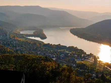
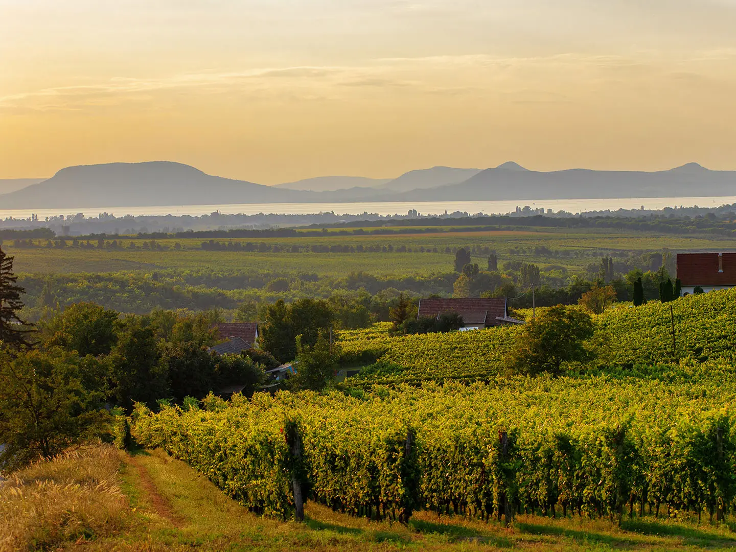
The Badacsony Volcano Trail is a 10 km circular day hike over Badacsony, an extinct basalt witness hill above the north shore of Lake Balaton in western Hungary. Starting in Badacsonytomaj, the route climbs through vineyards and deciduous forest to the flat basalt plateau and Kisfaludy lookout tower. It is moderate: short enough for a half-day, but with about 550 m of ascent, long basalt stairways, rocky ground and some steep stepped sections. It suits hikers who want geology, lake views and wine-country scenery in one compact loop.
Route Overview
The classic route starts and finishes at Heroes’ Square (Hősök tere) in Badacsonytomaj, beside the distinctive Basalt Church, making it a straightforward loop rather than a point-to-point hike. The circuit passes Köbölkút cemetery and the former Tördemic basalt quarry before climbing the Bujdosók stairway to Ranolder Cross and the Egry József and Páholykő viewpoints. A short detour reaches Rózsakő, then the path continues to the Kisfaludy lookout tower on the plateau, Kőkapu basalt columns, Klastrom Well and Saint Stephen Chapel before descending back to Badacsonytomaj. A shorter loop can start from the Rose Stone car park above Kisfaludy House, but this page covers the 10 km Badacsonytomaj circuit. Badacsony sits within the same protected landscape as the longer Balaton Uplands Trail, and pairs well with the nearby Bakony Hills Trail for a fuller Transdanubian walking trip.
Volcanic rock, quarrying and Badacsony wine history
Badacsony is a tanúhegy, or witness hill: an extinct volcano where softer ash and tuff eroded away, leaving a resistant basalt cap. Volcanic activity here occurred roughly 3–4 million years ago, the same process that shaped nearby Szent György-hegy, Csobánc and Gulács. Basalt was quarried on Badacsony for decades until quarrying stopped in 1964 to protect the landmark. The hill is also tied to the Badacsony wine region and to poet Sándor Kisfaludy, who lived here and met Róza Szegedy on the hill.
Notable highlights
- Kisfaludy lookout tower: An 18 m tower on the 437 m plateau, reached near the highest point of Badacsony. The spiral staircase gives a 360-degree view over Lake Balaton, the Tapolca and Káli basins and neighbouring witness hills.
- Kőkapu basalt columns: A natural stone “gate” formed by columnar basalt. The pillars and scree below are the clearest geological feature on the hike.
- Bujdosók stairway: A sustained climb of 464 unworked basalt steps on the western flank. It is one of the hardest sections of the loop and a memorable part of the ascent.
- Ranolder Cross: A large stone cross on the southern edge of the hill, erected in 1857 by János Ranolder, Bishop of Veszprém. It is also a strong viewpoint over Lake Balaton.
- Rózsakő: A flat, table-like basalt slab above Kisfaludy House, known as the Rose Stone. It is a short detour and a popular Balaton viewpoint linked to a local lovers’ legend.
- Vineyards and wine cellars: The lower slopes pass through the Badacsony wine region, with stone press-houses and cellars along the route.
Challenges to expect
Expect a short but physical hike: the main difficulty is the sustained climb from the lake-side slopes to the basalt plateau, especially the stepped sections such as the Bujdosók stairway. Underfoot, the route mixes dirt paths, rocky ground, basalt steps and scree. Slopes can be slick after rain. Navigation is helped by red-square trail markings and signed nature/geological trail stops, but pay attention at junctions and detours.
HikeList Score
Badacsony Volcano Trail scored 81/100 on HikeList's trail-quality metrics.
See score breakdownHide breakdown
- Ideal length 55
- Balanced challenge 100
- Scenery & wildness 98
- Varied terrain 64
- Accommodation 66
- Food & support 88
- Path quality 98
- Season flexibility 89
Computed from length, challenge, scenery & wildness, terrain variety, accommodation, food & support, path quality and season flexibility.
 Hungary
Show more data Show less
- Mountainous
- Forest
- Dirt
- Rocky
- Hotels
- Campsites
- Family Friendly
- Pet Friendly
- Restrooms
- Water Sources
- Campsites
- Picnic Areas
In these collections
Photos from hikers
Taken on the trail by people who've reviewed Badacsony Volcano Trail.
Reviews
How would you rate Badacsony Volcano Trail?
Tap a star to start your review — you could be the first.