Tre Cime di Lavaredo Loop
How would you rate Tre Cime di Lavaredo Loop?
Tap a star to share your experience and help other hikers.
Tre Cime di Lavaredo Loop: A Practical Day Hike Guide
HikeList Score
Tre Cime di Lavaredo Loop scored 76/100 on HikeList's trail-quality metrics.
See score breakdownHide breakdown
- Ideal length 55
- Balanced challenge 100
- Scenery & wildness 98
- Varied terrain 59
- Accommodation 49
- Food & support 72
- Path quality 98
- Season flexibility 76
Computed from length, challenge, scenery & wildness, terrain variety, accommodation, food & support, path quality and season flexibility.
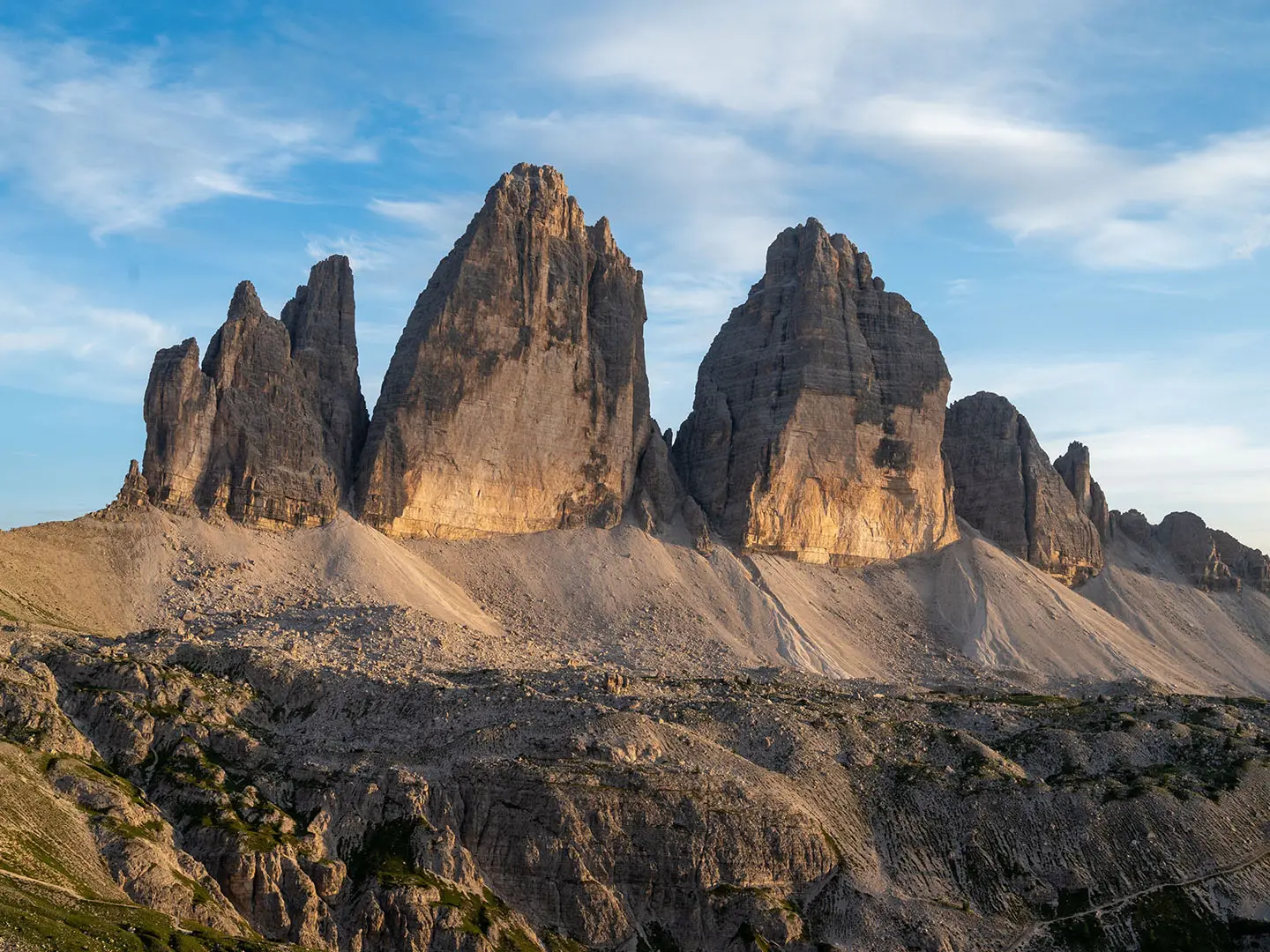
The Tre Cime di Lavaredo Loop is a moderate circular day hike in the Sexten (Sesto) Dolomites of northeastern Italy. The route is about 9–10 km, typically taking 3–5 hours, and circles the Drei Zinnen — the three famous dolomite towers on the South Tyrol–Belluno border. It suits reasonably fit walkers who want big alpine views without committing to a multi-day trek, but expect loose gravel, scree, rocky steps and short steep climbs on an exposed high-mountain circuit.
Route Overview
Start and finish at the Rifugio Auronzo car park, around 2,320–2,333 m, reached via the Misurina toll road or by summer bus. The loop is usually walked anticlockwise: Rifugio Auronzo, Cappella degli Alpini, Rifugio Lavaredo, Forcella Lavaredo, Rifugio Locatelli / Dreizinnenhütte, Malga Langalm, then back to Rifugio Auronzo. The southern side begins on a wide gravel mountain path before the route climbs to Forcella Lavaredo and crosses to the classic north-face view near Rifugio Locatelli. For longer Dolomites hut-to-hut trips, compare the Alta Via 1 and Alta Via 2.
Tre Cime history and the White War
The Tre Cime towers are among the most recognisable peaks in the Alps. Cima Grande was first climbed on 21 August 1869 by Paul Grohmann with guides Franz Innerkofler and Peter Salcher. During the First World War, from 1915 to 1917, the front line between Italy and Austria-Hungary ran through the massif as part of the high-altitude “White War”. Trenches, tunnels and fortifications still survive around the Tre Cime and nearby Monte Paterno.
Notable highlights
Tre Cime north faces: The near-vertical north faces are the signature view from Rifugio Locatelli and one of the best-known scenes in the Dolomites. Cima Grande’s north wall is also a famous big-wall climbing face.
Rifugio Locatelli / Dreizinnenhütte: A staffed mountain hut at around 2,440 m facing the peaks. It is the classic lunch stop and viewpoint roughly halfway around the loop.
Forcella Lavaredo: The high col at about 2,454 m is the circuit’s highest point. From here the route crosses from the southern side to the north-facing panorama.
First World War remains: Trenches, tunnels and gun positions from the 1915–17 mountain front survive around the Tre Cime and Monte Paterno. The Cappella degli Alpini near the start is a small reminder of this military history.
Laghi dei Piani: These small alpine tarns sit just off the northern side of the loop. They are a popular short detour for reflections of the peaks.
UNESCO Dolomites: The full circuit lies within the Dolomites UNESCO World Heritage Site, recognised for vertical rock walls, pinnacles and pale limestone scenery.
Challenges to expect
This is a short hike, but not a casual flat walk. Expect altitude above 2,300 m, sudden mountain weather, loose gravel, scree, rocky steps and short steep slopes, especially around Forcella Lavaredo and on the descent. The route is well waymarked, but summer crowds, toll-road access, parking slots and hut queues can affect timing. Snow is possible outside the main season.
HikeList Score
Tre Cime di Lavaredo Loop scored 76/100 on HikeList's trail-quality metrics.
See score breakdownHide breakdown
- Ideal length 55
- Balanced challenge 100
- Scenery & wildness 98
- Varied terrain 59
- Accommodation 49
- Food & support 72
- Path quality 98
- Season flexibility 76
Computed from length, challenge, scenery & wildness, terrain variety, accommodation, food & support, path quality and season flexibility.
 Italy
ItalyShow more data Show less
- Mountainous
- Gravel
- Scree
- Rocky
- Huts
- Family Friendly
- Pet Friendly
- Restrooms
- Water Sources
- Campsites
- Shelters
Download Our Full Guide to Tre Cime di Lavaredo Loop FREE!
Get our comprehensive guide to this hike for free. Save it for later reading or print out at home.
In these collections
Photos from hikers
Taken on the trail by people who've reviewed Tre Cime di Lavaredo Loop.
Tre Cime di Lavaredo Loop: The Complete Guide
 i
Image by Wirestock
i
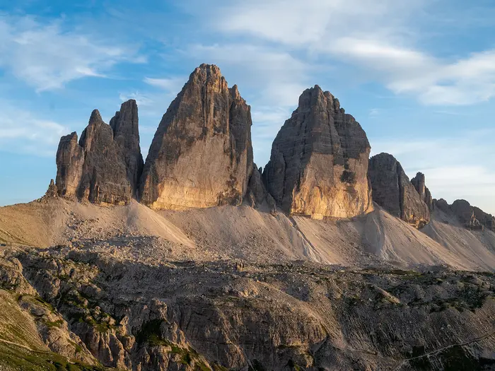
Image by Wirestock The Tre Cime di Lavaredo Loop is a short, high-mountain circuit around one of the Dolomites’ defining landmarks: the three pale limestone towers known in German as the Drei Zinnen. Starting and finishing at Rifugio Auronzo (Auronzohütte), it gives a full day-walk feel without needing a hut-to-hut itinerary.
Most walkers take the loop anticlockwise, following well-marked paths towards Rifugio Lavaredo before climbing to Forcella Lavaredo (Paternsattel), the highest point of the route at about 2,454 m. From there the view opens to the famous north faces of Cima Grande, Cima Ovest and Cima Piccola.
Rifugio Locatelli (Dreizinnenhütte) is the classic halfway stop, with the peaks directly across the basin and the Laghi dei Piani (Bödenseen) nearby. The return swings past Malga Langalm and Forcella di Mezzo, staying above 2,300 m on open Dolomites terrain.
This is not a technical walk and no via ferrata equipment is needed, but it is still a proper mountain route. Expect loose gravel, scree, rocky steps, short steep climbs, exposure to weather and the effects of altitude, even though the full circuit is only about 9.5–10 km.
The guide below covers stages, timings, accommodation, food, transport, terrain, season planning and the common mistakes to avoid.
Stage-by-Stage Guide
The loop is best treated as four short mountain sections rather than a village-to-village trek. Distances are modest, but the route stays high throughout, with gravel, scree, rocky steps and fully exposed alpine terrain above 2,300 m.
Most walkers go anticlockwise from Rifugio Auronzo (Auronzohütte), using the signed paths around the massif, mainly numbers 101 and 105. Carry the Tabacco 010 map, check the weather before starting, and do not rely on huts being open outside the main summer/autumn season.
Stage 1: Rifugio Auronzo to Forcella Lavaredo, via Cappella degli Alpini and Rifugio Lavaredo — ~3 km
This is the broadest and easiest-feeling part of the circuit, leaving the large Rifugio Auronzo car park on the southern side of the Tre Cime di Lavaredo / Drei Zinnen. The path is generally a wide gravel mountain track at first, with big views across the surrounding Dolomites and the cliffs rising immediately above the route.
Soon after the start, the route passes the Cappella degli Alpini, also known as the Chapel of Maria Ausiliatrice. This area carries strong First World War associations, and the chapel and nearby memorials are a reminder that the front line of 1915–1917 ran through this high mountain landscape.
Rifugio Lavaredo is the main service point on this section. When open, it is a useful place for refreshments before the climb to the col; hut opening dates should be checked before travelling, especially early or late in the season.
Beyond Rifugio Lavaredo the route steepens towards Forcella Lavaredo / Paternsattel. This pull is short but more strenuous than the opening kilometres, with loose gravel and stony ground underfoot. In busy periods, this section can feel crowded because many walkers head at least as far as the pass for the first major view towards the north faces.
Forcella Lavaredo, at about 2,454 m, is the highest point reached on the loop. It is not a technical pass, but it is exposed to wind and fast-changing weather; add layers before getting cold, and avoid lingering on the col if thunderstorms are building.
There is no accommodation, road access or public transport at Forcella Lavaredo itself. The nearest staffed hut behind you is Rifugio Lavaredo, while the next major hut ahead is Rifugio Locatelli / Dreizinnenhütte.
Navigation is straightforward in clear conditions: keep to the signed loop route and avoid being drawn onto steeper side paths towards Monte Paterno / Paternkofel unless intentionally taking a separate route. Snow can linger on high north-facing ground early and late in the season, so conditions should be checked before travelling.
Stage 2: Forcella Lavaredo to Rifugio Locatelli, the north-face viewpoint — ~2 km
This short section gives the classic transition from the southern side of the massif to the famous northern panorama. From Forcella Lavaredo, the route continues on open high-mountain ground towards Rifugio Locatelli / Dreizinnenhütte, with the north faces of Cima Grande / Große Zinne, Cima Ovest / Westliche Zinne and Cima Piccola / Kleine Zinne becoming the dominant view.
The path is still well marked, but the terrain is rougher than the initial approach from Auronzo. Expect scree, loose gravel and rocky steps rather than a smooth track. Walking poles can help on the looser sections, particularly if the ground is dry and ball-bearing-like underfoot.
Rifugio Locatelli sits at roughly 2,405–2,438 m and is the most popular lunch stop on the loop. It is also the key viewpoint for the sheer north walls of the Tre Cime / Drei Zinnen, so allow time here if the weather is clear.
Food and drinks are normally available at Rifugio Locatelli when the hut is open. Optional overnight stays are possible at the hut in season, but beds must be booked ahead and opening dates should be checked before travelling.
There is no road access at Rifugio Locatelli on this loop. If weather deteriorates, the practical choices are to continue around the circuit or return the way you came to Rifugio Auronzo, depending on visibility, time and conditions.
Navigation around the hut can be busy and confusing because several paths meet in the area, including routes towards Monte Paterno / Paternkofel and nearby First World War remains. Stay with the signed loop route unless deliberately taking a separate detour; the main circuit does not require via ferrata equipment.
The main warning on this stage is exposure to weather rather than technical difficulty. The ground is high, open and rocky, and the outlook can change quickly if cloud drops over the cols.
Stage 3: Rifugio Locatelli to Malga Langalm, past the Laghi dei Piani — ~2.5 km
From Rifugio Locatelli, the loop leaves the busiest viewpoint and starts to work around the northern side of the massif. This part of the walk feels more open and varied, with alpine paths, scree, rocky sections and pastureland rather than the broad gravel track of the southern approach.
The Laghi dei Piani / Bödenseen lie close to this northern section and are one of the best short scenic pauses on the circuit. In calm weather, the small tarns can give fine reflections of the peaks, but keep an eye on time if taking photos or making a short detour.
The route continues towards Malga Langalm, also signed as Rifugio Langalm. This is a useful landmark for pacing the second half of the loop, but service arrangements should be checked before travelling; do not rely on it as the only food or water stop of the day.
For overnight planning, the dependable hut options on the loop are Rifugio Auronzo, Rifugio Lavaredo and Rifugio Locatelli, all subject to seasonal opening and advance booking. There is no village, road head, railway station or regular public-transport stop on this northern section.
Underfoot, expect the roughest walking of the day in places: stony paths, loose material and uneven rocky steps. The terrain is not technical, but it asks for proper walking footwear and attention, especially when descending or passing other walkers on narrower sections.
Navigation remains based on the signed loop route, but visibility matters. In low cloud, the open alpine ground between the hut, tarns and pasture can feel less obvious than the wide approach from Auronzo, so map and trail-number checks are worthwhile.
Seasonal conditions matter here. Early or late in the walking window, lingering snow or wet rock can make the northern side slower and more awkward than the distance suggests.
Stage 4: Malga Langalm to Rifugio Auronzo, closing the loop via Forcella di Mezzo — ~2.5 km
The final section completes the circuit by curving back towards the southern side of the Tre Cime / Drei Zinnen. The route passes via Forcella di Mezzo before returning to the Rifugio Auronzo car park, with changing views back to the peaks and across the surrounding Dolomites.
Terrain remains alpine rather than valley walking. Expect gravel, rock and uneven path surfaces, with short climbs and descents rather than a flat finish. Fatigue can make this last quarter feel more awkward than expected, especially after a long lunch stop at Rifugio Locatelli.
There are no intermediate transport links on this section, so the practical exit is the return to Rifugio Auronzo. Once back at the car park, onward travel is by the Misurina toll road, DolomitiBus line 31 to Misurina when operating, or the seasonal shuttle 444 towards Dobbiaco / Toblach if pre-booked and running.
Rifugio Auronzo is the main service point at the end of the walk, with refreshments and optional overnight stays in season. Most walkers, however, return to valley bases such as Misurina, Auronzo di Cadore, Cortina d’Ampezzo, Dobbiaco / Toblach or Sesto / Sexten.
If using the toll road, remember that access arrangements and reservation rules change by season; high-season advance online reservation is required, and current prices and opening dates should be checked before travelling. The road is closed to vehicles in winter, when the huts also shut and the standard day loop is effectively out of season.
Navigation is generally clear as the circuit closes, but keep following the waymarked loop rather than cutting across faint ground towards the car park. Shortcuts on loose Dolomite scree damage the terrain and can be less safe than the signed path.
The final warning is timing. In stable summer weather the loop is a straightforward half-day mountain walk for fit hikers, but photo stops, hut queues, cloud, lingering snow or a late bus reservation can all stretch the day; start early enough to avoid being pressured on the return to Rifugio Auronzo.
Recommended Itinerary
Standard itinerary — anticlockwise day loop
This is the best plan for most walkers: start and finish at Rifugio Auronzo (Auronzohütte), walk anticlockwise on the main numbered paths, and use Rifugio Locatelli (Dreizinnenhütte) as the natural midpoint and lunch stop. Allow around 3–4 hours of walking, or 4–5 hours if stopping for photographs, food and the short look around the Laghi dei Piani (Bödenseen) area.
| Day | From | To | Approx. distance | Why this stage makes sense | Services/accommodation notes |
|---|---|---|---|---|---|
| 1 | Rifugio Auronzo (Auronzohütte) | Forcella Lavaredo (Paternsattel), via Cappella degli Alpini and Rifugio Lavaredo | ~3 km | This gives a straightforward warm-up on the southern side before the main pull up to Forcella Lavaredo, the highest point of the walk at about 2,454 m. It also places the steeper climb early, before fatigue or afternoon weather become more of a factor. | Rifugio Auronzo is at the trailhead and Rifugio Lavaredo is passed before the climb. Hut opening dates vary with the season and should be checked before travelling. |
| 1 | Forcella Lavaredo (Paternsattel) | Rifugio Locatelli (Dreizinnenhütte) | ~2 km | This is the classic transition onto the northern side of the Tre Cime di Lavaredo / Drei Zinnen, where the main north-face view opens up. The distance is short, but the ground is still high, exposed and stony. | Rifugio Locatelli is the most useful midpoint stop, with the famous view back to the three peaks. It is also an optional overnight hut, but beds must be booked ahead in season. |
| 1 | Rifugio Locatelli (Dreizinnenhütte) | Malga Langalm, past the Laghi dei Piani (Bödenseen) | ~2.5 km | This section keeps the loop moving round the quieter northern side, passing the small alpine tarns below Monte Paterno / Paternkofel. It is a good place to slow down without losing too much time. | Rifugio Locatelli is the last major hut before this section; Malga Langalm / Rifugio Langalm may offer refreshments in season. Check current opening before relying on it. |
| 1 | Malga Langalm | Rifugio Auronzo (Auronzohütte), via Forcella di Mezzo | ~2.5 km | The final leg closes the circuit around the western side of the peaks and returns to the Rifugio Auronzo car park. Keep enough time and energy for the final undulating ground rather than treating the walk as finished at Locatelli. | Rifugio Auronzo has the car park and road/bus access. If using public transport, check the last bus or shuttle time before setting off. |
Slower variant — overnight hut option
The loop does not need an overnight stop, but a slower version suits walkers who want sunset or early-morning light around the Tre Cime, or who prefer to break the high-level walking into two short days. The natural split is around Rifugio Locatelli (Dreizinnenhütte), roughly halfway round the circuit.
| Day | From | To | Approx. distance | Why this stage makes sense | Services/accommodation notes |
|---|---|---|---|---|---|
| 1 | Rifugio Auronzo (Auronzohütte) | Rifugio Locatelli (Dreizinnenhütte), via Rifugio Lavaredo and Forcella Lavaredo | ~5 km | This covers the main climb to Forcella Lavaredo and reaches the best north-face viewpoint without rushing. It leaves time for stops around the chapel, the pass and the Locatelli viewpoint. | Overnight at Rifugio Locatelli if booked in advance. Huts on the loop open only in the summer/autumn season; dates and availability should be checked before travelling. |
| 2 | Rifugio Locatelli (Dreizinnenhütte) | Rifugio Auronzo (Auronzohütte), via Laghi dei Piani, Malga Langalm and Forcella di Mezzo | ~5 km | This keeps the second day short and scenic, with time for the tarns and the return around the western side of the Tre Cime. It is also a sensible plan if starting late on Day 1 after travelling to the trailhead. | Finish back at the Rifugio Auronzo car park. If leaving by bus or shuttle, check current timetables and booking rules before committing to the overnight plan. |
Faster variant — compact half-day circuit
Fit, efficient walkers can complete the full loop as a continuous half-day walk, especially in stable weather and with an early start. This suits hikers who are comfortable on loose gravel, scree and rocky steps and do not need long hut stops.
| Day | From | To | Approx. distance | Why this stage makes sense | Services/accommodation notes |
|---|---|---|---|---|---|
| 1 | Rifugio Auronzo (Auronzohütte) | Rifugio Auronzo (Auronzohütte), full anticlockwise loop via Rifugio Lavaredo, Forcella Lavaredo, Rifugio Locatelli, Laghi dei Piani, Malga Langalm and Forcella di Mezzo | ~9.5–10 km | The circuit is short enough to walk in one push, but it remains a genuine high-mountain route above 2,300 m. Keep moving through the popular Auronzo–Lavaredo–Locatelli section, then take any longer break on the northern side if weather and timing allow. | Do not rely on speed to solve logistics: the toll road, car-park access, shuttle reservations, hut openings and bus times all change seasonally and should be checked before travelling. |
Planning the Route
How much time to allow
Plan the Tre Cime di Lavaredo / Drei Zinnen circuit as a single-day mountain walk, not as a hut-to-hut itinerary. The walking itself is usually comfortably completed in half a day by fit hikers, but most people should allow a longer window for weather changes, busy paths, photography and a proper stop at Rifugio Locatelli / Dreizinnenhütte.
A rushed circuit misses much of the point of the route. It is better planned as a slow day with an early start, especially in August or any period when the Rifugio Auronzo / Auronzohütte road and car park are busy.
The route is not naturally divided by overnight accommodation or valley villages. The rifugi on the loop are useful for food, drinks and optional overnight stays, but they are not required stages for completing the walk.
Choosing your direction
The loop is usually walked anticlockwise from Rifugio Auronzo / Auronzohütte. This gives a straightforward start on the southern side via Cappella degli Alpini and Rifugio Lavaredo, then a steady climb to Forcella Lavaredo / Paternsattel before reaching the classic north-face viewpoint at Rifugio Locatelli / Dreizinnenhütte.
Walking anticlockwise also makes the route easy to judge early on. If the weather is deteriorating, turning back before or around Forcella Lavaredo is simpler than committing to the northern side of the circuit.
Route sections in practice
| Section | Planning notes |
|---|---|
| Rifugio Auronzo to Rifugio Lavaredo | The easiest opening section, on the broad southern-side track. This is where crowds are most concentrated, especially close to the car park. |
| Rifugio Lavaredo to Forcella Lavaredo / Paternsattel | The key climb of the day and the highest point reached on the loop. Expect steeper stony ground and windier, more exposed conditions at the col. |
| Forcella Lavaredo to Rifugio Locatelli / Dreizinnenhütte | The route crosses onto the northern side, where the famous view of the Tre Cime north faces opens up. This is the natural main rest or lunch stop if the hut is open. |
| Rifugio Locatelli to Malga Langalm | More open alpine walking, with the Laghi dei Piani / Bödenseen nearby as a worthwhile short detour in settled weather. |
| Malga Langalm to Rifugio Auronzo | The closing section returns via Forcella di Mezzo to the start. Keep enough energy and weather margin for this final stretch; the route remains above 2,300 m until the end. |
Shortening, extending and section hiking
This is a compact circular route with no intermediate roadheads, so it is not well suited to formal section hiking. The practical choice is to complete the loop in one outing or turn back before committing to the far side.
The simplest way to shorten the day is to walk out from Rifugio Auronzo towards Rifugio Lavaredo and Forcella Lavaredo, then return the same way. Once beyond the Locatelli side, finishing the loop is usually the most logical option unless conditions make retracing safer.
The most relevant small extension is the detour around the Laghi dei Piani / Bödenseen area near the northern side of the loop. The First World War remains around the Tre Cime and Monte Paterno / Paternkofel are historically important, but neighbouring equipped paths and tunnels should be treated as separate objectives, not casual add-ons to this walk.
Access planning matters more than route planning
The main planning constraint is getting to and from Rifugio Auronzo. There is no railway to the trailhead, and the Misurina toll road is the standard access for drivers.
In high season, the toll road requires advance online reservation via auronzo.info. Current tolls, booking rules and opening dates should be checked before travelling; indicative charges are around €40 for a car, €26 for a motorbike and €60 for a camper, with the ticket valid for about 12 hours.
Without a car, plan around the seasonal buses rather than assuming a walk-up service will suit. DolomitiBus line 31 runs from Misurina to Rifugio Auronzo, Cortina d’Ampezzo access involves bus 30 to Misurina and then bus 31, and shuttle 444 links Dobbiaco / Toblach railway station with Rifugio Auronzo in season with advance online booking required.
Food, water and hut stops
Rifugio Auronzo, Rifugio Lavaredo and Rifugio Locatelli are the key refreshment points on or beside the loop, with Malga Langalm also on the return side. Hut opening dates are seasonal and should be checked before travelling, especially in late June, October or after early snow.
Do not rely on huts as the only safety margin. Carry enough water and snacks to complete the circuit if a hut is closed, full or delayed by queues. This is a popular route, and service points can be busy in peak season.
If staying overnight at any rifugio, book ahead in the summer/autumn season. Overnighting is optional for this route and is mainly useful for sunrise, sunset or combining the area with other separately planned walks.
Navigation and maps
The circuit is well waymarked, mainly on paths 101 and 105, but it should still be treated as a high-mountain route rather than a park path. Carry the Tabacco 010 “Dolomiti di Sesto / Sextener Dolomiten” 1:25,000 map or an equivalent offline map, and know the Italian and German place names used on signs.
Key names to recognise include Rifugio Auronzo / Auronzohütte, Forcella Lavaredo / Paternsattel, Rifugio Locatelli / Dreizinnenhütte, Laghi dei Piani / Bödenseen and Dobbiaco / Toblach. In mist, the broad popularity of the route is not a substitute for navigation.
Weather and season decisions
The route is exposed above 2,300 m for the whole circuit, so weather is the most important go/no-go decision. Fast-moving cloud, wind, rain, thunderstorms or lingering snow can turn a short walk into a serious mountain day.
The normal walking window is roughly late June to mid or late October, when the road and huts are open. August is busiest; September and October are generally quieter, but shorter days, colder conditions and early snow are more likely.
In winter the Misurina toll road is closed to vehicles and the huts shut, so the loop is effectively out of season for normal hikers. Any winter approach becomes a separate snow route and should not be planned as the standard Tre Cime loop.
Towns, Villages and Overnight Stops
The Tre Cime di Lavaredo Loop is normally planned as a day hike, not as a village-to-village trek. There is no need to book accommodation on the circuit unless you specifically want a night in a high-mountain rifugio.
Most walkers sleep in a valley base such as Misurina, Auronzo di Cadore, Cortina d’Ampezzo, Dobbiaco/Toblach or Sesto/Sexten, then travel up to Rifugio Auronzo for the start. On the route itself, services are concentrated in the rifugi and are seasonal, so hut opening dates should be checked before travelling.
Rifugio Auronzo / Auronzohütte
Rifugio Auronzo is the start and finish point of the loop, beside the large car park at the end of the Misurina toll road above Lago d’Antorno. It sits at roughly 2,320–2,333 m, so even the first steps are already in high-mountain terrain.
It is the most practical on-route overnight option if you want to start very early or stay high after the walk. Accommodation must be booked ahead in season, and opening dates should be checked before travelling.
Food and drink are available when the rifugio is open, making it useful for a pre-walk coffee, post-walk meal or bad-weather refuge. Do not rely on valley-style facilities here: there are no supermarkets or general shops at the trailhead.
Transport access is strongest here. Drivers use the Misurina toll road, with advance online reservation required in high season via auronzo.info; public transport options include DolomitiBus line 31 from Misurina and seasonal shuttle 444 from Dobbiaco/Toblach railway station, with advance booking required for the shuttle.
Cappella degli Alpini / Chapel of Maria Ausiliatrice
The Cappella degli Alpini is passed early on the southern side of the loop between Rifugio Auronzo and Rifugio Lavaredo. It is a landmark and historical stop rather than a service point.
There is no accommodation, food or transport link here. Its practical value is mainly orientation: it confirms you are on the broad southern approach section before the route continues towards Rifugio Lavaredo and Forcella Lavaredo/Paternsattel.
Rifugio Lavaredo
Rifugio Lavaredo lies on the southern side of the circuit before the climb to Forcella Lavaredo/Paternsattel. It is close enough to the start that many walkers use it as a short refreshment stop rather than a full break.
The hut offers refreshments and optional overnight accommodation during the summer/autumn operating window. Overnight stays should be booked ahead, especially in the busy August period.
There are no shops or village services here, and access is by mountain path rather than public road for normal route planning. It is useful if the weather turns before the steeper pull to the col, or if you want to break up the first section of the walk.
Forcella Lavaredo / Paternsattel
Forcella Lavaredo/Paternsattel is the high col of the route at about 2,454 m and the point where the circuit moves from the southern Auronzo side to the northern Locatelli side. It is not an overnight stop and has no services.
Treat it as an exposed high-mountain waypoint. In poor visibility, wind or early/late-season snow, this is one of the places where conditions can feel significantly more serious than the modest route distance suggests.
Rifugio Locatelli / Dreizinnenhütte
Rifugio Locatelli/Dreizinnenhütte is the key midway stop on the northern side of the loop, directly facing the famous north faces of the Tre Cime/Drei Zinnen. It is the classic lunch halt and the most popular place to pause for the main viewpoint.
The hut offers food, drink and optional overnight accommodation when open. Booking ahead is essential if staying overnight, as this is one of the best-known rifugi in the Dolomites and demand is high in the main season.
There are no shops, and access is on foot as part of the circuit. It is also the logical place to assess conditions before continuing around the northern and western side past Laghi dei Piani/Bödenseen and Malga Langalm.
Laghi dei Piani / Bödenseen
The Laghi dei Piani/Bödenseen are small alpine tarns near the northern side of the loop below Monte Paterno/Paternkofel. They are a scenic detour or pause rather than a serviced stop.
There is no accommodation, food or transport here. If adding time for photos or a short diversion, keep an eye on weather and return-transport timings, especially if using the bus or shuttle rather than a car.
Malga Langalm / Rifugio Langalm
Malga Langalm sits on the return side of the loop after the northern section and before the final traverse back towards Rifugio Auronzo via Forcella di Mezzo. It is a useful place to rest once the busiest Locatelli viewpoint area is behind you.
It may provide mountain refreshments when open, but current opening times should be checked before travelling. Do not plan it as a guaranteed overnight stop unless accommodation is booked directly and explicitly available.
There are no village services or public transport links here. Its main value is as a practical break point on the quieter return half of the circuit.
Forcella di Mezzo
Forcella di Mezzo is the final pass-like waypoint before the route closes the loop back to Rifugio Auronzo. It has no accommodation, food, shops or transport.
It is useful mainly for orientation on the last section. Once over this part of the circuit, you are returning towards the Auronzo car park and the road/bus connections at the trailhead.
Misurina
Misurina is the nearest practical valley base, on Lake Misurina below the toll road to Rifugio Auronzo. It works well for walkers who want the shortest approach to the trailhead.
Accommodation is available in the village area, with hotels, guesthouses, B&Bs and campsites in the wider local area. Availability can tighten in summer, so booking ahead is sensible.
Misurina has the key public-transport link to the start: DolomitiBus line 31 runs from Misurina Genzianella to Rifugio Auronzo in about 20 minutes. Drivers also approach the toll road from this side, but toll prices, reservation rules and road opening dates should be checked before travelling.
Auronzo di Cadore
Auronzo di Cadore is a good base on the Veneto side for walkers with a car or those combining the Tre Cime loop with time in the Cadore area. It is not on the walking circuit itself, but it is one of the established valley bases for the route.
Expect normal town accommodation rather than mountain-hut facilities: hotels, guesthouses, B&Bs and campsites are available in the area. Food shops, cafés and restaurants are more realistic here than at the high trailhead, so it is a better place to buy supplies before heading up.
Specific bus connections from Auronzo di Cadore to the trailhead are not detailed here. This should be checked before travelling.
Cortina d’Ampezzo
Cortina d’Ampezzo is a larger Dolomites base with broad accommodation and visitor services. It is farther from the trailhead than Misurina, but it suits walkers who want more choice of hotels, restaurants and transport connections.
For public transport, take bus 30 from Cortina d’Ampezzo to Misurina, then bus 31 from Misurina to Rifugio Auronzo. Timetables are seasonal and should be checked before travelling.
Cortina is a practical choice if the Tre Cime loop is one of several hikes in the area. For a very early start at Rifugio Auronzo, Misurina or a booked night at Rifugio Auronzo will usually be more convenient.
Dobbiaco / Toblach
Dobbiaco/Toblach is the main South Tyrol-side transport base for this hike, with a railway station and seasonal onward shuttle access to Rifugio Auronzo. It is a strong option for walkers arriving without a car.
Seasonal shuttle bus 444 links Dobbiaco/Toblach railway station with Rifugio Auronzo, and advance online booking is required. Current operating dates, times and booking rules should be checked before travelling.
Accommodation in and around Dobbiaco/Toblach includes hotels, guesthouses, B&Bs and campsites. It is also a sensible base if you are approaching from the German-speaking South Tyrol side of the Dolomites.
Sesto / Sexten
Sesto/Sexten is another South Tyrol-side base for the Sesto/Sexten Dolomites. It is not on the loop, but it is relevant for walkers staying north of the Tre Cime/Drei Zinnen area.
Accommodation is available in the wider town area, including hotels, guesthouses, B&Bs and campsites. It is better suited to walkers spending more time in the Sesto Dolomites rather than those wanting the absolute shortest morning transfer to Rifugio Auronzo.
Specific onward transport from Sesto/Sexten to the Rifugio Auronzo trailhead is not detailed here. This should be checked before travelling.
Getting to the Start
The Tre Cime di Lavaredo Loop starts and finishes at Rifugio Auronzo (Auronzohütte), above Lago d’Antorno and Misurina. There is no railway at the trailhead: the final approach is by toll road, bus or seasonal shuttle.
By train
The nearest useful railway stations are Dobbiaco/Toblach and Calalzo di Cadore. From either station, onward travel is needed by bus, shuttle, taxi or hire car.
Dobbiaco/Toblach is the most practical rail approach from the South Tyrol side because the seasonal shuttle bus 444 links Dobbiaco/Toblach railway station with Rifugio Auronzo. Advance online booking is required for this shuttle in season.
Calalzo di Cadore is another rail gateway for the Cadore/Belluno side, but there is still no direct train to Rifugio Auronzo. Onward bus and taxi arrangements from Calalzo di Cadore should be checked before travelling.
By bus
From Misurina, DolomitiBus line 31 runs from the Misurina Genzianella stop to Rifugio Auronzo in around 20 minutes. This is the simplest public-transport approach if staying in Misurina.
From Cortina d’Ampezzo, take bus 30 to Misurina, then change to bus 31 for Rifugio Auronzo. Allow enough margin for the connection, especially if aiming for an early start or relying on the last return service.
From the South Tyrol side, shuttle bus 444 runs in season from Dobbiaco/Toblach railway station to Rifugio Auronzo. Advance online booking is required, and the service should be treated as seasonal rather than year-round.
Bus times, operating dates, booking rules and return services should be checked before travelling. This is especially important outside peak summer, in poor weather, or if planning a late lunch stop at Rifugio Locatelli / Dreizinnenhütte before returning to the car park.
By car
Driving is the classic way to reach the start. The road climbs from the Misurina/Lago d’Antorno area to the large car park at Rifugio Auronzo, where the loop begins.
This is a toll road. Indicative charges are around €40 for a car, €26 for a motorbike and €60 for a camper, with the ticket valid for about 12 hours. Current prices, validity and access conditions should be checked before travelling.
In high season, advance online reservation is mandatory via auronzo.info. Do not assume it is possible to drive up and pay at the barrier without a booking during busy periods.
The road and huts are generally open from roughly late June to mid/late October. The Misurina toll road is closed to vehicles in winter, roughly November to late May or early June, so the normal trailhead access is not available then.
Parking is at the Rifugio Auronzo car park. For the standard day loop, the toll-road ticket window is usually sufficient, but overnight or long-stay parking arrangements for hut stays should be checked before travelling.
From the nearest airport
There is no airport at or near the trailhead. For international arrivals, the practical plan is to reach one of the valley bases — Cortina d’Ampezzo, Misurina, Auronzo di Cadore, Dobbiaco/Toblach or Sesto/Sexten — then continue by bus, shuttle, taxi or hire car to Rifugio Auronzo.
Exact airport choice and onward connections depend on where the wider trip begins in northern Italy or the Alps. Rail and bus connections, car-hire availability and transfer times should be checked before booking flights.
Where to stay before starting
Misurina is the nearest base, with the quickest access to Rifugio Auronzo by bus 31 or by car up the toll road. Staying here makes an early start easier and reduces the risk of arriving after the car park or road booking slots are busy.
Cortina d’Ampezzo is a common base with more services, but it adds a bus change via Misurina if travelling without a car. Drivers should still account for the toll-road reservation system and busy August traffic.
Dobbiaco/Toblach and Sesto/Sexten work well from the South Tyrol side, especially if using the seasonal shuttle 444 from Dobbiaco/Toblach railway station. Advance booking for the shuttle is required.
Auronzo di Cadore is another practical valley base on the Veneto side. If relying on taxis or local buses from any valley town, book or check arrangements in advance rather than assuming frequent early-morning transport.
The main logistical pinch points are the high-season toll-road reservation, seasonal bus/shuttle operation, winter road closure and the popularity of the route in August. Build the transport plan around reaching Rifugio Auronzo early, then make sure the return connection or parking validity comfortably covers a 4–5 hour outing with stops.
Getting Home from the Finish
The Tre Cime di Lavaredo / Drei Zinnen circuit finishes exactly where it starts: the Rifugio Auronzo / Auronzohütte car park at the top of the Misurina toll road. There is no onward valley settlement at the finish, so leaving the trailhead means descending by car, shuttle or bus to Misurina, Cortina d’Ampezzo, Dobbiaco / Toblach or another valley base.
By train
There is no railway station at Rifugio Auronzo. The nearest rail access points used for this hike are Dobbiaco / Toblach and Calalzo di Cadore, with onward bus connections required between the station and the mountains.
For the South Tyrol side, shuttle bus 444 links Dobbiaco / Toblach railway station with Rifugio Auronzo in season. This service requires advance online booking, and operating dates and times should be checked before travelling.
For the Veneto side, Calalzo di Cadore is a railhead with onward buses towards the Cadore and Cortina area. Exact connections from the Tre Cime trailhead via Misurina and onward to Calalzo di Cadore are timetable-dependent, so this should be checked before travelling.
By bus
The main public-transport exit from the finish is DolomitiBus line 31 from Rifugio Auronzo down to Misurina, with the Misurina Genzianella stop used for onward connections. The journey between Misurina and Rifugio Auronzo is about 20 minutes.
From Misurina, bus 30 connects with Cortina d’Ampezzo. From the South Tyrol side, shuttle 444 links Rifugio Auronzo with Dobbiaco / Toblach railway station in season and must be booked online in advance.
Bus and shuttle services to Rifugio Auronzo are seasonal mountain services rather than turn-up-all-year public transport. Check the current timetable, last departures and booking rules before committing to a late start or long lunch stop at Rifugio Locatelli / Dreizinnenhütte.
If you finish late in the day, do not assume there will be a bus still running from the car park. Either plan around the last confirmed departure, have a car waiting, pre-arrange a taxi from the valley, or stay overnight nearby.
By car/taxi
Most walkers who drive simply return to their vehicle in the large car park beside Rifugio Auronzo. The descent is via the Misurina toll road above Lago d’Antorno.
The toll road is typically open during the summer and autumn hiking season and closed to vehicles in winter, roughly from November to late May or early June. In high season, advance online reservation via auronzo.info is mandatory; current toll prices, reservation rules and road status should be checked before travelling.
As a guide, the toll has been around €40 for a car, €26 for a motorbike and €60 for a camper, with the ticket valid for about 12 hours. Confirm current prices before booking, especially if planning to stay high for sunrise, sunset or an overnight hut stay.
Taxis are a practical fallback only if arranged in advance from a valley base such as Misurina, Auronzo di Cadore, Cortina d’Ampezzo or Dobbiaco / Toblach. Do not rely on finding an available taxi waiting at Rifugio Auronzo at the end of the walk.
From the nearest airport
There is no airport close to the trailhead, and the final transfer from any airport will still involve reaching one of the valley bases and then continuing by car, bus or seasonal shuttle to Rifugio Auronzo. The most practical airport depends on whether you are approaching from the Veneto side, via Cortina d’Ampezzo or Cadore, or from the South Tyrol side, via Dobbiaco / Toblach and Sesto / Sexten.
Airport-to-valley travel times, rail links and bus connections vary by season and by day of the week. This should be checked before travelling, especially if trying to fly out on the same day as the hike.
For most independent hikers, it is safer to stay in the valley after the walk and travel to the airport the following day, rather than depending on a late mountain bus connection from Rifugio Auronzo.
Where to stay at the finish
The finish itself has Rifugio Auronzo / Auronzohütte, which can be useful if you want to stay high or avoid a late descent. Like the other huts on the loop, it operates only in the summer/autumn window and must be booked ahead in season.
The nearest valley base is Misurina, below the toll road by Lago di Misurina. Other practical bases for the night after the hike include Auronzo di Cadore, Cortina d’Ampezzo, Dobbiaco / Toblach and Sesto / Sexten, all of which have hotels, guesthouses, B&Bs and campsites.
If using public transport, choose accommodation that matches the bus or shuttle route you intend to use. Staying in Misurina is the simplest option after a bus descent from Rifugio Auronzo, while Dobbiaco / Toblach works well for hikers using shuttle 444 and the railway.
Which Direction Should You Walk?
The Tre Cime di Lavaredo Loop is usually walked anticlockwise from Rifugio Auronzo (Auronzohütte): first to Cappella degli Alpini and Rifugio Lavaredo, then over Forcella Lavaredo (Paternsattel) to Rifugio Locatelli (Dreizinnenhütte), before returning via Laghi dei Piani (Bödenseen), Malga Langalm and Forcella di Mezzo.
Because this is a circular day hike starting and finishing at the same car park, direction makes no difference to transport logistics. The Misurina toll road, buses and shuttle services all deliver walkers to Rifugio Auronzo, and the same access arrangements apply whichever way round the loop is walked.
Anticlockwise: the standard and best-balanced option
Anticlockwise gives the cleanest progression for most hikers. The opening section on the southern side is on easier, wider gravel mountain tracks, passing Cappella degli Alpini and Rifugio Lavaredo before the main pull up to Forcella Lavaredo.
That climb is short but stony, and it is generally more comfortable to climb it than to descend it later on tired legs. Reaching Forcella Lavaredo also gives the classic reveal onto the northern side, with the full Tre Cime / Drei Zinnen panorama opening out towards Rifugio Locatelli.
This direction also places Rifugio Locatelli roughly halfway round the loop, making it the natural lunch stop and main viewpoint. From there, the return via the Laghi dei Piani and Malga Langalm keeps the best north-face scenery in view for longer before the route closes back towards Rifugio Auronzo.
Clockwise: workable, but less natural
Walking clockwise is possible and uses the same paths, but it changes the feel of the day. You leave Rifugio Auronzo towards Forcella di Mezzo and Malga Langalm first, reaching the northern side before Rifugio Locatelli and then crossing Forcella Lavaredo later in the walk.
The main drawback is that the steeper, looser section around Forcella Lavaredo becomes a descent rather than a climb. On gravel and rocky steps, especially if the path is busy, that can feel more awkward than tackling it uphill.
Clockwise can still make sense if you specifically want to vary the usual flow or reach the Langalm side earlier. It also means finishing on the broader southern track past Rifugio Lavaredo and Cappella degli Alpini, which can feel straightforward at the end of the day.
Weather, crowds and hut stops
There is no direction that avoids the route’s main weather issue: the whole loop stays high, exposed and above 2,300 m. Fast-changing alpine weather matters more than clockwise versus anticlockwise, so start early, carry layers and be prepared to turn back if conditions deteriorate.
Hut and refreshment flow is better anticlockwise for most walkers. Rifugio Lavaredo comes early, Rifugio Locatelli sits at the obvious scenic midpoint, and Malga Langalm gives another useful stop on the return side when open. Hut opening dates should be checked before travelling.
Recommendation
Walk the Tre Cime di Lavaredo Loop anticlockwise unless there is a specific reason not to. It is the traditional direction, gives the strongest scenery progression, puts the steepest section uphill, and places Rifugio Locatelli at the most satisfying point of the day.
Accommodation Along the Route
This is a circular day hike, not an inn-to-inn route, so accommodation planning is mainly about choosing a valley base and deciding whether an overnight hut stay is worth adding. Most walkers sleep in Misurina, Auronzo di Cadore, Cortina d’Ampezzo, Dobbiaco/Toblach or Sesto/Sexten, then travel up to Rifugio Auronzo (Auronzohütte) for the start.
There are staffed rifugi on or close to the loop, but they should be treated as optional mountain stays rather than necessary stages. Rifugio Auronzo, Rifugio Lavaredo and Rifugio Locatelli/Dreizinnenhütte offer refreshments and may offer overnight accommodation during the summer/autumn opening window; stays need booking well ahead in season.
| Place | Accommodation level | Best for | Notes |
|---|---|---|---|
| Rifugio Auronzo / Auronzohütte | Limited | Earliest possible start; staying at the trailhead | At the roadhead and car park where the loop starts and finishes. Useful if avoiding a morning drive or bus, but hut places are limited and seasonal. Book ahead and check opening dates. |
| Rifugio Lavaredo | Limited | Optional hut night on the south side of the loop | Passed early on the usual anticlockwise circuit. More useful as a refreshment stop than as a required overnight point on this short hike. Book ahead if staying. |
| Rifugio Locatelli / Dreizinnenhütte | Limited | Overnight with the classic north-face view of the Tre Cime / Drei Zinnen | The most sought-after hut location on the circuit, facing the famous north walls. Expect strong demand in the main summer season, especially around August. Book well ahead and check current opening dates. |
| Malga Langalm / Rifugio Langalm | Limited / check before relying on it | Mid-route refreshment stop on the return side | Passed after the Laghi dei Piani / Bödenseen section. Do not plan an overnight here unless current accommodation availability has been checked directly before travelling. |
| Misurina | Good | Nearest practical valley base | The closest common base, by Lake Misurina, with access to the Rifugio Auronzo road and bus connection. A strong choice for a simple Tre Cime-focused trip. |
| Auronzo di Cadore | Good | Cadore-side base with more town facilities | Useful for walkers approaching from the Veneto side. Hotels, guesthouses, B&Bs and campsites are available in the wider town area. |
| Cortina d’Ampezzo | Good | Wider accommodation choice and a longer approach | A major Dolomites base with broad accommodation options. Reaching the trailhead without a car normally involves bus travel via Misurina; current timetables should be checked before booking. |
| Dobbiaco / Toblach | Good | Public transport from the South Tyrol side | Useful if arriving by rail, as Dobbiaco/Toblach has a railway station and seasonal shuttle access towards Rifugio Auronzo. Shuttle booking requirements and dates should be checked before travelling. |
| Sesto / Sexten | Good | South Tyrol base for the Sesto Dolomites | A practical base on the South Tyrol side, with hotels, guesthouses, B&Bs and campsites in the area. Check onward transport to the trailhead before committing without a car. |
Booking strategy
For a normal day walk, book accommodation in a valley base for the nights before and after the hike, then plan the road or bus access separately. Misurina is the most convenient base for minimising the morning journey; Cortina d’Ampezzo, Auronzo di Cadore, Dobbiaco/Toblach and Sesto/Sexten give broader trip options but add more transport planning.
Hut accommodation is far more limited than valley accommodation. Rifugio Locatelli/Dreizinnenhütte is especially popular because of its position facing the north faces, and August is the busiest period on the route. Weekend and high-season availability can disappear well in advance, so hut beds should not be left to arrival day.
The huts and the Misurina toll road operate in the summer/autumn window, roughly late June to mid/late October, depending on conditions. Outside that period the road is closed to vehicles and the huts shut, so normal accommodation-based access to the loop does not work. Opening dates should be checked before booking travel.
Does it work as an inn-to-inn walk?
Not really. The Tre Cime di Lavaredo Loop is only about 9.5–10 km and returns to the same trailhead, so there are no natural overnight stages or awkward accommodation gaps to solve. Luggage transfer is unnecessary for the standard hike.
Taxi transfers are also not normally part of the accommodation plan, because the key issue is reaching Rifugio Auronzo from a valley base. Most walkers either drive up the Misurina toll road or use the seasonal bus/shuttle options. If arranging a private transfer, availability and access rules should be checked before travelling.
Camping and Wild Camping
This is not a camping trek. The Tre Cime di Lavaredo / Drei Zinnen loop is a short high-mountain day walk from Rifugio Auronzo / Auronzohütte, and the practical way to do it is to stay in a valley base, use a campsite there if preferred, then walk the circuit with a light day pack.
There are no established campsites on the loop itself. On-route accommodation is in staffed rifugi — Rifugio Auronzo, Rifugio Lavaredo and Rifugio Locatelli / Dreizinnenhütte — which offer refreshments and, if booked ahead in season, optional overnight stays.
Where to camp nearby
Campsites are found in the main valley bases used for the hike, including Misurina, Auronzo di Cadore, Cortina d’Ampezzo, Dobbiaco / Toblach and Sesto / Sexten. These are the sensible places to camp if you want a tent-based trip while still walking the Tre Cime loop as a day hike.
Misurina is the closest base for the Rifugio Auronzo approach road and bus connection. Dobbiaco / Toblach and Sesto / Sexten work well from the South Tyrol side, particularly if using the seasonal shuttle 444 from Dobbiaco / Toblach railway station. Cortina d’Ampezzo and Auronzo di Cadore have more general tourist infrastructure but require a longer approach.
Wild camping on the route
Wild camping should not be treated as a normal option on this walk. The route lies in a very sensitive and heavily visited Dolomites UNESCO World Heritage landscape, on high alpine ground above 2,300 m, with rifugi, waymarked paths, pastureland and small tarns close to the circuit.
Rules on bivouacking and wild camping in the Dolomites can depend on the province, municipality, land ownership and protected-area status. This should be checked before travelling. Do not pitch near Rifugio Auronzo, Rifugio Lavaredo, Rifugio Locatelli, Malga Langalm, the Laghi dei Piani / Bödenseen, car parks, tracks, pastures or waymarked paths unless explicit local permission has been obtained.
A camper-van toll category for the Misurina road does not automatically mean overnight camping is allowed at the Rifugio Auronzo car park. Overnight parking and sleeping-in-vehicle rules should be checked before travelling, especially in high season when road access also requires advance online reservation.
Water, fires and impact
Do not rely on natural water on this loop. The Laghi dei Piani / Bödenseen are scenic alpine tarns, not a dependable drinking-water source, and water taken from the landscape would need proper treatment. In normal conditions, carry enough water from the valley or buy drinks at the rifugi when they are open.
Open fires are not appropriate on this route. The ground is exposed, busy, high-altitude and environmentally sensitive, with no suitable camping areas on the circuit. Cooking should be kept to legal, designated camping places in the valleys or to hut facilities where permitted by the hut.
Leave No Trace standards matter here because visitor pressure is extremely high. Stay on marked paths, pack out all litter, do not wash in tarns, keep well away from grazing animals, and use toilets at rifugi or established facilities rather than contaminating the open alpine ground.
Seasonal reality
Camping logistics follow the same seasonal limits as the hike. The practical walking season is roughly late June to mid/late October, when the road and huts normally operate; exact opening dates, road access and weather closures should be checked before travelling.
Outside that window the Misurina toll road is closed to vehicles and the huts shut, so the loop becomes a winter mountain outing rather than a normal camping-supported hike. Snow, ice, short daylight and lack of services make camping on or near the high route unsuitable for ordinary walkers.
Food, Water and Resupply
This is a short circular day hike, not a resupply-based trek. Food is straightforward in the main summer/autumn season because the loop passes several staffed rifugi, but there are no village shops, supermarkets, petrol stations or public water fountains on the high route itself.
The safest plan is to arrive at Rifugio Auronzo (Auronzohütte) already carrying water, snacks and at least one emergency layer of food. Hut meals and drinks are useful, but opening dates, daily hours and service levels depend on the season and weather; this should be checked before travelling.
| Section | Food availability | Water availability | Notes |
|---|---|---|---|
| Rifugio Auronzo (Auronzohütte) trailhead | Refreshments available when the rifugio is open | Buy drinks / use hut facilities when open | Last reliable staffed point before starting. There are no valley shops at the car park, so buy trail food before driving or taking the bus up. |
| Rifugio Auronzo to Rifugio Lavaredo | Rifugio Lavaredo is the next on-route refreshment stop when open | Buy drinks at huts when open; do not rely on natural water | Short, easy-access section, but already above 2,300 m and exposed to sun, wind and weather. |
| Rifugio Lavaredo to Rifugio Locatelli / Dreizinnenhütte via Forcella Lavaredo / Paternsattel | Rifugio Locatelli is the classic lunch stop when open | Buy drinks at the hut when open | This is the most obvious place for a proper meal break, roughly halfway round. It can be very busy in August and at peak lunch times. |
| Rifugio Locatelli to Malga Langalm, past Laghi dei Piani / Bödenseen | Do not depend on food here unless current hut opening is checked | The tarns are not a dependable drinking-water source; filter/treat any natural water if used | Carry enough water from Rifugio Locatelli to finish the walk. Pastureland and hut activity make untreated natural water a poor plan. |
| Malga Langalm to Rifugio Auronzo via Forcella di Mezzo | No guaranteed food until back at Rifugio Auronzo | No dependable refill point unless facilities are open | The final section is still high and exposed. Keep some water and snacks back rather than using everything at Rifugio Locatelli. |
What to carry
For a normal 3–5 hour circuit, most walkers should start with enough water for the full hike rather than assuming every hut stop will be usable. Around 1.5–2 litres per person is a sensible baseline in settled weather; take more in hot sun, with children, or if planning long photo stops.
Carry snacks even if planning to eat at Rifugio Locatelli / Dreizinnenhütte. A packed lunch is sensible outside the main season, in unsettled weather, or if walking early/late in the day when hut kitchens may not be serving.
Buying food before the hike
There are no supermarkets or general stores on the loop. Buy bread, snacks and picnic food before heading up from valley bases such as Misurina, Auronzo di Cadore, Cortina d’Ampezzo, Dobbiaco / Toblach or Sesto / Sexten.
Rural and resort opening hours can be limited outside the busiest holiday weeks, and Sunday or shoulder-season closures can affect valley shops. This should be checked before travelling, especially if relying on public transport and arriving early.
Natural water
Do not plan the Tre Cime di Lavaredo / Drei Zinnen loop around natural water. The route passes high alpine terrain and small tarns near the Laghi dei Piani / Bödenseen, but these should not be treated as drinking-water sources.
If natural water is used in an emergency, it should be filtered or treated. The better strategy is simple: start with enough water, top up with bought drinks at open rifugi, and keep a reserve for the exposed return to Rifugio Auronzo.
Terrain, Conditions and Difficulty in Practice
The Tre Cime di Lavaredo / Drei Zinnen loop is short, well waymarked and non-technical, but it is still a high-mountain walk. Almost the entire circuit sits above 2,300 m, with loose gravel, scree, rocky steps and fast-changing alpine weather making it more demanding than the distance alone suggests.
There is no via ferrata, no scrambling and no summit ground on the standard loop. The main challenges are the stony climb to Forcella Lavaredo / Paternsattel, rougher rock and scree on the northern side, and the exposed, open nature of the terrain if cloud, wind, rain or early/late-season snow arrives.
Underfoot: what the paths are like
The southern side from Rifugio Auronzo / Auronzohütte towards Rifugio Lavaredo is the easiest underfoot. Expect broad gravel mountain tracks and open walking, with no significant route-finding difficulty in clear weather.
The climb up to Forcella Lavaredo is steeper and rougher. This is the point where many walkers notice the altitude and the loose stony surface, especially on warm days or when the path is busy.
Beyond the pass towards Rifugio Locatelli / Dreizinnenhütte, the route feels more alpine. The path crosses scree, rocky steps and open ground, with the northern faces of the Tre Cime in view and less of the broad-track feel found at the start.
The return via the Laghi dei Piani / Bödenseen, Malga Langalm and Forcella di Mezzo remains mountain walking rather than a surfaced promenade. Expect gravel, rock and pastureland paths, with some uneven sections where walking poles can be useful on descents.
| Section | Terrain in practice | Main difficulty |
|---|---|---|
| Rifugio Auronzo to Rifugio Lavaredo | Wide gravel track and open mountain path | Easiest part of the loop; can be busy |
| Rifugio Lavaredo to Forcella Lavaredo | Steeper stony climb on loose ground | Short but sustained pull to the high point at about 2,454 m |
| Forcella Lavaredo to Rifugio Locatelli | Scree, rocky steps and open alpine path | Rougher underfoot; more exposed to weather |
| Rifugio Locatelli to Malga Langalm | Alpine paths past tarns and pastureland | Uneven ground, possible slower going after poor weather |
| Malga Langalm to Rifugio Auronzo | Open return route via Forcella di Mezzo | Final undulations and rough gravel/rock underfoot |
Climbs, descents and effort
The total ascent is around 425 m, so the loop is not a major endurance hike. However, the height makes the effort feel sharper than the numbers suggest, particularly for walkers arriving directly from the valley.
Forcella Lavaredo / Paternsattel is the highest point reached on the route, at about 2,454 m. The ascent to it is the most obvious climb of the day and is the section most likely to slow families, less fit walkers or anyone not used to loose mountain paths.
Descents are not technical, but loose gravel and scree can make footing insecure. Lightweight trainers are a poor choice; proper walking shoes or boots with good grip are strongly recommended.
Exposure and weather
“Exposure” on this route is mainly exposure to altitude and weather rather than sustained narrow cliff-edge walking. The loop is open and high throughout, with little shelter once away from the rifugi.
Cloud can reduce visibility quickly around the passes and northern side. In clear weather the waymarking on paths 101 and 105 is straightforward, but a map such as Tabacco 010 is still sensible because the landscape is rocky, open and heavily visited, with many walkers moving in different directions.
Wind, rain or a sudden temperature drop can turn a comfortable half-day walk into a cold mountain outing. Carry a waterproof layer, warm layer and sun protection even when starting in good weather from the Rifugio Auronzo car park.
Mud, snow and seasonal conditions
This is not a muddy lowland route. The ground is mostly gravel, rock, scree and high alpine pasture, so prolonged boggy walking is not a defining feature.
Snow is the bigger seasonal issue. Because the whole circuit is high, snow can linger early in the walking season and return late in autumn, especially around shaded or higher sections such as Forcella Lavaredo.
The normal walking window is roughly late June to mid/late October, matching the period when the toll road and huts usually operate. Outside that window the Misurina toll road is closed to vehicles in winter and the huts shut, so the loop becomes a very different mountain outing and is not the standard day hike described here.
In September and October the route can be quieter and the air clearer, but colder starts, shorter days and early snowfalls become more relevant. Current weather, road status and hut opening dates should be checked before travelling.
Crowds and how they affect difficulty
This is one of the most popular day walks in the Dolomites, and the terrain is made harder in practice by crowding as much as by gradient. The broad southern track copes best, but narrower stony sections near Forcella Lavaredo and the paths around Rifugio Locatelli can feel slow when many walkers are on the route.
Starting early helps with both crowds and weather. It also gives more time for stops at Rifugio Locatelli, the Laghi dei Piani and the viewpoints without rushing the rockier return side of the loop.
Who will find it manageable?
Reasonably fit walkers and families used to mountain paths should find the loop manageable in good summer conditions. The route is well marked, short and served by rifugi, which makes it accessible by Dolomites standards.
It is less suitable as a first mountain walk for anyone expecting a flat sightseeing path. The altitude, loose ground, rocky steps and exposure to weather require proper footwear, warm and waterproof layers, and enough confidence to walk on uneven alpine terrain for several hours.
Weather and Best Time to Walk
The Tre Cime di Lavaredo Loop is a high-mountain day walk, not a low-level valley path. The whole circuit sits above 2,300 m, reaches Forcella Lavaredo / Paternsattel at about 2,454 m, and is exposed to cold, wind, cloud and sudden weather changes even when Misurina, Cortina d’Ampezzo or Dobbiaco / Toblach feel mild.
Best months
The normal walking season is roughly late June to mid/late October, matching the usual opening window for the Misurina toll road and the rifugi. Within that period, the most reliable planning window is usually July to September, when access, hut refreshments and public transport options are most likely to be operating.
August is the busiest month. Start early if walking then: it gives a better chance of parking or using pre-booked access smoothly, avoids the densest foot traffic around Rifugio Auronzo and Rifugio Locatelli / Dreizinnenhütte, and leaves more time to get round before afternoon weather deteriorates.
September and early October can be excellent for clearer air, autumn light and fewer walkers. The trade-off is shorter days, colder starts and a higher chance of early snow or icy patches on shaded stony sections, especially around Forcella Lavaredo and the northern side of the loop.
Early season: late June to July
Snow can linger early in the season because the route stays high throughout. Even if the toll road is open, the paths may still have wet, soft or compacted snow in hollows, on shaded traverses and around higher ground.
Expect rougher underfoot conditions than the distance suggests. Gravel, scree and rocky steps are manageable in dry weather, but early-season meltwater and old snow can make the short steep climb to Forcella Lavaredo and the northern paths towards Rifugio Locatelli slower than usual.
Hut and road opening dates vary by year. Check the current status of the Misurina toll road, Rifugio Auronzo, Rifugio Lavaredo, Rifugio Locatelli and any bus or shuttle services before travelling.
Main summer season: July and August
Summer gives the best chance of a fully open route, staffed huts and straightforward access by road or seasonal bus. It is also when the loop is at its most crowded, particularly between Rifugio Auronzo, Rifugio Lavaredo, Forcella Lavaredo and Rifugio Locatelli.
Do not treat a warm valley forecast as enough. At over 2,300 m, wind and cloud can make conditions cold quickly, and visibility can drop around the cols and rock walls. Carry a waterproof jacket, warm layer, hat or buff, and enough water even on a sunny morning.
Start early in unsettled weather. The route is short enough to complete in half a day, but the exposed northern side and the return via Malga Langalm and Forcella di Mezzo are not places to be caught casually in poor visibility or a sudden storm.
Autumn: September to mid/late October
Autumn is often the best compromise for hikers who want the classic circuit with fewer crowds. The scenery can be at its sharpest in clear weather, and the Rifugio Locatelli viewpoint is less pressured than in peak summer.
Conditions become more serious as the season advances. Daylight is shorter, temperatures drop quickly after cloud builds or the sun leaves the path, and fresh snow can arrive before the road and huts have formally closed for the season.
Late autumn plans need more flexibility. If snow, ice, strong wind or low cloud is forecast, choose a lower walk rather than committing to the full circuit above 2,300 m. This should be checked before travelling.
Winter and out-of-season conditions
In winter the loop is effectively out of season for normal hikers. The Misurina toll road is closed to vehicles roughly from November to late May or early June, the huts shut, and the start at Rifugio Auronzo is no longer a simple road-accessed trailhead.
Access then is only on foot or snowshoes, with full winter-mountain considerations. That is a different undertaking from the standard Tre Cime day loop and should not be planned as a casual winter version of the summer walk.
Weather hazards to plan around
The main weather risks are:
- Fast-changing alpine weather above 2,300 m, including sudden cold and poor visibility.
- Wind exposure on the open cols and northern side of the circuit.
- Snow lingering early and arriving late, especially on shaded or higher sections.
- Loose gravel, scree and rocky steps becoming slower and less secure when wet, snowy or icy.
- Shorter daylight in autumn, reducing the margin for long lunch stops, photography delays or slow progress.
The loop is well waymarked, but in cloud the big views disappear and route-finding demands more attention. Carry a proper map such as Tabacco 010, keep an offline route available, and do not rely only on being able to see the next hut or the Tre Cime towers.
Practical timing advice
For most walkers, the safest plan is to start early from Rifugio Auronzo, walk the loop anticlockwise, and reach the Rifugio Locatelli / Dreizinnenhütte side before the busiest part of the day. Allow 4–5 hours if including stops, photos and lunch, even though the walking time is often shorter.
Before setting off, check three things: the mountain weather forecast, the current toll-road or shuttle status, and the hut opening dates if relying on refreshments. If the forecast includes poor visibility, strong wind, fresh snow or stormy conditions, postpone the walk or choose a lower route.
Safety Notes
Emergency help
Italy uses the European emergency number 112. In an emergency, give the location as clearly as possible using the nearest named point on the loop, such as Rifugio Auronzo / Auronzohütte, Rifugio Lavaredo, Forcella Lavaredo / Paternsattel, Rifugio Locatelli / Dreizinnenhütte, Laghi dei Piani / Bödenseen, Malga Langalm or Forcella di Mezzo.
Mobile reception should not be treated as guaranteed on the circuit. This is a very popular walk with staffed huts in season, but it is still high-mountain terrain above 2,300 m; carry a map, know the route, and do not rely solely on a phone for navigation or emergency contact.
Weather and exposure
The whole loop is exposed alpine ground, with little shelter between the huts. Weather can change quickly around the Tre Cime di Lavaredo / Drei Zinnen, and the walk becomes more serious in fog, strong wind, hail, thunderstorms or fresh snow.
Check the mountain forecast before setting off and avoid the high cols and open sections if thunderstorms are likely. Start early enough to be off the exposed ground before afternoon storms, especially in midsummer.
Snow can linger early and late in the season, particularly around cols, shaded slopes and the northern side of the loop. If the path is snow-covered or icy, the moderate summer walk can become unsuitable without winter mountain equipment and experience.
Underfoot hazards
The route is not technical and no via ferrata kit is needed for the standard loop, but the surface is often loose. Expect gravel tracks, scree, rocky steps and short steep climbs, especially on the pull up to Forcella Lavaredo / Paternsattel and on the northern side towards Rifugio Locatelli / Dreizinnenhütte and Malga Langalm.
Wear proper hiking footwear with good grip. Trekking poles are useful on loose descents, but they are not a substitute for careful foot placement on scree and rocky steps.
Do not leave the standard hiking route to explore First World War tunnels, trenches, equipped paths or routes around Monte Paterno / Paternkofel unless properly prepared for that specific terrain. The normal Tre Cime loop stays on marked hiking paths, mainly paths 101 and 105.
Heat, cold and altitude
Although the walk is short, it stays high throughout, reaching about 2,454 m at Forcella Lavaredo / Paternsattel. Some walkers will feel the altitude as breathlessness on the climbs, particularly when coming directly from lower valley towns.
Carry layers even on a warm day. Wind at the cols can be cold, while clear summer weather can bring strong sun and high UV exposure on the pale limestone and open tracks.
A practical kit list for safety includes waterproofs, warm layer, sun hat, sunglasses, sunscreen, gloves or a light hat outside peak summer, enough water, snacks, a charged phone, and the Tabacco 010 Dolomiti di Sesto / Sextener Dolomiten map or equivalent offline mapping.
Water and food
Do not depend on finding safe natural drinking water on the loop. The small tarns at Laghi dei Piani / Bödenseen are scenic features, not reliable drinking-water sources unless water is properly treated.
In season, refreshments are available at huts such as Rifugio Auronzo / Auronzohütte, Rifugio Lavaredo, Rifugio Locatelli / Dreizinnenhütte and Malga Langalm, but opening dates and services change with the season and weather. This should be checked before travelling, and each walker should still start with enough water and food to complete the circuit independently.
Crowds, road access and transport timing
This is one of the busiest day walks in the Dolomites, especially in August and around the main viewpoints. Crowds reduce the sense of remoteness but can increase trip hazards on narrow or loose sections, so step aside safely for faster walkers and avoid stopping in the middle of the path for photos.
There is no meaningful road-walking section on the standard loop, but the trailhead is a busy car park at Rifugio Auronzo / Auronzohütte. If using buses or shuttle services, check the last return time before starting; missing transport from the high trailhead can create an avoidable safety problem late in the day.
Livestock and dogs
The northern side around Malga Langalm includes pastureland, so livestock may be present in season. Give animals plenty of space, do not feed them, and pass calmly without getting between cows and calves.
Dogs should be kept under close control, especially near livestock, hut areas, steep ground and crowded paths. Local leash rules and hut policies should be checked before travelling.
Solo hiking and families
Solo walkers should leave a route plan and expected return time with someone reliable, particularly if starting late, walking outside the busiest months, or continuing beyond the standard loop. Carry enough battery power to navigate and call for help if needed.
Families used to mountain paths can manage the loop in good conditions, but children need close supervision on loose scree, rocky steps, steep drops beside the path, crowded viewpoints and around the tarns at Laghi dei Piani / Bödenseen.
Checks before setting off
Before committing to the loop, check:
- the mountain weather forecast, especially thunderstorms, wind, fog and snow;
- toll road access, car-park reservation rules and any road closures;
- bus or shuttle timetables and the last return service;
- hut opening dates if relying on food, drink or shelter;
- remaining daylight for a 3–4 hour walk, or longer with stops;
- whether early- or late-season snow affects paths 101 and 105;
- that every walker has proper footwear, warm/waterproof layers, water, food and offline navigation.
Gear Recommendations
This is a short day loop, but it is still a high-mountain walk above 2,300 m. Pack for loose Dolomite terrain, sudden weather changes and exposed paths rather than for a casual lakeside stroll.
Footwear
Wear proper walking shoes or lightweight hiking boots with a grippy sole. The southern side from Rifugio Auronzo (Auronzohütte) is on wide gravel tracks, but the climb to Forcella Lavaredo (Paternsattel) and the northern side towards Rifugio Locatelli (Dreizinnenhütte), Laghi dei Piani (Bödenseen) and Malga Langalm include loose gravel, scree, rocky steps and stony paths.
Smooth-soled trainers are a poor choice, especially after rain or if lingering snow is present early or late in the season. Ankle support is useful but not essential for confident walkers used to rocky alpine paths.
Waterproofs and Warm Layers
Carry a waterproof jacket even if the forecast looks settled. The whole loop is exposed, sits high in the Sesto Dolomites and has little shelter between the rifugi.
A warm mid-layer is strongly recommended. Conditions at Rifugio Auronzo, Forcella Lavaredo and Rifugio Locatelli can feel much colder than in Misurina, Cortina d’Ampezzo or Dobbiaco (Toblach), especially in wind or cloud.
For September and October, add a warm hat and light gloves. Snow can linger or return early and late in the walking season, so conditions should be checked before travelling.
Navigation
The loop is well waymarked on numbered paths, mainly 101 and 105, but navigation should not rely only on following crowds. Mist can obscure the landmarks, and the area has several side paths, wartime routes and viewpoints around Monte Paterno (Paternkofel).
Carry either the Tabacco 010 “Dolomiti di Sesto / Sextener Dolomiten” 1:25,000 map or a reliable offline map on a charged phone. A paper map or saved offline mapping is particularly sensible if using the bus or shuttle, where missing the return connection can cause problems.
Water and Food
There are staffed rifugi on or near the loop — Rifugio Auronzo, Rifugio Lavaredo and Rifugio Locatelli — and Malga Langalm is also passed on the return side. They are useful for drinks and meals when open, but hut opening dates and daily service should be checked before travelling.
Carry enough water to be self-sufficient between huts, with extra capacity in hot, sunny weather. The circuit is exposed and much of the walking is on pale rock and gravel, so dehydration can creep up quickly despite the modest distance.
Bring snacks or a simple packed lunch, even if planning to eat at Rifugio Locatelli. In peak season the huts can be busy, and in the shoulder season opening times are less dependable.
Trekking Poles
Trekking poles are optional but useful. They help on the stony pull up to Forcella Lavaredo and on the rougher northern half of the circuit, especially for walkers with sensitive knees.
They are less necessary on the wide track sections near Rifugio Auronzo and Rifugio Lavaredo. If carrying them, use rubber tips where appropriate and keep them controlled on busier sections of path.
Sun, Weather and Small Essentials
Sun protection matters on this route. Pack sunglasses, sun cream and a cap or brimmed hat; the loop is high, open and has limited shade.
A small first-aid kit, blister care, a whistle and an emergency layer are sensible for any walker. A power bank is useful if using phone navigation, taking photos or relying on digital bus or road-reservation information.
Insect protection is a lower priority than sun and weather protection, but a small repellent can be useful in warm, still conditions around pastureland and tarns.
Camping and Overnight Gear
Camping gear is not needed for the Tre Cime di Lavaredo Loop itself. This is a one-day circuit starting and finishing at Rifugio Auronzo, and most walkers stay in valley accommodation or return to Misurina, Auronzo di Cadore, Cortina d’Ampezzo, Dobbiaco (Toblach) or Sesto (Sexten).
If staying overnight in a rifugio, pack only hut-appropriate overnight kit and keep weight low. Booking ahead is essential in season, and current hut requirements should be checked before travelling.
If camping in the wider area, leave the tent, stove and sleeping kit at the valley campsite or accommodation rather than carrying them around the loop. Rules for camping outside established sites should be checked locally before travelling.
Advice by Hiker Type
| Hiker type | Gear approach |
|---|---|
| Standard day hikers and families | Use a small daypack with waterproofs, warm layer, water, snacks, sun protection, map/offline navigation and basic first aid. Do not underpack just because the circuit is short. |
| Rifugio overnight walkers | Add only compact overnight items needed for the hut stay. Heavy trekking packs are unnecessary on this loop and make the loose sections less comfortable. |
| Campers based in the valley | Treat the loop as a day hike. Leave camping equipment at the campsite or accommodation and carry only mountain-day essentials. |
| Fast hikers | Lightweight is fine, but not minimalist. Carry a waterproof shell, warm layer, navigation, water and emergency basics even if aiming to complete the circuit quickly. |
| Early/late-season walkers | Check snow, road and hut conditions before travelling. If snow or ice is present on the route, ordinary summer footwear may not be enough and the walk may no longer be a straightforward moderate hike. |
Budget and Costs
Tre Cime di Lavaredo / Drei Zinnen is a short day hike, so the budget is driven less by trail costs and more by how you reach Rifugio Auronzo / Auronzohütte and where you sleep in the valleys. Italy uses the euro (€).
Main costs to plan for
| Cost item | What to budget for |
|---|---|
| Misurina toll road | Car about €40, motorbike about €26, camper about €60. The ticket is valid for roughly 12 hours, and high-season access requires advance online reservation via auronzo.info. Confirm current prices and rules before travelling. |
| Public transport | DolomitiBus line 31 runs from Misurina to Rifugio Auronzo; from Cortina d’Ampezzo you use bus 30 to Misurina then bus 31; shuttle 444 links Dobbiaco / Toblach railway station with Rifugio Auronzo in season. Fares and timetables change, and the Dobbiaco / Toblach shuttle requires advance booking. This should be checked before travelling. |
| Valley accommodation | Most walkers stay in Misurina, Auronzo di Cadore, Cortina d’Ampezzo, Dobbiaco / Toblach or Sesto / Sexten. Hotels, guesthouses, B&Bs and campsites are available in these areas, but prices vary heavily by month and by town. Book early for August and good-weather weekends. |
| Rifugi food and drink | Rifugio Auronzo, Rifugio Lavaredo, Rifugio Locatelli / Dreizinnenhütte and Malga Langalm can serve as refreshment stops when open. Expect mountain-hut pricing rather than supermarket pricing; carry cash or a payment backup, and check opening dates before relying on them. |
| Optional hut overnight | Staying on the loop is optional, not required. Rifugio Auronzo, Rifugio Lavaredo and Rifugio Locatelli offer overnight stays in season, but beds must be booked ahead and current rates should be checked directly before booking. |
| Map and small extras | The Tabacco 010 “Dolomiti di Sesto / Sextener Dolomiten” 1:25,000 map is the appropriate paper map for the loop. Also allow for paid parking or local transport around your valley base where applicable. |
Budget approach
The lowest-cost approach is to stay in a campsite, guesthouse or other simple valley accommodation, travel up by bus or shuttle, and carry a packed lunch. This avoids the Misurina toll road and keeps on-trail spending limited to optional drinks or snacks.
This approach needs careful timetable planning. There is no railway at the trailhead, and seasonal buses to Rifugio Auronzo do not run all year. Check the first and last services before committing to a bus-based day.
Mid-range approach
A typical mid-range plan is to stay in a hotel, B&B or guesthouse in Misurina, Auronzo di Cadore, Cortina d’Ampezzo, Dobbiaco / Toblach or Sesto / Sexten, then either take the bus/shuttle or drive to Rifugio Auronzo. If driving, the access road toll is the main fixed cost of the hiking day: about €40 per car, so it becomes better value when shared.
Many walkers also budget for lunch or drinks at Rifugio Locatelli / Dreizinnenhütte, the classic halfway stop facing the north walls of the Tre Cime. Hut opening dates vary with the season, so do not rely on buying food on the mountain without checking first.
Comfortable approach
A more comfortable budget means staying in a well-located hotel in one of the main valley bases, driving or using pre-booked transport to the trailhead, and eating at one or more rifugi during the walk. This is the simplest option logistically, especially for an early start or a flexible return time.
If using a car, reserve the toll-road access in advance during high season and allow for the vehicle charge: about €40 for a car, €26 for a motorbike or €60 for a camper. The road is closed to vehicles in winter, and both road access and hut services are seasonal.
Taxis, luggage transfer and packages
Local taxis can be useful as a backup from valley bases such as Cortina d’Ampezzo, Misurina, Dobbiaco / Toblach or Auronzo di Cadore, but fares and availability should be checked before travelling. Do not assume a taxi will be available at short notice at Rifugio Auronzo, particularly late in the day or outside peak season.
Luggage transfer is not relevant for the standard Tre Cime di Lavaredo loop, because it is a circular day hike starting and finishing at the Rifugio Auronzo car park. Guided day walks and self-guided Dolomites packages may include the loop, but they are optional rather than necessary for competent hikers comfortable with mountain weather, loose ground and basic navigation.
Luggage Transfer, Guided Tours and Support Services
Luggage transfer
Luggage transfer is not normally relevant for the Tre Cime di Lavaredo / Drei Zinnen loop. This is a circular day hike from Rifugio Auronzo / Auronzohütte, so there is no point-to-point baggage move and no need to send bags between overnight stops.
Most walkers leave main luggage at accommodation in Misurina, Auronzo di Cadore, Cortina d'Ampezzo, Dobbiaco / Toblach or Sesto / Sexten, and carry only a day pack. If staying overnight in one of the rifugi on the route, pack light and take what is needed for the hut stay; do not assume there will be a luggage courier to Rifugio Auronzo, Rifugio Lavaredo or Rifugio Locatelli / Dreizinnenhütte.
For this route, useful support usually means access transport rather than baggage logistics.
Self-guided walking packages
A dedicated self-guided package is rarely necessary for this specific loop, because the route is short, well waymarked and returns to the same trailhead. Independent walkers can usually organise the day themselves by booking valley accommodation, reserving the Misurina toll road access if driving in high season, or using the seasonal buses to Rifugio Auronzo.
Some Dolomites walking holidays may include the Tre Cime circuit as one day within a wider itinerary based around Cortina d'Ampezzo, Misurina, Dobbiaco / Toblach or Sesto / Sexten. These packages typically suit walkers who want accommodation arranged for a longer trip, route notes, local transfers and backup support, rather than support for this single 9.5–10 km circuit alone.
If booking a wider self-guided holiday, check exactly how the Tre Cime day is handled: whether transport to Rifugio Auronzo is included, whether any toll-road reservation is your responsibility, and what alternative is offered if weather or road closures prevent access.
Guided hikes
A guide is not required for competent hikers in normal summer conditions. The standard loop follows signed mountain paths, mainly paths 101 and 105, with no via ferrata and no technical climbing.
A guided outing can still be worthwhile for walkers who are new to alpine terrain, families wanting more supervision, or anyone interested in the First World War remains around the Tre Cime and Monte Paterno / Paternkofel. A local guide can also help make sensible decisions in unstable weather, which matters because the whole route is above 2,300 m and conditions can change quickly.
For guided options, book ahead in the main summer season, especially in August. Check whether the guide fee includes transport to Rifugio Auronzo, whether lunch stops at Rifugio Locatelli / Dreizinnenhütte or other huts are planned, and what happens if the toll road or shuttle access is restricted.
Taxi and transfer support
Private taxis and transfers can be useful if bus times do not fit, if staying outside the main transport corridors, or if travelling as a group from bases such as Cortina d'Ampezzo, Misurina, Auronzo di Cadore, Dobbiaco / Toblach or Sesto / Sexten. They are most useful for reaching the Rifugio Auronzo car park early, before the busiest part of the day.
However, access is controlled by the Misurina toll road, and high-season road access may require advance online reservation. A taxi or private transfer does not remove the need to check current access rules, road status and any booking requirements before travelling.
Public transport is often the simpler option where it fits the day plan: DolomitiBus line 31 links Misurina with Rifugio Auronzo, bus 30 plus bus 31 can be used from Cortina d'Ampezzo via Misurina, and shuttle bus 444 links Dobbiaco / Toblach railway station with Rifugio Auronzo in season. Timetables, booking rules and operating dates change, so these should be checked before travelling.
What to book ahead
- Toll-road access if driving: the Misurina road to Rifugio Auronzo requires advance online reservation in high season, with a toll of roughly €40 per car, €26 per motorbike and €60 per camper. Current prices and rules should be checked before booking.
- Seasonal bus or shuttle seats: especially shuttle 444 from Dobbiaco / Toblach, which requires advance online booking in season.
- Rifugio overnight stays: only needed if deliberately staying on the mountain; huts are seasonal and should be booked well ahead.
- Guides or private transfers: book early in August and on peak-weather weekends.
For most independent hikers, the essential “support service” is simply a reliable plan for getting to and from Rifugio Auronzo, plus enough flexibility to change day if high wind, thunderstorms, snow or road restrictions affect the route.
Shorter Hikes and Best Sections
The Tre Cime di Lavaredo Loop is already a compact one-day route, so the best alternatives are not separate long sections but shorter out-and-back walks from Rifugio Auronzo (Auronzohütte). This keeps transport simple: the toll road, DolomitiBus line 31 from Misurina and the seasonal shuttle 444 from Dobbiaco/Toblach all use the Rifugio Auronzo trailhead area.
Best short options
| Best for | Start and end | Approx. distance | Why it is worth doing | Transport notes |
|---|---|---|---|---|
| Best full day walk | Rifugio Auronzo → Cappella degli Alpini → Rifugio Lavaredo → Forcella Lavaredo (Paternsattel) → Rifugio Locatelli (Dreizinnenhütte) → Laghi dei Piani (Bödenseen) → Malga Langalm → Forcella di Mezzo → Rifugio Auronzo | ~9.5-10 km | The complete circuit gives the south-side approach, the high col, the classic north-face view and the quieter return past Malga Langalm. For most walkers this is the best use of a day at Tre Cime. | Start and finish at Rifugio Auronzo. Drive via the Misurina toll road, use bus 31 from Misurina, bus 30 then 31 from Cortina d'Ampezzo, or seasonal shuttle 444 from Dobbiaco/Toblach. Advance road or shuttle booking may be required in high season. |
| Best shorter viewpoint walk for beginners | Rifugio Auronzo → Cappella degli Alpini → Rifugio Lavaredo → Forcella Lavaredo → return the same way to Rifugio Auronzo | ~6 km return | This reaches the loop's high point and the first major north-side panorama without committing to the rougher northern return. The climb to Forcella Lavaredo is still steep and stony, so it is a shorter mountain walk rather than an easy promenade. | Same trailhead transport as the full loop. If weather deteriorates, turn back before or at Rifugio Lavaredo rather than continuing to the col. |
| Best section for scenery | Rifugio Auronzo → Forcella Lavaredo → Rifugio Locatelli, then return by the same route | ~10 km return; the key Forcella Lavaredo to Rifugio Locatelli section is ~2 km one way | This concentrates the most famous view: the north faces of Cima Grande, Cima Ovest and Cima Piccola from the Locatelli side. It is not shorter than the full loop if walked as a return, but it is the most direct way to prioritise the postcard viewpoint. | There is no road access to Forcella Lavaredo or Rifugio Locatelli, so this still starts at Rifugio Auronzo. Check the last bus or shuttle time before setting off. |
| Best public-transport choice | Rifugio Auronzo circular loop, or Rifugio Auronzo to Forcella Lavaredo and back | ~9.5-10 km for the loop; ~6 km for the shorter return | A start-and-finish at the same high trailhead avoids awkward point-to-point logistics. This is the simplest format if relying on buses or the Dobbiaco/Toblach shuttle. | DolomitiBus line 31 links Misurina with Rifugio Auronzo in season. From Cortina d'Ampezzo, use bus 30 to Misurina then bus 31. From Dobbiaco/Toblach railway station, shuttle 444 runs in season and requires advance online booking. Timetables should be checked before travelling. |
Best weekend version
A weekend only makes sense if the aim is to slow the walk down, stay high in a rifugio and spend more time around the viewpoints. It is not needed for distance: fit walkers normally complete the loop in a single day.
| Plan | Start and end | Approx. distance | Why choose it | Transport notes |
|---|---|---|---|---|
| Two-day slow loop with a hut night | Day 1: Rifugio Auronzo → Rifugio Locatelli via Rifugio Lavaredo and Forcella Lavaredo. Day 2: Rifugio Locatelli → Laghi dei Piani → Malga Langalm → Forcella di Mezzo → Rifugio Auronzo | ~5 km each day | This splits the loop into two short mountain days and gives extra time on the Locatelli side, where the north faces are best seen. Rifugio Locatelli offers optional overnight stays in the summer/autumn hut season. | Book the hut well ahead in season. Use the same Rifugio Auronzo access options as the day hike, and check road, shuttle and hut opening dates before travelling. |
Best 3-5 day section
There is no natural 3-5 day version of this route. The Tre Cime di Lavaredo Loop is a one-day circuit, and stretching it to several days would mean adding other Dolomites routes rather than walking a longer section of this trail.
Anyone planning a multi-day hut-to-hut itinerary in the Sesto/Sexten Dolomites should treat it as a separate route plan, using current maps and hut information. Tabacco sheet 010 covers this area, but onward routes, hut availability and transport links should be checked before travelling.
Best base for villages and accommodation
There are no villages on the loop itself. The practical accommodation choice is to stay in a valley base and travel up to Rifugio Auronzo for the walk.
Misurina is the nearest base and has the simplest access to the trailhead via the toll road or DolomitiBus line 31. Cortina d'Ampezzo works well if using bus 30 to Misurina and then bus 31, while Dobbiaco/Toblach is the main rail-side base for the seasonal shuttle 444. Auronzo di Cadore and Sesto/Sexten are also popular bases, but current onward transport should be checked before travelling.
Camping
Camping is not a feature of the loop itself. The on-route overnight options are mountain huts such as Rifugio Auronzo, Rifugio Lavaredo and Rifugio Locatelli, while valley towns including Misurina, Auronzo di Cadore, Cortina d'Ampezzo, Dobbiaco/Toblach and Sesto/Sexten have standard accommodation and campsites.
Do not plan on simply pitching near the Tre Cime trail unless local rules and permitted camping arrangements have been checked before travelling. For most campers, the practical approach is to stay at an established valley campsite and use the bus, shuttle or toll road to reach Rifugio Auronzo for the hike.
Highlights and Points of Interest
This loop is short, but the interest is concentrated: the finest views, the main hut stops and the First World War remains all sit directly on or very close to the circuit. If time is limited, prioritise Forcella Lavaredo, Rifugio Locatelli and the Laghi dei Piani side area.
Key highlights along the loop
| Point of interest | Where it fits on the loop | Why spend extra time here |
|---|---|---|
| Cappella degli Alpini | Soon after leaving Rifugio Auronzo on the southern side | A small mountain chapel and memorial stop linked to the area’s Alpine-troop and wartime past. |
| Rifugio Lavaredo | Before the climb to Forcella Lavaredo | A useful refreshment stop before the steeper pull to the high col, with close views of the Tre Cime from the southern side. |
| Forcella Lavaredo / Paternsattel | High point of the walk, around 2,454 m | The main transition point of the route: the path leaves the easier southern gravel section and opens onto the classic north-face panorama. |
| Rifugio Locatelli / Dreizinnenhütte | Roughly halfway round, on the northern side | The classic lunch stop and the most famous viewpoint facing the north walls of the Tre Cime. Expect this area to be busy in good weather. |
| Laghi dei Piani / Bödenseen | Just off the northern side below Monte Paterno / Paternkofel | Small alpine tarns that are worth a short pause or detour, especially in still conditions when the peaks may reflect in the water. |
| Malga Langalm | On the return section around the northern/western side | A quieter-feeling pastureland section compared with the Locatelli viewpoint, with changing angles back towards the towers. |
| Forcella di Mezzo | Final return towards Rifugio Auronzo | A useful last viewpoint before the route closes the circuit back to the car park. |
The north faces of the Tre Cime di Lavaredo / Drei Zinnen
The north faces are the defining sight of the walk. Cima Grande / Große Zinne, Cima Ovest / Westliche Zinne and Cima Piccola / Kleine Zinne stand side by side as near-vertical pale limestone walls, forming one of the best-known mountain profiles in the Alps.
The finest broad view is from the Rifugio Locatelli / Dreizinnenhütte side of the loop. This is the place to allow extra time for photographs, food and simply identifying the three towers from left to right depending on your position on the path.
The Tre Cime are a major climbing landmark as well as a hiking objective. Cima Grande was first climbed on 21 August 1869 by Paul Grohmann with guides Franz Innerkofler and Peter Salcher; the walking loop does not summit any of the towers.
Forcella Lavaredo / Paternsattel
Forcella Lavaredo is the highest point reached on the hike, at around 2,454 m. It is also one of the most satisfying moments of the route, as the southern approach gives way to the dramatic northern outlook towards Rifugio Locatelli and the north walls.
The climb to the col is short but steeper and stonier than the early track from Rifugio Auronzo. In poor visibility or strong wind, take care here: the viewpoint is exposed and the weather can change quickly above 2,300 m.
Rifugio Locatelli / Dreizinnenhütte
Rifugio Locatelli is the main place to linger on the circuit. It faces the three peaks directly and works well as the natural lunch stop before continuing towards the Laghi dei Piani and Malga Langalm.
Because it is both a hut and a major viewpoint, it can feel crowded in August and on clear weekends. For a calmer stop, continue a little beyond the busiest terrace areas before taking a break, while keeping to established paths and avoiding damage to fragile alpine ground.
Laghi dei Piani / Bödenseen
The Laghi dei Piani are small alpine tarns below Monte Paterno / Paternkofel on the northern side of the route. They add a different character to the walk after the big-wall views around Rifugio Locatelli, with water, pasture and open high-mountain terrain replacing the close-up limestone walls.
They are especially worthwhile in settled weather, when reflections of the surrounding peaks may appear on the water. This is a good place for a short detour or quieter pause before continuing towards Malga Langalm.
First World War remains around Monte Paterno / Paternkofel
The Tre Cime area formed part of the First World War front during the White War of 1915–1917. Trenches, tunnels, gun positions and equipped paths remain around the massif and neighbouring Monte Paterno / Paternkofel.
The loop itself passes the Cappella degli Alpini and a war memorial near the start, while further military remains are visible around the broader area. Some equipped routes and tunnels are not part of the standard hiking loop and should not be entered or followed without the right route knowledge, conditions and equipment.
Rifugi and cultural stops
The on-route rifugi are part of the experience as well as practical facilities. Rifugio Auronzo / Auronzohütte marks the start and finish, Rifugio Lavaredo gives an early stop on the southern side, and Rifugio Locatelli / Dreizinnenhütte is the main northern viewpoint and lunch halt.
Opening dates vary with the summer and autumn season, so hut availability should be checked before travelling. If relying on food or drinks on the route, do not assume every hut will be open outside the main season.
Dolomites UNESCO landscape
The whole circuit sits within the Dolomites UNESCO World Heritage Site, inscribed in 2009. The route is a compact example of the landscape the Dolomites are known for: pale limestone walls, towers and pinnacles rising sharply above gravel paths, scree and alpine pasture.
This is not a village-to-village cultural walk and there are no towns on the loop itself. The interest is overwhelmingly mountain-based: geology, wartime history, rifugi and high-level viewpoints.
Common Mistakes and Planning Tips
| Common mistake | Practical fix |
|---|---|
| Treating the loop as an easy sightseeing stroll because it is only about 10 km. | Plan it as a short high-mountain hike. The route stays above 2,300 m, reaches Forcella Lavaredo / Paternsattel at about 2,454 m, and includes loose gravel, scree, rocky steps and short steep climbs. Wear proper walking shoes or boots, carry warm layers and allow more time than the pure walking estimate if stopping at viewpoints or rifugi. |
| Arriving at the Misurina toll road without checking the reservation rules. | In high season, access by car to the Rifugio Auronzo / Auronzohütte car park requires advance online reservation via auronzo.info. The toll is roughly €40 per car, with different rates for motorbikes and campers, and the ticket is valid for about 12 hours. Current toll prices, reservation rules and road status should be checked before travelling. |
| Assuming public transport can be improvised on the day. | If travelling without a car, plan the access before booking the hike day. DolomitiBus line 31 links Misurina with Rifugio Auronzo, bus 30 plus 31 connects from Cortina d’Ampezzo via Misurina, and shuttle 444 runs in season from Dobbiaco / Toblach railway station to Rifugio Auronzo with advance online booking required. Timetables and operating dates should be checked before travelling. |
| Starting late in August and expecting a quiet trail. | August is the busiest period on one of the Dolomites’ most popular day walks. Start early if using the classic anticlockwise circuit, especially if planning a long stop at Rifugio Locatelli / Dreizinnenhütte or the Laghi dei Piani / Bödenseen detour. September and October are generally quieter, but only when the road, huts and conditions are still suitable. |
| Forgetting that the road and huts are seasonal. | The usual walking window is roughly late June to mid/late October, when the Misurina toll road and huts are open. In winter the road is closed to vehicles and the huts shut, making the loop effectively out of season except for properly equipped winter travel on foot or snowshoes. Hut opening dates and any snow or road closures should be checked before travelling. |
| Relying on rifugi for all food, drink and shelter. | Rifugio Auronzo, Rifugio Lavaredo, Rifugio Locatelli and Malga Langalm are useful refreshment points, but opening depends on the season and conditions. Carry enough water, snacks and layers to complete the circuit without assuming every hut will be open or able to serve immediately. |
| Underestimating the climb to Forcella Lavaredo / Paternsattel. | The pull up to the col is the main effort on the outward half of the loop. Pace it steadily, especially if coming straight from a valley base such as Misurina, Cortina d’Ampezzo, Dobbiaco / Toblach or Sesto / Sexten, and expect the altitude to make the climb feel harder than its distance suggests. |
| Treating the waymarks as a substitute for navigation. | The loop is well waymarked, mainly on paths 101 and 105, but cloud, lingering snow early or late in the season, and the number of side paths around Monte Paterno / Paternkofel can still cause confusion. Carry a map as well as a phone route; Tabacco sheet 010 “Dolomiti di Sesto / Sextener Dolomiten” covers the circuit at 1:25,000. |
| Following interesting wartime paths or tunnels without realising they are separate routes. | The standard Tre Cime di Lavaredo / Drei Zinnen loop does not require via ferrata equipment and does not summit the peaks. Trenches, tunnels and equipped paths around Monte Paterno belong to the wider First World War landscape and should only be added if deliberately planned with the right kit, conditions and time. |
| Planning the day around only the headline walking time. | The moving time is typically around 3–4 hours, but most walkers take 4–5 hours with photos, a lunch stop at Rifugio Locatelli and time at viewpoints. Build in spare time for busy paths, weather changes, hut queues and the return to the car park or last bus. |
| Assuming the route is safe in any forecast because it is popular. | The circuit is exposed high-mountain terrain throughout, with little protection from sudden wind, rain, cold or poor visibility. Check the mountain forecast before setting off, carry waterproofs and warm layers, and be ready to shorten the day if cloud or storms build around Forcella Lavaredo or the northern side. |
| Booking an overnight hut stay too casually. | Overnight stays on the loop are optional, not required, but huts such as Rifugio Auronzo, Rifugio Lavaredo and Rifugio Locatelli are in a very popular area and must be booked ahead in season. Confirm opening dates, booking terms and current prices before relying on a hut night. |
Final Advice
The Tre Cime di Lavaredo Loop is best for walkers who want a short, spectacular Dolomites day hike without committing to a hut-to-hut route. It suits reasonably fit hikers, confident families and anyone comfortable on stony mountain paths, but it should still be treated as a high-level alpine walk rather than a sightseeing stroll.
The main planning issue is access to Rifugio Auronzo. If driving, the Misurina toll road can require advance online reservation in high season and the parking area is extremely popular; if using public transport, check the current DolomitiBus and shuttle timetables before travelling. Hut opening dates, road status and weather conditions should also be checked close to departure.
The most rewarding part of the loop is the crossing of Forcella Lavaredo / Paternsattel and the approach to Rifugio Locatelli / Dreizinnenhütte, where the north faces of the Tre Cime / Drei Zinnen come fully into view. Allow time here rather than rushing the circuit; the walk is short enough for a long lunch stop or the short detour towards the Laghi dei Piani / Bödenseen in good conditions.
This is not a thru-hike and does not need to be split into sections. The best way to walk it is as a complete circular day route from Rifugio Auronzo, usually anticlockwise, with paths 101 and 105 giving a natural circuit around the towers.
Carry proper footwear, warm layers, waterproofs, sun protection, water and a map such as Tabacco 010. Even in settled summer weather the route stays above 2,300 m, with loose gravel, scree, rocky steps and rapid changes in conditions. Start early, avoid poor-visibility forecasts, and do not underestimate the altitude simply because the distance is short.
Reviews
How would you rate Tre Cime di Lavaredo Loop?
Tap a star to start your review — you could be the first.