Ogasawara Islands Hike
How would you rate Ogasawara Islands Hike?
Tap a star to share your experience and help other hikers.
Ogasawara Islands Hike: Heart Rock Day Trek Guide
HikeList Score
Ogasawara Islands Hike scored 81/100 on HikeList's trail-quality metrics.
See score breakdownHide breakdown
- Ideal length 55
- Balanced challenge 100
- Scenery & wildness 88
- Varied terrain 94
- Accommodation 74
- Food & support 88
- Path quality 80
- Season flexibility 63
Computed from length, challenge, scenery & wildness, terrain variety, accommodation, food & support, path quality and season flexibility.
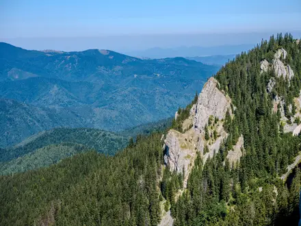
The Ogasawara Islands hike is not a continuous long-distance trail: it is a set of guided subtropical day-walks on Chichijima and Hahajima, about 1,000 km south of Tokyo in Japan. The main route is the Heart Rock / Chihiroiwa trek on Chichijima: about 10 km out-and-back, usually done in one full day, with roughly 300 m of ascent. It suits hikers wanting a remote, moderate guided walk through endemic forest to a high sea-cliff viewpoint.
Route Overview
The flagship Heart Rock trek starts and finishes near Futami in the Futami Port area on Chichijima. It follows the remains of an old military road through subtropical forest, passing Goat Valley, wartime relics such as a rusted jeep and radar wreckage, then climbs towards the Heart Rock viewpoint and the Mt Tsuitate high point. You return by the same approach, so it is an out-and-back day hike rather than a thru-hike. Access is a major part of the trip: the Ogasawara Maru ferry from Takeshiba Pier, Tokyo takes about 24 hours each way and sails about weekly. For a continuous route in Japan, compare the Michinoku Coastal Trail or the Kumano Kodo Nakahechi Route.
Ogasawara Islands history
The Ogasawara, or Bonin, Islands were uninhabited until 1830, when the first permanent settlers, led by American Nathaniel Savory with English, European and Hawaiian companions, colonised Chichijima. Commodore Matthew Perry visited in 1853, and Japan formally claimed and renamed the islands Ogasawara in 1862. After the Second World War they were administered by the United States, then returned to Japanese control in 1968. In 2011 the archipelago became a UNESCO Natural World Heritage Site for its isolated island ecosystems and ongoing evolutionary processes.
Notable highlights
- Heart Rock / Chihiroiwa (over 200 m above the sea): A huge reddish, heart-shaped sea-cliff on Chichijima’s south coast and the islands’ signature trekking objective. The final approach includes rope-assisted sections and open Pacific views.
- Old military road and wartime relics: The route uses the remains of a WWII-era military road. A rusted jeep, radar wreckage and other relics give the hike a strong historical layer as well as a natural one.
- Endemic forest and the “Galapagos of the Orient”: The islands’ isolation supports species found nowhere else, including Ogasawara livistona palm, Bonin white-eye and Bonin flying fox. This ecology is the reason for the UNESCO listing.
- Mt Chibusa / Chibusayama, Hahajima (463 m): The highest peak in the archipelago and the main summit walk on Hahajima, reached after taking the ferry from Chichijima.
- Mt Asahi, Chichijima (267 m): A shorter viewpoint walk east of Futami Port, with harbour and sea views; useful if you want an easier half-day option than Heart Rock. For another Japanese island forest hike, see the Jomon Sugi Trail.
Challenges to expect
Expect humid subtropical heat, a sustained climb from near sea level to about 303 m, rooty forest path, dirt and rock underfoot, and rope-assisted scrambly sections near the cliff. The key routes pass through protected ecosystem areas and legally require an authorised guide. Logistics are also restrictive: the ferry from Tokyo takes about 24 hours each way and sails about weekly, while camping is prohibited and there are no mountain huts.
HikeList Score
Ogasawara Islands Hike scored 81/100 on HikeList's trail-quality metrics.
See score breakdownHide breakdown
- Ideal length 55
- Balanced challenge 100
- Scenery & wildness 88
- Varied terrain 94
- Accommodation 74
- Food & support 88
- Path quality 80
- Season flexibility 63
Computed from length, challenge, scenery & wildness, terrain variety, accommodation, food & support, path quality and season flexibility.
 Japan
JapanShow more data Show less
- Mountainous
- Hilly
- Coastal
- Forest
- Dirt
- Rocky
- Paved
- Guesthouses
- Hotels
- Family Friendly
- Pet Friendly
- Restrooms
- Water Sources
- Campsites
- Picnic Areas
Photos from hikers
Taken on the trail by people who've reviewed Ogasawara Islands Hike.
Reviews
How would you rate Ogasawara Islands Hike?
Tap a star to start your review — you could be the first.