Alpine Pass Route (Route 6)
How would you rate Alpine Pass Route (Route 6)?
Tap a star to share your experience and help other hikers.
Alpine Pass Route: Sargans to Montreux Guide
HikeList Score
Alpine Pass Route (Route 6) scored 89/100 on HikeList's trail-quality metrics.
See score breakdownHide breakdown
- Ideal length 85
- Balanced challenge 80
- Scenery & wildness 88
- Varied terrain 94
- Accommodation 100
- Food & support 88
- Path quality 98
- Season flexibility 76
Computed from length, challenge, scenery & wildness, terrain variety, accommodation, food & support, path quality and season flexibility.
The Alpine Pass Route is a hard point-to-point trek across Switzerland, running east to west from Sargans near Liechtenstein to Montreux on Lake Geneva. Following the official Via Alpina line it measures around 390 km, though the classic route is often quoted at roughly 325–390 km depending on where you start and how the stages are split. Strong, experienced mountain walkers typically take about 15 demanding stages, with many trips stretching into two to three weeks. Expect repeated high passes, deep valley drops, roughly 20,000 m of ascent and excellent Swiss waymarking.
Route Overview
Walked east to west, the route starts at Sargans and threads via Elm, Linthal, the Altdorf area, Engelberg, Meiringen, Grindelwald, Lauterbrunnen, Mürren, Griesalp, Kandersteg, Adelboden, Lenk and Gstaad before the descent to Montreux. It is a true point-to-point crossing, not a loop, with villages, trains, postbuses and cable cars giving frequent entry, exit and skip-stage options. The Bernese Oberland core from around Meiringen to Lenk is the famous Bärentrek, where passes such as Sefinenfurgge, Hohtürli and Hahnenmoos come in quick succession. For other Alpine itineraries, compare the Engelberg Valley Trail or the Aletsch Glacier Panorama Trail.
From old pass crossings to the Via Alpina
The passes on the Alpine Pass Route were used for centuries as trans-Alpine links for trade and herding between Swiss valleys. As a continuous recreational trek, the APR was charted and popularised in the late 20th century, especially through Kev Reynolds’ Cicerone guidebook. Around 2000–2002 it was absorbed into the international Via Alpina network, created after the 1991 Alpine Convention among the eight Alpine states, and is now maintained in Switzerland as the Via Alpina Route 1.
Notable highlights
- Hohtürli pass (2,778 m): The highest point of the trek, on a shoulder of the Blümlisalp above Kandersteg. The climb from Griesalp is steep, with close views of the Blümlisalp glaciers and Oeschinensee far below.
- Bernese Oberland and the Bärentrek: The celebrated central section, roughly Meiringen to Lenk, passes below the Eiger, Mönch and Jungfrau. It is popular enough to have its own name: the Bear Trek.
- Sefinenfurgge (about 2,612 m): A dramatic pass above Mürren on the Lauterbrunnen-to-Griesalp stage. Short fixed-cable sections help on the steep, rocky descent.
- Lauterbrunnen valley and Mürren: Lauterbrunnen is a classic U-shaped glacial valley with cliffs and waterfalls, including Staubbach Falls. Mürren is a car-free village set on a high shelf above the valley.
- Montreux and Lake Geneva: The finish drops to Montreux on Lake Geneva, marking the cultural shift from German-speaking eastern Switzerland to the French-speaking west.
Challenges to expect
The APR is physically hard rather than technically complex: long climbs, full-valley descents and roughly 20,000 m of cumulative ascent add up quickly. Most walking is on good Swiss mountain paths, but high passes can be rocky, steep or briefly protected by fixed cables/chains. Snow can linger early or return late, so mid-July to mid-September is the safest window. Accommodation is plentiful but expensive, and booking ahead is wise in peak season.
HikeList Score
Alpine Pass Route (Route 6) scored 89/100 on HikeList's trail-quality metrics.
See score breakdownHide breakdown
- Ideal length 85
- Balanced challenge 80
- Scenery & wildness 88
- Varied terrain 94
- Accommodation 100
- Food & support 88
- Path quality 98
- Season flexibility 76
Computed from length, challenge, scenery & wildness, terrain variety, accommodation, food & support, path quality and season flexibility.
 Switzerland
Show more data Show less
- Mountainous
- Alpine Pasture
- Forest
- Valley
- Rocky
- Dirt
- Gravel
- Huts
- Hotels
- Guesthouses
- Hostels
- Campsites
- Pet Friendly
- Restrooms
- Water Sources
- Campsites
- Shelters
Download Our Full Guide to Alpine Pass Route (Route 6) FREE!
Get our comprehensive guide to this hike for free. Save it for later reading or print out at home.
In these collections
Photos from hikers
Taken on the trail by people who've reviewed Alpine Pass Route (Route 6).
Alpine Pass Route (Route 6): The Complete Guide
 i
Image by Freesurf
i
Image by Freesurf The Alpine Pass Route is Switzerland’s great east-to-west mountain traverse: a waymarked journey from Sargans in the Rhine valley to Montreux on the shore of Lac Léman. Officially it follows the Via Alpina, SwitzerlandMobility National Route No. 1, crossing a chain of high passes between German-speaking eastern Switzerland and French-speaking Vaud.
This is not a technical climbing route, but it is a serious Alpine walk. Expect long climbs from valley floors, steep rocky pass crossings, cable-protected sections in places, and repeated descents to villages where trains, PostAuto buses and cable cars make logistics unusually flexible.
The central Bernese Oberland section gives the route its classic character, with the Eiger, Mönch and Jungfrau above Grindelwald, Lauterbrunnen and Mürren. Hohtürli, at 2,778 m above Kandersteg, is the high point, with Oeschinensee far below and the Blümlisalp glaciers close by.
Most walkers need around two to three weeks for the full Swiss traverse, though the excellent public transport network makes shorter sections realistic. The best window is usually mid-July to mid or late September, when the high passes are most likely to be clear of snow and mountain services are running.
This guide covers stages, daily planning, accommodation, food, transport, terrain and the common mistakes to avoid.
Stage-by-Stage Guide
The stages below follow the current official western line via Gstaad, L'Etivaz and Rochers de Naye rather than the older Gsteig / Col des Mosses variant. Distances are approximate, and high-pass conditions, mountain transport and the current SwitzerlandMobility line should be checked before travelling.
Stage 1: Sargans to Weisstannen — 13 km
The opening stage leaves Sargans, a rail-served town in the Rhine valley below its castle, and heads into the Weisstannental. It is a shorter introductory day, but it begins the pattern of the whole route: leaving a transport hub, climbing away from the valley floor and finishing in a smaller mountain settlement.
Underfoot, expect a mix of valley paths, tracks and mountain-walking terrain rather than technical ground. This is not one of the major high-pass days, but weather can still change quickly once the route commits to the side valleys.
Sargans is the reliable place for shops, transport and last-minute supplies. Weisstannen is a much smaller end point, so accommodation and evening meals should be booked ahead; onward public transport from smaller valley villages should be checked before travelling.
Navigation is generally straightforward on the Via Alpina / National Route No. 1 waymarks, but the first day is a good point to settle into Swiss signposting and timing. Carry enough water and food for the day rather than relying on intermediate services.
Stage 2: Weisstannen to Elm — 22 km
This is the first big pass crossing of the traverse, climbing from the Weisstannental to Foopass at around 2,223 m before dropping into canton Glarus and the village of Elm. It marks the route’s shift from valley approach walking to sustained Alpine pass terrain.
The climb and descent are mountain paths, with pasture giving way to rougher, higher ground near the pass. In poor weather, Foopass should be treated seriously: mist, lingering snow or wet rock can make navigation and footing more demanding.
Elm is the main practical objective for the day, with accommodation expected in or near the village, though booking ahead is still sensible in the summer season. Food and water should be carried from Weisstannen, as high-ground services cannot be assumed.
The pass crossing is the key navigation point. Follow the white-red-white mountain waymarks carefully and allow extra time if snow remains on shaded slopes early in the season.
Stage 3: Elm to Linthal — 24 km
The stage from Elm to Linthal continues the high-valley rhythm through Glarus, crossing towards the Linthal side of the mountains. The Richetlipass is associated with this part of the Alpine Pass Route and gives the day its mountain character.
Expect a long day on mountain paths with a full climb and descent rather than a simple valley walk. Surfaces may include grassy alp tracks, stony paths and steeper sections near the pass.
Linthal is a useful logistics point because it is one of the route’s rail-served valley towns. It is a good place to resupply, reset plans, join or leave the route, and use public transport if weather or fitness requires a shorter itinerary.
Carry food from Elm and do not rely on open alp services between the valleys. Navigation is waymarked, but this is still pass terrain: keep map/app navigation available and check snow conditions before setting out.
Stage 4: Linthal to Urnerboden — 15 km
This shorter stage leads from Linthal towards the Klausenpass area and Urnerboden, the largest alp in Switzerland. It is a compact but still mountainous day, with the route moving from the Glarus side towards the Uri high pastures.
The walking is on mountain paths and tracks through pasture and higher open ground. Although the distance is moderate, weather on and around the Klausenpass can be colder and more exposed than in Linthal.
Urnerboden is a high summer-pasture settlement rather than a large valley town. Accommodation is more limited than in the major resorts, and food arrangements should be made in advance; seasonal opening dates matter here.
The Klausenpass road gives this area road access, but public transport timings and operating season should be checked before travelling. Navigation is not usually complex in clear conditions, but visibility can deteriorate quickly on open pass approaches.
Stage 5: Urnerboden to Altdorf — 26 km
This is a long stage from the high pastures of Urnerboden down into the Uri side of the Alps and the Reuss valley around Altdorf. It is a major change in scale: from open alp country to a substantial valley town with transport links.
Terrain includes mountain paths, tracks and a significant descent, so knees and feet often feel this day even if the high point has already been crossed. Wet grass, muddy pasture paths and slippery rock are realistic concerns in poor weather.
Altdorf is a strong resupply and accommodation stop, with public transport connections in the Altdorf / Flüelen area. This is one of the better places to pause, shorten the route, or wait out bad weather before the Surenenpass stage.
Carry enough water and food from Urnerboden, as reliable services between high pasture and valley should not be assumed. Waymarking remains good, but the length of the day makes an early start sensible.
Stage 6: Altdorf to Engelberg — 28 km
The Altdorf to Engelberg stage crosses the Surenenpass, around 2,291 m, and is one of the route’s major high-alpine crossings. It links the Reuss valley with the Engelberg valley and is a serious full mountain day.
Expect a long climb, rougher high-pass ground and a substantial descent. The terrain is not technical climbing, but it is exposed to weather and can hold snow early or after late-season storms.
Altdorf is the place to buy food before setting out. Engelberg is a major mountain resort below the Titlis, with plentiful accommodation, services and public transport, making it a natural recovery stop after a hard crossing.
Do not treat Surenenpass as a bad-weather shortcut. Check snow and forecast before committing, carry warm layers even in summer, and keep navigation tools accessible if cloud drops onto the pass.
Stage 7: Engelberg to Engstlenalp — 11 km
This is a shorter stage out of Engelberg towards the Jochpass and the alp basin of Engstlenalp. The reduced distance does not make it a rest day in terrain terms: it still moves through high mountain country.
Paths are generally good Swiss mountain trails, with pasture, stony sections and steeper ground around the pass. The Jochpass area can be affected by lingering snow early in the walking season and by rapid weather changes.
Engelberg is the reliable place for breakfast supplies, packed lunch items and transport. Engstlenalp is a mountain accommodation stop rather than a full-service town, so beds and meals should be booked ahead and opening dates checked.
This stage is also one where cable cars or other mountain transport may affect plans, but operating dates and times change seasonally. This should be checked before travelling.
Stage 8: Engstlenalp to Meiringen — 21 km
From Engstlenalp the route heads west towards Meiringen, descending from high alp country into the Hasli valley. It is a transition stage from remote-feeling mountain pasture back to a substantial valley base.
The walking mixes mountain paths, alp tracks and a long descent. In wet weather, grassy or rocky sections can be slippery, and a long downhill day can be tiring even without an extreme pass height.
Meiringen is one of the route’s most useful logistics stops, with accommodation, shops and public transport. It is a good place to resupply before the Bernese Oberland / Bärentrek section begins in earnest.
Food and water availability between Engstlenalp and Meiringen should not be assumed outside known open establishments. Follow the National Route No. 1 markers, and check any seasonal route notes before leaving Engstlenalp.
Stage 9: Meiringen to Grindelwald — 23 km
This is the Grosse Scheidegg stage, crossing the 1,962 m pass beneath the Wetterhorn and giving the first close views towards the Eiger’s north face. It is one of the classic scenic days of the route.
The terrain is mountain walking on established paths and tracks, with a sustained climb from the Meiringen side and descent towards Grindelwald. The pass is high enough for cold wind, low cloud and early or late snow to matter.
Meiringen and Grindelwald are both strong service bases, with shops, accommodation and public transport. Grindelwald is a popular resort, so beds should be booked early in July and August.
Carry enough food and water for the crossing, as open facilities on the pass should not be relied upon without checking. Navigation is usually clear, but cloud around Grosse Scheidegg can remove the visual cues that make the stage feel obvious in good weather.
Stage 10: Grindelwald to Lauterbrunnen — 20 km
This stage crosses from Grindelwald towards the Lauterbrunnen valley via the Kleine Scheidegg area and near Wengen. It sits below the Eiger, Mönch and Jungfrau and is part of the celebrated Bernese Oberland section of the route.
Expect well-used mountain paths, resort-area tracks and a significant descent into Lauterbrunnen. The popularity of this area does not remove the need for proper mountain clothing, especially if cloud or storms build around the high cols.
Grindelwald, Wengen and Lauterbrunnen are major service points by Alpine Pass Route standards, with food, accommodation and public transport options. Lauterbrunnen is a sensible place for a planned stop, but it is also busy in peak season.
Navigation is generally well signed, but this is an area with many intersecting paths and transport-assisted walkers. Keep following the Via Alpina / National Route No. 1 line rather than simply following the busiest track.
Stage 11: Lauterbrunnen to Griesalp — 21 km
This is a serious and memorable stage over Sefinenfurgge, around 2,612 m. The route leaves the cliff-and-waterfall scenery of Lauterbrunnen, passes the shelf-village landscape around Mürren, and crosses a dramatic rocky pass before descending to Griesalp.
Sefinenfurgge is steep, rough and more committing than the resort approaches might suggest. Short fixed-cable sections assist the steep descent, and the pass should not be attempted casually in snow, ice, thunderstorm conditions or poor visibility.
Lauterbrunnen is the dependable place to stock up. Griesalp has limited mountain-valley accommodation rather than big-resort capacity, so advance booking is important, especially in high summer.
Public transport and road access in the Griesalp area are more limited than in Lauterbrunnen; onward options should be checked before relying on them. This is a day to start early, carry full food and water, and keep a close eye on the forecast.
Stage 12: Griesalp to Kandersteg — 16 km
The Griesalp to Kandersteg stage crosses Hohtürli at 2,778 m, the highest point of the route, on the shoulder of the Blümlisalp. It is one of the hardest and most important days of the traverse.
The climb from Griesalp is steep and sustained, reaching rocky high ground with close views of the Blümlisalp glaciers. The descent towards Kandersteg brings the route above the Oeschinensee, one of the standout glacial lake views on the Swiss Via Alpina.
There is mountain accommodation in the Blüemlisalphütte area, but space, opening dates and meal arrangements must be checked and booked in advance if using it. Kandersteg is a major valley stop with accommodation, food and public transport.
Hohtürli should be planned around weather, snow and daylight, not just distance. Carry enough food and water from Griesalp, and be prepared for cold, wind and slow progress on rocky ground.
Stage 13: Kandersteg to Adelboden — 16 km
This stage crosses the Bunderchrinde, around 2,385 m, between Kandersteg and Adelboden. It is shorter on paper than some earlier days, but the pass is steep and deserves respect.
The route uses mountain paths with demanding ascent and descent, including rougher ground around the pass. Wet weather can make the steeper sections awkward, and snow early or late in the season can change the character of the day entirely.
Kandersteg and Adelboden are both good service settlements, with accommodation, food and public transport. Adelboden is a lively resort and generally a practical place to recover, resupply or adjust the itinerary.
Do not underestimate Bunderchrinde because of the modest stage distance. Check the forecast and snow conditions, carry enough water from Kandersteg, and keep to the waymarked line across the pass.
Stage 14: Adelboden to Lenk — 14 km
The stage from Adelboden to Lenk crosses Hahnenmoospass, around 1,950 m. Compared with the rockier high passes of the Bernese Oberland, this is generally a gentler grassy crossing with broad views towards the Wildstrubel.
Terrain is still mountain walking, with alp tracks, pasture paths and a pass crossing, but the day is usually less severe than Sefinenfurgge, Hohtürli or Bunderchrinde. In wet conditions, grassy slopes and farm tracks can be slippery.
Both Adelboden and Lenk have accommodation, food and transport options, making this a useful lower-intensity stage between harder mountain days. It is also a sensible place to manage fatigue before the western section into the Saanenland and Vaud.
Carry normal day food and water, and do not assume intermediate seasonal services are open. Livestock may be present on the alp pastures; give animals space and follow any local signs around herds.
Stage 15: Lenk to Gstaad — 21 km
This stage heads west from Lenk into the Saanenland around Gstaad, crossing the passes associated with Trüttlisberg and Krinnenpass. It is also part of the transition towards the language border, where German-speaking Bern gives way to French-speaking Vaud further west.
The terrain is a mix of pasture, mountain paths and pass walking, generally less glaciated in feel than the central Bernese Oberland but still demanding over a full day. Weather can remain very changeable on the open passes.
Lenk and Gstaad are practical service points with accommodation, food and public transport. Gstaad is an important place to confirm plans for the current western routing via L'Etivaz and Rochers de Naye.
The western end of the Alpine Pass Route has older variants, so navigation should be based on the current SwitzerlandMobility / Via Alpina line rather than an out-of-date itinerary. This should be checked before travelling.
Stage 16: Gstaad to L'Etivaz — 16 km
This stage leaves Gstaad and continues west towards L'Etivaz in French-speaking Vaud. It marks a clear cultural and linguistic shift on the route, as the traverse moves out of the Bernese Oberland and towards the Lake Geneva side of the Alps.
Expect mountain and pastoral walking rather than the highest rocky pass terrain of the central stages. The day still needs normal Alpine preparation: wet paths, exposed open slopes and sudden weather changes remain relevant.
Gstaad is the dependable place for supplies, accommodation and transport before setting out. L'Etivaz is a smaller end point, so accommodation and meals should be arranged ahead and onward transport checked before relying on it.
Because this is part of the re-aligned official western section, careful navigation matters. Follow the National Route No. 1 markers and current mapping rather than older route descriptions that head towards Gsteig or Col des Mosses.
Stage 17: L'Etivaz to Rochers de Naye — 23 km
This is the final major mountain stage, leading from L'Etivaz to Rochers de Naye, the high limestone balcony above Lake Geneva. It is a long day and should be treated as a proper mountain crossing, not simply the approach to the finish.
The terrain becomes more western-Alpine in character, with high open ground and limestone scenery rather than the glaciated passes of the Bernese Oberland. Rocky or wet sections can be awkward, and visibility matters on open high ground.
L'Etivaz has limited services compared with the larger resort towns, so start with food and water for the full day. Accommodation at or near Rochers de Naye is limited and seasonal; this should be checked before travelling and booked ahead if needed.
Public transport or mountain access options around Rochers de Naye should not be assumed without checking current timetables. Navigation should follow the current official line, especially because the western end has changed from older guidebook variants.
Stage 18: Rochers de Naye to Montreux — 13 km
The final stage descends from Rochers de Naye to Montreux on the shore of Lake Geneva / Lac Léman. It is shorter than many earlier days, but it still involves a significant mountain-to-lake descent.
The route leaves high limestone terrain and drops towards the gentler hills and vineyard country above Montreux. Paths and tracks can be steep in places, and wet ground may make the descent slippery.
Montreux is the clear finish point and a major transport hub on the Lake Geneva line, with onward rail connections towards Lausanne and Geneva and GoldenPass services. Accommodation and food are plentiful by route standards, though prices remain Swiss and booking ahead is sensible in busy periods.
Do not switch off navigation too early: descent routes above lake towns often have multiple path and track junctions. Keep following the Via Alpina / National Route No. 1 waymarks all the way to the lake shore.
Recommended Itinerary
The itinerary below follows the current official east-to-west line from Sargans to Montreux via Gstaad, L'Etivaz and Rochers de Naye. Distances are approximate and should be checked against official mapping before booking, especially around the western end where older Alpine Pass Route itineraries may use a different line via Lauenen, Gsteig, Col des Mosses and Col de Chaude.
Standard itinerary: 18 walking days
This is the most balanced version for experienced mountain walkers who want to complete the full traverse without relying heavily on transport shortcuts. It keeps the major Bernese Oberland passes as separate days and uses established valley towns for resupply, transport and accommodation.
| Day | From | To | Approx. distance | Why this stage makes sense | Services/accommodation notes |
|---|---|---|---|---|---|
| 1 | Sargans | Weisstannen | 13 km | A manageable opening day from the rail-served start, allowing time to arrive in Sargans and begin the climb into the Weisstannental without overcommitting on day one. | Sargans is on the main rail network. Weisstannen is a smaller overnight stop, so accommodation should be booked rather than assumed. |
| 2 | Weisstannen | Elm | 22 km | The first serious mountain stage, crossing the Foopass into canton Glarus and setting the tone for the route’s repeated pass-and-valley rhythm. | Elm is a village stop with accommodation options, but summer beds can still be limited compared with larger resorts. Book ahead. |
| 3 | Elm | Linthal | 24 km | A full mountain day continuing the traverse westwards towards the Glarus valley, commonly associated with the Richetlipass section. | Linthal is one of the useful public-transport access points on the route, making it a practical resupply, exit or joining point. |
| 4 | Linthal | Urnerboden | 15 km | A shorter but still substantial stage crossing towards the Klausenpass area and reaching Urnerboden, Switzerland’s largest alp. | Urnerboden is a high-pasture settlement rather than a large resort. Confirm accommodation and meal arrangements before travelling. |
| 5 | Urnerboden | Altdorf | 26 km | A long east-central stage descending into Uri, best kept as a dedicated day because of the distance and the cumulative fatigue after the early passes. | Altdorf and nearby Flüelen give strong public-transport access and more valley services than the previous overnight stops. |
| 6 | Altdorf | Engelberg | 28 km | One of the major committing stages, crossing the Surenenpass from the Reuss valley into the Engelberg valley. It is long and should not be treated as a recovery day. | Engelberg is a major mountain resort below the Titlis, with a wide range of accommodation and transport links. It is a good place for a rest, laundry or resupply night. |
| 7 | Engelberg | Engstlenalp | 11 km | A deliberately shorter stage after the Surenenpass, moving through the Jochpass/Engstlenalp area without forcing another long descent on the same day. | Engstlenalp is a mountain accommodation stop, not a large village. Book early in peak season and check seasonal opening dates. |
| 8 | Engstlenalp | Meiringen | 21 km | A practical link stage from the high alp basin down to Meiringen, bringing the route into the Bernese Oberland approach. | Meiringen has good services, accommodation and public transport, making it one of the easiest places to pause or re-plan. |
| 9 | Meiringen | Grindelwald | 23 km | A classic pass stage over Grosse Scheidegg beneath the Wetterhorn, with the first close views towards the Eiger area. | Grindelwald is a busy resort with extensive accommodation and mountain transport. Book well ahead in July and August. |
| 10 | Grindelwald | Lauterbrunnen | 20 km | A strong but logical day across the Kleine Scheidegg/Wengen side of the route into the Lauterbrunnen valley, keeping the central Oberland stages flowing. | Lauterbrunnen has transport links and accommodation, but it is extremely popular in summer. Early booking is sensible. |
| 11 | Lauterbrunnen | Griesalp | 21 km | A demanding high-mountain day via the Mürren side and Sefinenfurgge, including rocky ground and short fixed-cable sections on the steep descent. | Griesalp is a mountain-base overnight stop rather than a large town. Accommodation should be reserved, and late arrival margins should be avoided. |
| 12 | Griesalp | Kandersteg | 16 km | The route’s highest stage over Hohtürli at 2,778 m, above the Blümlisalp and Oeschinensee. The distance is modest, but the ascent and terrain make it a major day. | Kandersteg has good valley services and public transport. It is a sensible recovery or buffer-night location after Hohtürli. |
| 13 | Kandersteg | Adelboden | 16 km | A compact but steep pass day over Bunderchrinde, best kept separate rather than bolted onto the Hohtürli stage. | Adelboden is a resort stop with accommodation and onward transport options. Peak-season booking is still advised. |
| 14 | Adelboden | Lenk | 14 km | A shorter crossing over Hahnenmoospass, giving a useful lighter day after several tough Bernese Oberland passes. | Lenk has accommodation and public transport access, making it a convenient place to pause before the western section. |
| 15 | Lenk | Gstaad | 21 km | A full transition day west from Lenk into the Saanenland around Gstaad, where the route begins to feel less high-alpine than the central Oberland. | Gstaad has strong services and public transport. It is a practical resupply and rest point before crossing into the French-speaking west. |
| 16 | Gstaad | L'Etivaz | 16 km | A manageable stage into canton Vaud and the French-speaking western part of the route, following the current official line rather than the older Gsteig/Col des Mosses variant. | L'Etivaz is a smaller overnight stop. Confirm accommodation and food availability before committing to the day. |
| 17 | L'Etivaz | Rochers de Naye | 23 km | A long final mountain stage to the high limestone balcony above Lake Geneva, positioning the last day as a descent to Montreux. | Rochers de Naye is a high overnight location. Seasonal opening, accommodation and any mountain-transport options should be checked before travelling. |
| 18 | Rochers de Naye | Montreux | 13 km | A shorter finishing day descending from the high ground to Montreux on Lac Léman, leaving time for onward travel from the finish. | Montreux is a major station on the Lake Geneva line, with onward connections towards Geneva, Lausanne and the GoldenPass route. |
Slower itinerary: 20–22+ days
A slower schedule suits walkers carrying heavier packs, those new to repeated Alpine pass days, or anyone who wants weather buffers for the high crossings. It is also the safer choice if accommodation availability forces shorter bookings in peak season.
The most useful places to add rest or buffer nights are the larger service centres: Altdorf/Flüelen, Engelberg, Meiringen, Grindelwald, Lauterbrunnen, Kandersteg, Lenk and Gstaad. These are also the easiest places to join, leave, resupply or change plans using trains, PostAuto services or mountain transport.
Do not assume every high stage can be split neatly. Some overnight stops are small mountain settlements or high accommodation points, and seasonal opening dates matter. This should be checked before travelling.
Faster itinerary: 15–16 days
A faster schedule is only sensible for very fit, experienced mountain walkers who are comfortable with long consecutive days and who are willing to use Swiss public transport, cable cars or postbuses to remove selected valley drops. The route can be compressed, but the high passes remain serious mountain terrain and should not be rushed in poor weather.
The obvious places to save time are around the shorter listed stages, such as Engelberg–Engstlenalp, Kandersteg–Adelboden, Adelboden–Lenk and Rochers de Naye–Montreux. Combining short-distance stages can still mean stacking steep pass crossings together, so the deciding factor should be ascent, weather and accommodation logistics rather than distance alone.
For a fast itinerary, build the plan around booked accommodation first, then check current transport timetables and operating dates. This should be checked before travelling, particularly for mountain transport and for the final western section to Montreux.
Planning the Route
How many days to allow
For the full current Swiss Via Alpina line, plan around the official 19 Swiss stages, or 20 if adding the optional Liechtenstein prologue from Vaduz/Gaflei. The classic Alpine Pass Route described in older guidebooks is shorter, usually planned at about 15–18 stages, so make sure the distance, stage list and western-end routing all match the version being walked.
Most independent walkers should treat this as a two-to-three-week mountain journey rather than a race. The route repeatedly drops to valley level and climbs to another pass, so a schedule that looks reasonable on distance alone can become hard when stacked over many consecutive days.
A fast 15-day crossing is possible for very fit walkers, especially if using postbuses or cable cars to avoid some descents and re-ascents. It leaves little margin for bad weather, sore knees, missed connections or a snow-covered pass, so it is a poor default plan for a first long Alpine traverse.
Let the stages be shaped by accommodation
Daily stages are naturally dictated by villages, valley resorts, mountain inns and a few higher overnight stops. Places such as Sargans, Elm, Linthal, Altdorf, Engelberg, Meiringen, Grindelwald, Lauterbrunnen, Kandersteg, Adelboden, Lenk, Gstaad and Montreux are practical bases with transport links; smaller stops such as Weisstannen, Urnerboden, Engstlenalp, Griesalp, L'Etivaz and Rochers de Naye need more careful booking.
Do not assume that every stage can be shortened neatly on foot. Some high crossings commit you to a pass and a long descent before the next practical overnight option, particularly around Surenenpass, Sefinenfurgge, Hohtürli and Bunderchrinde.
In July and August, book ahead, especially through the Bernese Oberland between Meiringen, Grindelwald, Lauterbrunnen, Griesalp, Kandersteg, Adelboden and Lenk. This central Bärentrek section is popular, accommodation is expensive, and the most convenient beds can fill before the weather window arrives.
Choosing the route version
Plan with the official Via Alpina / SwitzerlandMobility National Route No. 1 if following the current waymarked Swiss line. The “Route 6” wording sometimes attached to this hike is not the official Swiss route number and should not be used for navigation or bookings.
The western end needs particular attention. The current official line continues from Lenk through Gstaad, L'Etivaz and Rochers de Naye to Montreux, while older Alpine Pass Route descriptions may use a different line via Lauenen, Gsteig, Col des Mosses and Col de Chaude. Pick one version before booking accommodation, then keep the maps, GPX and stage list consistent.
Shortening, extending and section hiking
This is one of the easier major Alpine traverses to section-hike because it repeatedly meets Swiss public transport. Useful entry and exit points include Sargans, Linthal, Altdorf/Flüelen, Engelberg, Meiringen, Grindelwald, Lauterbrunnen, Kandersteg, Adelboden, Lenk, Gstaad and Montreux.
Postbuses and cable cars can also be used tactically to shorten a day, skip a valley descent or recover time after poor weather. Operating dates and timetables change with the season and should be checked before travelling, especially outside the core mid-July to mid/late September window.
To extend the walk, add the Liechtenstein prologue from Vaduz/Gaflei to Sargans. To shorten it, start or finish at one of the major rail-linked valleys rather than trying to force longer daily stages across the high passes.
What to prioritise before departure
| Planning priority | What matters on this route |
|---|---|
| Accommodation | Book the popular Bernese Oberland stages early; confirm smaller mountain inns and high stops before committing to the day’s route. |
| Weather and snow | Check pass conditions before high crossings. Snow can linger early and return late, and wet rock or cable-protected sections can slow progress. |
| Transport | Use trains, PostAuto buses and cable cars as planned escape or shortening options, not as assumptions. Timetables and seasonal openings should be checked before travelling. |
| Navigation | Follow SwitzerlandMobility Route No. 1 waymarking, supported by swisstopo mapping or the SwitzerlandMobility app. Verify the current western-end line before relying on older guidebook stages. |
| Food | Resupply is regular in valley towns, but do not rely on finding full services on every alp or pass. Carry enough food for each day’s crossing. |
| Water | Carry enough water for the full high section between reliable settlements or accommodation stops. Streams, fountains and seasonal facilities should not be assumed on pass approaches. |
| Costs | Budget in Swiss francs. Switzerland is expensive, and accommodation, meals, cable cars and mountain transport can add up quickly. |
Permits are not the main planning constraint for the standard waymarked walk. If intending to camp rather than use accommodation, local rules and campsite options should be checked before travelling.
Towns, Villages and Overnight Stops
Accommodation on the Alpine Pass Route is generally straightforward by Alpine trekking standards, but it should not be treated casually. The route drops often into valley towns and resorts, yet several stage ends are small alpine villages, high pastures or mountain-inn locations where beds and evening meals can be limited.
Book ahead for July and August, especially through the Bernese Oberland between Meiringen, Grindelwald, Lauterbrunnen, Griesalp, Kandersteg, Adelboden and Lenk. In smaller places, check that accommodation is open, that an evening meal is available, and that breakfast times suit an early mountain start.
Sargans
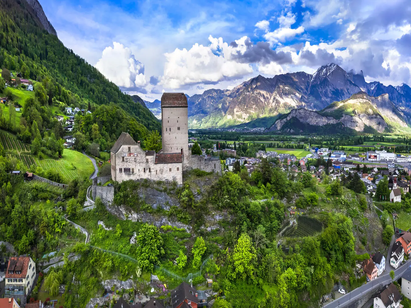
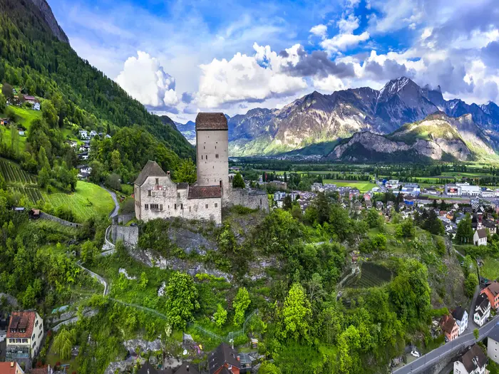
Sargans is the eastern start of the Swiss Via Alpina, set in the Rhine valley below its castle near the Liechtenstein border. It is the easiest place to arrive, organise final supplies and start with a full day’s walking to Weisstannen.
It is a practical overnight before Day 1 rather than a scenic mountain stop. Accommodation and food options are more dependable here than in the first small valley village, and the town sits on the main rail network, with direct trains from Zürich and on the St. Gallen/Chur line.
Weisstannen
Weisstannen is the first overnight stop on the standard east-to-west itinerary, reached after the opening stage from Sargans. It sits in the Weisstannental before the first serious mountain crossing towards Elm and the Foopass.
Treat it as a small-village stop. Accommodation and meal options are likely to be limited compared with the bigger valley towns, so reserve a bed and dinner in advance rather than arriving speculatively. Carry what is needed for the next day’s pass crossing unless current local resupply is known. This should be checked before travelling.
Elm
Elm is the usual overnight after crossing the Foopass into canton Glarus. It is an important early stop because the following stage to Linthal is another full mountain day.
As a village rather than a major resort, Elm should be planned as a booked overnight. Expect guesthouse or hotel-style accommodation rather than a wide urban choice, and check food arrangements before arrival. It is a sensible place to reassess weather and snow conditions before continuing west through the Glarus section.
Linthal
Linthal is a useful valley stop after the Elm stage and before the climb towards Urnerboden and the Klausenpass area. It is one of the first strong public-transport access points on the route.
For hikers sectioning the trail, Linthal is a natural entry or exit point. Accommodation and food are more practical here than at the smaller high-alp stops, and its transport link makes it a good place to recover, shorten the route or rejoin after poor weather.
Urnerboden
Urnerboden lies on the high pasture section associated with the Klausenpass crossing and is described as the largest alp in Switzerland. It is a memorable overnight because it keeps you high between Linthal and the descent towards Altdorf.
Do not expect the breadth of services found in larger towns. Accommodation is mountain-village or alpine-inn in character, and beds should be booked ahead in the main summer season. Check meal availability and carry adequate daytime food for the onward stage.
Altdorf
Altdorf is a major valley reset after the high ground around Klausenpass and Urnerboden. It is also the launch point for the demanding Surenenpass crossing towards Engelberg.
This is one of the best places on the eastern half of the route for transport, resupply and an easier logistical overnight. The trail meets the public transport network around Altdorf and nearby Flüelen, so it works well for joining, leaving, skipping a stage or taking a rest day before the next high pass.
Flüelen
Flüelen sits near the route on Lake Lucerne and is relevant around the Altdorf section. It is not a standard overnight in the stage schedule, but it is useful because the route touches the Altdorf/Flüelen transport area and there is a lake-steamer variant nearby.
Use Flüelen as a practical alternative base or transport connection rather than a required walking stop. If planning to use it instead of Altdorf, check the exact route connection, accommodation availability and onward transport times before committing. This should be checked before travelling.
Engelberg
Engelberg is a major resort stop below the Titlis and one of the most useful overnights on the route. It follows the Surenenpass stage from Altdorf and precedes the shorter stage to Engstlenalp.
This is a strong place for a rest, laundry, replacement kit and proper food before the central Alpine sections. Accommodation is more plentiful than in the smaller villages, but Engelberg is popular in summer, so advance booking is still sensible. It has public transport links and is one of the clearest places to break, shorten or restart the walk.
Engstlenalp
Engstlenalp is a high alp-basin overnight between Engelberg and Meiringen. It is a very different stop from Engelberg or Meiringen: useful because it breaks the route neatly, but limited because it is not a town.
Plan it as a booked mountain accommodation stop, with dinner and breakfast arrangements confirmed in advance. There may be little flexibility if beds are full, so do not rely on turning up late. Carry enough food for the day either side unless current services have been checked.
Meiringen
Meiringen is a key valley town and the eastern gateway to the busiest central section, the Bernese Oberland. It follows the Engstlenalp stage and comes before the Grosse Scheidegg crossing to Grindelwald.
This is one of the best-served stops for accommodation, food and transport. It is well suited to a rest night, resupply or itinerary adjustment, and its public transport links make it a good place for section hikers to begin or end the Bärentrek-style central traverse.
Grindelwald
Grindelwald is a major mountain resort after the Grosse Scheidegg stage from Meiringen. It sits beneath the high Bernese Oberland peaks and marks the start of the most popular and booked-up part of the route.
Accommodation choice is broad by trail standards, but demand is high in summer. Book early if walking in July or August, and expect prices to reflect a major Swiss resort. Grindelwald is also an important transport point, making it useful for rest days, bad-weather changes and rejoining the route.
Wengen
Wengen lies near the route above the Lauterbrunnen valley and is one of the car-free shelf villages associated with this section. It is not the standard stage end in the itinerary, which runs Grindelwald to Lauterbrunnen, but it can be relevant when planning variants or accommodation alternatives.
Use Wengen as a possible nearby overnight only after checking the current line and local connections. It may suit hikers wanting to stay high above the valley, but it should not be assumed to be directly interchangeable with Lauterbrunnen without checking route and transport details. This should be checked before travelling.
Lauterbrunnen
Lauterbrunnen is a major valley stop and one of the most practical overnights on the route. It follows the Grindelwald stage and precedes the demanding crossing towards Griesalp via the Mürren side and Sefinenfurgge.
The village is well placed for accommodation, food and transport, and is a sensible point to pause before one of the route’s more serious pass days. The valley’s cliff-and-waterfall scenery makes it a popular destination in its own right, so advance booking is important in peak season.
Mürren
Mürren sits near the route above Lauterbrunnen and below the approach towards Sefinenfurgge. Like Wengen, it is a car-free shelf village rather than the standard stage end in the day-by-day schedule.
It can be useful as a high alternative to sleeping in the valley, especially if splitting or adapting the Lauterbrunnen-to-Griesalp stage. However, any overnight here changes the practical shape of the day, so check the route, timing and local transport before booking. This should be checked before travelling.
Griesalp
Griesalp is the overnight between Sefinenfurgge and Hohtürli, two of the most demanding high-pass sections on the route. Its main value is strategic: it breaks the central Bernese Oberland traverse before the climb to the trail’s high point.
Accommodation is more limited than in Lauterbrunnen or Kandersteg, so this is one of the places where booking ahead matters most. Confirm dinner, breakfast and any packed-lunch options before arrival. Starting from Griesalp, the climb to Hohtürli and onward descent towards Kandersteg is a serious mountain day, so avoid leaving logistics unresolved.
Kandersteg
Kandersteg is a major valley resort after the Hohtürli crossing and the Oeschinensee area. It is one of the most important recovery stops on the entire route, coming immediately after the high point of the traverse.
Accommodation and food options are more substantial here than at Griesalp, and it has public transport links. Many walkers will want a full night here rather than pushing on, especially after a hard Hohtürli day. It is also a good place to reassess weather before crossing Bunderchrinde to Adelboden.
Adelboden
Adelboden is the next major resort stop west of Kandersteg, reached after the steep Bunderchrinde crossing. It is a practical and popular overnight before the easier grassy pass route towards Lenk over Hahnenmoospass.
Expect a better range of accommodation and food than in the smaller alp settlements, though summer booking is still recommended. Adelboden is also one of the named public transport points on the route, useful for section hiking or shortening the itinerary if weather or fatigue catches up.
Lenk
Lenk is a key valley stop after the Adelboden stage and before the route heads west towards Gstaad. It is also the area where hikers need to be aware of the difference between older Alpine Pass Route variants and the current official Via Alpina line.
As a transport-linked resort stop, Lenk is practical for accommodation, food, rest and itinerary changes. The current official line continues towards Gstaad and then L'Etivaz and Rochers de Naye; older descriptions may route via Lauenen, Gsteig and Col des Mosses. Check the current routing before booking onward accommodation.
Gstaad
Gstaad is the main Saanenland stop after Lenk on the current official route. It is a useful service centre before the route crosses into the French-speaking western end towards L'Etivaz.
Accommodation and food options are wider than in smaller villages, but Gstaad is an expensive and well-known resort, so book ahead and check prices before committing. It has public transport links and is a practical break point for hikers who want to divide the official route into sections.
Lauenen / Gsteig
Lauenen and Gsteig are associated with the older western variant of the Alpine Pass Route rather than the current official stage list used here. They remain important names because guidebooks, older itineraries and some trip reports may direct hikers this way.
Do not book Lauenen or Gsteig accommodation unless deliberately following that older variant. For the current official line, plan from Gstaad towards L'Etivaz. If mixing sources or maps, verify the exact western-end routing before travelling.
L'Etivaz
L'Etivaz is the first listed overnight in the French-speaking Vaud section on the current official line west of Gstaad. It marks a noticeable change from the German-speaking Bernese stages into Romandie.
Treat it as a small village stop, not a major resort hub. Accommodation and food should be arranged before arrival, and hikers should not assume late availability in peak season. It is an important staging point because the next stage continues towards Rochers de Naye before the final descent to Montreux.
Rougemont
Rougemont is near the western section around Gstaad and L'Etivaz, but it is not a stage end in the current official itinerary. It may be relevant as a nearby place name when comparing maps, transport options or older route descriptions.
Use it only if it genuinely fits the version of the route being walked. Check whether accommodation there requires a deviation from the official line and whether the next day’s stage still works logically. This should be checked before travelling.
Rochers de Naye
Rochers de Naye is the final high overnight on the current official route before Montreux. It is not a conventional town stop; it is a high limestone balcony above Lake Geneva and a strategic place to end the penultimate stage.
Accommodation and food options are much more limited than in Montreux or the larger valley resorts. Book ahead, confirm meals, and check that the stage timing is realistic in the weather conditions expected. From here, the route descends to the lake shore at Montreux.
Montreux
Montreux is the western finish of the Via Alpina on the shore of Lake Geneva, or Lac Léman. It is the natural place for a final overnight, onward travel, recovery and route-end logistics.
Accommodation and food options are extensive compared with the mountain stages, but it is still sensible to book in advance in the main summer season. Montreux is a major station on the Geneva–Lausanne–Montreux line, with onward GoldenPass connections, making onward travel much easier than at the high alpine stage ends.
Getting to the Start
By train
Sargans is the straightforward starting point for the official Swiss Via Alpina. The town is on the main Swiss rail network, with direct trains from Zürich and services on the St. Gallen–Chur line, making it one of the easier Alpine long-distance trailheads to reach without a car.
Plan to arrive in Sargans the day before starting if you want a relaxed first morning. The official line begins in the small town below Sargans castle, so there is no remote trailhead transfer to organise for the standard start.
If travelling from elsewhere in Switzerland, route via the national rail network to Sargans and check current connections before booking accommodation. This should be checked before travelling.
By bus
A bus is not normally needed to reach the standard start in Sargans, because the town has its own railway station and the trail begins in town. Buses become relevant only if you are joining from nearby villages, making local movements around Sargans, or choosing the optional Liechtenstein prologue from Vaduz/Gaflei.
For the Vaduz/Gaflei option, check the current cross-border and local bus arrangements before committing to an itinerary. This should be checked before travelling.
By car
Driving to Sargans is possible in general terms, but it is usually the least convenient option for this route. The Alpine Pass Route is a long east-to-west traverse ending at Montreux on Lake Geneva, a long way from the start, so leaving a vehicle at Sargans creates an extra return journey at the end.
If you do drive, do not assume that multi-week parking is available or suitable near the start. Long-stay parking arrangements should be checked directly with your accommodation, the local authorities or the relevant car park operator before travelling.
For most walkers, the better logistical choice is to use Swiss public transport to reach Sargans, then depart from Montreux by rail at the end.
From the nearest airport
For international arrivals, the practical approach is to enter the Swiss rail network and travel to Sargans via Zürich or another major rail hub. Sargans has direct trains from Zürich, so the airport-to-rail connection is usually simpler than arranging a private transfer.
Allow enough margin if flying in and starting the next morning, especially if you need to buy food, fuel or last-minute kit before leaving Sargans. Flight arrival times, rail connections and any late-evening services should be checked before travelling.
Where to stay before starting
Sargans is the most convenient place to stay before day one, as it avoids a morning transfer and lets you start directly from the official line. This is the cleanest option if you are beginning with the standard Sargans to Weisstannen stage.
If Sargans accommodation is full or expensive, look for alternatives on the same rail corridor and travel in by train in the morning. Keep the first walking day in mind: adding a rail connection before a mountain-walking stage is possible, but it reduces flexibility if trains are delayed or the weather is poor.
Accommodation in Switzerland can be expensive, and summer is the main season for this trek. Book ahead for July and August rather than assuming a last-minute bed will be available.
Getting Home from the Finish
By train
Montreux is the practical finish-point for public transport. The trail ends on the shore of Lake Geneva / Lac Léman, close to a major station on the Geneva–Lausanne–Montreux rail line.
From Montreux, walkers can continue by train towards Lausanne and Geneva, or use GoldenPass connections for onward travel through the Swiss rail network. Switzerland’s public transport is generally excellent, but exact departure times, last trains and seat-reservation requirements should be checked before travelling, especially if finishing late in the day.
If luggage has been stored elsewhere or a car has been left near the start, plan the return as a full rail journey from Montreux back across Switzerland. For most hikers, train travel is the simplest way to leave the route.
By bus
There is no need to rely on a bus to leave Montreux if finishing the full route, as the town has a mainline rail station. Local bus connections may be useful for accommodation away from the station or lakefront, but these are timetable-dependent and should be checked before travelling.
If ending early on the western stages before Montreux, public transport options become more location-specific around places such as Gstaad, L'Etivaz and Rochers de Naye. Check the current Swiss public transport timetable before committing to a shortened final day.
By car/taxi
A taxi from the finish is mainly useful for a short local transfer to accommodation, not for long-distance onward travel. Swiss taxis and private transfers are expensive, and a late finish can make availability more limited, so pre-booking is sensible if a taxi is essential.
For hikers who drove to Switzerland, leaving a car at Sargans and returning to it from Montreux means a long cross-country rail journey rather than a simple local shuttle. For a point-to-point traverse of this length, public transport is usually the more practical option.
From the nearest airport
For international departures, plan to leave Montreux by train towards the wider Swiss rail network, with Geneva the obvious major city on the Lake Geneva line. Airport rail connections, journey times and the last viable train after finishing should be checked before booking flights.
Avoid scheduling a same-evening flight unless there is a generous buffer. The final stage descends from the Rochers de Naye area to Montreux, and mountain weather, tired legs or a late start can easily make the day longer than expected.
Where to stay at the finish
Staying in Montreux is the safest option if there is any chance of finishing late. It avoids rushing the final descent, gives flexibility if the weather delays the last stage, and makes onward rail travel simpler the following morning.
Montreux is a major lakeside town, so expect a broader choice of hotels and other town accommodation than in many mountain-stage villages. Prices in Switzerland are high, and summer demand can be strong, so book ahead if finishing in July or August.
Which Direction Should You Walk?
Standard direction: Sargans to Montreux
The normal and most practical direction is east to west, from Sargans to Montreux. This follows the official SwitzerlandMobility Via Alpina stage order across Switzerland, beginning in the Rhine valley near the Liechtenstein border and finishing on the shore of Lake Geneva.
This direction also gives the route its best sense of progression. The walk starts with the eastern Swiss passes around Weisstannen, Elm, Linthal and Urnerboden, then builds through Engelberg and Meiringen into the Bernese Oberland, where the route crosses its most famous high passes: Sefinenfurgge, Hohtürli and Bunderchrinde. The final days then soften westwards through Gstaad, L'Etivaz and Rochers de Naye before the long descent to Montreux and Lac Léman.
That finish matters. Dropping from the high limestone balcony of Rochers de Naye to Montreux gives a clear end-point at a major lakefront town with excellent onward rail connections. Psychologically, it is a much stronger finish than ending inland at Sargans after having already crossed the highest and most dramatic central section.
Walking west to east
Walking Montreux to Sargans is possible, but it is the less natural choice for most hikers. The transport works at both ends — Montreux is a major station on the Lake Geneva line, while Sargans is also on the main rail network — so access is not the deciding factor.
The main drawback is the route narrative. Starting at Montreux means tackling the western high ground early, then entering the Bernese Oberland from the west before eventually finishing in the eastern valleys around Glarus, St. Gallen and Sargans. This can feel like a gradual step down in drama after the central section, rather than a build towards it.
Reverse walkers should also pay close attention to stage descriptions and navigation. The Via Alpina is waymarked, but most stage planning, guidebook convention and official stage order are easier to follow east to west. Any western-end variant should be checked before travelling, as the current official line runs via Gstaad, L'Etivaz and Rochers de Naye rather than some older Alpine Pass Route variants.
Climbs, descents and difficulty by direction
There is no genuinely “easy” direction. The route repeatedly drops to valley level and climbs back over high passes, with roughly 20,000 m of cumulative ascent across the full traverse. Whichever way it is walked, the effort comes from repeated height gain rather than one dominant crossing.
Direction can change the character of a few hard days. East to west, the Hohtürli is climbed steeply from Griesalp before descending towards Kandersteg and the Oeschinensee side. On the Lauterbrunnen-to-Griesalp stage, the Sefinenfurgge includes steep, rocky ground with short fixed-cable sections aiding the descent when walked east to west; in reverse, that same ground is climbed instead.
Some hikers prefer climbing steep rocky sections rather than descending them, which can make selected reverse stages feel more secure underfoot. Others prefer the conventional east-to-west rhythm because it matches the standard stages and keeps the major Bernese Oberland crossings in their expected order. There is no clear overall climbing advantage either way.
Accommodation and logistics
Accommodation planning is simplest in the standard direction because the official stage sequence runs from Sargans to Montreux. Villages, valley towns and transport links come frequently in both directions, including Linthal, Altdorf/Flüelen, Engelberg, Meiringen, Grindelwald, Lauterbrunnen, Kandersteg, Adelboden, Lenk, Gstaad and Montreux.
The Bernese Oberland section is the main booking pressure point in either direction, especially in July and August. Places around Grindelwald, Lauterbrunnen, Mürren, Griesalp, Kandersteg and Adelboden should be reserved early if walking in peak season.
Postbuses, trains and cable cars make section-hiking and stage-skipping practical whichever way you walk. Opening dates and timetables for mountain transport should be checked before travelling, especially outside the core mid-July to mid/late September season.
Weather and wind
There is no strong direction choice to make on prevailing wind alone. The more important weather issue is seasonality: high passes can hold snow early, receive fresh snow late, and become slippery or awkward in wet weather. Pass conditions matter far more than whether the route is walked eastbound or westbound.
Recommendation
For most hikers, walk from Sargans to Montreux. It follows the official stage order, gives the strongest scenery progression, makes guidebook and SwitzerlandMobility planning simpler, and ends with a memorable descent to Lake Geneva.
Walk in reverse only if accommodation availability, transport plans or a section-hike schedule make it more practical. The route is feasible both ways, but east to west is the cleaner and more satisfying choice for a full traverse.
Accommodation Along the Route
The Alpine Pass Route works well as an inn-to-inn trek. Most stage ends are villages, valley towns or mountain settlements with some form of paid accommodation: hotels, guesthouses, Gasthaus-style inns, Berghotels, hostels and a small number of mountain huts. Switzerland is expensive, so budget in CHF and check current rates before booking.
Accommodation is generally easiest in the larger valley towns and resort centres: Sargans, Altdorf, Engelberg, Meiringen, Grindelwald, Lauterbrunnen, Kandersteg, Adelboden, Lenk, Gstaad and Montreux. The awkward nights are the smaller alp or pass settlements such as Weisstannen, Urnerboden, Engstlenalp, Griesalp, L'Etivaz and Rochers de Naye, where choice is much narrower and beds can disappear quickly in peak season.
Booking strategy
Book ahead for July and August, especially through the Bernese Oberland section from Meiringen to Lenk. This is the most popular part of the route, overlapping with the Bärentrek and passing through high-demand places such as Grindelwald, Lauterbrunnen, Griesalp, Kandersteg and Adelboden.
Weekend pressure is also important. Mountain inns and resort hotels can fill with Swiss walkers, holidaymakers and tour groups, particularly when the weather is settled. For limited places such as Engstlenalp, Griesalp and Rochers de Naye, do not rely on turning up without a reservation.
For a full traverse, the safest approach is to reserve every night before starting, then build in flexibility through public transport rather than through unbooked accommodation. If walking in June, late September or outside the main summer season, accommodation and mountain transport opening dates become as important as snow conditions. This should be checked before travelling.
Where the choice is strongest
The best places for rest days, laundry, resupply and accommodation choice are the bigger valley towns and resorts. Engelberg, Meiringen, Grindelwald, Lauterbrunnen, Kandersteg, Adelboden, Lenk, Gstaad and Montreux are the most useful planning anchors because they combine beds with onward public transport.
These stops are also good places to absorb bad weather. If a high pass such as the Surenenpass, Sefinenfurgge, Hohtürli or Bunderchrinde is unsafe because of snow, storm or poor visibility, staying an extra night in a larger settlement is usually far easier than trying to improvise in a small alp hamlet.
Limited-accommodation stages
Some official stage ends have only a small accommodation base. Weisstannen, Urnerboden, Engstlenalp, Griesalp, L'Etivaz and Rochers de Naye should be treated as advance-booking stops, not flexible maybes.
If a bed is unavailable, the practical solution is often to adjust the stage using Swiss public transport, cable cars or PostAuto services where they intersect the route. Taxi transfers and luggage transfers may be possible in some valleys, but availability varies by place and season. This should be checked before travelling.
Camping and huts
There are some campsites in the valleys, but this is not a route where a simple campsite-at-every-stage plan can be assumed. Camping logistics need separate checking for each night, especially around resort areas and small high settlements.
Mountain huts and Berghotels can help on the higher sections, including the Blüemlisalphütte area around Hohtürli, but they should be booked like fixed accommodation rather than treated as emergency overflow. Hut-style accommodation may involve dormitory beds and fixed meal times, so confirm sleeping arrangements, food availability and payment methods before setting off.
Accommodation table
| Place | Accommodation level | Best for | Notes |
|---|---|---|---|
| Sargans | Good | Start night, rail access, final kit checks | Main start point for the Swiss route, with easier logistics than the smaller first-stage villages. |
| Weisstannen | Limited | First mountain-valley overnight | Small settlement; book ahead rather than relying on spare beds after the first stage. |
| Elm | Limited to good | Overnight before/after the Glarus passes | More useful than the smallest alp stops, but still worth booking in summer. |
| Linthal | Good | Valley reset, transport link, resupply | A practical low-level stop before the climb towards Urnerboden and Klausenpass. |
| Urnerboden | Limited | High-pasture overnight | Treat as a fixed reservation stop; choice is much narrower than in the main valleys. |
| Altdorf / Flüelen area | Good | Rest, transport, bad-weather flexibility | Useful for breaking the route before the Surenenpass crossing towards Engelberg. |
| Engelberg | Good | Rest day, resupply, accommodation choice | One of the stronger accommodation bases on the eastern half of the trek. |
| Engstlenalp | Limited | Mountain inn-style overnight | Small high settlement; reserve well ahead in peak season. |
| Meiringen | Good | Resupply, rest, start of the Bernese Oberland section | Strong planning anchor before the Grosse Scheidegg stage to Grindelwald. |
| Grindelwald | Good | Rest day, broad hotel choice, bad-weather hold | Popular resort; still book early in July–August despite the larger accommodation base. |
| Lauterbrunnen | Good | Valley base, rest day, Bernese Oberland logistics | High-demand area; book early, especially at weekends and in peak summer. |
| Griesalp | Limited | Overnight before Hohtürli | Important fixed point before the route's highest pass; do not leave this booking late. |
| Kandersteg | Good | Recovery after Hohtürli, resupply, transport | Strong valley base before the Bunderchrinde crossing to Adelboden. |
| Adelboden | Good | Resort accommodation, resupply, easier logistics | Good overnight stop after Bunderchrinde and before Hahnenmoospass. |
| Lenk | Good | Rest, resupply, stage adjustment | Useful base before the western section towards Gstaad and Vaud. |
| Gstaad | Good | Accommodation choice, transport flexibility | Expensive resort area; book early and confirm current prices. |
| L'Etivaz | Limited | Western-stage overnight | Smaller stop on the current official line; reserve before committing to the stage. |
| Rochers de Naye | Limited | Final high overnight before Montreux | High, exposed end-of-stage option with limited beds; opening dates and availability should be checked before travelling. |
| Montreux | Good | Finish night, onward rail travel | Major finish point on Lac Léman with the widest end-of-trek accommodation choice. |
Camping and Wild Camping
Camping can work on parts of the Alpine Pass Route, but it is not the simplest way to complete the full traverse. The route is designed around Swiss valley villages, mountain inns, Berghotels, guesthouses and a few huts, with only some campsites in the valleys. A tent can reduce accommodation costs, but it adds weight on a trek with around 20,000 m of ascent and many steep pass crossings.
For most walkers, the most practical camping strategy is a mixed one: use campsites where they fit naturally, then book huts, inns or valley accommodation for the higher or more awkward stages. Do not assume there will be a campsite at every stage end.
Campsites on or near the route
Campsites are most likely to be useful in the larger valley stops and resort areas rather than on the high passes themselves. Places to investigate when planning include valley towns and villages such as Linthal, Altdorf/Flüelen, Engelberg, Meiringen, Grindelwald, Lauterbrunnen, Kandersteg, Adelboden, Lenk, Gstaad and Montreux.
Availability, exact locations, opening dates and whether a site accepts one-night backpackers should be checked before travelling. This matters especially in July and August, and on the popular Bernese Oberland section between Meiringen, Grindelwald, Lauterbrunnen, Griesalp and Kandersteg.
A campsite that looks close on a map may still require an extra valley detour at the end of a long day. Build this into the stage plan rather than treating camping as a guaranteed like-for-like replacement for village accommodation.
Wild camping: legality and practical reality
Wild camping should not be treated as a default option on this route. The Via Alpina crosses several cantons, many communes, private alpine pasture, resort areas and sensitive high-mountain terrain, so rules and local tolerance can change from one valley to the next.
If considering any night outside an official campsite or accommodation, check locally first with the municipality, tourist office, landowner or hut/inn staff. This is particularly important near villages, mountain restaurants, cable-car stations, lakeside/resort areas, grazing land and any signed restricted areas.
Do not pitch on managed pasture without permission. Much of the route passes through working alp country with cattle, fencing, water troughs and farm tracks, and a tent in the wrong place can interfere with livestock or land management.
Does the route suit carrying camping gear?
A full camping load makes the Alpine Pass Route noticeably harder. The route crosses high passes including Surenenpass, Sefinenfurgge, Hohtürli and Bunderchrinde, where the path can be steep, rocky and occasionally cable-protected. Extra pack weight is a real disadvantage on these days.
Camping is most sensible for experienced walkers who are already comfortable carrying a light, compact mountain-camping setup. Heavy family-style tents, bulky cooking equipment or large food carries are poorly suited to the repeated climbs and descents.
The strongest case for taking camping gear is cost control and flexibility in the valley sections. The weakest case is self-sufficiency: Switzerland has excellent public transport, frequent villages and plenty of serviced accommodation, so a tent is not necessary to complete the route.
Better and worse sections for camping
Camping logistics are generally easier where the route drops to substantial valley settlements. These include the central and western resort valleys around Engelberg, Meiringen, Grindelwald, Lauterbrunnen, Kandersteg, Adelboden, Lenk, Gstaad and Montreux.
Camping is harder to plan on high-transition stages where the day ends at or near a smaller alp settlement, mountain inn or remote valley stop. Examples include Weisstannen, Urnerboden, Engstlenalp, Griesalp, L'Etivaz and Rochers de Naye, where accommodation may be more practical than assuming a tent pitch will be available.
The highest pass days are not good places to be searching late for an informal camp spot. Plan to cross them in stable weather and finish somewhere already arranged.
Water and cooking
Water is straightforward to manage in settlements, accommodation, campsites and many valley areas, but do not rely on every high pass having a convenient refill point. Carry enough for long climbs, especially on exposed stages in warm weather.
In alpine pasture, water sources may be affected by livestock. Treat or filter untreated water unless it is clearly signed as drinking water, and avoid taking water directly from troughs used by animals.
Stove use is preferable to open fires. Local fire restrictions can apply during dry summer periods, and open fires are inappropriate in many mountain, forest and pasture settings. Current fire rules should be checked locally.
Leave No Trace expectations
Keep camping low-impact and invisible. Use official campsites wherever possible, arrive late and leave early if local rules allow a temporary bivouac, and never leave gear pitched during the day.
Pack out all rubbish, including food scraps and hygiene waste. Burying waste is not acceptable in busy alpine valleys or near water sources.
Toileting must be well away from paths, buildings, grazing areas and water. In popular areas, use public toilets, campsite facilities, huts or village services instead of adding pressure to the landscape.
Avoid camping beside huts, Berghotels, mountain restaurants or farm buildings unless permission has been granted. If services are being used, pay for them properly rather than treating private facilities as free campsite infrastructure.
Seasonal concerns
The practical camping season broadly matches the hiking season: roughly mid-July to mid/late September, depending on snow cover and pass conditions. Earlier or later trips can involve snow on high passes, closed mountain services and much colder nights.
Storms, wet grass, cold nights and sudden changes in mountain weather are normal considerations even in summer. A campsite in a valley may feel benign, while the next morning’s pass can still be cold, windy or slippery.
Before committing to a camping-based itinerary, check current pass conditions, campsite opening dates, public transport links and the forecast for each mountain stage.
Food, Water and Resupply
Food planning on the Alpine Pass Route is less about carrying many days of supplies and more about managing short, expensive, mountain-stage gaps. The route repeatedly drops into serviced valleys, but the high-pass days can have little or no food available between the overnight stops.
Switzerland is expensive, and all budgeting should be in Swiss francs (CHF). Half-board in mountain inns, guesthouses and hotels is often the simplest option, especially where there is no meaningful shop at the stage end.
Where resupply is easiest
The best places to restock are the larger valley towns and resorts on the route: Sargans, Linthal, Altdorf, Engelberg, Meiringen, Grindelwald, Lauterbrunnen, Kandersteg, Adelboden, Lenk, Gstaad and Montreux. These are the points where walkers should plan proper grocery resupply, pharmacy stops and cash/ATM needs.
Smaller overnight places such as Weisstannen, Elm, Urnerboden, Engstlenalp, Griesalp, L'Etivaz and Rochers de Naye should be treated more cautiously. They may have accommodation meals, cafés or seasonal mountain-hospitality options, but do not assume a useful grocery shop without checking current opening hours before arrival.
Food on the trail
For most stages, carry lunch and snacks from the previous valley stop. Even where mountain inns, pass restaurants or cafés exist, they may keep seasonal hours, close for weather, or be shut on rest days.
The most important food-carry days are the bigger pass crossings where the route is away from towns for most of the day: Weisstannen to Elm over Foopass, Altdorf to Engelberg over Surenenpass, Lauterbrunnen to Griesalp over Sefinenfurgge, Griesalp to Kandersteg over Hohtürli, Kandersteg to Adelboden over Bunderchrinde, and the western stages towards L'Etivaz, Rochers de Naye and Montreux. On these days, start with a full day’s food plus a small emergency reserve.
If staying in hotels, guesthouses or Berghotels, ask the night before whether a packed lunch is available. This is often more reliable than hoping to find food mid-stage on a high crossing.
Water
Water is usually easiest to manage at accommodation, cafés and villages. Refill fully before leaving each stage start, especially before long climbs to high passes where there may be no treated water until the next settlement or mountain inn.
Natural water is present in many alpine valleys, but it should not automatically be treated as safe. Much of the route crosses pasture, farm tracks and glacial or snowmelt terrain, so streams can be affected by livestock, sediment or upstream human activity. Carry a filter, purification tablets or another treatment method if you expect to use natural sources.
A capacity of around two litres is sensible for most walkers, with more needed in hot weather, on exposed climbs, or if relying on dry ridgelines and pass crossings. Do not count on water at every alp building or mountain restaurant unless it has been checked before travelling.
Sundays, holidays and seasonal hours
Sunday opening can be limited in Switzerland, especially in smaller villages. Larger resort towns are safer for resupply, but hours still vary by season and local practice.
Mountain inns, cable-car-linked restaurants and high-alp services are seasonal. The safe walking window is broadly mid-July to mid/late September, but individual businesses and transport links may open later, close earlier or shut during bad weather. This should be checked before travelling.
| Section | Food availability | Water availability | Notes |
|---|---|---|---|
| Sargans to Linthal via Weisstannen and Elm | Good at Sargans and Linthal; more limited in Weisstannen and Elm. Carry food over Foopass. | Refill at overnight stops and villages; treat natural water if used. | The first big pass day is a poor place to rely on mid-stage food. |
| Linthal to Engelberg via Urnerboden and Altdorf | Best resupply in Linthal, Altdorf and Engelberg; Urnerboden is more limited. | Start full before Klausenpass/Urnerboden and before the Surenenpass crossing. | Altdorf is an important resupply and reset point before the harder western half begins. |
| Engelberg to Meiringen via Engstlenalp | Good at Engelberg and Meiringen; Engstlenalp should be treated as a mountain overnight stop rather than a full resupply point. | Refill at accommodation; carry enough for the Joch/Engstlenalp section. | Shorter stages do not remove the need to check seasonal openings. |
| Meiringen to Lenk via Grindelwald, Lauterbrunnen, Griesalp, Kandersteg and Adelboden | Excellent resupply in Meiringen, Grindelwald, Lauterbrunnen, Kandersteg, Adelboden and Lenk; limited at Griesalp. | Refill in valley towns and accommodation. Carry extra on Sefinenfurgge, Hohtürli and Bunderchrinde days. | This is the busiest Bernese Oberland section, but the major passes still have long food gaps. |
| Lenk to Montreux via Gstaad, L'Etivaz and Rochers de Naye | Good at Lenk, Gstaad and Montreux; more limited at L'Etivaz and Rochers de Naye. | Refill before leaving each settlement; treat natural sources if needed. | The current official line runs through Gstaad, L'Etivaz and Rochers de Naye before descending to Montreux. |
Terrain, Conditions and Difficulty in Practice
This is a hard walk because it repeats the same mountain problem for nearly the whole traverse: climb from a valley, cross a high pass, descend fully, then do it again. The route is not a technical climb, but the cumulative load is serious, with roughly 20,000 m of ascent and around 16 high passes across the Swiss Alps.
Most of the walking is on well-made Swiss mountain paths, generally in the T2–T3 range: clear trails, good waymarking and no need for climbing equipment in normal summer conditions. The difficulty comes from sustained height gain, steep descents, rocky pass terrain, changeable weather and the need to keep moving efficiently for many consecutive days.
Surfaces underfoot
Expect a mix of alpine pasture paths, meadow tracks, forest paths, gravel and farm tracks, plus short surfaced sections through villages, valley floors and resort areas. The route is not a wilderness trail in the North American sense; it regularly drops into inhabited valleys with hotels, roads, railways, PostAuto stops and cable-car stations nearby.
The easier ground is usually found in the pasture and valley sections: grassy alp paths, farm tracks and broad walking trails. These can still be tiring after rain, when grass, earth and cow-trodden pasture become slippery, especially on descents.
The high passes are different. Foopass, Surenenpass, Sefinenfurgge, Hohtürli and Bunderchrinde all involve steeper, rougher mountain terrain where progress is slower than the map distance suggests. On these sections, expect rocky path, loose stones, eroded steps and short places where hands may be used for balance rather than climbing.
The hardest terrain on the route
The Bernese Oberland section is the most concentrated stretch of serious mountain walking. From Meiringen through Grindelwald, Lauterbrunnen, Griesalp, Kandersteg, Adelboden and Lenk, the route crosses famous but demanding passes beneath the Eiger, Mönch, Jungfrau and Blümlisalp ranges.
Sefinenfurgge, above Mürren on the Lauterbrunnen-to-Griesalp stage, is one of the more dramatic crossings. It is rocky and steep, with short fixed-cable sections helping on the descent, and it is not a place to be rushed in poor visibility, high wind or lingering snow.
Hohtürli is the high point of the traverse at 2,778 m. The climb from Griesalp is steep and sustained, and the descent towards Kandersteg and the Oeschinensee area continues the mountain character rather than giving an immediate easy walk-out.
Bunderchrinde, between Kandersteg and Adelboden, is another steep pass where tired legs matter. By contrast, Hahnenmoospass between Adelboden and Lenk is generally gentler and grassier, though it still sits within a long sequence of demanding mountain days.
Climbs, descents and daily effort
The route’s difficulty is cumulative rather than isolated. A fit hillwalker may find any single day manageable in good weather, but the repeated valley-to-pass-to-valley pattern becomes wearing over two to three weeks.
Descents deserve as much respect as climbs. Long drops into places such as Linthal, Altdorf, Engelberg, Meiringen, Lauterbrunnen, Kandersteg and Adelboden can be hard on knees and feet, especially with a full pack. Trekking poles are useful for reducing strain on steep or loose ground.
Distances can also be deceptive. A 14–16 km Alpine stage over a high pass may take longer and feel harder than a much longer lowland day, particularly where the surface is rocky, the route is exposed or snow remains on the path.
Exposure, cables and technical difficulty
There is no technical climbing on the standard summer route, but it is still a mountain traverse. Some high-pass sections are steep, rocky and exposed enough to trouble walkers who dislike airy ground.
Fixed cables or chains may be present on brief sections, particularly where the path is steep or awkward. These are aids for walkers, not via ferrata equipment, but they indicate terrain where a slip would have more serious consequences than on a normal valley path.
Anyone attempting the route should be comfortable on rough mountain trails, able to descend steeply for long periods, and prepared to turn back or use public transport if weather or snow makes a pass unsafe.
Weather and seasonal conditions
The practical walking season is roughly mid-July to mid/late September, once the higher passes are usually clear of snow and before the first autumn snowfalls. Outside that window, snow can make the high crossings significantly harder or unsafe, and some mountain transport may not be operating.
Early in the season, lingering snow can remain on shaded or high pass approaches. Late in the season, new snow can arrive quickly and change a straightforward T2–T3 mountain path into a much more serious undertaking.
Wet weather also changes the character of the route. Rock, grass, timber steps, mud and farm tracks can all become slippery, and fixed-cable sections are less comfortable in rain or cold. Cloud and poor visibility can make broad pasture areas and pass approaches more difficult to follow, even with Swiss waymarking.
Pasture, livestock and working alp terrain
Much of the route crosses alpine pasture and meadow, including working summer grazing areas such as Urnerboden and the many alp basins between the main valleys. Cattle and farm activity are a normal part of the landscape.
Give livestock space, keep to the waymarked line and close any gates or pasture barriers encountered. Dogs should be managed carefully around cattle and farm buildings; local instructions on signs take priority.
Pasture walking is usually pleasant underfoot, but it is not always smooth. Expect uneven grass, churned patches near livestock areas and wet ground after rain, particularly where animals, farm tracks and walkers all use the same line.
What makes the route easier in practice
The waymarking and public transport network make the Alpine Pass Route more manageable than its raw statistics suggest. The route repeatedly reaches towns and resorts such as Linthal, Altdorf, Engelberg, Meiringen, Grindelwald, Lauterbrunnen, Kandersteg, Adelboden, Lenk and Gstaad, where trains, PostAuto services or cable cars may allow a rest, exit or skipped descent.
Accommodation in villages, mountain inns and Berghotels also reduces the need to carry camping gear for most itineraries. A lighter pack makes a real difference on steep pass days.
None of this makes the walking easy. The route remains a sustained Alpine traverse, and the safest approach is to treat every high-pass day as a mountain day: start early, check current pass and weather conditions, carry suitable layers and avoid committing to steep rocky ground when snow, ice, thunder or poor visibility are likely.
Weather and Best Time to Walk
The practical walking season for the Alpine Pass Route is short. For most independent hikers, the safest window is roughly mid-July to mid/late September, when the high passes are most likely to be clear of snow and mountain accommodation, postbuses and cable cars are operating on summer schedules.
This is still a high Alpine route, not a guaranteed fair-weather summer path. The line crosses repeated passes around or above 2,000 m, with the high point at Hohtürli, 2,778 m, so conditions can change quickly. Snow can linger into early summer and return in autumn, especially on the higher, rockier crossings such as Sefinenfurgge, Hohtürli and Bunderchrinde.
Best months
| Period | Practical verdict for hikers |
|---|---|
| June to early July | Often too early for the full route. Lower valleys may be walkable, but high passes can still hold snow and some mountain transport or accommodation may not yet be operating. This should be checked before travelling. |
| Mid-July to August | The main season. Best chance of open passes, staffed mountain accommodation and usable cable-car/postbus links. Also the busiest and most expensive period, especially through the Bernese Oberland; book ahead. |
| September to mid/late September | Often an excellent time for experienced walkers: generally quieter than August, with fewer accommodation pressure points. The trade-off is shorter days, colder mornings and a rising chance of early snow on the high passes. |
| Late September to October | Increasingly unreliable for a full traverse. A single snowfall can make the higher passes awkward or unsafe, and some summer services begin to close. Treat this as a section-hiking period only, with flexible plans. |
| Winter and spring | Not realistic as a standard hiking itinerary. The route crosses high Alpine passes that are snowbound or exposed to winter mountain hazards, and summer accommodation and transport links may be closed. |
Weather hazards that matter on this route
The main weather risks are snow, thunderstorms, poor visibility, wind and wet rock. The route is not a technical climb, but several stages use steep mountain paths, rocky pass crossings and short protected sections with fixed cables or chains. These become much more serious in rain, hail, fog or old snow.
Afternoon thunderstorms are a particular planning issue in summer. On long pass days, start early enough to be over exposed ground before weather builds, especially on stages with major crossings such as Altdorf to Engelberg over Surenenpass, Lauterbrunnen to Griesalp over Sefinenfurgge, and Griesalp to Kandersteg over Hohtürli.
Fog and low cloud can also be a problem. Waymarking is good, but on open Alpine pasture, rocky passes and broad cols, poor visibility makes navigation slower and can hide route junctions, drops and snow patches. Carry offline mapping and do not rely solely on seeing the next waymark.
Trail surface by season
In the main summer season, expect a mix of mountain path, gravel and farm track, with steep rocky ground on the higher passes. After rain, grassy slopes, limestone, timber steps and cable-protected descents can be slippery. Trekking poles are useful for repeated descents and for stability on wet ground.
Early in the season, lingering snow can turn straightforward T2–T3 mountain paths into more serious terrain. This matters most on north-facing slopes, shaded gullies and the approaches to higher passes. If snow remains on steep ground, the safe decision may be to wait, divert by public transport or skip the stage.
Late in the season, fresh snow can arrive before the valleys feel wintry. A clear day in Montreux or Sargans does not mean Hohtürli or Sefinenfurgge is clear. Check pass conditions locally before committing to a high crossing.
Daylight and timing
July and August give the longest, most forgiving walking days, which helps on a route with repeated full-valley climbs and descents. September remains very workable, but the margin for late starts, long lunches and weather delays is smaller.
Plan the hardest days around the passes rather than the distance alone. A 16 km stage over Hohtürli can demand more time and concentration than a longer valley-to-valley day on easier ground. In unsettled weather, build in enough slack to stop short, take a transport option or wait for a safer morning.
Accommodation and transport seasonality
Accommodation is plentiful by Alpine standards, but the useful places for walkers are not unlimited on key stages. July and August should be booked ahead, particularly around Grindelwald, Lauterbrunnen, Mürren, Griesalp, Kandersteg and Adelboden, where the route shares space with the busiest Bernese Oberland walking areas.
Mountain inns, huts, postbuses and cable cars are seasonal. Some are closed outside the summer walking period, and individual opening dates vary from year to year. Check current accommodation, PostAuto and cable-car operation before fixing a stage plan, especially for early July, late September and any itinerary using lifts to shorten descents or skip sections.
Safety Notes
The Alpine Pass Route is a non-technical walking route, but it is still a serious Alpine traverse. The main risks are not climbing moves; they are weather, fatigue, snow on passes, steep wet ground, long descents and poor decisions made late in the day.
Emergency planning and mobile signal
Save the relevant Swiss emergency numbers before starting; 112 is the general emergency number to know, but current local guidance should be checked before travelling. Do not assume a UK-style 999 call is the right default once in Switzerland.
Mobile coverage should not be treated as continuous. The route frequently drops to villages, valley towns, railways, postbuses and cable cars, but the high crossings between them can feel remote, especially on passes such as Surenenpass, Sefinenfurgge, Hohtürli and Bunderchrinde.
Carry an offline map, battery reserve and the day’s route details even though the trail is waymarked. The SwitzerlandMobility route signs are useful, but visibility, snow patches or temporary diversions can make navigation less obvious in the mountains.
Weather and exposure
Check the mountain weather forecast every day before leaving accommodation. A good valley forecast does not guarantee safe conditions on a 2,000 m-plus pass, and the route reaches 2,778 m at Hohtürli.
Start early on the longer pass days so there is time to descend before afternoon weather changes. If thunderstorms, fresh snow, strong winds or very poor visibility are forecast, use the route’s excellent transport links to wait, shorten the day or bypass a stage.
Carry layers for both heat and cold. The route can be hot in sheltered valleys and on open pasture, then cold and windy on exposed saddles within the same day.
Snow, wet rock and protected sections
The safest walking window is roughly mid-July to mid/late September, but snow can linger early and return late. High passes should not be treated as automatically clear just because valley paths are dry.
Steep, rocky and cable-protected sections occur on some high crossings, including the Sefinenfurgge descent and the approach to the route’s higher passes. These are walking routes rather than climbs, but they require steady footing, a head for exposure and hands free for balance where needed.
Wet weather makes the rocky and grassy sections more serious. Descents after rain can be more hazardous than the climbs, particularly when tired after a long stage.
Livestock and alpine pasture
Much of the route crosses active alp and meadow country, including large summer pasture areas such as Urnerboden. Give cattle and other livestock plenty of space, move calmly, and avoid passing between animals and their young.
Close gates where required and stay on the marked path through grazing land. If livestock blocks the trail, make a wide, quiet detour rather than pushing through the herd.
Roads, villages and transport corridors
This is primarily a mountain trail, but it repeatedly enters towns, villages and road passes, including places such as Klausenpass, Engelberg, Meiringen, Grindelwald, Lauterbrunnen, Kandersteg, Adelboden, Lenk and Gstaad. Take normal road caution on village approaches, at road crossings and where the trail shares short sections with traffic or service roads.
Do not leave key transport decisions until the end of the day. Postbuses, trains and cable cars make excellent bail-out options, but operating times and seasonal opening dates vary and should be checked before setting off.
Water, rivers and lakes
There is no need to enter rivers or lakes to complete the route. Treat streams, wet slabs, snowmelt channels and paths near waterfalls as slip hazards rather than swimming or wading problems.
Carry enough water for the full stage between reliable refill points. Villages and mountain accommodation are frequent by Alpine standards, but the higher crossings can still involve long dry stretches in hot weather.
Solo hiking
Solo walkers should leave the day’s intended stage with someone reliable or with their accommodation, especially before the longer crossings between valleys. The route’s popularity and waymarking reduce isolation, but they do not remove the consequences of an injury on a high pass.
Avoid pushing on alone into deteriorating weather, late daylight or uncertain snow conditions. The route is unusually easy to break with trains, postbuses and cable cars, so skipping or shortening a stage is a normal safety decision, not a failure.
Daily pre-start checks
Before setting off each morning, check:
- the mountain weather forecast for the pass, not just the valley;
- current snow and path conditions on the day’s high ground;
- whether cable cars, postbuses or other planned transport links are operating;
- the location of the next realistic exit point;
- accommodation arrival time and any dinner/check-in constraints;
- water availability and food for the full stage;
- whether the day includes steep, rocky or cable-protected ground;
- battery level, offline maps and a backup navigation option.
If any of these checks create doubt, shorten the stage, wait for better conditions or use public transport to rejoin the route later.
Gear Recommendations
The Alpine Pass Route is not a technical climbing route, but it is a sustained high-mountain traverse with repeated steep ascents, rocky passes, long descents and changeable Alpine weather. Gear should be chosen for moving efficiently over T2–T3 mountain paths while still being able to cope with cold rain, wind, lingering snow and exposed pass crossings.
Footwear
Choose footwear with reliable grip, good edging on rock and enough support for long descents. Lightweight boots or robust mountain walking shoes suit most hikers better than heavy alpine boots, provided they handle wet rock, gravel, meadow paths and steep broken ground confidently.
Trail shoes can work for experienced fast hikers in settled summer conditions, but they are less forgiving on rough, cable-protected sections and repeated descents such as the Sefinenfurgge, Hohtürli and Bunderchrinde stages. Early or late in the season, when snow can linger or return on the high passes, sturdier footwear is the safer choice.
Waterproofs and Warm Layers
Carry full waterproofs: jacket and trousers. The route crosses high passes up to 2,778 m at Hohtürli, and weather can change quickly between valley towns and exposed ridges.
A warm layer is essential even in July and August. A light insulated jacket or warm fleece, plus hat and gloves, is sensible for early starts, windy passes, hut evenings and delays in poor weather.
Avoid relying on valley temperatures when packing. Montreux, Sargans or the lower Bernese Oberland villages may feel warm, while the Surenenpass, Sefinenfurgge, Hohtürli and other high crossings can be cold, wet and windy on the same trip.
Navigation
The route is well waymarked as the Via Alpina / SwitzerlandMobility National Route No. 1, using green route-number signs and standard Swiss yellow and white-red-white mountain waymarks. Even so, carry independent navigation.
Use an offline map app such as SwitzerlandMobility or swisstopo, with the relevant route downloaded before each stage. A paper map or other backup is strongly recommended for fog, battery failure or route changes.
Check the current line before setting off, especially on the western end towards Gstaad, L'Etivaz, Rochers de Naye and Montreux, where the official route has changed in recent years. This should be checked before travelling.
Water and Food Carry
The route passes many villages, valley towns, mountain inns and transport points, so most walkers do not need to carry several days of food. Carry a full day’s food plus spare high-energy emergency food for delayed pass crossings or missed services.
Do not assume every high section has reliable drinking water. Start long climbs with enough water for the ascent, pass crossing and descent to the next dependable settlement or accommodation.
Food and drink are available in many places, but Switzerland is expensive and opening hours vary. If staying in smaller mountain inns or crossing quieter stages, buy supplies when passing larger stops such as Linthal, Altdorf, Engelberg, Meiringen, Grindelwald, Lauterbrunnen, Kandersteg, Adelboden, Lenk or Gstaad.
Trekking Poles
Trekking poles are strongly recommended. The route involves roughly 20,000 m of cumulative ascent and many full-valley descents, so poles reduce strain on knees and help with balance on loose, wet or steep ground.
They are particularly useful on long descents after high passes and on rocky sections where the path is steep but not technical. Poles should be easy to stow for short cable- or chain-protected sections where hands may be needed.
Camping Gear
This route is best suited to inn-to-inn walking, but valley campsites exist in some areas. Camping gear only makes sense if accommodation plans are built around those campsites; do not carry a full camping load without checking where camping is permitted and practical. This should be checked before travelling.
Campers should keep the kit as light as possible. The repeated height gain makes a heavy pack noticeably harder, especially over the Bernese Oberland passes.
A warm sleeping bag, weather-resistant shelter and reliable sleeping mat are needed for summer Alpine conditions. Nights can be cold at altitude even when valley days are hot.
Power and Electronics
Carry a power bank large enough to support navigation, accommodation communication and transport checks between charging opportunities. Inn-to-inn hikers can usually recharge overnight, but this should not be assumed for every mountain stay.
Keep phone maps available offline. Mobile signal is useful in Switzerland but should not be treated as a navigation system on its own, especially around high passes, deep valleys and poor weather.
Sun, Snow and Seasonal Protection
Sun protection matters throughout the route. Carry sunglasses, high-factor sunscreen and a brimmed cap or sun hat, particularly for open pasture, high passes and snow patches that reflect light.
In early summer or late season, snow can remain or return on the high passes. Pass conditions should be checked before travelling, especially before committing to Foopass, Surenenpass, Sefinenfurgge, Hohtürli or Bunderchrinde.
If snow is present, gear needs may change from normal summer hiking equipment. Do not treat lingering snow on steep mountain paths as a minor inconvenience.
Kit Priorities by Hiking Style
Inn-to-inn hikers should prioritise a moderate pack, reliable waterproofs, warm layers, strong footwear, poles, offline navigation and a compact overnight kit. A sleeping liner may be useful for hut-style accommodation, but requirements vary and should be checked when booking.
Campers need to be stricter about weight. Shelter, sleep system and cooking kit add up quickly on a route with repeated high passes, so avoid duplicating items and plan resupply carefully in valley towns.
Fast or section hikers can travel lighter, especially when using trains, postbuses or cable cars to shorten stages, but should not drop core mountain safety kit. Even a short section between resort towns can involve steep, exposed terrain and sudden bad weather.
Budget and Costs
Budget in Swiss francs (CHF / Fr.), not euros. Switzerland is outside the Eurozone and the Alpine Pass Route is an expensive trek by European long-distance walking standards, especially through the Bernese Oberland and resort valleys such as Grindelwald, Lauterbrunnen, Kandersteg, Adelboden, Lenk and Gstaad.
Prices vary heavily by season, room type, meal arrangement and whether you use cable cars or postbuses to shorten stages. Confirm current prices before booking, particularly for July–August accommodation and mountain transport.
Main cost drivers
Accommodation is the largest cost on a full traverse. The route uses a mix of valley hotels, guesthouses, hostels, mountain inns, Berghotels and a handful of huts, with some campsites in valleys where stages align.
Food is the next major expense. The cheapest approach is to buy supplies in valley towns and carry lunches; the cost rises quickly if taking packed lunches, drinks and dinners from mountain inns or eating out every night.
Transport costs are optional but can add up. Trains, PostAuto buses and cable cars are useful for getting to and from the route, skipping bad-weather stages, shortening big descents, or exiting at towns such as Linthal, Altdorf/Flüelen, Engelberg, Meiringen, Grindelwald, Lauterbrunnen, Kandersteg, Adelboden, Lenk, Gstaad and Montreux.
Budget styles
| Style | What it looks like on this route | Best for |
|---|---|---|
| Lower-cost | Dorms, hostels, simpler guesthouses, occasional valley campsites, supermarket-style lunches where available, limited cable-car use | Fit walkers willing to carry more food and accept less choice in popular valleys |
| Mid-range | Mix of guesthouses, mountain inns and modest hotels, regular dinners at accommodation, occasional cable cars or postbuses to shorten hard days | Most independent walkers on a 15–20 day traverse |
| Comfortable | Private rooms where available, hotels in resort towns, restaurant meals, frequent use of cable cars/postbuses, possible luggage or package support | Walkers prioritising comfort, flexibility and reduced pack weight |
The lower-cost version still requires a serious budget because the route spends two to three weeks in Switzerland. Camping can help in some valleys, but this is not a continuous campsite-to-campsite trail and camping options do not remove the need for booked accommodation on more remote or high-stage nights.
Accommodation costs
Expect the cheapest viable beds to be dormitory-style accommodation, hostels, huts or simple mountain inns. Private rooms in valley guesthouses and hotels will be a noticeable step up, and resort towns on the Bernese Oberland section can be significantly more expensive in peak summer.
Book early for July and August, especially between Meiringen, Grindelwald, Lauterbrunnen, Griesalp, Kandersteg, Adelboden and Lenk. The route is popular here as part of the Bärentrek, and leaving accommodation to the day itself can push walkers into more expensive options or force a transport detour.
Food and drink
Many walkers will take breakfast and dinner at their accommodation, then carry lunch for the day. This is practical on long pass stages where there may be limited opportunity to buy food between valleys.
Costs are easiest to control in larger valley stops and transport hubs, where there is generally more choice than at isolated mountain inns. Carrying snacks and lunch from the previous overnight stop is often cheaper than relying on high-alp cafés or hotel packed lunches, though opening hours and availability should be checked locally.
Transport, cable cars and taxis
The route is exceptionally well served by Swiss public transport. Sargans is on the main rail network, Montreux is a major station on the Lake Geneva line, and many intermediate valleys have train, PostAuto or cable-car links.
A Swiss Travel Pass or regional pass is worth considering if the itinerary includes several transfers, rest-day trips, bad-weather skips or a return across Switzerland after finishing. Do the calculation against the actual planned journeys before buying, as a simple end-to-end walk with few skips may not justify the same pass as a section-hike using transport frequently.
Cable cars and postbuses can reduce cumulative descent and help compress the itinerary, but they should be treated as paid extras rather than assumed savings. Opening dates and operating times can be seasonal, especially outside the core mid-July to mid/late September window. This should be checked before travelling.
Taxis are rarely the first-choice option because public transport coverage is so strong, but they can be useful after a missed last bus, during bad weather, or when accommodation is away from the main valley. They are likely to be expensive in mountain valleys; confirm the fare locally before committing.
Luggage transfer and packages
Independent walking is realistic because the Via Alpina is waymarked and repeatedly meets public transport. However, arranging every night separately takes time, and availability can become tight in peak season.
Commercial guided or self-guided packages may suit walkers who want accommodation booking handled for them or who need luggage support. These normally cost more than arranging the trek independently, and baggage movement should not be assumed for every overnight stop unless it is explicitly included. Confirm current prices, inclusions and stage routing before booking.
Practical ways to reduce costs
- Travel outside the busiest peak weeks if pass conditions and accommodation opening dates still work.
- Book the Bernese Oberland nights early rather than paying last-minute resort prices.
- Use dorms, hostels, huts and simpler guesthouses where available.
- Carry lunches and snacks from valley stops instead of buying everything at mountain inns.
- Limit cable cars to stages where they solve a real problem: bad weather, fatigue, injury risk or an otherwise impractical day.
- Section-hike using the rail and PostAuto network if a full two-to-three-week Swiss itinerary is too costly in one trip.
Luggage Transfer, Guided Tours and Support Services
Luggage transfer
There is no route-wide luggage system that should be assumed for the full Sargans–Montreux traverse. The Via Alpina crosses many serviced valleys, but it also includes high passes, mountain inns and remote overnight stops where vehicle access may be limited or indirect.
If luggage transfer is important, plan it stage by stage rather than assuming a single courier can cover the whole walk. Valley towns such as Linthal, Altdorf/Flüelen, Engelberg, Meiringen, Grindelwald, Lauterbrunnen, Kandersteg, Adelboden, Lenk, Gstaad and Montreux are the most realistic places to arrange baggage handling, taxis or public-transport-based logistics.
Accommodation providers may be able to suggest local taxi firms or transfer options, especially in the busier Bernese Oberland section. This should be checked before travelling, particularly for smaller mountain inns and overnight stops such as Engstlenalp, Griesalp, L'Etivaz and Rochers de Naye.
For most independent walkers, the safest assumption is to carry everything needed for each stage. A light multi-day pack is far more reliable than depending on daily baggage movement over a route with repeated high passes and occasional remote accommodation.
Self-guided packages
Self-guided walking holidays are a good fit for hikers who want accommodation booked in advance, a defined itinerary and some logistical support, but do not need a guide on the trail. Packages typically include accommodation reservations, route notes or GPX files, luggage-transfer arrangements where possible, and advice on using trains, postbuses and cable cars to shorten stages.
These services are most useful on the popular central section through the Bernese Oberland — roughly Meiringen, Grindelwald, Lauterbrunnen, Griesalp, Kandersteg, Adelboden and Lenk — where accommodation can fill quickly in July and August. They are also useful for walkers joining for a shorter section rather than attempting the full east-to-west traverse.
Before booking, check exactly which version of the route is being offered. Some itineraries follow the older Alpine Pass Route variant west of Lenk, while the current official SwitzerlandMobility line continues via Gstaad, L'Etivaz and Rochers de Naye to Montreux.
Guided trips
A guide is not required for navigation on the official Via Alpina, which is waymarked as SwitzerlandMobility National Route No. 1 with standard Swiss mountain signs. Experienced mountain walkers who are comfortable with long ascents, rocky passes and changeable Alpine weather usually walk it independently.
Guided options suit walkers who want group logistics, interpretation of local conditions, or extra confidence on the more serious pass crossings. The Sefinenfurgge, Hohtürli, Bunderchrinde and Surenenpass are not technical climbs, but they are demanding mountain days where weather, snow patches and fatigue matter.
Anyone booking a guided trip should check the inclusions carefully: whether luggage transfer is included, whether cable cars or postbuses are used to shorten stages, which accommodation standard is provided, and whether the itinerary follows the current official line to Montreux.
Taxis, postbuses and cable cars as support
Swiss public transport is the most dependable support system on this route. The trail repeatedly meets rail stations, PostAuto routes and cable cars, making it practical to skip a stage, descend in bad weather, shorten a long day or leave the route early.
Taxi transfers are best treated as local problem-solvers rather than the main logistics plan. They can be useful for reaching accommodation away from the trail, recovering from a missed bus, or avoiding a road approach, but availability and cost vary by valley. Current prices and booking requirements should be checked before relying on them.
Cable cars and mountain transport can make the route easier, but they are seasonal and weather-dependent. Opening dates and operating times should be checked before travelling, especially outside the main mid-July to mid/late September walking window.
What to book ahead
Book accommodation early for July and August, particularly in the Bernese Oberland and around the major pass stages. If using a walking-holiday company, luggage courier or taxi transfer, book before arrival rather than trying to arrange everything day by day.
For an independent end-to-end walk, the most robust support plan is simple: carry a light pack, reserve key overnight stops, keep the Swiss public transport network in reserve, and check pass conditions, cable-car dates and the current western routing before setting off.
Shorter Hikes and Best Sections
The Alpine Pass Route is unusually easy to divide because it drops repeatedly into serviced valleys. The most practical section starts and finishes are the transport towns already on the line: Sargans, Linthal, Altdorf/Flüelen, Engelberg, Meiringen, Grindelwald, Lauterbrunnen, Kandersteg, Adelboden, Lenk, Gstaad and Montreux.
Distances below use the staged itinerary on this guide, so treat them as planning figures rather than exact GPS totals. Timetables for PostAuto buses, cable cars and mountain transport should be checked before travelling, especially outside the main summer season.
Best day walk: Engelberg to Engstlenalp
| Start | End | Approx. distance | Why choose it | Transport notes |
|---|---|---|---|---|
| Engelberg | Engstlenalp | 11 km | A compact high-alpine day from the monastery resort of Engelberg towards the alp basin of Engstlenalp, with a big mountain feel without committing to a long stage. | Engelberg is a major access point on the route. Onward or return transport from Engstlenalp should be checked before travelling. |
This is one of the shorter official stages, making it a sensible choice if time is limited or the aim is to sample the route without a full pass-to-valley marathon. It is still mountain walking, so it should not be treated as a casual lowland stroll.
Best weekend section: Meiringen to Lauterbrunnen
| Start | End | Approx. distance | Why choose it | Transport notes |
|---|---|---|---|---|
| Meiringen | Lauterbrunnen | 43 km over 2 stages | Crosses Grosse Scheidegg to Grindelwald, then continues past the classic Bernese Oberland scenery towards the Lauterbrunnen valley. | Meiringen, Grindelwald and Lauterbrunnen are all strong public-transport points, making this one of the easiest short breaks to organise. |
This is a good two-day sample of the central route: big views, famous mountain villages and straightforward exit options if weather turns. Accommodation should still be booked ahead in July and August, particularly around Grindelwald and Lauterbrunnen.
Best 3–5 day section: Grindelwald to Adelboden
| Start | End | Approx. distance | Why choose it | Transport notes |
|---|---|---|---|---|
| Grindelwald | Adelboden | 73 km over 4 stages | A concentrated version of the route’s hardest and most scenic middle section, taking in Lauterbrunnen, the approach past Mürren, Sefinenfurgge, Hohtürli, Oeschinensee, Kandersteg and Bunderchrinde. | Grindelwald, Lauterbrunnen, Kandersteg and Adelboden all give useful access or exit options. Griesalp is an overnight point between Lauterbrunnen and Kandersteg; local access should be checked before travelling. |
This is the section to choose if the aim is to experience the Alpine Pass Route at its most dramatic without walking the full traverse. It is not a soft introduction: Sefinenfurgge and Hohtürli are high, rocky crossings, and Hohtürli is the route’s high point at 2,778 m.
Best section for scenery: Lauterbrunnen to Kandersteg
| Start | End | Approx. distance | Why choose it | Transport notes |
|---|---|---|---|---|
| Lauterbrunnen | Kandersteg | 37 km over 2 stages | Packs in the Lauterbrunnen valley, the Mürren side, Sefinenfurgge, Griesalp, Hohtürli and the descent towards Oeschinensee and Kandersteg. | Lauterbrunnen and Kandersteg are both major valley access points. Overnight logistics around Griesalp should be arranged before committing to the section. |
For scenery per kilometre, this is one of the strongest parts of the entire trail. It is also one of the more demanding short sections, with steep pass terrain and possible snow issues early or late in the season.
Best section for beginners: Adelboden to Lenk
| Start | End | Approx. distance | Why choose it | Transport notes |
|---|---|---|---|---|
| Adelboden | Lenk | 14 km | Crosses the gentler grassy Hahnenmoospass, with broad views over the Wildstrubel, and avoids the more serious rocky passes such as Sefinenfurgge and Hohtürli. | Adelboden and Lenk are both practical access points on the route, with public transport and mountain transport in the wider area. Timetables should be checked before travelling. |
This is still an Alpine stage, but it is a better first taste than the high Bernese Oberland passes. It works well for hikers who want a single manageable mountain day between two serviced resort villages.
Best section for public transport: Meiringen to Lauterbrunnen
| Start | End | Approx. distance | Why choose it | Transport notes |
|---|---|---|---|---|
| Meiringen | Lauterbrunnen | 43 km over 2 stages | Combines major scenery with easy access, including Grindelwald as a natural halfway stop. | Meiringen, Grindelwald and Lauterbrunnen are all on the route’s well-served public-transport network, giving simple start, finish and bail-out options. |
This is the easiest section to plan without a car. It also allows flexible pacing: walk Meiringen to Grindelwald as one stage, stop there, then continue to Lauterbrunnen the next day.
Best section for villages and accommodation: Meiringen to Kandersteg
| Start | End | Approx. distance | Why choose it | Transport notes |
|---|---|---|---|---|
| Meiringen | Kandersteg | 80 km over 4 stages | Links several of the route’s best-known overnight areas: Meiringen, Grindelwald, Lauterbrunnen, Griesalp and Kandersteg. | Meiringen, Grindelwald, Lauterbrunnen and Kandersteg are strong access points. Accommodation around the popular Bernese Oberland stages should be booked early in peak season. |
This is the best short itinerary for hikers who want mountain walking by day but proper villages or established overnight stops at night. It also gives several opportunities to shorten or exit by public transport if the weather deteriorates.
Best western taster: Lenk to Montreux
| Start | End | Approx. distance | Why choose it | Transport notes |
|---|---|---|---|---|
| Lenk | Montreux | 73 km over 4 stages on the current official line | Crosses from the Bernese Oberland towards the French-speaking western end, passing Gstaad, L'Etivaz and Rochers de Naye before descending to Lake Geneva. | Lenk, Gstaad and Montreux are useful transport points. The western end has had route variants, so the current line should be checked on SwitzerlandMobility before travelling. |
This section feels different from the central Bernese Oberland: it moves towards Vaud and finishes with the high balcony above Lac Léman. It is a strong choice for hikers who want a complete start-to-finish feeling without committing to the full east-to-west traverse.
Camping-based sections
Camping is possible only where suitable valley campsites or permitted sites fit the itinerary; this is not primarily a wild-camping trek. The most practical camping approach is to choose sections with regular valley towns, such as Meiringen to Lauterbrunnen or Kandersteg to Lenk, rather than relying on high-pass bivouacs.
Rules and availability vary by place, canton and landowner, and high mountain areas may have restrictions. This should be checked before travelling, and accommodation backup is wise in poor weather.
Highlights and Points of Interest
The Alpine Pass Route is strongest where it links a demanding pass crossing with a valley town that is worth pausing in. The central Bernese Oberland stages are the showpiece, but the eastern crossings and the final descent to Lac Léman give the route much of its variety.
Eastern passes and the approach to Uri
| Highlight | Why it matters | Extra-time value |
|---|---|---|
| Sargans | The official Swiss Via Alpina line begins below the castle in this Rhine valley town near the Liechtenstein border. | Useful for a calm first night before committing to the mountains. |
| Foopass and Elm | Foopass, climbed from the Weisstannental, is the first major pass and carries the route from canton St. Gallen into Glarus above Elm. | A good early test of fitness and weather judgement; Elm is the natural place to recover after the first bigger mountain crossing. |
| Klausenpass and Urnerboden | The route crosses the historic Klausenpass road area and drops to Urnerboden, the largest alp in Switzerland. | Worth slowing down if the weather is clear, as this is one of the first places where the route feels fully alpine rather than simply upland. |
| Altdorf and nearby Flüelen | The traverse reaches the Reuss valley around Altdorf, with Flüelen nearby on Lake Lucerne. | A practical pause point with public-transport options before the harder Surenenpass crossing. |
Surenenpass, Engelberg and Engstlenalp
Surenenpass is one of the route’s first truly high-alpine-feeling crossings, linking the Reuss valley near Altdorf with the Engelberg valley. It is a wild, sustained stage rather than a quick viewpoint, so it is best enjoyed with a stable forecast and an early start.
Engelberg is one of the most useful places to build in spare time. It is a monastery resort below the Titlis, has strong public-transport links, and sits between demanding pass stages, making it a sensible rest or reset point if weather, legs or bookings need adjustment.
The Jochpass / Engstlenalp section changes the tone again, moving through an alp basin on the way towards Meiringen. Engstlenalp is less of a large resort pause and more of a mountain-stage highlight: a good place to appreciate the quieter high-pasture character of the route before entering the busier Bernese Oberland.
Meiringen to Grindelwald: the first Bernese Oberland drama
The crossing of Grosse Scheidegg between Meiringen and Grindelwald is one of the most memorable view stages. The pass sits beneath the Wetterhorn and gives the first close views towards the Eiger’s north face, marking the transition into the route’s best-known mountain scenery.
Meiringen and Grindelwald both work well for an extra night. Meiringen is a practical valley base before Grosse Scheidegg, while Grindelwald is the stronger choice if the aim is to linger near the Eiger side of the route or wait for a clearer weather window.
The Bärentrek: Eiger, Mönch, Jungfrau and Lauterbrunnen
The central section from roughly Meiringen to Lenk is the famous Bärentrek, or Bear Trek. It is the most popular part of the Alpine Pass Route, passing below the Eiger, Mönch and Jungfrau and combining big-name scenery with demanding day stages.
The Lauterbrunnen valley is one of the best places on the whole route to slow down. It is a classic U-shaped glacial valley with cliffs and waterfalls, including Staubbach Falls, and the route passes close to the car-free shelf villages of Wengen and Mürren above the valley.
For walkers deciding where to spend a spare day, the Lauterbrunnen area is a strong candidate. It has dramatic scenery even without climbing another pass, and the surrounding transport links make it easier to pause without compromising the onward itinerary.
Sefinenfurgge, Hohtürli and Oeschinensee
Sefinenfurgge is one of the route’s most dramatic rocky passes, crossed after the Lauterbrunnen and Mürren area on the way to Griesalp. The descent includes short fixed-cable sections, so it is not a stage to treat casually in poor visibility, fresh snow or wet conditions.
Hohtürli is the high point of the Alpine Pass Route at 2,778 m. The climb from Griesalp is steep and serious, with close views of the Blümlisalp glaciers and the turquoise Oeschinensee far below near Kandersteg.
This is the section most worth protecting with schedule flexibility. If there is one place where an extra night can pay off, it is around Griesalp or Kandersteg, allowing the Hohtürli crossing to be taken in the best available conditions rather than rushed in cloud or unsettled weather.
Oeschinensee is the standout natural feature near Kandersteg. It is a glacial lake below the high ground crossed from Hohtürli, and it is one of the route’s most recognisable scenic rewards after the hardest pass of the trek.
Kandersteg to Lenk: steep passes and broader alpine views
The Bunderchrinde crossing from Kandersteg to Adelboden keeps the route demanding after Hohtürli. It is a steep pass rather than a gentle transition, so Adelboden is a natural place to pause if the previous days have been hard.
The Hahnenmoospass between Adelboden and Lenk is gentler in character, with grassy terrain and broad views over the Wildstrubel. It is a useful contrast to the rockier central passes and can feel like a welcome easing of the route before the western stages.
Adelboden and Lenk are both practical resort stops with public-transport options. They suit walkers who want to split the Bärentrek at a comfortable point or add recovery time before continuing towards the Saanenland and Vaud.
Saanenland, the language border and the western end
West of Lenk, the route enters the Saanenland around Gstaad and approaches the German–French language transition into Vaud. Place names, signage and settlement character begin to change as the route moves towards L’Etivaz and the French-speaking western end.
The current official Swiss line continues via Gstaad, L’Etivaz and Rochers de Naye to Montreux. Older Alpine Pass Route descriptions may use a different western variant via places such as Lauenen, Gsteig, Col des Mosses and Col de Chaude, so the intended line should be checked before booking the final stages.
Rochers de Naye is the final high balcony of the trek, standing above Lake Geneva. In clear weather it gives the route a strong finishing viewpoint before the descent to Montreux.
Montreux makes a satisfying endpoint because the mountain traverse finishes directly on the shore of Lac Léman. It is also a major rail hub on the Lake Geneva line, so it is the easiest place on the route to add a recovery night before onward travel.
Common Mistakes and Planning Tips
Confusing the route name and variants
The official Swiss route is the Via Alpina, SwitzerlandMobility National Route No. 1, waymarked as the green route. Do not plan by searching for “Route 6” on Swiss waymarking or transport tools; on the ground, the useful reference is Via Alpina / Route 1.
The other common trap is mixing the classic Alpine Pass Route with the current official SwitzerlandMobility line. This matters most at the western end: older descriptions may route from Lenk via Lauenen, Gsteig, Col des Mosses and Col de Chaude, while the current official line runs through Gstaad, L'Etivaz and Rochers de Naye to Montreux.
Fix: choose one route version before booking accommodation, then keep the GPX, maps and overnight stops consistent with that version. Verify the current routing on SwitzerlandMobility before relying on an older guidebook or downloaded track.
Underestimating the cumulative effort
The daily distances can look moderate on paper, but the Alpine Pass Route is hard because of repeated full-valley descents and climbs. Around 20,000 m of cumulative ascent over two to three weeks is more significant than any single stage distance.
Longer days such as Linthal to Urnerboden, Urnerboden to Altdorf, Altdorf to Engelberg and Meiringen to Grindelwald should not be judged by kilometres alone. Weather, steep ground, rocky paths and descent fatigue can make these days slower than expected.
Fix: plan stages around ascent, descent and pass conditions, not just distance. Build in at least one spare or flexible day if walking the full traverse, and use valley transport where needed rather than forcing a bad-weather high pass.
Booking too late in the Bernese Oberland
Accommodation is plentiful by Alpine standards, but it is not unlimited. The Bernese Oberland section around Meiringen, Grindelwald, Lauterbrunnen, Mürren, Griesalp, Kandersteg, Adelboden and Lenk is popular, and beds can be tight in July and August.
This is particularly important around the Bärentrek section and near the major passes of Sefinenfurgge and Hohtürli, where walkers often need specific overnight stops to make the next crossing work.
Fix: book key nights ahead in peak season, especially from Meiringen through Lenk. If keeping the itinerary flexible, identify nearby valley alternatives and the relevant train, PostAuto or cable-car options before starting the section.
Starting too early or too late in the season
The safe walking window is roughly mid-July to mid/late September. High passes can hold snow early in the season and can receive fresh snow again late in the year.
Snow on steep or rocky sections changes the nature of the route, especially on passes such as Surenenpass, Sefinenfurgge, Hohtürli and Bunderchrinde. Some mountain transport also operates seasonally.
Fix: check current pass conditions, snow cover and mountain-transport opening dates shortly before travelling. If a high pass is still snowbound or the forecast is poor, use the Swiss public transport network to wait, reroute or skip a section.
Treating waymarks as enough navigation
The route is well waymarked with Swiss yellow and white-red-white mountain signs, but that is not a reason to carry no navigation. Junctions in villages, meadow paths, forestry tracks and variant lines can still cause mistakes, especially if using an older western-end route description.
Bad visibility can also make a well-marked pass feel less straightforward. On rocky ground, painted marks may be harder to follow in cloud, rain or lingering snow.
Fix: carry offline mapping and a current GPX that matches the intended itinerary. SwitzerlandMobility and swisstopo mapping are the practical references for the official line; printed or offline backup is sensible for high-pass days.
Planning high passes for bad-weather afternoons
Many of the route’s hardest sections are exposed high crossings rather than technical climbs. Wind, thunderstorms, cold rain or poor visibility can turn a normal T2–T3 mountain day into a serious commitment.
Sefinenfurgge, Hohtürli and Bunderchrinde are not places to arrive late, tired and racing a storm. The cable- or chain-assisted sections are brief, but they still demand care in wet or icy conditions.
Fix: check the mountain forecast daily and start high-pass stages early. If conditions are deteriorating, delay, shorten the day or use transport from the nearest valley rather than continuing because accommodation is already booked.
Assuming every stop has the same services
The route passes many villages and resorts, but not every overnight point is a full-service town. Places such as Engstlenalp, Griesalp and L'Etivaz require more careful food and timing planning than larger centres like Engelberg, Meiringen, Grindelwald, Kandersteg, Gstaad or Montreux.
Village shops, restaurants and transport can also have limited or seasonal opening patterns. This is especially relevant when arriving late after a pass crossing.
Fix: check food options for each night before setting off that morning. Carry enough snacks and emergency food to cover a closed shop or a missed meal, and do not rely on buying lunch on a high pass unless a specific service is known to be open.
Misjudging transport as a last-minute rescue only
Swiss public transport is one of the strengths of this route. The trail repeatedly meets trains, PostAuto services and cable cars at or near valley towns including Linthal, Altdorf/Flüelen, Engelberg, Meiringen, Grindelwald, Lauterbrunnen, Kandersteg, Adelboden, Lenk and Gstaad.
The mistake is leaving transport planning until something goes wrong. Some services are seasonal, some are infrequent in mountain valleys, and the useful connection may be early in the day.
Fix: before each section, know the nearest bail-out valley and the transport option from it. Consider a Swiss Travel Pass or relevant regional pass if planning regular stage-skipping, but check current coverage and value before buying.
Ignoring the cost of Switzerland
Switzerland is expensive, and the currency is the Swiss franc, not the euro. Accommodation, meals, cable cars and short transport hops can add up quickly over a two- to three-week traverse.
This route is not a wilderness camp-and-carry route for most walkers; it is usually completed using a mix of valley hotels, guesthouses, mountain inns, hostels and huts, with some campsites in valleys.
Fix: budget in CHF and confirm current prices before booking. If costs are a concern, use hostels, dormitory-style accommodation where available, valley campsites where practical, and public transport strategically rather than assuming every mountain overnight will be cheap.
Carrying too much because the route feels “Alpine”
This is a sustained mountain trek, but it is not a remote expedition. The route regularly drops to valleys with accommodation and transport, so a very heavy pack will make the repeated climbs and descents harder than necessary.
At the same time, going too light is risky because weather can change quickly on high passes and wet, cold conditions are possible even in summer.
Fix: pack for mountain weather, not for technical climbing. Prioritise waterproofs, warm layers, reliable footwear, sun protection, navigation and food for the day, while avoiding unnecessary expedition kit unless using campsites as part of the plan.
Treating the final approach to Montreux as an easy stroll
The western end becomes gentler in character than the central Bernese Oberland, but it is still a mountain route until the final descent. The current official line reaches Rochers de Naye before dropping to Montreux on Lac Léman.
Tired walkers can underestimate this section because the lake feels close. The descent to Montreux still needs time, concentration and suitable weather.
Fix: keep a proper mountain-day mindset through L'Etivaz and Rochers de Naye. Do not discard warm or waterproof kit before the finish, and check the forecast and transport options for the final stage as carefully as earlier sections.
Final Advice
The Alpine Pass Route is best suited to fit, experienced mountain walkers who enjoy repeated big climbs, long descents and simple but sustained mountain logistics. It is not a technical climbing route, but it is a serious Alpine traverse: rocky passes, exposed sections, fixed cables or chains in places, wet-weather slipperiness and lingering snow can all affect the day’s difficulty.
The main planning priority is not navigation, which is generally helped by Swiss waymarking and the official Via Alpina signs, but timing and accommodation. Aim for the mid-July to mid/late September window, check pass conditions before committing to high stages, and book well ahead in July and August, especially through the Bernese Oberland between Meiringen, Grindelwald, Lauterbrunnen, Griesalp, Kandersteg, Adelboden and Lenk.
The most rewarding part for many walkers is the central Bärentrek section through the Bernese Oberland, where the route passes below the Eiger, Mönch and Jungfrau and crosses major passes such as Sefinenfurgge and Hohtürli. That central stretch is also where the route feels most uncompromising: steep approaches, high cols and limited easy shortcuts once committed to a pass crossing.
The full Sargans-to-Montreux traverse is the classic undertaking, but the route also works exceptionally well as a section hike. Railways, PostAuto services and cable cars at places such as Linthal, Altdorf/Flüelen, Engelberg, Meiringen, Grindelwald, Lauterbrunnen, Kandersteg, Adelboden, Lenk, Gstaad and Montreux make it practical to join, leave, shorten or skip stages without turning the hike into a logistical puzzle.
When navigating or booking, use the current official designation: Via Alpina, SwitzerlandMobility National Route No. 1. The western end has changed from older Alpine Pass Route descriptions, so check the current SwitzerlandMobility line before relying on an older guidebook itinerary, particularly beyond Lenk and Gstaad towards L'Etivaz, Rochers de Naye and Montreux.
Do not underestimate the cumulative effort. Around 20,000 m of ascent over roughly two to three weeks is demanding even when daily distances look moderate, and bad weather can make a high pass feel very different from its guidebook description. Build in flexibility, keep transport options in mind, and treat any doubtful snow, storm or late-day pass crossing conservatively.
Departing from Sargans, the trail follows valley paths and forest tracks, gently ascending toward the small alpine village of Weisstannen. The day features a mostly gradual climb through lush meadows, passing rural Swiss landscapes and quiet forested sections. This stage eases hikers into the journey with scenic mountain views and offers opportunities to rest at traditional guesthouses.
The route climbs steadily to the Foo Pass, the first significant challenge, offering spectacular high-alpine landscapes. After summiting the pass at over 2,200 meters, descend through rocky terrain and expansive alpine pasture to the peaceful village of Elm, surrounded by steep peaks.
Day 3 presents a demanding ascent over the Richetli Pass, with a long, gradual climb up stepped meadows and rocky slopes before a twisting descent into Linthal. The scenery changes from tranquil pastures to dramatic views of craggy mountain faces and waterfalls. Linthal, sitting at the valley floor, makes a convenient overnight retreat.
Leaving Linthal, the route starts with a long but steady ascent toward the Klausen Pass. The path meanders through woodlands, crossing streams and grazing land, before reaching the expansive plateau of Urnerboden, a traditional alpine farming region and the largest alp in Switzerland.
This section involves a steady climb over the Klausen Pass, offering panoramic mountain vistas, before descending a series of zigzag paths into the valley. The route continues through forests and alpine hamlets, passing waterfalls and farmsteads, before arriving in the historic town of Altdorf.
The trail leads out of Altdorf along a combination of valley and hillside paths, gradually rising through rural villages and forested slopes on the approach to Engelberg. Expect magnificent river views, traditional Swiss architecture, and a growing sense of remoteness as elevation increases throughout the day.
Begin with a challenging ascent over Surenenpass, the first high-alpine crossing since the initial stages of the route. The descent into Meiringen is long and scenic, featuring views of glaciers, alpine meadows, and rushing waterfalls. After crossing the pass, follow alpine trails and forested paths to the valley floor.
The route takes hikers from Meiringen through woodland and open pastures, climbing up to the famous Grosse Scheidegg pass. The day provides long stretches of beautiful mountain views and the first glimpses of the famous Eiger north face on approach to Grindelwald, a quintessential alpine resort town.
Departing Grindelwald, the trail climbs to the small settlement of Wengen before a steep descent into the iconic Lauterbrunnen Valley, near some of Switzerland's most spectacular waterfalls. Expect classic Swiss scenery, picturesque chalets, and a dramatic valley floor arrival.
This stage covers a shorter distance but involves significant elevation as you ascend from the valley to the alpine village of Mürren. The route passes through woodland, along cliffside paths, and provides stunning views across the Lauterbrunnen Valley and surrounding peaks.
A highlight stage, crossing the Sefinenfurgge pass—one of the route’s highest and most scenic points. Descend steeply into the Kiental, a dramatic valley, before making a final climb and long descent to the village of Kandersteg. Be prepared for changing weather conditions at altitude.
This day covers the picturesque crossing of the Hohtürli Pass and passes by the iconic Oeschinensee, a turquoise alpine lake. Expect a demanding climb and a rocky descent before finishing in Adelboden, a lively alpine resort town.
Depart Adelboden and follow mountain trails over the Hahnenmoospass. The path leads through meadows and alpine farms, eventually descending into the tranquil valley of Lenk. The walk is less demanding than preceding days but still features notable elevation changes.
Following a scenic valley, the route crosses the Trüttlisberg Pass to reach the famous resort town of Gstaad. The landscape alternates between forests, open fields, and mountain streams, with panoramic views over the Bernese Alps.
The final stage sees a transition from high alpine landscapes to the gentler hills above Lake Geneva. The path winds through forests and rural hamlets, culminating in a magnificent descent to the lakeside city of Montreux, where the trail officially ends.
Useful Links
Hand-picked external resources for planning and researching the Alpine Pass Route (Route 6) — official trail sites, maps and GPX downloads, baggage transfer and local information. Each link opens in a new tab.
Official & reference
- Via Alpina (Route 1) - SwitzerlandMobility (official) schweizmobil.ch
The official national-trail body's page for the route, which Switzerland maintains as Via Alpina Route 1. It carries the interactive map, every stage with distance, ascent and walking time, downloadable GPX tracks and links to public transport and accommodation.
- Via Alpina - Official International Trail Network via-alpina.org
Site of the body behind the Via Alpina, the waymarked network across the eight Alpine states that the Alpine Pass Route joined around 2000. Its trail section gives stage-by-stage detail, accommodation listings and planning and safety FAQs for the Swiss crossing.
Maps & GPX
-
 Via Alpina - 15 Stages of the Green Route (Komoot) komoot.com
A complete interactive collection of the Sargans-to-Montreux route split into stages, each with an elevation profile, surface and path-type breakdown and a downloadable GPX track for loading onto a phone or GPS before setting off.
Planning & logistics
- Via Alpina 1 / Barentrek - Planning Guide (Bookatrekking) bookatrekking.com
A detailed write-up of all 20 stages from the Liechtenstein prologue through Sargans to Montreux, with distances, walking times and elevation, best-season advice and stage-end accommodation, plus a booking option for the full route or the shorter Barentrek core.
-
 Swiss Via Alpina - Self-Guided & Guided Trek (Alpine Exploratory) alpineexploratory.com
An independent operator's in-depth Sargans-to-Montreux guide, arranging accommodation in a mix of huts and hotels with route cards and local maps. Useful for difficulty and season notes and for self-guided or guided arrangements on this stronger-trekker route.
Local area & national parks
-
 The Swiss Alpine Pass Route, Via Alpina 1 - Cicerone Guidebook cicerone.co.uk
The Kev Reynolds guidebook that charted and popularised the trek, covering 19 stages and 16 passes from Sargans to Montreux with a Liechtenstein prologue, stage descriptions, two-week section options and public-transport advice.
-
 Alpine Pass Route - Wikipedia en.wikipedia.org
An encyclopaedic overview of the east-to-west crossing of over 325 km and 16 mountain passes, its start at Sargans and finish at Montreux, its history and popularisation, and how it is signposted and folded into the Via Alpina.
External links are provided for convenience and are not affiliated with HikeList. Always check official sources for the latest trail conditions before you set out.
How long is the Alpine Pass Route?
The Alpine Pass Route runs about 390 km east to west across Switzerland, from Sargans to Montreux on Lake Geneva, though it is often quoted at roughly 325 to 390 km depending on where you start and how the stages are split. Strong, experienced mountain walkers typically take around 15 demanding stages, and many trips stretch into two to three weeks with rest days.
How hard is the Alpine Pass Route?
It is rated hard and is physically demanding rather than technically complex, with roughly 20,000 m of cumulative ascent and 16 mountain passes. Most walking is on good Swiss mountain paths, but the high passes can be rocky and steep, with short sections protected by fixed cables or chains, so it suits fit, experienced hillwalkers comfortable on loose ground.
Where does the Alpine Pass Route start and finish?
The Alpine Pass Route is a point-to-point crossing that starts at Sargans in eastern Switzerland, near Liechtenstein, and finishes at Montreux on Lake Geneva. Walking east to west it threads via Elm, Linthal, Engelberg, Meiringen, Grindelwald, Lauterbrunnen, Kandersteg, Adelboden, Lenk and Gstaad, with trains, postbuses and cable cars giving frequent entry, exit and skip-stage options.
What is the highest point on the Alpine Pass Route?
The high point is the Hohturli at 2,778 m, on a shoulder of the Blumlisalp between Griesalp and Kandersteg, where the steep climb gives close views of the Blumlisalp glaciers and the Oeschinensee below. Other major crossings include the Sefinenfurgge at about 2,612 m and the Bunderchrinde at 2,385 m.
When is the best time to walk the Alpine Pass Route?
Mid-July to mid-September is the safest window, once snow has cleared from the highest passes and mountain accommodation is open. Snow can linger into early summer or return in autumn, so the high cols are best avoided outside this season unless you are equipped and experienced for early or late conditions.
Is the Alpine Pass Route waymarked?
Yes, the trail is well signposted with excellent Swiss waymarking. You follow the standard white-red-white mountain-path blazes and yellow fingerposts, increasingly accompanied by the green square Via Alpina markers, as the route is maintained in Switzerland as Via Alpina Route 1.
What accommodation is there on the Alpine Pass Route?
Stages end either in villages and towns with a good choice of places to stay or at mountain huts offering rooms and dormitories. Options along the way include hotels, guesthouses, hostels, huts and some campsites; accommodation is plentiful but expensive, so booking ahead is wise in the peak summer season.
Do you need a permit or pay a fee for the Alpine Pass Route?
No permit or trail fee is required to walk the Alpine Pass Route, as Switzerland allows open access on its marked footpath network. Budget instead for accommodation, food and the mountain transport, such as cable cars and postbuses, that many walkers use to shorten stages or escape bad weather.
Reviews
How would you rate Alpine Pass Route (Route 6)?
Tap a star to start your review — you could be the first.