Abbey Trail of Wallonia
How would you rate Abbey Trail of Wallonia?
Tap a star to share your experience and help other hikers.
Abbey Trail of Wallonia: Trappist Abbeys on the SAT
HikeList Score
Abbey Trail of Wallonia scored 87/100 on HikeList's trail-quality metrics.
See score breakdownHide breakdown
- Ideal length 90
- Balanced challenge 80
- Scenery & wildness 98
- Varied terrain 83
- Accommodation 83
- Food & support 88
- Path quality 80
- Season flexibility 89
Computed from length, challenge, scenery & wildness, terrain variety, accommodation, food & support, path quality and season flexibility.
The Abbey Trail of Wallonia is a waymarked GR long-distance walk in southern Belgium, linking the Trappist abbeys of Chimay, Rochefort and Orval. The headline distance is 290 km, usually walked in 11-14 days, with a newer official topo-guide figure of about 272 km. It is a hard point-to-point route: not technical, but demanding because many days are long. It suits fit walkers who want forests, river valleys, Ardennes villages and a clear beer-and-abbey theme.
Route Overview
The SAT — officially the Sentier GR des Abbayes Trappistes de Wallonie — is most commonly walked west to south-east from Scourmont Abbey above Chimay to Orval Abbey in the Gaume, via Notre-Dame de Saint-Remy at Rochefort. It can also be walked in reverse; the topo-guide describes both directions. The route stitches together existing GR and local-GR sections through the Fagne, Viroin valley, Meuse around Hastiere-Lavaux and Waulsort, Famenne, Lesse valley, Daverdisse, Redu, Paliseul, Cugnon, the Semois valley and Florenville. For river-focused alternatives in Wallonia, compare the GR 126 Semois and Meuse Rivers or the longer GR 129 Great Belgium Traverse.
Monastic Brewing and a Modern GR Route
The trail’s story is anchored by the three Trappist abbeys. Orval is a Cistercian foundation of 1132, linked to the legend of Countess Mathilda and the “Val d’Or”; it was destroyed during the French Revolution in 1793 and rebuilt in the 20th century, with brewing revived in 1931. Scourmont at Chimay and Saint-Remy at Rochefort continue Walloon monastic brewing traditions. The hiking route itself is modern: GR Sentiers created the thematic SAT with the Walloon Region, with the current 3rd-edition topo-guide published in June 2022.
Notable highlights
- Scourmont Abbey, Chimay: The western trailhead above Chimay, where the route begins its crossing of the Fagne. The abbey is known for Chimay Trappist beers and cheeses.
- Viroin valley and Viroin-Hermeton Nature Park: A protected valley landscape around Nismes and Olloy-sur-Viroin, near the meeting of the Eau Noire and Eau Blanche. It is one of the SAT’s quieter scenic stretches.
- Notre-Dame de Saint-Remy, Rochefort: The Trappist abbey at Rochefort, roughly the mid-point of the walk. It marks the split between the Chimay-to-Rochefort and Rochefort-to-Orval sections.
- Han-sur-Lesse and the Grottes de Han: A major cave system shaped by the river Lesse, on the route just south of Rochefort. Hikers can add a paid visit if time allows.
- Redu, the book village: A small Ardenne village known for second-hand bookshops. It comes on the Rochefort-to-Orval section through Lesse and Semois country.
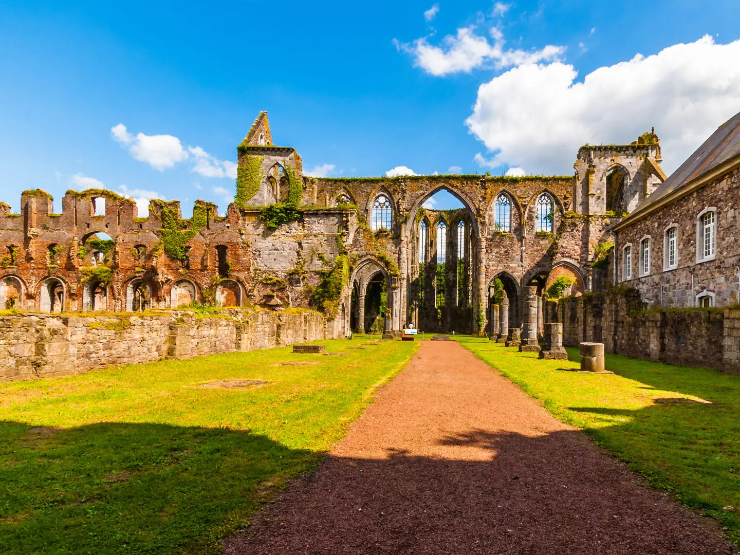
- Orval Abbey: The south-eastern finish in the Gaume. Medieval ruins stand beside the modern monastery, and Orval’s Trappist brewing heritage is central to the trail’s theme.
Challenges to expect
Expect hard days because of distance, not exposure: many stages are around 22-28 km, although the paths are generally non-technical. The steepest named pull is out of the Meuse near Waulsort and Hastiere. Weather in the Belgian Ardennes is changeable and wet year-round, so forest tracks and valley paths can be muddy. Navigation follows GR white-red waymarks, with yellow-red local-GR sections. For a more military-history themed Wallonia walk, see the Battle of the Bulge Trail; for a much longer north-south option, see the GR 12 Amsterdam to Paris Trail.
HikeList Score
Abbey Trail of Wallonia scored 87/100 on HikeList's trail-quality metrics.
See score breakdownHide breakdown
- Ideal length 90
- Balanced challenge 80
- Scenery & wildness 98
- Varied terrain 83
- Accommodation 83
- Food & support 88
- Path quality 80
- Season flexibility 89
Computed from length, challenge, scenery & wildness, terrain variety, accommodation, food & support, path quality and season flexibility.
 Belgium
Show more data Show less
- Forest
- River Valley
- Hills
- Dirt
- Gravel
- Paved
- Hotels
- Hostels
- Campsites
- Restrooms
- Water Sources
- Campsites
- Picnic Areas
Download Our Full Guide to Abbey Trail of Wallonia FREE!
Get our comprehensive guide to this hike for free. Save it for later reading or print out at home.
Photos from hikers
Taken on the trail by people who've reviewed Abbey Trail of Wallonia.
Abbey Trail of Wallonia: The Complete Guide
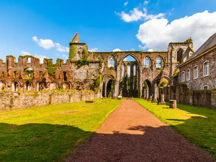 i
Image by Ralfik D
i
Image by Ralfik D The Abbey Trail of Wallonia is a 272 km waymarked crossing of southern Belgium, linking the Trappist abbeys of Scourmont, Rochefort and Orval. It suits fit, self-reliant walkers who want quiet Ardennes forests, river valleys and working monastery towns rather than a busy, serviced classic.
From the Fagne above Chimay, the route heads through the Viroin valley to the Meuse at Hastière-Lavaux and Waulsort. Beyond the river it climbs back onto the Ardennes plateaux and passes through limestone Famenne and Calestienne country towards Rochefort.
The eastern half follows the Lesse and Semois landscapes through places such as Han-sur-Lesse, Redu, Paliseul, Bertrix, Cugnon and Florenville before finishing at Abbaye d’Orval. The beer-and-abbey theme is real, but this is primarily a long walking route through rural Wallonia, not a tasting itinerary.
The challenge is distance and logistics rather than technical terrain. Many days run into the low-to-high twenties in kilometres, services thin out in the deeper Ardennes, and wet weather can turn forest tracks muddy at any time of year.
This guide covers stages, walking days, accommodation, food, transport, terrain and the common planning mistakes to avoid.
Stage-by-Stage Guide
The stages below use a practical 10-day split, but many walkers will add rest or shorter days, especially on the long forest sections between Chimay, Rochefort and the Semois. Distances are approximate, and the official GR Sentiers topo-guide should be used for exact routing, current variants and accommodation planning.
Food, water and accommodation are uneven outside the larger towns. Do not assume that every village has an open shop, café or evening meal available; carry enough food for the day and confirm opening times and beds before setting off.
Stage 1: Abbaye de Scourmont (Chimay) to Mariembourg / Nismes — approx. 26 km
The trail begins at Abbaye de Scourmont, the Trappist abbey above Chimay, then leaves the abbey plateau across the Fagne towards the Viroin valley. This is a long opening day rather than a gentle prologue, so it is worth starting early if arriving by bus on the same morning.
Underfoot, expect a typical Ardennes mix of quiet lanes, dirt tracks, gravel and forest paths. In wet weather, the Fagne and wooded sections can be muddy, and waterproof footwear is more useful than lightweight road shoes.
The main places for planning are Scourmont, Chimay, Mariembourg and Nismes. Chimay is the nearest service centre to the start, while Mariembourg and Nismes form the practical end area for this stage in the Viroin valley.
Carry lunch and water from the start area or Chimay unless current opening times in the intervening villages have been checked. Mariembourg and Nismes are better stage-end bases than smaller hamlets because they give more realistic options for accommodation and food.
Public transport to the start is via Chimay, with TEC bus links onwards to Scourmont; Chimay has no passenger railway station. Times can be sparse, especially at weekends and outside school periods, so this should be checked before travelling.
Navigation is by GR waymarks rather than a single bespoke SAT logo. Watch for the white-red GR and yellow-red GR-de-pays markings where the route joins or leaves existing GR sections, and use the topo-guide rather than relying on place-to-place assumptions.
Stage 2: Nismes to Hastière-Lavaux — approx. 27 km
This is another full-distance day, continuing through the Viroinval / Viroin-Hermeton landscape before reaching the Meuse at Hastière-Lavaux. The stage links quieter valley and woodland walking with the first major river landmark of the route.
Nismes, Olloy-sur-Viroin and Vierves-sur-Viroin are the key named places on or near this part of the trail. The Viroin valley is one of the more distinctive early sections, with the route moving through protected countryside around the meeting of the Eau Noire and Eau Blanche.
The walking is not technical, but the length makes it demanding. Expect forest tracks, dirt paths, gravel and some paved village sections; after rain, the wooded paths may be slow and muddy.
Do not rely on frequent food stops between Nismes and Hastière-Lavaux. Carry a full day’s food and water, and check any village services before committing to a long day with a light pack.
Hastière-Lavaux is a sensible overnight stop because it sits on the Meuse and has road access in a larger settlement than the intervening villages. Accommodation should still be booked ahead, as this route has uneven spacing of beds.
The Meuse/Famenne corridor has better transport possibilities than the more remote Ardennes stages, but current SNCB and TEC connections should be checked. This is a useful place to leave or join the trail for walkers section-hiking the western half.
Stage 3: Hastière-Lavaux to the Famenne / Rochefort approach — approx. 26 km
This stage starts with one of the most important physical features of the whole trail: the Meuse crossing area around Hastière-Lavaux and Waulsort, followed by the route’s notably steep climb back onto the plateau. It is not technical, but it is the clearest sustained pull on a route otherwise defined more by distance than by severe gradients.
Plan the morning around the climb rather than treating this as just another 26 km day. In wet weather, steep woodland paths above the Meuse can be slippery, and poles may be useful for both the ascent and any muddy descents.
After leaving the Meuse, the route enters the limestone Famenne and Calestienne country, part of the Famenne-Ardenne UNESCO Global Geopark. The scenery becomes more open in places, with a different feel from the Fagne and Viroin valley stages.
Services thin out away from the Meuse settlements, so carry enough food and water for the full stage. Accommodation at the “Rochefort approach” depends on the exact stage split chosen; this should be checked before travelling, and many walkers may prefer to adjust this day and the next around confirmed beds.
Road access is generally possible through villages and valley settlements, but public transport is not as dense as in northern Belgium. Check current TEC and SNCB options before using this stage as a section break.
Navigation remains straightforward if the GR markings are followed carefully, but this is a day where missing a turn could add unwelcome distance. Keep the topo-guide accessible at junctions, especially where several GR sections overlap or diverge.
Stage 4: Rochefort approach to Rochefort / Abbaye de Saint-Remy — approx. 25 km
This stage completes the western half of the Abbey Trail and brings the route into Rochefort, the middle Trappist abbey town of the walk. The destination is Abbaye Notre-Dame de Saint-Remy, associated with Rochefort beers, and the town makes the most practical mid-route stop.
Terrain continues through the Famenne-Ardenne landscape, using a mixture of forest and rural tracks, gravel paths and village lanes. The day is still long, but the approach to Rochefort gives a clearer service goal than the more remote preceding section.
Rochefort is one of the best places on the trail for resupply, accommodation and reorganisation. It is the natural point to add a rest day, replace worn kit, dry out after wet forest stages or split the route into two separate hikes.
Food and water planning is easier at the Rochefort end than on the approach, but carry enough for the day. Do not rely on small villages before Rochefort unless their opening times have been checked.
Rochefort and the surrounding Famenne towns have rail and bus links, making this one of the more practical access points on the route. Current SNCB train and TEC bus times should be checked, particularly for onward travel or a mid-walk arrival.
The abbey is a working monastery, so access, visiting hours and quiet areas must be respected. Navigation into and out of Rochefort should be checked against the topo-guide, as towns can be more confusing than forest tracks where waymarks compete with street furniture and road junctions.
Stage 5: Rochefort to Resteigne — approx. 21 km
This is a shorter day than the opening four stages and marks the start of the Rochefort to Orval half of the trail. The route leaves Rochefort for the Lesse country, with Han-sur-Lesse and its famous cave system as the major named landmark.
Han-sur-Lesse is on the route and the Grottes de Han are an optional paid visit beside it. Allow extra time if visiting the caves, as this can easily turn a moderate walking day into a full day.
The terrain is still Ardennes and Famenne walking: tracks, dirt paths, forest sections and village stretches. Mud remains a regular issue after rain, even where the daily distance is less intimidating.
Food and drink are more plausible around Rochefort and Han-sur-Lesse than in smaller settlements, but opening times should still be checked. Carry enough water to finish the stage comfortably, especially if taking time out for the Grottes de Han.
Resteigne is a smaller stage end, so accommodation and evening meal options need to be arranged in advance. If beds are unavailable, this is one of the stages where a different split or a transfer may be necessary; this should be checked before travelling.
Rochefort is the stronger public transport point at the start of the day. For Resteigne and smaller villages, assume limited bus options unless current TEC timetables show otherwise.
Stage 6: Resteigne to Redu — approx. 23 km
This stage continues through the Lesse-side Ardennes towards Redu, one of the most distinctive villages on the eastern half of the route. Redu is known as the village du livre, with second-hand bookshops giving it a different character from the forest and river settlements around it.
Expect a quiet walking day with a mix of woodland, rural tracks and small roads or lanes near villages. The route is not technically difficult, but the cumulative load of the previous days and muddy ground can make 23 km feel longer than it looks on paper.
Daverdisse lies on the broad line of this part of the route, with Redu as the main stage-end target. Views and interest come from the changing Ardennes valleys and the approach to the book village rather than from exposed ridges.
Carry lunch and enough water from Resteigne or from wherever the previous night’s accommodation is based. Services between stage ends should be treated as limited unless checked locally.
Redu is listed among the accommodation hubs for the route, but it is still a small village and beds should be booked ahead. Evening food availability should also be confirmed when booking.
Public transport is likely to be less convenient here than at Rochefort, Bertrix or Florenville. If using Redu as a start or finish point for a section hike, current TEC connections should be checked before fixing plans.
Navigation is generally by established GR markings, but pay attention at forest junctions and where the route passes through small settlements. In poor visibility or heavy rain, the topo-guide and an offline map are useful backups.
Stage 7: Redu to Paliseul — approx. 23 km
From Redu, the trail continues deeper into the Ardennes towards Paliseul. This is another steady middle-distance stage where the challenge is sustained walking on quiet rural and forest terrain rather than any single dramatic obstacle.
Maissin is one of the named places on this section, with Paliseul providing the practical overnight objective. The route remains within the pattern of wooded tracks, dirt paths, gravel and paved village links typical of the Abbey Trail.
The surface can be heavy after rain, so allow realistic timings. Even where gradients are moderate, wet forest tracks and repeated small climbs can slow progress.
Food and water availability should be planned conservatively. Redu and Paliseul are the important service points; anything between them should be treated as a bonus unless opening times have been checked.
Paliseul is one of the more useful accommodation bases on the Rochefort to Orval half. Book ahead, especially if walking in peak holiday periods or arriving on a day when local restaurants or shops may close early.
For access, Paliseul has better road and settlement infrastructure than the smaller villages around it, but public transport should still be checked with current SNCB and TEC information. Do not assume frequent evening departures.
Navigation is normally straightforward on waymarked GR, but this stage crosses country where long forest or rural stretches can feel repetitive. Check junctions carefully and keep track of progress against the topo-guide to avoid adding distance late in the day.
Stage 8: Paliseul to Cugnon — approx. 27 km
This is one of the longer eastern stages and should be treated as a full walking day. The route heads from Paliseul towards Bertrix and then on to Cugnon, approaching the Semois valley country that defines the final part of the trail.
Bertrix is the key mid-stage town and a useful planning point. It is also one of the better-connected places in this part of Wallonia, with the wider finish access described through the Libramont/Bertrix rail lines.
The terrain remains mixed: forest tracks, dirt and gravel paths, and paved sections through towns and villages. After rain, the forest sections can be muddy, and the day’s length leaves little margin for long unscheduled stops.
Use Bertrix as the main opportunity for food, water or a break if timings and opening hours work. Carry enough to complete the stage regardless, because relying on a single mid-stage service point is risky on a 27 km day.
Cugnon is a smaller Semois valley stage end. Accommodation should be secured in advance, and evening food should be confirmed before arrival.
Bertrix gives this stage better public transport flexibility than many others, making it a practical section access point. Cugnon is more limited, so onward travel from the stage end should be checked carefully before planning to stop there without accommodation.
Navigation through and around Bertrix may be less obvious than in open countryside because urban road junctions can interrupt the rhythm of the waymarks. Once back in forest or valley terrain, continue to check GR markings at every junction.
Stage 9: Cugnon to Martué, near Florenville — approx. 18 km
This is a shorter stage through the Semois valley approach to the Gaume. After the long Paliseul to Cugnon day, the reduced distance gives more time to enjoy the wooded river landscape around the Semois.
The route passes through the Semois valley around Cugnon and Lacuisine before reaching Martué near Florenville. This is one of the most attractive final sections of the trail, with meandering river scenery and wooded valley sides.
Path conditions remain typical of the route: forest and riverside tracks, dirt or gravel surfaces, and paved sections in villages. Mud can still be an issue after wet weather, especially in shaded valley woodland.
Carry food and water from Cugnon unless current services have been checked. Lacuisine and the Florenville area may help with logistics, but do not rely on unconfirmed opening hours.
Martué is near Florenville, which is one of the stronger accommodation and transport bases on the final approach to Orval. Many walkers may choose to stay in or near Florenville rather than rely on limited options at the exact stage end; this should be arranged before travelling.
Public transport becomes more relevant again around Florenville, with TEC bus access used for the Orval area and rail access on the wider Libramont/Bertrix lines. Current SNCB and TEC times should be checked before fixing the final day or planning to leave the trail here.
Navigation is usually uncomplicated, but pay attention where the route moves between river valley paths, villages and access roads. The final stages are shorter, but waymark discipline still matters.
Stage 10: Martué / Florenville to Abbaye d'Orval — approx. 12 km
The final stage is short by Abbey Trail standards, leading from the Florenville area through the Gaume to Abbaye d'Orval. It is best treated as a proper walking stage rather than a token finish, especially if onward buses are infrequent.
The route passes through the final Gaume villages, including the approach via Villers-devant-Orval, before reaching the abbey. The finish is at Abbaye Notre-Dame d'Orval, beside the medieval ruins and the modern monastery.
Terrain is still a mix of rural paths, tracks and village lanes, with less distance pressure than earlier in the hike. Mud is possible after rain, but the main planning issue is timing the finish around transport, visiting hours and any booked accommodation.
Carry enough water and a snack from Martué or Florenville. Do not assume that food will be available at exactly the right time near the finish unless current opening times have been checked.
Accommodation is usually planned around Florenville, Villers-devant-Orval or nearby settlements rather than assuming a bed at the abbey. The monastery is a working religious site, so visitors should respect quiet areas and current visiting arrangements.
The finish is reached by TEC bus near Florenville, with wider rail access via the Libramont/Bertrix lines. Public transport in this part of Wallonia can be sparse, so confirm current bus times from Orval before setting out on the final stage.
For navigation, follow the GR waymarks carefully into the abbey approach and keep the topo-guide available until the actual finish. The sense of arrival is strong, but the route still uses normal paths and roads rather than a ceremonial final walkway.
Recommended Itinerary
Distances on the Abbey Trail of Wallonia are best treated as planning distances, not booking guarantees. Use the current GR Sentiers topo-guide or official mapping before committing to accommodation, especially on the Chimay–Rochefort half where overnight spacing is less obvious.
The itinerary below is a demanding 10-walking-day schedule. It suits fit walkers who are comfortable with repeated 22–28 km days on muddy forest tracks, gravel paths and quiet village lanes. Most walkers will find the trail more manageable by adding one to four extra days, as described after the table.
Standard itinerary: 10 walking days
| Day | From | To | Approx. distance | Why this stage makes sense | Services/accommodation notes |
|---|---|---|---|---|---|
| 1 | Abbaye de Scourmont (Chimay) | Mariembourg / Nismes | 26 km | A full first day from the Scourmont plateau into the Fagne and towards the Viroin valley. It gets the route properly under way without needing to return to Chimay after starting at the abbey. | Chimay, Mariembourg and Nismes are the practical service points in this opening section. Bus timing to Scourmont matters, so many walkers will want to stay nearby the night before rather than start after a long journey. |
| 2 | Nismes | Hastière-Lavaux | 27 km | A long but logical Viroin-to-Meuse stage, passing through the Viroin valley country before reaching the river at Hastière-Lavaux. | Hastière-Lavaux is an important overnight target on the Meuse. Do not assume frequent services between villages; carry food for the day. |
| 3 | Hastière-Lavaux | Famenne / Rochefort approach | 26 km | This stage includes the key climb out of the Meuse valley after the Hastière/Waulsort area, then pushes on towards the Famenne. It is one of the harder days because the climb comes early and the distance remains substantial. | The exact overnight stop needs to be chosen around available beds. Check official mapping before booking and avoid leaving this night unplanned. |
| 4 | Famenne / Rochefort approach | Rochefort / Abbaye de Saint-Remy | 25 km | A second long approach day brings the route into Rochefort, the natural mid-point of the trail and the link between the Chimay–Rochefort and Rochefort–Orval halves. | Rochefort is one of the strongest accommodation and resupply points on the route. It is a sensible place for a rest night if walking the trail over 11–14 days. |
| 5 | Rochefort | Resteigne | 21 km | A slightly shorter day after Rochefort, with Han-sur-Lesse and the Lesse valley providing a more forgiving start to the eastern half. | Rochefort has the best services at the start of the day. Resteigne is a smaller overnight stop, so book ahead. The Grottes de Han at Han-sur-Lesse are an optional paid visit if time allows. |
| 6 | Resteigne | Redu | 23 km | A solid Ardennes stage through quieter country towards Redu, keeping the day within a manageable distance while maintaining progress towards the Semois. | Redu is a useful overnight village on the Rochefort–Orval half. Accommodation should still be booked in advance, particularly outside the main summer period. |
| 7 | Redu | Paliseul | 23 km | This stage uses Paliseul as a practical service and accommodation target after the Redu and Maissin section. The distance is steady rather than excessive. | Paliseul is one of the better planning anchors in this part of the route. Use it for food, lodging and any transport contingency checks. |
| 8 | Paliseul | Cugnon | 27 km | One of the longer days on the eastern half, carrying the trail via the Bertrix area towards the Semois valley around Cugnon. It is a good candidate for splitting if 27 km days are too much. | Bertrix is the obvious mid-section service point to consider when planning a slower version. Cugnon is smaller; secure accommodation before setting out. |
| 9 | Cugnon | Martué / Florenville area | 18 km | A deliberately shorter day after the long Paliseul–Cugnon stage, following the Semois-side approach towards Florenville, Lacuisine and Martué. | Florenville is the main practical hub in this area. Martué and Lacuisine may be useful for positioning, but availability should be checked before travelling. |
| 10 | Martué / Florenville | Abbaye d’Orval | 12 km | A short final stage leaves time for the approach to Villers-devant-Orval, the finish at Abbaye d’Orval and onward transport. | Orval is reached by TEC bus near Florenville; current TEC and SNCB connections should be checked before travelling. Respect the abbey’s visiting hours and the quiet of the working monastery. |
Slower variant: 11–14 days
This is the better option for walkers who want a more sustainable pace, are carrying camping or heavier luggage, or are unsure about repeated 25 km days in wet Ardennes conditions.
The easiest places to add time are:
- Before Day 1: stay in Chimay or the Mariembourg/Nismes area so the bus approach to Abbaye de Scourmont does not compress the first walking day.
- Opening section: split one of the longer Fagne, Viroin or Meuse days if beds are available around Chimay, Mariembourg, Nismes, Olloy-sur-Viroin, Vierves-sur-Viroin or Hastière-Lavaux. Check official mapping before booking.
- Rochefort: add a rest or short day in Rochefort, which is the most practical mid-route pause and a sensible place to reset food, laundry and weather plans.
- Paliseul–Cugnon: consider breaking the 27 km day by using Bertrix if accommodation and route logistics work.
- Final approach: keep the Cugnon–Martué/Florenville and Martué/Florenville–Orval stages separate rather than combining them, especially if relying on buses from Orval or Florenville.
Faster variant: 10 days or less
The table above is already the faster end of a realistic schedule. It suits strong, efficient walkers with light packs, pre-booked accommodation and no need for rest days.
Trying to compress the route further is only sensible for very fit walkers who are comfortable with long Ardennes days and limited service spacing. The most obvious compression is the final approach, combining the 18 km Cugnon–Martué/Florenville stage with the 12 km finish to Orval into one long day, but transport from the finish and accommodation availability must work cleanly. Check official mapping before booking.
Planning the Route
The Abbey Trail is best planned as a chain of accommodation stops, not as a purely distance-based itinerary. The harder days come from long forest and valley sections with limited services between villages, so the key task is matching daily distance to places that actually have beds and food.
Most walkers should allow 11–14 days. The official topo-guide suggests at least ten days, and the Rochefort–Orval half is presented as six stages, but a full fortnight gives more room for transport connections, wet conditions, monastery visiting hours and the occasional shorter day.
Choosing your timeframe
A 10-day schedule is possible for fit walkers who are comfortable with repeated 22–28 km days and who book accommodation carefully. It leaves little spare time for delays, mud, slow transport or optional visits such as Han-sur-Lesse.
An 11–12 day schedule is a more balanced plan for strong long-distance walkers. It keeps the route efficient while reducing the pressure on the longest Ardennes days.
A 13–14 day schedule suits walkers who want shorter days, more reliable arrival times in villages, and time around Chimay, Rochefort, Redu, the Semois valley and Orval. Less experienced long-distance walkers should plan towards this end of the range.
| Plan | Best for | Planning implication |
|---|---|---|
| 10 days | Very fit walkers | Long days, little slack, accommodation must line up exactly |
| 11–12 days | Most strong walkers | Practical balance of distance and recovery |
| 13–14 days | Slower walkers or those wanting visits | Easier daily pacing, more scope to use larger villages as bases |
Stage planning and accommodation
Daily stages are naturally shaped by villages and transport hubs. Useful planning anchors include Chimay, Mariembourg or Nismes, Hastière-Lavaux, Rochefort, Resteigne, Redu, Paliseul, Bertrix, Cugnon, Florenville and the Orval area.
Accommodation is mixed: hotels, chambres d’hôtes, gîtes, occasional hostels and campsites. The spacing is uneven, especially on the quieter Ardennes sections, so beds should be booked before committing to a daily plan.
The sample 10-day structure works as a fast itinerary, but it should not be treated as the only sensible division. If accommodation is unavailable in a small village, it may be necessary to shorten, lengthen or use a nearby larger place such as Rochefort, Paliseul, Bertrix or Florenville.
Splitting the trail at Rochefort
Rochefort is the natural break point. The official distance divides into Chimay–Rochefort and Rochefort–Orval, and the town sits roughly where the route changes from the western Fagne, Viroin and Meuse country into the Lesse, Semois and Gaume stages.
This makes section hiking practical. The western half is longer and includes the Meuse crossing and the steep climb out of the valley after Hastière-Lavaux and Waulsort; the eastern half is shorter and has the more clearly staged Rochefort–Orval structure.
If time is limited, walking Rochefort to Orval is the cleaner short version because the official half is already broken into six stages. Chimay to Rochefort is also practical, but the intermediate stage divisions need closer checking against accommodation and the current topo-guide.
Direction of travel
The route is usually presented from Abbaye de Scourmont near Chimay to Abbaye d’Orval, linking Chimay, Rochefort and Orval west to south-east. The official topo-guide describes the trail in both directions, so reversing the walk is possible.
West to south-east has a simple narrative progression through the three Trappist abbey areas and finishes at Orval. Either direction still requires the same transport checks, especially at the two rural trailheads.
Transport planning
Transport should be planned before booking the first and last nights. Chimay has no passenger train, so access to Abbaye de Scourmont normally involves reaching Chimay by TEC bus from the Charleroi rail hub, then using local TEC transport towards the abbey.
At the finish, Abbaye d’Orval is reached by TEC bus near Florenville, with rail access on the Libramont/Bertrix lines. Public transport is sparser than in northern Belgium, and Sunday or holiday services may affect the plan. Current SNCB train and TEC bus times should be checked before travelling.
Mid-route exits are more realistic around Rochefort and the Meuse/Famenne towns, where rail and bus links are better than in the deeper Ardennes. For section hikers, Rochefort is the most useful logistical hinge.
Navigation and route information
The SAT is a GR thematic route made by linking existing GR sections rather than by using a single dedicated trail symbol. On the ground, expect white-red GR waymarks on the through-route and yellow-red markings on GR-de-pays sections.
The official GR Sentiers topo-guide is the main planning tool. The current 3rd edition is dated June 2022, costs about €20, and describes the route in both directions. It should be used to check current stage distances, route notes and any diversions.
Distance figures need care when comparing plans. The official topo-guide gives 272 km, while an older or promotional figure of about 290 km is still encountered. For day-by-day planning, use the current topo-guide distance and leave a little margin rather than building an itinerary to the older figure.
Food, water and resupply
Do not assume every village has full services at the moment you arrive. Several stages pass through quiet forest, river valleys and small Ardennes settlements, so each day should start with enough food for the walking hours ahead.
Larger stops such as Chimay, Rochefort, Paliseul, Bertrix and Florenville are better places to organise resupply. On remoter days, confirm evening meals with accommodation in advance, especially where there may be few alternatives nearby.
Water planning is straightforward but should still be deliberate. Carry enough for long forest and plateau sections, and refill in villages or at accommodation rather than relying on untreated streams.
Weather and ground conditions
Ardennes weather is wet in any season, and muddy forest tracks are normal after rain. Waterproof footwear, gaiters or fast-drying trousers, and a reliable waterproof layer are more useful here than technical mountain equipment.
The route is not technically difficult, but long days become harder when tracks are wet and progress is slower. The climb out of the Meuse valley after Waulsort and Hastière is the one notably steep pull and should not be underestimated if it comes late in a long day.
Spring, summer and autumn are the main walking seasons. In all three, build the plan around daylight, opening hours, accommodation availability and the reality that a 25 km Ardennes day can take longer than the map distance suggests.
Monasteries and visits
The trailheads and Rochefort abbey are working monasteries, not just landmarks. Visiting hours, access rules and quiet areas should be respected, and current visitor information should be checked before planning a tight arrival or departure around them.
Optional stops such as the Grottes de Han at Han-sur-Lesse can add time to the day. If visiting, treat it as a planned half-day decision rather than something to squeeze into a full-distance stage.
Towns, Villages and Overnight Stops
Accommodation planning is one of the main challenges on the Abbey Trail of Wallonia. The route links several useful towns, but it also spends long days in quieter Ardennes and Gaume countryside where beds, shops and public transport are unevenly spaced.
Book accommodation before committing to daily stages, especially between Rochefort and Orval. On the smaller-village days, do not assume there will be a shop, evening meal or last-minute room available.
Abbaye de Scourmont (Chimay)
Abbaye de Scourmont is the western trailhead, on the plateau above Chimay. It is a working Trappist abbey, so treat it as a quiet start point rather than a conventional hiker service hub.
Most walkers will overnight in or near Chimay before starting, then use local transport or a pre-arranged lift to reach the abbey. TEC buses link Chimay with Scourmont, but current times should be checked before travelling.
There is no reason to carry extra food for the abbey itself beyond what is needed for the first walking day. Respect visiting hours and the monastic setting.
Chimay
Chimay is the practical western base for the start of the trail. It sits below the Scourmont plateau and is the best place to organise a pre-walk overnight before reaching the abbey trailhead.
Accommodation is more realistic here than at the abbey, with hotels, guesthouses and gîtes in the wider Chimay area. Food and basic town services are also more likely here than on the plateau, but opening hours should still be checked, particularly for early starts.
Chimay has no passenger railway station. Access is by TEC bus, including links from the Charleroi rail hub and onward local bus services towards Scourmont; check current SNCB and TEC times before booking fixed travel.
Mariembourg
Mariembourg is one of the first useful overnight targets after leaving Scourmont, often paired with nearby Nismes for the end of the first long day. The wider Couvin/Mariembourg area is one of the better-supported early sections for accommodation.
It can work well as a first-night stop if beds in Nismes are full or if the day needs adjusting after the approach from Chimay. Food and shop options should be checked in advance rather than assumed on arrival.
Public transport in this part of Wallonia is by local services rather than frequent big-city links. Timetables should be checked before using Mariembourg as a start, finish or bailout point.
Nismes
Nismes lies in the Viroin valley and is a logical overnight stop at the end of the first stage or the start of the second. The surrounding Viroinval landscape is one of the first major changes from the open Fagne into more wooded valley walking.
Accommodation may be available in the village or nearby, but it should be booked ahead because the next day towards Hastière-Lavaux is long. Check food options before arrival, especially if walking outside the main holiday season or arriving late.
For stage planning, Nismes is more useful than the smaller Viroin villages because it gives a clear break before the next long day towards the Meuse.
Olloy-sur-Viroin
Olloy-sur-Viroin is a smaller Viroin valley village on the early part of the route. It is more of a useful waypoint than a dependable overnight base unless accommodation has been booked specifically.
Do not rely on it for a full resupply. If planning to stop here, confirm both the bed and the evening meal arrangements before setting the stage length.
It can be useful for breaking up the Viroin section if the standard long stages feel too demanding, but onward transport and services should be checked before travelling.
Vierves-sur-Viroin
Vierves-sur-Viroin is another small Viroin valley settlement on the route. Like Olloy-sur-Viroin, it is best treated as a passing village unless a specific gîte or guesthouse has been reserved.
It may help shorten the early stages, but it is not a place to depend on for spontaneous accommodation or food. Carry enough supplies to continue to the planned overnight stop.
Transport and opening hours should be checked before using Vierves-sur-Viroin as a stage end.
Hastière-Lavaux
Hastière-Lavaux is one of the most important early overnight stops, sitting on the Meuse after the long stage from Nismes. It is a practical place to pause before the route leaves the river and climbs back onto the plateau.
Accommodation is available in the Hastière area, including the sort of mixed hotels, guesthouses and campsites found in the larger stops on this trail. Book ahead, as this is a key staging point rather than just an optional halt.
Food options should be checked before arrival, especially if staying outside the centre or relying on a campsite. The Meuse/Famenne corridor has rail and bus links in the wider area, but current SNCB and TEC times should be checked for any journey that starts or ends here.
Waulsort
Waulsort sits beside the Meuse close to Hastière-Lavaux and immediately before or around the route’s steepest sustained pull back out of the valley. It is an important pacing point even if not used overnight.
A stop here can make sense if suitable accommodation is available, but do not assume the same range of services as in a larger town. Confirm beds, food and onward transport before planning a night here.
The main hiking note is timing: avoid starting the climb out of the Meuse late in the day if conditions are wet, visibility is poor or accommodation ahead is not fixed.
Rochefort
Rochefort is the major mid-route town and one of the most useful places on the whole trail. It marks the area of Abbaye de Saint-Remy and the join between the Chimay to Rochefort and Rochefort to Orval halves.
This is a strong overnight stop, rest stop or section-hike break. Accommodation is better developed here than in the smaller Ardennes villages, with hotels, guesthouses and other options in and around the town.
Rochefort is also the sensible place to reset supplies, deal with laundry or adjust the itinerary before the more remote south-eastern half. Rail and bus links serve the wider Rochefort and Famenne area, but current connections should be checked before travelling.
Han-sur-Lesse
Han-sur-Lesse lies just south of Rochefort on the Lesse section. It is best known to walkers for the Grottes de Han, an optional paid visit close to the route.
As a stop, it can be useful for a shorter day out of Rochefort or for anyone building extra time into the itinerary. Accommodation and food should be checked before relying on it as a stage end.
If visiting the caves, allow enough time in the day and avoid compromising the onward walk to Resteigne or the next booked bed.
Resteigne
Resteigne is a stage-end village on the Rochefort to Orval half, commonly used after the shorter day from Rochefort. It is a good example of why this trail needs accommodation planning: the village works as a stop only if a bed and food have been arranged.
Do not treat Resteigne as a guaranteed full-service base. If accommodation is not available, the stage plan may need changing around Rochefort, Han-sur-Lesse or another nearby option.
Carry enough food for the day and confirm evening meal arrangements before leaving Rochefort.
Daverdisse
Daverdisse sits in the quieter Ardennes section between Resteigne and Redu. It is more relevant as a route village and possible stage-adjustment point than as a default overnight stop.
Use it cautiously in planning unless accommodation has been booked directly. Food, shops and transport should all be checked before travelling.
This part of the trail has fewer fallback options, so avoid setting an ambitious stage that depends on finding services on arrival.
Redu
Redu is one of the more useful overnight villages on the Rochefort to Orval half. It is known as the village du livre, but for hikers its main value is that it is a recognised accommodation stop in a section where spacing can be awkward.
Guesthouses, gîtes and other small-scale accommodation are the likely pattern here rather than large hotels. Book ahead and check whether an evening meal is available locally or at the accommodation.
Redu works well as a natural break between Resteigne and Paliseul. It is also a sensible place to slow the itinerary if the long forest and valley stages are starting to accumulate.
Maissin
Maissin is a smaller settlement on the route between Redu and Paliseul. It can be useful for orientation and pacing, but it should not be treated as a dependable resupply or overnight hub without a specific booking.
If using Maissin to split a stage, confirm accommodation and food before travelling. Otherwise, plan to carry what is needed through to Paliseul or the next confirmed stop.
Public transport should be treated as limited unless current TEC connections show otherwise.
Paliseul
Paliseul is a key planned overnight stop on the south-eastern half, coming after Redu and before the longer day towards Cugnon. It is one of the named larger stops where accommodation is more realistic than in the intervening hamlets.
Use Paliseul to reset food and water plans before the next long stage. Shops, cafés and restaurants should still be checked for opening days and hours, especially if arriving on a quiet evening.
Paliseul is a practical place for itinerary adjustments because it sits before a demanding 27 km stage in the standard schedule. Transport availability should be checked before using it as a section start or finish.
Bertrix
Bertrix is an important service town in the wider route corridor and one of the better places for accommodation if the Paliseul to Cugnon section needs altering. It is also relevant for public transport planning, as the nearest rail access for the Orval end is on the Libramont/Bertrix lines.
For hikers, Bertrix is most useful as a backup or alternative overnight base rather than necessarily a fixed stop on the standard day-by-day schedule. It may help if accommodation in smaller villages is full.
Check how any transfer to or from the actual trail line will work before booking. Do not assume late buses or easy evening connections in the Ardennes.
Cugnon
Cugnon is a stage-end village in the Semois valley, reached after the long day from Paliseul. It is an attractive and logical halt in route terms, but services need to be planned rather than left to chance.
Accommodation and food should be booked or confirmed ahead. If no suitable bed is available, adjust the stage around Bertrix, Florenville or another confirmed base rather than arriving without a plan.
Cugnon is also the point where the route feels noticeably closer to the Gaume and the final approach towards Orval.
Florenville
Florenville is the main practical town near the final part of the trail. It is one of the best bases for the Orval approach, with accommodation available and better access to transport than the smaller villages around the abbey.
Many walkers use Florenville or nearby Martué to stage the final day to Abbaye d'Orval. It is also useful for a final resupply and for organising onward travel after finishing.
The finish at Orval is reached by TEC bus near Florenville, and the nearest rail access is on the Libramont/Bertrix lines. Check current SNCB and TEC times before fixing return travel.
Lacuisine
Lacuisine lies in the Semois valley on the approach to Florenville and Orval. It is a useful route village, particularly for walkers breaking the final section into shorter days.
Do not assume full services unless they have been checked in advance. If using Lacuisine as a stop, confirm accommodation, food and any transfer needs before setting off from Cugnon or Florenville.
It can be a good pacing point in the final valley section, but Florenville remains the stronger logistics base.
Martué
Martué, near Florenville, is a common final overnight area before the short last stage to Abbaye d'Orval. In the standard schedule, the penultimate day ends around Martué or Florenville, leaving roughly half a day for the finish.
This is a practical arrangement because it avoids rushing the final approach and allows time at Orval Abbey. Accommodation should still be booked ahead, and evening food should be confirmed before arrival.
For transport, plan through Florenville unless a specific local connection has been checked.
Villers-devant-Orval
Villers-devant-Orval is the settlement closest to the Orval finish. It is useful for orientation and for anyone arranging pickup, accommodation or local transport around the abbey.
It should not be assumed to offer the same range of services as Florenville. If planning to stay here, confirm the bed, meals and onward transport before travelling.
This is the final village context before the route reaches the abbey precinct.
Abbaye d'Orval
Abbaye d'Orval is the south-eastern trailhead and finish of the Abbey Trail of Wallonia. It is a working monastery beside the medieval ruins and modern abbey, and should be treated as a destination with visiting hours rather than as a general service point.
The nearest practical accommodation and transport planning is usually around Florenville, Villers-devant-Orval or the wider local area. TEC buses serve the Orval area via nearby towns such as Florenville or Bouillon, but current times should be checked before travelling.
Finish-day logistics matter here. Check transport before setting out on the final stage, carry enough food and water to avoid depending on abbey facilities, and respect the quiet of the monastery grounds.
Getting to the Start
The western trailhead is at Abbaye Notre-Dame de Scourmont, on the plateau south of Chimay. It is not a railhead, so the usual approach is to reach Chimay first, then make the final hop to the abbey by TEC bus, taxi or arranged lift.
Public transport in this part of Hainaut is much thinner than in northern Belgium. Check current SNCB train times and TEC bus timetables before booking accommodation or committing to a first-day start time.
By train
Chimay has no passenger train station. The practical rail approach is to travel by SNCB train to the Charleroi rail hub, then continue by TEC bus towards Chimay.
Do not plan this as a simple train-to-trailhead journey. The final approach to Abbaye de Scourmont depends on bus connections from Chimay or a pre-arranged road transfer, and this should be checked before travelling.
By bus
Chimay is served by TEC bus from Charleroi. From Chimay, there is a TEC bus connection towards the Scourmont abbey, which is the official starting point of the route.
Connections may not line up neatly with long-distance trains or with a same-day first stage to Mariembourg / Nismes. If arriving late in the day, it is usually more practical to sleep in or near Chimay and start the trail the following morning.
For the final Chimay–Scourmont leg, check the current TEC timetable carefully. If the bus times are limited, a pre-booked taxi from Chimay can remove the risk of losing half a day before the walk has begun.
By car
By car, aim for Abbaye Notre-Dame de Scourmont, south of Chimay. The start is at a working Trappist abbey, so treat it as a drop-off point rather than assuming long-stay hiker parking is available.
Because the Abbey Trail is a point-to-point route finishing at Abbaye d’Orval, leaving a car at the start creates a difficult end-of-walk retrieval. Public transport between Orval / Florenville and Chimay is possible only with careful planning and may involve sparse bus connections; this should be checked before travelling.
If driving is unavoidable, the cleanest option is often to arrange a lift to Scourmont, use a taxi for the final approach from Chimay, or leave the car where long-stay parking is explicitly permitted. Do not leave a vehicle at the abbey without checking current parking rules.
From the nearest airport
No airport is directly useful for the trailhead. The simplest pattern is to fly into an airport with onward rail access to Charleroi, then continue by TEC bus to Chimay and onward to Scourmont.
Allow generous time for the transfer. A delayed flight or missed bus can easily make a same-day start from Abbaye de Scourmont impractical, especially if the first walking day is planned as the long stage towards Mariembourg / Nismes.
Where to stay before starting
Chimay is the most practical pre-walk base because it sits below the Scourmont plateau and has the onward bus/taxi link to the abbey. Staying there also gives more control over the first morning, rather than relying on a long chain of train and bus connections.
There may also be accommodation in the wider Chimay, Couvin or Mariembourg area, but stage planning should be tied to real bus times and available beds. Accommodation in the Ardennes and Fagne is unevenly spaced, so book ahead rather than arriving speculatively.
The abbey is a working monastery. Respect visiting hours, quiet areas and any access restrictions when starting the route.
Getting Home from the Finish
The Abbey Trail finishes at Abbaye d'Orval, near Villers-devant-Orval and Florenville, in a rural part of Luxembourg province. Do not assume you can simply arrive at the abbey late in the afternoon and find frequent onward transport: public transport is useful, but thinner than in northern Belgium, and the final leg needs checking before you commit to a finish time.
By train
There is no railway station at Abbaye d'Orval itself. The practical rail access is via the Florenville area, with onward SNCB connections on the Libramont/Bertrix rail network.
For most walkers, the key move is:
- Finish at Abbaye d'Orval.
- Use a TEC bus or taxi towards Florenville, Bertrix or Libramont, depending on the day’s services.
- Continue by SNCB train to larger Belgian rail hubs.
Train and bus times should be checked together before travelling, especially if finishing on a Sunday, public holiday or late in the day. If the last workable bus has gone, a night in Florenville or a pre-booked taxi becomes the sensible fallback.
By bus
TEC buses serve the Orval/Florenville area, and the finish can be reached or left by bus via places such as Florenville or Bouillon. Service frequency is limited compared with urban Belgium, so treat the bus as a planned connection rather than a turn-up-and-go option.
Check the current TEC timetable for the exact stop, direction and final departure before setting off on the last stage from Martué or Florenville. This is particularly important because the final day is short enough to tempt walkers into a relaxed late start, but the transport at the abbey may not suit a late finish.
By car/taxi
A pre-booked taxi is the simplest way to leave Abbaye d'Orval if bus times do not line up with your finish. It is also the safest plan if you have accommodation, a train connection or a flight to reach the same evening.
Drivers collecting walkers should use Abbaye d'Orval or Villers-devant-Orval as the rendezvous point, but exact access and parking arrangements at the working abbey should be checked before travelling. The trailheads are monasteries, so avoid relying on informal late-evening pick-ups inside abbey grounds.
If leaving a car for the end of the walk, plan the logistics around Florenville or another nearby settlement with services rather than assuming long-stay parking at the abbey. This should be checked before travelling.
From the nearest airport
The finish is not an airport-friendly trailhead in its own right. For flights after the walk, plan first to reach the SNCB rail network via Florenville, Bertrix or Libramont, then connect onward to the airport required.
Allow generous time between finishing at Orval and any same-day flight. The weak link is likely to be the rural bus or taxi transfer from the abbey area, not the mainline rail journey once you are back on the SNCB network.
Where to stay at the finish
Staying overnight near the finish is often the most comfortable option, especially if you want to visit Abbaye d'Orval without rushing or if public transport times are awkward. Florenville is the main nearby service base named on the route, with accommodation also possible in the wider Gaume area depending on availability.
Book ahead rather than arriving speculatively. Accommodation spacing is uneven in the Ardennes and Gaume, and the final stage passes through small places such as Lacuisine, Martué and Villers-devant-Orval where beds may be limited or seasonal.
Which Direction Should You Walk?
Standard direction: Abbaye de Scourmont to Abbaye d'Orval
The Abbey Trail is best planned in its standard west-to-south-east direction: Abbaye de Scourmont (Chimay) → Rochefort → Abbaye d'Orval. This is the natural order used for the through-route on this page and for the official split of the trail into the Chimay–Rochefort and Rochefort–Orval halves.
This direction gives the clearest sense of progression. The route starts on the Fagne above Chimay, moves through the Viroin valley, crosses the Meuse around Hastière-Lavaux and Waulsort, then works through the Famenne, Lesse and Semois valleys before finishing at Orval in the Gaume.
It also gives the strongest psychological finish. Abbaye d'Orval is a distinctive end point, with the medieval ruins and modern monastery beside the Trappist brewery, and it feels more like a destination than simply reaching a transport stop.
Is the reverse direction practical?
Yes. The SAT is a GR route and the official topo-guide describes it in both directions, so walking Orval → Rochefort → Chimay/Scourmont is entirely possible.
The main reason to reverse the route is transport or accommodation availability. If beds are easier to secure in a particular sequence, or if current TEC/SNCB connections work better for starting at Orval, the reverse direction is a reasonable choice.
The trade-off is that the route then gives away one of its best finishes on day one. You start with Orval rather than walking towards it, and the final approach is to Scourmont above Chimay, where onward travel still depends on TEC buses because Chimay has no passenger railway station.
Transport: neither direction is perfect
Transport does not strongly favour either direction. Both trailheads need bus planning, and public transport is sparser here than in northern Belgium.
For the standard direction, the start is reached via Chimay, with TEC bus links from the Charleroi rail hub and a local TEC connection towards Scourmont. The finish at Orval is reached by TEC bus near Florenville, with onward rail access on the Libramont/Bertrix lines.
In reverse, the same issue simply swaps ends: start with the Orval/Florenville bus link, then finish with the Chimay/Scourmont bus link. Current SNCB and TEC times should be checked before travelling, especially if finishing late in the day or walking outside the main holiday season.
Climbs and underfoot conditions
There is no major directional advantage in terms of height gain. This is a hard walk because of repeated long days, forest tracks and muddy Ardennes terrain, not because of technical climbing.
The one notable exception is the steep pull out of the Meuse valley after the Hastière-Lavaux/Waulsort crossing. In the standard direction this is a climb; in reverse it becomes a steep descent, which may feel easier aerobically but can be awkward on wet or muddy ground.
For most walkers, that single section is not enough reason to reverse the whole trail. Good footwear and conservative pacing matter more than direction.
Accommodation flow
Accommodation spacing is uneven in the deeper Ardennes sections whichever way you walk. The practical priority is to build stages around places with realistic beds and services, such as Chimay, the Couvin/Mariembourg area, Hastière, Rochefort, Redu, Paliseul, Bertrix and Florenville.
The standard direction works well with Rochefort as a natural mid-route planning point, separating the Chimay–Rochefort and Rochefort–Orval halves. If accommodation forces a shorter or longer day, adjust around villages with beds rather than trying to preserve a fixed daily mileage.
Recommendation
Walk Abbaye de Scourmont to Abbaye d'Orval unless there is a clear transport or accommodation reason to reverse it. The standard direction has the best narrative flow, a more satisfying finish at Orval, and no significant terrain disadvantage beyond the steep climb out of the Meuse valley.
Choose the reverse only if current bus/train connections or booked accommodation make it clearly easier. In either direction, confirm TEC and SNCB times, book Ardennes accommodation ahead, and expect muddy forest tracks after rain.
Accommodation Along the Route
The Abbey Trail of Wallonia works for inn-to-inn walkers, but only with advance planning. Accommodation is mixed — hotels, chambres d’hôtes, gîtes, occasional hostels and campsites — and the spacing is uneven once the route gets into the quieter Ardennes villages.
Do not plan this trail by distance alone. Build the itinerary around places with actual beds, then adjust walking days to fit. On several stages, especially between the Meuse, Rochefort, Redu, Paliseul, Cugnon and Florenville, a fully booked village can force a long onward day or a transfer.
Best overnight bases
The most useful accommodation hubs are Chimay, the Mariembourg / Nismes area, Hastière-Lavaux, Rochefort, Redu, Paliseul, Bertrix and Florenville. These are the places to prioritise when shaping the itinerary.
Rochefort is the strongest mid-route base and a sensible place for a rest or shorter recovery day. It also marks the join between the Chimay–Rochefort and Rochefort–Orval halves, so it is the easiest place to split the walk into two separate trips.
At the western end, staying in Chimay before starting is usually more practical than trying to stay at the Abbaye de Scourmont itself. At the south-eastern end, plan around Florenville, Lacuisine or Martué rather than assuming accommodation at Orval Abbey.
Accommodation planning table
Accommodation level means practical reliability for route planning, not a guarantee of availability. Small places can have very few beds, and all accommodation should be booked before relying on it.
| Place | Accommodation level (good/limited/none) | Best for | Notes |
|---|---|---|---|
| Abbaye de Scourmont / Chimay | Good | Pre-walk night and western trailhead logistics | Chimay is the practical base before reaching the abbey trailhead. Do not assume walker accommodation at the working monastery. |
| Mariembourg / Nismes | Good | First main overnight in the Viroin valley area | A useful early-stage hub after leaving the Chimay area. Book ahead if finishing a long first day here. |
| Olloy-sur-Viroin / Vierves-sur-Viroin | Limited | Shorter Viroin valley variants | Treat these as small-village options rather than guaranteed stage ends. Confirm a bed before building the day around them. |
| Hastière-Lavaux / Waulsort | Good | Meuse crossing and overnight before or after the steep climb out of the valley | Hastière is one of the more useful accommodation points on the western half. Waulsort is better treated as a route village unless accommodation has been booked. |
| Famenne / Rochefort approach | Limited | Breaking up the Meuse–Rochefort section | The stage plan includes a “Rochefort approach” night, but this is an accommodation-sensitive part of the walk. Plan this section carefully from confirmed lodging. |
| Rochefort | Good | Mid-route stop, rest day, section-hike start or finish | One of the strongest bases on the whole trail and the natural place to pause between the two halves. |
| Han-sur-Lesse / Resteigne | Limited | First night after Rochefort on the Lesse side | Useful for keeping the Rochefort–Redu stretch manageable, but accommodation choice should not be assumed. |
| Daverdisse | Limited | Adjusting the Resteigne–Redu section | A possible staging point only if accommodation is arranged in advance. |
| Redu | Limited | Overnight on the Rochefort–Orval half | Redu is an important route village but still small; book rather than arriving speculatively. |
| Maissin | Limited | Contingency between Redu and Paliseul | Do not rely on Maissin as a default overnight unless a bed has been secured. |
| Paliseul | Good | Main overnight between Redu and the Semois-side stages | One of the more useful accommodation hubs in the eastern half. |
| Bertrix | Good | Alternative or additional base near the Paliseul–Cugnon part of the route | Helpful if Paliseul-stage accommodation is tight or if a shorter stage pattern is preferred. |
| Cugnon | Limited | Overnight in the Semois valley | A key stage end in the faster itinerary, but small enough that advance booking matters. |
| Florenville | Good | Final approach to Orval, post-walk night and transport planning | The safest accommodation base near the finish area. Also useful if Martué or Lacuisine options are full. |
| Lacuisine / Martué | Limited | Short final approach to Abbaye d’Orval | Good for positioning close to the last day, but do not assume broad choice. |
| Villers-devant-Orval / Abbaye d’Orval | None | Finish visit only | Treat the abbey as the trail finish and a monastery visit, not as the default place to sleep. This should be checked before travelling. |
Booking strategy
Book the whole route in advance if walking a fixed 10–14 day schedule. The longer daily distances leave little margin for wandering on to the next village at the end of the day, especially on muddy Ardennes tracks or after the climb out of the Meuse valley.
The highest-risk nights are the smaller stage ends: the Famenne / Rochefort approach, Resteigne, Daverdisse, Redu, Cugnon, Lacuisine and Martué. If these do not have suitable accommodation, reshape the stage around Rochefort, Paliseul, Bertrix or Florenville rather than forcing an overlong day.
Weekend and holiday-period pressure should be treated seriously. The trail is normally walked in spring, summer and autumn, which overlaps with the main season for Ardennes village accommodation. Friday and Saturday nights are the least forgiving for last-minute changes.
Camping, luggage and transfers
Camping can form part of an itinerary, as campsites exist in some towns and larger villages along the route. It is not a simple campsite-to-campsite trail, so tent-based walkers should identify each campsite before setting off and avoid assuming there will be one at every stage end.
A route-wide luggage-transfer system should not be assumed. Local taxi transfers can sometimes solve awkward gaps, allow a two-night stay in a stronger base, or rescue an itinerary when a small village is full, but availability varies by area and date. This should be checked before travelling.
For most walkers, the most reliable approach is still a conventional inn-to-inn plan: book beds first, keep daily distances realistic, and use the larger hubs — especially Rochefort and Florenville — to absorb any awkward spacing near the middle and end of the trail.
Camping and Wild Camping
Camping is possible on the Abbey Trail of Wallonia, but it needs more planning than on routes with regular trail-side campgrounds. The route crosses quiet Ardennes valleys and forested plateaux where services are uneven, so a camping itinerary should be built around known towns and larger villages rather than assumed nightly stops.
Campsites are found in or near several useful trail hubs, including the Chimay area, Couvin/Mariembourg area, Hastière, Rochefort, Redu, Paliseul, Bertrix and Florenville. Exact locations, opening dates and whether they accept one-night walkers should be checked before travelling.
How well does the route suit camping?
Camping works best for self-reliant walkers who are prepared to mix campsites with occasional guesthouses or hotels. Some stages are long — often around 22–28 km — and the Ardennes sections can be thin on services, so carrying camping gear increases the physical load on an already demanding walk.
A pure campsite-only itinerary may force awkwardly long or short days unless accommodation is planned carefully in advance. Booking or contacting campsites ahead is especially important outside the main summer period, as not all sites operate year-round or accept late arrivals.
Useful camping areas by section
| Route section | Camping outlook | Practical notes |
|---|---|---|
| Abbaye de Scourmont / Chimay to Mariembourg / Nismes | One of the more practical early sections for camping, with services around Chimay and the Couvin/Mariembourg area. | The start is at a working abbey, not a camping area. Arrange the first night before setting off or plan transport carefully from Chimay. |
| Nismes to Hastière-Lavaux / Waulsort | Possible around larger valley settlements, especially towards the Meuse at Hastière. | This is a long section, so check that the intended campsite is close enough to the trail to avoid a tiring end-of-day road walk. |
| Hastière to Rochefort | More difficult to plan casually, with long forest and plateau walking after the Meuse. | The climb out of the Meuse valley is one of the steeper parts of the route; carrying a full camping load here will be noticeable. |
| Rochefort to Redu | Better supplied than some remote sections, with Rochefort as a major planning point and camping possible around Redu. | Rochefort is a sensible place to reset supplies, dry kit and adjust the itinerary. |
| Redu to Paliseul / Bertrix | Camping is possible around some larger villages and towns, but spacing still needs checking. | Do not assume every village has a campsite, shop or evening food. Plan food and water before leaving each service point. |
| Bertrix / Cugnon to Florenville / Orval | The Gaume approach is more practical near Florenville, but the final abbey is not a camping destination. | Finish-night accommodation should be arranged around Florenville, Villers-devant-Orval or onward transport. This should be checked before travelling. |
Wild camping
Do not plan this trail around informal wild camping. The route passes through private land, working countryside, forests, river valleys and protected landscapes, and camping rules can vary by commune, land manager and protected area.
If you want to sleep outside away from a formal campsite, obtain clear permission from the landowner or use an officially permitted bivouac/camping place where one exists. Do not assume that woodland, riverside meadows or quiet clearings are acceptable overnight stops.
Rules should be checked locally before relying on any wild-camping plan. Tourist offices, campsite owners, local communes and forestry notices are the practical places to confirm what is allowed in a specific area.
Water and supplies for campers
The trail follows or crosses several major valleys, including the Viroin, Meuse, Lesse and Semois, but river water should not be treated as a reliable drinking-water source. Use potable water from campsites, accommodation, cafés, shops and public facilities where available.
Because some Ardennes stages are long and lightly serviced, carry enough water from the last reliable village or campsite to reach the next confirmed source. This is particularly important in warm summer weather and on days where the route spends long periods in forest away from settlements.
Food planning matters as much as water. Do not expect every village on the route to have a shop open when you arrive, especially late in the day or outside peak season.
Fires, stoves and low-impact camping
Open fires should be avoided unless a campsite explicitly provides a permitted fire area. Forest and heathland restrictions can change with dry weather, and fire rules should be checked locally before using any flame outside formal facilities.
Use campsite kitchens or a small stove only where permitted, keep cooking away from dry vegetation, and leave no food waste. In forested sections, food scraps and toilet waste are a real impact, not a harmless trace.
Campers should follow strict Leave No Trace practice: arrive late, leave early if using a permitted bivouac, keep noise low, pack out all rubbish, use toilets where provided and never camp in monastery grounds, fields with livestock, protected habitats or beside private homes without permission.
Seasonal considerations
Spring, summer and autumn are the sensible walking seasons, but the Ardennes are wet year-round. Expect damp pitches, muddy tracks and heavy condensation after rain, particularly in wooded valleys.
In autumn, shorter daylight makes long campsite-to-campsite days less forgiving. In spring and outside high summer, campsite opening dates and food availability should be checked before travelling.
Food, Water and Resupply
Food planning on the Abbey Trail is straightforward in the towns but needs care on the quieter Ardennes stages. The route links real villages throughout, but many walking days are long, and services are uneven once the trail leaves the larger centres.
The safest approach is to buy breakfast and trail food in the larger towns and accommodation hubs, then treat any café, bakery, small shop or restaurant in between as a bonus rather than a guarantee. Rural opening hours in Wallonia can be limited, especially on Sundays, Mondays, public holidays and outside the main visitor season. This should be checked before travelling.
Where resupply is easiest
The best places to plan food around are the larger towns and villages named on the route: Chimay, Mariembourg / Nismes, Hastière-Lavaux, Rochefort, Redu, Paliseul, Bertrix and Florenville. These are the sensible points to look for evening meals, packed-lunch supplies and next-day breakfast arrangements.
Rochefort is the most useful mid-route reset. It sits roughly between the Chimay→Rochefort and Rochefort→Orval halves, and is the best place to arrive with enough time to restock properly before the more thinly serviced eastern Ardennes stages.
On smaller-village nights such as Resteigne, Daverdisse, Maissin, Cugnon, Lacuisine, Martué and Villers-devant-Orval, do not assume there will be a shop open when you arrive. If staying in a guesthouse or gîte, ask in advance about dinner, packed lunches and whether there is anywhere nearby to buy food.
How much food to carry
Most walkers should carry a full day of walking food from the start of each stage: lunch, snacks and an emergency meal or substantial backup. This is especially important on the longer 22–28 km days, where arriving late after a muddy forest stage can easily mean missing shop hours.
For the western half, stock up before leaving Chimay / Scourmont and again around Mariembourg / Nismes and Hastière-Lavaux if services are open. For the eastern half, leave Rochefort and later Paliseul or Bertrix with enough food to cover the next rural stretch.
If walking over a Sunday or public holiday, carry extra. A common mistake on this route is assuming that every overnight village will have a reliable evening meal and next-morning shop; that is not a safe plan in the deeper Ardennes.
Water
Start each day with enough water for several hours of walking. For most walkers, 1.5–2 litres is a sensible minimum on ordinary days, with more in summer, on hot exposed sections and on the longer stages into or out of the Ardennes valleys.
The route passes named rivers and valleys including the Viroin, the Meuse, the Lesse and the Semois, but natural water should not be treated as automatically drinkable. These are settled and agricultural landscapes as well as forested ones, so any stream, spring or river water should be filtered or otherwise treated if used.
The most reliable refill points are accommodation, cafés, restaurants and shops in the larger villages and towns. Ask for water before leaving a lunch stop or accommodation, particularly before long forest or valley sections where there may be no dependable public tap.
Resupply overview
| Section | Food availability | Water availability | Notes |
|---|---|---|---|
| Abbaye de Scourmont / Chimay to Mariembourg / Nismes | Best to start stocked from Chimay or before reaching the abbey. Mariembourg / Nismes is a sensible first resupply point. | Fill before leaving accommodation or Chimay. Do not rely on the abbey for hiker services. | The first day is long, around 26 km, so carry lunch and snacks from the start. Respect the working monastery setting at Scourmont. |
| Nismes to Hastière-Lavaux via the Viroin valley villages | Some services may be found in the Viroin valley villages, but opening hours should not be assumed. | Refill in villages where possible. Treat natural water from streams or the Viroin if used. | Carry a full day’s food. This stage is around 27 km, so a missed shop or closed café can leave a long gap. |
| Hastière-Lavaux / Waulsort to Rochefort | Hastière-Lavaux is an important place to leave supplied. Rochefort is the key mid-route resupply town. | Fill before the climb out of the Meuse valley. Refill again in Rochefort. | The route’s steepest pull comes after the Meuse crossing around Waulsort / Hastière, so avoid starting this section short of water. |
| Rochefort to Resteigne and Redu | Rochefort is the safest place for a proper restock. Resteigne and Redu should not be relied on for full grocery resupply without checking ahead. | Fill in Rochefort and at accommodation. Natural water near the Lesse should be treated. | Han-sur-Lesse lies on the route and may have visitor services, but do not build the day around an unverified opening time. |
| Redu to Paliseul, then towards Bertrix and Cugnon | Paliseul and Bertrix are the strongest resupply names in this part of the route. Smaller places such as Maissin and Cugnon need advance checking. | Refill wherever accommodation or hospitality is available. Carry enough between villages. | This is one of the sections where a spare meal is worth carrying, especially if walking outside peak holiday periods. |
| Cugnon to Florenville / Martué and Abbaye d’Orval | Florenville is the final major resupply point before the finish area. Villers-devant-Orval and the abbey should not be treated as grocery stops. | Fill in Cugnon or Florenville / Martué before the final approach. Treat any Semois-valley natural water. | The final stages are shorter, but bus times, abbey visiting hours and food availability near Orval should all be checked before travelling. |
Terrain, Conditions and Difficulty in Practice
What makes it hard
The Abbey Trail of Wallonia is hard because of sustained distance, not technical terrain. Most walkers should expect repeated long days of roughly 22–28 km, often on soft forest and valley tracks that become slower after rain.
The route is waymarked and stays at modest Ardennes heights, but it still accumulates a serious amount of climbing over the full crossing. GPX route data gives about 5,084 m of total ascent and a high point of roughly 462 m; treat these figures as useful planning indications rather than survey-grade numbers if exact ascent matters for your itinerary.
The hardest single climb is the pull out of the Meuse valley after the Hastière-Lavaux / Waulsort area. Elsewhere the work is more cumulative: rolling woodland, valley sides, plateaux, village approaches and repeated small climbs that add up across a fortnight.
Underfoot: tracks, paths and village tarmac
Underfoot, this is mainly a mixture of forest tracks, dirt paths and gravel tracks, with paved sections through towns and villages. It is not a mountain route and there is no normal scrambling, via ferrata-style ground or sustained exposed ridge walking.
The paved stretches matter because they come late in the day as you enter or leave places such as Chimay, Mariembourg, Nismes, Rochefort, Paliseul, Bertrix, Florenville and the smaller villages along the Lesse and Semois. They are useful for pace, but harder on feet after several days with a loaded pack.
The forest and valley sections are the more variable part of the trail. In dry spells they are generally straightforward walking; after rain they can become muddy, rutted and slower, especially where shade keeps tracks damp.
Mud and wet-weather conditions
Ardennes weather is wet year-round, so mud should be treated as a normal planning factor rather than an occasional inconvenience. Waterproof footwear, spare dry socks and trekking poles are sensible, particularly for the longer forest days between the Famenne, Lesse and Semois valleys.
Wet conditions increase the difficulty less through danger than through fatigue. A 25 km day on firm gravel is very different from the same distance on saturated forest tracks, especially when accommodation spacing leaves little room to stop early.
In autumn, fallen leaves can hide wet ground and make descents feel greasier. In spring, expect damp woodland and soft tracks even when the weather is mild. Summer gives the best chance of faster underfoot conditions, but rain can still turn shaded tracks muddy.
Climbs, descents and altitude
The route runs from the low Meuse valley up onto Ardennes plateaux rather than into high mountains. The altitude is modest, but the repeated rises and descents are enough to make this a demanding long-distance walk.
The Meuse section around Hastière-Lavaux and Waulsort is the main place to pace carefully. The climb back onto the plateau is the one notably steep pull on the trail and is best taken steadily, particularly in wet weather or with a full pack.
Beyond the Meuse, the trail continues through the limestone Famenne and Calestienne, then the Lesse and Semois valleys. These areas create rolling, irregular walking rather than one long pass: short climbs, woodland descents, river-valley sections and village-to-village undulations.
Terrain by broad section
| Section | Terrain and practical difficulty |
|---|---|
| Abbaye de Scourmont to the Viroin valley | The route starts on the Fagne plateau above Chimay, then works towards Mariembourg, Nismes and the Viroin valley. Expect mixed rural and wooded walking, with village tarmac and tracks that can be muddy after rain. |
| Nismes / Viroin to the Meuse | The trail continues through quiet valley and woodland country towards Hastière-Lavaux. The difficulty is mainly distance and underfoot conditions rather than steepness. |
| Meuse crossing and climb after Waulsort / Hastière | This is the most physically pronounced terrain change on the route. The valley crossing is followed by the steepest climb back onto higher ground, so allow extra time and avoid treating this as an easy transition stage. |
| Famenne, Calestienne, Rochefort and Han-sur-Lesse | Limestone country, forest paths, gravel tracks and village links dominate. The terrain remains non-technical, but long days and repeated undulations continue to build fatigue. |
| Resteigne, Daverdisse, Redu, Paliseul and Bertrix | This is where self-reliance matters: longer woodland and valley stages, uneven services and wet tracks can make progress feel slower than the map distance suggests. |
| Cugnon, Florenville, Lacuisine and Orval | The Semois and Gaume approach is still wooded and rolling, but the final stages are shorter in the common itinerary. Do not underestimate wet paths or tired legs near the end. |
Road walking, fields and obstacles
This is not primarily a road-walking route, but there are unavoidable paved sections through settlements and on village approaches. No reliable percentage of road walking should be assumed without checking the current topo-guide and stage plan.
Livestock fields, stiles, gates and fences are not defining obstacles on the Abbey Trail in the way they can be on some rural British routes. Treat it as a tracks-and-paths walk through forests, river valleys, plateaux and villages rather than a route where field furniture determines the difficulty.
There are no route-defining technical hazards such as exposed scrambles or mountain passes. The main practical hazards are wet ground, slippery descents after rain, fatigue from long stages and the risk of arriving late where accommodation and onward transport options are limited.
Seasonal difficulty
Spring is a good walking season, but paths can remain wet and muddy. The main advantage is milder weather and improving daylight; the main drawback is soft ground in woodland and valley sections.
Summer generally gives the easiest walking conditions underfoot and the longest days, which helps on 25 km-plus stages. Even then, the Ardennes should not be planned as a reliably dry trail, so waterproofs still belong in the pack.
Autumn is attractive but more demanding in practice. Shorter days, wetter tracks and leaf-covered paths can reduce pace, so stage lengths need to be realistic and accommodation should be fixed before setting out.
Winter is outside the main recommended window for this route. If walking then, short daylight, wet conditions and sparse services make the long stages much less forgiving; current route conditions, transport and accommodation availability should be checked before travelling.
Weather and Best Time to Walk
The Abbey Trail of Wallonia is best treated as a spring, summer or autumn walk. The route is not technically high, but it crosses the Belgian Ardennes on long forest and valley stages, and the main weather issue is not altitude exposure — it is persistent wet ground, mud and limited daylight on 22–28 km days.
Rain is possible at any time of year. Forest tracks, dirt paths and gravel lanes can stay wet after rain, especially in the Ardennes sections beyond the Meuse and through the Lesse and Semois valleys. Waterproof footwear and a reliable waterproof jacket are sensible even in summer.
Best months
| Season | Practical assessment |
|---|---|
| Spring | A good walking season, with improving daylight and generally workable temperatures. Expect muddy paths after wet spells, especially in forest. Accommodation should still be booked ahead because village spacing is uneven. |
| Summer | The easiest season for daylight, which matters on the longer 25–28 km stages. Heat can still make the open plateau sections and paved village stretches tiring, so start early and carry enough water between settlements. Book accommodation well ahead. |
| Autumn | Often a strong choice for experienced walkers who are comfortable with shorter days and wetter ground. Forest sections can be very muddy after rain, and late starts become risky on the longer stages. |
| Winter | Not the normal season for this route. The trail is low to moderate in height, but short daylight, wet tracks, cold conditions and possible snow or ice in the Ardennes make a full through-walk harder to manage. This should be checked before travelling. |
Rain, mud and trail surface
The route uses a lot of forest tracks, dirt paths and gravel lanes, with some paved stretches through villages. After rain, the slowest walking will usually be on wooded sections and valley paths rather than on the village roads.
Mud is a year-round planning issue, not just a winter problem. Long consecutive days on wet ground can add fatigue, so allow realistic stage times rather than planning from distance alone.
The steepest notable climb is the pull out of the Meuse valley after Waulsort/Hastière. In wet weather, expect this section to feel more demanding than its altitude suggests.
Daylight and stage planning
Several stages are around 22–28 km, so daylight matters. In spring and summer, there is more margin for café stops, abbey visits or minor navigation delays. In autumn, especially later in the season, early starts are important.
Winter makes the same distances much less forgiving. If walking outside the main season, shorten stages where possible and avoid relying on a late finish in small Ardennes villages with limited services.
Heat, storms and exposed sections
This is not an exposed mountain route, but hot weather can still be tiring on long days, especially where the trail crosses open plateau country near the start or uses paved approaches through towns and villages. Carry enough water before leaving larger places such as Chimay, Rochefort, Paliseul, Bertrix or Florenville, and do not assume frequent resupply on remoter days.
Thunderstorms and heavy rain can make forest tracks slippery and unpleasant. If a storm is forecast, the practical risk is usually slow progress, wet gear and difficult underfoot conditions rather than technical danger.
Accommodation by season
Accommodation spacing is uneven, particularly on the quieter Ardennes stages. In good walking weather, do not rely on turning up and finding a bed in the next village.
Book ahead in all seasons, and be especially careful if using campsites or smaller guesthouses, as opening periods can vary. This should be checked before travelling.
Insects and ticks
The route spends a lot of time in woodland, long grass, river valleys and rural tracks, so ticks are a practical consideration in the warmer months. Use repellent if needed, check skin and clothing at the end of the day, and carry a tick remover.
Seasonal closures and winter realism
There is no route-wide seasonal closure built into the trail description, but GR diversions, forestry works, local path closures and monastery visiting hours should be checked before setting off.
A winter completion is realistic only for experienced, self-reliant walkers who are comfortable with short days, cold rain, mud and possible icy conditions. For most hikers, late spring to early autumn is the most practical window.
Safety Notes
The Abbey Trail of Wallonia is not a technical mountain route, but it is a long, rural Ardennes walk with several demanding days. The main risks are fatigue, wet underfoot conditions, uneven service spacing and being caught out by weather or fading daylight on forest and valley sections.
Emergency help
In Belgium, dial 112 for emergency assistance. Save the number before starting and keep enough phone battery for the end of the day, not just for navigation.
Mobile signal should not be assumed to be continuous in wooded valleys, on quieter plateau sections or between villages. Carry the GR topo-guide and/or an offline map, and do not rely on live mapping or online transport information once away from towns.
Weather, mud and footing
Ardennes weather is wet year-round, so expect muddy forest tracks even outside winter. Waterproof footwear with good grip is more useful here than lightweight town shoes, especially after rain in the Viroin, Lesse and Semois valleys.
The route is hard mainly because many days are long, often around 22–28 km. A small slip or navigation delay late in the day becomes more serious when accommodation is still some distance away, so start early and keep an honest pace.
The one notably steep section is the climb out of the Meuse valley after the Hastière-Lavaux / Waulsort area. Take extra care here in wet conditions, particularly when descending if walking the route in reverse.
Exposure, heat and cold
The trail is mostly low-altitude Ardennes terrain, but the open Fagne plateau near Chimay and other exposed sections can feel bleak in wind and rain. Carry a waterproof layer even in settled weather, and add insulation in spring and autumn when cold rain can make long days uncomfortable.
In summer, forest cover helps, but long stages still require enough water between villages. Do not assume every hamlet will have an open shop, café or refill point; check the day’s services before leaving each morning.
Rivers and wet ground
The route crosses or follows major river valleys including the Meuse, Lesse and Semois. There is no need to enter the water as part of the normal trail, and river banks, bridges, steps and riverside paths can be slippery after rain.
After prolonged wet weather, avoid shortcuts along flooded or unstable banks. If a path is blocked or unsafe, use the official GR diversion where provided, or take a safe road or village alternative rather than forcing a passage.
Roads, villages and traffic
Underfoot, the trail mixes forest tracks, dirt and gravel paths with paved village stretches. On road sections and village approaches, walk facing traffic where there is no pavement, stay visible in poor light and take particular care on bends, narrow lanes and at the end of long days when concentration drops.
The route passes through working rural areas as well as forests and villages. Leave gates as found, keep away from farm machinery and give livestock space if encountered.
Solo hiking and remote days
Solo walkers should be comfortable with long self-supported days and with navigating when waymarks are temporarily missed. The waymarking is generally straightforward, but the SAT reuses existing GR and GR-de-pays sections, so carry the correct route information rather than following any red-white mark without checking direction.
Tell accommodation hosts or a trusted contact which village you expect to reach each night. This is especially sensible on the quieter Ardennes days between the larger service centres such as Rochefort, Redu, Paliseul, Bertrix, Cugnon and Florenville.
Daily checks before setting off
Before leaving each morning, check:
- the weather forecast, especially rain, wind and temperature;
- the distance to the next booked bed and whether there are escape options by bus or train;
- current SNCB and TEC times if planning to join, leave or shorten the route;
- food and water availability on that day’s villages;
- daylight remaining for the planned stage;
- any GR diversions or local closures;
- phone battery, offline maps and the relevant topo-guide pages.
Public transport is sparser than in northern Belgium, so do not plan a late bail-out without checking current timetables first. This should be checked before travelling and again on the day if the stage depends on a bus or train connection.
Gear Recommendations
The Abbey Trail of Wallonia is not a technical mountain route, but it is a long, wet-weather Ardennes walk with repeated 22–28 km days, muddy forest tracks and uneven services. Pack for long independent days rather than for difficult terrain.
Footwear
Choose footwear with dependable grip on wet dirt, gravel and forest tracks. Waterproof hiking shoes or lightweight boots are the safest default for spring and autumn, when mud is common and drying opportunities can be limited between village stops.
In a dry summer spell, robust trail shoes can work for fit walkers who are used to long-distance walking with a light pack. Avoid smooth-soled urban shoes: the climb out of the Meuse valley after Hastière-Lavaux and Waulsort, plus muddy woodland sections, make traction more important than ankle height.
Short gaiters are useful after rain, especially on forest tracks and grassy edges. They are not essential, but they help keep mud and water out of footwear over a fortnight.
Waterproofs and Warm Layers
Ardennes weather is wet year-round, so a proper waterproof jacket should be treated as essential in every season. Waterproof trousers are strongly recommended for spring and autumn, and still worth carrying in summer if the forecast is unsettled.
A light insulating layer is sensible even outside winter. The route crosses open plateau sections near Chimay and higher Ardennes country as well as shaded river valleys, so damp wind and cool evenings can matter more than altitude.
Pack spare dry socks and a dry top for the end of the day. On an inn-to-inn itinerary, the ability to keep one set of clothes dry is more useful than carrying many extra changes.
Navigation
The trail follows GR waymarking rather than a single dedicated symbol: white-red GR marks on the through-route and yellow-red marks on GR-de-pays sections. Waymarking is generally straightforward, but the route stitches together eleven existing GR sections, so navigation should not rely on paint marks alone.
Carry the official GR Sentiers topo-guide for the SAT, which describes the route in both directions. A phone with offline mapping and the route loaded is also advisable, especially on the remoter Ardennes days between accommodation hubs.
A power bank is recommended for anyone using a phone for mapping, bookings or transport checks. Long forest and valley stages leave little margin if a phone battery is drained before reaching the evening stop.
Water and Food Carry
Do not assume every village or hamlet has an open shop or café when you pass through. Services are uneven between Chimay, Rochefort and Orval, especially on the deeper Ardennes stages, so start each day with enough water and food to complete the planned stage.
A practical approach is to carry a full day’s lunch plus high-energy snacks for the longer 22–28 km days. Refill opportunities should be checked each evening against the next day’s route and accommodation location.
Water capacity should be sized for a full walking day in forest and valley terrain. In warmer weather, or when compressing stages, carry more than the minimum rather than relying on an unplanned stop.
Trekking Poles
Trekking poles are helpful rather than mandatory. They earn their place on muddy tracks, on long cumulative-distance days, and on the steep climb back onto the plateau after the Meuse crossing around Hastière-Lavaux and Waulsort.
They are also useful for campers carrying heavier packs. Fast walkers with light loads may prefer to leave them, but only if comfortable on wet, uneven woodland paths.
Inn-to-Inn Hikers
Inn-to-inn walkers can keep the pack compact, but should not strip it down to a town-walk setup. Accommodation spacing is uneven, and many days are long enough that bad weather, mud or a navigation delay can turn a simple stage into a tiring one.
Prioritise:
| Item | Why it matters on this route |
|---|---|
| Waterproof jacket and pack cover or liner | Frequent rain and muddy forest conditions |
| Dry evening layer and socks | Essential comfort when accommodation is the drying point |
| Offline navigation and topo-guide | GR junctions and reused GR sections require attention |
| Lunch, snacks and adequate water | Services are not evenly spaced on remote days |
| Small first-aid and blister kit | Repeated 22–28 km stages are hard on feet |
A comfortable daypack or light multi-day pack is usually enough for booked accommodation, provided luggage transfer or extra baggage arrangements are not being assumed. Any baggage service should be checked before travelling.
Campers
Camping is possible only where the itinerary is planned around actual campsites and accommodation points. Campsites exist in some towns and larger villages, but spacing is uneven, so camping does not automatically make the route easier to stage.
Use lightweight, weatherproof camping gear. A heavy pack becomes a serious disadvantage over long muddy forest days and on the climb after the Meuse.
Campers should pay particular attention to resupply. Carry enough food for sections where shops or eating places may not line up with the day’s walking plan, and check campsite opening dates before committing to an itinerary. This should be checked before travelling.
Fast and Section Hikers
Fast hikers compressing the route should pack for speed without removing safety margins. The limiting factor is usually accumulated distance, wet footing and service spacing, not technical difficulty.
A light waterproof shell, warm layer, offline route, power bank, food and sufficient water remain essential even for a short section. On single-day sections, plan transport carefully around the realistic finish point; public transport in southern Wallonia is sparser than in northern Belgium.
Section hikers can often use lighter footwear in dry conditions, but grip remains important. Mud after rain is common enough that shoe choice should be based on the forecast and recent weather, not just the season.
Sun, Insects and Seasonal Extras
In summer, carry sun protection for open plateau and village-road sections, even though much of the route uses woods and valleys. A cap, sunglasses and sunscreen are normally enough.
Insect repellent is useful in warmer months, particularly around wooded river valleys such as the Lesse and Semois. It is a small item and worth packing if walking in spring or summer.
For spring and autumn, add warmer gloves or a hat if the forecast is cool and wet. The route stays at modest altitude, but long damp days in the Ardennes can become uncomfortable quickly without a dry insulating layer.
Budget and Costs
Belgium uses the euro (€). Costs on the Abbey Trail of Wallonia vary mainly with accommodation choice: the route passes through rural Ardennes villages where cheap beds are not evenly spaced, so a low-budget plan still needs flexibility and advance booking.
The figures below are broad planning allowances, not fixed tariffs. Check current accommodation, SNCB/TEC transport and any transfer prices before booking.
Typical daily budget
| Style | Likely approach | Planning allowance per person per walking day |
|---|---|---|
| Budget | Campsites where they fit the stage, occasional hostel or simple gîte, supermarket food, minimal café/restaurant spending | €55–€85 |
| Mid-range | Guesthouses, chambres d’hôtes or modest hotels, bought lunches, simple evening meals | €100–€160 |
| Comfortable | Better hotels or private guesthouse rooms, restaurant meals, taxi transfers where stages or accommodation spacing are awkward | €170–€260+ |
For an 11–14 day traverse, this gives a rough on-trail total of about €600–€1,200 on a tight budget, €1,100–€2,250 mid-range, or €1,900–€3,650+ for a more comfortable itinerary. Add travel to and from Wallonia, the topo-guide, optional visits and any taxis.
Accommodation costs
Accommodation is the largest cost. The route has hotels, guesthouses, chambres d’hôtes, gîtes, the occasional hostel and campsites in or around larger places such as Chimay, the Couvin/Mariembourg area, Hastière, Rochefort, Redu, Paliseul, Bertrix and Florenville.
Do not assume there will be a cheap bed at every natural stage end. Some Ardennes sections have thin services, and booking ahead is part of the budget strategy: a slightly more expensive room in the right village can be cheaper than a taxi transfer from a cheaper place off-route.
As a broad guide, campsites and simple shared accommodation are the budget options where available; private guesthouse and hotel rooms move the trip into mid-range or comfortable territory. Prices change by season, day of week and room type, so confirm current rates before committing to a stage plan.
Food and drink
Food costs depend on how often meals can be bought in villages rather than carried. A low-cost walker should budget for supermarket breakfasts, packed lunches and simple evening meals where shops are available, but should still carry enough food for long forest and valley stages where services may be limited.
A practical daily allowance is roughly €15–€30 for self-catered food and snacks, €30–€60 if using cafés or restaurants regularly, and more if eating full restaurant meals each evening. The abbey theme makes beer and café stops part of the appeal for many walkers, but Chimay, Rochefort and Orval drinks and visits should be treated as extras rather than core walking costs.
Transport to and from the trail
There is no passenger rail station at Chimay. Access to the start is normally planned via Chimay, with TEC bus links from the Charleroi rail hub and a TEC bus onward towards the Scourmont abbey area.
At the finish, Orval is reached by TEC bus near Florenville, with rail access on the Libramont/Bertrix lines. Mid-route places around Rochefort and the Meuse/Famenne area have rail and bus options, which can also help with section-hiking.
Do not price the trip using urban Belgian transport assumptions. Public transport is sparser in this part of Wallonia, especially near the trailheads, so check current SNCB train and TEC bus times and fares before travelling.
Taxis and transfers
Taxis are useful as a contingency rather than a base plan. They can solve an accommodation gap, shorten a long day, or connect a village stage end to a rail or bus stop, but availability in the Ardennes should be arranged in advance where possible.
Keep a separate contingency for one or two taxi moves if walking the full route. Current local taxi prices and availability should be checked before travelling, particularly around the remoter sections between the Meuse, Redu, Paliseul, Cugnon and Florenville.
Camping and luggage transfer
Camping can reduce costs, but it should be planned around actual campsites rather than assumed every night. The accommodation spacing is uneven, and some stages may still require a guesthouse or hotel unless the itinerary is adjusted.
Do not assume a regular baggage-transfer system exists along every stage of the Abbey Trail. If luggage movement is needed, ask accommodation providers or local taxis in advance and price each transfer individually.
Guidebook and extras
Add about €20 for the official GR Sentiers SAT topo-guide, and confirm the current price before ordering. Optional paid visits, such as the Grottes de Han at Han-sur-Lesse, are additional to the walking budget.
A sensible cost plan also includes a small reserve for bad-weather changes. Muddy Ardennes tracks, long 22–28 km days and limited rural services can make an extra night or short transfer worthwhile.
Luggage Transfer, Guided Tours and Support Services
The Abbey Trail of Wallonia is best planned as a self-reliant hotel-to-hotel or gîte-to-gîte walk. It is waymarked as a GR route and does not require technical guiding, but the long stages and uneven accommodation spacing mean that support services can make the walk much more manageable.
Do not assume a standard luggage-transfer network will be available in every village. Any baggage moves, taxi pick-ups or accommodation shuttles should be arranged before the trip, especially through the quieter Ardennes sections between the Meuse, Rochefort, Redu, Paliseul, Cugnon and Florenville.
Luggage transfer
For most walkers, luggage transfer will need to be organised in one of three ways:
- through a self-guided walking-holiday package;
- directly with accommodation owners, where they are willing to help arrange local transport;
- by pre-booking local taxis stage by stage.
This is particularly useful if walking the longer 22–28 km days with only a daypack. It also suits walkers staying in fixed accommodation hubs and using short transfers to and from the route.
When booking luggage movement, give the provider exact place names, dates and contact details. Some stops are small villages rather than transport hubs, so specify the accommodation name, address, pick-up time, drop-off time, number of bags and any access instructions.
Ask in advance about bag weight limits, payment method and what happens if the driver cannot leave luggage at unattended accommodation. Prices vary by distance and provider, so confirm current prices before booking.
Self-guided packages
A self-guided package is the simplest option for walkers who want the route organised but do not need a guide on the trail. These packages typically include accommodation booking, daily route information, luggage transfers and sometimes transfers between accommodation and the GR route where beds are not directly on the line of walk.
Before booking, check exactly which part of the SAT is included. Some itineraries may focus on the Rochefort to Orval half rather than the full Abbaye de Scourmont to Abbaye d'Orval route.
Also check whether the package includes:
- transport to the start at Abbaye de Scourmont or Chimay;
- onward travel from Abbaye d'Orval, Villers-devant-Orval or Florenville;
- luggage transfer every day or only between selected accommodation stops;
- evening meals in smaller villages;
- GPX files, printed route notes or the GR Sentiers topo-guide;
- support if bad weather, illness or missed transport affects the itinerary.
Self-guided support is most useful for walkers with limited French, walkers travelling without a car, and anyone who wants to avoid spending time matching long stages to scattered accommodation.
Guided walking options
A guide is not necessary for navigation on the Abbey Trail of Wallonia: the route follows GR waymarking, using white-red GR marks and yellow-red GR-de-pays marks. The main challenge is logistical rather than technical.
Guided walking may still suit groups, first-time long-distance walkers, or visitors who want interpretation of the abbeys, the Famenne-Ardenne Geopark, the Lesse and Semois valleys, and the Trappist history of Chimay, Rochefort and Orval.
If booking a guide, check that the itinerary is designed for the full daily distances and that accommodation is secured before committing. The route includes long rural days where shortening or extending a stage at short notice is not always straightforward.
Taxi transfers and accommodation shuttles
Taxis are most useful at the start and finish, for missed buses, or for adjusting awkward accommodation gaps. Chimay has no passenger rail service, and the start at Abbaye de Scourmont sits above Chimay, so a pre-arranged taxi can be a practical backup if TEC bus timings do not fit.
At the finish, Abbaye d'Orval is reached by bus near Florenville, with rail access on the wider Libramont/Bertrix lines. If finishing late in the day, staying in or near Florenville, Lacuisine, Martué or Villers-devant-Orval may require careful transport planning. This should be checked before travelling.
On the route itself, taxis can help with:
- returning to accommodation when the nearest available bed is off-route;
- shortening a day after bad weather or injury;
- connecting to rail or bus links around Rochefort, the Meuse/Famenne area or Florenville;
- moving luggage where accommodation owners do not provide transfers.
Rural taxi availability can be limited, so book at least the day before where possible. For early starts, Sunday travel, public holidays or monastery visiting times, confirm arrangements directly with the driver.
When support is unnecessary
Fit walkers carrying a light overnight pack can complete the route independently with booked accommodation, the GR Sentiers topo-guide and current SNCB/TEC transport information. The route is not remote in a wilderness sense, but services are thin enough that accommodation and onward transport should not be left to chance.
Support becomes less necessary if stages are kept flexible, the full 11–14 days are allowed, and accommodation is booked in the main service points such as Chimay, the Mariembourg/Nismes area, Hastière-Lavaux, Rochefort, Redu, Paliseul, Bertrix, Cugnon and Florenville.
What to arrange before setting off
Before committing to a supported itinerary, confirm:
- every overnight stop, especially in the smaller Ardennes villages;
- whether luggage transfer is available for each stage;
- taxi numbers for the more isolated days;
- current SNCB and TEC times for access to Scourmont and departure from Orval/Florenville;
- monastery visiting hours at Scourmont, Rochefort and Orval;
- any current GR diversions or route changes.
The safest approach is to treat support services as pre-booked logistics, not as something to improvise on the day.
Shorter Hikes and Best Sections
The Abbey Trail is easy to divide on paper, but not every village has dependable accommodation or transport. For shorter trips, plan around the stronger hubs: Rochefort, Redu, Paliseul, Bertrix, Florenville and the Meuse/Famenne towns, and check current SNCB and TEC times before fixing dates.
Best day walk: Martué / Florenville to Abbaye d’Orval
| Start | End | Approx. distance | Best for | Transport notes |
|---|---|---|---|---|
| Martué / Florenville | Abbaye d’Orval | 12 km | A short final-stage walk with the Orval finish | Florenville is the key nearby hub; Orval is reached by TEC bus near Florenville. Timetables should be checked before travelling. |
This is the simplest way to experience the route without committing to a long Ardennes stage. It gives a compact taste of the Gaume approach and finishes at Abbaye d’Orval, with its medieval ruins, modern monastery and Trappist-brewing connection.
It is also the best choice for beginners, provided the weather and underfoot conditions are sensible. The full trail is hard because of long daily distances, but this final section is much shorter than the standard 22–28 km days.
Best weekend section: Cugnon to Abbaye d’Orval
| Start | End | Approx. distance | Best for | Transport notes |
|---|---|---|---|---|
| Cugnon | Abbaye d’Orval | 30 km over 2 days | Semois valley, Gaume and the Orval finish | Cugnon transport is sparser and should be checked before travelling. Finish logistics are usually planned through Florenville and TEC bus connections to/from Orval. |
This two-day option follows the southern end of the trail from the Semois valley towards Orval. A practical split is Cugnon to Martué / Florenville, then Martué / Florenville to Abbaye d’Orval.
It is a strong weekend choice because the distances are moderate by the standards of this trail: about 18 km on the first day and about 12 km on the second. Accommodation should still be booked ahead, especially if relying on Martué, Lacuisine or Florenville as the overnight base.
Best 3–5 day section: Rochefort to Paliseul
| Start | End | Approx. distance | Best for | Transport notes |
|---|---|---|---|---|
| Rochefort | Paliseul | 67 km over 3 days | Lesse country, Han-sur-Lesse, Redu and a manageable multi-day sample | Rochefort has useful rail and bus links in the wider Meuse/Famenne area. Onward transport from Paliseul should be checked before travelling. |
Rochefort to Paliseul is the best short multi-day sample of the route. It starts at the trail’s mid-point around Abbaye Notre-Dame de Saint-Remy, then passes Han-sur-Lesse, Resteigne, Daverdisse and Redu before reaching Paliseul.
The standard split is Rochefort to Resteigne, Resteigne to Redu, and Redu to Paliseul. That keeps the walking to roughly 21–23 km per day, which is still substantial but less punishing than the longest full-route stages.
Fit walkers can extend this to Cugnon for a four-day, roughly 94 km section by adding Paliseul to Cugnon. That extension brings in more remote Ardennes walking, so accommodation and exit transport need more care.
Best section for scenery: Rochefort to Redu
| Start | End | Approx. distance | Best for | Transport notes |
|---|---|---|---|---|
| Rochefort | Redu | 44 km over 2 days | Lesse valley, Han-sur-Lesse and the Famenne-Ardenne Geopark | Start logistics are easiest at Rochefort. Redu is a smaller village, so onward bus or taxi arrangements should be checked before travelling. |
This is the best scenic short section if the aim is landscape rather than simply reaching one of the abbeys. It combines Rochefort, the Han-sur-Lesse area, the Lesse valley and the limestone country of the Famenne-Ardenne UNESCO Global Geopark.
Redu makes a memorable finish because it is the route’s book village. The section is short enough for a weekend, but the two walking days are still around 21 km and 23 km, so it is not a soft option in wet conditions.
Best for public transport: Florenville / Martué to Abbaye d’Orval
| Start | End | Approx. distance | Best for | Transport notes |
|---|---|---|---|---|
| Florenville / Martué | Abbaye d’Orval | 12 km | Least complicated short linear walk | Florenville is the nearest practical rail-side hub for the Orval end of the trail. TEC bus times to and from Orval should be checked before travelling. |
For a single short section, the Orval approach is usually the most practical because the finish logistics are tied to Florenville rather than to a very remote Ardennes village. It also avoids the harder problem of starting or ending in places with thin services.
Do not assume frequent buses. Public transport in southern Wallonia is much sparser than in northern Belgium, particularly at weekends and outside school-commuting hours.
Best for villages and accommodation: Rochefort to Orval
| Start | End | Approx. distance | Best for | Transport notes |
|---|---|---|---|---|
| Rochefort | Abbaye d’Orval | 116 km, normally 6 stages | A shorter through-hike with the best chain of named stage stops | Rochefort is the main mid-route access point. Finish via Orval/Florenville TEC connections; current times should be checked before travelling. |
The Rochefort to Orval half is the strongest choice for hikers who want a shorter but complete-feeling journey. It is the official eastern half of the trail and is broken into six stages, with natural stops including Resteigne, Redu, Paliseul, Cugnon and Martué / Florenville.
This section still needs booking ahead. Accommodation exists in the larger villages and towns, but spacing is uneven and some Ardennes stages leave few easy fallback options.
Best camping-based option: Redu to Florenville / Martué
| Start | End | Approx. distance | Best for | Transport notes |
|---|---|---|---|---|
| Redu | Florenville / Martué | 68 km over 3 days | Using the better-known campsite hubs on the southern half | Redu access should be checked before travelling. Florenville is the stronger exit point because of its rail and bus connections. |
Camping is possible on the Abbey Trail, but it is not the easiest way to walk it. Campsites are available in some towns and larger villages, including Redu, Paliseul, Bertrix and Florenville, but openings, locations and seasonal availability must be checked before travelling.
Redu to Florenville / Martué gives the most logical camping-oriented short section from the stage structure: Redu to Paliseul, Paliseul to Cugnon, then Cugnon to Martué / Florenville. Do not rely on finding a campsite at every stage end without booking or checking current details first.
Highlights and Points of Interest
The Abbey Trail is strongest as a sequence of cultural stops and river landscapes rather than a route of high summits. The most worthwhile places to slow down are the three Trappist abbeys, the Viroin and Meuse valleys, the limestone country around Rochefort and Han-sur-Lesse, Redu, and the Semois valley on the approach to Orval.
Abbaye de Scourmont and the Fagne above Chimay
The western trailhead is the Abbaye Notre-Dame de Scourmont, a working Trappist abbey on the plateau south of Chimay. It gives the route its first abbey-and-beer connection: Scourmont is associated with Chimay beers and cheeses, although the abbey itself should be treated as a quiet monastic site rather than a general tourist attraction.
This is also where the route leaves the Chimay area and crosses the open Fagne. If arriving the day before starting, Chimay is the practical place to organise food, transport and accommodation before heading up to Scourmont.
Viroin valley: Nismes, Olloy-sur-Viroin and Vierves-sur-Viroin
The Viroin valley is one of the first major natural highlights after Chimay. Around Nismes and Olloy-sur-Viroin, the route enters the Viroinval / Viroin-Hermeton landscape near the meeting of the Eau Noire and Eau Blanche.
This section is quieter and more rural than the start at Chimay, with village-to-village walking through the wooded Viroin country. Nismes, Olloy-sur-Viroin and Vierves-sur-Viroin are useful places to consider for a slower first couple of days rather than pushing long distances immediately.
The Meuse at Hastière-Lavaux and Waulsort
The crossing of the Meuse around Hastière-Lavaux and Waulsort is a clear change in character. It is also one of the route’s key practical landmarks, because the climb out of the Meuse valley is the one notably steep pull on the Abbey Trail.
This is a good place to avoid overloading the day with extra distance. If the weather is wet or the forest tracks are muddy, the climb back towards the plateau will feel more demanding than its profile alone suggests.
Famenne-Ardenne UNESCO Global Geopark
South of the Meuse, the route crosses the limestone Famenne and Calestienne country, part of the Famenne-Ardenne UNESCO Global Geopark, recognised since 2018. This section gives a different feel from the forested Ardennes plateaux, with geology and landscape becoming more prominent around the Rochefort and Han-sur-Lesse area.
Walkers interested in landscape rather than only distance should avoid treating this as a transit section. It is one of the better parts of the route for building in flexibility, especially if combining Rochefort with Han-sur-Lesse.
Rochefort and Abbaye Notre-Dame de Saint-Remy
Rochefort is roughly the mid-point of the route and the join between the Chimay–Rochefort and Rochefort–Orval halves. It is also the second Trappist anchor of the walk, associated with the Abbaye Notre-Dame de Saint-Remy and Rochefort beers.
For planning, Rochefort is one of the most logical places for a rest night, resupply or section break. The abbey is a working monastic site, so visiting arrangements and access should be checked before travelling.
Han-sur-Lesse and the Grottes de Han
Han-sur-Lesse lies just south of Rochefort and is the main optional paid attraction on or immediately beside the route. The Grottes de Han are a major cave system associated with the Lesse, and they are the obvious choice for walkers wanting a non-walking half-day.
Because the visit is paid and can take time, it is best planned deliberately rather than added to the end of a long stage. Current opening times and prices should be checked before travelling.
Lesse valley villages: Resteigne, Daverdisse and the approach to Redu
Beyond Han-sur-Lesse, the trail continues through the Lesse valley country towards Resteigne, Daverdisse and Redu. This is classic Ardennes walking: long forest and valley sections, smaller settlements, and fewer services than in the larger towns.
The appeal here is the sustained quiet rather than a single landmark. Accommodation spacing becomes more important, so any extra time in this section should be matched to villages that actually have beds available.
Redu, the village du livre
Redu is one of the most distinctive villages on the Rochefort–Orval half. Known as a village du livre, it is associated with second-hand bookshops and makes a more characterful overnight stop than many small Ardennes villages.
It is a strong candidate for a slightly shorter day or a later start the following morning, especially for walkers who want more than a quick food-and-sleep stop. Check accommodation ahead, as services in this part of the Ardennes are uneven.
Semois valley around Cugnon and Lacuisine
The Semois valley around Cugnon and Lacuisine is one of the scenic rewards of the final third of the walk. The river meanders through wooded Gaume country as the route heads towards Florenville and Orval.
This section is worth giving enough time, particularly if walking the Rochefort–Orval half as a stand-alone trip. It is also one of the more atmospheric approaches to the final abbey, with the landscape softening as the route moves into the Gaume.
Abbaye d’Orval
The finish at Abbaye Notre-Dame d’Orval is the route’s strongest historical endpoint. Orval is a Cistercian foundation of 1132, with medieval ruins beside the rebuilt 20th-century monastery and the Orval Trappist brewery.
This is the best place on the route to allow unhurried time at the end rather than arriving late and leaving immediately. The abbey is a working religious site, so visiting hours and access should be checked before travelling, and the monastery setting should be treated respectfully.
Best places to spend extra time
| Place | Why linger |
|---|---|
| Chimay / Scourmont | Practical start logistics, the Fagne plateau and the Chimay Trappist connection. |
| Nismes / Viroin valley | Quiet valley walking around the Viroinval / Viroin-Hermeton landscape. |
| Hastière-Lavaux / Waulsort | Meuse crossing and the route’s steepest climb back onto the plateau. |
| Rochefort | Mid-route break, services and the Saint-Remy Trappist connection. |
| Han-sur-Lesse | Optional paid visit to the Grottes de Han. |
| Redu | Book village atmosphere and a good cultural stop on the Rochefort–Orval half. |
| Cugnon / Lacuisine | Semois valley scenery on the approach to Orval. |
| Abbaye d’Orval | Historic Cistercian ruins, modern monastery and the final Trappist abbey of the route. |
Common Mistakes and Planning Tips
1. Treating the Abbey Trail as an easy beer-and-abbey walk
Mistake: Underestimating the route because it is not technical. The SAT is hard mainly because of cumulative distance: many days sit around 22–28 km, often on muddy forest tracks and quiet rural paths, with services spread unevenly through the Ardennes.
Fix: Plan it as a serious long-distance walk, not a string of short day rambles between abbeys. Fit walkers can compress the route, but anyone new to multi-day hiking should allow closer to 14 days rather than forcing the official distance into a tight schedule.
2. Building stages around map-looking villages rather than real services
Mistake: Assuming that every village on the map has accommodation, food, or a shop. This is a common trap between the larger service points such as Chimay, Mariembourg/Nismes, Hastière-Lavaux, Rochefort, Redu, Paliseul, Bertrix and Florenville.
Fix: Build each day around places that actually have beds and resupply options, then check the walking distance between them. The remoter Ardennes sections need more planning than the names on the map suggest; some villages are useful landmarks but not reliable overnight bases.
3. Leaving accommodation until the day before
Mistake: Expecting to find a bed at the end of each stage without booking. Accommodation is mixed — hotels, chambres d’hôtes, gîtes, occasional hostels and campsites — but it is not evenly spaced along the route.
Fix: Book ahead, especially through the quieter Ardennes stretches and around smaller villages. If walking in a flexible style, at least identify two workable overnight options for each stage and know how far apart they are before setting off.
4. Planning only from the older 290 km figure
Mistake: Using the older approximately 290 km figure without checking it against the current route description. The official 3rd-edition topo-guide measures the SAT at 272 km: 156 km from Chimay to Rochefort and 116 km from Rochefort to Orval.
Fix: Use the current GR Sentiers topo-guide as the planning baseline, then treat any GPX track or older promotional distance as secondary. If a booked itinerary is based on the longer figure, compare each day carefully against the topo-guide so that accommodation and transport timings still make sense.
5. Assuming the trail has one unique symbol throughout
Mistake: Looking for a single dedicated Abbey Trail logo at every junction. The SAT is a GR thematic route that reuses eleven existing GR sections, so the waymarking on the ground is white-red GR and yellow-red GR-de-pays marking.
Fix: Learn the waymarking before starting and carry the topo-guide or a current offline map/GPX alongside it. The markings are straightforward, but junctions are easier to interpret when the day’s GR section is already understood.
6. Relying only on waymarks
Mistake: Walking with no map backup because the route is waymarked. Forest tracks, village exits and joined GR routes can still cause wrong turns, especially in poor weather or fading light.
Fix: Carry the official topo-guide and an offline map or GPX track on a charged device. A paper or offline backup matters on the long forest and valley days where a small navigation error can become a long detour.
7. Using an old GPX without checking diversions
Mistake: Downloading a route file and assuming it matches the current ground route. The SAT follows existing GR sections, and GR routes can be temporarily diverted for forestry, path damage or local works.
Fix: Check the current GR Sentiers information before leaving and follow official temporary diversions on the ground. This should be checked before travelling.
8. Misjudging the start logistics at Scourmont
Mistake: Treating Abbaye de Scourmont as if it were a town-centre trailhead with a railway station. Chimay has no passenger train, and the abbey sits above Chimay on the plateau.
Fix: Plan the approach through Chimay and the TEC bus connection to Scourmont, allowing for rural bus frequency. If travelling by train, the wider approach is via the Charleroi rail hub and onward TEC bus services to Chimay. Current SNCB and TEC times should be checked before travelling.
9. Under-planning the finish at Orval
Mistake: Reaching Abbaye d’Orval and only then checking how to leave. Orval is near Villers-devant-Orval and Florenville, not at a major transport hub.
Fix: Plan the exit before starting the final stage. Orval is served by TEC bus links near Florenville, with the nearest rail access on the Libramont/Bertrix lines. Current SNCB and TEC times should be checked before travelling, particularly if connecting to an international train or flight.
10. Forgetting that public transport is sparser than in northern Belgium
Mistake: Assuming Belgian public transport density will make every stage easy to shorten or escape from. The Meuse and Famenne areas have rail and bus links, and Rochefort is a practical mid-route planning point, but the deeper Ardennes sections are less forgiving.
Fix: Identify realistic bailout points in advance rather than improvising when tired. Rochefort is the natural mid-route reset point, while towns and larger villages such as Bertrix and Florenville are more practical than small hamlets for onward travel.
11. Overloading the middle days
Mistake: Treating the 10-day outline as suitable for everyone. Stages such as Abbaye de Scourmont to Mariembourg/Nismes, Nismes to Hastière-Lavaux, Paliseul to Cugnon and the early Chimay–Rochefort days can be long, especially in mud.
Fix: If daily distances above 25 km are not routine, add rest or shorter days rather than trying to “walk fit” from day one. The official guidance allows at least ten days, but a fortnight is a more comfortable planning frame for many independent walkers.
12. Underestimating the climb out of the Meuse valley
Mistake: Looking only at the moderate high point and assuming the walking is uniformly gentle. The route’s one notably steep pull comes after the Meuse crossing around Hastière-Lavaux and Waulsort, where the path climbs back onto the plateau.
Fix: Keep that day realistic, especially if starting from Hastière-Lavaux with a full pack or after wet weather. Save time and energy for the climb rather than planning a tight arrival at the next accommodation.
13. Ignoring mud and wet-weather pace
Mistake: Planning summer-style speeds year-round. The Ardennes are wet in every season, and forest tracks and dirt paths can be muddy after rain.
Fix: Use conservative walking times, carry footwear that copes with mud, and keep waterproofs accessible rather than buried deep in the pack. A 23 km Ardennes forest day can take longer than the same distance on dry, open paths.
14. Assuming food and drink will always appear at the right time
Mistake: Leaving a village with minimal food because the next place name looks close on the map. On this route, some settlements are small and not every stop should be treated as a guaranteed resupply point.
Fix: Carry enough food for the full day unless a specific shop, café or accommodation meal has been checked. For long stages through the Viroin valley, the Famenne, the Lesse valley and the Semois approach, start the day with water and snacks already sorted.
15. Not checking opening days for shops, restaurants and abbey visits
Mistake: Building the day around a meal, beer tasting or abbey visit without checking opening times. The trail links working monasteries and rural villages, where visiting hours and commercial opening days can change.
Fix: Confirm opening hours before relying on them, especially at Abbaye de Scourmont, Abbaye de Saint-Remy at Rochefort, Abbaye d’Orval, and in smaller overnight villages. The monasteries are working religious communities, so quiet behaviour and respect for visitor areas are part of the route.
16. Treating Han-sur-Lesse as a quick guaranteed stop
Mistake: Assuming the Grottes de Han can be fitted in without affecting the walking day. Han-sur-Lesse is on or beside the route, but the cave visit is an optional paid attraction and takes extra time.
Fix: Decide in advance whether the Grottes de Han are part of the itinerary. If so, shorten the walking day or book accommodation nearby rather than adding the visit to an already full stage.
17. Forgetting the route can be split at Rochefort
Mistake: Trying to complete the whole 272 km in one continuous push when time, fitness or accommodation availability makes that awkward.
Fix: Use Rochefort as a logical split point. The official distance divides naturally into Chimay–Rochefort and Rochefort–Orval, with the Rochefort–Orval half described as six stages. This makes the trail more manageable as two separate trips.
18. Treating ascent figures as exact planning data
Mistake: Planning around a single elevation-gain number as if it were definitive. Route data gives an indicative total ascent of about 5,084 m and a high point of roughly 462 m, but the real difficulty is the repeated distance, muddy ground and the climb out of the Meuse.
Fix: Use ascent figures only as a broad guide and plan days by distance, terrain, accommodation and weather. For precise elevation and route details, check the current topo-guide before finalising an itinerary.
Final Advice
The Abbey Trail of Wallonia is best suited to fit, self-reliant walkers who are comfortable with long days, quiet villages and uneven service spacing. It is not technically difficult, but the cumulative distance, frequent 22–28 km stages and muddy Ardennes tracks make it a serious multi-day walk rather than a casual abbey-to-abbey stroll.
The main planning task is accommodation. Build the itinerary around places that actually have beds — especially between the Viroin, the Famenne, Redu, Paliseul, Bertrix and the Semois — and book ahead rather than assuming every village can absorb walkers at short notice. Public transport at both ends also needs checking: Chimay has no passenger rail, Scourmont is reached by bus from Chimay, and Orval requires TEC bus planning via the Florenville/Bouillon area.
The most rewarding part of the route is the way the abbey theme gives structure to a genuinely varied Ardennes crossing: Scourmont above Chimay, Saint-Remy at Rochefort and Orval in the Gaume are linked by the Viroin, Meuse, Lesse and Semois valleys rather than by a simple tourist trail. The finish at Abbaye d'Orval is especially strong if the final stages through Cugnon, Lacuisine, Martué and Villers-devant-Orval have been allowed enough time rather than rushed.
For many walkers, the full thru-hike is the best way to experience the route’s west-to-south-east progression across Wallonia. That said, the trail also works well as a section hike, particularly by splitting it at Rochefort: the Chimay–Rochefort half is the longer western crossing, while Rochefort–Orval has the clearer six-stage structure and a strong finish at Orval.
Carry the current GR Sentiers topo-guide, check any GR diversions before setting off, and do not rely on old distance figures alone: the current official route is 272 km, though older material may still quote about 290 km. Expect wet ground in any season, respect the working monasteries’ visiting hours and quiet, and allow more time if 25 km muddy forest days with a pack are near the upper end of your comfort zone.
The walk sets out from Scourmont Abbey above Chimay, the western trailhead, home to the Chimay Trappist beers and cheeses. GR white-and-red waymarks lead across the open farmland and woods of the Fagne to the small limestone village of Lompret in the Eau Blanche valley. It is a gentle opening day with no serious climbs.
A shorter day continues through the fields, hedgerows and forest of the Fagne, the damp lowland belt along the French border. The trail works its way south-east towards Frasnes-lez-Couvin, near the small town of Couvin. At around 16 km it leaves time to reach the Viroin valley fresh the next morning.
This stage drops into the Viroin valley and the Viroin-Hermeton Nature Park, one of the quieter and prettier stretches of the route. The path passes near Nismes, close to where the Eau Noire and Eau Blanche meet to form the Viroin, before reaching Olloy-sur-Viroin. Expect wooded slopes and protected limestone grassland.
The trail follows the Viroin eastwards, hugging the French border and skirting the Givet salient towards the village of Doische. Limestone grasslands, dry valleys and forest tracks make up much of the walking. It is a rural, thinly populated day, so carry enough food and water.
A long day through Ardennes woodland brings the route down to the river Meuse at Hastière-Lavaux, known for its Romanesque priory church, where the trail crosses to the far bank. The riverside village makes a natural overnight halt on the water. Much of the day is on forest tracks before the final descent into the valley.
The longest and hardest stage climbs steeply away from the Meuse near Waulsort, the toughest pull on the whole route, then crosses the wooded ridges of the Condroz. It finishes at Celles, one of the Most Beautiful Villages of Wallonia, with its Romanesque church and the nearby fairy-tale Château de Vêves. Start early to allow for the 28 km and the climbing.
From Celles the trail heads into the Famenne and the Lesse country, closing on Rochefort at roughly the mid-point of the walk. The stage ends at the Abbaye Notre-Dame de Saint-Remy, where Rochefort Trappist beer is brewed and the two halves of the route meet. Farmland, woods and river valley make up the day.
Leaving the Rochefort abbey, the path climbs sharply out of town before easing onto a plateau around Han-sur-Lesse, home to the celebrated Grottes de Han cave system, which can be visited for a fee if time allows. It then follows the Lesse valley to the village of Resteigne. The gradient is varied but the distance is moderate.
This stage works through the forests and pastures of the upper Lesse to Redu, the Ardenne 'book village' known for its second-hand bookshops. The walking is classic Ardennes: woodland tracks, small valleys and quiet hamlets. Redu has cafes and places to stay, making it a good overnight.
Deep Ardenne woodland and rolling farmland carry the trail south-east past Daverdisse towards Paliseul. It is a rural day on forest tracks and country lanes between scattered villages. Stock up in Paliseul before continuing into the Semois country.
The route descends through forest into the Semois valley, one of the scenic highlights of the southern half. It reaches Herbeumont, dominated by the ruins of a medieval castle set on a rocky spur above the river. At around 27 km with a valley descent, this is the longest stage of the Rochefort-to-Orval section.
A short, easy day follows the meandering Semois downstream through forest and riverside meadows to Lacuisine, near the small town of Florenville. The gentle riverside walking is a welcome contrast to the longer days before it. Florenville, just beyond, has shops and its landmark church-tower viewpoint.
The final stage is not difficult, but for around 3 km it runs right along the natural Franco-Belgian border before turning towards Orval. It ends at the Abbaye Notre-Dame d'Orval in the Gaume, where medieval ruins stand beside the modern monastery that brews Orval Trappist beer. This is the south-eastern finish of the trail.
Useful Links
Hand-picked external resources for planning and researching the Abbey Trail of Wallonia — official trail sites, maps and GPX downloads, baggage transfer and local information. Each link opens in a new tab.
Official & reference
-
 GR Sentiers — SAT Sentier des Abbayes Trappistes (official topo-guide) grsentiers.be
The Belgian GR federation that waymarks and maintains the route. This page describes the official 3rd-edition topo-guide (June 2022), which covers both directions and the two sections, and is the definitive source for the trail and its GPX tracks.
- Sentier GR des Abbayes Trappistes de Wallonie — VisitWallonia visitwallonia.be
Wallonia's official tourism board page for the trail, confirming the 290 km route across its two sections (Chimay to Rochefort, and Rochefort to Orval at 116 km), the white-and-red GR waymarking and the regions crossed. A reliable orientation read before planning.
Maps & GPX
-
 Sentier des Abbayes Trappistes, part 1 (Chimay–Rochefort) — Komoot komoot.com
A Komoot collection breaking the first half (Chimay to Rochefort, about 159 km) into seven daily stages with maps, distances and downloadable GPX. Useful for loading the northern section onto a phone.
- Sentier GR des Abbayes Trappistes — interactive map & GPX (Cirkwi) cirkwi.com
An interactive map of the full 272 km route with an elevation profile and a one-click GPX download. Handy for previewing the whole Chimay-to-Orval line and transferring it to a GPS device.
Planning & logistics
- Rochefort to Orval by the SAT — Europ'Aventure europaventure.be
A local Ardenne operator offering the Rochefort–Orval half as a six-day self-guided trip with booked accommodation and luggage transfer. Its published stage list (Rochefort–Resteigne–Redu–Paliseul–Herbeumont–Lacuisine–Orval) is a useful planning reference even for independent walkers.
Local area & national parks
- Le sentier GR des Abbayes Trappistes, Rochefort à Orval — Tourisme en Ardenne visitardenne.com
The official Ardenne tourism office's slow-tourism guide to the southern half, describing the Ardennes villages (Redu, Daverdisse, Mortehan), the Semois valley scenery and the steeper section after the Meuse crossing at Waulsort.
External links are provided for convenience and are not affiliated with HikeList. Always check official sources for the latest trail conditions before you set out.
How long is the Abbey Trail of Wallonia?
The Abbey Trail of Wallonia, officially the Sentier GR des Abbayes Trappistes de Wallonie (SAT), runs about 290 km, with the current topo-guide giving a figure of roughly 272 km. It is a point-to-point walk usually completed in 11 to 14 days. The route links the three Walloon Trappist abbeys of Chimay, Rochefort and Orval.
How hard is the Abbey Trail of Wallonia?
It is graded hard, mainly because of distance rather than technical ground, as many stages run to 22-28 km on generally non-technical paths. The steepest climb comes when leaving the river Meuse near Waulsort and Hastière. The Belgian Ardennes are wet year-round, so forest and valley paths are often muddy.
Where does the Abbey Trail of Wallonia start and finish?
The trail is most often walked from Scourmont Abbey above Chimay in the west to Orval Abbey in the Gaume in the south-east, passing the Rochefort abbey at roughly the mid-point. The topo-guide describes the route in both directions, so it can equally be walked in reverse. Rochefort marks the split between the Chimay-to-Rochefort and Rochefort-to-Orval sections.
How is the SAT trail waymarked?
The SAT follows the standard Belgian GR waymarking of white-and-red horizontal rectangles, with yellow-and-red markings on local-GR variant sections. It is signposted and maintained by GR Sentiers, the Belgian long-distance footpath federation. Their official topo-guide and GPX tracks are the most reliable navigation aids.
When is the best time to walk the Abbey Trail of Wallonia?
Late spring to early autumn is the most comfortable window, and the trail is generally walked from spring through summer into autumn. Summer temperatures average around 17°C, but the Ardennes see rain in every season, so waterproofs and mud-ready footwear are sensible year-round. Winter walking is possible, though short daylight and wet ground make the long stages harder.
Where can you stay along the Abbey Trail of Wallonia?
Accommodation is found in the villages and towns along the way, ranging from hotels and B&Bs to hostels, gîtes and campsites. Useful overnight points include Nismes, Hastière, Rochefort, Redu, Herbeumont and Florenville. Booking ahead is wise in the smaller Ardennes villages, where beds are limited.
Do you need a permit or pay a fee to hike the trail?
No permit or fee is required to walk the trail, which follows public GR footpaths. The official printed topo-guide costs around €20, while the two route sections are also offered as PDF downloads at about €5 each and the GPX tracks are free. Some attractions on or near the route, such as the Grottes de Han caves, charge separate admission.
Which abbeys does the Abbey Trail of Wallonia link?
The trail connects three working Trappist monasteries famous for their beers: Scourmont Abbey at Chimay, Notre-Dame de Saint-Remy at Rochefort and Notre-Dame d'Orval in the Gaume. Orval is a Cistercian foundation of 1132 whose medieval ruins can be visited beside the modern abbey. This beer-and-abbey theme is the reason the route was created.
Reviews
How would you rate Abbey Trail of Wallonia?
Tap a star to start your review — you could be the first.