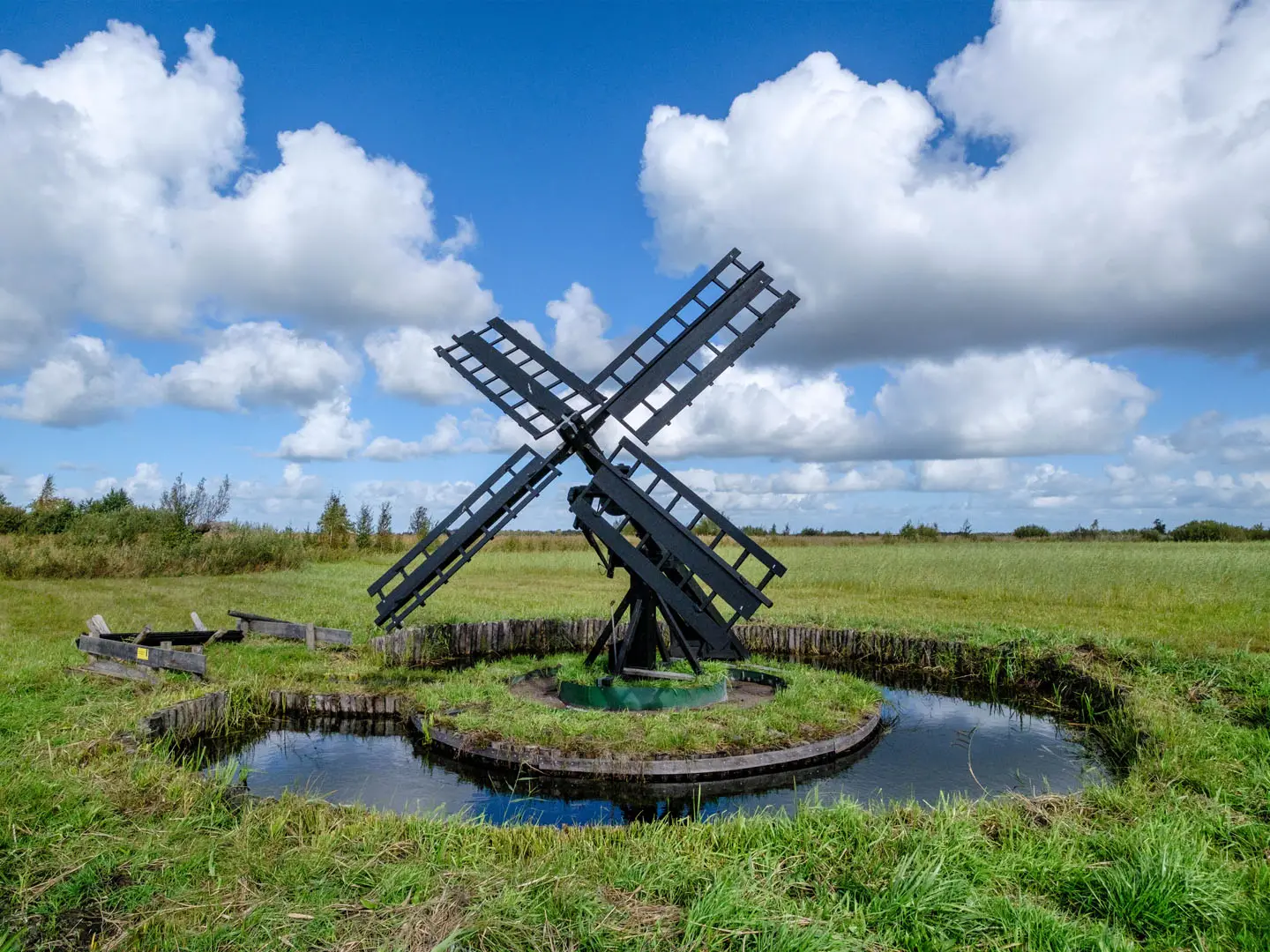
Weerribben-Wieden Trail
How would you rate Weerribben-Wieden Trail?
Tap a star to share your experience and help other hikers.
Weerribben-Wieden Trail: A 150 km Wetland Loop
HikeList Score
Weerribben-Wieden Trail scored 89/100 on HikeList's trail-quality metrics.
See score breakdownHide breakdown
- Ideal length 96
- Balanced challenge 90
- Scenery & wildness 78
- Varied terrain 100
- Accommodation 83
- Food & support 88
- Path quality 92
- Season flexibility 89
Computed from length, challenge, scenery & wildness, terrain variety, accommodation, food & support, path quality and season flexibility.
The Weerribben-Wieden Trail is the Weerribben-Wiedenpad / WaterReijkpad, a waymarked 150 km circular streekpad in Overijssel, the Netherlands. Starting and finishing at Steenwijk, it loops through Weerribben-Wieden National Park, a huge lowland peat-bog and freshwater-fen landscape of canals, reed beds, lakes and polders. Allow about 8–10 days. The walking is easy to moderate: almost flat, but long, often wet underfoot, and best suited to hikers who enjoy quiet lowland landscapes, wildlife and village-to-village stages.
Route Overview
The loop starts at Station Steenwijk / Stationsplein, by network marker paal B60, and can be walked in either direction or split into stages. Officially it is divided into 9 etappes, including Steenwijk to Giethoorn, Giethoorn to Wanneperveen, stages through Vollenhove, Sint Jansklooster, Muggenbeet, Blokzijl, Kalenberg, Oldemarkt, Paasloo, De Eese and a final Woldberg stage back to Steenwijk. Waymarking uses white-and-blue markers on the Wandelnetwerk WaterReijk poles. For other Dutch lowland hiking, compare the wetland focus of the Biesbosch National Park Trail, the regional character of the Drenthepad, or the northern landscapes of the Friese Woudenpad.
Peat, Reed and Reclaimed Wetland
This landscape is man-made. From the Middle Ages onwards, peat was cut for fuel, leaving narrow extraction trenches, drying strips and peat islands: the trekgaten, legakkers and ribben that still shape the route. Wind and water widened some areas into the open lakes of De Wieden. Reed has long been grown and harvested for thatch. The area later recovered into a major wetland, with otters successfully reintroduced, and Weerribben and De Wieden were combined as Weerribben-Wieden National Park in 2009.
Notable highlights
- Giethoorn: The celebrated car-free “Venice of the North”, with thatched farmhouses, canals and arched wooden footbridges. The trail reaches it on the first stage from Steenwijk.
- De Weerribben and De Wieden reed marshes: The core landscape of the route: harvested reed beds, peat trenches, islands, lakes and marsh. It is prime habitat for bittern, purple heron and otter.
- Blokzijl: A historic former Zuiderzee harbour town with a sheltered harbour and old merchants’ houses. It makes a memorable waypoint on the western side of the loop.
- Vollenhove and Sint Jansklooster: Vollenhove is a former Zuiderzee town, while Sint Jansklooster has a belvedere tower with views over the wetlands. Together they mark the shift from farmland into fen.
- Woldberg: At about 26 m NAP, this wooded rise is the high point of the route and of the small Steenwijker Heuvelland. It gives rare elevation on an otherwise flat walk.
- Otters and birdlife: Weerribben-Wieden is a stronghold for reintroduced European otters and marshland birds. Hides and observation points along the network reward a slow pace.
Challenges to expect
Do not expect climbs: the difficulty is distance, moisture and repetition. Much of the route is flat polder road, unpaved track, reed-land path, dike and occasional boardwalk; after rain, low ground can be soft or muddy. Waterproof footwear is sensible. In high summer, insects can be irritating. Navigation is by white-and-blue markers on walking-network poles, but carry the route guide or a reliable map for junction choices.
HikeList Score
Weerribben-Wieden Trail scored 89/100 on HikeList's trail-quality metrics.
See score breakdownHide breakdown
- Ideal length 96
- Balanced challenge 90
- Scenery & wildness 78
- Varied terrain 100
- Accommodation 83
- Food & support 88
- Path quality 92
- Season flexibility 89
Computed from length, challenge, scenery & wildness, terrain variety, accommodation, food & support, path quality and season flexibility.
 Netherlands
Show more data Show less
- Wetland
- Polder
- Reed Beds
- Lakes
- Farmland
- Woodland
- Paved Roads
- Unpaved Tracks
- Reed Land Paths
- Boardwalks
- Dikes
- Forest Trails
- B&Bs
- Hotels
- Campsites
- Family Friendly
- Pet Friendly
- Restrooms
- Water Sources
- Campsites
- Picnic Areas
Download Our Full Guide to Weerribben-Wieden Trail FREE!
Get our comprehensive guide to this hike for free. Save it for later reading or print out at home.
Photos from hikers
Taken on the trail by people who've reviewed Weerribben-Wieden Trail.
Weerribben-Wieden Trail: The Complete Guide
 i
Image by HollandPhotostock.nl
i
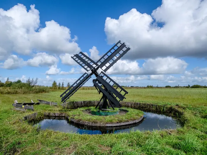
Image by HollandPhotostock.nl The Weerribben-Wieden Trail is a 150 km circular streekpad through the Netherlands’ largest freshwater wetland, starting and finishing at Station Steenwijk. It suits walkers who want a lowland journey of reed beds, canals, water villages and quiet polder rather than mountains or technical ground.
The route links places such as Giethoorn, Vollenhove, Blokzijl, Kalenberg, Ossenzijl and Oldemarkt, using the white-and-blue markers of Wandelnetwerk WaterReijk. Much of the character comes from the man-made fen landscape: peat trenches, reed-harvesting strips, dikes, lakes and narrow paths between water and field.
This is gentle walking in gradient only. The challenge is covering long daily distances on flat but sometimes soft, wet or muddy ground, with exposure to wind, summer insects and repeated stretches where services are spread out.
Steenwijk’s railway station makes the loop straightforward without a car, and the village-to-village structure works well for B&B, small hotel or campsite itineraries. Giethoorn-area accommodation should be booked early in busy summer periods.
This guide covers stages, days, accommodation, food, transport, terrain and common mistakes.
Stage-by-Stage Guide
Stage 1: Steenwijk Station to Giethoorn — approx. 16 km
This is the standard opening stage from Station Steenwijk / Stationsplein, near walking-network marker B60, and gives an immediate practical advantage: the route starts directly from rail access rather than from a remote trailhead. The walking is gentle and low-level, leading away from the fortified town of Steenwijk towards the water village of Giethoorn.
Underfoot, expect typical lowland conditions rather than hillwalking terrain: paved lanes, tracks, damp field-edge or polder sections, and paths that can become soft after rain. Waterproof footwear is sensible even on a dry forecast, as the wider route crosses wet peat-fen country.
Giethoorn is the clear landmark of the day. Its thatched farmhouses, narrow canals and wooden footbridges make it one of the busiest places on the whole trail, particularly in summer.
Food, water and overnight options are best planned around Steenwijk at the start and Giethoorn at the finish. Giethoorn-area beds should be booked early in the main season, as demand is high.
Public transport is strongest at Steenwijk, with the railway station on the Zwolle–Leeuwarden line. Giethoorn and the surrounding villages have local transport links, but bus and any seasonal water connections should be checked before travelling.
Navigation should be straightforward if following the white-and-blue Wandelnetwerk WaterReijk waymarks, but the walking-network pole system means paying attention at junctions. In Giethoorn, visitor foot traffic, bridges and waterside paths can make the route feel busier and less linear than the quieter fen stages.
Stage 2: Giethoorn to Wanneperveen — approx. 19 km
This stage continues through the wetland fringe south of Giethoorn towards Wanneperveen, with the character shifting from the famous canal village into quieter lowland walking. The day is still almost flat, so the effort comes from distance, damp ground and a steady rhythm rather than ascent.
Paths and tracks may include a mix of paved minor road, polder lane, unpaved track and wetland-edge walking. After wet weather, expect mud, standing water on low paths and soft verges.
The main interest is the transition from village canals into the broader De Wieden landscape: reed beds, ditches, open water and the pattern of peat-cutting country. Birdlife is a major reason to take this stage slowly, with marshland species possible around the quieter wetland margins.
Use Giethoorn for supplies before setting out and do not rely on frequent services between the stage ends. Wanneperveen is the practical end point for accommodation planning, but availability should be checked and booked ahead.
Road access is possible at the villages, and regional buses may be useful for section walkers. Current local bus times should be checked before relying on them, especially outside peak visitor periods.
The navigation issue on this stage is not complex terrain but the density of waterways, minor lanes and walking-network junctions. Keep following the white-and-blue markers and check the latest route guide where paths split around canals, ditches or village edges.
Stage 3: Wanneperveen to Vollenhove via Sint Jansklooster — approx. 21 km
At about 21 km, this is one of the longer days on the published itinerary. It links Wanneperveen with Vollenhove via Sint Jansklooster, crossing more of the De Wieden side of the national park.
The terrain remains low, wet and open, with a mixture of dikes, tracks, paved lanes and wetland paths. The flat profile can be deceptive: long straight sections and soft surfaces can make the day feel longer than the elevation profile suggests.
Sint Jansklooster is the key intermediate place. The belvedere viewing tower at Kaap De Wieden is an important landmark, offering panoramic views over the wetlands; it should not be confused with the route’s natural high point, which is De Woldberg on the final stage.
Vollenhove makes a strong finish to the day, with its former Zuiderzee-town character and better suitability as an overnight stop than the open wetland sections. Plan food and water around the settlements and carry enough for the full stage, as services between them may be limited or seasonal.
Vollenhove and Sint Jansklooster provide road access points, and regional buses may help with section walking or shortening the day. Timetables should be checked before travelling.
Navigation is generally waymarked on the WaterReijk network, but this is a stage where a current route guide or downloaded map is useful for junctions around Sint Jansklooster and the approach to Vollenhove. In warm months, insect cover is worth having on exposed wetland stretches.
Stage 4: Vollenhove to Muggenbeet — approx. 19 km
This stage leaves the historic edge of Vollenhove and moves back towards quieter wetland and polder country. It is a low, steady day with little physical difficulty beyond time on feet.
Expect a practical mix of dike, minor road, track and damp lowland paths. Where the route runs close to reed beds, ditches and open wet ground, footwear with good water resistance is useful.
The day’s appeal is the return to the working fen landscape: reeds, drainage channels, open skies and small settlements rather than major tourist landmarks. Muggenbeet is a modest but useful stage end on the western side of the loop.
Food and water should be planned carefully. Vollenhove is the place to start with full bottles and supplies; do not assume regular places to buy food across the intervening lowland sections. Accommodation at or near Muggenbeet should be arranged in advance, as options may be more spread out than in Steenwijk, Giethoorn or Vollenhove.
Road access exists at the settlement ends, and local buses may serve parts of the area. Check current transport before using this stage as a one-day section.
The main warning is monotony rather than danger: long flat stretches can be mentally tiring in wind, rain or hot sun. Navigation remains based on white-and-blue markers, but take care at minor-road and track junctions where several walking-network options may share the same area.
Stage 5: Muggenbeet to the Kalenberg area via Blokzijl — approx. 20 km
This is one of the most varied and memorable stages, linking Muggenbeet with the Kalenberg area and passing through Blokzijl. At around 20 km, it is a full day, but the walking remains almost level.
The route continues through wetland, polder and waterside country, with surfaces likely to vary between paved lanes, dikes, tracks and softer paths near reed beds or drainage channels. After rain, expect mud and slower going on unpaved sections.
Blokzijl is the main landmark, a historic former Zuiderzee harbour town with a sheltered harbour and Golden Age merchants’ houses. It makes a natural place to pause before the route turns back towards the reed-land heart of the national park.
The finish in the Kalenberg area places you close to one of the classic Weerribben landscapes: reed-cutters’ cottages, water-bound lanes and traditional small mills. Accommodation should be booked ahead, especially if the exact overnight location is not directly on the marked line.
Use Muggenbeet and Blokzijl as the main planning points for food and water. Carry enough to finish the stage, as the reed-land stretches approaching Kalenberg should not be treated as service-rich.
Blokzijl gives useful road access and may be a practical section break. Regional bus links and seasonal water options in the wider area should be checked before travelling.
Navigation deserves care on this stage because some stage breakdowns label this part of the loop differently, particularly around Muggenbeet, Blokzijl, Kalenberg and nearby overnight choices. Follow the latest WaterReijk waymarking and route guide rather than relying only on a stage title.
Stage 6: Ossenzijl to Oldemarkt via De Weerribben and Woldlakebos — approx. 16 km
Stage 6 crosses the Weerribben side of the national park, including the De Weerribben / Woldlakebos area, before finishing in Oldemarkt. Depending on where you slept after Stage 5, there may be a short transfer or positioning walk to the Ossenzijl start; this should be planned before booking accommodation.
The terrain is classic lowland wetland walking: reed marsh, ditches, peat-cutting patterns, tracks, paths and occasional wetter sections. It is not strenuous in gradient terms, but mud, soft ground and insects can slow the day.
This is one of the best stages for understanding the man-made fen landscape of trekgaten, legakkers and ribben. The De Weerribben marshes are also prime wildlife country, with otters reintroduced in the national park and marsh birds such as bittern, purple heron and black tern associated with the area.
Ossenzijl and Oldemarkt are the main service and accommodation planning points. Carry food and water for the wetland crossing, as the intervening nature areas are not places to rely on shops or cafés.
Road access is available at Ossenzijl and Oldemarkt. Regional buses may be useful, but current services should be checked before travelling, especially if using this as a standalone section.
Navigation is normally clear on the waymarked network, but reed-land paths and forest-edge tracks around Woldlakebos can make it important to watch for poles and markers at every junction. In high summer, insect repellent or covering clothing can make the stage much more comfortable.
Stage 7: Oldemarkt to Paasloo along the Linde — approx. 16 km
This stage leaves Oldemarkt and follows the Linde corridor towards Paasloo. It is a quieter inland day after the core marsh stages, still with very little ascent.
Expect flat paths, tracks, minor roads and riverside or lowland sections. The ground can remain damp, particularly after rain, so the same wet-footwear approach applies even away from the most obvious reed marsh.
The Linde gives the day its main line and sense of direction. Compared with Giethoorn, Blokzijl or Kalenberg, the appeal here is lower-key: open countryside, water, farmland and the gradual move towards the wooded rises encountered later in the loop.
Oldemarkt is the obvious place to leave with supplies. Paasloo is the stage-end accommodation point, but options should be checked and booked ahead rather than left to chance.
Both Oldemarkt and Paasloo provide road access for section walking. Any local bus option should be checked before travelling, as services in smaller villages may be limited.
Navigation is generally uncomplicated, but river and lowland walking often involves junctions with farm tracks, access paths and local walking routes. Continue to follow the white-and-blue WaterReijk markers and keep a map or current guide available for confirmation.
Stage 8: Paasloo to De Eese — approx. 18 km
Stage 8 takes the route from Paasloo towards De Eese, beginning the transition from wetland and polder walking to the slightly more wooded country north of Steenwijk. It remains a lowland stage, but the scenery starts to feel less dominated by reed marsh.
Surfaces are likely to include minor roads, tracks, field-edge paths and woodland approaches. The route is still not technically difficult, though wet ground and mud can persist on unpaved sections.
De Eese is the key end point and sets up the final crossing of De Woldberg. This is a useful place to break the loop before returning to Steenwijk, but accommodation availability should be checked before committing to this stage plan.
Food and water should be planned from Paasloo, with enough carried for the day. Do not assume regular resupply between the smaller settlements and the De Eese area.
Road access at Paasloo and De Eese can support section walking or luggage arrangements. Local public transport may not be as straightforward as at Steenwijk, so check current bus options before relying on them.
Navigation is primarily a matter of staying alert at rural junctions and where local paths enter woodland or estate-like country. If walking after heavy rain, allow extra time for muddy tracks and avoid planning a tight onward connection.
Stage 9: De Eese to Steenwijk over De Woldberg — approx. 11 km
The final stage is the shortest day on the standard nine-stage itinerary, returning from De Eese to Steenwijk over De Woldberg. This is the only part of the route that gives any real sense of height, though the high point is still only about 26 m above NAP.
The terrain changes noticeably with more woodland on and around De Woldberg, the high point of both the route and the small Steenwijker Heuvelland. The total ascent on the whole trail is negligible by hillwalking standards, but this stage provides a welcome contrast to the fen and polder kilometres already completed.
The key highlight is the wooded rise itself before the route drops back towards Steenwijk. On returning to the town, the fortified setting, ramparts, Sint Clemenskerk tower and Rams Woerthe park area make a satisfying finish to the loop.
Carry enough food and water from De Eese for the short stage, but Steenwijk is the practical place for post-walk services, onward travel and any final overnight stay. Accommodation in Steenwijk is the simplest option if finishing late or connecting by train the next morning.
Steenwijk has the best transport access on the route, with its railway station on the Zwolle–Leeuwarden line and connections into the wider Dutch rail network. Check current NS train times before travelling.
Navigation remains on the white-and-blue waymarked network, with extra attention needed where woodland paths meet on De Woldberg. There are no mountain hazards, but wet leaves, mud and shaded tracks can be slippery after rain.
Recommended Itinerary
The cleanest way to walk the Weerribben-Wieden Trail is to follow the published 9-stage rhythm, starting and finishing at Station Steenwijk. The route is flat, but the daily distances are long enough that accommodation should be tied carefully to the actual mapped stage end, especially around the smaller wetland villages.
Distances are approximate. Use the latest WaterReijk route guide or official mapping before booking beds, particularly where stage labels differ around Kalenberg, Ossenzijl and the central Weerribben section.
Standard itinerary: 9 walking days
| Day | From | To | Approx. distance | Why this stage makes sense | Services/accommodation notes |
|---|---|---|---|---|---|
| 1 | Steenwijk (Station) | Giethoorn | 16 km | A manageable first day straight from the railway station, with enough distance to leave Steenwijk and reach the best-known water village on the route. | Steenwijk is the easiest public-transport access point. Giethoorn is busy in summer, so book accommodation well ahead. |
| 2 | Giethoorn | Wanneperveen | 19 km | Keeps the route moving through the De Wieden side of the wetland without making the second day excessive. | Accommodation and services become more spread out after Giethoorn. Secure a bed in or near Wanneperveen before committing to this stage. |
| 3 | Wanneperveen | Vollenhove, via Sint Jansklooster | 21 km | One of the longer standard days, but it reaches Vollenhove rather than leaving an awkward stop between villages. Sint Jansklooster gives a clear mid-stage landmark. | Vollenhove is a more practical overnight target than a very small intermediate settlement. If 21 km is too much, look for a split around Sint Jansklooster, but this should be checked before travelling. |
| 4 | Vollenhove | Muggenbeet | 19 km | A steady day from the former Zuiderzee town back towards quieter wetland country, keeping the distance just under 20 km. | Muggenbeet is a small place, so do not rely on turning up without a booking. Check food and accommodation options in advance. |
| 5 | Muggenbeet, via Blokzijl | Kalenberg area | 20 km | Links Blokzijl with the classic reed-land villages of the Weerribben, making it one of the more characterful wetland stages. | Blokzijl is a useful waypoint, but the overnight target should be chosen carefully. Make sure your booked bed in the Kalenberg area matches the next morning’s route towards Ossenzijl. |
| 6 | Ossenzijl | Oldemarkt, via De Weerribben / Woldlakebos | 16 km | A shorter day after several 19–21 km stages, with time to move through the heart of De Weerribben without rushing. | Check how your night-before accommodation connects with the Ossenzijl start point on the route. Oldemarkt is one of the more practical overnight stops on this side of the loop. |
| 7 | Oldemarkt | Paasloo, along the Linde | 16 km | Another moderate-distance day, useful for keeping the later part of the walk from becoming too compressed. | Arrange accommodation in or near Paasloo ahead of time, as options are not as dense as in larger towns. |
| 8 | Paasloo | De Eese | 18 km | Positions the final day neatly for the short return to Steenwijk over the Woldberg. | De Eese is a practical staging point only if accommodation is available for your dates. If not, consider the faster variant below or adjust the final two days. |
| 9 | De Eese | Steenwijk, over the Woldberg | 11 km | A short final stage over the route’s modest high point, leaving time for onward travel from Steenwijk. | The trail finishes back at Steenwijk, with rail connections from Station Steenwijk. Check current NS train times before planning a same-day departure. |
Slower variant: 10 days
A 10-day plan suits walkers who prefer shorter days, want more time for birdlife and wetland stops, or are walking in high summer when heat and insects can make long lowland stages feel slower.
The most useful way to slow the route down is to split one of the longer middle stages, rather than simply adding a rest day. The best candidates are:
- Wanneperveen to Vollenhove via Sint Jansklooster — split only if accommodation or transport works around Sint Jansklooster. This should be checked before travelling.
- Muggenbeet to the Kalenberg area via Blokzijl — Blokzijl is a logical extra overnight stop if accommodation is available, turning a 20 km day into two shorter wetland-side days. Check official mapping before booking, as exact split distances depend on the chosen overnight location.
A spare night in Giethoorn is also sensible in peak season, especially if accommodation availability forces a later start or if a slower visit to the village is part of the plan. This does not shorten the walking stages by itself, but it can make the first part of the trip easier to organise.
Faster variant: 8 days
An 8-day itinerary is possible for strong walkers by keeping Days 1–7 as above, then combining the final two stages:
| Day | From | To | Approx. distance | Why this stage makes sense | Services/accommodation notes |
|---|---|---|---|---|---|
| 8 | Paasloo | Steenwijk, via De Eese and the Woldberg | 29 km | Avoids the need for an overnight at De Eese and finishes directly at the railway station in Steenwijk. | This is a long final day despite the flat terrain. Soft ground, wet paths and end-of-walk fatigue can make it slower than the profile suggests. |
This faster version suits fit walkers who are comfortable with a near-30 km day on lowland paths and who have already booked accommodation so the earlier stages run smoothly. Compressing the route further is usually less practical, because the challenge of this trail is repeated distance over wet, soft and sometimes monotonous ground rather than ascent.
The whole itinerary can be reversed, as the Weerribben-Wieden Trail is a loop. Reversing the stages is straightforward in principle, but accommodation and public-transport timings should still be checked before booking.
Planning the Route
How many days to allow
Most walkers should plan around the published 9-stage version of the Weerribben-Wiedenpad. The terrain is almost flat, but the days are still proper walking days: several stages sit around 19–21 km, and soft reed-land paths, muddy low ground and exposed polder roads can make progress slower than the map suggests.
An 8-day itinerary is realistic for strong walkers who are happy combining stages or using longer days. A 10-day plan is often more comfortable, especially if accommodation availability forces a shorter or longer split, or if time is wanted for Giethoorn, Blokzijl, Kalenberg and the wetland viewpoints.
This is not a route that rewards rushing. The main interest is the fen landscape, birdlife, canals, reed beds and water villages, so a steady village-to-village pace suits it better than trying to treat it as a fast endurance walk.
Direction and stage planning
The loop normally starts and finishes at Station Steenwijk / Stationsplein, by walking-network marker B60. It can be walked in either direction, and there is no major ascent-based reason to choose one over the other.
The most practical approach is to build the itinerary around available accommodation in the recognised stage hubs: Steenwijk, Giethoorn, Wanneperveen, Vollenhove, Muggenbeet, Blokzijl, Kalenberg, Ossenzijl, Oldemarkt, Paasloo and De Eese. The published stages are useful, but accommodation may require small adjustments, particularly around the Kalenberg / Ossenzijl part of the route.
Giethoorn is the place to book earliest in summer. It is a major visitor destination as well as a stage stop, so walkers relying on a specific bed there should not leave reservations until late.
A practical 9-day structure
The following structure matches the usual village-to-village rhythm of the trail and is a sensible starting point for accommodation planning.
| Day | Section | Planning notes |
|---|---|---|
| 1 | Steenwijk Station to Giethoorn | A straightforward first day from the railhead; useful if arriving by train in the morning. |
| 2 | Giethoorn to Wanneperveen | Book ahead if staying in or near Giethoorn before this stage. |
| 3 | Wanneperveen to Vollenhove via Sint Jansklooster | One of the longer days; allow time if visiting the viewing tower at Kaap De Wieden. |
| 4 | Vollenhove to Muggenbeet | Plan food and water before leaving larger settlements. |
| 5 | Muggenbeet via Blokzijl to the Kalenberg area | Accommodation location matters here; check exactly where the night’s lodging sits in relation to the route. |
| 6 | Ossenzijl to Oldemarkt via De Weerribben / Woldlakebos | A wetland-heavy section where footwear and insect protection matter in warm weather. |
| 7 | Oldemarkt to Paasloo along the Linde | Services should be checked before relying on them mid-stage. |
| 8 | Paasloo to De Eese | A transition towards the wooded rises north of Steenwijk. |
| 9 | De Eese to Steenwijk over De Woldberg | Shorter final stage, returning to the railway station area in Steenwijk. |
Stage boundaries are not rigid. The route is a waymarked loop rather than a hut-to-hut trail, so the best itinerary is the one that lines up with real beds, campsites, bus options and the walker’s preferred daily distance.
Shortening, extending and section hiking
Shortening the route is easiest by treating it as a series of sections from village hubs rather than trying to create wilderness shortcuts. Steenwijk is the strongest anchor point because it has rail access, and several villages on or near the loop have regional bus links, but current local bus times should be checked before relying on them.
Seasonal water transport may also be useful in the area, but it should not be assumed to run daily or year-round. This should be checked before travelling.
Section hiking is practical for walkers based in the region or using Steenwijk as a transport base. The main limitation is not terrain but logistics: some stage ends are small settlements, and connections may be infrequent outside busy periods.
Extending the walk is usually best done by adding rest or half-days rather than adding distance. Giethoorn, Blokzijl, Kalenberg, Sint Jansklooster and the Weerribben-Wieden wetland areas all suit a slower schedule, especially for walkers interested in birds, otters and photography.
Accommodation planning
Accommodation is mixed: B&Bs, small hotels, inns and campsites are found in and around the trail towns and water villages. There is also a dedicated WandelReijk B&B-to-B&B arrangement, and the official route guide lists accommodation addresses.
Do not assume every stage end has plentiful last-minute choice. Beds are spread out in places, and a booking that is only a few kilometres off-route can add an unwelcome road walk at the end of a long, wet day.
For an independent itinerary, book the first few nights and the Giethoorn-area night early, then work carefully through the middle of the route around Muggenbeet, Blokzijl, Kalenberg and Ossenzijl. If camping, check each campsite’s opening season and whether advance reservation is needed.
Food and water
This is not a remote mountain route, but some stretches cross reed marsh, polders, dikes and quiet farmland where services may be limited. Start each day with enough water and food to finish the stage if cafés or shops are closed.
Food planning is especially important on Sundays, public holidays and outside the main visitor season. Opening hours in small villages can vary, so shops, cafés and evening meal options should be checked before travelling.
Tap-water refills depend on accommodation, cafés and public facilities rather than natural sources. Do not plan to drink untreated water from canals, lakes, ditches or peat trenches.
Navigation and route resources
The Weerribben-Wiedenpad is waymarked with white-and-blue markers on the Wandelnetwerk WaterReijk poles. Waymarking is a major help, but the landscape can be visually repetitive in reed beds, polders and dike sections, so a current route guide or downloaded mapping is still sensible.
The printed route guide is sold locally at Tourist Information points and costs about €5.95; confirm the current price before buying. It is worth having the latest version because small route changes, accommodation listings and walking-network details can change over time.
A phone with offline maps is useful, but should not be the only navigation plan. Carrying a power bank is sensible on a multi-day route, particularly if using the phone for GPS, transport checks and accommodation communication.
Transport planning
Steenwijk is the simplest access point, with its own railway station on the Zwolle–Leeuwarden line and direct trains from Zwolle. This makes the loop well suited to car-free walkers.
Check current NS train times before fixing arrival and departure plans. If using buses to shorten stages, skip a section or return to Steenwijk from a village, check local timetables carefully; services can be much less convenient than the rail connection at the start and finish.
Because the route is circular, leaving a car in Steenwijk is possible in principle, but the strongest logistical advantage of this trail is that the start and finish are directly linked to the Dutch rail network.
Weather, ground conditions and insects
The route’s difficulty is shaped more by moisture than by gradients. After rain, low paths through peat-fen, reed-land and polder can be soft, muddy or waterlogged, so waterproof walking shoes or lightweight boots are a better choice than minimal trainers.
In summer, insects can be a real nuisance in still wetland areas. Long sleeves, repellent and a willingness to keep moving through reed beds can make the difference between an enjoyable day and a frustrating one.
There is little ascent and little shelter on some open polder and dike sections. Carry waterproofs even in settled weather, and treat wind, rain and sun exposure as normal lowland planning factors rather than mountain hazards.
Towns, Villages and Overnight Stops
Accommodation is available in and around the main towns and water villages on the Weerribben-Wiedenpad, but it is not evenly spread. The easiest planning is either to follow the published 9-stage pattern and pre-book each night, or to use the dedicated WandelReijk B&B-to-B&B arrangement and the current route guide’s accommodation list.
Giethoorn is the place most likely to create pressure on beds, especially in summer. Book early there, and avoid assuming that the smaller reed-land villages will have last-minute rooms, meals or shops.
| Place | Role on the route | Overnight usefulness | Service-planning note |
|---|---|---|---|
| Steenwijk | Start/finish | Strong | Best transport access; railway station on the Zwolle–Leeuwarden line |
| Giethoorn | End of Stage 1 | Strong but busy | Book well ahead in summer |
| Wanneperveen | End of Stage 2 | Useful | Smaller stop; pre-book accommodation and food plans |
| Sint Jansklooster | On Stage 3 | Useful waypoint | Good for a break and the Kaap De Wieden viewpoint; overnight plans should be checked |
| Vollenhove | End of Stage 3 | Strong | One of the better historic town stops on the western side of the loop |
| Muggenbeet | End of Stage 4 / Stage 5 start area | Limited-use stop | Treat as a pre-booked stop, not a place to improvise |
| Blokzijl | On Stage 5 | Strong waypoint / possible stop | Historic harbour town; useful for food and accommodation planning |
| Kalenberg | End of Stage 5 area | Useful but limited | Classic Weerribben reed village; pre-book beds in the area |
| Ossenzijl | Stage 6 start area | Useful | Practical gateway into De Weerribben; check accommodation and onward transport |
| Oldemarkt | End of Stage 6 | Strong | One of the more practical service bases on the northern/eastern side |
| Paasloo | End of Stage 7 | Useful but smaller | Pre-book and do not rely on extensive shops or eating options |
| De Eese | End of Stage 8 area | Limited-use stop | More of a route area than a large service village; plan carefully |
| Woldberg | Final-stage high point area | Not a normal overnight stop | Woodland walking and the route high point before returning to Steenwijk |
Steenwijk
Steenwijk is the practical start and finish for the loop, with the usual start at Station Steenwijk / Stationsplein near walking-network marker B60. It is the strongest transport base on the trail because it has its own railway station on the Zwolle–Leeuwarden line, with onward connections through the Dutch rail network.
For overnight planning, Steenwijk is the safest place to stay before the first stage or after finishing the loop. It is one of the named accommodation hubs on the route, with B&Bs, small hotels/inns and campsites in and around the town.
Food and resupply are most sensible here before setting out, especially if starting late in the day or walking outside the busiest season. Current opening hours, local bus times and any onward connections should be checked before travelling.
Hikers may also want time in Steenwijk itself, a fortified town with ramparts, the Sint Clemenskerk tower and Rams Woerthe in its park. Those are useful low-effort additions either side of the walk rather than reasons to extend a walking day.
Giethoorn
Giethoorn is reached at the end of the first stage from Steenwijk and is one of the most recognisable stops on the whole route. It is a water village of thatched farmhouses, narrow canals and wooden footbridges, and it is the stop most likely to feel busy compared with the quieter wetland stages.
It is a very good overnight stop, but also the one where early booking matters most. Summer demand can be high, so do not leave Giethoorn-area accommodation until the last minute.
Expect the best practical choice to be B&Bs, small hotels/inns and campsites in or around the village rather than a single large hiker facility. Food is more likely to be available here than in the smaller reed-land settlements, but opening hours and seasonal closures should still be checked before committing to a long day without supplies.
Regional buses and seasonal water links may be useful for joining, leaving or shortening this part of the route. This should be checked before travelling.
Wanneperveen
Wanneperveen is the usual second-night target after the stage from Giethoorn. It sits on the southern side of the route as the trail moves through the De Wieden landscape towards Sint Jansklooster and Vollenhove.
It is a useful overnight stop, but it should be treated as a pre-booked village stop rather than a place to arrive and search. Accommodation availability is more limited than in Steenwijk or Giethoorn, so use the current route guide, booking platforms or the WandelReijk arrangement before setting off.
Food planning matters here. Do not assume that evening meals, packed-lunch supplies or shops will be available at the exact time needed; confirm opening hours with the accommodation or local businesses in advance.
Regional bus links may help with access or a bail-out, but services in rural Overijssel should not be treated like city transport. This should be checked before travelling.
Sint Jansklooster
Sint Jansklooster is passed on the stage from Wanneperveen to Vollenhove. For many walkers it is more of a daytime waypoint than a fixed overnight stop, but it can be useful when adjusting stage lengths.
The main reason to pause here is the belvedere viewing tower at Kaap De Wieden, a converted water tower giving broad views over the wetlands. Keep this separate from the route high point: De Woldberg near Steenwijk is the natural high point of the walk, while the Sint Jansklooster tower is a built viewpoint.
Accommodation, food and transport should be planned rather than assumed. If using Sint Jansklooster to split a stage, confirm both a bed and an evening meal before committing to the revised itinerary.
Vollenhove
Vollenhove is the end of the third stage when walking the route in the order listed here, reached from Wanneperveen via Sint Jansklooster. It is one of the stronger overnight towns on the western side of the loop.
Accommodation is more promising here than in the smaller wetland hamlets, with B&Bs, small hotels/inns and campsites forming the general pattern along this route. It is still wise to book ahead, especially if walking at weekends or during holiday periods.
As a former Zuiderzee town, Vollenhove is also a good place to slow the pace rather than treating it as only a bed stop. It gives a more substantial break between the open wetland stages, and is a sensible point for food, laundry or recovery time if services line up with your accommodation.
Regional buses may be useful from Vollenhove for public-transport adjustments. Current timetables should be checked before relying on them.
Muggenbeet
Muggenbeet is used as the end point of the fourth stage and the start area for the following leg towards Blokzijl and Kalenberg. It sits in the quieter western wetland section, where services are more spread out.
This is a stop to organise in advance. It may work well as part of a B&B-to-B&B itinerary, but it should not be treated as a large service village with guaranteed last-minute options.
Food is the main practical issue. Confirm whether dinner and breakfast are available where you stay, and carry enough daytime food to cover the next stretch if services do not fall conveniently along the path.
Transport options may exist through regional buses or seasonal water links in the wider area, but they need checking carefully. This should be checked before travelling.
Blokzijl
Blokzijl is a key waypoint on the western side of the loop, normally reached on the stage from the Muggenbeet area towards Kalenberg. It is a historic former Zuiderzee harbour town and one of the more memorable service stops on this part of the trail.
For overnight planning, Blokzijl is stronger than the smallest reed villages and can be considered either as a lunch stop, an overnight alternative or a useful point to reshape stages. If changing the official stage pattern, check that the following day’s distance and accommodation still work, as the route soon returns to quieter wetland country.
Food and cafés are more plausible here than in the surrounding marshland, but opening hours vary and should be checked before depending on them. It is a sensible place to top up supplies if the timing works.
Regional buses may help if using Blokzijl as a joining or leaving point. This should be checked before travelling.
Kalenberg
Kalenberg is the usual overnight area after the long stage via Blokzijl. It lies in the heart of the Weerribben landscape, with reed-cutters’ cottages, traditional small mills and a strongly water-bound setting.
It is an excellent atmospheric stop, but practical planning is essential. Accommodation in the Kalenberg area should be booked ahead, as beds can be spread out and the next stage logistics depend on where exactly you stay.
Do not assume a full range of shops or evening food. Confirm meals with the accommodation, and carry enough food for the next day if starting early or walking outside the main visitor season.
Local transport should also be checked before relying on it. In this part of the route, the walking is easy underfoot in gradient terms, but a missed bus or closed kitchen can turn a simple stage into a long logistical day.
Ossenzijl
Ossenzijl is used as the start area for the stage through De Weerribben and Woldlakebos towards Oldemarkt. It is a practical gateway into one of the core wetland sections of the route.
It can work as an overnight stop, especially if the previous day is adjusted around Kalenberg or if accommodation availability makes the published stage split awkward. As with other smaller route villages, beds should be arranged in advance.
Food planning should be conservative. Check whether breakfast, packed lunches or nearby meals are available before arriving, and carry enough for the wetland section ahead.
Regional buses and seasonal water options may be useful in this area, but current times and operating periods should be checked before travelling.
Oldemarkt
Oldemarkt is the end of the stage from Ossenzijl through De Weerribben and Woldlakebos. It is one of the more practical overnight bases on the northern and eastern side of the loop.
Accommodation is part of the wider mix of B&Bs, small hotels/inns and campsites available around the trail’s main settlements. It is a good place to secure a proper night stop before the quieter stage along the Linde towards Paasloo.
Food and resupply are more likely here than in the smallest hamlets, but hikers should still check opening hours and avoid relying on late arrivals. If the following day’s route is started early, arrange breakfast and lunch in advance.
Oldemarkt is also a useful transport-check point if plans need to change. Regional buses link villages on and around the route, but current timetables should be checked before relying on them.
Paasloo
Paasloo is the usual overnight stop after the stage from Oldemarkt along the Linde. It marks the transition from the northern wetland and river-side walking towards the more wooded De Eese and Woldberg side of the loop.
It is a useful overnight stop, but smaller than the main towns. Book ahead and confirm exactly where the accommodation is relative to the trail, as even a short extra walk can matter at the end of a long flat day.
Food should be arranged before arrival. Confirm dinner, breakfast and any packed-lunch options, or carry what is needed from the previous service point.
Transport options should not be assumed. This should be checked before travelling.
De Eese
De Eese is the end area for the penultimate stage from Paasloo. It is best treated as a practical route area rather than a large settlement with extensive hiker services.
Overnighting here can work, but only with careful pre-booking. Confirm the exact location of the bed, whether an evening meal is available, and how far the next morning’s route is from the door.
This is also the point to prepare for the final short stage back to Steenwijk over De Woldberg. The distance is not long, but there may be limited opportunities to buy food before returning to town.
Regional transport, if needed, should be checked in advance. This should be checked before travelling.
Woldberg
De Woldberg is not a village stop in the normal accommodation sense. It is the low wooded rise crossed on the final stage from De Eese back to Steenwijk, and at about 26 m NAP it is the high point of the Weerribben-Wiedenpad.
There is no need to plan an overnight here unless using accommodation in the wider area. Most walkers simply cross the wooded section and continue down to Steenwijk, where rail connections and town services make the end of the loop straightforward.
Carry enough water and snacks from De Eese or the previous overnight stop, then use Steenwijk for the finish-day meal, onward travel or an extra night. Current train times from Station Steenwijk should be checked before fixing the final-day schedule.
Getting to the Start
The Weerribben-Wieden Trail is straightforward to start car-free because the loop begins at Station Steenwijk / Stationsplein in Overijssel. The usual starting point is by walking-network marker paal B60, and the route returns to the same place at the end of the circuit.
By train
Steenwijk is the key access point for the trail. The town has its own railway station on the Zwolle–Leeuwarden line, with direct trains from Zwolle and onward connections into the wider Dutch rail network.
For most international or long-distance arrivals, the simplest plan is to route to Zwolle first, then continue by train to Steenwijk. Check current NS train times before booking accommodation or committing to a same-day first stage. This should be checked before travelling.
Once at Station Steenwijk, there is no transfer needed to reach the trailhead. The first stage starts from the station area and heads towards Giethoorn.
By bus
Regional buses link villages around the route, including places used as stage hubs such as Giethoorn, Vollenhove, Blokzijl, Ossenzijl and Oldemarkt. These services are useful for shortening a day, recovering from a missed stage, or joining the loop somewhere other than Steenwijk.
Do not assume evening, Sunday or out-of-season frequency will be convenient, especially around smaller wetland villages. Local bus times should be checked against current timetables before relying on them. This should be checked before travelling.
Seasonal water links may also operate in parts of the region, but they should be treated as a bonus rather than core transport for a multi-day itinerary unless times are checked in advance.
By car
Because the route is a loop, driving to Steenwijk and returning to the same town at the end is logistically simple. The practical issue is parking for 8–10 days, not navigation to the start.
Use long-stay parking only where it is clearly permitted, and do not assume station or town-centre spaces allow multi-day parking. Current parking rules, charges and time limits in Steenwijk should be checked before leaving a vehicle for the full walk. This should be checked before travelling.
A car is not needed once on the trail. The route is designed as a village-to-village walking circuit, and Steenwijk’s rail access makes a car-free start the cleaner option for most walkers.
From the nearest airport
No airport sits directly at the trailhead. The normal approach is to enter the Dutch rail network and travel by train to Steenwijk, changing via Zwolle where necessary.
When arriving by air, allow enough margin for rail connections before beginning the first stage to Giethoorn. Starting the walk late in the day is unwise if accommodation is fixed ahead, as the first stage is around 16 km and the route uses local paths and wetland edges rather than a direct road walk.
Airport-to-Steenwijk rail routings and ticketing should be checked with current journey planners before travelling.
Where to stay before starting
Steenwijk is the most practical pre-walk base because the trail starts at the station and returns there at the end. Staying in town avoids needing a morning bus or taxi before the first stage.
If accommodation in Steenwijk is limited, nearby route towns and villages may work, but this adds a transfer before starting. For an efficient first day, avoid staying somewhere that requires an uncertain early bus connection back to Station Steenwijk.
Beds in the wider region can be busy in summer, especially around Giethoorn. Book the first few nights before travelling if walking in peak season or if following the published 9-stage itinerary.
Getting Home from the Finish
The Weerribben-Wieden Trail is a loop, so the finish brings you back to Steenwijk, normally at or close to Station Steenwijk / Stationsplein. This makes the end of the walk unusually straightforward: no shuttle is needed if you finish at the standard trailhead.
By train
Station Steenwijk is the key onward transport point. It sits on the Zwolle–Leeuwarden railway line, with direct trains from Zwolle and onward connections into the wider Dutch rail network.
For most walkers, the simplest plan is to finish the final stage from De Eese over De Woldberg into Steenwijk, then travel onwards by train the same day. Check current NS train times before committing to a tight connection, especially if finishing late, walking in poor weather, or relying on a same-day international connection.
If you are tired, muddy or delayed after the final stage, staying in Steenwijk and travelling the next morning is the safer option. The final day is short compared with earlier stages, but wet ground, navigation pauses and lowland weather can still slow progress.
By bus
Local and regional buses link villages around the route, but they are not normally needed to leave the finish because the trail returns directly to Steenwijk station. Bus times should be checked before travelling if you plan to break off before completing the loop or if your accommodation is outside Steenwijk.
Seasonal water links exist in the wider Weerribben-Wieden area, but they should not be treated as the main way home from the finish. For a reliable exit, plan around Station Steenwijk and the rail timetable.
By car/taxi
Because this is a circular route, walkers who leave a car in Steenwijk can return to the same town at the end of the hike. Parking arrangements, charges and time limits should be checked before travelling.
A taxi may be useful if your final accommodation is outside the centre, if you finish after local bus services have thinned out, or if you need to return to a car or lodging away from Station Steenwijk. Pre-booking is sensible for late finishes or busy summer periods.
From the nearest airport
No specific airport transfer is part of the trail logistics. The practical way to connect with flights is to take the train from Steenwijk via the wider Dutch rail network, typically changing at Zwolle for onward routes.
Airport rail connections, journey times and last trains depend on the airport and date of travel. This should be checked before travelling, particularly for early flights after the final stage.
Where to stay at the finish
Steenwijk has walker-friendly end-of-route logistics because it is both the start and finish town and has its own railway station. Accommodation in and around the trail includes B&Bs, small hotels and inns, with Steenwijk one of the main places to stay on the loop.
An overnight stop in Steenwijk is worth considering if onward trains would require a rushed finish, if you want to clean and dry gear before travelling, or if you are completing the route in wetter conditions. Book ahead in the main walking season rather than assuming late availability.
Which Direction Should You Walk?
The Weerribben-Wieden Trail is a loop, so there is no compulsory direction. In practice, the standard and simplest direction is to follow the published stage order from Station Steenwijk to Giethoorn, then on through Wanneperveen, Vollenhove, Muggenbeet, Blokzijl, Kalenberg, Ossenzijl, Oldemarkt, Paasloo and De Eese before returning over De Woldberg to Steenwijk.
Standard direction: Steenwijk to Giethoorn first
This is the easiest direction to plan because it matches the usual 9-stage structure. Accommodation searches, route notes and any B&B-to-B&B arrangements are more likely to make sense if followed in this order, even though individual stage boundaries can be adjusted.
The scenery progression also works well. The route begins with a clear objective — Giethoorn — then moves deeper into De Wieden and De Weerribben, through the old water and harbour settlements around Vollenhove and Blokzijl, before finishing with the small rise of De Woldberg on the final approach to Steenwijk.
That final day is also the shortest listed stage, at around 11 km from De Eese to Steenwijk. After several longer lowland days on soft or wet ground, a shorter finish into a railway town is practical and psychologically neat.
The main drawback is that Giethoorn comes immediately. Beds in and around Giethoorn can be busy in summer, so the first night should be booked early if walking the standard direction.
Reverse direction: Steenwijk to De Eese first
Walking in reverse is entirely viable. It can be useful if accommodation availability is better when the route is flipped, especially around Giethoorn, or if a shorter first day suits a late arrival into Steenwijk.
The reverse direction puts De Woldberg at the beginning rather than the end. This is not a serious climbing consideration — the whole route has negligible ascent — but it does mean the rare wooded height of the trail is used as an opening rather than a finale.
The reverse also saves Giethoorn for the last part of the walk. Some hikers may like that, but it makes the final approach busier and more tourist-facing than the quieter De Eese–Woldberg–Steenwijk finish in the standard direction.
Transport, weather and waymarking
Transport is not a major deciding factor because both directions start and finish at Station Steenwijk. For section hiking, villages on the route have regional bus links and some seasonal water options, but current times should be checked before travelling.
There is no meaningful climbing advantage either way. Wind and rain matter more than ascent on this exposed wetland route, especially across open polder, reed-bed and dike sections, but there is no reliable route-wide wind advantage to choosing one direction. Check the forecast and be prepared for wet, soft ground whichever way the loop is walked.
The route is waymarked with white-and-blue markers on the Wandelnetwerk WaterReijk poles and can be walked either way. Even so, the latest route guide or digital route information should be checked before travelling, particularly if relying on stage notes written in the standard order.
Recommendation
Walk the Weerribben-Wieden Trail in the standard published direction unless accommodation availability makes the reverse more convenient. It gives the simplest planning, the clearest match with the 9-stage structure, an immediate first-stage highlight at Giethoorn, and a satisfying short final day over De Woldberg back to Steenwijk.
Accommodation Along the Route
Accommodation is workable for an inn-to-inn walk, but it needs more planning than the flat terrain might suggest. The route passes several useful overnight hubs, but some stage ends are small wetland villages or rural areas where beds can be thinly spread.
The strongest places to build an itinerary around are Steenwijk, Giethoorn, Vollenhove, Blokzijl and Oldemarkt. These are the named accommodation centres on or near the trail, with a mix of B&Bs, small hotels or inns and campsites in the wider area.
Book ahead rather than arriving speculatively, especially in summer around Giethoorn. Weekend nights and school-holiday periods can also make the smaller villages awkward, because there may be few realistic alternatives within walking distance.
A dedicated WandelReijk B&B-to-B&B arrangement is offered for this route, which makes the Weerribben-Wiedenpad suitable for walkers who prefer pre-arranged nights. Check what is currently included before booking, especially if luggage transfer, meals or taxi links are important.
The official route guide also lists accommodation addresses. It is worth getting the latest version before fixing overnight stops, because opening periods, minimum-stay rules and availability can change.
| Place | Accommodation level | Best for | Notes |
|---|---|---|---|
| Steenwijk | Good | Start/finish night; rail-based arrival and departure | The easiest place to organise the first and final nights, with Station Steenwijk at the usual route start. Also useful if splitting the loop into sections. |
| Giethoorn | Good, but high demand | First overnight stop; water-village stay | Book early in summer. Giethoorn is the busiest accommodation pressure point on the route, so do not rely on last-minute availability. |
| Wanneperveen | Limited | Keeping the published second and third stages balanced | A practical stage end, but check beds before committing to the itinerary. If nothing suitable is available, a transfer or adjusted stage plan may be needed. |
| Sint Jansklooster | Limited | Optional staging between Wanneperveen and Vollenhove | More useful as a waypoint or adjustment point than as a guaranteed overnight base. This should be checked before travelling. |
| Vollenhove | Good | Western-side overnight hub | One of the better places to plan around after the Wanneperveen / Sint Jansklooster section. Sensible for walkers wanting firmer accommodation options. |
| Muggenbeet | Limited | Quiet wetland staging before or after Blokzijl | Treat this as a book-ahead stop. If no suitable accommodation is available, plan around Blokzijl or arrange a transfer. |
| Blokzijl | Good | Attractive western overnight; route hub before the Weerribben section | A useful place to anchor the middle part of the walk, particularly if Muggenbeet or Kalenberg-area accommodation is full. |
| Kalenberg area | Limited | Staying close to the Weerribben reed-land core | Accommodation can be spread out, so check the exact location against the route before booking. A short transfer may be more practical than walking extra kilometres at the end of the day. |
| Ossenzijl | Limited | Alternative staging into or out of De Weerribben | Useful for adjusting the Kalenberg–Oldemarkt part of the route. Availability and local transport should be checked before travelling. |
| Oldemarkt | Good | Northern route hub before Paasloo | One of the stronger accommodation points on the later part of the loop. Good for rebalancing stages if the wetland villages are difficult to book. |
| Paasloo | Limited | Penultimate section staging | Book ahead. If there is no suitable bed, the final two stages may need adjusting with a transfer or a longer walking day. |
| De Eese | Limited | Setting up the short final stage to Steenwijk | A rural stage end rather than a major accommodation centre. Check availability before relying on it; continuing or transferring to Steenwijk may be simpler. |
Planning the nights
For a straightforward 9-day itinerary, try to secure the stage-end beds before arranging travel. The main risk is not lack of accommodation across the whole region, but gaps between suitable places exactly where the published stages finish.
If preferred accommodation is unavailable, the easiest adjustments are usually around the stronger hubs: Steenwijk, Giethoorn, Vollenhove, Blokzijl and Oldemarkt. These give more flexibility than the smaller wetland villages.
Because the trail is almost flat, strong walkers may be tempted to combine stages. That can work in principle, but the soft ground, wet paths and long polder sections can make a nominally easy distance feel slower than expected, particularly in warm weather or after rain.
Camping and lower-cost options
Campsites are part of the accommodation mix in and around the route’s towns and water villages. They can make the walk cheaper and more flexible, but do not assume every stage end has a convenient campsite directly on the trail.
Opening dates, tent-pitch availability and minimum-stay rules should be checked before travelling. This is especially important outside the main summer season.
Transfers and luggage
Local buses, seasonal water links and taxis can help solve awkward accommodation gaps, but they should be planned in advance rather than treated as a fallback at the end of the day. Current bus times, seasonal services and taxi availability should be checked before travelling.
The WandelReijk B&B-to-B&B arrangement is the most relevant option for walkers who want the route organised as a continuous inn-to-inn trip. If luggage transfer is required, confirm current inclusions before booking rather than assuming bags are moved between all overnight stops.
Camping and Wild Camping
Camping can work well on the Weerribben-Wieden Trail, but it needs more planning than the flat profile suggests. The route passes through a highly managed wetland of reed beds, canals, polders, villages and protected national-park habitat, so camping is best treated as a booked-accommodation option rather than a spontaneous pitch-where-you-like walk.
Campsites and camping logistics
Campsites are available in and around some of the route’s main towns and water villages, including the wider areas around Steenwijk, Giethoorn, Blokzijl, Vollenhove and Oldemarkt. They are not evenly spaced for every published stage, so a camping itinerary may need shorter or longer days than the standard 9-stage split.
Book ahead in busy periods, especially around Giethoorn in summer. The area is popular with walkers, cyclists and water-based visitors, and small campsites can fill quickly at peak times.
A practical camping plan should be built around confirmed pitches rather than assuming that each stage-end village has a suitable campsite. This is particularly important on the wetland stages through and around Muggenbeet, Kalenberg, Ossenzijl and the Weerribben, where the landscape is cut by ditches, reed beds and water channels and usable dry ground is not guaranteed.
Wild camping
Do not plan the Weerribben-Wieden Trail as a wild-camping route. The walk crosses Weerribben-Wieden National Park, reed-harvesting landscapes, polders, farmland and village edges, with much of the ground either protected, private, wet, soft or unsuitable for a discreet tent.
Camping should be on official campsites or on private land only with explicit permission from the landowner. Current local rules and any national-park restrictions should be checked before travelling.
The practical reality is also poor for wild camping: many stretches are exposed, low-lying and crossed by canals or drainage ditches, while reed-land paths and dikes offer little suitable space. Insects can be a significant nuisance in high summer, and wet ground after rain makes low, informal pitching even less realistic.
Water, cooking and facilities
There is water everywhere in the landscape, but surface water from canals, ditches, lakes and peat-fen channels should not be relied on as a drinking source. Fill bottles at accommodation, campsites, cafés or village services where available, and carry enough for the longer wetland and polder sections.
Use campsite facilities for cooking and washing wherever possible. Open fires are not appropriate in reed-bed and peatland environments, and stove or fire rules outside designated camping areas must be checked locally.
Leave No Trace in the wetlands
The route passes through sensitive freshwater wetland, reed beds and bird habitat, so low-impact behaviour matters even on a waymarked lowland trail. Stay on the marked paths, dikes, boardwalks and tracks, especially where the ground is soft or wet.
Pack out all litter, avoid disturbing reed beds and waterside vegetation, and keep noise low near observation points and marshland bird areas. Dogs are described as suitable for the trail in general, but they should be kept under close control around livestock, nesting birds, village canals and protected wetland sections.
Food, Water and Resupply
The Weerribben-Wieden Trail is not remote in a mountain sense, but food planning still matters. The route links towns and water villages, then spends long stretches in reed marsh, polder, dike country and woodland where there may be no practical resupply directly on the path.
Treat each overnight stop as the main resupply point. Do not assume that every small village has a shop, café or evening meal available every day, especially on Sundays, outside the main summer season, or after normal Dutch rural opening hours. This should be checked before travelling.
Food planning
Steenwijk is the obvious place to start with a full food bag before leaving Station Steenwijk / Stationsplein. From there, the most useful planning hubs are the larger stage towns and villages on the loop: Giethoorn, Wanneperveen, Vollenhove, Blokzijl, Ossenzijl, Oldemarkt and the return to Steenwijk.
Smaller places such as Muggenbeet, Kalenberg, Paasloo and De Eese should be treated more cautiously. They may work well as overnight stops, but walkers should arrange breakfast, packed lunch and an evening meal when booking accommodation rather than arriving with no food plan.
Giethoorn is busy in summer, so food may be easy to find at peak times but also crowded or seasonal. Book accommodation early and check whether dinner or a packed lunch can be provided, particularly if arriving late in the day.
For most stages, carry at least lunch plus snacks from the start of the day. The walking is flat, but stages of 16–21 km over soft ground can feel longer than expected, and the wetland sections are not places to rely on finding an open shop.
Water planning
Start each day with full bottles and refill from accommodation, cafés, inns or campsites where available. A practical starting amount for most walkers is around 1.5–2 litres in mild conditions, with more in hot summer weather or if walking slowly through exposed reed beds.
The route passes canals, ditches, peat trenches, lakes and the Linde, but this water should not be treated as drinkable. If natural water is used in an emergency it should be filtered or otherwise treated, but the better plan is to avoid needing it by filling up in villages and at booked accommodation.
In summer, warm weather and insects can make the lowland stages more draining than the elevation profile suggests. Carrying a little extra water is usually a better choice than depending on an uncertain mid-stage refill.
| Section | Food availability | Water availability | Notes |
|---|---|---|---|
| Steenwijk to Giethoorn | Best planned from Steenwijk before starting, with Giethoorn as the end-of-stage hub. Do not rely on a mid-stage food stop unless checked. | Fill before leaving Steenwijk; refill at accommodation or open services in Giethoorn. | Carry lunch and snacks from the start. Giethoorn can be busy in summer, so check meal arrangements when booking. |
| Giethoorn to Wanneperveen | Plan around Giethoorn and Wanneperveen. Food availability between them should be checked before relying on it. | Start full; refill at the overnight stop or any open service encountered. | A 19 km stage through water-village and lowland terrain; carry a complete day’s food. |
| Wanneperveen to Vollenhove via Sint Jansklooster | Wanneperveen and Vollenhove are the main planning points; any stop in Sint Jansklooster should be checked in advance. | Fill at the start and refill in Vollenhove or confirmed open services. | One of the longer stages at about 21 km, so take enough food and water for the full distance. |
| Vollenhove to Muggenbeet | Start well supplied from Vollenhove. Muggenbeet is a small endpoint, so arrange dinner or provisions with accommodation. | Leave Vollenhove with full bottles; confirm refill options at the overnight stop. | Do not arrive in Muggenbeet assuming late shopping or food service. |
| Muggenbeet via Blokzijl to Kalenberg area | Blokzijl is the key named waypoint for planning a food stop, but current opening times still need checking. Kalenberg-area accommodation should be asked about meals. | Refill only where services are open; otherwise carry enough from the start. | A 20 km wetland-side stage. Avoid depending on small-village shops without checking. |
| Ossenzijl to Oldemarkt via De Weerribben / Woldlakebos | Plan food at Ossenzijl and Oldemarkt; do not expect reliable resupply in the reed marsh or woodland sections. | Start full; refill in Oldemarkt or at confirmed services. | The national park sections are the reason for the walk, but they are not the place to run short of food or water. |
| Oldemarkt to Paasloo along the Linde | Oldemarkt is the safer place to begin supplied; arrange food at Paasloo accommodation. | Fill before leaving Oldemarkt; do not drink untreated river, ditch or canal water. | A flat 16 km stage where rural opening hours matter. |
| Paasloo to De Eese | Limited food planning between small settlements; arrange packed lunch and dinner when booking. | Start with enough for the day and confirm refill options at De Eese. | Treat this as a self-contained rural day rather than a shop-to-shop walk. |
| De Eese to Steenwijk over De Woldberg | Short final stage; food is mainly needed as snacks before reaching Steenwijk. | Carry a normal day bottle; refill on arrival in Steenwijk. | Only about 11 km, but still start with water rather than depending on the woodland section. |
Terrain, Conditions and Difficulty in Practice
The Weerribben-Wieden Trail is physically gentle in gradient but not always effortless underfoot. Its difficulty comes from covering around 150 km of low, wet country, often on soft surfaces, with long flat stages that can feel repetitive when the weather turns or insects are active.
There is no mountain terrain, no rocky ground and no technical walking. The highest natural point is De Woldberg, at about 26 m above NAP, and the total ascent over the whole loop is negligible. Fit walkers should treat the route as an endurance and conditions challenge rather than a climbing challenge.
Path surfaces
Expect a typical Dutch lowland mix rather than a single continuous footpath surface:
| Surface type | What it means in practice |
|---|---|
| Paved polder roads | Easy walking, but can be hard on feet over repeated long days. Lightweight shoes may be comfortable in dry weather, but waterproof footwear is still useful overall. |
| Unpaved tracks | Generally straightforward, but prone to puddles and soft patches after rain. |
| Reed-land and wetland paths | The most condition-dependent parts of the route. These can be damp, muddy or spongy, especially in the Weerribben and De Wieden areas. |
| Dikes | Usually simple walking with wide views, but exposed to wind and weather. |
| Boardwalks | Occasional rather than dominant. They help through wetter ground but may be slippery when wet. |
| Woodland paths | Limited mainly to the Woldberg / De Eese area, giving a different feel near the end of the loop. |
Road walking is part of the route, mainly on quiet paved polder roads, village lanes and links between wetland sections. It is not a wilderness trail, and the walking often shifts between water villages, farmland, dikes, reed beds and small towns.
Wet ground, mud and footwear
This is the key practical issue. Much of the route lies close to water: peat-fen, reed marsh, canals, ditches, lakes and polders. Even though the trail is flat and waymarked, low ground can hold water after rain.
Waterproof walking shoes or lightweight boots are sensible. In dry spells, heavy boots are not necessary for support, but footwear still needs enough grip for muddy reed-land paths, wet boardwalks and damp tracks.
Gaiters are optional rather than essential, but can be useful after prolonged rain or when walking through wet vegetation. A spare pair of dry socks is worth carrying on longer stages.
Climbs, descents and exposure
There are effectively no sustained climbs. De Woldberg, crossed near the return to Steenwijk, is the only notable rise and is modest by any hillwalking standard.
The lack of elevation makes the route accessible, but it also means there is little natural shelter on some open polder, dike and lakeside stretches. Wind, rain and strong sun can feel more significant than the map profile suggests, particularly on long, straight sections through open country.
Technical difficulty
The trail has no scrambling, boulder fields, steep descents or mountain hazards. It is suitable for walkers who are comfortable following a waymarked lowland route over mixed surfaces.
The main technical requirement is staying attentive at junctions on the Wandelnetwerk WaterReijk system, where the route follows white-and-blue waymarks on network poles. Carry the latest route guide or a reliable digital map, especially because local route alignments and waymarking should be checked before travelling.
Fields, gates and barriers
This is not a stile-heavy British-style countryside route. The practical interruptions are more likely to be road crossings, village edges, dikes, tracks and transitions between farmland and wetland than repeated fences or awkward barriers.
Where the trail passes through farmland or managed wetland, stay on the marked route. Dogs may be possible on the route in general, but any local restrictions in nature areas or around livestock should be checked before travelling.
Seasonal conditions
Spring, summer and autumn are the realistic walking seasons. Winter is not the natural choice for this route because the low wetland terrain can be cold, wet and muddy, and services may be more limited.
Spring can be one of the best times for walking, with cooler temperatures and active wetland wildlife. After wet weather, however, reed-land paths and unpaved tracks can still be soft.
Summer brings the easiest long daylight hours but also the main nuisance factor: insects. In high summer, carry insect repellent and consider long sleeves or light insect cover, especially through reed beds and still-water areas. Accommodation around Giethoorn should also be booked early in the busy season.
Autumn can be quieter and atmospheric, but rain has a bigger effect on comfort. Waterproof footwear and a proper waterproof shell matter more, and the long, flat stages can feel slower when paths are muddy.
What makes it feel easy — and what makes it harder
The route feels easy because navigation is structured, the profile is almost flat, villages occur regularly, and there is no technical terrain. It is a good choice for walkers who want a multi-day trail without mountain fitness or steep gradients.
It feels harder when daily distances are combined with wet ground, hard paved sections and exposed lowland weather. The flatness also removes the natural rhythm of climbs and descents, so pacing, foot care and realistic stage planning matter more than the elevation profile suggests.
Weather and Best Time to Walk
The Weerribben-Wieden Trail is best planned between spring and autumn. The route is almost completely flat, so weather affects the walk less through exposure at height and more through wet ground, wind across open polders, slippery boardwalks and long reed-land stretches with little shelter.
The most comfortable periods are usually spring and autumn, when the wetlands are quieter than in peak summer and insects are less of a nuisance. Summer gives the longest daylight and the easiest logistics, but accommodation around Giethoorn is busier and the reed beds can be insect-heavy.
Seasonal planning
| Season | What to expect | Practical advice |
|---|---|---|
| Spring | A good walking season for wetland wildlife and village-to-village stages. Paths can still be soft or muddy after rain. | Waterproof footwear is sensible. Book accommodation ahead on weekends and around popular places such as Giethoorn. |
| Summer | Long daylight, generally the easiest season for completing the full 8–10 day loop. High summer brings more visitors, especially near Giethoorn, and more insects in the reed marshes. | Book beds early, carry insect repellent or cover up in reed-land sections, and start early on hotter days. |
| Autumn | Often a practical, quieter season, but wet spells can make low-lying paths muddy and slow. Mist and poor visibility can also make open polder and wetland navigation feel less straightforward. | Allow extra time for softer ground, keep waterproofs accessible, and do not rely solely on waymarks in poor visibility. |
| Winter | The route is not primarily a winter trail. It is low and non-technical, but short daylight, cold rain, wind, mud and reduced seasonal services can make the multi-day walk less attractive. | A full winter traverse is possible only with careful planning, conservative daily distances and current checks on accommodation and transport. This should be checked before travelling. |
Rain, mud and wet ground
This is a freshwater wetland route, not a hill walk. The main underfoot issue is moisture: peat-fen, reed-land paths, dikes, unpaved tracks and occasional boardwalk can all become wet, soft or slippery after rain.
Waterproof walking shoes or lightweight boots are more useful than heavy mountain footwear. Gaiters can be helpful in wet grass and reed margins, but the route does not require technical gear.
After prolonged wet weather, expect slower progress than the flat profile suggests. The official stages are long enough that repeated muddy sections can turn an easy day into a tiring one.
Wind, storms and exposure
Although the trail has almost no ascent, it crosses open polders, lakeside areas, dikes and reed beds where wind can be tiring. A cool headwind on a flat 19–21 km day can matter more than the elevation profile suggests.
There is limited shelter on some open wetland sections. In stormy weather, exposed dikes, open farmland and boardwalks are not places to linger; build flexibility into the schedule rather than forcing a long stage in poor conditions.
Heat, sun and insects
High summer is popular but not always the easiest walking season. The route includes long, flat stretches with little shade, and the wetland environment means insects can be a real nuisance in warm, still conditions.
Carry enough water between villages, use sun protection, and consider lightweight long sleeves or insect repellent for the reed beds around De Wieden and De Weerribben. Evening accommodation locations near water can also be insect-prone in warm weather.
Fog, navigation and daylight
Fog and mist matter on this trail because the landscape is low, open and repetitive. Waymarking is by white-and-blue markers on Wandelnetwerk WaterReijk poles, but a map, route guide or downloaded GPS line is still useful when visibility is poor or paths cross similar-looking dikes and tracks.
Summer daylight makes the 8–10 day schedule easier, especially on the longer stages to Vollenhove, Muggenbeet and Kalenberg. In late autumn and winter, shorter daylight increases pressure on accommodation timings and transport connections.
Accommodation and seasonal services
Summer is the busiest period, particularly around Giethoorn. Accommodation should be booked well ahead if walking the full loop in fixed stages, as village-to-village options are spread out in places.
Regional buses and seasonal water links can help with section walking or shortening a day, but timetables change. Check current NS trains to Steenwijk, local buses and any seasonal-boat options before relying on them.
No fixed seasonal closure is a defining feature of the Weerribben-Wiedenpad, but wetland path works, temporary diversions and current waymarking should be checked before travelling.
Safety Notes
The Weerribben-Wieden Trail is not a technical or mountainous route. The main safety issues are long, flat days, wet or slippery ground, exposure on open polders and dikes, water edges, summer insects and the need to stay attentive through quiet reed-land sections.
Emergency help
The emergency number in the Netherlands is 112. Use it for police, ambulance or fire service emergencies.
For non-urgent problems, deal with them early in the nearest village rather than pressing on into a long wetland section. Steenwijk, Giethoorn, Wanneperveen, Vollenhove, Blokzijl, Kalenberg, Ossenzijl, Oldemarkt and other route villages are useful practical points, but opening hours and services should be checked before relying on them.
Navigation and waymarking
The trail is waymarked with white-and-blue markers on the Wandelnetwerk WaterReijk poles, but the landscape can be repetitive: canals, ditches, reed beds, tracks and dikes can look very similar after several hours. Carry the latest route guide or downloaded route file, and do not rely only on spotting the next waymark.
Check the route for the day before setting off, especially where stage divisions differ or where accommodation is away from the exact line. If a marker is missing or unclear, stop and check the map rather than continuing along the most obvious track.
Wet ground, boardwalks and water edges
Waterproof footwear is sensible throughout the route. Low-lying reed-land paths, unpaved tracks and dike-side sections can be soft, wet or muddy after rain, even though the route is almost flat.
Take care on boardwalks, wooden bridges, canal edges and grassy banks, particularly in rain or early morning damp. Avoid shortcuts along ditch edges or through reed beds: the ground can be unstable, and stepping off the marked path can also damage sensitive wetland habitat.
Weather exposure
There is little ascent, but the route crosses open polders, dikes, lakeside areas and broad wetland landscapes where wind, rain and sun are felt more strongly than the elevation profile suggests. Carry waterproofs even on a mild forecast, and use sun protection on clear days.
In summer, heat can become tiring because the stages are long and flat, with stretches where shade may be limited. Start early in hot weather, carry enough water between villages, and plan proper breaks rather than assuming easy terrain means easy days.
Insects and wildlife
Summer insects are a genuine nuisance in the reed beds and wetland sections. Long sleeves, repellent and a head net or light insect cover can make a significant difference in still, warm conditions.
Weerribben-Wieden is important habitat for birds and otters. Keep to marked paths, keep dogs under close control, and avoid disturbing reed beds, nesting areas or observation points.
Road and dike walking
Parts of the trail use paved polder roads, dikes and access tracks. These are generally straightforward walking, but some can be narrow or shared with local traffic, cyclists and agricultural vehicles.
Walk on the safest side, stay visible in poor light, and take extra care where the route leaves a path for a road section or crosses between dike, track and village street. A small reflective item or bright waterproof is useful on dull days.
Solo hiking
Solo walking is realistic on this route, but the quieter wetland stages still require normal self-sufficiency. Tell someone the day’s planned start and finish, carry a charged phone and power bank, and have an offline map available.
Do not leave decisions about transport, food or accommodation until late in the day. Some stage ends and villages are spread out, and local bus or seasonal-boat options should be checked before relying on them.
Daily checks before setting off
Before each stage, check:
- the day’s route, waymarks and any planned detour to accommodation;
- the weather forecast, especially wind, rain, heat and thunderstorms;
- daylight available for the full stage distance;
- food and water between villages;
- onward transport or bail-out options, if needed;
- footwear condition after wet sections;
- insect protection in warm months;
- that phone, power bank and offline mapping are ready.
The route’s flat profile can make it easy to underestimate. Most problems are avoided by treating each day as a full walking day across wet, exposed lowland rather than a short village stroll.
Gear Recommendations
The Weerribben-Wieden Trail is not a mountain route, so heavy alpine kit is unnecessary. The right gear is aimed at wet lowland walking: waterproof footwear, reliable rain protection, insect cover in summer, and enough food, water and battery life for long, quiet stretches through reed beds, polders and dikes.
Footwear
Waterproof walking shoes or lightweight boots are the most sensible choice. The route is almost flat, but low ground in De Wieden, De Weerribben and the polder sections can be soft, wet or muddy after rain, and there are unpaved tracks, reed-land paths and occasional boardwalks mixed with paved lanes.
Full high boots are not essential for most walkers, but ankle support may help if carrying camping gear or walking repeated 16–21 km stages. Avoid relying on thin town trainers: they may be comfortable on paved polder roads but are poor once paths become saturated.
Useful additions:
- Waterproof socks or spare dry socks for wet stages.
- Light gaiters if rain or muddy reed paths are expected.
- Camp or evening shoes for B&B/campsite use, especially if footwear gets soaked.
Waterproofs and layers
Carry proper waterproofs even in settled-looking weather. The trail crosses open wetlands, dikes, lakeside edges and agricultural land where shelter can be limited, and rain on soft ground quickly affects comfort.
A waterproof jacket is essential; waterproof trousers are strongly recommended for multi-day walkers. A light warm layer is also useful outside high summer, as flat Dutch wetland walking can feel colder in wind and rain than the elevation suggests.
A practical clothing system is:
- Breathable base layer.
- Light fleece or insulated mid-layer.
- Waterproof shell.
- Waterproof trousers or rain skirt.
- Warm hat or buff for spring/autumn and windy days.
Navigation
The route is waymarked with white-and-blue markers on the Wandelnetwerk WaterReijk poles, but navigation should not rely on waymarks alone. Carry the latest route guide, a downloaded map or GPX track, and enough phone battery to follow the route through junctions, villages and reed-land tracks.
The printed WaterReijk route guide includes map information and accommodation addresses and is sold locally for about €5.95. Current availability and the latest edition should be checked before travelling.
A paper backup or offline mapping is particularly useful because the route can be walked in either direction and stage divisions vary slightly between walkers. If section-hiking, mark the exact access point to bus stops, accommodation or pick-up locations before setting out.
Water and food carry
This is village-to-village walking, not wilderness trekking, but do not treat every kilometre as serviced. Between Steenwijk, Giethoorn, Wanneperveen, Vollenhove, Blokzijl, Kalenberg, Ossenzijl, Oldemarkt and the smaller stage points, there are long quiet stretches where there may be nowhere to buy food or refill water.
Carry enough water for the full stage, especially in summer when exposed polder sections and insect protection can make the day feel hotter. Do not plan to drink untreated ditch, canal or lake water.
For food, carry lunch and snacks unless a definite café, shop or accommodation meal has been planned. Opening days and hours in smaller villages can vary; this should be checked before travelling.
Insects, sun and wetland comfort
Summer insects are one of the main route-specific annoyances. Pack insect repellent and consider long sleeves, long trousers and a headnet if walking slowly through reed beds, marsh edges or still, humid sections.
Sun exposure can also be strong on open dikes, polders and lakeside sections. Sunglasses, sun cream and a brimmed cap are useful even though the route is low and flat.
A small sit mat is helpful for breaks on damp ground. Lightweight binoculars are worthwhile for walkers interested in otters and wetland birds, but they are optional rather than essential.
Trekking poles
Trekking poles are optional. There is almost no climbing, and De Woldberg is only a low wooded rise, so poles are not needed for steep ascent or descent.
They can still be useful for balance on wet paths, soft reed-land edges and long repetitive days on dikes and tracks. Rubber tips are sensible for paved sections and village walking.
Power and electronics
Carry a power bank if using a phone for navigation, accommodation contact, transport checks or photography. The route passes villages, but a flat phone in the middle of a long wetland stage is still a planning problem.
Download maps, GPX files and booking details before leaving Steenwijk or each overnight stop. Keep electronics in a dry bag or waterproof pouch, as rain and wet vegetation are more relevant risks here than rough terrain.
Camping gear
Camping is possible in and around the route’s towns and water villages, but campsites are spread out and should be planned stage by stage. Book or check availability ahead in busy periods, especially around Giethoorn in summer.
Campers should keep the setup light because the challenge is the repeated distance rather than elevation. A compact tent, reliable waterproofs, dry bags and a sleeping system suited to damp lowland conditions are more important than mountain-grade insulation.
Do not assume stove fuel, camping supplies or late food options are available in every village. This should be checked before travelling.
Inn-to-inn hikers
Inn-to-inn walkers can keep luggage relatively light, especially if using a B&B-to-B&B arrangement. The key is not to under-pack for weather simply because the trail is flat.
Prioritise:
- Waterproof footwear.
- Full rain protection.
- Dry socks and a change of base layer.
- Offline navigation.
- Lunch, snacks and water for each stage.
- Insect repellent in summer.
A small daypack is enough for many inn-to-inn walkers, but it should still have room for waterproofs, warm layer, food, water and a power bank.
Fast and section hikers
Fast walkers and section hikers can go lighter, but should not strip kit down to road-running levels unless conditions are dry and the day is short. Soft paths, wet reed-land and long paved stretches can all punish poor footwear choices.
For single-day sections, carry a compact waterproof, water for the full planned section, offline navigation and a small power bank. If using regional buses or seasonal water links to shorten stages, check current times before relying on them.
Seasonal extras
Spring and autumn call for warmer layers and more serious rain protection. Paths may be wetter after unsettled weather, and wind across open polders can make rest stops cold.
High summer calls for insect repellent, sun protection and extra water capacity. This is also the season when accommodation around Giethoorn can be busy, so packing light should go together with booking ahead rather than assuming last-minute beds or campsite space.
Budget and Costs
Costs on the Weerribben-Wieden Trail are driven far more by accommodation choice and season than by the walking itself. The route is waymarked, has no permit fee, starts and finishes at Station Steenwijk, and can be walked independently without expensive mountain transport or specialist services.
The main budget pressure is accommodation around popular water villages, especially Giethoorn in summer. Book stage-end beds early, and check current prices before booking.
Main cost items
| Cost item | What to budget for | Practical notes |
|---|---|---|
| Route guide | About €5.95 | The printed Weerribben-Wiedenpad / WaterReijk route guide is sold at local Tourist Information points and includes mapping, route notes and accommodation addresses. Check the current edition before starting. |
| Accommodation | Variable | B&Bs, small hotels/inns and campsites are used along the route, with availability spread unevenly between Steenwijk, Giethoorn, Blokzijl, Vollenhove, Oldemarkt and the smaller villages. Giethoorn-area beds should be booked well ahead in busy summer periods. |
| Food | Variable | Budget walkers can keep costs down with supermarket and bakery supplies where available; mid-range walkers should allow for café lunches and evening meals in villages. Do not assume every stage has frequent shops or long opening hours. |
| Transport to/from the route | Variable | Steenwijk has rail access on the Zwolle–Leeuwarden line, making the route straightforward to reach without a car. Check current NS fares and train times before travelling. |
| Local transport | Variable | Regional buses and some seasonal water links can help with shortening or exiting stages, but services should be checked before relying on them. Rural taxi hops can be expensive relative to the distance, so get a quote in advance if using one. |
| Camping | Variable | Campsites exist in and around the trail area and can reduce costs, but exact locations and seasonal opening need checking before planning a camping itinerary. |
| Luggage transfer / packages | Variable | A dedicated WandelReijk B&B-to-B&B arrangement is offered. Check directly for current inclusions, prices, luggage options and stage flexibility before booking. |
Budget approach
The cheapest realistic approach is to camp where campsites fit the stages, use Steenwijk’s rail connection rather than driving, carry picnic food, and keep café stops occasional. This works best for walkers comfortable with a little extra planning, because campsites and services are not evenly spaced across the wetland villages.
A low-cost B&B itinerary is possible in principle, but it depends heavily on booking early and being flexible with stage lengths. The smaller places around Muggenbeet, Kalenberg, Ossenzijl, Paasloo and De Eese may require more careful accommodation planning than the larger hubs.
Mid-range approach
Most independent walkers should budget for B&Bs or small hotels/inns, daily breakfast, packed lunches bought locally, and evening meals in stage-end villages. This is the most practical style for the published 8–10 day / 9-stage itinerary.
Allow extra flexibility in the budget for Giethoorn and other popular water-village areas in high season. If beds are scarce, a short bus or taxi transfer to nearby accommodation may be cheaper or more practical than forcing the stage plan.
Comfortable approach
A comfortable itinerary means pre-booked hotels or higher-end B&Bs, restaurant meals, occasional taxi transfers, and possibly the WandelReijk B&B-to-B&B arrangement. This reduces daily logistics but usually costs more, particularly if luggage support or transfers are included.
This approach suits walkers who want fixed accommodation each night and less time spent matching services to the stage ends. Confirm exactly what any package includes: accommodation standard, meals, luggage movement, route material, and what happens if a stage is shortened or skipped.
Where to save money
Start and finish by train at Steenwijk rather than arranging long road transfers. The circular route removes the need to pay for transport back to a separate trailhead.
Carry lunch and snacks on the longer polder and reed-land stages, where buying food en route may be limited. Stocking up in larger settlements such as Steenwijk, Giethoorn, Vollenhove, Blokzijl and Oldemarkt gives more control over daily spending.
Book accommodation early for summer, especially around Giethoorn. Last-minute availability can push walkers into higher-priced rooms or require paid transfers away from the trail.
Costs to check before booking
Accommodation, campsite fees, NS rail fares, local bus times, seasonal boat services, taxi rates and package prices all change over time. Check current prices before booking, and do not rely on a rural bus, boat link or luggage service without confirming it for the exact date of travel.
Luggage Transfer, Guided Tours and Support Services
Luggage transfer
The Weerribben-Wieden Trail is a lowland village-to-village route rather than a mountain trek, so many walkers carry their own overnight kit. The terrain is almost flat, and the main physical demand is the length of the stages, wet or soft ground, and repeated days on polder roads, dikes and reed-land paths.
Do not assume a route-wide baggage courier operates automatically on every stage. If walking without a full pack is important, arrange it before booking the trip rather than trying to organise it stage by stage once on the trail.
The most practical options are:
- Use the dedicated WandelReijk B&B-to-B&B arrangement, which is designed for walkers using local accommodation along the route. Current inclusions, stage choices, prices and luggage arrangements should be checked before booking.
- Ask each booked B&B, inn or small hotel whether they can move bags to the next night’s stop, especially on shorter transfers between villages such as Giethoorn, Wanneperveen, Vollenhove, Blokzijl, Kalenberg, Ossenzijl, Oldemarkt and Paasloo. Some may help directly or arrange a local taxi, but this should be agreed in advance.
- Use taxis for occasional bag transfers or stage shortcuts where public transport is inconvenient. This is most useful if accommodation availability forces a night away from the exact stage end.
Pack assuming luggage transfer might not be available every day. A light waterproof daypack, waterproof footwear and insect protection in high summer still matter even if the main bag is being moved.
Self-guided walking arrangements
This route suits independent self-guided walking very well. It is waymarked with white-and-blue markers on the Wandelnetwerk WaterReijk poles, starts and finishes at Station Steenwijk, and passes a chain of towns and villages where accommodation can be combined into an 8–10 day itinerary.
For walkers who prefer not to build the trip from scratch, the local WandelReijk B&B-to-B&B arrangement is the key structured option named for this route. It is best suited to walkers who want pre-arranged overnight stops and local support while still walking independently each day.
The official route guide also lists accommodation addresses and is useful when building a custom itinerary. Current availability should be checked early, particularly around Giethoorn in summer, where visitor demand can make beds tighter than on quieter parts of the loop.
Guided tours
A guided group is not necessary for most walkers on the Weerribben-Wieden Trail. The route is almost completely flat, technically straightforward and designed as a waymarked regional long-distance path.
A guide may still be worthwhile for walkers especially interested in the wetland ecology, reed-cutting landscape, peat history, birds and otters of Weerribben-Wieden National Park. For the full 150 km circuit, guided multi-day departures should be checked before travelling, as this is not a route where fixed guided groups can be assumed to run throughout the walking season.
Taxis, buses and local support
Steenwijk is the strongest transport point on the route, with rail access on the Zwolle–Leeuwarden line and the start/finish at Station Steenwijk / Stationsplein. This makes the loop practical without a car.
Within the route, regional buses and seasonal water links can help with shorter sections, rest days or access to accommodation away from the path. Times change, and local services can be limited outside busier periods, so check current NS train times and local bus or seasonal-boat options before relying on them.
Taxis are the fallback for awkward accommodation gaps, missed buses, injury, or moving luggage where a B&B cannot help. They are most useful on the more spread-out wetland stages around Muggenbeet, Blokzijl, Kalenberg and Ossenzijl, where the walking is easy but services are not always close together.
When support is worth booking
Support services are most useful if:
- daily distances of 16–21 km feel long with a full pack;
- wet or muddy ground would make carrying camping-style weight uncomfortable;
- accommodation availability forces a night away from the planned stage end;
- walking in high summer, when Giethoorn and nearby beds should be booked early;
- a more relaxed pace is preferred for birdwatching, viewpoints and village stops.
They are less necessary for fit walkers staying in B&Bs or small hotels and carrying a light pack. The trail’s main difficulty is endurance over several flat days, not navigation, ascent or technical terrain.
Shorter Hikes and Best Sections
The Weerribben-Wieden Trail is easy to divide because it is a loop through named villages rather than a remote through-hike. The main planning constraint is transport between villages: Steenwijk is the strongest access point by rail, while other starts and finishes depend on regional buses or seasonal water links. This should be checked before travelling.
Distances below use the published stage distances and should be treated as practical approximations rather than exact GPS totals.
| Best for | Start → finish | Approx. distance | Why this section works | Transport notes |
|---|---|---|---|---|
| Best day walk and public-transport sampler | Steenwijk Station → Giethoorn | 16 km | The easiest way to sample the route without committing to the full loop. It starts directly from the rail-accessible trailhead at Station Steenwijk / Stationsplein and finishes in Giethoorn, the route’s best-known water village of canals, thatched farmhouses and wooden footbridges. | Travel to Steenwijk by train. Return options from Giethoorn rely on local bus or seasonal links and should be checked before travelling. |
| Best short section for beginners | De Eese → Steenwijk, over De Woldberg | 11 km | The shortest listed stage and a good choice if distance is the main concern. It includes De Woldberg, the modest high point of the whole route, and ends in Steenwijk, making the finish straightforward. | Finish at Steenwijk railway station. Getting to De Eese needs advance planning; check current bus options or arrange a lift/taxi before committing. Walking it in reverse from Steenwijk may be simpler logistically. |
| Best weekend section | Giethoorn → Vollenhove via Wanneperveen and Sint Jansklooster | About 40 km over 2 days | A strong two-day taste of De Wieden, combining canal village scenery, wetland walking, Sint Jansklooster and the former Zuiderzee town of Vollenhove. It avoids the need to walk the whole loop but still feels like a proper point-to-point journey. | Overnight around Wanneperveen. Giethoorn and Vollenhove are served by regional transport, but current bus times should be checked carefully, especially outside peak visitor periods. |
| Best 3-day village-and-accommodation section | Steenwijk → Vollenhove via Giethoorn, Wanneperveen and Sint Jansklooster | About 56 km over 3 days | This is the most straightforward multi-day section for first-time visitors: rail access at the start, well-known overnight hubs, Giethoorn early in the walk, and a satisfying finish in Vollenhove. It is also one of the better sections for walkers who want B&Bs, small hotels or campsites rather than remote overnight stops. | Start at Steenwijk railway station. Book accommodation ahead, especially around Giethoorn in summer. Return from Vollenhove by regional bus; check current services before booking fixed accommodation. |
| Best 3–5 day wetland immersion | Vollenhove → Oldemarkt via Muggenbeet, Blokzijl, Kalenberg/Ossenzijl and De Weerribben | About 55 km, depending on the exact Kalenberg/Ossenzijl overnight location | This is the strongest section for the classic Weerribben-Wieden landscape: reed beds, peat trenches, ditches, low polders, Blokzijl’s historic harbour, Kalenberg’s reed-cutters’ village character and the De Weerribben/Woldlakebos section towards Oldemarkt. | Plan accommodation carefully around Muggenbeet, Blokzijl, Kalenberg or Ossenzijl, as stage ends can be spread out. Regional bus options exist in the wider area but should be checked before relying on them. |
| Best single stage for wetland scenery | Muggenbeet → Kalenberg area via Blokzijl | 20 km | A long but rewarding day through the western and northern wetland side of the loop, with Blokzijl as a memorable mid-stage waypoint and Kalenberg giving a clear sense of the reed-land heart of the national park. | This is not as simple logistically as starting from Steenwijk. Check current local bus times and accommodation availability before choosing it as a standalone day walk. |
| Best section for camping planning | Steenwijk → Vollenhove, or Vollenhove → Oldemarkt | 56 km, or about 55 km depending on exact overnight points | Campsites are found in and around several route towns and water villages, including Steenwijk, Giethoorn, Vollenhove, Blokzijl and Oldemarkt. These sections keep you closer to named settlements than the quieter reed-land stretches, making them more practical for a camping-based short trip. | Do not assume a campsite will be available on arrival, particularly in summer around Giethoorn. Check opening dates, pitch availability and the exact distance from the trail before setting your daily stages. |
Highlights and Points of Interest
The Weerribben-Wieden Trail is strongest where the walking slows down: reed beds, peat-cut channels, old water villages and quiet bird-rich margins are the reason to allow spare time. The route has very little height, so the main viewpoints are built structures, dikes, open wetland edges and the wooded rise of De Woldberg rather than mountain-style panoramas.
Steenwijk
Steenwijk is more than a practical railhead. The fortified start and finish town has historic ramparts, the tall tower of the Sint Clemenskerk and the Jugendstil villa Rams Woerthe set in its park.
It is a sensible place to add time at either end of the walk, especially if arriving by train or finishing late in the day. Because the loop returns here, it also works well for storing luggage or building in a flexible final night.
Giethoorn
Giethoorn is the best-known village on the route and the place most walkers will want to reach with time in hand. The first stage from Steenwijk brings you into a car-free water village of thatched farmhouses, narrow canals and arched wooden footbridges — the reason for its “Venice of the North” reputation.
It can be busy in summer, so accommodation and meals should be planned rather than left to chance. If choosing one place on the eastern side of the loop for an extra night, Giethoorn is the obvious candidate, though it is also the place where early booking matters most.
De Wieden and the peat-fen landscape
De Wieden forms one of the core wetland sections of the trail: a low, watery landscape of reed marsh, open lakes, ditches, islands and the long traces of peat extraction. The route gives close-up views of the trekgaten, legakkers and ribben that define the area — peat trenches, drying strips and narrow ribs of land shaped by centuries of cutting, draining and reed harvesting.
This is not a landscape to rush through. The interest lies in the repetition of water, reed and sky, plus the chance of seeing marshland birds from hides and observation points along the way.
Sint Jansklooster and Kaap De Wieden
Sint Jansklooster is worth noting because of the belvedere viewing tower at Kaap De Wieden, a converted water tower with broad views over the wetlands. It is distinct from the route’s natural high point: the tower gives the panorama, while De Woldberg is the highest ground crossed by the trail.
For walkers who want a sense of the scale of Weerribben-Wieden, this is one of the best places to pause. The surrounding stage also links the water landscape with the former Zuiderzee towns on the western side of the loop.
Vollenhove
Vollenhove is a former Zuiderzee town and one of the more substantial historic stops on the trail. It makes a useful overnight halt in the published stage pattern and gives a change of character after the low wetland and village sections.
Allow time here if the itinerary has been focused mainly on nature, as Vollenhove adds the cultural and historic side of the region without requiring a major detour.
Blokzijl
Blokzijl is one of the most memorable built highlights of the route: a historic former Zuiderzee harbour town with a sheltered harbour and Golden Age merchants’ houses. It is a natural place to slow down on the western side of the loop, especially on the stage between Muggenbeet and the Kalenberg area.
The harbour setting gives a clear contrast with the reed-land walking before and after it. If breaking a long day, Blokzijl is the point to plan around.
Kalenberg and the heart of De Weerribben
Kalenberg sits deep in the Weerribben character of the route: reed-cutters’ village, water-bound lanes, peat-workers’ cottages and small traditional mills including spinnenkop and tjasker types. This is one of the best places to understand the working landscape behind the national park scenery.
The walking here is especially atmospheric because the village, reed beds and waterways are closely tied together. Extra time is worthwhile for slow wildlife watching and for absorbing the layout of the old reed and peat landscape.
De Weerribben, Woldlakebos and Ossenzijl
The stage through De Weerribben towards Oldemarkt takes the route through one of its richest natural sections. Expect reed marsh, wet woodland, ditches and open water margins, with Ossenzijl acting as a practical village reference point on this part of the loop.
This is a good section to keep the day unhurried. Soft or wet ground can slow progress, and the wildlife interest is better if the pace is steady rather than rushed.
The Linde near Oldemarkt and Paasloo
Between Oldemarkt and Paasloo the route follows the Linde, adding a river corridor to the wetland and polder scenery. It is a quieter contrast to the better-known tourist villages and is useful for walkers who enjoy less built-up, lowland stages.
This section is not about dramatic landmarks. Its value is in the slower transition from the main fen country towards the wooded and slightly higher ground near De Eese and De Woldberg.
De Woldberg and the Steenwijker Heuvelland
De Woldberg, north of Steenwijk, is the high point of the trail at about 26 m above NAP. On almost any other long-distance walk that would be modest, but on this route it feels significant because so much of the trail is near sea level.
The final stage crosses this low wooded rise before returning to Steenwijk. It provides a welcome change in footing and scenery after days of wetland, polder roads and reed paths.
Wildlife: otters, bittern, purple heron and black tern
Weerribben-Wieden is an important wetland habitat, and wildlife is a major reason to walk this route slowly. European otters have been reintroduced here, and the reed beds and open waters support birds including bittern, purple heron and black tern.
Sightings are never guaranteed, but dawn, dusk and quiet pauses at hides or observation points give the best chance of rewarding encounters. Binoculars are worth carrying if wildlife is a priority, and insect cover is sensible in high summer.
Where to spend extra time
| Place or area | Why linger |
|---|---|
| Steenwijk | Historic fortified town, Sint Clemenskerk tower, Rams Woerthe and practical rail access. |
| Giethoorn | Car-free canals, thatched farmhouses and footbridges; book early in summer. |
| Sint Jansklooster / Kaap De Wieden | Belvedere viewing tower with wide wetland views. |
| Vollenhove | Former Zuiderzee town and useful cultural stop. |
| Blokzijl | Historic harbour, merchants’ houses and one of the route’s most attractive town centres. |
| Kalenberg / De Weerribben | Reed-cutters’ village, peat-workers’ cottages, mills and classic wetland scenery. |
| De Woldberg | Wooded high point of the route and a rare change from flat fen and polder walking. |
Common Mistakes and Planning Tips
Mistake: treating “flat” as the same as “easy”
The Weerribben-Wiedenpad has almost no climbing, but the difficulty comes from repeated 16–21 km days, soft wet ground and long, open reed-land and polder sections. A stage that looks simple on paper can feel slow after rain or when the path is muddy.
Fix: plan it as an 8–10 day walk unless you are comfortable with consecutive long lowland days. Avoid combining stages purely because the ascent figure is negligible, and allow time for slower going through wet or soft sections.
Mistake: leaving accommodation until late
Beds are spread unevenly around the loop, and Giethoorn is especially busy in summer. Smaller overnight stops such as Muggenbeet, Kalenberg, Paasloo and De Eese need more planning than a town-to-town route with large hotels at every finish.
Fix: book stage ends before committing to dates, especially around Giethoorn in summer. If a preferred village has no suitable bed, adjust the stage split early rather than relying on a last-minute solution. The dedicated WandelReijk B&B-to-B&B arrangement and the official route guide’s accommodation list are useful planning tools; current availability and prices should be checked before booking.
Mistake: assuming every village has easy food options
The route passes well-known places such as Steenwijk, Giethoorn, Vollenhove, Blokzijl and Oldemarkt, but it also uses smaller wetland villages and rural stage ends. It is a mistake to assume that every overnight stop will have a shop, evening meal option or early breakfast available exactly when needed.
Fix: check food, breakfast and evening meal arrangements for each booked night. Carry lunch and snacks from the previous larger stop when the next stage ends in a smaller village or accommodation outside the centre.
Mistake: relying only on the waymarks
The trail is waymarked with white-and-blue markers on the Wandelnetwerk WaterReijk poles, but it is still a long regional route with local network junctions, stage variants and occasional route-label differences. The branded distance is 150 km, while some GPS stage breakdowns come out slightly longer.
Fix: carry the latest WaterReijk route guide, a current digital map or GPX, and enough battery to navigate without relying solely on posts. Start at Station Steenwijk / Stationsplein near marker B60, and expect the total walking distance to be a little flexible depending on stage splits and exact overnight locations.
Mistake: using an outdated route plan or GPX without checking it
This is a waymarked network route through wetland, polder and village infrastructure, where path access, waymarking and local links can change. Stage labels also vary slightly between route descriptions, particularly around Muggenbeet, Blokzijl, Kalenberg and Ossenzijl.
Fix: before travelling, check the current Weerribben-Wiedenpad / WaterReijkpad route information and buy or download the latest guide. Match each day’s GPX to the actual accommodation booked, not just to a generic stage name.
Mistake: wearing footwear for dry pavement only
Much of the trail is low, wet country: peat-fen, reed marsh, dikes, unpaved tracks, boardwalk and polder paths. Even though there is little ascent, rain can leave sections soft, muddy or waterlogged underfoot.
Fix: use waterproof walking shoes or lightweight boots with good grip. Pack spare socks and plan for damp footwear to dry overnight, particularly on multi-day sections through De Wieden and De Weerribben.
Mistake: ignoring insects in high summer
The route crosses one of the Netherlands’ major freshwater wetland landscapes, with reed beds, ditches, lakes and still water. In warm weather, insects can be more of a nuisance than the walking itself.
Fix: carry insect repellent and consider long sleeves or lightweight insect cover in summer. This is especially useful for slow sections through reed-land and for evening stops near water.
Mistake: underestimating exposure in flat country
There are no mountain hazards here, but open polder and wetland walking can be exposed to wind, rain and sun. Long straight sections can feel tougher than expected when there is little shelter.
Fix: check the forecast before each stage and pack for changeable lowland weather: waterproofs, sun protection and enough drinking water for the day. Do not judge the kit list by the elevation profile alone.
Mistake: assuming transport is simple everywhere because Steenwijk has a station
Steenwijk is an easy car-free start and finish, with rail access on the Zwolle–Leeuwarden line. That does not mean every village on the loop has frequent public transport at the exact time needed, and seasonal water links should not be treated as guaranteed.
Fix: check NS train times to and from Steenwijk, then check local bus and any seasonal boat options separately for intermediate access or bail-out plans. This should be checked before travelling, especially if section-hiking or skipping a stage.
Mistake: not allowing time for Giethoorn
Giethoorn is reached on the first stage from Steenwijk and is one of the busiest places on the route in summer. Accommodation pressure, visitors and narrow waterside routes can all slow down an otherwise straightforward day.
Fix: book Giethoorn-area accommodation early, and avoid planning a rushed arrival if walking in peak season. Starting the first day promptly from Steenwijk gives more flexibility once the route reaches the village.
Mistake: confusing viewpoints with the route’s high point
Sint Jansklooster has the Kaap De Wieden belvedere viewing tower, but the trail’s natural high point is De Woldberg, the low wooded rise north of Steenwijk crossed on the final stage. The distinction matters when reading route notes or planning the final day.
Fix: treat De Woldberg as the only real “high ground” on the walk, while remembering that it is still only about 26 m above NAP. The final stage is short compared with most days, but it is not simply more reed-land and polder walking.
Mistake: planning stages only by the published village names
Because this is a loop through villages, wetland edges and rural accommodation, the practical start or finish of a day may be outside the named stage village. A bed labelled near Kalenberg, Ossenzijl, Paasloo or De Eese may add distance before or after the official route line.
Fix: map the exact address of each night’s accommodation against the trail before booking. Add any off-route approach distance to the day’s total, and do not rely on the rounded 150 km figure for precise daily mileage.
Final Advice
The Weerribben-Wieden Trail is best suited to walkers who enjoy quiet lowland miles, wetland wildlife, waterside villages and an unhurried rhythm rather than mountain terrain. It is also a strong choice for a first multi-day trail in the Netherlands: the route is flat, waymarked and accessible by rail at Steenwijk, but still long enough to feel like a proper journey.
The main planning task is accommodation. Stage-end options are spread unevenly, and beds around Giethoorn can be busy in summer, so book ahead rather than assuming a room will be available at the end of each day. If using the WandelReijk B&B-to-B&B arrangement or the printed route guide’s accommodation list, confirm current availability and prices before booking.
Do not underestimate the walking just because the total ascent is negligible. The effort comes from repeated 16–21 km days, soft or muddy ground after rain, long polder and reed-land sections, and insects in warm weather. Waterproof footwear and reliable insect protection are more useful here than technical mountain kit.
The most rewarding sections are through the reed marshes and water villages of De Wieden and De Weerribben, especially where the route passes places such as Giethoorn, Blokzijl, Kalenberg and Ossenzijl. These stages are where the trail feels most distinctive: canals, ditches, reed beds, peat-cutting traces, birdlife and the chance of otter habitat all come together.
A full 8–10 day circuit gives the best sense of immersion in the wetland landscape, but the route also works well as a section hike. Steenwijk’s railway station makes the loop easy to access without a car, and local buses or seasonal water links may help with shorter itineraries; these should be checked before travelling.
Before setting off, check the latest WaterReijk route information, current white-and-blue waymarking, NS train times to and from Steenwijk, and any local bus or seasonal-boat links needed for the itinerary. Walkers who plan the logistics carefully will find this an easy-going but memorable long-distance route through one of the Netherlands’ most unusual landscapes.
Start at Station Steenwijk / Stationsplein and walk out towards Giethoorn, the well-known water village reached on the first official stage.
A water-village to water-village stage through the canal and polder landscape of WaterReijk.
Continue towards Vollenhove and Sint Jansklooster, where the route transitions between farmland and fen.
This stage crosses the central wetland area via Muggenbeet, with canals, reed beds, ditches and low polder terrain.
Leave the historic harbour town of Blokzijl and head into the wetland scenery towards Kalenberg.
A classic Weerribben stage through reed marsh, peatland channels and lowland paths on the way to Oldemarkt.
Follow the landscape near the river Linde on the Overijssel/Friesland border before reaching Paasloo.
Head towards De Eese, close to the Colonies of Benevolence area around Frederiksoord and Wilhelminaoord.
The final stage crosses the wooded Woldberg, the route’s high point, before returning to Steenwijk to complete the loop.
Reviews
How would you rate Weerribben-Wieden Trail?
Tap a star to start your review — you could be the first.