Volcano Route (Ruta de los Volcanes)
How would you rate Volcano Route (Ruta de los Volcanes)?
Tap a star to share your experience and help other hikers.
Volcano Route (Ruta de los Volcanes): La Palma’s GR 131 Ridge Hike
HikeList Score
Volcano Route (Ruta de los Volcanes) scored 78/100 on HikeList's trail-quality metrics.
See score breakdownHide breakdown
- Ideal length 55
- Balanced challenge 80
- Scenery & wildness 88
- Varied terrain 100
- Accommodation 83
- Food & support 68
- Path quality 87
- Season flexibility 63
Computed from length, challenge, scenery & wildness, terrain variety, accommodation, food & support, path quality and season flexibility.
The Volcano Route is a hard 23.5 km point-to-point day hike on La Palma in the Canary Islands, Spain. It is Stage 3 of the GR 131, following the Cumbre Vieja volcanic ridge from Refugio de El Pilar towards Los Canarios and, on the full route, Faro de Fuencaliente. Expect around 7–8 hours for the full version, with a common 17.5–18 km finish in Los Canarios. It suits fit hikers comfortable with heat, wind, loose volcanic ground and a long descent.
Route Overview
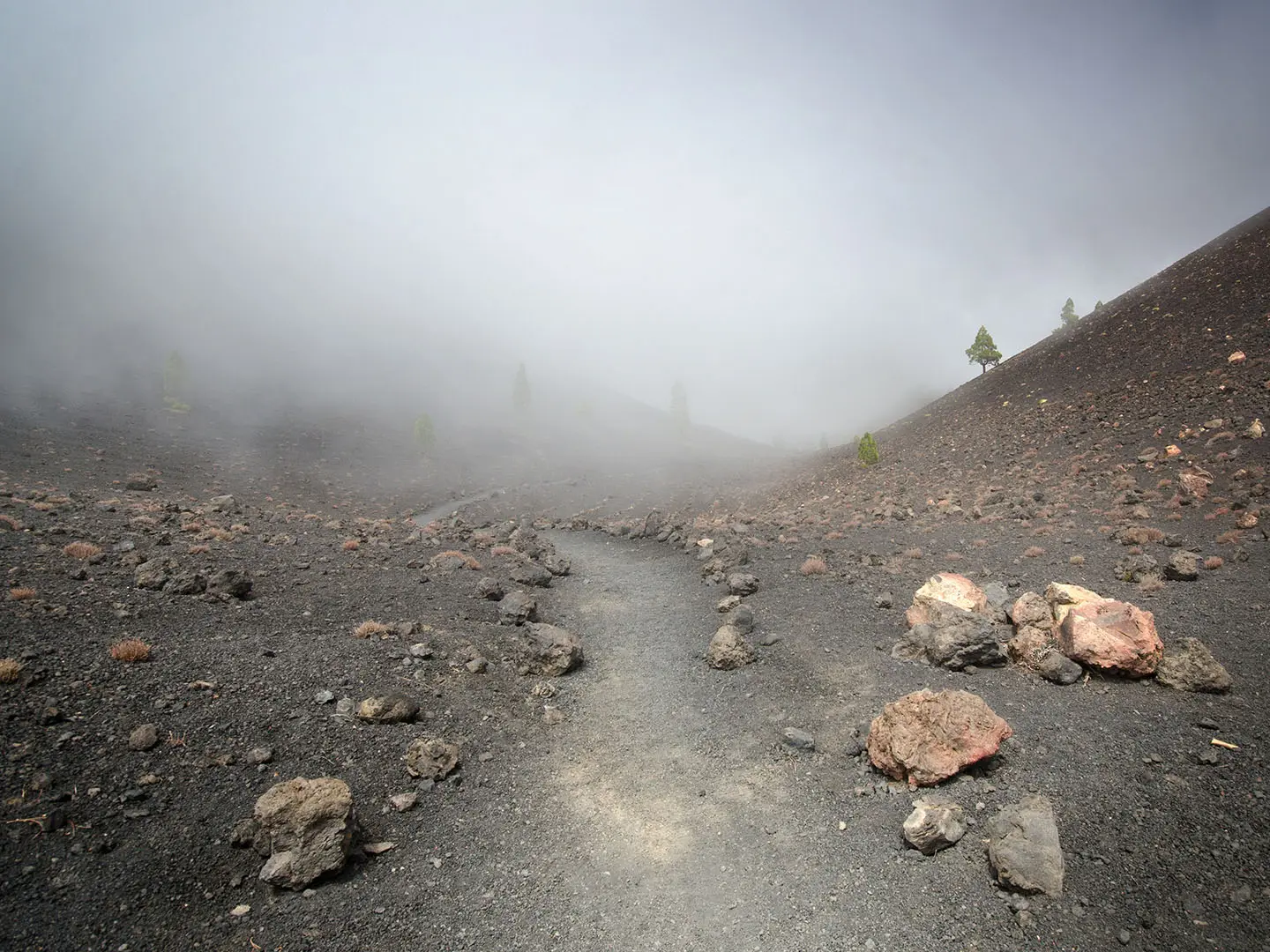
Walk north to south from Refugio de El Pilar, at about 1,450 m, through Canary pine forest and onto the open Cumbre Vieja ridge. The route passes Birigoyo, Hoyo Negro, Nambroque, the Duraznero lava field, Las Deseadas, Volcan Martin and then drops to Los Canarios, the usual finish. The full 23.5 km version continues past San Antonio and Teneguia to Faro de Fuencaliente and the Salinas at sea level. It is a point-to-point hike: there is no reliable public bus to Refugio de El Pilar, so most walkers use a taxi or organised transfer. For other Spanish mountain routes, compare the Alpujarras Trail or the higher Pyrenean Carros de Foc.
Volcanic history of the Cumbre Vieja
Cumbre Vieja is an active volcanic ridge forming the southern half of La Palma, with recorded eruptions since the 15th century. The walk crosses landscapes shaped by historic activity, including San Antonio from 1677, Hoyo Negro and Duraznero from the 1949 San Juan/Nambroque eruption, and Teneguia from 1971. The 2021 eruption near Cabeza de Vaca/Tajogaite did not bury the GR 131 ridge route, but it reshaped La Palma’s western slopes and is a clear reminder that this is a living volcanic landscape.
Notable highlights
- Cumbre Vieja ridge walk: The route follows the spine of La Palma’s volcanic ridge, with views to both the west and east coasts when the weather is clear.
- Las Deseadas: These twin craters mark the high point of the walk, at roughly 1,932–1,949 m depending on the source, before the long descent towards Fuencaliente.
- Hoyo Negro and Duraznero: Craters and lava fields from the 1949 San Juan/Nambroque eruption give this central section its stark volcanic character.
- Canary pine forest: Endemic Pinus canariensis shades the start and parts of the finish, contrasting with the bare ash and cinder of the ridge.
- San Antonio and Teneguia volcanoes: The southern extension passes two historic cones above Fuencaliente, linked to eruptions in 1677 and 1971.
- Faro de Fuencaliente and the Salinas: The full route ends at the southern lighthouse beside working sea-salt pans on the lava-bound tip of La Palma.
Challenges to expect
This is a hard day: around 1,207 m of ascent, a much longer descent to sea level on the full route, and no water or facilities between start and finish. The ridge is exposed to sun, wind, cloud and cold, while loose ash, lapilli and gravel make the descent tiring. Compared with the coastal Camí de Ronda, this is more remote, higher and rougher underfoot.
HikeList Score
Volcano Route (Ruta de los Volcanes) scored 78/100 on HikeList's trail-quality metrics.
See score breakdownHide breakdown
- Ideal length 55
- Balanced challenge 80
- Scenery & wildness 88
- Varied terrain 100
- Accommodation 83
- Food & support 68
- Path quality 87
- Season flexibility 63
Computed from length, challenge, scenery & wildness, terrain variety, accommodation, food & support, path quality and season flexibility.
 Spain
SpainShow more data Show less
- Mountainous
- Volcanic
- Forest
- Exposed Ridge
- Footpath
- Forest Tracks
- Gravel
- Volcanic Ash
- Roads
- Hotels
- Guesthouses
- Rural Houses
- Pet Friendly
- Campsites
- Shelters
In these collections
Photos from hikers
Taken on the trail by people who've reviewed Volcano Route (Ruta de los Volcanes).
Start at Refugio de El Pilar, climb through Canary pine forest and follow the GR 131 over the Cumbre Vieja ridge via Hoyo Negro, Duraznero, Las Deseadas and Volcan Martin. The usual finish is Los Canarios after about 5.5–7 hours; the full version continues past San Antonio and Teneguia to Faro de Fuencaliente and the Salinas, making a long 7–8 hour day.
Reviews
How would you rate Volcano Route (Ruta de los Volcanes)?
Tap a star to start your review — you could be the first.