Mount Koya Choishi Michi Trail
How would you rate Mount Koya Choishi Michi Trail?
Tap a star to share your experience and help other hikers.
Mount Koya Choishi Michi Trail: Ancient Pilgrimage Hike to Koyasan
HikeList Score
Mount Koya Choishi Michi Trail scored 79/100 on HikeList's trail-quality metrics.
See score breakdownHide breakdown
- Ideal length 55
- Balanced challenge 100
- Scenery & wildness 85
- Varied terrain 89
- Accommodation 66
- Food & support 74
- Path quality 98
- Season flexibility 76
Computed from length, challenge, scenery & wildness, terrain variety, accommodation, food & support, path quality and season flexibility.
The Mount Koya Choishi Michi Trail is a ~24 km point-to-point pilgrimage hike in Wakayama Prefecture, Japan, linking Jison-in Temple near Kudoyama with Koyasan’s Daimon Gate and Danjo Garan. It is a moderate but long day hike, typically taking 7–8 hours, with about 800 m of ascent. The route suits fit walkers who want a historic, waymarked forest trail rather than technical mountain terrain. It is part of the UNESCO-listed Sacred Sites and Pilgrimage Routes in the Kii Mountain Range.
Route Overview
The classic direction is uphill: start at Jison-in Temple in Kudoyama, reached by an additional ~2 km walk from Kudoyama Station on the Nankai Koya Line, then follow the choishi stone markers from 180 down to 1 towards the Danjo Garan. The lower trail climbs through persimmon and mikan orchards before settling into cedar and mixed woodland along the ridge. Key points include the Futatsu Torii above the Amano shrine area, Yatate teahouse, and the final approach to the crimson Daimon Gate. Many walkers continue into the Danjo Garan and on towards Okunoin. For longer Kii pilgrimage planning, compare it with the Kumano Kodo Pilgrimage Routes and the Kumano Kodo Nakahechi Route.
History of the Choishi Michi
The Choishi Michi is the historic main approach to Koyasan, the Shingon Buddhist centre founded by Kukai, posthumously known as Kobo Daishi. Tradition says Kukai used this route and descended it to visit his mother at Jison-in in her final years. The path is named for its choishi: stone stupa markers set at intervals of one cho, counting down from Jison-in to the Danjo Garan. The route was inscribed in 2004 as part of the UNESCO World Heritage listing for the Kii Mountain Range.
Notable highlights
- Jison-in Temple (marker 180): The trailhead temple at the foot of the mountain, associated with Kukai’s mother. It is the symbolic start of the Choishi Michi and the first point for following the numbered stone markers.
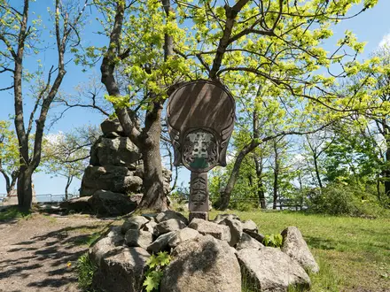
- Choishi stone markers (~109 m intervals): The defining feature of the trail, with 180 markers counting down to the Danjo Garan and further markers continuing towards Okunoin. Each is carved with a Sanskrit seed-syllable linked to the five Buddhist elements.
- Niu-Tsuhime / Amano Shrine area and Futatsu Torii: This area is linked to the local Shinto deities said to have granted Kukai the land for Koyasan. The twin torii above Amano is a memorable cultural landmark on the ridge route.
- Yatate teahouse: A rest stop roughly two-thirds along the walk, known for yakimochi, grilled mochi traditionally eaten by pilgrims. It is a useful break before the final approach to Koyasan.
- Daimon Gate (25.1 m): The great crimson entrance gate marks arrival at Koyasan’s plateau. The current gate dates from 1705 and is flanked by guardian Nio statues.
- Danjo Garan and Konpon Daito: The sacred temple complex at the end of the route, centred on the vermilion Konpon Daito pagoda. If you like shrine approaches, the much shorter Fushimi Inari Shrine Path offers a very different urban pilgrimage walk.
Challenges to expect
The difficulty is mainly endurance: ~24 km in one day, with about 800 m of climbing, much of it packed into the first ~5 km. The surface is mostly dirt and forest path, with some stone-paved and forest-road sections, so it is not technical. Summer heat and humidity can be draining; late autumn and early winter can be cold. Bears inhabit the area, and a bear bell is recommended.
HikeList Score
Mount Koya Choishi Michi Trail scored 79/100 on HikeList's trail-quality metrics.
See score breakdownHide breakdown
- Ideal length 55
- Balanced challenge 100
- Scenery & wildness 85
- Varied terrain 89
- Accommodation 66
- Food & support 74
- Path quality 98
- Season flexibility 76
Computed from length, challenge, scenery & wildness, terrain variety, accommodation, food & support, path quality and season flexibility.
 Japan
JapanShow more data Show less
- Forest
- Ridge
- Orchards
- Dirt
- Earth
- Stone Paved
- Forest Road
- Temple Lodging
- Guesthouses
- Family Friendly
- Restrooms
- Water Sources
In these collections
Photos from hikers
Taken on the trail by people who've reviewed Mount Koya Choishi Michi Trail.
Reviews
How would you rate Mount Koya Choishi Michi Trail?
Tap a star to start your review — you could be the first.