Vienna Woods Trail
How would you rate Vienna Woods Trail?
Tap a star to share your experience and help other hikers.
Vienna Woods Trail: Rundumadum Loop Around Vienna
HikeList Score
Vienna Woods Trail scored 91/100 on HikeList's trail-quality metrics.
See score breakdownHide breakdown
- Ideal length 98
- Balanced challenge 100
- Scenery & wildness 82
- Varied terrain 94
- Accommodation 91
- Food & support 88
- Path quality 80
- Season flexibility 89
Computed from length, challenge, scenery & wildness, terrain variety, accommodation, food & support, path quality and season flexibility.
The Vienna Woods Trail is best understood as the Rundumadum-Wanderweg, the real 120 km loop around Vienna through the Wienerwald, vineyards, city forest and Danube-side green spaces. This moderate circuit in Austria is usually walked in 6-10 days, though its 24 short official stages make it easy to split into day hikes using Vienna public transport. It suits walkers who want a long-distance feel without remote logistics, huts or technical mountain terrain.
Route Overview
The official start and finish is Nussdorf S-Bahn station in Vienna-Döbling, but the loop can be joined almost anywhere because every stage start and end is served by S-Bahn, U-Bahn, tram or bus. The route circles Vienna through Leopoldsberg, Kahlenberg, Hermannskogel with the Habsburgwarte, Lainzer Tiergarten, the Lobau floodplain and the city’s vineyard slopes. It is a loop, not a point-to-point walk to Baden bei Wien. For a Danube-focused Austrian route, compare the Donausteig; for much higher alpine walking, see the Eagle Walk or the Carnic High Trail.
Wienerwald history and conservation
The Wienerwald were Habsburg royal hunting grounds from the 11th century until 1850. In 1870, plans to clear-fell the forest triggered public opposition led by journalist and politician Josef Schöffel, later known as the saviour of the Vienna Woods. Beethoven and other composers walked here, and the area later gained formal protection: the Vienna Woods Declaration came in 1987, followed by UNESCO Biosphere Reserve status in 2005.
Notable highlights
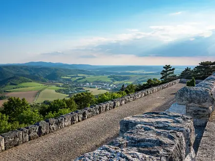
- Leopoldsberg (~425 m): A hill above the Danube with a baroque church and broad views over Vienna and the Wiener Pforte, where the river cuts through the woods.
- Kahlenberg (484 m): One of Vienna’s classic viewpoints, overlooking the city and vineyards; it is also linked to the 1683 Battle of Vienna and King Jan III Sobieski’s relief army.
- Hermannskogel and Habsburgwarte (542 m): The highest natural point of Vienna and the high point of the loop, topped by the Habsburgwarte tower.
- Lainzer Tiergarten: A walled former imperial hunting reserve on the edge of Vienna, with ancient woodland, deer, wild boar and the Jugendstil Hermesvilla.
- Vienna vineyards and Heuriger: The route crosses wine slopes around Nussberg and Kahlenberg, where traditional Heuriger taverns are part of the local walking culture.
- Lobau / Danube floodplain: The eastern arc reaches a wetland landscape within the Donau-Auen National Park, a marked contrast to the wooded western hills.
Challenges to expect
The Rundumadum is moderate rather than technical: expect dirt forest paths, gravel, paved parkland and some urban sections. The main challenge is distance management, since the full 120 km loop is often compressed into long day-stages. Navigation is easier than on remote trails, but pay attention where woodland, suburbs and transport links meet. Spring, summer and autumn are the best snow-free seasons.
HikeList Score
Vienna Woods Trail scored 91/100 on HikeList's trail-quality metrics.
See score breakdownHide breakdown
- Ideal length 98
- Balanced challenge 100
- Scenery & wildness 82
- Varied terrain 94
- Accommodation 91
- Food & support 88
- Path quality 80
- Season flexibility 89
Computed from length, challenge, scenery & wildness, terrain variety, accommodation, food & support, path quality and season flexibility.
 Austria
Show more data Show less
- Forest
- Hills
- Vineyard Slopes
- Urban Green Space
- Riverside
- Dirt
- Gravel
- Paved
- Hotels
- Guesthouses
- Hostels
- Family Friendly
- Pet Friendly
- Restrooms
- Water Sources
- Shelters
- Picnic Areas
Download Our Full Guide to Vienna Woods Trail FREE!
Get our comprehensive guide to this hike for free. Save it for later reading or print out at home.
In these collections
Photos from hikers
Taken on the trail by people who've reviewed Vienna Woods Trail.
Vienna Woods Trail: The Complete Guide
 i
Image by Herbert
i
Image by Herbert The Vienna Woods Trail is Vienna’s official rundumadum-Wanderweg: a waymarked 120 km circuit that turns the city’s green belt into a practical long-distance walk. It suits beginners, day-walkers and experienced hikers who want a full loop without remote logistics, huts or technical terrain.
Starting and finishing at Nussdorf in Döbling, the route climbs early into the wooded Wienerwald via vineyards, Leopoldsberg, Kahlenberg and Hermannskogel, Vienna’s highest natural point. Later stages swing through Lainzer Tiergarten, open southern parks, the Zentralfriedhof and the flat Lobau floodplain before returning north through Süßenbrunn, Stammersdorf and Bisamberg.
Its biggest strength is flexibility. Every official stage start and finish is reachable by Vienna’s public transport network, so the walk can be done over 7–10 days, split into short official sections, or completed as separate day hikes across a season.
The trail asks for steady walking rather than mountain skills. Expect forest paths, gravel tracks, parkland, urban links, some mud after rain, hot exposed sections in summer, and enough cumulative distance to make sensible pacing worthwhile.
This guide covers stages, day planning, accommodation, food, transport, terrain and common mistakes.
Stage-by-Stage Guide
The stages below use a practical 10-day grouping of the official rundumadum-Wanderweg. The City of Vienna divides the same loop into 24 shorter sections, so walkers using the official stamp scheme or walking half-days should check the current Stadt Wien stage and stamp-station details before travelling.
Every stage start and finish is on Vienna’s public-transport network, but live Wiener Linien, S-Bahn and ÖBB times should be checked before each walk. Accommodation is best handled by staying in Vienna and commuting out and back; Heuriger taverns are useful for food and drink, not overnight stops.
Stage 1: Nussdorf to Cobenzl — 9 km
This is a short but memorable opening stage, climbing straight from the Danube edge into the vineyard and hill country above Döbling. From Nussdorf the route passes towards Kahlenbergerdorf, then tackles the stepped Nasenweg up to Leopoldsberg before continuing over the classic viewpoint country of Kahlenberg and towards Cobenzl.
Underfoot, expect a mix of paved riverside and village sections, vineyard tracks, steps and woodland paths. The climb to Leopoldsberg is one of the sharper efforts of the whole loop, so this stage feels more strenuous than its distance suggests.
The main highlights are immediate: the Danube at the Wiener Pforte, the baroque church on Leopoldsberg, the city panorama from Kahlenberg and the vineyard slopes around the Nussberg. In clear weather this stage gives the strongest early sense of how the route circles Vienna rather than heading away from it.
Food and drink are easiest at Nussdorf and in the wine-growing areas around the western hills, where Heuriger taverns are part of local walking culture. Opening days and hours vary, so carry water and do not rely on a specific tavern being open.
Nussdorf is reached by tram line D or S-Bahn, with Wien Heiligenstadt nearby as the larger U-Bahn and S-Bahn interchange. Cobenzl also has public-transport access, making this an easy half-day or first day from a Vienna base.
Navigation is generally straightforward, but there are many local walking paths, vineyard lanes and viewpoint routes in this area. Stay with the rundumadum waymarks rather than simply following signs to Kahlenberg or Leopoldsberg, as those can lead onto shorter local circuits.
In wet weather the steps and wooded sections can be slippery. In hot weather the vineyard slopes are exposed, so start early and carry enough water even though the stage is short.
Stage 2: Cobenzl to Schottenhof — 13 km
This stage stays high in the wooded western Wienerwald and reaches the highest point of the whole route. From Cobenzl the trail works through forest and hill paths towards Hermannskogel and the Habsburgwarte, then continues by way of Dreimarkstein, Sievering and the Neuwaldegg/Schottenhof area.
The walking is mostly forest path and gravel track, with steady undulation rather than any technical ground. It is one of the more wooded stages, and after rain the beech-and-oak forest paths can be muddy.
Hermannskogel, at 542 m, is the key landmark. The Habsburgwarte tower crowns the summit, and the area gives a clear contrast with the open vineyard walking of Stage 1.
Food and drink options are more intermittent than the urban stages, despite the route never being far from Vienna. Start with water and snacks from the city, and treat any tavern or local refreshment stop as a bonus unless opening has been checked.
Cobenzl and Schottenhof are both reachable by public transport. This makes it simple to shorten the day or walk it as a standalone forest stage from Vienna.
Navigation needs attention at junctions. The western hills have a dense network of local paths, forest tracks and approach routes from nearby districts, so follow the rundumadum signs carefully where several tracks leave a clearing or ridge.
There is no exposure or remote terrain, but this is a stage where poor visibility, leaf litter and mud can make waymarking and footing less obvious. A downloaded map or GPX is useful as a backup.
Stage 3: Schottenhof to Lainzer Tor — 15 km
This is a varied western-ridge stage linking Schottenhof with the Steinhofgründe, Wilhelminenberg/Jubiläumswarte, Hütteldorf and the northern edge of the Lainzer Tiergarten. It is one of the longer days in this 10-stage schedule and has frequent changes between forest, meadow, parkland and urban fringe.
The terrain remains non-technical, but it is rarely monotonous. Expect gravel tracks, park paths, woodland sections and some paved links where the green belt meets the suburbs.
The broad views from the Wilhelminenberg and Jubiläumswarte area are the main scenic reward, with Steinhofgründe adding open hill meadows above the city. The approach towards Hütteldorf and Lainzer Tor marks the transition into the former imperial hunting landscape of the Lainzer Tiergarten.
Food and water are easier to manage than on the deeper forest sections because the stage passes close to urban districts such as Hütteldorf. Even so, carry water from the start; park and hill sections should not be treated as guaranteed resupply points.
Both Schottenhof and Lainzer Tor have public-transport access. Hütteldorf is also a useful transport area on or near this part of the route, which gives flexibility if the full 15 km day needs to be shortened.
Dogs are restricted in the Steinhofgründe and Lainzer Tiergarten, and the official route provides alternatives. Anyone walking with a dog should check the current official guidance before travelling.
Navigation is most awkward where parkland, suburban streets and forest tracks meet. Watch for rundumadum discs at exits from open spaces and do not assume the most prominent path is the through-route.
Stage 4: Lainzer Tor to Liesing — 12 km
This stage crosses the southern part of Vienna’s wooded west, with the Lainzer Tiergarten and the Mauer/Maurer Wald area shaping the day before the route drops towards Liesing. It is a quieter-feeling stage, despite being within easy reach of the city.
Paths are mainly forest tracks, gravel paths and short paved connectors. The walking is moderate rather than difficult, with enough woodland undulation to keep the stage interesting.
The Lainzer Tiergarten is the defining feature. This walled former imperial hunting reserve is known for old woodland, free-roaming deer and wild boar, and the Hermesvilla, though exact access and any temporary route changes should be checked before travelling.
Food and drink are most reliable at the urban ends of the stage and in the districts around Mauer and Liesing. Carry sufficient water through the forested middle of the day.
Lainzer Tor and Liesing are both public-transport accessible, so returning to accommodation elsewhere in Vienna is straightforward. Road access exists around the urban edges, but public transport is normally the more practical option.
Dogs are restricted in the Lainzer Tiergarten, with alternatives on the official route. Walkers with dogs should plan this stage in advance rather than discovering the restriction at the gate.
Wildlife should be given space, especially in the Lainzer Tiergarten. Mud can linger on shaded forest tracks after rain, and navigation needs attention at gates, boundary paths and suburban transitions.
Stage 5: Liesing to Laaer Berg — 12 km
Stage 5 shifts from the wooded west into the more open southern green belt. From Liesing the route passes through or near Alterlaa, Wienerberg and Laaer Berg, using a mixture of parkland, low hills and urban links.
This is easier underfoot than the western hill stages, with more paved paths, gravel park tracks and suburban walking. The challenge is less about ascent and more about keeping the route line through a built-up edge of the city.
Wienerberg and Laaer Berg provide the main green spaces and a different feel from the Wienerwald: more open, lower and more exposed. The stage is useful for understanding the full variety of the loop, not just its forested western side.
Food and drink are generally easier to obtain in the southern urban districts than in the forest, but there can still be long park sections without dependable facilities. Start with water and use shops or cafés only where they naturally appear on the day.
Both Liesing and Laaer Berg are linked to Vienna’s public-transport system. This stage is therefore simple to walk as a day section without moving accommodation.
Dog restrictions apply in the Laaer Wald area, with official alternatives. If walking with a dog, check the current route instructions before setting out.
The main warning is heat rather than technical difficulty. In summer, the open parks and paved sections can feel much hotter than the shaded Wienerwald; an early start is sensible.
Stage 6: Laaer Berg to Lobau (Biberhaufenweg) — 14 km
This stage takes the loop from the southern hills towards the Danube floodplain. From Laaer Berg the route passes Oberlaa, the Zentralfriedhof and Kaiserebersdorf before reaching the Lobau around Biberhaufenweg.
Expect a practical mix of park paths, cemetery avenues, paved urban links and flatter approach walking towards the eastern side of Vienna. It is not technically hard, but it is a longer stage with more hard surface than the forest days.
The Zentralfriedhof is the major landmark. The route follows tree-lined avenues through one of Europe’s great cemeteries, associated with the honorary graves of Beethoven, Schubert, Brahms and the Strauss family.
Food and water are best planned around the urban districts at the start, along the way and near the finish. Do not assume that the cemetery or park sections will provide convenient walker-focused services at the right time.
Laaer Berg and Lobau/Biberhaufenweg are both public-transport accessible. As elsewhere on the loop, live connections should be checked before travelling, especially if finishing later in the day.
Dogs are restricted in the Zentralfriedhof, and the official route gives alternatives. Respect cemetery rules and keep to the signed route through this section.
This stage has several transitions between park, cemetery, road-edge and floodplain approaches, so navigation needs more concentration than the terrain implies. Hot weather can also make the paved and open sections tiring.
Stage 7: Lobau (Biberhaufenweg) to Esslinger Furt — 13 km
Stage 7 is the flattest-feeling and most distinctive part of the loop, crossing the Lobau section of the Donau-Auen National Park. The wooded hills are now replaced by Danube floodplain, side-channels, wetland vegetation and broad, level tracks.
The terrain is mostly flat dirt or gravel path, with little physical difficulty beyond the distance. After wet weather, some tracks can be muddy, and in high summer the lack of climbing does not necessarily mean an easy day if the temperature is high.
The Lobau is the highlight: a protected floodplain landscape with beavers, turtles and birdlife, very different from the vineyards and Vienna Woods of the earlier stages. Stay on the marked route and respect National Park rules.
Food and water are more limited through the wetland than in the urban districts. Carry enough for the full stage from the start, particularly in warm weather.
Both Biberhaufenweg and Esslinger Furt are served by public transport as part of the rundumadum stage network. Check current times before setting out, as this eastern arc can feel less convenient if a connection is missed.
Navigation is generally simple on the main tracks, but there are many paths and water-side routes in the Lobau. Follow the rundumadum waymarks rather than improvising across the protected area.
There is no mountain hazard here, but seasonal mud, heat and long flat walking can still be tiring. The stage is best approached as a full wetland day with water carried from the start.
Stage 8: Esslinger Furt to Süßenbrunn — 12 km
This stage leaves the deepest Lobau character and works through Vienna’s eastern and north-eastern edge, including the Seestadt Aspern area before reaching Süßenbrunn. It is an easier walking day in terms of gradient, but less enclosed and less shaded than the western stages.
Underfoot, expect flat paths, gravel, paved links and urban-fringe walking. The route is practical rather than wild here, moving between green spaces, development edges and transport-linked districts.
Seestadt Aspern is the main named landmark on this stage. The day is less about dramatic viewpoints and more about completing the eastern arc of the city circuit.
Food and water planning is easier around urban areas, but the route may not pass a convenient open shop or café exactly when needed. Carry water and basic food rather than relying on ad-hoc resupply.
Esslinger Furt and Süßenbrunn are both public-transport accessible. This stage is well suited to a straightforward day walk from a Vienna base.
Navigation matters where the route threads between open land, streets and newer urban development. Keep checking for rundumadum signs at junctions and road crossings.
The main seasonal concern is exposure. In hot, sunny weather this flatter eastern section can feel more draining than its profile suggests.
Stage 9: Süßenbrunn to Stammersdorf / Senderstraße — 15 km
Stage 9 is one of the longer days in this schedule and carries the route into Vienna’s northern wine landscape. From Süßenbrunn it heads towards Stammersdorf and Senderstraße, with the terrain gradually taking on more vineyard and meadow character around the Bisamberg side of the loop.
The walking is mostly easy to moderate, with a mix of open tracks, paths and urban-fringe connectors. It is less wooded than the western Wienerwald and can feel exposed in sun or wind.
Stammersdorf is the key highlight, known for its wine culture, Kellergassen and rustic Heuriger taverns around the northern edge of Vienna. This is one of the better stages for combining the walk with a traditional wine-tavern stop, provided opening times are checked.
Food and drink are more promising around Stammersdorf than on the open approach, but Heuriger taverns are not guaranteed to be open every day. Carry water for the full stage and treat tavern stops as planned extras rather than essential resupply.
Süßenbrunn and Stammersdorf/Senderstraße are both on the public-transport network. The length of the stage makes it worth checking return options before starting, particularly outside peak hours.
Navigation is mostly about staying alert through the transitions from open land into vineyard lanes and village-edge streets. The rundumadum signs are the route authority where local paths and wine-area lanes diverge.
There are no technical hazards, but the combination of distance, exposure and limited shade can be tiring in summer. Autumn is especially attractive in the vineyards, but opening hours and busy periods at taverns can vary.
Stage 10: Stammersdorf / Senderstraße to Nussdorf — 11 km
The final stage completes the northern arc of the loop, linking Stammersdorf and Senderstraße with the Bisamberg, Strebersdorf, Jedlersdorf and the return to Nussdorf. It is a varied closing day with vineyards, meadow, wooded hill country and urban approaches.
Terrain alternates between vineyard and meadow paths, woodland tracks and paved links through the northern districts. The walking is moderate but generally straightforward, with no technical sections.
The Bisamberg is the main natural feature: a wooded and vineyard-clad hill on the north bank of the Danube. Around Stammersdorf and Strebersdorf, the Kellergassen and Heuriger culture give the stage a strong local character before the route returns to the Danube-side start area at Nussdorf.
Food and drink are most likely around Stammersdorf, Strebersdorf and Nussdorf, especially where Heuriger taverns are open. As always on this route, check opening times if a meal stop matters and carry enough water to finish without relying on one.
Public transport is available at both ends, with Nussdorf served by tram line D and S-Bahn. Finishing at the same Nussdorf transport hub makes the loop logistically simple to complete from anywhere in Vienna.
Navigation needs care where vineyard lanes, local paths and urban streets overlap. Follow the rundumadum waymarks back to Nussdorf rather than dropping early towards whichever transport stop seems closest.
The final stage is not difficult, but it can still be hot on exposed vineyard sections and slippery on wooded paths after rain. Allow enough time to enjoy the northern wine landscape without rushing the return to Nussdorf.
Recommended Itinerary
The most practical way to walk the Vienna Woods Trail is to keep one base in Vienna and use public transport to reach each day’s start and return from each finish. The table below uses a sensible 10-day grouping of the official rundumadum route; it keeps most days in the 9–15 km range and avoids turning a beginner-friendly green-belt trail into a forced march.
Check current Stadt Wien stage information, any route diversions and live Wiener Linien / S-Bahn / ÖBB times before travelling, especially if starting early, finishing late or walking outside the main spring–autumn season.
Standard 10-day itinerary
| Day | From | To | Approx. distance | Why this stage makes sense | Services/accommodation notes |
|---|---|---|---|---|---|
| 1 | Nussdorf | Cobenzl | 9 km | A short but scenic opening day over the northern hills above the Danube, taking in the early climb towards Leopoldsberg and Kahlenberg without overloading the first stage. | Start at Nussdorf, reached by tram D or S-Bahn. Stay in Vienna rather than looking for trailside accommodation; food and drink options vary by hilltop and vineyard area, so carry water and snacks. |
| 2 | Cobenzl | Schottenhof | 13 km | This is a good second day for the wooded western arc, with the route building towards Hermannskogel and the Habsburgwarte, the high point of the circuit. | Public transport access at both ends makes this straightforward as a day walk from a Vienna base. Forest sections can be muddy after rain; do not rely on frequent services directly on the path. |
| 3 | Schottenhof | Lainzer Tor | 15 km | One of the fuller western-hill days, linking the Neuwaldegg / Wilhelminenberg side with Steinhofgründe, Hütteldorf and the approach to Lainzer Tiergarten. | This is a longer day by this itinerary’s standards. Lainzer Tiergarten has specific access rules and dog restrictions; use the official alternatives where required and check current information before travelling. |
| 4 | Lainzer Tor | Liesing | 12 km | A manageable stage through the south-western green belt, including Lainzer Tiergarten and the Maurer Wald side before dropping towards Liesing. | Stay in Vienna and commute back from Liesing. Carry enough food and water for the park and woodland sections rather than assuming continuous facilities. |
| 5 | Liesing | Laaer Berg | 12 km | This day shifts the character of the walk from the wooded west towards the more open southern city edge, including Alterlaa, Wienerberg and Laaer Berg. | Public transport makes both ends easy to use as access points. Expect more paved and urban linking sections than on the Wienerwald days. |
| 6 | Laaer Berg | Lobau (Biberhaufenweg) | 14 km | A practical crossing of the south-eastern arc, passing Oberlaa, the Zentralfriedhof and Kaiserebersdorf before reaching the Danube floodplain side. | The Zentralfriedhof has its own rules, including dog restrictions. Services are more urban than remote, but the stage is still long enough to justify carrying lunch and water. |
| 7 | Lobau (Biberhaufenweg) | Esslinger Furt | 13 km | A flat, distinctive day through the Lobau and the Donau-Auen National Park landscape, very different from the western hills. | Check any National Park route advice before travelling. Shade and refreshments should not be assumed across the floodplain; high-summer heat can make this stage feel harder than its distance suggests. |
| 8 | Esslinger Furt | Süßenbrunn | 12 km | This keeps the north-eastern arc to a comfortable length as the route leaves the Lobau / Seestadt Aspern side and works towards Süßenbrunn. | Continue using Vienna as the overnight base. Public transport access is the key advantage here, but live times should be checked before committing to a late finish. |
| 9 | Süßenbrunn | Stammersdorf / Senderstraße | 15 km | A longer northern stage that brings the route into the vineyard and Bisamberg fringe around Stammersdorf. It is a satisfying penultimate day but should not be underestimated. | Stammersdorf and the Bisamberg area are known for Heuriger culture, but taverns are food-and-drink stops rather than accommodation. Opening days and hours vary; check before relying on them. |
| 10 | Stammersdorf / Senderstraße | Nussdorf | 11 km | A compact final stage back to Nussdorf, completing the loop via the northern green belt, Strebersdorf and Jedlersdorf side. | Finish where the trail began at Nussdorf, with tram D and S-Bahn access. This stage is short enough to pair with onward travel, provided current transport times are checked. |
Slower variant: official short-stage approach
The official rundumadum route is divided into 24 short stages of roughly 3–10 km, all linked to public transport. This is the best option for families, first-time long-distance walkers, anyone carrying minimal fitness, or visitors who want to fit the trail around sightseeing, work or poor weather windows.
Rather than booking a chain of accommodation, stay in Vienna and complete one or two official stages at a time. Exact stage breaks, stamp stations and any diversions should be checked on the official Stadt Wien route information before setting out.
Faster variant: 7–8 walking days
Fit walkers can compress the route by combining adjacent stages from the 10-day itinerary. This suits hikers already comfortable with 20 km-plus days on mixed forest, gravel, parkland and pavement, and with the discipline to manage food, water and transport connections without relying on trailside lodgings.
A faster schedule works best by combining the shorter western and southern days where public transport gives easy exit options. Avoid making the Lobau or exposed southern parkland sections unnecessarily long in hot weather, and check official mapping before booking or fixing a non-refundable travel plan.
Planning the Route
Choose a schedule that fits the purpose
The Vienna Woods Trail is unusually flexible because it is not planned around huts, remote villages or fixed overnight stops. The official rundumadum-Wanderweg is split into 24 short stages, but most end-to-end walkers combine these into a 7–10 day circuit.
A 10-day schedule is the most comfortable way to walk the whole loop without turning it into a distance challenge. It keeps daily distances moderate, leaves time for the climbs on the western arc, and makes it easier to pause at places such as Kahlenberg, Hermannskogel, Lainzer Tiergarten, the Zentralfriedhof and the Lobau.
A 7-day version suits fitter walkers who are happy linking several official stages each day and using public transport at the beginning and end. The terrain is not technical, but compressed schedules make the route feel more like a sustained urban-edge endurance walk than a relaxed green-belt circuit.
| Planning style | Best for | Practical notes |
|---|---|---|
| 24 official stages | Families, beginners, local day walkers | Short sections of roughly 3–10 km, each linked to public transport. |
| 10 walking days | Most end-to-end walkers | A balanced schedule with time for viewpoints, parks and transport connections. |
| 7–8 walking days | Fit walkers | Feasible, but the western hills and longer paved/urban links become more tiring. |
| Section hiking | Very practical | The route can be completed over weekends, single days or a whole season. |
Base yourself in Vienna rather than moving accommodation
Accommodation does not dictate the daily stages on this route. Most walkers stay in Vienna and travel out to each day’s start by U-Bahn, tram, bus, S-Bahn or ÖBB regional rail, then return from the day’s finish.
This is usually simpler than trying to sleep along the green-belt sections. There are few trailside lodgings in the forest, vineyard and floodplain parts of the route, while Vienna has hotels, guesthouses, pensions, hostels and apartments across all budgets.
Nussdorf, the official start and finish, is reached by tram D or S-Bahn, with Wien Heiligenstadt as the nearest major interchange on U4 and the S-Bahn network. For visitors arriving by air, Flughafen Wien-Schwechat connects into the city by CAT, S7 S-Bahn and rail, followed by local public transport to accommodation or to a stage start.
Use public transport as the main planning tool
Public transport access is the route’s biggest logistical advantage. Every official stage start and finish is reachable by Wiener Linien services and/or S-Bahn and ÖBB connections, so you can shorten a day, skip bad weather, or split a longer stage without disrupting the whole itinerary.
Plan each walking day with two transport checks: how to reach the start in the morning, and how to leave the finish in the afternoon or evening. Timetables, platform changes and service patterns should be checked before travelling, especially at weekends, on public holidays and on the outer edges of the city.
For section hikers, this makes the route particularly low-risk. You can walk the loop anticlockwise from Nussdorf in order, or treat it as a set of independent day walks, returning later to fill gaps.
Do not plan it like a hut-to-hut trail
There are no mountain huts, remote resupply points or wilderness camping logistics to organise. Food, water and shelter planning is still necessary, but it is closer to planning a series of long day walks from a city base than a backcountry trek.
Carry enough water for each day rather than relying on finding it on the path. The route passes through suburbs, parks, vineyards and well-used recreation areas, but service availability changes by district, day of the week and season.
Heuriger taverns are an important part of the walking culture around Nussberg, Kahlenberg, Stammersdorf and Bisamberg, but they should be treated as food and drink stops, not accommodation. Opening times vary and should be checked before building a day around a particular tavern.
Navigation: easy, but not automatic
The route is waymarked with rundumadum signs and discs, and most of the walking is on clear forest paths, gravel tracks, parkland routes, promenades and urban links. Navigation problems are most likely where woodland paths meet suburbs, where park paths branch, or where the route crosses transport corridors.
Carry an offline map or GPX track as well as following the waymarks. This is especially useful if combining several official stages into a longer day, where a missed turn can add unnecessary pavement walking or complicate the return transport plan.
Be careful not to confuse this route with the separate Wienerwald-Wanderweg 404. The Vienna Woods Trail described here is the City of Vienna’s rundumadum-Wanderweg, a loop around Vienna starting and finishing at Nussdorf, not the longer point-to-point 404 route.
Where the route needs the most care
The western arc through Leopoldsberg, Kahlenberg, Hermannskogel, Steinhofgründe, Hütteldorf and Lainzer Tiergarten has the most sustained climbing and the highest woodland sections. It is still moderate walking, but it is where wet paths, mud after rain and cumulative ascent matter most.
The southern and eastern parts are generally lower and more open, including Wienerberg, Laaer Berg, the Zentralfriedhof and the Lobau. In high summer these exposed parkland and floodplain sections can feel hot, so an early start and sufficient water are more important than technical gear.
The northern return through Süßenbrunn, Stammersdorf, Bisamberg and Strebersdorf mixes open ground, vineyards and urban-edge paths. It is straightforward to walk, but still needs normal stage planning for food stops, wayfinding and the journey back to your base.
Access rules, dogs and current route information
No special long-distance hiking permit is part of the normal planning for this route, but access rules in individual green spaces matter. The official route provides alternatives where dog restrictions apply in places including Lainzer Tiergarten, Laaer Wald, the Zentralfriedhof and the Steinhofgründe.
Current stage information, stamp-station details and any temporary closures should be checked on the official Stadt Wien rundumadum page before setting out. Live Wiener Linien, S-Bahn and ÖBB times should also be checked for each day’s start and finish.
Towns, Villages and Overnight Stops
The Vienna Woods Trail is not an inn-to-inn route. The practical overnight strategy is to stay in Vienna and use Wiener Linien, S-Bahn and ÖBB links to reach each day’s start and leave from each day’s finish.
Accommodation is available across Vienna in hotels, guesthouses, pensions, hostels and apartments, but there are few true trailside lodgings on the green-belt sections. Heuriger wine taverns are useful for food and drink, especially in the vineyard districts, but should not be treated as overnight stops.
For a multi-day itinerary, choose accommodation close to reliable U-Bahn, tram, S-Bahn or bus connections rather than trying to sleep directly on the route. Current stage details, stamp stations, opening times and live transport should be checked before travelling.
Nussdorf, Vienna-Döbling
Nussdorf is the official start and finish, by the Nussdorf tram and S-Bahn terminus near the Danube and the Donaupromenade. It is the most convenient place to begin the loop cleanly, especially if arriving with a day pack and returning by public transport after each stage.
It can work well as a first or final-night base, but there is no need to stay in Nussdorf specifically. Any well-connected part of Vienna can serve the same purpose, provided the morning journey to Nussdorf and later stage access is straightforward.
Nussdorf is reached by tram D or S-Bahn, with Wien Heiligenstadt nearby as the larger interchange on U4 and S-Bahn. The surrounding Döbling and vineyard fringe make it a useful place for pre- or post-walk food, but check current opening days if planning around a specific Heuriger.
Kahlenbergerdorf
Kahlenbergerdorf comes early on the route after Nussdorf, before the climb towards Leopoldsberg via the Nasenweg. It is better viewed as a pause and access point than as an overnight stop.
Do not rely on Kahlenbergerdorf for full hiker services unless checked in advance. Most walkers will have food and water already sorted before leaving Nussdorf, then continue into the hills towards Leopoldsberg, Kahlenberg and Cobenzl.
Leopoldsberg
Leopoldsberg is a hilltop landmark above the Danube, with the baroque church and one of the first major views of the route. It is not a practical overnight stop.
Treat it as a viewpoint and short rest on the first stage rather than a resupply point. If the weather is hot or the stepped climb has taken longer than expected, continue only if there is enough water for the remainder of the hill section.
Kahlenberg
Kahlenberg is one of Vienna’s classic viewpoints and a major early landmark on the western arc. It sits in the vineyard-and-woodland belt above the city, between Leopoldsberg and Cobenzl.
It is useful for a longer break rather than an overnight. Food and drink may be available in the wider Kahlenberg vineyard area, including Heuriger-style stops, but opening times are variable and should be checked before building a day around them.
Accommodation is better booked in Vienna proper. Kahlenberg’s main value for hikers is as a natural pause after the first climbs and before continuing towards Cobenzl and the higher wooded ground.
Cobenzl
Cobenzl is the end of the first practical day stage and the start of the second in the 10-day grouping. It is a sensible stage break because it sits high on the western edge of the city and is reachable by public transport.
It is not usually the place to look for trail accommodation. Most walkers leave the route here, travel back to their Vienna base, then return the next day to continue towards Hermannskogel and Schottenhof.
Plan food and water before setting out if relying on a full walking day beyond Cobenzl. Any café or tavern opening times in this hill-and-vineyard area should be checked before travelling.
Hermannskogel and Habsburgwarte
Hermannskogel is the high point of the whole circuit at 542 m, crowned by the Habsburgwarte. It lies on the wooded western arc between Cobenzl and the Dreimarkstein/Neuwaldegg side of the route.
This is a landmark, not a service stop. There is no reason to plan an overnight here, and hikers should carry what they need for the forest section rather than assuming facilities on the summit.
The climb is modest by alpine standards but still one of the more sustained parts of the route. In wet weather, the forest paths can be muddy, so allow time rather than treating this as a fast urban stroll.
Dreimarkstein
Dreimarkstein is part of the wooded western ridge after Hermannskogel. It is another route point rather than a settlement for accommodation.
Use it for orientation on the forested arc towards Sievering and Neuwaldegg/Schottenhof. Food, shops and beds should be planned elsewhere, either before the stage or after leaving the route by public transport.
Sievering
Sievering brings the route back towards the settled edge of Döbling after the high wooded ground. It can be useful as an access or exit area if a western stage needs shortening.
As part of Vienna’s urban fringe, services are more realistic here than on the ridge, but accommodation planning is still best handled city-wide. Stay near good public transport rather than trying to match a hotel exactly to the trail line.
Neuwaldegg / Schottenhof
Schottenhof is the end of the second practical day stage and the start of the third. It is one of the more useful western break points because it sits where the route transitions between forest, suburban edge and onward links towards Wilhelminenberg and Steinhof.
It is a good place to finish for the day, but not necessarily to sleep. Most walkers will return to accommodation elsewhere in Vienna, then travel back for the next stage.
Check current Wiener Linien connections before fixing a start time. In shoulder seasons or after poor weather, allow some margin for slower going through the wooded sections on either side.
Wilhelminenberg and Jubiläumswarte
Wilhelminenberg and the Jubiläumswarte sit on the western ridge above the city, on the way towards Steinhof. The area is valuable for views and route variety, not for overnight logistics.
Do not plan on it as a full resupply stop. If combining the Schottenhof to Lainzer Tor stage into one longer day, carry sufficient food and water and use the surrounding city-edge transport links only as planned exit options.
Steinhof and the Steinhofgründe
The Steinhofgründe section crosses open hill meadows on the western side of Vienna. It is a useful contrast to the enclosed Wienerwald forest, but it remains a day-walking section rather than an overnight base.
Dog restrictions apply in the Steinhofgründe, and the official route provides alternatives where needed. Anyone walking with a dog should check the current official route notes before travelling.
Exposed meadow sections can feel hot in high summer. Start early, carry water and do not assume shade will be as consistent as in the forested western hills.
Hütteldorf
Hütteldorf is a practical urban access area before the route reaches the Lainzer Tiergarten side of the circuit. It is one of the better places to think about supplies, transport and shortening a day if needed.
Accommodation may be possible in the wider western Vienna area, but it is still usually simpler to keep one Vienna base for the whole trail. Hütteldorf’s main value is logistical: it sits on the city edge where walking terrain and public transport are close together.
Lainzer Tiergarten and Lainzer Tor
Lainzer Tor is the end of the third practical day stage and the start of the fourth. The route here uses the Lainzer Tiergarten, the walled former imperial hunting reserve that includes the Hermesvilla.
This is one of the most important route sections, but it is not an overnight stop. Treat Lainzer Tor as the transport break and book accommodation elsewhere in Vienna.
Dog restrictions apply in the Lainzer Tiergarten, with official alternatives for affected walkers. Rules, access information and any closures should be checked before travelling, particularly if walking with a dog.
Mauer and Maurer Wald
Mauer and the Maurer Wald mark the south-western part of the loop after the Lainzer Tiergarten. The route here is still green and wooded, but closer to the settled southern edge of Vienna.
Mauer can be useful for exiting, joining or finding urban services near the route. It is not a key overnight destination unless suitable accommodation has already been booked nearby.
Liesing
Liesing is the end of the fourth practical day stage and the start of the fifth. It is one of the more useful southern logistics points because it sits in a fully urban district rather than in a park or forest section.
This is a sensible place to finish a day, resupply and leave the route by public transport. Accommodation planning can include the wider Liesing area, but many walkers will still find it easier to sleep at a central or otherwise well-connected Vienna base.
If compressing the route into fewer than 10 days, Liesing is a useful place to reassess. The next section towards Alterlaa, Wienerberg and Laaer Berg is less remote, but paved and exposed stretches can still be tiring in heat.
Alterlaa
Alterlaa lies on the southern urban arc between Liesing and Wienerberg. It is useful mainly because the route is close to city services and transport options.
It is not a distinctive overnight stop for most hikers. Use it as a practical access or bail-out area if the day needs adjusting, and keep accommodation plans tied to Vienna’s wider public-transport network.
Wienerberg
Wienerberg is part of the low, open southern parkland section. It is a good place to understand the changing character of the trail: less forest, more open ground and city-edge walking.
There is no need to sleep at Wienerberg to walk the route efficiently. It is better handled as part of the Liesing to Laaer Berg stage, with food and transport planned at the urban ends rather than inside the parkland itself.
In high summer, exposed park sections can be hot. Carry water even though the route is never far from the city.
Laaer Berg
Laaer Berg is the end of the fifth practical day stage and the start of the sixth. It is a useful southern break before the route heads onwards towards Oberlaa, Zentralfriedhof and Kaiserebersdorf.
As with most stage ends on this trail, the value is public-transport access rather than accommodation on the doorstep. Return to a Vienna base unless a specific nearby booking makes better sense.
Dog restrictions apply in the Laaer Wald area, and official alternatives may be required. This should be checked before travelling if walking with a dog.
Oberlaa
Oberlaa sits on the south-eastern side of the city after Laaer Berg. It is a practical access and refreshment area on the way towards the Zentralfriedhof and Kaiserebersdorf.
It can be a useful place to break the walking day if transport works better than continuing. Overnight stays are optional rather than necessary; the standard approach remains to use Vienna accommodation and commute to the route.
Zentralfriedhof
The Zentralfriedhof is a major route landmark on the south-eastern arc, with long tree-lined avenues and the honorary graves of Beethoven, Schubert, Brahms and the Strauss family. It is a walking section and cultural stop, not an overnight base.
Follow site rules and keep the pace respectful. Dog restrictions apply in the Zentralfriedhof, and the official route provides alternatives where required.
Opening rules, access arrangements and any route changes should be checked before travelling. If the cemetery section does not fit the day plan, use nearby public-transport access points to adjust rather than rushing through.
Kaiserebersdorf
Kaiserebersdorf is the south-eastern urban edge before the route turns towards the Lobau and the Danube floodplain. It is a practical place for transport and services before a more open, flatter wetland stage.
It is not a classic overnight stop, although accommodation in the wider Vienna area is always the realistic fallback. Use Kaiserebersdorf as a planning point: after here, carry what is needed for the Lobau section rather than assuming frequent facilities inside the national-park landscape.
Lobau / Donau-Auen National Park
The Lobau forms the flat eastern arc of the loop through the Donau-Auen National Park. In the 10-day grouping, the route reaches Lobau at Biberhaufenweg and then continues towards Esslinger Furt on the following stage.
This is one of the least urban-feeling parts of the trail, but it is still a day-walking section rather than a place to sleep. There are no huts, and accommodation should be kept in Vienna with transport used to reach and leave the stage ends.
Carry food and water for the wetland stretch, especially in hot weather. National-park paths and any temporary closures should be respected, and current route information should be checked before travelling.
Seestadt Aspern
Seestadt Aspern is the main modern urban area on the eastern side of the loop after the Lobau sector. It is useful for transport, services and re-entering the city network after the floodplain walking.
It can work as a practical access point for walkers splitting the eastern arc into shorter sections. Overnight stays are possible in the wider city context, but there is usually no logistical need to move accommodation here for one night.
Süßenbrunn
Süßenbrunn is the end of the eighth practical day stage and the start of the ninth. It sits on the north-eastern side of the loop, after the eastern arc and before the route turns towards Stammersdorf and Bisamberg.
It is a useful stage break because public transport makes it possible to leave and return. Accommodation is better handled elsewhere in Vienna unless a specific local booking suits the itinerary.
The following stage to Stammersdorf/Senderstraße is longer in the 10-day plan, so start with food, water and a clear transport plan for the finish.
Stammersdorf and Senderstraße
Stammersdorf, including the Senderstraße stage break, is the end of the ninth practical day stage and the start of the final day back to Nussdorf. It is one of the best food-and-drink areas on the route because of the vineyards, Kellergassen and Heuriger culture around the northern edge of Vienna.
Heuriger taverns are for meals and wine, not accommodation. Opening days and hours can vary, so do not assume a specific tavern will be open at the end of a stage without checking.
Stammersdorf is a strong place to finish a walking day, especially before the final stage over Bisamberg and through the northern districts. Most walkers return to their Vienna base rather than staying locally.
Bisamberg
Bisamberg is the wooded and vineyard-clad hill on the north side of the Danube. It gives the final stage its main green-belt character before the route drops back towards Strebersdorf, Jedlersdorf and Nussdorf.
It is not an overnight location. Use Stammersdorf, Strebersdorf or other transport-linked points for logistics, and treat Bisamberg as a walking and viewpoint section.
Food and drink are best planned around the surrounding vineyard villages and Heuriger areas rather than on the hill itself. Carry enough water for the final stage, particularly in warm weather.
Strebersdorf
Strebersdorf is a practical northern access area after Bisamberg and before the final return towards the Danube side of the loop. It can be useful if the last stage needs shortening or if transport works better from here than from Nussdorf.
It is not a necessary overnight stop. If stopping here, use Vienna-wide accommodation search rather than expecting a trail-specific lodging cluster.
Jedlersdorf
Jedlersdorf lies on the final approach back towards Nussdorf. It is mainly a logistics point: useful for urban services, transport access and adjusting the last day if time or weather changes.
Most hikers will continue to Nussdorf to complete the circuit. If abandoning or shortening the final stage here, check current Wiener Linien, S-Bahn or ÖBB options before leaving the route.
Getting to the Start
The official start of the Vienna Woods Trail — Vienna’s rundumadum-Wanderweg — is at Nussdorf in Vienna-Döbling, by the Nussdorf tram/S-Bahn terminus near the Danube and the start of the Donaupromenade. Because this is a city green-belt loop, reaching the start is usually a public-transport task rather than a remote trailhead transfer.
By train
Long-distance rail travellers should first get to Vienna, then use the city transport network to reach Nussdorf. The most useful interchange for the start is Wien Heiligenstadt, which is served by U4 and S-Bahn connections, with onward access towards Nussdorf.
Nussdorf itself is reachable by S-Bahn, and the start is close to the Nussdorf tram/S-Bahn terminus. Live Wiener Linien, S-Bahn and ÖBB times should be checked before travelling, especially if starting early, walking on a public holiday or linking several stage transfers in one day.
By bus
The route’s main advantage is that every official stage start and finish is reachable by Vienna’s public transport network, including city buses where relevant. For the official Nussdorf start, however, tram and S-Bahn access are the key options rather than a dedicated long-distance bus transfer.
If staying elsewhere in Vienna, use Wiener Linien journey planning to link U-Bahn, tram and bus services to Nussdorf or to Wien Heiligenstadt. This should be checked before travelling, as the best connection depends heavily on accommodation location and time of day.
By car
Driving to the start is usually less convenient than using public transport. The trail is a loop and returns to Nussdorf, but the official format is built around stage access by Wiener Linien, S-Bahn and ÖBB rather than trailhead parking.
Do not assume easy long-stay parking at Nussdorf. If arriving by car, the simplest plan is often to leave the vehicle at accommodation in Vienna and use public transport to the start and back from each stage. Current parking rules, costs and any long-stay restrictions should be checked before travelling.
A taxi to Nussdorf can work as a convenience if starting very early or carrying extra luggage, but it is not normally necessary for this route. The start is within Vienna’s normal urban transport reach.
From the nearest airport
The nearest airport is Vienna International Airport, Flughafen Wien-Schwechat (VIE). It is connected to the city by the City Airport Train (CAT), the S7 S-Bahn and rail services, with typical city access taking around 15–25 minutes before the onward U-Bahn, tram or S-Bahn connection to Nussdorf.
From the airport, travel into Vienna and continue across the city transport network towards Wien Heiligenstadt or Nussdorf. Airport rail times, ticket options and onward Wiener Linien connections should be checked before travelling.
Where to stay before starting
Most walkers stay in Vienna rather than trying to sleep on the trail. Hotels, guesthouses, pensions, hostels and apartments are available across the city, and the public-transport network makes it practical to commute to Nussdorf for the first stage.
For the easiest start, choose accommodation with straightforward access to tram line D, an S-Bahn connection, or U4 towards Wien Heiligenstadt. Staying in or near Döbling is convenient for the Nussdorf start, but it is not essential.
Heuriger wine taverns around the vineyard areas are useful for food and drink during the walk, but they should not be treated as accommodation. There are few trailside lodging options on the green-belt sections themselves, so overnight planning is normally based around Vienna.
Getting Home from the Finish
The Vienna Woods Trail finishes back at Nussdorf in Vienna-Döbling, the same place it starts. This makes the exit logistics unusually simple: there is no end-to-start transfer, and most walkers can return directly to their accommodation by Vienna public transport.
By train
Nussdorf has S-Bahn access at the finish, with Wien Heiligenstadt the nearest major interchange. Heiligenstadt is on the U4 and S-Bahn network, so it is the practical hub for continuing into central Vienna or connecting onwards through the city.
Use the live Wiener Linien and ÖBB planners before finishing, especially if walking the final Stammersdorf / Senderstraße to Nussdorf stage late in the day. Services are generally good by long-distance hiking standards, but exact evening and weekend frequencies are timetable-dependent.
By bus
City bus connections can be useful for local moves within Döbling and the surrounding districts, but the main public-transport exits from the finish are the tram and S-Bahn at Nussdorf, plus the wider interchange at Heiligenstadt.
If finishing after dark, plan the final connection before leaving Stammersdorf / Senderstraße. Do not assume every local bus stop near the green-belt sections has the same evening frequency as the main tram, U-Bahn and S-Bahn corridors; this should be checked before travelling.
By car/taxi
Because the route is a loop, anyone who left a car at Nussdorf returns to the same area at the finish. Parking rules in Vienna can be restrictive and district-dependent, so current parking regulations should be checked before relying on a multi-day space.
Taxis and app-based rides are a straightforward fallback from Nussdorf or nearby Heiligenstadt, particularly after a late finish or with luggage. For most walkers, however, public transport is the simpler and cheaper option.
From the nearest airport
The nearest relevant airport is Vienna International Airport, Flughafen Wien-Schwechat (VIE). From the city, it is reached by the City Airport Train, the S7 S-Bahn and other rail services, with typical city-centre journey times of around 15–25 minutes before onward local connections.
From the Nussdorf finish, allow time to get back across Vienna by tram, U-Bahn, S-Bahn or rail before the airport leg. For flights on the same evening as the final stage, check live Wiener Linien, ÖBB and airport-rail times before committing to a tight connection.
Where to stay at the finish
There is usually no need to book a special “finish” night at Nussdorf. The practical choice is to stay in Vienna, either near Döbling/Nussdorf if an early departure from the finish area suits, or near a U-Bahn, S-Bahn or tram connection for onward travel.
If completing the full loop over several days, keeping the same Vienna base throughout is often the easiest arrangement. Heuriger taverns around the vineyard districts are useful for food and drink after the walk, but they should not be treated as trail accommodation.
Which Direction Should You Walk?
The standard direction for the Vienna Woods Trail is anticlockwise from Nussdorf back to Nussdorf. This is the direction used by the official rundumadum route structure and it is the simplest choice if you are following the 24 official stages, collecting stamps or matching your days to published stage starts and finishes.
Because this is a loop with public transport at every official stage point, the direction is not dictated by accommodation or transport in the way it is on many long-distance trails. Most walkers stay in Vienna and commute to each day’s start, so reversing the route does not create a major booking problem.
Why walk anticlockwise?
Anticlockwise gives the route its most natural progression. It starts strongly from Nussdorf with the wooded and vineyard slopes above the Danube, then reaches Leopoldsberg, Kahlenberg and Hermannskogel early in the circuit. That means the highest and hilliest western Wienerwald section comes while legs are fresh.
After the western hills, the route opens out through the southern green belt, the Zentralfriedhof and the flatter eastern arc through the Lobau. The final stages then return through Süßenbrunn, Stammersdorf, Bisamberg and the northern wine country before closing the loop at Nussdorf.
This direction also makes navigation easier because it matches the official framing of the rundumadum-Wanderweg. The trail is waymarked, but suburban edges, forest junctions and transport interchanges can still be places where it helps to be moving in the expected stage order.
What changes if you walk it in reverse?
Walking clockwise is entirely possible. The practical transport advantages remain almost identical, as the same U-Bahn, tram, bus, S-Bahn and ÖBB links serve the stage access points.
The main difference is pacing. A clockwise walk leaves much of the wooded western high ground until late in the route, so the climbs around the Wienerwald come after the flatter eastern and southern sections. That may suit walkers who prefer to warm up gradually, but it can feel harder if the circuit is being compressed into long consecutive days.
The scenery also builds differently. Instead of opening with the classic Danube and hill viewpoints, a reverse walk begins with the northern vineyards and Bisamberg area, then works through the eastern and southern green belt before saving Kahlenberg, Leopoldsberg and the Nussdorf descent for the finish.
Climbs, weather and logistics
There is no major technical advantage in either direction. The total ascent remains modest for a 120 km trail, and the route has no scrambling or remote mountain ground. The western arc is the main hilly section whichever way it is walked.
Weather does not strongly favour one direction. In summer, the exposed parkland and Lobau sections can be hot in either direction; after rain, forest paths in the Wienerwald can be muddy. Plan stage timing around heat, daylight and public transport rather than wind direction.
Accommodation flow is also neutral. The usual strategy is to sleep in Vienna each night, not to move from lodging to lodging along the trail. Heuriger taverns are useful for food and drink on some vineyard sections, but they should not be treated as overnight trail accommodation.
Recommendation
Walk the Vienna Woods Trail anticlockwise from Nussdorf unless there is a specific reason to reverse a particular stage. It follows the official route order, gives the strongest early introduction to the Wienerwald hills and viewpoints, and keeps planning straightforward for transport, stage matching and navigation.
Accommodation Along the Route
Accommodation on the Vienna Woods Trail is best understood differently from a rural hut-to-hut route. The loop stays within Vienna’s public-transport reach throughout, so most walkers sleep in Vienna each night and travel out to the next stage start by U-Bahn, tram, bus, S-Bahn or regional rail.
This is the simplest, lightest and most reliable approach. It lets you carry only a daypack, avoid moving luggage, and choose from Vienna’s full range of hotels, guesthouses, pensions, hostels and apartments rather than trying to find beds beside forest paths, vineyards or parkland.
Best accommodation strategy
For most walkers, the best overnight stop for every night is Vienna itself. Choose accommodation with easy access to the public-transport network rather than trying to stay directly on the route.
Staying near a strong transport hub is more useful than staying close to one particular stage end. Nussdorf, the official start and finish, is reached by tram D and S-Bahn, with Wien Heiligenstadt nearby as a larger U4 and S-Bahn interchange. However, any well-connected Vienna base can work because every official stage start and finish has public-transport access.
This route is especially well suited to:
- walkers doing the full circuit over 7–10 days from one base;
- visitors adding individual stages to a Vienna trip;
- section-hikers completing the loop over several weekends;
- beginners who want a long-distance project without remote accommodation logistics.
It is not a classic inn-to-inn walk. There are few trailside lodgings on the green-belt sections themselves, and the route has no mountain-hut chain or remote overnight structure.
Accommodation by area
| Place | Accommodation level | Best for | Notes |
|---|---|---|---|
| Vienna city base | Good | Almost all walkers | The most practical option. Use the city’s hotels, guesthouses, pensions, hostels and apartments, then commute to each stage by public transport. |
| Nussdorf / Döbling / Heiligenstadt access area | Good in the wider area; limited directly on the trail | First and final stages | Convenient for the official start and finish at Nussdorf. Heiligenstadt is a useful larger interchange for reaching the route. |
| Kahlenbergerdorf, Leopoldsberg, Kahlenberg, Cobenzl | Limited for beds | Western vineyard and viewpoint stages | Good for walking, viewpoints and food stops, but not a reliable overnight base unless accommodation has been booked in advance. |
| Hermannskogel, Dreimarkstein, Neuwaldegg / Schottenhof | Limited to none on the trail | Forest stages on the western arc | These are walking-stage locations rather than natural overnight stops. Return to Vienna by public transport. |
| Wilhelminenberg, Steinhofgründe, Hütteldorf | Limited on or near the route | Breaking the western arc | Possible to use nearby urban accommodation if it suits an itinerary, but most walkers will still find a central Vienna base easier. This should be checked before travelling. |
| Lainzer Tiergarten / Hermesvilla / Lainzer Tor | None inside the walking area | Day walking through the former imperial hunting reserve | Do not plan on sleeping within the parkland section. Use public transport to and from the stage ends. |
| Mauer, Liesing, Alterlaa | Limited or variable | South-western stage access | Urban-edge locations with transport access, but not a strong reason to move accommodation unless it fits a wider Vienna stay. |
| Wienerberg, Laaer Berg, Oberlaa, Zentralfriedhof, Kaiserebersdorf | Limited or variable | Southern arc stages | These are practical stage points rather than key overnight stops. A city base remains the simpler option. |
| Lobau / Biberhaufenweg / Esslinger Furt | None on the trail | Eastern floodplain stages | The Lobau section is part of the Danube floodplain landscape, not an accommodation corridor. Plan transport out after the stage. |
| Seestadt Aspern, Süßenbrunn | Limited or variable | Eastern and north-eastern stage breaks | Could be used if you specifically want to relocate on this side of the city, but availability should be checked before travelling. |
| Stammersdorf, Bisamberg, Strebersdorf, Jedlersdorf | Limited for beds | Northern vineyard stages and final approach | Heuriger taverns are part of the walking culture here, but they are for food and drink rather than assumed overnight accommodation. |
Booking ahead
Vienna has a large accommodation supply, but prices and availability can change sharply with weekends, public holidays and major city events. Book ahead if walking in the main spring-to-autumn season, especially if fixed dates matter or if travelling with a group.
For the trail itself, the bigger risk is not a lack of city beds but choosing a base with awkward transport connections. Before booking, check how easily the accommodation links to the public-transport network, particularly if starting early or finishing late.
Confirm current prices, cancellation terms and transport times before booking. Stage access is one of the strengths of this route, but live timetables still matter.
Luggage transfer, taxis and moving hotels
Luggage transfer is rarely needed on the Vienna Woods Trail. The standard approach is to leave luggage at one Vienna base and walk each stage with a daypack.
Taxi transfers can solve the occasional awkward finish or late return, but they are not central to planning the route. Public transport is the normal solution because every official stage start and finish is reachable by Vienna’s transport network.
Moving hotels along the route is possible but usually inefficient. It adds packing, check-in logistics and luggage handling without giving much advantage, because the trail repeatedly passes through green belts, woodland, vineyards, parks and floodplain rather than a chain of overnight villages.
Food stops are not accommodation
The Vienna Woods Trail passes through areas with strong food-and-drink culture, especially around the vineyards of Nussberg, Kahlenberg, Stammersdorf and Bisamberg. Heuriger wine taverns can be useful for meals, drinks and breaks, but they should not be treated as overnight stops.
If a stage plan depends on a specific tavern, restaurant or hotel being open, check current opening days before travelling.
Camping and Wild Camping
The Vienna Woods Trail is not a natural camping route. It is a city green-belt loop with excellent public transport at every official stage start and finish, so the practical approach is to sleep in Vienna and travel out to each day’s section by U-Bahn, tram, bus, S-Bahn or regional rail.
There is no hut-to-hut or campsite-to-campsite structure built into the rundumadum-Wanderweg. Heuriger taverns around the vineyard sections are useful for food and drink, but they should not be treated as accommodation.
Campsites
Do not plan the route around trailside campsites unless specific bookings and transport links have been checked in advance. Any commercial camping in or around Greater Vienna would be separate from the official trail logistics, and may involve leaving the route by public transport.
For most walkers, camping adds weight without solving a real problem. The stages are short, the public-transport network is dense, and Vienna has a wide range of hotels, guesthouses, pensions, hostels and apartments.
Wild camping
Wild camping is not recommended on this route. The trail passes through managed city forest, parks, vineyards, the Lainzer Tiergarten, the Zentralfriedhof, private and semi-rural land, and the Lobau section of the Donau-Auen National Park. These are not remote areas where discreet camping is a normal part of the walking culture.
Rules can vary between protected areas, municipal land and private land, so permission and local regulations must be checked before travelling. In practice, assume that pitching a tent or bivvying along the trail is inappropriate unless an official site or explicit permission is available.
Particular care is needed in the Lobau and other protected or sensitive green spaces. Stay on marked paths where required, avoid disturbing wildlife, and do not attempt to create informal camp spots.
Fires, stoves and overnight impact
Open fires are not appropriate on this route and may be prohibited, especially in forest, parkland, dry grassland, vineyards and protected areas. Stove use should also be treated cautiously and checked locally; in many places it will be unnecessary because the route repeatedly returns to urban services.
If using a commercial campsite away from the route, follow the site’s own rules on cooking, waste and quiet hours. Do not cook in woodland, cemetery grounds, vineyards, the Lobau, Lainzer Tiergarten or other managed green spaces unless local rules clearly allow it.
Water and food if carrying camping gear
Do not rely on natural water from streams, ponds, side-channels or wetland areas. The sensible approach is to carry the day’s water and refill through legitimate services: accommodation, cafés, shops, Heuriger taverns or other public facilities where available.
The exposed southern parks and the flat Lobau section can be hot in high summer, while forest paths can be muddy after rain. If carrying overnight kit, allow for slower progress and more water weight, particularly on warm days.
Leave No Trace for this route
Even if not camping, low-impact behaviour matters because the trail crosses busy recreational land as well as sensitive habitats.
- Take all rubbish out, including food scraps.
- Keep to marked paths in protected or managed areas.
- Do not camp in vineyards, meadows, woodland clearings, cemetery grounds or floodplain habitats.
- Do not light fires.
- Respect private land, gates, fences and local signs.
- Use toilets in cafés, stations, accommodation or other public facilities rather than the trail corridor.
For this particular hike, the best camping plan is usually no camping plan: base in Vienna, walk light, and use the public-transport access that makes the rundumadum-Wanderweg unusually straightforward.
Food, Water and Resupply
Food logistics on the Vienna Woods Trail are straightforward compared with most long-distance walks. The route stays within Vienna’s public-transport reach, so most walkers buy supplies in the city before each stage and return to accommodation each evening rather than carrying several days of food.
Do not treat that as meaning food is available constantly on the path. The trail deliberately uses forests, parks, vineyards, cemetery avenues and the Lobau floodplain, where cafés, shops and taverns may be off-route, seasonal, closed on certain days or separated by several hours of walking.
General resupply strategy
Carry the day’s lunch and snacks from the start unless the stage is deliberately planned around a known open Heuriger, café or shop. This is especially sensible on the wooded western arc, through Lainzer Tiergarten, across the Zentralfriedhof section and in the Lobau.
Vienna’s suburbs and transport nodes make end-of-stage resupply easy in practical terms, but individual shop opening hours vary. Sunday and public-holiday trading can be limited, and Heuriger wine taverns often keep individual or seasonal hours; current opening times should be checked before travelling.
The best food culture directly on this route is around the vineyard areas: Nussdorf, the Nussberg/Kahlenberg slopes, Stammersdorf and the Bisamberg/Strebersdorf side. These are good places to plan a meal or drink, but they should not be treated as guaranteed all-day resupply points.
Water planning
Start each stage with enough water to finish it without relying on refills. For most walkers, 1.5–2 litres is a sensible minimum for a normal day stage; in hot weather, exposed parkland, vineyard slopes and the flat Lobau can justify carrying more.
Refilling is most realistic in cafés, taverns, shops or public facilities near settlements and transport points. Do not assume that every forest, park or national-park section has a convenient drinking-water tap beside the route.
Natural water is not a reliable resupply strategy on this trail. The Danube floodplain, side-channels and park waters should not be drunk untreated; if water is ever taken from a natural source in an emergency, it should be filtered or treated, but the better plan is to carry enough from the start.
Section-by-section food and water availability
| Section | Food availability | Water availability | Notes |
|---|---|---|---|
| Nussdorf to Cobenzl | Good at the Vienna end and in the vineyard/viewpoint belt, especially around Nussdorf, Nussberg, Kahlenberg and nearby Heuriger areas. | Start with full bottles; refills are most realistic at open taverns/cafés or public facilities. | Do not rely on Heuriger opening hours without checking, particularly outside peak season or on rest days. |
| Cobenzl to Schottenhof | Moderate to limited once in the wooded western hills around Hermannskogel and Dreimarkstein. | Carry enough for the full stage unless a planned stop is known to be open. | A packed lunch is sensible; this is one of the more forested parts of the loop. |
| Schottenhof to Lainzer Tor | Moderate near suburban edges such as Neuwaldegg, Wilhelminenberg, Steinhof and Hütteldorf, but limited inside green spaces. | Refill opportunities are more likely near settlements than in Steinhofgründe or Lainzer Tiergarten. | Carry food through the park and woodland sections rather than assuming trailside service. |
| Lainzer Tor to Liesing | Moderate near Mauer and Liesing; limited through Lainzer Tiergarten, Hermesvilla surroundings and Maurer Wald. | Start full; refill near settlements where facilities are open. | Lainzer Tiergarten is a place to walk through self-sufficiently, not a reliable resupply corridor. |
| Liesing to Laaer Berg | Generally better, with more urban and parkland walking through Liesing, Alterlaa, Wienerberg and Laaer Berg. | Easier than the forest stages, but still carry enough between stops. | Exposed park sections can feel hot in summer; increase water accordingly. |
| Laaer Berg to Lobau/Biberhaufenweg | Moderate near Oberlaa, Kaiserebersdorf and other urban edges; limited through the Zentralfriedhof and into the Lobau approach. | Carry enough before entering longer green or cemetery sections. | Check opening hours if planning to eat before the Lobau section. |
| Lobau/Biberhaufenweg to Esslinger Furt | Limited. The Lobau is the least reliable section for food directly on the route. | Limited; carry all water needed for the stage. | Treat this as the key self-sufficient day for food and water. Natural floodplain water is not a drinking-water plan. |
| Esslinger Furt to Süßenbrunn | Moderate near Seestadt Aspern and settlement edges, but less reliable on open links between them. | Refill where facilities are open; carry enough to cover gaps. | Plan around actual opening hours rather than assuming resupply in every suburb. |
| Süßenbrunn to Stammersdorf/Senderstraße | Moderate, improving towards Stammersdorf and the vineyard/Heuriger area. | Carry sufficient water from the start, especially in warm weather. | Heuriger stops can work well here, but opening days and hours vary. |
| Stammersdorf/Senderstraße to Nussdorf | Moderate to good near Stammersdorf, Strebersdorf, Jedlersdorf and Nussdorf, with vineyard taverns on the northern arc. | Start full for the Bisamberg section; refill near open taverns, cafés or settlement facilities. | A pleasant section to finish with food or wine, but do not count on a specific tavern without checking current hours. |
Terrain, Conditions and Difficulty in Practice
The Vienna Woods Trail is physically modest by long-distance hiking standards, but it is not a flat city stroll. The challenge comes from linking many different surfaces and landscapes into one continuous 120 km circuit: wooded hills, vineyard slopes, parks, suburban pavements, cemetery avenues, riverside promenade and the flat wetlands of the Lobau.
There is no scrambling, no exposed mountain ground and no remote terrain. Good trail shoes are normally enough in dry conditions, but waterproof footwear is useful after rain on the forest sections of the Wienerwald.
Underfoot: what the walking is actually like
Expect frequent changes of surface. The wooded western arc uses dirt forest paths and gravel tracks through beech-and-oak woodland, with some steeper, stepped or hard-surfaced sections around the early climbs from Nussdorf towards Leopoldsberg and Kahlenberg.
The route also includes paved park paths, urban pavements, cemetery avenues through the Zentralfriedhof, riverside promenade and connecting streets between green spaces. These sections are easy to follow but can be tiring over repeated long days because of the harder surface underfoot.
The eastern arc through the Lobau is much flatter and more open, with wetland and floodplain walking rather than hill terrain. In the north, around Stammersdorf, Bisamberg and the return towards Nussdorf, the trail returns to vineyard, meadow and wooded slopes.
| Part of the loop | Typical terrain | Practical difficulty |
|---|---|---|
| Nussdorf, Leopoldsberg, Kahlenberg, Cobenzl, Hermannskogel | Vineyard slopes, forest paths, steps, gravel and hill tracks | The hillier start of the route; steady climbing and descents, especially early on |
| Schottenhof, Wilhelminenberg, Steinhofgründe, Hütteldorf | Woodland, open meadows, parkland and urban links | Moderate walking with some route-finding where green spaces meet streets |
| Lainzer Tiergarten, Maurer Wald, Liesing | Forest, parkland and edge-of-city paths | Generally straightforward; allow for gates/access rules and possible muddy tracks after rain |
| Liesing, Wienerberg, Laaer Berg, Oberlaa, Zentralfriedhof | Parkland, low hills, paved paths and urban walking | Easy gradients, but more hard-surface walking |
| Lobau / Donau-Auen National Park to Seestadt Aspern and Süßenbrunn | Flat Danube floodplain, wetland paths, open ground and urban-edge links | Physically easy, but can feel long and exposed in heat |
| Stammersdorf, Bisamberg, Strebersdorf, Jedlersdorf, Nussdorf | Vineyards, meadows, wooded hill paths and suburban links | Moderate; some climbing returns before the final approach |
Climbs and descents
The total ascent is about 1,560 m across the full loop, so the climbing is spread out rather than severe. The highest point is Hermannskogel at 542 m, reached in the wooded western arc above Döbling.
The most sustained climbing comes early in the walk, as the route rises from the Danube-side start at Nussdorf towards Leopoldsberg, Kahlenberg, Cobenzl and Hermannskogel. This section feels more like a proper hill walk than the later southern and eastern arcs.
The southern parkland and eastern Lobau sections are much gentler. If the route is walked in longer 7–10 day stages, fatigue is more likely to come from cumulative distance and hard surfaces than from any single climb.
Mud, heat and seasonal conditions
Spring and autumn are usually the most comfortable seasons for the full circuit. Forest paths can be muddy after rain, especially on shaded ground in the Wienerwald, and wet leaves can make wooded descents slippery in autumn.
Summer walking is straightforward but can be hot. The exposed parkland, vineyard slopes and floodplain sections offer less continuous shade than the western woods, so early starts and carrying enough water matter on warm days.
The route is best treated as a spring-to-autumn walk. In colder months, short daylight, ice or snow on steps and forest tracks can make otherwise easy sections more awkward; current conditions should be checked before travelling.
Road walking, urban edges and navigation
This is a green-belt route, not a wilderness trail, so urban transitions are part of the experience. Pavement, road-side links and transport-node approaches appear between the forests, vineyards, parks and wetlands.
Waymarking is a major advantage: the official rundumadum signs and discs guide the circuit, and every stage start or finish is reachable by public transport. The places where walkers most need to stay alert are not remote mountainsides, but junctions where forest paths meet suburban streets, parks, transport stops or multiple local walking routes.
A map or GPX track is still sensible, particularly if combining several official short stages into a longer day. Missing a turn may not be dangerous on this route, but it can add unwanted pavement walking or complicate the return to the right U-Bahn, tram, bus, S-Bahn or rail connection.
Technical hazards, livestock and access points
There is no technical mountain terrain, scrambling, river fording or cliff exposure on this circuit. Normal hiking judgement is still needed on wet steps, muddy wooded paths and long paved sections that can be hard on feet.
Livestock fields and rural stile-hopping are not defining features of this route. The more relevant access issues are park, cemetery and reserve rules, especially in places such as Lainzer Tiergarten, Laaer Wald, the Zentralfriedhof and the Steinhofgründe, where dog restrictions and official alternatives may apply. This should be checked before travelling.
What makes it easier — and what makes it harder
The route is unusually forgiving because it stays within reach of Vienna’s public transport network. Tired walkers can shorten a day, skip ahead, or split the official 24 short stages into manageable pieces rather than committing to a fixed hut-to-hut itinerary.
The main difficulty is self-imposed: walking the whole circuit in 7 days creates several long days on mixed surfaces, while spreading it over 10 days or more keeps the effort moderate. For most hikers, the western hills provide the best physical test, while the flatter southern and eastern sections test pacing, heat management and tolerance for urban-edge walking.
Weather and Best Time to Walk
The Vienna Woods Trail is best treated as a spring-to-autumn walk. It is a low-level circuit rather than an alpine route — the high point is Hermannskogel at 542 m — but weather still affects the comfort and pace of the walk, especially on muddy forest paths, exposed parkland and the flat Lobau floodplain.
Best time to walk
Spring and autumn are the most comfortable seasons for most walkers. The wooded western arc through the Wienerwald is pleasant in cooler conditions, and the vineyard sections around Nussberg, Kahlenberg, Stammersdorf and Bisamberg are especially rewarding in autumn.
Summer is workable but can be hot, particularly on the open southern and eastern parts of the loop around Wienerberg, Laaer Berg, the Zentralfriedhof approaches and the Lobau. These sections have less sustained shade than the western forest stages, so early starts, extra water and a realistic pace matter more than on the shaded Wienerwald days.
Winter is not the best season for the full circuit. The route is not remote and public transport makes short day walks feasible, but snow, ice, mud and short daylight make a compressed multi-day itinerary less attractive. If walking in winter, choose individual stages and check current path and transport conditions before travelling.
Seasonal conditions at a glance
| Season | What to expect | Planning advice |
|---|---|---|
| Spring | Generally one of the best periods, with cooler walking conditions and fresh forest growth. Paths can be muddy after rain. | Waterproof footwear is useful on the Wienerwald forest sections. Keep plans flexible if several wet days are forecast. |
| Summer | Long daylight and easy logistics, but exposed parkland, urban links and the Lobau can feel hot. | Start early, carry more water than usual and avoid underestimating the flatter eastern stages. Shade is not continuous. |
| Autumn | One of the best seasons, particularly through the vineyard areas around Nussberg, Stammersdorf and Bisamberg. | Good for combining walking with Heuriger stops, but opening times vary and should be checked before relying on them for food. |
| Winter | Possible as short day walks, but not the natural season for the whole route. Mud, ice, snow and limited daylight can slow progress. | Treat it as a section-hiking season rather than a full 7–10 day walk. Check the official Stadt Wien route information and live transport times before setting out. |
Rain, mud and trail surface
The western half through the Wienerwald, including the areas around Kahlenberg, Hermannskogel, Neuwaldegg, Steinhofgründe and Lainzer Tiergarten, uses many forest paths and gravel tracks. After rain, these can be muddy and slower than the modest distances suggest.
The southern and eastern arcs include more paved, parkland and riverside or floodplain-style walking. These sections are usually less technically demanding underfoot, but they can be more exposed to heat and wind than the forested hills.
Storms, wind and route choice
There is no high mountain exposure on this route, but thunderstorms and strong winds still matter. In unsettled weather, avoid committing to long combined stages through woodland or the open Lobau if conditions are deteriorating.
The major advantage of the rundumadum-Wanderweg is that every official stage start and finish is reachable by public transport. In poor weather, it is easy to shorten the day, leave the route, or rearrange stages rather than pushing on.
Daylight and itinerary length
A 7–10 day version of the trail is easiest in the longer daylight of spring, summer and early autumn. The official 24-stage structure also makes the route ideal for shorter day walks, so there is no need to force long days in poor light.
If walking outside the main season, build stages around public-transport exits rather than distance alone. Forest junctions, suburban links and changes between green space and streets are easier to follow in good visibility.
Accommodation and services by season
Accommodation planning is simpler than on most long-distance trails because most walkers stay in Vienna and travel out to each stage by U-Bahn, tram, bus, S-Bahn or ÖBB services. There are no mountain huts to book along the route, and the Heuriger taverns are food and drink stops rather than overnight accommodation.
City accommodation is available across the year, but prices and availability can change, so confirm current rates before booking. Heuriger opening days and hours vary by venue and season; do not rely on a vineyard tavern for a meal without checking ahead.
Seasonal checks before setting out
Before walking, check the official Stadt Wien rundumadum page for current route information, stage details, stamp stations and any temporary closures. Also verify Wiener Linien, S-Bahn and ÖBB times on the day, especially if starting or finishing away from Nussdorf.
Safety Notes
The Vienna Woods Trail is a low-risk long-distance walk by Alpine standards: it stays within Vienna’s green belt, uses marked paths, and has frequent public-transport escape points. The main safety issues are not remoteness or technical ground, but heat, slippery woodland paths after rain, urban road crossings, navigation at the edge of suburbs, and making sure the day’s transport works before setting off.
Emergency help and communication
Use 112 for emergency services in Austria. The route is never truly remote, and every official stage start and end is linked to public transport, but a charged phone is still essential for checking maps, weather, transport and closures.
Mobile signal is generally much less of a concern here than on mountain routes, but short gaps or weak reception can still occur in wooded sections, the Lobau floodplain, and among the western Wienerwald hills. Download an offline map or GPX before walking, especially if combining several official short stages into a longer day.
Navigation and waymarking
The route is waymarked with its own rundumadum signs and discs, but do not rely on waymarks alone. The most common mistakes are likely where forest paths, suburban streets, parks and transport interchanges meet, rather than on open hill paths.
Carry a phone map or printed backup showing the day’s start, finish and any planned exit points. This is particularly useful around larger green spaces such as Lainzer Tiergarten, the Steinhofgründe, Wienerberg, Laaer Berg, the Zentralfriedhof, the Lobau and the northern vineyard sections around Stammersdorf and Bisamberg.
Road crossings and urban links
Several parts of the loop use urban pavements, park roads, riverside promenade and suburban links between green spaces. Treat road crossings as a real part of the route rather than a break from hiking: stay alert for traffic, cyclists and public-transport corridors, especially when tired at the end of a longer combined stage.
Walking poles should be carried rather than swung through busy paved areas and transport interchanges. In parks and on shared paths, keep to the side and expect cyclists, runners, dog walkers and families.
Weather, heat and exposure
The western arc through Leopoldsberg, Kahlenberg, Hermannskogel, Wilhelminenberg and the Wienerwald is shaded in many places, but the southern and eastern arcs can feel much more exposed. Wienerberg, Laaer Berg, parts of the Zentralfriedhof, the Lobau floodplain, Süßenbrunn, Stammersdorf and Bisamberg can be hot in high summer, with long stretches where shade, seating and water should not be assumed.
Start early in hot weather, carry more water than feels necessary for a city-edge walk, and plan food and drink stops before leaving the city streets. Heuriger taverns and cafés can be useful, especially in vineyard areas, but opening times vary and should not be treated as guaranteed safety cover.
In spring and autumn, conditions can change quickly between warm open parks and cool shaded forest. A light waterproof and an insulating layer are sensible even on a route that feels urban in places.
Mud, slips and underfoot hazards
The trail is non-technical, with no scrambling, but forest paths can become muddy and slippery after rain. The wooded western hills have modest but steady climbing, and descents on dirt paths or gravel can catch out walkers in smooth city shoes.
Wear proper walking shoes or trail shoes with grip, particularly for the Nussdorf–Kahlenberg–Hermannskogel sections, the Wienerwald arc, Lainzer Tiergarten, Maurer Wald, the Lobau and Bisamberg. After heavy rain, allow extra time and avoid rushing for a transport connection.
Wildlife, dogs and protected areas
Lainzer Tiergarten has free-roaming deer and wild boar. Keep a sensible distance, do not feed animals, and give wildlife space on narrow paths. In the Lobau and other protected green spaces, stay on marked paths and avoid disturbing wetland habitats.
Dog restrictions apply in Lainzer Tiergarten, Laaer Wald, the Zentralfriedhof and the Steinhofgründe, with alternatives used by the official route. Walkers with dogs should check the current rules and route options before setting out.
Livestock is not a major feature of this route. Wildlife and dog-control rules are more relevant than farm-animal hazards.
Water and floodplain safety
The route passes close to the Danube environment and through the Lobau section of the Donau-Auen National Park, where side-channels, wetland and floodplain terrain form part of the landscape. This is not a route that depends on river fords or tidal timing, but water edges still require care.
Do not leave the marked route to shortcut across wet ground or banks. Children and dogs need close supervision near channels, ponds and wetland edges, especially where vegetation hides the drop to the water.
Solo walking and stage planning
Solo walking is realistic on this trail because public transport is frequent and the route stays within Vienna’s reach. The safety margin comes from planning each day properly: know where the stage ends, where the next tram, U-Bahn, S-Bahn, bus or ÖBB stop is, and where an earlier exit is possible if heat, fatigue or weather becomes a problem.
Before setting off each day, check:
- the current route and any closures on the official Stadt Wien rundumadum page;
- live Wiener Linien, S-Bahn and ÖBB times for both the start and finish;
- the weather forecast, especially heat, storms, heavy rain or strong wind;
- whether food and drink stops are open on that day;
- whether any dog restrictions or local access rules affect the stage;
- battery level, offline map access and a backup way to navigate.
The route’s flexibility is one of its biggest safety advantages. If conditions are poor, shorten the day, switch to one of the official shorter stages, or use public transport to leave the trail and return another time.
Gear Recommendations
The Vienna Woods Trail is a low-altitude, non-technical green-belt circuit, so gear should be light, practical and weather-aware rather than alpine. The key is to be comfortable over repeated day distances on mixed surfaces: forest paths, gravel tracks, paved promenades, parkland and urban pavement.
Most walkers base themselves in Vienna and use public transport to reach each stage, which keeps pack weight low. A compact day pack is usually more useful than a large trekking rucksack.
Footwear
Trail shoes or lightweight walking boots are the best choice for most hikers. The route has enough forest path, gravel and muddy ground after rain to make ordinary trainers a poor choice, but it does not require stiff mountain boots.
Choose footwear that copes with both dirt tracks and long paved sections. The urban and riverside stretches can be hard on feet over consecutive days, so cushioning matters as much as grip.
Water-resistant footwear is useful in spring and autumn, especially through the wooded western Wienerwald sections and after rain. In dry summer conditions, breathable trail shoes may be more comfortable.
Clothing and Weather Protection
Carry a waterproof jacket even when starting from the city in good weather. The route is never remote, but several stages pass through forest, open parkland and the Lobau, where shelter may not be immediately available.
A light insulating layer is enough for most spring-to-autumn walks. The high point at Hermannskogel is only 542 m, so this is not a cold mountain route, but exposed viewpoints and shaded woodland can feel cool outside midsummer.
In high summer, prioritise sun protection: hat, sunglasses, sunscreen and a light long-sleeved layer. The southern parkland, Danube floodplain and open vineyard sections around Stammersdorf and Bisamberg can feel hot and exposed.
Navigation
The rundumadum-Wanderweg is waymarked with its own signs and discs, but navigation should not be treated as automatic. The places most likely to cause hesitation are where forest paths meet suburban streets, transport stops and park exits.
Carry an offline map or GPX track on a phone, plus enough battery to use it all day. A small power bank is sensible if using the phone for navigation, public transport connections and photos.
A paper city map is not essential for everyone, but it can be useful for section hikers who may need to leave the route at short notice and find the nearest tram, U-Bahn, bus, S-Bahn or ÖBB connection.
Water and Food
Carry enough water for the full day’s stage, with extra in hot weather. Vienna’s public-transport access makes resupply easier than on a remote trail, but water and food are not continuous along the forest, vineyard and Lobau sections.
Do not rely on Heuriger taverns as guaranteed daytime resupply. They are part of the walking culture around the vineyard areas, especially near the Nussberg, Stammersdorf and Bisamberg, but opening days and hours vary and should be checked before travelling.
Pack lunch or substantial snacks for longer combined stages, particularly through the Lainzer Tiergarten, the southern green-belt sections and the Lobau. The trail passes through urban areas, but a convenient shop or café is not always directly on the walking line.
Trekking Poles
Trekking poles are optional rather than necessary. They can help on the stepped climb towards Leopoldsberg, the wooded western hills, muddy forest tracks and longer multi-stage days.
Fast walkers and section hikers on short stages may prefer to leave them behind, especially where the route includes pavement, promenades and public transport transfers.
Camping and Overnight Gear
Camping gear is generally unnecessary for this route. The practical approach is to sleep in Vienna and commute to and from each stage by public transport.
There are few trailside lodgings on the green-belt sections themselves, and the route is not organised around huts or campsites. Anyone considering camping should check current local rules and suitable sites before travelling.
A sleeping bag, stove and large overnight pack will usually make the walk less enjoyable without solving a real logistics problem. Lightweight day-hiking gear is the better fit for the Vienna Woods Trail.
Distinct Set-ups by Hiking Style
| Hiking style | Recommended gear approach |
|---|---|
| Vienna-based multi-day hikers | Use a 15–25 litre day pack with waterproof, warm layer, food, water, map/GPX, power bank and sun protection. Keep spare clothes and luggage at accommodation in the city. |
| Campers | This is not the natural style for the route. Check current camping rules before travelling, and avoid carrying overnight kit unless a legal, pre-planned overnight option is in place. |
| Fast or section hikers | Go lighter, but still carry rain protection, water, phone navigation and a way to handle public transport changes. A small power bank is useful if combining navigation with live transport apps. |
Seasonal Extras
In spring and autumn, expect muddier forest paths after rain and carry footwear with dependable grip. A light hat or gloves may be useful on cool mornings, especially on the western hills.
In summer, carry more water than usual, use strong sun protection and consider insect repellent for the Lobau and other wetter green areas. Heat can be a bigger issue than elevation on the open southern and eastern arcs.
In winter, the route may still be walkable in sections, but the main recommended seasons are spring, summer and autumn. Current path conditions and transport connections should be checked before travelling.
Budget and Costs
The Vienna Woods Trail is one of the cheaper long-distance walks to organise because it is not a hut-to-hut or point-to-point trek. The walking itself has no supplied trail fee, and the main costs are Vienna accommodation, daily public transport, food and any optional restaurant or Heuriger stops.
Exact prices in Vienna change by season, event dates and booking lead time, so accommodation, transport tickets and airport fares should be checked before booking. Budget in EUR (€).
Main cost factors
| Cost item | What to budget for | Notes |
|---|---|---|
| Accommodation | Usually the biggest cost | Most walkers stay in Vienna and commute to each stage by U-Bahn, tram, bus, S-Bahn or ÖBB regional rail. There are hotels, guesthouses, pensions, hostels and apartments across a wide range of budgets. |
| Food and drink | Flexible | Supermarkets and bakeries keep costs low; Heuriger wine taverns around areas such as Nussberg, Kahlenberg, Stammersdorf and Bisamberg are a worthwhile extra but can raise daily spend. |
| Local transport | Essential but efficient | Every official stage start/end is on public transport. Check current Wiener Linien, S-Bahn and ÖBB fares before travelling, especially if buying day, multi-day or weekly tickets. |
| Airport transfer | If arriving by air | Flughafen Wien-Schwechat (VIE) connects to the city by CAT, S7 S-Bahn and rail, with onward U-Bahn/tram connections. Compare current fares and journey times before choosing. |
| Taxis | Usually optional | Public transport is normally the practical option. Taxis are mainly a backup for late finishes, bad weather, injury or accommodation away from useful transport lines. |
| Luggage transfer | Usually unnecessary | Because most walkers sleep in one Vienna base, daily luggage transfer is not a normal cost for this route. |
| Campsites / huts | Not a standard budget item | This is a city green-belt walk, not a camping or mountain-hut trail. Plan around Vienna accommodation rather than trailside campsites or huts. |
| Guided or self-guided packages | Optional, not essential | The route is waymarked and well connected by public transport, so independent planning is straightforward. Any package prices should be checked directly with the operator. |
Budget approach
The lowest-cost way to walk the route is to stay in a hostel, simple pension or apartment in Vienna, use public transport for every stage, and buy most lunches from supermarkets or bakeries. This works especially well because there is no need to move accommodation each night.
For walkers already based in Vienna, the trail can be extremely low-cost: daily spending may be limited to public transport and food. Section-hiking the 24 official short stages over several weekends also avoids a block of hotel nights.
Mid-range approach
A mid-range budget usually means staying in a comfortable Vienna hotel or guesthouse, commuting to and from the route each day, and mixing packed lunches with cafés, restaurants or Heuriger stops. This is the most natural style for a 7–10 day circuit.
Location matters. Accommodation near good U-Bahn, tram or S-Bahn links can save time every morning and evening, especially for the eastern and northern stages around Lobau, Seestadt Aspern, Süßenbrunn, Stammersdorf and Strebersdorf.
Comfortable approach
A comfortable version keeps the same basic structure — one Vienna base, daily transport to the route — but adds a central or higher-standard hotel, more restaurant meals, Heuriger visits and occasional taxis. The CAT from Flughafen Wien-Schwechat may also appeal if speed and convenience matter more than minimising cost.
This route does not require spending on specialist logistics. There are no remote transfers, no hut bookings, no mandatory guide and no technical equipment costs beyond normal walking gear.
Cost-saving tips
- Use Vienna’s public transport network rather than taxis wherever possible.
- Compare single tickets with day, multi-day or weekly options before starting the walk.
- Book Vienna accommodation early if walking during busy city periods.
- Base yourself near a useful interchange rather than choosing accommodation only by room price.
- Carry water and a packed lunch on longer green-belt sections, then use Heuriger stops selectively.
- Check opening times before relying on a tavern or café for food, especially outside peak season.
Luggage Transfer, Guided Tours and Support Services
Luggage transfer
Luggage transfer is usually unnecessary on the Vienna Woods Trail. The practical way to walk the rundumadum-Wanderweg is to stay in Vienna and travel out to each stage by Wiener Linien, S-Bahn or ÖBB, carrying only a daypack.
This also avoids one of the main logistical problems of the route: there are few true trailside lodgings around the green-belt sections, and Heuriger taverns are food-and-drink stops rather than overnight accommodation. Most walkers should book one base in Vienna, leave the main bag there, and use public transport to return after each day.
If splitting the walk between several Vienna hotels or apartments, arrange luggage storage or bag holding directly with accommodation. A standard hotel-to-hotel courier or taxi move may be possible within the city, but this is not a dedicated long-distance-trail luggage-transfer model; availability, timing and prices should be checked before booking.
Self-guided walking arrangements
This route is particularly well suited to independent self-guided walking. The official route is waymarked, the terrain is non-technical, and every official stage start and finish is reachable by public transport, so the usual need for a walking-holiday company is lower than on remote hut-to-hut or point-to-point trails.
A good self-guided set-up is usually:
| What to arrange | Practical approach |
|---|---|
| Accommodation | One Vienna base for the full walk, or a small number of city bases if extending the trip |
| Daily transport | Use Wiener Linien, S-Bahn and ÖBB to reach the day’s start and return from the finish |
| Navigation | Carry the official route information plus an offline map/GPX on a phone or GPS device |
| Food and water | Buy supplies in Vienna before setting out; use cafés, shops and Heuriger where they fit the day |
| Flexibility | Shorten, skip or swap stages using public transport if weather, heat or fatigue becomes an issue |
Anyone booking a self-guided package through a walking-holiday operator should check exactly what is included. Useful inclusions would be Vienna accommodation, route notes, GPX files, public-transport guidance and emergency contact details; luggage transfer is unlikely to be the central service on this particular loop.
Guided options
A fully guided end-to-end trek is not essential for this route. The trail stays within Vienna’s transport reach, and the walking is easy to moderate rather than technically demanding.
Guided walking can still make sense for groups, first-time visitors to Vienna, schools, clubs, or hikers who want local interpretation of the vineyards, Wienerwald, Lobau, Zentralfriedhof, Lainzer Tiergarten and historic viewpoints such as Leopoldsberg, Kahlenberg and Hermannskogel. A guide is most valuable on selected themed days rather than necessarily for the entire 120 km circuit.
If booking a guide, agree the exact stage, meeting point, end point, pace, language and bad-weather plan in advance. Access rules and route alternatives can change in managed areas such as Lainzer Tiergarten, Laaer Wald, the Zentralfriedhof and the Steinhofgründe, so current details should be checked before travelling.
Taxi transfers and bail-out support
Taxis are a fallback rather than a core logistics tool. Because every official stage start and finish is connected to public transport, most walkers will use U-Bahn, tram, bus, S-Bahn or ÖBB rather than pre-booking road transfers.
A taxi can be useful after a late finish, in very hot weather, for walkers with mobility limits, or if accommodation is awkwardly placed for the next morning’s public-transport connection. It can also provide a simple bail-out from suburban edges of the route, but in the forest, vineyard and Lobau sections you may still need to walk to the nearest road or transport stop.
For early starts, group movements or luggage moves between hotels, book ahead and confirm the pick-up point carefully. Many stage ends are best identified by their public-transport stop or nearby street rather than by a vague trail description.
What to book ahead
Book Vienna accommodation before peak travel periods, especially if walking over weekends, holidays or during the more popular spring and autumn months. If staying in one place for the whole route, choose accommodation with easy access to U-Bahn, tram or S-Bahn rather than trying to stay beside the trail.
Before starting each day, check current Wiener Linien, S-Bahn and ÖBB times, especially for outer sections such as the Lobau, Süßenbrunn, Stammersdorf, Strebersdorf and the return towards Nussdorf. Also check the official Stadt Wien rundumadum information for current stage details, stamp stations and any closures or diversions.
Shorter Hikes and Best Sections
The Vienna Woods Trail is unusually easy to split because every official stage start and finish is on public transport. The full circuit can be treated as a set of day walks from a Vienna base rather than a linear expedition with overnight stops.
Distances below use the practical 10-stage grouping of the route. For shorter outings, the official 24 rundumadum stages are typically only 3–10 km each; current stage details, stamp points and any diversions should be checked on the Stadt Wien route page before travelling.
| Best for | Suggested section | Approx. distance | Why choose it | Transport notes |
|---|---|---|---|---|
| Best single day walk | Nussdorf to Cobenzl | 9 km | The classic opening section: Danube-side start, Nussberg vineyards, the stepped Nasenweg, Leopoldsberg and Kahlenberg viewpoints. It gives the strongest “Vienna plus Wienerwald” feel in a short distance. | Start at Nussdorf, reached by tram D or S-Bahn. Cobenzl is on the city transport network; check current Wiener Linien connections before setting out. |
| Best weekend section | Nussdorf to Schottenhof, via Cobenzl | 22 km over 2 days | A compact western-hills weekend taking in the route’s best-known viewpoints and the wooded high ground towards Hermannskogel and the Habsburgwarte. Good for walkers who want the most upland-feeling part of the circuit without committing to the full loop. | Nussdorf is the simplest access point. Cobenzl and Schottenhof are public-transport stage points, so this works well with a hotel or apartment base in Vienna. |
| Best 3–5 day section | Nussdorf to Liesing | 49 km over 4 days | The strongest long sample of the trail: vineyards and Danube views, Hermannskogel, Steinhofgründe, Wilhelminenberg, Hütteldorf, Lainzer Tiergarten and the wooded southern approach to Liesing. It covers the most varied western arc before the route becomes more urban and lowland. | Each day can be started and finished by U-Bahn, tram, bus, S-Bahn and/or ÖBB connections. Check Lainzer Tiergarten access rules and any dog alternatives before travelling. |
| Best for big scenery | Nussdorf to Cobenzl | 9 km | The most rewarding short scenic section, with early views over the Wiener Pforte, the Danube and the city from Leopoldsberg and Kahlenberg. There is climbing, but the effort-to-view ratio is excellent. | Very practical from central Vienna via Nussdorf. Return from Cobenzl by Wiener Linien services; check live times. |
| Best for forest and wildlife feel | Lainzer Tor to Liesing | 12 km | A good choice for walkers who want the Lainzer Tiergarten and Maurer Wald side of the route, including former imperial hunting-reserve woodland rather than city-edge pavement. | Both ends are public-transport accessible. Lainzer Tiergarten has access rules, and dog restrictions apply on this part of the route; check current information before travelling. |
| Best flatter wetland day | Lobau (Biberhaufenweg) to Esslinger Furt | 13 km | The eastern arc is the big contrast to the Wienerwald hills: flat Danube floodplain, side-channels and wetland within the Donau-Auen National Park. Choose this when views and wildlife matter more than elevation. | Use Wiener Linien / S-Bahn connections to reach and leave the stage points. Check live services, especially if walking at the start or end of the day. |
| Best for beginners | One official short stage, or Nussdorf to Cobenzl if comfortable with steps and climbing | 3–10 km for official stages; 9 km for Nussdorf–Cobenzl | The official rundumadum stages are short and well suited to first-time long-distance walkers testing footwear, pacing and navigation. Nussdorf–Cobenzl is more memorable, but the Nasenweg climb makes it less gentle than the distance suggests. | Pick a stage with easy public-transport access at both ends and carry a current route map or GPX. The ability to leave the trail by public transport is the main safety net. |
| Best for Heuriger culture and villages | Stammersdorf / Senderstraße to Nussdorf | 11 km | A good northern finale through the Bisamberg, Strebersdorf and the wine-growing edge of Vienna, with Heuriger taverns forming part of the walking culture. This is better for food and atmosphere than for overnight logistics. | Start and finish are on Vienna’s transport network. Heuriger opening days and hours vary, so check before relying on them for a meal. |
| Best for public transport flexibility | Any official stage; Nussdorf to Cobenzl is the easiest introduction | 3–10 km official stages; 9 km for Nussdorf–Cobenzl | This is one of the route’s defining strengths: the circuit can be walked in small pieces over weeks or a season, with no need to carry overnight kit. | Nussdorf has tram D and S-Bahn access, with Wien Heiligenstadt nearby for U4 and S-Bahn interchange. For all other stages, check Wiener Linien, S-Bahn and ÖBB times before travel. |
Camping and overnighting on shorter sections
Camping is not a useful strategy for this route. The Vienna Woods Trail is designed around public transport access and a Vienna accommodation base, not huts, campsites or remote overnight stops.
For multi-day sections, book accommodation in Vienna and commute to the day’s start and finish. Heuriger taverns are valuable for food and drink on vineyard sections, but they should not be treated as accommodation.
Highlights and Points of Interest
The Vienna Woods Trail is strongest for its variety: wooded ridges, vineyard slopes, imperial parkland, cemetery avenues and Danube floodplain all sit within one public-transport-accessible circuit. The best places to slow down are the western viewpoints, Lainzer Tiergarten, the Zentralfriedhof, the Lobau and the northern wine villages around Stammersdorf and Bisamberg.
Best viewpoints on the western arc
Leopoldsberg is one of the first major rewards after leaving Nussdorf. The route reaches the hill via the stepped Nasenweg, with views over the Danube, Vienna and the Wiener Pforte, the gap where the river breaks through the wooded hills. The baroque church on the summit makes this a natural pause point early in the walk.
Kahlenberg is another classic Vienna lookout, higher and more open, with wide views across the city and vineyard slopes. It also has historic weight as the launch point of King Jan III Sobieski’s relief army at the 1683 Battle of Vienna, known as the Schlacht am Kahlenberg.
Hermannskogel is the high point of the whole circuit at 542 m. The summit is crowned by the 27 m Habsburgwarte, opened in 1889, which once served as the zero point for cartographic survey in Austria-Hungary. If tower access or opening times matter to the day’s plan, this should be checked before travelling.
Steinhofgründe, Wilhelminenberg and the Jubiläumswarte give another set of broad city views from open hill meadows above Ottakring. This is one of the more spacious sections of the western ridge, and a good place to build in extra time if the weather is clear.
Imperial parkland and woodland
Lainzer Tiergarten is one of the most distinctive sections of the route: a walled former imperial hunting reserve on Vienna’s western edge. Expect ancient woodland, a quieter feel than the suburban approach might suggest, and the chance of seeing free-roaming deer and wild boar.
The Hermesvilla sits within Lainzer Tiergarten and adds a cultural stop to what is otherwise a woodland stage. Built for Empress Elisabeth, known as Sisi, it is worth allowing extra time here rather than treating the section purely as a through-walk. Current access arrangements should be checked before travelling.
Vineyards, Heuriger culture and wine villages
The trail repeatedly crosses Vienna’s wine landscape, especially around the Nussberg, Kahlenberg, Stammersdorf and Bisamberg. These sections are among the most local-feeling parts of the loop, where vineyards and Heuriger taverns sit directly on or close to the walking line.
Heuriger taverns are part of the walking culture here, but they should be treated as food-and-drink stops rather than accommodation. Opening days and hours can vary, so any planned meal stop should be checked before travelling, especially outside peak season or on a longer stage where alternatives may be spread out.
Stammersdorf, Strebersdorf and the Bisamberg make the northern arc especially worthwhile. The Bisamberg is wooded and vineyard-clad, with Kellergassen — wine-cellar lanes — and rustic taverns around the nearby wine villages.
Historic and cultural stops
Wiener Zentralfriedhof is a major landmark rather than just a transit section. The route follows its tree-lined avenues through one of Europe’s largest cemeteries, with honorary graves of Beethoven, Schubert, Brahms and the Strauss family.
The cemetery is best enjoyed at a slower pace, particularly if you want to visit specific graves rather than simply follow the waymarks through the grounds. Check current access rules and opening times before travelling, as this is an enclosed managed site.
Wetland and Danube floodplain
The Lobau is the clearest change of landscape on the whole circuit. After the wooded western hills and urban green spaces, the route enters the flat eastern arc of the Donau-Auen National Park, with Danube floodplain, side-channels, wetland habitat and a much more open walking rhythm.
Wildlife is a key reason to linger here. The area is known for beavers, turtles and birdlife, and it offers a very different experience from the vineyard and ridge sections elsewhere on the loop. In hot weather this flatter floodplain section can feel exposed, so it is better planned with water and shade stops in mind.
Quick highlight planner
| Area | Best for | Why allow extra time |
|---|---|---|
| Leopoldsberg and Nasenweg | Early views, Danube scenery | Stepped climb, baroque church and views over the Wiener Pforte |
| Kahlenberg | City panorama and history | One of Vienna’s classic viewpoints; linked to the 1683 Battle of Vienna |
| Hermannskogel and Habsburgwarte | Highest point | Summit tower and historic survey significance |
| Steinhofgründe / Jubiläumswarte | Open hill views | Meadow walking and broad views back over Vienna |
| Lainzer Tiergarten / Hermesvilla | Woodland, wildlife and imperial history | Former hunting reserve with deer, wild boar and the Hermesvilla |
| Zentralfriedhof | Music history and monumental cemetery landscape | Graves of Beethoven, Schubert, Brahms and the Strauss family |
| Lobau | Wetland nature | Danube floodplain, side-channels, beavers, turtles and birdlife |
| Stammersdorf / Bisamberg | Vineyards and Heuriger stops | Wine-cellar lanes, vineyard slopes and rustic taverns |
Common Mistakes and Planning Tips
Confusing the route with the Wienerwald-Wanderweg 404
The Vienna Woods Trail on HikeList is the City of Vienna’s official rundumadum-Wanderweg: a waymarked loop of about 120 km starting and finishing at Nussdorf. It is not the older Wienerwald-Wanderweg 404, a much longer point-to-point route towards Mödling and beyond.
Fix: use route information, GPX files and stage notes labelled for the rundumadum-Wanderweg. If a description sends the walk out to places such as Mödling, Baden bei Wien or Heiligenkreuz, it is not this route.
Treating it as a hut-to-hut or moving-accommodation trek
The loop stays within reach of Vienna’s public transport network, and most walkers base themselves in the city rather than changing accommodation each night. There are few trailside lodgings on the green-belt sections themselves, and Heuriger wine taverns should be treated as food-and-drink stops, not overnight accommodation.
Fix: book accommodation in Vienna and commute to each stage start and finish by Wiener Linien, S-Bahn or ÖBB services. This is usually simpler than trying to sleep along the route.
Underestimating the distance because the terrain is “easy”
The trail is non-technical, but the full circuit is still about 120 km with roughly 1,560 m of ascent. The western arc over Leopoldsberg, Kahlenberg, Hermannskogel, Steinhofgründe and the Lainzer Tiergarten is hillier than many first-time visitors expect.
Fix: combine the 24 official short stages carefully. A 7-day itinerary means long days; a 9- or 10-day version gives more margin for transport, viewpoints, Heuriger stops and tired legs.
Assuming public transport removes the need to plan
Every official stage start and finish is reachable by public transport, but that does not mean connections will always be immediate or equally frequent. Late finishes, weekends and outer-edge sections can still create delays.
Fix: check live Wiener Linien, S-Bahn and ÖBB times before setting off each day, and save the route back to the accommodation before starting. For the official start at Nussdorf, tram D and the S-Bahn provide the usual access, with Wien Heiligenstadt as the nearest major interchange.
Relying only on waymarks at complicated edges of the city
The rundumadum signs are a major strength of the route, but the walk repeatedly crosses the boundary between forest, suburb, parkland, vineyard and transport corridors. Missed turns are most likely where green space meets streets, tram stops, cemetery avenues or residential edges.
Fix: carry an offline map or GPX track as well as following the discs. Check the current route on the official Stadt Wien page before travelling, especially if using an old downloaded track.
Forgetting that the landscape changes sharply around the loop
The western Wienerwald sections are wooded and rolling; the southern and eastern arcs include open parkland, urban links and the flat Lobau floodplain; the northern return passes vineyards and low hills around Stammersdorf and Bisamberg. Weather and pacing can feel very different from one side of the city to the next.
Fix: plan clothing and water for the actual day’s terrain. Forest paths can be muddy after rain, while exposed parkland and floodplain sections can feel hot in high summer.
Counting on cafés, Heuriger taverns or shops at exactly the right moment
The route passes through a city green belt, but some sections spend long stretches in woodland, parkland, cemetery avenues, floodplain or vineyards rather than shopping streets. Heuriger taverns around the wine areas are part of the pleasure of the walk, but opening days and hours vary.
Fix: start each stage with enough water and food to complete it comfortably. Treat taverns and cafés as bonuses unless opening times have been checked in advance.
Ignoring dog restrictions and alternatives
Dogs are not automatically allowed on every part of the official line. The route has dog restrictions in places including the Lainzer Tiergarten, Laaer Wald, the Zentralfriedhof and the Steinhofgründe, with alternatives given by the official route information.
Fix: if walking with a dog, check the current Stadt Wien guidance before choosing stages. Do not assume the signed pedestrian route is also the dog-friendly route.
Starting too late on short official stages that have been combined
The official 24 stages are short, but many hikers combine them into 12–15 km days or longer. That changes the feel of the walk, especially where the day includes a hill section, sightseeing stops, a transport transfer at each end and possible navigation pauses.
Fix: plan the day around the combined distance, not the official stage count. Leave enough daylight for the final urban or transport-link section, where tired walkers are most likely to make small route-finding errors.
Not checking current closures, stamp stations or route updates
The rundumadum-Wanderweg has an official Wanderpass stamp scheme, and stage details can change over time. Temporary diversions, closure information and stamp-station details should not be assumed from an old printout or saved webpage.
Fix: check the official Stadt Wien rundumadum page before travelling. Confirm current stamp-station details, any route closures and live public-transport times before each stage.
Final Advice
The Vienna Woods Trail is best for walkers who want a genuine long-distance circuit without the usual hut, transfer and remote-terrain logistics. It suits first-time multi-day hikers, visitors staying in Vienna, families building up distance, and experienced walkers who want a flexible project that can be fitted around weather, work or travel days.
The main thing to plan carefully is not accommodation, but daily transport and stage length. Staying in Vienna and using Wiener Linien, S-Bahn and ÖBB access at each stage end is the simplest approach, but live timetables should be checked before travelling, especially when starting early, finishing late or linking less central stage points.
The most rewarding sections are the contrasts: the wooded western hills over Leopoldsberg, Kahlenberg and Hermannskogel; the imperial woodland of Lainzer Tiergarten; the flat wetland arc through the Lobau; and the vineyard country around Stammersdorf and Bisamberg. Compressing the whole loop into 7–10 days gives a satisfying continuous journey, but the route is arguably at its most practical as a section hike, using Vienna as a base and choosing days that match weather, daylight and energy.
Carry a proper map or GPX as well as following the rundumadum waymarks, particularly where forest paths, suburbs and public-transport links meet. Check the official Stadt Wien route information for current stage details, stamp stations and any closures; dog walkers should also check the official alternatives for Lainzer Tiergarten, Laaer Wald, the Zentralfriedhof and the Steinhofgründe.
A final practical point: do not confuse this official rundumadum loop with the separate Wienerwald-Wanderweg 404, a different and largely historic point-to-point route. For this hike, the essential plan is simple: base in Vienna, walk light, use public transport intelligently, and give the western hills and Lobau enough time to be more than just kilometres on the way round.
Useful Links
Hand-picked external resources for planning and researching the Vienna Woods Trail — official trail sites, maps and GPX downloads, baggage transfer and local information. Each link opens in a new tab.
Official & reference
-
 Rundumadum-Wanderweg (City of Vienna official page) wien.gv.at
The authoritative City of Vienna (Stadt Wien) page for the 120 km Rundumadum loop, with links to all 24 official stages, public-transport access for every stage start/end, and the trail's stamp-station scheme.
-
 Wiener Wanderwege – Rundumadum (Wikipedia) de.wikipedia.org
Wikipedia's article on Vienna's hiking trails includes a dedicated Rundumadum section covering the trail's history (created 2004), the 24-stage structure and the ~120 km route around the city perimeter.
Maps & GPX
-
 Wien rundumadum-Wanderweg – GPX/KML & map (bergfex) bergfex.com
Interactive map and downloadable GPS track (GPX and KML) for the full Rundumadum loop from Nussdorf, with elevation profile and 50+ named waypoints including Leopoldsberg, Kahlenberg and Hermannskogel.
-
 Rundumadum hiking trail – stage collection (komoot) komoot.com
A komoot collection breaking the loop into walkable stages, each with distance, elevation, an interactive map and send-to-phone GPS navigation — handy for splitting the route into day hikes.
Local area & national parks
-
 Biosphärenpark Wienerwald – hiking bpww.at
Official site of the UNESCO Vienna Woods Biosphere Reserve that most of the loop crosses, with curated, verified walking routes and downloadable guides to the area's forests, wildlife and conservation.
-
 Nationalpark Donau-Auen – Die Lobau donauauen.at
Official national-park page for the Lobau, the Danube floodplain that forms the loop's eastern arc; covers the Upper Lobau nature trail, access by bus 92B, and the wetland's beavers, turtles and birdlife.
-
 Wienerwald Tourismus – Wandern wienerwald.info
Regional tourism portal for the Vienna Woods with 55 graded hiking suggestions, public-transport details and seasonal/closure info — useful for planning side trips and understanding the wider Wienerwald the loop passes through.
External links are provided for convenience and are not affiliated with HikeList. Always check official sources for the latest trail conditions before you set out.
Reviews
How would you rate Vienna Woods Trail?
Tap a star to start your review — you could be the first.