Via Ferrata delle Bocchette
How would you rate Via Ferrata delle Bocchette?
Tap a star to share your experience and help other hikers.
Via Ferrata delle Bocchette: Brenta Dolomites Hut-to-Hut Traverse
HikeList Score
Via Ferrata delle Bocchette scored 65/100 on HikeList's trail-quality metrics.
See score breakdownHide breakdown
- Ideal length 63
- Balanced challenge 38
- Scenery & wildness 98
- Varied terrain 45
- Accommodation 49
- Food & support 65
- Path quality 98
- Season flexibility 76
Computed from length, challenge, scenery & wildness, terrain variety, accommodation, food & support, path quality and season flexibility.
The Via Ferrata delle Bocchette is an expert, hut-to-hut via ferrata traverse in the Brenta Dolomites of Trentino, Italy. The standard two-day core covers about 14 km from Rifugio Tuckett towards Rifugio Pedrotti-Tosa or Rifugio Agostini, crossing exposed limestone ledges close to 3000 m. It suits experienced via ferrata hikers with a head for height, not walkers new to cables. Unlike many ferratas, the route moves mainly horizontally across natural ledges and clefts, linking high rifugi across the massif.
Route Overview
The popular core is a point-to-point traverse starting at Rifugio Tuckett, reached from Madonna di Campiglio via the Groste cableway, and continuing across the Brenta limestone massif. Day one usually links Rifugio Tuckett with Rifugio Alimonta via Bocca del Tuckett, Bocchette Alte ledges and the high terrain below Cima Brenta. Day two crosses towards Bocca degli Armi, the Bocchette Centrali ledge, Campanile Basso and Bocca di Brenta, finishing at Rifugio Pedrotti-Tosa or continuing towards Rifugio Agostini. The full classic traverse adds further sections such as Benini, Brentari and Castiglioni over more days. For non-ferrata Dolomite hut routes, compare Alta Via 1 and Alta Via 2.
History of the Via Ferrata delle Bocchette
The Bocchette system was waymarked and built by the SAT, the Società degli Alpinisti Tridentini. Its first and most famous section, the Bocchette Centrali, began as a 1930s project; work on the wider system was interrupted by the Second World War and completed in the 1950s. Mountaineer Bruno Detassis is closely linked with the idea of connecting the Brenta huts through these ledges and protected passages, creating the classic high-level traverse used today.
Notable highlights
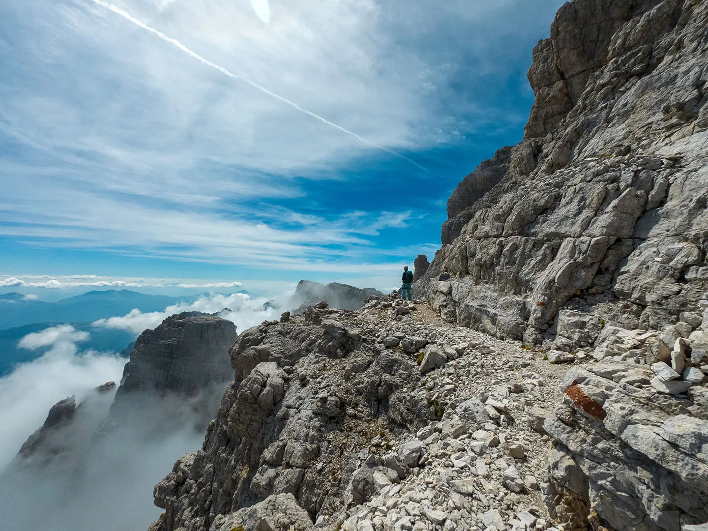
- Bocchette Centrali: The best-known section follows a near-horizontal ledge cut into a vertical cliff, with drops of around 500 m to one side. It passes close to Campanile Basso and takes roughly three hours to cross.
- Campanile Basso: This free-standing rock tower is the symbol of the Brenta Dolomites. From the Centrali ledge it appears at close range, making it one of the route’s defining views.
- Sentiero delle Bocchette Alte: The highest and hardest part of the traverse is graded C and reaches close to 3000 m below Cima Brenta. Its dark, damp crux gully can hold snow into early summer.
- Bocca di Brenta: A high saddle and historic crossing point of the massif. It is a key junction between the huts and a natural break in the limestone wall.
- Hut-to-hut refuges: Rifugio Tuckett, Alimonta, Brentei and Pedrotti provide food and overnight lodging high in the range. The route stays high, rarely dropping below about 2000 m.
Challenges to expect
Expect exposed limestone ledges, iron rungs, vertical ladders and long sections protected by cables. The route is expert-level because of height exposure, altitude and the consequences of a slip, not because of walking distance alone. Snow can linger in the Bocchette Alte gully early in the season. You need a helmet, harness, energy-absorbing via ferrata lanyards and confident movement on rock.
HikeList Score
Via Ferrata delle Bocchette scored 65/100 on HikeList's trail-quality metrics.
See score breakdownHide breakdown
- Ideal length 63
- Balanced challenge 38
- Scenery & wildness 98
- Varied terrain 45
- Accommodation 49
- Food & support 65
- Path quality 98
- Season flexibility 76
Computed from length, challenge, scenery & wildness, terrain variety, accommodation, food & support, path quality and season flexibility.
 Italy
ItalyShow more data Show less
- Mountainous
- Rocky
- Huts
- None
- Restrooms
- Water Sources
- Shelters
In these collections
Photos from hikers
Taken on the trail by people who've reviewed Via Ferrata delle Bocchette.
Start at Rifugio Tuckett, reached from Madonna di Campiglio and the Groste area. The route crosses towards Bocca del Tuckett and takes the demanding Bocchette Alte, with exposed ledges, cable-protected passages and high ground below Cima Brenta. This is the harder day of the standard core and is quoted at about 5–7.5 hours.
From Rifugio Alimonta, continue towards Bocca degli Armi and onto the Bocchette Centrali, the classic horizontal ledge system passing Campanile Basso. The standard finish is Rifugio Pedrotti-Tosa, with possible continuation towards Rifugio Agostini. This section is quoted at about 3–4.5 hours.
Reviews
How would you rate Via Ferrata delle Bocchette?
Tap a star to start your review — you could be the first.