Mount Olympus Ascent (Litochoro to Mytikas)
How would you rate Mount Olympus Ascent (Litochoro to Mytikas)?
Tap a star to share your experience and help other hikers.
Mount Olympus Ascent: Litochoro to Mytikas Hiking Guide
HikeList Score
Mount Olympus Ascent (Litochoro to Mytikas) scored 74/100 on HikeList's trail-quality metrics.
See score breakdownHide breakdown
- Ideal length 63
- Balanced challenge 38
- Scenery & wildness 98
- Varied terrain 64
- Accommodation 75
- Food & support 88
- Path quality 98
- Season flexibility 76
Computed from length, challenge, scenery & wildness, terrain variety, accommodation, food & support, path quality and season flexibility.
The Mount Olympus ascent from Litochoro to Mytikas is the standard route up Greece’s highest mountain: a 22 km, 2-day, expert out-and-back in the Mount Olympus massif. It follows the E4 waymarked mountain route through Enipeas Gorge to Prionia, climbs to Spilios Agapitos Refuge, then continues via Skala to Mytikas at 2,917.7 m. It suits fit mountain hikers who are comfortable with altitude, loose rock and a short but serious exposed scramble near the summit.
Route Overview
Start and finish in Litochoro, though most hikers drive to the Prionia trailhead at 1,100 m and begin the main climb there. The route runs up the Enipeas Gorge, passes the ruined Agios Dionysios monastery, reaches Prionia, then climbs through forest to Spilios Agapitos Refuge / Refuge A at 2,100 m. From the refuge, the trail rises above the tree line to Skala, where walking gives way to the exposed scramble to Mytikas. Return the same way, making this an out-and-back rather than a point-to-point. For wider route context, see the E4 European Long-Distance Trail (Greek Section), or compare other Greek hikes such as the Agrafa Mountains Circuit and Delphi to Chrisso Trail.
Mount Olympus: myth, first ascent and national park status
In Greek mythology, Mount Olympus was the home of the twelve Olympian gods, with Mytikas and nearby Stefani associated with Zeus. The first recorded ascent of Mytikas was on 2 August 1913 by Swiss climbers Frederic Boissonnas and Daniel Baud-Bovy, guided by Christos Kakkalos of Litochoro, a local chamois hunter who became the mountain’s first official guide. Olympus became Greece’s first national park in 1938 and a UNESCO Biosphere Reserve in 1981.
Notable highlights
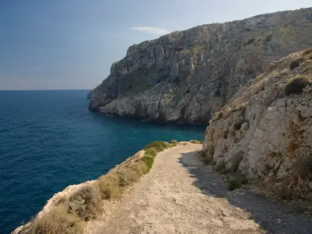
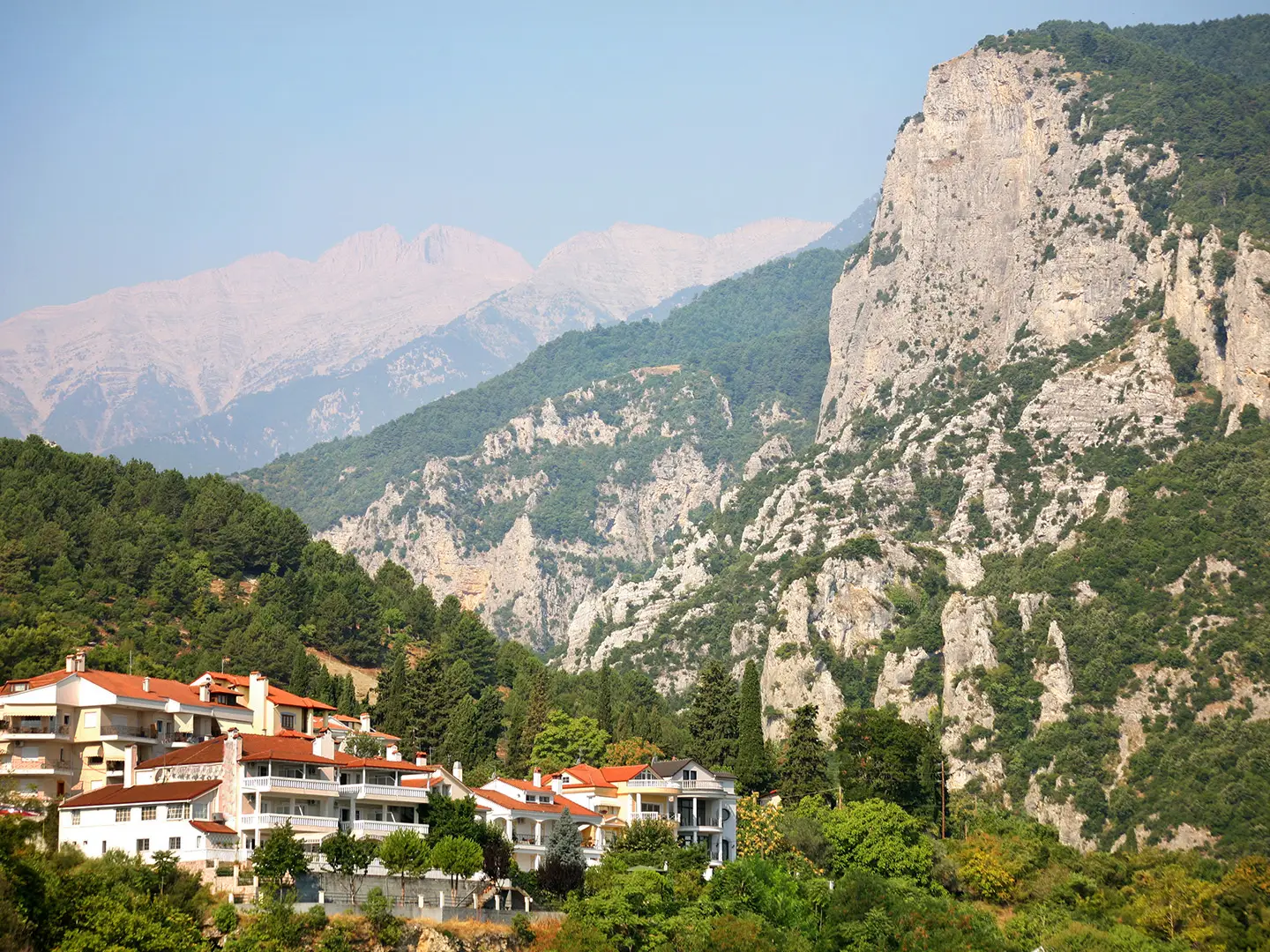
Enipeas Gorge: The forested approach from Litochoro follows the Enipeas river through a deep gorge with footbridges, pools and small waterfalls. It also passes the ruined Agios Dionysios monastery.
Prionia (1,100 m): The usual trailhead and last vehicle access before the climb to the refuge. It has a spring and a small taverna.
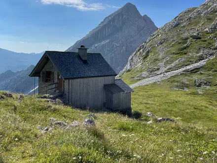
Spilios Agapitos Refuge / Refuge A (2,100 m): The classic staffed stone refuge on the standard route. Most hikers eat and sleep here before an early summit start.
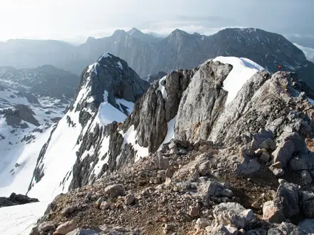
Skala: A high ridge peak at about 2,880 m where the hiking trail reaches the rim. This is the decision point before the exposed scramble to Mytikas.
Mytikas (2,917.7 m): The highest point in Greece, reached by a Class 3 / UIAA I-II scramble. The summit looks across the Aegean and the neighbouring peaks of Skolio and Stefani.
Stefani, the Throne of Zeus (2,902 m): A jagged horn beside the summit, traditionally linked with Zeus in myth. It is one of the most recognisable landmarks on the final ridge.
Challenges to expect
The main difficulty is not the distance but the final section from Skala to Mytikas: an exposed hands-and-feet scramble over solid and loose rock above big drops. The approach is also strenuous, with major ascent, rocky ground above the tree line and altitude near 2,918 m. Snow or ice can linger into early summer and return by autumn. Afternoon thunderstorms and rapid weather changes are common, so start early and book the refuge ahead in peak season.
HikeList Score
Mount Olympus Ascent (Litochoro to Mytikas) scored 74/100 on HikeList's trail-quality metrics.
See score breakdownHide breakdown
- Ideal length 63
- Balanced challenge 38
- Scenery & wildness 98
- Varied terrain 64
- Accommodation 75
- Food & support 88
- Path quality 98
- Season flexibility 76
Computed from length, challenge, scenery & wildness, terrain variety, accommodation, food & support, path quality and season flexibility.
 Greece
Show more data Show less
- Mountainous
- Forest
- Dirt
- Rocky
- Huts
- Campsites
- Hotels
- Pet Friendly
- Restrooms
- Water Sources
- Campsites
- Shelters
In these collections
Photos from hikers
Taken on the trail by people who've reviewed Mount Olympus Ascent (Litochoro to Mytikas).
Walk the E4 approach through Enipeas Gorge if starting from Litochoro, or begin at the usual Prionia trailhead at 1,100 m. From Prionia, climb the maintained trail through forest to Spilios Agapitos Refuge / Refuge A at 2,100 m for the night.
Start early from the refuge, climb above the tree line to Skala, then assess conditions before the exposed scramble to Mytikas. After summiting Greece’s highest point, descend the same way to the refuge and continue down to Prionia or Litochoro.
Reviews
How would you rate Mount Olympus Ascent (Litochoro to Mytikas)?
Tap a star to start your review — you could be the first.